Environment News: Issue 656 - July 2026

Week One July 2026: Issue 656 (published Sunday July 19)

Plastic Free July 2026: 3 Quick ways to Protect our Pittwater Estuary, Bays, Creeks

July is the month when we can all focus in on keeping the plastic out of the real, especially in our natural environment.

This month you too can contribute to looking after the world you live in by ensuring you're not part of the problem.

Single-use plastics easily blow off boats, causing hazards and endangering our local marine life - 3 quick ways boaters can protect Pittwater:

  1. Secure your deck – lock down lightweight trash so it doesn't blow overboard.
  2. Ditch plastic bottles – swap to reusable flasks for your day on the water.
  3. Pack away– leave absolutely zero waste behind at your favourite beaches.

Idea courtesy Marine Rescue Broken Bay - whose volunteer members are also saving the pristineness of your Pittwater estuary waterways.

Keep it real Pittwater!


Shark‑spotting drones are about reassurance – not full protection

Samuel Cornell, The University of Queensland and Rob Brander, UNSW Sydney

Sharks are front of mind for many Sydneysiders and coastal New South Wales residents. In January, a teenager died amid a spate of attacks in and around Sydney. This month, a woman was bitten by a large great white while swimming close to shore and between the flags at Coogee Beach.

These incidents have made many swimmers and surfers fearful of returning to the ocean. Public figures have called for shark culls.

The NSW government has ruled out culling great whites, a protected species, but is considering a bull shark cull. This week, it announced $A34 million in new funding to expand its shark-spotting drone program, as part of a larger shark safety program. It will mean daily drone surveillance of around 70 beaches, including every Sydney beach and one for each coastal council.

While spotter drones are a genuine advance in shark detection, they’re not foolproof. After flying spotter drones over Sydney beaches for a season, this article’s lead author found shark detection didn’t mean protection.

The more you look, the more you see

Before drones, authorities relied on infrequent spotter flights over popular beaches. As a result, few sharks were sighted.

Drones have made it much easier to watch the ocean from above for extended periods. As a result, spotting a shark is now more likely. But more sightings doesn’t necessarily mean there are more sharks.

As authorities roll out their expanded drone program, we can expect to see a surge in shark sightings and more beaches closed as a precaution.

Detection doesn’t mean protection

Researchers have used drone footage to map shark movements and assess the risk to help pilots decide when to evacuate beaches. This showed the risk was low. At three Queensland beaches, only 4% of sightings over four years were bull sharks and no white or tiger sharks were seen at all. Drones mostly spotted small whaler sharks.

To date, there’s no published peer-reviewed research showing drone surveillance reduces shark bites. This isn’t an oversight. Shark bites get a lot of media attention, which makes them seem common. In reality, they are extremely rare.

Millions of Australians swim in the ocean every year. Last year, there were 23 bites across all Australian waters.

Their rarity means no research could realistically gather enough data to prove drone spotting led to a fall in bites, given many other possible explanations and factors.

Drone spotting is not flawless. Even in good conditions, drone pilots only detect around 40% of sharks swimming under the surface in real time. The figure rises to about 50% after careful post-flight review.

Detection is even more challenging when water isn’t clear. Murky water is common after periods of rain.

Drowning is a much bigger risk than sharks

Shark bites make headlines and capture public attention. This gives many of us a skewed view of what the real risks are of swimming in oceans and estuaries.

Deaths due to shark bites in Australia averaged about 3 per year over the last decade.

But in just the last year, 154 people drowned along the Australian coast. This included 30 deaths due to the single biggest beach hazard – offshore flowing rip currents.

In an average year, rip currents cause more deaths than bushfires, floods, cyclones and sharks combined. Each death causes significant trauma for loved ones and the community.

It’s worth asking why a spate of shark bites led to major public investment while deaths from rip currents do not tend to attract the same spending.

If the goal of the NSW government was to save the most lives at the beach, it might have made sense to first tackle drownings due to rip currents. Local governments could be funded to extend and expand their beach lifeguard services.

Evaluation before expansion

Drones may well prove useful tools to boost beach safety. The scale and cost of the NSW drone spotting program makes it a world-first.

But it’s an open question whether rapid expansion of drone spotting will boost the safety of beachgoers, given shark bites are the rarest hazard. The NSW government announced the investment without an evaluation of evidence for spotting program effectiveness.

It may not be possible to prove drones reduce bites, but we could still evaluate what they demonstrably do: shark detection and species identification, response times, and how often drones assist with other rescues.

We should expect the drone spotting program to lead to more frequent and more extended beach closures. That could have unintended consequences, such as a fall in beach visitors and a drop in revenue for coastal economies.

If closures get more frequent and become the new norm, people may seek out unpatrolled beaches with no flags, lifeguards or drones. That would be a dangerous outcome, as almost every coastal drowning occurs on unpatrolled beaches or outside lifeguard patrol hours and times.

Until we have evidence to say drone spotting will help, we should be honest about what this program will do.

Their clearest life-saving value may be elsewhere: in Queensland’s trial, drones were also used to spot swimmers caught in rip currents and locate missing persons.

Spotting for sharks alone looks to be about reassurance – not true protection.The Conversation

Samuel Cornell, Honorary Research Fellow in Public Health, The University of Queensland and Rob Brander, Professor, UNSW Beach Safety Research Group, School of Biological, Earth & Environmental Sciences, UNSW Sydney

This article is republished from The Conversation under a Creative Commons license. Read the original article.

Narrabeen bird tests negative for H5 bird flu

July 7 2026

The NSW Department of Primary Industries and Regional Development (DPIRD) has confirmed a cormorant found at Narrabeen on the weekend has tested negative for H5 bird flu.

The bird was tested at Elizabeth Macarthur Agricultural Institute (EMAI) as part of the ongoing surveillance and analysis underway in response to H5N1.

NSW Chief Veterinary Officer, Jo Coombe, said it is not normal procedure to report negative results, as the Department routinely performs these exclusions.

However, due to the significant interest in this particular case, the Department is reporting that it has tested negative.

“Since the response was stood up on 19 June, many investigations have been conducted relating to sick or dead birds and have all come back negative for H5, apart from the one confirmed Giant Petrel near Hawks Nest on the weekend,” Dr Coombe said.

“There are no detections in poultry or evidence of spread to local wildlife or large-scale deaths in any animals.

“The risk to human health remains low.

“I would like to remind members of the community if unusual deaths or illness in wild birds are observed please AVOID contact, RECORD by taking photos or video and REPORT immediately to the Emergency Animal Disease (EAD) Hotline on 1800 675 888.

“Australia remains well prepared to respond quickly to H5 bird flu.”

For more information visit: birdflu.gov.au

No further information as to the actual cause of the cormorants' death has been released.

Volunteer Crown land managers caring for Dundundra Falls Reserve: A few insights

The July Crown Land NSW Updates received this week shared some insights on volunteers with one stemming from an 18 May 2026 update, but worth recording here as we head towards National Tree Day 2026, running next Sunday, and how the ethos there, in 'everyday is tree day', extends to all those who look after and restore our local bushland reserves through the numerous local Bushcare, Crown Land, Floating Bushcare and Landcare Groups and the sustained efforts of their volunteers. 

For those who want to contribute to the restoration of those areas by getting their hands in the dirt, the full list of Pittwater Bushcare Groups is listed on the PON Environment page - just scroll further down.

That insight is: 

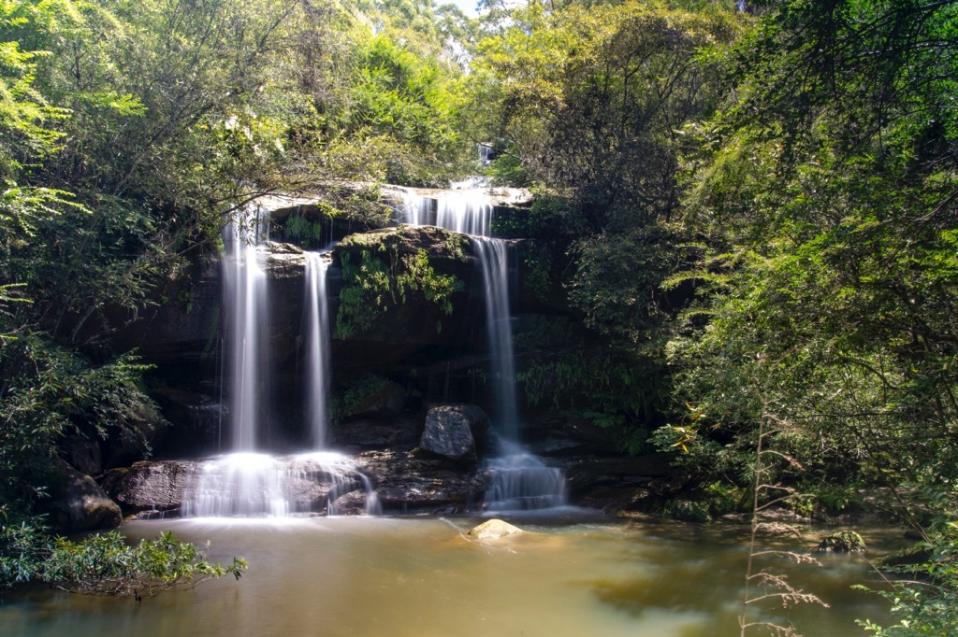
Years of sustained effort by volunteer Crown land managers have helped protect and preserve Dundundra Falls Reserve, creating a special place for the community to enjoy nature just minutes from suburban life in northern Sydney (at Terrey Hills).

Spanning around 40 hectares, Dundundra Falls Reserve is a place where bushland, creeks and waterfalls come together to create a unique environment for people and wildlife alike. The reserve offers opportunities for walking, dog-walking, horse riding and bike riding, while providing important habitat for native plants, birds and animals.

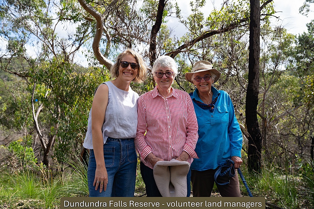
The reserve is currently cared for by an all-female board of dedicated Crown land manager volunteers who give their time to bush regeneration, weed control and caring for wildlife habitat - helping ensure the Crown reserve remains healthy, welcoming and resilient.

Bush regeneration work focuses on removing invasive weeds and supporting the return of native plants, with volunteers working in different areas of the reserve throughout the year.

Chairperson Sally White has been involved with Dundundra Falls Reserve for more than 25 years and has seen the long-term benefit of consistent care, with volunteers taking a careful approach to protecting wildlife while restoring the land.

Board members, including Glenda Spresser and Tracey Poulter, said their motivation for volunteering comes from a deep personal connection to the reserve and a desire to see it protected for the future.

Chairperson of the Dundundra Falls Reserve Crown land manager board, Sally White, said:

"I've seen areas that were once completely overrun with weeds slowly return to beautiful bushland.

"It didn't happen overnight - it's the result of years of volunteers turning up and caring for this place.

"There was an area we used to call the bird sanctuary because so many small birds lived there.

"We reduced the weeds gradually, making sure the birds still had somewhere to live. Now they're thriving in native plants instead, and the area looks incredible."

Katie Leonardi, Secretary of the Dundundra Falls Reserve Crown land manager board, said:

"We come out once a month with our bush care group, and everything we do is volunteer-led.

"It's a huge area to look after, so without volunteers it simply wouldn’t be possible to keep this Crown land healthy and protected."

Minister for Lands and Property, Steve Kamper, said:

"Crown land managers are at the heart of how our public reserves are cared for and protected.

"These volunteers take on real responsibility - managing land, restoring natural environments and making sure Crown land remains open, safe and welcoming for community use.

"The work being done by Crown land managers at Dundundra Falls Reserve shows the difference local knowledge, long -term commitment and community pride can make.

"Their efforts help ensure Crown land continues to deliver lasting benefits for the community and the environment, now and for future generations."

Dundundra Falls Reserve volunteers. Photo: NSW Government

To make a difference by volunteering on Crown land in your community, find out how to get involved and view current volunteer board vacancies by visiting Get involved.

Want to have a look around? Visit: Dundundra Falls Reserve - Photographs By Selena Griffith from 2020, Issue 463

A few Background Notes

Dundundra Falls Reserve is a 40 hectare Crown Land reserve in Terrey Hills. It was notified for the purpose of Public Recreation on January 11th, 1935:

Sydney, 11th January, 1935.
REVOCATION OP RESERVES FROM SALE, LEASE, Etc.

IT is hereby notified that under the provisions of section 30 of the Crown Lands Consolidation Act, 1913, the reserves from sale, lease, etc., hereunder described, are hereby revoked.

E. A. BUTTENSHAW, Minister for Lands.

Land District.        Reserve No.    Purpose                            Date of Notification  Parish               County                 Shire                       Area (acres/perches)     Part revoked                             Papers


REVOCATION OF RESERVES FROM SALE, LEASE, ETC. (1935, January 11). Government Gazette of the State of New South Wales (Sydney, NSW : 1901 - 2001), p. 178. Retrieved from http://nla.gov.au/nla.news-article224745340

For insights into the 1881 proposal to have a railway from Lane Cove/Gordon to Pittwater, visit History page: Roads To Pittwater: The Mona Vale Road  

“Dundundra” was a pastoral station in the Southern Highlands of NSW near Bombala from 1848 that had formerly been known as “Chain-of-ponds,” (Gazette) which may be a clue to its renaming with the Aboriginal language word “dundundra” subsequently recorded in 1904 in that area as meaning “rapid or waterfall”. Later listings of “dundundra” (eg. Thorpe) have only the meaning of “waterfall,” without any reference to the source of the word.

ASSIGNMENT OF NAME TO A RESERVE TRUST
PURSUANT to Paragraph 4 (3) of Schedule 8 to the Crown Lands Act 1989, the name specified in Column 1 of the Schedule is assigned to the reserve trust constituted as trustee for the reserve specified in Column 2 of the Schedule.
File No.: MN80R291.

GEORGE SOURIS,M.P.,

Minister for Land and Water Conservation.

SCHEDULE

COLUMN 1

Dundundra Falls (R .65042) Reserve Trust (as at 19 July 1994).

COLUMN 2

Reserve No. 65042 for the public purpose of public recreation at Terrey Hills, notified in the Government Gazette of 11 January 1935. 

ASSIGNMENT OF NAME TO A RESERVE TRUST (1994, August 19). Government Gazette of the State of New South Wales (Sydney, NSW : 1901 - 2001), p. 4463. Retrieved from http://nla.gov.au/nla.news-article231945513

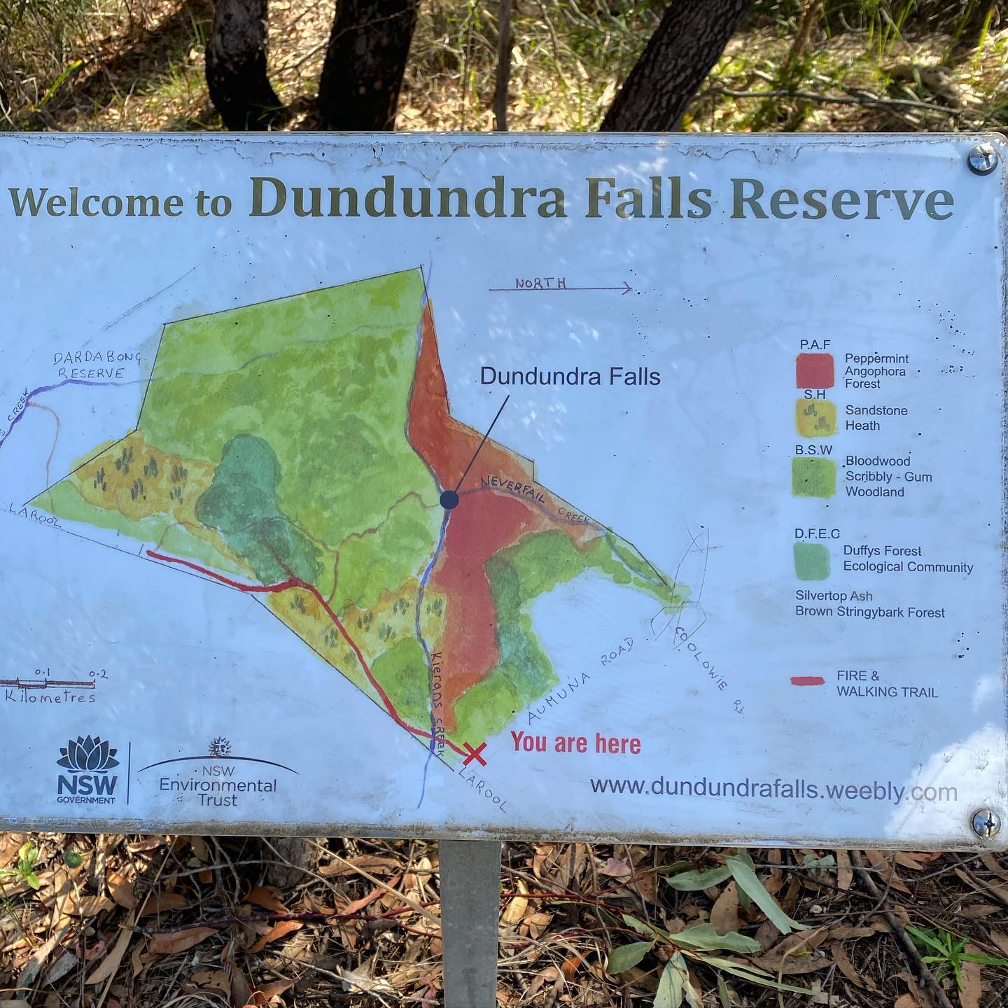
The Reserve is home to a variety of plant habitat, native animals and birds as well as, as the name implies, waterfalls. Kieriens creek makes its way through the reserve and meets up with Neverfail Creek with a series of falls and cascades along the way.

The reserve is located on the southern side of Aumuna Road Terrey Hills. A fire trail, Larool Trail, runs along the eastern boundary connecting Aumuna Road to the southern part of Larool Road. It adjoins Dardabong Reserve which contains aboriginal rock carving to the south.

On Friday August 17th, 2018 then Member for Pittwater, Rob Stokes, announced Dundundra Falls Reserve at Terrey Hills has been awarded NSW Government funding to assist with the protection of its spectacular native bushland.

A grant of $77,505 was provided under the NSW Government’s Restoration and Rehabilitation Program to help preserve and enhance the reserve’s native vegetation and fauna habitat.

See: Funding For Dundundra Falls Reserve - 2018, Issue 372

The bush regeneration group meets on the first Sunday of the month 8:30-11:30am (warm seasons - get the work done before the heat) 9:00-12:00 (cooler seasons). All are welcome to join in, although initial contact should be done via email. Training in bush re-gen and OH&S is provided.

Send them an email at: Dundundrafalls@gmail.com, or contact the group by original mail at: PO Box 381, Terrey Hills, NSW 2084. Bushcare Group details and more are available at: https://dundundrafalls.weebly.com/

Dundundra Falls - photo courtesy Dundundra Falls Reserve Bushcare Group

Maxwell Coal Mine in NSW Opened

On July 9 2026 The Minns Labor Government welcomed news that more than 400 direct, ongoing jobs are being supported in the Upper Hunter, as the Maxwell Underground Mine officially opened.

The mine, which is operated by Malabar Resources, was approved by the NSW Independent Planning Commission in 2020. 

The mine produces high-quality coals with at least 75% of coal produced capable of being used in the making of steel (known as coking or metallurgical coals) and is approved to operate until 2048 – although extensions of coal mines have been approved under successive NSW Governments. 

The government stated ‘today’s milestone marks the transition to long-term production, with around 430 permanent jobs confirmed, and a workforce drawn largely from communities across the Hunter.

Malabar Resources Ltd (Maxwell Underground Project) stated ‘that steel is critical to building homes, schools, hospitals, roads, railways, renewable energy assets and major infrastructure projects’.

The Minns Government stated in a release it supports the Maxwell Underground Mine and recognises Malabar’s investment as a strong vote of confidence in the Hunter, its skilled workforce and its future.

‘Mining in NSW supports more than 30,000 direct jobs across the state, and it remains one of the state's largest export industries, with the Hunter at the heart of that success.’ The media release states

‘The Hunter is one of Australia's most important mining regions, with generations of local workers helping supply the energy, steelmaking and industrial resources that have supported growth across NSW and globally.’

‘The opening comes as the Minns Labor Government continues to implement Coal Industry 2026-2050, which provides a long-term vision for the sector and recognises the enduring contribution coal mining makes to jobs, regional communities and the state's economy.

The plan acknowledges that coal will continue to play an important role in NSW for decades to come, while giving workers, communities and industry greater certainty about the future and supporting continued investment in mining regions.’

Minister for the Hunter Yasmin Catley said:

“The Hunter has never been a region that waits for opportunity to arrive. We build it, mine it, grow it and power it - and Maxwell is proof of that.

“Four hundred and thirty long-term jobs is not just a number on a page. It is mortgages paid, apprentices trained, kids in local schools and money going through local businesses.

“Coal mining has played a central role in our state’s economic development for more than a century, and that contribution is not behind us, it is still being made today.

“Maxwell is a major vote of confidence in the Hunter, its workforce and its future, and the Minns Labor Government will keep backing the industries and the workers that keep the Hunter strong.”

Minister for Natural Resources Courtney Houssos said:

"NSW has a proud mining history and we are just as optimistic about its future.

"The coal industry continues to support thousands of jobs, strong regional communities and the industrial capability our state relies on.

"Through Coal Industry 2026-2050, the Minns Labor Government is providing a long-term vision for coal mining in NSW and backing the workers and communities that have helped build NSW.

"The Maxwell Underground Mine will support hundreds of local jobs and generate economic opportunities throughout the Upper Hunter for years to come.”

Executive Chairman of Malabar Resources Wayne Seabrook said:

“Maxwell is now a working underground mine, supporting hundreds of long-term jobs and creating ongoing opportunities for people and businesses across the Upper Hunter.

"This is a proud milestone for Malabar, but more importantly it is a milestone for the people who have helped deliver it.

"Our team lives locally, works locally and contributes locally. These are people from Muswellbrook, Denman, Aberdeen, Scone, Singleton and the surrounding towns who have helped build a project that will be part of the Upper Hunter for decades to come.

"Projects like Maxwell do not happen without people. To every employee, contractor, supplier, neighbouring landholder and local business that has been part of this journey, thank you.

"Maxwell has moved from planning, to construction, to production. Today is about recognising that achievement and looking ahead to the next chapter for Malabar and the Upper Hunter."

However, the mine has not been greeted with open arms by everyone in the Hunter Valley.

The Nature Conservation Council of NSW states the Maxwell Coal Mine opening is 'shamefully short sighted'.

''Today’s opening of the Maxwell coal mine in the Hunter Valley will do enormous harm to the people of the Hunter and NSW'', according to environment groups. 

Jacqui Mumford, CEO of the Nature Conservation Council of NSW (NCC), said:  

“Coal is the number one cause of global heating, and it’s this coal that’s making bushfires unfightable, heat waves unbearable, and floods more frequent.  

“Every coal mine approved does enormous economic damage to the people of NSW by undermining our climate, groundwater, and local environment. 

“The Minns government is trying to walk both sides of the street by saying it’s pro-climate action, but also supporting coal expansions. 

“We’re calling on Premier Minns to set a clear direction away from harmful industries like coal mining and toward sustainable jobs that give future generations a chance to live with a safe climate.  

“There's still no real support on the ground for workers and communities to transition, and the Labor Government needs to focus on getting its Future Jobs and Investment Authority through parliament and into reality.” 

Tony Lonergan, spokesperson for Denman, Aberdeen, Muswellbrook, Scone Healthy Environment Group (DAMSHEG), said:  

“We hope the Minns government hasn’t forgotten its legislated 2030 greenhouse gas emission reduction targets, which are not on track to being met.  

“The recent Autumn rain has given Upper Hunter farmers temporary respite from worsening drought conditions, but recent record heatwaves across the Northern hemisphere remind us that climate change is only intensifying. 

“NSW citizens are already paying the price by way of the costs of more frequent droughts, floods, heatwaves and fires.  

“Doubling down on coal mining is the last thing the Hunter needs.  

“Starting operations at this coal mine undermines the future of Hunter residents who will bear the impacts of climate change for decades to come.” 

The news came in the same day a notice the Minns Government had approved its 11th coal mine since winning government in 2023 was received.

Details below

NSW approves 11th coal project in a row ahead of decision on state’s largest ever coal proposal

The NSW government has approved its 11th coal project since the 2023 election, ignoring warnings from its independent advisory body that further coal projects are incompatible with a safe climate. 

The Bloomfield Coal Modification 5, approved 9 July, will allow mining to continue to 2035, and is expected to generate almost 10 million tonnes of downstream carbon pollution. 

The approval comes just days before the Independent Planning Commission (IPC) will begin public hearings on the Hunter Valley Operations Continuation Project, the largest coal project ever proposed in NSW.

Lock the Gate Alliance’s NSW Coordinator Nic Clyde said: “The NSW government has once again ignored clear advice from the NSW Net Zero Commission that more coal extensions aren’t compatible with a safe climate future.

"The state government hasn’t refused a single coal project since the 2023 election. This week the IPC held public hearings on the Hunter Valley Operations Continuation Project, the largest ever coal proposal in New South Wales history.

"Communities across New South Wales are already paying the price for climate change through rising food, energy and insurance costs. If NSW continues to allow new coal projects, it will lock in more climate pollution, and more frequent bushfires, floods and heatwaves."

Community members and independent experts will address IPC public hearings on HVO from Thursday 16 July. Glencore and Yancoal are proposing to extend operations at the Upper Hunter mine for another two decades. 

If approved, HVO would generate 800 million tonnes of greenhouse gas pollution, worsen air pollution in the Upper Hunter and dig coal pits next to the mighty Hunter River, putting water at risk, Lock the Gate stated. 

Background

Last year, the NSW Net Zero Commission’s landmark Spotlight on Coal report found that any extensions or expansions of coal mines in NSW are not compatible with NSW’s “emissions reduction targets in the Climate Change Act or the Paris Agreement temperature goals it gives effect to.”

The ongoing approval of coal expansion projects in NSW are increasingly being viewed as ‘internationally wrongful acts’ based on the recent International Court of Justice (ICJ) Advisory Opinion of the International Court of Justice on Obligations of States in respect of Climate Change (23 July 2025).

Bloomfield Mod 5 is the 5th coal expansion approved in NSW since the ICJ’s landmark opinion labelled decisions to approve new fossil fuel projects as ‘internationally wrongful acts’.

$24.8 million investment to build the NSW clean energy workforce

The Albanese and Minns Labor Governments announced on Thursday July 9 2026 they are investing almost $25 million to expand clean energy training facilities and grow the vocational education and training workforce needed to support New South Wales' energy transition.

The joint investment includes:  

  • $16.7 million to upgrade and expand training facilities at six TAFE NSW campuses; and
  • $8.1 million to strengthen the capability and capacity of teachers, trainers and assessors delivering clean energy training across NSW. 

The announcement was made at TAFE NSW Campbelltown, where a $3.6 million investment will establish electrotechnology training facilities for the first time.  

The new facilities will help meet growing demand for electricians and clean energy-aligned trades in south-western Sydney, while supporting students to train closer to home.  

The Campbelltown project is one of six training facility upgrades being delivered across NSW, including Cessnock, Dubbo, Tamworth, Wellington, and Wyong.  

On top of new and upgraded training facilities, the investment will strengthen the workforce responsible for delivering clean energy training across NSW.  

The $8.1 million workforce package includes:  

  • scholarships to help businesses build workplace training and assessment capability and support existing workers to become qualified workplace trainers and assessors;
  • upskilling and retraining for up to 500 TAFE NSW teachers in emerging areas like solar panel installation, battery storage, hydrogen safety and electric vehicle servicing; and
  • a shared teacher resourcing pilot between TAFE NSW and the NSW Department of Education to create pathways into renewable energy careers for secondary school students.  

Together, these investments will ensure NSW has the facilities, training capability and workforce needed to support growing clean energy industries.  

Federal Minister for Skills and Training Andrew Giles said: 

“Australia’s clean energy transition is one of the biggest opportunities of our time, and for the first time young people in these communities will be able to train locally and step straight into secure, well-paid jobs in the electrical trade.

"This investment will expand access to high-quality training, delivered in local communities who are set to be at the forefront of this growing industry.

“By partnering with the Minns Government to back TAFE and school partnerships, we are creating a clear path from school to a good job in renewable energy and ensuring Australians are the ones building and benefiting from this transformation.”

New South Wales Minister for Skills, TAFE and Tertiary Education Steve Whan said: 

"The clean energy future of NSW depends on having the skilled workforce to build it, maintain it and power it.

"That's why we're investing in both modern training TAFE NSW facilities and the teachers, trainers and assessors who help deliver those skills.  

"Building the clean energy workforce takes more than new infrastructure. By investing in training facilities, industry capability and teacher development, we're delivering the skills that work for the jobs NSW will need in the decades ahead.”  

Member for Macarthur Dr Mike Freelander said:

“The work to build Australia’s future industries starts right here at Campbelltown TAFE. Cutting-edge skills training and facilities on offer for locals, without having to travel to get the qualifications they need for a great career.

“This is what Labor Governments do – deliver real support and real change for the people of south-western Sydney.”

Member for Campbelltown Greg Warren said:

"This investment is fantastic news for Campbelltown and south-western Sydney, creating new opportunities for local people to train for careers in electrical and clean energy industries close to home.  

"For the first time, TAFE NSW Campbelltown will deliver electrotechnology training, giving more students access to the skills and courses needed for secure jobs in a growing sector."  

Jobs and investment from mining land reuse: NSW's Hunter Valley

On Tuesday July 14 2026 the Albanese and Minns Labor Governments and Muswellbrook and Lake Macquarie councils announced they are working together to secure the future of the Hunter, with new plans set to unlock more than 7,000 jobs as part of the region’s shift from coal into a major industrial hub.

''The first major post-mining land transformations plans at the Mt Arthur Coal Mine site near Muswellbrook and the Macquarie Coal Complex at West Wallsend have been revealed today delivering on the Commonwealth Government’s $5 million investment, alongside in-kind support from the NSW Government.'' a release statement says

''These sites will be repurposed to create new jobs and industrial precincts that drive economic growth across the region.

The draft master plans and rezoning proposals are now on public exhibition. They map out how the Hunter’s skilled workforce combined with the proximity of strong rail, road, power and water infrastructure lay the foundation for the success of new industries including renewable energy, advanced manufacturing and warehousing.

The plans set out how the Mt Arthur and Macquarie coal mining areas will be transformed from supplying coal to providing new job opportunities as part of a post-mining land use trial.

The plans deliver on the Albanese and Minns Labor Governments’ effort in the Hunter that land previously used for mining can be transformed for new employment and industry.

Mt Arthur coal mine, Muswellbrook

Following the commercial decision by BHP to cease mining operations at their Mt Arthur coal mine in 2030, two areas will be zoned for new industry with access to major highways and the existing rail loop.

Key features of the draft master plan and rezoning proposal include:

  • Total area of 5,400 hectares
  • Over 950 hectares of land in the two priority areas identified for early activation
  • Approximately 5,900 new jobs.

Macquarie Coal Complex, Teralba/West Wallsend

The Macquarie Coal Complex, located just 20km south-west of Newcastle, is ideally positioned to become a major employment precinct for renewable energy, advanced manufacturing and warehousing.

Macquarie Coal Complex is a former mine site and is directly linked to the M1 and the Main Northern Railway.

Key features of the draft master plan and rezoning proposal include:

  • Total area of 1,160 hectares
  • At least 500 hectares of developable land
  • Up to 1,130 new jobs
  • Around 36 hectares of new open space

Next Steps

A recommendations report will be handed down based on these pilot projects by the end of the year, setting out a clear reform agenda to streamline future post-mining land use opportunities.

This complements other work by the Albanese and Minns Labor Governments along with local councils, already underway to investigate future rezonings at sites across the state including Eraring, Liddell and Bayswater.

The draft master plans are on public exhibition for 28 days from 14 July to 11 August. In-person drop-in sessions will be held in both Muswellbrook and Lake Macquarie during the exhibition period, giving the community the chance to speak directly with the project team.

Community feedback received during this time will help shape the final plans, which are expected to be finalised by the end of the year. To view the proposals and have your say, visit Mt Arthur Mine or Macquarie Coal Complex.

Federal Minister for Industry and Innovation and Minister for Science Tim Ayres said:

“The Hunter has the skills, infrastructure and industrial capacity to lead Australia’s next wave of economic growth.

“These masterplans are about attracting new industries, creating high quality local jobs and cementing the region as a major hub for manufacturing and innovation –powering Australia’s economic resilience for decades to come.”

NSW Minister for the Hunter Yasmin Catley said:

“The Hunter has powered NSW for generations and we are making sure it continues to power our economy into the future.

“These plans will help create thousands of local jobs, attract new investment and give Hunter communities confidence that the region will remain one of the state’s economic powerhouses.”

NSW Minister for Planning and Public Spaces Paul Scully said:

"The Minns Labor Government is acting now to plan for the Hunter’s future, including making the most of strategically located land and existing infrastructure.

“These proposals provide a clear pathway for former mining land to support new industries, investment and jobs for decades to come and add thousands of hectares to the amount of available and serviced industrial land in NSW.”

NSW Minister for Natural Resources Courtney Houssos said:

“Coal mines in the Hunter have sustained communities and families for generations, and we want to make sure these sites can continue to support jobs even after mining ends.

“This is another example of how the Minns Labor Government is partnering with communities and industry to re-build manufacturing and industry across the Hunter.”

Federal Member for Hunter Dan Repacholi said:

“The Hunter’s next chapter has been built here, by Hunter workers, using Hunter skills. These plans are about turning former mine land into future job sites, with real opportunities in manufacturing, renewables, logistics and industry.

“We’ve got the workforce, we’ve got the know-how, and we’ve got the infrastructure. Now it’s about making sure local people are front and centre as these sites are transformed.”

NSW Member for Cessnock Clayton Barr said:

“The Minns Labor Government is backing the Hunter, creating opportunities for local workers, businesses and communities as the region’s economy evolves.”

“The more than 7,000 jobs set to be created through these projects will make the most of the existing Hunters skilled workforce and help cement the region as a major industrial hub.”

Muswellbrook Shire Council Mayor Jeffrey Drayton said:

“This project is critical for our community. We need the land to attract new industry and create jobs, so Muswellbrook has a future after mining. We don’t have time to wait until mines close down to do this work.”

“This is not about letting mines off the hook. It is about balancing environmental, economic and social outcomes so Muswellbrook can achieve our potential and continue to power the future economy like we have been doing for decades.”

Lake Macquarie Mayor Adam Shultz said:

"The transformation of the Macquarie Coal Complex represents a once-in-a-generation opportunity to help shape Lake Macquarie's future.

“By working in partnership with the NSW and Australian Governments and industry, we're planning ahead to create new jobs and attract investment as the economy evolves.”

$1.8b pumped hydro project approved for old Mine Site in Gloucester Valley

On Wednesday July 15 2026 the NSW Government announced a major pumped hydro project with the potential to power up to 120,000 homes has been given the green light to transform a former mining site into a renewable energy generator in the Gloucester Valley.

The $1.8 billion Stratford Pumped Hydro and Solar project will boost energy security and bring investment and jobs to the Hunter, with up to 350 construction jobs and 10 ongoing jobs.

''This project will bring lasting benefits for the region, including around $18.2 million over the life of the project for community and infrastructure projects through a Voluntary Planning Agreement with Mid Coast Council.'' the government said in a released statement

Located, about 100 kilometres north of Newcastle, the project will sit on the Stratford Mining Complex site where coal mining operations ended in 2024, providing a productive and innovative future for the post-mining land.

The project by Gloucester Coal Pty Ltd, a subsidiary of Yancoal Australia Limited, includes a 300 megawatt (MW) pumped hydro power station with 12 hours of energy storage and a 320 MW solar farm.

To generate electricity, water will be transferred between a new upper reservoir and an existing dam via a tunnel, with water for the initial reservoir to be sourced from the existing mine site.

It will provide “firming” energy by storing surplus electricity generated during the day during and releasing it to generate electricity at peak times in the evening. It is forecast to deliver around 13 per cent of the State’s 2034 long duration storage target.

Declared Critical State Significant Infrastructure (CSSI) in June 2024, the project is a crucial component of the NSW Government’s Electricity Infrastructure Roadmap, a 20-year plan to diversify the energy generation mix, and provide energy security as NSW moves away from coal-fired power.

''The coal to renewable energy evolution happening in the Hunter is also demonstrated in the Port of Newcastle.

While the Port of Newcastle remains the largest coal export port in the world, it is also now a critical gateway for renewables infrastructure. The port is the entry point for everything from wind turbines, to solar panels and battery energy storage systems to enable energy projects across the Hunter and beyond.'' the release states

''The Minns Labor Government has supported this evolution by declaring part of the Port of Newcastle State Significant Infrastructure, consolidating approvals for updates to the Port which will add flexibility for future operations.''

''Since March 2023, the Minns Labor Government has approved 52 renewable energy projects that, when built, will generate enough electricity to power 5.1 million homes.

There are currently more than 57 renewable energy, storage, pumped hydro and transmission projects under assessment in NSW. If approved, these 12.9 GW of generation projects could produce enough electricity to power about 6.68 million homes.

A further 107 projects, including solar, wind, battery storage and pumped hydro projects are at various stages in the planning pipeline.''

''This is another example of the Minns Labor Government backing jobs in the Hunter for decades to come, alongside pilot sites, to rezoning mines into employment land and its commitment to establish a long-term pipeline of passenger train manufacturing in the region.''

However, Yancoal stated in their own release the company "will now progress with assessing the commercial viability of the project".

"Yancoal is considering preferred ownership, funding and operating models, subject to board approval," a spokesperson said.

There were also numerous objections from residents to the project, many of them stating the same thing over and over as though part of a campaign. The gist of these is:

''I object because the repurposing of agricultural land for questionable energy projects poses a significant threat to our nation’s food security.

As arable land is sacrificed for unreliable energy generation, we jeopardize our ability to produce food, undermining both local farmers and the wider community's access to healthy nutrition.

Australian Coal & a Nuclear Power Plant is essential instead for the Hunter as they have Minimal Environmental Impact unlike this disaster!''

Hunter Nationals MP Dave Layzell told the ABC mining sites should be converted for productive purposes such as power generation and that planning should start before mines were decommissioned.

"There's a bit of a time lag from the mine shutting to the new project starting and that's a challenge for local communities," he said.

"We're certainly feeling the effects in Gloucester from the shutting of the mine, as businesses are really hurting there.

"Pumped hydro storage of energy is a massive challenge in our future transition [and] this is a really good project."

Minister for the Hunter Yasmin Catley said:

“This is exactly what planning for the future looks like. 

“We are taking a former mine site and giving it a new purpose powering up to 120,000 homes across New South Wales.

“This is a major vote of confidence in our region. We have the land, infrastructure, and skilled workforce needed to deliver the next generation of major energy projects.”

Minister for Planning and Public Spaces Paul Scully said:

“This is the first pumped hydro project to secure final planning approval in NSW in 6 years. It’s a sign of our commitment to a clean energy future and the beginnings of an evolution of jobs and energy generation in the Hunter to power homes and businesses.

“Projects like Stratford Pumped Hydro also show how we can make the most of former mining sites and create new jobs and industry which will help to drive the region’s economic growth for decades to come.”

Member for Newcastle Tim Crackanthorp said:

“The Port of Newcastle is the mouth that feeds the state’s transition to renewable energy.”

“This project is a great glimpse into NSW energy future, reusing a former mining site for new and innovative renewable energy technologies.”

Community calls for recreational opportunities and conservation in the proposed Great Koala National Park

Recreation and conservation have emerged as top priorities for the community from extensive consultation on the proposed Great Koala National Park.

The What We Heard report has been released, summarising feedback from members of the public about how they currently use the area, and what they envisage for the park in the future.

It reveals people in the local region and across NSW widely appreciate the area for its recreation opportunities, outstanding conservation values, natural beauty and wellbeing benefits.

There is strong support for improved protection for koalas and other threatened species while also ensuring that a broad range of recreational uses are available in the park.

This aligns with the Minns Labor Government’s vision for the Great Koala National Park to be one of the most significant conservation initiatives in NSW as well as a must-see destination attracting visitors and contributing to the local economy.

Key feedback themes include:

  • How people use the area: Bushwalking is the most popular activity, alongside camping, sightseeing, wildlife watching, four-wheel driving, swimming, mountain biking and trail bike riding.
  • What people value most: Protecting habitat and wildlife, while continuing opportunities for a wide range of recreational activities people currently enjoy.
  • Ideas for the future park: Upgraded trails and infrastructure, new recreation opportunities, supporting education, exploring tourism and nature-based experiences and ongoing community involvement.

The consultation is one of the largest ever undertaken for a new national park. It attracted around 4,000 survey responses and involved more than 70 face-to-face meetings, group forums, community events and online sessions.

The What We Heard report will be used to inform reserve categories and future management. This is not the end of the consultation: collaboration with Aboriginal stakeholders, neighbours, councils, tourism operators, recreation and conservation groups is ongoing.

The NSW Government is working to register a carbon project for the Great Koala National park with the Clean Energy Regulator. The creation of the Park is conditional on the successful registration of this project.

The What We Heard report is available here: www.environment.nsw.gov.au/publications/what-we-heard-report-proposed-great-koala-national-park-community-consultation

Acting Minister for the Environment Jihad Dib said:

“Creating the Great Koala National Park is about protecting the future of koalas in the wild, safeguarding some of their best habitat in NSW while giving locals and visitors the chance to enjoy a world-class park.

“We appreciate the strong community input and we are listening carefully. Through consultation the feedback is that people want the park to deliver great opportunities for recreation and nature-based experiences.”

Minister for North Coast Janelle Saffin said:

“This report shows we can absolutely protect our environment while also backing our local economy.

“Our community has spoken loud and clear: they want a park that is active, accessible, and alive with recreation.  

“By listening to the 4,000 people who engaged with this survey, we are designing a world-class destination that keeps the outdoor activities locals love, while unlocking economic opportunities for our regional businesses, tour operators, and our hospitality sector.  

“Local voices are driving this process, and that’s exactly how it should be.” 

By 2050, many Sydney apartments built to today’s standards could be too hot for weeks at a time

A tall apartment block.
Photo by Anthony Sebbo on Unsplash
Shamila Haddad, University of Sydney; Arianna Brambilla, University of Sydney; Jingjing Liu, University of Sydney, and Mat Santamouris, UNSW Sydney

Sydney is no stranger to extreme heat. In January 2020, Penrith in Western Sydney reached 48.9°C, the highest temperature ever recorded in Greater Sydney.

Now imagine Penrith in 2050: the heat lasts longer, extreme heat events happen more often, and power goes out on the hottest days because the grid can’t cope.

Our recent research, published in the journal Energy and Buildings, shows Sydney apartments built to current building codes may become very uncomfortable by 2050 far more often. In fact, we found that inside an apartment built to today’s standards, temperatures would stay above 30°C for several days in a row.

Sydney is rapidly rezoning, leads the nation in apartment living, and is still racing to build more homes. Many of the developments approved today will still be standing in 2050.

But while we are building for the future, we are designing for the past.

Building for yesterday’s climate

Our study used the latest climate projections for Sydney to test apartments built to today’s standards in inner-city Redfern and Western Sydney’s Penrith.

By the 2050s, owing to climate change, Sydney’s median outdoor temperatures could be up to 5°C higher than today in its hotter inland areas under the highest-warming regional projection (a high greenhouse gas emissions scenario known to researchers and policymakers as SSP3–7.0), with hot days becoming longer and more frequent.

We found apartments built to today’s standards could be too hot for comfort for the equivalent of about four weeks a year in Redfern and more than seven weeks in Penrith.

The level of indoor overheating could pose a serious heat stress risk to residents.

Design matters. West-facing homes receive intense afternoon sun, while top-floor apartments absorb heat radiating through the roof. Opening a window offers relief when air outside is cooler. But many apartments lack cross-ventilation, and others have windows too small to remove the heat that builds up indoors.

A threat faced unequally

Older people, poorer communities, and people with chronic illnesses face the greatest risks.

Our projections show people living in Penrith could face almost twice as much overheating inside their homes as people in Redfern.

Air conditioning (AC) isn’t always an option. This is especially true for renters, elderly residents, and low-income households who make up much of western Sydney’s growing apartment population.

Some renters may not be allowed to install AC. And even where it’s already installed (it is not mandatory in new builds), not everyone can afford to run it.

One national longitudinal study estimated about one in 14 Australian households (around 7% of households) already spends more than 10% of their income on energy bills.

A survey of more than 1,000 Australian found 49.7% of households resist using their AC units on hot days to save on summer electricity bills.

Running air conditioners during extreme heat also puts enormous strain on the electricity grid. On hot summer days, NSW peak electricity demand can surge above 13,000 megawatts, well above the state’s average operational demand of around 7,700 megawatts, straining the grid and increasing the risk of blackouts.

During a blackout, even homes with AC may lose cooling when they need it the most. Air conditioners also release heat outdoors, making already hot neighbourhoods even hotter.

To sum up: many people cannot rely on AC and may not be able to easily relocate during a heatwave.

Homes should be able to keep people safe even when AC is not available.

Two changes could make a major difference

The solution starts with building standards. Australia’s current construction code focuses on predicted energy use for heating and cooling based on historical weather data, not the warmer climate those buildings will face. They should also test how long a home can stay at safe temperatures in a warmer future, especially during heatwaves, without relying on AC. This is known as a building’s “passive survivability”.

To make homes safer, we need two changes to building standards.

First, new apartments should be tested against a range of future climates, including longer and more intense periods of heat.

Second, standards should set a minimum time that a home must stay safe without air conditioning and provide practical guidance on how to achieve this.

Better design can cut the risk

Adding more insulation on its own doesn’t go far enough to protect apartments from future heat. But our study found several design changes that can make a real difference:

  • External window shades block sunlight before it heats the apartment. We found they reduced the time apartments were too warm by up to 32%
  • Safe night-time ventilation – meaning windows you can leave open overnight – lets trapped heat escape after sunset. We found it reduced overly warm hours by up to 34%, especially in Penrith
  • Lighter roof colours also helped protect top-floor apartments.

The best results came from combining these measures with double glazed windows and insulation. Together, they cut the risk of Sydney apartments becoming too hot in the 2050s by up to 94%.

Australia needs more apartments. But homes approved today must still protect people decades from now.

Building codes need to change so the country’s growing apartment stock stays safe, liveable and resilient in a hotter future.

Our study focused on Sydney, but it is likely these findings are applicable across many other parts of Australia, and the region.

More broadly, planning for new developments should also combine urban-scale heat mitigation measures (such as urban greening, light-coloured or reflective materials for roofs, roads and pavements, providing shade for built surfaces, and designing with water) with building adaptation to offset the impacts of climate change.The Conversation

Shamila Haddad, Sydney Horizon Fellow (Senior Lecturer) School of Architecture, Design and Planning, University of Sydney; Arianna Brambilla, Lecturer in Architecture, University of Sydney; Jingjing Liu, Research Fellow Sydney School of Architecture, Design and Planning, University of Sydney, and Mat Santamouris, Anita Lawrence Chair of High Performance Architecture, Professor, UNSW Sydney

This article is republished from The Conversation under a Creative Commons license. Read the original article.

Neil the seal is more than a viral animal. He’s become a global folk hero

Gemma Blackwood, University of Tasmania

I am one of Hobart’s many residents who travelled to a nearby beach to witness Neil the seal – an animal that has been receiving global attention for his wild personality and humorous antics.

Neil’s latest arrival in Tasmania was in late June. Due to his celebrity status, a security detail from the local council had been tasked with limiting all pedestrian access to the animal.

On my visit yesterday evening, people peered from a distance at the sleeping giant. A constant stream of cars was permitted to travel on the road, slowly, as though on an impromptu safari.

The one-tonne creature hadn’t moved much over the previous two days. But since my visit he has returned to the waters, and wildlife managers are now speculating he might have left Tasmania.

As we wait for Neil to return or head out deeper into southern waters, it’s worth reflecting on the cultural meaning we’ve ascribed to this wild animal.

In reality, he’s a five-year-old southern elephant seal who returns to the region to moult and rest. But in our hearts and social media feeds, he has become an international folk hero.

What is it about him that’s caused such worldwide mania?

A rare wild encounter

Firstly, we can look to our enduring fascination with wild animal encounters.

David Attenborough’s decades-long legacy of wildlife documentaries reflects the global appetite that exists for wild animal media.

In Australia, celebrity wildlife ambassadors such as the deeply missed “crocodile hunter” Steve Irwin, his wife Terri and children Bindi and Robert Irwin have long enthralled both television and real-life audiences as they get up close with nature.

And Steve’s tragic death from a stingray barb in 2006 also demonstrates the manifest danger of such encounters – no matter how much preparation is undertaken.

Due to these dangers, public encounters with wild animals are usually highly controlled, such as through zoos, aquariums, wildlife parks, circuses and tours. The recent virality of baby penguin Pesto all took place from inside Melbourne’s SEA LIFE aquarium.

Neil, however, is a free animal who can only be minimally controlled due to his hefty size. The nature of his short-term visits also means he poses relatively little risk to humans.

Perhaps one reason Neil has captured our imagination is because he dodged these controlled spaces. It’s rare to have a wild encounter that takes place on the animal’s terms.

Sealy behaviour

An examination of the Neil memes currently circulating on TikTok, Instagram and Facebook quickly reveal the seal’s emerging online status as a folk hero.

Online video and news footage shows the seal lying in the middle of the road, disrupting traffic, knocking over traffic signs and groaning heavily as workers attempt to move him.

It’s easy to imagine Neil as a rebel loner who doesn’t follow rules.

To this end, we’ve seen footage of Neil remixed with metal music, most frequently to A Day to Remember’s lyric “disrespect your surroundings”, and Rage Against the Machine’s 1992 anthem Killing in the Name.

In some funny videos, Neil’s awkward land waddle is sped up to show him flopping endlessly onto the road.

His biological need for deep sleep is also played as hilarious and obstinately slothful.

Online, Neil’s rebellious antics have been leveraged by users to comment on issues as varied as the anti-data centre movement to denouncing politicians. Artists are even creating imagery of Neil as a defiant anti-establishment icon.

A digital hero

Of course, these interpretations are far removed from the reality of this wild elephant seal. Neil doesn’t break the rules because he’s a rebel – but because he’s not human.

Yet folk heroes, even in animal form, appear in popular culture for a reason. As Marxist historian Eric Hobsbawm argued in his first major work Primitive Rebels (1959), these mythic examples can serve a therapeutic function, providing a coping mechanism against the stifling rules and inhibitions of a society.

They arguably also draw out, or stand for, the unconscious desires of a community. In other words, maybe we love Neil because we’re jealous of his freedom.

Perhaps our adoration suggests we, too, wish to live a little more on our own terms.

This article was amended to remove mentions of Neil’s moulting, as this was not confirmed by wildlife experts.The Conversation

Gemma Blackwood, Lecturer, Media, University of Tasmania

This article is republished from The Conversation under a Creative Commons license. Read the original article.


National Plant a Tree Day 2026: 30 Year Anniversary

Planet Ark's National Tree Day started in 1996 and has grown into Australia's largest community tree planting and nature care event.

It's a call to action for all Australians to get their hands dirty and give back to the community. While every day can be Tree Day, we generally celebrate Schools Tree Day and National Tree Day on the last Friday and Sunday in July.

2026 DATES

  • National Tree Day - Sunday 26 July
  • Schools Tree Day - Friday 24 July
  • Tropical Tree Day - Sunday 6 December

To find out more, get involved, or register a site, visit: nationaltreeday.org.au

At this stage only one local site is registered - but this section will be updated prior to NTD 2026 - that site is:

Saint Matthews Farm Reserve, Cromer

Everyone is invited to help us regenerate this important wildlife corridor with native plants. Make Cromer a cooler, greener and more connected place for our community, wildlife and creek stabilisation.

Sunday, 26 July 2026: 10:00am to 1:00pm

Site Organiser: Michael Kneipp - volunteer at this site

PNHA Activities 2026

Our walks for 2026 are listed below. 

You are very welcome to bring friends and older children on these outings. Please book by emailing pnhainfo@gmail.com and include  your PHONE NUMBER so we can contact you in case of changes because of weather etc. 

Looking forward to getting out and about in our lovely area! 

Your PNHA Committee

Pittwater Natural Heritage Association

The Pittwater Natural Heritage Association has been formed to act to protect and preserve the Pittwater areas major and most valuable asset - its natural heritage.

PNHA is an incorporated association seeking broad based community membership and support to enable it to have an effective and authoritative voice speaking out for the preservation of Pittwater's natural heritage.

Our Aims

  • To raise public awareness of the conservation value of the natural heritage of the Pittwater area: its landforms, watercourses, soils and local native vegetation and fauna.
  • To raise public awareness of the threats to the long-term sustainability of Pittwater's natural heritage.
  • To foster individual and community responsibility for caring for this natural heritage.
  • To encourage Pittwater Council and the NSW Government to adopt and implement policies and works which will conserve, sustain and enhance the natural heritage of Pittwater.

Some of our interests and concerns include:

  • Native Tree Canopy
  • "Wildlife Friendly" Gardens
  • Weed Infestation
  • Keeping our Waterways Healthy
  • Beaches and Dunes

Act to Preserve and Protect!

If you would like to join us, please fill out the Membership Form. Visit: https://pnha.org.au

Sunday April 26 Fauna: Underpass below Mona Vale Rd East, Ingleside.

If you missed this walk last year, here’s your chance to see how fauna can move between areas of bushland, so important for finding territory, mates and food. 

Meet 9am at corner of Ingleside Rd and Laurel Rd East. Walk ends about 11am.

Saturday May 23: PNHA stall at Avalon Car Boot Sale, Dunbar Park Avalon.

From 8am to 2pm, we’ll offer Information on identifying and controlling weeds. See our posters about invertebrates in local gardens. Our famous $2 local flora, fauna and scenery cards will be for sale. Come and have a chat. 

Sunday May 24: Walk in Red Hill Bushland Reserve, Beacon Hill

Meet 9am on Lady Penrhyn Drive opposite no. 41A, close to the open gate. Flora, birds, views. Walk ends about 11.30. 

Sunday June 28: Crown to the Sea Walk, Newport

Meet 9am please note that the meeting point is on Burke Rd next to Porter Reserve. Walk ends about 12 noon. This walk goes through several very different bushland reserves with coastal heath and littoral rainforest.

Wildflowers, ferns and coastal views. Moderate fitness needed for some steep tracks and many steps. Limit: 15 people so please book early. We will provide the Crown to the Sea map to participants on booking.

Sunday July 26: Ingleside Chase Reserve

Meet 9am at end of Irrawong Rd North Narrabeen, walk ends about 11am. Birds and swamp forest along Mullet Creek. Swamp Mahoganies will be flowering attracting birds. Binoculars a must for this walk.

Sunday August 23: Spring in the Bush

Meet 9am at corner of Mallawa Rd and Bulara St, Terrey Hills. Walk ends about 11am. With a focus on botany, we’ll see flowering plants in the Proteaceae plant family, waratahs, endangered Grevillea caleyi , right, and others in the major Australian Proteaceae plant family. Birds, too. 

Sunday September 27: The Chiltern Track, Ku-ring-gai N.P.

Meet 9am at track entrance with barred gate on Chiltern Rd Ingleside. Walk ends about 11am. One of our favourite walks to see Sydney sandstone flora in spring. Native plant species list available. Birds too, often a Yellow-tufted Honeyeater here. 

Sunday October 25: Katandra by Night

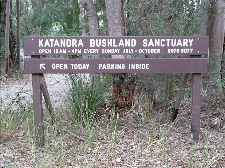
Meet 6.45pm at Katandra Bushland Sanctuary on Lane Cove Rd Ingleside. Walk ends about 8.45pm. Sunset is about 7.15. The bush by night is wonderful. We hope to see fireflies again as on previous walks here in October. Bring a torch, or headtorch, preferably with a red light option so as not to dazzle possums. Moderate fitness needed for the bush track and steps. Limit: 15 people, so please book early. 

Sunday November 22: Deep Creek Reserve

Meet 9am in Deep Creek reserve, off Wakehurst Parkway. Walk ends about 11am. Birds and bushland. From the bridge across the creek we may see Dollarbirds, summer breeding migrants that nest in hollows, with their youngsters. Black Bitterns have been observed along the creek margins, so bring binoculars. 

Solar for apartment residents: Co-funding

Less than 2% of apartment buildings in NSW have solar installed, but the NSW Department of Climate Chnage, Energy, the Environment and Water are on a mission to change this.

Their Solar for Apartment Residents grant is co-funding shared solar panel installations on eligible apartment buildings and multi-unit dwellings and has already helped thousands of households.

They’ve extended the program to help more homeowners and renters reduce their energy bills and have also allocated extra funds through a separate Boost grant to help priority communities too.

Application closes: 4 December 2026, 5:00 pm

Share this with your Owners Corporation or Stata Manager and check your building's eligibility at: www.nsw.gov.au/grants-and-funding/solar-for-apartment-residents-soar-grant-program


Dedicated alpine weather page part of latest BOM website improvements

The Bureau of Meteorology has delivered its latest website update.

In this release navigation has improved, there’s a new dedicated alpine weather page in time for the ski season, and the weather map has more place names.

Bureau of Meteorology CEO Dr Stuart Minchin said the update was a direct response to community feedback.

“Since launch, we've had requests for more locations to be added to the weather map,” Dr Minchin said.

“Our website is there to serve all Australians. We've now added more than 100 place names, primarily in the Northern Territory and Queensland.

“We'll be adding hundreds more in the months ahead.”

The weather map will now remember users’ most recent pan and zoom position, keeping the settings the same for the next time the page is viewed.

For example, if your last visit was a maximum zoomed-in view of Mount Isa, Queensland, this is the view you'll see next time you visit the rain radar.

“Changes like these will make it easier for everyone to find what they need,” Dr Minchin said.

Other changes include the UV Index being restored to the hourly forecast and updating the presentation of flood warnings.

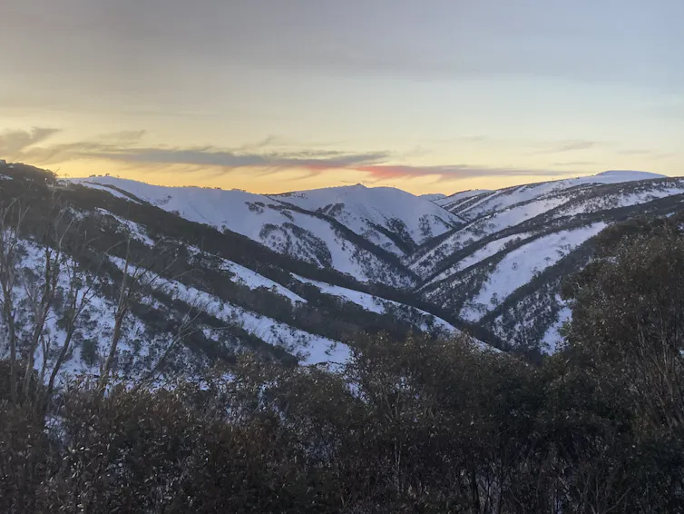
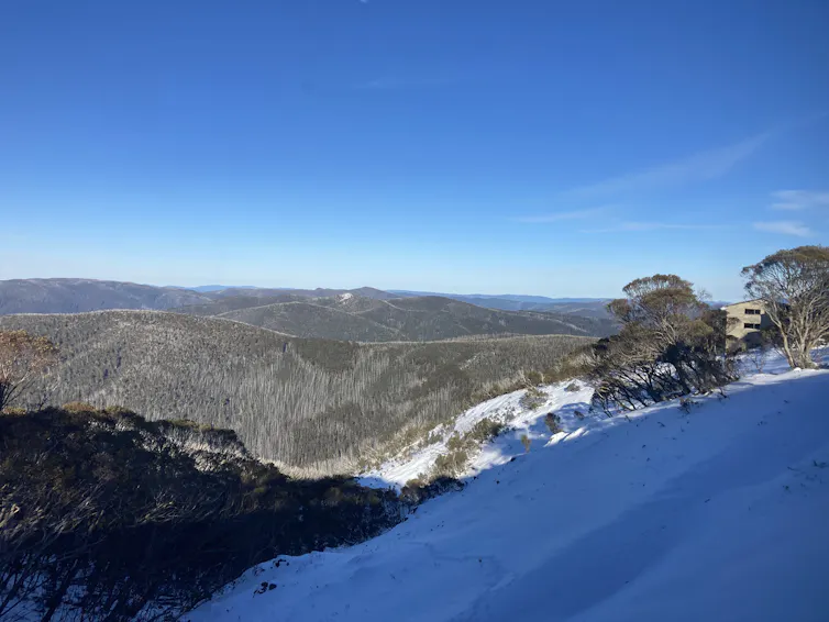
A new alpine weather page provides weather map layers for snow, wind and temperature, and forecasts for snow resorts, towns, and remote areas in Australia's alpine regions in one page.

The updated Alpine regions page provides weather maps and forecasts for snow resorts, towns, and remote areas in Australia's alpine regions.

Alpine regions offers information across 2 tabs:

  • Forecasts – alpine districts and locations
  • Map – 3 hourly snow, wind and temperature forecasts.

Navigating the website has become easier with changes to tabs and page layouts on a number of key pages such as Forecasts and observations, Coasts and Oceans and state, territory and district pages.

“People have told us that navigating to forecasts and observations for districts and states was hard,” Dr Minchin said.

“We’ve paid close attention to this feedback.

“Combined with last month's search improvements, this will make it easier for regional web users to find out if their district is expecting rain or sunshine.”

Updates will continue to be made to the website in response to the feedback received from the community.

Information about recent changes is available at bom.gov.au/website-help/website-updates

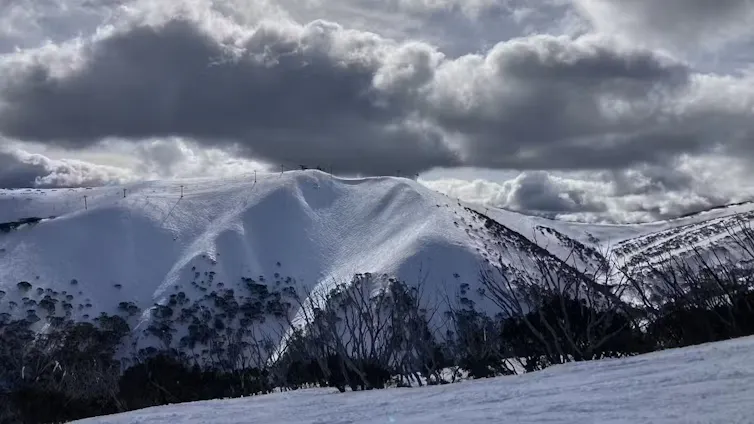
The ski season starts on the June long weekend and runs until October's long weekend in NSW. 

The Kiandra Alpine Club's Snow Carnival, 1900. Photo: Kerry

Birdwood Park Bushcare Group Narrabeen

The council has received an application from residents to volunteer to look after bushland at 199/201 Ocean street North Narrabeen.

The group will meet once a month for 2-3 hours at a time to be decided by the group. Activities will consist of weeding out invasive species and encouraging the regeneration of native plants. Support and supervision will be provided by the council.

If you have questions or are interested in joining the group please email the council on bushcare@northernbeaches.nsw.gov.au

Sydney Wildlife (Sydney Metropolitan Wildlife Services) Needs People for the Rescue Line

We are calling on you to help save the rescue line because the current lack of operators is seriously worrying. Look at these faces! They need you! 

Every week we have around 15 shifts either not filled or with just one operator and the busy season is around the corner. This situation impacts on the operators, MOPs, vets and the animals, because the phone line is constantly busy. Already the baby possum season is ramping up with calls for urgent assistance for these vulnerable little ones.

We have an amazing team, but they can’t answer every call in Spring and Summer if they work on their own.  Please jump in and join us – you would be welcomed with open arms!  We offer lots of training and support and you can work from the office in the Lane Cove National Park or on your home computer.

If you are not able to help do you know someone (a friend or family member perhaps) who might be interested?

Please send us a message and we will get in touch. Please send our wonderful office admin Carolyn an email at  sydneywildliferescueline@gmail.com

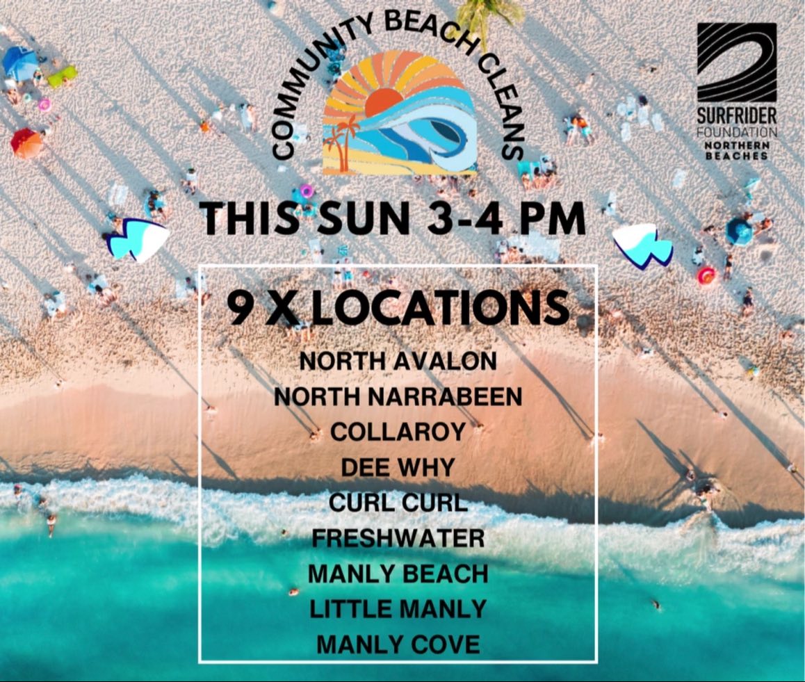
622kg of Rubbish Collected from Local Beaches: Adopt your local beach program

Sadly, our beaches are not as pristine as we'd all like to think they are. 

Surfrider Foundation Northern Beaches' Adopt A beach ocean conservation program is highlighting that we need to clean up our act.

Surfrider Foundation Northern Beaches' states:
''The collective action by our amazing local community at their monthly beach clean events across 9 beach locations is assisting Surfrider Foundation NB in the compilation of quantitative data on the volume, type and often source of the marine pollution occurring at each location.

In just 6 sessions, clear indicators are already forming on the waste items and areas to target with dedicated litter prevention strategies.

Plastic pollution is an every body problem and the solution to fixing it lies within every one of us.
Together we can choose to refuse this fate on our Northern beaches and turn the tide on pollution. 
A cleaner coast together !''

Join us - 1st Sunday of the month, Adopt your local for a power beach clean or donate to help support our program here. https://www.surfrider.org.au/donate/

Event locations 
  • Avalon – Des Creagh Reserve (North Avalon Beach Lookout)
  • North Narrabeen – Corner Ocean St & Malcolm St (grass reserve next to North Narrabeen SLSC)
  • Collaroy– 1058 Pittwater Rd (beachfront next to The Beach Club Collaroy)
  • Dee Why Beach –  Corner Howard Ave & The Strand (beachfront grass reserve, opposite Blu Restaurant)
  • Curl Curl – Beachfront at North Curl Curl Surf Club. Shuttle bus also available from Harbord Diggers to transport participants to/from North Curl Curl beach. 
  • Freshwater Beach – Moore Rd Beach Reserve (opposite Pilu Restaurant)
  • Manly Beach – 11 South Steyne (grass reserve opposite Manly Grill)
  • Manly Cove – Beach at West Esplanade (opposite Fratelli Fresh)
  • Little Manly– 55 Stuart St Little Manly (Beachfront Grass Reserve)
… and more to follow!

Surfrider Foundation Northern Beaches

This Tick Season: Freeze it - don't squeeze it

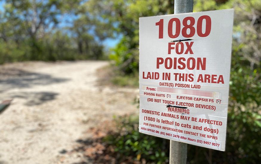
Notice of 1080 Poison Baiting

The NSW National Parks and Wildlife Service (NPWS) will be conducting a baiting program using manufactured baits, fresh baits and Canid Pest Ejectors (CPE’s/ejectors) containing 1080 poison (sodium fluoroacetate) for the control of foxes. The program is continuous and ongoing for the protection of threatened species.

This notification is for the period to 31 July 2026 at the following locations:

  • Garigal National Park
  • Lane Cove National Park (baits only, no ejectors are used in Lane Cove National Park)
  • Ku-ring-gai Chase National Park
  • Sydney Harbour National Park – North Head (including the Quarantine Station), Dobroyd Head, Chowder Head & Bradleys Head managed by the NPWS
  • The North Head Sanctuary managed by the Sydney Harbour Federation Trust
  • The Australian Institute of Police Management, North Head

DO NOT TOUCH BAITS OR EJECTORS

All baiting locations will be identifiable by signs.

Please be reminded that domestic pets are not permitted on NPWS Estate. Pets and working dogs may be affected (1080 is lethal to cats and dogs). Pets and working dogs must be restrained or muzzled in the vicinity and must not enter the baiting location. Penalties apply for non-compliance.

In the event of accidental poisoning seek immediate veterinary assistance.

For further information please call the local NPWS office on:

NPWS Sydney North (Middle Head) Area office: 9960 6266

NPWS Sydney North (Forestville) Area office: 9451 3479

NPWS North West Sydney (Lane Cove NP) Area office: 8448 0400

NPWS after-hours Duty officer service: 1300 056 294

Sydney Harbour Federation Trust: 8969 2128

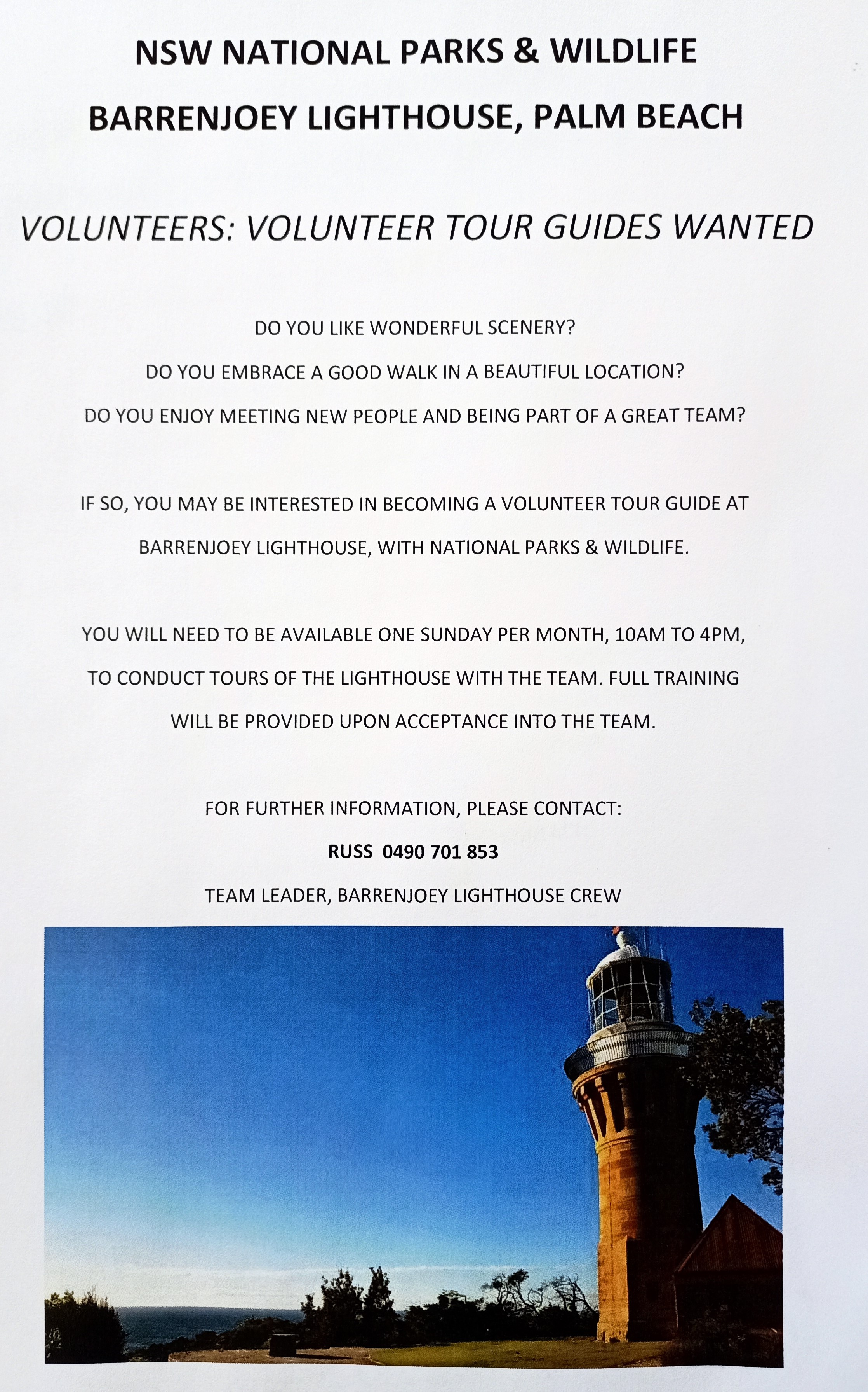
Volunteers for Barrenjoey Lighthouse Tours needed

Details:

Johnson Brothers Mitre 10 Recycling Batteries: at Mona Vale + Avalon Beach

Over 18,600 tonnes of batteries are discarded to landfill in Australia each year, even though 95% of a battery can be recycled!

That’s why we are rolling out battery recycling units across our stores! Our battery recycling units accept household, button cell, laptop, and power tool batteries as well as mobile phones! 

How To Dispose Of Your Batteries Safely: 

  1. Collect Your Used Batteries: Gather all used batteries from your home. Our battery recycling units accept batteries from a wide range of products such as household, button cell, laptop, and power tool batteries.
  2. Tape Your Terminals: Tape the terminals of used batteries with clear sticky tape.
  3. Drop Them Off: Come and visit your nearest participating store to recycle your batteries for free (at Johnson Brothers Mitre 10 Mona Vale and Avalon Beach).
  4. Feel Good About Your Impact: By recycling your batteries, you're helping support a healthier planet by keeping hazardous material out of landfills and conserving resources.

Environmental Benefits

  • Reduces hazardous waste in landfill
  • Conserves natural resources by promoting the use of recycled materials
  • Keep toxic materials out of waterways 

Reporting Dogs Offleash - Dog Attacks to Council

If the attack happened outside local council hours, you may call your local police station. Police officers are also authorised officers under the Companion Animals Act 1998. Authorised officers have a wide range of powers to deal with owners of attacking dogs, including seizing dogs that have attacked.

You can report dog attacks, along with dogs offleash where they should not be, to the NBC anonymously and via your own name, to get a response, at: https://help.northernbeaches.nsw.gov.au/s/submit-request?topic=Pets_Animals

If the matter is urgent or dangerous call Council on 1300 434 434 (24 hours a day, 7 days a week).

If you find injured wildlife please contact:
  • Sydney Wildlife Rescue (24/7): 9413 4300 
  • WIRES: 1300 094 737

Plastic Bread Ties For Wheelchairs

The Berry Collective at 1691 Pittwater Rd, Mona Vale collects them for Oz Bread Tags for Wheelchairs, who recycle the plastic.

Berry Collective is the practice on the left side of the road as you head north, a few blocks before Mona Vale shops . They have parking. Enter the foyer and there's a small bin on a table where you drop your bread ties - very easy.

A full list of Aussie bread tags for wheelchairs is available at: HERE 


Stay Safe From Mosquitoes 

NSW Health is reminding people to protect themselves from mosquitoes when they are out and about.

NSW Health states Mosquitoes in NSW can carry viruses such as Japanese encephalitis (JE), Murray Valley encephalitis (MVE), Kunjin, Ross River and Barmah Forest. The viruses may cause serious diseases with symptoms ranging from tiredness, rash, headache and sore and swollen joints to rare but severe symptoms of seizures and loss of consciousness.

A free vaccine to protect against JE infection is available to those at highest risk in NSW and people can check their eligibility at NSW Health.

People are encouraged to take actions to prevent mosquito bites and reduce the risk of acquiring a mosquito-borne virus by:
  • Applying repellent to exposed skin. Use repellents that contain DEET, picaridin, or oil of lemon eucalyptus. Check the label for reapplication times.
  • Re-applying repellent regularly, particularly after swimming. Be sure to apply sunscreen first and then apply repellent.
  • Wearing light, loose-fitting long-sleeve shirts, long pants and covered footwear and socks.
  • Avoiding going outdoors during peak mosquito times, especially at dawn and dusk.
  • Using insecticide sprays, vapour dispensing units and mosquito coils to repel mosquitoes (mosquito coils should only be used outdoors in well-ventilated areas)
  • Covering windows and doors with insect screens and checking there are no gaps.
  • Removing items that may collect water such as old tyres and empty pots from around your home to reduce the places where mosquitoes can breed.
  • Using repellents that are safe for children. Most skin repellents are safe for use on children aged three months and older. Always check the label for instructions. Protecting infants aged less than three months by using an infant carrier draped with mosquito netting, secured along the edges.
  • While camping, use a tent that has fly screens to prevent mosquitoes entering or sleep under a mosquito net.
Remember, Spray Up – Cover Up – Screen Up to protect from mosquito bite. For more information go to NSW Health.

Mountain Bike Incidents On Public Land: Survey

This survey aims to document mountain bike related incidents on public land, available at: https://www.surveymonkey.com/r/K88PSNP

Sent in by Pittwater resident Academic for future report- study. 

Report fox sightings

Fox sightings, signs of fox activity, den locations and attacks on native or domestic animals can be reported into FoxScan. FoxScan is a free resource for residents, community groups, local Councils, and other land managers to record and report fox sightings and control activities. 

Our Council's Invasive species Team receives an alert when an entry is made into FoxScan.  The information in FoxScan will assist with planning fox control activities and to notify the community when and where foxes are active.


marine wildlife rescue group on the Central Coast

A new wildlife group was launched on the Central Coast on Saturday, December 10, 2022.

Marine Wildlife Rescue Central Coast (MWRCC) had its official launch at The Entrance Boat Shed at 10am.

The group comprises current and former members of ASTR, ORRCA, Sea Shepherd, Greenpeace, WIRES and Wildlife ARC, as well as vets, academics, and people from all walks of life.

Well known marine wildlife advocate and activist Cathy Gilmore is spearheading the organisation.

“We believe that it is time the Central Coast looked after its own marine wildlife, and not be under the control or directed by groups that aren’t based locally,” Gilmore said.

“We have the local knowledge and are set up to respond and help injured animals more quickly.

“This also means that donations and money fundraised will go directly into helping our local marine creatures, and not get tied up elsewhere in the state.”

The organisation plans to have rehabilitation facilities and rescue kits placed in strategic locations around the region.

MWRCC will also be in touch with Indigenous groups to learn the traditional importance of the local marine environment and its inhabitants.

“We want to work with these groups and share knowledge between us,” Gilmore said.

“This is an opportunity to help save and protect our local marine wildlife, so if you have passion and commitment, then you are more than welcome to join us.”

Marine Wildlife Rescue Central Coast has a Facebook page where you may contact members. Visit: https://www.facebook.com/profile.php?id=100076317431064


Watch out - shorebirds about

Pittwater is home to many resident and annually visiting birds. If you watch your step you won't harm any beach-nesting and estuary-nesting birds have started setting up home on our shores.

Did you know that Careel Bay and other spots throughout our area are part of the East Asian-Australasian Flyway Partnership (EAAFP)?

This flyway, and all of the stopping points along its way, are vital to ensure the survival of these Spring and Summer visitors. This is where they rest and feed on their journeys.  For example, did you know that the bar-tailed godwit flies for 239 hours for 8,108 miles from Alaska to Australia?

Not only that, Shorebirds such as endangered oystercatchers and little terns lay their eggs in shallow scraped-out nests in the sand, NSW National Parks and Wildlife Service (NPWS) Threatened Species officer Ms Katherine Howard has said.
Even our regular residents such as seagulls are currently nesting to bear young.

What can you do to help them?
Known nest sites may be indicated by fencing or signs. The whole community can help protect shorebirds by keeping out of nesting areas marked by signs or fences and only taking your dog to designated dog offleash area. 

Just remember WE are visitors to these areas. These birds LIVE there. This is their home.

Four simple steps to help keep beach-nesting birds safe:
1. Look out for bird nesting signs or fenced-off nesting areas on the beach, stay well clear of these areas and give the parent birds plenty of space.
2. Walk your dogs in designated dog-friendly areas only and always keep them on a leash over summer.
3. Stay out of nesting areas and follow all local rules.
4. Chicks are mobile and don't necessarily stay within fenced nesting areas. When you're near a nesting area, stick to the wet sand to avoid accidentally stepping on a chick.


Possums In Your Roof?: do the right thing

Possums in your roof? Please do the right thing 
On the weekend, one of our volunteers noticed a driver pull up, get out of their vehicle, open the boot, remove a trap and attempt to dump a possum on a bush track. Fortunately, our member intervened and saved the beautiful female brushtail and the baby in her pouch from certain death. 

It is illegal to relocate a trapped possum more than 150 metres from the point of capture and substantial penalties apply.  Urbanised possums are highly territorial and do not fare well in unfamiliar bushland. In fact, they may starve to death or be taken by predators.

While Sydney Wildlife Rescue does not provide a service to remove possums from your roof, we do offer this advice:

✅ Call us on (02) 9413 4300 and we will refer you to a reliable and trusted licenced contractor in the Sydney metropolitan area. For a small fee they will remove the possum, seal the entry to your roof and provide a suitable home for the possum - a box for a brushtail or drey for a ringtail.
✅ Do-it-yourself by following this advice from the Department of Planning and Environment: 

❌ Do not under any circumstances relocate a possum more than 150 metres from the capture site.
Thank you for caring and doing the right thing.


Sydney Wildlife photos

Aviaries + Possum Release Sites Needed

Pittwater Online News has interviewed Lynette Millett OAM (WIRES Northern Beaches Branch) needs more bird cages of all sizes for keeping the current huge amount of baby wildlife in care safe or 'homed' while they are healed/allowed to grow bigger to the point where they may be released back into their own home. 

If you have an aviary or large bird cage you are getting rid of or don't need anymore, please email via the link provided above. There is also a pressing need for release sites for brushtail possums - a species that is very territorial and where release into a site already lived in by one possum can result in serious problems and injury. 

If you have a decent backyard and can help out, Lyn and husband Dave can supply you with a simple drey for a nest and food for their first weeks of adjustment.

Mona Vale Dunes bushcare group: 2026 Dates

What’s Happening? Mona Vale Dunes Bushcare group catch-up. 

In 2026 our usual work mornings will be the second Saturday and third Thursday of each month. You can come to either or both. 

We are maintaining an area south of Golf Avenue. This was cleared of dense lantana, green cestrum and ground Asparagus in 2019-2020. 600 tubestock were planted in June 2021, and natural regeneration is ongoing. 

Photos: The site In November 2019, chainsaws at the ready. In July 2025, look at the difference - coastal dune vegetation instead of dense weeds. But maintenance continues and bushcarers are on the job. Can you join us?

(access to this southern of MV Dunes  - parking near Mona Vale Headland reserve, or walk from Golf Ave.) 

For comparison, see this image of MV dunes in 1969!, taken from atop the home units at the end of Golf Avenue. 

2026 Dates

Bangalley Headland WPA Bushcare 2026

Watch out for PNHA signs telling you about bush regeneration and our local environment. This is one of many coming up.

Bushcare in Pittwater: where + when

For further information or to confirm the meeting details for below groups, please contact Council's Bushcare Officer on 9970 1367 or visit Council's bushcare webpage to find out how you can get involved.

BUSHCARE SCHEDULES 
Where we work                      Which day                              What time 

Avalon     
Angophora Reserve             3rd Sunday                         8:30 - 11:30am 
Avalon Dunes                        1st Sunday                         8:30 - 11:30am 
Avalon Golf Course              2nd Wednesday                 3 - 5:30pm 
Careel Creek                         4th Saturday                      8:30 - 11:30am 
Toongari Reserve                 3rd Saturday                      9 - 12noon (8 - 11am in summer) 
Bangalley Headland            2nd Sunday                         9 to 12noon 
Catalpa Reserve              4th Sunday of the month        8.30 – 11.30
Palmgrove Park              1st Saturday of the month        9.00 – 12 

Bayview     
Winnererremy Bay                 4th Sunday                        9 to 12noon 

Bilgola     
North Bilgola Beach              3rd Monday                        9 - 12noon 
Algona Reserve                     1st Saturday                       9 - 12noon 
Plateau Park                          1st Friday                            8:30 - 11:30am 

Church Point     
Browns Bay Reserve             1st Tuesday                        9 - 12noon 
McCarrs Creek Reserve       Contact Bushcare Officer     To be confirmed 

Clareville     
Old Wharf Reserve                 3rd Saturday                      8 - 11am 

Elanora     
Kundibah Reserve                   4th Sunday                       8:30 - 11:30am 

Mona Vale     
Mona Vale Beach Basin          1st Saturday                    8 - 11am 
Mona Vale Dunes                     2nd Saturday +3rd Thursday     8:30 - 11:30am 

Newport     
Bungan Beach                          4th Sunday                      9 - 12noon 
Crescent Reserve                    3rd Sunday                      9 - 12noon 
North Newport Beach              4th Saturday                    8:30 - 11:30am 
Porter Reserve                          2nd Saturday                  8 - 11am 

North Narrabeen     
Irrawong Reserve                     2nd Saturday                   2 - 5pm 

Palm Beach     
North Palm Beach Dunes      3rd Saturday                    9 - 12noon 

Scotland Island     
Catherine Park                          2nd Sunday                     10 - 12:30pm 
Elizabeth Park                           1st Saturday                      9 - 12noon 
Pathilda Reserve                      3rd Saturday                      9 - 12noon 

Warriewood     
Warriewood Wetlands             1st Sunday                         8:30 - 11:30am 

Whale Beach     
Norma Park                               1st Friday                            9 - 12noon 

Western Foreshores     
Coopers Point, Elvina Bay      2nd Sunday                        10 - 1pm 
Rocky Point, Elvina Bay           1st Monday                          9 - 12noon

Friends Of Narrabeen Lagoon Catchment Activities

Bush Regeneration - Narrabeen Lagoon Catchment  
This is a wonderful way to become connected to nature and contribute to the health of the environment.  Over the weeks and months you can see positive changes as you give native species a better chance to thrive.  Wildlife appreciate the improvement in their habitat.

Belrose area - Thursday mornings 
Belrose area - Weekend mornings by arrangement
Contact: Phone or text Conny Harris on 0432 643 295

Wheeler Creek - Wednesday mornings 9-11am
Contact: Phone or text Judith Bennett on 0402 974 105
Or email: Friends of Narrabeen Lagoon Catchment : email@narrabeenlagoon.org.au

Gardens and Environment Groups and Organisations in Pittwater


Ringtail Posses 2023

The world’s oceans are the hottest on record for June – and El Niño is set to turn up the heat even more

large red sun setting over grey ocean.
Artur Debat/Getty
Matthew England, UNSW Sydney; Alex Sen Gupta, UNSW Sydney, and Alistair Hobday, CSIRO

The world’s oceans are the hottest on record for June, pushing past records set during the 2023–24 El Niño years.

Right now, the average sea surface temperature is just under 21°C across the world’s tropical and temperate oceans. Before widespread industrialisation in 1870, the temperature was about 19.6°C.

That may not sound like a big difference. But heating the world’s oceans this much requires a truly enormous amount of energy. Of all the extra heat trapped by greenhouse gases from burning coal, gas and oil, more than 90% has gone into the world’s oceans.

As a result, the oceans are getting rapidly warmer. In 2025, the heat added was the equivalent of about 12 Hiroshima-scale nuclear bombs exploding every second of every day.

To find a climate analogue comparable to what’s happening now in the oceans, we would have to go back around 120,000 years to before the last ice age. Back then, slow shifts in Earth’s orbit led it to heat up gradually over thousands of years. Humans have accomplished a similar result in a little over a century.

But the heat in the ocean doesn’t just stay there. Hotter oceans fuel stronger cyclones, a more humid atmosphere, more intense rainfall and more heat in air masses over the seas, which can in turn make heatwaves over land more likely and more intense.

The El Niño forming in the tropical Pacific right now is likely to be a big one. As it develops, we can expect to see warmer temperatures and extreme events such as marine heatwaves in the western Indian, tropical Atlantic and eastern Pacific Oceans.

figure showing temperature trends in oceans over time, showing steady warming trend.
Global ocean sea surface temperatures are at the highest level recorded during June. HadISST, CC BY-NC-ND

Where are the hotspots on land and in the ocean?

Europe is sweltering through a record-breaking heatwave. The oceans surrounding the region and in enclosed seas are also exceptionally hot.

Parts of the Mediterranean are up to 6°C hotter than the long-term average.

Parts of the North Sea are up to 3°C warmer than average.

map of Europe and North Africa showing sea surface temperature anomalies.
The seas around Europe have been much warmer than average. This map shows temperature anomalies from June 29 2026. opernicus Marine Service Data/European Union, CC BY-NC-ND

The forming El Niño has led to sea surface temperatures about 1.24°C warmer than average across a large area of the central eastern Pacific.

There’s much more heat below the surface as well. Subsurface conditions in the eastern Pacific are more than 6°C above average.

A typical El Niño lasts about a year. The full effect on atmospheric heat becomes clearest towards the end of the cycle. That means while we can expect 2026 to be very hot – perhaps a new record – next year is very likely to be even hotter, as ocean heat is moved back to the surface. We saw this during El Niño events over 2023–24 and 2015–16.

Steady ocean warming coupled with longer-lasting and more intense marine heatwaves pose huge threats to marine ecosystems such as coral reefs, sea grass meadows and coastal reefs. Research on the 2023–24 El Niño and the warm 2024 year showed widespread impacts.

map of globe showing heat anomalies in oceans.
Regions such as the eastern Pacific and the Mediterranean are unusually hot at present. This map shows temperature anomalies on June 30th 2026. Climate Reanalyzer, CC BY-NC-ND

From oceans to land

What happens in the oceans doesn’t stay there.

In June 2023, a record-breaking marine heatwave broke previous temperature records across the North Atlantic Ocean. Soon afterwards, large areas of Europe were hit by intense heatwaves, while extreme rains triggered deadly floods in Spain and severe bushfires broke out around the Mediterranean.

Rising ocean temperatures have many consequences.

A warmer ocean is less able to cool the land over summer. Warmer oceans also lead to more evaporation, boosting humidity and fuelling more intense and more sudden extreme rain and floods. These can have devastating consequences.

During El Niño events, there’s a clear geographical pattern. The regions we expect to be warmer or cooler during an El Niño roughly reflect where we are more or less likely to get marine heatwaves and more intense tropical cyclones.

Typical cyclone areas such as the western Indian Ocean could see stronger cyclones dumping heavier rainfall when they hit land. El Niño tends to bring extreme rain and floods to the western South America and dry conditions over parts of Australia and Southeast Asia.

a graph showing global temperature trends since 1950, with la Nina and El Nino events colour coded.
Global surface temperatures tend to spike during strong El Nino years (red) and fall back during La Nina years, even as climate change drives the baseline higher. HadCRUT, CC BY-NC-ND

Can we prepare?

We are gaining a better understanding of how big climate drivers like El Niño shape weather and how to use ocean data from around the world to develop better seasonal forecasts authorities can use to prepare.

Over the past two years, we have improved our ability to forecast marine heatwaves three to four months ahead in Australia, the United States and other regions. Forecasts give marine authorities a chance to act early by reducing allowable fishery catches and beginning conservation efforts for vulnerable species.

climate stripes visualisation showing heating in world's oceans.
The world’s oceans have been steadily warming since the 1870s, as this climate stripes visualisation shows. El Niño years (red tag above) tend to boost ocean warming while La Niña years (blue tag below) tend to be cooler. Tag width represents strength of the event. HadISST (before 1982)/NOAA OISST (1982 onward), CC BY-NC-ND

This early success in ocean forecasting may be short-lived. The current US administration last year slashed funding for climate data gathering networks and has worked to dismantle the National Center for Atmospheric Research.

This year, the administration announced it would end funding for a key ocean monitoring network before backing down.

Ongoing collection of ocean data is crucial for ocean and land forecasts. If they are weakened or discontinued, we could face the challenge of dealing with worsening climate impacts blind.

Ending the measuring of climate change won’t stop it happening. The only way to keep climate change from steadily worsening is to reach net zero as soon as humanly possible. Until then, we must use forecasts to prepare for what we can’t avoid.The Conversation

Matthew England, Director of the ARC Centre of Excellence for Our Future Oceans and Scientia Professor in Oceanography, UNSW Sydney; Alex Sen Gupta, Associate Professor in Climate Science, UNSW Sydney, and Alistair Hobday, Chief Research Scientist - Environment, CSIRO

This article is republished from The Conversation under a Creative Commons license. Read the original article.

With an El Niño looming, Australia has new laws to stop water market manipulation

Vicki Smith/Getty
Sarah Ann Wheeler, Flinders University

It might feel strange to talk about being able to trade water as a financial asset, in the same way as company shares or bonds. But water is big business.

Australia leads the world on the size, extent and adoption of formal water markets, especially in our largest river system, the Murray-Darling Basin.

The impacts of climate change are already being felt, and water security is one of the world’s biggest vulnerabilities.

Australia is facing predictions of a strong El Niño event this year, meaning hotter, drier conditions are more likely. Water markets play an important rule in helping farmers’ share water.

Yet they have also been the subject of criticism. This month, stronger rules on Basin-wide market manipulation and insider trading came into effect, enforced by the Australian Competition and Consumer Commission (ACCC).

Here’s a refresher on how water markets work, what the new laws mean – and why despite their flaws, well-designed water markets remain one of our best tools for managing drought.

A liquid asset

Around the world, water markets exist in two forms: informal (think unregulated “handshake deals” between neighbours) and formal (heavily regulated with oversight).

Formal water markets have been around for decades in Australia. They began state-by-state, but were supercharged by the Council of Australian Government (COAG) reforms in the 1990s and the implementation of the National Water Initiative in 2004.

The Millennium Drought of the 2000s and the buyback of water entitlements for environmental purposes also hastened adoption.

How water markets work

Most farmers who irrigate crops own a certain amount of water, known as their “entitlements” or “shares”, which is their ongoing right to water. Depending on water availability, each water season they receive a percentage of this water – known as their allocation – depending on the type of entitlement they have.

For example, a farmer in South Australia’s Riverland who owns 100 megalitres (one megalitre equals one million litres) of “high security” water, will in high rainfall and good years receive their full allocation.

However, in times of drought, they might only receive 30% of their allocation by the end of the water year. Other farmers in the Murray-Darling Basin who own “low security” entitlements, might receive nothing.

What happens if farmers don’t have enough water from what they own, or if they have water they are not using? This is where water markets come in.

Such markets allow those who have surplus water (and there are many who do) to sell water, either in the permanent entitlement or temporary allocation market.

Prices are not fixed; they fluctuate freely depending on how much water is available each year. But they are far more volatile in the temporary allocation market, which farmers’ use more often.

Separating water from land ownership

These price signals provide the biggest advantage of markets in promoting adaptation.

However, when water was separated from land, this also allowed other stakeholders to buy and hold water – such as superannuation companies, retired farmers, institutional investors, and so on.

In 2025, foreign investors held 13% of the freshwater entitlements in the Murray-Darling Basin.

The high water prices seen in the Tinderbox drought (from 2017 to 2019) and the increasing ownership of water by non-farmers led to demands for a government review of water markets.

In 2021, the ACCC handed down a report from the largest ever review of water markets in the Basin. The regulator had considerable powers to investigate and requested and analysed the water trade records from 20 of the largest non-landholders.

Overall, the ACCC found no evidence that investors exercised market power or manipulated markets.

Previous research suggests insider trading may have happened prior to 2014 (when the first insider trading rules were introduced), but no real evidence after this.

Nevertheless, the ACCC recommended the implementation of stronger market manipulation rules, which are now in force.

For the first time, as of July 1 this year, there are now Basin-wide insider trading laws. It is now illegal for any participant to engage in any conduct to artificially influence water prices, create a false or misleading impression of market activity, or to distort the efficient operations of the market.

The ACCC is now an official market conduct regulator, and there are significant civil penalties for those who breach rules.

Where we are today

Water markets – including the involvement of large, non-farmer investors – are a popular punching bag. Most of this criticism is over-hyped and incorrect.

However, some criticism is warranted. Some stakeholders, including First Nations people, have historically been excluded from markets, and there is action to change this.

In addition, setting up water markets requires substantial institutional investment, regulation and water extraction caps. Not all countries have the resources and institutions developed enough to do so.

Continual improvement of water governance issues in Australian water markets is a good thing. This year, it is possible we will see prices rise again to Tinderbox drought levels, and water market prices will again be one of the main topics of conversation for many farmers.

Society needs to have confidence water markets are operating fairly, and that they are being continually improved for the good of everyone. Doing so reinforces one of the best mechanisms we have for sharing water in the Basin.The Conversation

Sarah Ann Wheeler, Matthew Flinders Professor in Water Economics, Flinders University

This article is republished from The Conversation under a Creative Commons license. Read the original article.

A big El Niño is likely. Australia needs to get ready now for drought, fire and the unknown

Em Murdock, University of California, Berkeley and Lucas Vargas Zeppetello, University of California, Berkeley

This year’s El Niño is expected to be strong to very strong, tilting the odds toward a hotter, drier winter and spring across southern and eastern Australia. Droughts, water shortages and a dangerous fire season become more likely.

It makes sense to prepare. But the size of the event isn’t set in stone.

For authorities, farmers and land managers, this poses a challenge – wait, and risk being unprepared, or act with a chance preparations may go to waste. Prescribed burn windows, water allocation deadlines and decisions about crop sowing all need to happen before the forecast solidifies.

Faced with decision problems like this, it’s best to stage interventions, starting with low-cost, low-regret actions and preparing contingency plans in case the worst happens.

Why are authorities worried?

Forecasters expect El Niño to keep strengthening into spring.

But a strong event doesn’t always mean worse conditions here. The very strong 1997–98 El Niño resulted in near-average rainfall in most of Australia, while the far weaker 2002–03 event helped produce the severe Millennium Drought.

The Indian Ocean Dipole (IOD) climate driver can either intensify or weaken El Niño’s effect on Australia.
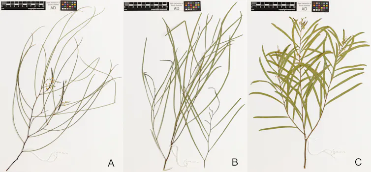
It’s not yet clear which way it will go, though models suggest it may switch from neutral to positive into spring. If it does, the chances of dangerous levels of drying increase substantially.

Over 2018 and 2019, these two climate drivers overlapped, causing intense drying ahead of the Black Summer bushfires. In 2023, they overlapped again, producing Australia’s driest three-month stretch on record.

We should know if they will overlap this year by late July or August.

From reacting to acting

It makes sense to lay out stages of action and do more as necessary, rather than waiting for certainty.

State government drought responses are largely structured like this.

But federal leaders have consistently relied on ad-hoc spending as droughts worsen rather than building resilience early, leading to worse outcomes for rural communities and a higher cost.

Similar criticism has been made of our bushfire response. A recent independent review found only 7% of federal disaster funds went to reduce risk and boost preparedness before the disaster.

So what would a staged approach look like?

aerial view of burned out land on one side of dirt road and green pasture on the other side.
The huge fires of the 2019–20 Black Summer came after El Niño and the IOD coincided – and exposed flaws in disaster response. BeyondImage/Getty

Stage 1: low regrets

Some actions can be taken without regret because they cost little and build resilience. These would include:

  • properly funding volunteer firefighter training and accreditation at state level. Volunteer firefighters do much of Australia’s firefighting but the sector is chronically underfunded

  • create a national drought early warning system

  • lift the legal barriers that prevent Traditional Owners practising cultural burning at scale. Cultural burning could match existing fuel reduction with far less ecological cost.

  • build the national register of firefighting personnel, equipment and aerial assets the Bushfire Royal Commission recommended back in 2020. It is still not in place.

  • expand existing advice services for farmers, such as financial counselling and on-farm advice for sowing decisions and livestock feed planning.

Stage 2: getting ready

If a positive IOD is confirmed, authorities should focus on actions too specific or too costly to justify now, but too important to improvise mid-crisis.

These could include:

  • boosting staffing and readiness for agencies responsible for drought and bushfire response

  • tying drought relief to observed conditions so support reaches farmers in weeks rather than months

  • boost federal support for rural mental health early. At present, these measures require assessment after the disaster and sign-off from the prime minister

  • confirm aerial firefighting capacity, cross-state emergency communications and potential defence force deployment in advance. This would avoid repeating Black Summer’s reactive scramble when more than 60 firefighting aircraft had to be sourced from overseas mid-crisis, incompatible radio systems left crews from different states unable to communicate directly, and defence force deployment only came after weeks of public pressure

  • provide hospitals with access to better air-quality forecasts ahead of fire season, to allow preparation for surges in respiratory illness

  • establish and resource more community-led networks such as the Red Cross’s Community-led Resilience Teams. These networks have proven critical to effective disaster response and recovery but are often left out of formal emergency management planning.

During and after disaster

Preparation ahead of time means authorities aren’t building capacity under pressure but simply trigger what’s already in place.

States use their incident control structures to coordinate police, fire, ambulance and the defence force under one chain of command.

Declaring a state of emergency unlocks legal powers and funding pathways agreed well in advance.

Evacuation orders go out through tested and proven public warning systems.

The same logic carries into recovery. Rapid damage assessment teams establish what’s needed where, feeding into the first wave of financial support — one-off emergency payments and short-term income assistance for people who’ve lost homes, livelihoods or income.

Recovery centres open as a single point of contact, so affected residents can access grants, counselling, insurance guidance and practical help in one place.

Failing to plan is planning to fail

An unprepared, improvised response doesn’t fail everyone equally – it punishes those with less capacity to compensate. A wealthy irrigator with secure water entitlements can weather a bad season better than a farmer reliant on the volatile temporary water market.

Similarly, First Nations communities repeatedly report being left out of disaster planning and facing unwelcoming treatment during a disaster response.

Australians are no strangers to natural disasters. What we have failed to do consistently is plan staged responses and begin as soon as a large event seems probable, rather than waiting for absolute certainty.The Conversation

Em Murdock, PhD Student, Department of Environmental Science, Policy and Management, University of California, Berkeley and Lucas Vargas Zeppetello, Assistant Professor, Department of Environmental Science, Policy, and Management, University of California, Berkeley

This article is republished from The Conversation under a Creative Commons license. Read the original article.

This rare Australian wattle is on the brink of extinction: new research

A close-up view of a spidery wattle plant, with thin branches and small yellow flowers.
The spidery wattle is a rare but much-loved species in South Australia. Emily McAllan
Brittany Hogben, Adelaide University ; Andrew Lowe, Adelaide University ; Colette Blyth, University of Adelaide, and James B. Dorey, University of Wollongong

The spidery wattle (Acacia araneosa) is a national treasure.

This plant is named for its spidery, leaf-like phyllodes and shares the same iconic golden flowers as Australia’s floral emblem, the golden wattle (Acacia pycnantha).

The spidery wattle is extremely rare, found only in a tiny area of South Australia’s Arkaroola Wilderness Sanctuary and Vulkathunha-Gammon Ranges National Park. This, alongside its unusual appearance, makes it a distinctive and beloved part of the landscape.

But this local icon is under threat. In the late 1830s, the first pastoral leases – which allowed livestock grazing on government land – were granted in South Australia. This significantly reshaped the state’s landscapes and ecosystems.

Our new study shows since that period, the spidery wattle population has drastically shrunk by about 98%. If this trend continues, the future of this unique species looks grim.

Thankfully, we can do something about it.

An image of a tall plant with thin branches in a rocky landscape.
There are only two remaining spidery wattle populations, both found in South Australia. Emily McAllan

A perplexing plant

The spidery wattle has long puzzled scientists.

For years, researchers studying this unassuming plant noticed seed from the spidery wattle would sometimes “revert” to the form of another common wattle species, the silver wattle (Acacia rivalis). The silver wattle is a more widespread species than the spidery wattle, but grows in the same area.

This phenomenon could be explained by phenotypic plasticity — the ability of an organism to modify its physical traits or behaviour in response to environmental changes. This is fairly common in the plant world, with one example being Hydrangea flowers that change colour depending on soil pH levels.

These observations raised a crucial question: are spidery wattles just silver wattles that have changed form to suit local conditions?

It can be difficult to get funding for conservation efforts, so if we are to protect a plant or animal, it better be a “real” species!

Our latest research reveals, for the first time, the spidery wattle and silver wattle are indeed two distinct species. But we found these plants can hybridise in the wild, meaning the “reverted” seeds scientists observed were very likely hybrid seeds.

Why genes matter

We know of only two small spidery wattle populations, growing very close together on the hills of the Arkaroola Wilderness Sanctuary. Data from the mid-1990s suggests there were about 1,000 individual plants in total. This figure has almost certainly decreased since.

Despite being within shouting distance of each other, these two populations are genetically distinct. This is concerning because when populations shrink, they can rapidly lose genetic diversity. This is due to a process known as “genetic drift”, where the number of different genes in a small population randomly fluctuates.

Three botanical specimens of wattle plants.
Herbarium specimens collected for spidery wattle (left), potential hybrids (middle) and silver wattle (right), showing the differences between each. Brittany Hogben

It’s also more likely that individual plants with similar genes will interbreed. This means two small populations of 50 individuals are more vulnerable to pests, disease and environmental change, compared to a single population of 100.

This was the case with the Florida panther, a species once found across the south-eastern United States. In the 1980s, this panther population rapidly shrank, leading to inbreeding and the birth of many unhealthy kittens.

Worryingly, our research suggests the two remaining spidery wattle populations are already showing signs of being less genetically diverse.

A species under threat

Local observations suggest adult spidery wattles cope reasonably well in hot and dry conditions. However, their tiny seedlings are extremely vulnerable to drought and introduced herbivores such as rabbits, goats and sheep.

Over the past few millenia, Australia’s weather has become more dry and unpredictable. Our research shows these climatic changes have had a marked impact on the spidery wattle. This is because seedlings struggle to reach maturity in drought conditions, affecting the overall health of the spidery wattle population.

We found the species started declining roughly 3,300 years ago. Other research shows the now-extinct Tasmanian tiger disappeared from mainland Australia at this time, due to the same climatic changes.

However, the spidery wattle population started declining much faster once humans settled in South Australia and started farming from 1836 onwards. In the intervening years, the spidery wattle population has shrunk by roughly 98%.

So, what can we do?

Together, these factors mean the spidery wattle is now on the brink of extinction. However, work is already underway to ensure this unique species survives.

A passionate group of South Australian conservationists are spearheading efforts to set up exclusion fences, which stop herbivores from grazing spidery wattle seedlings. Through restoration planting, they have also grown and planted seedlings to boost the size of existing populations.

Importantly, about 2,000 spidery wattle seeds are being preserved in South Australia’s Botanic Gardens and the United Kingdom’s Millennium Seed Bank.

But there is still more we can do.

Two women collecting plant samples on a low hill covered with dry-looking vegetation.
Researchers collecting spidery wattle genetic samples at Arkaroola Wilderness Sanctuary. Emily McAllan

Currently, the spidery wattle is listed as a “Vulnerable” species federally, and “Endangered” at a state level. Given the two remaining populations are still at risk, it’s time we recognise it as a “Critically Endangered” species in Australia.

The spidery wattle should also be added to the International Union for Conservation of Nature’s Red List. These listings would support conservationists and policymakers to secure the funding needed to protect this iconic species.


We dedicate this work to the memory of Martin O‘Leary of the South Australian Herbarium, whose contribution to this study was crucial. A leading plant taxonomist in South Australia, Martin brought warmth and enthusiasm to his work, with a particular kindness to students. We are grateful for the privilege of working with him.The Conversation

Brittany Hogben, PhD Candidate in Conservation Biology, Adelaide University ; Andrew Lowe, Director, Environment Institute, Adelaide University ; Colette Blyth, Postdoctoral Researcher, School of Biological Sciences, University of Adelaide, and James B. Dorey, Lecturer in Biological Sciences, University of Wollongong

This article is republished from The Conversation under a Creative Commons license. Read the original article.

Big bees have the most to lose as global CO₂ levels rise: new research

A close-up image of a native Xylocopa bee, with large eyes and black antennae.
Xylocopa (Koptortosoma) sp. female. Kit Prendergast
Kit Prendergast, University of Southern Queensland; Curtin University

Pollinators – including bees, flies, wasps, moths, butterflies and some nectar-loving birds – are a cornerstone of our natural environment.

By helping plants reproduce, they keep our ecosystems healthy and ensure we can grow vital food crops.

But climate change threatens the very survival of these hard-working animals.

Previous research has focused on how temperature changes affect bees, finding that certain groups are more vulnerable to hotter temperatures.

But our new study shows rising carbon dioxide (CO₂) levels may also be putting pollinators – such as bees and hoverflies – at risk.

Larger bees are the most vulnerable. We found populations of big bees – including Bombus asiaticus and Xylocopa pubescens – were smaller and less genetically diverse in areas with high CO₂. Small-bodied pollinators, however, may actually do better in higher-CO₂ environments.

A dire situation

In Australia and around the world, we are facing a pollinator crisis. There are several reasons for this, including the loss and degradation of wild pollinator habitat, the introduction of the European honey bee and other invasive species, and the use of broad-spectrum pesticides.

But climate change – driven by human-made greenhouse gases including CO₂ emissions – is another key factor. Australia contributes to higher CO₂ levels as the second-largest fossil fuel exporter in the world.

Elevated CO₂ levels can affect pollinators by reducing how much protein is in flower pollen. Having more CO₂ in our atmosphere may also change the chemical make-up of nectar, for example reducing how much sugar it contains. Both factors influence how pollinators develop and survive.

Other research suggests higher CO₂ concentrations could impact how pollinators’ bodies function, for example by accelerating how quickly they break down fats.

What we studied

In our latest study, we examined how bees and hoverflies coped with different levels of CO₂ across 25 sites. This is the first time researchers have investigated how natural changes in CO₂ levels affect pollinators.

While our study was conducted in Pakistan, it is relevant to pollinator networks in Australia and around the world, given that CO₂ levels are rising globally. Importantly, we controlled for other factors that may affect the number and distribution of bees and hoverflies, including altitude, temperature, humidity and rainfall.

Our results suggest pollinators respond to variations in CO₂ in different ways. Specifically, smaller pollinators may actually do better in higher-CO₂ environments. In contrast, larger-bodied pollinators were less abundant in areas with more CO₂.

We identified Xylocopa and Amegilla bees, two genera found in Australia, as being particularly vulnerable to increased CO₂ levels. Ceratina and Lasioglossum bees are two examples of smaller-bodied Australian genera that did well in higher-CO₂ environments.

A close-up image of a large, green-coloured bee.
The pubescent carpenter bee is a larger-bodied species that is vulnerable to rising CO₂ levels. Waseem Akram

Why big bees matter

These findings are concerning for several reasons.

Existing evidence shows larger-bodied bees such as Bombus are already more vulnerable to climate change. This is because they tend to retain more heat and don’t cope as well in dry conditions. Big bees also have higher metabolic demands than smaller pollinators, meaning they need more resources to keep their bodies functioning.

Large bees are among our most effective pollinators. They typically carry and deposit more pollen than smaller-bodied pollinator species. They also fly longer distances, meaning they can transport seeds and pollen to help plants reproduce and spread their genes to new places.

Other research suggests flowers have even evolved to match pollinators with particular body sizes. We see this in Australia with Melastoma. This plant’s impressive flowers are most effectively pollinated by large pollinators such as Xylocopa bees, which use vibrations to release pollen from flowers.

So, what can we do?

Here are four practical ways we can help our larger pollinators thrive in a warming world.

  • protect their habitat by preventing further land clearing, for example to make room for more livestock farms

  • ensure pollinators have access to wildlife corridors to help them move to areas that are naturally lower in CO₂, such as dense forests

  • plant more bee-friendly trees, with some Australian examples being Eucalyptus, Corymbia, Angophora, Melaleuca, Banksia and Brachychiton

  • maintain populations of larger-bodied bees by reducing other threats such as competition from introduced honey bees, to ensure they have the genetic diversity to adapt to rising CO₂ levels.

To protect our pollinators in a rapidly changing climate, we must act now. Ensuring their habitat remains intact and curbing our greenhouse gas emissions are vital first steps.The Conversation

Kit Prendergast, Postdoctoral Researcher, Pollination Ecology, University of Southern Queensland; Curtin University

This article is republished from The Conversation under a Creative Commons license. Read the original article.

The tiny microalgae behind South Australia’s harmful algal bloom is among the most toxic ever tested

Two dead fish lay on a beach during a harmful algal bloom.
Mark Piovesan/Getty
Shauna Murray, University of Technology Sydney; Cheong Xin Chan, The University of Queensland; Craig Styan, University of Adelaide; Greta Gaiani, University of Technology Sydney, and Gustaaf Hallegraeff, University of Tasmania

Over the past 15 months, one of the country’s worst marine environmental disasters has been unfolding in South Australia.

A harmful algal bloom expanded in many coastal seas, killing thousands of fish, birds, shellfish and marine mammals. Even iconic species such as giant cuttlefish and seadragons have washed up dead on beaches.

These blooms happen when particular species of microscopic algae accumulate in a body of water. Several hundred species of microalgae produce toxins that, in high concentrations, can be harmful to humans and deadly to marine creatures.

Our new research shows Karenia cristata, the rare microalgal species behind this catastrophic bloom, is among the most toxic species to marine life ever studied. It’s capable of killing zooplankton, a type of small marine animal, in concentrations of just five cells per millilitre of seawater.

A marine disaster

In March 2025, dozens of surfers and swimmers fell ill after being exposed to water or seafoam on the Fleurieu Peninsula, south of Adelaide.

Local residents and tourists reported respiratory symptoms such as coughing and shortness of breath, as well as skin and eye irritation.

Reports of dead or dying marine creatures followed. And water testing by authorities found the first signs of an algal bloom.

In the following months, the algal bloom spread across SA’s two main gulfs, the Gulf St Vincent and Spencer Gulf. It has proved devastating for the state’s marine ecosystems, aquaculture industries and coastal communities.

The detection of brevetoxins in shellfish forced local oyster and mussel farmers to stop harvesting for up to eight months. Hundreds of coastal businesses, such as recreational fishing charters and wildlife tour operators, lost significant income.

What is Karenia cristata?

K. cristata is an extremely rare microalgal species. Before this bloom, it has only ever been found in two locations: South Africa and an island off the coast of Newfoundland.

There are many different species of Karenia. But they’re often hard to distinguish as their cells have a similar size and shape. This is a problem because Karenia species that look similar can produce completely different toxins, or no toxins at all.

In our new study, we used a method called scanning electron microscopy to get an extremely close-up view of K. cristata cells. This allowed us to compare them with the cells of other types of Karenia.

We also developed several new molecular genetic methods to measure the number and distribution of Karenia during the SA bloom. These genetic methods allowed us to easily distinguish between different Karenia species.

We found the only other Karenia species known to produce brevetoxins, K. brevis, was not in the SA bloom. We also found both K. cristata and K. brevis produced similar concentrations of brevetoxins, but with a different chemical makeup.

We found K. cristata was the dominant Karenia species. It was in 90% of the samples we tested, and remained in high concentrations over time. We also identified four other Karenia species in our samples.

Why is this algae so lethal?

Our latest research suggests the microalgae that caused SA algal bloom is among the deadliest species of its kind, in terms of impact on marine life.

Our team of 25 scientists took a closer look at laboratory-grown strains of K. cristata. To do this, we hand-picked individual cells of microalgae from seawater using ultrafine glass pipettes. We then grew them in bacteria-free, nutrient-rich seawater and made sure the temperature and amount of light stayed the same.

Using these lab-grown cells, we conducted three different experiments to observe how Karenia toxins affect the cells of fish and invertebrates – tiny marine animals that don’t have a backbone such as rotifers, a type of small zooplankton, and larval crustaceans.

The results were startling. K. cristata killed half the invertebrates we studied, even in extremely low concentrations of only five cells per millilitre – or 5,000 cells per litre – of seawater. This makes it more deadly to invertebrates than any other species of toxin-producing algae tested using this same method. The algae had a similar affect on lab-grown fish gill cells.

Compared with our experiments, K. cristata was present in higher concentrations in the waters around SA during the latest algal bloom. In August and September 2025, we routinely recorded concentrations higher than one million cells per litre of seawater off the coast of Adelaide.

This may explain why this bloom was so catastrophic.

Where to from here?

Until now, we thought an algal bloom of this scale could only develop in the warm waters off the southeastern United States. There, harmful algal blooms caused by the K. brevis microalgae are fairly common.

But our research shows other coastal areas around the world could also be at risk – including those with cooler waters.

We urgently need more research to understand the conditions that allow K. cristata to thrive and produce toxins in such high concentrations.

This will allow us to develop monitoring programs that not only detect harmful algae, but also identify which species may be most deadly. Only then can we protect our coastal ecosystems, industries and communities from another marine disaster.

The Conversation

Shauna Murray, Professor; Faculty of Science, University of Technology Sydney; Cheong Xin Chan, Associate Professor, School of Chemistry and Molecular Biosciences, The University of Queensland; Craig Styan, Associate Professor, School of Physics, Chemistry and Earth Sciences, University of Adelaide; Greta Gaiani, Chancellor's Postdoctoral Research Fellow, School of Life Sciences, University of Technology Sydney, and Gustaaf Hallegraeff, Adjunct Senior Researcher, Ecology and Biodiversity, University of Tasmania

This article is republished from The Conversation under a Creative Commons license. Read the original article.

What happened to Australia’s snow season? A climate expert explains

Young girl slides down a snowy mountain on a red toboggan.
Kinson C Photography/Getty
Andrew B. Watkins, Monash University

There’s nothing like gliding down a snow-covered slope.

That’s if you ask the thousands of people that make an annual pilgrimage to our alpine resorts during the Australian winter.

But this year, the start to the snow season has been far from spectacular.

While there is still some way to go before the typical peak of the season in mid- to late August, maximum snow depths have declined by around 30% since the middle of last century.

Given the underwhelming start to the season, many ski resorts are struggling to attract visitors and keep their lifts running. It’s also affecting local businesses, alpine communities and parents who hoped a school holiday skiing trip would keep their kids occupied.

So why is there so little snow this year? And what does it mean?

A view of snow-covered mountains with a sunset in the background.
View of Mount Hotham, Victoria in July 2026. Andrew Watkins

What shapes our snow season?

There are four main climate drivers that shape Australia’s alpine weather – including whether we get a good or bad snow season.

1. El Niño or La Niña

El Niño and La Niña refer to naturally occurring variations in temperature and winds over the Pacific Ocean that can influence weather around the world.

In Australia, El Niño years typically bring drier and warmer weather. In the eastern half of the country, this translates to below-average rainfall and warmer daytime temperatures during winter and spring. This also raises the risk of a shorter snow season. At the higher peaks, the season ends roughly two weeks earlier with maximum snow depths that are about 35cm less than average.

La Niña is the opposite to El Niño, characterised by higher rainfall and cooler temperatures in Australia. La Niña winters typically bring more snow. But occasionally mild temperatures in alpine regions can result in warm rain, the natural enemy of decent snow cover. This can mean some La Niña snow seasons can end abruptly due to spring rain.

2. Indian Ocean Dipole (IOD)

The IOD is caused by changes in sea surface temperatures in the Indian Ocean. A positive IOD indicates cooler ocean temperatures in the eastern Indian Ocean, near Indonesia. This means south-eastern Australia typically receives less winter rain and snow. In contrast, a negative IOD generally means more snow falls across eastern Australia.

3. Southern Annular Mode (SAM)

The SAM tells us where the main weather systems that bring snow and rain – cold fronts and low pressure systems – are located over the Southern Ocean. If they are closer to Australia – where they can draw up cold air and moisture from the south – this is known as a negative SAM. If they are closer to Antarctica than normal, this creates a positive SAM.

We’re most likely to score a good snow season when La Niña, a negative IOD and a negative SAM all coincide. These conditions make Australia’s alpine regions colder and wetter than average, creating the ideal conditions for snow. We saw this in 2022 and 2025, the last two times when the peaks of the Snowy Mountains were blanketed in more than two metres of snow.

An underwhelming year

This snow season, none of the good-for-snow climate drivers have arrived.

In fact, we currently have an El Niño, a positive SAM and a neutral IOD, loading the dice for a drier and warmer winter in Australia.

As a result, we’ve seen a slow start to this year’s snow season. Ski resorts are battling warmer daytime temperatures, bouts of rain and warm soils, which mean snow tends to melt once it hits the ground.

Using machines to make artificial snow has helped. But conditions have sometimes been too humid to make snow.

A view of mountains covered either by snow or vegetation.
A lack of snow on north-facing slopes, taken from Mount Hotham in July 2026. Andrew Watkins

The latest snow depths from July 7 show Spencers Creek in the Snowy Mountains had only 35cm of snow, and Mount Hotham just 28cm. We had similar poor starts to the snow season in 1957, 1967, 1982 and 1997.

Most recently, both 2023 and 2015 saw our snow-related climate drivers all point to a poorer snow season. On July 9 2015, less than 5cm of snow was on the ground at Spencers Creek, and just 9cm at Mount Hotham. That’s far less than our current 2026 totals.

On July 9 2023, Hotham had a much healthier 88cm, but that ended up being its maximum depth for the entire season. That’s well below its long-term average peak of 116cm.

A concerning trend

We’ve now had three poor starts – 2020, 2023 and 2026 – to the snow season in just seven years. And worryingly, the length of the snow season, snow depth and area of snow cover are all shrinking.

Global warming – driven by our continued burning of fossil fuels such as coal, oil and gas – is already reducing how much snow is falling. It’s also changing our alpine landscapes in Australia.

The world has now warmed by 1.44C and Australia by 1.59C, since the early 20th century. And research suggests climate change is gradually overtaking the traditional climate drivers which have, until now, largely shaped our snow seasons.

If we don’t curb our greenhouse gas emissions, our snow season is likely to slowly disappear. The good news is, the faster we abandon fossil fuels, the better our future winters will be.

View of a snow-covered mountain in Victoria's alpine region.
View of the Mary’s Slide ski run at Mount Hotham, Victoria in 2025. Andrew Watkins

Correction: This article originally said weather systems close to Australia were known as positive SAM and those closer to Antarctica created a negative SAM. This has now been corrected.The Conversation

Andrew B. Watkins, Adjunct Professor (Practice) in the School of Earth, Atmosphere and Environment, Monash University

This article is republished from The Conversation under a Creative Commons license. Read the original article.

A severe El Niño could threaten something essential to half of humanity – rice

sun rising over rice paddy filled with water, rice seedlings.
Eko Prasetyo/Getty
Vito Butardo Jr, Swinburne University of Technology

Forecasters expect the El Niño now underway in the tropical Pacific to strengthen into a strong or very strong climate driver later this year.

When an El Niño arrives, it reorganises rainfall patterns around the world. Parts of the Americas and east Africa tend to get heavier rain, while monsoonal rains in Asia get weaker and drier conditions settle over eastern Australia, southeast Asia, India and southern Africa.

This mix of heat and disrupted water supplies could have real consequences for food supply, especially rice. El Niño doesn’t tend to hit wheat as hard, because a bad season in one region is often offset elsewhere. But rice is different. Production is concentrated in Asia and only a small share is traded.

The last El Niño in 2023-24 threatened rice supplies. This one may be worse for farming, because climate change is adding extra heat on top of disrupted rainfall.

Why rice is the crop to watch

Over half the world’s population relies on rice. India and China grow more than half of the world’s supply, and rice supplies more than half of all daily calories in countries such as Bangladesh, Vietnam and Cambodia.

Poorer households spend the largest share of income on food, so price spikes hit them first and hardest. In 2007-08, rice prices roughly tripled, food riots broke out in dozens of countries, and in Haiti, the unrest helped bring down the prime minister. Securing rice is about more than food – it underpins public order.

Rice is also a thirsty crop. Most high-yielding varieties are bred for flooded paddies, where water suppresses weeds, supports flowering and grain development, and helps keep plants cool. Hardier upland rice can grow with less water but usually yields less. Hence, breeders want to move the drought-tolerance of upland rice into lowland varieties that most farmers actually grow.

If this year’s El Niño is severe, it could hit the water supplies of several major producers at once, so shortfalls compound rather than cancel out.

Fertiliser prices have also spiked in 2026 due to the Iran war and disruption to the Strait of Hormuz, making a hard season even harder.

The issue with irrigation

Around three-quarters of the world’s rice comes from irrigated lowland paddies. Irrigation buffers rice against patchy rainfall in normal years, but it depends on water sources such as rivers, reservoirs and snowmelt which El Niño can affect.

Australia shows this clearly. The Riverina region of New South Wales grows some of the most water-efficient rice in the world. But rice competes for water with permanent plantings such as almonds, which must be watered regularly.

In the worst droughts, Australia’s rice crop has fallen to a small fraction of normal production.

A shock that travels

Rice is thinly traded. Most of what a country grows is eaten at home, and exports are often less than 10% of production. This means a disruption to a few big exporters can move prices fast.

In 2023, India clamped down on rice exports to protect domestic prices, resulting in global price surge. But the picture recently reversed. India now has record stocks and is exporting heavily after lifting its bans, easing prices.

This situation is not guaranteed to last. During the 2007-08 rice crisis, export bans and panic buying were the major factors driving up prices. If this year’s El Niño is severe, it could hit several regions at once, triggering bans and panic buying on a larger scale. Worst hit would be poorer nations dependent on rice imports, such as the Philippines and West African countries.

rice plants growing in dried up paddy.
Some rice varieties can better tolerate hotter, drier conditions. Rio Susanto/Getty

Can we prepare?

Rice farmers in Indonesia are racing to plant their crop ahead of El Niño, and farmers elsewhere are trying to adapt too.

Researchers can play a key role. Before being domesticated, wild rice was a humble grass with much smaller grains and lower yields. Thousands of years of selective breeding have turned it into cultivated rice, with much larger yields.

Even more can be done to make rice stress resilient, climate adapted, and water efficient.

Our recent work suggests some rice varieties can conserve water without an obvious yield and quality penalty even when water supplies are limited.

Farming methods can save water too: growers can let paddies dry between waterings, irrigate later in the season, or grow rice more like a dryland crop. Standing water also shields the crop from temperature extremes, cooling it in heat and buffering it against cold, so cutting it back too far can expose flowers to damage at the most vulnerable stage.

Beyond the farm, preparation means better forecasting, sustained research investment, and a shared resolve among rice-growing nations to keep trade open rather than hoard in a crisis.

We are not powerless against a strong El Niño. But this year’s rice supply faces a real test. The stakes are high, not just for food security, but also for global stability.The Conversation

Vito Butardo Jr, Senior Lecturer in Biotechnology, Swinburne University of Technology

This article is republished from The Conversation under a Creative Commons license. Read the original article.

Prickly starfish and urchins are decimating Australia’s reefs. But we could find ways to protect them

A crown-of-thorns starfish on coral (left image) and a long-spined sea urchin in the foreground with kelp in the background (right image).
Peter Doll and Scott Ling
Sterling B. Tebbett, University of Tasmania; John Keane, University of Tasmania, and Scott Ling, University of Tasmania

Australia is home to some of the world’s most beautiful reefs.

This includes the lush Great Southern Reef, which wraps around Australia’s southern coastline, and the world-renowned Great Barrier Reef.

But the corals of the Great Barrier Reef and the kelp forests of the south are both plagued by prickly problems – voracious starfish and sea urchins.

The coral-eating crown-of-thorns starfish is one of the greatest threats to the Great Barrier Reef. And on the temperate Great Southern Reef, long-spined sea urchins have eaten their way through thousands of hectares of kelp forests. Both species are native but can boom in numbers, and the urchins have spread to new areas due to climate change.

Scientists tend to study these two species as isolated threats. But our new study shows that while they pose high but differing risks, investing in control programs and innovative research could help curb these two prickly problems.

Overabundant species

Crown-of-thorns starfish and long-spined sea urchins threaten reefs by building up large populations that overgraze coral or kelp.

Crown-of-thorns starfish are native to the Great Barrier Reef. Their population growth follows a boom-and-bust cycle. Since data were first available in the 1950s, the number of crown-of-thorns starfish has surged by more than 1,500 per square kilometre roughly every 15 years. But once they eat all the available coral – the foundation of their diet – the population crashes. When the starfish eat too much coral, this represents another threat to reefs already stressed by climate change.

Three crown-of-thorns starfish feeding on a coral (left image) and three long-spined sea urchins feeding at the edge of a kelp forest (right image).
Crown-of-thorns starfish feeding on coral (left) and long-spined sea urchins feeding at the edge of a kelp forest (right). Peter Doll and Scott Ling, CC BY

Long-spined sea urchins are native to the seas off mainland Australia. Tasmanian waters were once too cold. But as the oceans have warmed due to climate change, the sea urchin has been able to spread south.

Their spread into Tasmania in recent decades, in their millions, has caused extensive damage to kelp forests.

Our neighbours in New Zealand are also battling an influx of these urchins.

The long-spined sea urchins can build up to densities hundreds of times higher than peak crown-of-thorns starfish densities. And further, because of their flexible diet of various kinds of microalgae, drifting seaweed, and invertebrates, the urchins can survive in a semi-starved state. This results in the barren reefs they create persisting for decades.

Tricky to manage

From a conservation perspective, the way to tackle long-spined sea urchins currently differs from tackling crown-of-thorns starfish for three main reasons:

1. Fluid borders

Crown-of-thorns starfish are monitored and managed by federal institutions on the Great Barrier Reef, including monitoring by the Australian Institute of Marine Science and management by the Great Barrier Reef Marine Park Authority.

In contrast, long-spined urchins are spread across multiple jurisdictions, stretching from northern New South Wales to southern Tasmania. Authorities in each state manage urchins in different ways and to varying degrees, as populations change from native to invasive and overabundant. But these urchins are a national problem, given that urchin larvae travel south for hundreds of kilometres on the prevailing ocean currents, with no regard for state borders.

2. Commercial interests

Crown-of-thorns starfish have no economic value. But urchins can be harvested for their roe, considered a delicacy in countries such as Japan. While demand for this high-value seafood product continues to grow, it is not yet at the scale required to combat the problem. Developing the urchin industry further would see more urchins removed from the water, enhancing reef protection.

A diver culling a crown-of-thorns starfish (left image) and a diver harvesting long-spined sea urchins (right image).
A diver culling a crown-of-thorns starfish on the Great Barrier Reef (left) and a diver harvesting long-spined sea urchins on the Great Southern Reef (right). Peter Doll and Matt Testoni, CC BY

3. Inconsistent funding

Sustained, large-scale investment in management is necessary to tackle these prickly problems. The roughly $20 million-per-year federally funded crown-of-thorns starfish control program is locked in years in advance. But funding for urchin control in Tasmania is about 40 times lower.

Researchers, managers and politicians alike have been calling for federal investment into the urchin fishery, but to date no substantial funding has been delivered. Investment into developing a profitable and larger sea urchin industry would deliver a long-term, low-cost solution to the urchin problem.

Natural defences

To protect our precious tropical and temperate reefs, we must take action.

One strategy is to protect their natural predators.

A 2026 study showed the spangled emperor is the key predator of crown-of-thorns starfish on the Great Barrier Reef. This fish species is found throughout the Indo-Pacific region but is sought after by fishers.

On the Great Barrier Reef there are six times more spangled emperor in areas protected from fishing. This suggests protecting spangled emperor populations can help control crown-of-thorns starfish.

Similarly, the highly valuable southern rock lobster is a predator of long-spined sea urchins in Tasmania. Although these lobsters are widespread, they are highly sought after by fishers. When given a break from intensive fishing, lobster populations can build up, helping to limit urchin populations.

Rebuilding predator populations can form part of a whole-of-ecosystem reef management approach, where priority is given to the overall health and balance of ecosystems and communities.

Plotting a positive future

As our climate changes, Australia’s reefs face an uncertain future. Outbreaks of coral-eating starfish and kelp-grazing sea urchins can rapidly transform healthy reefs into degraded ecosystems.

Yet this future is not inevitable. By investing in collaborative research we can find ways to restore and protect these iconic environments.

The Conversation

Sterling B. Tebbett, Postdoctoral Researcher, Tropical and Temperate Reef Ecology, University of Tasmania; John Keane, Research Fellow (Dive Fisheries), University of Tasmania, and Scott Ling, Associate Professor, Ecology and Biodiversity, University of Tasmania

This article is republished from The Conversation under a Creative Commons license. Read the original article.

Wilsons Prom has been scarred by bushfires. It may help us protect other fire‑prone forests

A eucalyptus tree resprouts.
Tom Fairman
Aaron Heap, The University of Melbourne and Tom Fairman, The University of Melbourne

Our national parks are a haven for humans, plants and animals alike.

Protected areas such as national parks are a cornerstone of our efforts to conserve nature. But these unique ecosystems can still bear the scars of past fires, floods and other natural disturbances.

Our new study examines how repeated bushfires have changed, and continue to change, one of Australia’s iconic national parks.

Located on Australia’s southernmost tip, Wilsons Promontory or “the Prom” is one of Victoria’s most popular national parks, famous for its wombats, rosellas, mountains and coastlines.

But in the first half of last century, the Prom was repeatedly burnt by intense bushfires. This pushed thousands of hectares of eucalypt forests towards collapse. And as our climate changes, bushfires will only become more frequent and severe.

The history of the Prom may provide a preview of what our forests could look like in a warmer, more fire-prone future. It could also give us clues about how to protect them.

Fire and forests: a delicate balance

Over millions of years, Australia’s eucalypt forests have evolved to both survive and recover from bushfires.

For many species, this includes their ability to resprout new stems and leaves from the sides of charred trunks – a process known as “epicormic resprouting”.

Even so, resprouting eucalypts need time to recover before they can withstand another fire. If they’re burnt by back-to-back bushfires, eucalypts may start to die.

At its most severe, this can lead to “ecosystem collapse” – where an area loses all forest cover and only patches of dense, short shrubs remain.

This has serious consequences for the entire ecosystem, including less habitat for wildlife, less carbon storage and potentially increased bushfire risk. But we still don’t fully understand how long these changes last, and what the longer-term implications may be.

Our new research aims to provide some answers.

What we studied

After multiple successive bushfires in the early 1900s, the Prom’s eucalypt forests failed to recover and resprout, and became “collapsed forests”. They have stayed that way for the past 70 years.

Our study compared areas of collapsed forests with nearby areas of “intact forests”, where eucalyptus trees are still growing, at the Prom.

We found collapsed forests had 97% fewer large trees and were dominated by shrubs. Large trees provide areas for birds to build nests and possums, gliders and microbats to shelter in hollows.

We also found collapsed forests have 40% fewer fallen trees and trunks, compared with intact forests. These logs act as shelter for native ground-dwelling mammals such as the long-nosed potoroo and the pookila, also known as the New Holland mouse. They also provide food and other resources for various types of fungi and insects.

Collapsed forests store 60% less carbon than intact forests. In collapsed forests, carbon is mainly stored in short, dense shrubs. This type of vegetation is more likely to be burnt up in future fires, meaning any carbon they store is released back into the atmosphere.

So, what can we do?

Given these collapsed forests have persisted for 70 years, the only way they may be restored is if we intervene. This is possible through forest management strategies such as reforestation or reseeding.

But before we try to restore these forests, we must consider several questions:

  • how much should we intervene in national parks? Is it our responsibility to reforest these areas, or should we expect to see more collapsed forests in protected areas?

  • should we restore these collapsed forests to what they were in the 1900s, or prepare them for a more fire-prone future by introducing more drought- and fire-tolerant trees?

These are complex questions. We need more research to know how to best protect our national parks and other vulnerable ecosystems from future fires, floods and other natural disturbances. We must also ensure our national parks are reliably funded.

The Prom shows us forest collapse is not inevitable. But it’s an urgent reminder of the importance of actively managing and investing in our national parks, particularly as the warming climate threatens their very survival.The Conversation

Aaron Heap, PhD candidate, The University of Melbourne and Tom Fairman, Forest and fire scientist, The University of Melbourne

This article is republished from The Conversation under a Creative Commons license. Read the original article.

Can we keep Australia’s endangered alpine ash on the map? New modelling shows where to focus our efforts

Benjamin Wagner, The University of Melbourne; Craig Nitschke, The University of Melbourne, and Kaitlyn Hammond, University of Northern British Columbia

An alpine ash forest is a sight to behold.

Alpine ash (Eucalyptus delegatensis) is a tall eucalypt species that grows in the cool, wet mountains of south‑eastern Australia.

These forests store large amounts of carbon in their wood and soils. They help regulate water flows into major rivers and dams, and provide habitat for a wide range of birds, mammals and insects.

Mainland alpine ash forests are now formally listed as endangered. This is because bushfires are becoming more frequent and severe due to climate change, which threatens to wipe out some of these forests.

In our new study, we examined how alpine ash forests would change under different climate scenarios, and found that difficult choices likely lie ahead.

Is it still possible to protect this unique species? We think so.

From the ashes

Alpine ash is what ecologists call an “obligate seeder”. This refers to plants that, after a major disturbance such as a bushfire, can only regenerate from seed.

If a mature forest burns, many adult trees die. However, the heat from the flames opens their seed capsules high in the canopy, releasing a flush of seed that allows the forest to regenerate. But this strategy only works if there is enough time between fires for young trees to mature and start to reproduce.

In recent decades, increasingly hot and dry conditions have sparked larger fires, including the devastating “Black Summer” fires of 2019-20. As a result, some regions have been repeatedly burnt within a matter of years.

When fire returns before the new generation of trees can produce seed of their own, alpine ash forests can fail to regenerate and may be replaced by other vegetation. This process, known as “immaturity risk”, is a major reason why alpine ash is now considered an endangered species.

In response, forest managers are increasingly turning to aerial resowing. Helicopters or planes are used to drop seed over burnt areas where young trees were killed before they could produce seed. The goal is to protect patches of alpine ash forest which could otherwise be replaced by other species, and turn into shrublands or grasslands.

Research has shown this active management approach helps protect smaller pockets of alpine ash affected by repeated severe fires. But it’s still unclear how effective aerial sowing can be at a landscape scale.

What we did

In our study, we used a powerful computer model to simulate these ecosystems over the next century and examined the forest changes that happened along the way. We focused on the Australian Alps, the country’s highest mountain range which stretches across southeast Australia.

We then tested how alpine ash forests will fare under different climate scenarios. This allowed us to consider three main questions:

  1. what drives alpine ash decline in mainland Australia and how much loss can we expect?

  2. in a warmer climate, how important is the reproductive age, meaning when the trees first produce seed, to the species’ survival?

  3. how effective is aerial resowing after fires for protecting alpine ash at a landscape scale?

Finally, we examined how these combined factors – climate, fire, tree maturity and resowing – together may reshape the size, location and spread of alpine ash forests over the next century.

What we found

The results were striking.

Across all scenarios, alpine ash forests shrank dramatically – by between 49% and 65% – over the next 100 years, even without taking extra warming from future climate change into account.

This means that even our current climate and fire patterns are enough to push alpine ash towards extinction. The main drivers of its decline were aridity (hot and dry conditions) and the frequency and severity of current bushfires. But what mattered in its survival?

The strongest factor was the age at which trees first produced seed. We examined trees at seven and 15 years of age. Scientists often treat 15 years as the “normal” age for this species to reach maturity. Work by colleagues and our own field observations, however, suggest that young alpine ash trees can start producing seed much earlier, at about seven years age.

When we assumed trees could produce seed earlier, our model predicted about 96,000 hectares more alpine ash forest would survive in a century’s time. compared to maturity at 15 years. That’s about 14% of existing alpine ash forests in mainland Australia.

Surprisingly, our study shows aerial resowing after fire would only boost alpine ash survival marginally, saving between 1% and 3% of alpine ash forest area over the next 100 years.

Hard decisions ahead

Our findings show even current climate and fire risk are enough to push Australia’s alpine ash forests towards long-term decline. Therefore, authorities have to make hard decisions about which areas can be saved – and which can’t.

It also means we can’t wait for the future to unfold. To protect this important species, we must make targeted decisions about which regions to prioritise now.

To guide these difficult decisions, authorities can use the resist–accept–direct framework to target management and conservation activities at large scales, relevant to species conservation.

Resist

In some high value areas, forest managers can “resist” change by focusing on fuel management to reduce the intensity of future fires and limit how quickly they spread.

In areas where fuel management works, managers can also use targeted resowing. Given our research shows this approach isn’t as effective across large scales however, resowing should be used selectively to to keep patches of alpine ash connected and protect forest edges that will burn more frequently.

Accept

In high-risk areas, managers may need to “accept” that alpine ash will be taken over by more fire-tolerant vegetation, such as resprouting eucalypts. These trees can survive fires and regenerate their crowns by growing fresh shoots from their bark or roots. Such vegetation types may provide different ecosystem values, but are more resilient to future fire and climate.

Direct

In the remaining areas, managers can actively “direct” change. For example, they could introduce these fire-resilient “resprouter” tree species, such as mountain gums (Eucalyptus dalrympleana), or snow gums (E. pauciflora). They could also sow or plant alpine ash in areas previously occupied by other species or used by humans, or test climate-resilient seed sources for regeneration.

The future for alpine ash is likely going to be a mixed bag.

Landscape-scale models like ours can be used to map and better understand which areas can be protected, which can’t, and what else can be done to help forest managers take the best course of action.

That’s crucial to protect our unique alpine ash forests in a warmer, drier and more fire-prone world.The Conversation

Benjamin Wagner, Research Fellow - Forest Resilience and Adaptation, The University of Melbourne; Craig Nitschke, Professor in Forest and Landscape Dynamics, The University of Melbourne, and Kaitlyn Hammond, Postdoctoral fellow, University of Northern British Columbia

This article is republished from The Conversation under a Creative Commons license. Read the original article.

Heat is destroying Australia’s underwater forests. Seaweed biobanks could help save them

A scuba diver transplanting seaweed
Tom Burd, CC BY-NC-ND
Catalina A. Musrri, University of Sydney and Georgina Wood, Flinders University

Australia’s Great Southern Reef is built not by coral but by seaweed. The seaweed forests on these rocky reefs stretch more than 8,000 kilometres around southern Australia.

Amid the swaying fronds live seadragons, rock lobsters, giant cuttlefish and southern blue devils. The reef is home to more than 1,500 seaweed species and contributes billions to the economy each year.

But these remarkable cold water forests face a worsening threat. The ocean is getting steadily warmer, pushing seaweed species outside their survival zone. Much of this damage is done by sudden marine heatwaves, where temperatures spike and remain high for some time. Heatwaves have driven the decline of seaweed forests across the country.

To protect these underwater forests, we need to preserve their genetic diversity. We led the first attempt to cryopreserve (freezing and storing reproductive material at ultra-low temperatures) a key Australian seaweed, crayweed, and found the idea shows promise, though the techniques need to be perfected.

Why does seaweed matter?

Most of us encounter seaweed as a slightly stinky mass spotted when walking along a beach. But underwater, these large algae (not plants) form beautiful forests swaying in the current – some as tall as 30 metres.

Seaweed forests are among the most productive ecosystems on Earth. Like forests on land, they provide habitat, shelter and food for many creatures. They underpin valuable fisheries such as lobster and abalone.

When local populations are wiped out, they take something important with them – genetic diversity. Species with high genetic diversity can better adapt to change. Some populations will be able to tolerate heat better, for instance. But if these populations disappear, their unique genes go with them.

In 2011, an extreme marine heatwave in Western Australia led to two common seaweed species losing an estimated 30 to 65% of their genetic diversity. These losses may mean poorer outcomes in response to intensifying threats.

shovelnose ray sitting on rocky reef, surrounded by seaweed.
Seaweed forests are home to many species, such as this shovelnose ray in Australia’s first named seaweed forest, Yanggaa, at Coogee Beach in New South Wales. Operation Crayweed, CC BY-NC-ND

Consider the crayweed

Golden-brown crayweed (Phyllospora comosa) once formed extensive underwater forests along Sydney’s coastline. Many of these disappeared in the 1980s, likely due to sewage pollution. But crayweed didn’t return even after pollution levels fell.

Over the past 14 years, scientists and divers have replanted this species around Sydney through Operation Crayweed. Their work has led to the return of self-sustaining populations, including Australia’s first named seaweed forest – Yanggaa forest at Coogee Beach.

But restoration may not be enough in a rapidly warming ocean. Our research shows separate crayweed populations harbour unique genetic diversity – and some individuals appear better equipped to tolerate heat. It may make sense to plant germlings (baby seaweed) from these individuals in vulnerable populations to boost their chances of survival.

A scientist holding a liquid nitrogen hose and pumping it into a container.
We tested storing crayweed reproductive material at very low temperatures using cryopreservation in liquid nitrogen. Rachel Venhuizen, CC BY-NC-ND

Of seed banks, biobanks and cryopreservation

For decades, thousands of land-based plant species have had their genetic diversity preserved through seed banks. The seeds stored are sleeping but still alive. If planted in the right conditions, they will grow.

Some kelp species can also be kept alive in biobanks – not as seeds, but in a microscopic form (gametophytes) able to be kept alive in laboratories for years. Current kelp collections support research, aquaculture and restoration programs around the world, including in Australia.

These banks are important. But they won’t be enough. The majority of seaweed species dominating the Great Southern Reef are known as fucoids. Unlike true kelps, fucoids don’t have this microscopic life stage – they release sperm and eggs directly into seawater that fertilise and form germlings. This makes species such as crayweed, bull kelp (Durvillaea potatorum), Cystophora sp. and Scytothalia dorycarpa more challenging to conserve.

It is possible to bank species which rely on sexual reproduction, such as humans, cows, corals and fucoids. Assisted reproduction methods such as IVF rely on cryopreservation: storing reproductive material, tissue or early life stages at ultra-low temperatures (around –196 °C) so it remains viable for future use.

Our recent research tested whether frozen crayweed sperm and germlings were viable after being thawed. We found the sperm did well, but the germlings did not (for now). Our ultimate goal is to develop proven methods able to work across a broader range of Australian seaweed species.

Preserving the genetic diversity of seaweed species would mean these genes can be drawn on to bring them back. This buys valuable time and keeps the door open for new methods such as assisted gene flow, where individuals from better-adapted populations are used to help vulnerable ones cope with warmer conditions.

Time for seaweed biobanks?

Australia already has an impressive algal culture collection and is a global leader in coral cryobanking.

Even so, it will take real work to develop methods of preserving the forest-forming seaweed species that rely on sexual reproduction. We need to learn which populations contain unique or threatened genetic diversity, understand which are most vulnerable to climate change and improve freezing and recovery techniques.

Choosing which species and populations should be done alongside Indigenous custodians, governments, conservation organisations and local communities.

Cryobanking doesn’t solve climate change or replace the need to protect habitat. It’s an insurance policy for biodiversity. Much has already been lost. Preserving the remaining genetic diversity of our seaweed forests may well be critical to the survival of the Great Southern Reef.The Conversation

Catalina A. Musrri, Postdoctoral Research Fellow in Marine Biology, University of Sydney and Georgina Wood, ARC Research Fellow in Marine Science, Flinders University

This article is republished from The Conversation under a Creative Commons license. Read the original article.

Water pollution has long been a threat to the Great Barrier Reef – plans to fix it aren’t up to the task

a plume of floodwater entering blue sea, aerial view over farmland and forests with mountains behind.
greenantphoto/Getty
Jon C. Day, James Cook University and Rob Coles, James Cook University

When you think about threats to the Great Barrier Reef, coral bleaching due to climate change would likely be first.

But the world’s largest reef system faces many threats. One surprisingly large threat is poor water quality. When sediment is washed off farms, cities and bushland into rivers, it can be transported kilometres offshore. If there’s too much, it can smother corals and seagrass meadows. Fertiliser and pesticide residue can make things worse.

Unlike the global problem of climate change, water quality is a threat Australia can directly address. The issue has been repeatedly flagged by UNESCO, the United Nations body responsible for World Heritage areas such as the reef. In its latest draft decision – the fourth since 2023 – water quality remains a major issue, alongside climate change.

The draft decision notes “with utmost concern, the continuing negative impacts on hard coral cover across the Reef” and asks the Australian government to report on the damage done by coral bleaching in 2024–25 as well as poor water quality, unsustainable fishing practices and poorly managed uses of coastal land. The draft decision also requests an assessment of the impacts caused by dumping sediments from dredging in coastal waters.

In April, the Queensland and federal governments released a revised strategy to improve water quality. Previous plans have talked the talk but failed to deliver.

The new strategy is also likely to disappoint. It relies on broad vision statements without clear responsibilities, an adequate budget or realistic actions.

Water pollution is the biggest local threat

For years, one of the biggest local threats to the reef’s ecosystems has been land-based runoff.

Shallow seagrass meadows act as nurseries for fish and food for turtles and dugong. Like all plants, seagrass requires light to survive. If too much sediment blocks light or settles on a plant’s leaves, it can die. This is often worst after storms or cyclones, which churn up seas and mix sediment back into the water. Coral can be similarly hard-hit, especially if the sediments are laced with pesticides and other contaminants.

To improve water quality, farmers need to reduce sediment washing into rivers and reduce fertiliser and pesticide use. But it’s not just farms – runoff from industries, cities and towns also contributes.

Progress has been made to reduce fertiliser overuse. But Australia has repeatedly missed its own targets to cut water pollutants such as sediments, pesticides and dissolved inorganic nitrogen from fertilisers.

The federal and state governments have remained largely silent about these missed targets in favour of focusing on water quality successes, community involvement and investment.

Reasons for concerns about the new strategy

The recently released water quality strategy was delayed, with the previous plan expiring in 2022. Drawing on the latest Scientific Consensus Statement and two decades of monitoring, the plan proposes solutions such as better land management, rehabilitating mangroves, seagrass and wetlands and updated targets.

Despite that, the plan is unlikely to achieve what it’s meant to.

  • Implementation. It’s not clear how the updated strategy will become reality. Previous strategies have suffered due to insufficient funding or limited success.

  • Funding is uncertain. We estimate less than 25% of the funds necessary to meet the water quality targets have been invested by governments since 2003. The 2026 strategy and revised targets do not come with costings.

  • Lack of coordination. Too often, aspirations set by one government department clash with another. When land is cleared for farming, the farm industry can grow. But cleared land leads to more sediment washing into waterways. Between 2018 and 2022, more than 680,000 hectares of land were cleared across the reef’s 35 river catchments. Of this, almost 90% was for livestock grazing. Last year’s federal environment law reforms were meant to protect the trees and shrubs growing along rivers but much work is still required.

There are other reasons to be concerned. To date, much of the funding from the Queensland government has gone to voluntary programs to improve farming practices – despite limited evidence these programs represent the best approach to improve water quality.

Inspections of sugarcane and banana farms show almost 50% aren’t compliant with regulations meant to protect the reef.

cleared land next to intact shrubby forest.
Substantial land clearing across the Great Barrier Reef catchments has taken place in recent years. Australian Marine Conservation Society, CC BY-NC-ND

What future?

As climate change worsens and water quality problems persist, authorities are increasingly worried about the future of the Great Barrier Reef.

Last year, the International Union for Conservation of Nature rated its condition as “critical”. The 2024 Outlook Report from the Great Barrier Reef Marine Park Authority describes the long-term outlook as very poor, with water quality efforts only “partially effective”.

satellite image showing plume of floodwater going out into ocean.
In February 2026, a massive sediment plume flowed from the flooded Burdekin River out to the Great Barrier Reef. Copernicus Sentinel, CC BY-NC-ND

The reef faces a dire future. Efforts are being made, but there are reasons for onging concerns after years of missed targets, incomplete compliance and inadequate funding.

The latest water quality plan will only work if the federal and state governments invest more in evidence-based solutions, such as better management of river catchments, continuous improvements in farming practices, stronger actions to protect riverside vegetation, improving stormwater and sewage management and reducing deforestation, earthworks and marine debris.

Later this month, UNESCO’s World Heritage Committee will consider the draft decision. Then the ball will be back in Australia’s court. It remains to be seen whether authorities will properly address major threats such as poor water quality.

The authors would like to acknowledge the input of environmental scientist Dr Maximilian Hirschfeld.The Conversation

Jon C. Day, Adjunct Principal Research Fellow, College of Science and Engineering, James Cook University and Rob Coles, Principal Research Scientist at TropWATER, James Cook University

This article is republished from The Conversation under a Creative Commons license. Read the original article.

‘Balcony solar’ and plug‑in systems could help cut your energy costs. But only if rules change

Couple installing a set of solar panels on a balcony.
Westend61/Getty
Nicola Willand, RMIT University; Alan Pears, RMIT University; Mike Roberts, UNSW Sydney, and Xiufang (Leah) Li, RMIT University

Australia is a world leader when it comes to adopting rooftop solar systems. But our solar transition is leaving renters and apartment dwellers behind.

According to the latest census, almost one-third of Australians rent their homes, live in apartments or are connected to private energy networks. These households are largely unable to benefit from rooftop solar.

Our research shows the reasons for this include limited roof space, relatively high costs for upgrading switchboards and wiring, and long approval wait times. Landlords may also be reluctant to install solar as any energy bill savings go directly to renters.

So renters and apartment dwellers face multiple obstacles in accessing free solar energy. That’s where plug-in solar comes in.

Plug-in solar systems – also known as balcony solar because they can be hung off balcony balustrades – are a convenient, low-cost way for households to take control of their energy use.

But there are several reasons why these systems aren’t being rolled out across Australia.

What are plug-in systems?

Plug-in solar systems are generally made of one or two solar photovoltaic panels, which turn sunlight into electricity. They also have a micro-inverter, which converts solar-generated electricity into the type of electricity that can power household appliances.

These “mini power plants” just need a standard power plug to work. So unlike rooftop systems, they are easily installed and removed without the help of an electrician. Many also include a battery, which stores any extra electricity.

Germany is spearheading the uptake of plug-in technology, with more than 1.2 million systems now installed across the country. The technology has recently also been legalised in other European nations such as France and Austria, as well as the United Kingdom and many jurisdictions in the United States.

Could they save you money?

Plug-in solar systems could help Australians save hundreds of dollars on their annual power bills. However, the exact benefits depend on what kind of home you have and how you use energy.

We used the Nationwide Home Energy Rating Scheme Whole of Home tool to estimate how much households in Australia’s capital cities could save by installing a one-kilowatt plug-in solar system that is vertical, unshaded and faces true north. A household in Canberra could save A$226 each year. In Adelaide, this figure rises to $372.

This equates to about 13% in savings, based on the average amount Australians pay in annual energy bills. This may be even higher for low-income households, which typically use less electricity than other households.

Obstacles remain

In Australia, these systems are gaining traction among advocates and policy makers. However, it’s currently illegal to install such systems in Australia.

If this is to change, we must overcome three main obstacles.

Technical challenges

Currently, no tested or certified plug-in solar systems are available in Australia. This means existing technical standards and safety rules don’t account for this new technology. More research is needed to understand how we can use plug-in systems safely, and how they may affect the wider electricity grid. This will determine if we place limits on how big these systems are and whether they can be exported. It will also tell us if we must update Australia’s household wiring standards.

Regulatory challenges

Australian rental and strata laws are a major barrier to adopting plug-in systems. These laws give landlords and body-corporates – legal bodies that manage shared property such as an apartment block – more control over building upgrades than the people living in the homes. However, Germany has changed its rules to empower households. For example, German landlords and body-corporates can’t unreasonably block plug‑in balcony solar systems, say if they simply don’t like how the systems look.

Social challenges

Our research shows many renters and vulnerable households want more climate‑friendly homes. However, they may not make any concrete changes because they lack information or mistrust new technologies. To ensure all Australians benefit from renewable energy systems, we need solutions that suit different kinds of households and are co-designed with local communities.

What can we do right now?

In Australia, we’re not yet ready to install plug‑in solar systems. But portable power stations are already available, and could help more Australians benefit from free solar power.

Portable power stations are indoor battery packs charged via a household powerpoint. These packs are able to store free daytime electricity for later use and have sockets to connect lights, small appliances and devices such as TVs, computers and phones. These stations can be installed in Australia without the approval of an electrician, landlord or strata body.

The new federal Solar Sharer Offer and Victoria’s upcoming Midday Power Saver provide free midday electricity tariffs to eligible households. Electricity tariffs determine how much you pay for the energy you consume. Free midday tariffs are most helpful for households who can use a lot of power over lunchtime.

For people who aren’t as flexible, however, portable power stations allow the storage of this free midday electricity to use at other times. This combination may also benefit people living in high-rise apartments, where it’s difficult to install rooftop solar. But some people may need support to buy and use them efficiently.

Australia is making ground in our clean energy transition. But we must develop safe and affordable ways for all households to switch to renewable electricity.The Conversation

Nicola Willand, Associate Professor in Housing, School of Property, Construction and Project Management, RMIT University; Alan Pears, Senior Industry Fellow, Environment and Planning, RMIT University; Mike Roberts, Senior Research Fellow, School of Photovoltaic and Renewable Energy Engineering, UNSW Sydney, and Xiufang (Leah) Li, Senior Lecturer, Communication and Media Studies, RMIT University

This article is republished from The Conversation under a Creative Commons license. Read the original article.

Australia’s most diverse marsupial predators have been hiding their origins for millions of years

A small marsupial on a tree branch, hunting a flying insect.
Artist reconstruction of Miyumba chrisdickmani. Neville Garden
Timothy Churchill, UNSW Sydney

When you think of carnivorous marsupials, you probably picture the Tasmanian devil or perhaps a spotted-tailed quoll. But these famous predators are only the largest members of a remarkable family of marsupials called dasyurids.

Today the dasyurid family contains almost 80 living species. Some live in trees, others in deserts. Some eat insects and weigh only a few grams, while others can weigh up to 14 kilograms and feast on wombats and wallabies. Together they occupy habitats stretching from New Guinea’s tropical rainforests to Australia’s deserts and alpine woodlands.

Despite this extraordinary diversity, one of the biggest questions about their evolution has remained unanswered. Where did they come from?

Our new research, published today in Australian Zoologist, describes what is now the earliest known member of the dasyurid family – a mouse-sized predator we have named Miyumba chrisdickmani. It pushes the fossil record of dasyurids back by more than five million years and provides the first clear picture of what the earliest members of this iconic Australian group looked like.

A long-running puzzle

For decades, scientists have puzzled over the origins of dasyurids.

Early researchers assumed they must be an ancient group because their molar teeth exhibit a remarkably primitive design, little changed from the earliest Australian marsupial ancestors.

But DNA studies later suggested something very different. Modern dasyurids are actually a comparatively young branch of the marsupial family tree, diverging from their closest relatives around 18 million years ago.

The problem was that the fossil record didn’t seem to agree.

Almost every fossil dasyurid known was younger than five million years old. One supposed dasyurid, Barinya wangala, from the Miocene Epoch, appeared to have filled this evolutionary gap. But recent work showed it actually belongs to an entirely different family of bizarre snail-eating marsupials called the malleodectids.

Suddenly, the fossil record contained no confirmed dasyurids at all before the start of the Pliocene roughly 5.3 million years ago. This left an apparent evolutionary ghost lineage stretching back millions of years.

Our new fossil helps solve that mystery.

A group of people walking through rocky shrub.
The Riversleigh World Heritage Area on Waanyi country in northwestern Queensland is one of the world’s richest fossil deposits. Timothy Churchill

Tiny teeth hold important clue

Miyumba chrisdickmani was about the size of a modern antechinus or large dunnart, weighing only around 30 grams.

It is known from six fossil lower jaws recovered from the Riversleigh World Heritage Area on Waanyi country in northwestern Queensland. This is one of the world’s richest fossil deposits. It preserves Australian ecosystems that span more than 25 million years.

Although tiny, the animal’s teeth preserve an important evolutionary clue.

For decades, palaeontologists struggled to identify fossil dasyurids because there was no unique dental feature that clearly separated them from their extinct relatives. Miyumba reveals one at last.

In most primitive marsupial predators, the third lower premolar is the largest of the three premolars. In modern dasyurids, however, that tooth is actually smaller than both the first and second premolars.

Miyumba possesses exactly this arrangement. This makes it the earliest known fossil to display what appears to be a defining feature of the dasyurid family.

That seemingly subtle difference finally gives palaeontologists a reliable way to recognise early members of this important group.

The earliest known dasyurid

To test where Miyumba belonged, we compared its anatomy with living and extinct marsupials using two different evolutionary analyses.

One examined hundreds of anatomical features preserved in fossils. The other combined anatomical evidence with DNA sequence data from living species while also incorporating the ages of fossil species to estimate when major groups evolved.

Both approaches reached the same conclusion. Miyumba chrisdickmani represents the earliest and most primitive known dasyurid.

The analyses also identified another small Riversleigh fossil, Mayigriphus orbus, as one of the earliest members of the lineage that eventually gave rise to today’s dunnarts, planigales and other small arid-adapted dasyurids.

Together these discoveries push the origin of the dasyurid family back to around 23 million years ago, roughly five million years earlier than previous estimates.

An early life in rainforests

Perhaps the biggest surprise is what these fossils reveal about where modern dasyurids came from.

Today, many of Australia’s smallest dasyurids thrive in dry grasslands and deserts. Yet Miyumba lived in the lush rainforest ecosystems that covered much of northern Australia during the Early Miocene. Its anatomy also suggests it was most closely related to modern rainforest species found only in New Guinea.

This hints that the earliest dasyurids evolved in rainforests before some lineages adapted to the increasingly dry environments that spread across Australia over the past 15 million years.

While many ancient rainforest species disappeared from mainland Australia, some of their descendants may have survived in New Guinea’s tropical forests, where similar environments persist today.

A second mystery might be solved

The timing may also explain another long-standing mystery.

Early dasyurids appear just as another group of Australian marsupial predators, the keeunamorphians, disappeared from the fossil record.

It’s possible that as these older predators declined, early dasyurids expanded into the ecological niches they left behind before eventually diversifying into the remarkable array of carnivorous marsupials we know today.

A handful of tiny fossil jaws may not seem like much. But they reveal the missing opening chapter in the evolutionary history of Australia’s most successful marsupial predators and show that sometimes the smallest fossils answer the biggest questions.The Conversation

Timothy Churchill, Adjunct Associate Lecturer, School of Biological, Earth & Environmental Sciences, UNSW Sydney

This article is republished from The Conversation under a Creative Commons license. Read the original article.

Aboriginal people harvested this native grass for millennia. Scientists have now found an odd trait in its DNA

A golden grass seed against a bright blue sky.
Channel millet (Echinochloa turneriana). Chris Haikings
Michael Westaway, The University of Queensland; Jennifer Silcock, The University of Queensland; Rahul Chandora, The University of Queensland; Robert Henry, The University of Queensland; Sammi Blinco, Indigenous Knowledge, and Shawnee Gorringe, Indigenous Knowledge

Seen from the air, Channel Country resembles a vibrant and vast tapestry, with a network of waterways crisscrossing the land. Spread across more than 280,000 square kilometres in outback Australia, it is one of the world’s last free-flowing desert river systems.

In the heart of Channel Country, in southwest Queensland, live the Mithaka people whose ancestors over at least the past 3,000 years played a key role in the development of a transcontinental trade and exchange system. Plants were a central part of the economy of Mithaka people, with at least 200 different species used for food, medicine, materials and ceremonial purposes.

In a new paper published in Nature Communications, we reveal important new information about the genetic complexity of one particular food source from the region: channel millet (Echinochloa turneriana).

The traits we found are often associated with domestication.

Deep importance of plants in Mithaka life

How people managed and interacted with plants is an area that’s slowly starting to gain momentum in Australian archaeology.

Genomics has played a fundamental role in increasing understanding of relationships between people and plants in several regions of the world, including the Americas and Asia. It has the potential to shed light on how humans influenced vegetation communities in Australia, though much of the detailed research is yet to be done.

The few genetic studies undertaken in Australia working with Aboriginal people on understanding their history of plant interactions have revealed important new insights.

One outstanding example is the discovery that Aboriginal people in northeast New South Wales and southeast Queensland deliberately dispersed the black bean (Castanospermum australe), a valuable native food source.

The Mithaka people have a rich archaeological record that highlights the deep importance of plants in everyday life. Our previous research has identified hundreds of grinding stone quarries used to process the seeds of native grasses, herbs, shrubs and trees – evidence of sophisticated knowledge of local ecosystems and food resources.

Together, these sites form an interconnected cultural landscape of exceptional significance, recently recognised and added to the National Heritage List.

An excavated patch of dirt.
An Aboriginal hearth from Mithaka country. Hearths burn plant seeds, making them resilient to erosion, and when analysed by archaeobotanists reveal important information about ancient Mithaka food production systems. Michael Westaway

Untangling complex genetics

Our new study builds on this foundation.

Channel millet grows more than a metre tall. A robust grass, it flourishes after flooding, forming extensive fields of waving brown seedheads. At such times in the past, it was an important food source for Aboriginal people.

The explorer Augustus Gregory came upon “fields of 1,000 acres of millet” on the Cooper Creek floodplain in 1884, and described people cutting the stalk halfway up. Early pastoralist and writer Alice Duncan-Kemp described the processing of “ugar” or “egar” (grass seeds resembling canary seeds) by Aboriginal women on the Diamantina River.

We first sequenced the DNA in the channel millet. When we analysed the genome we found it to be highly complex. While humans and many plants have two copies of each chromosome (one from the father and one from the mother), this plant has 12 copies of each chromosome.

This is called polyploidy, in which an organism acquires multiple sets of chromosomes, typically through accidents of reproduction or through hybridisation.

Large numbers of copies of each chromosome are common in domesticated crops such as wheat, rice and sugarcane. It’s not a smoking gun for domestication; in fact, natural polyploidy has been occurring for millions of years through the processes of chromosome duplication and hybridisation.

People, however, have greatly accelerated and exploited the process, sometimes accidentally, but in more recent history deliberately, inducing chromosome doubling to produce crops with larger fruits, greater vigour and improved resilience.

This novel genetic pattern may explain how this plant survives the bust and boom environment in which it grows. Populations of channel millet are decimated during extended dry periods. But they survive as underground seeds that germinate rapidly in periods when floodwaters flow across the region.

Multiple copies of each chromosome may help these populations endure the dramatic fluctuations of life in the Channel Country. Like the hybrid crops prized by farmers, plants with extra chromosome sets can be especially vigorous, giving them a genetic toolkit that helps them survive and thrive in an unpredictable environment.

More than natural selection?

Natural selection may not be the only force that has contributed to the evolution of such unusual genetics.

This plant has large seeds making it an attractive food source. Like other grass species such as wheat, rice and corn that have been domesticated by people in the past, it also shows little shattering (shedding of the mature seed). This means it is quite efficient to harvest, with seeds remaining attached to the plant at harvest.

Human harvest, storage and consumption may have contributed to the evolution of this unique plant. Harvest will have favoured large seeds that did not shatter.

Human consumption may have contributed to population bottlenecks in the ancestors of modern channel millet, while storage may have ensured survival of at least some seeds during extended dry periods. Studies of population variation and other species in the area will be needed to better define these impacts.

Four people standing in a field of grass.
During field work in 2025, a large field of channel millet was located in the centre of an extensive archaeological landscape. Genetic research is now underway on this sample and will be linked to the surrounding archaeological and palaeoenvironmental record. Akamu Stark

Informing knowledge for future foods

Today, Mithaka people are keen to learn more about plants such as channel millet, and how past human interactions with these species may inform knowledge for future foods.

Our future research will link plant genetics with evidence from ancient fireplaces and shell midden sites, plant residues from grinding stones and pollen cores from waterholes targeting specific landscapes in Mithaka country.

Combined with Indigenous knowledge, this research will help build a clearer picture of how Mithaka people actively shaped – and were shaped by – the vegetation communities around them over thousands of years.The Conversation

Michael Westaway, Professor of Archaeology and Biological Anthropology, School of Social Science, The University of Queensland; Jennifer Silcock, Post-doctoral Research Fellow, School of the Environment, The University of Queensland; Rahul Chandora, PhD Student, Centre for Crop Science, The University of Queensland; Robert Henry, Director, Queensland Alliance for Agriculture and Food Innovation, The University of Queensland; Sammi Blinco, Director, Mithaka Aboriginal Corporation, Indigenous Knowledge, and Shawnee Gorringe, Admin & Research Support at Mithaka Aboriginal Corporation, Indigenous Knowledge

This article is republished from The Conversation under a Creative Commons license. Read the original article.

NZ’s approval of Roundup relies on industry‑funded reviews currently under investigation

Person in protective gear and wearing a mask spraying some plants
Adriana Duduleanu/Getty Images
Alexander Kaurov, Te Herenga Waka — Victoria University of Wellington

Last month’s US Supreme Court ruling in favour of the makers of the weedkiller Roundup (formerly Monsanto, now owned by German pharmaceuticals group Bayer) upended thousands of lawsuits based on the cancer risk associated with the product’s active ingredient glyphosate.

But the ruling also highlights a longstanding controversy about how the product’s use is approved, including in New Zealand.

The US Environmental Protection Agency (EPA) has judged glyphosate “not likely” to cause cancer, while the World Health Organization’s International Agency for Research on Cancer (IARC) describes it as “probably carcinogenic to humans”.

The two agencies weigh the evidence differently. IARC uses only publicly available studies and tests animal data for dose-response trends, while the US EPA leans heavily on unpublished studies commissioned by the manufacturer itself.

As a small country, New Zealand cannot itself conduct full risk assessments of thousands of chemicals in use, and leans on findings from bigger agencies overseas.

In the case of glyphosate, New Zealand’s approval process is based on several reviews shaped by Monsanto. But I argue this is no longer tenable, as one of them has now been retracted and two are under investigation.

Compromised evidence in regulatory decisions

Monsanto-produced evidence has a questionable track record. Its early tests during the 1970s and ‘80s were conducted in contract laboratories that have since been convicted of fabricating data.

In 2017, litigation forced Monsanto’s internal documents to be unsealed. These exposed how the company interacted with researchers who gave favourable assessments and produced ghostwritten reviews.

In this context, ghostwriting is the practice of putting names of independent scientists on work produced by employees of the company. It is explicitly prohibited under the standards of scientific practice.

Faced with the divided evidence, New Zealand’s Environmental Protection Authority (NZ EPA) commissioned its own report in 2016. It concluded glyphosate is “unlikely to be genotoxic or carcinogenic to humans”.

New Zealand scientists objected at the time. In 2018, six New Zealand public-health researchers, several of whom have connections to IARC, challenged the authority’s report.

They listed many concerns, including reliance on unpublished industry studies and ghostwriting. None of this moved the authority’s position. In 2024, it again found no grounds to reassess the use of glyphosate. A High Court challenge to this decision was unsuccessful.

However, the ground beneath this debate is shifting.

Three key Monsanto reviews under scrutiny

Over the past year, together with colleagues, I have traced how Monsanto-influenced reviews shape public discourse and regulation around the world.

We found they had been effective in their intended purpose of convincing people and regulators of glyphosate’s safety.

We called for them to be retracted because the first was written by Monsanto and signed by outside academics. An internal email describes the practice of writing the sections so the named authors “would just edit & sign their names”.

The journal retracted this review in November 2025, noting Monsanto employees “may have contributed […] without proper acknowledgement as co-authors”, among other issues.

Another two have recently come under investigation.

One was also shaped by Monsanto, with a company scientist who helped write it deliberately kept off the byline to make it look independent.

A recently disclosed memo shows the US EPA’s own investigator reached the same conclusion that the paper “hid Monsanto’s role as an author”, but the agency kept citing it.

Another review published in 2015 discredited a study that had found glyphosate caused a significant rise in malignant lymphoma in mice, instead invoking a “viral infection”. But subsequent independent reanalysis found no evidence of this in the original study.

Bayer continues to reject the ghostwriting characterisation, saying Monsanto’s involvement was appropriately cited in the acknowledgments which thanked the company’s scientists for “significant contributions”.

NZ should reconsider glyphosate regulation

Institutional trust varies significantly. US EPA emails from 2025 show Bayer promising the agency “a small thanks” for updating its glyphosate webpage.

By contrast, the judge in Australia’s 2024 Roundup class action warned that a company dealing with regulators cannot be assumed to “play with a straight bat,” and said the evidence gave him “concerns about accepting anything from Monsanto at face value”. Yet the 2015 review was used by the applicant’s own statistician.

New Zealand’s 2016 report also leans on these three reviews. But now, in 2026, it is much harder to treat them as legitimate evidence in an honest scientific debate about glyphosate’s safety.

When New Zealanders are told dietary exposure sits well under 1% of the “acceptable level”, they should keep in mind two things.

First, this level is based on industry-sponsored studies. Second, an average hides how unevenly exposure falls on sprayers, rural communities and people with particular diets. These factors should be weighted in, but New Zealand holds almost no exposure data.

Glyphosate is only one of 16 high-use pesticides in New Zealand flagged as suspected carcinogens by at least one major agency.

The costs of using them should be estimated explicitly: an uptick in illnesses, strain on the healthcare system, harm to the environment and lost quality of life.

The intellectually honest process would be to assess risks with broad scientific consultation and acknowledgement of where evidence is compromised or plainly missing.

For New Zealand to keep avoiding a comprehensive reassessment of glyphosate is to make wilful ignorance a matter of national policy.The Conversation

Alexander Kaurov, PhD Candidate in Science and Society, Te Herenga Waka — Victoria University of Wellington

This article is republished from The Conversation under a Creative Commons license. Read the original article.

Upside‑down whales aren’t sick or hurt – they’re just resting

A whale and her calf in clear blue water.
Southern right whale mother resting at the surface upside-down. Fredrik Christiansen/Aarhus University.
Kate Sprogis, The University of Western Australia; Fredrik Christiansen, Aarhus University, and Renae van Noort, The University of Western Australia

If you stand on one of Australia’s southern shorelines at this time of the year, you might be lucky enough to spot a southern right whale (Eubalaena australis) swimming in the shallow waters.

These ocean giants have migrated from the Southern Ocean and Antarctica to breed, give birth and to rest. If you’re really lucky, you may even see one of them resting upside-down.

At first glance, this perplexing behaviour, which has not been reported in other large whales, may make you think the animal is sick or injured. But our new paper, published in the journal Mammalian Biology, suggests quite the opposite.

It may actually be an indicator of a healthy mother carefully managing her energy reserves during one of the most energetically demanding periods of her life.

A balancing act

Southern right whales migrate long distances, greater than 6,000 kilometres. That’s like travelling the distance from Perth to Sydney … and back.

If that didn’t sound difficult enough, southern right whales are not feeding when they are on the calving grounds in Australia. The whales are known as capital breeders, meaning they feed intensively for half the year on their feeding grounds, before migrating to their calving grounds where they rely on stored energy in their blubber.

Mothers with newborns require the largest amount of energy compared to others. They therefore face a delicate balancing act to conserve enough energy to be able to return to the feeding grounds while producing enough milk to feed their hungry, growing calf.

To better understand this balancing act, we took to the skies with our drones to film the behaviours of whales along the Great Australian Bight.

Hundreds of drone flights and many batteries later, we collected hours upon hours of footage of the whales nursing and resting.

What really sparked our interest was an unusual behaviour we observed: whales lying upside-down on the surface or just below the surface.

To our knowledge, no other large whale has been recorded resting this way.

Why do southern right whales rest upside-down?

The first clue as to why the whales are resting this way lies in who is resting this way.

Whales who were observed resting upside down were only mothers with newborn calves and one mother who was in the late stages of pregnancy. The behaviour wasn’t observed in other adults, juveniles or calves.

We saw this behaviour in 25% of the mothers we observed, suggesting this behaviour may be linked to the energetic demands of reproduction. When these mothers did rest this way, they did so for roughly 19% of their time we followed them.

One reason for this behaviour could be that upside-down resting helps mothers regulate how much milk they feed their calf.

When mothers rest upside-down, the calf is unable to reach their mammary slits where the milk is. Mothers therefore may rest in this position when they are feeling low on energy and need a break.

Another possible reason for mothers to rest upside-down is to help prevent overheating.

Unlike some other whales and dolphins, these whales completely lack a dorsal fin. Dorsal fins often play an important role in controlling internal temperature, by exposing blood vessels that are close to the skin to the cool air.

By lying upside-down at the surface and exposing her belly and pectoral fins out of the water, she could be increasing the surface area of skin that’s in contact with the sea breeze, helping her cool down, like us dipping our legs in a cold pool on a hot day.

Two black whales swimming through clear, shallow, blue water.
A mother with her calf the ‘right way up’. Fredrik Christiansen/Aarhus University

Beauty sleep at a cost

Regardless of its purpose, upside-down resting places southern right whales in a vulnerable position.

Rotating the right way up is no easy feat, especially when you can weigh upwards of 40 tonnes. By resting the “wrong way up”, it takes the whale longer to rotate to breathe and swim away quickly if a threat approaches (such as boats or ships).

As southern right whale populations stall and are yet to recover from historical whaling, understanding unique behaviours such as upside-down resting help inform how we better protect this species.

If you are lucky enough to see a southern right whale resting upside-down this winter, remember these animals are undertaking one of the most energetically demanding periods of their lives and it’s best to give them space and not disturb them.

Take a moment to appreciate how perplexing and unique this behaviour is. You are one of the few people to witness one of Australia’s upside-down resting whales.The Conversation

Kate Sprogis, Lecturer, UWA Oceans Institute, The University of Western Australia; Fredrik Christiansen, Senior Researcher in Marine Biology, Aarhus University, and Renae van Noort, Research Associate, UWA Oceans Institute, The University of Western Australia

This article is republished from The Conversation under a Creative Commons license. Read the original article.

What is no‑till farming, and is it actually better for the environment?

Farmer puts his hand on a patch of soil, with the sun setting in the background.
Maksym Belchenko/Getty
David John Eldridge, UNSW Sydney

Humans have been turning seeds and soil into food for thousands of years.

We first started cultivating edible plants at the end of the last Ice Age, roughly 12,000 years ago. Ploughing made this possible.

Ploughing, also known as tilling, is the process of turning over soil to bury weeds, loosen the earth and bring fresh nutrients to the surface.

But ploughing, particularly over long periods, can erode the soil and make it less healthy. This is where conservation-focused farming methods, including no-till farming, come in.

So what is no-till farming? And does it actually improve the soil?

Many ways to work the soil

Conventional farming involves sowing a crop into ploughed soil. Ploughing kills weeds that compete with crops for resources, such as water. It also buries weeds and dead plant material deep into the ground, where they are then broken down by bacteria and fungi.

Humans first ploughed the earth using curved wooden sticks known as ards. In Roman times, we invented the iron ploughs on which our modern moldboard ploughs are based.

But herbicides, which are chemicals that kill weeds, became much cheaper to buy from the mid-20th century. This allowed farmers to kill weeds without cultivating the soil. And it paved the way for the no-till farming movement.

Put simply, no-till farming is farming without disturbing the soil. No-till approaches use specialised machinery to sow directly into the plant waste that’s left once previous crops have been harvested, and any remaining weeds have been killed with chemicals.

The rise of no-till farming

No-till farming gained traction in the 1950s and 1960s as more people learnt of its potential benefits. These include:

  • limiting soil erosion, by shielding the surface of the soil from wind and rain

  • retaining soil moisture, by trapping it under a layer of crop waste

  • protecting the large holes in the soil, known as macropores, that allow water to seep into the soil

  • reducing our reliance on machinery such as disc ploughs and rotary hoes, and the fossil fuels needed to operate them.

Supporters of no-till farming also claim it boosts the amount of beneficial organisms and nutrients in the soil. They also say no-till farming improves water quality, reduces the risk of pests and diseases, and boosts farmer profits.

Digging deeper

However, there is a darker side to no-till farming. Here are three reasons why.

More harmful chemicals

No-till farmers must use much larger amounts of chemicals to destroy weeds that would otherwise be killed by tilling.

A 2025 report by Friends of the Earth found the United States’ corn and soybean industries rely heavily on widespread chemical use to produce their crops, using no-till or minimum-till methods. Research has linked these chemicals with higher rates of cancer, birth defects, infertility and other medical conditions. However, any harmful effects will depend on how they are applied and in what doses.

These chemicals have also been shown to harm the health of animals that live in the soil. A recent meta-analysis examined nearly 400 studies about how chemicals used in no-till farming affect soil organisms, such as earthworms, beetles and mites. It found these chemicals affected how these animals bred and how long they lived in 70% of cases. Another recent study from Estonia suggests pesticide use is more harmful to soil microbes, including bacteria and fungi, than conventional tillage.

Less stored carbon

Research shows no-till farming practices may boost the amount of carbon that’s stored near the surface of the soil. This matters because carbon-rich soils are less likely to erode, and most of the beneficial organisms and microbes are found in the soil’s top layer.

But when you consider the various layers that make up our soils, this is not the case. One study found soils that haven’t been ploughed contain about 5% less stored carbon than conventionally-farmed soils. Other research shows no-till practices don’t necessarily increase carbon storage, contrary to what many no-till advocates say.

Lower crop yields

Even if no-till farming is better for the environment, it may not produce the yields farmers need to earn an income. One international meta-analysis found farmers grew about 5% less crop, one to two years after switching from conventional to no-till practices. This drop in yields was consistent across 678 studies looking at 50 different crops. This may be because no-till practices can compact the soil, limiting how much roots can grow and absorb nutrients.

A balancing act

Overall, it seems conventional farming methods are better for the soil than no-till practices. But that’s only if farmers plough the soil without relying on herbicides and other harmful chemicals.

Current evidence suggests these chemicals are damaging, both for the soil and our health. So we need new ways of producing food without chemicals. “No-kill cropping” – which involves sowing seed directly into dry soils without any artificial chemicals – may be one option.

But we urgently need more research to know if such alternative ways of farming will actually improve the health of our soils, communities and agriculture sector.The Conversation

David John Eldridge, Professor of Dryland Ecology, UNSW Sydney

This article is republished from The Conversation under a Creative Commons license. Read the original article.

Darwin residents want answers on toxic gas emissions. The science shows their concerns are warranted

An LNG tanker off the coast of Darwin.
EAGiven/Getty
Melissa Haswell, Queensland University of Technology and Kerrie Mengersen, Queensland University of Technology

For years, Darwin residents have been concerned about toxic chemicals emitted by the city’s two gas export facilities.

In fact, some locals are so worried about these airborne chemicals – particularly benzene – they recently formed a community group and launched a fundraiser to buy a regulation-grade mobile device for continuous monitoring.

Only days later, the Northern Territory Environment Protection Authority (NTEPA) approved a permit extension allowing international gas giant Santos to emit – or “hot vent” – toxic gases and volatile organic compounds (VOCs), such as benzene, for an extra 26 days each year. Santos already has permission to emit for 36 days each year.

The evidence shows benzene and other gas-related chemicals pose significant health risks. So why is the NT willing to green-light this additional pollution without more rigorous monitoring?

Why benzene exposure is a problem

Among the many hazardous gases released into the atmosphere during gas and Liquified Natural Gas (LNG) production, benzene is one of the most concerning.

Many recent studies link benzene exposure to significant health risks, both alone and with other “BTEX” chemicals (toluene, ethylbenzene and xylene).

These risks include cancers, childhood asthma, heart and respiratory diseases, hospitalisations and deaths, low birth weight and cancer risks to the developing fetus, even at low levels of exposure in outdoor environments.

The research is clear: there is no safe level of exposure to benzene. Every part per billion people inhale matters.

In 2004, the Australian government committed to review evidence and set a formal standard for benzene exposure by 2012, but none has been set. The level of benzene that triggers an investigation in Australia is two to three times higher than benzene standards across Europe, India, Japan and New Zealand.

Permission to emit

Darwin has two LNG export facilities, operated by Japanese giant Inpex and global energy corporation Santos. They are respectively located about 10 kilometres from Darwin’s central business district.

Residents concerned about the levels of benzene and other toxic chemicals being emitted by these two plants recently formed a group called Community Healthy Air Northern Territory (CHANT).

Launched on June 14, CHANT has raised more than $100,000 to buy a regulation-grade mobile BTEX monitoring device. The community is currently gaining advice from experts to conduct their own air monitoring project.

The day after this group was launched, NTEPA announced its own plans to establish an air-quality testing network. The authority said this would measure and report on toxic air substances, including BTEX chemicals.

Yet only two days later, the authority approved the extension – allowing Santos to “hot vent” toxic waste gases from its new controversial Barossa gas supply for an additional 26 days. Hot venting is when waste gas is released directly into the atmosphere, bypassing anti-pollution devices.

Concerns over priorities

Some Darwin residents see this extension as an example of the priority given to the gas industry over the community concerns.

This view has merit. For example, in 2025 an ABC Darwin investigation revealed Santos failed to report a serious leak in its LNG storage tank for 20 years. Despite large volumes of methane escaping, Santos is not required to repair the crack.

In 2024, Darwin residents became aware Inpex LNG had emitted VOCs, such as benzene, up to 22 times higher than it originally estimated it would.

In 2025, Inpex admitted to underestimating benzene emissions by 138 times in compulsory reporting of total VOCs, likely since 2018. It also admitted to hot venting for extended periods of time when the company’s anti-pollution devices were not operating.

In 2025, Inpex commissioned a consultancy to conduct desktop modelling of estimated levels of benzene and toluene across nearby areas in greater Darwin. The modelling used Inpex’s own emissions data and monthly measurements of BTEX chemicals in ambient air samples at four community locations, as well as the gas plant boundary. This report was not made public.

A second consultancy found fundamental deficiencies in INPEX’s emissions calculation methodologies, meaning hot venting emissions were consistently underestimated by several orders of magnitude.

It also found multiple additional flaws, such as poor documentation, inconsistencies and incomplete coverage of all emission sources.

How has the government responded?

Following the release of the report, the NT Chief Health Officer commissioned a preliminary human health risk assessment in relation to hot venting and high emissions of benzene and toluene. The assessment concluded that the risk of health effects from these emissions was low.

This raises some serious questions. The quality of the report results depends entirely on the quality of the input data. Continuous air quality measurements, not just monthly sampling, are needed. If benzene is systemically under-reported, then exposure estimates and potential health impacts may be substantially underestimated.

Past exposures should be investigated urgently. Because air quality measurements ceased at their peak in October 2021, health studies will be needed to assess any adverse health outcomes in future years, particularly in children.

Stronger action needed

Given the evidence, we urge the federal government’s National Environment Protection Council to carefully review the many recent population studies that reveal serious risks of exposure levels below those currently considered ‘safe’.

We await truly protective short and long term standards for benzene and total BTEX exposure that must be acted upon when exceeded. The NT EPA and government must take full responsibility to ensure emissions of these pollutants are minimised for people and their environment.

Getting this right now is critical for Darwin, and rapidly growing gas developments across the world. Clear limits to toxic emissions, careful independent monitoring and firm regulatory action is essential to protect people.The Conversation

Melissa Haswell, Professor of Health, Safety and Environment, School of Public Health and Social Work, Queensland University of Technology and Kerrie Mengersen, Distinguished Professor in Statistical Science, Queensland University of Technology

This article is republished from The Conversation under a Creative Commons license. Read the original article.

Living in a glorified tent: new research shows huge energy gaps between older and newer homes

line of older terrace houses, footpath and trees in inner Sydney.
Andrew Merry/Getty
Matthew Daly, University of Technology Sydney

Every winter, millions of Australians are reminded how hard it is to live comfortably in older homes. Warm air constantly leaks out through poorly insulated ceilings, walls and floors, and through gaps in floors, windows and under doors. Heaters run day and night, sending energy bills soaring.

The gap between new and old homes is huge. Since 2004, new homes across most of Australia have to meet minimum energy performance standards. Homes now have to reach 7 stars on the national Home Energy Rating scheme, known as NatHERS (or the equivalent BASIX system in New South Wales). The higher the rating, the cheaper it is to get through winter or summer.

By contrast, homes built before 2004 get an average of just 2.1 stars. Many lack basic features such as insulation, draught proofing and energy efficient appliances. That’s according to new research we undertook assessing energy performance of almost 1,100 older homes in NSW. Across the state, this means about 850,000 homes would get zero or 1 star for energy performance.

graphs showing how many old homes fare badly on energy performance in hot and cold weather.
Almost half (46%) the homes assessed got the worst rating for cold weather comfort, while 37% were rated as very difficult to keep cool in summer. UTS/DCCEEW

Why does this matter?

Requiring new homes to be more and more energy efficient over time is good policy. Energy efficient homes require less heating and cooling and keep residents comfortable.

But houses last a long time. In NSW, most homes were built before these standards were introduced over 20 years ago. Older homes make up 61% of the state’s housing stock, or just over two million homes.

The energy performance gap means most people in NSW live in homes which are harder and more expensive to keep comfortable during cold and hot weather.

These costs can be considerable. Of a home’s fixed energy use, 38% is used to heat air, 29% to heat water, and 16% to cool air. A 2-star home would typically need 4–6 times as much energy as a 7 star home to maintain a comfortable temperature.

Residents are forced to run their heaters and air conditioners more often to maintain comfortable temperatures or risk their wellbeing if they can’t afford to.

It’s not news that older homes aren’t as energy efficient. But much of what was known came from a 2015 study on 60 houses in Victoria, which found homes built before 2005 averaged 1.8 stars. Our new research analysed 1,091 homes across New South Wales, giving us a much larger and geographically diverse evidence base.

The homes in this research came from across the state. They were selected to be representative of older housing types, including single dwellings and townhouses built before 2004. Apartments were not included.

A small group of home energy assessors visited and assessed all 1,091 homes between July 2023 and June 2024. Each home was assessed using the Residential Efficiency Scorecard approach, and then converted into the equivalent NatHERS star rating.

bar chart showing differing demand for heating and cooling by climatic zone.
Demand for heating and cooling differ depending on climatic zones in NSW. UTS/DCCEEW

Why is the gap so large?

The introduction of minimum energy standards has led to clear improvement in new homes. Builders and owners can choose how to meet energy performance requirements – it’s not one size fits all.

Typically, newer NSW homes have double the ceiling insulation of older homes, coupled with insulation in external walls and often under floors. Windows and doors with good air seals are now standard features.

By contrast, a typical older home has little or no insulation in the walls and floors. It’s common for warm air to leak out and draughts of cold air to blow in. Our research found only 22% of doors and 40% of windows were sealed.

Older homes also tend to have older, less energy-efficient methods of heating and cooling. We found 72% of fixed heating and 60% of cooling appliances had efficiency ratings of medium or below.

table showing older homes with much less insulation than newer.
Older homes have much worse insulation than newer homes. The R value refers to how well insulation resists heat flow. UTS/DCCEEW/CSIRO

Renters have it worse

Our research shows renters have it worse. Older homes used as private rentals had significantly lower energy ratings (1.6 NatHERS stars) compared to the homes where owners lived there (2.1 stars).

Rental properties had lower levels of insulation in ceilings and walls, as well as less access to heating and cooling. Almost a quarter of rentals (24%) had no air conditioners.

Rental homes were more than twice as likely to have expensive-to-run electric radiators for winter heating (16% compared to 6–7% for owner-occupied).

What can be done?

Many older homes can be upgraded to make them more liveable and cheaper to live in. These include:

Lower cost

  • sealing gaps to prevent draughts
  • switching to water-efficient shower heads

Mid-range

  • upgrading insulation in ceilings, walls and potentially floors
  • improving internal window coverings
  • replacing inefficient appliances with energy-efficient reverse cycle air conditioners for heating and cooling
  • switching to efficient heat pumps for hot water or setting existing electric systems to heat in the middle of the day alongside new solar sharer plans if eligible

Higher cost

  • install high-performance double or triple glazed windows
  • install external blinds or shading

Combining improvements can cut energy consumption up to 39%.

man installs a draught stopper around a window inside his house.
Cheap upgrades include sealing gaps around windows, under doors and in walls to stop cold air getting in. NataKor/Getty

Scaling up

Upgrading older homes at scale would cut energy consumption while improving resident comfort and reducing energy bills.

But cost is a deterrent. Our research has informed the state government’s new Home Energy Saver scheme, intended to make this less of a barrier.

The scheme currently offers zero interest loans for home owners to upgrade energy performance. In the future, it will offer discounts of up to A$4,000 for owners and renters on lower incomes.

The government plans to introduce disclosure of home energy ratings when homes are sold or rented to give people more information about energy costs.

It’s too early to say whether these schemes will do what policymakers hope. But our research shows the problem is real – and it won’t fix itself.The Conversation

Matthew Daly, Research Principal, Institute for Sustainable Futures, University of Technology Sydney

This article is republished from The Conversation under a Creative Commons license. Read the original article.

Careel Head Road Shops and the Bangalley- Burrowong Creeks: Some History 
Careel Bay Marina Environs November 2024 - Spring Celebrations
Careel Bay Playing Fields History and Current
Careel Bay Steamer Wharf + Boatshed: some history 
Careel Creek 
Careel Creek - If you rebuild it they will come
Church Point Public Wharf - 1885 to 2025: Some History 
Clareville Beach
Clareville/Long Beach Reserve + some History
Clareville Public Wharf: 1885 to 1935 - Some History 
Coastal Stability Series: Cabbage Tree Bay To Barrenjoey To Observation Point by John Illingsworth, Pittwater Pathways, and Dr. Peter Mitchell OAM
Community Concerned Over the Increase of Plastic Products Being Used by the Northern Beaches Council for Installations in Pittwater's Environment
Cowan Track by Kevin Murray
Crown Reserves Improvement Fund Allocations 2021
Crown Reserves Improvement Fund 2022-23: $378,072 Allocated To Council For Weed Control - Governor Phillip Park Gets a Grant This Time: full details of all 11 sites
Crown Reserves Improvement Fund Allocations 2023-2024
Crown Reserves Grants 2025 Announced: Local focus on Weeds + Repairs to Long Reef Boardwalk + some pictures of council's recent works at Hitchcock Park - Careel Bay playing fields - CRIF 2025
Curl Curl To Freshwater Walk: October 2021 by Kevin Murray and Joe Mills
Currawong and Palm Beach Views - Winter 2018
Currawong-Mackerel-The Basin A Stroll In Early November 2021 - photos by Selena Griffith
Currawong State Park Currawong Beach +  Currawong Creek
Deep Creek To Warriewood Walk photos by Joe Mills
Microplastic assessment report 2026: Dee Why Lagoon Among Most Polluted in New South Wales - 56.55% of Manly Lagoon's plastic pollution is Artificial Turf - Pittwater Least Polluted
Milton Family Property History - Palm Beach By William (Bill) James Goddard II with photos courtesy of the Milton Family   - Snapperman to Sandy Point, Pittwater
Mona Vale Beach - A Stroll Along, Spring 2021 by Kevin Murray
Mona Vale Headland, Basin and Beach Restoration
Mona Vale Woolworths Front Entrance Gets Garden Upgrade: A Few Notes On The Site's History 
Mother Brushtail Killed On Barrenjoey Road: Baby Cried All Night - Powerful Owl Struck At Same Time At Careel Bay During Owlet Fledgling Season: calls for mitigation measures - The List of what you can do for those who ask 'What You I Do' as requested
Mount Murray Anderson Walking Track by Kevin Murray and Joe Mills
Mullet Creek
Muogamarra Nature Reserve in Cowan celebrates 90 years: a few insights into The Vision of John Duncan Tipper, Founder 
Muogamarra by Dr Peter Mitchell OAM and John Illingsworth
Narrabeen Creek
Narrabeen Lagoon Catchment: Past Notes Present Photos by Margaret Woods
Narrabeen Lagoon Entrance Clearing Works: September To October 2023  pictures by Joe Mills
North Narrabeen in 1911 - Panoramas taken for West's Lakeside Estate 
Out and About July 2020 - Storm swell
Out & About: July 2024 - Barrenjoey To Paradise Beach To Bayview To Narrabeen + Middle Creek - by John Illingsworth, Adriaan van der Wallen, Joe Mills, Suzanne Daly, Jacqui Marlowe and AJG
Palm Beach Headland Becomes Australia’s First Urban Night Sky Place: Barrenjoey High School Alumni Marnie Ogg's Hard Work
Palm Beach Public Wharf: Some History 
Paradise Beach Baths renewal Complete - Taylor's Point Public Wharf Rebuild Underway
Realises Long-Held Dream For Everyone
Paradise Beach Wharf + Taylor's Wharf renewal projects: October 2024 pictorial update - update pics of Paradise Wharf and Pool renewal, pre-renewal Taylors Point wharf + a few others of Pittwater on a Spring Saturday afternoon
Pictures From The Past: Views Of Early Narrabeen Bridges - 1860 To 1966
Pittwater Beach Reserves Have Been Dedicated For Public Use Since 1887 - No 1.: Avalon Beach Reserve- Bequeathed By John Therry 
Pittwater Reserves: The Green Ways; Bungan Beach and Bungan Head Reserves:  A Headland Garden 
Pittwater Reserves, The Green Ways: Clareville Wharf and Taylor's Point Jetty
Pittwater Reserves: The Green Ways; Hordern, Wilshire Parks, McKay Reserve: From Beach to Estuary 
Pittwater Reserves - The Green Ways: Mona Vale's Village Greens a Map of the Historic Crown Lands Ethos Realised in The Village, Kitchener and Beeby Parks 
Pittwater Reserves: The Green Ways Bilgola Beach - The Cabbage Tree Gardens and Camping Grounds - Includes Bilgola - The Story Of A Politician, A Pilot and An Epicure by Tony Dawson and Anne Spencer  
Pittwater spring: waterbirds return to Wetlands
Pittwater's Koalas Driven to Extinction: Some History
Pittwater's Lone Rangers - 120 Years of Ku-Ring-Gai Chase and the Men of Flowers Inspired by Eccleston Du Faur 
Pittwater's Great Outdoors: Spotted To The North, South, East + West- June 2023:  Palm Beach Boat House rebuild going well - First day of Winter Rainbow over Turimetta - what's Blooming in the bush? + more by Joe Mills, Selena Griffith and Pittwater Online
Scotland Island's Public Wharves: Some History 
Seagull Pair At Turimetta Beach: Spring Is In The Air!
Shark net removal trial cancelled for this year:  Shark Meshing (Bather Protection) Program 2024-25 Annual Performance Report Released
2023-2024 Shark Meshing Program statistics released: council's to decide on use or removal
Shark Meshing (Bather Protection) Program 2022/23 Annual Performance Report 
Shark Meshing (Bather Protection) Program 2021/22 Annual Performance Report - Data Shows Vulnerable, Endangered and Critically Endangered Species Being Found Dead In Nets Off Our Beaches 
Shark Meshing (Bather Protection) Program 2020/21 Annual Performance Report 
Shark Meshing 2019/20 Performance Report Released
DPI Shark Meshing 2018/19 Performance Report: Local Nets Catch Turtles, a Few Sharks + Alternatives Being Tested + Historical Insights
Some late November Insects (2023)
Stapleton Reserve
Stapleton Park Reserve In Spring 2020: An Urban Ark Of Plants Found Nowhere Else
Stealing The Bush: Pittwater's Trees Changes - Some History 
Stokes Point To Taylor's Point: An Ideal Picnic, Camping & Bathing Place 
Stony Range Regional Botanical Garden: Some History On How A Reserve Became An Australian Plant Park
Taylor's Point Public Wharf 2013-2020 History
The Chiltern Track
The Chiltern Trail On The Verge Of Spring 2023 by Kevin Murray and Joe Mills
The 'Newport Loop': Some History 
The Resolute Beach Loop Track At West Head In Ku-Ring-Gai Chase National Park by Kevin Murray
The Top Predator by A Dad from A Pittwater Family of Dog Owners & Dog Lovers
Threatened Species Day 2025 + A few insights into Pittwater's Past + Present Threatened Species 
$378,072 Allocated To Council For Weed Control: Governor Phillip Park Gets a Grant This Time: full details of all 11 sites - Crown Reserves Improvement Fund (CRIF) March 2023
Topham Track Ku-Ring-Gai Chase NP,  August 2022 by Joe Mills and Kevin Murray
Towlers Bay Walking Track by Joe Mills
Trafalgar Square, Newport: A 'Commons' Park Dedicated By Private Landholders - The Green Heart Of This Community
Tranquil Turimetta Beach, April 2022 by Joe Mills
Tree Management Policy Passed
Trial to remove shark nets - NBC - Central Coast - Waverly approached to nominate a beach each
Turimetta Beach Reserve by Joe Mills, Bea Pierce and Lesley
Turimetta Beach Reserve: Old & New Images (by Kevin Murray) + Some History
Turimetta Headland
Turimetta Moods by Joe Mills: June 2023
Turimetta Moods (Week Ending June 23 2023) by Joe Mills
Turimetta Moods: June To July 2023 Pictures by Joe Mills
Turimetta Moods: July Becomes August 2023 by Joe Mills
Turimetta Moods: August Becomes September 2023 ; North Narrabeen - Turimetta - Warriewood - Mona Vale photographs by Joe Mills
Turimetta Moods August 2025 by Joe Mills
Turimetta Moods: Mid-September To Mid-October 2023 by Joe Mills
Turimetta Moods: Late Spring Becomes Summer 2023-2024 by Joe Mills
Turimetta Moods: Warriewood Wetlands Perimeter Walk October 2024 by Joe Mills
Turimetta Moods: November 2024 by Joe Mills

Pittwater's Birds

Attracting Insectivore Birds to Your Garden: DIY Natural Tick Control - small bird insectivores, species like the Silvereye, Spotted Pardalote, Gerygone, Fairywren and Thornbill, feed on ticks. Attracting these birds back into your garden will provide not only a residence for tick eaters but also the delightful moments watching these tiny birds provides.
Aussie Backyard Bird Count 2017: Take part from 23 - 29 October - how many birds live here?
Aussie Backyard Bird Count 2018 - Our Annual 'What Bird Is That?' Week Is Here! - This week the annual Aussie Backyard Bird Count runs from 22-28 October 2018. Pittwater is one of those places fortunate to have birds that thrive because of an Aquatic environment, a tall treed Bush environment and areas set aside for those that dwell closer to the ground, in a sand, scrub or earth environment. To take part all you need is 20 minutes and your favourite outdoor space. Head to the website and register as a Counter today! And if you're a teacher, check out BirdLife Australia's Bird Count curriculum-based lesson plans to get your students (or the whole school!) involved

Australian Predators of the Sky by Penny Olsen - published by National Library of Australia

Australian Raven  Australian Wood Duck Family at Newport

A Week In Pittwater Issue 128   A Week In Pittwater - June 2014 Issue 168

Baby Birds Spring 2015 - Rainbow Lorikeets in our Yard - for Children 

Baby Birds by Lynleigh Greig, Southern Cross Wildlife Care - what do if being chased by a nesting magpie or if you find a baby bird on the ground

Baby Kookaburras in our Backyard: Aussie Bird Count 2016 - October

Balloons Are The Number 1 Marine Debris Risk Of Mortality For Our Seabirds - Feb 2019 Study

Bangalley Mid-Winter   Barrenjoey Birds Bird Antics This Week: December 2016

Bird of the Month February 2019 by Michael Mannington

Birdland Above the Estuary - October 2012  Birds At Our Window   Birds at our Window - Winter 2014  Birdland June 2016

Birdsong Is a Lovesong at This time of The Year - Brown Falcon, Little Wattle Bird, Australian Pied cormorant, Mangrove or Striated Heron, Great Egret, Grey Butcherbird, White-faced Heron 

Bird Songs – poems about our birds by youngsters from yesterdays - for children Bird Week 2015: 19-25 October

Bird Songs For Spring 2016 For Children by Joanne Seve

Birds at Careel Creek this Week - November 2017: includes Bird Count 2017 for Local Birds - BirdLife Australia by postcode

Black Cockatoo photographed in the Narrabeen Catchment Reserves this week by Margaret G Woods - July 2019

Black-Necked Stork, Mycteria Australis, Now Endangered In NSW, Once Visited Pittwater: Breeding Pair shot in 1855

Black Swans on Narrabeen Lagoon - April 2013   Black Swans Pictorial

Blue-faced Honeyeaters Breeding In Pittwater

Brush Turkeys In Suburbia: There's An App For That - Citizen Scientists Called On To Spot Brush Turkeys In Their Backyards
Buff-banded Rail spotted at Careel Creek 22.12.2012: a breeding pair and a fluffy black chick

Cayley & Son - The life and Art of Neville Henry Cayley & Neville William Cayley by Penny Olsen - great new book on the art works on birds of these Australian gentlemen and a few insights from the author herself
Crimson Rosella - + Historical Articles on

Death By 775 Cuts: How Conservation Law Is Failing The Black-Throated Finch - new study 'How to Send a Finch Extinct' now published

Eastern Rosella - and a little more about our progression to protecting our birds instead of exporting them or decimating them.

Endangered Little Tern Fishing at Mona Vale Beach

‘Feather Map of Australia’: Citizen scientists can support the future of Australia's wetland birds: for Birdwatchers, school students and everyone who loves our estuarine and lagoon and wetland birds

First Week of Spring 2014

Fledging - Baby Birds coming to ground: Please try and Keep them close to Parent Birds - Please Put out shallow dishes of water in hot weather

Fledgling Common Koel Adopted by Red Wattlebird -Summer Bird fest 2013  Flegdlings of Summer - January 2012

Flocks of Colour by Penny Olsen - beautiful new Bird Book Celebrates the 'Land of the Parrots'

Friendly Goose at Palm Beach Wharf - Pittwater's Own Mother Goose

Front Page Issue 177  Front Page Issue 185 Front Page Issue 193 - Discarded Fishing Tackle killing shorebirds Front Page Issue 203 - Juvenile Brush Turkey  Front Page Issue 208 - Lyrebird by Marita Macrae Front Page Issue 219  Superb Fairy Wren Female  Front Page Issue 234: National Bird Week October 19-25  and the 2015 the Aussie Back Yard Bird Count: Australia's First Bird Counts - a 115 Year Legacy - with a small insight into our first zoos Front Page Issue 236: Bird Week 2015 Front Page Issue 244: watebirds Front Page Issue 260: White-face Heron at Careel Creek Front Page Issue 283: Pittwater + more birds for Bird Week/Aussie Bird Count  Front Page Issue 284: Pittwater + more birds for Bird Week/Aussie Bird Count Front Page Issue 285: Bird Week 2016  Front Page Issue 331: Spring Visitor Birds Return

G . E. Archer Russell (1881-1960) and His Passion For Avifauna From Narrabeen To Newport 

Glossy Black-Cockatoo Returns To Pittwater by Paul Wheeler Glossy Cockatoos - 6 spotted at Careel Bay February 2018

Grey Butcher Birds of Pittwater

Harry Wolstenholme (June 21, 1868 - October 14, 1930) Ornithologist Of Palm Beach, Bird Man Of Wahroonga 

INGLESIDE LAND RELEASE ON AGAIN BUT MANY CHALLENGES  AHEAD by David Palmer

Issue 60 May 2012 Birdland - Smiles- Beamings -Early -Winter - Blooms

Jayden Walsh’s Northern Beaches Big Year - courtesy Pittwater Natural Heritage Association

John Gould's Extinct and Endangered Mammals of Australia  by Dr. Fred Ford - Between 1850 and 1950 as many mammals disappeared from the Australian continent as had disappeared from the rest of the world between 1600 and 2000! Zoologist Fred Ford provides fascinating, and often poignant, stories of European attitudes and behaviour towards Australia's native fauna and connects these to the animal's fate today in this beautiful new book - our interview with the author

July 2012 Pittwater Environment Snippets; Birds, Sea and Flowerings

Juvenile Sea Eagle at Church Point - for children

King Parrots in Our Front Yard  

Kookaburra Turf Kookaburra Fledglings Summer 2013  Kookaburra Nesting Season by Ray Chappelow  Kookaburra Nest – Babies at 1.5 and 2.5 weeks old by Ray Chappelow  Kookaburra Nest – Babies at 3 and 4 weeks old by Ray Chappelow  Kookaburra Nest – Babies at 5 weeks old by Ray Chappelow Kookaburra and Pittwater Fledglings February 2020 to April 2020

Lion Island's Little Penguins (Fairy Penguins) Get Fireproof Homes - thanks to NSW National Parks and Wildlife Service and the Fix it Sisters Shed

Long-Billed Corella

Lorikeet - Summer 2015 Nectar

Lyre Bird Sings in Local National Park - Flock of Black Cockatoos spotted - June 2019

Magpie's Melodic Melodies - For Children (includes 'The Magpie's Song' by F S Williamson)

Masked Lapwing (Plover) - Reflected

May 2012 Birdland Smiles Beamings Early Winter Blooms 

Mistletoebird At Bayview

Musk Lorikeets In Pittwater: Pittwater Spotted Gum Flower Feast - May 2020

Nankeen Kestrel Feasting at Newport: May 2016

National Bird Week 2014 - Get Involved in the Aussie Backyard Bird Count: National Bird Week 2014 will take place between Monday 20 October and Sunday 26 October, 2014. BirdLife Australia and the Birds in Backyards team have come together to launch this year’s national Bird Week event the Aussie Backyard Bird Count! This is one the whole family can do together and become citizen scientists...

National Bird Week October 19-25  and the 2015 the Aussie Back Yard Bird Count: Australia's First Bird Counts - a 115 Year Legacy - with a small insight into our first zoos

Native Duck Hunting Season Opens in Tasmania and Victoria March 2018: hundreds of thousands of endangered birds being killed - 'legally'!

Nature 2015 Review Earth Air Water Stone

New Family of Barking Owls Seen in Bayview - Church Point by Pittwater Council

Noisy Visitors by Marita Macrae of PNHA 

Pittwater Becalmed  Pittwater Birds in Careel Creek Spring 2018   Pittwater Waterbirds Spring 2011  Pittwater Waterbirds - A Celebration for World Oceans Day 2015

Pittwater's Little Penguin Colony: The Saving of the Fairies of Lion Island Commenced 65 Years Ago this Year - 2019

Pittwater's Mother Nature for Mother's Day 2019

Pittwater's Waterhens: Some Notes - Narrabeen Creek Bird Gathering: Curious Juvenile Swamp Hen On Warriewood Boardwalk + Dusky Moorhens + Buff Banded Rails In Careel Creek

Plastic in 99 percent of seabirds by 2050 by CSIRO

Plover Appreciation Day September 16th 2015

Powerful and Precious by Lynleigh Grieg

Red Wattlebird Song - November 2012

Restoring The Diamond: every single drop. A Reason to Keep Dogs and Cats in at Night. 

Return Of Australasian Figbird Pair: A Reason To Keep The Trees - Aussie Bird Count 2023 (16–22 October) You can get involved here: aussiebirdcount.org.au

Salt Air Creatures Feb.2013

Scaly-breasted Lorikeet

Sea Birds off the Pittwater Coast: Albatross, Gannet, Skau + Australian Poets 1849, 1898 and 1930, 1932

Sea Eagle Juvenile at Church Point

Seagulls at Narrabeen Lagoon

Seen but Not Heard: Lilian Medland's Birds - Christobel Mattingley - one of Australia's premier Ornithological illustrators was a Queenscliff lady - 53 of her previously unpublished works have now been made available through the auspices of the National Library of Australia in a beautiful new book

7 Little Ducklings: Just Keep Paddling - Australian Wood Duck family take over local pool by Peta Wise 

Shag on a North Avalon Rock -  Seabirds for World Oceans Day 2012

Short-tailed Shearwaters Spring Migration 2013 

South-West North-East Issue 176 Pictorial

Spring 2012 - Birds are Splashing - Bees are Buzzing

Spring Becomes Summer 2014- Royal Spoonbill Pair at Careel Creek

Spring Notes 2018 - Royal Spoonbill in Careel Creek

Station Beach Off Leash Dog Area Proposal Ignores Current Uses Of Area, Environment, Long-Term Fauna Residents, Lack Of Safe Parking and Clearly Stated Intentions Of Proponents have your say until February 28, 2019

Summer 2013 BirdFest - Brown Thornbill  Summer 2013 BirdFest- Canoodlers and getting Wet to Cool off  Summer 2013 Bird Fest - Little Black Cormorant   Summer 2013 BirdFest - Magpie Lark

Summer BirdFest 2026: Play antics of New Locals - Blue-faced Honeyeaters Breeding In Pittwater

The Mopoke or Tawny Frogmouth For Children - A little bit about these birds, an Australian Mopoke Fairy Story from 91 years ago, some poems and more - photo by Adrian Boddy
Winter Bird Party by Joanne Seve

New Shorebirds WingThing  For Youngsters Available To Download

A Shorebirds WingThing educational brochure for kids (A5) helps children learn about shorebirds, their life and journey. The 2021 revised brochure version was published in February 2021 and is available now. You can download a file copy here.

If you would like a free print copy of this brochure, please send a self-addressed envelope with A$1.10 postage (or larger if you would like it unfolded) affixed to: BirdLife Australia, Shorebird WingThing Request, 2-05Shorebird WingThing/60 Leicester St, Carlton VIC 3053.


Shorebird Identification Booklet

The Migratory Shorebird Program has just released the third edition of its hugely popular Shorebird Identification Booklet. The team has thoroughly revised and updated this pocket-sized companion for all shorebird counters and interested birders, with lots of useful information on our most common shorebirds, key identification features, sighting distribution maps and short articles on some of BirdLife’s shorebird activities. 

The booklet can be downloaded here in PDF file format: http://www.birdlife.org.au/documents/Shorebird_ID_Booklet_V3.pdf

Paper copies can be ordered as well, see http://www.birdlife.org.au/projects/shorebirds-2020/counter-resources for details.

Download BirdLife Australia's children’s education kit to help them learn more about our wading birdlife

Shorebirds are a group of wading birds that can be found feeding on swamps, tidal mudflats, estuaries, beaches and open country. For many people, shorebirds are just those brown birds feeding a long way out on the mud but they are actually a remarkably diverse collection of birds including stilts, sandpipers, snipe, curlews, godwits, plovers and oystercatchers. Each species is superbly adapted to suit its preferred habitat.  The Red-necked Stint is as small as a sparrow, with relatively short legs and bill that it pecks food from the surface of the mud with, whereas the Eastern Curlew is over two feet long with a exceptionally long legs and a massively curved beak that it thrusts deep down into the mud to pull out crabs, worms and other creatures hidden below the surface.

Some shorebirds are fairly drab in plumage, especially when they are visiting Australia in their non-breeding season, but when they migrate to their Arctic nesting grounds, they develop a vibrant flush of bright colours to attract a mate. We have 37 types of shorebirds that annually migrate to Australia on some of the most lengthy and arduous journeys in the animal kingdom, but there are also 18 shorebirds that call Australia home all year round.

What all our shorebirds have in common—be they large or small, seasoned traveller or homebody, brightly coloured or in muted tones—is that each species needs adequate safe areas where they can successfully feed and breed.

The National Shorebird Monitoring Program is managed and supported by BirdLife Australia. 

This project is supported by Glenelg Hopkins Catchment Management Authority and Hunter Local Land Services through funding from the Australian Government’s National Landcare Program. Funding from Helen Macpherson Smith Trust and Port Phillip Bay Fund is acknowledged. 

The National Shorebird Monitoring Program is made possible with the help of over 1,600 volunteers working in coastal and inland habitats all over Australia. 

The National Shorebird Monitoring program (started as the Shorebirds 2020 project initiated to re-invigorate monitoring around Australia) is raising awareness of how incredible shorebirds are, and actively engaging the community to participate in gathering information needed to conserve shorebirds. 

In the short term, the destruction of tidal ecosystems will need to be stopped, and our program is designed to strengthen the case for protecting these important habitats. 

In the long term, there will be a need to mitigate against the likely effects of climate change on a species that travels across the entire range of latitudes where impacts are likely. 

The identification and protection of critical areas for shorebirds will need to continue in order to guard against the potential threats associated with habitats in close proximity to nearly half the human population. 

Here in Australia, the place where these birds grow up and spend most of their lives, continued monitoring is necessary to inform the best management practice to maintain shorebird populations. 

BirdLife Australia believe that we can help secure a brighter future for these remarkable birds by educating stakeholders, gathering information on how and why shorebird populations are changing, and working to grow the community of people who care about shorebirds.

To find out more visit: http://www.birdlife.org.au/projects/shorebirds-2020/shorebirds-2020-program