An absolute downpour of 340.5mm at Palm Beach, 258.5mm at Mackerel Beach, 191.5 and 180.5mm at Newport in the 24 hours of January 17-18, Saturday to Sunday, and flooding along the Barrenjoey road from Palm Beach Golf Club, at Pittwater Park, on the corner of Careel Head road, Careel Bay, and through the shopping area of Avalon Beach at the other end, along the 1860’s named ‘Priest's Flat’, coupled with the application to excavate at Careel Bay to facilitate a Dan Murphy’s outlet atop a Childcare Centre, with the ‘feedback’ period running from December 16 to January 15, when everyone has ‘clocked off’ for a few weeks, inspires a look into what may occur during this council approved DA build.
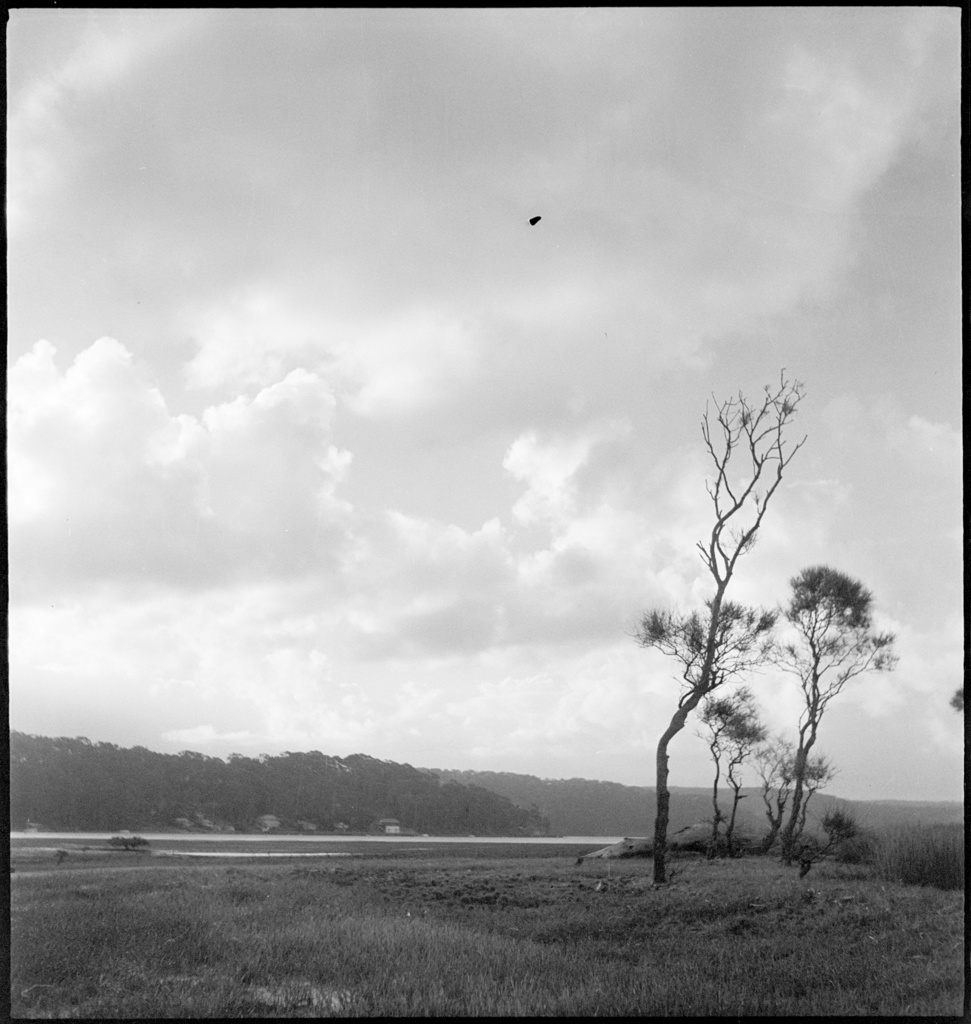
Some of what was once here may be an indication of what will happen. This is a place of wetlands, creeks, coastal grasslands and sheer rising hills.
In 1828 the area was surveyed for land grants. Sketches of the Careel Bay area were made, two of which simply show hills covered with trees surrounding the bay, while another shows:
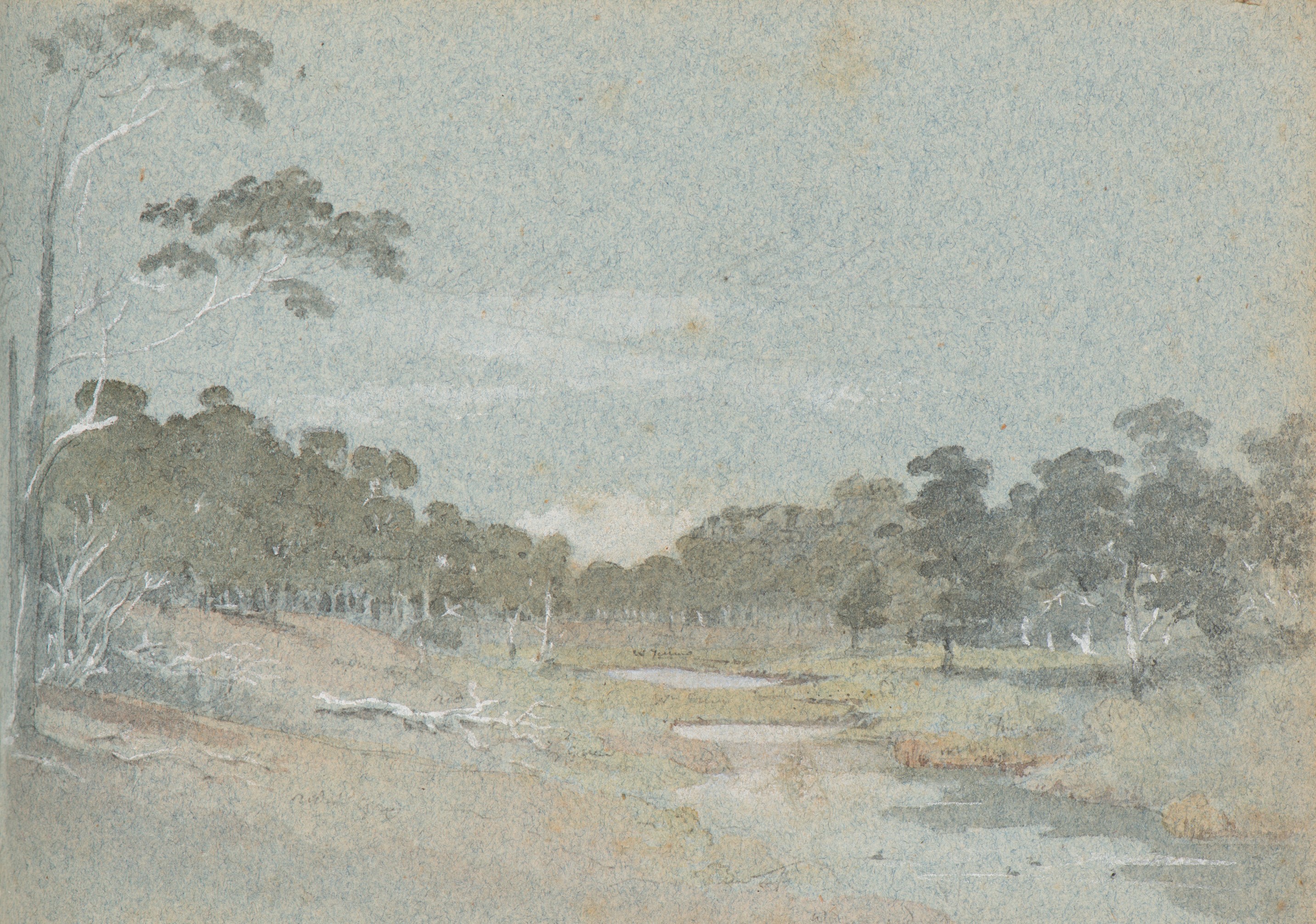
Sir Thomas Mitchell sketchbook - Careel Bay 1828 (flat area leading north towards; where present day Careel Creek is) - Item c03082_0024_m, courtesy State Library of NSW
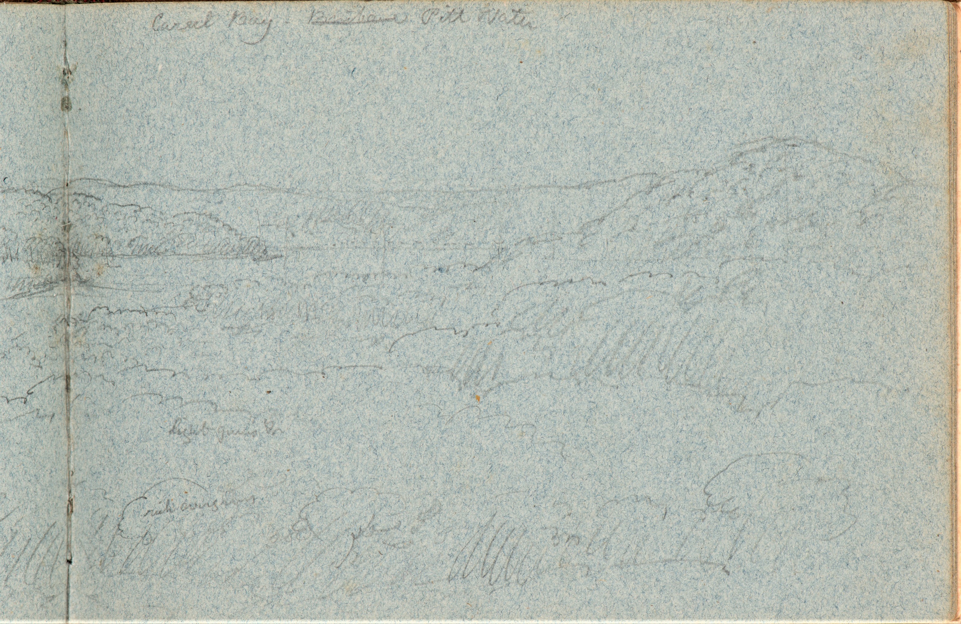
Careel Bay, by Sir Thomas Mitchell, 1828 Field and Sketchbook, Items c03082_0015_m and c03082_0016_m, courtesy State Library of NSW - 'this looks to have been sketched like on the ridge line Binburra, before Whale Beach road - you can see today's Stokes Point to the left and the hill to the right that runs up from Careel Head road.' - Geoff Searl
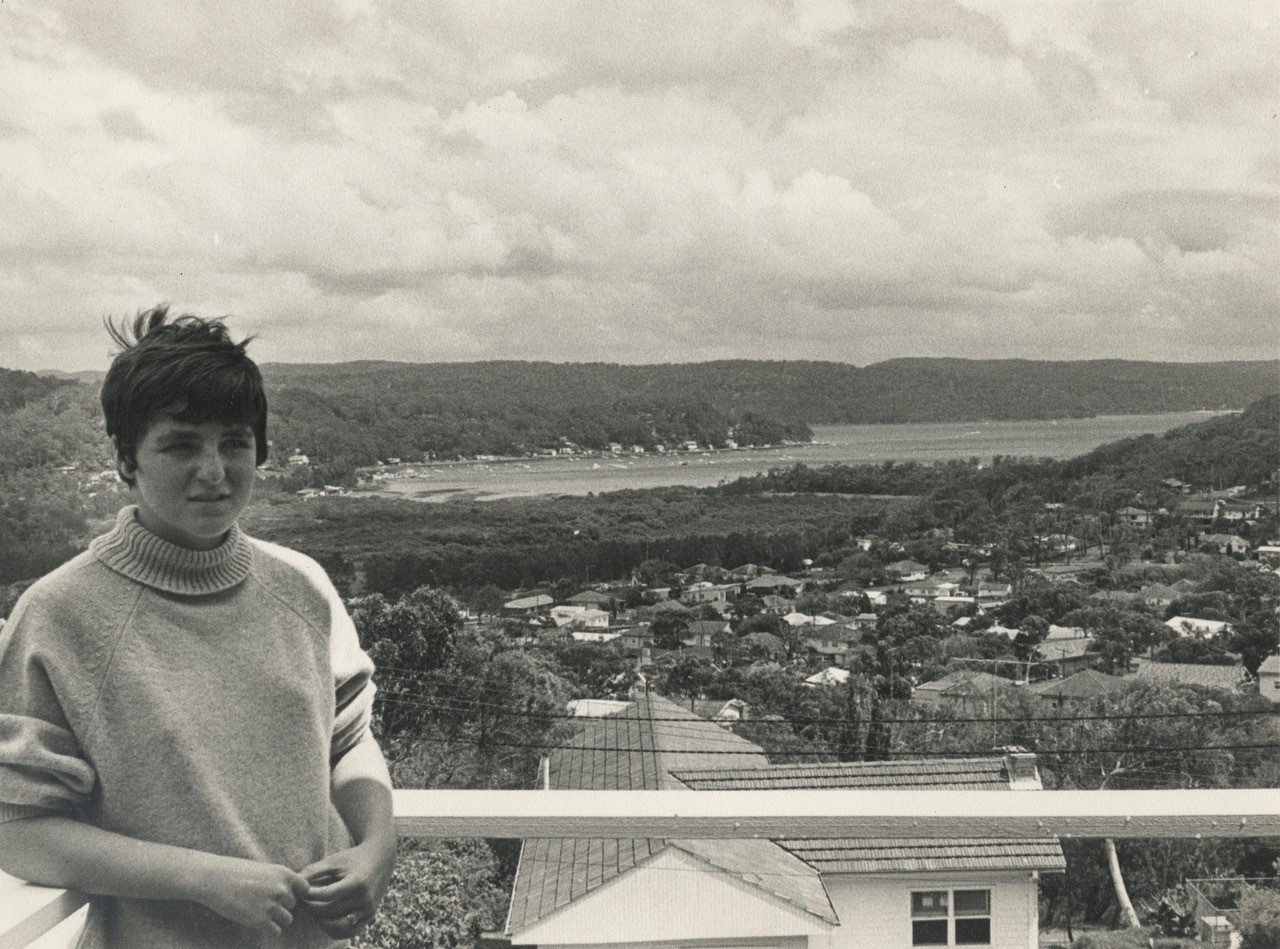
''This first pic is of the home (middle) from where the 2nd pic was taken.Her dad was on a short flight down the coast and he diverted to get a pic of his house in Binburra. I’ve already sent the cropped version of no 2 to you (runs below) but without Robin on the verandah.'' - Geoff Searl OAM, ABHS President
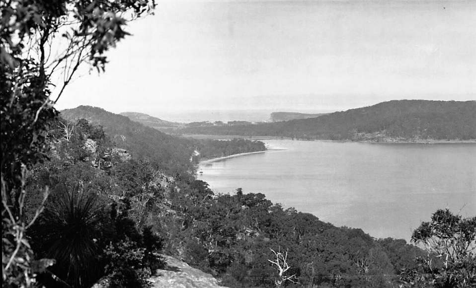
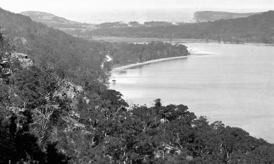
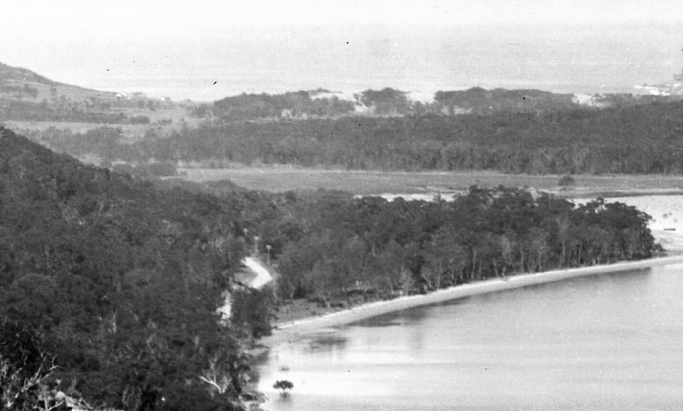
The Careel Bay East of then
Charles De Boos described the section in his 1861 published ‘My Holiday’ as marshy, with mangroves. Some of the northern end of this was filled in by the Warringah Shire Council to create the Careel Bay Playing Fields by treating the area as a tip, literally.
An account of an excursion overseen by then land grantee, Rev. Therry, describes a ‘flat area’ near Careel Bay where visitors danced and picnicked in 1862. Although this too may refer to ‘Priest's Flat’ it equally describes the area tucked under what Bangalley Head at the Whale Beach end and Careel Head road.
When the initial subdivisions and land sales of the period from 1918 to the late 1930's occurred, creeks and access to fresh water was a selling point. However, the creeks were then 'put into pipes' or drains, which may have facilitated further home building, but also ignored what creeks do - they don't just move over the surface of the land, they also move through the ground. When there is a sustained downpour, they overflow.
This was also a place of koala thoroughfares as they moved across their ancient and known and built into their DNA seasonal shifts from food trees in south Avalon Beach to those at the north end and in the hills surrounding Careel Bay and where those face oceanward, becoming Whale Beach.
Dairy managers bought land here and put in the first shop in part of the house they built there on Careel Head road – a home later moved to North Avalon and the corner of Milga-road. With the sell off of some of these lots, water began to be connected to some from 1936 and simple dwellings appeared on the landscape. This is nothing compared to the building boom that occurred in the post-World War Two era, particularly the 1950's. Crown Land aerials from 1951 show a place that is still mostly paddocks and bush, but by the end of that decade, houses outnumber trees.
At the corner of Careel Head Road and Barrenjoey road, the current site of the Careel Bay Shopping Village, the Whale Beach Service Station was opened in the 1950's and operated until the early 1980’s when a rebuild in 1985-86 saw a larger structure where there had been two simple one-storey buildings and Patrick's Patisserie, a Cake and Pie Shop, was opened, alongside a general store, operated during the 1980’s by Fay and Yousef, which was alongside an Indian Restaurant. Cranzgots Pizza Café was originally a Chicken Shop and alongside this was a laundromat.
Just east of these at 3 Careel Head Road is a small cottage, on piles, as was required during the flood zone Health requirements for Avalon
Further up the hill on the corner of Careel Head and Burrawong roads, Mali Thai restaurant commenced under that name in 1990. Owned and run by a French chef with an Indonesian wife, they sold Nasi Goreng by the ton as locals who had gone to Indonesia in the later 1970’s and early 1980’s for the surfing brought back their passion for this version of Indonesian fried rice.
Alongside it, the red bricks of a further shops, with flats above them.
At 3-5 Careel Head road a 1990's application to erect a three-storey 'shop-top' development with underground parking, with literally no setbacks, was approved through a Land and Environment court case after the proponents rejected Pittwater residents and Pittwater Council's LEP and DCP, formed by residents. Built on the perimeter of a well-known water thoroughfare, the underground carpark for this structure, a huge hole in the ground, filled with water and became a mosquito breeding edifice for years.
However, the Careel Bay Shopping Village at No 1 was allowed no setbacks as well in the mid-1980's, under the Warringah Shire Council - so a precedent had been set by that council that was leveraged for the same DA.
 smaller.jpg?timestamp=1770232576392)
1 Careel Head road - no setback to 3 Careel Head Road approved by WSC
.jpg?timestamp=1770232615488)
5-7 Careel Head road on other side - no setback to 3 Careel Head road allowed
Local Environmental Plans (LEPs) are key legal documents guiding land use, zoning (residential, commercial, etc.), building rules (height, floor space), and protecting heritage/environment within a local area, working alongside Development Control Plans (DCPs) for more detailed guidance, all under the state's Environmental Planning and Assessment Act (EP&A Act).
A new DA has just been agreed to by the Northern Beaches Council with similar no setback to the same, meaning there will just be a wall of concrete blocking out the view to Bangalley Headland from 1-7 Careel Head Road. With plans by the owner of 9 Careel Head Road for more shop-top housing, and the precedent set and continued by the Warringah Shire Council, the difference between Careel Bay East as a garden threaded with singing creeks, birds and wildlife in 1826, and the shacks and fields of 1926, and that 'fill the whole block' commercialised landscape of 2026 will be even more marked.
The lay of the land as described in Charles De Boos 1861 account reads:
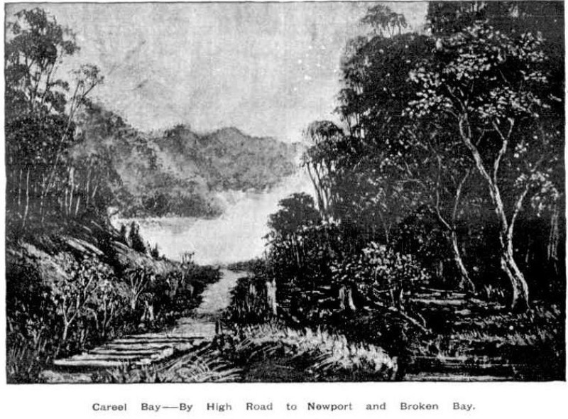
'Once through this jungle of a gully, and we had a gently rising road, creeping steadily up the face of the range, by easy graduation until at last it had gained the crest. Then we had a monotonous walk along the top of the ridge, in full view of the vast Pacific to our right, whose waves were now beating almost lazily along the beach at our feet and whose waters had barely swell enough on them to keel over the tiny fleet of coasters that had put out from different ports of shelter on the coast with the first slant of the favouring wind, and were now lying almost motionless, with scarce wind enough to lift their sails. To the left, the hills, covered with the low close scrub common to our coast ranges, bounded our view, the inland ridges, with their heavily timbered sides being hidden from our sight. Suddenly, however, the road took a curve round to the left, crossed a knoll of the range, and then swept down, in some fifty different tracks, on to a broad swampy plain, or flat, which seemed to us to be inundated, for we could see the water sparkling and glistening in the sun over its whole face. I pulled up short here.
" It won't do to go down there, Tom," said I.
"Oh, but we must," he replied. "This is the Priest's Flat, and there, where you see those shears erected, with the two tents alongside of them, is where they are boring for coal. We must go and report progress."
I looked ruefully at Nat, who made no reply, but, grinning viciously, bent down and turned up his trousers to the knees.
“Do you think there are any leeches there ?” I asked. Nat's trousers were instantly turned down again, and this time he didn't grin,
"Oh, no," Tom answered, "there's too much water there for them, and not enough shelter.
I was easier in my mind, though I had my misgivings; but as these Antipodean leeches seemed to be ruled by laws, and to have amongst themselves habits and customs totally at variance with those of leeches in civilised communities, possibly Tom might be correct; so, tucking up my trousers, I prepared to descend. And, after all, when we got down to the flat it was not so bad as it had appeared to us from the hill. The ground was somewhat honeycombed and the water lay in pools, between which however, we managed to find sufficient footing without actually walking in water.
From the information thus acquired, as well as from enquiries subsequently made, I learnt that the spot now being bored was about the centre of a very fine property of some 1200 acres in area, granted many years ago to the Rev. Father Therry, and extending across the Barranjuee peninsula from the shores of the Atlantic to those of Creel Bay; the one being its eastern, the other its western boundary. Hence the plain had been christened the Priest's Flat.....
NB: mangroves sections stretch from today's Avalon Beach village shops to Careel Bay. Item: c050370020, from 1880-1881 Pittwater Estate land sales, Lithograph, courtesy State Library of NSW

The 1862 account of the Therry picnic here describes those on this excursion as dancing and playing cricket 'near the house on the flat'. Although this would point to being the current flat area behind the Avalon Beach sand dunes, and the house as being the John Collins home of near current day Cabarita Crescent, this dancing and cricketing may also have taken place a little further north, on the Careel Bay East side:
PITT WATER.
Yesterday, being Easter Monday, a pleasant steam excursion took place in connection with the St Benedict's Young Men's Society. The commodious steamer the Collaroy, under the command of Captain Mulhall, had been chartered for the occasion, and left the Australasian Steam Navigation Company's Wharf, Sussex-street North, with about 260 persons on board, at ten o' clock a.m. Part of the band of H. M. S. 12th Regiment were in attendance, their cheerful and untiring efforts contributing not a little towards making the day pass harmoniously and agreeably away. Working along through the ever changing scenery displayed on the shores of our harbour, the Collaroy at length rounded the Heads, and, taking a northerly course, rushed past that enormous barrier presented by the weather-worn cliffs which face the ocean between the Great North Head and the seaward aspect of Manly Beach. Following on the interesting coast line of Curl Curl, Dee why, Long Reef, and Narrabeen, &c, - varied succession of wooded eminences, long sandy reaches, towering precipices, and grassy park-like slopes, - the pleasure-seekers were at length abreast of the singular headland of Barrenjoey, forming the extreme south-eastern limit of the estuary which serves as a common outlet for the River Hawkesbury and the Pitt Water. Shortly after passing the Custom House station the course of the Collaroy then took a southerly direction, and so brought the holiday folks into the lake-like solitudes of Pitt Water, until wooded hills seemed to be rising on every side of the vessel.
The passengers were landed at a small, but commodious wharf, erected on the property of the Venerable J. J Therry, under whose especial patronage the excursion had been got up. Most of the visitors set off in quest of St. Michael's Cave, determined not to lose the opportunity of seeing so great a natural curiosity. The walk, it was found, lay through woods, a long flat, and a hilly scrub, until, facing to the east at the head of the inlet, the merry party, in a straggling Indian file, at length arrived in the vicinity of the cave, cautiously descending the rocks, and creeping carefully along a narrow path specially made for their convenience on the face of the cliffs, they were thus finally rewarded for their perseverance. Almost every body managed to scramble up into the cave, and not a few of the more adventurous explored its inmost recesses by candle-light. The effect of the gloomy inner arch looked down upon from the top of the second angle of the cave, was much admired; and so also was the wider arch at the entrance, as contemplated from the spot where the bright daylight again began to stream down upon the faces of the returning explorers. There was, for some time, a pleasant buzz of conversation and a discussion of food at the mouth of St Michael's Cave, and then the party set out on their way back to the steamer, where dinner had been prepared.
Some with sharpened appetites posted thither at once, but many remained with the band near the house on the flat, and amused themselves with dancing, playing cricket, and so on. There was some dancing also at the steamer after dinner was over. The Kembla steamer visited the wharf at an early hour, landed some passengers, and afterwards returned for them. The Collaroy left the wharf for Sydney at about five o'clock, and arrived safe at Sydney soon after eight. The Right Worshipful the Mayor of Sydney, the Mayoress, and other members of the family were on board. We also observed the Rev. Fathers Corish, Curtis, Hanson, and Powell, besides the Venerable J. J. Therry. The trip appeared to give general satisfaction, although a slight shower, soon after the arrival of the Collaroy at Pitt Water, interfered with some of the arrangements.
PITT WATER. (1862, April 22). The Sydney Morning Herald (NSW : 1842 - 1954), p. 4. Retrieved from http://nla.gov.au/nla.news-article13227471
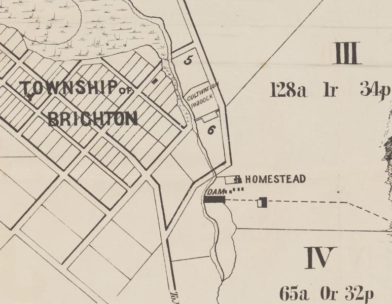
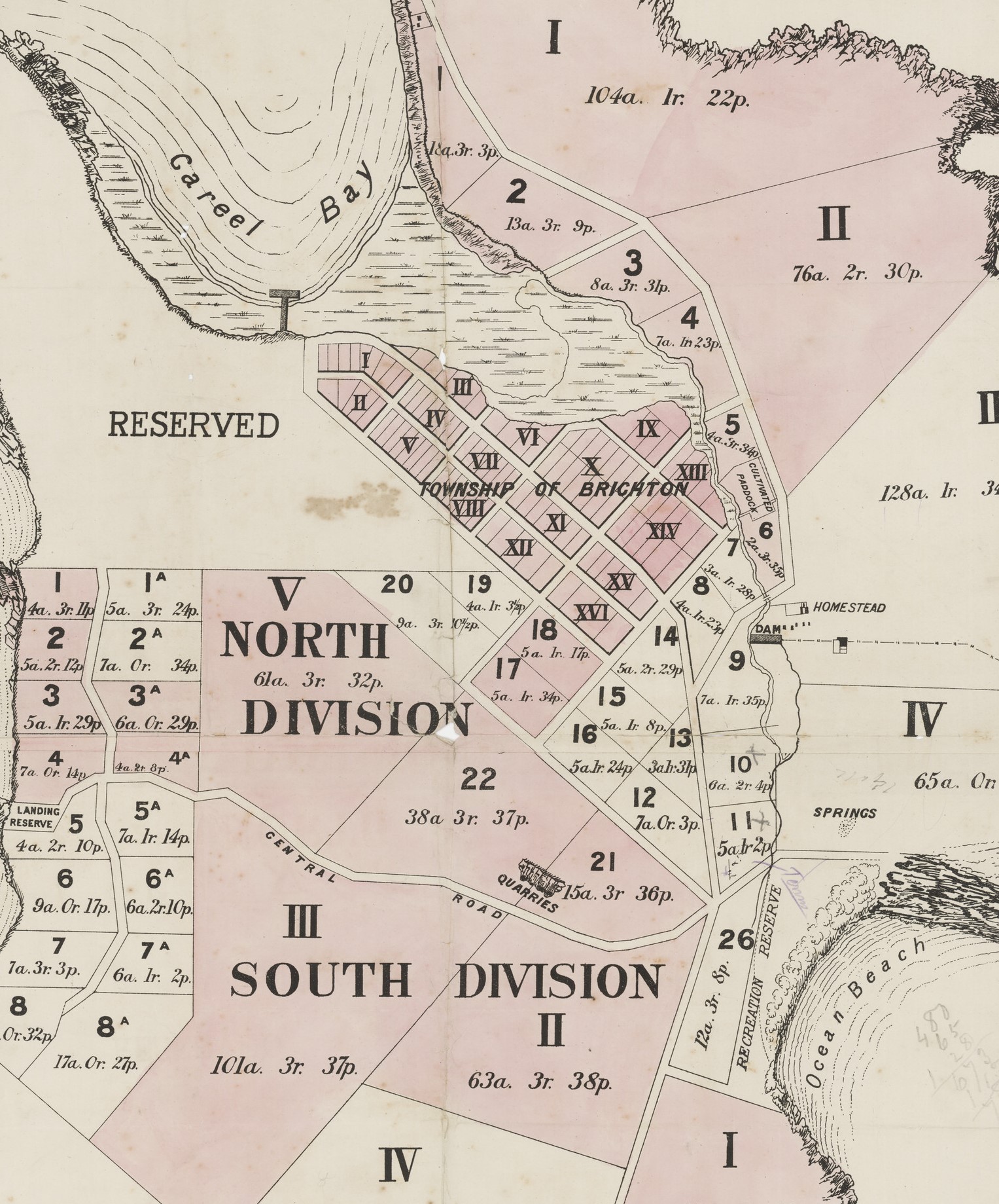
Section from: Careel Bay Pittwater [cartographic material] : township of Brighton, 8 blocks of land with ocean frontage - 1882. MAP Folder 135, LFSP 2160. Courtesy National Library of Australia.
Charles de Boos described:
Pushing along the edge of the flat, we crossed the foot of the hill we had not long previously descended, and, passing along an inner one of well-grassed sandbanks, that formed the landmost barrier against any encroachment of the waves, we came after a walk of half a mile to a paddock fence, through a slip panel of which the road evidently ran. Entering the paddock we found the upper part overgrown with young timber, principally wattles, that had sprang up since the cultivation of the toil had been discontinued, whilst about half-way across it we encountered a beautiful stream of running water, bright and clear as crystal, and crossed by a very rustic, and at the same time, very dilapidated-looking bridge. Nat was in the van at the moment, and I was astonished to see him, when he reached the brook, throw down his load and descend the bank to the water. Arrived there, he began hastily selecting some of the darkest leaves of a plant which I now observed grew very thickly on the margin of, and even in the water.
"What's the row ?" said I.
" Watercresses," replied he. "Stunning!"
" I'm there," cried Tom; whilst I made no answer, but slipped my shoulders out of my load, and commenced an attack upon this favourite pungent water plant. We amused ourselves for some five minutes over them, and then, filling our billy with the choicest stems we could find, once more made tracks.
After crossing the creek, we came in sight of a homestead, small but neat, having evidently been only recently whitewashed. The paddock was now clear of all undergrowth, and, as a goodly cluster of large trees, the remnants of the former occupants of the soil, had been left standing round the house, it had an exceedingly pretty and picturesque appearance, its white sides gleaming out markedly from amongst the bright green of the shrubs around it, and the dark and sombre verdure of the forest monarchs that overshadowed it.
"This," said Tom, "is Tom Collins, and he's the man that will show us the cave."
“The cave ?" asked I. "What cave ?".
" You'll see," he answered, "a rum 'un; such a one as you won't find anywhere else within a day's ride of Sydney, I can tell you."
Here was a surprise indeed. I had never, during the whole of my lengthened sojourn in Sydney, heard of this cave, and I don't believe that fifty persons in the metropolis are to this day cognisant of its existence; thus, with a feeling something near akin to that of a first discoverer, I hastened up to Collins domicile.
(To be continued.)
MY HOLIDAY. (1861, August 26). The Sydney Morning Herald (NSW : 1842 - 1954), p. 3. Retrieved from http://nla.gov.au/nla.news-article13059581
And:
MY HOLIDAY
[CONTINUED.]
(From the Sydney Mail, August 31.)
A tap at the door brought out the mistress of the house, accompanied by her brood of little ones, all fat, chubby, and rosy faced, bearing on their countenances the imprimatur of good health. Having mentioned our errand, we were invited to enter, and we found the interior of the domicile even more neat, and white, and bright, than the exterior, for it was the very beau ideal of cleanliness, and care. The tin-ware which hung from the shelves was polished till it shone like silver, whilst the shelves themselves being of deal, were scoured almost to whiteness. The floor, though an earthern one, was swept so clean that it more resembled a single large slab of stone than what it really was; and the fire in the huge bush fireplace was nicely kept in the centre, each side being swept as carefully as the floor itself had been. The hut had been recently whitewashed throughout, and the whole had such a light and cleanly air as strongly to remind me of some of the farmhouses it has been my lot to visit in the mother country, where, perchance, some notable housewife would take such a pride in polishing that even to the iron hoops of the churn, the piggins or the milk coolers would be burnished up till they resembled steel.
Unfortunately our man, Tom Collins, who knew all about the cave, and who was, in fact, its first discoverer, was absent from home; his brother, however, would very willingly guide us to the spot, so said Mrs. Collins, and waiting the arrival of her brother-in-law, she brought forth a huge jug of milk, from which she desired us to help ourselves; and if Tom and Nat didn't do so to a pretty considerable extent, they made a very good attempt at it, that's all. I verily believe that they would have had impudence enough to have asked for another quart, had not the arrival of Collins frer turned their attention to another quarter. He at once expressed his willingness to conduct us, and furnished himself with a piece of candle, the interior part of the cave being so dark as to require a light for guidance amongst the fallen rocks that encumber it.
He led us off in a straight line from the front of the house to the sea, to a spot where the high wall of rock which is here presented to the waves sinks rather slightly, and a little to the north of the well-known rock, "The Hole in the Wall." Bringing us to the edge of the cliff, he pointed to a bit of a track, down which there had evidently been some slipping and shuffling. This went down for about five feet, and then we could see no more. All beyond that appeared to us, from where we stood, to be blank space; and I had a kind of faint idea that, like Farrell's candleing, this was some more of the peninsularies' fun, and that they let themselves slip down here, shot out into space, and chanced the rest. Tom looked at the track and turned pale. Nat inspected it, and turned up the bottoms of his trousers, a sure sign with him of determination, and about equivalent to the turning up of the coat cuffs by the school boy when he has made up his mind to dare some bigger boy to combat. I have already said what my feelings were, but in the position I occupied, as leader and originator of the expedition, it was necessary that I should set an example of decision, if not of courage. There was a small ledge or platform about three feet down on which the whole four of us could have stood easily ; so down on to this I leaped, with something of the same kind of feeling as Marcus Curtius must have had when he took his leap that everybody has heard so much about. Nat followed very readily, but Tom still hung fire.
....
Having thanked Collins for his kindness and attention, we once more pushed ahead, the road now leading us across a long level piece of country that intervened between the sea and the waters of Creel Bay, until it brought us down to the margin of the latter. Arrived here, we had before us as pretty a marine picture as ever painter sketched, and as directly opposite to the one we had but so recently left as could be well conceived. The flat level land had here narrowed to some sixty rods in width, being backed by a heavily wooded range, the base of which was here and there encumbered by large masses of rock, from which the incumbent soil had been washed, and which now protruded in huge boulders, or lay out bare and detached from their native beds. On the margin of the bay were three little whitewashed slab huts with bark roofs, the passion- ate squalling of an infant that proceeded from one of them would have given evidence of their being inha- bited, even if we had not seen two or three barelegged and barefooted children peering at us round the corner of the house.
Through the narrow belt of low swamp oaks that edged the margin of the bay, the clear smooth waters of Creel glistened in the sun, as the gentle breeze swept over its face and slightly ruffled its surface. On the sands, midway between the shore and the retreating water, for it was nearly low tide, two boys were busied collecting shells, by filling an old basket with the sand, and then agitating it in a water-hole, made for the purpose, until the sand was washed away, and nothing was left but the shells that had been mingled with it. These, when washed clean, were thrown into a boat that lay down helplessly on its side close to them. Out on the waters of the bay, floated a smart little cutter, which, though probably only a shell boat, looked from the clear atmosphere, and perhaps also from the fact that she was the only vessel in view, smart and dapper as a yacht, the red shirt and striped cap of the one man on board, adding still farther to the picturesque appearance of the vessel. Behind her again stretched out the waters of the bay, until they encountered the ranges of the other side, which coming down in many a ridge and gully, and forming many a deep indentation or projecting point, gave a gorgeous variety of tints and lights to a background that under a less brilliant sun or less pure atmosphere would have been sombre and monotonous.
Manly to Broken Bay. (1893, November 11). Australian Town and Country Journal (NSW : 1870 - 1907), p. 19. Retrieved from http://nla.gov.au/nla.news-article71191632
We halted here just long enough to admire the scene, and to have a shot at one of a number of blue cranes, that were stalking about most consequentially and at the same time most warily upon the sands. It was only by dint of a good deal of manoeuvring and dodging that Nat was enabled to get even within possible shooting distance of the rearmost of the lot; and after all, when he fired, he didn't kill his bird. He however succeeded in frightening it, and not only it but all its companions, for they one and all took to flight with a wild cry. But if he had in one quarter caused a fright and a cry he had in another caused a fright and quietness for the report of the gun had stilled the squalling in the hut so effectually that it was not resumed, so long at least as we remained within hearing.
The track, a mere bridle path, now led along the flat, then across a dank luxuriant gully, down which a little stream roared and brattled and foamed with as much fuss and bother as would have been sufficient for a volume of water twenty times its quantity; afterwards, up a wet sloppy hill from which the water exuded in every direction, round the point of the range, down a correspondingly wet and sloppy descent on the other side; and then on to another flat the very counterpart of the one we had just quitted. Another luxuriant and overgrown gully, another wet hill teeming with springs, and then we come down, upon a somewhat broader flat, at the extremity of which we see two tents a short distance apart that we at once recognise, from the description we had received of them, as being the Chinamen's place.
(To be continued.)
MY HOLIDAY. (1861, September 2). The Sydney Morning Herald (NSW : 1842 - 1954), p. 3. Retrieved from http://nla.gov.au/nla.news-article13057913
How storms impact this area, in those early 1860's accounts, may be read in this 1867 version, possibly sent in by the Collins family:
The 'Hole in the Wall' or St. Michael's Arch fell in 1867 - The storm that turned an arch into a pedestal:
BROKEN BAY.
[FROM OUR CORRESPONDENT]
June 24 – We have had tremendous weather, but, as far as Pitt Water is concerned, no damage has been done with the exception to one of our picturesque curiosities, St. Michael’s Arch. It has at length to the too mighty elements and the destroying influence of time, that which was the admiration of all who have beheld it is now almost baseless fabric-there is only about one half of the outer support left, looking at it at a distance it has the resemblance of a coloured pillar. In its fall it carried a large portion of the overhanging rock with it, a thousand tons of gigantic boulders, and in such masses that I think it will stop the ingress from that part to the cave, but at yet we have had no close inspection for the rollers are dashing to the height of the stupendous rocks. The only idea I can give of the gale is that the froth of (not spray) the sea came over Mount St. Joseph, opposite the house, half a foot in size, and spread itself down to the dam, at times shading the heights of the mountain,-its resemblance was that of an overwhelming snow storm.
The sea at Barranjoey washed away the flower garden in front of the Chinamen's huts, taking soil and all, so that the beach comes close up to their door. There must have been awful havoc in the Hawkesbury, for all the beaches from Barranjoey to the Long Beach are strewn with fragments of houses, boxes, chairs, door frames, dead pigs, hay, wheat, broken bedsteads, weather-board sides of houses, oranges with large branches, pumpkins, melons, corn cobs, and other debris, that scarcely any portion of the beaches can be seen. Mr. Conolly picked up a workbox, in which was contained a number of receipts and letters directed to Mr. Moss, Windsor. The beaches on which are the debris is Barrenjoey, Whale Beach, Collins's Beach, Mick's Hollow Beach, Farrell's Beach, Mona Beach, and Long Beach, so it may be imagined the great extent of destruction. BROKEN BAY. (1867, June 27). The Sydney Morning Herald (NSW : 1842 - 1954), p. 2. Retrieved from http://nla.gov.au/nla.news-article13144304
A stylised painting of the 'Hole in the Wall' from 1860:
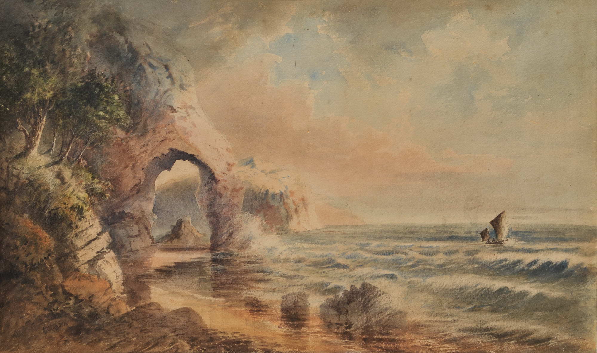
W.H. Raworth (Brit./Aust./NZ, c1821-1904). St Michael’s Arch, NSW [Avalon] c1860s. Watercolour, signed lower left, obscured title in colour pencil verso, 34.2 x 56.5cm. Tear to left portion of image, slight scuffs and foxing to upper portion. Price (AUD): $2,900.00 at:https://www.joseflebovicgallery.com/pages/books/CL181-53/w-h-raworth-c-brit-aust-nz/st-michaels-arch-nsw-avalon
BROKEN BAY. [From the Herald's Correspondents.]
June 24. — We have had tremendous weather, but, as far as Pitt Water is concerned, no damage has been done, with the exception to one of our picturesque curiosities, St. Michael's Arch. It has at length yielded to the too mighty elements and the destroying influence of time,— that which, was the admiration of all who have beheld it is now almost a baseless fabric,— there is only about one half of the outer support left, looking at it at a distance it has the resemblance of a colossal pillar. In its fall it carried a large portion of the overhanging rock with it, a thousand tons of gigantic boulders, and in such masses that I think it will stop the ingress from that part to the cave, but as yet we have had no close inspection, for the rollers are dashing to the height of the stupendous rocks. The only idea I can give of the gale is, that the froth of (not spray) the sea came over Mount St. Joseph, opposite the house, half a foot in size, and spread itself down to the dam, at times shading the heights of the mountain, — its resemblance was that of an overwhelming snow storm. The sea at Barranjoey washed away the flower garden in front of the Chinamen's huts, taking soil and all, so that the beach comes close up to their door. There must have been awful havoc in the Hawkesbury, for all the beaches from Barrenjoey to the Long Reach are strewed with fragments of houses, boxes, chairs, doorframes, dead pigs, hay, wheat, broken bedsteads, weatherboard sides of houses, oranges with large branches, pumpkins, melons, corn cobs, and other debris, that scarcely any portion of the beaches can be seen. Mr. Conolly picked up a workbox, in which was contained a number of receipts and letters directed to Mr. Moss, Windsor. The beaches on which are the debris is Barrenjoey, Whale Beach, Collins's Beach, Mick's Hollow Beach, Farrell's Beach, Mona Beach, and Long Reach, so it may be imagined the great extent of destruction. BROKEN BAY. (1867, June 29). Sydney Mail (NSW : 1860 - 1871), p. 11. Retrieved from http://nla.gov.au/nla.news-article166799304
Known Songlines: Koala Food Tree Paths - The North Bangalley & Burrowong Creeks - Dancing Wallabies - Frog Heaven - Black Ducks
Our First Nations peoples share a knowledge which states the land does not belong to us, rather, we belong to the land. This articulates being part of the flow of the seasons and all that lives within them, and for humans it means having a capacity to be good keepers of the land, its waters, and the air that flows above every place.
For clarity, we have chosen to call 'Burrowong Creek' as the stream from the north, Whale Beach end of Bangalley headland, down through this, and Albert and Burrawong roads into Careel Bay. There is also another that ran at the end of current day Burrawong Road and Whale Beach Road dubbed 'North Bangalley Creek' here to distinguish this flow from another on the other side of the headland which ran down into and through the landscape of North Avalon Beach.
That road and headland were named for the plants that once flourished here.
A burrawong is a large attractive palm-like evergreen cycad of New South Wales. Individual specimens take 10–20 years to mature and may live for up to 120 years. Also a name for the poisonous nut of the burrawang, which becomes edible after prolonged soaking. Macrozamia communis is an Australian cycad found on the east coast of New South Wales. The common name for the species is burrawang, a word derived from the Daruk Australian Aboriginal language; this name is also often applied to other species of Macrozamia. The burrawang has the most extensive distribution of any cycad in New South Wales and is found along the coast from the district around Armidale, New South Wales to Bega 700 km south and on the coastal slopes of the Great Dividing Range with some instances on the inland slopes of the range; as far west as the Mudgee district. It is most abundant on the south coast of the state. The plants grow in open forests. Seed cones are formed after fire. Male and female seed cones are on separate plants and the large female seeds are ripe when red or yellow.
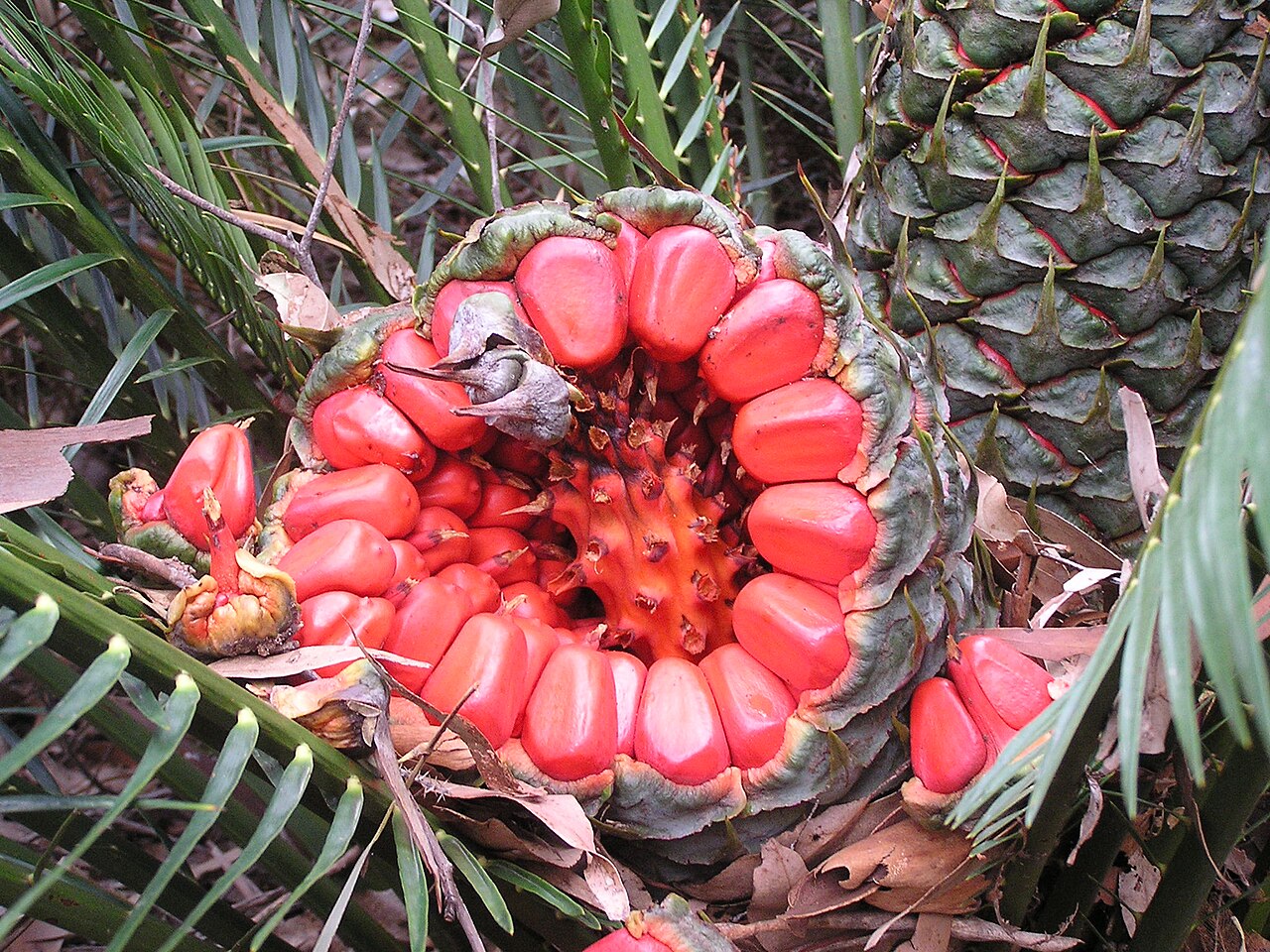
Burrawang seeds and plant (below), Batemans Bay, New South Wales. Photos: AYArktos

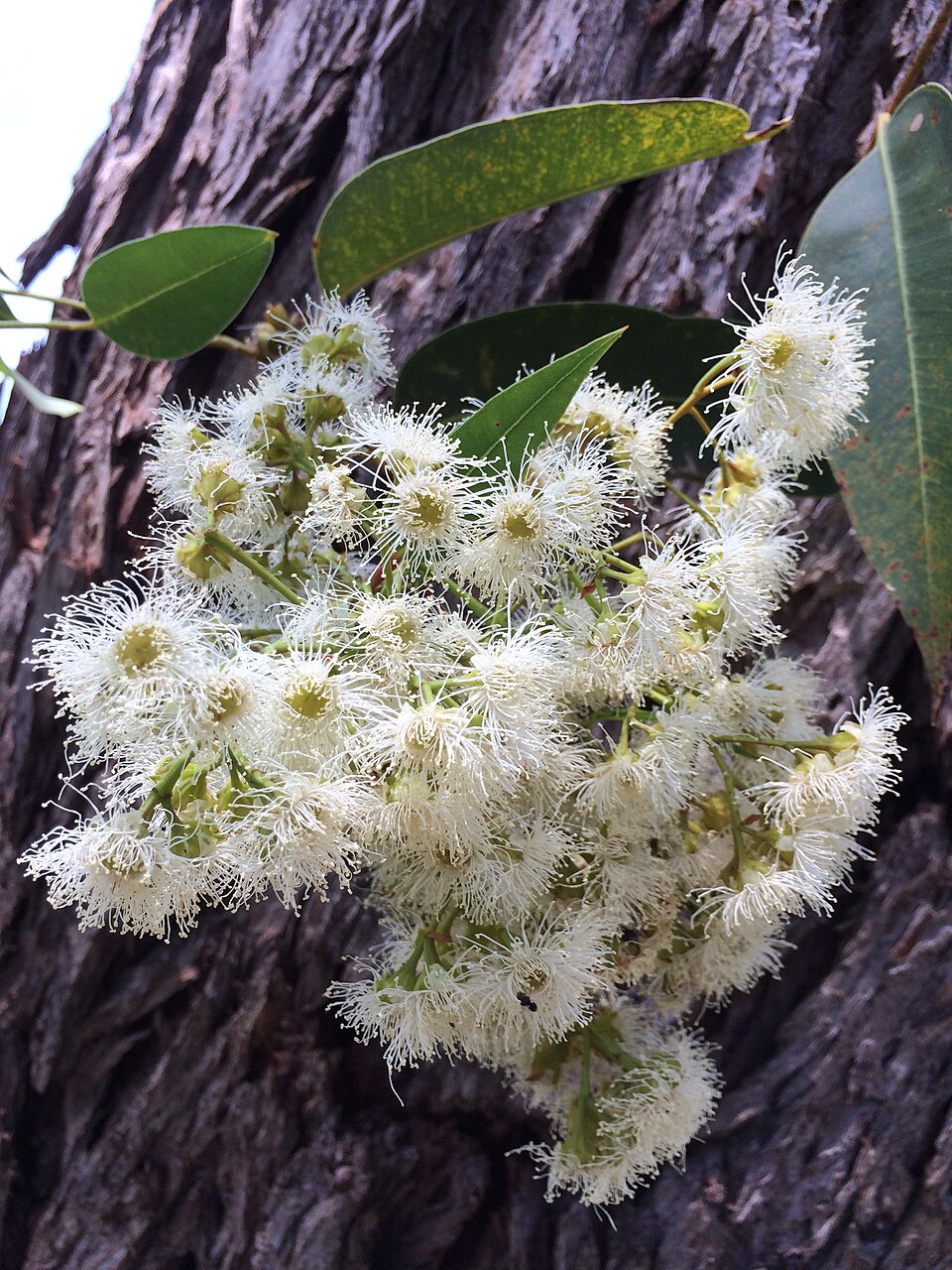
Bangalley is the Aboriginal name for the Eucalyptus botryoides, commonly known as the bangalay, bastard jarrah, woollybutt or southern mahogany, is a small to tall tree native to southeastern Australia. Reaching up to 40 metres (130 feet) high, it has rough bark on its trunk and branches. It is found on sandstone- or shale-based soils in open woodland, or on more sandy soils behind sand dunes. The white flowers appear in summer and autumn. It reproduces by resprouting from its woody lignotuber or epicormic buds after bushfire. E. botryoides hybridises with the Sydney blue gum (E. saligna) in the Sydney region. The hard, durable wood has been used for panelling and flooring.
The species name is derived from the Ancient Greek botrys "cluster", and may relate to the clustered flowerheads and fruit. It has been classified in the subgenus Symphyomyrtus, Section Latoangulatae, Series Annulares (red mahoganies). Its closest relatives are the red mahogany (Eucalyptus scias) and the Blue Mountains mahogany (E. notabilis), red mahogany/red messmate (E. resinifera) and swamp mahogany (E. robusta). Some sources state individual specimens take 10–20 years to mature and may live for up to 120 years.
 smaller.jpg?timestamp=1770164028784)
corner of Careel Head and Albert roads, East Careel Bay, February 4 2025
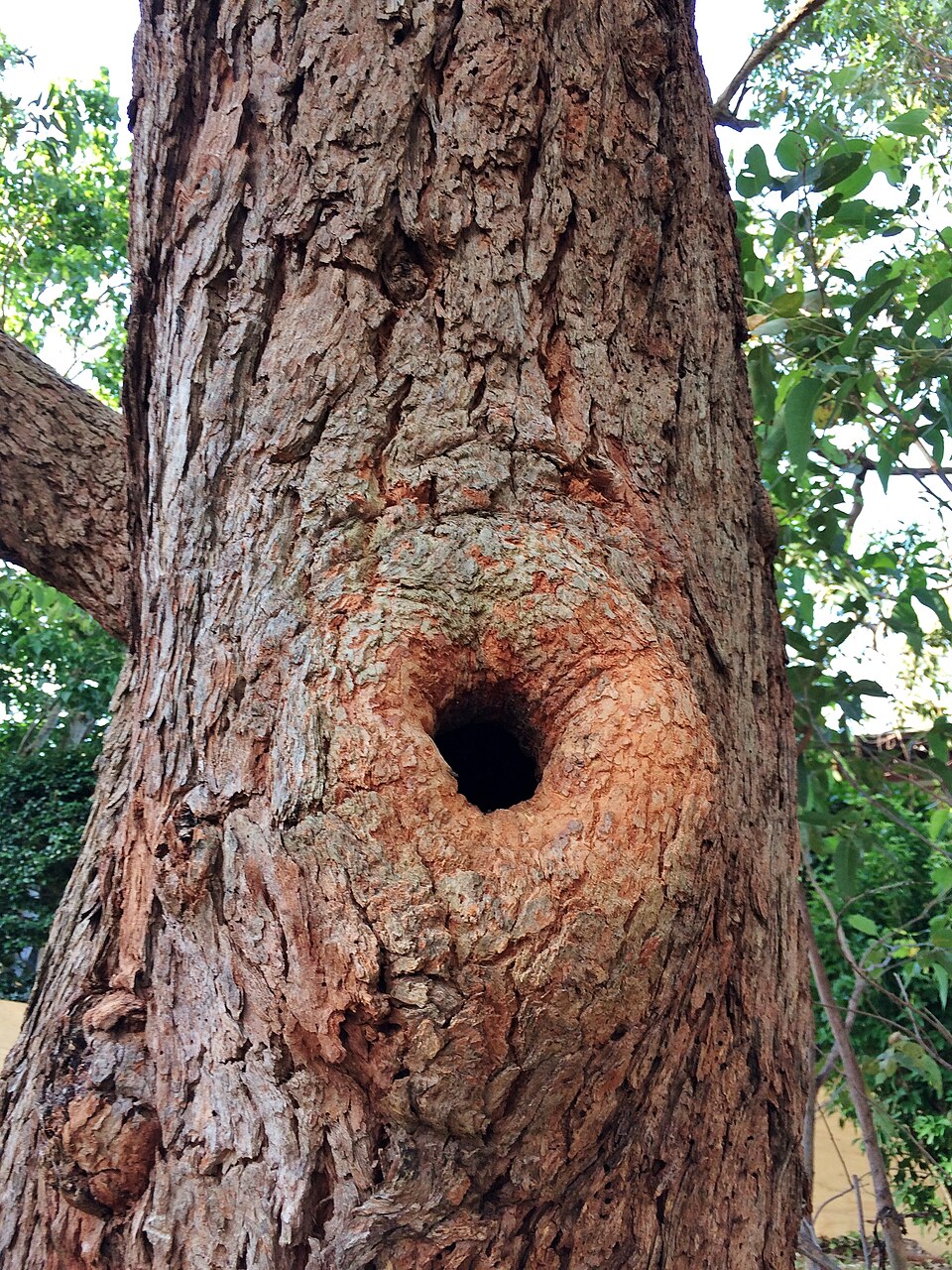
Bird hollow in Bangalley tree and flowers. Photos: Geekstreet
The creeks of North Avalon Beach and Careel Head history page in the 'Pittwater Creeks' series is being finalised at present.
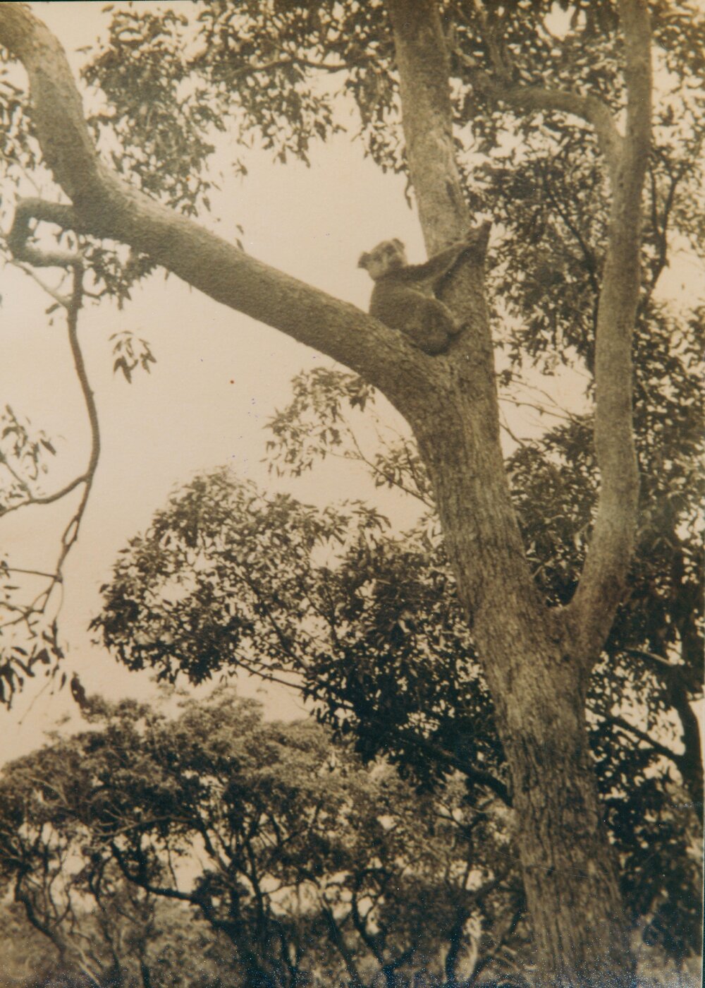
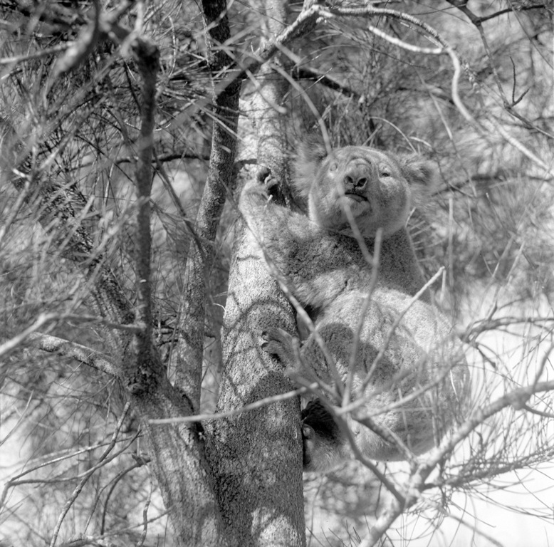
Koala sitting in fork of tree, Careel Bay (East) - Avalon Beach, 1930s - Hammond Family photo
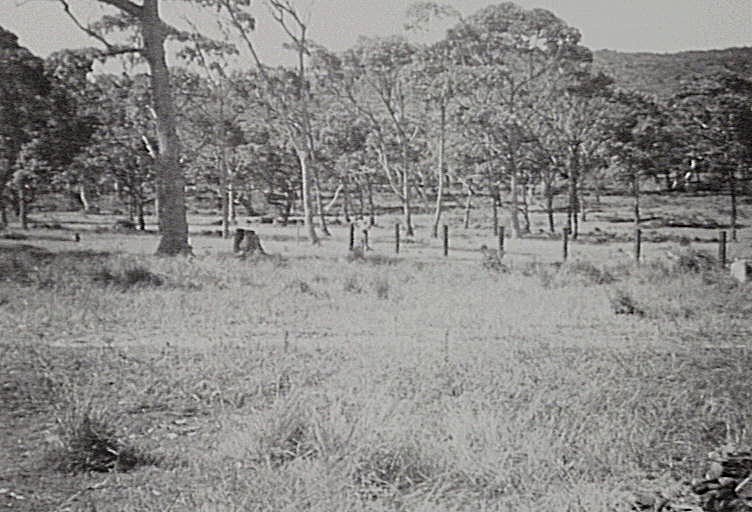
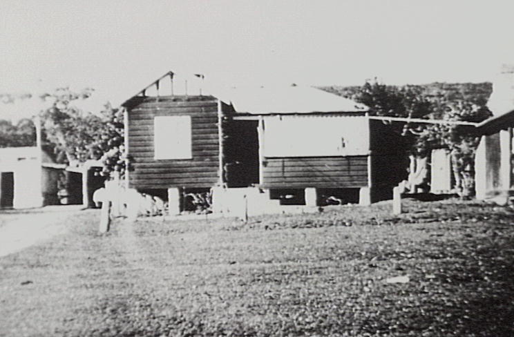
Hammond family dairy farm lands at Careel Bay East, circa 1935 and Hammond Dairy - Hammond Family photos
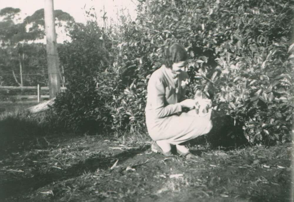
Mrs Hammond with Baby Koala at Careel Bay East - Hammond Family photos
In 'Decline of the urban Koala (Phascolarctos cinereus) population in Warringah Shire, Sydney' by Pete and Judy Smith [September 1990. Australian Zoologist 26(3):109-129. DOI:10.7882/AZ.1990.004] the authors stated in their Abstract:
The Koala population in Warringah Shire has declined over the last 50 years with increasing urbanization. Koalas were reported from various localities throughout the Shire in the 1940's, 1950's and 1960's. They now occur only at the Barrenjoey Peninsula, Ku-ring-gai Chase National Park and, possibly, Davidson Park State Recreation Area. The colonies at Barrenjoey Peninsula and Ku-ring-gai Chase National Park have both declined in numbers and distribution since the 1970's. On Barrenjoey Peninsula, the main subject of this study, clearing for residential development has steadily reduced the area of forested land from about 705 ha (47% of the Peninsula north of Bungan Beach) in 1946 to about 125 ha (8%) in 1989. The Koala colony on the Peninsula has declined from an estimated 123+ Koalas in 1970 to only about eight Koalas in 1989.
The remaining Koalas appear to use several Council bushland reserves as refuges: Angophora Reserve/Hudson Park, Stapleton Park, Careel Headland Reserve, Crown of Newport Reserve and, until 1988, Algona Reserve.
The principal food tree on Barrenjoey Peninsula is Grey Gum, Eucalyptus punctata. Other important food trees are Scribbly Gum, E. haemastoma, and Swamp Mahogany, E. robusta. These food trees occur in low densities in the reserves compared with their former densities elsewhere on the Peninsula. The Reserves have also suffered extensive eucalypt dieback associated with urban runoff and their eucalypt communities are threatened by expansion of rainforest vegetation and Black She-oak, Allocasuarina littoralis, scrub.
The chief threats to continued survival of the Peninsula's Koala colony are further loss of habitat, within as well as outside reserves, and further mortality from dogs, motor vehicles and the disease chlamydiosis. The limited information available suggests that dogs have been the chief cause of mortality on the Peninsula in contrast to other urban colonies studied, where it has been motor vehicles and chlamydiosis. The incidence of chlamydiosis has been low but may pose a particular threat to the few remaining Koalas.
The history of Koalas on Barrenjoey Peninsula illustrates how a carefully planned and managed reserve system is crucial for Koala conservation In urban areas. This must be established in the early stages of regional development. The deficiencies of the reserve system on Barrenjoey Peninsula pose enormous difficulties for rehabilitation of the Koala colony now.
.JPG?timestamp=1770084007433)
Grey Gum stands alongside Spotted gum on Riviera Road, Clareville - aspect is overlooking north end of Careel Bay towards Dark Gully corner at Palm Beach. Photo taken 2020 for Stapleton Reserve pictorial
.JPG?timestamp=1770084095342)
Dogs weren't the only introduced predators. Foxes and cats were brought here by humans and rabbits would also prove to be a problem and even today baiting, and the poisons used in these at Careel Bay, continue to impact on local wildlife residents. Raptors or birds such as kookaburras, that catch dying rabbits, or rats poisoned by residents, die slow horrible deaths - especially adults birds catching food for young ones - as they digest these poisons. Residents in 2025 report whole kookaburra families being wiped out or finding dead owls with no marks on them which have died due to poisons.
The NSW Department of Environment states; 'Koalas feed almost exclusively on a few preferred tree species which are of primary and secondary importance. If primary tree food species are not present or occur in low density, koalas must rely on secondary food tree species, but the number of animals per hectare is lower. The occurrence of both primary and secondary tree species varies widely on a regional, local and even a seasonal basis, meaning that koalas are unevenly distributed across their range.
Although primary and secondary food trees provide most of a koala's diet, other tree species, including non-eucalypts, also provide seasonal or supplementary food. Koalas also require a range of other trees across their habitat for resting and shelter, particularly in extreme weather conditions. Examples of shelter trees include turpentine, cypress pine and brush box.'
The other main furry doe-eyed resident of local trees are the possums of Pittwater - the pygmy possums, brush-tailed, the ringtails, along with the species of micro bats that love tree hollows that once towered over the species of bandicoots snuffling and gardening below them at night.
This small insight, still experienced by some in Pittwater, comes from the pen of one of the youngsters of the Wilson family that lived on Careel Bay itself, on home acreage they called, appropriately for then, 'Koala'. This 'visitor' sounds like a brushie:
Visitor In The Night
By JOAN WILSON
IT was, a hot summer night, and the air appeared over- powering and musky. On retiring from a strenuous day's work, we decided to leave the front door open to allow plenty of cool, refreshing air into the house, in order to obtain a pleasant night's rest.
Shortly after midnight, mother heard a faint, steady pat-pat coming stealthily across the verandah. Quivering from head to foot with fright, she silently stole out of bed and crept cautiously into my sister's room to awaken her. Immediately sensing that something was wrong, she grasped an iron rod out of my younger sister's cot and stole forth to confront the intruder.
But, alas, what a surprise they received when they discovered it to be a possum. It had evidently came in search of food, as our neighbors were in the habit of fending possums on scraps of bread &c. It was sitting sheepishly in one of the armchairs. On seeing my mother and sister it leapt down on to the floor and scampered madly around the room in search of an exit, but the opening which it discovered, led Into one of the bedrooms and it still continued to race around, springing every now and then at the window curtains and finally into the foot of my sister's cot, on to the window-sill and once more out in the open space.
Everyone appeared to enjoy the situation immensely, but mother's one thought was for her curtains, fearing they would be torn to pieces, However, the frightened little creature had escaped without doing any damage.
(Blue Certificate to Joan Wilson, S.W. (18). George-street, 'Careel Bay, via Newport,) Visitor In The Night (1939, November 19). The Sun (Sydney, NSW : 1910 - 1954), p. 3 (SUPPLEMENT TO THE SUNDAY SUN AND GUARDIAN SUNBEAMS). Retrieved from http://nla.gov.au/nla.news-article231503235
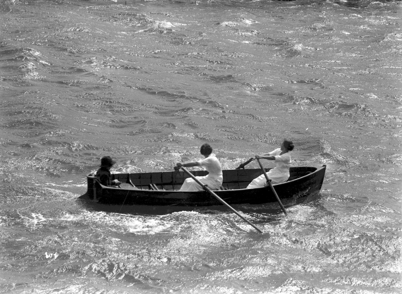
Mrs Jessie Wilson and Miss Hastie, Careel Bay ladies, winning the Ladies Double Sculls at the Pittwater Regatta, during the 2nd Regatta for 1921 - held on December 31st. This image appears in The Sydney Mail, 4 January 1922, page 18. The caption for the image includes the following details: 'The winners had a handicap of 15s, the distance being a mile. Mrs Hendrie and Miss Beaumont were second, and Mrs Allen and Miss K. Bolt (3s) third.' Image 12152 courtesy Australian National Maritime Museum. See: PITTWATER REGATTA : THE GOVERNOR-GENERAL'S WIN. (1922, January 4). Sydney Mail (NSW : 1912 - 1938), p. 18. Retrieved from http://nla.gov.au/nla.news-article169769804
Ted Allan:
I grew up with Colin Wilson, and I fished with them. Colin, the Wilsons, lived in the corner here. I’d walk across the bay here when young and Colin and I would muck about with nets. After I finished my apprenticeship as a carpenter I went commercial fishing with them for four years. I fished with Charlie Wilson and old Jackie. The land in the corner that is Careel Bay Close now, that was the Wilson’s place.
There was another bloke by the name of “Hastie’ and old grandmother Hastie lived in the bottom house there which is in that old photograph – it had a mandarin tree. They were yum. Old Jackie Wilson, in between fishing, he had a very good garden on the hill there.
The man who had the Newport Hotel, as I remember it, bought the land from the Wilson family – I think his surname was Seibert. There were four boys and four girls in the Wilson family. Of the four Wilson family girls some are still alive – Jean lives down in Canberra, she’s the youngest, Mercia lived in Mona Vale, Joan used to live in Joseph street but is in a nursing home now, her surname is Hillier, and there is also Betty.
Late in 2014 we were contacted by a relative of the Wilson family, who shared this insight on the Wilson ladies and their sequence of birth:
The youngest is JEAN (my mother) and she resides in Queanbeyan near Canberra; the next oldest is Betty who has lived in Newport Beach for almost 30 years; Joan Hillier does in fact live in a Mona Vale nursing home. The eldest Mercia (known as Bid), who had also moved to the same nursing home, has unfortunately now passed away. - WENDY LOYD.
Peter Verrills:
The nets you see in this old photograph – old Jackie had a net pole along here and they used to dry their nets on these. In the photograph you can see a big tub. In those days they used to boil the ironbark up to dye the nets as these were cotton, or they were when I first started. There was no nylon then. You would pick an ironbark tree that had a lot of sap coming out of it and chop the bark up finely to use as a dye. - photo courtesy Verrills family
More on 'Koala', Careel Bay, and the Wilson family in: Stokes Point Careel Bay: The Shift From Warner's Hut In 1813 To Finisterre In 1924; 1934 Additions Probably Designed By Australia's First Female Architect, Beatrice (Bea) May Hutton - A Pittwater Rendezvous Site For Royal Sydney Yacht Squadron Members Is Still A Home With A View For Those With A Passion For Sailing
Along the west and east verges of Careel Bay itself local species of grasses were home to Kangaroos, Wallabies, Bandicoots, Echidnas and Rakli. Charles de Boos and his companion had come here to hunt on the, by 1861, long dead ‘kangaroo grounds’ near Manly and throughout Pittwater - he ended up shooting at ‘Gill Birds’. Almost 20 years prior to that one account of an aquatic point near 'Hunter's Hill', just up the road, records the mindset of killing wildlife as being considered 'sport' and how many of the original locals had already disappeared:
Rare Sport.— As a gentleman and his son, residing at Bedlam Point, were strolling through the bush on Friday last, with their fowling-pieces in search of parrots, they were startled by the appearance of an immense kangaroo: of the 'old-man' species. They immediately fired at him but only succeeded in wounding him, upon which he made off ; they, however, followed him to a place called Looking-Glass Point, and again fired at him, this time with fatal effect. It is many years since a kangaroo has been seen in the neighbourhood, the nearest kangaroo ground being at 'Pittwater,' a distance of forty miles off. No title. (1844, April 9). The Australian (Sydney, NSW : 1824 - 1848), p. 3. Retrieved from http://nla.gov.au/nla.news-article37124141
Hunters Hill is the name given to the peninsula situated between the Parramatta and Lane Cove Rivers, although at one time it included the whole area from Onions Point (the present eastern extremity of the peninsula) to Kissing Point and as far north as Middle Harbour. Later on, when the colony was divided into counties and parishes, the name ‘Hunter’s Hill’ was applied to that portion of land lying between the two rivers and as far west as Kissing Point.
The Aboriginal name for the land is 'Moocooboola', meaning 'meeting of waters' - an accurate and spiritual sounding word - a songline word, to be sung to maintain its inner essence.
The name 'Barrenjoey' for the Palm Beach headland, means 'little kangaroo' or refers to the wallaby, and for many Pittwaterians remains the preferred 'name' for the Barrenjoey peninsula as it is one of the few remnant words we have left from those original Keepers of these lands.
Looking across Looking Glass Bay towards Bedlam Point and "Rockend Cottage", around 1892, photo courtesy of City of Ryde Libraries - Ryde History Hub
There is also an incredible family of birdlife here, from shorebirds, to ground nesting birds, to those that flit through the understorey or make their homes in tree hollows or weave nests to place in branches or tree tops.
Marita Macrae OAM, PNHA shares; ''Of special interest is the Mangrove Warbler, I think at its southern limit (range). Worth listening out for. There are a surprising number of other small birds visit the mangrove. Once I saw a Rose Robin there.''
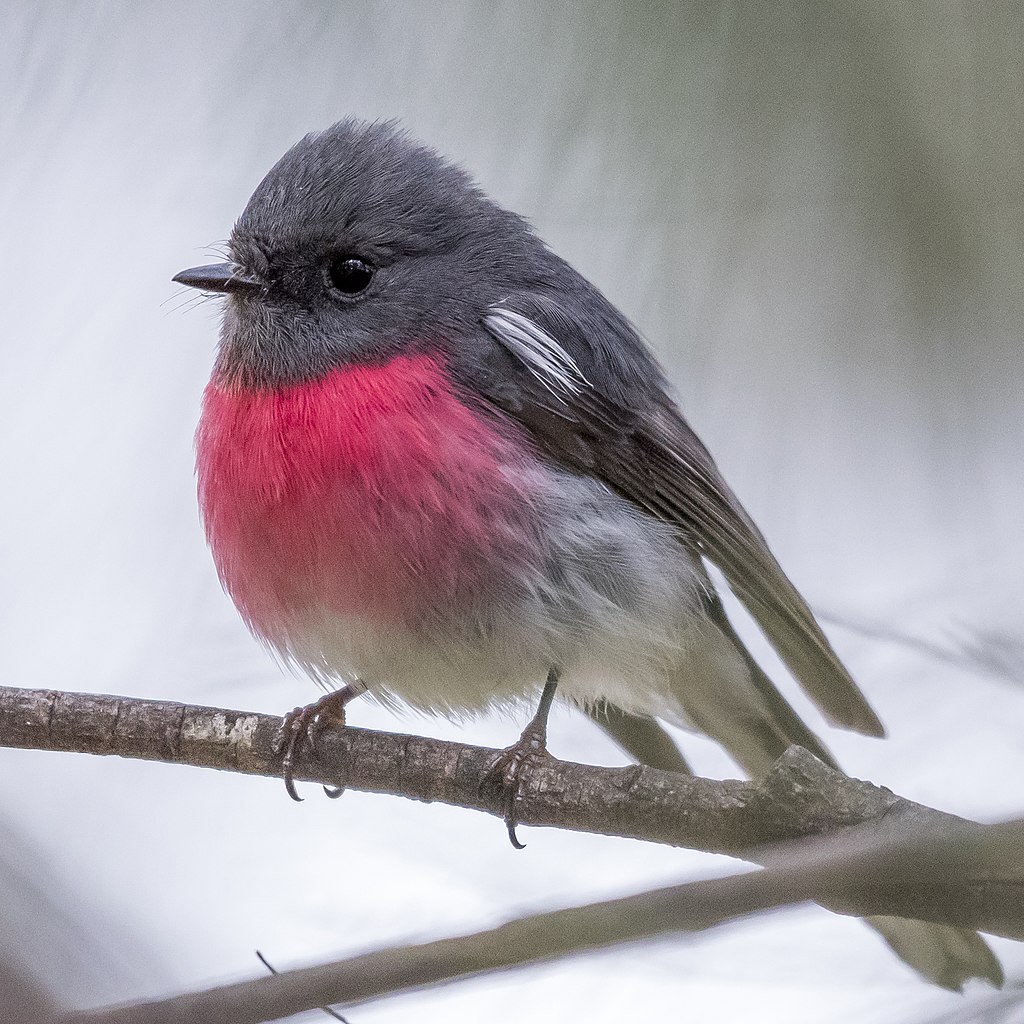
Male Rose Robin - photo by Gunjan Pandey
The Mangrove Warbler (Gerygone levigaster) is a small plain bird with thin bill. Upperparts grey, underparts whitish, with striking white tail spots (best seen in flight), pale eyebrow, and red eye. They are usually detected by their song; a tinkling melodious string of notes moving up and down in pitch (like a musician practicing scales). This bird inhabits mangroves and surrounding habitats, and is unlikely to be far from mangroves.
Also the Brown Thornbill (Acanthiza pusilla) is a passerine bird usually found in eastern and south-eastern Australia, including Tasmania. It can grow up to 10 cm long, and feeds on insects but may sometimes eat seeds, nectar or fruit. They feed, mainly in pairs, at all levels from the ground up, but mostly in understorey shrubs and low trees. Will feed in mixed flocks with other thornbills out of breeding season.
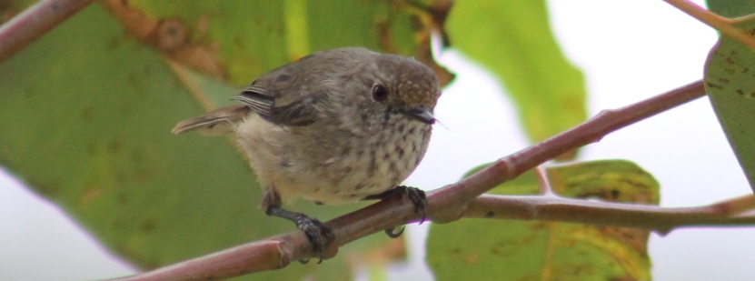
Brown Thornbill At Careel Creek, Jan 12 2013

Royal Spoonbill - frequents Careel Creek and Careel Bay wetlands
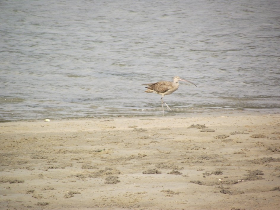
Eastern Curlew at Careel Bay foreshore in October 2011, now Critically Endangered - A J Guesdon photo
Peter Smith, Judy Smith, P & J Smith Ecological Consultants. Bird Habitat Study of Careel Bay (report to Pittwater Council). June 1997. DOI:10.13140/RG.2.2.16461.87526 - Abstract;
Careel Bay is the most significant area of estuarine wetlands in the Pittwater Local Government Area. Management of the wetlands is the responsibility of Pittwater Council. We have been engaged by Council to undertake a study of the birds of Careel Bay, their habitats and conservation needs, to guide Council in the preparation of a plan of management for the wetlands. The bird habitats of Careel Bay and its immediate catchment may be divided into eight categories: subtidal waters of the bay (including an extensive area with submerged Posidonia australis seagrass beds); intertidal mudflats (including Zostera capricorni seagrass beds that are exposed at low tide); mangrove forest (10 ha, dominated by Grey Mangrove Avicennia marina); saltmarsh (3 ha, consisting of low, sparse mangroves over a ground layer of Samphire Sarcocornia quinqueflora); casuarina forest (4 ha, dominated by Swamp Oak Casuarina glauca, with a weedy understorey); eucalypt forest (McKay Reserve, Stapleton Park and Careel Headland Reserve); open parkland (Hitchcock Park); and residential areas (notable for their high tree density). A total of 122 bird species (114 native) have been recorded from the area, of which 72 species (65 native) were recorded during the 1997 survey. lt is a regionally significant site for an endangered species, the Bush Stone-curlew Burhinus grallarius. Careel Bay, which has a single resident pair, is the only site in the County of Cumberland where this species is still regularly recorded. Also regionally significant is the Mangrove Gerygone Gerygone levigaster, a recent colonist of the Sydney region which is only known from two other sites in the County. Three other resident species are also noteworthy occurrences, particularly at the local level, the Striated Heron Butorides striatus, Whistling Kite Hatiastur sphenurus and Azure Kingfisher Alcedo azurea. As the largest area of estuarine wetlands in Pittwater, Careel Bay provides habitat of high local conservation significance for a variety of waterbirds. These include migratory waders from the Northern Hemisphere such as the Eastern Curlew Numenius madagascariensis, Whimbrel N. phaeopus and Bar-tailed Godwit Limosa lapponica, whose conservation is the subject of international agreements. Careel Bay also has local significance as a temporary stopover for birds during migration, both waterbirds and bushbirds. Management issues identified in the study were:
- Potential predation of Bush Stone-curlews by foxes and cats.
- Excessive disturbance by people and dogs of waterbirds feeding on the intertidal mudflats or roosting on the sandspit north of Etival Street.
- lnterference by increasing numbers of Silver Gulls Larus novaehollandiae in the feeding activities of other waterbirds on the mudflats.
- o lnterbreeding of introduced Mallards Anas platyrhynchos with native Pacific Black Ducks A. superciliosa.
- o Continued invasion of saltmarsh by mangroves resulting in the total loss of saltmarsh, a critical roosting and nesting habitat for the Bush Stone-curlew.
- o Potential effects of various human-related factors on invertebrate and fish populations that are the food resources for the waterbirds. Management recommendations are made to address these issues.
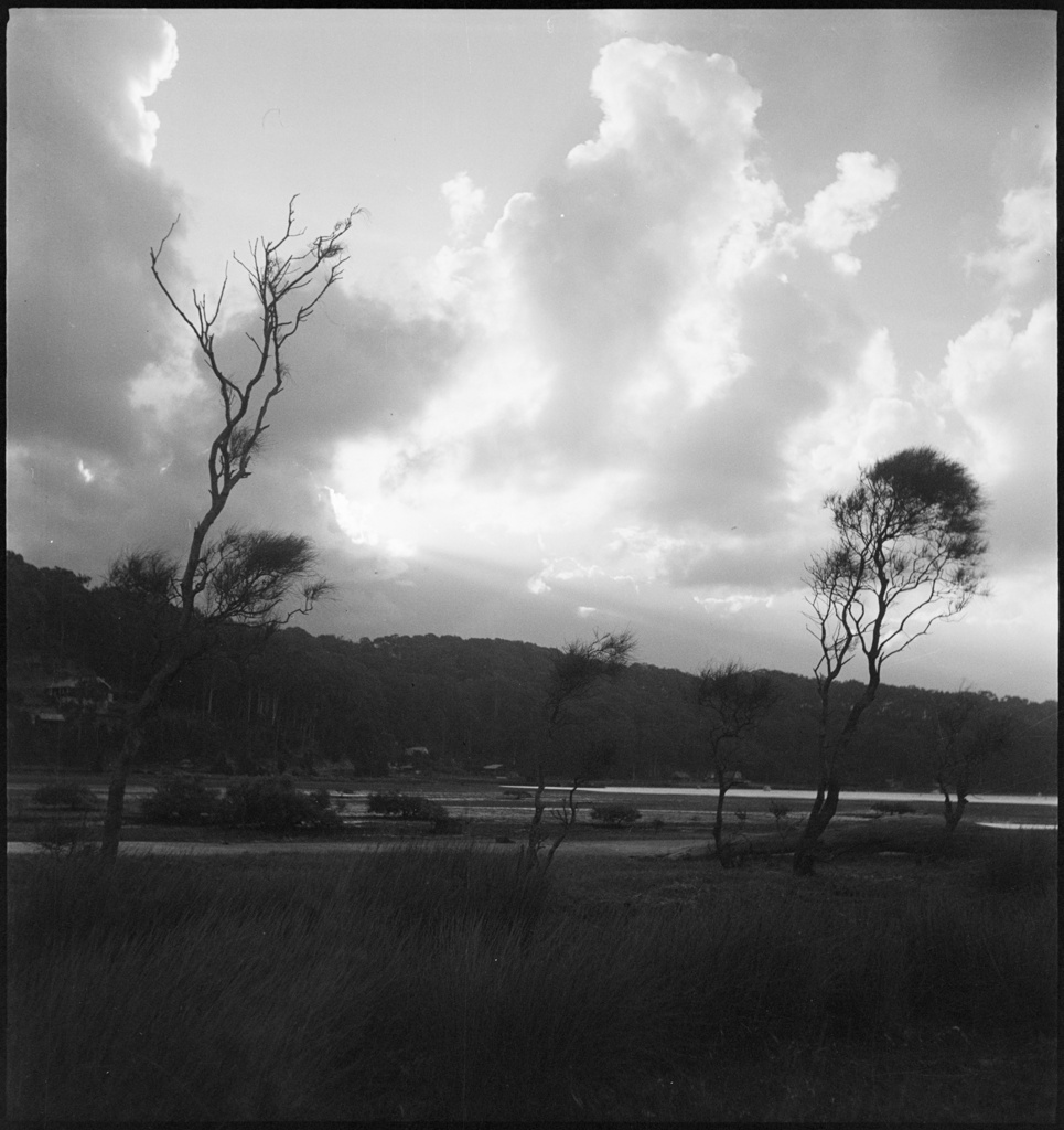
Careel Bay foreshore 1938 - photos by Max Dupain Items: Sequence: SLNSW_FL19428919 to SLNSW_FL19428922
All wildlife and insects living in those trees and across those east side of Careel Bay to Whale Beach and Bangalley headlands thrived because of the creeks that ran through this place.
The knowledge that we belong to the land rather than the land belonging to us, that we are part of maintaining its natural systems like all other species here, was an alien concept to some colonists, especially those brought up to believe humans had a right to destroy places, to kill other animals. Farmers well knew that if you look after the land you will do better, but this was still from an exploitation point of view; training plants to produce sweeter juicier apples, wheat and barley for beer, and destroying all plant communities there previously to do so.
The 'clearing the land' requirements of original land grant terms applied to colonists, and killing the wildlife whose home this was, an inherent part of what belongs to and makes the land sing with knowledge, sometimes for trading in 'skins', was brought with them - even to the point of extinction. This persisted, even into the 1980's when Pittwater lost all its koalas - now functionally locally extinct.
See: Stealing The Bush: Pittwater's Trees Changes - Some History or;
Thylacine tales captured for Threatened Species Day 2025 + A few insights into Pittwater's Past + Present Threatened Species
or A Bunch Of Wildflowers: Historical Spring September Songs
or Pittwater's Koalas Driven to Extinction: Some History
In a place threaded with creeklines that run from ocean to bay, beneath trees standing on grassed plains and through tidal mangroves the change from these inspiring the Collins to Hammond to Tunney dairies, crops, and then holiday homes with access to permanent water, and further along, suburban lots where the creeks were put into concrete pipes called 'drainage easements' and 'stormwater pipes' until every few feet the dirt has been sewn/sown with concrete and steel pipes, the covering over of the landscape and loss of shade - the disconnection from the original songs - is very apparent.
And the resultant discord. Naturally.
Especially since the water still moves through the earth, through the old slopes and creeklines, bringing subsidence and flooding, just to meet where it runs to.
By the time it becomes suburban lots it is a story of pressure on local councils to get it done and get it done cheaply, and get it done yesterday. Warringah Shire Council records are littered during this early build phase of the 1920's through 1930's, with residents requesting the council to provide driveway access to their land/properties - and the council even providing half the fee in many cases - usually when road-building was already being undertaken. That does not happen today - if you need your driveway to meet the road outside to provide access, you need to pay the cost for this, and do it to required council specifications so the pavement stays in place and the flow of water in the gutter goes where it has been previously directed to go.
By the early 1930's the state government imposed requirements on local residents and councils to raise land being built on, to place homes on brick piles, and install stormwater drains to 'carry away all water' from these lands as a 'Healthy Land' requirement.
The rush to have a home, with infrastructure at little or no cost to the newly moving in residents who could neither afford or envision they could wreck the place, lost what doing it best, and keeping the flows would maintain as part of this place; optimum environmental and residential health. The lack of funds, vision and the knowledge and time to do it right, produced a bandaid, patch-it-up, cover it up, fill it with pipes, cover over the wetlands destruction, concrete everywhere theory that persists today.
The 1920's breakup of large land grants into urban lots, the 1930's evictions and camping out, and post World War Two housing shortage crisis, had pretty much everyone racing to move from rough huts to cottage homes and even better architecture.
What wasn't included to begin with, the knowledge inherent in we belonging to the land, that the cost-prohibitive choice can be ignored as the land is free, the land 'belongs to us', mix of ignorance and arrogance, despite the isolated instances of the opposite such as Volunteer Rangers to look after the Wildlife and Flora, to save or grow trees, to set aside areas as reserves for plants and wildlife - an inbuilt into many residents practice and policy that's still being maintained by the current generations - propagated the mindset that has become 'policy' today.
The Warringah Shire Council had a very poor environmental caretakers record in this regard - an opposite to the land grabs for public reserves, parks and wharves it insisted developers provide as the subdivisions sell off occurred. Although some of these early councillors came from the land as orchardists or pastoralists, the total disregard for the environment or even a nod towards being best-practice keepers, persists today, 120 years worth of damage on.
Councils are still trying to cope with community demands, the policy is still 'cheapest' and requiring (Taxpayer funded) grants or using products that are actually poison to the environment, and every species in that environment too. The point now reached, where it's obvious what the costs really are, prompts some to state we really cannot afford to keep pursuing the easiest, cheapest, slapdash method.
Why do we still think the whole place will be magically restored to its pristine best, those shining creeks still wending beneath trees we cut down decades ago, trees filled with koalas and birds and possums and cicadas, trees giving shade to the rooves of homes that fit into, rather than obliterate the gentle slope of the land? Because that's what lives within us - we can see, hear, taste and feel how it really should be; the living knowledge inherent in the enthreaded songlines.
The koalas are gone - the creeks have been put into concrete pipes - the bright coloured playful birds are huddled soaked to the skin in the increasing rain storms, all the trees and tree hollows rapidly disappearing with each criminal who kills the same 'for the view'.
The Pittwater Council Plan of Management for Bangalley Headland Bush Reserve describes what landscape was here prior to urbanisation and is filled with a long list of plants and description of the landscape as Open Woodland/Open-forest, Coastal Scrub - both Shale and Sandstone, and Low Heath; in fact Bangalley Head is the only location for this plant community in the Pittwater local government area, along with several Significant Plant Species. A full list is under References.
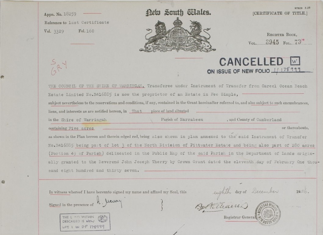
The garden, as described above, was saved from extinction in Pittwater, through the setting aside of a bush reserve. This was a requirement for the progression of the Careel Ocean Beach Estate Limited (Second stage registered in June 1922 and Lots/Sales available in Vol-Fol: 3329-160).
In the Certificate of Title (Vol-Fol 3945-73() is recorded the 5 acres bequeathed to residents and officially transferred to the then Warringah Shire Council on December 8, 1926:
.jpg?timestamp=1769194810031)
The Burrowong - North Bangalley Creeklines and The First Subdivision Impacts
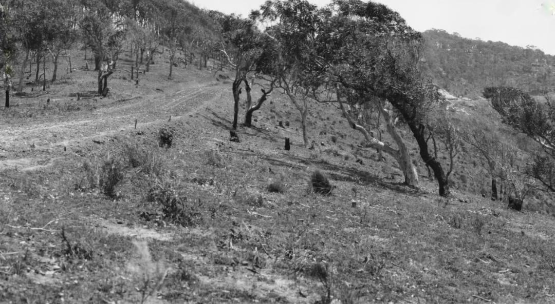
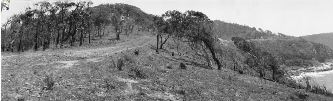
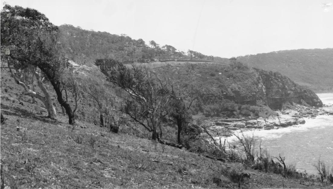
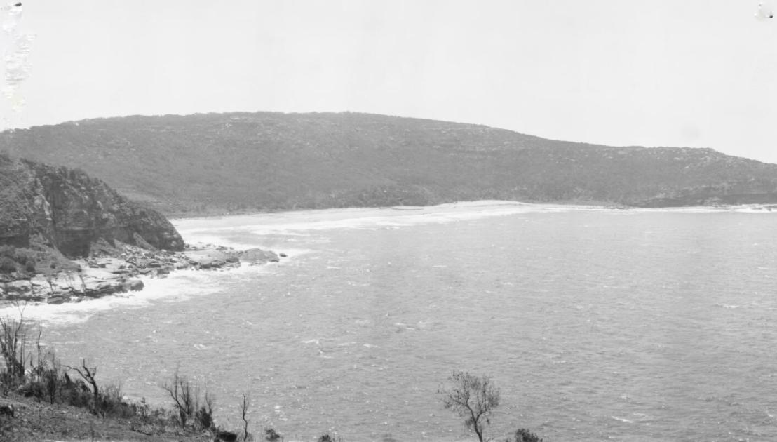
Careel Head Road and North Bangalley Headland are a true 'place of tinkling creeks'. Anyone who lives on the eastern side of Careel Bay Playing fields will tell you this is a microclimate where that long flat stretch out towards Surf Road is cooler and the sound of frogs may be heard, year round, especially after downpours that flush through the age-old creek beds and down into the bay. Peron tree frogs have been found in yards while the water-filled ditches alongside Barrenjoey road are a veritable symphony of calls that sing all night long after sustained rainfall.
Frog Species that have been recorded in the Careel Bay-Avalon vicinity within the past year are the Red-eyed Tree Frog (Chlorohyla chloris) Last observation: Red-eyed Tree Frog from Central Rd, Avalon Beach, on 01 November, 2024 at 07:38 PM by Jimbobaroobob and the Dainty Tree Frog (Chlorohyla gracilenta) Last observation: Dainty Tree Frog from Toongari Bushland Reserve, Avalon Beach, on 09 January, 2025 at 08:34 PM by Jimbobaroobob - iNaturalist listings.
Our area is also home to, among other species of frogs, the Coastal Banjo Frog (Limnodynastes superciliaris), Striped Marsh Frog (Limnodynastes peronii), Giant Burrowing Frog (Heleioporus australiacus), Common Eastern Froglet (Crinia signifera), Red-crowned Toadlet (Pseudophryne australis), Dusky Toadlet (Uperoleia fusca), Eastern Dwarf Tree Frog (Drymomantis fallax), Leaf Green Tree Frog (Dryopsophus phyllochrous) and Green Tree Frog (Pelodryas caerulea).
The sounds of frogs in chorus is a known sign of healthy land and a 'singing' place, just like 'chirruping' creeks.
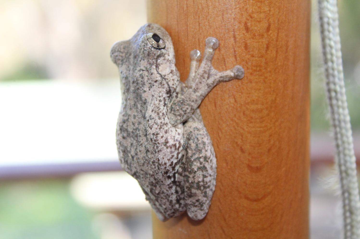
Peron's tree frog at Careel Bay East (Litoria peronii) - photo by A J Guesdon
The playing fields themselves are filled in mangroves, where what remnants of mangroves exist are species of waterbirds that live here year-round, along with annual seasonal visitors, thrive. In the trees are all manner of birds too, from the small wrens through to the larger wattlebirds, currawongs.
The Songline for the Black Duck runs through this place, finishing at the mouth of the Hawkesbury River, just a little further up the estuary alongside Lion Island.
Even the insects here, from the Jumping jack ants that can give our bare toes a nasty nip, through to cicadas, dragonflies, moths and all other manner of insects are interwoven with every other species of animal and plant - especially those that like a cooler, damp environment.
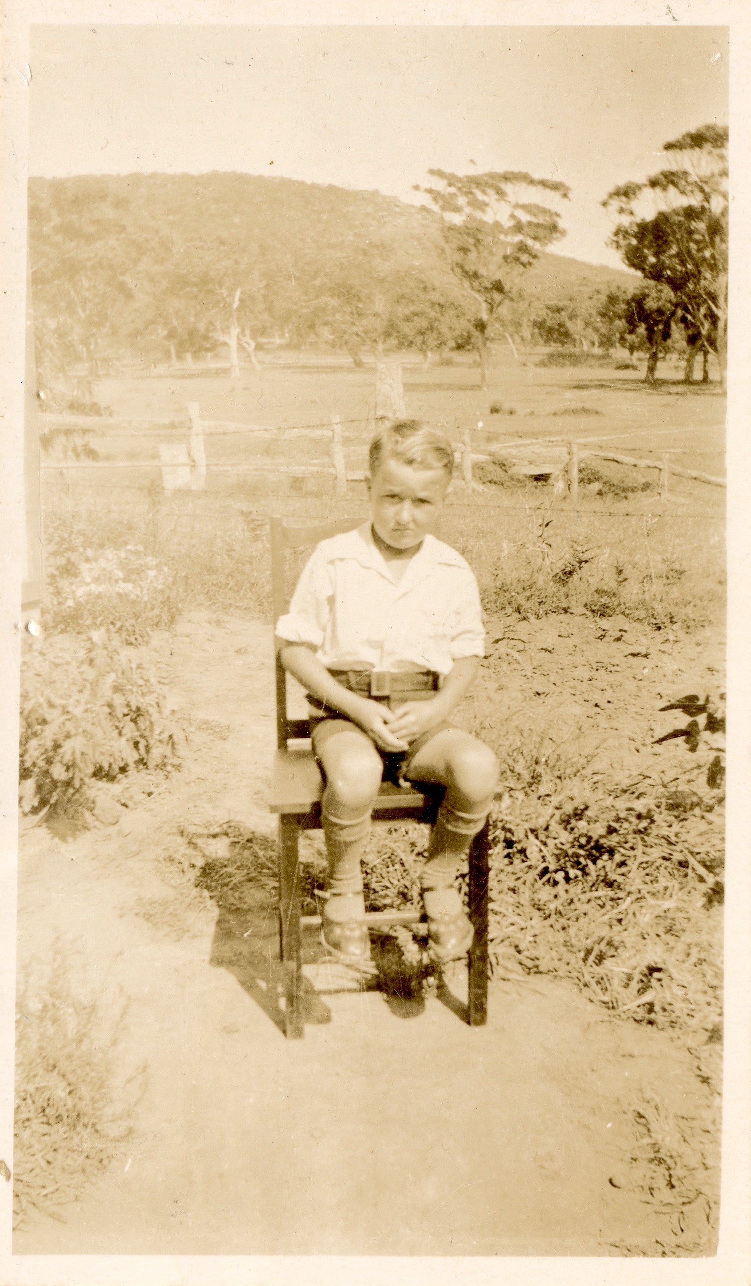
This early photo, circa 1938, of Frank (Francis) Tunney shows the land at that time. Frank was born in 1932. Is that the creek behind him? Photo courtesy Tunney-Goddard families:
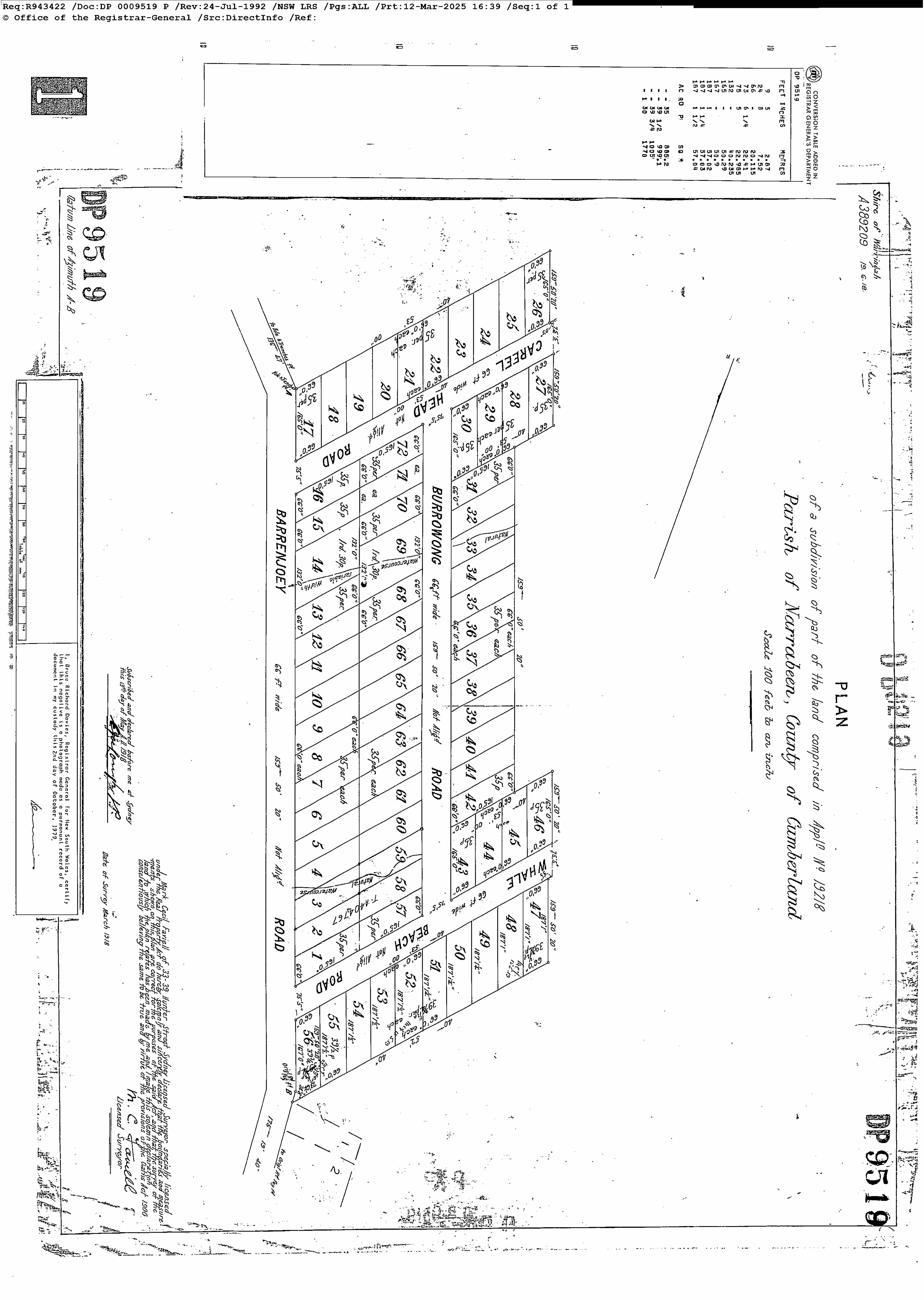
Deposited Plan 9519 shows the two creeks and their location relative to the lots:
.jpg?timestamp=1768957337615)
the Burrowong Creek path
.jpg?timestamp=1768957454822)
North Bangalley-Whale Beach road end of Burrawong Road, showing 'natural watercourse' marked
No. 19,248. APPLICANT .—Mabel Daisy Black, Annandale. LAND: County Cumberland, parish Narrabeen, shire Warringah,—8 acres 20 perches, at Pittwater, on Bay View road and a road 30 links wide,—being part 40 acres (portion 43. of parish), granted to George Weller; adjoining properties of F. J. S. Young, S. R. Mitchell, P. T. Taylor, Dr. J. Isbister, and G. Leslie. NOTICE UNDER REAL PROPERTY ACT. (1914, August 19). Government Gazette of the State of New South Wales (Sydney, NSW : 1901 - 2001), p. 5039. Retrieved from http://nla.gov.au/nla.news-article227674898
Dr. Herbert 'Russell' Nolan, known for performing the first appendectomy in Australia, served in the Boer War where he contracted typhoid fever, from which he never really recovered.
He passed away in February 1915. His estate, when valued, showed the bulk of his assets were investments in real estate.
His passing may account for the delay between bringing these parcels of land under the Real Property Act and the first 'Whale Beach' subdivision at the Careel Head Road-Whale Beach Road end.
However, soon afterwards his widow, Emma Florence Nolan, sold the Blocks 1 and 2 of the Therry north division, of 179 acres and 3 roods, to James Young, Barrister and, Robert Jardine Browning.
James Young was one of the original Directors of the Barranjoey Land Company, and a relative of Mr. Wolstenholme, who was in turn a son of Maybanke Anderson. He was a barrister by profession, and served as President of Ku-ring-gai Council at one time.
Mrs. Nolan granted them a mortgage to her in March 1918, as did, as well, Mabel Daisy Mitchell, 'wife of Ernest Meyer Mitchell, another Barrister. The pair discharged this mortgages by late 1922.
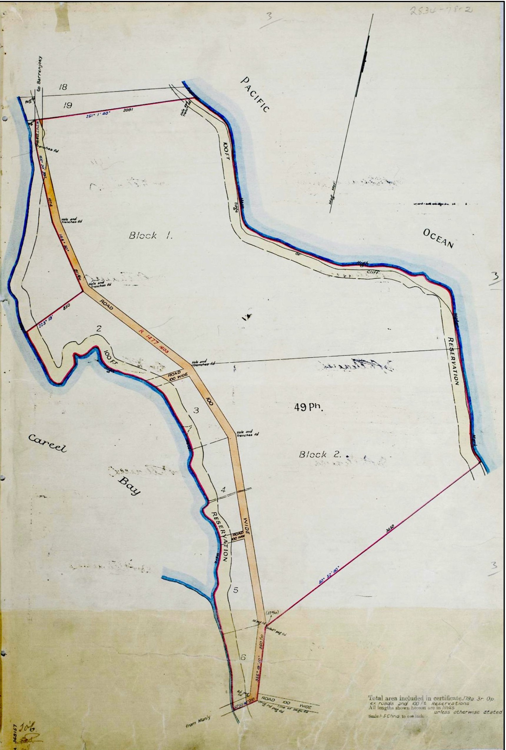
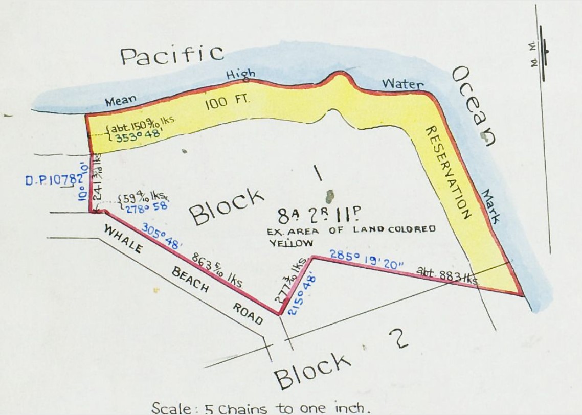
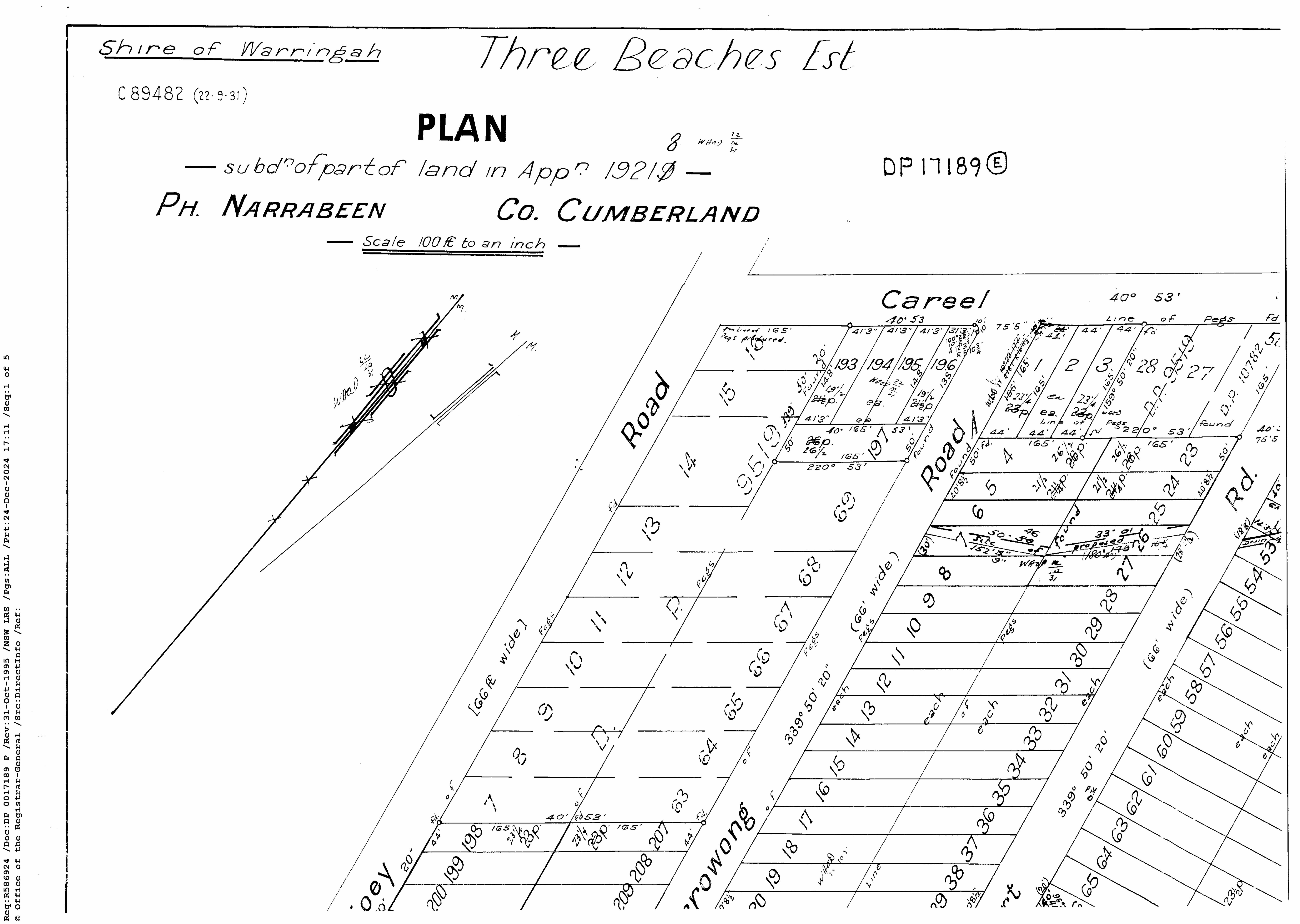
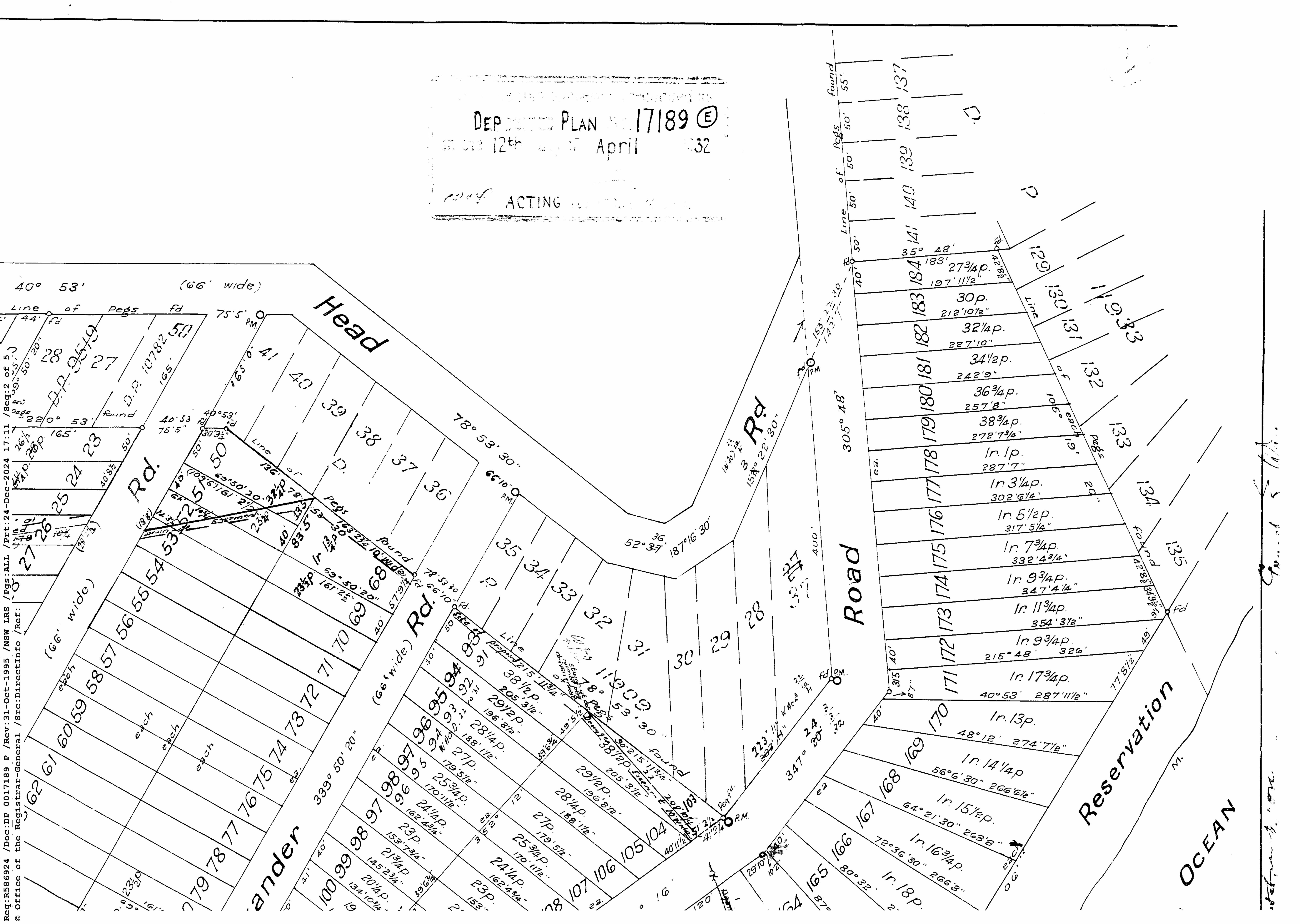
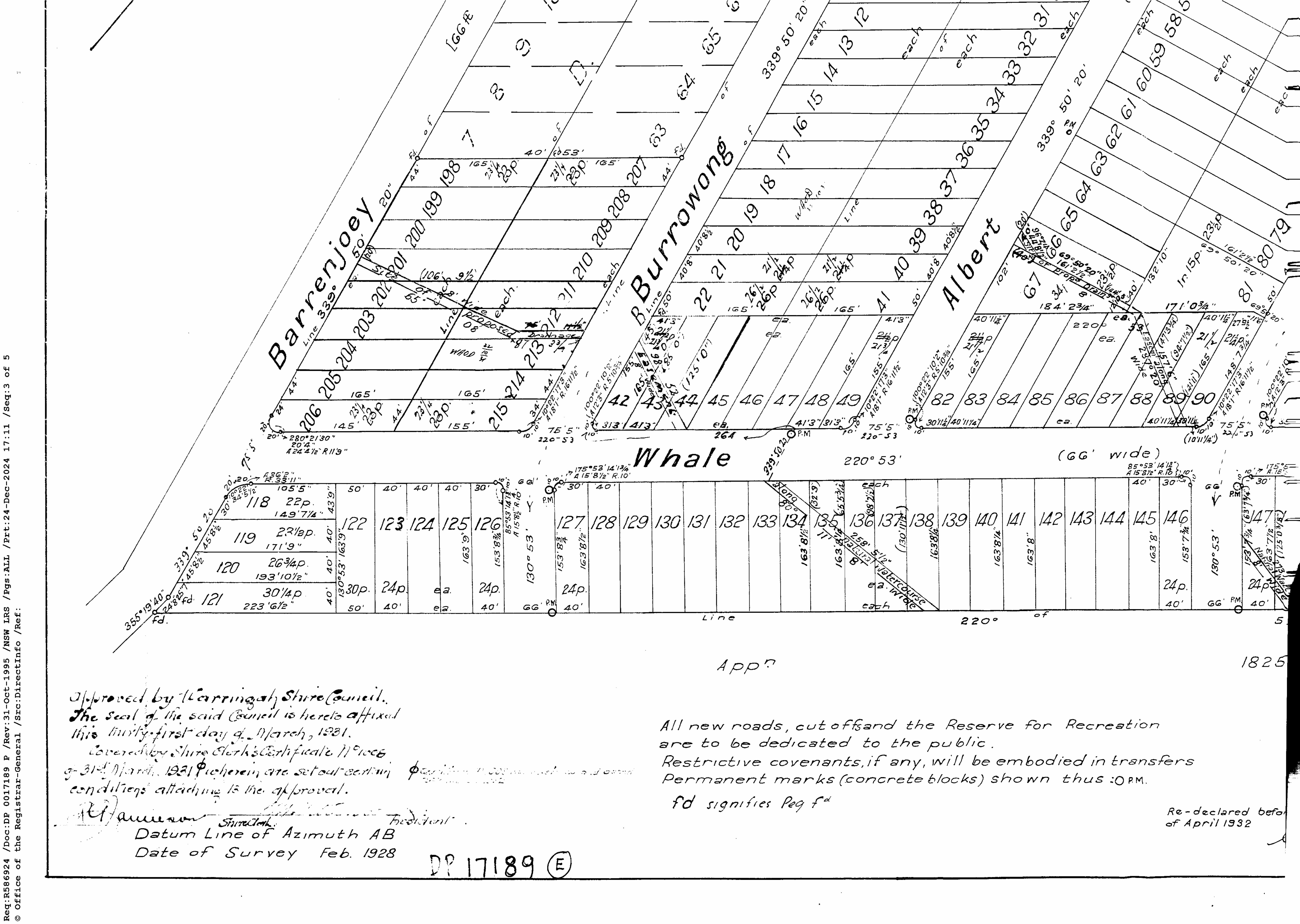
The Certificate of Title was registered April 5th 1918 - and subsequent land sales are listed in Vol-Fol: 2834-78. The surveyors drawing accompanying the CofT shows:
It should also be noted that 'Careel Bay' on earlier maps, and through the 1920's, was described as stretching from the Dark Gully and MacKays Reserve at Palm Beach end of the Pittwater estuary down to what we today call Careel Bay.
The first sales occurred at the beach itself, but also at the Careel Bay east side by one of the early buyers, who was also associated with the Barrenjoey Land Company:
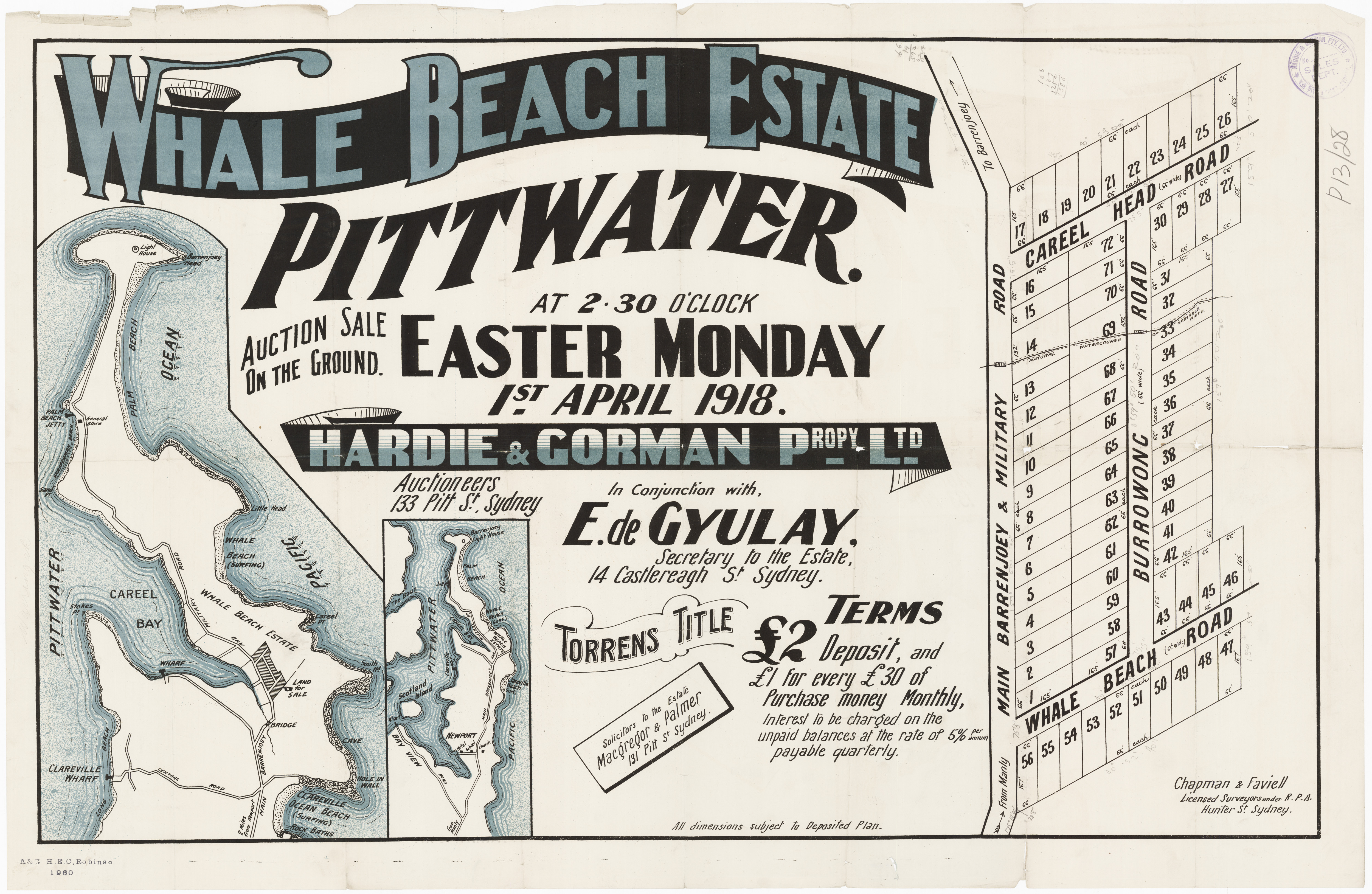
Whale Beach Estate 1918 April 1st c053460074, showing Careel Head Road, Burrowong Road (now spelled Burrawong) and Whale Beach Road - from and courtesy State Library of NSW Pittwater Subdivisions folder.
The initial sales at Careel Bay East attracted some interest, with the newspapers of then recording:
PROPERTY SALES.
Hardie and Gorman Proprietary, Limited, in conjunction with Mr. E de Gyulay, conducted the opening sale of the Whale Beach Estate, Pittwater, yesterday afternoon, on the ground. There was a large attendance, and the sale was very successful, 52 allotments out of 72 being sold, at prices ranging from 6/6 to 12/ a foot. Total of sale, £1584/2/. PROPERTY SALES. (1918, April 2). The Sydney Morning Herald (NSW : 1842 - 1954), p. 9. Retrieved from http://nla.gov.au/nla.news-article15766139
A few days later a change in the sold £ total:
Messrs. Hardie and Gorman had a fairly busy week in their now rooms. They sold a pair of houses, Nundarra and Yarama, Moonbie-street, Summer Hill, for £1650; 52 allotments in the Whale Beach Estate, Pittwater, from 6s 6d to 12s per foot (£1574); REAL ESTATE. (1918, April 6). The Sydney Morning Herald (NSW : 1842 - 1954), p. 9. Retrieved from http://nla.gov.au/nla.news-article15770535
The pathway of the 'Burrowong creek' runs from the north end of Whale beach road down into Careel Head road junction, then across today's Albert road through to Burrawong road.
Photo: Albert and Burrawong roads creek – Tom Gilbert stated here was a creek running through his lot at north end of Albert road
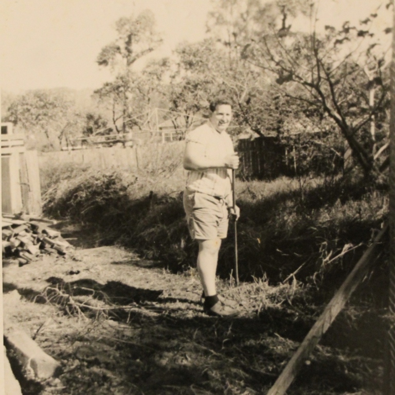
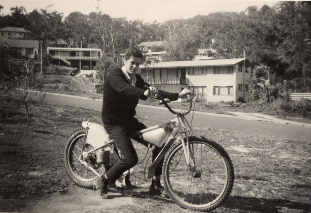
Tom in the garden at the first home he and Dawn owned in Albert Road, Avalon. This formed part of the Dairy and was originally one of the workers houses. This photo is from February 1966. Photo: Tom Gilbert.
Careel Head road - Whale beach road end, and Albert road junction to south off Careel Head road in February 2026:
 smaller.jpg?timestamp=1771181559911)
Looking up Careel Head Road towards Whale Beach road
 smaller.jpg?timestamp=1771181614858)
Junction of Careel Head Road with Albert Road, aspect towards south - creek runs down into Albert road
 smaller.jpg?timestamp=1771181788209)
 smaller.jpg?timestamp=1771181903229)
Aspect towards north-east, corner of Albert and Careel head roads slope of hill
smaller.jpg?timestamp=1771182117176)
Aspect to west towards Barrenjoey road, with Burrawong road to left
smaller.jpg?timestamp=1771182183149)
View direction still west towards Barrenjoey road with junction of Burrawong(left) and Careel Head roads
 smaller.jpg?timestamp=1771182629377)
View direction east, uphill along Careel Head road towards Albert and Whale Beach roads
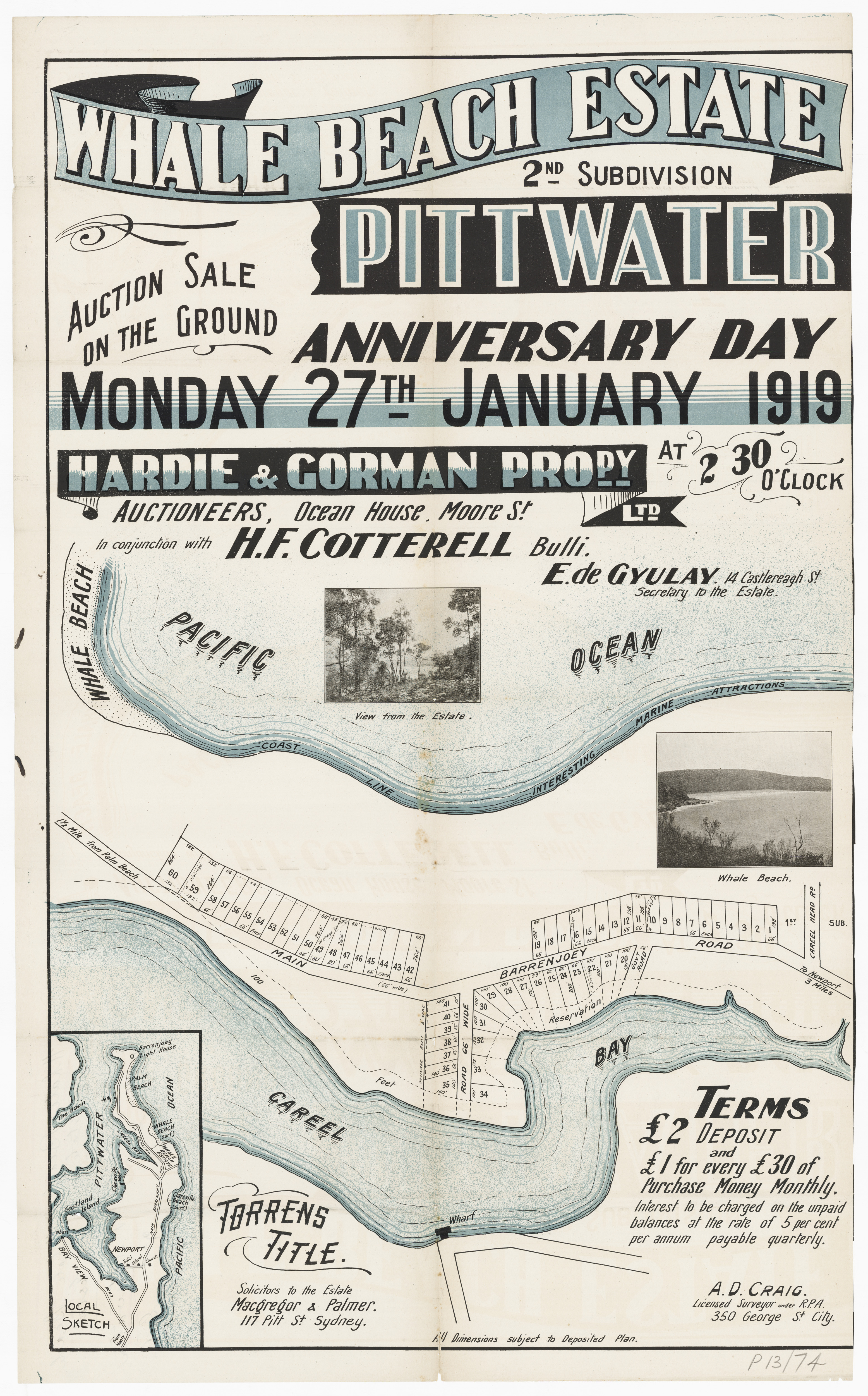
The next, or ‘second subdivision’ was along the main road further north and what is today, and subsequent sales stuck to the 'close to the main road and has running fresh water theme' - and also dedicated accessways and drainage to the council, indicating other known water thoroughfares through and on the landscape:
.jpg?timestamp=1770141528591)
Whale Beach Estate 1919 Item No.: c053460079 - showing Careel Head Road and Barrenjoey Road, from and courtesy State Library of NSW Pittwater Subdivisions folder - showing 'drainage reserves' - all three run down from today's Dolphin Crescent with the one furthest north running down from steepest/highest pat of Dolphin Crescent -;
southernmost - closest to Careel Head road
.jpg?timestamp=1770141933198)
towards north end
Some site photos taken Feb 4 2026 to show current drains on Barrenjoey Road, and area of Careel Bay Playing (Soccer) Fields these ran into until recent clearing of trees-vegetation and drains by the council (June 4 2025 - 1st lot of pics, of tree - vegetation clearing from Hitchcock Park near Burrowong Creek across/under Barrenjoey Road to Careel Bay Soccer fields):
small.jpg?timestamp=1770228202101)
small.jpg?timestamp=1770228293172)
small.jpg?timestamp=1770228350473)
small.jpg?timestamp=1770228448285)
small.jpg?timestamp=1770228504117)
Drains in first section going north on Barrenjoey road from Dolphin Crescent - as per above subdivision lithograph - (Feb 4, 2026) :
small.jpg?timestamp=1770227536794)
small.jpg?timestamp=1770227826551)
small.jpg?timestamp=1770227856125)
small.jpg?timestamp=1770228546935)
 small.jpg?timestamp=1770229087634)
 small.jpg?timestamp=1770229130113)
small.jpg?timestamp=1770229322315)
small.jpg?timestamp=1770229437494)
small.jpg?timestamp=1770229475443)
small.jpg?timestamp=1770229669052)
small.jpg?timestamp=1770229706732)
small.jpg?timestamp=1770229745070)
.jpg?timestamp=1770229789753)
small.jpg?timestamp=1770229836926)
small.jpg?timestamp=1770229915174)
small.jpg?timestamp=1770229970337)
small.jpg?timestamp=1770230937644)
A site investigation of this park may be seen in: Dolphin Park Bushland Reserve: a stroll through this Right-of-way Park between Dolphin Crescent and Barrenjoey Road, at Careel Bay to Whale Beach - Feb 2026
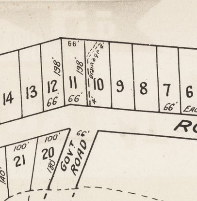
The First, Second and Third show on this lithograph, with the drawing stating ‘the shaded Lots are sold’ – there is no ‘Albert Road’ as yet, just one lot ‘reserved for road purposes’ as Lot 43 further up Careel Head Road. Those Lots left are the beachfront ones, on today's 'The Strand' south end of the ocean facing beach bay:
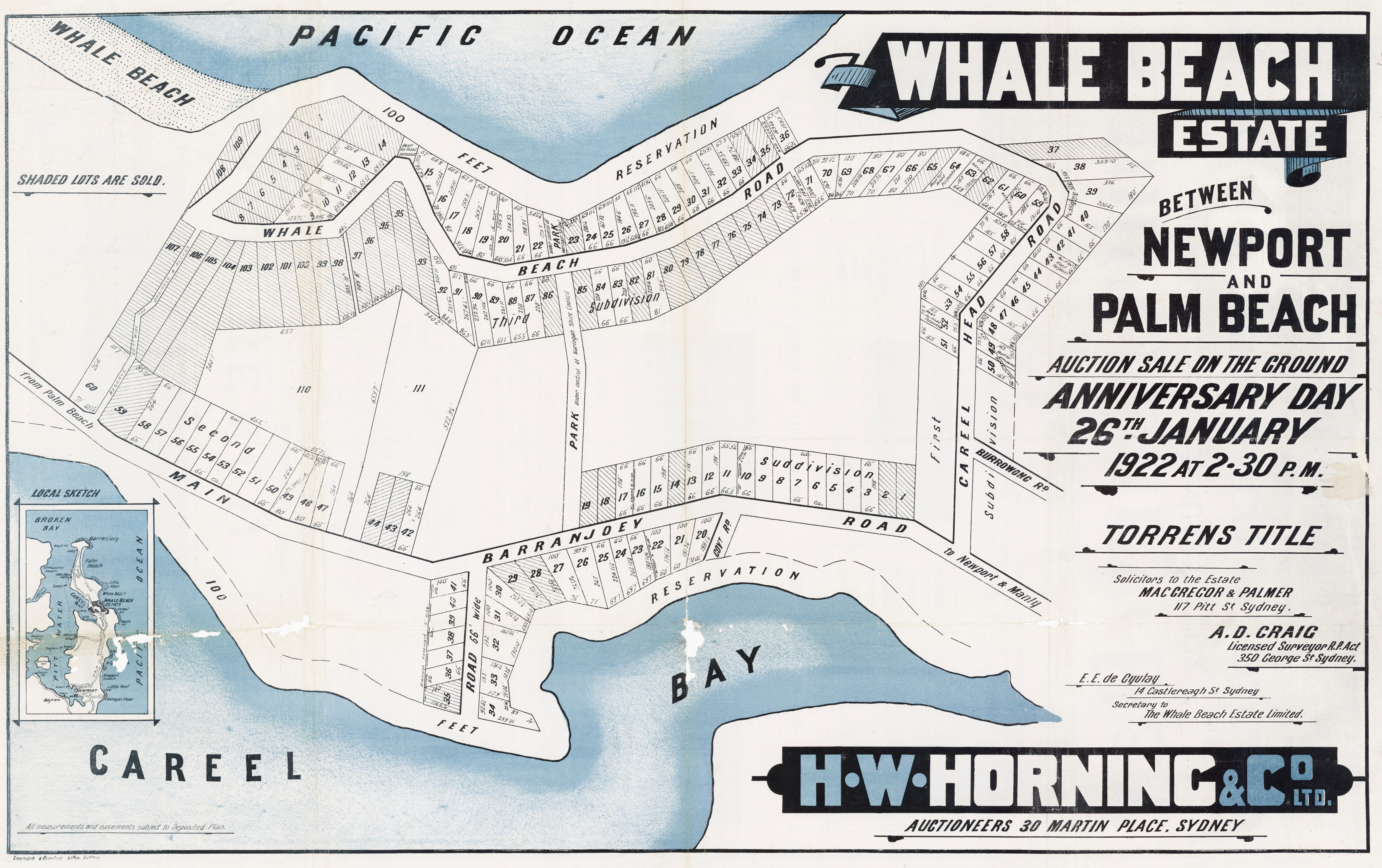
Whale Beach Estate January 26th, 1922, showing 2nd and 3rd subdivision - names Barranjoey Road with an 'a', Mr de Gyulay is still secretary but this is named as 'The Whale Beach Estate Limited' subdivision. Item No.: c053460088, from and courtesy State Library of NSW Pittwater Subdivisions folder.
See: Pittwater Roads II: Where the Streets Have Your Name - Whale Beach and Whale Beach Ocean Reserve: 'The Strand' - some history on another great Protected Pittwater reserve, and how Camping and campers At Whale Beach Helped The Whale Beach SLSC Save Lives, and Pittwater Restaurants you could stay at Jonah's Road House – Whale Beach
The landscape of then can be seen in Enemark panoramas taken for these further subdivision land sales:
Enlarged sections taken from another from today's McKay Reserve with a south-facing aspect showing Careel Bay:
EB Studios (Sydney, N.S.W.). (circa 1917-1919). Panorama of Palm Beach, New South Wales, 11 Retrieved from http://nla.gov.au/nla.obj-162487775 - and enlarged sections from to show road running north beside Careel Bay - courtesy National Library of Australia.
Manly's Constance Phillipson initially bought on Dec. 16 1922 Vol-Fol: 3414-172 (mix of lots) and Vol-Fol3418-44 (8 acres, 2 roods and 11 perches.
The Albert Road-Burrawong creekline drainage reserve in Vol-Fol 5424-249, shows up in William Henry Jones, Dairyman of North Sydney, subdivision:
.jpg?timestamp=1768959805133)
.jpg?timestamp=1768959848423)
.jpg?timestamp=1768959372202)
.jpg?timestamp=1768959431439)
The Minutes of the Warringah Shire Council Meeting of 27th October,1924 state ''The President verbally reported having interviewed Mr. James Young and submitted a letter from Mr. Young, offering to sell his 10 ¾ acres at Careel Bay fronting Barrenjoey Road for £700 on terms, namely, £50 deposit, and the balance in annual instalments of £100 each with interest at 6 ½ % on unpaid purchase money. It was resolved, - (per Crs. Hewitt, Hitchcock) That the offer be accepted and the terms approved, but that the President endeavour to arrange for a smaller deposit. ''
By November 10th, 1924 a report regarding Careel Ocean Beach Estate Subdivision is being referred to the Works Committee, and the subdividers are to be asked what provision they are making for recreation area's at North Avalon.
The adjacent land was subdivided in 1914 as part of "Careel Ocean Beach Estate". It is presumed that the three large blocks of land that comprise the bulk of the reserve's bushland were dedicated as open space during this and subsequent subdivisions.
At the same time the President reports on the Careel Bay Park purchase from James Young and an interview he had with Mr. James Young in regard to the purchase, for public recreation purposes of that gentleman's 10 ½ acres adjoining Barrenjoey road at Careel Bay, and it was resolved that the terms arranged with Mr. Young by the President be continued, namely ''That the Council pay a deposit of £10; £60 on 1st May next, and the balance of the £700 by 14 equal half-yearly instalments of £90, the first to be paid on 1st May, 1926 with interest at 6 ½ % to be paid on unpaid-balances of purchase money.''
In 1925:
NEW COMPANIES.
The following new companies have been registered in New South Wales:
City Securities, Limited. — Capital, £50,000 in £1 shares. Objects are to buy, sell, lease or otherwise deal in land, buildings and other property. First directors are T. J. Martin, Rose A. Phillipson, Mary C. Carruthers, and T. A. Thomson. Registered office Sydney, Registered March 7. NEW COMPANIES. (1925, March 10). Daily Commercial News and Shipping List (Sydney, NSW : 1891 - 1954), p. 4. Retrieved from http://nla.gov.au/nla.news-article159952523
A few years later, on September 13th, 1926 Council records that a letter from James Young, dated 3.9.26, offering ten or twelve Lots adjacent to the land at Careel Bay, which the Council acquired from him for a park, at £1 per foot on five years' terms, with interest at 6 per cent, was read. It was Resolved, (Crs. Simpson, Hope) ''That if he will sell the land with not less than 500 feet frontage for £500, on satisfactory terms, the Council agree to purchase it, and it be left with the President to negotiate with him in regard to the terms.''
On October 11th, 1926 Council Records regarding the Careel Bay Park Extension note that a F. T. Jeffery, 30.9.26, is offering to sell twelve lots in Palm Beach Extension Estate, as an addition to Careel Bay Park Reserve and that Miss C. Phillipson (Mrs. Carruthers) has written in correspondence dated 8.10.26 about the purchase of her land at Careel Bay, and asking for a Deposit of £25, whereon it was Resolved, 'that a deposit of £25 be paid'.
A fortnight later, on the 26th of October, 1926, the Careel Bay Park Extension arises again with the recommendation to purchase Lots 60, 80A, 81A and 82 to 89, for £600 Cash, for the purpose of extending the Careel Bay Park, be adopted, provided the two sold lots, namely Lots. 80B and 81B be also acquired.
F. T Jeffery is an Estate agent involved in selling The Boulevarde Estate in conjunction with Hardie and Gorman along the main road and shop sites at Newport in 1929 and the Hollywood Estate at the same place later on. A son is born at Newport in 1928 and named 'Gerald'.
In 1941 the construction or expansion of a Dairy took place in the Careel Head Road-Burrawong-Albert Road vicinity adjacent to the current day soccer fields - the Notice published in Construction for William (Bill) Jones shows a substantial expansion for new works. The Hammond family were running this dairy for Mr. Jones by the early 1930s with around 100 cows being milked twice a day, according to an oral history placed from the Mona Vale Library in the mid 1980s.
There is also a Edwin Theordore Bruce registering a stock brand at Careel Bay in 1935:
Careel Bay—Blk. dairy premises, Albert & Burra Wong Rd.—W. H. Jones, Barrenjoey Rd., Careel Bay, Owner; £1170. BUILDINGS & WORKS APPROVED (1941, November 26). Construction (Sydney, NSW : 1938 - 1954), p. 3. Retrieved from http://nla.gov.au/nla.news-article222862494

Bruce, Edwin Theodore, Careel Bay, Palm Beach...REGISTRATION OF STOCK BRANDS ACT, 1921. (1935, March 15). Government Gazette of the State of New South Wales (Sydney, NSW : 1901 - 2001), p. 1133. Retrieved from http://nla.gov.au/nla.news-article224743561
William Henry Jones – Burrawong and Albert roads; north end creek.
Vol-Fol: 5424-249 – bought 6 acres 7 ½ perches on May 9th 1944 – even though he had been there prior to this:
Careel Bay—Blk. dairy premises, Albert & Burra Wong Rd.—W. H. Jones, Barrenjoey Rd., Careel Bay, Owner; £1170. BUILDINGS & WORKS APPROVED (1941, November 26). Construction (Sydney, NSW : 1938 - 1954), p. 3. Retrieved from http://nla.gov.au/nla.news-article222862494
Prior Vol-Fol had been 5278-154 which officially registers a Grant of Easement to Warringah Shire Council of Lots; 7, 26, 42, 43 and 44 and Lots 50 to 53 inclusive and Lots 66, 68 and 81, Lots 86 to 90 inclusive, Lot 103, Lots 133 to 138 inclusive and Lots 147 and 143 of Deposited Plan 17189
Lots 10 to 14 and Lots 68, 69 (Vol-Fol: 3323-100) were sold to Joseph Thompson of Sydney, 'Contractor' in 1920 and 1922. These show ' North Bangalley Creek' running through - Certificate of Title registered June 19, 1922:
.jpg?timestamp=1768887095815)
.jpg?timestamp=1768887175102)
William (Bill) Goddard II has researched and written the Careel Bay Dairy Farms (East) and where this becomes the first Careel Head Road shops. Bill's work runs below.
This later DP 17189 for the 'Three Beaches Estate', when the corner shop lots were turned to face Careel Head Road, also details the drainage easements across and through the various Lots:
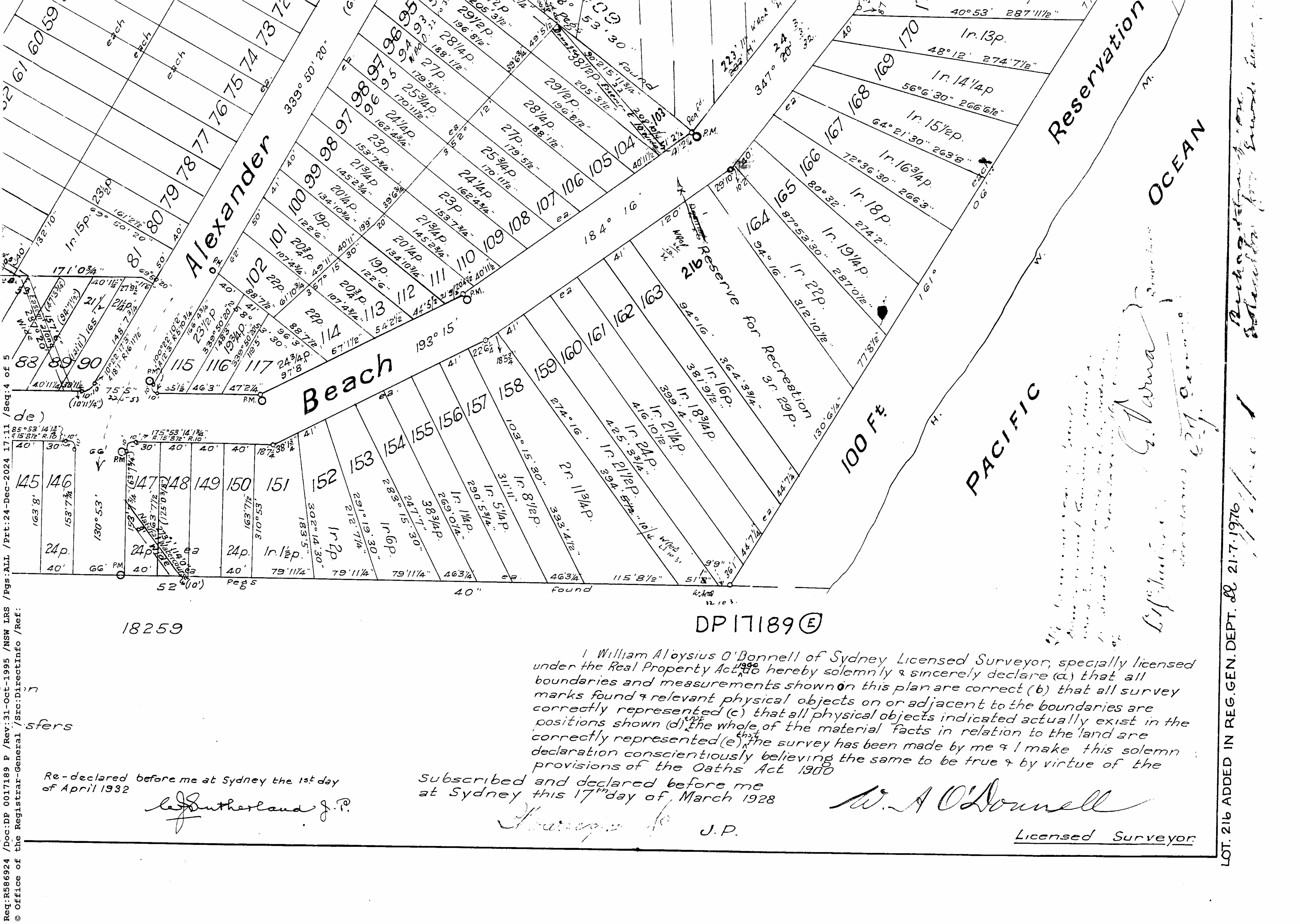
The Phillipson land holdings underline 'Careel Bay' as stretching from McKay Reserve Palm Beach to Careel Bay surrounded by Careel Head and Bangalley Reserve on the east and Stokes Point on the west. Through Warringah Shire Councils' ethos of requiring reserves to be set aside or dedicated to council in subdivisions, and purchasing lots of land in some places to facilitate larger holdings for the community, Careel Bay not only has laying fields, it has the aforementioned Bangalley Reserve, Careel Bay boatshed foreshore reserves, and a public wharf, a thoroughfare originally named 'Dolphin Park in Dolphin Crescent, as well as 'Coral Park' and steps up Whale Beach road, and Hitchcock Park and the Careel Bay Play Fields.
Their big 1924-1926 reserve acquisition lands come through the rush by the populace to have a plot of green beside the sea and those who owned the land deciding it was time to subdivide.
Mary Constance Carruthers was born in 1896, in Perth, Australia, to Walter John Phillipson and Rose Ann Phillipson (nee McKenzie). Her father was a son of Jonas Moses Phillipson and Matilda Constance (Goldsmid) Phillipson, early settlers in Adelaide, South Australia, who also had vast land holdings.
Her father passed away in 1923: PHILLIPSON. — On the twenty-fifth (25th) January, at Domain road, South Yarra, Melbourne, Walter John, second son of the late J. M. and M. C. Phillipson. Family Notices (1923, January 27). The Register (Adelaide, SA : 1901 - 1929), p. 8. Retrieved from http://nla.gov.au/nla.news-article63831524
Her mother owned:
No. 25,430. Rose Ana Phillipson, 96 a. 3 r. 38 p., Block V, South Division, Pittwater Este., Shire Warringah. NOTICE UNDER REAL PROPERTY ACT. (1924, May 30). Government Gazette of the State of New South Wales (Sydney, NSW : 1901 - 2001), p. 2547. Retrieved from http://nla.gov.au/nla.news-article219978762
Later that year Mary was married to a son of a NSW Premier:
WEDDINGS.
CARRUTHERS-PHILLIPSON.
The marriage of Miss Mary Constance Phillipson, only daughter of Mrs. Phillipson, of Kinnell, Elizabeth Bay, and the late W. J. Phillipson, of Perth, Western Australia, to Dr. Douglas Gordon Carruthers, son of Sir Joseph and Lady Carruthers, Waverley, was celebrated by Rev. J. P. .S. Russell at St. James' Church, King-street, on Tuesday evening. The bridal gown was of white silk morocain and georgette, with borderings of white fur. She wore a tulle veil, encircled with orange blossom, and her bouquet was of white blooms. The bridesmaids were Miss Sybil Scharre, in rose pink georgette, and Miss Alice Carruthers, in rose pink crepe romaine. They carried posies of delphiniums, forget-me-nots, and white sweet pea, tied with blue tulle. Mr. J. B. Carruthers was best man, and Messrs. W. A. Carruthers and Eric Hull groomsmen. A reception was afterwards held at the Ambassadors, where Mrs. Phillipson, wearing a gown of black morocain, received the guests. Lady Carruthers wore a frock of mole morocain, and hat of the same shade. Dr. and Mrs. Carruthers left by the Makura for a honeymoon trip to Canada and U.S.A. Family Notices (1924, November 21). The Sydney Morning Herald (NSW : 1842 - 1954), p. 5. Retrieved from http://nla.gov.au/nla.news-article16170017
(4) Mrs. Douglas Carruthers (Miss Phillipson), who was married on Tuesday evening. (Monte Luke.) Society (1924, November 23). Sunday Times (Sydney, NSW : 1895 - 1930), p. 6 (Social and Magazine Section). Retrieved from http://nla.gov.au/nla.news-article128152518
By November 10th, 1924 a report regarding Careel Ocean Beach Estate Subdivision is being referred to the Works Committee, and the subdividers are to be asked what provision they are making for recreation area's at North Avalon. Bangalley Reserve, comprising Careel Head in old terminology, and North Avalon Headland Reserve includes lands reserved under the County of Cumberland Planning Scheme in the 1950's and subsequent open space contributions from subdivisions in the area.
The adjacent land was subdivided in 1914 as part of "Careel Ocean Beach Estate". It is presumed that the three large blocks of land that comprise the bulk of the reserve's bushland were dedicated as open space during this and subsequent subdivisions.
At the same time the President reports on the Careel Bay Park purchase from James Young and an interview he had with Mr. James Young in regard to the purchase, for public recreation purposes of that gentleman's 10 ½ acres adjoining Barrenjoey road at Careel Bay, and it was resolved that the terms arranged with Mr. Young by the President be continued, namely ''That the Council pay a deposit of £10; £60 on 1st May next, and the balance of the £700 by 14 equal half-yearly instalments of £90, the first to be paid on 1st May, 1926 with interest at 6 ½ % to be paid on unpaid-balances of purchase money.''
In 1925:
NEW COMPANIES.
The following new companies have been registered in New South Wales:
City Securities, Limited. — Capital, £50,000 in £1 shares. Objects are to buy, sell, lease or otherwise deal in land, buildings and other property. First directors are T. J. Martin, Rose A. Phillipson, Mary C. Carruthers, and T. A. Thomson. Registered office Sydney, Registered March 7. NEW COMPANIES. (1925, March 10). Daily Commercial News and Shipping List (Sydney, NSW : 1891 - 1954), p. 4. Retrieved from http://nla.gov.au/nla.news-article159952523
A few years later, on September 13th, 1926 Council records that a letter from James Young, dated 3.9.26, offering ten or twelve Lots adjacent to the land at Careel Bay, which the Council acquired from him for a park, at £1 per foot on five years' terms, with interest at 6 per cent, was read. It was Resolved, (Crs. Simpson, Hope) ''That if he will sell the land with not less than 500 feet frontage for £500, on satisfactory terms, the Council agree to purchase it, and it be left with the President to negotiate with him in regard to the terms.''
Warringah Shire Council Minutes of Meetings records on the 27th of September, 1926;
Careel Bay Park Extension. The President verbally reported on his interview with Miss C. Phillipson (Mrs. Carruthers) and Mr James Young, on the matter of acquiring their land for the extension of the Careel Bay Park northwards, and that Miss Phillipson was prepared to sell Lots 68 to 70 for £180 Cash, or £200 - terms; and Mr. Young Lots 71 to 79 for £406 cash or £450 terms, Resolved, - (Crs. Simpson, Hitchcock) That the offers to sell for cash be accepted; the purchase prices to be included in the proposed loan for resumptions for public recreation purposes in A. Riding.
On October 11th, 1926 Council Records regarding the Careel Bay Park Extension note that a F. T. Jeffery, 30.9.26, is offering to sell twelve lots in Palm Beach Estate, as an addition to Careel Bay Park Reserve and that Miss C. Phillipson (Mrs. Carruthers) has written in correspondence dated 8.10.26 about the purchase of her land at Careel Bay, and asking for a Deposit of £25, whereon it was Resolved, that a deposit of £25 be paid.
A fortnight later, on the 26th of October, 1926, the Careel Bay Park Extension arises again with the recommendation to purchase Lots 60, 80A, 81A and 82 to 89, for £600 Cash, for the purpose of extending the Careel Bay Park, be adopted, provided the two sold lots, namely Lots. 80B and 81B be also acquired.
This is from the Kenneth Gray Byrne 40 acres in Vol-Fol 3694-119 - Certificate of Title registered February 10 1925, with Mortgage to Constance Phillipson of Sydney, 'Estate Agent' (instead of 'Spinster' - she had married) on June 19 1924 - foreclosed in 1926 with some of these Lots bought by A J Small - note the park and right-of-way path between Barrenjoey road an Dolphin Crescent and the two drainage lines:
.jpg?timestamp=1768954540117)
.jpg?timestamp=1768954652391)
.jpg?timestamp=1768954683301)
.jpg?timestamp=1768954732048)
The Phillipson - creek/drain reserve, transfer to Warringah Shire Council in Vol-Fol: 3630-112, dated August 22, 1924 - on Whale Beach road, alongside Lot 72, is 20 feet wide and 199 feet long on one side, 170 feet long on other and 12 1/4 perches.
Vol-Fol 3414-172 shows Constance Phillipson of Manly, 'Spinster', still has 25 acres of varying Lots in the Whale Beach road to what will become the Currawong avenue end - north of Careel Head road two creek ways, shown as 'drains' are on this sale map:
.jpg?timestamp=1768887321846)
.jpg?timestamp=1768887354814)
.jpg?timestamp=1768887392196)
Above - the transfer of land for access and drainage - between Lots 71 and 72 of 12 1/4 perches - at top of Whale Beach road - along with other drainage lines transferred to the council:
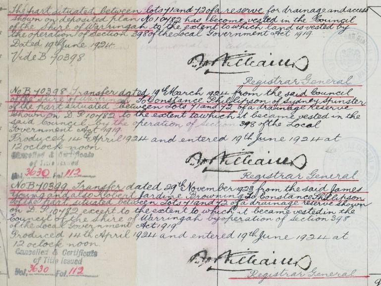
James Young bought Lot 1 at top of Whale Beach Road (Vol-Fol: 3256-28 of 2 Roods, 8 perches) on ocean front. A Right-of-Way through the land was granted on November 16, 1923, marked in blue on Certificate of Title. The Lot was sold by mortgagee Ernest George Stevenson on June 23rd 1930 to Leonard William Smith of Sydney, Gentleman.
Some of the Phillipson land sales:
NEWPORT Whale Beach fronting Careel Head road -Vacant Land Lots 36 to 41, Phillipson's Estate, each about 56ft x 165ft TORRENS TITLE. Also Lots 23 to 20, fronting Whale Beach-road each about 50ft X 100ft 6in, Lot 27 having a frontage of about 110 feet TORRENS TITLE. Under instructions from Mortgagee … Advertising (1930, November 27). The Sydney Morning Herald (NSW : 1842 - 1954), p. 3. Retrieved from http://nla.gov.au/nla.news-article16733641
FORTHCOMING AUCTION SALES.
Richardson and Wrench, Ltd., will include in their list for Friday, June 2, the following properties: ....Careel Head, Rayner road, off Whale Beach-road, vacant land, lots 110, 111, and 112. Phillipson's subdivision: Careel Bay, fronting Barrenjoey-road near Whale Beach-road, lot 102, Phillipson's sub-division; REAL ESTATE. (1933, May 27). The Sydney Morning Herald (NSW : 1842 - 1954), p. 8. Retrieved from http://nla.gov.au/nla.news-article16985206
PHILLIPSON.—March 5, 1935, at 589 New South Head-road, Rose Bay, Rose Anna Phillipson, mother of Mrs. D. G. Carruthers in her 63rd year. Family Notices (1935, March 6). The Sydney Morning Herald (NSW : 1842 - 1954), p. 12. Retrieved from http://nla.gov.au/nla.news-article17143373
PHILLIPSON.--The Funeral of the late ROSE ANA PHILLIPSON, of Rose Bay, took place privately in Church of England Cemetery, South Head, YESTERDAY, 6th March, 1935. CHARLES KINSELA, Motor Funeral Director, Oxford-street, Taylor-square, Darlinghurst. Phones, FL4136-7-8. Family Notices (1935, March 7). The Sydney Morning Herald (NSW : 1842 - 1954), p. 9. Retrieved from http://nla.gov.au/nla.news-article28016921
Rose ‘Ana’ had extensive holdings at Blacktown and the Blue Mountains as well, with many Rates Notices showing up with her name, in conjunction with others, for decades after she passed away. Her daughter 'Constance' also turns up with more land holdings at Careel Bay-Whale Beach about to be sold due to unpaid Rates:
OVERDUE RATES.—Shire of Warringah.—Land to be Sold for Default.—The following persons are required to take notice that the Council of the Shire of Warringah has applied to the Public Trustee to sell the land specified below against their names, of which they appear to be the owners or in which they appear to be interested for overdue rates, amounting to the sums mentioned in each case, and that in default of payment forthwith to the Public Trustee of the said rates and all interest charges and expenses in connection with the said applications and proceedings by the Public Trustee, the raid land will be offered for sale at public auction by Messrs. Weight & Yonge, Auctioneers, of Dee Why, in conjunction with Beach Estates Pty. Limited, at 2.30 p.m. on Saturday, 1st September, 1951, at Glendowie Hall, The Strand, Dee Why, on behalf of the Public Trustee:—
Mary Constance Carruthers, of Sydney, and Jack Kenny, of Narrabeen; overdue rates, £54 17s. 9d.; land, lot 52, d.p. 11,900, Barrenjoey-road, Careel Bay. OVERDUE RATES.—SHIRE OF WARRINGAH.—Land to be Sold (1951, June 29). Government Gazette of the State of New South Wales (Sydney, NSW : 1901 - 2001), p. 1919. Retrieved from http://nla.gov.au/nla.news-article220110458
Mary passed away on September 11 1972, at age 76. Her address given as 4 St Mervyns Avenue, Point Piper in her Probate Notice. Her husband, Douglas Gordon Carruthers, is named the executor of the will.
The reliance on creek water for fresh water access finishes for some sections in the 1930’s but persist into 1987 for Sewer lines, and even 1990 in one case – for Cabarita road, Careel Bay.
This would have also accelerated land sales and the value of that land. Photos and information by Geoff Searl OAM, President of the Avalon Beach Historical; Society, along with Crown Land aerials of this section of East Careel Bay, show a rapid growth in houses built between those taken in 1951 and those just a few years later.
The other aspect of this is the rapid change from land owners being required to lay their own pipe and stop-cock for connection and the announcement they would be required to pay water rates thereafter, whether connected to piped water, instead of rain tanks or creeks, or not.
Some of those water pipes Notices:
Metropolitan Water, Sewerage, and Drainage Board,
Sydney. 23rd October. 1936.
NOTICE TO LAY SERVICE PIPES.
Notice to the Owners or Tenements and Premises IN—
Warringah: Avalon-parade, from Barrenjoey-road to Riverview-road 5,089 feet. P.N. 3,029f, 3,029h. Beach-parade, from Avalon-parade to Hudson-parade; Hudson-parade, from Beach-parade to end of Hudson-parade 7,377 feet. P.N. 3,029h, 3,029g.
Central-road, from Avalon-parade easterly 1,443 feet. P.N. 3,029f.
Riverview-road, from Avalon-parade north-westerly 293 feet; Deleeta-avenue, from Hudson-parade northerly 970 feet. P.N. 3,029h.
Central-road, from Barrenjoey-road westerly 1,558 feet; Kevin-avenue, from Barrenjoey-road north-westerly 483 feet; Wollstonecraft-avenue, from Barrenjoey-road north-westerly 630 feet. P.N. 3,029k. Careel-road, from Barrenjoey-road to Tasman-road 621 feet; Careel-road, from Tasman-road easterly 114 feet. P.N. 3,029r.
Atunga-road, from 12-inch main easterly 400 feet; Bilgola-avenue, from Old Barrenjoey road to Allen-avenue 515 feet; Allen-avenue, from Bilgola-avenue * northerly 357 feet. P.N. 3,029d.
Dress Circle road, from Old Barrenjoey road to Bellevue-avenue 669 feet; Bellevue-avenue, from Dress Circle road northerly 625 feet. P.N. 3,029e. Avalon-parade, from Barrenjoey-road easterly 553 feet; New Barrenjoey road, from Avalon-parade south-easterly 1,509 feet; Bellevue-avenue, from Avalon-parade to Dress Circle road 877 feet; Dress Circle road, from Bellevue-avenue south-westerly 312 feet; Sea View avenue, from Bellevue-avenue to Palm Grove road 1,236 feet; Palm Grove road, from Sea View avenue south-westerly 897 feet. P.N. 3,029f. Barrenjoey-road, from Cecil-road to Beaconsfield-street 2,085 feet; Barrenjoey-road, from Queen's avenue to Palm-street 777 feet; Barrenjoey-road, from Neptune-street to the intersection of Old Barrenjoey road and New Barrenjoey road; thence along Old Barrenjoey road northerly to an easement through Village Reserve No. 18,805 and along the western boundary of lot 122; thence across New Barrenjoey road to Old Barrenjoey road, Bilgola, northerly along Old Barrenjoey road to the intersection of New Barrenjoey road at The Serpentine; thence along Old Barrenjoey road to Avalon-parade 6,686 feet. P.N. 3,029a.
Tasman-road, from Careel-road to Coonanga-road 934 feet; Cooranga-road, from Tasman-road to Marine-parade 861 feet; Marine-parade, from Cooranga-road northerly 589 feet; Harley-road, from Cooranga-road to Marine-parade 913 feet; Marine-parade, from Harley-road to Tasman-road; Tasman-road, from Marine-parade northerly 766 feet; Marine-parade, from Harley-road easterly 601 feet. P.N. 3,029i.
Careel Head road, from Barrenjoey-road to Burrowong-road 343 feet; Etival-road, from Barrenjoey-road to Careel Bay 559 feet. P.N. 3,029j.
Barrenjoey-road, from Avalon-parade to access road to Whale Beach 9,361 feet (W/O 82,399). P.N. 3,029b.
And the various private streets, lanes, courts, and alleys opening thereunto.
THE main pipe in the said streets having been laid down, the owners of all tenements and premises situated at above, are hereby required to cause a proper pipe and stop-cocks to be laid, so as to supply water from the main pipe to such tenements and premises, within three weeks from the date of this publication.
(7878)
F. J. HENRY, Secretary. NOTICE TO LAY SERVICE PIPES. (1936, October 23). Government Gazette of the State of New South Wales (Sydney, NSW : 1901 - 2001), p. 4420. Retrieved from http://nla.gov.au/nla.news-article223041288
Change to being charged water rates for same, whether connected or not by 1937:
Metropolitan Water, Sewerage, and Drainage Board,
Sydney, 19th March. 1937.
NOTICE TO LAY SERTICE PIPES.
Notice to the Owners of Tenements and Premises in—
Warringah: Careel Head road, from Burrowong-road north-easterly 909 feet (W/Q 82,498). P.N. 5,609. Hillside-road from existing main northerly 370 feet (W/O 82,462). P.N. 5,713.
And the various private streets, lanes, courts, and alleys opening thereunto.
The main pipe in the said streets having been laid down, the owners of all tenements and premises situated at above, are hereby required to cause a proper pipe and stop-cocks to be laid, so as to supply water from the main pipe to such tenements and premises, within three weeks from the date of this publication.
(1682) F. J. HENRY, Secretary. NOTICE TO LAY SERVICE PIPES. (1937, March 19). Government Gazette of the State of New South Wales (Sydney, NSW : 1901 - 2001), p. 1221. Retrieved from http://nla.gov.au/nla.news-article222068588
Metropolitan Water, Sewerage, and Drainage Board,
Sydney, 26th November, 1937.
NOTICE TO LAY SERVICE PIPES.
Notice to the Owners of Tenements and
Premises in—
Warringah: King Edward street, from Roclife-avenue north'-easterly 168 feet (W.O. 82,714). P.N. 6,567. Careel Head road, from existing main to Whale Beach road; Whale Beach road, from Careel Head road together 885 feet (W.O. 82,683). P.N. 5,945. Park-street, from Stuart-street to Wetherill-street 357 feet (W/O 81,815). P.N. 763/26 <3). NOTICE TO LAY SERVICE PIPES. (1937, November 26). Government Gazette of the State of New South Wales (Sydney, NSW : 1901 - 2001), p. 4725. Retrieved, from http://nla.gov.au/nla.news-article225129625
(1193) Metropolitan Water, Sewerage and Drainage Board,
Sydney, 20th November, 1942.
WATER MAINS.
NOTICE is hereby given that water mains, as described below and shown on plans which may be inspected at the Head Office of the Board, have been laid and are available for connections:—
Warringah: Burrawong-road, from Careel Head road southerly 444 feet (W/O 83,586). P.N. 10,311.
Subject to the provisions of the Metropolitan Water, Sewerage and Drainage Act, the owners of all lands within the prescribed distance will be liable for payment of water rates as from the expiration of three (3) weeks after the publication of this notice. G. C. HICKS, Secretary. WATER MAINS. (1942, November 20). Government Gazette of the State of New South Wales (Sydney, NSW : 1901 - 2001), p. 3010. Retrieved from http://nla.gov.au/nla.news-article225125840
Meanwhile, in the Avalon Beach valley and Careel Bay:
PINNED BY HORSE
While rounding up stray cows at Avalon yesterday, William Easton, 43, a poundkeeper. was pinned by his horse and critically Injured. The horse slipped on the bitumen roadway and fell on the rider. Easton, who resides In Pittwater Road, Dee Why, had his skull, pelvis, right, thigh, and right ankle fractured. PINNED BY HORSE (1939, June 7). Daily News (Sydney, NSW : 1938 - 1940), p. 2. Retrieved fromhttp://nla.gov.au/nla.news-article236293584
NOISES IN THE NIGHT
IT is no easy task to pick out all the noises that come out of the night, when one is the bush. I am writing this in a camp near Avalon Beach, and while for an instant it might seem that the night is still but for the roar and restless beat of the waves on the sand, and the rise and fall of the wind In the trees, yet a little attention brings a myriad night-noises to the ear.
There is the chorused chirp of distant crickets; there is the rustle of the leaves; there is the drip, drip of some mysterious moisture falling from the tent-fly to the ground; there is the strain and tiny groan of the 'guys;' there is the 'plop' of a stray frog, and croaks of others from far off. A dog barks intermittently. Now and again the sound of a distant motorhorn pierces the wall of trees. Every little while some forest-thing makes a noise like the faint chop of an axe, but it is more resonant. A bird is whimpering, a low 'caw' at times. There are small whisperings and movements in the grass and amid the bushes. Some wandering horse or cow too, is cropping at the grass— first a slight tug- and then a soft crunch, and its hooves stumble unevenly over the broken ground. Suddenly the earth seems to respond with a rumble to the heavy passage of a motor-'bus on its way to or from Narrabeen; and, finally the shrill cry of a boy, or the deep note from the throat of a man, comes up, imperiously, from the beach. —WARREN GRAVES. NOISES IN THE NIGHT (1926, February 27). Evening News (Sydney, NSW : 1869 - 1931), p. 4. Retrieved June 7, 2018, fromhttp://nla.gov.au/nla.news-article126129866
A few more reports from pages of the past on this part of Pittwater tell tales of the landscapes, seasonal and weather changes as well as the visible impact some ascribed to the cows foraging on native plants this creek was named for:
BUSHFIRE AT WHALE BEACH.
Big Area Still Burning.
Throughout yesterday afternoon and until late last night more than a score of campers and local residents from the Whale Beach district fought a bushfire that swept through the bush between Careel Head Road and Barrenjoey Road.
The fire was begun by some careless picnickers, to boil their billy. The wind carried sparks into the scrub, which quickly caught fire. The picnickers abandoned the scene and the fire soon assumed alarming pro-portions.
Numerous surfers and residents organised fire-fighting squads, but the veering winds rendered their efforts futile. As quickly as they beat out the flames in one area the fire spread to another. More than a square mile of bushland has been swept by the fire, and late last night It was still burning fiercely. Flames could be seen for miles around. Many campers had hurriedly to abandon their camping sites. BUSHFIRE AT WHALE BEACH. (1940, January 1). The Sydney Morning Herald (NSW : 1842 - 1954), p. 8. Retrieved from http://nla.gov.au/nla.news-article17653965
The council decided, after this fire, that people may not camp on their land, although this persisted. Some land had been sold, 20 years before at Mona Vale, a 'camping sites', and through to the mid 1950's there was a camping area at Avalon Beach, behind the sand dunes. This continued through to the 1950's when post WWII shortages of materials saw new locals living in sheds and garages while they waited to secure the bricks and mortar and sheets of fibro to build a home with.
The camping area at Avalon, allowed alongside Careel Creek where it flooded regularly, washing them out, was closed by the council. One report from that year states:
Tents a nice perk — AT £30.000 A YEAR
By Larry Boys
THE night the storm hit Avalon was the sort of night Noah picked to launch his Ark.
As Avalon's teat-dwellers cowered under their flimsy roofs, a great flood roared down the storm water channel. It ripped through makeshift bedrooms and alfresco kitchens, tore up floorboards, carried homes, people, dogs, tables, beds, and mutton chops away, in the flood. Several persons escaped death by hard swimming and good fortune. Outsize hailstones pelted through membranous ceilings, and vicious winds turned canvas walls into flying kites. Mothers waded waist deep through floods, rescuing babies and family albums; whole tent-homes sailed away on the storm-water. It was nothing new. Whenever there's a decent sort of a storm there's added misery at the "permanent" camps at Narrabeen, Avalon, and Palm Beach.
THE bitter thing about it is that - these tent villages are, for the most part, the permanent homes of the people who live there. That these brown-paper-and- canvas settlements exist in our loveliest coastal resorts is a mocking commentary on the regulation-ridden State.' After 160 years of settlement. we find civilised, compulsorily educated Australians living in sub-standard conditions. But these areas, of Narrabeen, Avalon, and Palm Beach seem not to touch the official conscience The State Government gives them the Nelson eye, and the Warringah Shire Council openly connives at their existence. "Connives" is just about the right word there. Hail, rain, or shine. Warringah Shire Council collects 15/ a week from the tenant of each tent, shack, or humpy On its three main .camping areas While city landlords are struggling to maintain and service houses and flats at pre-inflation fixed rentals, the Warringah Council coolly and effortlessly collects about £30,000 a year for letting homeless people camp on public reserves. These camps actually belong to you and me.
According to the Minister for Lands (Mr. Hawkins), the Warringah Council, as trustee of these public reserves, has no right to permit any kind of permanent structure to be erected on them. Mr. Hawkins told the Council as much last year, when they tried to raise the Palm Beach camping fees' from 15/ to £1 a week. The Council quietly dropped the idea, and hung on to the 15 bob. In return for this comfortable revenue, the Warringah Shire Council has provided open-air cold showers at Narrabeen and Palm Palm Beach (the Avalon campers have to beg showers from the surf club) and a few lavatory pans.
There's been no effort to give the campers anti-flood foundations or drainage, or to assist them repair their pitiful "homes" in the Wake of the storm. On the nights of the big storm, when dozens of tent-dwellers were wet, hungry, and homeless, it was the police, the social welfare workers, surf club boys, and private local citizens who did the right thing. They rushed into the flood and . rain, salvaged and rescued, comforted and first-aided. - - , But . Warringah Shire Council— £30,000 a year landlords of these pitiful slums— did nothing to help. The tent-dwellers didn't expect them to.' help. They know that it isn't only the storms that rip off your canvas room. The Council does, if the rent isn't paid regularly. Narrabeen campers say that on several occasions the "Council men" have snatched away tent, furniture, floorboards, and bedding from a family in arrears. In parts, these tent slums are as squalid as anything that leers between the lines of Tobacco Road of No Mean City
TAKE a look at the Narrabeen camp, for a start. It sprawls along the northern shore of the Narrabeen lagoon, on the starboard beam of the main Palm Beach Road. Enter from the eastern end, and you're among the "nicer" tents, the ones on the high ground where the flood doesn't linger much as it sidles through the floorboards. Here you have the Dutch" people, striving with paint, scrubbing-brush and elbow grease to preserve their ancient reputation for cleanliness. Some of them. like Mrs. Evert Harder, in Fifth Avenue (yes, that's what they call her tent "street > are living in tents in a deliberate effort to save enough to buy their own homes' x Move along towards the western end of the camp, between Third and First Avenues, and the smell hits vou first. , It's an all-embracing reek speaking of greasy cooking on kerosene stoves, wet bedding, drying out in the sun, damp floorboards rotting almost audibly, cabbage ' water and stale suds.
Everything is bedraggled — the tents, the women, the children, the cats, the pitiful flowers pining in the sterile sand. In a 12-by-12 tent-; h u m p y on Third Avenue. lives. Mrs. D. Hudson and her eight children; youngest five months, eldest 12 years, j Her husband doesn't live there any more. The storm-rent walls of her tent gape open and her ceiling has a good view of the stars. In a partitioned corner, a huddle of double-bunks gives everybody a bed or part thereof, and the "living room" has a bare table, a chair, a kerosene cooker, and a heap of pots and pans. The family gets by on child endowment and a 30/ weekly grocery order from Social Services. . " 'T wouldn't keep a cocky in corn," Mrs. Hudson says, "but we battle on. : "The storms come and the walls go, and there's nothing to patch the holes with except faith, and that doesn't grow too well around here. Too exposed.
"The Council's always on on your back for the rent, and the Child Welfare about the kids.
"And if you want to use the copper in the laundry you have to have a stand-up fist fight with some woman who reckons she got there first. "Everything is damp and rotten, and the rats reckon they own the place. "But it's our only home.'
As you come over the hill into Avalon, there's a great notice that reads;
"SOS. TREES ARE THIS DISTRICT'S BEAUTY. SAVE THEM IF YOU CAN.?'
Impressed by this evidence of civic pride, you slide down the hill and into the Avalon camping area. The storm has festooned the camp's everyday ugliness with the pride of utter desolation. Mud. Mud. slime, filth everywhere Some tents and
shanties hopeless, abandoned wrecks; others shattered but standing; others faltering at the end of a guy-rope. You meet young, pretty Mrs. Fay Reynolds, whose husband, John, paid £250 (all their savings) for the hail-riddled shack they now call home. . But it's the first home they've had since they married four years ago, and it's < better, they reason. than going from pub to pub at £7 a week, just for a roof. They have a son, aged two. "The day I Was due to go into hospital with him," Mrs, Reynolds said, "the Housing Commission people laughed at us and said there were thousands worse off. v "If I hadn't 'gone,- into hospital that night I'd have had nowhere to sleep."
WARRINGAH Shire President, Councillor J L. Fisher says: "It costs my council about £50,000 a year to operate our Parks and Reserves Department.
"As our Beauty spots, and beaches are mainly enjoyed by visitors from other municipalities, it would be unfair to expect the Warringah ratepayers to bear the cost of maintaining them. "So we raise most of the money by charging fees for camping, parking, and using dressing-sheds.
"We intend soon to close the Avalon camping area. Tenants who so desire will be given sites at Narrabeen ".We are considering plans to improve amenities at the camps by providing hot showers and washrooms, better laundry-facilities, and even a plug-in electricity supply" So, it seems, the camps (or two out of three) will remain indefinitely as an anachronism to rigid regulations and specifications which drive near-crazy architects planning REAL homes for the people. Tent towns a nice "perk" (1953, May 17). The Daily Telegraph (Sydney, NSW : 1931 - 1954), p. 52. Retrieved from http://nla.gov.au/nla.news-article248693455
One of the boys who came out of the Police Youth Clubs to help out during WWII, Reg Woods, is mentioned here:
BOAT SAVED AT CLIFF- FOOT
Many Rescues From Season's Wildest Surf
A trawler and a surfboat raced to the rescue of the 20ft. launch Hazel which was drifting helplessly in huge seas off Careel Head, Whale Beach, yesterday afternoon. The launch was towed to safety when it was within 30 yards of the breakers which crashed on to the rocks at the foot of the cliffs. On the beaches, where the surf was one of the heaviest and most dangerous of the season, several thrilling rescues were made.
Lifesaver Injured After Rescue
A member of the Avalon surfboat crew, which went to the launch's rescue, received a probable fracture of the skull when a heavy wave broke into the boat. The two occupants of the launch had been fishing some miles off Barrenjoey, when the engine broke down. A strong north-east wind blew the craft rapidly down the coast and toward the shore. The men's signals were seen by people in a car on the headland. These people drove to Avalon Surf Club, and told the secretary (Mr. J. C. Wells).
Crew Mustered
He mustered a boat crew. The surfboat was manned by J Kearns, R. Meade, R. Woods (State amateur featherweight wrestling champion) S. Butler, J. Andries. and Wells
Although the launch was then only a mile from Avalon beach, the surfboat had to cover more than two miles to reach it, as the crew had to row out to sea to remain safe from breaking waves. A report of the launch's plight had also reached Gow's boatshed, Palm Beach, and skipper Frank Gonsalves put to sea in the trawler Mary Jane. Trawler and surfboat reached the launch at the same time.
The trawler crew were unable to see the launch because of the heavy swell, but were guided by signals from the people on the cliffs who had first given the alarm. The surfboat stood by while the trawler manoeuvred close to the launch so that a line could be put aboard from a dinghy. The launch was then towed back to Pittwater.
Dangerous Landing
The surfboat crew, tired and muscle-sore after its strenuous battle, had several narrow escapes from overturning during the row back to Avalon. "Cracking" a large wave to "shoot" to the beach, the boat broadsided, and an oar, swung by the water, struck one of the rowers heavily across the forehead. He is Stanislaus Butler; 18. Moore Park Road, Centennial Park. Butler fell unconscious on the floorboards of the surfboat. The boat had shipped several waves, and while the rest of the crew struggled to keep it from overturning, Wells held Butler's head out of the water in the boat. Manly District Ambulance took Butler to Manly District Hospital, where he was admitted suffering abrasions to the forehead, and a probable fracture of the skull.
Double Rescue
Fifty lifesavers started in North Narrabeen Club's surf race yesterday morning, but only 20 reached the swimming buoys. The others were unable to battle through the surf. Waves 30 feet high were breaking 400 yards from the beach, and there was a strong, "drag" towards South Narrabeen. During the surf race a member of the public was seen being swept away in the undertow. One of the contestants, D. Lawler, swam after him. The man had been carried 500 yards before Lawler reached him. Both were exhausted, and Lawler had difficulty in supporting his patient as heavy waves swept over them.
After a gruelling 300-yard belt swim, during which he was swept a long way down the beach, Peter Cullen reached the pair, and all three were hauled ashore by the linesmen on the beach. Two oars and, the sweep of Manly's surfboat were broken and the stern rowlock bent, when the boat swerved across the race of a wave. Sweep oarsman Frank Davis, captain of the Australian surfboat crew which visited Honolulu in 1939, said: "The waves were too big to hold on 'the body,' so we decided to have a crack at them in the boat. "It was like looking down from the top of a skyscraper."
At Bronte, where the undertow was heavy, there were 12 belt rescues. At Coogee, two of Sydney's best known surf men, Jack Cannot and Keith Little, performed rescues after 200-yard belt swims. Usually a sheltered beach, Coogee was pounded by waves breaking 250 yards out.
Other rescues were reported from Bondi, North Cronulla, and South Curl Curl. A cloudburst at Cronulla caught 7000 people on the two beaches soon after 3 p.m. Some huddled under beach wig- warns, but most dashed frantically looking for shelter. Surf at metropolitan beaches yesterday was the coldest for many years, according to Surf Life Saving Club officials. Bronte Club boat captain, Jack Greig, said the water temperature at Bronte was 57 degrees — the lowest he could remember for this time of the year. North Bondi Club captain Alan Pearson said temperature of the Bondi surf was 59 degrees. "That is colder, than we ever get it in winter," he said. "Temperature of the water has dropped six degrees in the last two days." Lifesavers said that the normal summer temperature for the surf was about 65 degrees. Maximum air temperature in Sydney yesterday was 77.5 degrees at 9:50 a jn., and minimum 66.7 at 4 p.m. - BOAT SAVED AT CLIFF-FOOT (1945, November 19). The Daily Telegraph (Sydney, NSW : 1931 - 1954), p. 5. Retrieved from http://nla.gov.au/nla.news-article248033655
BAN ON COWS BLAMED FOR BUSHFIRES
Mir. J .A. Small blames the local ban on cows for bushfires in the Palm Beach-' Barrenjoey area.
Mr. Small, a Palm Beach estate agent, was speaking at a meeting of the Parks and Play-grounds Movement this week. He said "that about five years ago many cows grazed in the area. . i
"The cows belonged to local dairy farmers,", he said.
"Then Palm Beach residents complained to Warringah Council that the cows wandered into their gardens and ate ' the flowers. KlTTT- ,
Warringah council banned dairy farmers from grazing cattle in the area.
"The cows ' ate the undergrowth, minimising the risk of bushfires. "Now the undergrowth is very high. . "We have had several bad fires on Barrenjoey since the cows left. "Koala bears are no good. "They only eat the top growth. "I wish the cows were back again." BAN ON COWS BLAMED FOR BUSHFIRES (1949, May 8). The Daily Telegraph (Sydney, NSW : 1931 - 1954), p. 16. Retrieved from http://nla.gov.au/nla.news-article248245438
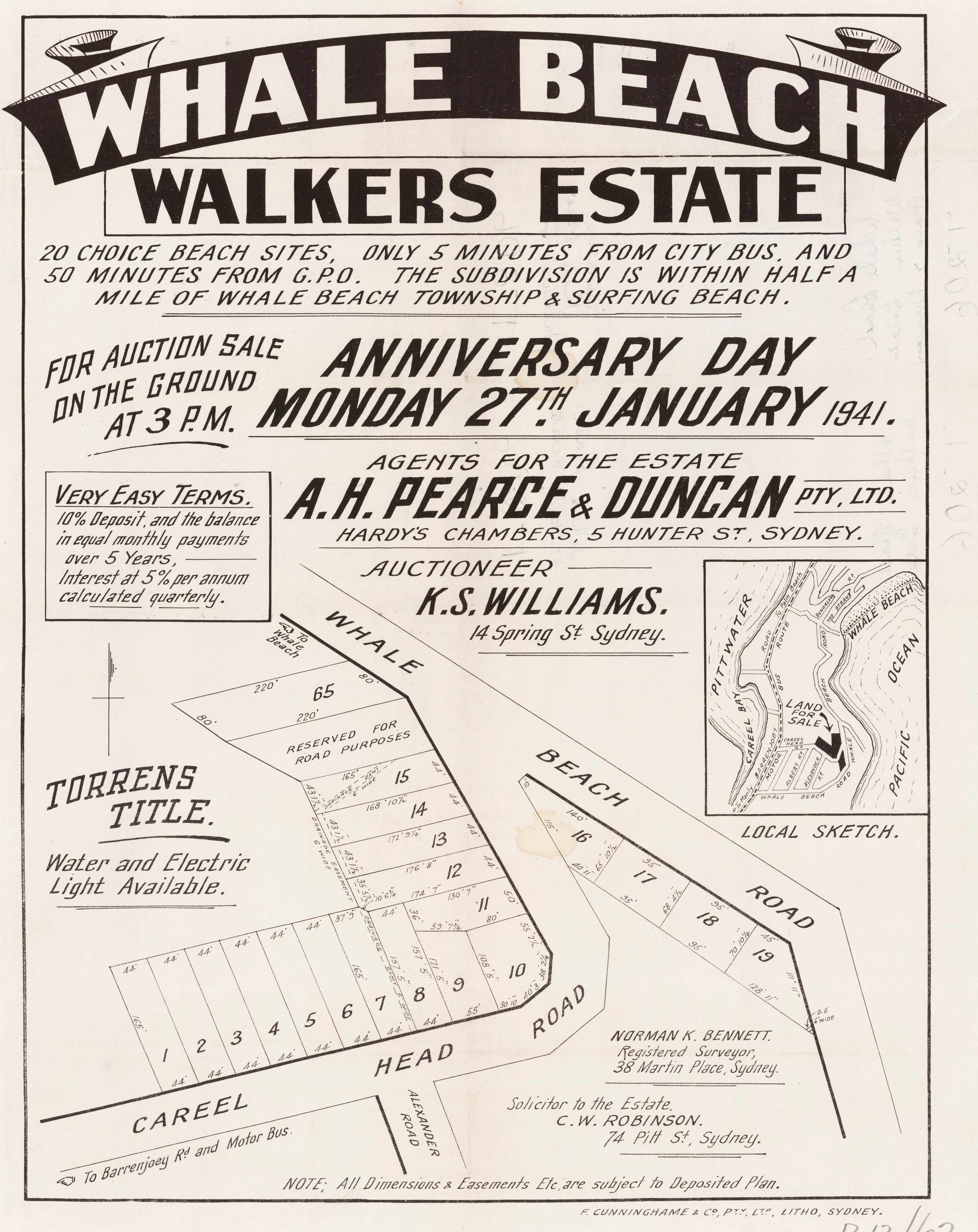
Whale Beach Walkers Estate, January 27th, 1941 c053460066, from and courtesy State Library of NSW Pittwater Subdivisions folder
Section from showing drainage easement:
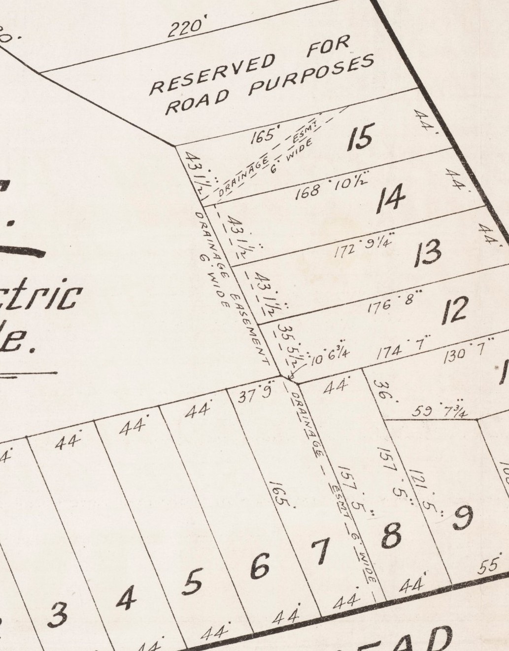
WHALE BEACH. WHALE BEACH.
PICTURESQUE BUILDING BLOCKS OVERLOOKING OCEAN AND BEACH.
AUCTION SALE, ON THE GROUND,
ANNIVERSARY DAY, MONDAY, 27th JANUARY,
AT 3 P.M. (Wet or Fine.)
20 LOTS and Fibro COTTAGE of 4 rooms.
MANY LOTS HAVE MAGNIFICENT VIEWS OF SURROUNDING HEADLANDS.
Frontíng CAREEL HEAD ROAD and WHALE BEACH ROAD.
TERMS: 10 per cent. DEPOSIT, balance over 3 years. Interest 5 per cent.
TORRENS TITLE.
NOTE: Leave Main Road at Careel Head Road and proceed to Junction oí that road and Whale Beach Road.
Plans and Lithographs from A. H. PEARCE AND DUNCAN PTY., LTD., HARDY'S CHAMBERS, 5 HUNTER STREET. BW5064.
AND Auctioneer, K. S. WILLIAMS, 14 Spring Street. B0142.
PLANS are obtainable at WICKHAM'S STORE, AVALON OR WHALE BEACH STORE. Advertising (1941, January 25). The Sydney Morning Herald (NSW : 1842 - 1954), p. 19. Retrieved from http://nla.gov.au/nla.news-article17740596
Hardie and Gorman Pty Ltd -… Whale Beach, Careel Head Rd vacant land 66 by 165, £232 REAL ESTATE REPORTS (1949, October 8). The Sydney Morning Herald (NSW : 1842 - 1954), p. 6. Retrieved from http://nla.gov.au/nla.news-article18133778
SHIRE OF WARRINGAH.
DWELLINGS.
Avalon: Barrenjoey Road: F. cott.—L. C. Fowler, 14 Harrison Avenue, Eastwood, O/B, £1500; Careel Head Road: F. cott. — T. J. Shepperd, Kembla Ready-Cut Homes P/L, 58 Margaret St, Sydney, B, £1400; Park Avenue: F. cott. — H. Thornhill, 9 Romford Rd, Epping, O/B, £2500; New Barrenjoey Road: W.B. cott.— B. E. Yates, 43 Jocelyn Street, Dee Why, O, £1250; Weetawa Road: T. cott. — C. Seymour, 12 Northcote Ave, Fairlight, O, £850. … SMALL CONTRACTS (1953, August 26). Construction (Sydney, NSW : 1938 - 1954), p. 20. Retrieved from http://nla.gov.au/nla.news-article222898287
SMALL CONTRACTS SHIRE OF WARRINGAH.
DWELLINGS.
Avalon: Watkins Rd.: B. cott.—A. M. Shaw, 7 Cook Rd., Lindfield, O., <£2000; Careel Head Rd.: T. cott.—J. H. Nutt, 433 Cleveland St., Redfern, O/B., £1000; Hilltop Rd.: W.B. cott. —A. Cousins, 6 Kingston St., Haberfield, O/B., £2000; Weetawa Rd.: B. cott.—D. L. Griffin, O.—Welsh Bros. Pty. Ltd., 98 Bay Rd., Waverton, B., £4900; Hudson Pde.: T. cott. —C. Sullivan, C/o Grimwood Electrics, Parkes St., Botany, £3000; Bellevue Ave.: W.B. cott.—V. Hogbin, O. —N. Whitting, Riverview Rd., Avalon, B., £3500; Ruskin Rowe Rd.: W.B. cott.—A. Clune, O.—James Verney, Princes Ave., Vaucluse, B., £4000; Marine Pde.: W.B. cott.—L. Howe. 37 Wanganella Rd., Lane Cove, O/B., £1650.
Avalon Beach: Barrenjoey Rd.: B. cott.—H. J. Bodewes, Lot 29. Careel Rd., Avalon Beach, O/B., £2500; Marine Pde.: W.B. cott.—A. F. Reed, O.—Whitfield, Wollstonecraft Ave., Avalon Beach, B., £2600. Avalon Nth.: Whale Beach Rd.: T cott.—C. H. & J. M. Smith, O.—D. Laslett, 25 Rowe St., Sydney, B., £2000; George St.: T. cott.—G. M. Macdonald, O.—G. Johnson, 78 New South Head Rd., Rose Bay, B., £2750. SMALL CONTRACTS (1954, October 27). Construction (Sydney, NSW : 1938 - 1954), p. 19. Retrieved from http://nla.gov.au/nla.news-article224517965
In the above 'B' stands for Builder and 'O/B' stands for Owner-Builder.
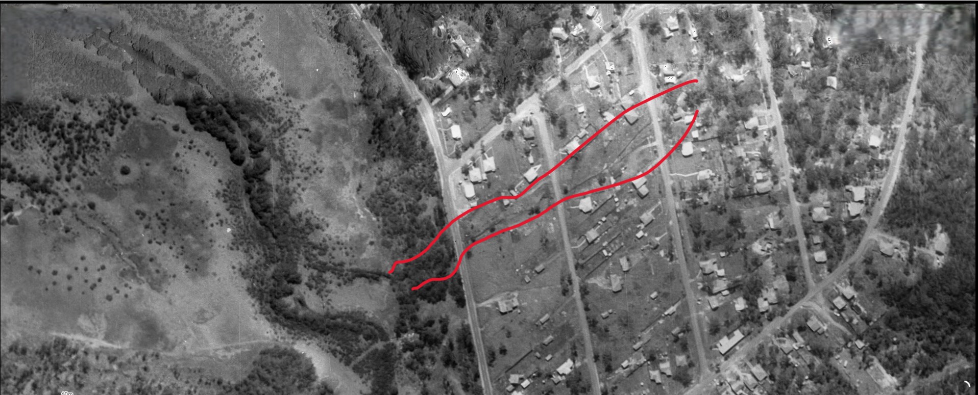
Crown Lands aerial dated 5.1.1951 showing Burrowong creekline (between red lines) and corner of Careel Head road structures - note the cottage at 3 Careel Head Road is already in place, as are two structures on corner block
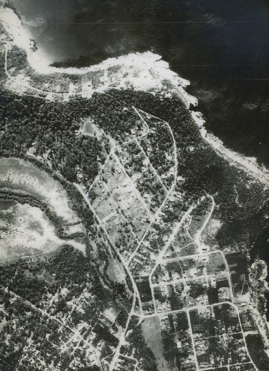
'Burrowong creek' going under the Barrenjoey road - this Crown Land aerials is dated circa 1955. courtesy ABHS
The 1950's were a busy time for subdivisions around Careel Bay from Stokes Point to Whale Beach and into Avalon Beach itself, the pages of the then published 'Construction' are filled with Building Approvals at many addresses. So much so that one visitor, possibly with a weekender, writes:
Dumped Rubbish
Sir,-Palm Beach is one of the beauty spots of the world.
The magnificent views of Pittwater and Careel Bay are spoilt by the enormous quantities of rubbish dumped in the bush by builders.
At the same time the wildflowers are being killed.
Nothing seems to be done to prevent this, nor is the rubbish being removed.
The result is: more and more rubbish. It is a disgrace. Perhaps the Queen's visit will help.
W. J. WATERMAN.
Wahroonga.
Dumped Rubbish (1953, November 9). The Sydney Morning Herald (NSW : 1842 - 1954), p. 2. Retrieved from http://nla.gov.au/nla.news-article27523148
However, dumping rubbish didn't seem to worry the then council. Part of this area was used as a tip, filling in what had been wetlands and an extensive mangrove area to create Hitchcock Park to begin with and then spread that tip further north. Records submitted to the Ordinary Meeting of Warringah Shire Council held on Report by Shire Engineer held on 20th November,1967 state:
Rubbish tips at Boondah Road, Terrey Hills and Careel Bay given regular maintenance with bulldozer and surrounding areas thoroughly cleaned. Careel Bay tip fenced and gates erected, together with appropriate signs re hours open _8,00 a.m.-4.00p.m.
The Warringah Shire Council Meeting of February 6th 1967 records:
Minutes Ordinary Meeting 6.2.67. 10; Cr.Creagh: Would the Engineer investigate the deterioration of the roadway at the entrance to Careel Head Road, near Barrenjoey Road, North Avalon, and bring forward an estimate of the cost to rectify it? I will refer it to the Engineer.
The March 9th 1962 Meeting records:
(T)H. Wilshire Webb &Son, Solicitors, 23.2:.62--‘ forwarding Transfer re drainage easement over Lot B Albert Road, Avalon; Housing Commission Subdivision advising that after being in touch with the Crown Solicitor's Office, they had-ascertained that no action had been taken in this matter since 1.3.61 when that office wrote to the then Solicitor suggesting re-engrossed form of transfer. The re-engrossed form of-transfer now submitted for completion. Under (Note by Shire Clerk: Completion recommended) .65. Resolved _That the Transfer be completed under Seal (Crs. Wade/Jones)
The Warringah Shire Council's Report by Shire Engineer dated 5th June, 1967 records:
- (b) URGENT MAINTENANCE. The following urgent maintenance was carried out during this period:-Delecta Avenue, Avalon. Right-of-way cleared. Hillside Road, Newport. Right-of-way cleared. Prince Alfred Parade, Newport. Right-of-way cleared. Hudson Parade, Newport. Lantana cleared from rear of No. 3 Delecta Avenue. Careel Head Road, Avalon. Drain behind Nos. 50, 52, 54, 56 cleared. Central Road, Avalon. Drainage easement at No. 73 cleared. Burrawong Road/Barrenjoey Road, Avalon. Drain cleared. Rubbish tips at Boondah Road, Careel Bay and Terrey Hills given regular maintenance with bulldozer and surrounding areas thoroughly cleaned. Old tip in Boondah Road closed and covered and further tip in Boondah Road now operating. Elvina Bay Wharf. Repairs to planking carried out. Pittwater Road & McCarrs Creek Road, Bayview - Church Point. Premix repair to previously prepared extensive pavement failures in progress. Auaba Place, Mona Vale. Pedestrian right-of-way to Ventura Place cleared. Cook Terrace, Mona Vale. Concrete footway from Pittwater Road to Melbourne Avenue cleared. Darley Street West, Mona Vale. Chipping of grass from kerb and clearing of deposited rubbish from Antway carried out. McLean Road, Ingleside. Scoured section of pavement repaired with gravel. Garden Street, North Narrabeen. 26 guide posts erected on curve adjacent to Irrawong Road. Gondola Road, North Nanabeen. Laneway to Rickard Road given road base and maintenance attention. Narrabeen Park Parade. Right-of-way between Nos..101 and 103 and extending to Warriewnd Beach chipped and mown. Nanabeen Street, Mona Vale. Lantana growth removed from footway on eastern side. Barrenjoey Road, Mona Vale. Chipping of grass from concrete footway between Darley Street and Seabeach Avenue carried out. Alleyne Avenue, North Narrabeen. Lantana, scrub, etc. removed from boundary of No. 73 and rat poison applied. Vineyard Street, Mona Vale. Both sides of culvert adjacent to Macpherson Street:- cleared of silt and growth. - Cottage Point. Grading maintenance carried out to unconstructed section. Emergency Drinking Water. 90 deliveries made during this period. Mona Vale Cemetery. Sinking of graves for 10 interments carried out.
A few years later the Warringah Shire Council's Report by Shire Engineer dated 31st July, 1967 records:
SECTION 2 _WORKS MATTERS. WI. WORKS IN HAND, COMPLETED OR ANTICIPATED TO COMMENCE CONSTRUCTION. (a) WORKS COMPLETED DURING PERIOD ENDING 24.7.67. Sanders Lane, Avalon. 116 lin.ft. of kerb and gutter, 193 lin.ft. of 4' wide concrete footpath and 120 lin.ft. of concrete dish drain constructed. Daly Street, Bilgola Plateau. 158 lin.ft. of 18*; dia. pipes laid and backfilled, two concrete gully pits and one concrete headwall constructed. George Street, Avalon. Failed section of pavement, 50' x 12',excavated and filled with 40 tons of sand, covered by 30 tons of fine crushed rock. Section. of pavement hotmixed, 90' x 30'. Palm Beach Road, Palm Beach, Road shoulder excavated, 200' x 6', 80 tons of sand used in excavation and covered with 65 tons of fine crushed rock. Section of pavement hotmixed, 280' x 7'. Careel Head Road, North Avalon. Failed section of pavement excavated, 100' x 24', 80 tons of sand used in excavation and covered with 40 tons of fine crushed rock. 195 lin.ft. of 4*; agricultural pipe and metal drain laid, using 15 tons of metal. Section of pavement hotmixed, 110' x 24'. Harkeith Street, Mona Vale. 2 coat bitumen sealing of new pavement area carried out. Namona Street, North Narrabeen. 630 lin.ft. of 6' wide concrete footpath constructed, together with 112' of concrete toewall, 8'; high and 6'; wide. Concrete access to school catered for and two pram ramps installed. Kalang Road, Elanora Heights. 2 coat bitumen sealing of pavement carried out. Tidying, levelling and grass seeding of footpaths completed.....
By May 8th 1967:
Burrawong Road, North Avalon. 264 lin.ft. of 24'; dia. pipes laid and backfilled,
The putting the creeks into pipes methodology continued including putting 'Burrowong Creek' and 'North Bangalley Creek' into cement tubes. The Report by the Warringah Shire Council Engineer dated 4th July, 1967 records what was used:
WORKS IN HAND AS AT 26/6/67. Burrawong Road, North Avalon. 50 lin.ft. of 21''; dia., 26 lin.ft. of 18''; dia., 80 lin.ft. of 15''; dia. pipes laid and backfilled. Seven concrete gully pits constructed. Careel Head Road, Careel Bay. Section of Careel Head Road at intersection with Barrenjoey Road excavated to depth of 3', excavation filled with 180 c.yds. of sand and covered with 120 c.yds. of road base. Tumburra Road, Tumbledown Dick. A further 1700 c.yds. of ripped sandstone placed and graded into fill areas and 40 lin.ft. of 12*;dia. pipes laid in culvert construction.
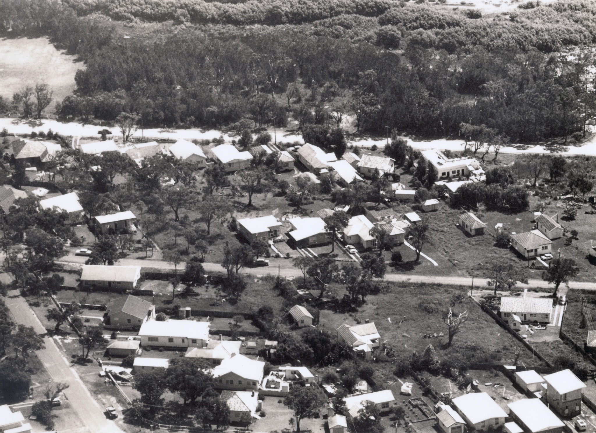
North Avalon looking west at Barrenjoey Road and Burrawong Road with the Careel Bay mangroves beyond, to the right has not yet been released to be 'filled in' as a tip. You can see Whale Beach Road on the far left and part of Hitchcock Park. We estimate that this photo was taken in the early 1960s. Photo/Information: Geoff Searl OAM- President, Avalon Beach Historical Society
Warringah Shire Council's Minutes Ordinary Meeting held 16.1.67. record under their 1967 Works Programme:
;A; RIDING (con't) ...Alan Rd., Elanora $12,000 Kerb & Guttering west side, north to St. Andrew's Gate. Myoora Rd., Terrey Hills $7,500 Reconstruction four bad portions. Calvert Parade, Newport $10,000 Kerb & guttering, road widening, cast side from The Boulevarde to Stanley St. Marine Parade and Watkins Rd. $20,000 Drainage, kerb & Guttering, pavement Avalon widening, east side. Cook Terrace, Mona Vale $9,000 Kerb & Guttering north side Coronation St. to Narrabeen Park Parade. Powderworks Road, North $5,000 Footpath construction south side from Narrabeen Warraba Road westerly. Turrimetta St., Mona Vale $10,000 Part cost full construction from existing construction westerly. Burrawong Rd., Avalon $5,500 Drainage and road construction from Whale Beach Rd. to Binburra Ave. $100,000 ADOPTION OF WORKS COMMITTEE REPORT. 10.Resolved, That the report of the Works Committee 11.1.67 as written, be adopted
Warringah Shire Council's Report by Shire Engineer dated 25th. September, 1967 records:
(a) WORKS COMPLETED DURING PERIOD ENDING 18/9/67: Central Road, Avalon _240 lin.ft 21'; diam. R.C.pipes laid and backfilled, one concrete drop box and one stone headwall constructed. Burrawong Road, North Avalon _Road pavement prepared and given a two coat bitumen seal
The 28th August, 1967. Report by Shire Engineer records that at works on Careel Head Road, Avalon, were:
'Six Guide posts erected in front of Nos. 43 and 47. Careel Head. Road, at corner of Whale Beach Road. Herbert Avenue Avalon. Large rock removed from embankment in turning circle. .... Road shodder premixed. Paradise Avenue, Avalon. Pipeline adjacent to No. 40 cleared. Daly Street, Newport. Road shoulder raised to direct water to gully pit outside Lot 312. Central Road North Avalon Road Avalon. Main open drain cleared by dragline. Concrete channel-6 in Avalon and Newport cleared. Rubbish tips at Boondah Road, Careel Bay, Terrey Hills given regular maintenance with bulldozer and surrounding areas cleaned thoroughly. New section of tip opened at Terrey Hills and also at Careel Bay. Pittwater & McCarrs Creek Roads Bayview _Church Point. Clearing of culverts, prelim, repair to potholes and rayed pavement, replacement of numerous guide posts attended to during this period. Eastview Road Church Point. Right-of-way to Pittwater Road cleared.
Even so, residents of the 1960's and 1970's recall flooding continued along Careel Head Road, 'even up to No. 35' one resident has stated.
The Report to the Warringah Shire Council meeting held on 30th January, 1968 records: .... Footpath area cleared at No. 4. Bellevue Avenue-Barrenjoey Road, Avalon. Right-of-way cleared. Surfview Road, Mona Vale. Sand removed from driveway to No. 14, Careel Head Road, North Avalon. Emergency Drinking Water. 43 loads delivered. Cargo Wharf Scotland Island. Old timber removed and replaced with new.
The Engineer's report to the Meeting held 22nd April, 1968 shows one of the guard posts already needs replacing and that drains installed in prior 1920's subdivisions and 'piping' through lands that had been part of the Narrabeen lagoon, where other creeks were directed to make their flows into the lagoon itself, were being maintained as well:
URGENT MAINTENANCE. The following urgent maintenance was carried out during this period: Barrenjoey Road, Newport-Avalon, Maintenance attention given to footpath at No. 351 and rubbish removed from footpath at No. 989. Elaine Avenue, Avalon. Gutter cleared outside No. 6. Grandview Drive, Newport. Maintenance attention given to road pavement and footpath at No. 39. Seaview Avenue_Ismona Avenue, Newport. Footpath cleared. Pacific Road, Palm Beach. Corners cleared near Nos. 29 and 97. Careel Head Road, Avalon. Guide post replaced at No. 43. Newport and Avalon Main Concrete Drains cleared. Rubbish tips at Terrey Hills, Careel Bay and Mona Vale covered daily by bulldozer and surrounding areas thoroughly cleaned. Each tip fenced and set of double gates erected. Pittwater and McCarrs Creek Roads, Bayview -Church Point. Restoration of failed sections, clearing of watertables, culverts, erection and replacement guide posts, clearing of scrub from embankments and premix repair to potholes carried out during this period. Narroy Park _Pittwater Road, North Narrabeen. Main concrete drain extending to lagoon cleared. Various open concrete drains extending from this drain to Wakehurst Parkway also cleared.
The Report to the Warringah Shire Council Works Committee meeting, Monday 24th October, 1977:
6.13 CAREEL HEAD ROAD, NORTH AVALON (FILE Esr.BB3) Report No, N771320 (8ft) stormwater drainage easement within Lots 7, 12/14 (No.. 42, 52/6) Careel Head Road is now redundant (shown in red on tabled plan), following the construction of a stormwater pipeline in Careel Heed Road.
RECOMMENDATION That Council proceed to expunge the redundant drainage easement within Lots 7, 12/14 Cereal Heed Road, North Avalon, and further that authority be given for Council's peel to be affixed to the legal document involved. CO+ITTEE'S RECOIQ4ENOATION: That the foregoing recommendation be adopted. COUNCIL'S DECISION (31.10.77): 20 ADOPTED
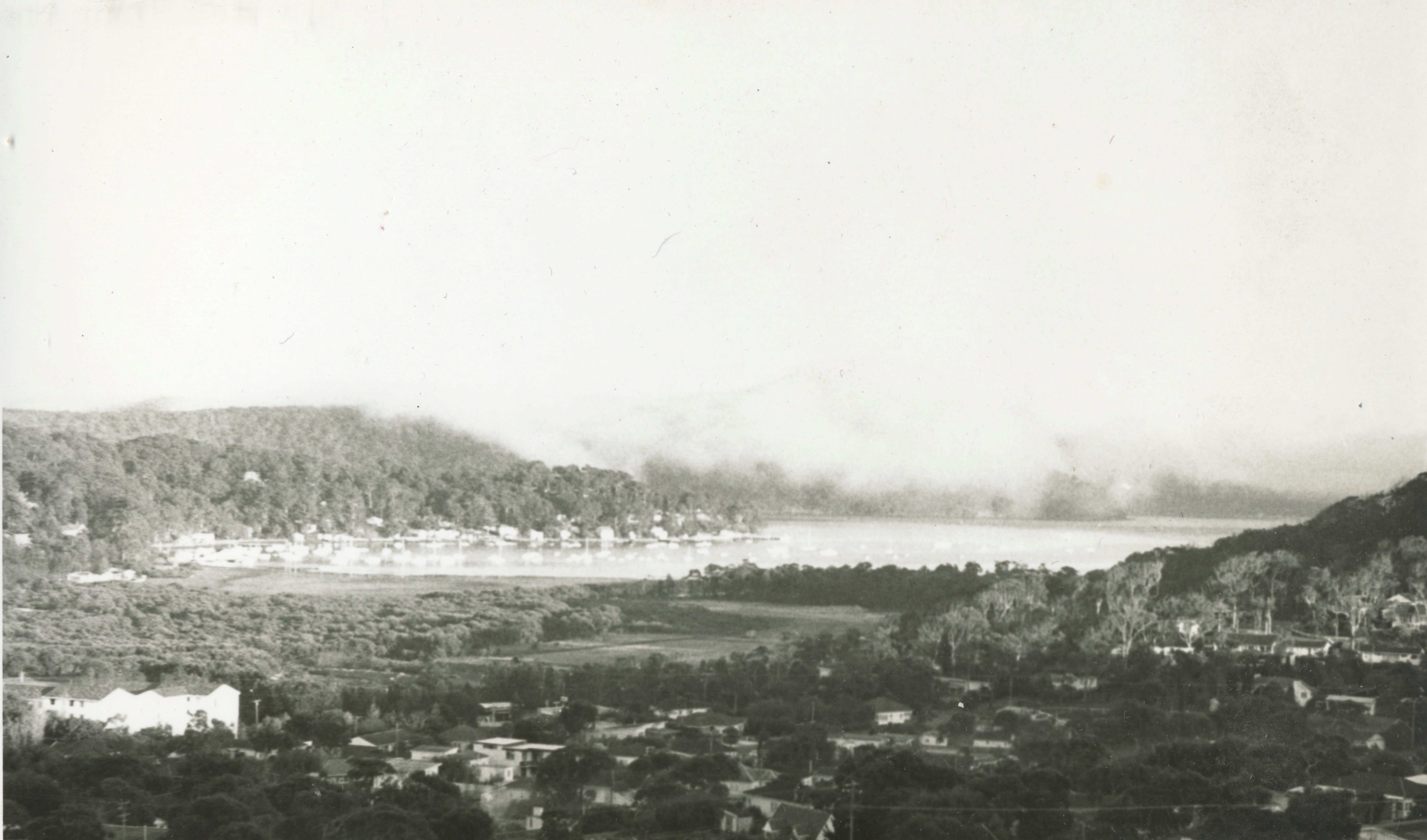
View west, note the El Cortigo units are in place - Photo/Information: Geoff Searl OAM- President, Avalon Beach Historical Society
In 1979 more changes were mooted. The Report to council Works Committee meeting held 19th November, 1979 records:
6.22 CAREEL HEAD ROAD. NORTH AVALON - RELEASE OF DRAINAGE EASEMENT AFFECTING NOS. 42, 52. 54 and 56. (File ESF 883) Council resolved at the Ordinary Meeting of 24.4.1978, that: ;(i) The affected owners be requested to agree to replacement of the existing drainage easement which is in favour of Council, with a normal common drainage easement 1m. wide in favour of the four properties having a natural drainage fall to the easement, on the basis of Council filling and regrading the present easement with topsoil and laying a 150mm. waste pipe from such properties to Council's gully pit in Careel Head Road, opposite Alexander Road and legal and survey work to be at Council's cost. (ii) 'Council proceed to expunge the easement as previously resolved and the Seal be affixed to the appropriate documents when (i) is settled.; Although the easement is no longer required for the provision of piped drainage from the public road, affected residents have not agreed to the release of easement because stormwater flows off the edge of Careel Head Road and runs through the private properties in the depression containing the easement. The concentration of stormwater flow off the public road can be rectified by the provision of half road construction from Whale Beach Road for 125m. southerly at an estimated cost of $12,000, thus completing the existing half road construction. Unallocated funds are available from the 1980 Road Improvement Programme adopted O.M. 29.10.79 for inclusion in the 1980 Draft Estimates. RECOMMENDATION That the amount of $12,000 for the provision of half- road construction in Careel Head Road for 125m southerly from Whale Beach Road and the expunging of the existing drainage easement affecting Nos. 42, 52, 54 and 56 be included in the 'A' Riding Future Works Ledger, Priority 1 - Urgent. O COMMITTEE'S RECOMMENDATION (19.11.1979): That the foregoing recommendation be adopted. COUNCIL'S DECISION (26.11.1979): 1998 ADOPTED
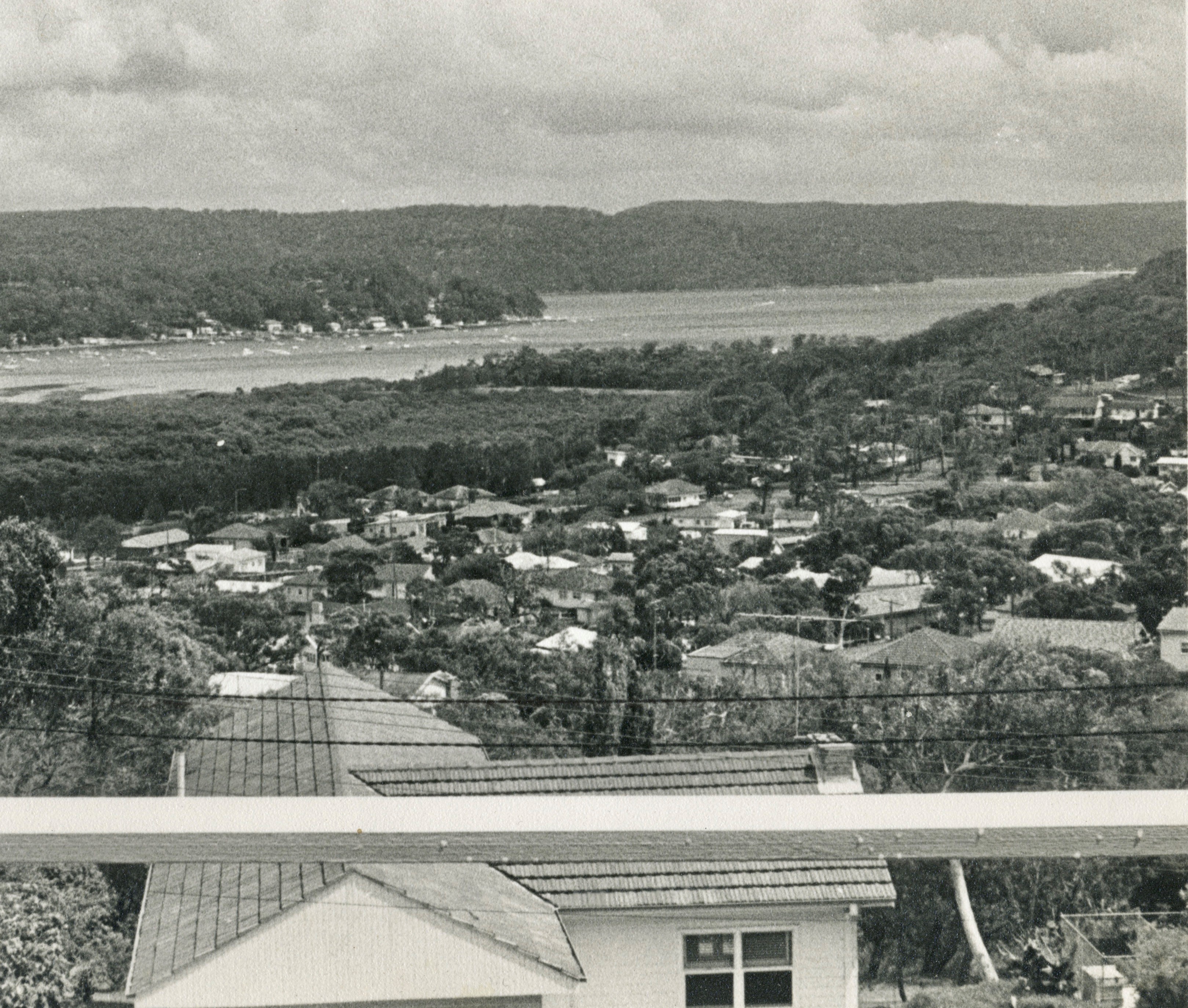
View West from up on Whale Beach road, near Binburra Avenue - shows Albert road aspects. Photo/Information: Geoff Searl OAM- President, Avalon Beach Historical Society
In 1982 the council was working on, as recorded in a Report to Works Committee, 15th June, 1982:
_3.1 110. 42 CAREEL HEAD ROAD. AVALON _STORMWATER DRAINAGE CONSTRUCTION. (File E5F883) A vote of 52,000 has been included in the 1982 'A' Riding revenue programme for the amplification of the stormwater drainage opposite No. 42 Careel Head Road, Avalon. A final estimate of $5,500 is submitted for the work. It is proposed that $3,500 balance of funds be re-allocated from anticipated savings on job 519 Bassett Street, Mona Vale. RECOMMENDATION: That an additional vote of $3,500 to Careel Head Road Avalon be made from anticipated savings on job 519 Bassett Street, Mona Vale. COMMITTEE'S RECOMMENDATION ( 15.6.1982) That the foregoing recommendation be adopted. COUNCIL'S DECISION (28.6,1982) 583 ADOPTED.
The subdivision of lots also persisted. The WSC Meeting held Tuesday, 27th September, 1977 records:
SUBDIVISION APPROVALS APPLICATION NO. PARTICULARS S.D. 19/77 Pittwater Road, Mona Vale Lots A & B. D.P. 37054. Waiving of Conditions - I.D.O. 20 specifies no minimum width. 80/77 Pittwater Road, Collaroy (No. 1030) Lots 4 and B, D.P. 6777 Consolidation. 82/77 Careel Head Road, Avalon (Mos. 12, 12, 14 and 16) Lots 22. 23 and 24, D.P. 9519.
Burrowong Creekline showing in indentation in Burrawong road - the blockage seen during these site investigation photography session was reported to the NB Council which were out the next day clearing it:
smaller.jpg?timestamp=1770240733630)
small.jpg?timestamp=1770240817003)
small.jpg?timestamp=1770240902212)
.jpg?timestamp=1770240943897)
small.jpg?timestamp=1770240981093)
small.jpg?timestamp=1770241021394)
small.jpg?timestamp=1770241091572)
small.jpg?timestamp=1770241122699)
small.jpg?timestamp=1770241154484)
small.jpg?timestamp=1770241190526)
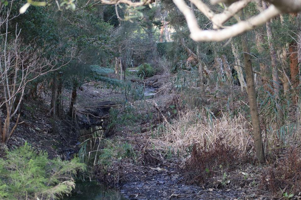
small.jpg?timestamp=1770241431250)
small.jpg?timestamp=1770241495961)
small.jpg?timestamp=1770241551324)
DAIRY FARMS CAREEL BAY (EAST) ---
JONES, THOMPSON, BAILEY AND HAMMOND FAMILIES
by William Goddard II, Tommy Gilbert extras from his Profile
Research material and credits include:
- Geoff Searl - Avalon Beach Historical Society
- The Tunney and Hammond Family’s
- Peter Verrills
- Pittwater Online News
Whale Beach Estate 1918 April 1st c053460074, showing Careel Head Road, Burrowong Road (now spelled Burrawong) and Whale Beach Road - from and courtesy State Library of NSW Pittwater Subdivisions folder. Land within the road boundaries of Barrenjoey Road to the West, Albert Road to the East, Whale Beach Road to the South and Careel Head Road to the North
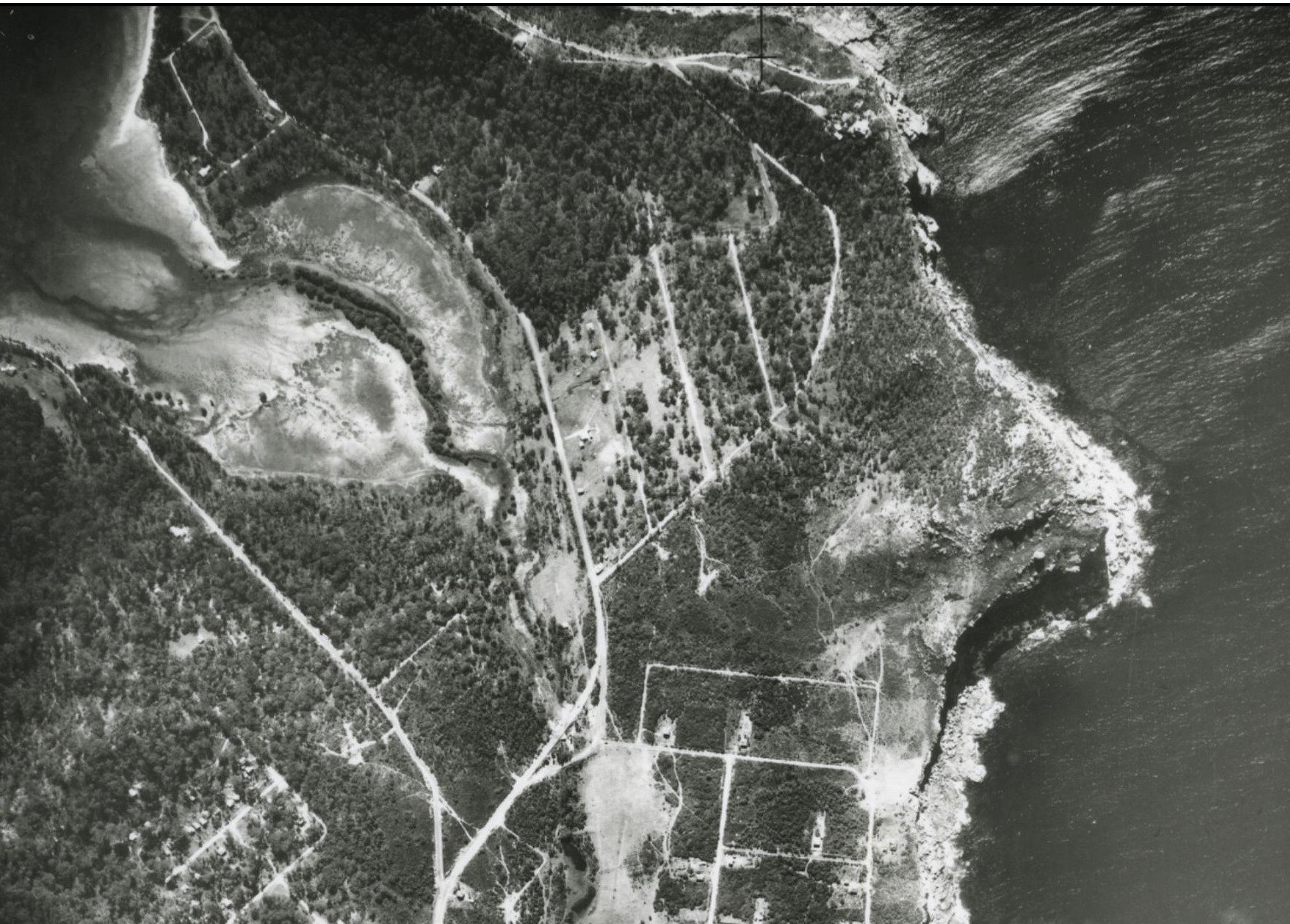
1951 Aerial View – Careel Bay Dairy and North Avalon Area.
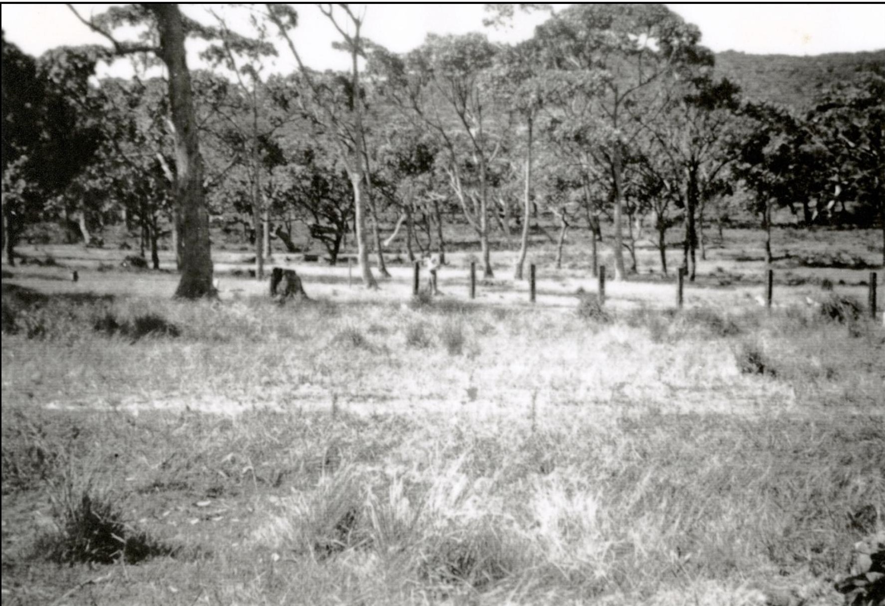
The Dairyland looking east from Burrowong Road towards Albert Road (About 1935).
Careel Bay's dairy occupied around 3.6 hectares (9 acres) and was bounded by Careel Head Road, Whale Beach Road, Barrenjoey Road, and Burrawong Road. However, the cows roamed freely over most of the North Avalon area. The area was largely open woodland, with several small creeks fed from the hills behind and the catchment area. The land was rough and provided very little good-quality naturally grown feed.
The dairy was initially run as two farms by a brother and sister from St Albans on the MacDonald River. Joe Thompson ran the northern portion, and Jessie Bailey (nee Thompson) ran the more significant southern portion called "The Pioneer Dairy". Besides milk, she also sold cream, chicken’s, butter, eggs and ice.
Mrs Bailey's daughter, Clara, married Jack Tunney, and they gave birth to a son, John, in 1928. Then Frank and Kathleen were born, and the family lived with Grandma in the dairy house, helping run the farm. The late John Tunney recalled selling a pint of milk for a penny or tuppence and a fill for a billycan cost sixpence' (5 cents).
They grew around a quarter to half an acre of feed, mostly oats and corn, and would either let the cows in to roam or sickle them down and put them through the chaff cutter. When feed was scarce, they took the cows to Ruskin Rowe, where they were always guaranteed good feed.
Sam Meek (who became our first butcher) left Marrickville as a 23-year-old in 1938 to work on the dairy. After a short time at Joe Homer’s Dairy at Mona Vale, Sam travelled north to the Stan Jones Dairy at Careel Bay. When he arrived, he was told to “camp near the cow shed, you'll find some straw, make yourself comfortable and come over to the house for a few meals”. He recalled waking at 3 am to gallop around the area in the dark, listening for cowbells. The cows had to be back in the yard for milking (or "tit pulling' as Sam so politely put it) by 4 am. They had to milk twice daily because there were no refrigerators, only the ice. Sam became a local butcher and, later in life, a refrigeration mechanic. He loved growing tomatoes at his Therry Street property.
When Ruth Hammond was interviewed in 1984, she said, “The dairymen were big eaters, heavy meals like steak for breakfast and baked dinners”. “I had a full-time job, rearing my family and feeding and washing seven men”. “We had a huge dining room, and my neighbour, Mrs Tunnie, would help me”. “I’ve always been in the habit of working at night; It was always a big wash up after meals.” “The dairyman would pay me board for my service and meals.”
After milking the cows in the morning, the crew had to deliver the fresh milk all over the hills at Palm Beach by horse and cart before returning to do their books and handing them into the office. This process was repeated in the afternoon before they returned for a big dinner, a drink and listening to the wireless before heading to bed. Ruth said, “The cow bales were on a separate block of land and were all hand-built; I had no occasion to go to the bales at all; my husband managed all that.”
The primary focus of my research was to look at the property transactions that occurred in relation to the dairy land and my relatives and family connections. The land titles researched provided compelling evidence of property purchases and sales with accurate dates and land ownership.
This research relates to land with the road boundaries of Barrenjoey Road to the West, Albert Road to the East, Whale Beach Road to the South and Careel Head Road to the North. The land was part of blocks 1 and 2 in the northern subdivision of the Pittwater Estate. It was part of 280 acres (Portion 49 of Parish) originally granted to John Therry by Crown Grant dated the 11th of February 1837. The below diagram is from 1918.
JONES DAIRY
On the 24th of April 1944, Ada Hindmarsh, a spinster of Manly, sold lots 201, 202, 203, 204, 205 and 206 facing Barrenjoey Road and lots 210, 211, 212, 213, 214 and 215 facing Burrowong Road to William Henry Jones, North Sydney Dairyman. This transfer's volume/folio number is 4593-45 (DP17189), and the previous land title volume/folio numbers were 2880-14, 3182-184 and 4422-19. The land area was one acre, two roods, and thirty-nine perches (244ft x 330ft x 254ft x 300ft). The land adjoined Whale Beach Road and had an 8ft easement for drainage that followed a natural watercourse.
William was known as a North Sydney Dairyman and owned several dairies. The below newspaper article references one at Gore Hill.
Sun (Sydney, NSW: 1910 - 1954), Tuesday 12 February 1924, page 14:
DIRTY DAIRY PREMISES
William Henry Jones, dairyman, pleaded guilty at the North Sydney Police Court to an information alleging that on January 28 last, he failed to keep clean his dairy premises in Osborne-road, Gore Hill.
Inspector Bertram, Health Officer to the Lane Cove Council, stated that when he inspected the premises, he found the stables in a very dirty condition. Manure was laying about within 25 yards of the milk room, which was not protected. Jones, who stated that he had only recently acquired the place and was carrying out improvements, was fined £3, with 8s costs.
William Henry Jones’ father, Thomas Jones, was convicted of stealing in Middlesex Quarter Sessions on the 1st of September 1831. He was sentenced to transportation for seven years, and on the 19th of November 1831, he sailed on the convict ship ‘Portland’ to Australia.
He was assigned to work in the County of Murray and received a Ticket of Leave on 24 June 1836. This was cancelled on 29 May 1838 because it was alleged that he had been harbouring bushrangers.
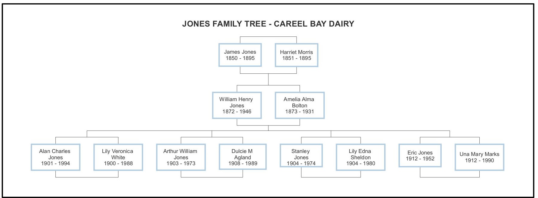
Jones Family Tree - Careel Bay Dairy
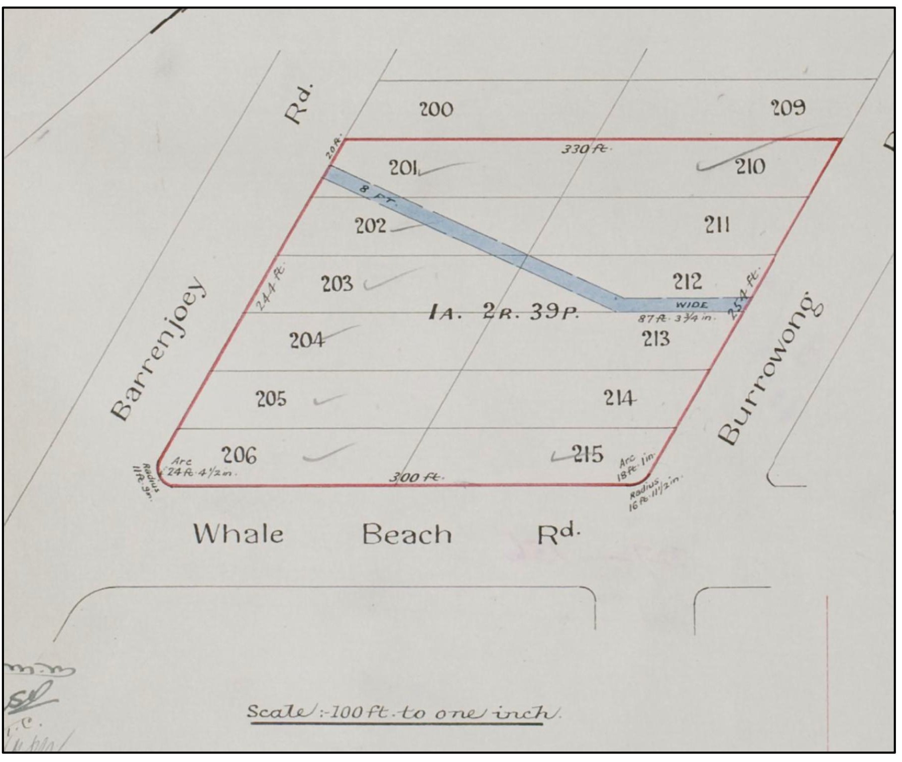
Volume/Folio Number 4593-45 (DP17189)
On the 16th of May 1947, William Henry Jones transferred the property to Alan Charles Jones, Cremorne Manager and Eric Jones, Sydney Solicitor. Then, on the 21st of April 1947, Alan and Eric transferred lots 204, 205 and 206 to Arthur William Jones. This transfer's volume/folio number is 5811-223 (DP17189). During 1949, most of the other lots were sold, including lots 209 and 210, to Mabel Caroline Smith on the 17th of March 1949. Mabel was part of the Gonsalves family, early settlers of Palm Beach, the daughter of Henry Francis Gonsalves (1868-1954) and Caroline Emily Walter (1868-1954), and she married Alfred Ernest Smith. On the 27th of April 1950, Alfred’s son, Keith Smith, transferred the property to Harold (Midge) Edward Gonsalves; then, in 1955, Midge sold lot 210 to James Aloysius Stevens. These transfers were Volume/Folio 6043-141 (DP9519).
In 1918, the Jones’ land was owned by Francis Brell and on the 12th of March 1929, he sold the land to ‘Land Development Company Limited.’
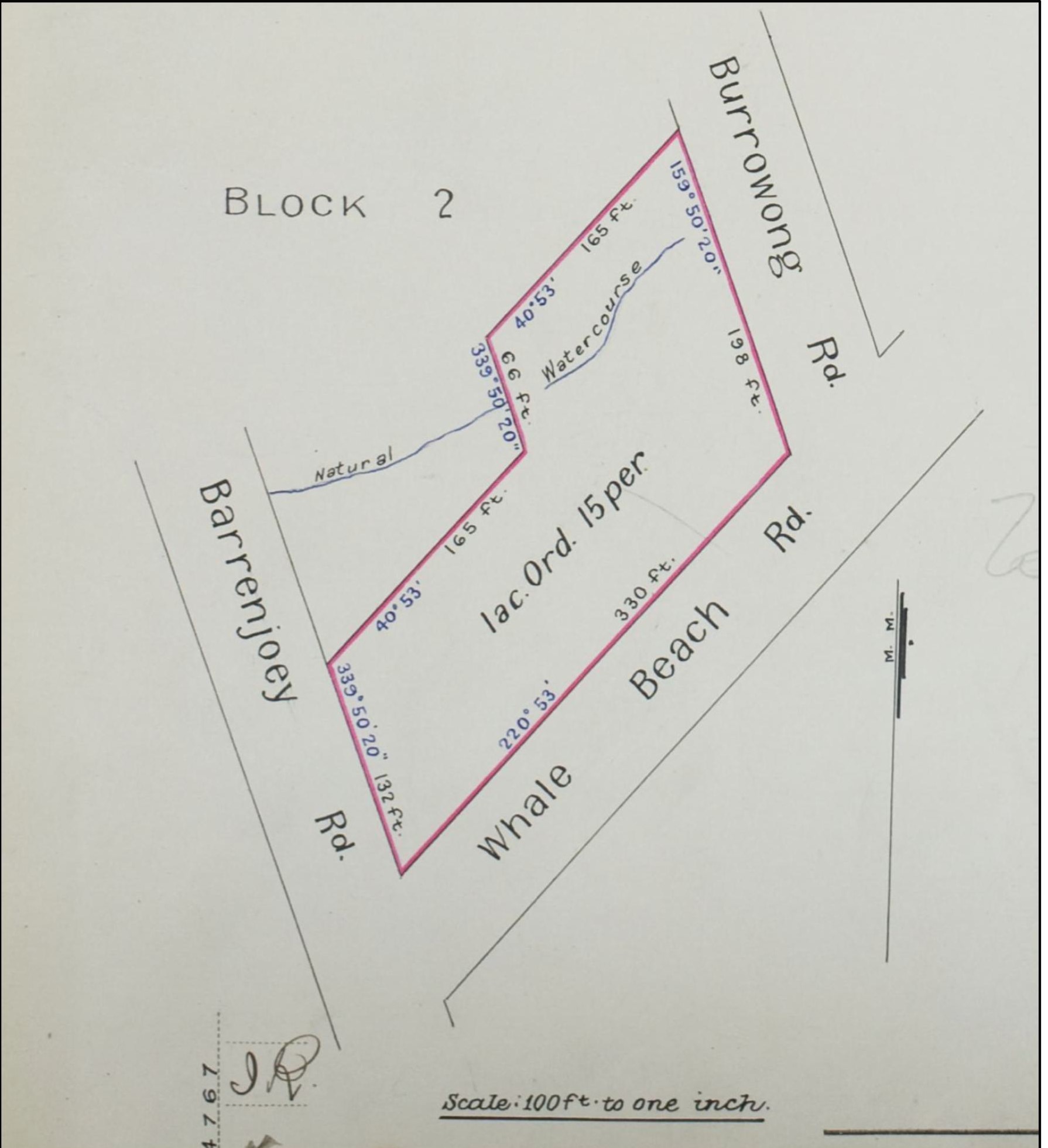
Volume/Folio Number 2880-14 (DP9519)
It is assumed the Land Development Company Limited subdivided the land, and all the lots were sold to Ada Hindmarsh on the 23rd of May 1933.
In 1921, Stanley Francis Ross Lakeman owned lots 7 and 8 facing Barrenjoey Rd and lots 63 and 64 facing Burrowong Rd. On the 23rd of May 1938, the lots were transferred to Gladys May Homer, wife of Joseph Homer, Mona Vale Dairyman. Then, on the 14th of December 1939, Gladys May Homer transferred the lots to William Henry Jones, a North Sydney Dairyman.
On the 16th of May 1947, William Henry Jones transferred the lots to Alan Charles Jones, a Cremorne Manager and Eric Jones, a Sydney Solicitor; then, shortly after, it was transferred to Stanley Jones of Palm Beach. Then, in 1949, the lots were sold off individually. This transfer was Volume/Folio 3246-246 (DP9519).
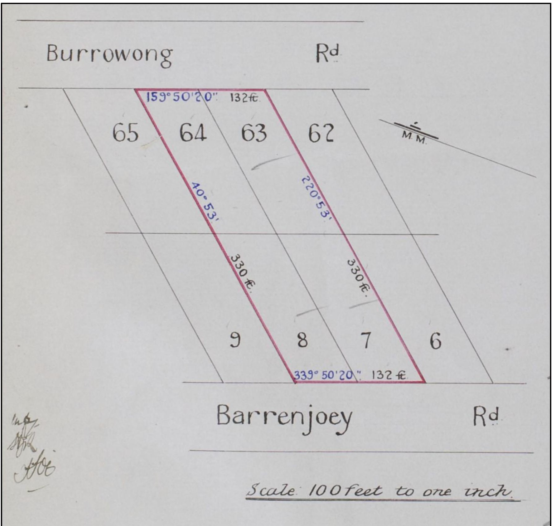
Volume/Folio 3246-246 (DP9519)
Then, on the 9th of May 1944, William Henry Jones (North Sydney Dairyman) purchased virtually all the land between Burrowong Road and Albert Road. They were lots 4 to 47 (DP 17189). He was responsible for dividing the land into residential building blocks and selling the block for housing. Peter Verrills said his father, Fredrick (Fred) Leonard Verrills (1915-1989), was responsible for building many houses on Burrowang Road.
Some of the families living in this subdivision include.
Lot 10 - Alphonsus Cleveland Dever and Phyllis May Dever – Purchased 17/11/1953.
Lot 11 - Wilfred Thomas Dever – Purchased 17/07/1950.
Lot 12 - Wilfred Thomas Dever – Purchased 04/03/1955.
Lot 14 - Thomas Joseph Gilbert and Dawn Marie Gilbert – Purchased 21/05/1965.
Lot 23 - Thomas Joseph Gilbert and Dawn Marie Gilbert – Purchased 13/07/1966.
Lot 42 - Ernest Albert Verrills – Purchased 13/07/1951.
Lot 43 - William James Goddard – Purchased 12/03/1953.
Lot 44 - Sidney William James Verrills – Purchased 18/06/1952.
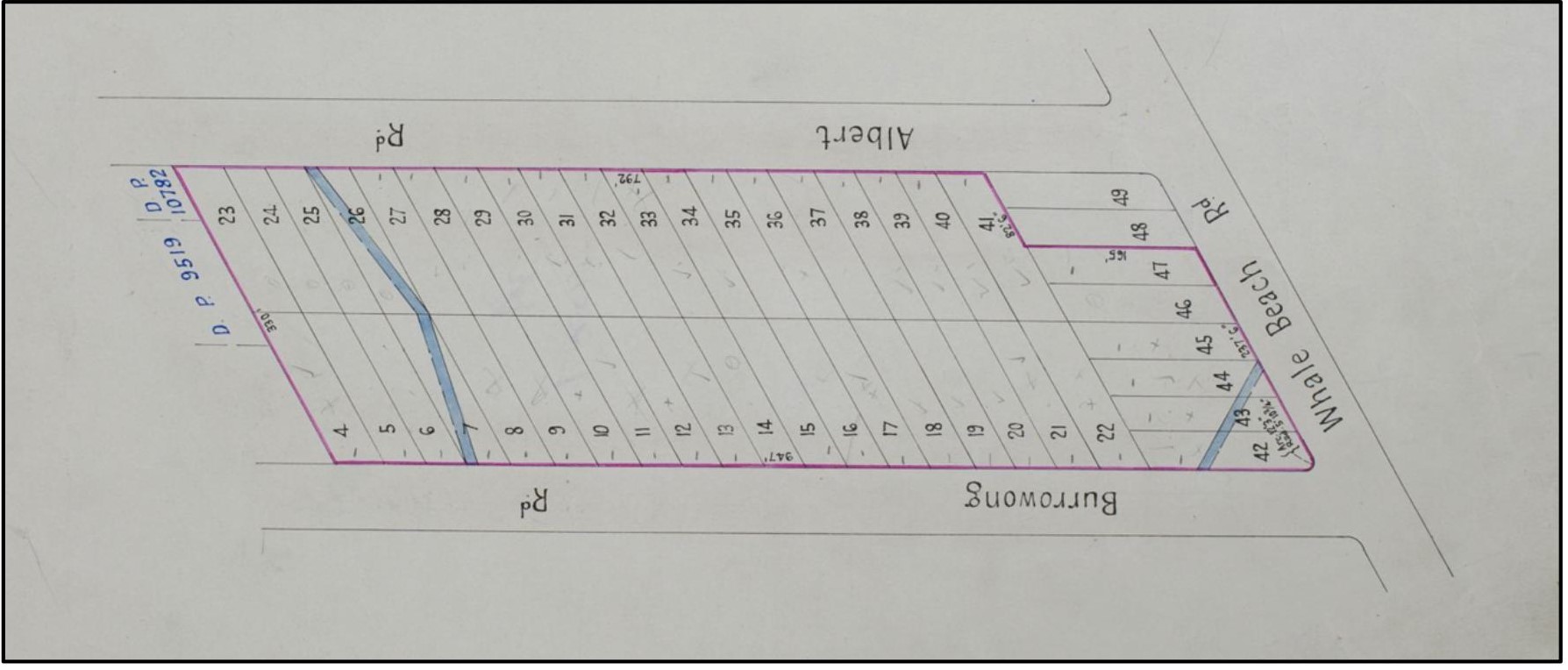
Volume/Folio Number 5424 - 249 (DP17189)
THOMPSON DAIRY
On the 28th of June 1922, Joseph Thompson purchased lots 9, 65, 66 and 67 from a Sydney Barrister, James Young, and Robert Jardine Browning. It was part of 280 acres (Portion 49 of Parish) originally granted to John Therry by Crown Grant dated the 11th of February 1837.
This transfer's volume/folio number is 3331-217 (DP9519), and the previous land title volume/folio number was 2834-78 and 79.
Joseph Thompson (1866-1947) was the brother of Jessie Thompson (1883-1966), who married Francis Walter Bailey (1874-1941). Jessie Thompson (1883-1966) was the mother of Clara Hedges Bailey (1907-1975), who married John Francis Tunney. They were from the Tunney Dairy, as detailed later in this account
Joseph’s great-grandfather arrived in Australia as a convict. Matthew Pearson Thompson was born on the 12th of January 1780 in Slingsby, Yorkshire, England, as the sixth child of Richard Thompson and Ann Pearson. He had seven siblings: John, Sarah, Ann, Richard, Frances, Elizabeth, and Mary. He died on 09 May 1849[2] in MacDonald River, New South Wales, Australia. When he was about 15, he married Ann Earl, daughter of William Robert Earle and Mary Yeoman, on 02 Sep 1795 in London, England. He died on the 9th of May 1849 at age 69 in MacDonald River, New South Wales, Australia.
On the 29th of March 1813 in Surrey, England, Matthew was charged at Lent Sessions, Surrey, for 22 counts of stealing money from his employers, Sir Robert Burnett and others over a three-year period. He was sentenced on the 29th of March 1813 to transportation for 14 years. On the 26th of August 1813, Matthew departed England on the convict ship ‘The General Hewitt’ and arrived in Port Jackson, New South Wales, Australia on the 7th of Feb., 1814.
His wife Ann and two children arrived on "Broxbornebury" on 28 July 1814. He likely had letters of introduction as his wife and children got free passage.
Matthew was appointed schoolmaster at the Government Charity School in Pitt Town. He was given a school residence and 30 pounds in salary, and then, in 1818, was promoted to assistant to the teacher at Wilberforce, where he stayed until receiving his ‘ticket of leave’ in 1822.
Joseph Thompson was born on the 16th of October 1866 on the McDonald River at Albans, New South Wales, Australia. He most likely died in 1947 at Goulburn, New South Wales, Australia (Not confirmed). His parents were George Matthew Thompson - born on the 30th of October 1846 and died on the 13th of March 1909) and Mary Preston - born on the 21st of November 1842 and died on the 12th of April 1919).
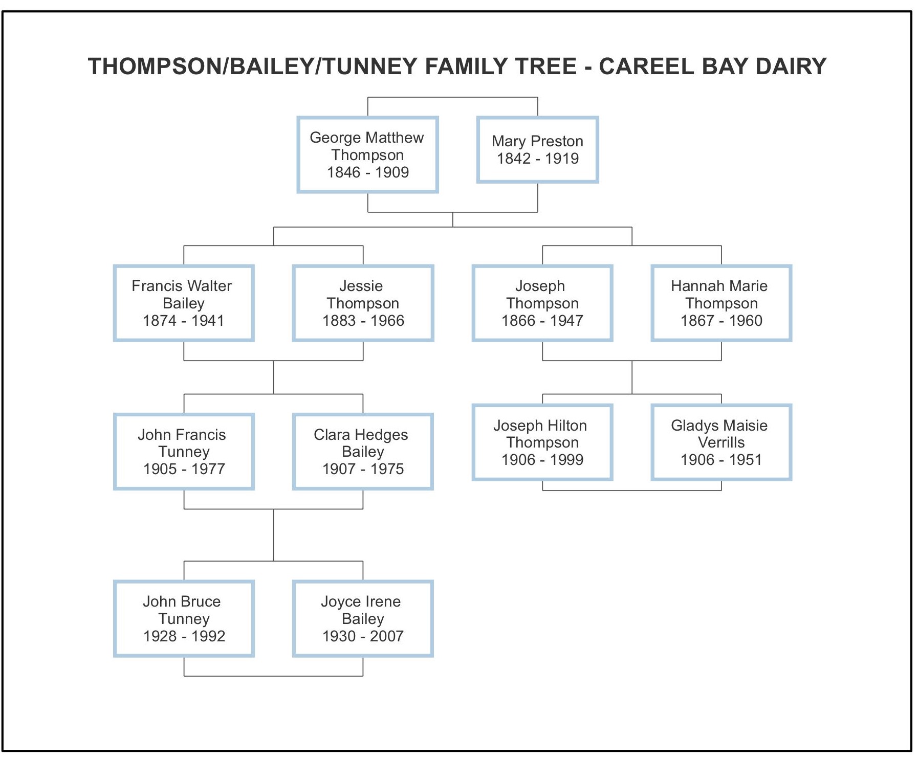
Thompson/Bailey/Tunney Family Tree – Careel Bay Dairy
One of Joseph’s sons, Joseph Hilton Thompson (1906-1999), married Gladys Maisie Verrills; she was a daughter of Albert George Wanstead Verrills (1885-1960) and Florence Hodge (1888-1955). The following newspaper article describes the divorce proceeding between Joseph and Gladys.
Truth (Sydney, NSW: 1894 - 1954), Sunday 30 August 1931, Page 13
Wife's Win
The wife who recently told a Divorce Court jury, Mrs. Gladys Maisie Thompson, of Palm Beach, that her husband stood behind her with his hands around her neck and forced her to write out a statement confessing infidelity had a hands-down win when the fight ended the other day.
The husband, Joseph Hilton Thompson, a dairyman of Palm Beach, sought his freedom, alleging adultery by his wife with Roy Turner, a young dairy hand, in his home at Palm Beach. On top of that, he asked a jury of four to give him £1000 damages against Turner, who was joined as co-re.
Thompson — whose father was a witness on his behalf and who said that he had seen Mrs. T. in a bedroom with Turner — alleged that his wife carried on with the co-re., who is little more than a boy and produced a letter alleged to have been handed voluntarily to him on Goddard's wharf at Palm Beach, and in which was the statement that she had been guilty of adultery.
Against that, Gladys, who denied emphatically that she had been unfaithful, raised an issue of condonation of the adultery alleged (if any) and, in addition, told the sensational story that Thompson had forced her to write out the confession while he stood behind her chair with his hands around her neck.
Witnesses were called by Mrs. Thompson in the various phases of her denials, and Turner also declared that there was no adultery.
The four men weren't away long and returned with a verdict in favour of Mrs. Thompson and the co-re. Mr. Justice Owen thereupon dismissed Thompson's petition and ordered him to foot the costs so that he gets no damages and has a nice fat bill to pay.
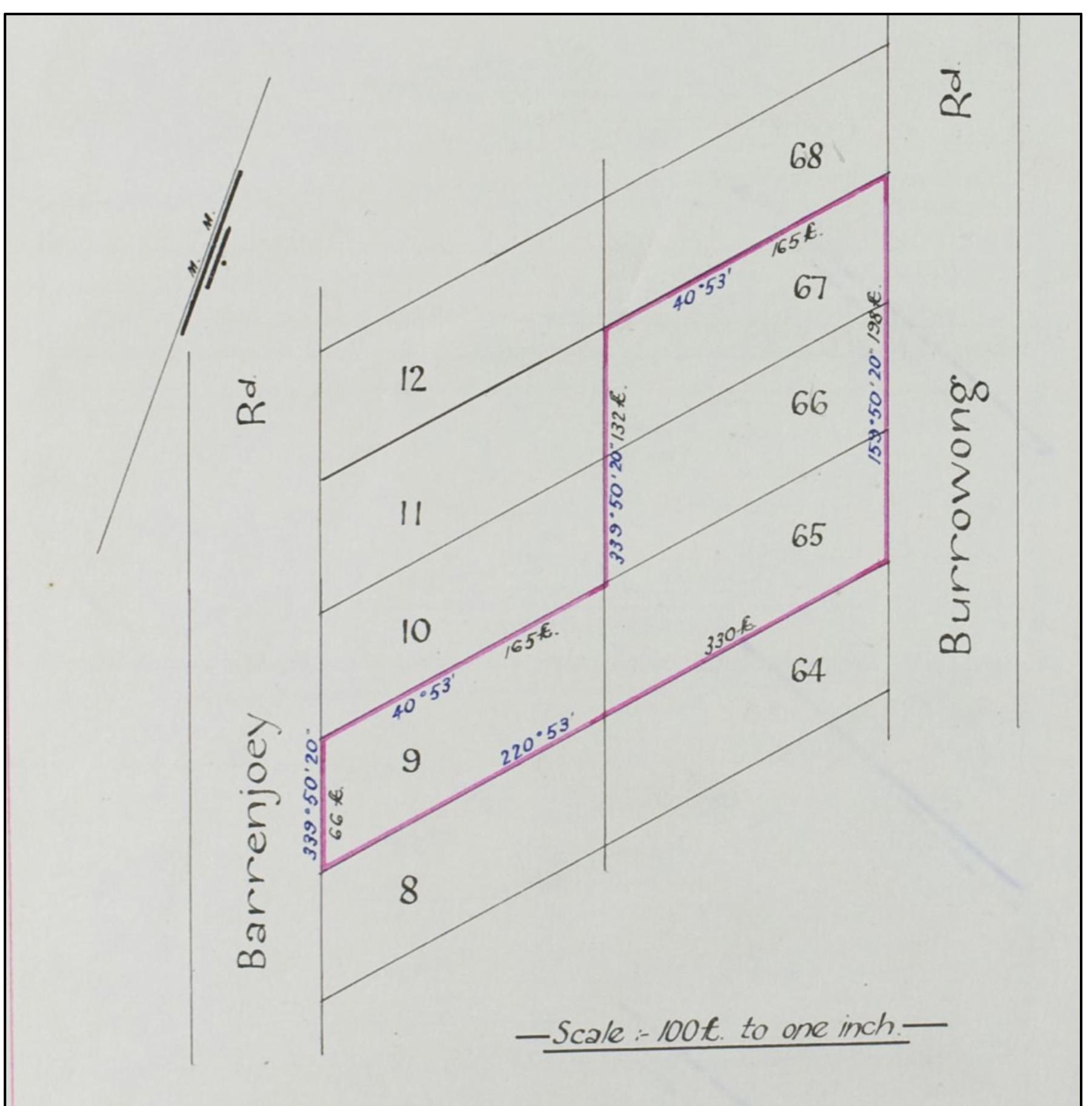
Volume/Folio Number 3331 - 217 (DP 9519)
LOTS 10, 11, 12, 13, 65, 66, 67 and 69
He also purchased the adjoining blocks to the north, lots 10, 11, 12 and 13 facing Barrenjoey Road and lots 65, 66, 67, 68 and 69 facing Burrowong Road, also from James Young and Robert Jardine Browning. This transaction occurred on the 10th of June 1922.
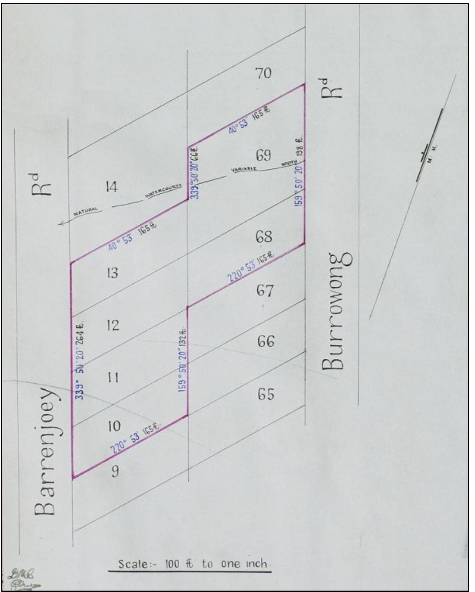
Volume/Folio Number 3323 - 100 (DP 9519)
On the 1st of September 1922, Joseph established a mortgage with the Bank of New South Wales, followed by two more in 1923 and 1926. He discharged these mortgages with the Bank of New South Wales in June 1928. He then had several mortgages with private investors, including a Sydney Spinster, Minnie Wright. On the 30th of March 1931, he leased the land to George Henry Gray, a dairyman from Palm Beach.
Then, on the 29th of May 1934, it appears that Minnie Wright, as mortgagee, exercised her power to lease the land to Edwin Theodore Bruce, a Dairyman from Palm Beach. Then, on the 8th of May 1935, she again exercised her power to lease the land to Henry Alexander Cooke, another dairyman from Palm Beach.
It is worth noting on all the land titles the following notification:
“Amongst the reservations and conditions contained in the grant above referred to are reservations of all mines of gold and silver.”
LOT 14
Then, on the 9th of July 1925, Joseph purchased lot 14 facing Barrenjoey Road, also from James Young and Robert Jardine Browning. This gave him extra land but also had the advantage of extending the watercourse that ran through lot 69 that faced Burrowong Road. It would have provided valuable drinking water for the cattle and the dairy operation.
On the 30th of March 1931, Joseph leased the land to George Henry Gray, a Palm Beach Dairyman. Then, on the 29th of May 1934, Minnie Wright, as mortgagee, exercised her power to lease the land to Edwin Theodore Bruce, a Dairyman from Palm Beach. Then, on the 8th of May 1935, she again exercised her power to lease the land to Henry Alexander Cooke, another dairyman from Palm Beach.
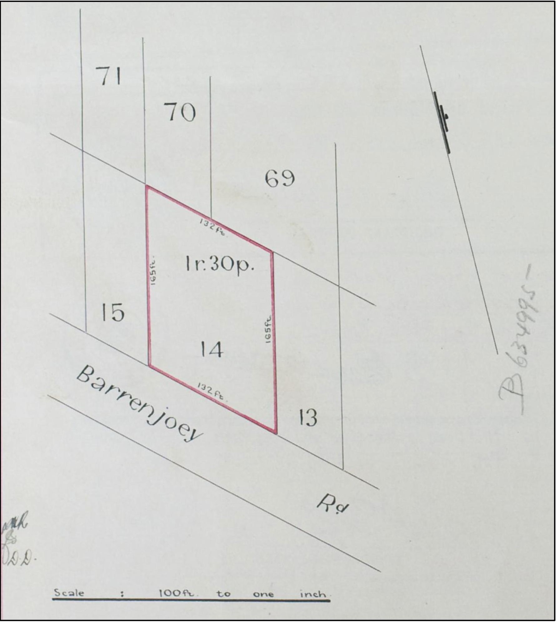
Lot 14 - Volume/Folio Number 3750 - 6 (DP 9519)
Interestingly, Joseph Thompson was declared bankrupt on the 12th of September 1927. The notice in the Government Gazette:
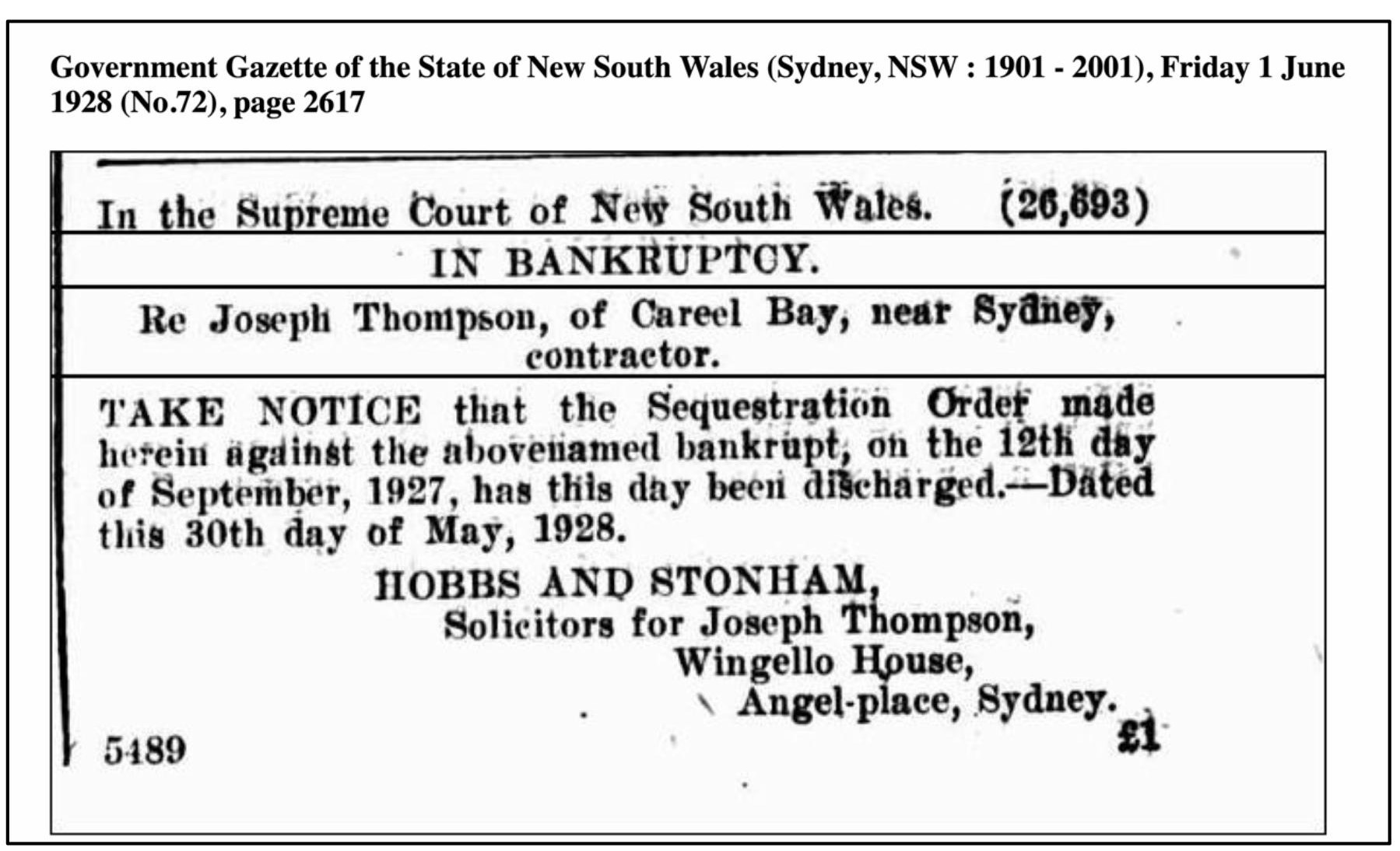
Joseph Thompson Bankruptcy - 1928
BAILEY DAIRY
Advertising Mrs Jessie Bailey – Pioneer Dairy - 1930’s. It was one of the only phones in the area at that time. The phone number was Palm Beach 29.
LOTS 5, 6, 61, 62, 70, 71 and 72
On the 11th of April 1924, Ernest Ebenezer Way, a gentleman from Burradoo, purchased lots 5 and 6 facing Barrenjoey Road and lots 61, 62, 70, 71 and 72 facing Burrowong Road from James Young and Robert Jardine Browning. Lot 72 was on the corner of Careel Head Road and Burrowong Road. A creek ran between lots 62 and 70 and followed a natural watercourse under Barrenjoey Road and into Careel Creek. This transfer's volume/folio number is 3580-30 (DP 9519).
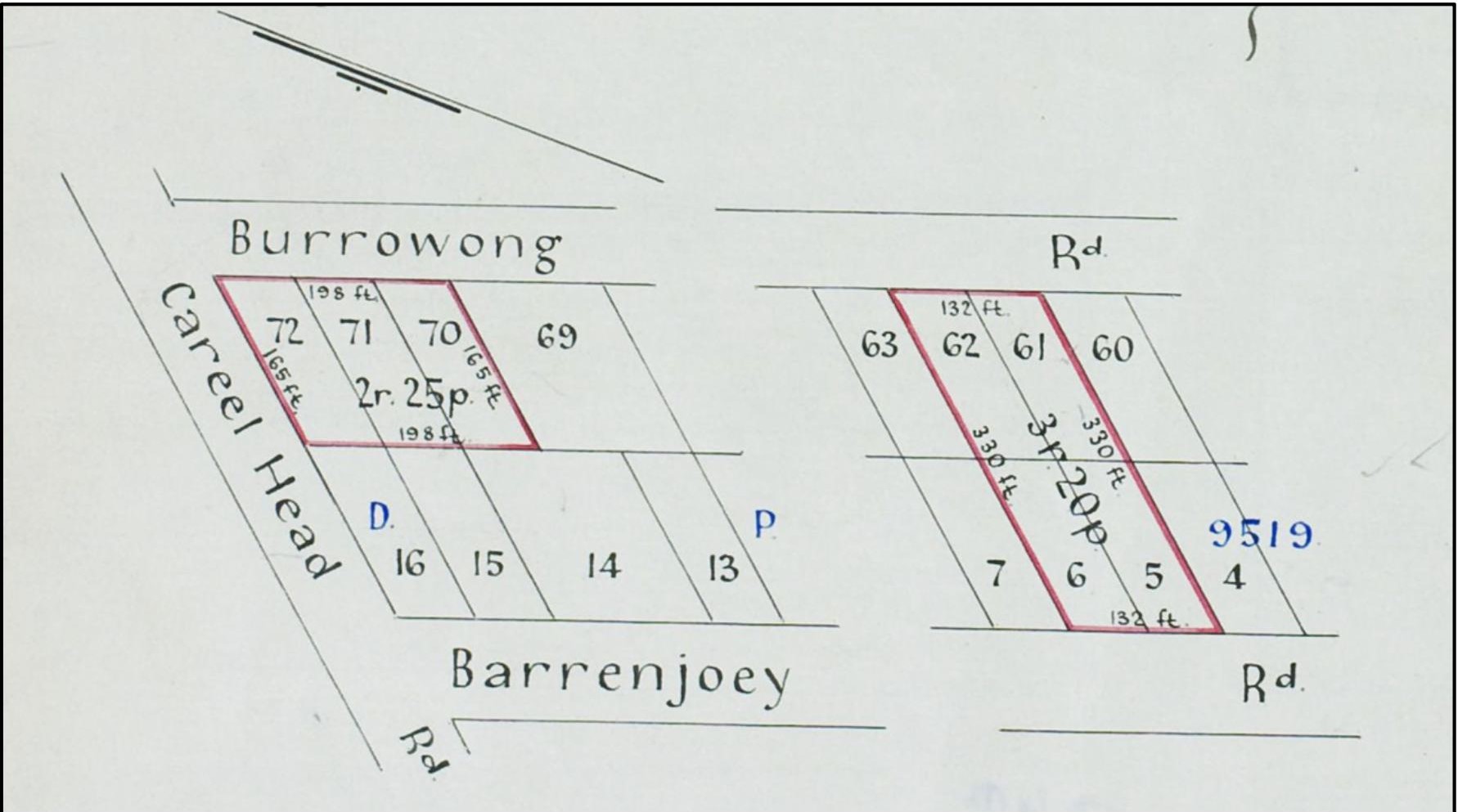
Volume/Folio Number 3580 - 30 (DP 9519)
On the 27th of January 1928, the lots were transferred to Harold Fredrick Kent, a Sydney Solicitor. Harold established a mortgage with Ernest Ebenezer Way on the same day for the purchase. Then, on the 12th of September 1928, Harold Fredrick Kent transferred part of the lots to Clara Tunney (née Bailey) with the mortgagee's consent. Clara purchased part of lots 70, 71 and 72; the volume/folio number was 4200-11 (DP 9519). The area was 21.5 perches (approximately 533 square metres). On the 26th of October 1925, Clara established a mortgage with the Government Savings Bank of New South Wales and then, on the 1st of December 1928, with Samuel Arthur Ray of Lindfield.
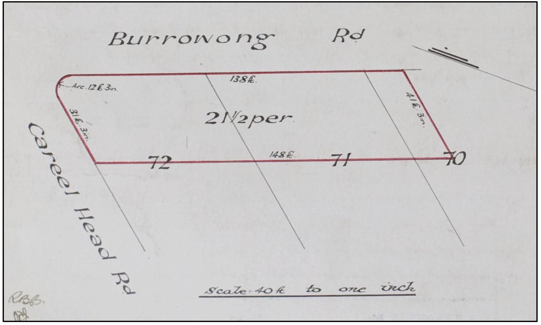
Volume/Folio Number 4200 - 11 (DP 9519)
Clara Hedges Bailey married John Francis Tunney on the 13th of August 1927 at St Michael’s Church, Newport, New South Wales, Australia. John (Jack) Francis Tunney was born on the 9th of April 1905 in Young, New South Wales, Australia and died on the 11th of February 1977 at Mona Vale, New South Wales, Australia.
Jack's parents were:
- John Joseph Tunney (05/11/1873 - 01/09/1925)
- Frances (Fanny) Hooper (23/04/1877 - 30/08/1908)
Clara (Clare) Hedges Bailey was born on the 14th of May 1907 at Rockdale, New South Wales, Australia and died on the 8th of September 1975 at Avalon, New South Wales, Australia.
Clara’s Parents were:
- Francis Walter Bailey - Stonemason (1874 - 07/06/1941)
- Jessie Thompson (26/11/1883 - 1/07/1966)
They had three children:
- John (Nippy) Bruce Tunney (16/05/1928 - 04/12/1992)
- Francis (Frank) William Tunney (26/02/1932 - 29/07/2017)
- Kathleen (Kath) June Tunney (18/07/1934 - 21/07/2001)
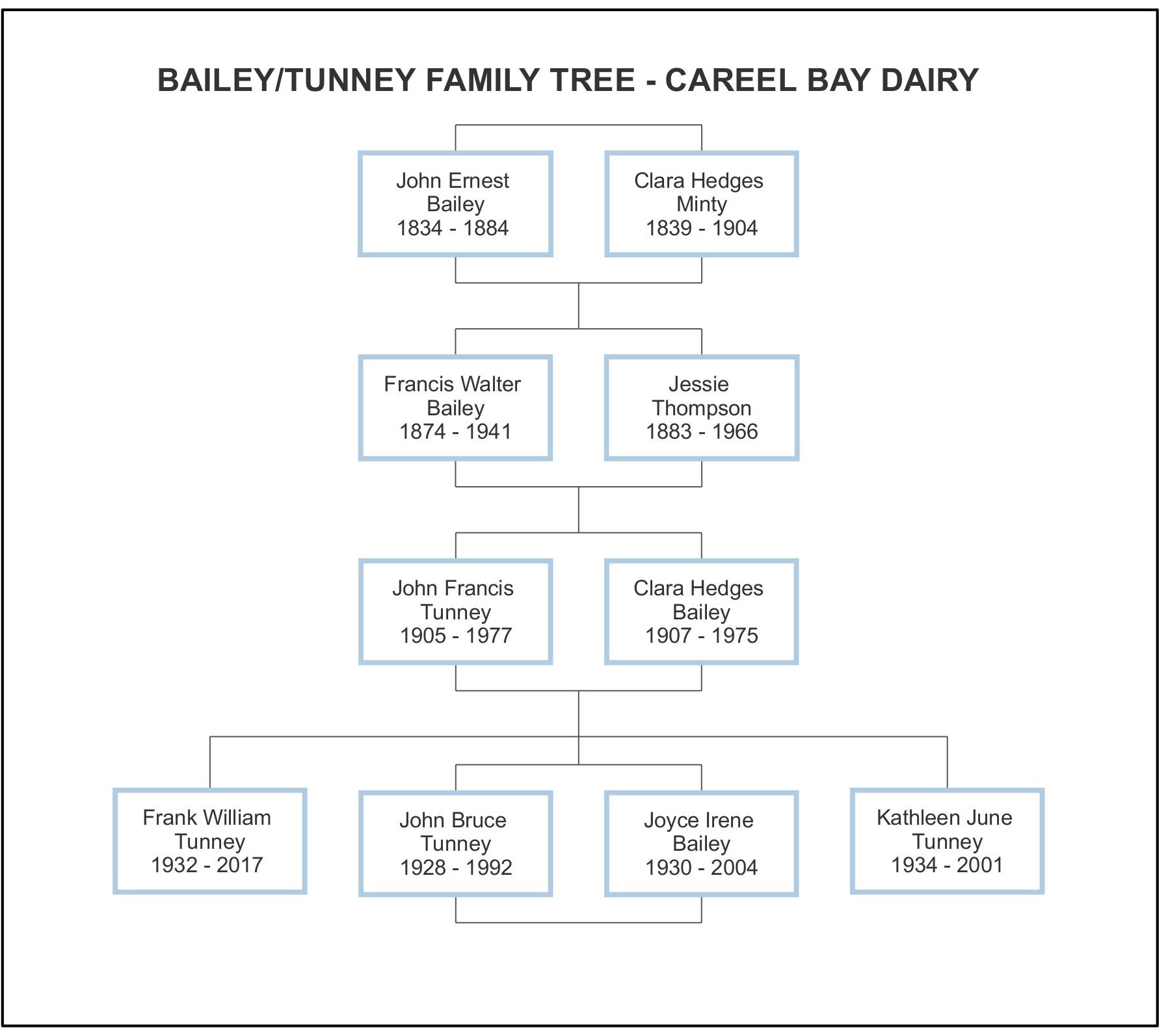
Bailey/Tunney Family Tree – Careel Bay Dairy
LOT 197
On the 15th of March 1941, John Francis Tunney and Clara Hedges Tunney purchased lot 197 (DP 17189) from Ernest Ebenezer Way. The property was part of a new subdivision that divided the larger lots into smaller housing lots. The lot was on Burrowong Road, near the corner of Careel Head Road. The lot had an area of 26 ½ Perches (165 feet x 50 feet).
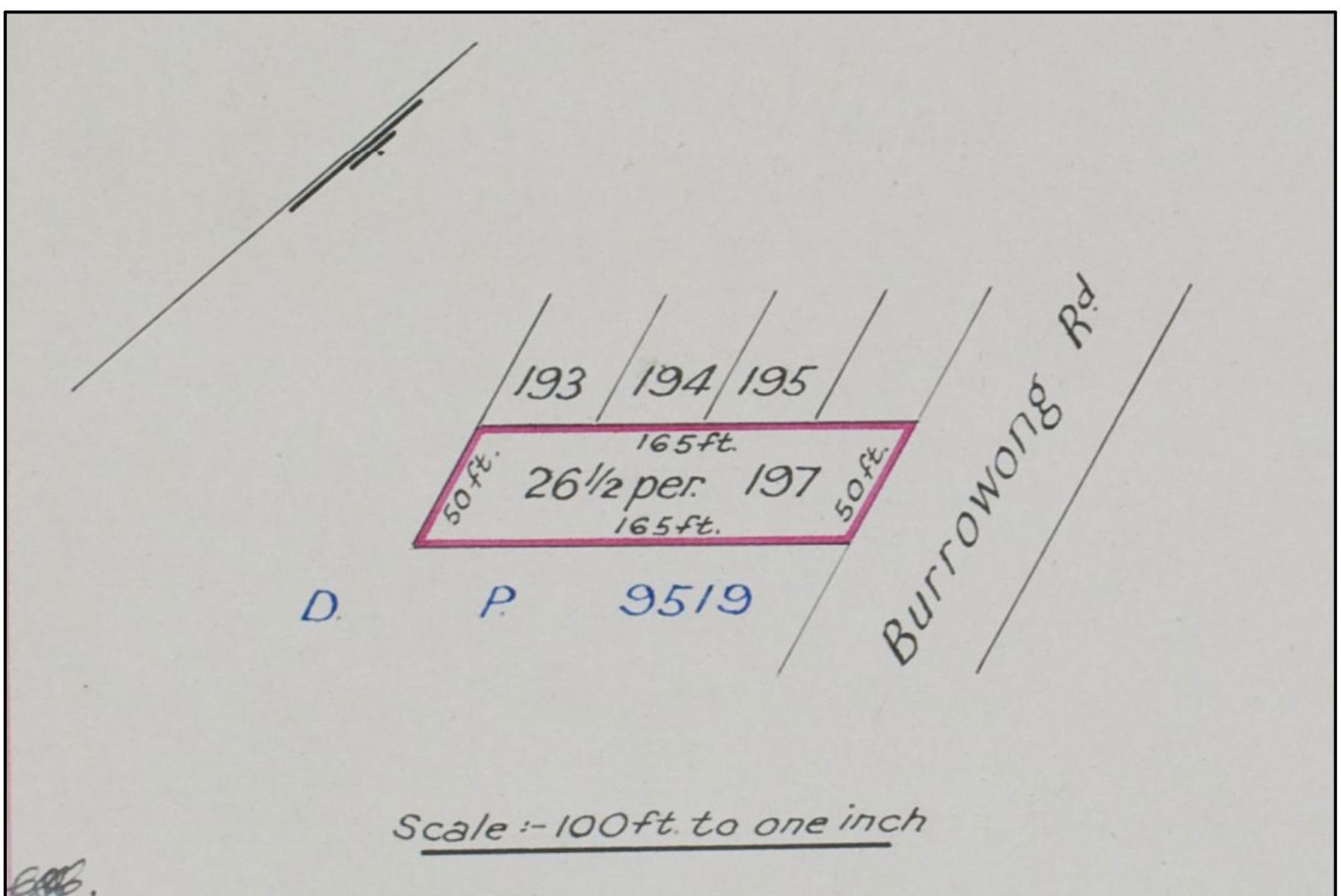
Lot 197 - Volume/Folio Number 5290 - 44 (DP17189)
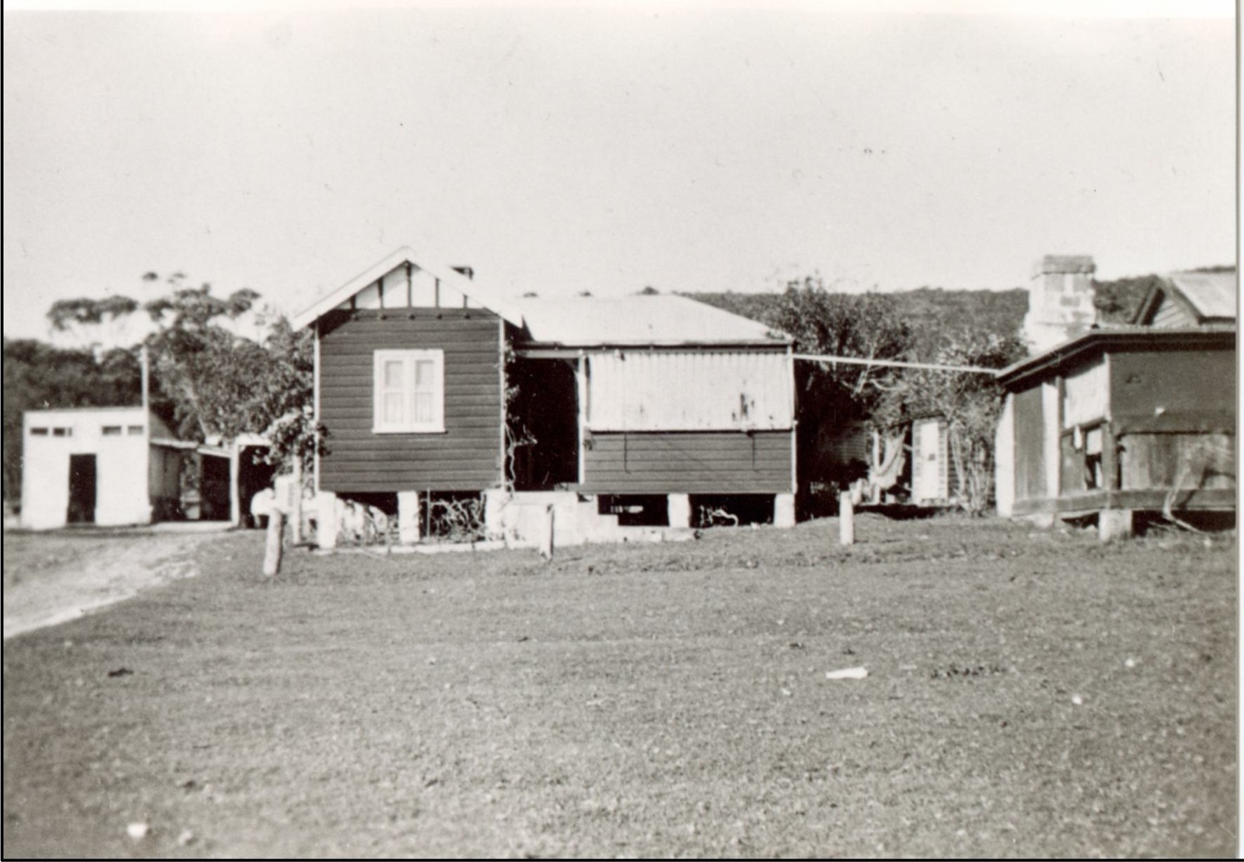
Dairy House (L) and Farm Hand Quarters (R) – Bailey’s Chevy is in the carport to the left of the house. Access was from Barrenjoey Road, Careel Bay, near the current location of the El Cortigo Units.
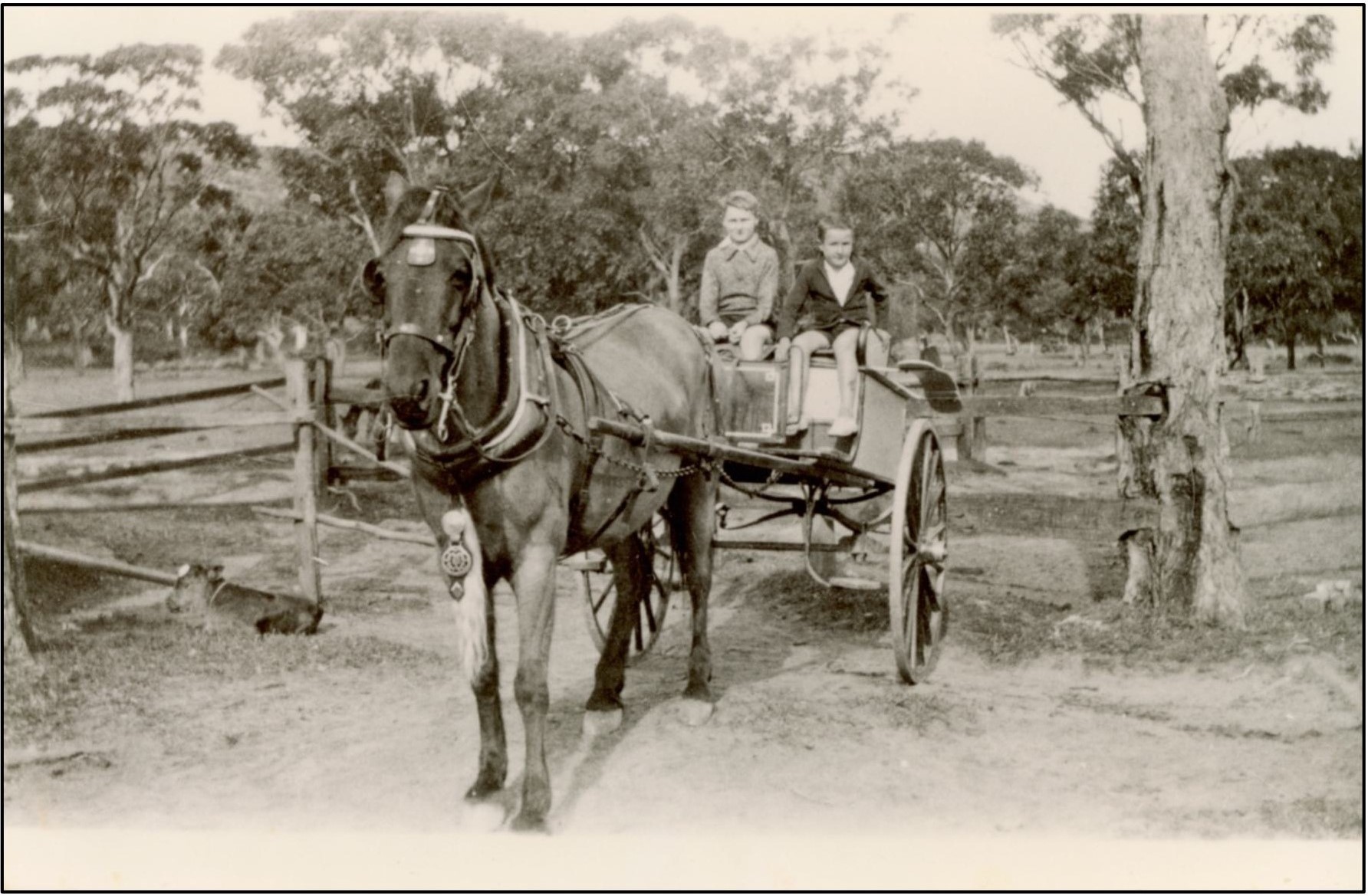
John and Frank Tunney with Tony the horse at the dairy, Careel Bay - 1940
In about 1926, they purchased a Chevy truck to help with deliveries, and it was stored in the garage to the left of the dairy house. This was a significant improvement on the horse and cart.
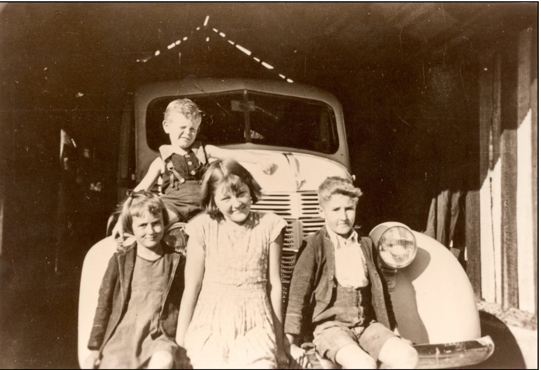
Kathleen Tunney, Peggy Hammond, Frank Tunney Max Hammond (at Rear) - 1942
Jessie Bailey Cow Brand – 12th August 1927 – New South Wales Government Gazette
Unfortunately, on the 31st of December 1948, the Rural Bank of New South Wales, the mortgagee, exercised its power to sell the property due to the inability to fund the loan repayments. War and the depression created hardship for many, and the family fell on hard times. On the same day, the property was purchased by Senly Harold Hammond and Ruth Muriel Hammond as Joint Tenants. On the 6th of January 1949, the Hammonds took out a mortgage with the Commonwealth Bank of Australia and discharged the mortgage on the 23rd of July 1958.
This included the house built for John and Clara Tunney on the corner of Careel Head Road and Burrawong Road. Harold and Ruth Hammond moved in with their three children, Peggy, Gwen and Max, before having two more children, Warren and Lyn.
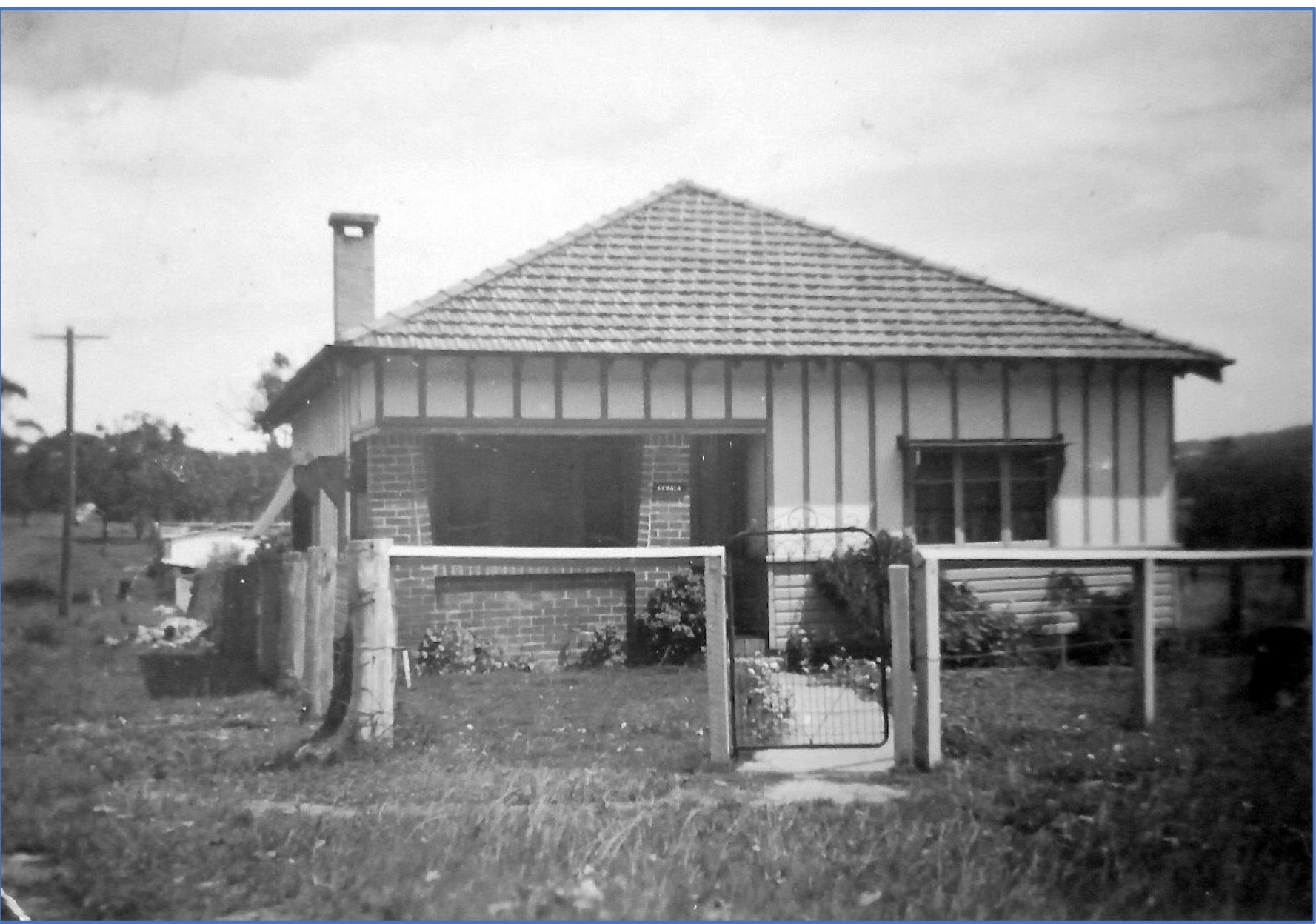
John and Clara Tunney House – Corner of Careel Head Road and Burrowong Road, Careel Bay
They named the house ‘Kembla’ and lived there for about two years before opening a small shop in the front room. They started selling things like Arnott’s Biscuits, Milk and Bread. Jack and Joyce Tunney said Ruth purchased goods from Grace Brothers.
As demand grew, the shop expanded to include more of the building. Jim Goddard changed the internal layout and built a new kitchen. The store earned the nickname of ‘Little Anthony Horderns’. They also had a post box out the front.
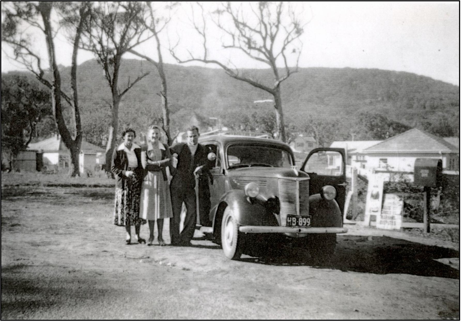
Ruth Hammond and her daughter Gwen with John Hirt outside the shop on Careel Head Road
Senly Harold Hammond and Ruth Muriel Hammond had been employed to manage the Jones’ dairy from about 1937. Harold, as he was known, and Ruth moved to Sydney in about 1927; they initially stayed at Cecil Guesthouse in Manly. The move to Sydney following their marriage was partly promoted by the death of Harold’s boss, John Thomson, at his farm named ‘Glen Leith’ at Mount George, just inland of Taree, New South Wales. Harold and Ruth were married on the 29th of March 1927 at the Methodist Church in Newcastle. They may have had their honeymoon at Cecil Guesthouse in Manly.
The following article relates to the death of John Thomson:
Extract from the Northern Champion (Taree, NSW), Wednesday 18 July 1934, Page 2
“On Saturday morning the 14th of July, he made an inspection of his property and stock, and remarked to his manager, Mr. H. Hammond, that he never felt better in his life. After partaking of afternoon tea he had his customary romp with Mrs. Hammond's children and then retired to his room to read a newspaper. At 4.45 p.m. he spoke to Mrs. Hammond, but when she later called him for tea she did not receive any response. Mr. Hammond then entered the room and discovered that Mr. Thomson was dead. He was lying propped up on his bed, with his spectacles on and the paper spread across his chest.”
Harold worked for a short while at the Timber Merchants - Vanderfield and Reed at Leichhardt Street, Glebe Point, before he was retrenched, and they moved to a cottage named ‘Woorak’in Wollstonecraft Ave, Avalon Beach. Harold was a countryman, a grazier, and a dairy farmer; his experience was an asset for the Careel Bay Dairy.
Harold, Ruth, and the children lived onsite and managed the day-to-day operation of the dairy. Ruth was also employed to look after the men - serving meals, washing dishes and their clothing in an old-fashioned copper. The dairyman paid board to Ruth for her service. It was said they had about 100 crows milked twice daily. They had the only phone for miles, but there was no electricity and only ice for refrigeration. It was also said that Ruth ran a small tea house from the dairy at some stage, offering fresh scones and cream with a pot of tea.
Senly Harold Hammond was born on the 25th of January 1895 in Motto, New South Wales, Australia, and died on the 26th of March 1965 in North Avalon, New South Wales, Australia.
Harold’s parents were:
- William Thomas Hammond (1863 - 25/04/1925)
- Eliza Unicomb (28/02/1866 - 05/03/1945)
Ruth Muriel Call was born on the 13th of April 1907 in Wee Waa, Narrabri, New South Wales, Australia and died on the 27th of July 1985 at Manly Hospital, New South Wales, Australia.
Ruth’s parents were:
- Michael John Call (1879 - 21/09/1913)
- Gertrude Amy Keppie (20/05/1878 – 02/06/1966)
Ruth and Harold had five children:
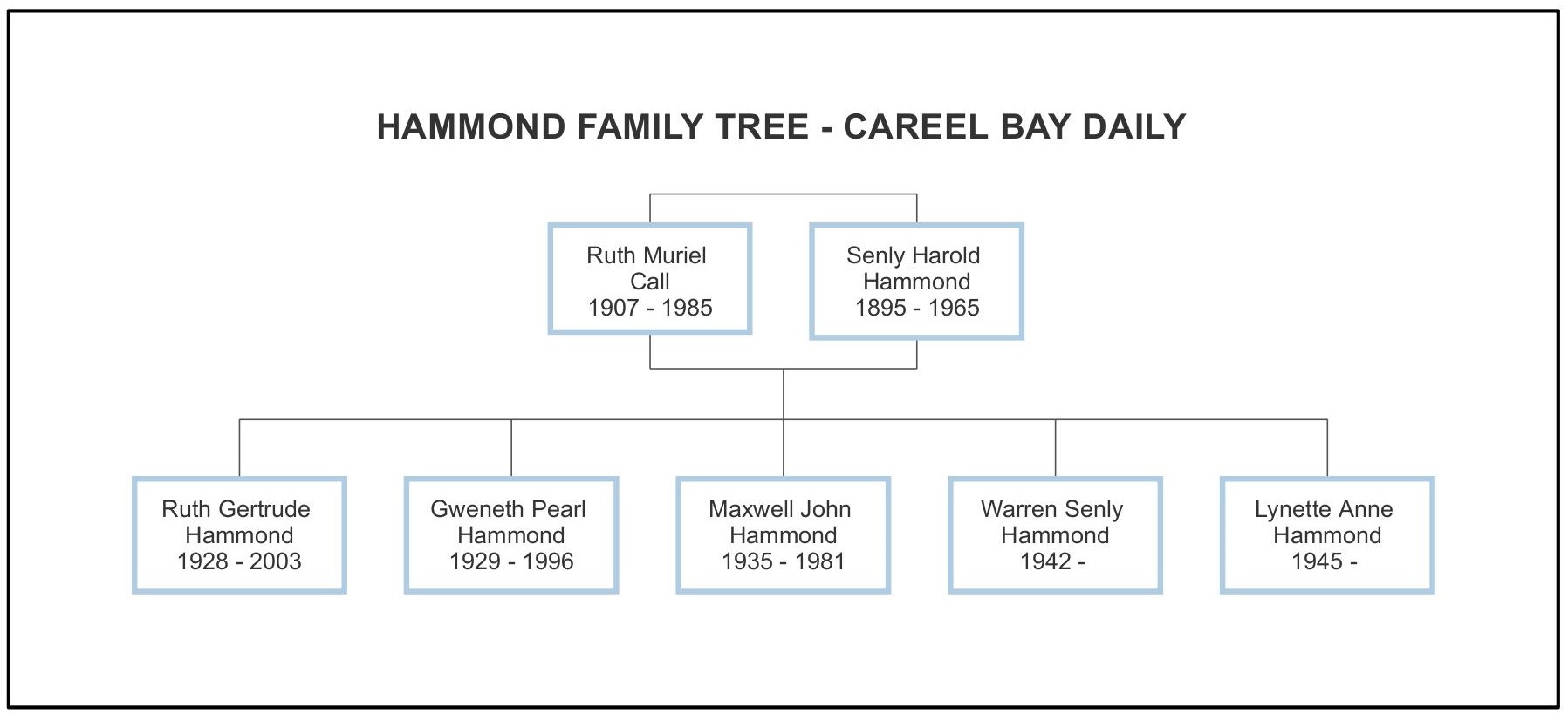
Following the closure of the dairy, Harold went to work for Dairy Farmers at Dee Why.
On the 8th of March 1949, Ruth and Harold purchased a block of land on the opposite corner of Burrowong Road, directly opposite the corner store. The land was transferred from Edward James Constable, a Neutral Bay Labourer. The land was described as lot 1 on deposited plan 17189, part of lot 30 on deposited plan 9519 (as shown in the diagram below).
The land on the corner of Careel Head Road and Burrowong Road had an area of 23 ¼ Perches and measured 44ft x 165ft. They sold it on the 3rd of July 1957 to Ronald James Maher and his wife, Collen Margaret Maher, as joint tenants.
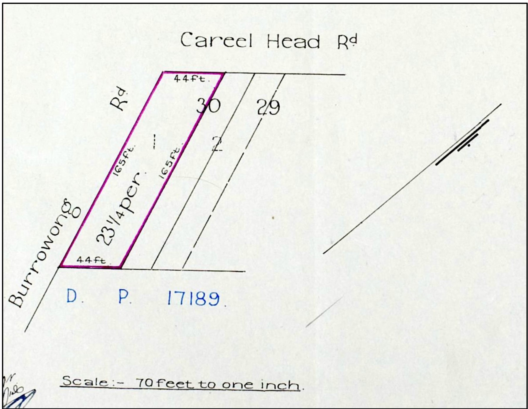
Lot 1 - Volume/Folio Number 5627 - 165 (DP17189)
On the 30th of June 1958, Senly and Ruth leased the shop premises and two garages at 7-11 Careel Head Road to Allan Le Clercq, Storekeeper. The lease included a flat at the rear of the premises. The land title was transferred to Ruth on the 4th of August 1966 following her husband’s death and then on the 21st of September 1966 to Allan Maxwell Milton and Ruth’s daughter, Ruth Gertrude Milton, as joint tenants.
Following Allan’s death on the 30th of November 1967, Ruth Gertrude Milton transferred the property to Rita May Ellison of Surry Hills. On the 27th of August 1973, the property was transferred to Edward Kevin Williamson (Avalon Beach Shop Keeper) and Betty Margaret Williamson as joint tenants.
Finally, on the 14th of May 1975, the property was sold to Douglas Robert Gravenor, a builder from Clareville. I assume he was the person who sold the shop building for relocation and developed the site with the present-day shops and units above.
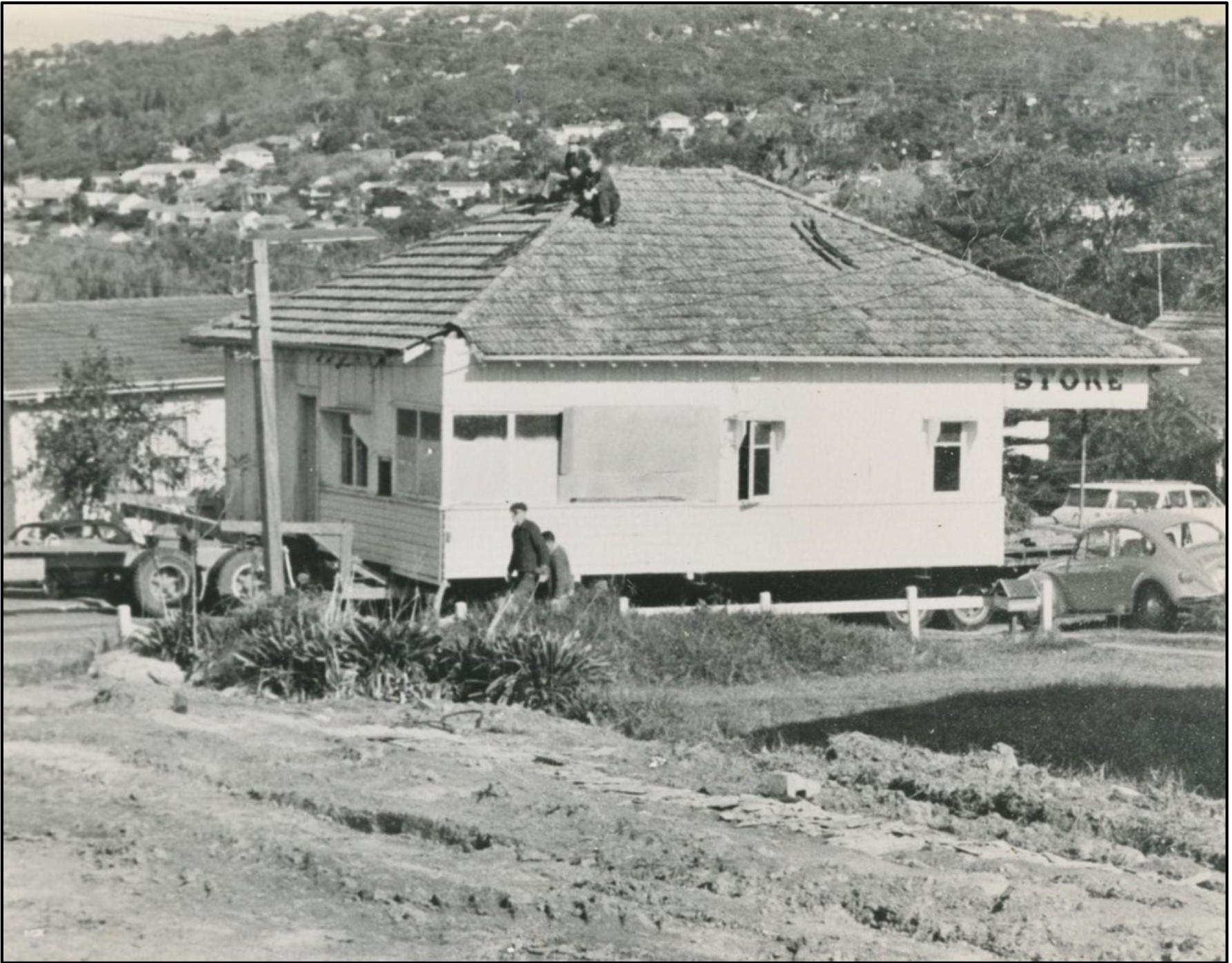
House relocation from the corner of Careel Head Road and Burrowong Road to 22 Milga Road, North Avalon
On the 1st of November 1945, Fredrick Charles Jones sold lot 193 to Arthur McGavock, a fisherman from Newport. Then, the lot was transferred to the Public Trustee before being sold on the 27th of May 1947 to Dorothy Pickard, wife of Edward Henry Pickard, Palm Beach Storekeeper.
LOT 193
On the 18th of November 1953, lot 193 was sold by Dorothy Pickard to Ruth Muriel Hammond. Then, on the 15th of March 1954, Ruth Muriel Hammond transferred the property to Jessie Bailey (Randwick Widower). On the 20th of February 1962, the property was transferred to Francis William Tunney (Avalon Garden Contractor).
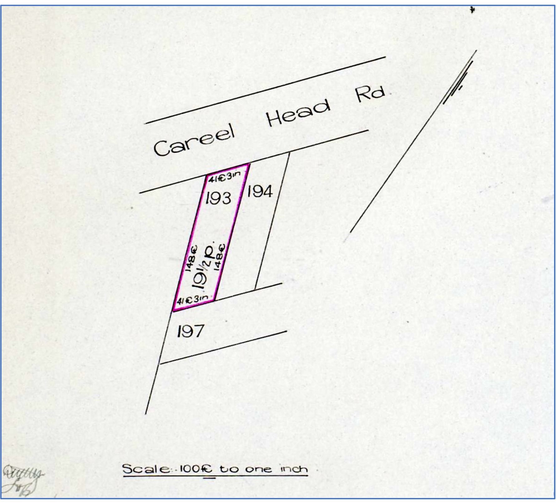
Lot 193 - Volume/Folio Number 5393 - 203 (DP17189)
LOT 194
On the twenty-third of November 1948, Jessie Bailey purchased lot 194 from Harold Fredrick Kent, a Sydney Solicitor). The lot faced Careel Head Road and was the second lot from the corner of Burrowong Road (see diagram below). The lot had an area of 19 ½ Perches (148 feet x 41 feet 3 inches). The title number was Volume 5900 Folio 159 (DP17159). Then, on the 20th of February 1961, the property was transferred to Francis William Tunney of Avalon (Garden Contractor).
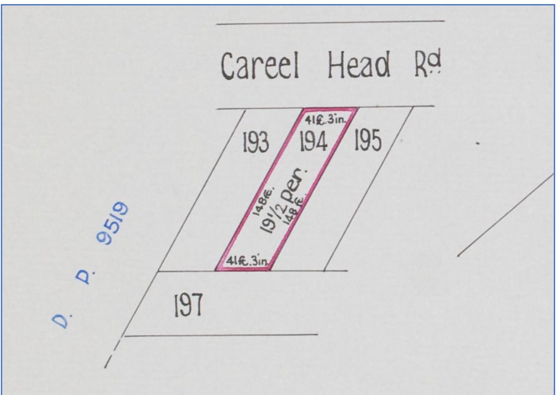
Lot 194 - Volume/Folio Number 5900 - 159 (DP17159)
LOT 195
On the 15th of March 1954, lot 195 was transferred to Ruth Muriel Hammond from Jessie Bailey (Randwick Widower). The lot faced Careel Head Road and was one lot from the corner of Burrowong Road (see diagram below). The lot had an area of 19 ½ Perches (148 feet x 41 feet 3 inches). The title number was Volume 5900 Folio 225 (DP17159).
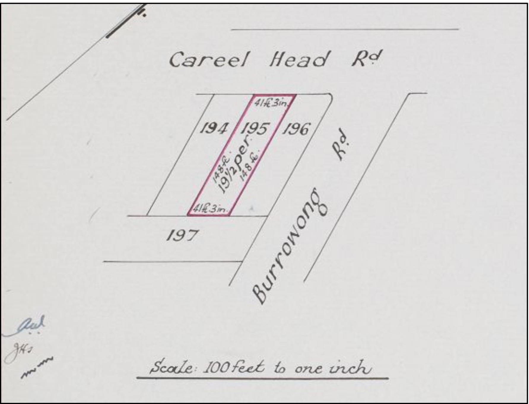
Lot 195 - Volume/Folio Number 5900 - 225 (DP17159)
LOT 69
On the 22nd of April 1953, Alan Charles Jones sold lot 69 to Clara Hedges Tunney, wife of John Francis Tunney (North Avalon Stone Worker). Lot 69 was effectively a double block with the creek running diagonally through the centre of the property. The lot measured 156 feet wide and 132 feet deep and had an area of one Rood and 30 Perches. The title number was Volume 6664 - Folio 154 (DP17159). On the 25th of July 1957, the property was transferred to John Bruce Tunney (North Avalon Contractor). On the 30th of December 1957, John Bruce Tunney took out a mortgage with the Commonwealth Bank and the mortgage was discharged on the 9th of March 1967.
On the 9th of March 1967, records indicate that lot 69 was subdivided, and lot 2 (DP232203) was transferred to John Francis Tunney and his wife, Clara Hedges Tunney, as joint tenants.
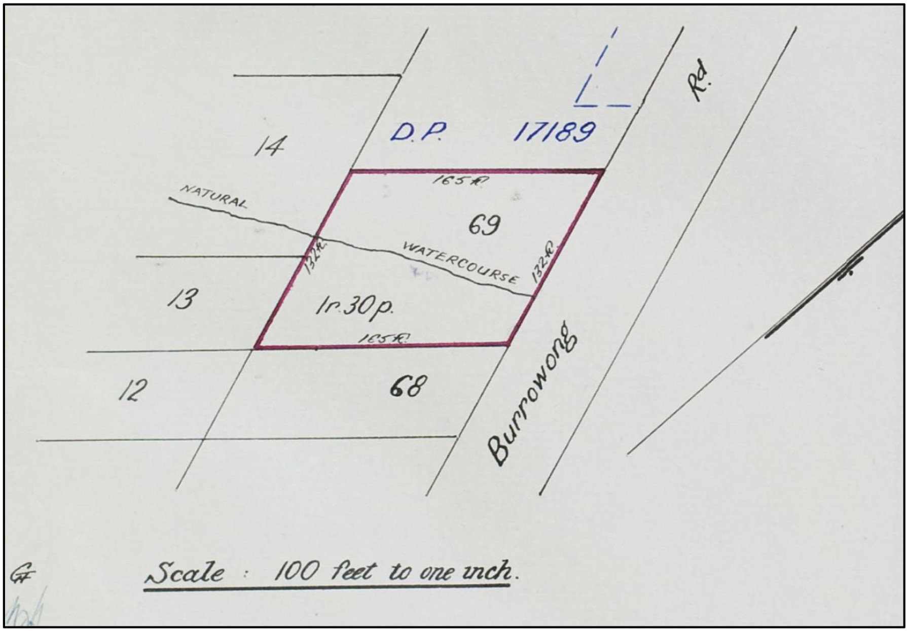
Lot 69 - Volume/Folio Number 6664 - 154 (DP17159)
LOT 68
On the 13th of September 1955, Alan Charles Jones sold lot 68 to Andrew John Hirt and Marjorie Salome Hirt as joint tenants. The title number was Volume 7087 - Folio 187 (DP17159). On the 2nd of November 1955, Andrew John Hirt and Marjorie Salome Hirt took out a mortgage with the Director of War Service Homes.
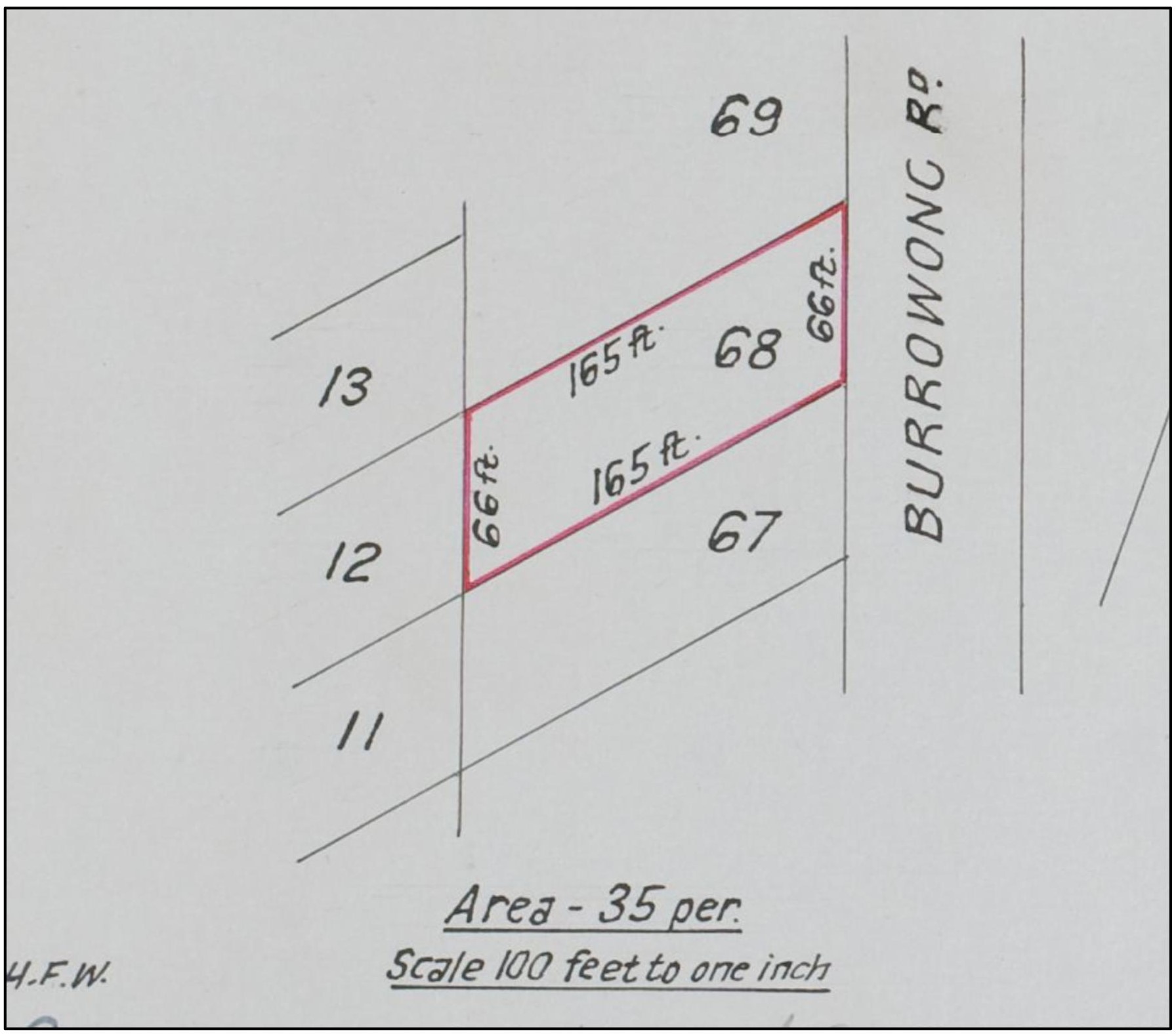
Lot 68 - Volume/Folio Number 7087 - 187 (DP17159)
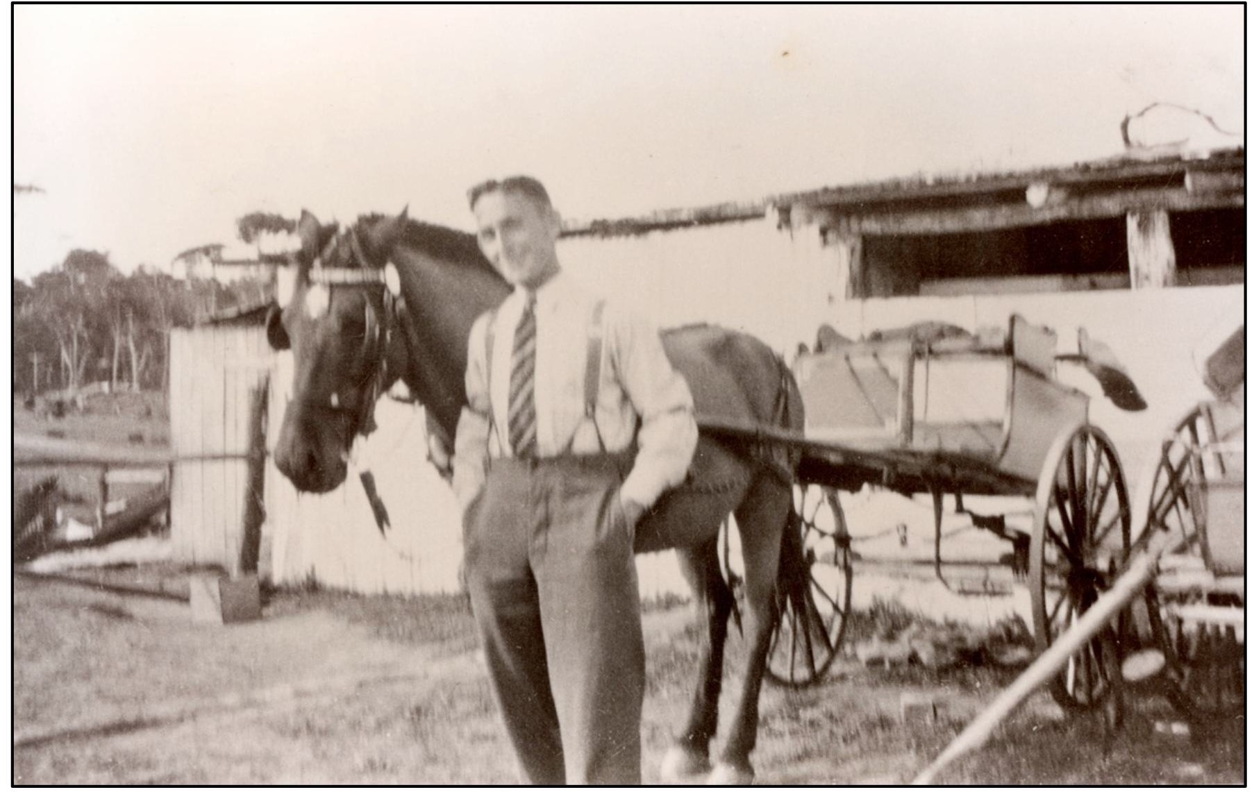
Dairy hand Jack Shawtell in front of the bails on Burrowong Road with Tony, the horse
BAN ON CATTLE GRAZING IN THE AREA - 1949; Daily Telegraph (Sydney, NSW: 1931 - 1954), Sunday 8 May 1949, Page 16
BAN ON COWS BLAMED FOR BUSHFIRES
Mr. J. A. Small blames the local ban on cows for bushfires in the Palm Beach - Barrenjoey area. Mr. Small, a Palm Beach estate agent, was speaking at a meeting of the Parks and Playgrounds Movement this week.
He said that about five years ago, many cows grazed in the area. “The cows belonged to local dairy farmers, he said. “Then Palm Beach residents complained to Warringah Council that the cows wandered into their gardens and ate the flowers.
Warringah Council banned dairy farmers from grazing cattle in the area. “The cows ate the undergrowth, minimising the risk of bushfires. “Now the undergrowth is very high. “We have had several bad fires on Barrenjoey since the cows left. “Koala bears are no good. "They only eat the top growth. “I wish the cows were back again.”
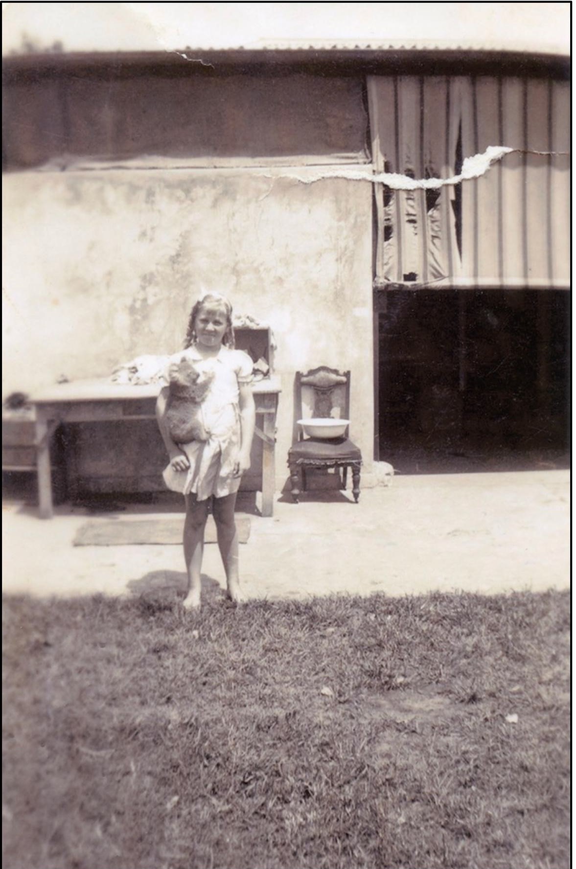
Gweneth Pearl Hammond (1929 - 1996) at the Dairy
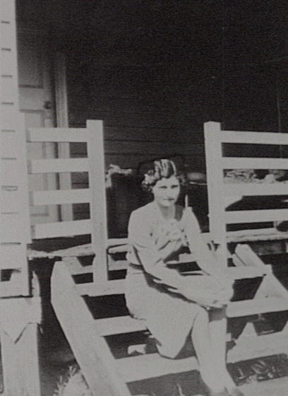
Ruth Hammond - is stated to be on stores steps in mid-1930's
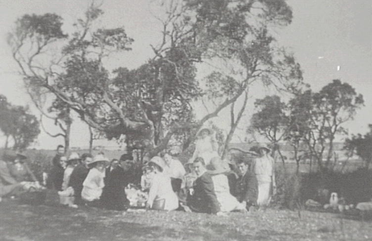
Ruth Hammond and friends (is stated to be 'at Whale Beach' but looks more like the flat area at Careel Bay foreshores or at Careel Head road to Bangalley paddocks)
El Cortigo Units at today's 704 Barrenjoey Road, North Avalon-Careel Bay - note the structure is up on high concrete columns/piles, out of the flood zone
Tom in the garden at the first home he and Dawn owned in Albert Road, Avalon. This formed part of the Dairy and was originally one of the workers houses. This photo is from February 1966. Photo: Tom Gilbert.
Tom was the grandson of Pittwater’s Joseph Gregory Lipscombe, patriarch of a family of 13 children who resided at Careel Bay, and son of Cecil and Daphne Gilbert this gentle giant has seen many changes occur in Pittwater. When it comes to cars and tyres there’s few who are as sharp on each model and its year. The proprietor of Totally Tom’s, Avalon Bulldogs Club president 1977 – 1981 and childhood mate of Peter Verrills, Tom Gilbert, is what is great about Pittwater people and what is still prevalent in them and the area due to his salt of the earth nature and spending a lifetime in this beautiful place.
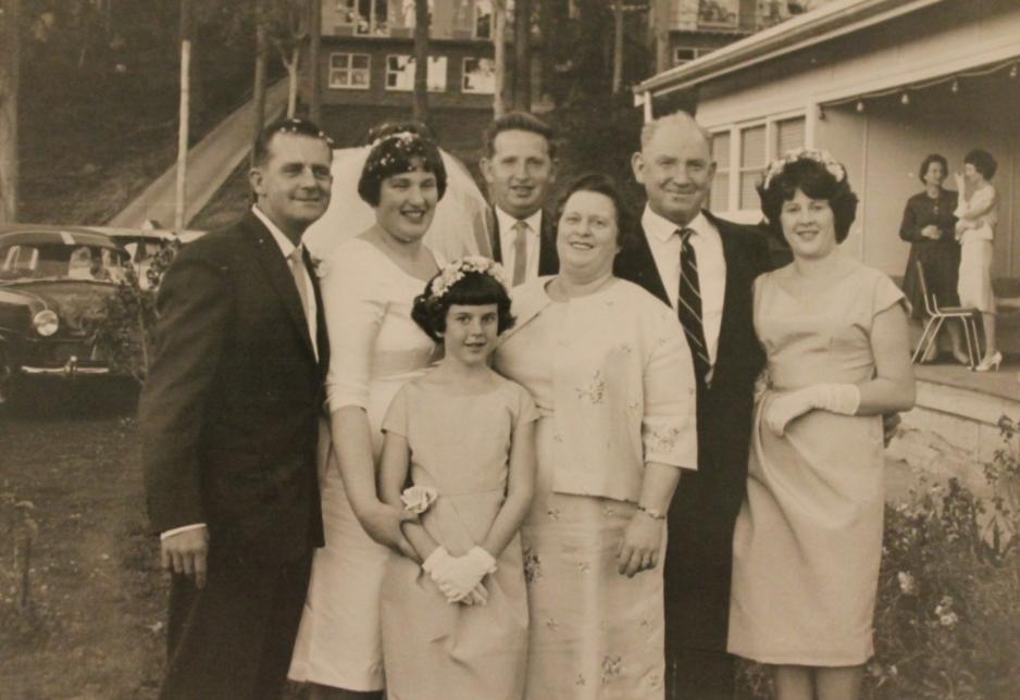
The Gilbert Family in front yard of their home at Currawong Avenue, Careel Bay on day Tom's sister Edna Grace Gilbert was married to Robert Fred Carter in 1962. They were mum and dad to Peter Carter. Tom is in the middle at the back. His mother and father Daphne and Cecil 'Bluey' Gilbert directly in front and to his left. Photos courtesy Tom and Dawn Gilbert.
Joseph Gregory Lipscombe of Careel Bay, Carpenter, bought Lots 14 and 35 (DP 10375) on Oct. 12, 1923, Vol-Fol: 3515-237 (Lot 35 was where built family home on Currawong Avenue at Careel Bay):
He sold Lot 14, measuring 198 feet by 66 feet, to Noel Gregory Lipscombe on January 30, 1936, Vol-Fol remained the same - the Currawong road Lot 35 went into Vol-Fol 4801-9.
Memories of the Dairy situated at corner of Barrenjoey Road and Careel Head Road.
Mrs Hammond transcript - notes of interview state that she and her husband managed a milk depot for a larger Warringah Dairy - on the present site El Corigo Flats, Barrenjoey Road North Avalon/Careel Bay. Mrs Hammond and her husband managed the dairy at Avalon from 1935 to 1947, then opened the store ‘Little Anthony Horderns’. The store was located on the corner of Burrawong & Careel Head Rd Avalon.
“In 1935 the Hammonds took on the management of a branch dairy owned by Mr. Bill Jones. The dairy was situated on a site at the intersection of Barrenjoey Road and Careel Head Road, North Avalon.
There were only two buses per day to Narrabeen and the tram from Narrabeen to the Spit. Roads were only sandy tracks. The Hammonds had the only phone for miles – there was no electricity and the only form of entertainment was the wireless. They grew their own fresh vegetables but most of their meat was tinned.”
Manly Warringah: People Places & Pastimes. During the 30’s. Pittwater- Narrabeen Local History Resource Unit, 1985.
Mrs Hammond remembers:
"My husband being a country man, they came to us, asked him if he’d take over the dairy, and we could move into the dairy house, but they’d have to employ me too to look after the men, that had to work and milk the cows in the dairy. They had to milk twice a day because there were no refrigerators, only the ice. They used to have to get up in the morning, two o’clock or one o clock, they used to start at midnight and get up, some to harness up the horse and the others had to milk the cows.
I was going to say we had 100 cows, whether it was more or less I can’t recall. The cow bales, on their own block of land, was all hand done, I had no occasion to go to the bales at all, my husband managed all that, then there was the house, then there was the men’s quarters.
Well, I had to do for the men, so I had a full-time job, rearing my family and looking after seven men, so my neighbour, Mrs Tunnie, used to help me. We had a huge dining room, we had to wait on the men, bring their meals in and they paid board. They had to pay me board.
Big meals, steak for breakfast, working men. After they’d had to milk the cows, the same crew, had to deliver the milk, at two o’clock in the morning, all up and down those hills at Palm Beach, return, do their books up, hand them into the office, then go and milk the cows in the afternoon and take the horse and cart and milk out for the second delivery. They came home, had dinner, made up their books for that run, hand them in. Then tea was ready for them. Always baked dinners, heavy meals. Cup of tea at twelve before milking, cup of tea and toast at 2 o’clock before they went out, breakfast at 11 o’clock, sleep, then you gave them a big tea, then supper before they went to sleep at night. There was no TV, we had the wireless.
I’ve always been in the habit of working at night. Big wash up. Not one of my kids ever went to school with a button off their shirts or holes in their socks. You didn’t throw them away, you darned everything in those days. I polished the kids shoes to the nines. Today’s mothers don’t do all that. All the clothes were starched. I did the men’s washing too, in an old fashioned copper. But when you’re young and energetic you don’t notice it." - Mrs Hammond, Oral History,1984
Warringah Shire Council Minutes of Meetings record in September 1948:
Postmaster General's Dept. 15/9/1948, requesting concurrence Telephones in the site proposed for a public telephone outside Hammond's Store at the corner of Burrawong and Careel Head Roads, Careel Bay. Resolved, - That the Council concur in the proposed site. (Cr;.s Butcher Dunbar) (3) Same 21/9/48, requesting concurrence in the site proposed for two public telephones outside the Narrabeen Post Office. Do. Resolved, - That the Council concur in the site proposed. (Crs. Forster Kent)
The same meeting records a project along Pittwater's foreshores, approved by the council, and with another version to come, that went bad: Dredging Bayview - L,W.Jones, replying that the Mines Department has been proceeding with inquiries with a view to claim being made against the Denver Trading Pty. Ltd, regarding restoration of the land and foreshores of the bay at Bayview. Received; (7) F.W.Duesbury., 17/9/48. advising that it has been decided to place the Denver Trading Co. Ltd. into voluntary liquidation, inquiring whether Council has any objection to the removal of the buildings, etc, at Bayview and the retention by them of the proceeds and requesting confirmation that Council holds a deposit of £10 on behalf of the Company. Resolved, That subject to the Solicitor's approval, the Council hold all materials as an offset against the cost of cleaning up the site, and that the cleaning up be done forthwith. (Cr's. Forster Dunbar)
Corner of Careel Head - Burrawong Roads Shops
Canadian born Douglas Robert Gravenor, Builder, then of 28 Delecta Avenue, Clareville, later of Cheryl Crescent, Newport, became the owner of 5-11 Careel Head Road on May 14, 1975, and sold and disposed of the old shop, which is moved to Milga road at North Avalon. He then applies to construct the shops at 9 Careel Head road.
The Minutes of the Ordinary Meeting of Warringah Shire Council, held on Monday, 10th November, 1975 records:
TOWN PLANNER'S REPORT NO. TP75/509 _AMENDMENT TO DEVELOPMENT CONTROL PLAN FOR NEIGHBOURHOOD BUSINESS ZONE _LOTS 193_196, D.P. 17189, Nos. 5-11 CAREEL HEAD ROAD, PALM BEACH. (Copy supplied to each Councillor). 35. Resolved That the Town Planner's recommendation be adopted, viz. That Development Control Plan P.A.167 for Lots 193 to 196 inclusive, D.P.17189, Nos. 5 to 11 Careel Head Road be amended so that Council's recommendation, H.B.D.C. 10.6.1974 reads:
(1) That Engineer's Plan A_1-5642 be adopted as a detailed plan for the locality under Clause 36(d) of Warringah Shire Planning Scheme Ordinance; and be so marked on Council's zoning records;
(2) That development of the land be in accordance with Engineer's Plan A_1-5642 and that the areas for parking be dedicated to Council at applicant's expense for car parking purposes. (Crs. Begaud/Beckman).
The Report to the Warringah Shire Council Works Committee Meeting, Tuesday, 1st February, 1977 records:
4.2 SUBDIVISION APPLICATIONS APPROVED/REFUSED UNDER AUTHORITY DELEGATED TO THE SHIRE CLERK Period 22nd December, 1976 to 12th January, 1977. APPROVED - Subdivision Application 90/76 - Careel Head Road, Avalon - Lot 196, D.P. 17189. Application for subdivision for the purpose of public road dedication in conformity with Development Control Plan P.A. - 167 and Council's regulation 0/M 10/11/75 (Min. 35)
WSC's records hold a Report to Works Committee Meeting, Monday, 22nd May, 1978, which records the shops are built and the construction works required by the council as a final stage:
4.18 CAREEL HEAD ROAD AND BURRAWONG ROAD, AVALON Report No. N7B/102 (S/E) (FILE ESF.883) A request has been received from Mr. D.R. Grovenor, Builder, of Avalon, to vary the footpath croasfall outside the new shops at the corner of Careel Head Road and Burrawong Road, Avalon and incorporate large brick squares in the footpath to break the expense of concrete. The proposed croasfall varies from 1:34, which is Council's standard, to 1:9 to eliminate a step outside the shop doorways.' It is considered that a croasfall of 1:9 is too steep for pedestrian movement and further that the proposed brick squares in the footpath could create a pedestrian hazard in wet weather. RECOMMENDATION That Mr. Gravenor of Avalon be advised that: a) the footpath is to be constructed in accordance, with Council's standard croasfall of 3.0% b) the difference in level between the shop floors and the adjoining footpath level will require the construction of steps; inside the existing properties. c) .. brick paving sections to be located on the footpath to be permitted subject to the indentations not being greeter than 6mm . in depth. COMMITTEE'S RECOMMENDATION: That the foregoing recommendation be adopted. 750 COUNCIL'S DECISION (29.5.1978): ADOPTED
At present these shops on the corner of Burrawong are still those built by Mr. Grovenor, and are Besser Blocks, painted - apart from the top storey of the one tucked into the corner at 9 Careel Head Road, which has 1970's red bricks - this is where flats are.
Besser blocks, invented by Jesse Besser in 1904, when one of the first concrete block machines was produced in the US by what was soon to become Besser Manufacturing - this revolutionised masonry with efficient, machine-made concrete blocks. The technology peaked post-WWII, becoming a global standard for affordable, durable construction. In Australia, they became iconic in 1950s-70s mid-century architecture for residential and commercial, particularly in Tasmania.
Apartment blocks from the 1970s were usually brown or red brick. Although today's generations may find them ugly, these were solid constructions with better build conditions required than developers can slip through today, usually double brick for insulation and quietness, and open to the light.
A few 'site investigation' photos from January and February 2025:
smaller.jpg?timestamp=1770411752691)
Taken from Careel Head Road- view is towards south
 small.jpg?timestamp=1770411883797)
Besser blocks topped with red Bricks at 9 Careel Head Road, flats above
 small.jpg?timestamp=1770415791634)
On Burrawong - view south along storefront of this restaurant-shops
 small.jpg?timestamp=1770416207852)
Storefront of current restaurant on side facing Burrawong - these decorative arches have been there since it was the 'Mali Thai' - the name of which was first registered with ASIC in 1990
small.jpg?timestamp=1770416314507)
bit further south along Burrawong, showing one of the set of steps built (and Matilda Mae BooseBop Gumley-Guesdon not going on road while photo is taken and off to sniff her daily to be visited spots)
small.jpg?timestamp=1770416507876)
Current day Graze'n'Cakes also has a set of two tiled cement steps leading into shop
small.jpg?timestamp=1770416781830)
View along Burrawong to south and where Burrowong Creek indentation is
smaller.jpg?timestamp=1770416909731)
Burrawong Road end back perimeter of Besser blocks building with adjacent redbrick flats/shops at 9 Careel Head road
 smaller.jpg?timestamp=1770417027567)
carpark area at fronting Careel Head Road - and Bus stop
small.jpg?timestamp=1770417241234)
same carpark - taken from opposite side of the road (east) - cream east wall of 3 storey units at 5-7 Careel head road at edge
small.jpg?timestamp=1770417742393)
The Ordinary Council Meeting held May 28th 1979 Meeting records:
DEED OF AGREEMENT - RIGHT-OF-WAY. (File S.F. 883/3_11) With Eric Newham Holdings Pty. Limited as the Mortgagee concerning Rights-of-way at the rear of 11, Careel Head Road, Lot 1, D.P. 321356 - North Avalon.
A Report to Ordinary Meeting, 22nd March. 1982 records:
- 2.9 11 CAREEL HEAD ROAD, NORTH AVALON _SALE OF STRATA 4 TYMC UNIT (File: SF883/3_11) In accordance with the terms of the original deed, the new owner of one of the units, Mr. S. & MS. E. Van der Kamp; the proprietors of Strata Plan No. 16792; and the proposed new mortgagee, Finance Corporation of Australia Limited, have all entered into deeds with Warringah Shire Council for the grant of the right-of-carriageway when required. C) RECOMMENDATION That approval be given to the execution under seal of documents relating to the matters covered by the foregoing items 2.1-2.9 inclusive. COUNCIL'S DECISION
Soon after Mr. Gravenor is declared bankrupt and his address is Cheryl Crescent, Newport - he may have lost or sold his Clareville home to fund completion of the works:
No. 143 of 1983—Re Douglas Robert Gravenor
TAKE notice that the first meeting of the creditors of Douglas Robert Gravenor who become a bankrupt on the 28th day of February 1983 will be held at the offices of Hamiltons, Chartered Accountants, 18th Floor, 1 York Street, Sydney, at 10 00 o'clock in the forenoon on the 30th day of November 1983.
Dated this 14th day of November 1983.
W J HAMILTON, Trustee, C/o Hamiltons, Chartered Accountants, 18th Floor, 1 York Street, Sydney 2000 Telephone 241 3831. No. 143 of 1983—Re Douglas Robert Gravenor. (1983, November 22). Commonwealth of Australia Gazette. General (National : 1977 - 1987), p. 3864. Retrieved from http://nla.gov.au/nla.news-article240756198
It wasn't the first time this gentleman went bankrupt:
No 130 of 1965 —Re Douglas Robert Gravenor, 10 Ricketty street, Mascot, trading as C M P Umflow. Date of first meeting of creditors—26th May, 1965, at half past Eleven am, at Official Receiver's Office, Sydney. Date of public examination—24th November, 1965, at half-past Ten a m, at Federal Bankruptcy Court, Sydney. In the Federal Court of Bankruptcy, Bankruptcy District of the State of New South Wales and the Australian Capital Territory. (1965, May 13). Commonwealth of Australia Gazette (National : 1901 - 1973), p. 1880. Retrieved from http://nla.gov.au/nla.news-article241020113
And this hadn't been resolved when the gentleman had left this mortal coil:
NOTICE of application relating to TAMAREE PTY LIMITED.—In respect of proceedings commenced on 6th May, 1993.—Application will be made by William James Hamilton as trustee for the estate of Douglas Robert Gravenor, to the Supreme Court of New South Wales, at Sydney, at 11.00 a.m., on 22nd June, 1993, at the Registrars Court, Court 7A, Level 7, Supreme Court Building, Queens Square, Sydney, for an Order that Tamaree Pty Limited be wound up. Copies of documents filed may be obtained under the rules. Any person intending to appear at the hearing must serve a notice in the prescribed form so as to reach the address below not later than 1.00 p.m. on the day prior to the hearing of the summons or on the preceding Friday where the summons is to be heard on a Monday or on a Tuesday following a Court holiday. LEDLIN PARTNERS, Solicitors, 410 Chapel Road, Bankstown, N.S.W. 2200 (D.X. 11210, Bankstown), tel.: 708 2811 [02462]. NOTICE of application relating to TAMAREE PTY LIMITED.—In respect of proceedings commenced on (1993, June 11). Government Gazette of the State of New South Wales (Sydney, NSW : 1901 - 2001), p. 2843. Retrieved from http://nla.gov.au/nla.news-article231921753
The restaurant established as 'Mali Thai in 1990 facing Burrawong Road, had a menu with a fusion of French and Indonesian influences - including the decoration of the exterior which is still in place. The were popular for their Nasi Goreng was the most popular dish, for takeaways as well as those dining in. Although one of the authors of this page worked there on weekends, and can still see the faces of the Australian-French chef and his Indonesia wife, she cannot recall their names.
That restaurant changed hands several times since then, operating under the name of Mali Thai still, and became the Potala Kitchen just a few years ago.
The structure was, and remains, a simple Besser Block topped with boards buildings.
Around the corner, and alongside the old restaurant, an older couple used this as a place to prepare foods such as large potato pies and salads which were sold to delicatessen's around the are and as far as St. Ives.
In September 2017 Sandy and Viet opened 'Graze'n'Cakes' here, which continues, with their food so good and so popular they are selling out by 1.30pm each day or before.
Viet, Sandy and Matt - Graze n Cakes on opening day 2017
The red brick building erected beside it up until a few years ago had the Cha No.9 restaurant prior to the owners being unable to secure an extension to their lease and moving to Tasmania. A ceramics studio now operates in the same shop area while beside this to the east is a shop space dedicated to a gym and fitness area as well as stairs to access the upstairs flats.
Local knowledge states the premises at 9-11 Careel Head Road is also up for changes soon, with the owner, who sought changes to the use of the parking area granted to the WSC back in 1975, applied in 2025 for changes in this spot and is soon to apply to develop the site into more shop-top flats. No DA has been lodged as yet with the council.
That 2025 Public Notice placed on the council website:
Proposed Road Reserve Closure - Land adjoining 9 Careel Head Road and 38 Burrawong Road Avalon Beach
_Avalon%20(1).JPG?timestamp=1743534411323)
Units at 5-7 Careel Head Road
The residential building at 5-7 Careel Head Road, Avalon Beach, is a 3-storey unit complex built/completed in 2012, after a huge pit sat idle for some years. The hole in the ground, for a future underground carpark, would fill with water, even when it didn't rain due to the amount of water seeping through the earth. The site of 5-7 Careel Head road is 854m squared site measuring 25mx39m.
Locals recall an 1996 DA for shop top housing, and that this was one of the first shop top approved after years of opposition. Another who witnessed this change, states:
'' The site was excavated and remained an ‘unsightly a dam’ for years until the current shop top was built. The problem with the site - when excavated - is that the ‘below ground ‘ level of the development is below the water table and subject to continual water ingress. Pumps required to run constantly.''
''Scientist Bill Conway - an expert in underground water and aquifers - warned against the excavation and the expected problems associated with building concreted dams below ground in this area. Underground parking dams water flow from the nearby headlands. Underground water has to find another path due to the underground dam (concrete underground parking). That blocked underground water flow has to find another way /route ….resulting in unintended knock on effects for 1. The environment and 2. Other developments nearby.
Despite valiant efforts by Pittwater Council, the council's LEP and DEC was ignored, the Land and Environment court case was lost, favouring developers/profiteers now long gone. The development was built. Another development adjacent on the 1 to 3 Careel Head Road sites will add to the issue. Care in what is built is required.''
Overland flooding along with being a part of a known flood-affected area zone, with creeks, and a tidal creek further west (Careel Creek) can be exacerbated by installing structures into the earth, and through their channels- disrupting the flows.
Underground carparks significantly alter local hydrology by acting as large, impermeable barriers that force surrounding groundwater to move around or underneath them. As urban development covers natural, porous ground, stormwater and groundwater cannot flow freely, causing the soil to saturate and exert intense "hydrostatic pressure" on the underground structure.
Because the concrete structure is impermeable, water that would naturally percolate through the soil is instead forced to move through the remaining surrounding earth.
Due to being below the water table, these structures are highly susceptible to flooding from rising groundwater or runoff entering via ramps.
To manage this, engineers often design these structures with, or rely on, specialised drainage, sump pumps, and, in some innovative designs, and intentional "water reservoirs" or OSD's (Onsite Stormwater Detention) that handle the water pressure to prevent catastrophic failure. However, this still forces the water into the adjacent areas and properties and if an OSD's contents are released during flood times to save the building, that can worsen what is happening all around it.
Although the corner of Careel Head Road and Barrenjoey Road has been a known flood zone for decades, during urbanisation eras, the frequency and level of flooding has become higher since 2012. Since 2020, sustained rainfall has meant water across this dangerous corner, and main road, for weeks in a row - more below.
 small.jpg?timestamp=1770419451503)
entrance to underground carpark
small.jpg?timestamp=1770421314691)
.jpg?timestamp=1770420985599)
Careel Bay Shopping Village: Corner of Barrenjoey & Careel Head Roads - from Service Station to food/Service-focussed outlets
Lots 14 to 16 - Volume-Folio: 2834-78 and 79 - land goes to James Young from Emma Florence Nolan (Vol-Fol 2560-192) measuring 179 acres 3 roods, being Primary Application 19218, being Lots 2-6 and Blocks 1 and 2 in North Subdivision of the Pittwater Estate and part of 280 acres (Portion 49 of Parish) granted by Crown Grant to John Joseph Therry.
Whale Beach Estate 1918 April 1st c053460074, showing Careel Head Road, Burrowong Road (now spelled Burrawong) and Whale Beach Road - from and courtesy State Library of NSW Pittwater Subdivisions folder.
Caroline Cecilia May Webb of Bondi, Widow, bought Lots 15 and 16 DP 9519 and part of Lot 60 DP10345 on December 27th 1923 Vol-Fol: 3545-130:
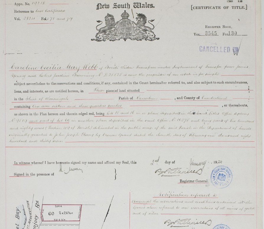
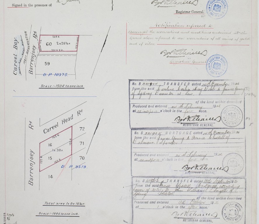
She sold this back to James Young, one of the Barrenjoey Land Company founders, a year later, December 14 1925. Annie Clisdell of Balmain, Spinster, became mortgagee and transferred power of sale to John William Smyth of Sydney, Solicitor. He sold Lot 60 to Eliza Jane Broderick of Manly on March 18, 1947 (Vol-Fol: 5714-66) with the residue Lots 15 and 16 going into Vol-Fol: 5714-107:
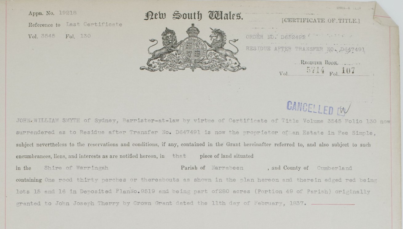
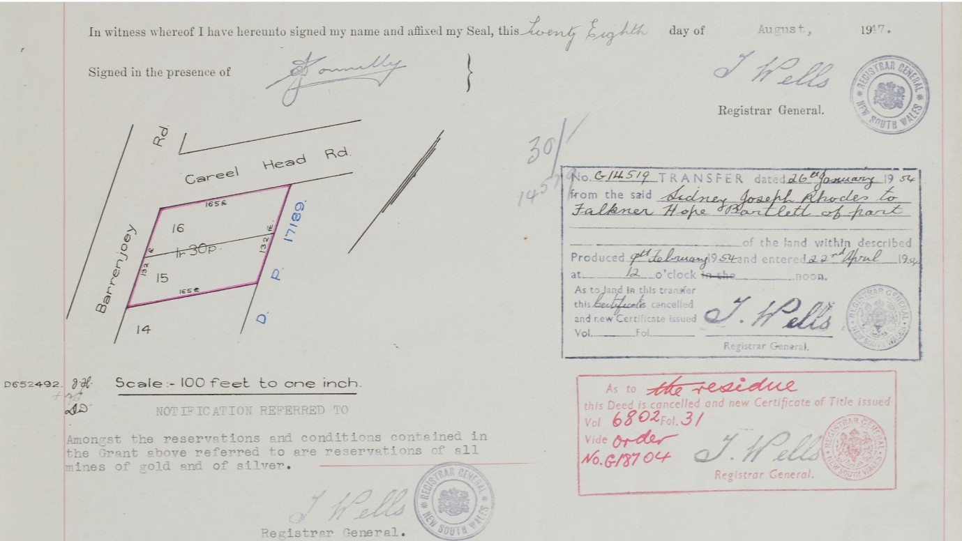
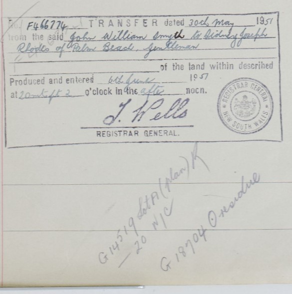
Sidney Joseph Rhodes of Palm Beach, Gentleman, became the owner of both Lots 15 and 16 on May 30 1951, measuring 132 feet across by 165 feet on both sides of the two blocks.

Crown Lands aerial dated 5.1.1951 showing Burrowong creekline (between red lines) and corner of Careel Head road structures - note the cottage at 3 Careel Head Road is already in place, as are two structures on corner block
Sidney Joseph Rhodes was born in 1901 at Windsor, New South Wales, and passed away on March 10 1967 at Kiama, New South Wales. His father was Charles Rhodes (1855-1914), was 47 and his mother, Lavinia Dumble (1866-1945), was 36. He married Pretoria M. Atkins in 1927, in Balmain. He had a variety of businesses and by the time he was in Palm Beach had dealings on the Hawkesbury.
Sidney Rhodes sold part of this holding to Falkner Hope Bartlett on January 26, 1954.
The residue went into Vol-Fol: 6802-31. This became 'Lot B' on Careel Head Road, measuring 132 feet by 66 feet. The Certificate of Title shows the front Lot, on the corner of Careel Head Road and Barrenjoey Road, has become 'Lot A'.
This 'Lot B' was sold to Donald Harry Dickson, Engineer of Avalon Beach, and his wife, Joyce May Dickson, as joint tenants, on June 4th, 1954. They sold to Brooklyn Troy Webb of Eastwood, retired Public Servant, and his wife, Gwenda May Webb on February 10th, 1958. A Notice of Death is on the Certificate of Title for Gwenda, Widow, on the 27th of April 1977. The property passed to Lia Wyndam Kemsley on August 11 1977 and then to Joseph Anthony Dawe of Avalon Beach, Specialist Mechanic, and Julie Ann Dawe his wife, as joint tenants, on January 25th, 1978, and then to Mabel Winifred Thornton on July 12th, 1982.
Vol-Fol: 6802-31:
.jpeg?timestamp=1768880794092)
.jpeg?timestamp=1768880858599)
This is the site of the current cottage on piles at 3 Careel Head Road, and the back part of the Lots 15-16.
.JPG?timestamp=1770087609858)
.JPG?timestamp=1770139806845)
Whale Beach Service Station - Corner of Careel Head-Barrenjoey Roads
 Falkner Hope Bartlett (1892 - 1984), was named after his grandfather and born in Waverly. He was the son of son of Charles Henry Falkner Hope Bartlett (1853-1916) and Ada Louise (Gale) Bartlett, and brother of Doris T H Bartlett and Hallett Robertson Hope Bartlett. An ANU Biography on his father is under Extras.
Falkner Hope Bartlett, or 'Hope', as he was known, was the older son of Charles Bartlett and Ada Gale. His need for speed was fuelled when Hope started as a works rider in 1910 on the belt-driven Zenith motorcycle.
Hope's first job was a trainee wool buyer, but that was soon abandoned in favour of something more exciting; taking over the motor service previously operated by George Harrison and running a daily motor service (bus company) between Nowra and Moruya from 1924, and later went as far as Bega, Eden and Cooma. He lived on his Kinghorne Street premises at Nowra for around thirty years. While his business allowed him to drive, Hope was passionate about motor racing and he is considered by some to have been well ahead of his time.
He was as successful on oval tracks (especially the 1.4-kilometre concrete Maroubra Speedway) as on the road or at hillclimbs, and on two wheels as on four. He was known as a wizard on the sand at the Gerringong Beach course. Between 1931 and 1948, he competed in several Australian Grands Prix. Twice during the 1930s he crossed the Tasman Sea to win the prestigious New Zealand Cup, firstly in a Vauxhall and then in a Bugatti. During his motor racing career than spanned more than forty years, he drove a Sunbeam, MG, Dixon Riley, and a Jaguar. The XJ Jaguar powered Hope to victory at Bathurst's famous Mount Panorama circuit in 1951, after which he hung up his goggles and helmet aged 59 years.
He was as adapt on water as on land and, as a member of the Royal Motor Yacht Club, won many speed boat titles.
He passed away, aged 92 years, in 1984 in New South Wales.
Whilst Hope never married and had no children of his own, he helped raise his nephew from the late 1930s, future Australian racing car driver and engineer, Frank Gardner.
Hope Bartlett was posthumously inducted into the Australian Motorsport Hall of Fame, in the Speedway Cars section, in 2019. Frank had been inducted two years earlier.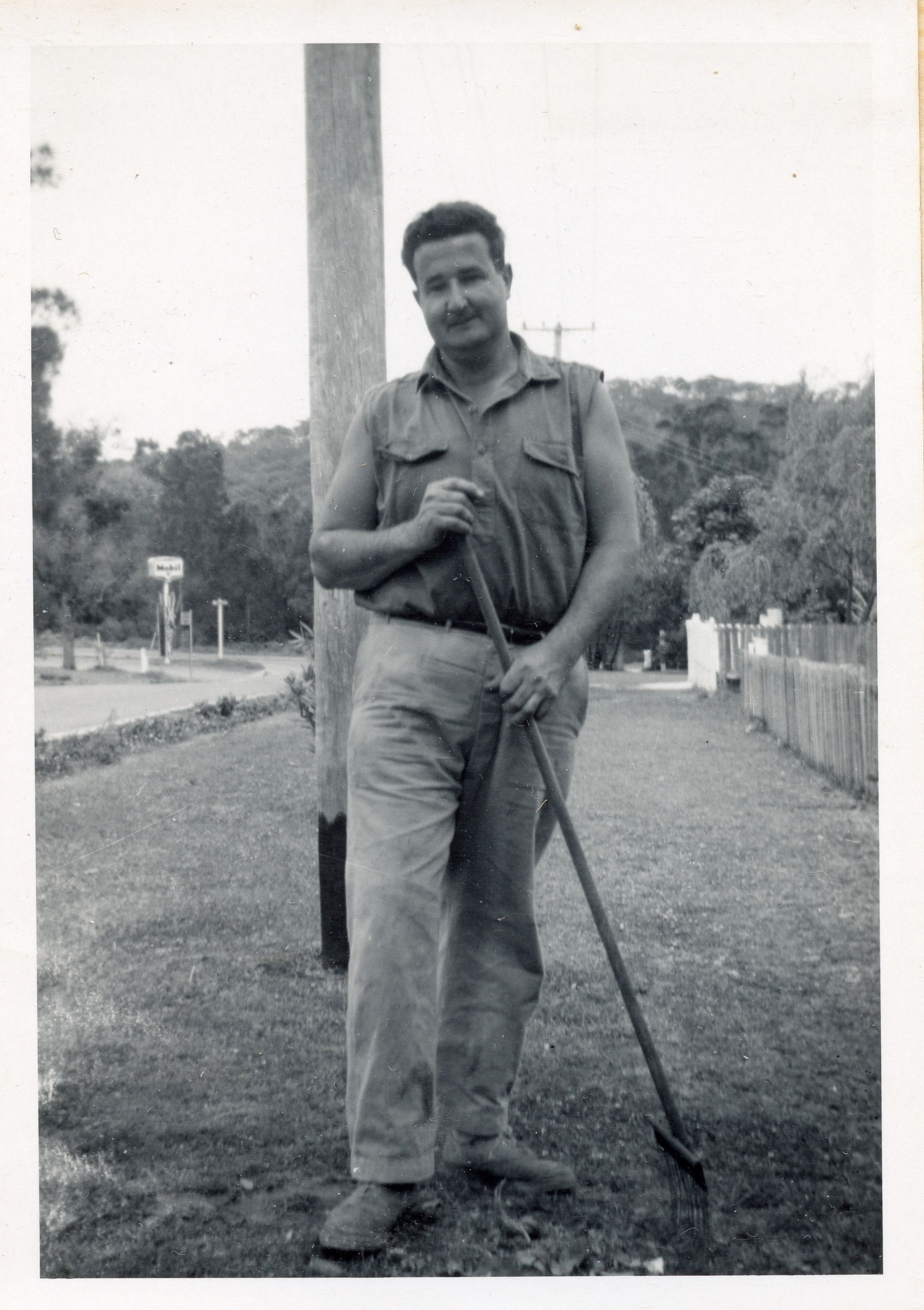
Photo of Frank (Francis) Tunney at his home on Careel Head Road shows it as a Mobil sign in background. Photo courtesy Tunney - Goddard families.
Bill Goddard recalls:
''I am not sure of the date of this photo. I remember a Col Mathews having the servo, when I was a kid, after that was the White family.''
Geoff Searl OAM, President of the Avalon Beach Historical Society, relates:
''The 'Whale Beach S/S’ was definitely a Mobil station initially run by the fabled Frank Gardner, shown here standing beside his stunning XK120 Jaguar.
Apparently Col Matthews took over in 1958 with the White Brothers assisting until they headed north to run the Ampol, originally on the Iluka Road and Barrenjoey Road northern intersection at Palm Beach.''
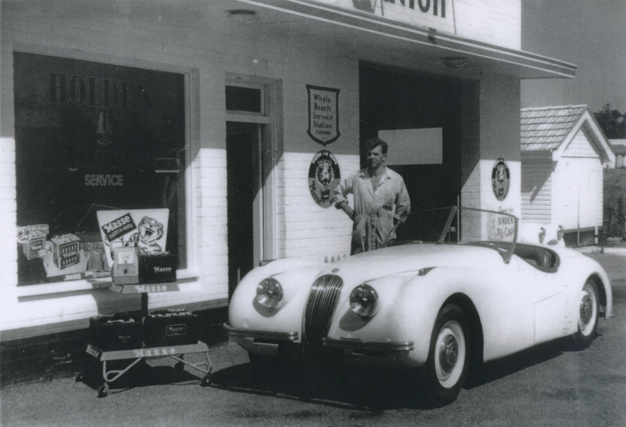
Frank Gardner, shown here standing beside his stunning XK120 Jaguar.at the Whale Beach Service Station on the corner of Barrenjoey and Careel Head Roads, during the mid to late 1950's.
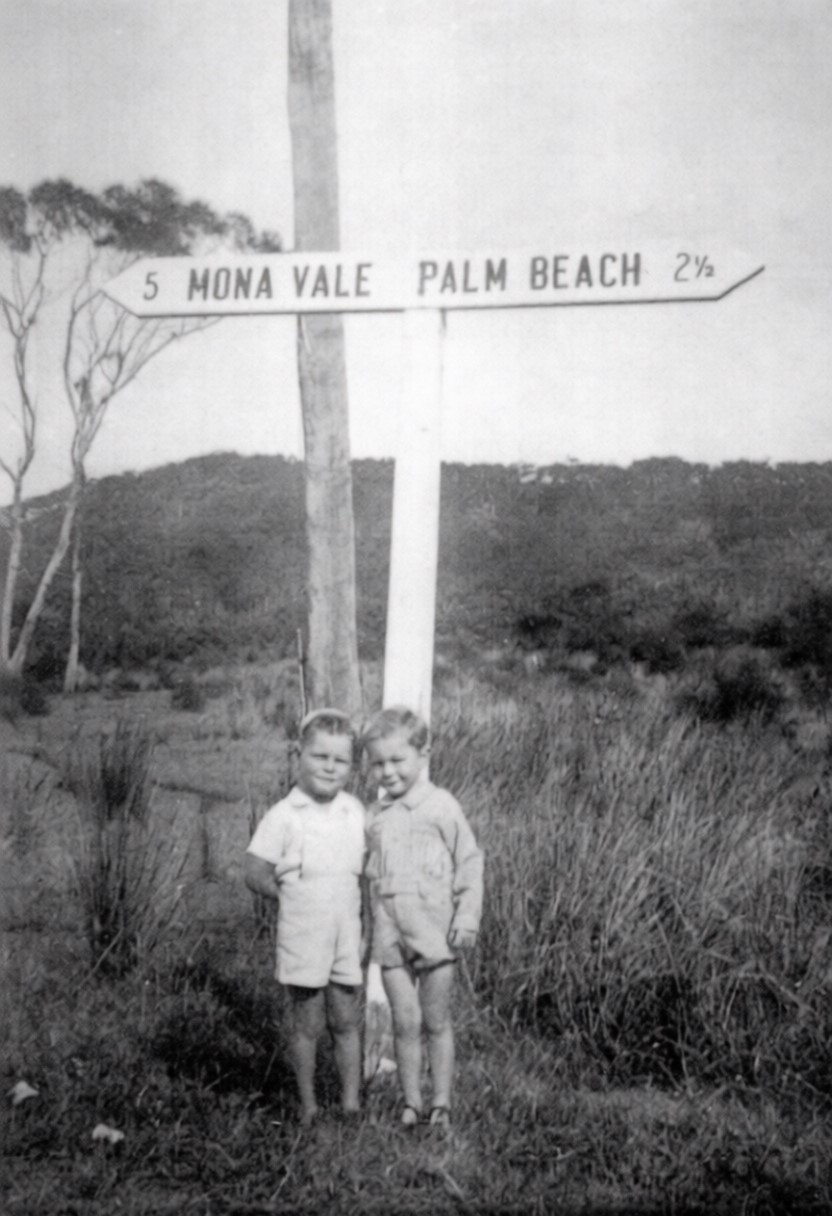
That’s Warren Hammond on the left at age 4.5 years and John Hirt, apparently on 4 May 1946. They are standing at the bus stop at the bottom of Careel Head Road on Barrenjoey Road (on the outgoing trip to Palmy). Almost opposite the later (?) Mobil servo. - So that's the then being filled in Careel Bay playing fields and former mangrove wetlands behind them. Info from either Deb or mum Peggy and Geoff Searl OAM, President Avalon Beach Historical Society. Photo: Bill Goddard and family albums.
Peter Verrills recalls Mobil petrol being sold at Careel Bay Boatshed as well.
Peter Verrills:
''It was ‘Fred’s Boats’ in those days, owned by a bloke called ‘Freddie Scharer’. I first came here in the late 1940’s, around 1950; I was just a kid who hung around the boatsheds. They used to hire out boats, sell fuel (Mobil) which was ‘look for the sign of the flying red horse’.
There used to be cows here then. Wilson’s the fishermen, they owned all the corner over there – they had a couple of cows and a horse or two. It was very country, so isolated, beautiful. No houses – they owned that all waterfront. A lot of timber was cut out of here which was loaded from the jetty. They did careening here too, these were only small boats of forty or fifty tons. The storms used to clean Careel Bay out, make it hard to get a good mooring on the eastern side of the bay. A lot of boats would drag their moorings in these storms. During this era they only had hand winches on the barges and this made it difficult to get a decent mooring laid. Those that are around now can put anything down, it’s totally different. Mind you there’s a lot more boats now.''
Colin Mathews went bankrupt here, possibly due to there by then being 9 service stations in the vicinity between Palm Beach, Avalon Beach and Clareville:
No 447 of 1967—Re Colin Mathews, trading as 'Whale Beach Service Station', Barrenjoey Road, North Avalon, service station proprietor. Date of presentation of petition—29th August, 1967. Date of sequestration order—9th October, 1967 . In the Federal Court of Bankruptcy, Bankruptcy District of the State of New South Wales and the Australian Capital Territory. (1967, October 19). Commonwealth of Australia Gazette (National : 1901 - 1973), p. 5817. Retrieved from http://nla.gov.au/nla.news-article241018696
Bankruptcy Court, Sydney. No. 447 of 1967—Re Colin Rupert Matthews, trading as 'Whale Beach Service Station ... ', Barrenjoey Road, North Avalon, service station proprietor. Date of first meeting of creditors—4th December at half-past Ten a.m., at Official Receiver's Office, Sydney. In the Federal Court of Bankruptcy, Bankruptcy District of the State of New South Wales and the Australian Capital Territory. (1967, November 16). Commonwealth of Australia Gazette (National : 1901 - 1973), p. 6319. Retrieved from http://nla.gov.au/nla.news-article241019291
Simon Lewis recalls working there: ''I worked at the Mobil garage on the corner of Careel head Rd & Barrenjoey roads in 1969-72 when the owners would go skiing on Narrabeen lakes. Petrol was apparently 32c per gallon (7c per litre). I'd help people search under the seats, in the ashtray etc for a 20c coin or two.''
Bill Solway and his then wife Gail took over the Service station and ran it from 1970 to 1973. Gail recalls:
''They put new petrol tanks in, they were only in 1 day and they floated to the top because it was 35ft below sea level so when the tide came in the tanks would flow to the top. They had to concrete them in. We had a safe in the office which always had water in it, the money use to float...''

Careel Head Road Service Station keyring courtesy Don and Mat Goddard - front and back
By the mid 1980's things had changed. An Application, and the difference between Crown Land Aerials taken in May 1984 and those taken in August 1986 shows a change in the structures at the corner of Careel Head and Barrenjoey roads.
The Report to WSC's Town Planning and Building Committee Meeting of the 1st October 1985 records:
Item 5. Decon Management P/L Cnr Barrenjoey & Careel Head Rds Matter: Deemed Refusal of DA lodged 8.5.85 not determined within 40 days Notice of discontinuance of appeal received 20.9.85. Ava].Conference on 16.8.85
The Report to WSC's Town Planning and Building Committee Meeting 5th November 1985 records:
CAREEL HEAD ROAD/CNR BARRENJOEY ROAD, AVALON - NEIGHBOURHOOD SHOPPING CENTRE . Notice of discontinuance of appeal was filed with the Land & Environment Court 20.9.85 and a modified consent has now been issued.
What the original DA was is not among the digitised Warringah Shire Council records.
Section from Crown Lands aerial taken 26.5.1984, shows two separate buildings
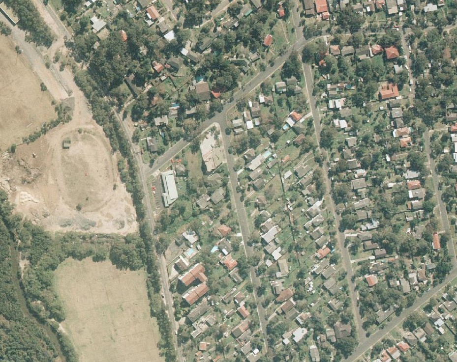
Section from Crown Lands aerial taken 19.8.1986, shows one alike that still in place
Patrick's Patisserie opened around 40 years ago this year, and Oliver’s Pie opened around 2012 - with several different owners over the years, including current owner Daniel Roberts of Oliver's who consistently wins awards for his pies.
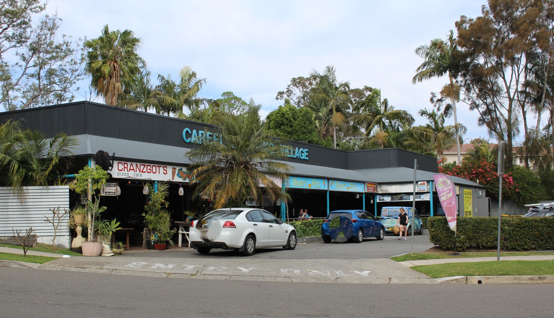
Where Cranzgots is used to be a roast chicken shop, the No Nonsense space in the corner was a Indian Restaurant, originally owned by Paul Birk, now of Seaforth, while the No Nonsense shop space alongside the north side of the pie shop was a laundromat before becoming 'The Little Oak Tree Cafe' for a short time. To the south end alongside the pie shop was a general store, with the last owners being Yousef and Faye, who lived, then in the El Cortigo units further along the road.
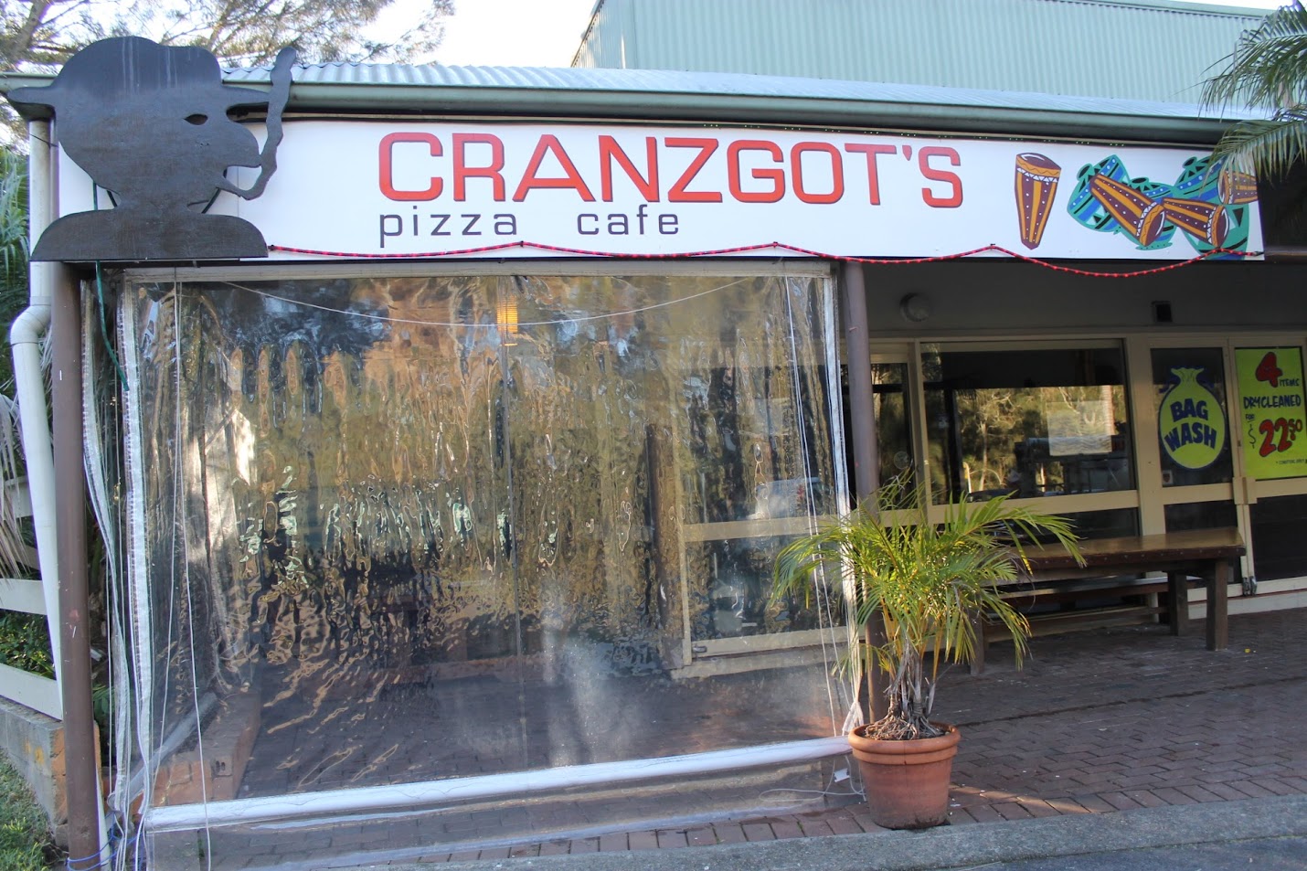
Cranzgots, July 3rd 2013 - note the Laundromat alongside this
Opposite the former Indian restaurant space was, most recently, Chris Hynes' 'Chick'n Shack', with some of the best burgers around.
-1500x1000.JPG?timestamp=1769319946131)
Chris inside and outside his shop in 2018
.jpg?timestamp=1769319991553)
A DA (DA2024/1091) puts all these lots back together again.
Exhibition Notice: 1 Careel Head Road
No Nonsense Avalon moving south
No Nonsense Avalon is a community based health and wellness business focussing on you as their priority.
The outfit has been successfully running its programs at the Careel Bay shops on Barrenjoey road for a few years now, but with plans to develop this site, they are fitting out the old Beachwood shop near Avalon Newsagency.
A move is imminent.
Pics taken Saturday October 26, 2024
The DA, approved in September 2025 through a Land and Environment Court action - ''Appeal Upheld with Amended Plans'' with the Judge accepting the NB Council’s submission that the amended application adequately responds to the concerns raised, despite residents still opposing this - is for Demolition works and construction of a mixed use development with basement (underground) parking comprising of retail uses and a childcare centre at 1-3 Careel Head Road. Cost of Work:$ 7,246,888.
There will be Zero setbacks with the structure meeting the 3 storey development approved at 5-7 Careel Head Road also given permission for zero setbacks, meaning there will be a wall to wall structures along this section of Careel Head road, completely blocking out the sun and views to the Bangalley Hills and south.
 zero setback.jpg?timestamp=1770140650855)
zero setbacks approved for 5-7 Careel Head road, East Careel Bay
In mid-December 2025, when most had clocked off for the year to rest, another application, solely advertised on the fence of 3 Careel Head Road, advised:
.jpg?timestamp=1770140335043)
Application for Dan Murphy's at Careel Head Road
.jpg?timestamp=1768876404214)
A Place of Flooding Creeks and Choked Drains
With Careel Creek at one end of this stretch of road and alongside it to Careel Bay, coupled with the North Bangalley and Burrowong Creeks running down, and those smaller drain-creeks north of Careel Head Road, it should come as no surprise that the embedded into these flows structures create flooding - with residents who live in this spot stating this is getting worse.
The whole of the Avalon Valley is threaded with creeks, some which overflow during downpours. One of the early ways people were required to address this was to raise the land they would build on and place homes themselves up on brick piles, alike what is seen in Brisbane in the 'Queenslander' style of architecture, only a lot closer to the ground, leading to inundation of some places, and homes, despite these measures. One aspect of this requirement related to preventing health issues, such as T.B. or diseases transmitted by mosquitoes in places where fallows filled with stagnant water helped these proliferate.
At the Avalon Beach Village end people were required to, by May 1934:
Department of Public Health,
Sydney, 23rd May, 1934.
PUBLIC HEALTH ACT; 1902, SECTION 55.
Unhealthy building land at Avalon, fronting Barrenjoey-road, Old Barrenjoey road, Avalon-parade and Central-road, Shire of Warringah.
THE Board of Health have reported that after due inquiry, they are of opinion that it would be prejudicial to health it certain land situated in the Shire of Warringah, and described in Schedules hereunder, were built upon in its present condition.
The Board of Health hare further reported that in order to render such land fit to be built upon it is necessary that:—
(a) the land be drained by properly constructed stormwater channels of capacity sufficient to carry off all water passing over the area;
(b) The surface of the land comprised in Schedule 1 be raised with clean soil or sand to conform to the following grades—
1. at Barrenjoey-road and Old Barrenjoey road to the height of the adjacent crown of those roads, rising therefrom on a grade of one in 100;
2. at the drainage easement or lane to a height 3 inches above the natural surface of the land, rising therefrom on a grade of one in 100;
(c) the surface of the land comprised in Schedule 2 be raised with clean soil or sand at the watercourse to a height 3 inches above the natural surface, rising therefrom on a grade of one in 100;
(d) all floors be laid on joists, the undersides of which shall be not less than 18 inches above the surface of the land when raised;
(e) the whole of the work be done to the satisfaction of the Board of Health.
Now, therefore, in pursuance of the power and authority vested in me by section 55 (1) of the Public Health Act, 1902, I hereby declare that such land shall not be built upon until the measures above referred to which are also specified in a document deposited in the office of the Local Authority (the Council of the Shire of Warringah) and open to, the inspection of any person, have been complied with, or until this notice has been revoked by me.
R. W. D. WEAVER, Minister for Health.
Schedule No. 1.
Commencing at a point 011 the north-western side of Old Barrenjoey road, being the southernmost corner of lot 10, d.p. 9,151; and bounded thence 011 the south-west by the south-western boundary of Jot 10 north-westerly to lane; thence by that lane north-easterly to Avalon-parade; thence by a line north-easterly to the westernmost corner of lot 13; thence by lane north-easterly to the northernmost corner of lot 20; thence by part of the north-eastern boundary of lot 20 south-easterly to a point 135 feet along that boundary north-westerly from Barrenjoey-road; thence by a line north-easterly to a point on the south-western boundary of lot 22, being 70 feet along that boundary from Barrenjoey-road thence by that boundary south-easterly to Barrenjoey Road; thence by lines bearing consecutively 37 degrees 185 feet, 47 degrees 310 feet, 122 degrees 125 feet, 189 degrees 250 feet, 196 degrees 0*50 feet; thence by a line southwesterly to the easternmost corner of lot*8, d.p. 13,975; thence by the south-eastern and south-western boundaries of lot 8 to the westernmost corner of lot 8; thence by a line south-westerly to the southernmost corner of lot 13, d.p. 12,047; thence by lane south-westerly to the*southernmost corner of lot "21; thence by the south-western boundary of lot 21 north-westerly' to Old Barrenjoey road; thence by Old Barren joey road north-easterly to the westernmost corner of lot 13; thence by a line northwesterly, to the point of commencement.
Schedule No. 2.
Commencing at a point on the north-eastern side of Avalon-parade, being the westernmost corner of lot 33, d.p. 9,151; and bounded thence on the south-west by Avalon-parade north-westerly to the westernmost corner of lot 52; thence by the north-western boundary of lot 52 north-easterly 80 feet; thence by a line parallel to Avalon-parade north-westerly to the south-eastern boundary of lot 60; thence by a line north-westerly to the north-western boundary of lot 66, beings point 190 feet north-easterly along that boundary from Avalon-parade; thence by that boundary north-easterly 430 feet; thence by a line south-easterly to the south-eastern boundary of lot 37, being a point 30 feet north-easterly from the southernmost corner of lot 37; thence by a line parallel to the south-western boundary of lot 36 south-easterly to the south-eastern boundary of lot 34; thence by a line south-easterly to the southernmost corner of lot 33; thence by a line bearing 116 degrees 160 feet; and by a line north-easterly to the northernmost corner of lot 20; thence by lane south-westerly, to the point of commencement. PUBLIC HEALTH ACT, 1902, SECTION 55. (1934, May 25). Government Gazette of the State of New South Wales (Sydney, NSW : 1901 - 2001), p. 2030. Retrieved from http://nla.gov.au/nla.news-article223060059
Flooding at Corner of Careel Head - Barrenjoey Roads
WSC Minutes Ordinary Meeting 6.2.67. record:
By Cr.Creagh: Would the Engineer investigate the deterioration of the roadway at the entrance to Careel Head Road, near Barrenjoey Road, North Avalon, and bring forward an estimate of the cost to rectify it? I will refer it to the Engineer.
As seen under the creeklines timeline, this Report by Shire Engineer dated 4th July, 1967 records the pipes going in:
SECTION 2 _WORKS MATTERS. WI, WORKS IN HAND, COMPLETED OR ANTICIPATED TO COMMENCE. CONSTRUCTION. (a) WORKS COMPLETED DURING PERIOD ENDING 26.6.67: ... WORKS IN HAND AS AT 26/6/67. Burrawong Road, North Avalon. 50 lin.ft. of 21*; dia., 26 lin.ft. of 18*; dia., 80 lin.ft. of 15*; dia. pipes laid and backfilled. Seven concrete gully pits constructed. Careel Head Road, Careel Bay. Section of Careel Head Road at intersection with Barrenjoey Road excavated to depth of 3', excavation filled with 180 c.yds. of sand and covered with 120 c.yds. of road base. Tumburra Road, Tumbledown Dick. A further 1700 c.yds. of ripped sandstone placed and graded into fill areas and 40 lin.ft. of 12*;dia. pipes laid in culvert construction.
Report to Works Committee Meeting, 12th March 1985 TO:
The General Manager/Shire Clerk 6.1 PROPOSED RECONSTRUCTIC& OF BURRAWONG ROAD, AVALON FROM NO.4 NEAR WHALE BEACH ROAD TO NO.30 NEAR CAREEL HEAD ROAD. (File: ESF 175) Deign details have been prepared and are tabled showing the proposed L fconstruction of the above section of Burrawong Ave, Avalon. Details of the main features of the proposal are as follows:- Plan No A47524 Length 195m Proposed Work Rerb construction and pavement widening on the western side. Ll Classification Local Bus Route No AADT 200 Road Width 20.1 Proposed C/Way 9.8 Proposed F/Path 4.9 and 5.4 Width Land Acg Involved NIL St Tree Removals NIL Public Ut Alts NIL Comments Road and access levels will not be substantially altered. Accordingly, no action under section 264 of the Local Government Act is proposed. Carriageway width has been selected to suit existing kerb and gutter. Li PAGE 58 Minutes Special Meeting - Warringah Shire Council 12th March 1985
In December 2022 former Pittwater MP Rob Stokes announced funding for the footpath under the Get NSW Active program for a section of this road. The amount of $971,000 was for a new footpath, kerbs, gutters and drainage along the eastern side of Barrenjoey Road, North Avalon between Careel Head Road and Currawong Avenue.
Kerb and guttering systems, typically constructed from concrete, are essential infrastructure that separate road pavements from nature strips, providing effective stormwater drainage, structural support to roads, and enhanced, safer, streets. They are crucial for controlling runoff and reducing road damage.
The works commenced in June 2023.
By early November 2023 the footpath was almost completed. However, due the plan for same being changed by the council the same organisation stated there was not enough money left to complete the works as originally specified - namely, no guttering would be done along the section where it floods from Etival street up to Careel Head Road.
The 'retaining walls' were also changed from being made from being Besser blocks to a much lower in height slab of concrete the contractors simply poured and stood up onsite, in another cost-cutting measure.
Residents along that flooding stretch were told this would all be completed in full once money could be allocated to the complete the project, at some future stage.
From the PON November 2023 Community News page:
Footpath For Careel Bay To Currawong Avenue Palm Beach: Update
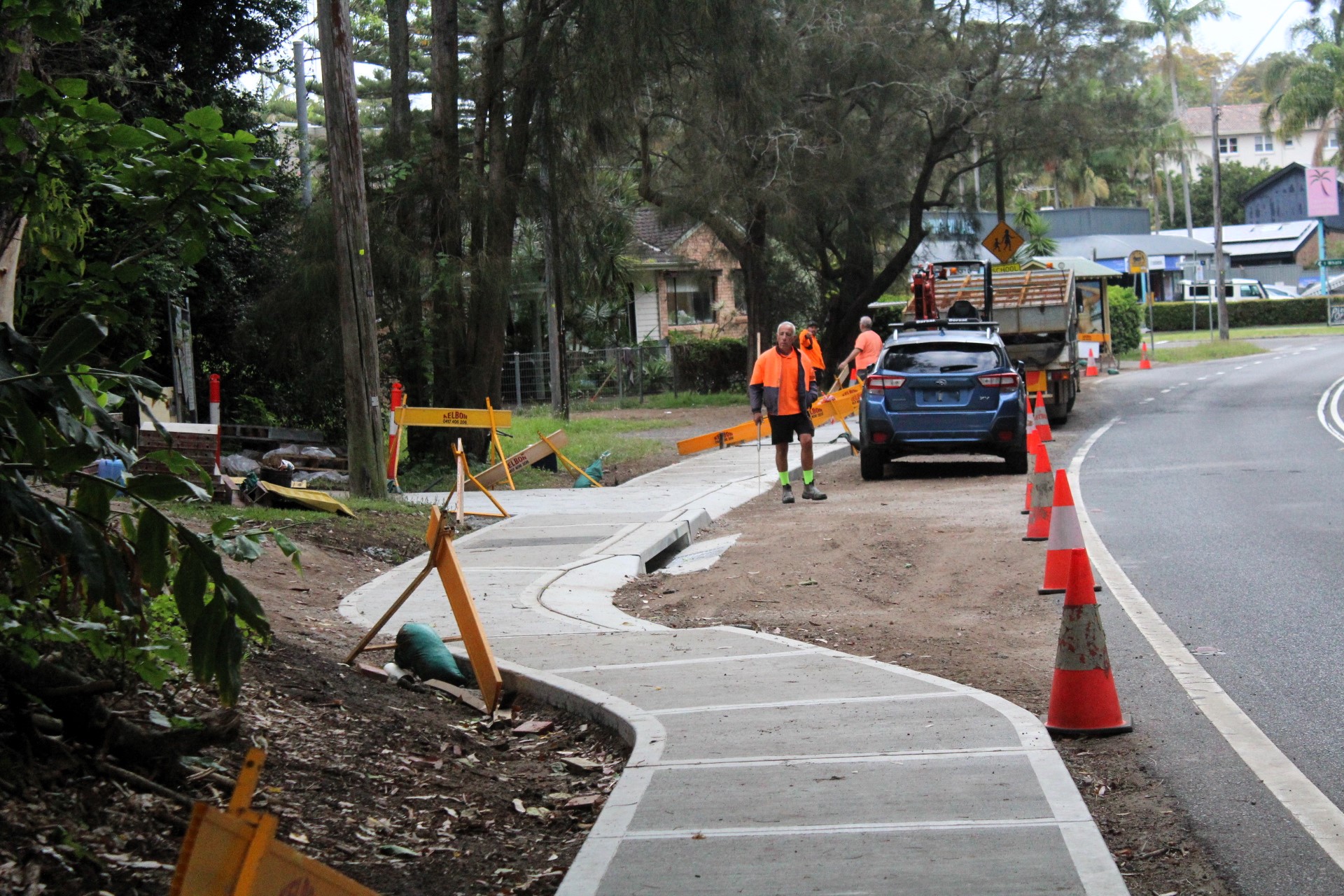
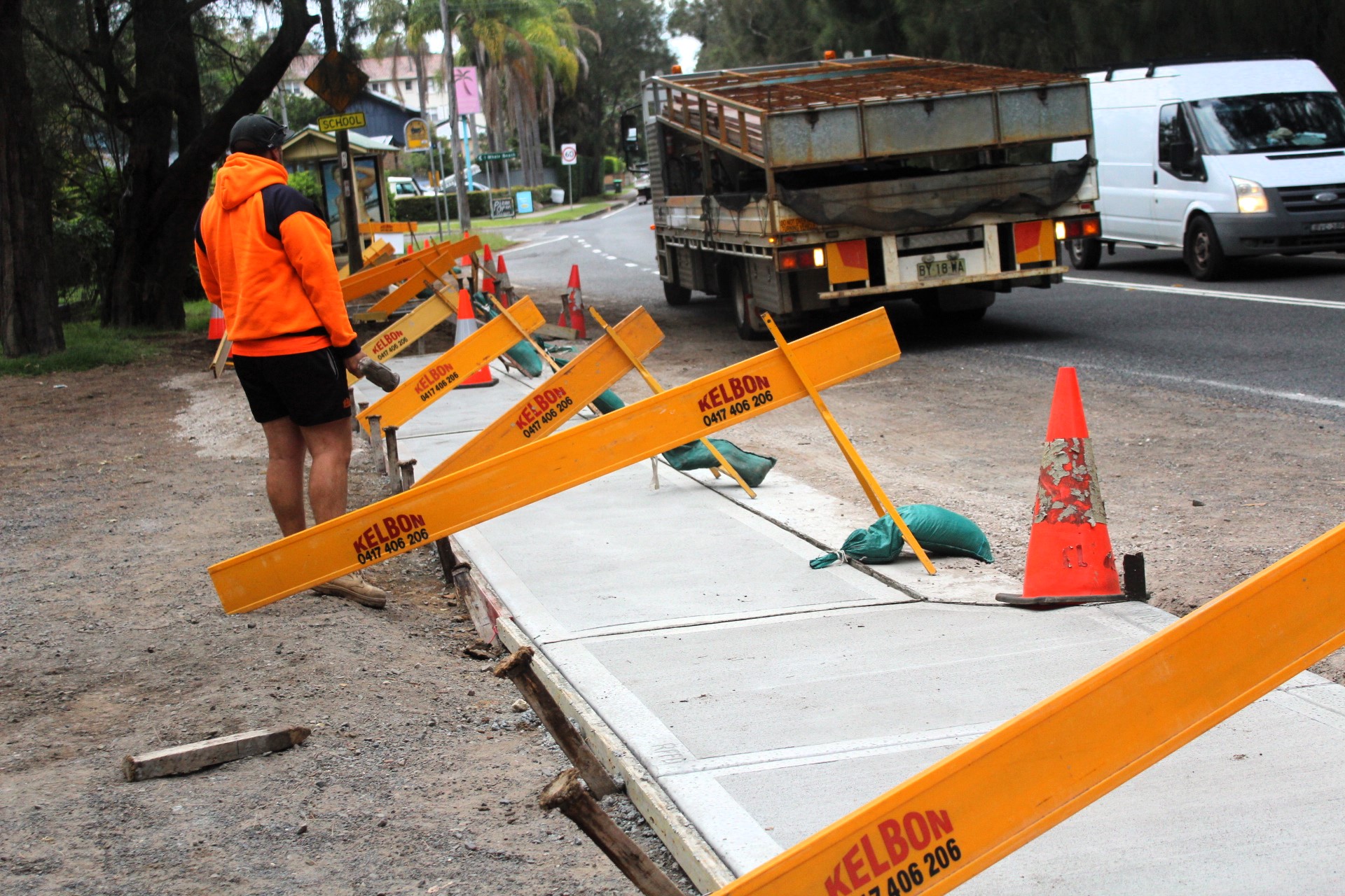
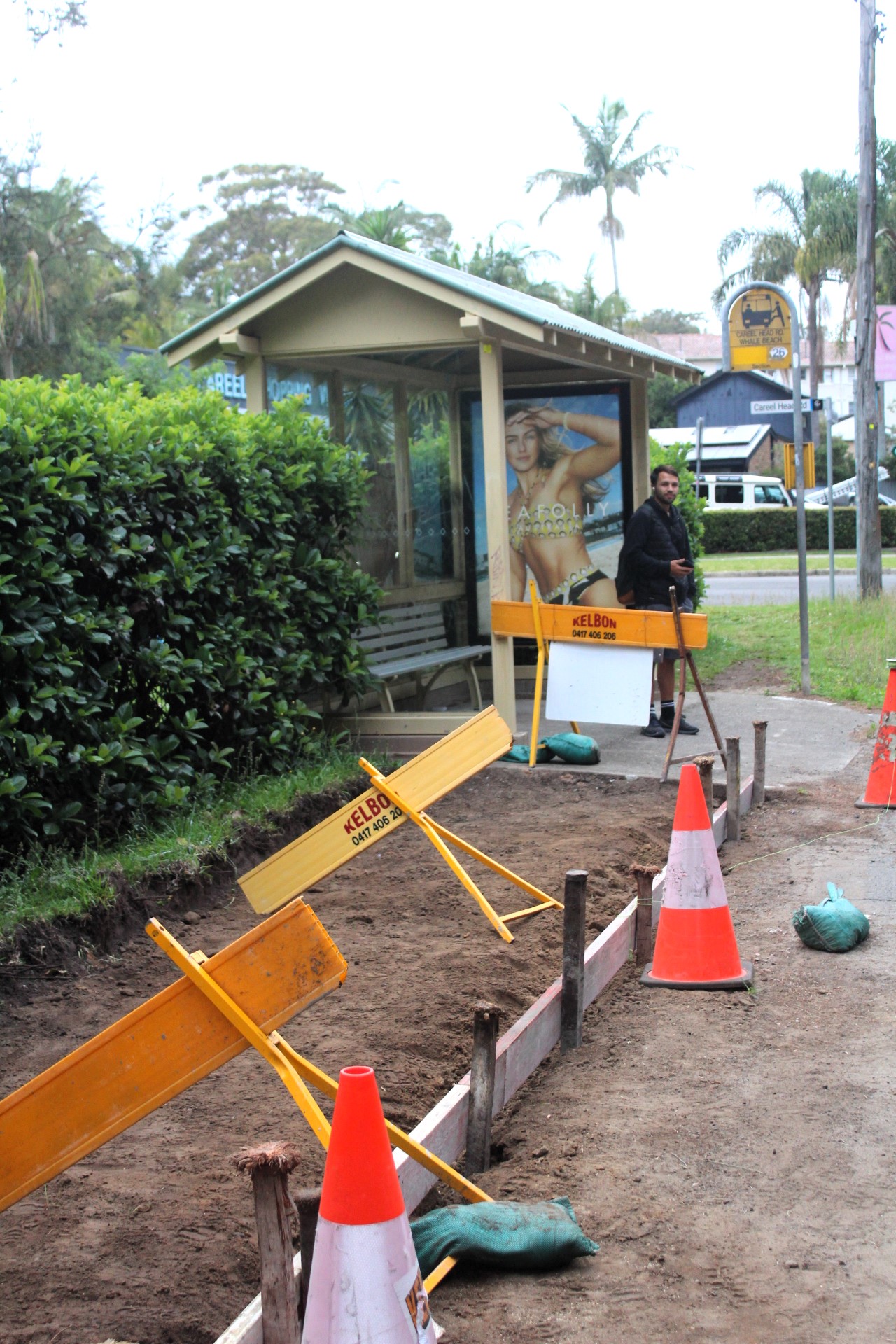
- $971,000 for a new footpath, kerbs, gutters and drainage along the eastern side of Barrenjoey Road, North Avalon between Careel Head Road and Currawong Avenue.
- $369,000 for a new footpath on the northern side of Turimetta Street, Mona Vale to complete the missing connection between Mona Vale Police Station and George Mockler House, a strategic walking connection to Mona Vale, schools and the B-Line.
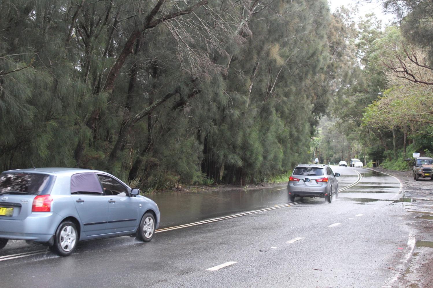
.JPG?timestamp=1752944543816)
Above and Below: Bangalley creek overflowing onto Barrenjoey road at 1 Careel Head road - it stayed like this from mid-May 2025 to third week of June 2025, the footpath was unusable, unless you wanted a truck splashed muddy drenching - cars driving north (right side of road) had to slow down for car on the left moving into their lane
.JPG?timestamp=1752944940314)
Same spot, April 28, 2025:
.JPG?timestamp=1752945508773)
.JPG?timestamp=1752945808728)
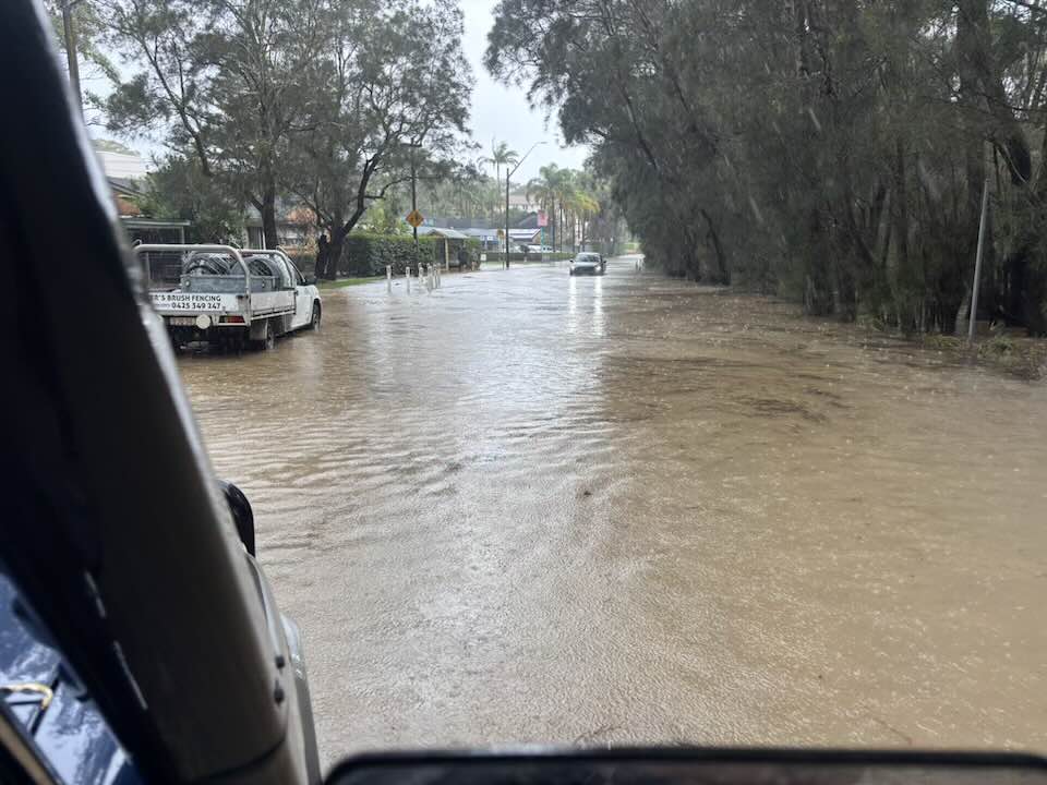
Careel Head-Barrenjoey Road section, January 17 2026 - more flooding, more often. Photo: Adam L'Green/FB

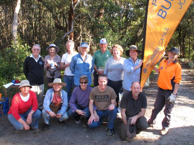 PNHA:
PNHA:
We had an excellent time and planted lots of Swamp Mahogany, Bangalay, Sword Sedge, Carex and moisture loving plants to turn this once weedy area back to good bush.
Since 1990 bush regeneration projects are replacing weeds and recreating valuable fauna habitat. To provide a link to Careel Bay, Careel Creek’s banks are being progressively re-vegetated with local native plants. Help us continue the successful restoration of Careel Creek’s unique environment on Saturday 20 July.
This project is being funded by a Community Action grant to Pittwater Natural Heritage Association, in partnership with Pittwater Council. The grant is from the Federal Government via Hawkesbury Nepean Catchment Authority.
More in: Careel Creek Bushcare Group 1990 To 2019
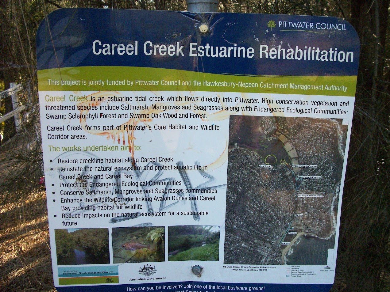
September 2012 signboard
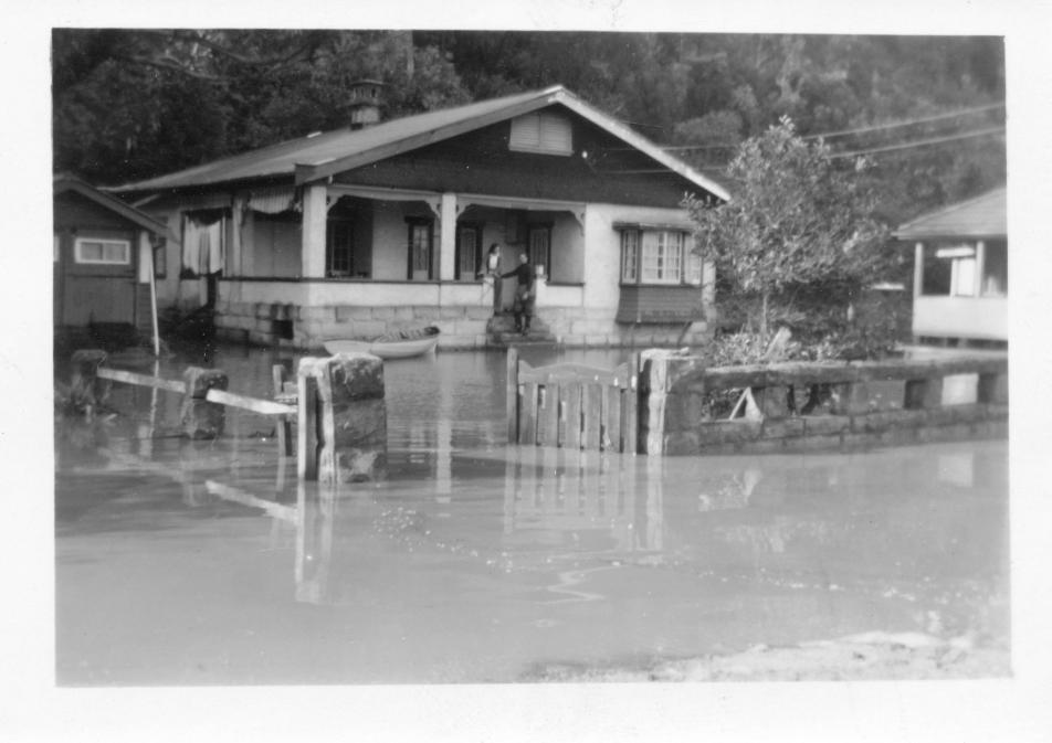
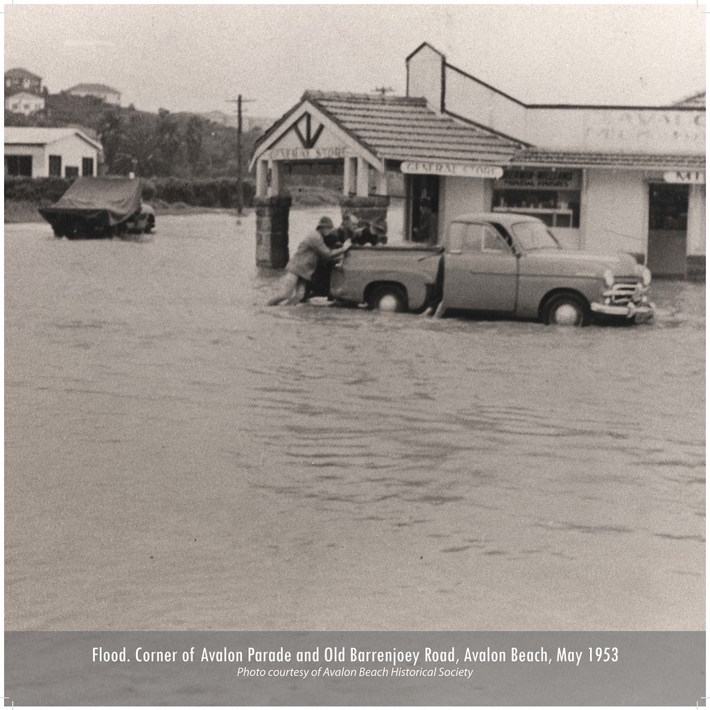
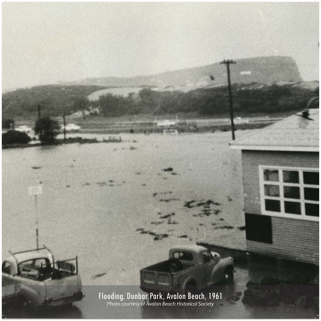
These photos, taken in May 1974 by John Stone, shows Old Barrenjoey Rd in flood.
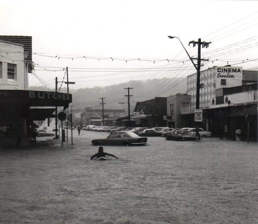
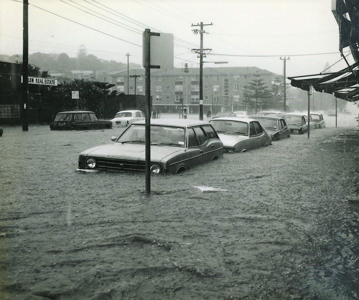
Photos courtesy John Stone and ABHS
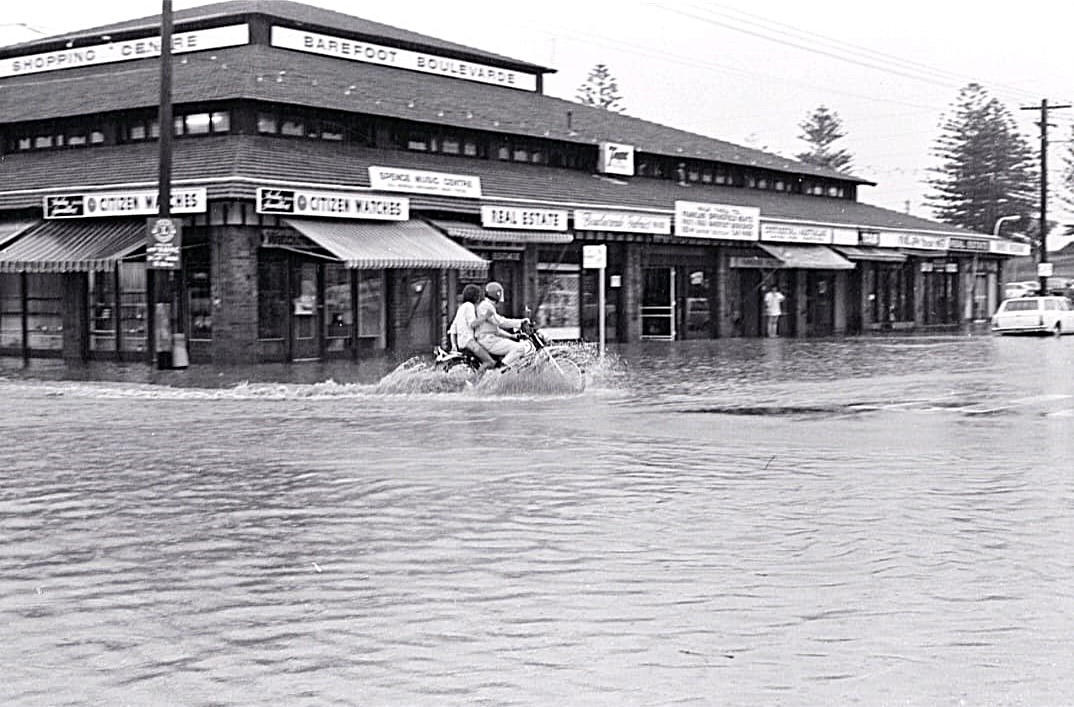
Giles Stoddart of Avalon Honey:
I lost two of my colonies of bees when Careel Creek flooded in March 2022 during heavy rains and a king tide that meant there was nowhere for the rain to go except into people’s gardens and houses. I have a couple in North Avalon that host hives for me in their back garden, which backs on to Careel Creek. We had agreed on a location for the bees which was away from the house, and unfortunately the garden flooded very quickly before I could get there to move the hives. I was devastated and I tried to save the colony, but despite many thousands of bee surviving the flood and me giving them a new dry home with food, they never really became strong enough to survive the cooler Winter weather.
Avalon Honey's Giles trying to save his bees:
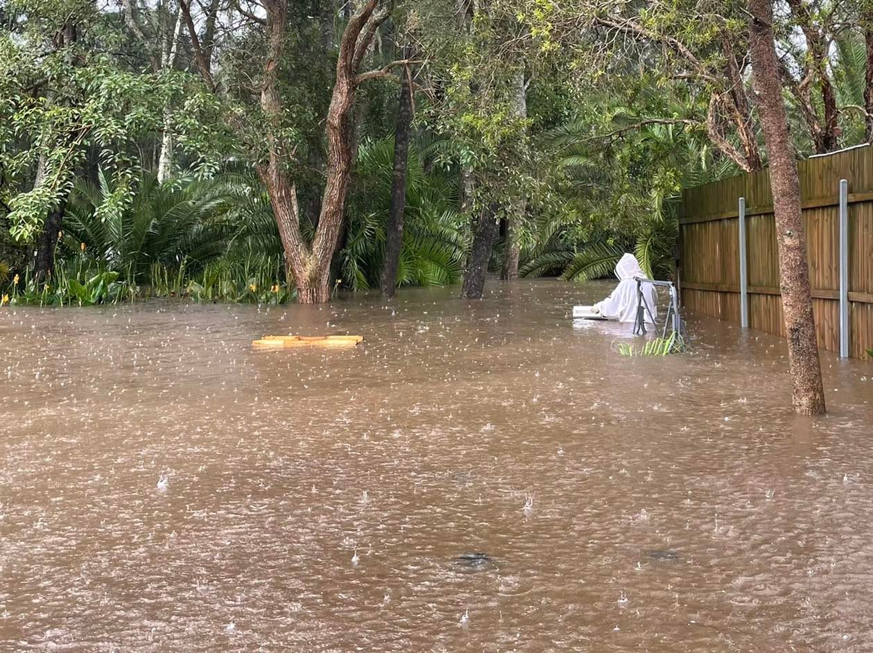
In May 2024 the valley of Avalon and Bilgola Plateau has been reminded this week that it was once a marshy floodplain called 'Priests' Flat' alongside the beach from Kamikazee corner to the mangroves of Careel Bay and that even though those water channels may now be funnelled into concrete pipes, they may still reappear during prolonged downpours of rain.
A few weeks later (video supplied):
References - Extras
- My Holiday by Charles de Boos – 1861
- Archpriest John Joseph Therry 1790 - May 25, 1864
- The Collaroy Paddle Steamer: New Ephemera Added To Public Records - Her Connections To Pittwater
- Careel Bay Steamer Wharf and Boatshed
- John Collins (of Avalon)
- Pittwater Roads II: Where The Streets Have Your Name - Careel Bay
- Pittwater Roads II: Where the Streets Have Your Name - Whale Beach
- Whale Beach Ocean Reserve: 'The Strand' - some history on another great Protected Pittwater Reserve
- Pittwater Restaurants you could stay at Jonah's Road House – Whale Beach (original 2015 version) - 2024 95 years of Jonah's celebratory rerun
- How Camping and Campers At Whale Beach Helped The Whale Beach SLSC Save Lives
- Peter Verrills - Profile
- Albert George Verrills 1886-1960
- Tom Gilbert, 4th Of February 1941 - 27th Of April 2020 - Tribute and earlier Profile
- Avalon Beach Historical Society's September 2024 Meeting speaker: Ray Henman ACS on 70+ years of living in Pittwater
- Ray Henman ACS - Profile
- Peter Carter - Profile
- Goddard Family History Website by William (Bill) James Goddard II
- Grace Brook, 1921-2017, of North Avalon, by Paul McGrath and Robin Bayes
- Pittwater's Koalas Driven to Extinction: Some History
- Bayview Koala Sanctuary
- Barrenjoey Road - Careel Head Road Corner Creeks Overflow: July 2 2024 - the drains in Pittwater are just for rain
- Trove - National Library of Australia
- Avalon Beach Historical Society records and Geoff Searl OAM
- The NSW Historical Land Records Viewer (HLRV)
- NSW Records and Archives - digitised records now held by Museums of History NSW
- NSW Government Historical, Aerial and Satellite Imagery (Crown Lands) and the Historical Imagery Viewer, as part of the Spatial Collaboration Portal
- Manly Warringah: People Places & Pastimes. During the 30’s. Pittwater-Narrabeen Local History Resource Unit, 1985. Interview with Mrs. Hammond
- Careel Bay Playing Fields Reserve - Including Hitchcock Park: Birds, Boots & Beauty - History
- Careel Bay Saltmarsh plants
- Careel Creek - If you rebuild it they will come - 2012 bushcare works succeed in attracting native wildlife back
- Careel Bay Birds - 2013
- Careel Creek Bushcare Group 1990 To 2019
- Barrenjoey Road - Careel Head Road Corner Creeks Overflow: July 2 2024 - the drains in Pittwater are just for rain
- Avalon Beach This Week: A Place Of A Bursting Main, Flooding Drains + Falling Boulders - Council Announces Intention To Progress One LEP For Whole LGA + Transport Oriented Development Begins - May 2024 report
- Crown Reserves Grants 2025 Announced: Local focus on Weeds + Repairs to Long Reef Boardwalk + some pictures of council's recent works at Hitchcock Park - Careel Bay playing fields - July 2025 report
- Avalon's 'Telford' Road to have signage about its Heritage
- Pittwater Beach Reserves have been dedicated for public use since 1887 - No 1.: Avalon Beach Reserve- Bequeathed by john Therry
- Reginald Charles Wood (Reg) - Tribute of 2021 (from prior Profile)
- Perfect Send Off For Two ABSLSC Club Legends - Life Members Reg Wood And Don "Imo" Imison
- Stokes Point Careel Bay: The Shift From Warner's Hut In 1813 To Finisterre In 1924; 1934 Additions Probably Designed By Australia's First Female Architect, Beatrice (Bea) May Hutton - A Pittwater Rendezvous Site For Royal Sydney Yacht Squadron Members Is Still A Home With A View For Those With A Passion For Sailing
- Katandra Bushland Sanctuary
- Annie Wyatt Reserve: Palm Beach - Pittwater Fields of Dreams II
- The Old Road To Narrabeen - The Unspoilt Days Of 100 Years Ago When You Could Still See The Sea
- Black Duck Songline through Careel Bay: Ellis Rowan's Adventures In Painting Birds, Flowers And Insects: 'This Meant That I Was Tapu - Sacred - Because I Painted The Birds'
- Butter Churns and Milk Separators: Where Taste Comes From + Early Pittwater Dairies
- Over 5 million birds counted: Aussie Bird Count 2020 - Local by postcode statistics for our area
- Garrett, W., & Garrett, N. (1975). Census of Birds at Careel Bay, NSW. Emu - Austral Ornithology, 75(2), 85–86. https://doi.org/10.1071/MU9750085
- CHANGES IN COASTAL WETLAND HABITATS IN CAREEL BAY, PITTWATER, NSW, FROM 1940 TO 1996. W KM - Wetlands (Australia), 2001 - researchgate.net [PDF]… This paper presents a case study of mangrove and saltmarsh changes in Careel Bay, Pittwater, over the past 56 years, where substantial saltmarsh decline has occurred.
- Hutchings, P. A., and RECHER HF. "The fauna of Careel Bay with comments on the ecology of mangrove and sea-grass communities." (1974).
- Smith, Peter, and Judy Smith. "Waterbird Survey of Careel Bay." (2001). ... … In 1997 we carried out a study of the birds of Careel Bay, their habitats and their … of the Careel Bay wetlands. Our 1997 survey indicated that the waterbird fauna at Careel Bay had - commissioned by Pittwater Council ]PDF].
- Hutchings, P., & Rainer, S. (1979). The polychaete fauna of Careel Bay, Pittwater, New South Wales, Australia. Journal of Natural History, 13(6), 745–796. https://doi.org/10.1080/00222937900770561
- Elizabeth Kennedy. Artifacts from Careel Bay and Avalon. First published: June 1934 https://doi.org/10.1111/j.1835-9310.1934.tb00076.xDigital
- BANGALLEY HEADLAND RESERVE AND NORTH AVALON HEADLAND PLAN OF MANAGEMENT. Pittwater Council - Adopted 21 October 2002
- Bangalley Seeds - July 2011, Pittwater Online News Pictorial for Issue 15
- Bangalley Headland, Pittwater Council's Self Guided Walk, Pittwater Online News, July 2014, Issue 170
- Traces Of WWII Coast Watchers (1942) Found On Bangalley Headland After Recent Fire, Pittwater Online News, October 2017, Issue 332
- Pittwater's Ground Nesting Birds, Pittwater Online News, July 2021, Issue 502
- Bangalley Headland Walk: Spring 2023, photos by Kevin Murray and Joe Mills, Pittwater Online News, October 2023, Issue 603
- Careel House - History
- Careel Creek Bushcare Group 1990 To 2019
- Crown Reserves Grants 2025 Announced: Local focus on Weeds + Repairs to Long Reef Boardwalk + some pictures of council's recent works at Hitchcock Park - Careel Bay playing fields
Plan of Management for Bangalley Headland Bush Reserve - Pittwater Council
The Pittwater Council Plan of Management for Bangalley Headland Bush Reserve describes what landscape was here prior to urbanisation and is filled with a long list of plants and description of the landscape as Open Woodland/Open-forest, Coastal Scrub - both Shale and Sandstone, Low Heath; Bangalley Head is the only location for this plant community in the Pittwater local government area, and several Significant Plant Species.
The full list in this document is:
Within the escarpment are a number of vertical doleritic dykes including St Michaels Cave. These were probably formed during the Jurassic era. St Michael’s Cave is a significant geological feature that extends approximately 110 metres into the cliff face. The dolerite is evident in a band approximately one meter in width at the roof of the cave. The cave has a maximum height and width of 15 metres and 10 metres respectively (Coffey & Partners, 1987).
The ridge crest geology is Hawkesbury sandstone of medium to coarse-grained quartz sandstone, with very minor shale and laminite lenses. A short distance down slope, the Narrabeen shales and sandstones of the Newport Formation outcrop. These sediments underlie most of the Reserves.
The North Head soil landscape occurs on the relatively level crest of the reserve. Below the crest is soil of the Hawkesbury landscape, characterised by the large percentage of rock outcrop. Both these soil landscapes are generally, shallow, stony, highly permeable and of low fertility.
North Avalon Head and a narrow band between Careel and Bangalley Heads has soil of the Watagan landscape which is derived from Narrabeen Sandstone. It is deeper and more fertile than the Hawkesbury sandstone soil. The lower slopes, e.g. near Whale Beach Road, have soils of the Erina landscape, which are also derived from sandstones, and claystones of the Narrabeen sandstone.
The distribution of plant communities in Bangalley and North Avalon Headland Reserves were re-assessed as part of the development of this management plan. This description of plant communities is based on earlier work by Marita Macrae, field observations, aerial photograph interpretation and consultation with Chris Wright, Council's Senior Bush Regenerator. This management plan identifies six plant communities within the area.
Open Woodland/Open-forest
The northern part of the reserve and west facing slopes support a woodland or open-forest dominated by Scribbly Gum (Eucalyptus haemastoma), Sydney Peppermint (E. piperita), Red Bloodwood (Corymbia gummifera) and Broad-leaved Mahogany (E. umbra). This community apparently occurs on the upper strata of Narrabeen group sediments. Scribbly Gum is more frequent on crests whilst Sydney Peppermint increases in abundance on slopes.
Associated tree species include Bangalay (E. botryoides) and Rough-barked Apple (Angophora floribunda).
Shrub species present include Black She-Oak (Allocasuarina littoralis), Scrub She-Oak (Allocasuarina distyla), Coast Banksia (Banksia integrifolia), Hairpin Banksia (Banksia spinulosa), Breynia oblongifolia, Hopbush (Dodonaea triquetra), Dogwood (Jacksonia scoparia), Lasiopetalum ferrugineum, Mock Olive (Notelaea longifolia) and Persoonia linearis.
Ground layer species include Entolasia marginata, Dianella caerulea var. producta, Burrawang (Macrozamia communis), Blady Grass (Imperata cylindrica), Xanthorrhoea media and Kangaroo Grass (Themeda australis).
Low Open Forest
A sheltered gully below a cliff to the south of the trig supports a low open-forest dominated by Lilly-Pilly (Acmena smithii) and Rusty Fig (Ficus rubiginosa). Emergent trees of Coast Banksia (Banksia integrifolia) are present through the community. Another small tree species present is Grey Myrtle (Backhousia myrtifolia).
Shrub species present include Scrub She-Oak, Heath-leaved Banksia (Banksia ericifolia) and Melaleuca hypericifolia.
The community includes a number of species of vines and a diversity of ferns. These species include Common Maidenhair (Adiantum aethiopicum), Rasp Fern (Doodia aspera), Lawyer Vine (Smilax australis), False Sarsaparilla (Smilax glyciphylla) and Coral Fern (Gleichenia dicarpa). Of particular interest is the closed canopy that occurs when Cissus antarctica and Cissus hypoglauca fill the gaps of the otherwise open canopy of this community.
This community is a depauperate form of littoral rainforest and is of local conservation significance as examples of littoral rainforest remaining in the Pittwater local government area are extremely rare.
Broad-leaved Mahogany Woodland
Woodland or low woodland dominated by Broad-leaved Mahogany (Eucalyptus umbra) occurs on Hawkesbury Sandstone near Bangalley Trig and on nearby west and north facing slopes.
Associated tall shrub species include Coast Banksia and Scrub She-Oak. Smaller shrub species include Acacia myrtifolia, Sweet-Scented Wattle (Acacia suaveolens), Hopbush, Pultenaea daphnoides, Hakea gibbosa and Leucopogon juniperinus.
Ground layer species include Dianella caerulea var. producta, Flannel Flower (Actinotus helianthi), Swamp Pennywort (Centella asiatica), Kidney Weed (Dichondra repens) and Spiny Mat-Rush (Lomandra longifolia).
Bangalley Head is the only location for this community in the Pittwater local government area due to the restricted nature of the soil landscape on which it occurs, hence is of local conservation significance.
Coastal Scrub, Shale
Lower slopes, south west of Bangalley Trig and south of North Avalon head support a scrub community dominated by Coastal Teatree (Leptospermum laevigatum), Coast Banksia and Coast Wattle (Acacia sophorae).
There is a ground layer of medium density, with a range of grasses, vines and grass-like plants. These include Kangaroo Grass, Sea Rush (Juncus krausii), Dusky Coral Pea (Kennedia rubicunda), Dianella revoluta, Spiny Mat-rush, Scented Marsdenia (Marsdenia suaveolens) and Old Man's Beard (Clematis aristata).
This community is present in a number of coastal reserves within the Pittwater local government area.
Coastal Scrub, Sandstone
The spine of the spur leading south from Bangalley Trig and rocky areas between the Trig and the Lilly-Pilly Low Open Forest support a closed scrub community dominated by Scrub She-Oak and Coast Banksia.
Associated shrub species include Coast Wattle, Coastal Teatree, Hakea gibbosa, Hakea dactyloides, Lasiopetalum ferrugineum, Epacris pulchella, Grevillea sericea, Melaleuca hypericifolia and Zieria laevigata.
The ground layer is generally sparse. Common ground layer species include Spiny MatRush, Common Maidenhair, False Bracken (Calochlaena dubia), Weeping Meadow Grass (Microlaena stipoides) and Oplismenus imbecillis.
This community is similar to coastal scrub communities which occur elsewhere in the Pittwater local government area, such as at Attunga Reserve and on Barrenjoey Head.
Low Heath
Bangalley Head She-Oak Closed Heath occurs in the area around Bangalley Trig and the headland to the east supports a closed heath community dominated by Scrub She-Oak.
Associated shrub species include Acacia myrtifolia, Heath-leaved Banksia, Melaleuca hypericifolia, Epacris pulchella, Hakea gibbosa and Leucopogon juniperinus.
Ground layer species include Opercularia aspera, Billardiera scandens, Kangaroo Grass, Spiny Mat-Rush and Entolasia stricta.
Bangalley Head is the only location for this plant community in the Pittwater local government area, hence is of local conservation significance.
Significant Plant Species
Rulingia hermaniifolia is a low, spreading shrub with small, wrinkled leaves. It occurs along the coast from Jervis Bay to Broken Bay (Bouddi National Park) and is coded 3RCa on the ROTAP database (Briggs & Leigh, 1995). In Pittwater, it is only known from Bangalley Head.
Black Plum (Diospyros australis) is a tall shrub or small tree, the leaves of which have a pale yellowish-green undersurface. It occurs in coastal rainforests from southern NSW to north Queensland. The only other known locations in Pittwater are Barrenjoey Head, Avalon Dunes, Palmgrove Park and a remnant tree in Coonanga Rd, Avalon. It is also known from Bouddi and Royal National Parks.
Bolwarra (Eupomatia laurina) is a shrub or small tree with spreading branches from near the base. It occurs in rainforest or wet forests along the coast and Blue Mountains, including Darling Mills Creek at Baulkham Hills and Royal and Ku-ring-gai Chase National Parks. Apart from Bangalley Reserve and North Avalon Headland Reserve, it has been recorded at Loquat Valley Reserve, Crown of Newport Reserve, Angophora Reserve, Stapleton Park, McKay Reserve and nearby private lands.
Fauna
Threatened Fauna
St Michael’s Cave is a very significant fauna habitat as it is used for roosting by several hundred Common Bentwing Bats (Miniopterus schreibersii) and some Large-eared Pied Bats (Chalinolobus dwyeri). Both species are listed as vulnerable under the Threatened Species Conservation Act, 1995. The bats in St Michael’s Cave were commented upon as early as 1862 by a visiting member of the St Benedict's Society as "flitting to and for through the gloom (conjuring) up dramatic scenes, such as the Weird Sisters in Macbeth".
Although trapping and spotlighting surveys have failed to detect the Squirrel Glider, the Reserve provides potential habitat. It has been recorded less than a kilometre away at Careel Bay and is favoured by the presence in the reserve of suitable tree hollows and the winter-flowering Coast Banksia (Banksia integrifolia), one of its key feeding resources (Quin, 1996, Smith, 1996, Smith & Smith, 1998).
There is also suitable habitat for the Glossy Black-cockatoo (Calyptorhynchus lathami), an occasional visitor to the Peninsula, foraging on she-oaks (Allocasuarina spp) in the Reserve.
Black Cockatoo families that had been seen winging their way to Bangalley head in Winter of 2025, landed in our yardKevin Murray and Joe Mills got some better photos while walking the Elvina Bay- Lovett Bay loop a few years ago, feasting on one of their favourites, Banksias.
The Osprey (Pandion haliaetus) has been recorded at nearby Whale Beach. The foreshores of the Reserve provide suitable foraging habitat. Though thought to nest at Narrabeen Lake, the Reserve' cliffs could provide an alternative, more protected nesting location.
The Sooty Oystercatcher (Haematopus fuliginosa) has been recorded on the rock platforms adjacent to Bangalley Reserve and North Avalon Headland Reserve (sources quoted in Burcher & Lembit, 1997) and is likely to use the foreshore areas adjacent to the Reserve. The NSW population of this species is estimated to be only 200 individuals. It inhabits rocky shores in summer where it feeds on a wide range of prey including molluscs, crustaceans and sea worms. In winter, it is also reported to forage on washed-up seaweed on beaches, due to reduced period for exposure of intertidal feeding sites.
The Koala (Phascolarctos cinereus) population in Pittwater LGA is believed to be in the order of six to eight individuals (Smith and Smith, 1998). The Reserve acts as a possible refuge and feeding area for the species due to the presence of Scribbly Gum (E. haemastoma) and other favored Eucalypts. The most recent sighting of Koalas in the vicinity of the Reserve was in 1989 (Smith & Smith, 1990). Most sightings in the 1990s have been recorded between the southern side of Careel Bay and Algona Reserve, Bilgola Plateau (Smith and Smith, 1998). In common with other reserves on the Barrenjoey Peninsula, the Bangalley Reserve and North Avalon Headland Reserve has a low abundance (3%) of major food trees suitable for the species (Smith & Smith, 1998). However, the Smiths’ study also shows that 90% of the trees in the reserve are healthy. Therefore, the reserve would be vital to re-establishment of the population in the northern part of the Peninsula.
Other Significant Fauna Species
The low forest in the lee of the wind is habitat for arboreal mammals and an important local refuge for the Long-nosed Bandicoot. The scrub and heath areas of the Reserve are an important local habitat area due to the presence of scrub dominated by Banksia ericifolia. During winter, this plant flowers profusely and the area is alive with both migrant and resident honeyeaters (eg Little Wattlebird Anthochaera chrysoptera and White-naped Honeyeater Melithreptus lunatus) as well as lorikeets (eg Rainbow Lorikeet Trichoglossus haematodus and Scaly-breasted Lorikeet T.chlorolepidotus).
Red wattlebird (Anthochaera carunculata) - at Careel Bay playing fieldsScaly-breasted lorikeet at Careel Bay, October 2024The Peregrine Falcon (Falco peregrinus) hunts along the cliff-line and sometimes roosts on ledges below. This species was formerly listed as endangered in NSW. It appears to be recovering well after a decline induced by the herbicide DDT and is reinhabiting many urban areas.
The Eastern Reef Egret (Egretta sancta) is an inhabitant of rock platforms, beaches and tidal flats where it feeds on fish, marine invertebrates and insects. Like the Sooty Oystercatcher it is sedentary or part nomadic. It is regarded as scarce in NSW (Morris et al.,1981; Blakers et al, 1984). It has been recorded on the rock platforms adjacent to the Reserve.
During field work for this plan of management a Brahminy Kite (Haliastur indus) was sighted above Bangalley Head. There have only been a few records of this species in the Sydney area which is the extreme southern limit of its distribution.
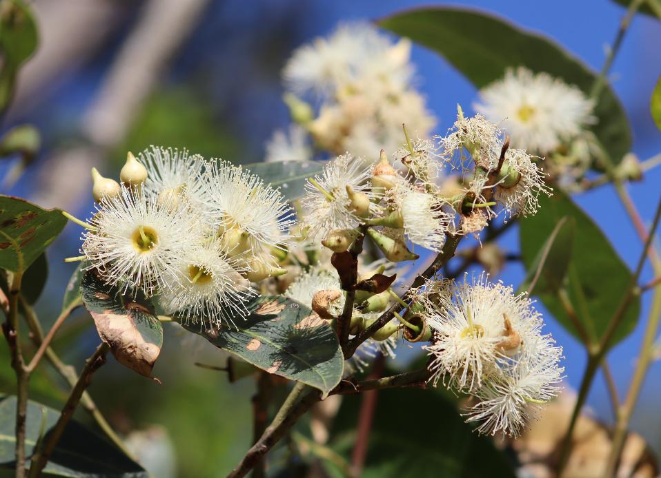
.JPG?timestamp=1747195817715)
.JPG?timestamp=1747195857029)
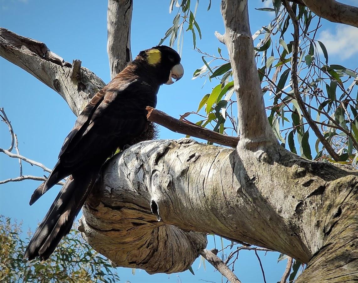
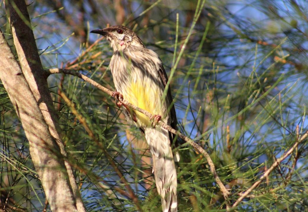
.JPG?timestamp=1731740660758)
Joseph Thompson Land in Vol-Fol 3323-100:
.jpg?timestamp=1770238900716)
.jpg?timestamp=1770238947514)
WSC Meeting held January 16 1967 - this was Rev. Dalton's address in the original land sales - Lots: FORMAL VOTING OF MONIES TO COVER REVENUE EXPENDITURE FOR 1967
No.17/67 - APPLICATION FOR EXEMPT/ON FROM RATING IN RESPECT OF ASSESSMENT A2959 at 15 CAREEL HEAD ROAD, AVALON, BY THE AVALON BAPTIST CHURCH. This report indicated that application had been received from the Avalon Baptist Church claiming exemption in respect of this property which is owned by the Church and which since 10.10.66 has been occupied and used by Rev. Green, the Minister of the area, and that the facts stated in the Statutory Declaration had been verified by an inspection of the By-Laws Inspector. Resolved, That the property be exempt from rating in accordance with the provisions of Section 132(1)(h)(ii) of the Local Government Act, as amended, as from 10th October 1966, and that the Council's rate records be adjusted accordingly. (Crs. Miles/Lindsay)
SHIRE CLERK'S REPORT TO ORDINARY MEETING 4.7.67:
TENDERS, SALVAGE RIGHTS, CAREEL BAY TIP. Tenders have been invited and close at 3 p.m. on 3.7.67, for the salvage rights at Careel Bay Tip, for a two year period commencing 1.8.67. RECOMMENDATION: That the tender box be opened by the Administrator and Shire Clerk, the tenders endorsed by the. Administrator and referred for report.
Mary Gibson had the salvage rights to this and other local tips. see; Careel Bay Playing Fields Reserve - Including Hitchcock Park: Birds, Boots & Beauty - History
During the 1970's the Careel- Bay-North Avalon Avalon Progress Association worked to look after Careel Bay when a large marina was proposed that would have further annihilated the environment, and were outspoken on other matters that would impact the environment and its wildlife and human residents.
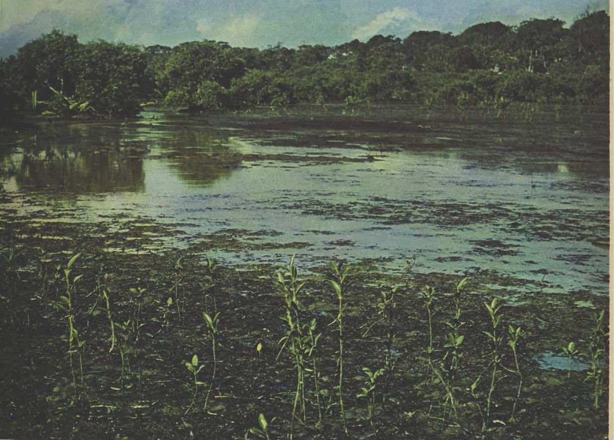
The Avalon Preservation Trust became a major player on the Careel Bay Advisory Committee and a public meeting in 1975 attracted 600 people.A 1974 report from the Water Research Laboratory confirmed that the bay must be left alone. - Geoff Searl, Avalon Preservation Association History, 2019
The Warringah shire council minutes of meeting held July 29th 1974 record (post-Sygna storm of June 1974):
ORDERS OF THE DAY COSTS OF RESTORATION AND PRESERVATION OF BILGOLA BEACH (Resubmission of Presidential Minute submitted to the Ordinary Meeting 8.7.1974, also Shire Clerk's Report No. 216/74 to Finance/Staff Committee Meeting 24.7.1974 _in pursuance of a recommendation by the Finance/Staff Committee 24.7.1974.) Prior to discussion, the President advised he had received a letter from The Careel Bay-North Avalon Progress Association dated 25.7.1974 objecting to a suggestion that ratepayers' funds should be employed for the protection of beach front flats and dwellings; further a letter had been received from the Vice-President of the Bilgola Beach Preservation Committee dated 16.7.1974 and this was tabled. 14. Resolved _That subject to the Council being fully reimbursed by the State government, it accepts responsibility for the expenditure of the difference between $24,671 and the amount already spent for work at Bilgola Beach made up of the rock fill $16,421.25 and the cost of the 05 dozer $688, and lodges a claim with the State Government. (Crs. Dawson/Begaud) The President requested that his name be recorded as voting against the motion.
Meeting held August 26th 1974:
(A3) BILGOLA STORM DAMAGE. Letter, 16.8.1974, Careel Bay-North Avalon Progress Association advising it considers it is grossly irresponsible by the Council to accept liability of some $17,000 utilized in the protection of private property at Bilgola Beach. 55. Resolved _That the Association be informed of the details of the Council owned property between the storm damaged houses and the beach, and the consequent difference between the situation operating at Bilgola and other beaches under the Council's general-administration. (Crs. Creagh/Begaud)
Ordinary Meeting, held 16.12.1974:
4. Report of Special Meeting ;in Committee of the Whole;, 7.12.1974. Also: Report of Adjourned Special Meeting ;in Committee of the Whole;, 16.12.1974 _continued. Shire Clerk's Report No. 386/74 _1975 Budget _continued. Grants Commission Allocation _continued.
Careel Creek, North Avalon _extension of existing concrete stormwater channel from Central Road to Barrenjoey Road $ 40,000 ... Financial Assistance for the provision of Sand Dunes Stabilisation: North Palm Beach _sand dunes stabilisation fencing and tree planting (See Item 5, Shire Engineer's report 674/I42) $ 10,000
Meeting held 17.2.1975:
52. Could an estimate for floodlighting the main field at Careel Bay be obtained and submitted to the next meeting of the Parks and Reserves Committee? I will have it brought forward to the next parks and Reserves Committee for report. 53.In view of the latest serious accident at the corner of Tasman and Coonanga Roads, North Avalon, could the Police Traffic Branch be again requested to instal a ;Stop; sign at this intersection? I will have the matter referred to the Engineers Department for report.
Meeting held 21.4.1975:
REPORT OF MEETING OF CAREEL BAY RECLAMATION AND DEVELOPMENT ADVISORY COMMITTEE HELD 2.4.1975. (Copy supplied to each Councillor). 52.Resolved _That the report and the recommendations contained therein be adopted. (Crs. Huntingdon/Beckman).
PUBLIC HEALTH ACT, 1902 (SECTION 55)
Area. No. 835
Unhealthy Building Land at Careel Bay
THE Health Commission has reported that after due inquiry it is of the opinion that it would be prejudicial to health if certain land situated in the Shire of Warringah and described in the Schedule hereunder were built upon in its present condition.
The Health Commission has further reported that in order to render such land fit to be built upon, it is necessary that the whole of the garbage that has been deposited on the land shall be assimilated to the satisfaction of the Health Commission or the area shall otherwise be treated in a manner approved by the Health Commission.
Now, therefore, in pursuance of the power and authority vested in me by section 55 (1) of the Public Health Act, 1902, I hereby declare that such land shall not be built upon until the measures referred to, which are also specified in a document accompanied by a plan of the area deposited in the office of the Local Authority (The Council of the Shire of Warringah) and open to the inspection of any person, have been complied with or until this notice has been revoked by me.
JOHN M. MASON, for Minister for Health.
Schedule
All that piece or parcel of land situated in the Shire of Warringah, Parish of Narrabeen, County of Cumberland: Commencing at the intersection of the western side of Barrenjoey Road with the prolongation of the southeastern boundary of lot 120 in Deposited Plan 17189, bounded thence on part of the south by a line bearing 288 degrees 15 minutes distant 76 metres, bounded thence on part of the southwest, part of the west and part of the northwest by lines bearing 320 degrees 45 minutes for 89 metres, 333 degrees 20 minutes for 222 metres, 323 degrees 30 minutes for 94 metres, 313 degrees 45 minutes for 197 metres, 42 degrees 30 minutes for 57 metres, thence again on the remainder of the southwest, south and west by lines bearing 301 degrees 00 minutes for 111 metres, 245 degrees 20 minutes for 159 metres, 347 degrees 00 minutes for 64 metres, thence bounded on the northwest by a line to the southwestern corner of lot 88 in Deposited Plan 11909, thence by a line to the southwestern corner of lot 84 in said Deposited Plan 11909, again by a line to the northeastern corner of lot 80 in aforementioned Deposited Plan 11909, thence bounded on the north, northeast, and east by the southern, southwestern and western sides of Barrenjoey Road to the point of commencement. PUBLIC HEALTH ACT, 1902 (SECTION 55) (1975, July 18). Government Gazette of the State of New South Wales (Sydney, NSW : 1901 - 2001), p. 2827. Retrieved from http://nla.gov.au/nla.news-article220188752
WSC Minutes - Ordinary Meeting, held 14.7.1975:
PARKS AND RESERVES COMMITTEE'S REPORT, 8.7.1975. The report of the Parks and Reserves Committee, as contained in the Minutes of that Committee's meeting held 8.7.1975, was received and dealt with as follows: Item 36 - AVALON SOCCER CLUB. Provision of Caravan/Canteen facility at Careel Bay playing field during the soccer season. 27.Resolved - That the Committee's recommendation be adopted; pad that permission be granted.to have the caravan put into the Council compound for the duration of the season. (Crs. Couvret/Sainsbery).
WSC Minutes - Ordinary Meeting, held Monday, 22nd December, 1975:
PROPOSED COMMUNAL JETTY _LOT 11 CAREEL BAY CRESCENT, CAREEL BAY. Petition dated 4.11.1975 bearing six signatures objecting to the proposed granting of a private Marina at Careel Bay. Resolved _That the Petitioners be informed of the details of Council's resolved motion which includes a large number of conditions including for private use only. (Crs. Dawson/Beckman) (A6) BARRENJOEY PENINSULA ENVIRONMENTAL TASK FORCE., 8.12.1975, requesting that Council makes available copies of all current policies and resolutions not contained within its Planning Ordinance and Policy Guidelines for Dwellings as the organisation is currently developing Environmental Guidelines for the Avalon-Palm Beach area in association with local businessmen and residents. Resolved _That the request be refused and the Barrenjoey Peninsula Environmental Task Force be informed that the elected Council has this responsibility; further that the local businessmen referred to be advised of Council's resolution and policies. (Crs. Huntingdon/Burgin)
Although the primary food trees for koalas during the era the above study was conducted, it is well-known that koalas have a much larger food tree and shelter tree choice. In Pittwater, and across to the Central Coast, the Main Koala Food Trees are, or were in the Pittwater koala instances, the following food trees across the grounds of their home:
Primary food tree species
- Parramatta red gum E. parramattensis
- Swamp mahogany E. robusta
- Forest red gum E. tereticornis
- Tallowwood E. microcorys
- Ribbon gum E. viminalis
- Cabbage gum E. amplifolia
Secondary food tree species
- Broad-leaved sally E. camphora
- Swamp gum E. ovata
- Fuzzy box E. conica
- Brittle gum E. praecox
- Yertchuk E. consideniana
- White-topped box E. quadrangulata
- Dwyer’s red gum E. dwyeri
- Red mahogany E. resinifera
- Slaty red gum E. glaucina
- Rudder’s box E. rudderi
- Bundy E. goniocalyx
- Large-fruited red mahogany E. scias
- Craven grey box E. largeana
- Grey gum E. punctata
- Maiden’s gum E. maidenii
- Monkey gum E. cypellocarpa
- Brittle gum E. michaeliana
- Woollybutt E. longifolia
- Western grey box E. microcarpa
- Blue box E. baueriana
- Grey box E. moluccana
- Coast grey box E. bosistoana
- E. notabilis
Stringybarks/supplementary species
- Blue-leaved stringybark E. agglomerate
- E. oblonga
- Thin-leaved stringybark E. eugenioides
- E. ralla
- White stringybark E. globoidea
- E. tenella
- Yellow stringybark E. muelleriana
- Privet-leaved stringybark E. ligustrina
- Red stringybark E. cannonii
- Brown stringybark E. capitellata
- E. prominula
- Heart-leaved stringybark E. camfieldii
- Narrow-leaved stringybark E. sparsifolia
- E. bensonii
- E. imitans
- E. blaxlandii
THE NEW BUS 1-MILE SECTIONS
Weekly Tickets To Be Dearer
The Commissioner for Road Transport, Mr. A. A. Shoe-bridge, yesterday announced new bus sections, which will be introduced on November 5. Tram sections were announced some weeks ago.
Mr. Shoebridge said: -
* Increase in cost of travel by bus will generally be less severe than for travel by tram. Existing bus sections are considerably shorter than the average length of tram sections.
* In some instances there will be no increase in single fares, although the weekly tickets would be dearer. On the long distance routes, such as Palm Beach and Epping, some single fares will be reduced.
* The length of sections after November 5 on all bus and tram routes will average about a mile.
* The 1d surcharge at night and at week-ends will be abolished.
NEW BASES
The existing discounts to weekly ticket-holders are in many instances over liberal, said Mr. Shoebridge.
With the reduction of single journey fares on many of the long distance routes under the new fare scale, the whole of the weekly ticket rates have been reviewed.
In future, the rates will be fixed on the basis of 12 single journey fares less an average discount of 10 per cent.
Separate weekly tickets will not be provided to each section point. They will be available for various zones, each consisting of several sections, and the price will be based on, and the 10 per cent. discount applied to, the average single journey fare for the sections in each zone.
On the Palm Beach-Wyn-yard services, weekly tickets will be available as follows:
Wynyard to Mona Vale Junction, £1; Wynyard to Avalon Parade, Avalon or Church Point, £1/4/; Wynyard to Palm Beach, £1/8/.
The weekly ticket at present used has a flat rate price of £1 from Wynyard to Mona Vale Junction and all points beyond to Palm Beach.
Details Of Sections
The proposed bus sections in the various districts are:
142, Palm Beach - Manly Wharf -Manly Wharf, 1. Queenscliff Bridge (Manly side), 2. Soldiers Avenue, Harbord, 3. Winbourne Road, Brook-vale, 4. Howard Avenue, Deewhy, 5. Hay Street, Long Reef, 6. Ramsay Street, Collaroy, 7. Waterloo Street, Narrabeen, 8. Collins Street, North Narrabeen, 9. Hill St, Warriewood, 10. Mona Vale Junction, 11. Phillip Road, Mona Vale, 12. Newport Holel, 13. Neptune Road, Newport Beach, 14. Bilgola, 15. Avalon Parade, Avalon, 16. Careel Head Road, Careel Head, 17. Surf Road, Whale Beach, 18. Iluka Road, Palm Beach, 19. Palm Beach Terminus.
150, Palm Beach - Wynyard. - Wynyard: Bridge Orpheum Theatre, North Sydney. 1. Miller and Falcon Streets, North Sydney. 2. Neutral Bay Junction. 3. Spit Junction. 4. Medusa Street, Mosman. 5. The Spit. 6 Dud-ley Street, Balgowlah. 7. Balgowlah Road, Balgowlah. 8. Kentwell Road, Brookvale. 9. Shire Hall, Brookvale. 10. Howard Avenue, Deewhy. 11. Hay Street, Long Reef. 12. Ramsay Street, Collaroy. 13. Waterloo Street, Narrabeen. 14. Collins Street, North Narrabeen. 15. Hill Street, Warriewood. 16. Mona Vale Junction. 17. Philip Road, Mona Vale. 18. New-port Hotel. 19. Neptune Street, New-port. 20. Bilgola. 21. Avalon Parade, Avalon. 22. Careel Head Road, Careel Head. 23. Surf Road, Whale Beach. 24. Iluka Road, Palm Beach. 25. Palm Beach Terminus.
151, Church Point - Wynyard (via Warriewood - Wynyard Bridge: Orpheum Theatre, North Sydney. 1. Miller and Falcon Streets, North Sydney. 2. Neutral Bay Junction. 3. Spit Junction. 4. Medusa Street, Mosman. 5. The Spit. 6. Dudley Street, Balgowlah. 7. Balgowlah Road, Balgowlah. 8. Kentwell Road. 9. Shire Hall, Brookvale. 10. Howard Avenue, Deewhy. 11. Hay Street, Long Reef. 12. Ramsay Street, Collaroy. 13. Waterloo Street, Narrabeen. 14. Taiyul Road and Garden Street, North Narrabeen. 15. Hill Street, Warriewood. 16. Mona Vale Junction. 17. Cabbage Tree Road, Bayview. 18. Essan Street. 19. Church Point.
154, Frenchs Forest Cemetery -Manly Wharf. - Manly Wharf: 1. Eurabin Avenue, Manly. 2. Kent-well Road. 3. Shire Hall, Brook-vale. 4. Alfred Road, Brookvale. 5. Willandra Road, Beacon Hill. 6. Rodborough and Roseville Roads. 7. French's Forest Post Office. 8. French s Forest Cemetery.
155, North Narrabeen - Manly Wharf. - Manly Wharf: 1. Eurobin Avenue, Manly. 2. Kentwell Road. 3. Shire Hall, Brookvale. 4. How-ard Avenue, Deewhy. 5. Hay Street, Long Reef. 6. Ramsay Street, Collaroy. 7. Waterloo Street, Narrabeen. 8. Collins Street, North Narrabeen.
156, French's Forest Cemetery -Manly Wharf (via Dalwood Homes). - Manly Wharf: 1. Hill Street, Manly. 2. Dudley Street, Balgowlah. 3. Balgowlah Public School. 4. Burnt Street, Bantry Bay. 5. and 6. Watermain, French s Forest. 7. French s Forest Post office. 8. French s Forest Cemetery.
157, Church Point - Manly Wharf (via Warriewood). -Manly Wharf. 1. Queenscliffe Bridge (Manly side). 2. Soldier's Avenue, Harbord. 3. Winbourne Road, Brookvale. 4. Howard Avenue, Deewhy. 5. Hay Street, Long Reef. 6. Ramsay Street, Collaroy. 7. Waterloo Street, Nar-rabeen. 8. Taiyul Road and Garden Street, North Narrabeen. 9. Hill Street, Warriewood. 10. Mona Vale Junction. 11. Cabbage Tree Road, Bayview. 12. Essan Street. 13. Church Point.
158, Taylor's Point - Wynyard. -Wynyard Bridge: Orpheum Theatre, North Sydney. 1. Miller and Falcon Streets, North Sydney. 2. Neutral Bay Junction. 3. Spit Junction. 4. Medusa Street, Mosman. 5. The Spit. 6. Dudley Street, Balgowlah. 7. Balgowlah Road, Balgowlah. 8. Kentwell Road, Brookvale. 9. Shire Hall, Brookvale. 10. Howard Avenue, Deewhy. 11. Hay Street, Long Reef. 12. Ramsay Street, Collaroy. 13. Waterloo Street, Narrabeen. 14. Collins Street, North Narrabeen. 15. Hill Street, Warriewood. 16. Mona Vale Junction. 17. Phillip Road, Mona Vale. 18. Newport Hotel. 19. Neptune Street, Newport. 20. Bilgola. 21. Avalon Parade Ava-lon and Barrenjoey Road. 22. Hilltop Road, Clareville. 23. Taylor's Point.
158, Taylor's Point - Manly Wharf. - Manly Wharf. 1. Queenscliffe Bridge (Manly side). 2. Soldier's Avenue, Harbord. 3. Winbourne Road, Brookvale. 4. Howard Ave-nue, Deewhy. 5. Hay Street, Long Reef. 6. Ramsay Street, Collaroy. 7. Waterloo Street, Narrabeen. 8. Collins Street, North Narrabeen. 9. Hill Street, Warriewood. 10. Mona Vale Junction. 11. Philip Road, Mona Vale. 12. Newport Hotel. 13. Neptune Road ,Newport Beach. 14. Bilgola. 15. Avalon Parade and Barrenjoey Road, Avalon. 16. Hilltop Road, Clare-ville. 17. Tavlor's Point.
159, Church Point - Wynyard (via Mona Vale direct). - Wynyard Bridge: Orpheum Theatre, North Sydney: 1. Miller and Falcon Streets, North Sydney. 2. Neutral Bay Junction. 3. Spit Junction. 4. Medusa Street, Mosman. 5. The Spit. 6. Dudley Street, Balgowlah. 7. Balgowlah Road, Balgowlah. 8. Kentwell Road. 9. Shire Hall, Brookvale. 10. Howard Avenue, Deewhy. 11. Hay Street, Long Reef. 12. Ramsay Street, Collaroy. 13. Waterloo Street, Narrabeen. 14. Collins Street, North Narrabeen. 15. Hill Street, Warriewood. 16. Mona Vale Junction. 17. Cabbage Tree Road, Bayview. 18. Essan Street. 19. Church Point. THE NEW BUS 1-MILE SECTIONS (1951, October 28). The Sunday Herald (Sydney, NSW : 1949 - 1953), p. 6. Retrieved from http://nla.gov.au/nla.news-article18500413
The other side of the road at the junction of the old Telford road and today's North Avalon road and Catalina Crescent - and George street to the west in particular - Notes:
APPLICATIONS having been made to bring the lands hereunder described under the provisions of the Real Property Act, Certificates of Indefensible Title will issue, unless Caveats been lodged in accordance with the Third Schedule to the said Act on or before THE 20TH SEPTEMBER, 1919: —
No. 20.950. APPLICANTS:—Emily Darvall, Moss Vale, and Florence Maud Callaghan, Sydney. LAND : — Shire Warringah, 8 acres 0 roods 24, perches,—lot 9 of the North Division of the Pittwater Estate, at the junction of the roads from Manly to Careel Bay, and to Barrenjoey, about 17 chains northerly from Central-road. NOTICE UNDER REAL PROPERTY ACT. (1919, August 8). Government Gazette of the State of New South Wales (Sydney, NSW : 1901 - 2001), p. 4425. Retrieved from http://nla.gov.au/nla.news-article222512530
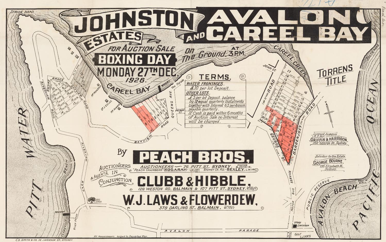
Johnston Estate 1926, showing Riverview road, Shore Brace, Bayview, Queens Avenue, Patrick Street, The Parade, George Street - and NEWLY formed Elvina Avenue Herbert J Fitzpatrick - (but no Lewis street as yet - Fitzpatrick Subdivisions - See Scotland Island Street Names) Item c027560023, Pittwater Subdivisions folders, courtesy State Library of NSW
Previous Vol-Fol 3723-65 (1925 – Henry Brisbane Swan, of Balmain, Timber Merchant and Alfred George Crump of Rockdale, retired House Decorator) granted to Henry Gaskin on July 6th 1833 – Certificate of Title registered May 6th 1925, and is 5 acres, 4 roads and 65 perches all up, on Bayview, Riverview, Shore Brace and Queens Avenue, as well as 8 acres and O perches on George street and to Barrenjoey road – Careel Creek shown at side of BJ road: this whole is sold to William David Johnston of Manly, Draftsman on June 22nd 1927, who proceeds to sell off as Lots. Previous is primary application 24765 which is the 50 acres granted to Thomas Warner, the 50 acres granted to Henry Gaskin and the 1200 acres granted to John Joseph Therry. Mr. Johnston had already been advertising the same the year before.
Vol-Fol 3723-65:
.jpg?timestamp=1770132790159)
.jpg?timestamp=1770132854193)
.jpg?timestamp=1770132898103)
.jpg?timestamp=1770132953881)
No. 33,683. Catherine Georgina McPhillimy, 2 a. 1 r, 16 p., lot 8, sec. C. Stokes Point Subdn., Bayview rd., and on Careel Bay, Narrabeen. NOTICE UNDER REAL PROPERTY ACT. (1939, April 6). Government Gazette of the State of New South Wales (Sydney, NSW : 1901 - 2001), p. 2037. Retrieved from http://nla.gov.au/nla.news-article222063158
PA 33683- Title; Primary Application - Catherine Georgina McPhillimy 2 acres 1 rood 16 perches in Bayview Road & on Careel Bay in Parish Narrabeen County Cumberland Shire Warringah Volume 5062 Folio 213 Contents Date Range: 30-08-1938 to 26-08-1941 – this is transferred to Catherine Georgina Hopper, wife of John Byess Hopper of Careel Bay, Bank Officer, on May 24th, 1954. They sell Lot 1 of this subdivided acreage to Ronald James Rankin on august 31st 1956 (Vol-Fol: 7267-59), Lots 2 and 3 to Edward Robert Turner and Merle Ida Turner on June 18, 1957 (Vol-Fol: not entered) and Lots 4,5,6 and 7 to Harold William Woods (Vol-Fol: 7383-142/143/144/145):
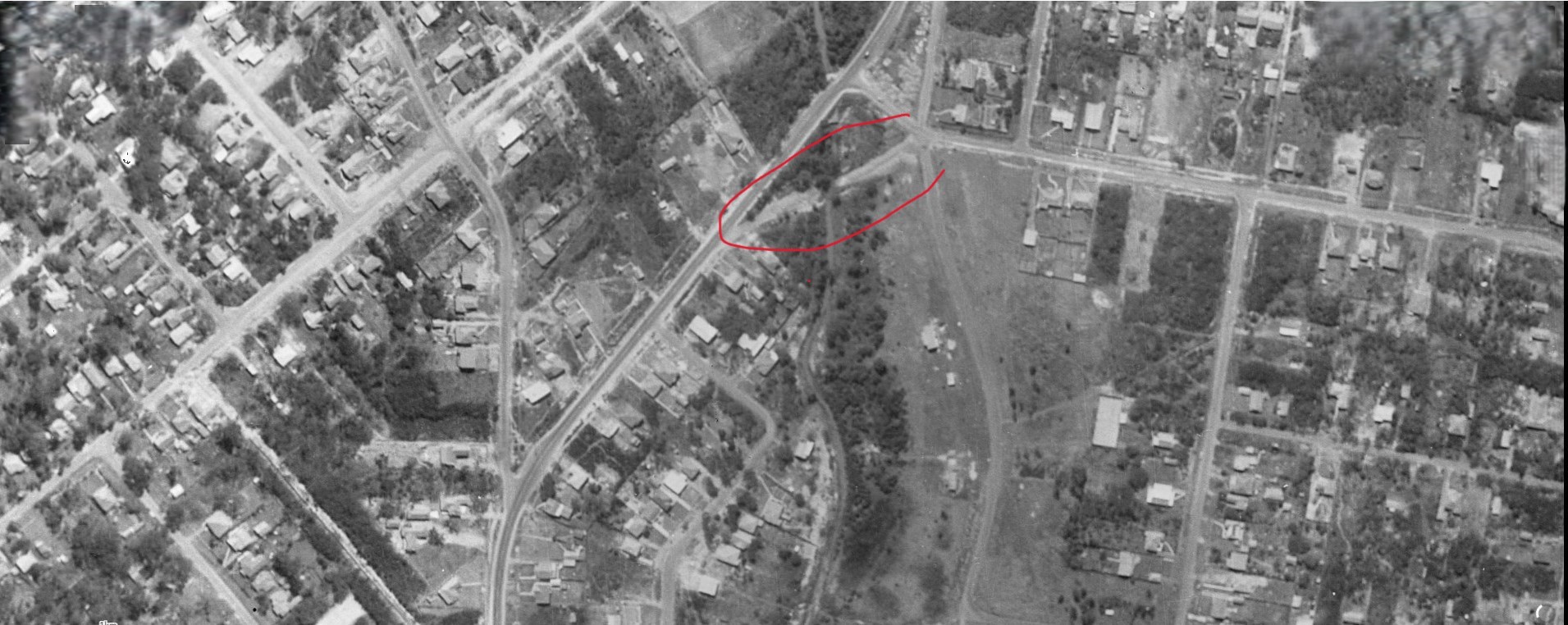
Crown Land Aerial Section, showing this side of George street/Careel Creek with 'Telford' road (old route of Barrenjoey road) marked in red. Dated 5.1.1951
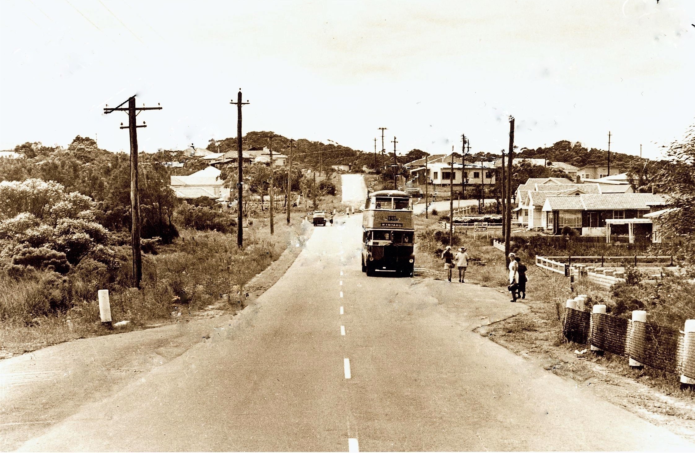
Barrenjoey road looking north - George street on the right straight ahead, circa 1950-1955
IN DIVORCE.
(Before the Judge in Divorce, Mr. Justice Boyce.)
DECREES ABSOLUTE.
Decrees absolute were pronounced in the following suits:-… Stanley James McPhillimy v Catherine Georgina McPhillimy,… IN DIVORCE. (1937, November 24). The Sydney Morning Herald (NSW : 1842 - 1954), p. 10. Retrieved from http://nla.gov.au/nla.news-article17398155
WIFE'S FIGHT FOR HUSBAND'S ESTATE
Whether the estate of a former director of Malleys Ltd. should be shared equally by his wife and a woman with whom he had been living was argued before Mr. Justice Nicholas in the Equity Court today.
'THE' director, Clyde Malley, Careel Bay, via Newport, left an estate worth £49,859 on his death in December, 1943. He provided that most of the estate should go into a fund to be shared equally by his wife and Mrs. Catherine Georgina McPhillimy. Today the wife, Mrs. Annie Cordery Malley, 200 Spit Rd„ Mosman, asked Mr. Justice Nicholas to grant her the whole of the income from her late husband's estate.
In an affidavit, Mrs. Malley said her husband deserted her in 1937, and went to live with Mrs. McPhillimy, who at the time was conducting a beauty parlor under the name of "Georgina." in St. James Building, Elizabeth St. Mr. M. F. Hardy (for the Perpetual Trustee Company, executor of the estate) submitted that no further demands should be made by Mrs. Malley, who had capital valued at £14,382 and a home worth £2100. "Mrs. Malley's income, apart from what she derives from the estate, is £567 a year," he said. Mr. E. J. Hooke (for Mrs. Malley); My client's income from the estate should be a guaranteed sum. The judge made an order granting Mrs. Malley £1000 a year or half the income from the estate, whichever was the greater. WIFE'S FIGHT FOR HUSBAND'S ESTATE (1945, July 27). Daily Mirror (Sydney, NSW : 1941 - 1955), p. 3 (Late Final Extra). Retrieved from http://nla.gov.au/nla.news-article272496496
An advertorial for same:
AVALON-CAREEL
THREE ESTATES AT ONCE
Three separate estates at Avalon and Careel Bay are to be sold by Messrs. Peach Bros, (in conjunction with Clubb and Hibble, and Laws and Flowerdew), next Monday.
They are linked together by the title of Johnston Estates, but are separate, and strung across the Barrenjoey Peninsula, between Avalon and Pittwater. There are 14 allotments in the section situated on the narrow strip which juts Into Pittwater and terminates at Stripe Head. They overlook the broad sheet of water, and are Within 100 feet of it. The second wayside estate has actual water frontages to Careel Bay. There are eight of these, with big depths of nearly 400 feet, which gives them other frontages to Bayview-road and Queen's-avenue as well. The Avalon offering is situated slightly north of the beach, on a rising slope which gives wonderful views across Pittwater, as well as down the southern coastline. This is the bigger section, its 34 allotments having frontages of from 40 to over 100 feet. Deposits for water frontages are £10. per lot, and for others £5 per lot. AVALON-CAREEL (1926, December 24). The Sun (Sydney, NSW : 1910 - 1954), p. 2 (FINAL EXTRA). Retrieved from http://nla.gov.au/nla.news-article224119171
On the above you can see the placement of the homes of the Monckton, Elliott and Howard lands. Mr. Howard was married to a daughter of the same Frederick Smith who bought a farm lot and other land holdings in May 1881- specifically lots 5 and 6, section A, 3 acres 1 rood 21 perches and a Farm; lot 4, 65 acres 0 roods 32 perches, paying L247 15s 2d for the 65 acre farm
HOWARD — SMITH.— April 25th. at St. Augustine's Church, Neutral Bay, by the Rev. G. North Ash, Harold T. Howard, third son of W. H. Howard, of North Sydney, to Mary T. J. Smith, youngest daughter of Frederick Smith, of "Alma," Belmont Rd., Mosman. Family Notices (1900, May 12). The Daily Telegraph (Sydney, NSW : 1883 - 1930), p. 1. Retrieved from http://nla.gov.au/nla.news-article237306577

Frederick Smith, Careel Bay, Pittwater - REGISTRATION OF BRANDS ACT OF 1866. (1886, January 9). New South Wales Government Gazette (Sydney, NSW : 1832 - 1900), p. 171. Retrieved from http://nla.gov.au/nla.news-article221650296
When Frederick Smith passed away Mr. Howard was placed in charge of part of his Careel Bay land holdings:
ESTATE VALUED AT £17,159.
LATE FREDERICK SMITH'S WILL
The net value of the estate of the late Frederick Smith, who resided at Alma, Belmont-road, Mosman, has been sworn for probate purposes at £17,159. By his will dated October 26, 1904, testator appointed his sons Sidney, Arthur, and Frederick, and his daughter Frances, executors, executrix, and trustees of his estate.
He bequeathed the furniture, ornaments, plate, and effects at Alma to his daughter Frances, which furniture and effects were purchased by her with her own money. He also gave his pony phaeton, harness, and all other articles of a similar nature to his daughter Frances. The house occupied by his son Frederick in Chuter-street, North Sydney, testator left to Frederick upon trust to receive the benefits, rents, or profits from it until his death, when it goes to the children. If there are no children the house becomes part of testator's residuary estate. He left the property at the corner of Alexander and Atchison streets, North Sydney, upon trust to his son Francis, and the property in Glover-street upon trust to his son Arthur for life, both upon the same terms as that provided in the case of the be quest to the son Frederick.
He left certain property at Careel Bay, Pittwater, to his son-in-law, Harold Trotman Howard, absolutely, and the remainder of his Careel Bay property to all of testator's children as joint tenants.
He left £50 to the North Shore Hospital, an annuity of £200 to his daughter Frances, an annuity of £150 to his friend Rosalie Grigg, and an annuity of £50 to his daughter Isabella, now Isabella Reed. The residue of real and personal estate to be held in trust for the children after due provision has been made for the paying off of certain mortgages. In a codicil dated March 31, 1908, testator revoked his former provision In the matter, of the trustees, executors, and executrix, and appointed In their place his son-in-law, Harold Trotman Howard, in conjunction with testator's son Arthur and daughter Frances. He further provided that in the event of Rosalie Grigg predeceasing his daughter Frances the annuity of £150 should go to Frances, while the annuity of £50 payable to Isabella Reed is to go to the daughter May Howard in the event of the annuitant predeceasing May Howard. ESTATE VALUED AT £17,159. (1914, July 7). The Sun (Sydney, NSW : 1910 - 1954), p. 1 (FINAL EXTRA). Retrieved from http://nla.gov.au/nla.news-article229855290
LATE MR. FREDERICK SMITH.
Old North Sydney resident.
The late Mr, Frederick Smith, who died at his residence, Belmont-road, Mosman, on Wednesday, was one of the oldest identities of North Sydney. He had reached his 83rd year, and the greater part of this long life was spent in that district, where, until recently, he was a familiar figure at most public gatherings. His interest in local office was shown in his participation in public duties. Prior to the amalgamation of the old municipalities of Victoria, St. Leonards, and East St. Leonards into the present North Sydney in 1890, he was Mayor and Alderman of Victoria, which was that area around M'Mahon's Point, Blue's Point, Lavender Bay, and Bay-road. In the united council, he sat for six years, then giving place to a younger man. He was one of the oldest Masons of the northern suburbs, having been Initiated into the mysteries of the Order about 50 years ago, and was associated with the first lodge established on the North Shore in 1867. He was also a foundation member of Lodge Samaritan, formed in 1874, subsequently occupying the chair. His interest in the craft was very keen, and fit the meeting of the latter lodge in April last, he was presented with a framed photograph of himself, to mark the members' appreciation of his services. As a member of the committee of the North Shore Hospital, he did good work, besides taking an interest in charitable movements generally. The funeral took, place at Gore-hill Cemetery yesterday afternoon, in the presence of a large and representative gathering. The burial service' was read by tile Rev. G, North Ash, and following It, extracts from the Masonic ritual were lead by Wor. Bro. Hall (Lodge Samaritan), accompanied by the usual riles of the Order. The chief mourners were:— Messrs. Frederick, Francis, Sidney, and Arthur Smith (sons), Howard (son-in-law), and amongst the others present were Ald. Anderson (Mayor of North Sydney), and other representatives of the council, Captain Green (representing the North Sydney Orphans), Wor. Bros. V. E. Neilly (W.U.), and F. S. Murco (secretary), and officers and brethren of Lodge Samaritan, and representatives of St. Leonards. Mosman, Ku-ring-gal, Lawson, Empress of India, and other lodges. LATE MR. FREDERICK SMITH. (1914, May 15). The Daily Telegraph (Sydney, NSW : 1883 - 1930), p. 11. Retrieved from http://nla.gov.au/nla.news-article238801150
It is Mr. Howard, a Surveyor whose main address is at ''Lincoln'', Kenneth-street and Belcote-avenue, Longueville, who on August 26, 1918 has correspondence dated 8/8/18, is recorded in Warringah Shire Council records, on behalf of seven owners at Careel Bay, who is asking council to take steps to have an obstruction across old road way leading from Stokes Point to the main Careel Bay Road removed. This was Referred to the Engineer for report, and perhaps lends insight into his 1924 objections as well.
Warringah Shire Councils' Meeting of October 21st, 1918 records Russell C. Roxburgh, 17/10/18, re notice to W. H. Monckton to remove fence from road at Careel Bay and a notice to Dr. Elliott to remove fence from road at Careel Bay; Consideration was deferred-until next meeting.
On November 4th, 1918 Howard & Company, 22/10/18, are submitting a plan of a proposed subdivision of land at junction of Careel Bay Road and Barrenjoey Road. It was Resolved, on the motion of Councillor Atkin, seconded by Councillor Sturman, that the plan be approved.
In July 1926, Mr. Howard died, at a relatively young age:
HOWARD -July 27, 1926, at his residence, Lincoln, Kenneth street, Longueville, Harold Trotman, beloved husband of Mary Howard, aged 53 years By request no flowers.
HOWARD.-the Relatives and Friends of the late Mr. HAROLD TROTMAN HOWARD are informed that his Funeral will leave his leave residence, Lincoln, Kenneth street, Longueville, THIS WEDNESDAY, at 9.45 a.m., for Church of England Cemetery, Northern suburbs. Motor funeral. By request, no flowers. WOOD COFFILL LIMITED, Motor Funeral Directors.
HOWARD-MASONIC-The Members of LODGE LANE COVE, No 338, are requsted to attend the funeral of the late Bro. H. T. HOWARD: to leave his residence at 9.45 o'clock THIS MORNING. E.L. TRISTRAM W.M. E. H. THORNTON, Sec. ,
HOWARD.-MASONIC- The Members of the LANE COVE ROYAL ARCH CHAPTER, No 567, S.C. are requested to attend the Funeral of the late Comp H. T. HOWARD; to leave his residence at 9 45 o'clock THIS MORNING. R. H. WHITEHOUSE, M E Z, C PEARSON SHAW, Scribe E. Family Notices (1926, July 28). The Sydney Morning Herald (NSW : 1842 - 1954), p. 12. Retrieved from http://nla.gov.au/nla.news-article16309211
His wife then had to deal with:
Notice under Section 11 of the Bankruptcy Act, 1898. In the Supreme Court of New South Wales. (26,159)
IN BANKRUPTCY.
Re The Estate of Harold Trotman Howard, deceased, late of Lincoln, Kenneth-street and Belcote-avenue, Longueville, surveyor, and carried on business with John Noble Rogers, as Howard & Rogers, at Lom bard Chambers, 107 Pitt-street, Sydney.
NOTICE is hereby given that a Sequestration Order has this day been made against the abovenamed bankrupt, on the petition of the executrix of the will of Harold Trotman Howard, deceased, and Mr. C. F. W. Lloyd appointed to be the Official Assignee.—Dated at Sydney, this 11th day of January, 1927.
N. C. LOCKHART,
Registrar in Bankruptcy. IN BANKRUPTCY. (1927, January 14). Government Gazette of the State of New South Wales (Sydney, NSW : 1901 - 2001), p. 200. Retrieved from http://nla.gov.au/nla.news-article220227488
The Estate of HAROLD TROTMAN HOWARD (deceased), late of Longueville, and carried on business with John Noble Rogers as HOWARD and ROGERS, at Lombard Chambers. 107 Pitt St., Sydney, Surveyor (No. 261»9), a first account and plan of distribution, showing, payment of a dividend of elevenpence and five-sixteenths of a penny in the £ on all proved concurrent claims. Advertising (1927, September 19). The Daily Telegraph (Sydney, NSW : 1883 - 1930), p. 22. Retrieved from http://nla.gov.au/nla.news-article247931819
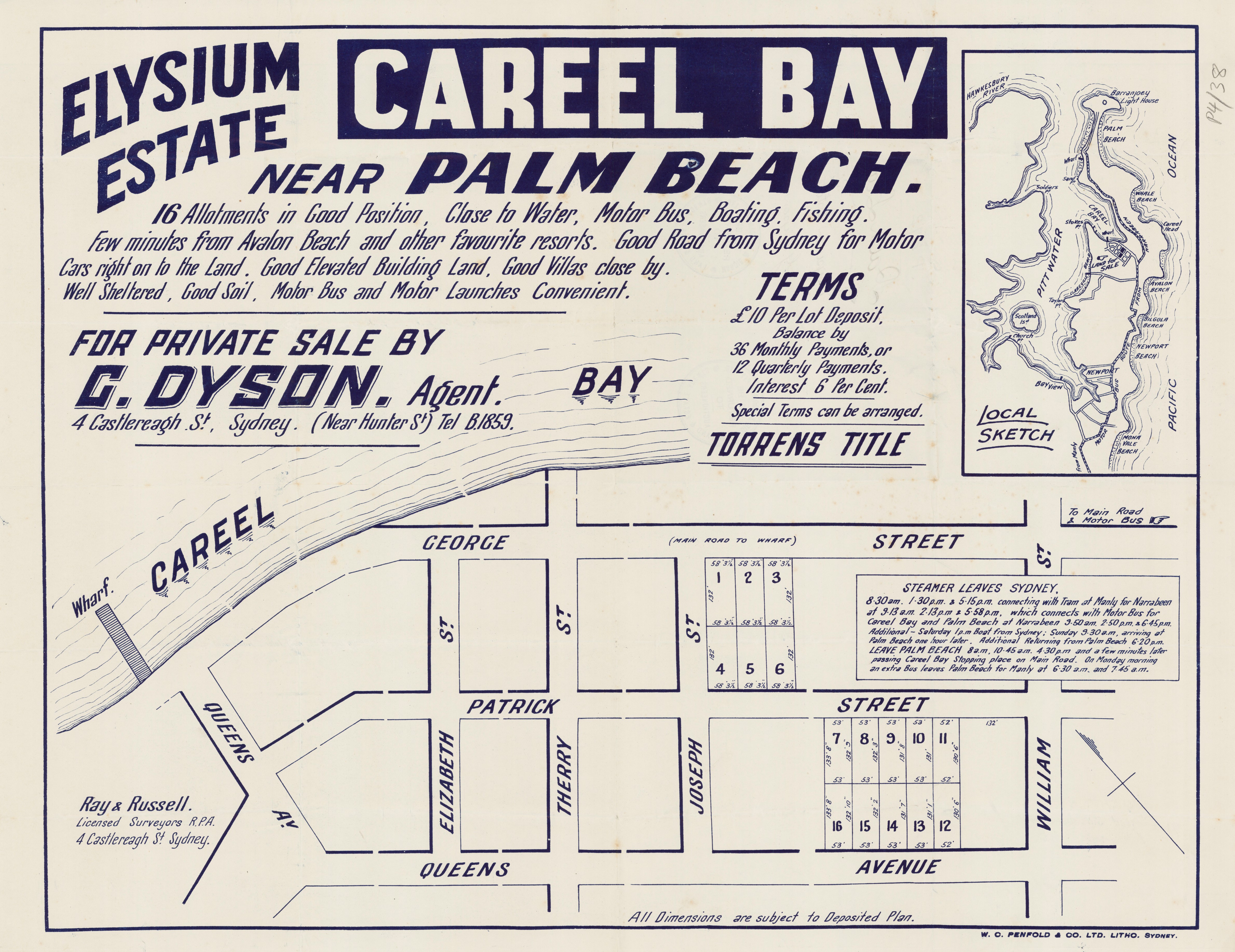
THE WORLD'S WANTS REAL ESTATE - HOMESITES FOR SALE CAREEL BAY, ELYSIUM ESTATE This Estate Is Just opened up. It Is situated In the midst of picturesque surroundings, and offers Ideal opportunities for home or week-end bungalow sites. Numerous Lots to Choose From torrens title. Surrounded by every facility, close to surf, booting, fishing, end within cosy distance of the famous Avondale Golf links. MOTOR 'BUS PASSES THE ESTATE. KEENLY PRICED BLOCKS, VERY EASY TERMS. BUT DIRECT FROM THE OWNER, AND SAVE MONET. A. C. McEWAN 308 ENMORE ROAD, ENMORE. . Right at the Tram Terminus. 'PHONE, L1708. 1 Please forward me, without obligation, full particulars of your Elysium Estate. NAME | ADDRESS .. .. .. J' I DATE .. .. .. .. .. Advertising (1928, December 2). The Sun (Sydney, NSW : 1910 - 1954), p. 24. Retrieved from http://nla.gov.au/nla.news-article223253467
‘Bay View road’ land Issue of Provisional Certificates of Title.
Vol. 4,515, Fol 117. Registered proprietor: Maria Ethel Simons. Land: Lots 11 and 12, deposited plan 14,884, at Careel Bay, ph. Narrabeen.
PROVISIONAL Certificates of Title for the lands above described will be issued after twenty-one days from the date hereof.
R. W, WILLIS, Registrar-General. 28th July, 1939. Private Advertisements. NOTICE UNDER REAL PROPERTY ACT. (1939, July 28). Government Gazette of the State of New South Wales (Sydney, NSW : 1901 - 2001), p. 3898. Retrieved from http://nla.gov.au/nla.news-article225730719
She sells to Harold Thurston Edwards, salesman of West Ryde in October 1939, who sells Lot 11 to Percival Lewis Travers (Vol-Fol: 5101-36) and Lot 12 to Gordon Taylor, ‘Motor Trader’ (Vol-Fol: 5139-192) at same time. Gordon Taylor sells, in June 1940, to Bayview resident Arthur Rutherford Fryer, Electrical Contractor.
Previous Vol-Fol of this section of Careel Bay-Avalon-Clareville in Vol-Fol: 4404-193 and was Lots 8 to 12 near Shore Brace bought by William Angus, Builder, of Sydney.
Those Lots stem from Vol-Fol: 4401-31, which is numerous lots and ‘2 acres, four and one quarter perches from part of 50 acres originally granted to Thomas Warner by Crown Grant dated 10th of July 1833’. Application 24765.
REAL PROPERTY ACT NOTICE..
Applications have been made to bring the undermentioned lands under the Real Property Act. Plans may be inspected and caveats lodged at the Land Titles Office Sydney until 13th August 1954:—
No. 38487 Valerie May Relton 1 r. 31 p. lots 1 and 8 M.P.S. (O.S.) 8984 Elizabeth, George and Patrick Sts. Careel Bay. 9th July 1954. T. WELLS, Registrar-General. (5138) REAL PROPERTY ACT NOTICE. (1954, July 9). Government Gazette of the State of New South Wales (Sydney, NSW : 1901 - 2001), p. 2005. Retrieved from http://nla.gov.au/nla.news-article220291316
More Water-Sewerage connections:
(6181) Metropolitan Water, Sewerage and Drainage Boar J,
Sydney, 25th July, 1947.
WATER MAINS.
NOTICE is hereby given that water mains, as described below and shown on plans which may be inspected at the Head Office of the Board, have been laid and are available for connections:—
Warringah Shire: Whale Beach road and Raynor-road, from existing main in Careel Head road north-westerly, northerly and north-easterly 781 feet to common boundary (of lots 105 and 106 in Raynor-road (W/O. 83,716). Plan 11,209. Raynor-road, from existing main easterly 320 feet to common boundary of lots 107 and 108 (W/O. 66,571). Plan 14,051.
Wakehurst Parkway, from existing main westerly 159 feet to Elanora-road; Elanora-road, from Wakehurst Parkway westerly and northerly 1.633 feet to Woorarra-road; Woorarra-road, from Elanora-road easterly 621 feet to a point opposite common boundary of lots 73 and 74 (W/O. 66,645). Plan 14,078.
Vineyard-street, from existing main westerly 707 feet to Herbert-street (W/O. 66,484). Plan 12,278.
Hawkesbury-avenue, from Pittwater-road 346 feet to Clarence-avenue (W/O. 66,707). Plan 32,519.
Subject to the provisions of the Metropolitan Water. Sewerage and Drainage Act, the owners of all lands within the prescribed distance will be liable for payment of water rates as from the expiration of three (3) weeks after the publication of this notice.
G. C. HICKS, Secretary. WATER MAINS. (1947, July 25). Government Gazette of the State of New South Wales (Sydney, NSW : 1901 - 2001), p. 1718. Retrieved from http://nla.gov.au/nla.news-article224770802
Metropolitan. Water Sewerage and Drainage Board,
Sydney, 8th May, 1953.
WATER MAINS.
NOTICE is hereby given that water mains, as described below and shown 011 plans which may be inspected at the Head Office of the Board, have been laid and are available for connections:—
Warringah Shire: Sunrise-road, from existing main in Palm
Beach road northerly, north-easterly, north-westerly and southerly to the common boundary of lots 154 and 155 (W/O. 68,350). Plan No. 11,306.
Urara-road, from existing main westerly to the common boundary of lot 1, Urara-road and lot 9, Tasman-road, (W/O. 84,774). Plan No. 19,187.
Binburra-avenue, from existing main in Milga-road northerly and north-easterlv to the common boundary of lots 54 and 55 (W/O. 84,808). Plan No. 17,559.
Alexander-road, from existing main north-westerly to existing main in Careel Head road (W/O. 67,265). Plan No. 14,670.
Albert-road, from existing main north-westerly to the common boundary of lots 52 and 51 (W/O. 66,673). Plan No. 12,013 (4th and final portion).
Albert-road, from existing main north-westerly to existmain in Careel Head road (W/O. 68,727). Plan No. 16,524.
Subject to the provisions of the Metropolitan Water, Sewerage and Drainage Act, the owners of all lands within the prescribed distance will be liable for payment of water rates as from the expiration of three (3) weeks after the publication of this notice.
W. V. AIRD, Secretary. WATER MAINS. (1953, May 8). Government Gazette of the State of New South Wales (Sydney, NSW : 1901 - 2001), p. 1519. Retrieved from http://nla.gov.au/nla.news-article220014424
(885) Metropolitan Water Sewerage and Drainage Board,
Sydney, 12th June, 1959.
WATER MAINS
NOTICE is hereby given that water mains, as described below and shown on plans which may be inspected at the Head Office of the Board, have been laid and are available for connections:—
Warringah Shire: Tyalla-avenue, from existing main easterly to 50 feet east of the common boundary of lots 74 and 75 (W/O. 64,385). Plan No. 25,228.
Stoddart-place, from existing main in Tor-road northerly to 12 feet north of the common boundary of lots 9 and 10 (W/O. 64,231). Plan No. 25,015.
Dolphin-crescent, from existing main in Careel Head road northerly and north-easterly to the common boundary of lots 9 and 8, and from existing main opposite lot 53 westerly and northerly to .30 feet north of the common boundary of lots 43 and 42 (W/O. 64,286). Plan No. 23,810.
Subject to the provisions of the Metropolitan Water, Sewerage, and Drainage Act, the owners of all lands within the prescribed distance will be liable for payment of water rates as from the expiration of three (3) weeks after the publication of this notice.
A. R. STAFFORD, Secretary. WATER MAINS (1959, June 12). Government Gazette of the State of New South Wales (Sydney, NSW : 1901 - 2001), p. 1760. Retrieved from http://nla.gov.au/nla.news-article220269587
(128) Metropolitan Water Sewerage and Drainage Board,
Sydney, 17th January, 1969.
WATER MAINS
NOTICE is hereby given that water mains as described below and shown on plans which may be inspected at the Head Office of the Board, have been laid and are available for connections:
Warringah Shire: Proposed Road (off Careel Bay Crescent), from existing main in Careel Bay Crescent generally northwesterly and northeasterly to the common boundary of lots 8 and 9 (W/O. 81930), Plan No. 34527. Subject to the provisions of the Metropolitan Water, Sewerage, and Drainage Act, the owners of all lands within the prescribed distance will be liable for payment of water rates as from the expiration of three (3) weeks after the publication of this notice.
S. R. SMITH, Secretary.
WATER MAINS (1969, January 17). Government Gazette of the State of New South Wales (Sydney, NSW : 1901 - 2001), p. 126. Retrieved from http://nla.gov.au/nla.news-article220063536
Finally!! Younger readers may not know about the septic tanks and septic trucks that would empty these, in this part of Pittwater, up until the 1980's - just 40 years ago:
(9667) Metropolitan Water Sewerage and Drainage Board,
Sydney, 23rd November, 1984.
SEWER MAINS
NOTICE is hereby given that sewer mains as described below and shown on plans which may be inspected at the Head Office of the Board, have been laid and are available for connections:
Warringah Shire: Careel Bay (Careel Bay L.L. Area 3).
First Portion. W/O. 37552. Lines 11 to 17 inclusive and 49 and their appurtenant junctions, sidelines and inlets serving Careel Head Road, Barrenjoey Road, Burrawong Road and Whale Beach Road.
Subject to the provisions of the Metropolitan Water, Sewerage, and Drainage Act, the owners of all lands within the prescribed distance will be liable for payment of sewer rates as from the expiration of sixty (60) days after the publication of this notice.
C. S. KEITH, Secretary. SEWER MAINS (1984, November 23). Government Gazette of the State of New South Wales (Sydney, NSW : 1901 - 2001), p. 5782. Retrieved from http://nla.gov.au/nla.news-article231374505
(1583) Metropolitan Water Sewerage and Drainage Board,
Sydney, 1st March, 1985.
SEWER MAINS
NOTICE is hereby given that sewer mains as described below and shown on plans which may be inspected at the Head Office of the Board, have been laid and are available for connections.
Warringah: Careel Bay. W/O. 37552 (Careel Bay Low Level area 3) (second portion). Lines 18 to 21 inclusive, 42,46,47 and 51, Line 10 from chainage 163.50 to end and their appurtenant junctions, sidelines and inlets serving Careel Head Road, Burrawong Road, Albert Road, Alexander Road and Whale Beach Road.
SEWER MAINS (1985, March 1). Government Gazette of the State of New South Wales (Sydney, NSW : 1901 - 2001), p. 970. Retrieved from http://nla.gov.au/nla.news-article231879123
(5055) Metropolitan Water Sewerage and Drainage Board,,
Sidney, 9th August, 1985,
SEWER MAINS
NOTICE is hereby given that sewer mains as described below and shown on plans which may be inspected at the Head Office of the Board, have been laid and are available for connections:
Warringah Shire: Avalon. W/0.37552 (Third Portion) (Careel Bay Low Level Area 3). lines 1,3 to 6 inclusive, 26,45, line 2 from chainage 00 to chainage 146.36, line 22 from chainage 00 to chainage 270.5 and their appurtenant junctions, sidelines and inlets serving Careel Head Road, Whale Beach Road, Binburra Avenue and Barrenjoey Road.
Queenscliff. File No. 119/753530. Line 1 and its appurtenant junctions, sidelines and inlets serving Crown Road. SEWER MAINS (1985, August 9). Government Gazette of the State of New South Wales (Sydney, NSW : 1901 - 2001), p. 4234. Retrieved from http://nla.gov.au/nla.news-article231420364
(9000) Metropolitan Water Sewerage and Drainage Board,
Sydney, 28th February, 1986.
SEWER MAINS
NOTICE is hereby given that sewer mains as described below and shown on plans which may be inspected at the Head Office of the Board, have been laid and are available for connections:
Warringah Shire: Careel Bay. W/O. 37552 (Fourth Portion) (Careel Bay Low Level Area 3). Lines 7 to 9 inclusive, line 2 from chainage 175.96 to end and their appurtenant junctions, sidelines and inlets serving Binburra Avenue and Milga Road.
Subject to the provisions of the Metropolitan Water, Sewerage, and Drainage Act, the owners of all lands within the prescribed distance will be liable for payment of sewer rates as from the expiration of sixty (60) days after the publication of this notice.
C. S. KEITH, Secretary. SEWER MAINS (1986, February 28). Government Gazette of the State of New South Wales (Sydney, NSW : 1901 - 2001), p. 940. Retrieved from http://nla.gov.au/nla.news-article231538910
(9710) Metropolitan Water Sewerage and Drainage Board,
Sydney, 4th April, 1986.
SEWER MAINS
NOTICE is hereby given that sewer mains as described below and shown on plans which may be inspected at the Head Office of the Board, have been laid and are available for connections:
Warringah Shire: Careel Bay. W/O. 37548 (Sixth Portion) (Careel Bay Low Level Area 4). Lines 27 to 29 inclusive, 33 to 35 inclusive, sideline 5 and their appurtenant junctions, sidelines and inlets serving Barrenjoey Road; Elvina Avenue, John Street, Lewis Street, William Street and George Street.
Bayview. W.N. 300245. Line I, sideline 1 and their appurtenant junctions, sidelines and inlets serving Utingu Place.
Subject to the provisions of the Metropolitan Water, Sewerage, and Drainage Act, the owners of all lands within the prescribed distance will be liable for payment of sewer rates as from the expiration of sixty (60) days after the publication of this notice.
C. S. KEITH, Secretary. SEWER MAINS (1986, April 4). Government Gazette of the State of New South Wales (Sydney, NSW : 1901 - 2001), p. 1496. Retrieved, from http://nla.gov.au/nla.news-article231484408
(381) Metropolitan Water Sewerage and Drainage Board,
Sydney, 9th May, 1986.
SEWER MAINS
NOTICE is hereby given that sewer mains as described below and shown on plans which may be inspected at the Head Office of the Board, have been laid and are available for connections.
Warringah Shire: Careel Bay. W/O. 37548 (seventh portion) (Careel Bay Low Level Area 4). Lines 30 to 32 inclusive, line 36 and their appurtenant junctions, sidelines and inlets serving George Street, Elvina Avenue and William Street.
Careel Bay. W/O. 37552 (fifth portion) (Careel Bay Low Level Area 3). Lines 23 to 25 inclusive, 27 to 34 inclusive, lines 44, 50, lines 22 from chainage 270.5 to chainage 360.7 line 37 from chainage 00 to chainage 77.05, line 39 from chainage 00 to chainage 55.8 and their appurtenant junctions, sidelines and inlets serving Barrenjoey Road, Dolphin Crescent, Neweena Place, Careel Head Road, Whale Beach Road, Rayner Road and Coral Close. Careel Bay. W/O. 37616 (third portion) (Middle Creek Area 3b portion 1). Lines 11 to 16 inclusive and their appurtenant junctions, sidelines and inlets serving Frenchs Forest Road and Blue Cum Crescent.
Collaroy Plateau. W.N. 300453. Sideline 1 and its appurtenant junctions, sidelines and inlets serving Aubreen Street, Ioaline Street and Telopea Street. SEWER MAINS (1986, May 9). Government Gazette of the State of New South Wales (Sydney, NSW : 1901 - 2001), p. 2043. Retrieved from http://nla.gov.au/nla.news-article231422421
(4091) Metropolitan Water Sewerage and Drainage Board,
Sydney, 31st October, 1986.
SEWER MAINS
NOTICE is hereby given that sewer mains as described below and shown on plans which may be inspected at respective Regional Offices and at the Head Office of the Board, have been laid and are available for connections.
Warringah Shire: Careel Bay. W.O. 37552. Lines 36, 38, 40, 41, 52, line 37 from chainage 72.05 to end, line 39 from chainage 39.0 to end, sideline 3 and their appurtenant junctions, sidelines and inlets serving Whale Beach Road and Careel Head Road.
Frenchs Forest. W.N. A 89508. Line 1 and its appurtenant junctions, sidelines and inlets serving Frenchs Forest Road East.
Subject to the provisions of the Metropolitan Water, Sewerage, and Drainage Act, the owners of all lands within the prescribed distance will be liable for payment of sewer rates as from the expiration of sixty (60) days after the publication of this notice.
C. S. KEITH, Secretary.
SEWER MAINS (1986, October 31). Government Gazette of the State of New South Wales (Sydney, NSW : 1901 - 2001), p. 5323. Retrieved from http://nla.gov.au/nla.news-article231528590
(1316) Water Board, Sydney, 6th November, 1987.
SEWER MAINS
NOTICE is hereby given that sewer mains as described below and shown on plans which may be inspected at respective Regional Offices and at the Head Office of the Board, have been laid and are available for connections:
Northern Regional Office, Chatswood (02) 410 9444
Warringah, Shire of: At Careel Bay, Plan W.N. 300359. (Careel Bay L.L. Area 7). Lines 1 to 30 inclusive, sidelines 1 to 5 inclusive, 7 to 10 inclusive and their appurtenant junctions, sidelines and inlets serving William Street, John Street, Toorak Place, Joseph Street, Therry Street, George Street, Patrick Street, Queens Avenue and Elizabeth Street.
Subject to the provisions of the Water Board Act and the Water Legislation (Repeal, Amendment and Savings) Act, the owners of all lands within the prescribed distance will be liable for payment of sewer rates as from the expiration of sixty (60) days after the publication of this notice.
W. R. HAZELL,
Regional Manager, Northern Region. SEWER MAINS (1987, November 6). Government Gazette of the State of New South Wales (Sydney, NSW : 1901 - 2001), p. 6206. Retrieved from http://nla.gov.au/nla.news-article231246974
(9183) Water Board, Sydney, 27th January, 1989.
SEWER MAINS
NOTICE is hereby given that sewer mains as described below and shown on plans which may be inspected at the Regional Office and at the Head Office of the Board, have been laid and are available for connections.
NOTICE is also hereby given that, in the opinion of the Board, for the identified properties on the plans, it is reasonably practicable for sewage to be discharged.
Northern Regional Office, Chatswood (02) 410 9444
Warringah Shire of: At Careel Bay. Plan W.N. 300360 (Careel Bay L.L. Area 8). Lines 1 to 16 inclusive, 19 to 22 inclusive, 24 to 39 inclusive, sidelines 1, 5 and 6 inclusive and their appurtenant junctions, sidelines and inlets serving Queens Avenue, Netts Road, Gunyah Place, Therry Street, Wanawong Road, Wanderah Avenue, Elgata Place, Daymar Place, Riviera Avenue and Cannes Drive.
Subject to the provisions of the Water Board Act 1987, the owners of all lands being identified properties on the plans will be liable for payment of sewerage service charges after the expiration of twenty-one (21) days from the publication of this notice.
N. R. TURNER,
Regional Director, Northern. SEWER MAINS (1989, January 27). Government Gazette of the State of New South Wales (Sydney, NSW : 1901 - 2001), p. 450. Retrieved from http://nla.gov.au/nla.news-article231511647
Water Board
Sydney, 28th September, 1990
SEWER MAINS
NOTICE is hereby given that sewer mains as described below and
shown on plans which may be inspected at the Regional Office and at the Head Office of the Board, have been laid and are available for connections.
NOTICE is also hereby given that, in the opinion of the Board, for the identified properties on the plans, it is reasonably practicable for sewage to be discharged.
Northern Regional Office Chatswood (02) 410-9444
Warringah, Shire of; at Brookvale W.N. 303183 Line 1 and its appurtenant junctions, sidelines and inlets serving Warringah Road.
At Careel Bay W.N. 302995 (second and final portion) Careel Bay L.L. Area 9A-Part 3) Lines 1, 26, 27, 28, 29, 30 and 31 sidelines 11, 12, 14, 15, 16, 17 and 20 and its appurtenant junctions, sidelines and inlets serving Cabarita Road.
Subject to the provisions of the Water Board Act 1987 the owners of all lands being identified properties on the plans will be liable for payment of sewerage service charges after the expiration of twenty-one (21) days from the publication of this notice.
J. CURTIS,
DIRECTOR, NORTHERN. Water Board (1990, September 28). Government Gazette of the State of New South Wales (Sydney, NSW : 1901 - 2001), p. 8787. Retrieved from http://nla.gov.au/nla.news-article231939576
The Burrowong road wasn’t sealed until the 1980s.
(2903) Department of Lands, Sydney, 7th January, 1972.
GEOGRAPHICAL NAMES ACT, 1966
HAVING reviewed certain place names in SYDNEY 9130 I, 1:100,000 map area, on A AS one inch to the mile map of BROKEN BAY, in County Cumberland, Shire of Warringah, the Geographical Names Board of New South Wales proposes to assign certain geographical names as indicated hereunder. GNB 850.
Any objections to the proposals should be in writing and lodged with the undersigned within one month from 7th January,
1972.
AAS BROKEN BAY MAP
Proposed- Geographical Name - Designation - Description Latitude- Longitude -Parish
Bangalley Head (also known as South Head). Headland - Headland between Careel Head and Hole in the Wall, Avalon. 33° 37' 151° 21' - Narrabeen
Woody Point Point Point of land between Lovett Bay and Towlers Bay, Pitt Water. 33° 38' 151° 17' - Broken Bay
D. C. MILLER, Secretary, Geographical Names Board. GEOGRAPHICAL NAMES ACT, 1966 (1972, January 7). Government Gazette of the State of New South Wales (Sydney, NSW : 1901 - 2001), p. 67. Retrieved from http://nla.gov.au/nla.news-article220039675
Was re-notified February 25 1972:
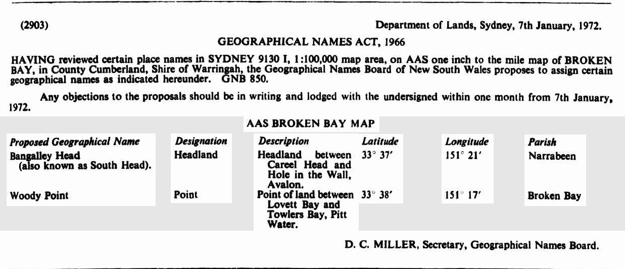
ASSIGNMENT OF NAME TO A RESERVE TRUST
PURSUANT to paragraph 4 (3) of Schedule 8 of the Crown Lands Act 1989, the name specified in Column 1 of the Schedule is assigned to the reserve trust constituted as trustee for the reserve specified in Column 2 of die Schedule.
RICHARD AMERY, M,R, Minister for Agriculture and Minister for Land and Water Conservation
SCHEDULE 1
COLUMN 1
Hitchcock Park, (R70736) Reserve Trust
COLUMN 2
Reserve No. 70736 at Careel Bay notified for the purpose of Public Recreation on 13 November, 1942. File No. MN83R13. ASSIGNMENT OF NAME TO A RESERVE TRUST (2000, February 25). Government Gazette of the State of New South Wales (Sydney, NSW : 1901 - 2001), p. 1444. Retrieved from http://nla.gov.au/nla.news-article231996117
Vol-Fol 3044-52, Certificate of Title for Lots 20-23 Careel Head Road:
.jpg?timestamp=1768887219835)
.jpg?timestamp=1768887260572)
Kenneth Gray Byrne 40 acres in Vol-Fol 3694-119 - Certificate of Title registered February 10 1925, with Mortgage to Constance Phillipson of Sydney, Estate Agent on June 19 1924:
.jpg?timestamp=1768954540117)
.jpg?timestamp=1768954652391)
.jpg?timestamp=1768954683301)
.jpg?timestamp=1768954732048)
Sidney Joseph Rhodes
The election of trustees for building and site of Freeman's Reach School of Arts was held on Friday last, when the following gentlemen were .elected:— Messrs. Henry Daniel Steele; Henry Joseph Greentree, Sidney Joseph Rhodes. Week to Week (1924, March 21). Windsor and Richmond Gazette (NSW : 1888 - 1971), p. 4. Retrieved from http://nla.gov.au/nla.news-article85899739
NOTICE is hereby given that the partnership heretofore subsisting between the undersigned William Henry Shepherd and Sidney Joseph Rhodes, carrying on business at the Municipal Markets, Sydney, under the name of Harry Kemp, has been dissolved by mutual consent as from the eighth day of November, one thousand nine hundred and thirty-two. All debts due to and owing by the said late firm will be received and paid by Sidney Joseph Rhodes, who will continue to carry on the business at the same place.
Dated at Sydney, this eighth day of November, one thousand nine hundred and thirty-two.
S. J. RHODES.
WILLIAM H. SHEPHERD.
Witness to both signatures,—I. Black. 1202 . 16s. NOTICE is hereby given that the partnership heretofore (1932, November 18). Government Gazette of the State of New South Wales (Sydney, NSW : 1901 - 2001), p. 4149. Retrieved from http://nla.gov.au/nla.news-article219911832
Vol. 5917 Fol. 170 Sidney Joseph Rhodes lot 10 D.P. 17191 Shire Warringah. REAL PEOPERTY ACT NOTICE. (1953, June 12). Government Gazette of the State of New South Wales (Sydney, NSW : 1901 - 2001), p. 1967. Retrieved from http://nla.gov.au/nla.news-article220015503
This Lot measured 118 feet by 60 feet on the corner of Currawong Avenue and Barrenjoey roads, Careel Bay/Palm Beach.
The Albert Road-Whale Beach Road creekline - drainage reserves to the then Warringah Shire Council are in Vol-Fol 5424-249:
.jpg?timestamp=1770135824574)
.jpg?timestamp=1770136074503)
.jpg?timestamp=1770136107740)
.jpg?timestamp=1770136165541)
.jpg?timestamp=1770136213563)
.jpg?timestamp=1770136263842)
.jpg?timestamp=1770136305626)
.jpg?timestamp=1770136490945)
.jpg?timestamp=1770136533161)
.jpg?timestamp=1770136622514)
 Charles Henry Falkner Hope Bartlett (1853-1916), soldier, was born on 1 August 1853 at Maitland, New South Wales, son of Falkner Hope Bartlett, pastoralist, and his wife Hephzibah Elizabeth, née Hallett. He was educated by private tutors and trained as a solicitor but did not practise. In 1872 he joined the East Maitland Company of the Northern Battalion, New South Wales Volunteer Force, and was commissioned captain in March 1875. When the Force was reorganized three years later, he reverted to the rank of lieutenant, but was again made captain in October 1880. He resigned from the volunteer infantry on 21 November 1883 and next day joined the New South Wales Permanent Military Forces; immediately commissioned captain, he was appointed adjutant of the 1st Australian Infantry Regiment.
In 1885 Bartlett went to the Sudan as adjutant of the New South Wales infantry contingent. He took part in the advance on Tamai, the only notable skirmish of the campaign, was mentioned in dispatches, and was awarded the Egypt Medal and clasp and the Khedive Star, the standard campaign decorations. On returning home he resumed duty with the 1st Regiment. In 1887 he went to England on leave and, while there, obtained permission to undergo military instruction. He was attached to the 1st Manchester Regiment at Aldershot in July, and next month attended a course at the School of Musketry, Hythe; he later completed another course there, qualifying as an instructor in the operation of Nordenfelt and Gardner machine-guns. He was promoted major that year and on 20 December 1888 married Ada Louisa Gale at St Thomas's Anglican Church, Willoughby, New South Wales.
In 1893-95 Bartlett served as deputy assistant adjutant general at New South Wales headquarters; he became adjutant of the 3rd Australian Regiment in 1895, was promoted brevet lieutenant-colonel in 1899, and was appointed to the administrative and instructional staff of the 3rd and 4th Regiments in 1902, then to the instructional staff at State headquarters, Commonwealth Military Forces, in 1904. Two years later he became assistant adjutant general and chief staff officer there. His last appointment, on 23 December 1909, was as aide-de-camp to the governor-general, the Earl of Dudley; he retired, with step in rank to colonel, on 1st April 1912. He was a foundation member and councillor of the United Service Institution of New South Wales.
Bartlett died of pneumonia on June 17th 1916 at Woollahra, survived by his wife and two sons and predeceased by his only daughter. After a service at St Matthias Anglican Church, Paddington, he was buried in South Head cemetery with full military honours.
A man of exceptional tact and loyalty, with a firm grasp of administrative and tactical procedures, Bartlett was a staff officer of outstanding merit. As director of many training and promotion courses he made a significant contribution to the training of volunteers.
R. Sutton, 'Bartlett, Charles Henry Falkner Hope (1853–1916)', Australian Dictionary of Biography, National Centre of Biography, Australian National University, https://adb.anu.edu.au/biography/bartlett-charles-henry-falkner-hope-5148/text8625, published first in hardcopy 1979. Photo: Charles Henry Falkner Hope Bartlett (1853-1916), by Falk Studios, courtesy Australian War Memorial, P01327.003
Archpriest J J Therry's association with Pittwater came through a land Grant. Some sources state he was given 1200 acres, others cite 1400. Either way this area ran from Newport to Careel Bay and encompassed most of Avalon. Published in the Government Gazette lists:
113. Thomas Warner, 50, Fifty Acres, Parish of Narrabeen, commencing at the Northeast corner, and bounded on the East by a side Hue of twenty-five chains; on the South by a West line of twenty-five chains to Pitt Water; and on the West and North by the waters of Pitt Water to the commencing corner.
Promised by Governor Macquarie on 31st March, 1821. Quit-rent 1s. sterling per annum, commencing 1st January, 1827.
114. Henry Gaskin, 50, Fifty Acres, Parish of Narrabeen, commencing at the North-east corner of Warner's fifty acres, and bounded on the West by a South line of twenty-nine chains; on the South by an East line of twenty chains ; on the East by a North line of twenty four chains to Pitt Water ; and on the North by the waters of Pitt Water to the commencing corner. Promised by Governor Macquarie on 31st March, 1821. Quit-rent Is. sterling per annum, commencing 1st January, 1827.
115. John Joseph Therry, 1200, One thousand two hundred Acres, Parish of Narrabeen, commencing at the South-east comer of the Government Reserve of two hundred and eighty acres, and bounded on the North by that Reserve by a line West twenty-five chains to a Stream ; on the North by that Stream and Careel Bay to the North-east Gorner of Henry Gaskin's fifty acres; on the West by Gaskin's by a line South twenty-four chains ; on the South by a line West twenty chains, and again by a line North four chains to the South-east corner of. Warner's fifty acres; on the North by Warner by a line West twenty-five chains to Pitt Water; on the West by the waters of Pitt Water to the North-west coiner of John William's sixty acres ; on the South by that farm by a line South fifty degrees East 38 chains ; on the West by a line South forty decrees West sixteen chains ; on the North by a line North fifty degrees West thirty-nine chains to the North corner of John Taylor's thirty acres ; on the West by Taylor by a line South twenty three chains to Pitt Water ; on the West by the waters of Pitt Water to the North-west corner of James M'Donald's thirty acres ; on the South by that farm by a line East eleven chains ; on the West by a line South twenty-three chains to Robert Melvyn's sixty acres; on the South by part of Melvyn's farm, and by Porter's and Anderson's farms by a line East fifty chains to Martin Burke's fifty acres; on the East by that farm by a line North six chains to a Stream ; on the East by that Stream, which is the Western boundary of John Farrell's sixty acres; on the South by that farm by a line East twenty-eight chains to the Village Reserve of one hundred acres ; on the East by part of the Village Reserve by a line North seven chains to a Stream ; on the South by that Stream, which is the North boundary of the Village Reserve to the Sea; and on the East by
the Sea to the commencing comer. Promised by Sir Thomas Brisbane, 200 acres, on 23d July, 1824 ; 500 acres on 1st September,1824; and 500 acres on the 19th December,1825. Quit-rent £9 8s. 4d. sterling per annum, commencing 1st January, 1829. Classified Advertising. (1832, November 1). The Sydney Gazette and New South Wales Advertiser (NSW : 1803 - 1842), p. 1. Retrieved from http://nla.gov.au/nla.news-article2209217
Charles de Boos in his 1861 published series 'My Holiday' described the landscape leading from Bilgola to Careel Bay as;
'Once through this jungle of a gully, and we had a gently rising road, creeping steadily up the face of the range, by easy graduation until at last it had gained the crest. Then we had a monotonous walk along the top of the ridge, in full view of the vast Pacific to our right, whose waves were now beating almost lazily along the beach at our feet and whose waters had barely swell enough on them to keel over the tiny fleet of coasters that had put out from different ports of shelter on the coast with the first slant of the favouring wind, and were now lying almost motionless, with scarce wind enough to lift their sails. To the left, the hills, covered with the low close scrub common to our coast ranges, bounded our view, the inland ridges, with their heavily timbered sides being hidden from our sight.Suddenly, however, the road took a curve round to the left, crossed a knoll of the range, and then swept down, in some fifty different tracks, on to a broad swampy plain, or flat, which seemed to us to be inundated, for we could see the water sparkling and glistening in the sun over its whole face. I pulled up short here.
" It won't do to go down there, Tom," said I.
"Oh, but we must," he replied. "This is the Priest's Flat, and there, where you see those shears erected, with the two tents alongside of them, is where they are boring for coal. We must go and report progress."
I looked ruefully at Nat, who made no reply, but, grinning viciously, bent down and turned up his trousers to the knees.
“Do you think there are any leeches there ?” I asked. Nat's trousers were instantly turned down again, and this time he didn't grin,
"Oh, no," Tom answered, "there's too much water there for them, and not enough shelter.
I was easier in my mind, though I had my misgivings; but as these Antipodean leeches seemed to be ruled by laws, and to have amongst themselves habits and customs totally at variance with those of leeches in civilised communities, possibly Tom might be correct; so, tucking up my trousers, I prepared to descend. And, after all, when we got down to the flat it was not so bad as it had appeared to us from the hill. The ground was somewhat honeycombed and the water lay in pools, between which however, we managed to find sufficient footing without actually walking in water.
Arrived at the tents, warning of our approach was given by a solitary dejected bark, ending in a melancholy and prolonged howl, from some unseen dog, that was evidently too broken down and low-spirited to repeat the challenge and it was only after we had approached the shears, and had commenced our examination of the boring, which, to tell truth, none of us could make head or tail of, that a tall sailor looking man, who appeared as if he had but just that instant been uncoiled full-rigged from between the blankets, came out to the entrance of one of the tents, and regarded us with an air of blank and sleepy astonishment. Just after him followed his watchful canine guardian, whose short bark and long ululation had effected his master's awakening, but so far behind as not to be within kicking distance; his cowering watchful look, and his tail hard down between his legs, evidently saying as plain as could be said, " I don't know whether I have done right, so I must stand by for squalls."
It took a good deal to waken up our friend to a full sense of the information we required from him, and it was only by the casual mention of Farrell's name that he was brought to his full mental perceptions. A grin spread over his countenance when we said where we had just come from.
“Did you go candling with him ?" he asked. We explained how it was that we had not done so.'
“Oh, isn't it prime fun !" He was fast getting lively.
He had been of the party the night before our arrival, had got wet through, had disported himself like a grampus in the pool, and had got home with an exulted notion of the sport. Of course we did not undeceive him; but having now got him up to the proper communicative pitch, we proceeded to worm out of him, by dint of much questioning, and much labour in bringing him back to the subject in hand for he would insist upon darting off from it at a tangent to give us collateral evidence upon matters in which we had not the slightest interest-all that he knew of the boring.
From the information thus acquired, as well as from enquiries subsequently made, I learnt that the spot now being bored was about the centre of a very fine property of some 1200 acres in area, granted many years ago to the Rev. Father Therry, and extending across the Barranjuee peninsula from the shores of the Atlantic to those of Creel Bay; the one being its eastern, the other its western boundary. Hence the plain had been christened the Priest's Flat. It had been for some time surmised, taking into account the dip of the coal basin, which crops up to the north at Newcastle, and to the south at Wollongong, that at this spot, which lies so near the northern cropping point, the coal seam might be struck at such a medium depth as would allow of payable working. Somewhere about twelve months ago, the reverend proprietor determined upon trying the experiment, and he has continued perseveringly at the work in spite of every discouragement that has beset him; and certainly he has had in this matter to bear up against contrarieties sufficient to have wearied out the majority of ordinary persons.
At no time have the men employed ever injured themselves by hard work, for the testimony of the natives goes to show that they hung it on most amazingly, and when obliged to do something for their money, rather than sink deeper they would break the auger. On another, occasion, an overseer that was employed bolted with the month's pay of the men, and, not satisfied with that, took also the reverend father's horse, though this was subsequently recovered, but only after paying a pretty Bullish sum for stabling expenses. Just as we visited the spot the 'works were again at a stand-still by the breakage of the apparatus, and the newly-appointed overseer was away in Sydney getting it repaired, whilst the hands were scattered hither and thither. They had at that time got to a depth of 186 feet, but had come upon no indications of coal, if we except the passage of the auger through a 6-inch pipe of coal at a depth of 123 feet. (Since these articles were commenced, I have learnt that the boring has reached a depth of 220 feet), when the work was suddenly brought to a close by the breaking of the auger, and, what was worse, by the cutting portion of it being left firmly embedded in the rock that was then being pierced.
Whilst upon this subject, it may-not be out of place to mention that I visited, though somewhat subsequently to the time now alluded to, the bluff headland almost in an easterly line with the boring, and named by the reverend proprietor St. Michael's Head; and there, at about eight feet above high water mark, and quite open to view, is a thin seam, or, as miners term it, pipe of coal, scarcely an inch in thickness. On examination I found also that very much of the shale, both above and below the seam, bore carboniferous indications-leaves, ferns, &c, being distinctly traceable on the face of the cleavages. Another great discouragement that must have operated very strongly upon the rev. owner has been the expense that the work has entailed on him, in consequence of the bungling inexperience and roguery of the persons who have, until lately, been entrusted with it. On this point I speak only on hearsay, and my information is consequently liable to correction ; but I was told with an air of authority that the cost of sinking had, up to that time, reached very nearly £800, being at the rate of rather more than £4 per foot, whilst the time occupied in sinking had been over nine months, or about twenty feet per month not a foot per diem ! If this was not enough to put an extinguisher upon ordinary enterprise, I can't conceive anything that would be. Under the present management I am informed that the work promises to progress more favourably.
We were not very long in pumping perfectly dry the maritime-looking individual who had charge of the works pro tem ; and, by the way, I would here ask how it is that nearly all the males we have encountered in our tracks have so decidedly nautical an appearance? Can it be that, like the islands in the Pacific have been said to have been, this particular portion of the territory of New South Wales has been peopled by the sole survivors of awful wrecks, by men supposed by anxious friends to have been drowned years ago, and who now turn up mysteriously in this unknown land? or, are the inhabitants of the Peninsula like the Arabs on the African coast, and do they seize and treat as slaves the shipwrecked mariners that are cast amongst them by the Pacific, in its un-pacific moods? or have they fled to these wilds to escape the too fond and anxious enquiries, through the water police, of disappointed shipmasters or deluded agents ? The question is one that perhaps some future Australian physiologist may be tempted to solve.
We parted with our friend with but scant ceremony, he turning on his heel and walking into his tent when we told him, "that was all;" whilst we shouldered our loads and walked ahead. Pushing along the edge of the flat, we crossed the foot of the hill we had not long previously descended, and, passing along an inner one of well-grassed sandbanks, that formed the landmost barrier against any encroachment of the waves, we came after a walk of half a mile to a paddock fence, through a slip panel of which the road evidently ran. Entering the paddock we found the upper part overgrown with young timber, principally wattles, that had sprang up since the cultivation of the toil had been discontinued, whilst about half-way across it we encountered a beautiful stream of running water, bright and clear as crystal, and crossed by a very rustic, and at the same time, very dilapidated-looking bridge. Nat was in the van at the moment, and I was astonished to see him, when he reached the brook, throw down his load and descend the bank to the water. Arrived there, he began hastily selecting some of the darkest leaves of a plant which I now observed grew very thickly on the margin of, and even in the water.
"What's the row ?" said I.
" Watercresses," replied he. "Stunning!"
" I'm there," cried Tom; whilst I made no answer, but slipped my shoulders out of my load, and commenced an attack upon this favourite pungent water plant. We amused ourselves for some five minutes over them, and then, filling our billy with the choicest stems we could find, once more made tracks.
After crossing the creek, we came in sight of a homestead, small but neat, having evidently been only recently whitewashed. The paddock was now clear of all undergrowth, and, as a goodly cluster of large trees, the remnants of the former occupants of the soil, had been left standing round the house, it had an exceedingly pretty and picturesque appearance, its white sides gleaming out markedly from amongst the bright green of the shrubs around it, and the dark and sombre verdure of the forest monarchs that overshadowed it.
"This," said Tom, "is Tom Collins, and he's the man that will show us the cave."
“The cave ?" asked I. "What cave ?".
" You'll see," he answered, "a rum 'un; such a one as you won't find anywhere else within a day's ride of Sydney, I can tell you."
Here was a surprise indeed. I had never, during the whole of my lengthened sojourn in Sydney, heard of this cave, and I don't believe that fifty persons in the metropolis are to this day cognisant of its existence; thus, with a feeling something near akin to that of a first discoverer, I hastened up to Collins domicile.
(To be continued.)
MY HOLIDAY. (1861, August 26). The Sydney Morning Herald (NSW : 1842 - 1954), p. 3. Retrieved from http://nla.gov.au/nla.news-article13059581
MY HOLIDAY
[CONTINUED.]
(From the Sydney Mail, August 31.)
A tap at the door brought out the mistress of the house, accompanied by her brood of little ones, all fat, chubby, and rosy faced, bearing on their countenances the imprimatur of good health. Having mentioned our errand, we were invited to enter, and we found the interior of the domicile even more neat, and white, and bright, than the exterior, for it was the very beau ideal of cleanliness, and care. The tin-ware which hung from the shelves was polished till it shone like silver, whilst the shelves themselves being of deal, were scoured almost to whiteness. The floor, though an earthern one, was swept so clean that it more resembled a single large slab of stone than what it really was; and the fire in the huge bush fireplace was nicely kept in the centre, each side being swept as carefully as the floor itself had been. The hut had been recently whitewashed throughout, and the whole had such a light and cleanly air as strongly to remind me of some of the farmhouses it has been my lot to visit in the mother country, where, perchance, some notable housewife would take such a pride in polishing that even to the iron hoops of the churn, the piggins or the milk coolers would be burnished up till they resembled steel.
Unfortunately our man, Tom Collins, who knew all about the cave, and who was, in fact, its first discoverer, was absent from home; his brother, however, would very willingly guide us to the spot, so said Mrs. Collins, and waiting the arrival of her brother-in-law, she brought forth a huge jug of milk, from which she desired us to help ourselves; and if Tom and Nat didn't do so to a pretty considerable extent, they made a very good attempt at it, that's all. I verily believe that they would have had impudence enough to have asked for another quart, had not the arrival of Collins frer turned their attention to another quarter. He at once expressed his willingness to conduct us, and furnished himself with a piece of candle, the interior part of the cave being so dark as to require a light for guidance amongst the fallen rocks that encumber it.
He led us off in a straight line from the front of the house to the sea, to a spot where the high wall of rock which is here presented to the waves sinks rather slightly, and a little to the north of the well-known rock, "The Hole in the Wall." Bringing us to the edge of the cliff, he pointed to a bit of a track, down which there had evidently been some slipping and shuffling. This went down for about five feet, and then we could see no more. All beyond that appeared to us, from where we stood, to be blank space; and I had a kind of faint idea that, like Farrell's candleing, this was some more of the peninsularies' fun, and that they let themselves slip down here, shot out into space, and chanced the rest. Tom looked at the track and turned pale. Nat inspected it, and turned up the bottoms of his trousers, a sure sign with him of determination, and about equivalent to the turning up of the coat cuffs by the school boy when he has made up his mind to dare some bigger boy to combat. I have already said what my feelings were, but in the position I occupied, as leader and originator of the expedition, it was necessary that I should set an example of decision, if not of courage. There was a small ledge or platform about three feet down on which the whole four of us could have stood easily ; so down on to this I leaped, with something of the same kind of feeling as Marcus Curtius must have had when he took his leap that everybody has heard so much about. Nat followed very readily, but Tom still hung fire.
"It's only just a little bit that's awkward," said Collins, "after that there's as good walking as there is up above."
But Tom was not to be tempted, and that "little bit" struck terror even to my heart, though I was determined upon prosecuting my discovery to the utmost. From the ledge on which we stood, we could only see just two or three feet' of downright slippery descent, and beyond that nothing but the black rocks two hundred feet below, and the crested waves breaking on them in white foam.
"Follow me," said Collins, as griping a projecting point of rock, he slid down the track, dislodging the stones and pebbles, and sending them rattling down upon the rocks below in a regular shower. In another second he had disappeared, and I heard no smash, no cry of torture, so taking heart of grace, I laid hold of the point of rock - oh, if I didn't hold it tight - slipped down the path, shot round a corner, almost breaking my spine with the twist, found my feet laid hold of by somebody, who placed them firmly upon a stone, and then, looking round, perceived that the worst was really over, and that now there was a good plain track running down to the rocks.' ....
Having thanked Collins for his kindness and attention, we once more pushed ahead, the road now leading us across a long level piece of country that intervened between the sea and the waters of Creel Bay, until it brought us down to the margin of the latter. Arrived here, we had before us as pretty a marine picture as ever painter sketched, and as directly opposite to the one we had but so recently left as could be well conceived. The flat level land had here narrowed to some sixty rods in width, being backed by a heavily wooded range, the base of which was here and there encumbered by large masses of rock, from which the incumbent soil had been washed, and which now protruded in huge boulders, or lay out bare and detached from their native beds. On the margin of the bay were three little whitewashed slab huts with bark roofs, the passion- ate squalling of an infant that proceeded from one of them would have given evidence of their being inhabited, even if we had not seen two or three barelegged and barefooted children peering at us round the corner of the house.
Through the narrow belt of low swamp oaks that edged the margin of the bay, the clear smooth waters of Creel glistened in the sun, as the gentle breeze swept over its face and slightly ruffled its surface. On the sands, midway between the shore and the retreating water, for it was nearly low tide, two boys were busied collecting shells, by filling an old basket with the sand, and then agitating it in a water-hole, made for the purpose, until the sand was washed away, and nothing was left but the shells that had been mingled with it. These, when washed clean, were thrown into a boat that lay down helplessly on its side close to them. Out on the waters of the bay, floated a smart little cutter, which, though probably only a shell boat, looked from the clear atmosphere, and perhaps also from the fact that she was the only vessel in view, smart and dapper as a yacht, the red shirt and striped cap of the one man on board, adding still farther to the picturesque appearance of the vessel. Behind her again stretched out the waters of the bay, until they encountered the ranges of the other side, which coming down in many a ridge and gully, and forming many a deep indentation or projecting point, gave a gorgeous variety of tints and lights to a background that under a less brilliant sun or less pure atmosphere would have been sombre and monotonous.
Manly to Broken Bay. (1893, November 11). Australian Town and Country Journal (NSW : 1870 - 1907), p. 19. Retrieved from http://nla.gov.au/nla.news-article71191632
We halted here just long enough to admire the scene, and to have a shot at one of a number of blue cranes, that were stalking about most consequentially and at the same time most warily upon the sands. It was only by dint of a good deal of manoeuvring and dodging that Nat was enabled to get even within possible shooting distance of the rearmost of the lot; and after all, when he fired, he didn't kill his bird. He however succeeded in frightening it, and not only it but all its companions, for they one and all took to flight with a wild cry. But if he had in one quarter caused a fright and a cry he had in another caused a fright and quietness for the report of the gun had stilled the squalling in the hut so effectually that it was not resumed, so long at least as we remained within hearing.
The track, a mere bridle path, now led along the flat, then across a dank luxuriant gully, down which a little stream roared and brattled and foamed with as much fuss and bother as would have been sufficient for a volume of water twenty times its quantity; afterwards,up a wet sloppy hill from which the water exuded in every direction, round the point of the range, down a correspondingly wet and sloppy descent on the other side; and then on to another flat the very counterpart of the one we had just quitted. Another luxuriant and overgrown gully, another wet hill teeming with springs, and then we come down, upon a somewhat broader flat, at the extremity of which we see two tents a short distance apart that we at once recognise, from the description we had received of them, as being the Chinamen's place.
(To be continued.)
MY HOLIDAY. (1861, September 2). The Sydney Morning Herald (NSW : 1842 - 1954), p. 3. Retrieved from http://nla.gov.au/nla.news-article13057913
The cave referred to is what we today call St. Michael's cave and was spoken of as being designated as being used as a possible church by John Joseph Therry, although this never seemed to occur. Pittwater’s first church at Careel Bay, St Josephs, a small one room wooden church with a shingle roof, built in early 1870, was a Memorial to John Joseph Therry and stood near the present corner of Joseph (or George) and Therry Streets with farm lands around it that went back to bush. Catholic settlers of the area were fortunate if the church was opened once a year for Mass. The little church, known as the Barrenjoey Church of St Joseph’s, (the Catholic patron saint for workers) even though it was known as Father Therry’s, was not actually built until after his death.
__________________________________
The Adopted October 21 2002 Pittwater Council Plan of Management (POM) for Bangalley Headland bush reserve states:
'The core objectives for management of community land categorised as a natural area are (Section 36 E):
(a) to conserve biodiversity and maintain ecosystem function in respect of the land, or the feature or habitat in respect of which the land is categorised as a natural area, and
(b) to maintain the land, or that feature of habitat, in its natural state and setting, and
(c) to provide for the restoration and regeneration of the land, and
(d) to provide for community use of and access to the land in such a manner as will minimise and mitigate any disturbance caused by human intrusion, and
(e) to assist in and facilitate the implementation of any provisions restricting the use and management of the land that area set out in a recovery plan or threat abatement plan under the Threatened Species Conservation Act 1995 or the Fisheries Management Act 1994.
The core objectives for management of community land categorised as bushland (Section 36J) are:
(a) to ensure the ongoing ecological viability of the land by protecting the ecological biodiversity and habitat values of the land, the flora and fauna (including invertebrates, fungi and micro-organisms) of the land and other ecological value of the land, and
(b) to protect the aesthetic, heritage, recreational, educational and scientific values of the land, and
(c) to promote the management of the land in a manner that protects and enhances the quality of the land and facilitates public enjoyment of the land, and to implement measures directed to minimising or mitigating any disturbance caused by human intrusion, and
(d) to restore degraded bushland, and
(e) to protect existing landforms such as natural drainage lines, watercourses and foreshores, and
(f) to retain bushland in parcels of a size and configuration that will enable the existing plant and animal communities to survive in the long term, and
(g) to protect bushland as a natural stabiliser of the soil surface
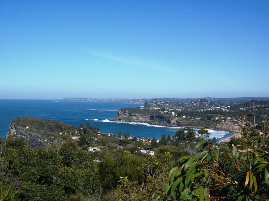
View from Bangalley Headland over Avalon Beach, 2011
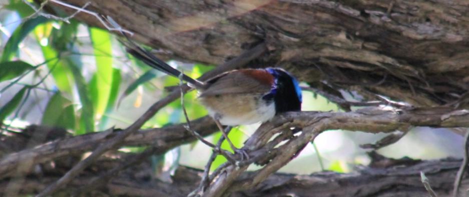
Variegated Fairy-wren (Malurus lamberti) - seen at entrance to bush path, North Avalon end - there was a family of these there
.jpg?timestamp=1698478463734)
in 2023 this Reserve remains a WPA - a place for Wildlife (a mere 5 acres of what was left - given by developers, as required by the WSC, in order to further their sales), and had to wait to be established as a WPA under Pittwater Council - by that time all the koalas that would travel across the land to feed and shelter there had been killed
Douglas Gravenor - few insights from the pages of the past:
R.M.S. ZEALANDIA FROM VANCOUVER.
AUCKLAND, Tuesday.-The JR.M.S. Zealandia arrived here from Vancouver with the following passengers for Sydney. Messrs. .. .Gravenor, Douglas, two children. Senior and infant, ... R.M.S. ZEALANDIA FROM YANCOUVER. (1913, April 9). The Daily Telegraph (Sydney, NSW : 1883 - 1930), p. 7. Retrieved from http://nla.gov.au/nla.news-article238938979
and Douglas Gravenor (North Sydney Boys' High School), who gained first class honours in Latin and Greek. (Honours Lists, p. 5.) ' L.C. HONOURS (1947, January 16). The Sydney Morning Herald (NSW : 1842 - 1954), p. 1. Retrieved from http://nla.gov.au/nla.news-article27904971
Modifieds To Provide Sharpies In, Olympic Games Class
The story behind this headline started last winter, when the committee of the Modified VS and VJ Association mapped out some very extensive plans — so far-reaching and all-embracing that by the end of this year there will not be many clubs in New South Wales left unaffected by them.
At the annual meeting of the association the committee put forward various proposals, one of which was that the 12 Square Metre Sharpie class should be promoted in NSW. This was accepted. The next step was to contact the Sharpie body in South Australia and negotiations are still proceeding with them. Fortunately for the association, Mr. Eric Lang, who until recently was secretary of the South Australian 12 Square Metre Sharpie Association, was posted by Chrysler (Australia) to Sydney. The Modified Association has appointed Mr. Lang Sharpie secretary for NSW, and the full organisation, press and financial weight of the association is being thrown in behind him. The Australian Yachting Federation last year recommended the 12 square metre Sharpie as one of the Olympic Games boats for 1956. WHAT ARE 'SHARPIES'? The Sharpie class are halfdecked centre-board boats, gunter rigged, with a sail area of ' approximately 130 square feet. For the purpose of competition in State and Australian championships the use of an extra is permitted, but this is not permitted in International racing. The boats are strongly built, with oak frames and no steamed timbers, are of a comparatively narrow design, with broad V sections, fine forward and flat aft. The hull is therefore capable of high speeds, especially when made to plane. Like all open, unballasted sailing boats, sharpies can be capsized ; but when capsized have sufficient buoyancy to support the helmsman and crew. Air tanks of total capacity of 4 cubic feet are optional. At the same time, owing to the moderate sail area, they are stiff boats, admirable for Bailing in all weathers. PLANS AVAILABLE SOON Estimated cost of building the Sharpie in Australia is £200, and it is expected that plans will become available in volume within the next fortnight.
These will be the International plans in metric measurements, as published by the Royal Yachting Association, and a metric conversion table will be supplied with these plans. The 12 square metre class rules, setting out specifications and administration of the class, are available now. This information can be obtained by contacting any of the following: Mr. Douglas R. Gravenor, 48-50 Kareela Road Cremorne. (XY4531) : Mr. Eric A. Lang, 233 Old South Head Road,! North Bondi (FA2807); Mr.] Lloyd T. Burgess, c/o Royal Sydney Yacht Squadron, Milson's Point. (XB4073). Clubs interested in accepting and racing these boats as a class, and persons wishing to sail with the Sharpie class in a club, should contact Mr. Gravenor. SYDNEY POSSIBLE VENUE It has been put forward that next season there should be held a regatta to include all classes of boats scheduled to appear in the 1956 games; but so far this is only in the discussion stage.Of Of immediate major importance are the tentative proposals which have already been made in some quarters that, to popularise the Sharpie in New South Wales, the Australian championships should be held in Sydney next year. This State will have a very strong argument if a mere six| boats can be found for competition. 'GET BOATS BUILDING' ] The Modified Association is letting this have both barrels. The time is now — and the action is now. The association wants to get boats building almost immediately, and to have at least three clubs forpied and a Sharpie fleet sailing by October of this year. , Here is a golden opportunity for young yachtsmen to get cracking now, and in three years' time to compete in the Olympic Games in Melbourne, with the full knowledge and assurance that an able committee, with strong organisation, is one hundred per cent, behind them. Modifieds To Provide Sharpies In, Olympic Games Class (1953, March 13). The Gosford Times and Wyong District Advocate (NSW : 1906 - 1954), p. 9. Retrieved from http://nla.gov.au/nla.news-article167230913
Appeal For Funds To Aid Sharpies
The Modified VS and VJ Association Is making an appeal for £1000 to prepare 12 sq. metre sharpies for the 1956 Olympic Games in Melbourne.
Association secretary Douglas R. Gravenor said this week: 'In the three seasons left to as our NSW skippers must be given an opportunity to compete interstate in Australian championships, in preparation for the Games. 'We want the best boats to go interstate, irrespective of means, and to achieve this we have opened a trust fund to subsidise crews'. Sharpies are the recognised small boat class for international competition. Appeal For Funds To Aid Sharpies (1953, June 9). The Gosford Times and Wyong District Advocate (NSW : 1906 - 1954), p. 6. Retrieved from http://nla.gov.au/nla.news-article167384532
Further matters Warringah Shire Council encountered this gentleman in:
Report to Finance, Property and Staff Management Committee, 12th May, 1981 2.0 PROPERTY - LAND ACQUISITION/DISPOSAL 2.1 MACKAY RESERVE - PROPOSED SUBDIVISION OF PART THEREOF AND EXCHANGE FOR ADJACENT LAND (File: 5F360/1.47 & 48) (File: SD103/80) On 18/6/80, a proposal was received by letter from Mr. D.R. Gravenor which involved the subdivision of Lots 47 and 48 in DP 6746, Barrenjoey Road, Palm Beach. Mr. Gravenor did not own the land at the time and it is understood still does not do so. The proposal was that, after subdivision, the westernmost parts' of Lots 47 and 48, which consisted of land at the Barrenjoey Road level as well as the escarpment, would be exchanged for a smaller parcel of land (being part of Mackay Reserve) adjoining the eastern boundary of the easternmost part of the subdivided allotments at the top of the escarpment in order to crate two new residential allotments with ac.cess from Pacific Road. The' area to be exchanged by Council was known at the time to be part of Mackay Reserve and was identified as Lot 49 in DP 8595. The site was inspected by members of the Property Management Panel, and after consideration of the matter at its meeting on 1/8/110, recommended to Council that the proposal be endorsed subject to - a)The Sm wide battle-axe handle over the present unmade section of Ralston Road, as indicated on plans available at the time, being offered for sale on a nominal basis; b)access being constructed at the owner's full cost in accordance with approved engineering plans; and, c)provision being madp for a 450mm diameter pipe culvert under the access to discharge into the drainage easement adjacent to the northern boundary of Lot 47. The matter came before the Ordinary Meeting of Council on 25/8/80 at which time Council adopted the above recommendation. Mr. Gravenor was informed of this decision by letter on 23/9/80. In 1968, Council considered another approach by the owners of these allotments. However, the proposition in question on this occasion was that Council should grant a right of carriageway across Mackay Reserve to enable dwellings to be erected at the eastern end of the two allotments. There was no mention of annexing any part of Mackay Reserve to the allotments, and consideration for the access rights was to be the dedication for, road purposes of the lower level of the allotments which faced Barrenjoey Road. This earlier proposition gained the endorsement of Council, and the then State Planning Authority also sanctioned the idea.
No subdivision application was ever submitted, and the proposal was never proceeded with. Mr. Gravenor made references to this original proposal in his letter of 18/6/80 and appeared to be saying that his more recent proposal should be viewed in the light of the 1968 ;right of access; arrangement now being proceeded with if his alternative proposition were not accepted. Legal advice was sought on the legal status of this earlier proposal, and without detailing the advice, it is sufficient to state that it is not in any way binding on Council. Mr. Gravenor hasdescribed the 1968 proposal as ;visually offensive;. Both the Town Planning and Engineering Departments would agree with this assessment and would oppose it today on both aesthetic and technical grounds. After he had been notified of Council's endorsement of his land C exchange idea, Mr. Gravenor arranged for the submission of a. subdivision application. This was received on 17/11/80. He was then informed verbally that Lot 49 (Mackay Reserve) was inappropriately zoned as Existing Recreation 6(a) to the extent that the zoning would not allow the subdivision application to be approved. Mr. Gravenor then lodged on 17/12/80 application for rezoning of the land for residential purposes and paid the appropriate fee. It was in the process of handling this re-zoning application that additional information came to hand which made it quite clear that Council was in no position to proceed with the matter as it presently stands, the information consists of a Declaration of Trust which was recorded against the title of lot 49 upon it being transferred to Warringah Shire Council by an from the former Cumberland County Council. Legal advice suggests that, pursuant to Section 8 of the Environmental Planning and Assessment Act, the beneficiary under the trust is the Minister administering that particular act. The Declaration of Trust binds Council so as not to use or permit to be used the said land for any other purpose other than the purposes of a public park, public reserve or public recreation area. Buildings which may be erected on the land must be ancillary to these uses. Legal advice received from Council's solicitors states that there does not appear to be any power in the Minister or Council to vary the purposes set out in the Delcaration of Trust. The advice states further that the only way in which the Declaration could be altered or revoked would be for either Council (with the approval of the Minister for Local Government) or the Minister for Planning and Environment to resume that part of Mackay Reserve involved (i.e. Lot 49). Quite apart from the problem associated with the Declaration of Trust, the decision of 25/8/80 would have been illegal on other grounds. Section 518(2) of the Local Government Act expressly prohibits the sale or exchange of any public reserve, public place, cemetery, or any land subject to a trust.
A further objection to the land exchange proposal is apparent. - No allowance was made for compensation to be paid for better- ment. No formal valuations have been obtained, but it is considered that the land to be acquired by Mr. Gravenor is of much greater value than that to be given by him in exchange. The Council holcs all assets vested in it as the statutory representative of the ratepayers of the area. Disposal of the land upon terms which are known to be less than full market value would amount to a breach of the implied trust upon which Council holds such assets. The present position is then as follows: * Council has adopted a proposal which cannot be given legal effect to in its present form; * A subdivision application has been lodged in respect of Lots 47 and 48 in DR 6746 and Lot 49 in DP 8595; * An application for the re-zoning of Lot 49 in OP 8595 has been lodged; and, * The only means available to give effect to any part of the proposal would be to endeavour to resume Lot 49 in DP 8595 in one of the two ways mentioned earlier. Even if this did happen, no arrangement has been made for suitable compensation to be recovered for the disposal of highly valued public land. Whilst Council may have felt inclined to accept the arrangement previously, it is certainly not now1 considered to be approp- riate or legal. Quite obviously, undertakings have been given in the past that the land which comprises Mackay Reserve would not be developed, but would always remain in public ownership and accessible to the public for its enjoyment. It is considered that the present terms of the Declaration of Trust should be honoured. RECOMMENDATION 1. That the applicant be informed that Council does not support his request for a re-zoning of Lot 49 in OP 8595 for the following reasons - (a)The land is vested in the Council upon trust to hold it for the purposes of a public park, public reserve and public recreation area, and any support for a re-zoning would be in breach of that trust. (b)A re-zoning resulting in the erection of build±ngs on any part of Lot 49 would co:flict with the long established planning objectives of maintaining the whole of Mackay Reserve as a PAssive recreation area.
Report to Ordinary Meeting, 25th May, 1981 MOTIONS IN PURSUANCE OF NOTICE (contd) *;That the applicant be asked to expri,ss his interpretations of the proposal and that the application be reviewed in light of the new information _and a proposal be sent to the Palm Beach Association for its comment. Proceedings in BrIef Mr Gravenor; with the aid of a location map, pointed out his proposal whIch he claims would ensure preservatIon of the ecology in reducing the Impact of residential construction on the envIronment, minimise the removal of trees and preserve the dense bushland. COUNCIL'S DECISION (25/5/1981): 456 ADOPTED.
Report to Town Planning & Building Committee Meeting 1st March 1983 ; 5.0 GENERAL MATTERS 5.1 LIST OF APPEALS TO THE LAND AND ENVIRONMENT COURT - C Gravenor 9 Morandoo Road, Elanora Heights 14. 2.83 4. 3.83