Autumn 2024 School Holidays Fun That Won't Break The Bank: Explore All Those Pittwater Pathways To Public Lands & Reserves, Catch A Ferry, Take A Stroll, Have A Hike, Go Watching Whales, Dolphins, Birds
You can go:
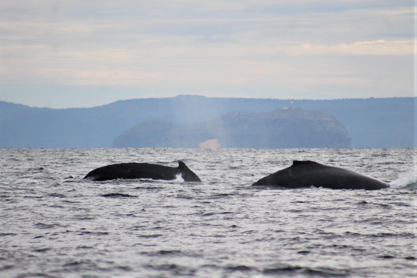
- whale watching - these giants of the sea are now making their way north
- bird watching - we're lucky here as you can look at birds that live in wetlands, along the shore and in the bus reserves - you just have to listen for them too in order to find some species
- there are some great walks - long ones, short ones, ones beside waters, ones that wend over hills beneath trees and have breath-taking views from the top of hills, ones
- a ferry ride is a great way to see the estuary - you can catch one from Church Point Ferry Services or over to The Basin via Palm Beach Ferries and have...
- a picnic!
Here are some spots to visit and what to look out for if you want to do your own thing this Autumn break and enjoy living in the best place this side of the harbor bridge.
Whale Watching
There have bene a few sightings already - not as many as we'll see during May and June, but you may just be lucky. Pack a rug, a thermos or cold drink, some nibbles or a sandwich and head out to your favourite headland or beach with some binoculars. There can also be dolphins around at this time of year, and seals - it's an aquatic wonderland out there.
A few things to remember, if you're going out on the water about 'approach' distances for these mammals.
There are laws in place for the protection of marine mammals. These include the approach distances of:
- 100 metres for drones (also known as RPAs and UAVs)
- If you are a swimmer, snorkeller or diver, to observe a marine mammal, you may enter the water at a minimum distance of:
- 100 metres away from a whale
- 50 metres from a dolphin or dugong
If you are in the water, you must keep at least:
- 30 metres from a whale, dolphin or dugong, including a calf
- 10 metres from a seal
- 80 metres from a seal pup
Watercraft that can be used as transport, including motorised or non-motorised boats, surfboards, surf skis and kayaks.
A vessel can move no closer than:
- 100 metres to a whale
- 50 metres to a dolphin or dugong
- 10 metres from a seal
- 80 metres from a seal pup
If a calf is present vessel can move no closer than:
- 300 metres from a whale
- 150 metres from a dolphin or dugong
- 80 metres from a seal pup
Prohibited vessels include personal motorised watercraft (jet skis), parasail boats, hovercraft, hydrofoils, wing-in-ground effect craft, remotely operated craft or motorised diving aids like underwater scooters. These vessels are prohibited because they can make fast and erratic movements and not much noise underwater, so there is more chance they may collide with a marine mammal.
If you are approaching a marine mammal using a jet ski or other prohibited vessel you must have negligible wake and stay at least 300 metres from a whale, dolphin or dugong.
Best spots to watch for whales
- North Bilgola/Avalon headland
- Barrenjoey Headland
- North Mona Vale headland
.JPG.opt1498x998o0,0s1498x998.jpg?timestamp=1709242242779)
Bird Watching
At 26 hectares, Warriewood Wetland is the largest remaining sand plain wetland in the northern Sydney area. It provides a variety of habitats for native animals and also plays a vital role in flood mitigation, nutrient recycling and filtering sediments. The wetlands contain several Endangered Ecological Communities. Over 180 bird species have been recorded here - it's great for ducks, egrets, spoonbills, honeyeaters, grebes, fairywrens, whipbirds, lorikeets, goshawks, kingfisher, brushturkey - although you may be lucky and see other species here as well.
Narrabeen lagoon is another great place to go birdwatching - there are so many kinds of aquatic birds there; swans and darters, along with those birds that go fishing - the kestrels and sea eagles.
For shorebirds, have a look at North Narrabeen, Careel Bay, Bayview or Long Reef.
For birds that live in trees, Bangalley Headland is a great spot, as is McCarrs creek reserve and Ingleside, in fact many of our bush reserves have little communities of ground, tree and rock loving birds.
The best birding time is often between dawn and 11am, when birds are most active.
You will need to be quiet and just sit still so you don't frighten them off. A good way to see them up close is to take some binoculars or a decent camera with you.
Here's a great video by a gentleman who has visited Warriewood wetlands.
Take A Stroll, Take A Walk, Go On A Hike Along All The Pittwater Pathways To Public Land
Our good friends Joe Mills and Kevin Murray have been taking some great long walks for a few years now and provided us all with great insights on where yo go and what you may see along the way. These hikes mean you will need to pack some drinks and lunch to have at a nice chosen spot.
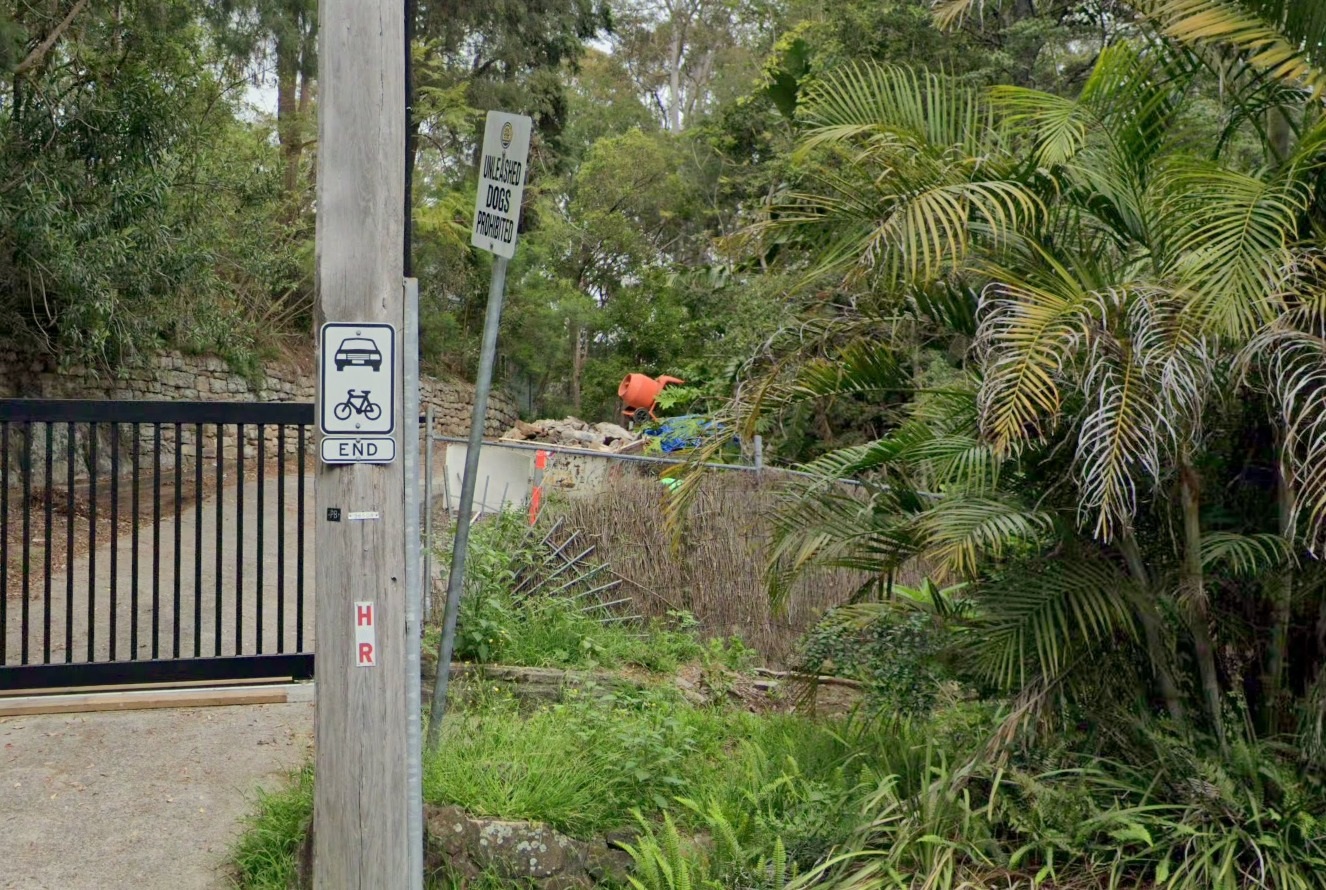
Even a short stroll can be a great way to get some sunshine and fresh air - either slowly or fast - along a favourite footpath or beside a creek. We have so many public footpaths wending all over our hills and up and down to the bays and waters where you can spend some time at one of any of these many reserves. Just look for one of these signs to find any of those paths:
Sometimes it will only look like this one at 320a Hudson Parade that leads down to Refuge Cove Reserve on Pittwater - another lovely little bay and Pittwater place of public land - you would have to choose when to visit that one though; low tide would be best:
Refuge Cove Reserve, Clareville is 1.16 hectares of public foreshore land and a nice spot for a sunny afternoon dip or a picnic - just remember to check the tides:
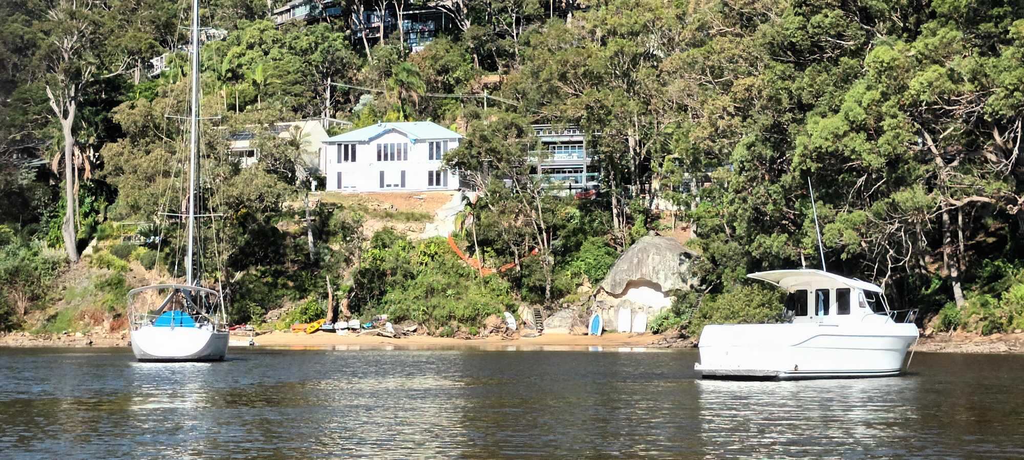
Refuge Cove Reserve
The group “Pittwater Pathways” have put an extensive, well research report into Pittwater Council which lists every pathway in Pittwater and the current state of these pathways as of May 2013.
That list of public pathways to public lands is in the PDF below so you can find them all and have a nice romp. Below this Kevin and Joe's lists of the walks they've shared with those of us who are less mobile so far - they have a few planned for this year too!
You can still do that great hike up Barrenjoey Headland for that wonderful view down the estuary and over Palm Beach - or those great options the Ku-ring-gai Chase National Park offers as well - but these offer a quieter paths to quieter places, and are well worth exploring on any other day as well.
Locals believe these paths are a great asset to Pittwater, the Pittwater community and visitors to Pittwater. They provide a means of transport, enliven the area, give health benefits and link the community together, and were set aside when this place was being changed from a farm and holiday area into a place of urban homes so people could always maintain their connection to nature and to be able to move through the landscape along these green and blue paths.
Some of them preceded roads being built and were the way those who lived here would climb up from the bays and over the hills to the main roads when these were just broad tracks so they could make their way south - others were where boats used to ferry people across the estuary from one side to the other, again because we once didn't have all these roads everywhere as we do now. People would catch a ferry to Palm Beach, not a bus, and a ferry to Church Point, or ride their horse.
There is even some history about some of these places in the Contents page lists if you want to know more about who stood in that same place in that same season before you.
The Mullhalls, the first lightkeepers at Barrenjoey, for instance, for those who will climb that hill anyway! Or would you like to know more about 'Clareville' when it was still called 'Long Beach' or who is 'Taylor' or Taylor's Point - or the family of rowers, called Fox, who held regattas here?
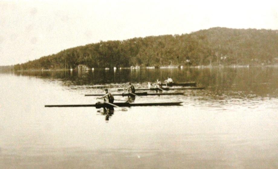
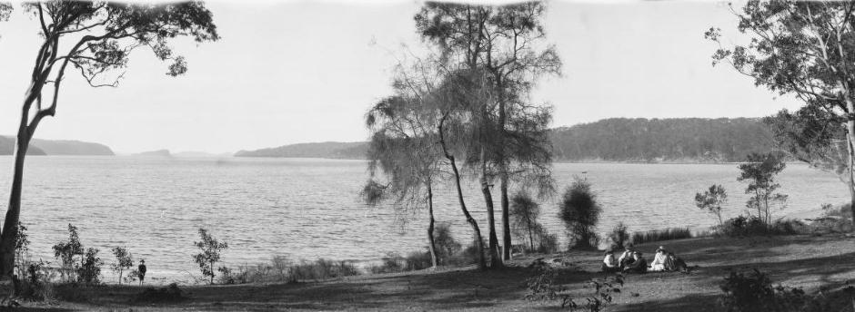
'Panorama of Taylors Point' - 2, Pittwater, New South Wales circa 1917-1921, courtesy National Library of Australia, Image No.: nla.pic-vn6149430 - Part of Enemark collection of panoramic photographs [picture] [1917-1946] .
Why not go on a great adventure right here in Pittwater this Autumn? Pack some water, pack your lunch, maybe put on some tick repleellant if going along the ones with lots of trees and bush, and off you go; have some fun seeing parts of your very own home you may not have visited before.
That Pittwater Pathways List, with thanks to the group Pittwater Pathways and CABPRA.
You can find the full list of Pittwater public spaces and reserves, and their land sizes, in the Pittwater Public Space and Recreation Strategy 2014
Pittwater Pathways to Public Lands:
 | Pittwater-Pathways-path address-descriptionsme.pdf Size : 540.575 Kb Type : pdf |
Joe and Kevin's walks (so Far) + a few others from over the years (there's a lot to explore):
A History Of The Campaign For Preservation Of The Warriewood Escarpment by David Palmer OAM and Angus Gordon OAM
A Stroll Around Manly Dam: Spring 2023 by Kevin Murray and Joe Mills
A Stroll Through Warriewood Wetlands by Joe Mills February 2023
A Walk Around The Cromer Side Of Narrabeen Lake by Joe Mills
America Bay Track Walk - photos by Joe Mills
An Aquatic June: North Narrabeen - Turimetta - Collaroy photos by Joe Mills
Angophora Reserve Angophora Reserve Flowers Grand Old Tree Of Angophora Reserve Falls Back To The Earth - History page
Annie Wyatt Reserve - A Pictorial
Aquatic Reflections seen this week (May 2023): Narrabeen + Turimetta by Joe Mills
Avalon's Village Green: Avalon Park Becomes Dunbar Park - Some History + Toongari Reserve and Catalpa Reserve
Bairne Walking Track Ku-Ring-Gai Chase NP by Kevin Murray
Bangalley Headland Bangalley Mid Winter
Bangalley Headland Walk: Spring 2023 by Kevin Murray and Joe Mills
Banksias of Pittwater
Barrenjoey Boathouse In Governor Phillip Park Part Of Our Community For 75 Years: Photos From The Collection Of Russell Walton, Son Of Victor Walton
Barrenjoey Headland: Spring flowers
Barrenjoey Headland after fire
Bayview Baths
Bayview Wetlands
Beeby Park
Bilgola Beach
Botham Beach by Barbara Davies
Bungan Beach Bush Care
Careel Bay Saltmarsh plants
Careel Bay Birds
Careel Bay Clean Up day
Careel Bay Playing Fields History and Current
Careel Creek
Careel Creek - If you rebuild it they will come
Centre trail in Ku-ring-gai Chase National Park
Chiltern Track- Ingleside by Marita Macrae
Clareville Beach
Clareville/Long Beach Reserve + some History
Coastal Stability Series: Cabbage Tree Bay To Barrenjoey To Observation Point by John Illingsworth, Pittwater Pathways, and Dr. Peter Mitchell OAM
Cowan Track by Kevin Murray
Curl Curl To Freshwater Walk: October 2021 by Kevin Murray and Joe Mills
Currawong and Palm Beach Views - Winter 2018
Currawong-Mackerel-The Basin A Stroll In Early November 2021 - photos by Selena Griffith
Currawong State Park Currawong Beach + Currawong Creek
Deep Creek To Warriewood Walk photos by Joe Mills
Drone Gives A New View On Coastal Stability; Bungan: Bungan Headland To Newport Beach + Bilgola: North Newport Beach To Avalon + Bangalley: Avalon Headland To Palm Beach
Duck Holes: McCarrs Creek by Joe Mills
Dunbar Park - Some History + Toongari Reserve and Catalpa Reserve
Dundundra Falls Reserve: August 2020 photos by Selena Griffith - Listed in 1935
Elsie Track, Scotland Island
Elvina Track in Late Winter 2019 by Penny Gleen
Elvina Bay Walking Track: Spring 2020 photos by Joe Mills
Elvina Bay-Lovett Bay Loop Spring 2020 by Kevin Murray and Joe Mills
Fern Creek - Ingleside Escarpment To Warriewood Walk + Some History photos by Joe Mills
Iluka Park, Woorak Park, Pittwater Park, Sand Point Reserve, Snapperman Beach Reserve - Palm Beach: Some History
Ingleside
Ingleside Wildflowers August 2013
Irrawong - Ingleside Escarpment Trail Walk Spring 2020 photos by Joe Mills
Irrawong - Mullet Creek Restoration
Katandra Bushland Sanctuary - Ingleside
Lucinda Park, Palm Beach: Some History + 2022 Pictures
McCarrs Creek
McCarr's Creek to Church Point to Bayview Waterfront Path
McKay Reserve
Mona Vale Beach - A Stroll Along, Spring 2021 by Kevin Murray
Mona Vale Headland, Basin and Beach Restoration
Mona Vale Woolworths Front Entrance Gets Garden Upgrade: A Few Notes On The Site's History
Mother Brushtail Killed On Barrenjoey Road: Baby Cried All Night - Powerful Owl Struck At Same Time At Careel Bay During Owlet Fledgling Season: calls for mitigation measures - The List of what you can do for those who ask 'What You I Do' as requested
Mount Murray Anderson Walking Track by Kevin Murray and Joe Mills
Mullet Creek
Narrabeen Creek
Narrabeen Lagoon Catchment: Past Notes Present Photos by Margaret Woods
Narrabeen Lagoon Entrance Clearing Works: September To October 2023 pictures by Joe Mills
Narrabeen Lagoon State Park
Narrabeen Lagoon State Park Expansion
Narrabeen Rockshelf Aquatic Reserve
Nerang Track, Terrey Hills by Bea Pierce
Newport Bushlink - the Crown of the Hill Linked Reserves
Newport Community Garden - Woolcott Reserve
Newport to Bilgola Bushlink 'From The Crown To The Sea' Paths: Founded In 1956 - A Tip and Quarry Becomes Green Space For People and Wildlife
Pittwater Reserves: The Green Ways; Bungan Beach and Bungan Head Reserves: A Headland Garden
Pittwater Reserves, The Green Ways: Clareville Wharf and Taylor's Point Jetty
Pittwater Reserves: The Green Ways; Hordern, Wilshire Parks, McKay Reserve: From Beach to Estuary
Pittwater Reserves - The Green Ways: Mona Vale's Village Greens a Map of the Historic Crown Lands Ethos Realised in The Village, Kitchener and Beeby Parks
Pittwater Reserves: The Green Ways Bilgola Beach - The Cabbage Tree Gardens and Camping Grounds - Includes Bilgola - The Story Of A Politician, A Pilot and An Epicure by Tony Dawson and Anne Spencer
Pittwater spring: waterbirds return to Wetlands
Pittwater's Lone Rangers - 120 Years of Ku-Ring-Gai Chase and the Men of Flowers Inspired by Eccleston Du Faur
Pittwater's Great Outdoors: Spotted To The North, South, East + West- June 2023: Palm Beach Boat House rebuild going well - First day of Winter Rainbow over Turimetta - what's Blooming in the bush? + more by Joe Mills, Selena Griffith and Pittwater Online
Pittwater's Parallel Estuary - The Cowan 'Creek
Resolute Track at West Head by Kevin Murray
Resolute Track Stroll by Joe Mills
Riddle Reserve, Bayview
Salvation Loop Trail, Ku-Ring-Gai Chase National Park- Spring 2020 - by Selena Griffith
Seagull Pair At Turimetta Beach: Spring Is In The Air!
Some late November Insects (2023)
Stapleton Reserve
Stapleton Park Reserve In Spring 2020: An Urban Ark Of Plants Found Nowhere Else
Stony Range Regional Botanical Garden: Some History On How A Reserve Became An Australian Plant Park
The Chiltern Track
The Chiltern Trail On The Verge Of Spring 2023 by Kevin Murray and Joe Mills
The Resolute Beach Loop Track At West Head In Ku-Ring-Gai Chase National Park by Kevin Murray
Topham Track Ku-Ring-Gai Chase NP, August 2022 by Joe Mills and Kevin Murray
Towlers Bay Walking Track by Joe Mills
Trafalgar Square, Newport: A 'Commons' Park Dedicated By Private Landholders - The Green Heart Of This Community
Tranquil Turimetta Beach, April 2022 by Joe Mills
Turimetta Beach Reserve by Joe Mills, Bea Pierce and Lesley
Turimetta Beach Reserve: Old & New Images (by Kevin Murray) + Some History
Turimetta Headland
Turimetta Moods by Joe Mills: June 2023
Turimetta Moods (Week Ending June 23 2023) by Joe Mills
Turimetta Moods: June To July 2023 Pictures by Joe Mills
Turimetta Moods: July Becomes August 2023 by Joe Mills
Turimetta Moods: August Becomes September 2023 ; North Narrabeen - Turimetta - Warriewood - Mona Vale photographs by Joe Mills
Turimetta Moods: Mid-September To Mid-October 2023 by Joe Mills
Warriewood Wetlands - Creeks Deteriorating: How To Report Construction Site Breaches, Weed Infestations + The Long Campaign To Save The Warriewood Wetlands & Ingleside Escarpment March 2023
Warriewood Wetlands and Irrawong Reserve
Whale Beach Ocean Reserve: 'The Strand' - Some History On Another Great Protected Pittwater Reserve
Wilshire Park Palm Beach: Some History + Photos From May 2022
Winji Jimmi - Water Maze
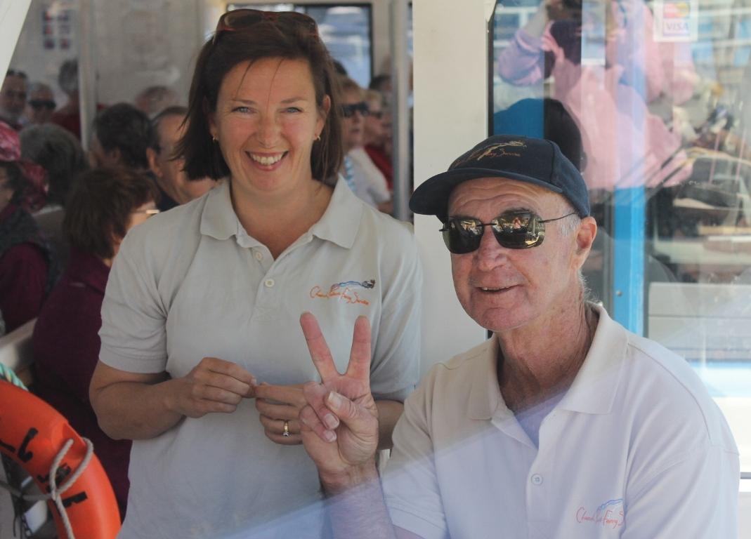
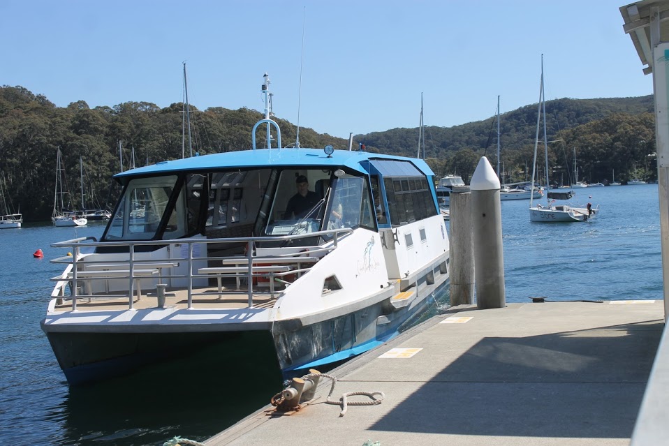
Church Point Ferry Services - Take A Ride On The Water
Speaking of the best way to get around Pittwater, on the water, how about a ride on one of the beauties run by the Church Point Ferry Service? Children under 5 ride free, you can get off at Lovett Bay and take a walk and maybe stay at the Pittwater YHA or up the track to the Lookout or along the Towlers' Bay Trail.
The Church Point Ferry Service website even has a history page to list what you will see along the way. Their timetable is here: www.churchpointferryservice.com.au/ferry-timeable
Palm Beach Ferries
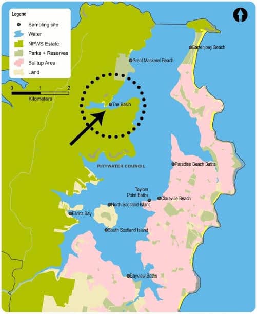
For those who want to explore the northern end of the Pittwater estuary and take a ferry ride to see the wharves of Palm Beach - Bennetts - Bonnie Doon - Basin - Currawong - Mackerel, then Palm Beach Ferries is for you!
Their timetable is available at: palmbeachferries.com.au/timetables
If there is a few of you and you're heading over to The Basin camping or heading off to Resolute beach for a picnic and want to get there by water then Barrenjoey Boating Services will take the whole tribe and kit and caboodle.
.jpg?timestamp=1599249145859)