The instances of 'parks for the people' formed part of Pittwater from the earliest days of the shift of the area from being a rural food bowl to a holiday resort and, during the 1920's, a potential suburban area.
The preservation of the Barrenjoey peninsula has been enriched through the work of those who came before us who had connections and homes here.
Along with the focus that stemmed from such bodies as the Kindergarten Movement to ensure children in inner city areas had access to play areas, with Maybanke Anderson at the helm, whose son Harry was one of the Barrenjoey Land Company Directors, the Wildlife Preservation Society and Sydney Bushwalkers and Marie Byles of Sunrise road Palm Beach, and Annie Wyatt of the Tree Lovers League and National Trust, and the Boomerang Walking Club of children's champion Ella McFadyen, developers such as Arthur Jabez Small were founders of the NSW Parks and Playground Movement, which was then embedded in his membership of the Town Planning Association.
Annie Wyatt was also involved and, as this small report records, brought all these like-minded organisations together:
PARKS AND PLAYGROUNDS.
Aims of Movement.
"That every child shall have a chance to play and every citizen the opportunity for recreation" was adopted as a chief aim in the constitution of the New South Wales Parks and Playgrounds Movement, which held its first annual meeting at the New South Wales Cricket Association's Chambers on Wednesday.
"The normal expansion of Sydneys playing fields should be, at a minimum, from 100 to 120 acres of level land every year," says the report of the movement. A report on the whole matter by the Surveyor-General, who was being assisted by a committee of the movement, was expected shortly. "In the meantime, the executive of the movement has taken up (as an Immediate measure) the question of pressing for 'Five More Moore Parks."
The meeting, which was a full one, delegates from 30 bodies being present, was concerned largely with the elimination by the Legislative Council of the parks clauses of the Greater Sydney Bill.
'This meant', said Dr. C. E. W. Bean, honorary secretary of the movement, 'that, although the Greater Sydney authority, if established, could plan parks and playgrounds, it would not be able to acquire them, or even to accept them if given to it-powers which were possessed by greater-city authorities all over the world. '
On the motion of the chairman, Mr. A. J. Small, seconded by Mr. D. G. Stead, the meeting expressed its unanimous disapproval of the elimination of these powers from the bill. The liability of all State school playgrounds to taxation while many private school grounds were exempt was also strongly criticised in the report, a case being cited in which public land lying Idle was heavily rated as soon as it was permitted to be used as a play-ground for State schoolchildren.
On the motion of the chairman, seconded by Mr. R.A. Bennett, it was resolved to urge that, in the bill projected by the Government, exemption should be extended to all school play-grounds. A committee was appointed "to co-operate with the city authorities in their task of re-organising the playground system of Sydney," And It was also resolved, on the motion of Mr. Burrows and Mrs. Wyatt, to urge the preservation by some means of the Pymble State forest. Mr. A. J. Small (president of the Town Planning Association) was elected as first president of the Parks and Playgrounds Movement. PARKS AND PLAYGROUNDS. (1931, September 25). The Sydney Morning Herald (NSW : 1842 - 1954), p. 10. Retrieved from http://nla.gov.au/nla.news-article16818070
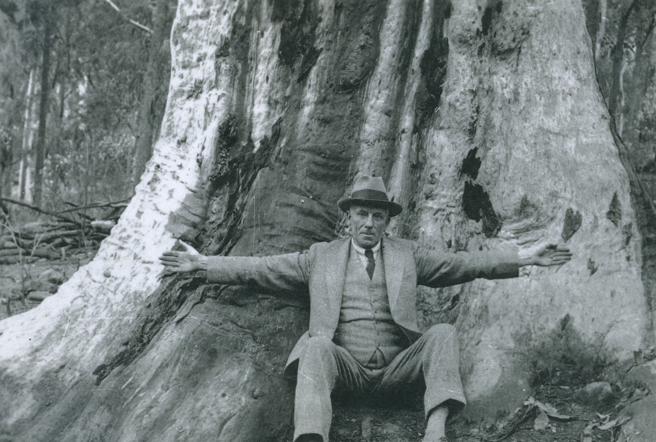
Arthur Jabez Small and the 'Old Girl' in Angophora Reserve Avalon Beach this reserve was named for, pre-1954 - photo courtesy ABHS - Geoff Searl OAM
This wasn't just a New South Wales movement - this was happening worldwide. In America there was the Outdoor Recreation League and the Playground Association of America, in the UK the older public park movement, which started in the 1830s, sprang mainly out of a desire to improve health in the over-crowded conditions of the rapidly growing industrial towns. They had swapped the Village Green for the grim factories; they needed to be able to access fresh air and sunshine.
By the end of the Victorian era the need for public open space had become widely appreciated. Increasingly, parks additionally became symbols of civic pride, providing inhabitants and visitors alike with attractive surroundings in which to enjoy their leisure time. In the minds of their promoters they also assumed a social role as places of betterment for the lower levels of society. [2.]
Ultimately their aim was to make playgrounds a part of any public landscape and planning - something which did not exist until these people stood up and stated this should occur.
People were distressed by the rapid destruction of bushland and the 'hemming in' of populations by the rapid expansion of urban areas and also was was cited as poor planning and filling every green spaces with buildings when these open spaces were needed for exercise, for sport, for contact with the natural world and all a connection to the changing of the seasons naturally brings in maintaining the physical health of the body and the mindful health that supports.
On September 20th 1935 a newspaper report records:
''The Parks and Playground Movement has protested against suggestion in the Macquarie Street replanning committee's report, that new Parliament buildings and additions to Sydney Hospital should be built on open land in the Domain and old Government House grounds..''
One academic states;
The Parks and Playground Movement was heavily influenced by social Darwinism, and declared that ‘clean sport is not merely preventive of crime; it is undoubtedly one of the most powerful positive character-moulding influences in operation in the world today’.
Many would also cite Sir John Sulman’s 1890 lecture ‘The laying out of towns’ as marking the beginning of town planning in Australia. He too was an influential advocate for open space and garden suburbs over the next 40 years.
The vision, which was shared from its outset by the newly created Warringah Shire Council, was ensuring places were set aside so people may access green areas and places for play. The State Government also shared this vision and resumed and set aside larger portions of land - Long Reef Aquatic Reserve and Griffith Park are one example, the gradual resumptions or gifting to everyone of Newport Beach, Palm Beach and Avalon Beach, as well as lands alongside another.
The keeping of green spaces, places with views outwards to sea and bush, and bush areas within the streets was part of this - the 'closing in' isolation identified through the Kindergarten Movement that would apply once these areas had become urbanised was well-known from the outset and the remedy was to keep it greener.
Apart from the coastal headlands where open coastal scrub thrived, areas beside roads, originally mere tracks, were cleared of much of the original thick bushland enthreaded with creeks, the huge trees shipped off to England for ship-building and other commercial use, and as part of what colonists were required to do - 'clear the land' - so the land could produce crops, and when that failed due to the poor quality of the soil in this area, dairies and cows kept these cleared places of now paddocks alike green areas in the centre of villages.
This may have made land sales easier as people could pitch a tent in the cleared space of a bought block prior to building, but it emphasised those areas not cleared lent themselves to being ideal places to set aside as 'parks where children may play' and as places where the bushland and views may still be experienced.
The National Fitness Council's camps at Broken Bay, Mona Vale and Narrabeen, with the Pittwater Youth Hostel opening as part of this, were intent on connecting children and young adults to the environment, exercise and good health.
This has been an ongoing local campaign in Pittwater - the Bible Garden at Palm Beach, one of the later established 'parks for people', was preserved in part so everyone could see that view over Palm Beach from that height that many subsequent house projects have blocked from those walking along the roads, despite Pittwater Council's 'view sharing' clause as part of any DA application still applying.
The current day residents association for Avalon Beach, the Avalon Preservation Association commenced in 1967 as a result of local concern about the indifference to the natural environment displayed by Warringah Council and exploitative developers.
Our environment as the restorative of health and as the place to connect to the original church and Voice of many seasonal songs and habitat therein, as a place to walk, hike, hear and see wildlife, and as a place exhale, to sit quietly and just be, was being passed on by one generation to the next as knowledge of where what is worth more is stored. This was decades before the 1975 discovery of endorphins in pigs and calves, and humans, and that was years before the relation between exercise or being in the great outdoors increasing endorphins release in the body - or 'being en-dolphined' as it sometimes gets called around here after a particularly stoked session in the salty ocean or an hour or two strolling along Pittwater bush tracks.
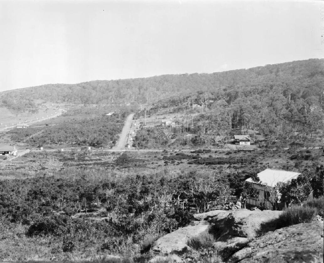
The five parks and bushland reserves that form part of this credo for Bilgola Plateau predate the formation of the Parks and Playground Movement although they were the intent of A J Small from the outset of the Avalon Beach valley, Clareville and Bilgola Plateau subdivisions which stemmed from his work.
Bilgola Plateau came after the earlier and sales down on what was once called 'Priests Flat' beside the beach.
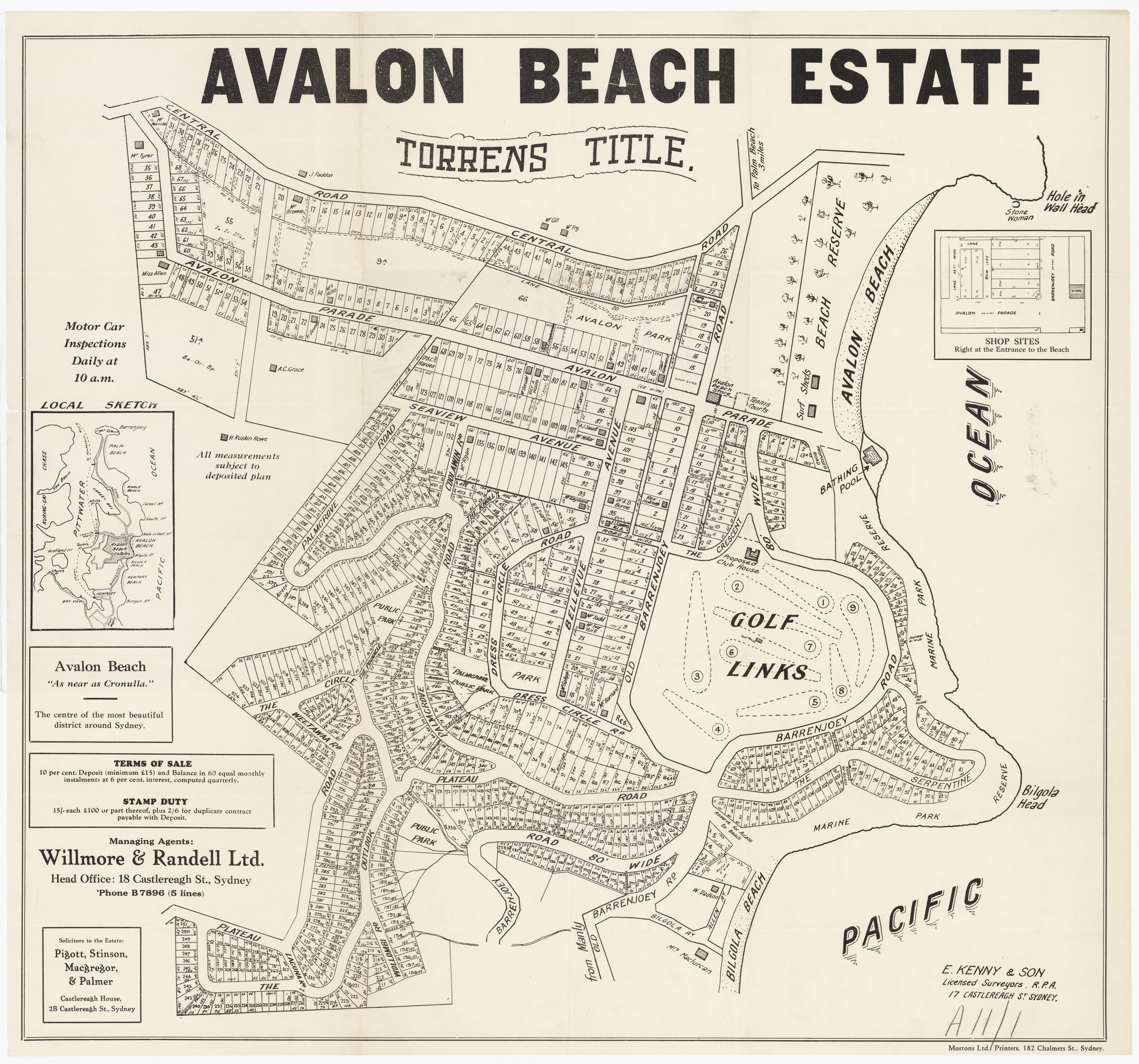
In 1927 Arthur Jabez Small handed over the selling of the portions of land to two gentlemen who were to become big land developers in New South Wales and later, other states, George Malcolm Willmore and Reginald N. Randell. Although there would be problems with this arrangement, and he would be left responsible for the same, A J Small went ahead as land at Bilgola Plateau, that overlooking the Avalon Beach side, was being subdivided for sale. Late 1927 newspapers record:
COMPANY NEWS.
The following companies have been registered, shares being of the value of £1 each: Avalon Beach Estates, Limited, capital £25,000, to purchase, take on lease or in exchange, or otherwise acquire any lands and buildings, but In particular to acquire a certain parcel of land, containing about 180 acres, situated at Avalon, N.S.W. First directors, G. M. Whitmore, R. N. Randell, and A. R. Macgregor. COMPANY NEWS. (1927, November 4). The Sydney Morning Herald (NSW : 1842 - 1954), p. 15. Retrieved from http://nla.gov.au/nla.news-article16416226
REAL ESTATE
TO SELL AVALON NEW COY. FORMED 180-ACRE HOLDING
After 15 years of quietly developing a large tract of land at Avalon Beach, Mr. A. J. Small has disposed of his entire Interest to the Avalon Beach Estates. Ltd.
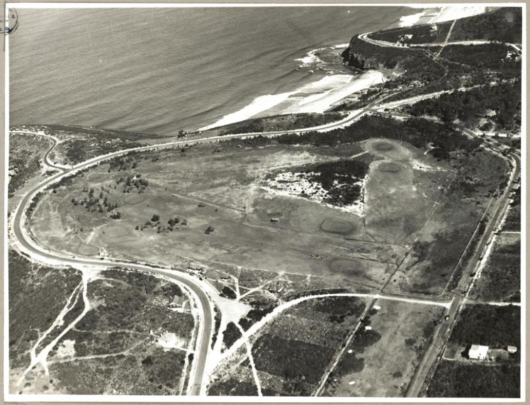
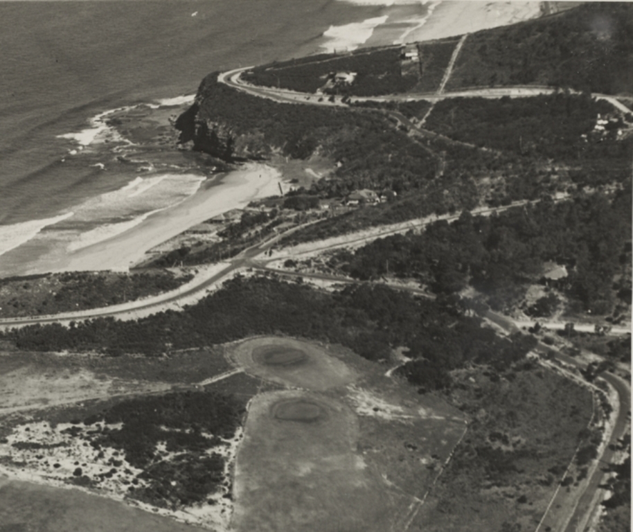
This new company was formed and registered to exercise the option to. purchase, and has now formally taken possession. The area, comprising approximately 180 acres, is situated right at and adjoining the beach, and completely surrounds the golf course which was laid out by the well-known professional golfer Mr. D. G. Soutar, who claims that it Is the best nine-hole seaside golf course in the State.
Modern town-planning has played an Important part in this new subdivision, and generous allowance has been made for public parks and reserves. The selling agents are Willmore and Randall Ltd. and the first release will probably be offered to the public this week. REAL ESTATE (1927, November 16). The Sun (Sydney, NSW : 1910 - 1954), p. 23 (FINAL EXTRA). Retrieved from http://nla.gov.au/nla.news-article222739439
Warringah Shire Council Minutes of Meetings record in January 1928;
Bilgola heights reserve - 47. A.J. SMALL. 18/1/28. Submitting plan Avalon Estate Avalon Estate No. 1 and residue Lots 24 and 25 Bilgola Heights Estate. Dealt with in the Engineers' report.
By 1929, when they're trying to launch the venture, they're asking the council:
17. Avalon Beach Estates Ltd. 30/4/29. Inquiring if the Council will affix its Seal to the Deposited Plans of the Avalon subdivision, if furnished with a Bond from the Southern Union Insurance Co. Ltd.. for an amount sufficient to cover the cost of completing the unfinished roads. Referred to the Works Committee.
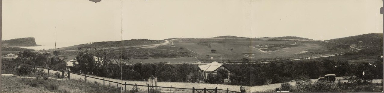
The Deposited Plan (DP16902) and plans drawn for the sales lithographs along with the advertisements for same show the extent and not so rapid uptake of the lots for sale. They also show in these drawings acres set aside for parks for people and the preservation of bushland areas, along with dedicated pathways between the streets and bush areas to connect people to these set aside green lots as well as other roads and main roads where bus transport could be accessed.
It is here that the first of 6 Bilgola Plateau 'parks for the people' and preservation of original remnant bushland appear on maps and in records - most of them gifted to the community and the future by Arthur Jabez Small as part of his credo, along with this aligning with the then Warringah Shire Council's policy from its commencement to set aside parks for public recreation of residents and visitors and to ensure all these early subdivisions allowed pathways over the hills and through to the foreshores to keep permanent access to these for all the people all the time as much as connect those that walk to the transport available along main roads and to connect to village centres without having to walk the whole street.
.jpg?timestamp=1714584951907)
.jpg?timestamp=1714584978198)
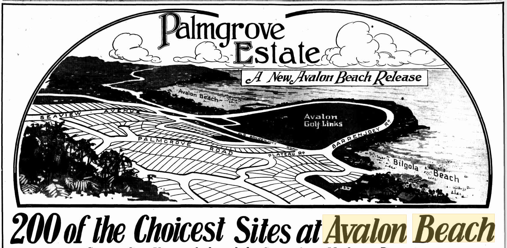
Avalon Beach Estate Bilgola Plateau and Palmgrove estate lots - DP16902, courtesy NSW HRLV
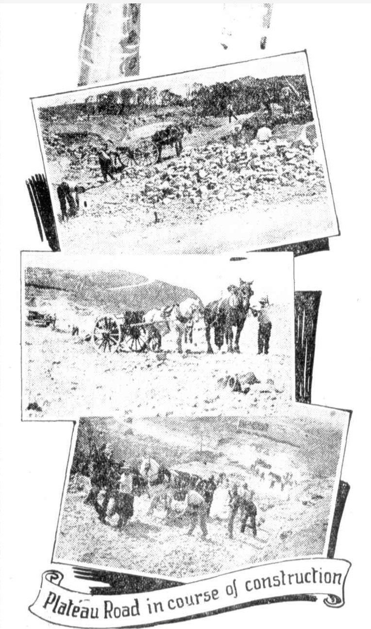
In October 1928 Plateau road, and a sketch of other roads, as well as the then being constructed torpedo wharf at Clareville, appears in Willmore and Randall advertisements:
.jpg?timestamp=1574890765534)
.jpg?timestamp=1574890825627)
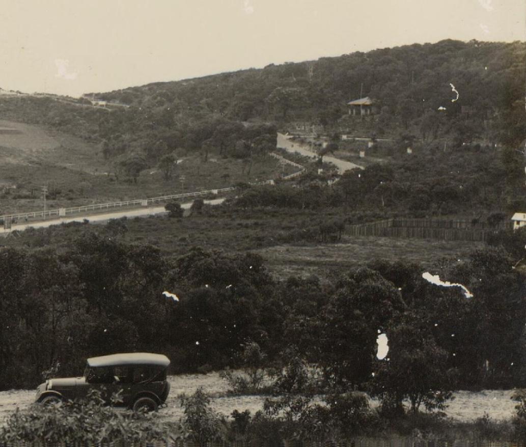
Plateau Road is now open for traffic. This enables us to release 200 new and particularly choice sites — sites with glorious elevation, within easy distance of ...Advertising (1928, October 7). The Sun (Sydney, NSW : 1910 - 1954), p. 33. Retrieved from http://nla.gov.au/nla.news-article224680128
.jpg?timestamp=1566429296153)
.jpg?timestamp=1566429330395)
Advertising (1928, November 11). The Sun (Sydney, NSW : 1910 - 1954), p. 37. Retrieved from http://nla.gov.au/nla.news-article223246319
The Bilgola Plateau Parks for People and wildlife
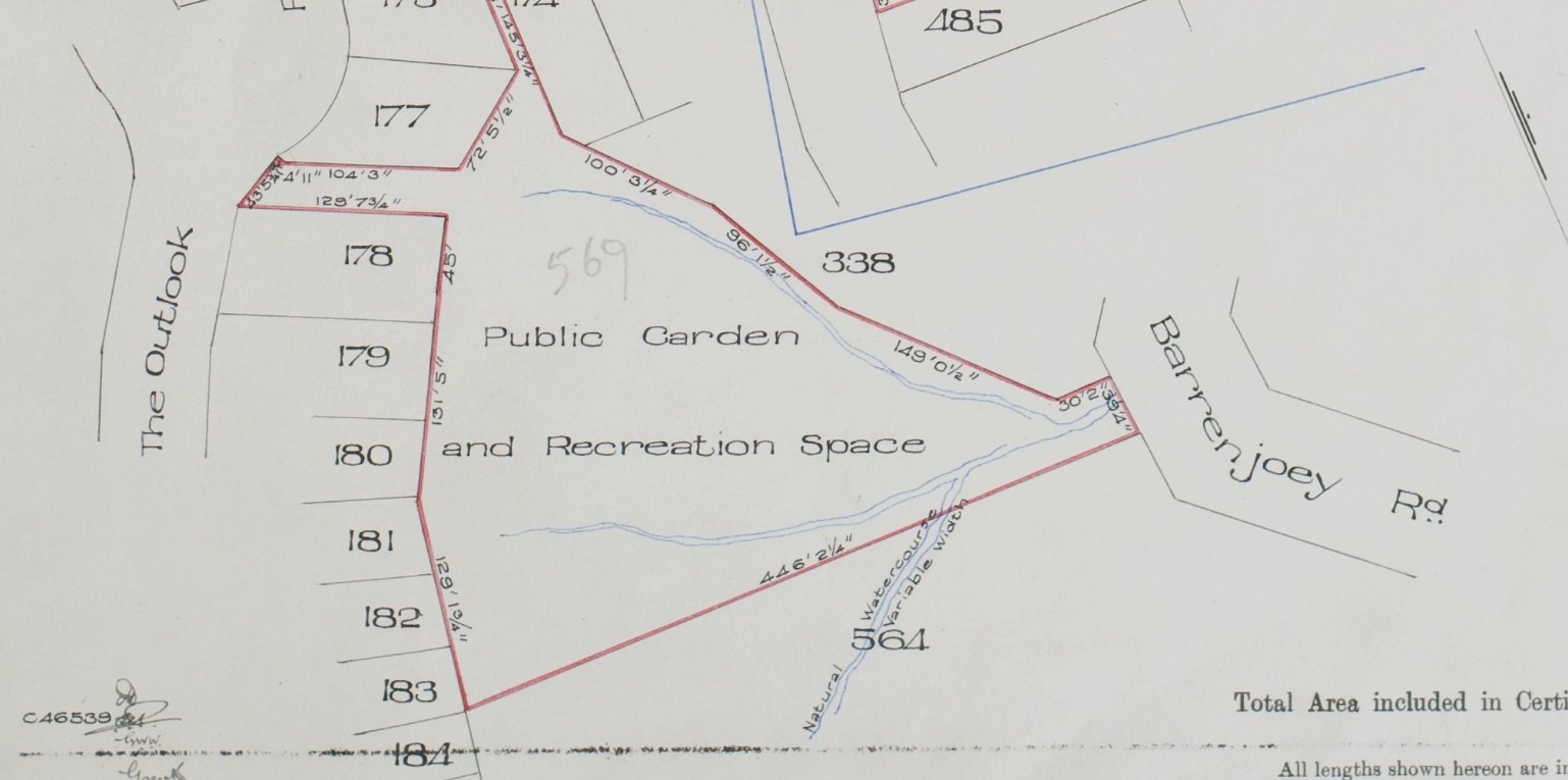
In February 1931 the formalisation of the dedicating these parks is recorded in Vol-Fol 4469-13, over 5 acres all up, which included some of the well-known Bilgola Plateau parks:
.jpg?timestamp=1714593544979)
.jpg?timestamp=1714594261697)
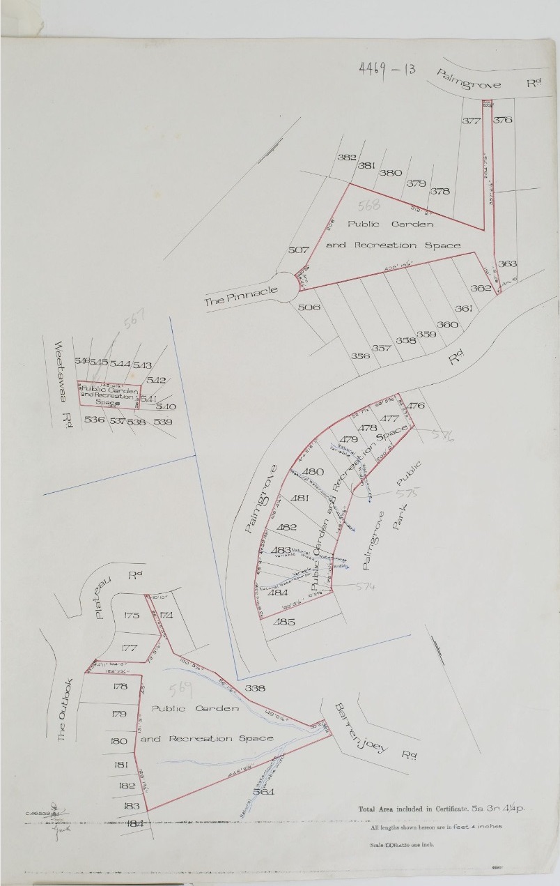
Note the creeks threading through these parks - the same is in the landscape at Angophora Reserve and Hudson Park (dedicated later as a public reserve, in 1957) during this era, as shown when that was formally gifted by A J Small and had the Wildlife Presrevation Society as Trustees, and in Dunbar Park, when that was gifted as well:
Pittwater Pathways: the Bilgola Plateau 'Ginnels'
A ginnel is a word in various Scottish and northern English dialects describing a fenced or walled alley between residential buildings that provides a pedestrian shortcut to nearby streets. Ginnels are typically found in suburban areas, and do not contain any business premises, unlike some other types of alley. Other related terms include snicket, tenfoot and snickleway.
Suburban streets in Pittwater similarly feature "cut-throughs", which are fenced or walled passages found between residential lots that grant pedestrians easy access to nearby facilities situated on other roads or to public areas on the foreshores. They may feature a nature strip and are generally marked by 'public pathway' signs and at times secured by bollards to prevent vehicle access.
According to Collins English Dictionary, a snicket is 'a passageway between walls or fences', and a ginnel is 'a narrow passageway between or through buildings'. Editors of some Yorkshire glossaries asserted a connection between ginnel and a Scandinavian word for 'mouth', on the analogy of an opening.
Land given to create and maintain public pathways Vol-Fol 4468-3:
.jpg?timestamp=1714610015193)
.jpg?timestamp=1714610144740)
Note the then Warringah Shire Council decides to permanently 'lease' some of this public land in the Dress Circle connections in 1955:
.jpg?timestamp=1714610202546)
The three spaces given to the community and future generations by A J Small are:
Weetawaa Road Reserve
0.0726 hectare
A small neighbourhood park, adjoining residential lots on three sides. The park consists of flat Kikuyu lawn areas with scattered trees and shrubs, including Eucalypts, Casuarinas and a large Coral tree. The park has some play equipment, seating and a tap/bubbler;

Plateau Park
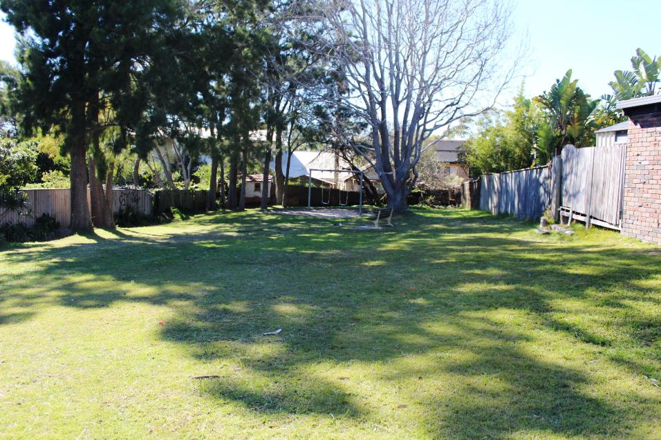
Plateau Park is located on Bilgola Plateau and fronts onto Plateau Road. The reserve is 1.8850 hectares and contains Duffy's Forest, a Threatened Ecological Community - there is an access pathway through to Bilambee Avenue and Loblay Crescent.
Bushland: 90% small developed park: 10%
This large lawn area functions as a "village green" and field area for school and community. It is a large reserve comprising mainly natural bushland adjoining Bilgola Plateau Primary School and has a playground area near the park's frontage to Plateau Road, lawn areas with native trees and pockets of bushland. Trees include E haemastoma, E gummifera and Angophora costata.
The vegetation in Plateau Park is Duffy's Forest a listed Threatened Ecological Community and dominated by Eucalyptus sieberi, Corymbia gummifera and Eucalyptus haemastoma. There is a diverse shrub layer with common species including Glochidion ferinandii, Acacia myrtifolia and Lambertia formosa. There are also rare species including Woody Pear (Xylomelum pyriforme) and Waratah (Telopea speciosissima).
The reserve contains a range of nectar-rich shrub species that are important for a range of birds and insects. Plateau Park acts as a wildlife refuge for local fauna, and provides an important link in the wildlife corridor for faunal movement between larger bushland areas.
 The Pinnacle Reserve at Bilgola
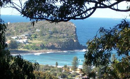
Area: 0.61 hectare. 5A The Pinnacle, Bilgola Plateau - which connects through to Palmgrove road at the eastern end and has some great views east over the valley of Avalon Beach.
To the right is a photo taken from this track in 2012.
The track through this bush wends, is quite steep and the bushland itself is thick - but this is a great way to descend from near the top of Bilgola Plateau and take the back way down the hill to the village.
The vegetation here is described as Hawkesbury sandstone open forest and has some great Angophoa costata trees - even the street leading down the hill into this reserve has great examples of these beautiful trees. Black She oaks, Red bloodwood, old man Banksia and Blueberry Ash may be found here too.
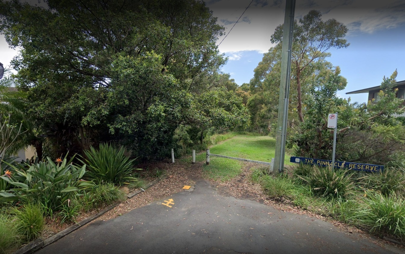
Pinnacle access point from Bilgola Plateau end
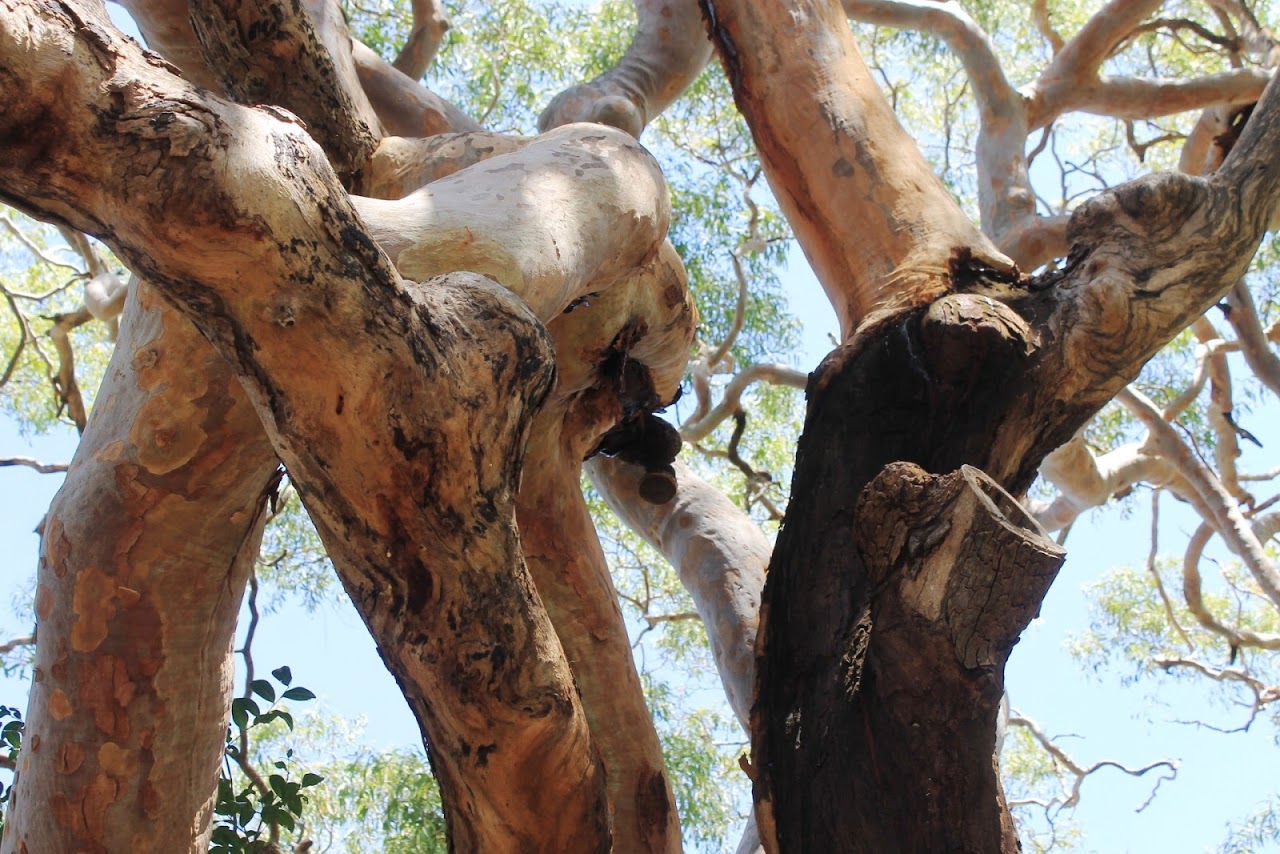
Sydney red gum (Angophora costata) - pictures we took in 2017 at this site
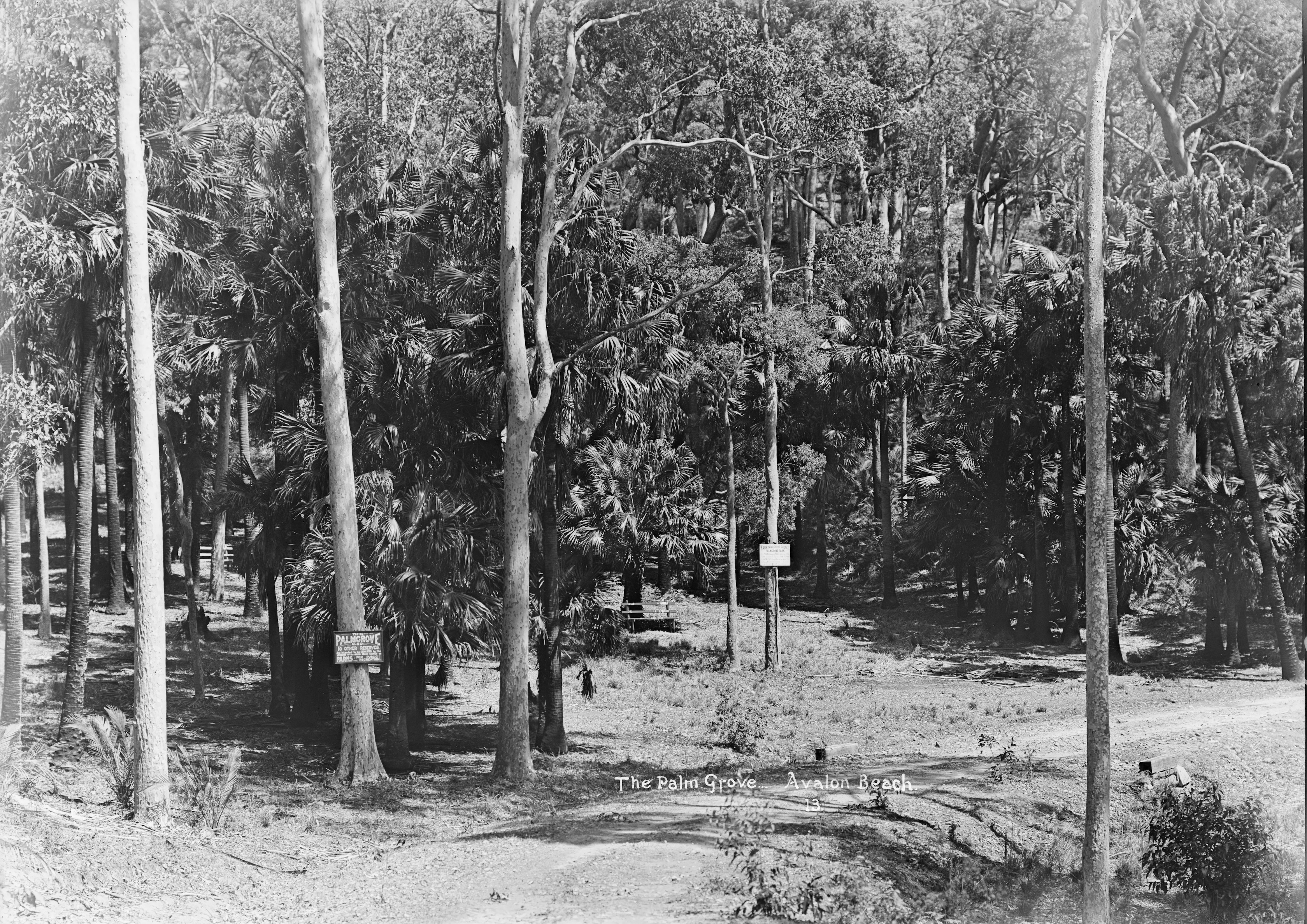
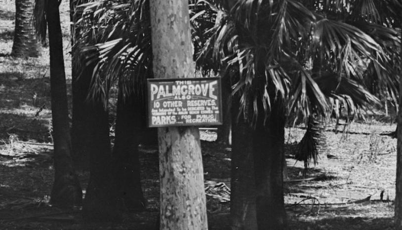
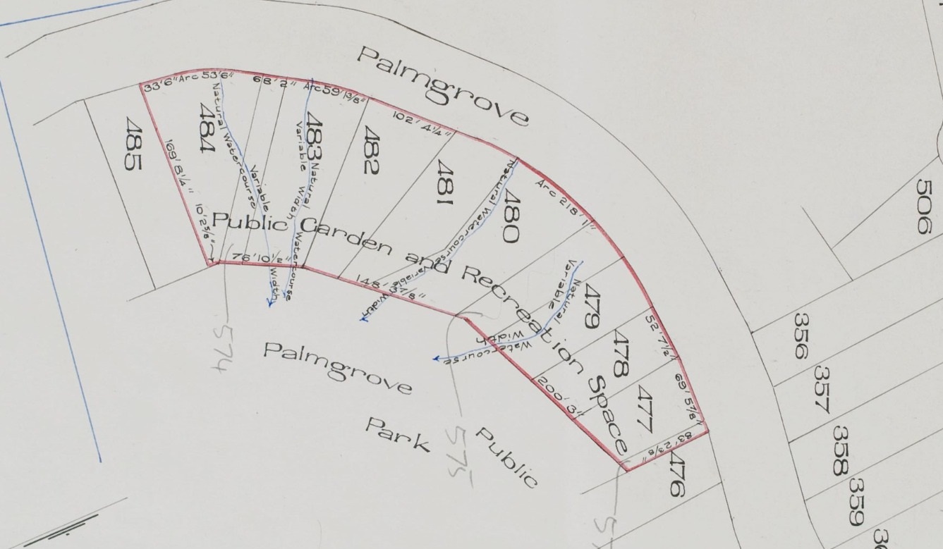
Palmgrove Park
As can be seen above, a park was set aside at Palmgrove Road and Dress Circle Road, Avalon as well.
At: Dress Circle Road and Bellevue Avenue Avalon. Area (ha): 2.34 hectares - 0.7188 m2 (western part), 0.4969 m2 (eastern). Land Title Reference: Lot 100 and 101 in DP11462, and Lots 477 to 488 in DP16902.
This is what is classed as a 'medium sized reserve', bisected by Dress Circle Road, comprising mostly natural bushland in a steep sheltered gully in the western part and lawn areas with stands of mainly native Cabbage Tree Palms and Spotted Gums in the flatter eastern part. The park also contains some items of play equipment. A track with flights of steps links the eastern parts of the park with Palmgrove Road. Palmgrove Park contains a significant stand of Cabbage Tree Palms as part of the Littoral Rainforest and Pittwater Wagstaffe Spotted Gum Forest.
Bilgola Plateau has two other parks for the public:
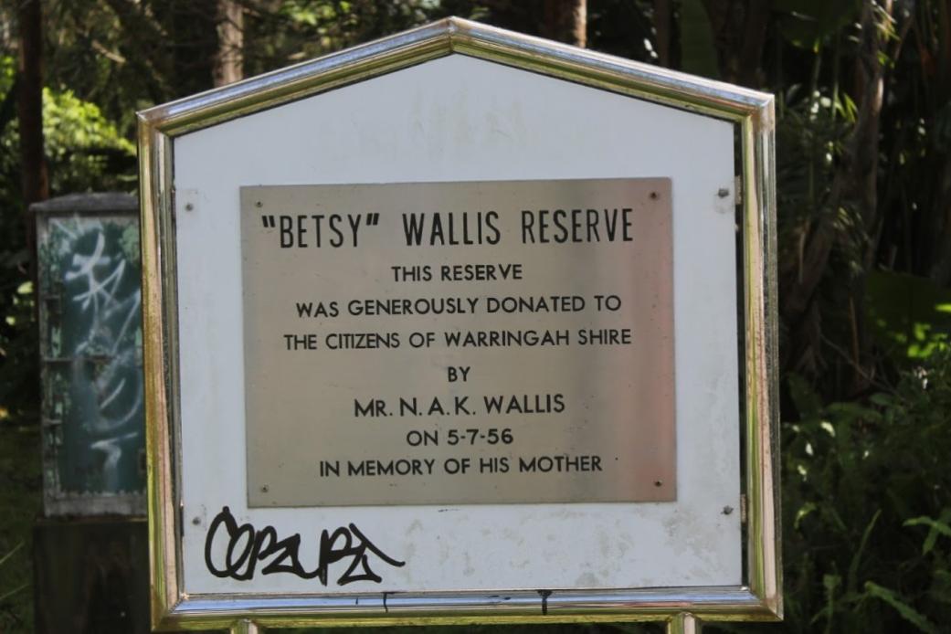
Betsy Wallis Reserve
At: The Circle Bilgola. Area: 0.0793 hectare, Land Title Reference: Plateau Lot 491, DP 16902
A small neighbourhood park with a feature sandstone rock garden and bench 'Betsy's Corner', as well as some notable remnant Angophoras, Banksias and other planted species such as succulents, amongst natural rock outcrops and low stone walls. It is a memorial park and a prominent local landmark and is used for informal recreation.
This as given to the community by Norman Arthur Kingsbury Wallis on July 5th 1956 in memory of his mother.
Algona Bushland Reserve
At: Algona Street and Joanne Place, Bilgola Plateau Size: 0.15 hectare Small Park (5%) and Bushland (95%)
This is a predominantly steep bushland reserve with filtered views of Pittwater over Salt Pan Cove. Contains a small area of parkland with play equipment adjoining Joanne Place. The park is densely vegetated with remnant trees such as Angophora costata, Eucalyptus gummifera, E. piperita, Allocasuarina littoralis, and Banksia sp.
Algona Reserve is a small example of bushland containing regionally significant plant species and acts as a local refuge for fauna and a stepping stone between larger areas of habitat.
The vegetation is Hawkesbury Sandstone Open-forest dominated by Sydney Peppermint (Eucalyptus piperita). The reserve protects a small example of bushland containing regionally significant species, namely of Cabbage Tree Palms stands which are very restricted in Pittwater
Grey Gums, a notable feature of Algona Reserve, form a stand in the mown upper part of the Reserve. These trees also have hollows suitable for other arboreal mammals, as indicated by numerous smaller scratch marks, and may be used by Sugar Gliders or the threatened Squirrel Glider. The understorey provide cover for small birds, reptiles and frogs.
Some animals which have been recorded in this reserve include: Eastern Rosella's, Grey Butcher birds, King Parrots, Powerful Owls, Rainbow Lorikeets, Striped Marsh Frogs, Whip Snakes and a Pacific Baza.
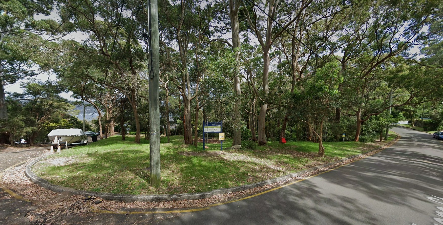
Algona bushland reserve - Google maps
One people may forget exists is:
Lower Plateau Reserve
This Reserve of 0.7 hectares may be accessed between 284 and 286 and 240 and 242 Lower Plateau road, Bilgola and is listed as Lot 136 in DP12838. The vegtation is described as Bloodwood-Scribbly Gum Woodland
This vegetation community is categorised by canopy species such as Red Bloodwood (Corymbia gummifera) and Broad-leaved Scribbly Gums (Eucalyptus haemastoma) and Smooth-barked Apple (Angophora costata) and shrub species such as Banksia Serrata and Sweet wattle (Acacia suaveolens). Tree canopy height reaches 10-15 metres.
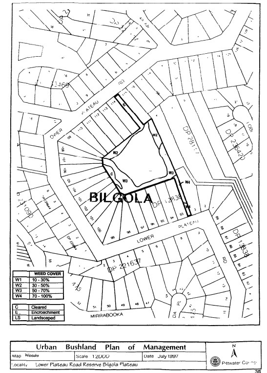
Lower Plateau Reserve - map, 1997: Pittwater Council
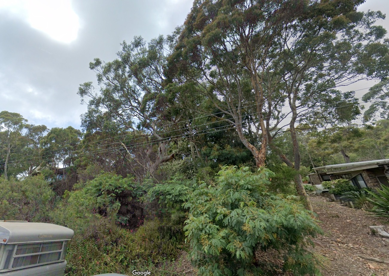
Lower Plateau Reserve access point - Google maps
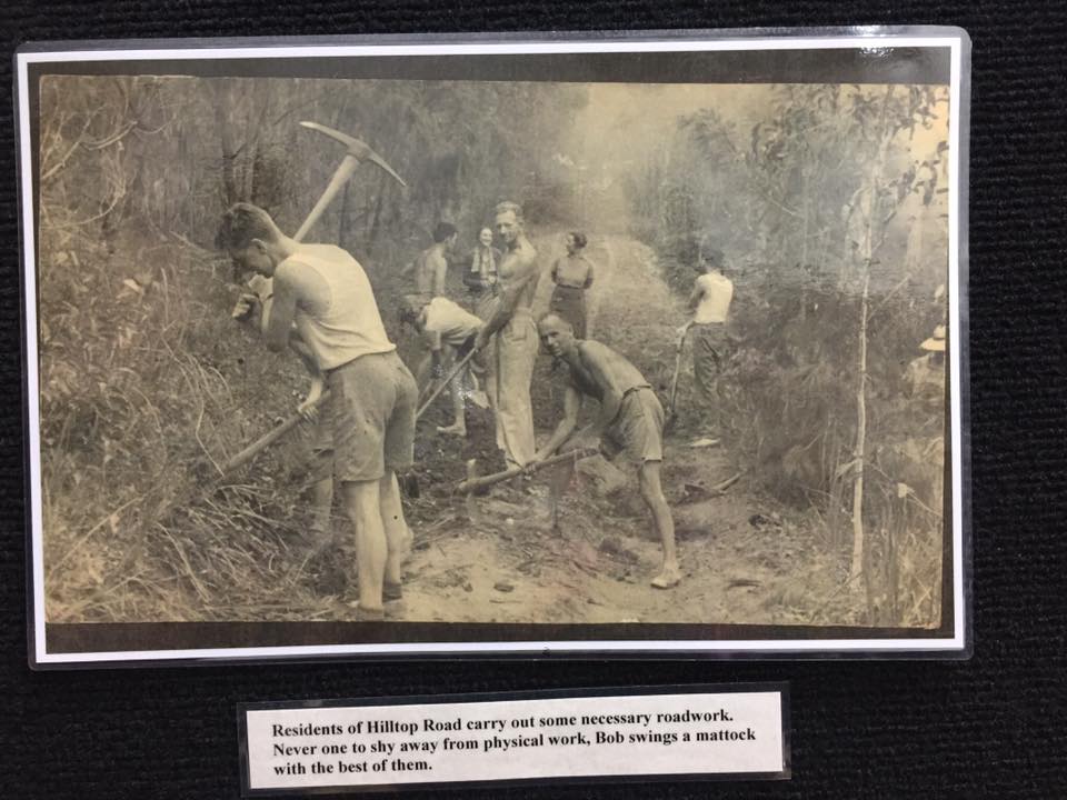
This reserve is tucked behind the homes, underlining the maintaining of access to bushland is embedded in our community, and has been since the outset of the shift from a place to relax or grow food to an urban environment. This great old ABHS photo of people working to keep the edges of Hilltop Road at Bilgola underlines those who lived here permanently, or spent months here during Summer, worked as one team - and maintaining that access to a park to play in or a tree to sit under, with a view to the horizon before you, and listen to the birds sing - and exhale:
References - extras
- TROVE - National Library of Australia
- Harriet Jordan. Public Parks, 1885-1914. Garden History, Vol. 22, No. 1 (Summer, 1994), pp. 85-113 (29 pages). Published By: The Gardens Trust. https://doi.org/10.2307/1587004
- Explore All Those Pittwater Pathways To Public Lands & Reserves, Catch A Ferry, Take A Stroll, Have A Hike, Go Watching Whales, Dolphins, Birds
- Pittwater Roads II: Where The Streets Have Your Name - Bilgola
- Pittwater Roads II: Where The Streets Have Your Name - Avalon Beach
- Pittwater Beach Reserves Have Been Dedicated For Public Use Since 1887 - No 1.: Avalon Beach Reserve- Bequeathed By John Therry
- Pittwater Reserves: The Green Ways Bilgola Beach - The Cabbage Tree Gardens and Camping Grounds
- Newport Surf Club Celebrates 110 Years On October 19, 2019 - A Few Club Firsts
- Wilshire Park Palm Beach: Some History + Photos From May 2022
- The NSW Women's Legal Status Bill 1918: How The 'Petticoat Interference In Government' Came Of Age - A 100 Years Celebration Of Women Alike Our Own Maybanke Selfe-Wolstenholme-Anderson
- Harry Wolstenholme, June 21, 1868 - October 14, 1930 - Ornithologist Of Palm Beach, Bird Man Of Wahroonga
- A Pearl Of An Idea: Long Reef Aquatic Reserve Celebrates 40th Anniversary
- Annie Wyatt Reserve: Palm Beach - Pittwater Fields of Dreams II
- Marie Beuzeville Byles - 8th Of April, 1900 To 21st Of November, 1979
- Ella McFadyen's Love Of Pittwater: An Environment, Wildlife and Children's Champion
- Ella McFadyen's Love Of Pittwater: Children's Champion - shorter version for youngsters
- National Fitness Centres At Broken Bay, Mona Vale, Narrabeen: Local History Shows We Like To Move It! Move It!
- The Pittwater YHA: Some History
- Grand Old Tree Of Angophora Reserve Falls Back To The Earth - Angophora Reserve History (Creeks)
- Angophora Costata Named Eucalypt Of The Year 2023: The Tree One Of Our Local Reserves Is Named For - A Celebration
- Avalon's Village Green: Avalon Park Becomes Dunbar Park - Some History + Toongari Reserve And Catalpa Reserve
- Roads In Pittwater: The Barrenjoey Road
- Palm Beach Bible Garden
- Palm Beach Bible Garden Regeneration – Official Launch
- Avalon Preservation Association - Profile + History by Geoff Searl OAM
Soon after the first European settlers made their ways into Pittwater people were calling for a road:
COAST ROAD
Among the many improvements called for in the Colony, it has struck us as most essential, that the means of communication should be opened, by road, to Newcastle, and the settlements at and near Broken Bay. That fine settlement is almost unknown from the present want of ferries and roads; and we have no hesitation in saying that Broken Bay will, ere long be one of the most important districts in the Colony. Settlers, newly arrived, are beginning to cry out - ‘There is no land’, while millions of acres lie entombed upon the seaside. In America the finest land taken possession of, is generally that contiguous to water carriage, and with the convenience of good harbours. The North-east arm of Broken-bay is one of the finest enclosed pieces of water in any Colony, resembling, it is said, in extent and smoothness, the beautiful water of Lochlomond, in Scotland; and when the day arrives, which we trust is not far distant, when steam boats will ply from harbour to harbour along the shores of Australia, a grant of 1000 or 2000 acres in the neighbourhood of Broken-bay, Reid’s Mistake [Lake Macquarie], and Port Stephens, will be a fortune. "An honest tale speeds best, being plainly told." (1825, June 16). The Sydney Gazette and New South Wales Advertiser (NSW : 1803 - 1842), p. 2. Retrieved from http://nla.gov.au/nla.news-article2184149
For decades moving yourself or produce via boats was the easier way to shift anything, whether going into 'Sydney Town' or just across to the other side of Pittwater via the estuary. The open land between Mona Vale and Narrabeen allowed the carrying of goods via carts as time went on, as shown in the story of David Foley.
A description of the road north published in 1861 marks a start point in the pre-developments for mail runs and conjures up a rural idyll that was more bush and creeks than smooth thoroughfares built for soft tyres:
Passing Jenkins' farm there is a level piece of beautiful turf nearly two miles long, and a quarter of a mile broad, quite fitted for a racecourse ; forming the finest gallop anywhere near Sydney, and almost of it-self worth the trouble of riding out to. After this, bush occurs again, and then the Narrobin lagoon is reached, half a mile wide-sometimes nearly dry, sometimes up to the horses' knees or girths, and at times impassable. "We found it very low, but filled with fish of various sizes, darting in all directions. This back water extends inland quite out of sight, but is a perfect level sand all over, and, if not fordable, can be crossed by the bar of sand which shuts it out from the sea.
%20Parish%20of%20Manly%20Cove.jpg?timestamp=1537924794578)
%20-%20Copy%20Jenkins%20homestead.jpg?timestamp=1537924833256)
Parish of Manly Cove land titles map section from and section from that section showing placement of the Jenkins' homestead - courtesy NSW Land Registry Services, HLRV - Historic Parish Maps, NSW Records
The road continues alternating with fine galloping ground over the downs, on the sand-hills and through the bush; every now and then magnificent headlands appearing suddenly as you emerge from the bush, generally enclosing between them a fine sandy bay, upon which the ocean rolls in with a most majestic appearance from the heights above.
Near Mr. Farrell's farm are cliffs at least 100 feet high, from which a man fell, whilst shooting birds, from the rock giving way; and, strange to say, he was not much hurt, as he walked out a few days afterwards. The beach underneath is covered with debris of trees and timber, driven down the Hawkesbury by the recent floods, and drifted about here into the bays. The road from Farrell's to the flagstaff has not the sea in view, being amongst bush and steep gullies, over picturesque murmuring creeks. We crossed a tent, where men were boring for coals on the Rev. Mr. Therry's land they have reached 150 feet without success; but it appears that the cognoscenti have pronounced the seam to be deep but certain.
That it is hard stuff in some strata, is seen by four inches only having been gained in the last two weeks. If coal is found, a tramway to Manly will save a sea voyage to Newcastle, and open a great traffic.
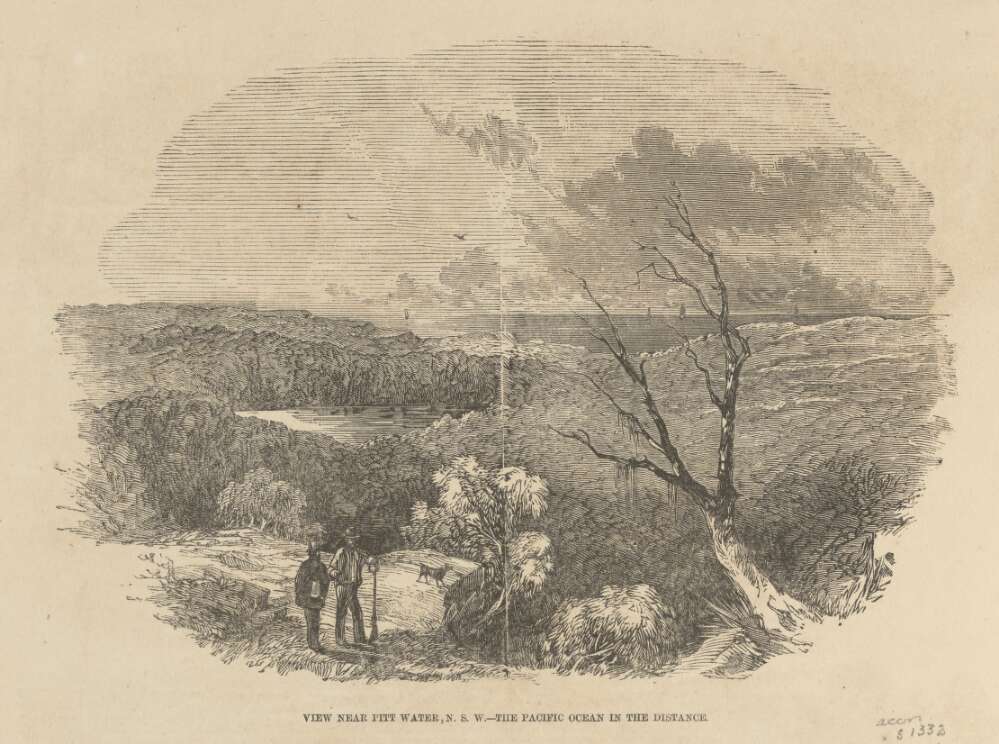
Suddenly, after emerging from a tortuous mountain track, we come in full view of the magnificent estuary of Broken Bay or Pitt Water, running nine miles inland, with water enough for the largest man of war: here the Juno formerly went for gunnery practice, and ascended five miles up.
The middle water is the mouth of the Hawkesbury, several miles in extent, and beyond it is the bar of Brisbane Water, known by the surf beating over it, and difficult of access for any but coasters and steamers, the deep channel being narrow with less than two fathoms of water This runs inland sixteen miles ; East Gosford, a rising township, being at the head of the head of the navigation.
Thus the Hawkesbury has Brisbane Water on the north, and Pitt Water on the south of its embouchure, all three compused between the North and South heads, and about ten miles across. The appearance is not unlike Sydney Harbour near Middle and North Harbours, with the exception of more width, and heavier timber all around
The first thing that met our eyes on the shores of Pitt Water, was a small colony of Chinamen, who live in tents, and are engaged in curing fish caught there, for the Melbourne and Sydney markets a dozen small boats are engaged in the trade, which I hear has been a good hit, although, just now, there are no fish, which is attributed to the great floods having driven them all out to sea. Another mile along a level piece of turf by the water side, brings us to the coast-guard station, where Mr Ross has for several years been in charge. He very politely led us to the top of the rock, where the flagstaff is placed commanding a splendid view of all the surrounding scenery for many miles in all directions. This is Barenjo on the south Head, and is about 100 feet high. Several soldiers, made out of trees, as large as life, and painted, are placed about, and might actually serve as landmarks to vessels entering these complicated waters they would be more useful several miles up the mer, where steamers have often taken the wrong channel, owing to the numerous wide branches on either side, rendering the proper channel difficult to recognise.
Thus ends the trip to Broken Bay, which, for diversity of scenery of entirely an opposite nature, constantly' recurring, forming a succession of panoramas of forest, lagoon, green turf, sand hills, mountains, gullies, creeks, precipices, and (few and far between) settlers farms, I will venture to affirm, cannot be equalled in so short a distance of thirty miles in any part of Australia, and will much repay the trouble of the journey and somewhat plain fare attendant upon it, as, after Manly, there is no accommodation for travellers, and supplies should be carried with them from there from Manly, the distance to Barenjo is twenty-one miles, and can be performed, starting early in the morning, there and back the same day, half the road being a splendid turf, which part of the ground can be got over quickly, and the remainder offering no difficulties to the rider
This trip can only be performed on horseback, but you can avoid taking a horse across Middle Harbour by hiring one at Manly Beach, and going from there to Broken Bay, the road, after crossing the Manly Lagoon, being the same as I have attempted to describe.
JUNIUS . A TRIP OVERLAND TO BROKEN BAY, THE MOUTH OF THE HAWKESBURY. (1861, April 6). The Sydney Morning Herald (NSW : 1842 - 1954), p. 8. Retrieved from http://nla.gov.au/nla.news-article13059376
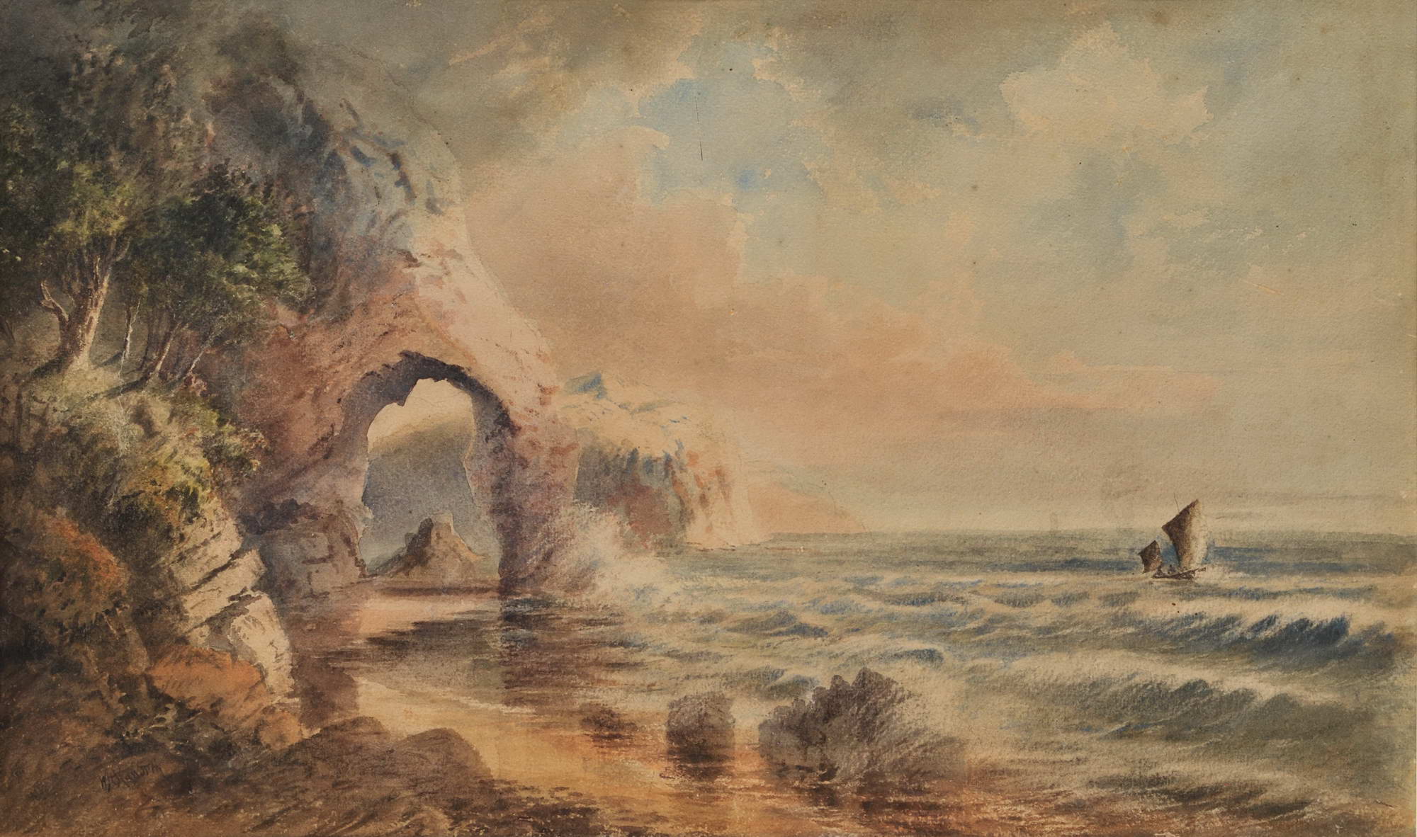
W.H. Raworth (Brit./Aust./NZ, c1821-1904). St Michael’s Arch, NSW [Avalon] c1860s. Watercolour, signed lower left, obscured title in colour pencil verso, 34.2 x 56.5cm. Tear to left portion of image, slight scuffs and foxing to upper portion. Price (AUD): $2,900.00 at:https://www.joseflebovicgallery.com/pages/books/CL181-53/w-h-raworth-c-brit-aust-nz/st-michaels-arch-nsw-avalon
With a Customs House at Barrenjoey by 1840, and then a light to warn all ships at sea of the headland's position, came the need for telegraphic communication - these poles following that early route:
The Legislative Assembly on Wednesday, approved of the agreement entered into at the Postal Conference of March last. At the same sitting, the sanction of the House was accorded to the placing of a light on Barrenjuey, at the entrance of Broken Bay. NOTES OF THE WEEK. (1867, July 13). The Sydney Morning Herald (NSW : 1842 - 1954), p. 9. Retrieved from http://nla.gov.au/nla.news-article28611620
No. 87.—Australia, East Coast, "New South Wales.—Temporary Fixed Lights at Broken Bay.
The colonial Government of New South Wales has given notice that from the 20th day of July, 1868, two temporary lights, called Stewart's lights, would be exhibited on Barrenjuey, the inner south headland of BROKEN BAY.
The lights are fixed white lights, bearing E.S.E. and W.N.W. from each other, distant 390 yards; the higher one is elevated 347 feet, and the lower one 315 feet, above high water, and in clear weather should be seen from a distance of about 12 miles.
Both lights will be eclipsed from seaward between the bearings North to N.N.W., N. W., to prevent them from being seen over the land, which recedes from the outer south head, and also to ensure a vessel passing a safe distance off the south head, by keeping the lights in sight when running for Broken Bay. The lower or outer light will be lost sight of in rounding Barrenjuey, but the upper light will be a good guide for coasters bound to Pitt Water, or for large vessels wishing to obtain shelter in Flint and Steel Bay. SHIPPING NEWS. (1868, December 11). The Express and Telegraph (Adelaide, SA : 1867 - 1922), p. 2 (LATE EDITION.). Retrieved from http://nla.gov.au/nla.news-article207678469
L1350, to connect Barrenjuey with Sydney, by telegraph, was voted, as also L750 for the purchase of 500 iron telegraph poles, tenders for the supply of which will be invited in the colony. WEDNESDAY, MARCH 30. (1870, April 2). Australian Town and Country Journal (Sydney, NSW : 1870 - 1907), p. 4. Retrieved from http://nla.gov.au/nla.news-article70458523
Electric Telegraphs:— To connect Barrenjuey with Sydney 1,350 0 0, Iron Telegraph Posts 3,750 . 0 0 No. II. An Act to enable the Government to raise a Loan for Public Works and other purposes. [Assented to, 26th September, 1870.] (1870, September 30). New South Wales Government Gazette (Sydney, NSW : 1832 - 1900), p. 2121. Retrieved from http://nla.gov.au/nla.news-article223532392
The distance from Manly to Barrenjoey in the 1870s was 17 miles (showing four miles had been trimmed from the 1861 account) and still made by horseback. Today it is 13.79 miles, or 22.2 kilometres:
Farming Prospects at Blue Gum Flat.
We give space to the following account of a district that is now becoming known as an agricultural area, which but a few years ago did not even bear a name : — This flat lies nearly north of Sydney some thirty miles (as the crow flies). To one inclined to proceed to it on a tour of discovery, three routes are available. First, by steamer to Gosford— a four hours' passage — thence by host Campbell's cob, over six miles of particular 'corduroy' or logged roadway. Second, on horseback, by the mail route (we have a post-office, through St. Leonards, and over the Hawkesbury at Peat's Ferry; the total distance some 35 miles. Third, per steamer to Manly, thence by horse to Barrenjuey (17 miles), thence by boat to Gosford, and onward as before; the distance by this route approaching 40 miles in all. Farming Prospects at Blue Gum Flat. (1872, February 10). The Sydney Mail and New South Wales Advertiser (NSW : 1871 - 1912), p. 164. Retrieved from http://nla.gov.au/nla.news-article162667318
The first 'tourist' visitors were landed at Careel Bay or Barrenjoey itself via steamers. With the building of a Lighthouse at Barrenjoey and a hotel at Newport in 1880 a shift towards making the shorelines more accessible for wave after wave of 'excursionist' meant thousands came here to fish, to gather wildflowers, to picnic prior to the toot of that steamer signalling the return home along the Pittwater estuary, out around the Barrenjoey Headland and down the coast back into Sydney Harbour.
Telegraph Lines
1. Manly Beach to join the Barrenjuey Line at Bolton's Farm, a distance of 12 miles, and an extra wire on the present poles to Barrenjuey; also a line from Ettalong Beach to Webb's, a distance of two and a half miles; and from the cable landing at Gosford to the Telegraph Office at that place,—to be completed in one month. No. 8 E. B. B. wire to be used. TENDERS FOR TELEGRAPH LINES. (1881, January 25). New South Wales Government Gazette (Sydney, NSW : 1832 - 1900), p. 492. Retrieved from http://nla.gov.au/nla.news-article223688954
The instigation of a mail route, and this being deliverable to Mona Vale, Newport and Church Point by coach, and further on to Barrenjoey on horseback also underlined the tracks built by the first European settlers were and must be further developed.
The rise of a holiday tide and Boarding Houses or holiday cottages for hire attracted more visitors and more coaches for moving people beyond Narrabeen. The opening up of parcels of land for sale from the 1880 'Newport Marine Estate' right through to the 1920's Avalon Beach Subdivisions also contributed to the development of roads and even changes to the way the road north went; the filling in of Newport 'lagoon', the cutting into the Bungan beach hill to form a six lane carriageway, the building of the Bilgola Bends and the change of the main road through Avalon Beach from Old Barrenjoey Road to what was named, initially, the New Barrenjoey Road being four 'change of landscape' examples.
The advent of the motor vehicle and the drive to open up parcels of land this invention brought, especially the influence of motor vehicle organisations such as the N.R.M.A. for better and therefore safer roads, caused faster changes than the 'patch ups' that marked previous decades. The rise of motor vehicle enthusiasts in Australia occurring a few years prior to the first real council for the northern end of the peninsula being instigated in the Warringah Shire Council, which worked in concert with some of the earliest Residents 'Progress' Associations, such as those formed a few years prior to them at Church Point and Bayview as well as the longer lived Newport residents association, were also an influence.
The development of Newport as a 'resort' was a key factor in seeing the oft called for 'improvements' finally materialise from those earliest days, as was Mona Vale residents determination to see 'Mona Vale go ahead' - first signalled with the opening of Taramatta Park (now known as the Village Green park at Mona Vale) and continuing into the 1920's and 1950's with calls for electricity, for water pipes to be connected to houses. These developments give us the names of 'subordinate roads' - they also show when and where these were built first, and improved.
Campbell Avenue (main view) Newport, from the corner of Beaconsfield Street, from album Pittwater scenes, 1880 / Harold Brees courtesy State Library of NSW - note the Telegraph wires. The drawings appear to be the originals for six of the lithographs illustrating 'The Pittwater and Hawkesbury Lakes album'. [Sydney] : Mills, Pile & Gilchrist, 1880. (Lithographed by S.T. Leigh & Co.)
We have received from Messrs. Mills, Pile, and Gilchrist, (who have published it for the proprietors) an interesting pamphlet descriptive and illustrative of the beauties and attractions of Newport, Pittwater, and the celebrated Hawkesbury lakes. The work consists of about eight pages of letter-press and nine carefully lithographed drawings, depicting the more important scenes and places of interest in the locality. The description is capably written, and the illustrations, lithographed by Messrs. S. T. Leigh and Co., from water colour drawing- by Mr. H. Brees, are very creditably executed, and give excellent ideas of the places represented. Appended is a plan and local sketch of the new marine township of Newport, and altogether the publication is one which will commend itself highly to all interested in one of the most picturesque spots on the New South Welsh coast. NEW'S OF THE DAY. (1880, August 26). The Sydney Morning Herald (NSW : 1842 - 1954), p. 5. Retrieved from http://nla.gov.au/nla.news-article13466890
Angophora Reserve
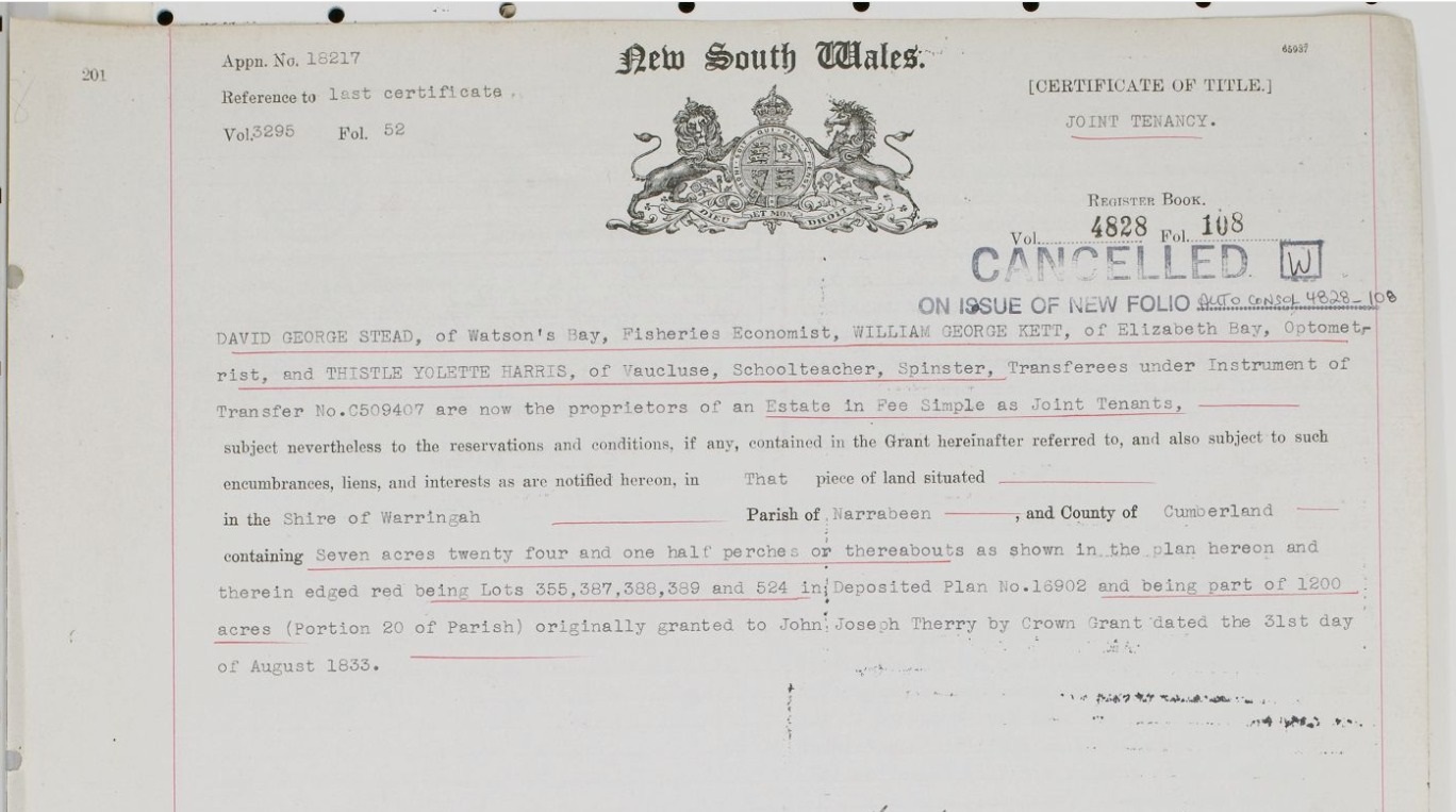
When the bush reserve was purchased in 1937 W.G. Kett, W.G. Stead and T.Y Harris were appointed trustees.
The NSW HRLV provides under Volume 4828, Folio 108:
%20Vol%20Fol%204828-108.png?timestamp=1659822451523)
%20Vol%20Fol%204828-108.jpg?timestamp=1659822727993)
%20Vol%20Fol%204828-108.jpg?timestamp=1659822927794)
%20Vol%20Fol%204828-108.jpg?timestamp=1659822952409)