 April 6, 2016: ANSTO/UNSW
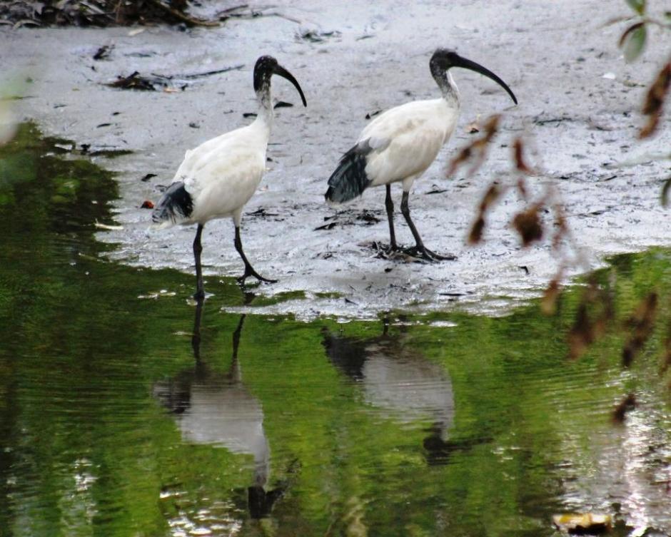
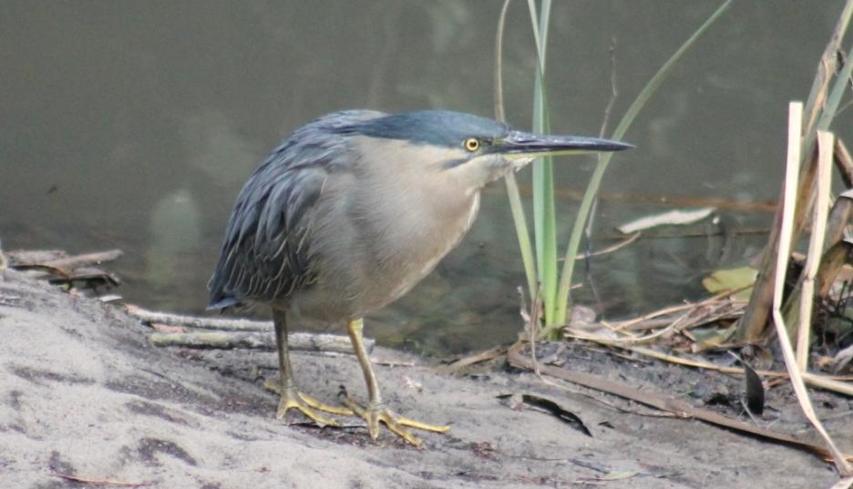
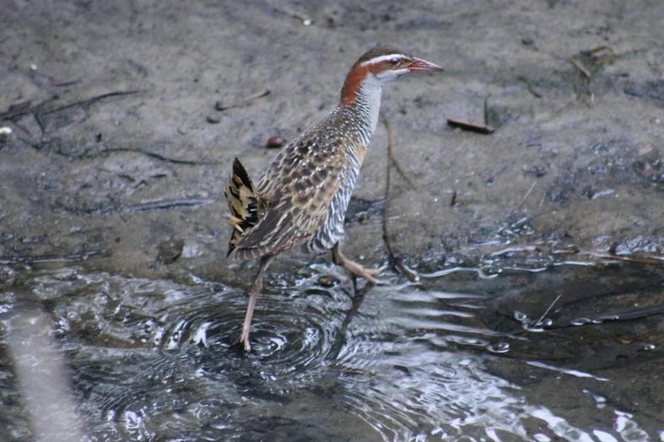
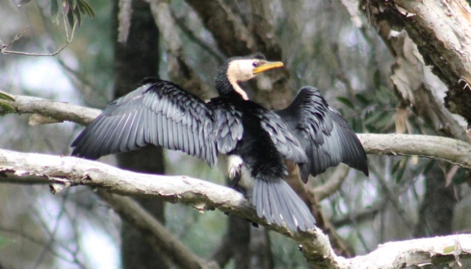
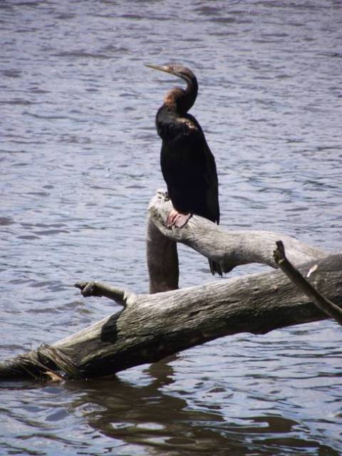
Here’s one for all Pittwater residents and students who love our estuarine waterways and their birds.
Australians are being asked to collect wetland bird feathers to help scientists create the first ever ‘Feather Map of Australia’ to show the health of the country's wetland birds.
In a joint research project between the Australian Nuclear Science and Technology Organisation (ANSTO) and UNSW, “citizen scientists” are being enlisted to gather bird feathers from wetlands.
The feathers will be analysed using nuclear techniques to understand the diet and environmental conditions that grew the feather.
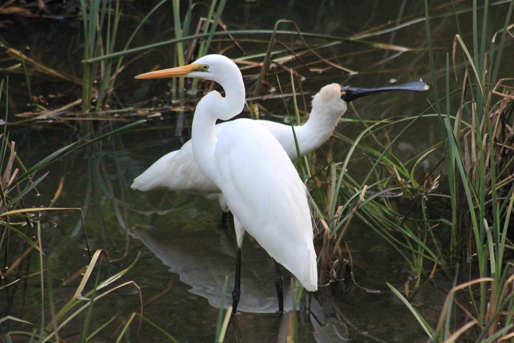
Each bird feather is like a memory chip of where that bird has been. For example, a feather found in a wetland in NSW, once analysed using nuclear techniques, can reveal the bird has been living in the Northern Territory.
Scientists will compare feathers from diverse parts of Australia, to identify differences and create a map to understand more about these ecosystems.
“There are some big questions about waterbirds, which we are seeking to answer,” says project leader Dr Kate Brandis, an environmental researcher and waterbird expert with UNSW and ANSTO.
“Colonies of birds come together in their thousands on flooded inland water systems to breed, then they disappear into much smaller groups and you might not see them for years.
“We would like to determine where they go, and where they come from, to find out which wetlands are really important for certain species,” says Dr Brandis.
 The research team also includes Professor Richard Kingsford from UNSW’s Centre for Ecosystem Science and Dr Debashish Mazumder and Dr Suzanne Hollins from ANSTO.
“We are primarily interested in inland wetlands where you find birds such as colonial straw-necked and glossy ibis, as opposed to coastal estuarine wetlands,” says Dr Brandis.
When we contacted Dr Brandis this week to check if she would be interested in feathers from Pittwater, her reply was, “While our focus is the more inland freshwater wetlands, we are also interested in the estuarine lagoons and estuarine wetlands.”
“Wetlands around Australia are under threat from reduced river flows and flooding, drought, climate change and land use change.
“These are crucial habitats for Australia’s waterbirds, providing places for nesting, feeding and roosting, and if there are not flooded wetlands, the waterbirds don’t breed.
“We are also hoping to determine whether the birds return to the wetlands where they hatched, to breed – there is some debate as to whether this idea of a ‘natal site fidelity’ exists,” she says.
Information from the Feather Map will improve understanding of the ecology and life cycles of waterbirds and waterbird populations, and ensuring their populations are maintained or increased.
“Everyone can take part, from school groups to birdwatchers - anyone wanting to help preserve our precious wetland ecosystems,” says Dr Brandis.
“The more feathers, the more complete the picture and the better the map we will have.”
This unique project provides a non-invasive method to acquire samples, and also avoids welfare issues associated with tagging, tacking or capturing individual birds.
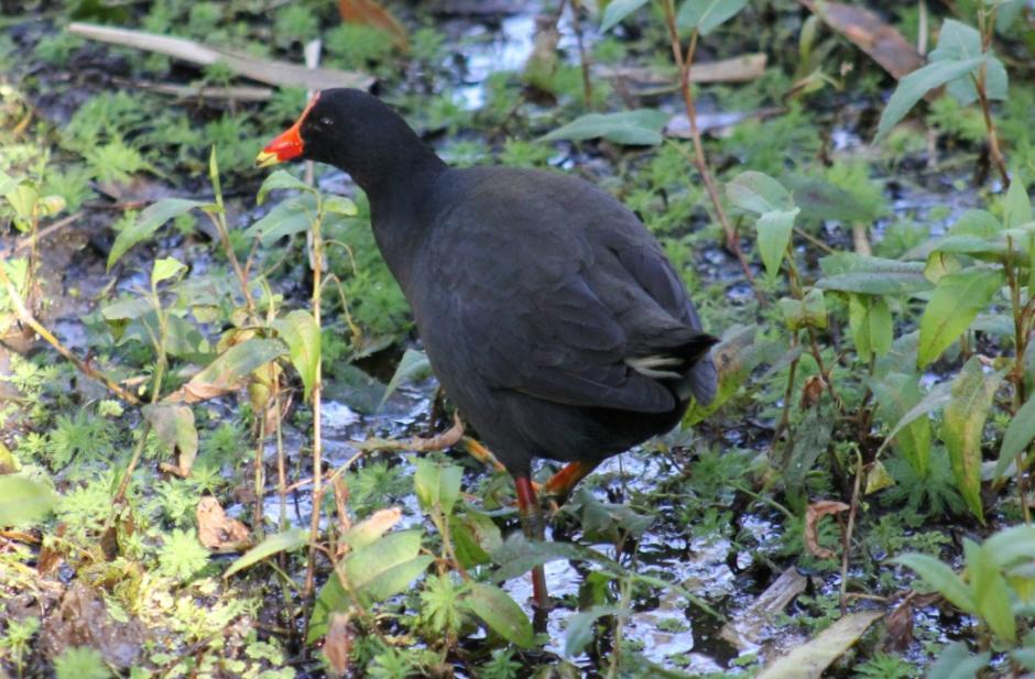
Wetlands are areas where water covers soil year round, or just some of the time – swamps, marshes, lakes, billabongs, lagoons, saltmarshes, mudflats, mangroves, dams and farm dams, rivers and creeks all classify.
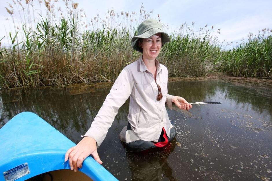
Dr. Brandis collected feathers during an earlier pilot; a dietary study conducted in collaboration with ANSTO environmental researcher Debashish Mazumder, at Lowidgee on the Lower Murrumbidgee and received feathers from colleagues at other wetlands.
By analysing isotopes of carbon and nitrogen, they were able to discern a significant difference in the feathers and link them to wetland sites. “Identifying the elements with another nuclear technique can also help you distinguish between wetland sites,” said Brandis.
Brandis applied for a fellowship to use isotope analysis to identify waterbird movement across Australia that has been funded by ANSTO until 2018. UNSW is jointly supporting the research.
“I have collected feathers in Western Australia and have colleagues all along the Murray Darling Basin collecting feathers for me.”
The initiative is at the stage where the research team, which includes Debashish Mazumder and Suzanne Hollins from ANSTO and Richard Kingsford from UNSW is determining the order of methodologies for analysing of the feathers.
Brandis has a PhD student who is washing the collected feathers to collect zooplankton eggs as there are specific wetland birds, such as the pink eared ducks and freckled ducks that eat them.
Zooplankton species are important as the basis of the food web. “They get transported from wetland to wetland on the feathers of birds,” said Brandis.
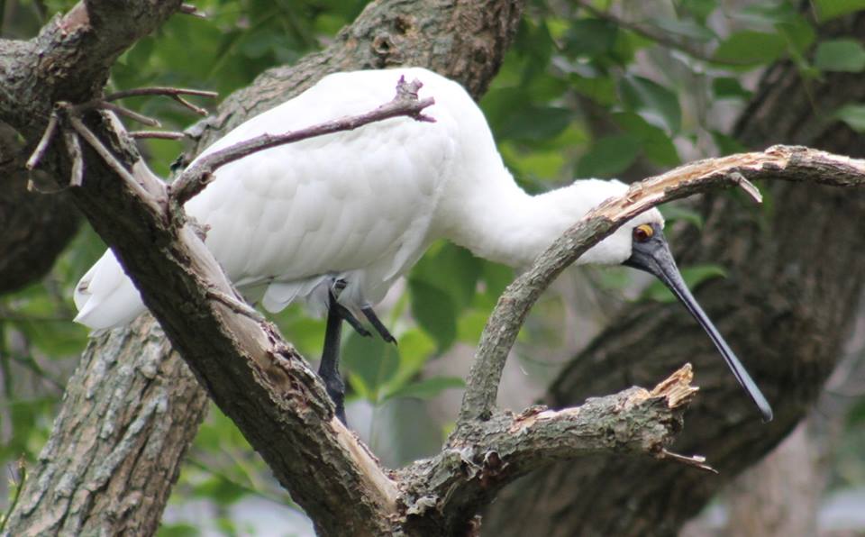
High resolution X-ray fluorescence (ITRAX-XRF) provides information about the mineral elements in the feathers. The measurements will be managed by ANSTO's ITRAX Facility Officer Patricia Gadd (pictured above).
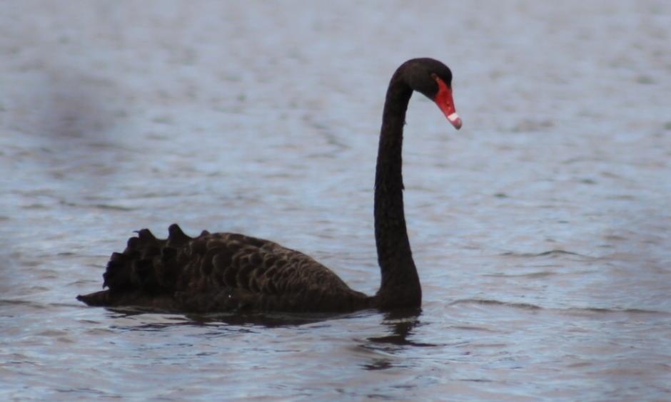
“The isotope analysis of carbon and nitrogen gives us an idea of the diet, whether it is a plant eating or fish eating bird, which helps narrow down the species, such as a cormorant or a swan,” said Brandis.
The isotopes of oxygen and hydrogen provide information about the water.
Another question they hope to answer by sampling during breeding events relates to whether birds use only the breeding site where they were born. This is known as natal site fidelity and there is some debate as to whether it exists at all.
“We do not know if they only go back to the wetland site, where they hatched.“
The information gained by the initiative is important for understanding the ecology and life cycles of waterbirds and waterbird populations and ensuring that populations of Australia’s waterbirds are maintained or increased.
The Citizen Science contribution to the Feather Map encourages people to collect feathers and post them to the research team.
It is important to record the location where the feather was found and identify the species if it is known when submitting feathers.
ANSTO has a commitment to citizen science to support research on important issues. The Feather Map follows the Plastics Project, which involved the collection of plastic from waterways and beaches in the Sutherland Shire.
HOW TO GET INVOLVED:
Step one: Understand the scientific licence or permit requirements for your state or territory. The Feather Map of Australia Project has obtained licences from each state and territory in order for members of the public to help us with this important research. Each state or territory has their own strict rules and regulations – please check online for permit details relevant to you.
Step two: Visit a local wetland in your region and collect feathers that you find on the ground. Please leave any feathers attached to birds in place! Take a look around the wetland while you are there and write down any birds you recognise. Please ensure you wash your hands thoroughly after touching the feathers (or wear gloves while collecting).
We also encourage everyone to take lots of photos while collecting to add to our Instagram page feathermapau.
Step three: Place the feathers in an envelope including the following information:
• Date of collection
• Location of collection: preferably co-ordinate information (GPS location, latitude and longitude). This can be taken from smart phones or Google Maps)
• A list of the birds you identified using the wetland
• Type of bird feather if you know. It’s ok if you don’t. Remember to keep each feather separate if you do, and tag it.
• Include your name and address: this is a condition of our scientific licences. The information will only be kept, or provided to the relevant government body, for this and no other purpose.
Step four: Send your feathers to help us complete our feather map.
ACT, New South Wales Victoria, South Australia, Northern Territory and Queensland
Feathers collected in ACT, New South Wales Victoria, South Australia, Northern Territory and Queensland should be sent to:
 The Feather Map of Australia Project
c/- Dr Kate Brandis
Centre for Ecosystem Science
School of Biological, Earth and Environmental Sciences, Room 508 D26
UNIVERSITY OF NEW SOUTH WALES, SYDNEY NSW 2052
Western Australia
Feathers collected in Western Australia should be sent to:
Feather Map of Australia Project
PO Box 384
WEMBLEY WA 6913
Tasmania
Feathers collected in Tasmania should be sent to:
Feather Map of Australia Project
c/- Vishnu Prahalad
Private Bag 78
University of Tasmania
HOBART TAS 7001
The more feathers we have, the more completed the picture and the better the map!
To get you started, we have provided the locations of some key wetland locations but there are many more.
Wetlands are areas of land where water covers the soil - all year or just at certain times of the year. Wetlands may be natural or artificial and the water within a wetland may be static or flowing, fresh, brackish or saline. Wetlands include:
• swamps, marshes
• billabongs, lakes, lagoons
• saltmarshes, mudflats
• mangroves
• dams and farm dams
• rivers and creeks.
Learn more www.environment.gov.au/water/wetlands/about
New South Wales and ACT
Albury Wonga Wetlands
Location: A five-minute drive from the Albury CBD along the Riverina Highway (the road to Howlong and Corowa).
T: (02) 6043 5820
E: jhawkins@alburycity.nsw.gov.au
W: www.alburycity.nsw.gov.au/leisure-and-culture/wonga-wetlands
Barmah Forest
Location: On the Murray River between the towns of Barmah and Strathmerton. Access to the 12 major entrance gates is available from the Moira Lakes Road, Barmah-Picola Road, and the Murray Valley Highway.
T: 13 1963
E: info@parks.vic.gov.au
Bicentennial Park
Location: Homebush Bay
W: www.sydneyolympicpark.com.au/whats_on/parks/bicentennial_park
Coomaditchy Lagoon
Location: Port Kembla
W: www.environment.nsw.gov.au/heritageapp/ViewHeritageItemDetails.aspx?ID=2700738
Jerrabomberra Wetlands
Location: Canberra
T: (02) 6205 7151
E: FriendsOfJerraWetlands@gmail.com
W: www.jerrabomberrawetlands.org
Lake Brewster wetland
Location: Between Lake Cargelligo & Hilston
W: www.environment.gov.au/water/cities-towns/water-smart/lake-brewster-dam
Lake Cowal
Location: 43 km northwest of West Wyalong, and approximately 60 km south west of Forbes in Central New South Wales.
W: www.lakecowalfoundation.org.au
Lake Wollumboula
Location: Culburra Beach
Macquarie Marshes
Location: 60km north of Warren
W: www.nationalparks.nsw.gov.au/visit-a-park/parks/Macquarie-Marshes-Nature-Reserve
Mannus Lake Dam
Location: Tumbarumba
W: www.tumbashire.nsw.gov.au/mannus-dam-project
Menindee Lakes
Location: Broken Hill
W: www.menindeelakes.com/home.htm
Murray River
Locations: Throughout the river's length
NSW: www.visitnsw.com/destinations/country-nsw/the-murray
Namoi River
Location: Gunnedah
Paroo Overflow Lakes
Locations: Bourke, Louth and Tibooburra
W: www.nationalparks.nsw.gov.au/visit-a-park/parks/paroodarling-national-park
Saltpan Creek Wetlands
Location: Riverwood
Thirlmere Lakes National Park
Location: Couridjah
T: (02) 4632 4500
W: www.nationalparks.nsw.gov.au/visit-a-park/parks/Thirlmere-Lakes-National-Park
New South Wales (scientific licence #SL101642)
The Feather Map of Australia's NSW licence allows for the collection of moulted feathers from birds at wetland sites throughout NSW. Landholders permission is required on private land.
National Parks and Wildlife Services Estates where feathers can be collected are:
Narran Lakes Nature Reserve
Macquarie Marshes Nature Reserve
Gwydir Wetlands State Conservation Area
Murrumbidgee Valley National Park
Toorale National Park
Paroo-Darling National Park
For more information check the website.