Feedback on biodiversity certification of the State Environmental Planning Policy (Sydney Region Growth Centres) 2026 open Until May 18
The Minister for Environment is seeking feedback on biodiversity certification of the State Environmental Planning Policy (Sydney Region Growth Centres) 2026.
Consultation period: 17th April 2026 - 18th May 2026
The government states 'the Sydney Region Growth Centres biodiversity certification aims to protect some of the best remaining bushland in Western Sydney while providing the underlying biodiversity approvals for the delivery of much needed housing'.
Locals shared their summation on some aspects of this the 2022 PON report: Finalised Cumberland Plain Plan released: 'a developers plan that will facilitate extinction of Sydney's koalas' locals state - a 'tree museum plan' for Critically Endangered Woodplain: - ' Currently, less than 6% of the Woodlands remain in small parts distributed across the western suburbs of Sydney, totalling only around 6400 hectares.
Cumberland Plain Woodland was listed as an Endangered Ecological Community under the Threatened Species Conservation Act 1995 in June 1997.
Cumberland Plain Woodland in the Sydney Basin Bioregion was then uplisted to being a Critically Endangered Ecological Community (CEEC) under both NSW and Commonwealth legislation. It was formally listed under the NSW Threatened Species Conservation Act 1995 (now BC Act) in December 2009 and under the Commonwealth EPBC Act 1999 on December 9, 2009.
And in: Saving Sydney's Koalas Requires Scrapping the Cumberland Plain Tree Museum Plan according to 25 Organisations
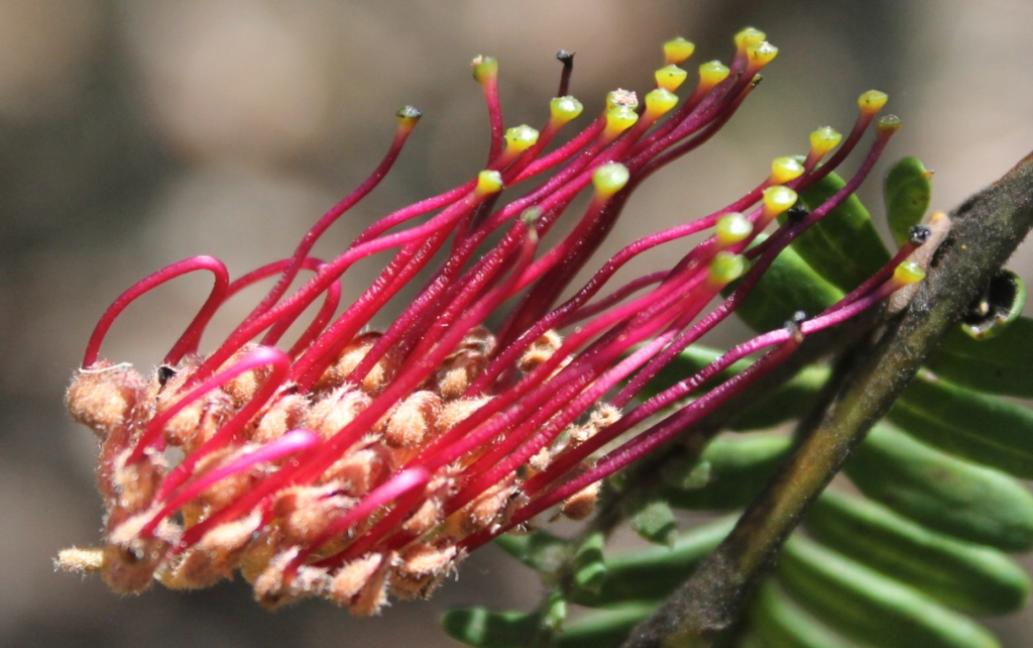
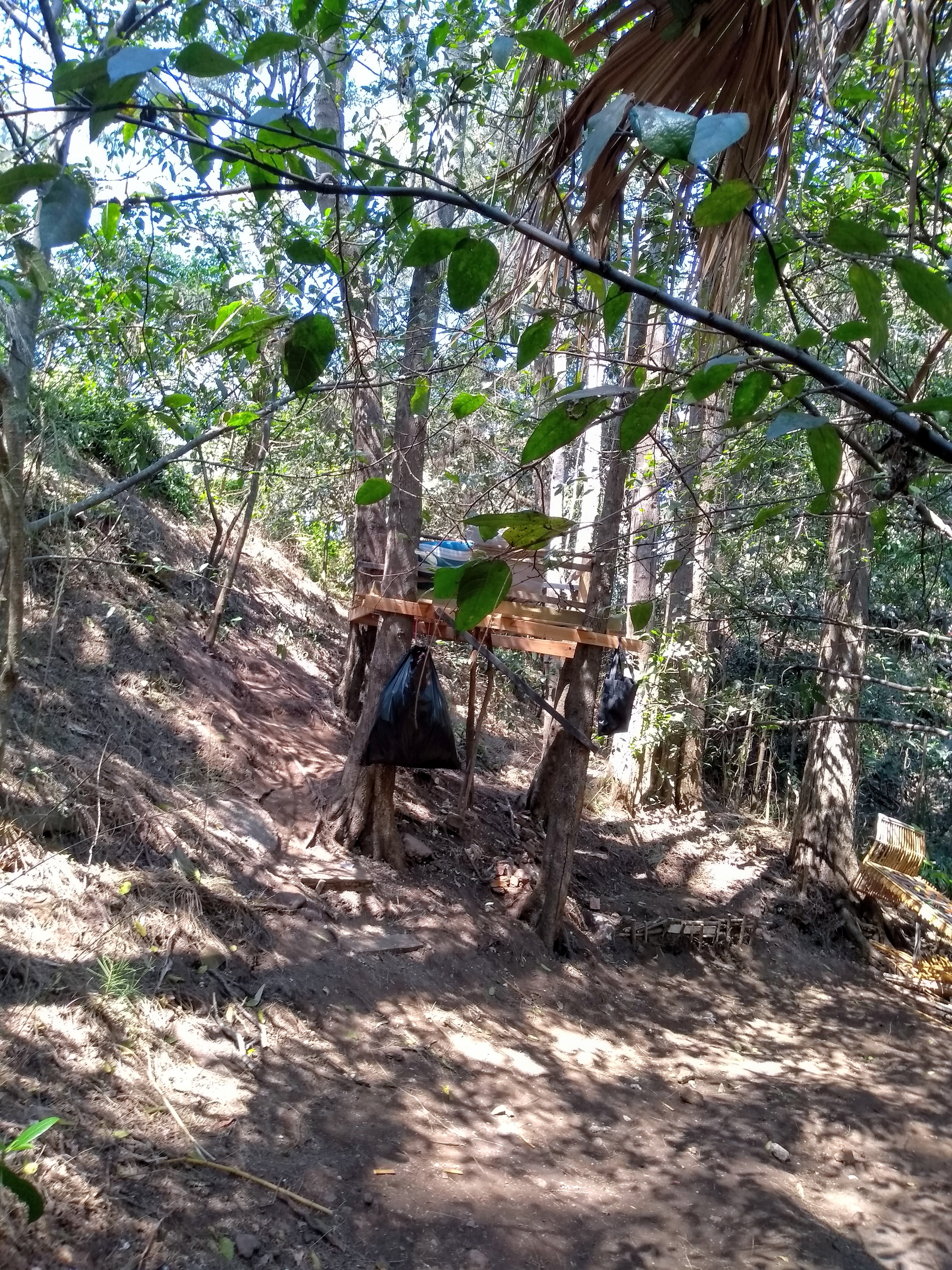
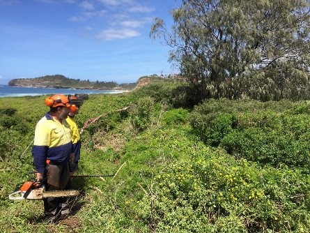
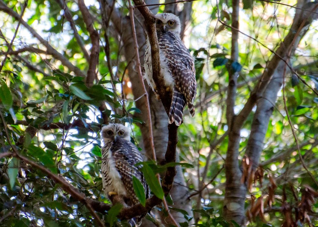
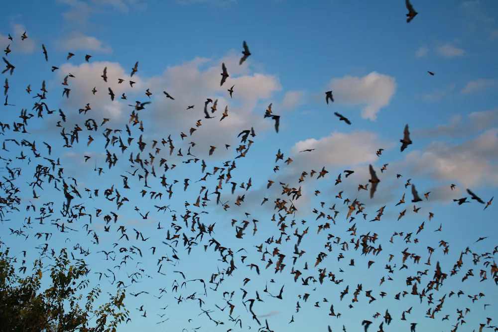
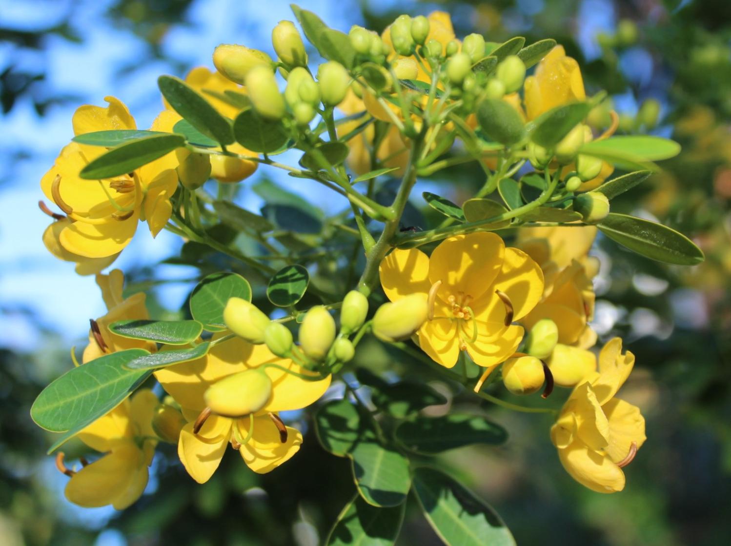
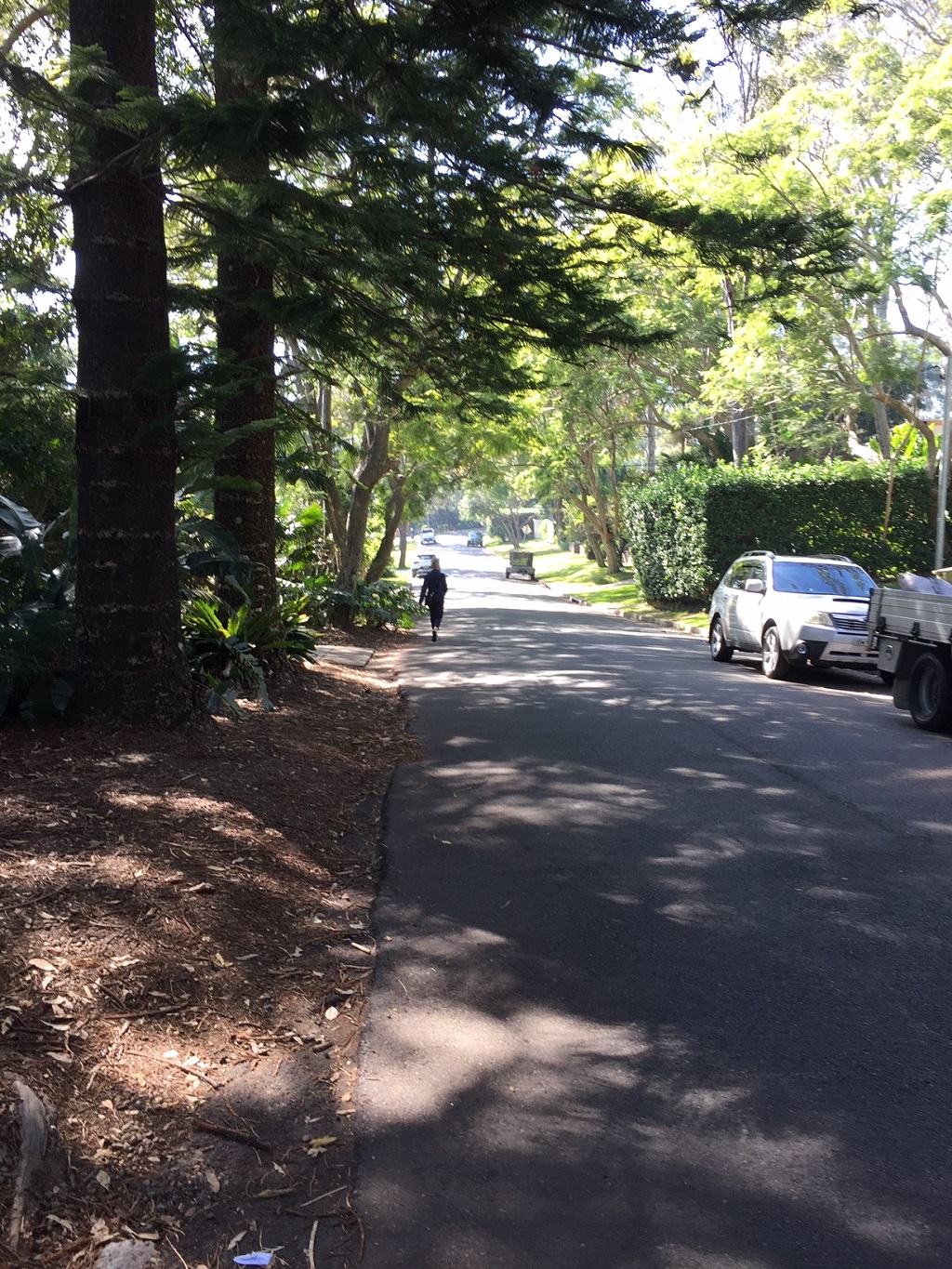
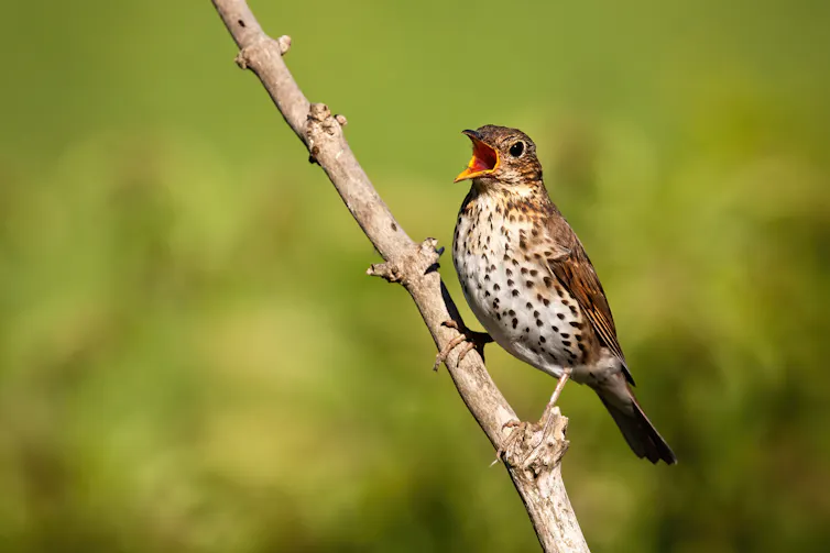
One Cumberland Woodplain resident. Photo: A J Guesdon.
The government webpage states that the Minister for the Environment proposes to extend the biodiversity certification of the State Environmental Planning Policy (Sydney Region Growth Centres) 2006 under the repealed Threatened Species Conservation Act 1995, Part 7 of Schedule 7, clause 20.
The certification is currently set to expire on 30 June 2026.
However, current Environment Minister Penny Sharpe has returned the 'environment' aspect of being the Environment Minister to the portfolio, and has scrutinised all aspects of environment plans since the incumbent government took office, along with being opening to not just 'hearing from' residents, but actually listening to them. Further, the consultation webpage states 'the Minister will consider the feedback submitted in deciding whether to extend the certification and the period of extension.'. So if there is a gap, some promise not being met, something that should be included, a better way of doing this, now would be the time to speak up.
For more information on biodiversity certification of the State Environmental Planning Policy (Sydney Region Growth Centres) 2006, go to:
The public is invited to make submissions relating to the proposed extension of the biodiversity certification.
There are 2 ways to submit your feedback.
Have your say on the consultation website
Email: gs.certification@environment.nsw.gov.au
The Growth Centres Biodiversity Offset Program
from webpage:
''The NSW Government is protecting native vegetation by purchasing land for new reserves and establishing funding agreements with landowners to ensure conservation. These efforts help offset the biodiversity impacts from development in Sydney's North West and South West growth centres.
In 2008, the NSW Government established a $530 million (2006–07 dollar values) Growth Centres Conservation Fund to protect areas of high biodiversity value.
Of this, $397.5 million was allocated over 30 years to support the establishment of conservation agreements and the purchase and retirement of biodiversity credits outside the growth centres. This funding has been derived partly from a special infrastructure contribution (SIC) applying to development in the Growth Centres and partly from the government's Consolidated Fund equally shared 50:50.
Growth Centres Biodiversity Offset certification extension
On 6 June 2025, the Minister for the Environment signed an Order extending biodiversity certification of the Growth Centres Environmental Planning Instruments (EPIs) for one year to 30 June 2026.
This determination was published in the NSW Gazette on 20 June 2025 (PDF 1.3MB).
During the one-year extension period, a review of the biodiversity certification will be undertaken. Based on the review’s findings, the biodiversity certification may be extended for up to 9 additional years. Public consultation for any further extension is anticipated in April-May 2026.
What's been achieved
As of 2025, the Growth Centres Biodiversity Offset Program has permanently protected approximately 913 hectares of land at 25 locations in western Sydney, comprising 24 biodiversity stewardship sites and one reserve. These sites protect threatened ecological communities, including critically endangered Cumberland Plain Woodland, and provide valuable habitat for threatened animal and plant species.
For site details, see Land protected through the Growth Centres Biodiversity Offset Program.
How the offset program works
The offset program delivers offsets for the NSW Government under 4 key agreements:
- Biodiversity Certification of the State Environmental Planning Policy (Sydney Region Growth Centres) (2006)
- Edmondson Park Conservation Agreement
- Sydney Growth Centres Strategic Assessment Program Report
- Mulgoa biodiversity stewardship site funding agreement with the Australian Government.
In accordance with the biodiversity certification, the program receives funding annually at the same rate at which development is expected to occur in the growth centres. The program has also been supported by grants of additional funding from the NSW Government and the Australian Government.
The program spends the funds, as a first preference, within priority areas that contain the largest remaining areas of high conservation value bushland on the Cumberland Plain. If it is not possible to create a reserve, the program will protect the land by entering into biodiversity stewardship agreements (previously known as biobanking agreements) with existing landowners.
Biodiversity stewardship agreements are a type of permanent conservation agreement in which funding for site management is invested in an endowment fund (the Biodiversity Stewardship Payments Fund). The fund provides ongoing annual payments to the landowner, allowing the ongoing management of the bushland.'' - the webpage states.
Purchasing and retiring biodiversity credits - Definition
Purchasing and retiring biodiversity credits allows developers to legally clear or destroy bushland.
The NSW Dept. of Environment definition states:
'Purchasing and retiring biodiversity credits is a mechanism where developers buy, from landowners, standardised units representing "like-for-like" biodiversity gains to legally offset environmental damage from projects. "Retiring" means permanently removing these credits from the market to ensure they cannot be reused, fulfilling regulatory, "in-perpetuity" conservation obligations.'
The list pertaining to this consultation comprises a list which states that even before the 2022 Cumberland Plain Conservation Plan was enacted by the then Environment Minister, developers were able to destroy hectares of the critically endangered with extinction Cumberland Plain Woodland in Sydney's western suburbs, with only 9% remaining in scattered, degraded patches, and without any regard to what species are already living there, and which stated, under a Legal disclaimer:
'The NSW Environment and Heritage Minister approved the CPCP which provides biodiversity certification under Part 8 of the NSW Biodiversity Conservation Act 2016 (BC Act). This approval removes the need for landholders to seek their own biodiversity approvals under the BC Act for development on certified - urban capable land as long as they comply with planning controls under the CPCP, as set out in the Strategic Conservation Chapter of the SEPP (Biodiversity and Conservation) 2021.
The department is currently pursuing Commonwealth approval for the CPCP under Part 10 of the Environment Protection and Biodiversity Conservation Act 1999. Landholders can submit development applications, seek subdivision or start master planning. However, development that will have a significant impact on matters of national environmental significance (MNES) on certified - urban capable land cannot commence until the Commonwealth CPCP approval is in place. If MNES will not be significantly impacted, then the development may proceed subject to other relevant environmental and planning approvals being obtained. If you are unsure whether to submit a referral under the EPBC Act, please contact the Department of Climate Change, Energy and Environment and Water for advice. '
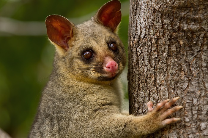
The CPCP, already passed by the then NSW government in August 2022, and by the Federal Government in March 2024. Koalas, which live across these areas, listed as Endangered in NSW on Friday February 11th 2022, continue to be killed in this area, along with every other species of non-human life.
On the evening of April 25 2026 another koala was killed on the Appin Road.
Ricardo Lonza, of 'Help Save the Wildlife and Bushlands in Campbelltown', stated:
''A koala was killed on Appin Road near Mallaty Creek this Anzac Day evening, in an area identified as a critical wildlife corridor. Plans for a dedicated overpass or underpass at this location have been abandoned.
A young learner driver and his mother were returning home from work when the koala ran onto the road and was struck. The animal died on impact. The occupants stopped immediately, removed the animal from the road, and contacted local wildlife rescuer Ricardo .
This incident highlights the consequences of fragmented planning. Housing development is expanding into koala habitat without adequate mitigation. Existing exclusion fencing terminates near this location, funnelling animals onto an unlit, high-speed road with no safe crossing point.
We are calling for urgent installation of wildlife infrastructure, lighting, and extended fencing to prevent further deaths in this known corridor.''
And:
''An extraordinary koala was lost on Appin Road tonight. The koala killed this evening was not what we expected. At 9.5kg, this adult had a rare intersex condition — a natural biological variation that’s almost never documented in the wild.
On examination, our team found:
- A rudimentary pouch, too shallow to hold a joey, with only one nipple
- External male genitalia, but no descended testicles
- A very small, underdeveloped scent gland
This is significant. Intersex animals are incredibly rare, and each case helps researchers understand koala development, genetics, and health.
We’re heartbroken this unique individual died on the road before we could learn more from them in life. ''
The only underpass on the Appin road, although built, is still not open due to a dispute over a bit of land between two developers.
The 'Glen Lorne' Koala underpass was required as an EBPCA condition when federal approval was given to developer Lendlease to build a residential development in Mt. Gilead called 'Figtree Hill' in the Campbelltown LGA. This condition required the delivery of a Koala Plan of Management, which included two Koala underpasses under Appin Road, linking koala habitat on the the east side of Appin Road to Koala habitat on the West, allowing movement via Koala habitat corridors from the Georges to Nepean Rivers.
In November 2024 Lendlease sold the unfinished development to developer Stocklands, who in turn took responsibility for delivery of the underpasses, with a commitment the Glen Lorne underpass would be delivered in the first half of 2025.
When the Sydney Basin Koala Network raised issues on the delay on underpasses as part of their 2025 progress report release in July, Yahoo News uncovered the reason for the underpass not being completed was Lendlease refusing to give Stocklands access to the land it still held on the other side of Appin Road. On further investigation by ABC News, Lendlease doubled down and said it was not their responsibility to do so. And so there is still no underpass with Koalas trapped and East West connectivity now cut off by fencing.
This update was also reported in Pittwater Online News as this community does not want to see the extinction of more koala populations in Sydney, and locals have a lot of connections to the western suburbs of Sydney, have had for generations.
The Sydney Basin Koala Network stated in 2025:
''How Lendlease was able to sell a development reliant on the fulfilment of Koala Plan of Management to proceed, without including the small parcels of land required to fulfil this is a failure of governance. Sadly, but not surprisingly, both NSW and Federal government have proceeded in buck-passing with no department seemingly willing or able to resolve the conflict.
The is creating a significant impact on Koalas, where they are now cut off from Koala habitat "biobanks" that have been used as offsets by the developer by retiring Koala species credits.
It is inconsistent with the:
- National Recovery Plan for the Koala,
- developer approval for Gilead Stage 1,
- decision to not self-refer the Appin Road upgrade to EBPC referrals.
- NSW Chief Scientist Campbelltown Koala advice
''We are also concerned that revegetation efforts on the developer side have failed, and are non-existent on the Georges River side, another undelivered requirement of the federally approved Koala Plan of Management. There is no known start date for the second Koala underpass promised at the Beulah Biobank, despite this location now also fenced off to Koalas.
As seen by Ricardo the day after Anzac Day, and now well into 2026, koalas continue to be killed on this road and the sole underpass so far completed is still not open.
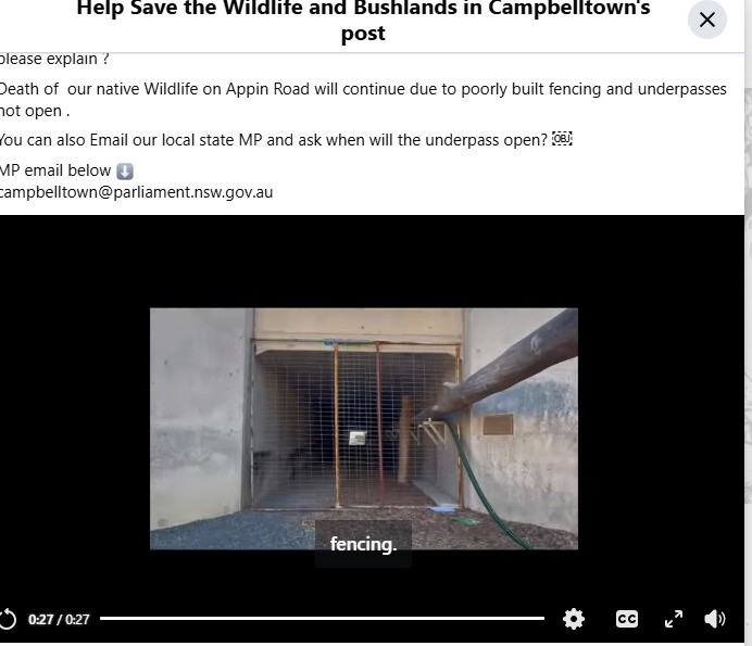
screenshot by Ricardo
Land protected through the Growth Centres Biodiversity Offset Program
from webpage
''This comprises 24 biodiversity stewardship sites and one National Parks and Wildlife Service reserve.
Formerly referred to as biobanking, Biodiversity Stewardship Agreement sites are funded by the Growth Centres Biodiversity Offset Program to protect and provide ongoing management to restore ecological values and ensure the site’s long-term conservation.
Offset locations
The map below shows the locations of land protected by the offset program (sites 1 to 25). This comprises 24 biodiversity stewardship sites and one National Parks and Wildlife Service reserve.
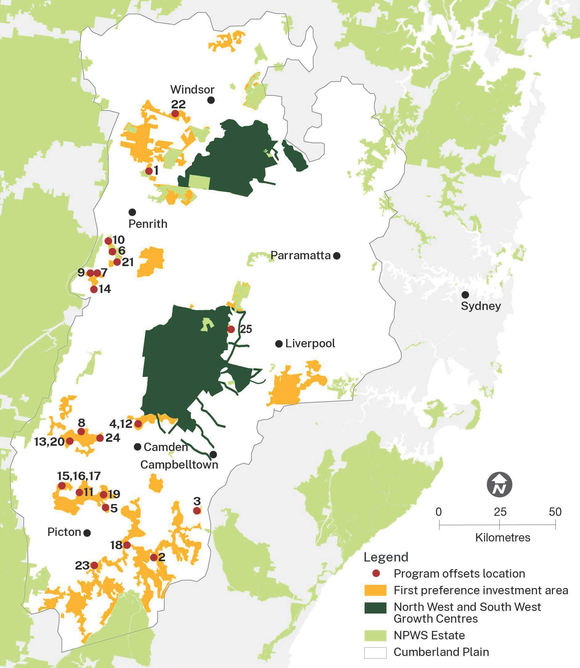
A map showing 25 sites in the Sydney region protected by the Growth Centres Biodiversity Offset Program as well as first preference investment areas (orange), north west and south west growth centres (black), Cumberland Plain (white) and national parks (green).
Protected vegetation sites under the Growth Centres Biodiversity Offset Program
1. Wianamatta Nature Reserve (2008–09): In 2009, the offset program purchased Wianamatta Nature Reserve, in Cranebrook, Penrith local government area, with the additional support from an $11.7 million Australian Government grant. The 181-hectare reserve protects 161 hectares of threatened ecological communities, including:
- Castlereagh Swamp Woodland
- Cooks River Castlereagh Ironbark Forest
- Castlereagh Scribbly Gum Woodland
- Shale Gravel Transition Forest.
This large, connected landscape offers vital refuge for native plants and animals and is not counted towards offset requirements under the Sydney Growth Centres Strategic Assessment Program.
The reserve is home to many threatened species, such as:
Bynoe's wattle (Acacia bynoeana)
Allocasuarina glareicola
Dillwynia tenuifolia
Grevillea juniperina subsp. juniperina
Micromyrtus minutiflora
nodding geebung (Persoonia nutans)
Sydney bush-pea (Pultenaea parviflora)
eastern free-tail bat (Mormopterus norfolkensis)
Cumberland Plain land snail (Meridolum corneovirens).
Before its protection, the site suffered from illegal access and dumping. In 2010, the offset program funded fencing along road frontages to stop further damage to vegetation and support the reserve’s ecological recovery.
2. St Mary’s Towers (2009–10): In 2010, the first biobank site was established at the historic St Mary’s Towers property at Douglas Park, in the Wollondilly local government area. The biobank site (BA40) conserves the natural transition between shale woodlands and sandstone gully forests in the southern Cumberland Plain. The offset program funded the long-term conservation of 36 hectares of critically endangered Cumberland Plain Woodland, 33 hectares of Sandstone Transition Forest, and 11 hectares of gully forest and dry rainforest by purchasing and retiring biodiversity credits and funding ongoing ecological management.
3. Beulah (2010–11): Beulah is a 90-hectare historic property near Appin, in the Wollondilly local government area, home to the original 1830s residence of explorer Hamilton Hume. The site holds outstanding biodiversity values and conserves 20 hectares of critically endangered Cumberland Plain Woodland, 40 hectares of Shale Sandstone Transition Forest, and known koala habitat. In 2010, the offset program helped the Historic Houses Trust of NSW to purchase the property by contributing $600,000 and securing a biobanking agreement to permanently protect its remnant vegetation. The biobank site (BA58), created in 2011, conserves 60 hectares of threatened bushland. The offset program purchased and retired biodiversity credits, with proceeds placed in a trust fund to support ongoing ecological management.
4. Mater Dei (2011–12): The Mater Dei property in Cobbitty, in the Camden local government area, owned by the Sisters of the Good Samaritan since 1910, is celebrated for its heritage and environmental significance. In 2012, a biobank site (BA81) was established to permanently protect 26 hectares of threatened woodland, including the critically endangered Cumberland Plain Woodland surrounding the historic Wivenhoe house. The site was grazed by livestock and heavily infested with African olive. The offset program funded the long-term conservation of 20 hectares of Cumberland Plain Woodland and 6 hectares of River Flat Eucalypt Forest by purchasing and retiring biodiversity credits to protect and restore ecological values.
5. Mt Hercules (2012–13): Established in 2013, the Mount Hercules biobank site in the Wollondilly local government area permanently protects 22 hectares of high-value bushland at Razorback Range. The offset program funded the long-term conservation of 19 hectares of critically endangered Cumberland Plain Woodland, 2 hectares of Western Sydney Dry Rainforest, and one hectare of Moist Shale Woodland by purchasing and retiring biodiversity credits. The site also provides habitat for the endangered Cumberland Plain land snail (Meridolum corneovirens). Although much of the bushland is in poor condition and heavily infested with African olive, the offset program funds weed control and ecological monitoring and reporting to restore the site’s ecological values.
6. Mulgoa (2012–13): The privately owned Mulgoa biobank site (BA99) in the Penrith local government area borders Mulgoa Nature Reserve and showcases how private land conservation can strengthen public reserves, especially in areas where native vegetation is scarce. The site connects with Mulgoa Creek and the Blue Mountains National Park, creating vital habitat corridors for woodland birds, including the threatened varied sittella (Daphoenositta chrysoptera) and black-chinned honeyeater (Melithreptus gularis gularis). The offset program funded the long-term conservation of 38 hectares of critically endangered Cumberland Plain Woodland, 5 hectares of River Flat Eucalypt Forest, and 7 hectares of Moist Shale Woodland by purchasing and retiring biodiversity credits. This site expands suitable habitat and supports the long-term survival of threatened species in the region.
7. Fernhill East (2013–14): Fernhill Estate is a 648-hectare privately-owned property in Mulgoa, in the Penrith local government area. The estate contains an 1840s homestead and is listed as ‘historic landscape' in the State Heritage Register. Consistent with the property’s heritage values, large areas of remnant bushland on the property have been protected through biobanking agreements. The Fernhill East biobank site (BA117) was the first site to protect 128 hectares of bushland in the eastern part of the property. In 2014, the Growth Centres Biodiversity Offset Program funded the long-term conservation of 16 hectares of critically endangered Cumberland Plain Woodland on the site by purchasing and retiring biodiversity credits.''
NB RE: Fernhill Estate - The Fernhill Estate Foundation Plan of Management to 2026 (PDF 8.5 MB) was adopted on 19 October 2021. This first plan of management for the Fernhill Estate established custodianship and stewardship arrangements.
The list continues:
''8. Orangeville (2013–14): The Orangeville biobank site (BA110) is on a 125-hectare private property used for livestock grazing, in the Wollondilly local government area. In 2012, a 38-hectare biobank site was established along Wattle Creek. The offset program funded the long-term conservation of 9 hectares of critically endangered Cumberland Plain Woodland, 4 hectares of critically endangered Shale Sandstone Transition Forest, 15 hectares of Sydney Turpentine Ironbark Forest, and 10 hectares of Grey Myrtle Dry Rainforest by purchasing and retiring biodiversity credits. While the site supports valuable native vegetation, much of it is overrun by African olive. With program funding, intensive bush regeneration is underway to restore the ecological values of this important habitat.
9. Fernhill Central West biobank site (2014–15): The Fernhill Central West biobank site (BA117) is the second biobank established on the Fernhill property in Mulgoa, in the Penrith local government area. Created in 2014, the 147-hectare site protects a diverse mix of woodlands and forests and provides habitat for threatened birds like the varied sittella (Daphoenositta chrysoptera) and glossy black-cockatoo (Calyptorhynchus lathami lathami). Between 2013–14 and 2014–15, the offset program funded the long-term conservation of 9.5 hectares of critically endangered Shale Sandstone Transition Forest by purchasing and retiring biodiversity credits. Program funding is restoring the site by removing rubbish, installing fences to keep out livestock, and controlling weeds and feral animals.
10. Glenmore Park biobank site (2014–15): The Glenmore Park biobank site (BA137) was established independently of the offset program on a 15-hectare rural residential property in the Penrith local government area. The offset program funded the long-term conservation of 8 hectares of critically endangered Cumberland Plain Woodland, 5 hectares of endangered River Flat Eucalypt Forest, and 2 hectares of endangered Moist Shale Woodland by purchasing and retiring biodiversity credits. This privately protected site plays a vital role in supporting public reserves. It links 2 separated parts of Mulgoa Nature Reserve, boosting habitat connectivity and long-term viability for native species. Together with the nearby Mulgoa biobank site number 6, it expands the protected bushland by 30% to 276 hectares and strengthens a key biodiversity corridor along Mulgoa Creek, connecting to the Blue Mountains National Park.
11. Williamswood biobank site (2015–16, 2018–19, 2019–20): Williamswood is a 124-hectare rural property in Mount Hunter, in the Wollondilly local government area. In 2015, a biobank site (BA147) was established independently of the offset program to protect 104 hectares of threatened bushland. Over 3 years, the offset program funded the long-term conservation of 60 hectares of critically endangered Cumberland Plain Woodland and 4 hectares of endangered Moist Shale Woodland by purchasing and retiring biodiversity credits. Program funding will actively manage weed infested areas to restore the site’s ecological values.
12. Mater Dei Stage 2 (2015–16): In 2015, a 58-hectare biobank site (BA217) at the historic Mater Dei property was established in Cobbitty, in the Camden local government area. Nestled along the Nepean River, the site sits beside an earlier 26-hectare biobank (Matter Dei site number 4) area protected by the offset program in 2011–12. The offset program funded the long-term conservation of 34 hectares of critically endangered Cumberland Plain Woodland and 24 hectares of endangered River Flat Eucalypt Forest by purchasing and retiring biodiversity credits. The Stage 2 site also safeguards several rare Camden white gums (Eucalyptus benthamii), helping to conserve important habitat.
A baseline fauna survey conducted in 2016 recorded 137 native species on the property, highlighting its rich biodiversity. Among these were 6 threatened bird species:
- powerful owl (Ninox strenua)
- little lorikeet (Parvipsitta pusilla)
- speckled warbler (Pyrrholaemus sagittatus)
- little eagle (Hieraaetus morphnoides)
- dusky woodswallow (Artamus cyanopterus cyanopterus)
- varied sittella (Daphoenositta chrysoptera).
Three threatened microbat species were also recorded:
- eastern bent-wing bat (Miniopterus orianae oceanensis)
- east coast free-tail bat (Mormopterus norfolkensis)
- large-eared pied bat (Chalinolobus dwyeri).
The survey also confirmed the presence of the threatened Cumberland Plain land snail (Meridolum corneovirens).
13. Hardwicke Stage 1 biobank site (2016–17): The program funded the long-term conservation of 27 hectares of critically endangered Cumberland Plain Woodland by purchasing and retiring biodiversity credits at the Hardwicke Stage 1 biobank site (BA168), in the Wollondilly local government area. The 57-hectare site at Orangeville site number 8 was created independently of the program in 2017. The site’s vegetation ranges from degraded grasslands to thriving Cumberland Plain Woodland. Since the late 1990s, reduced pastural stock and grazing pressure have enabled natural regeneration to occur across the site. While invasive weeds like African olive, African boxthorn and lantana remain a challenge, secure biobanking funds will support ongoing management and restoration.
14. Winbourne stewardship site (2017–18): The offset program funded the long-term conservation of 3 hectares of critically endangered Cumberland Plain Woodland and 8 hectares of critically endangered Shale Sandstone Transition Forest by purchasing and retiring biodiversity credits on a 20-hectare biodiversity stewardship site (BA339) on a historic property at Mulgoa, in the Penrith local government area.
15. Montpelier Lot 72 stewardship site (2017–18): The offset program funded the long-term conservation of 3 hectares of critically endangered Cumberland Plain Woodland by purchasing and retiring biodiversity credits at a 64-hectare biodiversity stewardship site (BA235) at The Oaks, in the Wollondilly local government area.
16. Montpelier Lot 64 stewardship site (2017–18, 2018–19): Over 2 years, the offset program funded the long-term conservation of 14 hectares of critically endangered Cumberland Plain Woodland by purchasing and retiring biodiversity credits at a 35-hectare biodiversity stewardship site (BA399) at The Oaks, in the Wollondilly local government area.
17. Montpelier Lot 653 stewardship site (2017–18): The offset program funded the long-term conservation of 11 hectares of critically endangered Cumberland Plain Woodland by purchasing and retiring biodiversity credits at a 31-hectare biodiversity stewardship site (BA358) at The Oaks, in the Wollondilly local government area.
18. Nepean River stewardship site (2017–18): The offset program funded the long-term conservation of 18 hectares of critically endangered Cumberland Plain Woodland by purchasing and retiring biodiversity credits at a 67-hectare biodiversity stewardship site (BA382) that adjoins the banks of the Nepean River near Douglas Park, in the Wollondilly local government area.
19. Hampden Vale stewardship site (2017–18, 2018–19): Over 2 years, the offset program funded the long-term conservation of 19 hectares of critically endangered Cumberland Plain Woodland by purchasing and retiring biodiversity credits at a 101-hectare biodiversity stewardship site (BA250) at Razorback, in the Wollondilly local government area.
20. Hardwicke Stage 2 stewardship site (2018–19): The offset program funded the long-term conservation of 15 hectares of critically endangered Cumberland Plain Woodland and a population of the threatened plant spiked rice-flower (Pimelea spicata) by purchasing and retiring biodiversity credits at a 169-hectare biodiversity stewardship site (BA213) at Orangeville, in the Wollondilly local government area.
21. Mulgoa East stewardship site (2019–20, 2020–21): Over 2 years, the offset program funded the long-term conservation of 41 hectares of critically endangered Cumberland Plain Woodland by purchasing and retiring biodiversity credits at a 59-hectare biodiversity stewardship site (BA 283) in Mulgoa, in the Penrith local government area.
22. Western Sydney University Hawkesbury Campus stewardship site (2021–22): The offset program funded the long-term conservation of 34 hectares of endangered Shale Gravel Transition Forest and 22 hectares of critically endangered Cumberland Plain Woodland by purchasing and retiring biodiversity credits at a 117-hectare biodiversity stewardship site (BS0032) established by the offset program at the Hawkesbury campus of Western Sydney University, in the Hawkesbury local government area.
23. Picton Farm stewardship site (2021–22, 2024–25): Over 2 years, the offset program funded the long-term conservation of 44 hectares of Shale Sandstone Transition Forest by purchasing and retiring biodiversity credits at a 144-hectare stewardship site (BS0027) near Picton, in the Wollondilly local government area.
24. Brownlow Hill Stage 6 stewardship site (2023–24): The offset program funded the long-term conservation of 45 hectares of critically endangered Cumberland Plain Woodland by purchasing and retiring biodiversity credits at a 165-hectare biodiversity stewardship site (BS0088) at Brownlow Hill, in the Wollondilly local government area.
25. Middleton Grange stewardship site (2024–25): The offset program funded the long-term conservation of 11 hectares of critically endangered Cumberland Plain Woodland by purchasing and retiring biodiversity credits at the 91-hectare biodiversity stewardship site (BS0111) in Middleton Grange, in the Liverpool local government area.''
The Consultation period runs: 17th April 2026 - 18th May 2026. To provide feedback, visit the consultation webpage.
.JPG?timestamp=1665628406858)
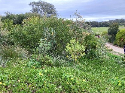
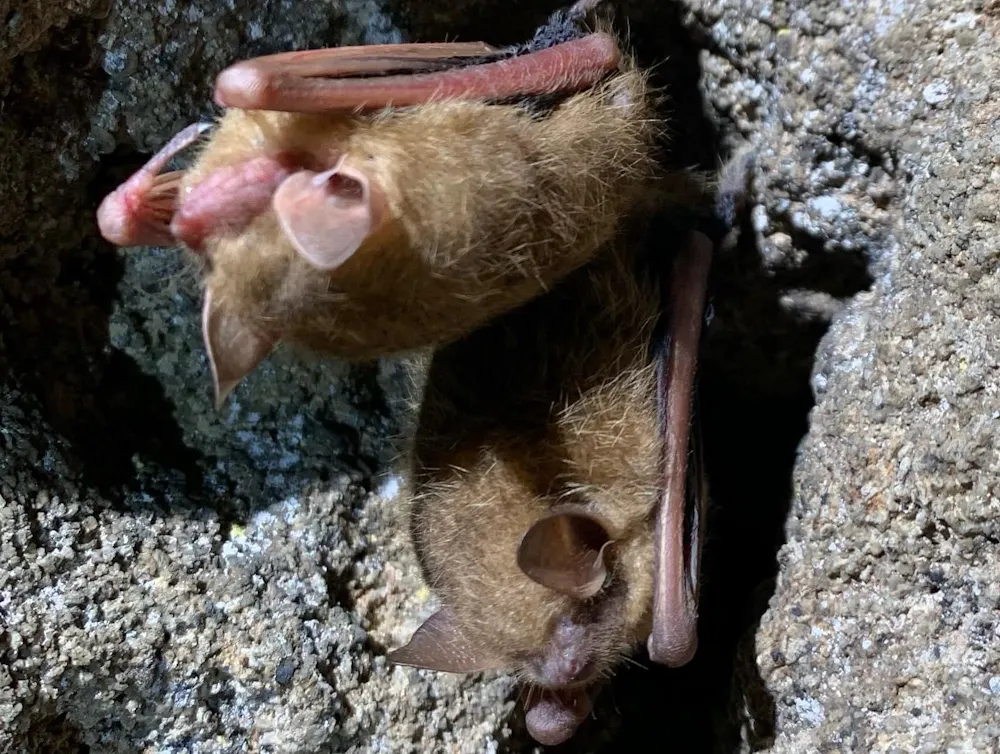
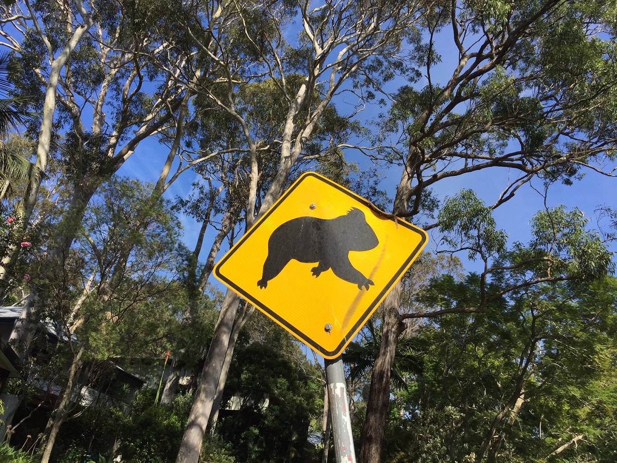
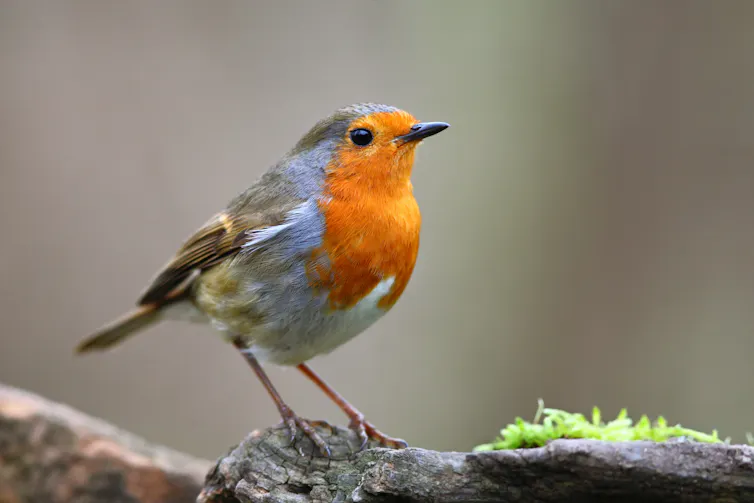
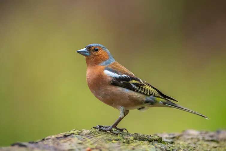
More Cumberland Woodplain residents. Photo: A J Guesdon


smaller.jpg?timestamp=1779505013189)
smaller.jpg?timestamp=1779505047587)
smaller.jpg?timestamp=1779505078088)


%20(1).jpg?timestamp=1675893929686)
.JPG.opt1460x973o0,0s1460x973.jpg?timestamp=1663629195339)


.JPG?timestamp=1778707053590)
.JPG?timestamp=1778704845729)
.JPG?timestamp=1778705182453)
.JPG?timestamp=1778707216464)
.JPG?timestamp=1778707433837)
.jpg?timestamp=1749336676422)

.jpg?timestamp=1749338397954)
.jpg?timestamp=1749338652037)
.jpg?timestamp=1749338696434)
.jpg?timestamp=1749338730626)
.jpg?timestamp=1749338787920)
.jpg?timestamp=1749338819568)
.jpg?timestamp=1749338899367)
.jpg?timestamp=1749338935846)
.jpg?timestamp=1749338965544)
.jpg?timestamp=1749338992005)
.jpg?timestamp=1749339019924)


