Lifesaving natural hazards technology put through its paces
August 19, 2025
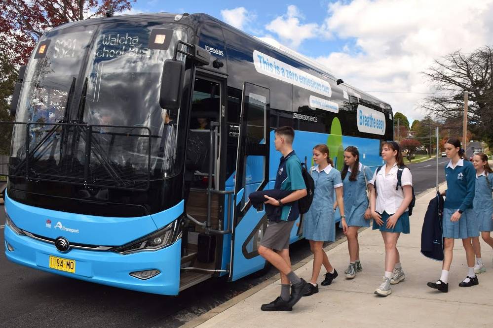
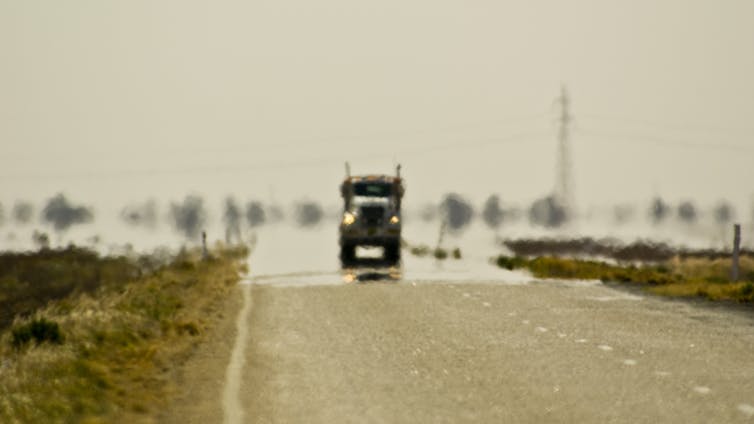
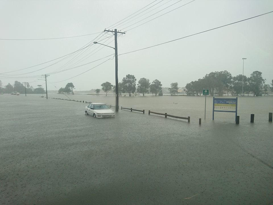
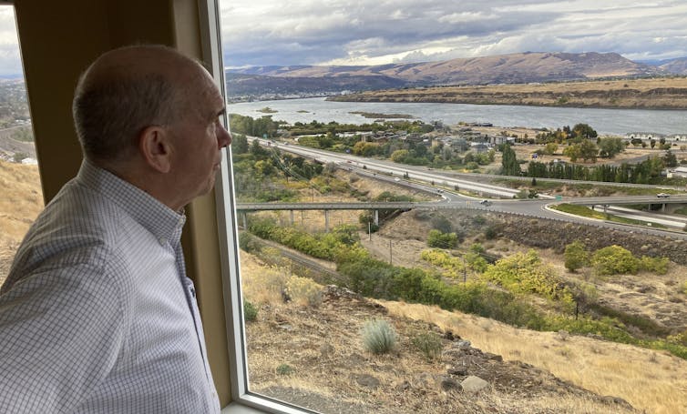
A device that retrofits onto existing infrastructure to deliver remote, real-time updates on water levels at road crossings is one of 15 innovations being considered in Phase 1 of the Minns Government’s $3.3 million Natural Hazards Detection System (NHDS) program.
The program, led by the Office of the Chief Scientist & Engineer in collaboration with the NSW Reconstruction Authority, will test a broad range of innovative technologies to reduce the cost and impact from disasters caused by natural hazards.
The funded projects include technology which can be mounted directly onto flood depth water indicator signs on NSW roads and transmit data to emergency services, AI and night vision-enabled imaging, a stratospheric blimp-based imaging system and a network of sensors to measure soil and fuel moisture for fire management.
Successful Phase 1 recipients will develop their technologies and can apply for Phase 2, in which they will be deployed and rigorously tested at pilot locations in at-risk Local Government Areas identified by the NSW State Emergency Service and NSW Rural Fire Service.
The NHDS program is an outcome of the 2020 Bushfire Inquiry and 2022 Flood Inquiry to use new detection technology to improve the identification and warning of impacts of natural hazards.
For a full list of recipients and further program details, visit: https://www.chiefscientist.nsw.gov.au/natural-hazards-detection-system
NHDS Proof of Concept Funding Recipients
Fifteen companies have been successful in receiving funding for Phase 1 of the NHDS.
Company Solution/Description Funding Amount Challenge
Aquamonix Envoy - a smart and flexible disaster management IoT $20,400.00 Challenge 4 - Rainfall/Soil Moisture Data (Flood)
Envoy is a low-cost, solar-powered monitoring system that uses cellular, LoRaWAN, or satellite services for data transmission. It can be equipped with a variety of analogue and digital sensors to monitor environmental parameters such as rainfall, soil moisture, water levels, and weather conditions. This robust and flexible IoT system enhances flood prediction accuracy and situational awareness for disaster management, offering a scalable and cost-effective solution for remote and underserved areas.
Aquamonix FloodCAM -Visual AI for Camera-Based Flood Monitoring $48,428.00 Challenge 1 - Water over Roads and Assets (Flood)
FloodCAM is solar-powered, non-contact sensor, attachable to existing infrastructure with an inbuilt smart camera featuring IR capability for night vision, and inbuilt analytics. The sensor detects water surfaces over roads and critical assets within the camera view, and identifies and evaluates water levels against safety thresholds, offering regular and precise water measurements and alerts.
Aquamonix Vortex Micro Station $25,000.00 Challenge 2 - Flash Flooding Water Levels (Flood)
The Vortex Microstation is a compact, solar-powered sensor that utilises multiple non-contact sensing techniques, including IR (Infrared), LiDAR (Light Detection and Ranging) and GNSS (Global Navigation Satellite System). These techniques are processed onboard to provide reliable and accurate water level measurements during flood events. The sensor ensures precise measurements at critical locations, enabling emergency services to more easily track the progress of an ongoing flood and supporting the effective protection of local communities.
Austrapex Transformative Water Sensing Solution for Flash Flood Management $ 49,500.00 Challenge 2 - Flash Flooding Water Levels (Flood)
Austrapex’s solution is a sensor that passively captures cellular signals transmitted by nearby towers and reflected off water surfaces. The system translates the signals into precise and efficient estimates of water levels and velocity, providing a cost-effective method for gathering real-time data during a flood event, and contributes to safer communities, efficient resource management and long-term resilience planning.
Kallipr Kallipr Rain and Soil Moisture Monitoring Solution & Kallipr Flood Monitoring Solution $ 103,000.00 (total - three combined applications)
Challenge 1 - Water over Roads and Assets (Flood)
Challenge 2 - Flash Flooding Water Levels (Flood)
Challenge 4 - Rainfall/Soil Moisture Data (Flood)
Kallipr offers a solar-powered Internet of Things (IoT) flood monitoring sensor capable of gathering data on water level, water velocity and soil moisture in areas prone to flash flooding in real time. It delivers timely alerts, empowering local councils and emergency services teams to make rapid, informed decisions during critical events. The system integrates high accuracy radar, rain gauge, soil probe and advanced IoT data loggers to collect, process and transmit high-precision water level and surface velocity data as well as other environmental data such as soil moisture. This enables swift decision-making during flood events and expands monitoring capabilities for broader environmental and flood management applications.
Kablamo Hazards Near Me 2.0 - Citizen Insight Exchange $ 50,000.00 Challenge 9 - Existing Data (Flood & Fire)
Kablamo’s proposed solution enhances natural hazard management by transforming the ‘Hazards Near Me’ (HNM) app into a two-way communication tool, allowing the public to upload geotagged images and videos of incidents. This system provides real-time, actionable intelligence without the need for expensive physical sensors. By leveraging the trusted HNM platform, it empowers local communities to contribute high-quality data, improving public safety, resource allocation and decision-making for NSW Emergency Services.
Indicium Dynamics Fire Foresight $50,000.00 Challenge 8 - Bushfire Fuel and Soil Moisture Monitoring (Fire)
The Fire Foresight proposed solution integrates a network of portable, low-maintenance sensors that monitor bushfire fuel and soil moisture every 15 minutes. These sensors use non-destructive techniques to measure moisture content in fine and 10-hour fuel types, as well as upper soil moisture, and transmit real-time data to emergency services. This innovative system enhances situational awareness for fire agencies, enabling informed decisions on hazard reduction and fire management, while reducing the need for on-the-ground testing and improving overall efficiency and accuracy.
MaxWave Technology Pty Ltd AquaSense Technology: Dual-Mode Passive Tag and AI-Driven System for Environmental Monitoring and Hazard Mitigation $44,300.00 Challenge 4 - Rainfall/Soil Moisture Data (Flood)
Aquasense passive battery-less sensors monitor volumetric water content in the soil. If this exceeds a threshold indicating flood risk, the tags switch to active sensing and monitor temperature, humidity and water levels providing crucial data for drought, flood and fire management. This system can be deployed in remote areas, operating without batteries and utilising energy harvested from an external transmitter, and offers high adaptability and reliable real-time environmental monitoring.
MVP Engineering FloodMate $41,900.00 Challenge 1 - Water over Roads and Assets (Flood)
FloodMate is a novel, capacitance-based flood depth sensor designed to retrofit onto existing flood depth indicator signs. It uses capacitance-based water sensing technology to detect water presence without physical contact, ensuring reliability and low cost. This innovative sensor provides real-time flood tracking and alerting capabilities, making it a practical and scalable solution for hazard detection and disaster response
NGIS Automatic Water Level Estimation from Imagery $50,000.00 Challenge 3 - Water Level from Imagery (Flood)
NGIS’s proposed solution utilises computer vision and AI to measure water levels and velocity from existing and newly installed camera feeds. The system can detect water boundaries, measure water levels and track water movement, critical during a flood event. It supports cloud-based processing for high-bandwidth areas and edge computing for remote locations, ensuring flexibility and continuous monitoring. This innovative system leverages existing camera networks, reducing infrastructure costs and enhancing flood management for local and NSW Government agencies.
Nova Systems Firewar Early Bushfire Detection System $50,000.00 Challenge 5 - Ignition Detection (Fire)
The Firewar system is a network of sensors deployed over high risk locations that can continuously monitor large areas. These sensors measure temperature, humidity, volatile organic compounds, CO2 and air pressure every three minutes, with an AI algorithm estimating the probability of fire ignition. The sensors communicate via LoRaWAN to a gateway, which then uses standard networks to provide real-time data collection and alerts through a cloud-hosted API, ensuring rapid and accurate fire monitoring.
Silicon Vandals EnviroDrop $46,800.00 Challenge 7 - Local Fire Weather Monitoring (Fire)
EnviroDrop is an environmental monitoring system designed to be aerially deployed in remote and hard-to-reach areas. It uses advanced sensor technology to measure temperature, humidity, wind speed/direction, rainfall and solar radiation without any moving parts. This system ensures safe aerial deployment, durability and long operational life, making it a practical and scalable solution for environmental monitoring and disaster response.
Stratoship Hyperspectral detection from the Stratosphere $ 50,000.00 Challenge 5 - Ignition Detection (Fire)
Stratoship offers a novel solution that uses a non-flammable helium airship to place a highly sensitive remote sensor 20km high in the stratosphere to provide a satellite-like view of fires in a region. The payload on the airship uses a Near-Infrared imaging system to detect fire ignition in the early stages, as the sensors are less affected by atmospheric interference, enabling reliable imagery in hazardous conditions. This innovative approach offers persistent and precise monitoring over large areas.
WatchTowers Networks The Mobile WatchTower Solution $47,600.00 Challenge 6 - Fire Assessment and Monitoring (Fire)
The Mobile WatchTower solution is an advanced, rapidly deployable platform designed to enhance bushfire detection and situational awareness for emergency services. It combines dual high-definition PTZ cameras, solar-powered energy systems, and multi-mode connectivity options like LTE and Starlink, ensuring coverage in underserved or high-risk areas within minutes and is mounted on a towable trailer for easy deployment by emergency service vehicles. This innovative system integrates with the WatchTowers Command platform providing real-time intelligence and AI-generated alerts for adaptive hazard management in NSW.
WaterMark WaterMark $50,000.00 Challenge 3 - Water Level from Imagery (Flood)
WaterMark transforms existing surveillance and traffic cameras into an intelligent water level monitoring network using advanced computer vision technology. It processes camera feeds with deep learning algorithms to identify reference points, and extract measurements ensuring accurate water level monitoring without new sensor deployments. This innovative system enhances flood monitoring coverage, reduces costs and provides real-time reliability assessments, making it a scalable and practical solution for emergency services.
NSW Minister for Emergency Services, The Hon. Jihad Dib said:
“We are investing in technologies and infrastructure to improve the way we communicate and respond to disasters, in the face of increasing risk from more frequent and intense natural hazards.
“By testing cutting edge technologies and new early warning systems, we can improve the way we predict and provide disaster warnings, and this program is yet another way we are finding solutions that work for our emergency services and the communities of NSW.”
NSW Minister for Innovation, Science and Technology, The Hon. Anoulack Chanthivong, said:
“The National Hazards Detection System program is another example of the Minns Labor Government partnering with innovators to tackle the biggest challenges faced by our state.
“These exciting new technologies can make positive change in the lives of those most directly impacted by disasters caused by natural hazards.
“The Government is investing nearly $80 million to implement our Innovation Blueprint to cement NSW as the best place to innovate, connect with investors, and scale a business, which includes $20 million for the Emerging Technology Commercialisation Fund to drive long term growth and productivity in Government priority areas, such as housing, Net Zero and energy transition and local manufacturing.
“With these investments, the Minns Government is supporting the next generation of researchers, scientists and other innovators to generate both social and economic benefits for NSW.”
NSW Minister for Recovery Janelle Saffin said:
“With the constant change in our climate, floods and bushfires are occurring more frequently and we have a responsibility to ensure our communities are better prepared and more resilient to their impacts.
“The Minns Labor Government is committed to protecting communities by ensuring they have adequate time to evacuate, and new hazard-warning technologies such as these will go a long way to delivering that.
“Having enough time to plan evacuation routes could save lives, and in locations such as the Northern Rivers and the Hawkesbury Nepean, give farmers advanced warning to move livestock to higher ground.”
Office of the Chief Scientist & Engineer Professor Hugh Durrant-Whyte stated:
"These innovative technologies are changing the thinking on how we might best respond to natural hazards in the future.
“By supporting these companies to further develop and test their systems and devices, we will be able to provide real-time solutions for the prediction and management of both fire and flood hazards for NSW communities and emergency services.”

.JPG?timestamp=1756517743580)

.jpg?timestamp=1756504925437)
.jpg?timestamp=1756504808787)
.JPG?timestamp=1600365439628)


%20(1).jpg?timestamp=1675893929686)

.JPG.opt1460x973o0,0s1460x973.jpg?timestamp=1663629195339)


.jpg?timestamp=1606328948617)
.jpg?timestamp=1619878281381)
.jpg?timestamp=1619878349216)

.jpg?timestamp=1619878478650)

.JPG?timestamp=1690515297279)


.jpg?timestamp=1754123873611)


.JPG?timestamp=1753573453767)
.JPG?timestamp=1754031734627)
.JPG?timestamp=1754031783298)
.JPG?timestamp=1754031836386)
.JPG?timestamp=1754032091726)
.JPG?timestamp=1754032160514)
.JPG?timestamp=1754032215008)


