


.jpg?timestamp=1758944259922)

.JPG?timestamp=1600365439628)


%20(1).jpg?timestamp=1675893929686)

.JPG.opt1460x973o0,0s1460x973.jpg?timestamp=1663629195339)


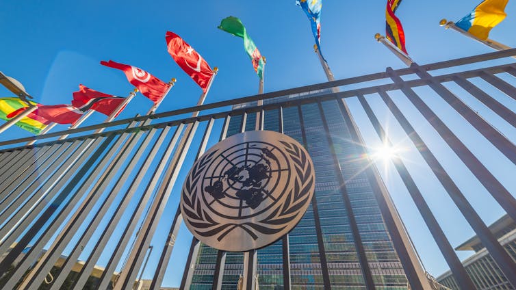
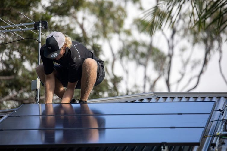
This week, Prime Minister Anthony Albanese will attend the annual United Nations General Assembly meeting in New York. He will bring something important: Australia’s new 2035 emission cut target of 62–70% on 2005 levels.
UN Secretary General António Guterres has invited global leaders to gather to present their new 2035 targets, known formally as Nationally Determined Contributions, ahead of the COP30 climate talks in Brazil in November.
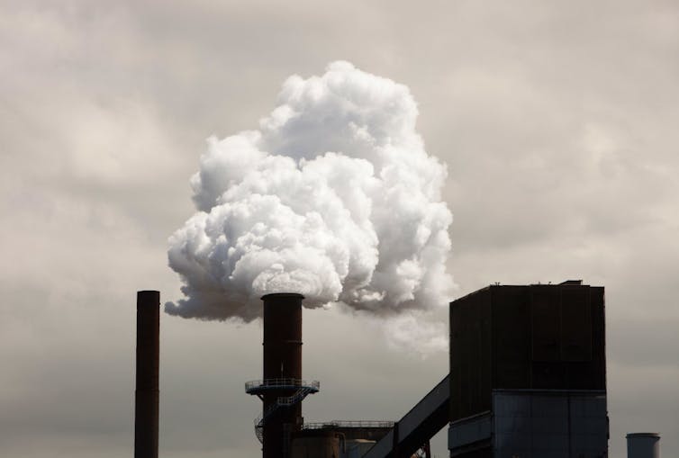
COP30 is shaping up as the most consequential round of climate commitments since the 2015 Paris Agreement. Even as climate damage intensifies, there are worrying signs of backsliding on climate action in some nations.
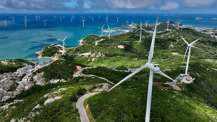
The United States is focused on increasing fossil fuel production and hobbling clean energy. Other nations are stepping up. China’s clean energy exports are reshaping electricity markets around the world. The UN is hoping more ambitious 2035 targets will build momentum.
What role will Australia play? Our 2035 goal, announced by Albanese last week, will be important in driving the domestic transition to a clean economy. It will also factor into international climate efforts.
Australia’s target is not ambitious enough to be in line with pathways to hold climate change under 1.5°C, but it offers clarity. It also raises the possibility of achieving net zero earlier than 2050 if underpinned by strong, rapid action.

How does Australia’s target stack up?
Australia’s 62–70% target range has been critiqued from several sides. Climate advocates wanted more ambition. Some business groups wanted a lower figure, while others called for a 75% target.
In reality, this pathway seeks a balance between pragmatism and higher ambition. The planned emission cuts are actually more ambitious than if Australia were to cut emissions at a steady rate between 2030 and 2050 – the year we need to reach net zero.
Over the past decade, Australia’s emissions outside the land-use sector have been falling slowly. Falling emissions from electricity production have been offset by rising emissions in transport and other sectors.
At present, emissions are about 28% lower than 2005 levels, due largely to changes in land use.
The nation’s 2030 goal is a 43% cut before hitting a minimum of 62% by 2035. Our analysis indicates this will require a sharp acceleration in how fast emissions fall between 2030 and 2035.
To make this steep trajectory less challenging, Australia could go faster in the next five years to make the path to 2035 smoother. If Australia maintained this pace, it could have another benefit: increasing the feasibility of Australia reaching net zero at an earlier date.
Global temperatures are tracking upwards
As global momentum builds ahead of COP30, the choices made by major economies such as Australia will influence whether a 1.5°C pathway remains within reach. As one of the world’s largest fossil fuel exporters, Australia’s decisions on energy and climate policy can shift global markets and boost momentum toward a 1.5°C future.
The Paris Agreement commits countries to hold the increase in global temperature well below 2°C and pursue efforts to limit it to 1.5°C.
Some have concluded the 1.5°C goal is already out of reach, but this is premature.
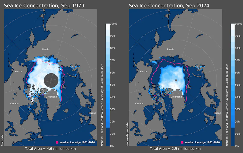
The World Meteorological Organization confirmed 2024 was likely the first year where global average temperatures had risen to 1.5°C above pre-industrial levels. There’s a 70% chance average warming in the five-year period from 2025–29 will be above 1.5°C.
Despite this, the best estimates of long-term average warming are still below 1.5°C, hovering between 1.34°C and 1.44°C between 2015 and 2034.
Can we still limit warming to 1.5°C?
Every fraction of a degree past 1.5°C adds more risks to food and water security, health and ecosystems, as well as costing more in adaptation and raising chances of irreversible impacts such as sea level rise and species extinctions.
The 1.5°C target is also legally significant. In July, the International Court of Justice issued an advisory opinion that states have legal duties under international law to prevent significant harm to the climate, using 1.5°C as a benchmark for responsible action.
The latest figures on the global carbon budget show the remaining volume of carbon dioxide able to be emitted for a 50:50 chance of limiting warming to 1.5°C is now just 130 gigatonnes.
Given the world is still emitting more than 40 gigatonnes a year, this budget will be used up in a little over three years. Global emissions have simply not declined fast enough. They may peak in 2025, but this is still unclear.
As a result, feasible scenarios for limiting end-of-century warming to 1.5°C now involve overshooting this target temporarily while working towards net zero and then bringing it back down. The risk here is that carbon removal techniques and other measures may not be viable on the timelines and scale required.
These 1.5°C scenarios will require strong global action to rapidly phase out fossil fuels, strengthen net zero targets by bringing them forward, and scaling up realistic and sustainable forms of carbon removal.

What are other countries doing?
As of September 2025, 36 countries have submitted new or updated targets for 2030 or 2035, covering around 23% of global emissions.
This includes major emitters such as the US (under the former Biden administration), Japan, Canada and Brazil, while others such as China and India are yet to submit. The European Union has flagged an indicative 2035 target of 66.3–72.5% below 1990 levels.
If all existing national emission reduction goals and net-zero targets are implemented in full, warming is projected to reach 1.7–2.1°C by 2100.
If countries instead continue to emit at levels in line with their 2030 targets, warming will be well over 2°C.
These estimates may change as leaders announce more 2035 targets. If these targets collectively set the world on a straight line towards net zero – backed by strong implementation – it will mark a decisive shift in global efforts to limit warming and avoid the worst consequences of climate change.
Achieving this for the world as a whole means high-income, high-emitting countries such as Australia must be as ambitious as possible in setting targets and taking action. They also have a responsibility to support global efforts to limit warming to 1.5°C to ensure a fairer and more climate-resilient future.![]()
Rebecca Burdon, CEO Climate Resource, and Senior Advisor to Melbourne Climate Futures , The University of Melbourne
This article is republished from The Conversation under a Creative Commons license. Read the original article.


.jpg?timestamp=1758346536112)
.jpg?timestamp=1758346611303)
.jpg?timestamp=1758346644682)


.jpg?timestamp=1758089175863)


.JPG?timestamp=1757811352021)
.JPG?timestamp=1757811516312)


.jpg)