Soon after the first European settlers made their ways into Pittwater people were calling for a road:
COAST ROAD
Among the many improvements called for in the Colony, it has struck us as most essential, that the means of communication should be opened, by road, to Newcastle, and the settlements at and near Broken Bay. That fine settlement is almost unknown from the present want of ferries and roads; and we have no hesitation in saying that Broken Bay will, ere long be one of the most important districts in the Colony. Settlers, newly arrived, are beginning to cry out - ‘There is no land’, while millions of acres lie entombed upon the seaside. In America the finest land taken possession of, is generally that contiguous to water carriage, and with the convenience of good harbours. The North-east arm of Broken-bay is one of the finest enclosed pieces of water in any Colony, resembling, it is said, in extent and smoothness, the beautiful water of Lochlomond, in Scotland; and when the day arrives, which we trust is not far distant, when steam boats will ply from harbour to harbour along the shores of Australia, a grant of 1000 or 2000 acres in the neighbourhood of Broken-bay, Reid’s Mistake [Lake Macquarie], and Port Stephens, will be a fortune. "An honest tale speeds best, being plainly told." (1825, June 16). The Sydney Gazette and New South Wales Advertiser (NSW : 1803 - 1842), p. 2. Retrieved from http://nla.gov.au/nla.news-article2184149
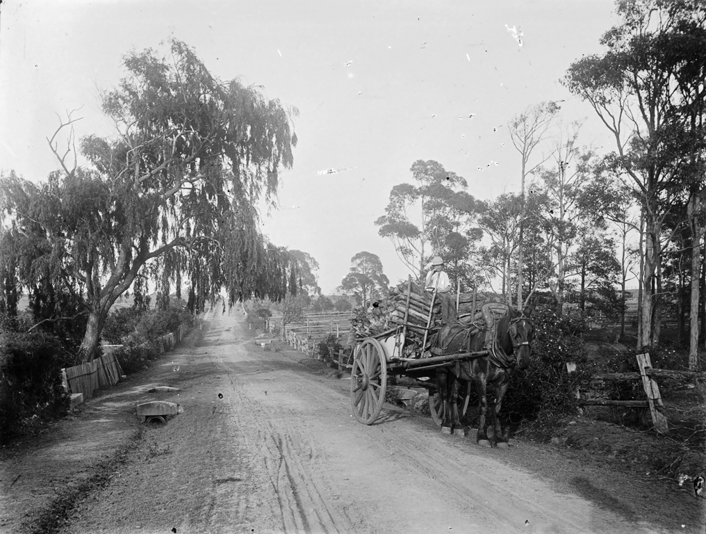
For decades moving yourself or produce via boats was the easier way to shift anything, whether going into 'Sydney Town' or just across to the other side of Pittwater via the estuary. The open land between Mona Vale and Narrabeen allowed the carrying of goods via carts as time went on, as shown in the story of David Foley.
A description of the road north published in 1861 marks a start point in the pre-developments for mail runs and conjures up a rural idyll that was more bush and creeks than smooth thoroughfares built for soft tyres:
Passing Jenkins' farm there is a level piece of beautiful turf nearly two miles long, and a quarter of a mile broad, quite fitted for a racecourse ; forming the finest gallop anywhere near Sydney, and almost of it-self worth the trouble of riding out to. After this, bush occurs again, and then the Narrobin lagoon is reached, half a mile wide-sometimes nearly dry, sometimes up to the horses' knees or girths, and at times impassable. "We found it very low, but filled with fish of various sizes, darting in all directions. This back water extends inland quite out of sight, but is a perfect level sand all over, and, if not fordable, can be crossed by the bar of sand which shuts it out from the sea.
%20Parish%20of%20Manly%20Cove.jpg?timestamp=1537924794578)
%20-%20Copy%20Jenkins%20homestead.jpg?timestamp=1537924833256)
Parish of Manly Cove land titles map section from and section from that section showing placement of the Jenkins' homestead - courtesy NSW Land Registry Services, HLRV - Historic Parish Maps, NSW Records
The road continues alternating with fine galloping ground over the downs, on the sand-hills and through the bush; every now and then magnificent headlands appearing suddenly as you emerge from the bush, generally enclosing between them a fine sandy bay, upon which the ocean rolls in with a most majestic appearance from the heights above.
Near Mr. Farrell's farm are cliffs at least 100 feet high, from which a man fell, whilst shooting birds, from the rock giving way; and, strange to say, he was not much hurt, as he walked out a few days afterwards. The beach underneath is covered with debris of trees and timber, driven down the Hawkesbury by the recent floods, and drifted about here into the bays. The road from Farrell's to the flagstaff has not the sea in view, being amongst bush and steep gullies, over picturesque murmuring creeks. We crossed a tent, where men were boring for coals on the Rev. Mr. Therry's land they have reached 150 feet without success; but it appears that the cognoscenti have pronounced the seam to be deep but certain.
That it is hard stuff in some strata, is seen by four inches only having been gained in the last two weeks. If coal is found, a tramway to Manly will save a sea voyage to Newcastle, and open a great traffic.
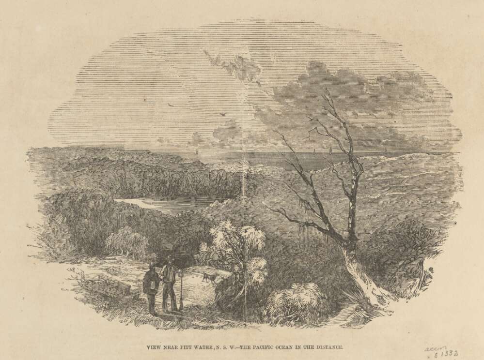
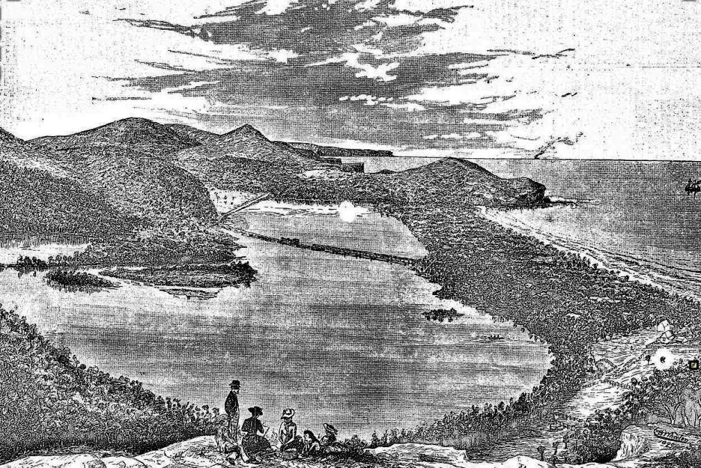
Suddenly, after emerging from a tortuous mountain track, we come in full view of the magnificent estuary of Broken Bay or Pitt Water, running nine miles inland, with water enough for the largest man of war: here the Juno formerly went for gunnery practice, and ascended five miles up.
The middle water is the mouth of the Hawkesbury, several miles in extent, and beyond it is the bar of Brisbane Water, known by the surf beating over it, and difficult of access for any but coasters and steamers, the deep channel being narrow with less than two fathoms of water This runs inland sixteen miles ; East Gosford, a rising township, being at the head of the head of the navigation.
Thus the Hawkesbury has Brisbane Water on the north, and Pitt Water on the south of its embouchure, all three compused between the North and South heads, and about ten miles across. The appearance is not unlike Sydney Harbour near Middle and North Harbours, with the exception of more width, and heavier timber all around
The first thing that met our eyes on the shores of Pitt Water, was a small colony of Chinamen, who live in tents, and are engaged in curing fish caught there, for the Melbourne and Sydney markets a dozen small boats are engaged in the trade, which I hear has been a good hit, although, just now, there are no fish, which is attributed to the great floods having driven them all out to sea. Another mile along a level piece of turf by the water side, brings us to the coast-guard station, where Mr Ross has for several years been in charge. He very politely led us to the top of the rock, where the flagstaff is placed commanding a splendid view of all the surrounding scenery for many miles in all directions. This is Barenjo on the south Head, and is about 100 feet high. Several soldiers, made out of trees, as large as life, and painted, are placed about, and might actually serve as landmarks to vessels entering these complicated waters they would be more useful several miles up the mer, where steamers have often taken the wrong channel, owing to the numerous wide branches on either side, rendering the proper channel difficult to recognise.
Thus ends the trip to Broken Bay, which, for diversity of scenery of entirely an opposite nature, constantly' recurring, forming a succession of panoramas of forest, lagoon, green turf, sand hills, mountains, gullies, creeks, precipices, and (few and far between) settlers farms, I will venture to affirm, cannot be equalled in so short a distance of thirty miles in any part of Australia, and will much repay the trouble of the journey and somewhat plain fare attendant upon it, as, after Manly, there is no accommodation for travellers, and supplies should be carried with them from there from Manly, the distance to Barenjo is twenty-one miles, and can be performed, starting early in the morning, there and back the same day, half the road being a splendid turf, which part of the ground can be got over quickly, and the remainder offering no difficulties to the rider
This trip can only be performed on horseback, but you can avoid taking a horse across Middle Harbour by hiring one at Manly Beach, and going from there to Broken Bay, the road, after crossing the Manly Lagoon, being the same as I have attempted to describe.
JUNIUS . A TRIP OVERLAND TO BROKEN BAY, THE MOUTH OF THE HAWKESBURY. (1861, April 6). The Sydney Morning Herald (NSW : 1842 - 1954), p. 8. Retrieved from http://nla.gov.au/nla.news-article13059376
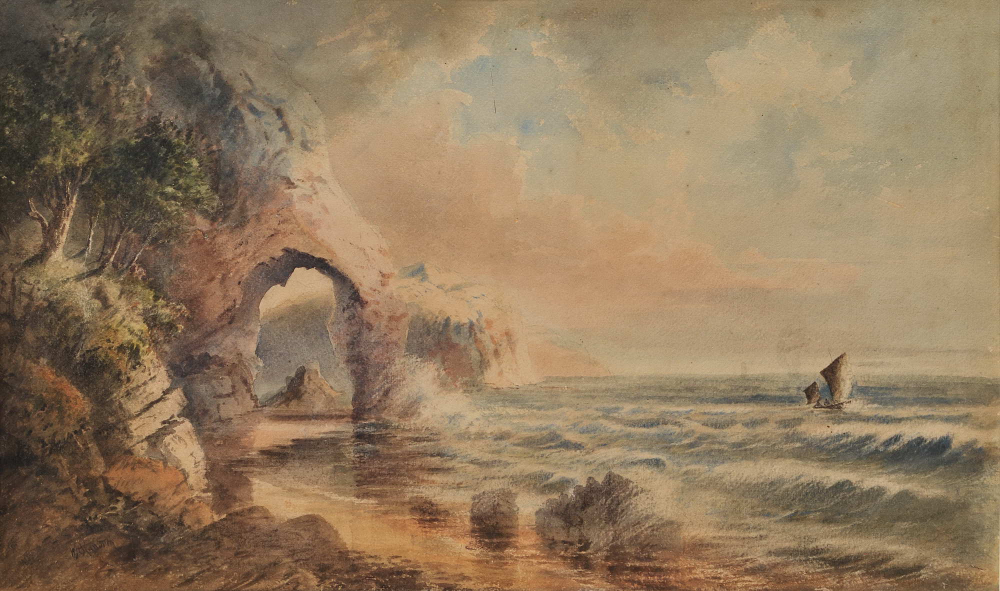
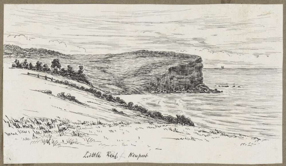
W.H. Raworth (Brit./Aust./NZ, c1821-1904). St Michael’s Arch, NSW [Avalon] c1860s. Watercolour, signed lower left, obscured title in colour pencil verso, 34.2 x 56.5cm. Tear to left portion of image, slight scuffs and foxing to upper portion. Price (AUD): $2,900.00 at:https://www.joseflebovicgallery.com/pages/books/CL181-53/w-h-raworth-c-brit-aust-nz/st-michaels-arch-nsw-avalon
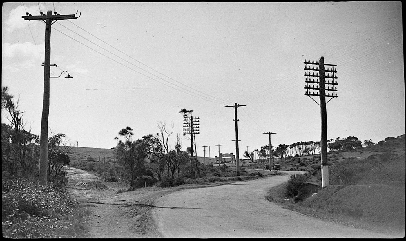
With a Customs House at Barrenjoey by 1840, and then a light to warn all ships at sea of the headland's position, came the need for telegraphic communication - these poles following that early route:
The Legislative Assembly on Wednesday, approved of the agreement entered into at the Postal Conference of March last. At the same sitting, the sanction of the House was accorded to the placing of a light on Barrenjuey, at the entrance of Broken Bay. NOTES OF THE WEEK. (1867, July 13). The Sydney Morning Herald (NSW : 1842 - 1954), p. 9. Retrieved from http://nla.gov.au/nla.news-article28611620
No. 87.—Australia, East Coast, "New South Wales.—Temporary Fixed Lights at Broken Bay.
The colonial Government of New South Wales has given notice that from the 20th day of July, 1868, two temporary lights, called Stewart's lights, would be exhibited on Barrenjuey, the inner south headland of BROKEN BAY.
The lights are fixed white lights, bearing E.S.E. and W.N.W. from each other, distant 390 yards; the higher one is elevated 347 feet, and the lower one 315 feet, above high water, and in clear weather should be seen from a distance of about 12 miles.
Both lights will be eclipsed from seaward between the bearings North to N.N.W., N. W., to prevent them from being seen over the land, which recedes from the outer south head, and also to ensure a vessel passing a safe distance off the south head, by keeping the lights in sight when running for Broken Bay. The lower or outer light will be lost sight of in rounding Barrenjuey, but the upper light will be a good guide for coasters bound to Pitt Water, or for large vessels wishing to obtain shelter in Flint and Steel Bay. SHIPPING NEWS. (1868, December 11). The Express and Telegraph (Adelaide, SA : 1867 - 1922), p. 2 (LATE EDITION.). Retrieved from http://nla.gov.au/nla.news-article207678469
L1350, to connect Barrenjuey with Sydney, by telegraph, was voted, as also L750 for the purchase of 500 iron telegraph poles, tenders for the supply of which will be invited in the colony. WEDNESDAY, MARCH 30. (1870, April 2). Australian Town and Country Journal (Sydney, NSW : 1870 - 1907), p. 4. Retrieved from http://nla.gov.au/nla.news-article70458523
Electric Telegraphs:— To connect Barrenjuey with Sydney 1,350 0 0, Iron Telegraph Posts 3,750 . 0 0 No. II. An Act to enable the Government to raise a Loan for Public Works and other purposes. [Assented to, 26th September, 1870.] (1870, September 30). New South Wales Government Gazette (Sydney, NSW : 1832 - 1900), p. 2121. Retrieved from http://nla.gov.au/nla.news-article223532392
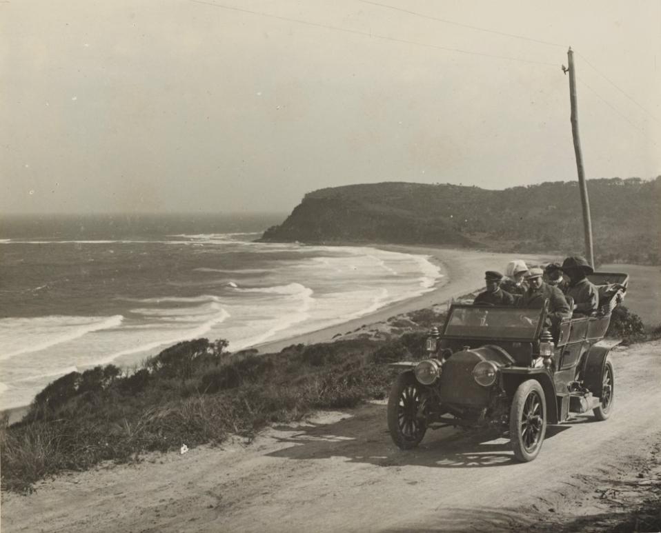
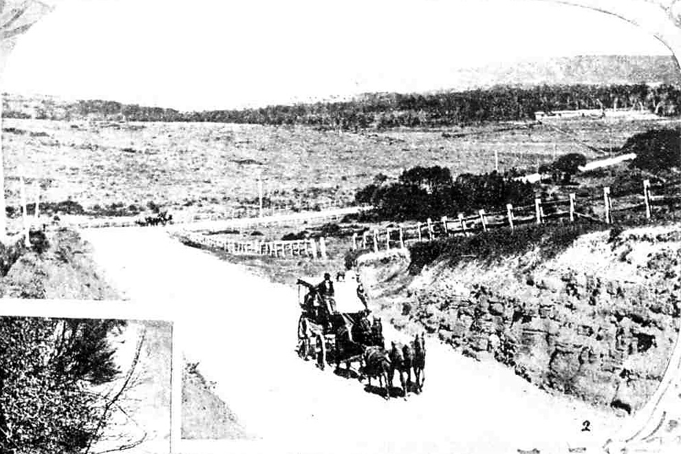
The distance from Manly to Barrenjoey in the 1870s was 17 miles (showing four miles had been trimmed from the 1861 account) and still made by horseback. Today it is 13.79 miles, or 22.2 kilometres:
Farming Prospects at Blue Gum Flat.
We give space to the following account of a district that is now becoming known as an agricultural area, which but a few years ago did not even bear a name : — This flat lies nearly north of Sydney some thirty miles (as the crow flies). To one inclined to proceed to it on a tour of discovery, three routes are available. First, by steamer to Gosford— a four hours' passage — thence by host Campbell's cob, over six miles of particular 'corduroy' or logged roadway. Second, on horseback, by the mail route (we have a post-office, through St. Leonards, and over the Hawkesbury at Peat's Ferry; the total distance some 35 miles. Third, per steamer to Manly, thence by horse to Barrenjuey (17 miles), thence by boat to Gosford, and onward as before; the distance by this route approaching 40 miles in all. Farming Prospects at Blue Gum Flat. (1872, February 10). The Sydney Mail and New South Wales Advertiser (NSW : 1871 - 1912), p. 164. Retrieved from http://nla.gov.au/nla.news-article162667318
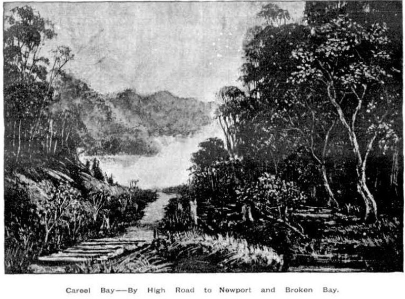
The first 'tourist' visitors were landed at Careel Bay or Barrenjoey itself via steamers. With the building of a Lighthouse at Barrenjoey and a hotel at Newport in 1880 a shift towards making the shorelines more accessible for wave after wave of 'excursionist' meant thousands came here to fish, to gather wildflowers, to picnic prior to the toot of that steamer signalling the return home along the Pittwater estuary, out around the Barrenjoey Headland and down the coast back into Sydney Harbour.
Telegraph Lines
1. Manly Beach to join the Barrenjuey Line at Bolton's Farm, a distance of 12 miles, and an extra wire on the present poles to Barrenjuey; also a line from Ettalong Beach to Webb's, a distance of two and a half miles; and from the cable landing at Gosford to the Telegraph Office at that place,—to be completed in one month. No. 8 E. B. B. wire to be used. TENDERS FOR TELEGRAPH LINES. (1881, January 25). New South Wales Government Gazette (Sydney, NSW : 1832 - 1900), p. 492. Retrieved from http://nla.gov.au/nla.news-article223688954
The instigation of a mail route, and this being deliverable to Mona Vale, Newport and Church Point by coach, and further on to Barrenjoey on horseback also underlined the tracks built by the first European settlers were and must be further developed.
The rise of a holiday tide and Boarding Houses or holiday cottages for hire attracted more visitors and more coaches for moving people beyond Narrabeen. The opening up of parcels of land for sale from the 1880 'Newport Marine Estate' right through to the 1920's Avalon Beach Subdivisions also contributed to the development of roads and even changes to the way the road north went; the filling in of Newport 'lagoon', the cutting into the Bungan beach hill to form a six lane carriageway, the building of the Bilgola Bends and the change of the main road through Avalon Beach from Old Barrenjoey Road to what was named, initially, the New Barrenjoey Road being four 'change of landscape' examples.
The advent of the motor vehicle and the drive to open up parcels of land this invention brought, especially the influence of motor vehicle organisations such as the N.R.M.A. for better and therefore safer roads, caused faster changes than the 'patch ups' that marked previous decades. The rise of motor vehicle enthusiasts in Australia occurring a few years prior to the first real council for the northern end of the peninsula being instigated in the Warringah Shire Council, which worked in concert with some of the earliest Residents 'Progress' Associations, such as those formed a few years prior to them at Church Point and Bayview as well as the longer lived Newport residents association, were also an influence.
The development of Newport as a 'resort' was a key factor in seeing the oft called for 'improvements' finally materialise from those earliest days, as was Mona Vale residents determination to see 'Mona Vale go ahead' - first signalled with the opening of Taramatta Park (now known as the Village Green park at Mona Vale) and continuing into the 1920's and 1950's with calls for electricity, for water pipes to be connected to houses. These developments give us the names of 'subordinate roads' - they also show when and where these were built first, and improved.
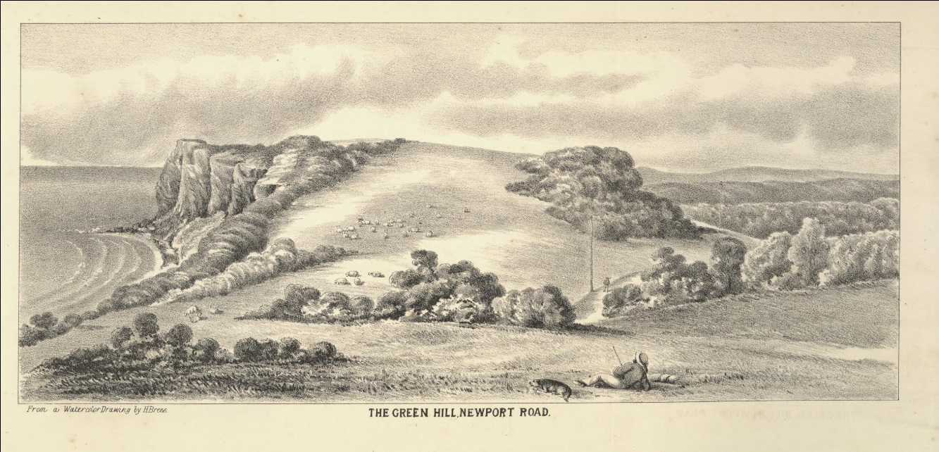
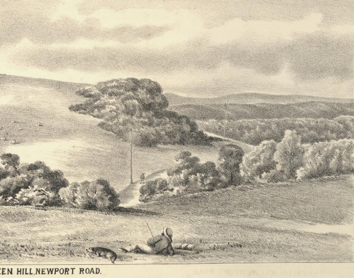
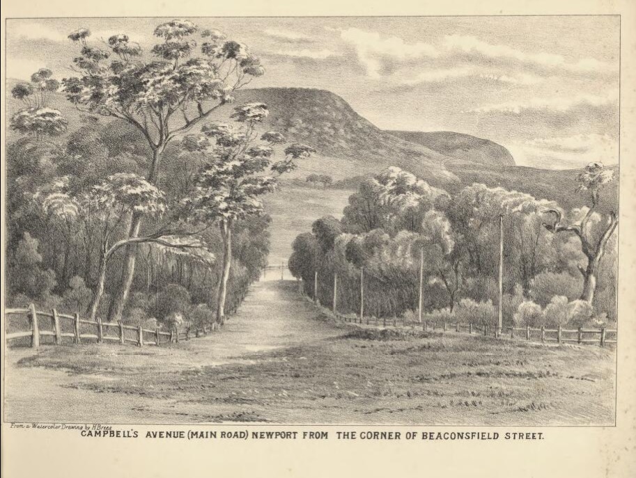
Campbell Avenue (main view) Newport, from the corner of Beaconsfield Street, from album Pittwater scenes, 1880 / Harold Brees courtesy State Library of NSW - note the Telegraph wires. The drawings appear to be the originals for six of the lithographs illustrating 'The Pittwater and Hawkesbury Lakes album'. [Sydney] : Mills, Pile & Gilchrist, 1880. (Lithographed by S.T. Leigh & Co.)
We have received from Messrs. Mills, Pile, and Gilchrist, (who have published it for the proprietors) an interesting pamphlet descriptive and illustrative of the beauties and attractions of Newport, Pittwater, and the celebrated Hawkesbury lakes. The work consists of about eight pages of letter-press and nine carefully lithographed drawings, depicting the more important scenes and places of interest in the locality. The description is capably written, and the illustrations, lithographed by Messrs. S. T. Leigh and Co., from water colour drawing- by Mr. H. Brees, are very creditably executed, and give excellent ideas of the places represented. Appended is a plan and local sketch of the new marine township of Newport, and altogether the publication is one which will commend itself highly to all interested in one of the most picturesque spots on the New South Welsh coast. NEW'S OF THE DAY. (1880, August 26). The Sydney Morning Herald (NSW : 1842 - 1954), p. 5. Retrieved from http://nla.gov.au/nla.news-article13466890
.jpg?timestamp=1537938813630)
" It's a strange thing that when the Government were making that nice piece of road that is cut out of the side of the hill, they didn't come on a bit further, and level the part you speak of, which I now remember is dangerous."
"The Government!" he exclaimed in the most contemptuous accents. " Why the Government have never laid out a shilling on our road. We did that ourselves!”
"And the bridge over the creek," I asked.
“That I built myself, and the causeway over the swampy land on each side, and this bridge, too, in front of the house. I've done all that myself, and I never go along the road that I don't throw some pieces of timber into some one or other of the ruts on the track. If I didn't it would soon be impassable."
“But you say the Government has done nothing, when I remember they took a vote last session of some £200 or £300 for the repair of this road. Hasn't that been expended ?"
"I don't know," he answered, " and that is what I want you to find out for us. We up here are more concerned about this matter than those nearer to Manly, and to all the enquiries and the applications for assistance we have made, the answer has been that the money has been expended, If it has, I, want to know where, for I have my team on the road between here and Manly every week, and neither I nor any of my men have ever seen any person at work on the road, or seen anything in the shape of work done. Why, even when the Deewy bridge was carried away, and a portion of the money voted by Parliament was applied for to repair it, it was actually refused. Now it strikes me that as the money was voted for the whole fine, we, beyond Manly, ought to have had some share of it, if only to patch up the bad places. And let me tell you that there are a very great many settlers who use this line down to Manly, on account of the convenience of the steamer running regularly, and very many more would use it if the road was only made,-I don't mean to say comfortable, but only not dangerous."
They continued north, encountering the coal diggers, who are still going, and who were first reported on in 1861:
"I don't wish to be selfish in this matter," he replied, "although I have more particularly drawn your attention to the part of the road that interests me. But, if you think the road hitherto bad. I don't know what you will say to the rest of it, between here and Barranjuee."
I promised to take notes of the track as I went along, and to publish my experiences, at which he evinced the liveliest gratitude. But it was now time to move, and, to my utter astonishment, Tom came forward fully booted and prepared. I had noticed him going off into the barn, in company with two of the farm-labourers, and it seems that by their assistance aided by a threshing machine, or a chaff-cutter, or some other of the mysterious instruments that were scattered about in the barn, those awful boots had been conned. We took leave of our host and his numerous family of children, dogs, and goats-with a full sense of the kindliness and heartiness with which our arrival had been welcomed, and of the hospitality that had pressed a longer stay.
Following the road, we mounted and crossed the range which terminates in the bluff headland, at the base of which I had been so completely drenched on the proceeding day, and then followed a gradually descending track which wound round the hill side into a deep indentation of the land, until it came down to the level of the sandy ridges which bordered the beach, and then dived into a thickly wooded dell, which though so close to the borders of the seam was one tangled mass of vegetation. It was in fact the embouchure of a long gulley, that, separating two extensive and lofty spurs from the main range was so far sheltered by each from the cutting breezes of ocean, as to allow of the growth of every description of plant in we same profusion as in the gullies I have previously described. Through the midst of it ran a tolerably broad sheet of water, the ordinary brooklet of clear, bright, and sparkling water having been transformed by the late rains into a miniature torrent, turgid and bellowing and carrying down before it small boughs and debris from the hills above, in humble imitation of larger streams. By the aid of a fallen tree we managed to cross the stream dry footed, but it was only by breaking down and walking over the branches of the bangolas and by taking advantage of such tufts of grass or such dead timber as offered that we could manage to cross the centre of the gully which the brook had covered with a mimic inundation.
Once through this jungle of a gully, and we had a gently rising road, creeping steadily up the face of the range, by easy graduation until at last it had gained the crest. Then we had a monotonous walk along the top of the ridge, in full view of the vast Pacific to our right, whose waves were now beating almost lazily along the beach at our feet and whose waters had barely swell enough on them to keel over the tiny fleet of coasters that had put out from different ports of shelter on the coast with the first slant of the favouring wind, and were now lying almost motionless, with scarce wind enough to lift their sails. To the left, the hills, covered with the low close scrub common to our coast ranges, bounded our view, the inland ridges, with their heavily timbered sides being hidden from our sight. Suddenly, however, the road took a curve round to the left, crossed a knoll of the range, and then swept down, in some fifty different tracks, on to a broad swampy plain, or flat, which seemed to us to be inundated, for we could see the water sparkling and glistening in the sun over its whole face. I pulled up short here.
" It won't do to go down there, Tom," said I.
"Oh, but we must," he replied. "This is the Priest's Flat, and there, where you see those shears erected, with the two tents alongside of them, is where they are boring for coal. We must go and report progress."
I looked ruefully at Nat, who made no reply, but, grinning viciously, bent down and turned up his trousers to the knees.
“Do you think there are any leeches there ?” I asked. Nat's trousers were instantly turned down again, and this time he didn't grin,
"Oh, no," Tom answered, "there's too much water there for them, and not enough shelter.
I was easier in my mind, though I had my misgivings; but as these Antipodean leeches seemed to be ruled by laws, and to have amongst themselves habits and customs totally at variance with those of leeches in civilised communities, possibly Tom might be correct; so, tucking up my trousers, I prepared to descend. And, after all, when we got down to the flat it was not so bad as it had appeared to us from the hill. The ground was somewhat honeycombed and the water lay in pools, between which however, we managed to find sufficient footing without actually walking in water.
Arrived at the tents, warning of our approach was given by a solitary dejected bark, ending in a melancholy and prolonged howl, from some unseen dog, that was evidently too broken down and low-spirited to repeat the challenge and it was only after we had approached the shears, and had commenced our examination of the boring, which, to tell truth, none of us could make head or tail of, that a tall sailor looking man, who appeared as if he had but just that instant been uncoiled full-rigged from between the blankets, came out to the entrance of one of the tents, and regarded us with an air of blank and sleepy astonishment. Just after him followed his watchful canine guardian, whose short bark and long ululation had effected his master's awakening, but so far behind as not to be within kicking distance; his cowering watchful look, and his tail hard down between his legs, evidently saying as plain as could be said, " I don't know whether I have done right, so I must stand by for squalls."
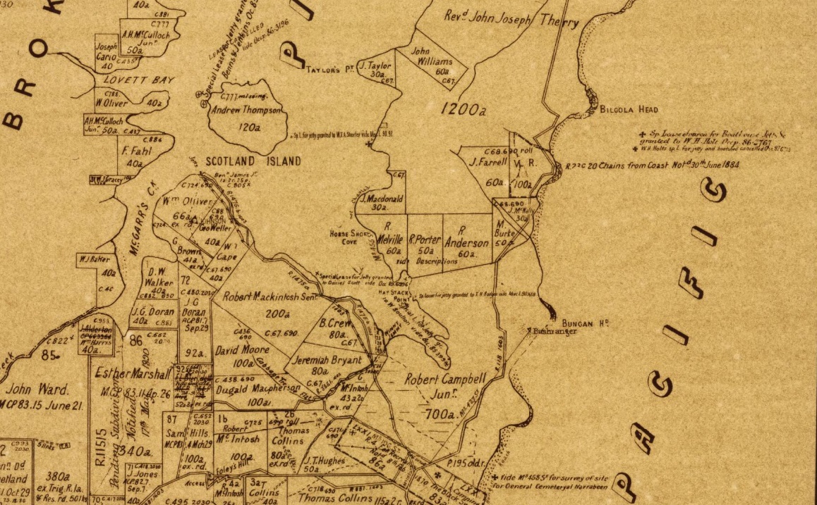
From the information thus acquired, as well as from enquiries subsequently made, I learnt that the spot now being bored was about the centre of a very fine property of some 1200 acres in area, granted many years ago to the Rev. Father Therry, and extending across the Barranjuee peninsula from the shores of the Atlantic to those of Creel Bay; the one being its eastern, the other its western boundary. Hence the plain had been christened the Priest's Flat. ...
Whilst upon this subject, it may-not be out of place to mention that I visited, though somewhat subsequently to the time now alluded to, the bluff headland almost in an easterly line with the boring, and named by the reverend proprietor St. Michael's Head; and there, at about eight feet above high water mark, and quite open to view, is a thin seam, or, as miners term it, pipe of coal, scarcely an inch in thickness. On examination I found also that very much of the shale, both above and below the seam, bore carboniferous indications-leaves, ferns, &c, being distinctly traceable on the face of the cleavages. Another great discouragement that must have operated very strongly upon the rev. owner has been the expense that the work has entailed on him, in consequence of the bungling inexperience and roguery of the persons who have, until lately, been entrusted with it. On this point I speak only on hearsay, and my information is consequently liable to correction ; but I was told with an air of authority that the cost of sinking had, up to that time, reached very nearly £800, being at the rate of rather more than £4 per foot, whilst the time occupied in sinking had been over nine months, or about twenty feet per month not a foot per diem ! If this was not enough to put an extinguisher upon ordinary enterprise, I can't conceive anything that would be. Under the present management I am informed that the work promises to progress more favourably.
We were not very long in pumping perfectly dry the maritime-looking individual who had charge of the works pro tem ; and, by the way, I would here ask how it is that nearly all the males we have encountered in our tracks have so decidedly nautical an appearance? Can it be that, like the islands in the Pacific have been said to have been, this particular portion of the territory of New South Wales has been peopled by the sole survivors of awful wrecks, by men supposed by anxious friends to have been drowned years ago, and who now turn up mysteriously in this unknown land? or, are the inhabitants of the Peninsula like the Arabs on the African coast, and do they seize and treat as slaves the shipwrecked mariners that are cast amongst them by the Pacific, in its un-pacific moods? or have they fled to these wilds to escape the too fond and anxious enquiries, through the water police, of disappointed shipmasters or deluded agents ? The question is one that perhaps some future Australian physiologist may be tempted to solve.
We parted with our friend with but scant ceremony, he turning on his heel and walking into his tent when we told him, "that was all;" whilst we shouldered our loads and walked ahead. Pushing along the edge of the flat, we crossed the foot of the hill we had not long previously descended, and, passing along an inner one of well-grassed sandbanks, that formed the landmost barrier against any encroachment of the waves, we came after a walk of half a mile to a paddock fence, through a slip panel of which the road evidently ran. Entering the paddock we found the upper part overgrown with young timber, principally wattles, that had sprang up since the cultivation of the toil had been discontinued, whilst about half-way across it we encountered a beautiful stream of running water, bright and clear as crystal, and crossed by a very rustic, and at the same time, very dilapidated-looking bridge. Nat was in the van at the moment, and I was astonished to see him, when he reached the brook, throw down his load and descend the bank to the water. Arrived there, he began hastily selecting some of the darkest leaves of a plant which I now observed grew very thickly on the margin of, and even in the water.
"What's the row ?" said I.
" Watercresses," replied he. "Stunning!"
" I'm there," cried Tom; whilst I made no answer, but slipped my shoulders out of my load, and commenced an attack upon this favourite pungent water plant. We amused ourselves for some five minutes over them, and then, filling our billy with the choicest stems we could find, once more made tracks.
After crossing the creek, we came in sight of a homestead, small but neat, having evidently been only recently whitewashed. The paddock was now clear of all undergrowth, and, as a goodly cluster of large trees, the remnants of the former occupants of the soil, had been left standing round the house, it had an exceedingly pretty and picturesque appearance, its white sides gleaming out markedly from amongst the bright green of the shrubs around it, and the dark and sombre verdure of the forest monarchs that overshadowed it.
"This," said Tom, "is Tom Collins, and he's the man that will show us the cave."
“The cave ?" asked I. "What cave ?".
" You'll see," he answered, "a rum 'un; such a one as you won't find anywhere else within a day's ride of Sydney, I can tell you."
Here was a surprise indeed. I had never, during the whole of my lengthened sojourn in Sydney, heard of this cave, and I don't believe that fifty persons in the metropolis are to this day cognisant of its existence; thus, with a feeling something near akin to that of a first discoverer, I hastened up to Collins domicile.
(To be continued.)
MY HOLIDAY. (1861, August 26). The Sydney Morning Herald (NSW : 1842 - 1954), p. 3. Retrieved from http://nla.gov.au/nla.news-article13059581
Having thanked Collins for his kindness and attention, we once more pushed ahead, the road now leading us across a long level piece of country that intervened between the sea and the waters of Creel Bay, until it brought us down to the margin of the latter. Arrived here, we had before us as pretty a marine picture as ever painter sketched, and as directly opposite to the one we had but so recently left as could be well conceived. The flat level land had here narrowed to some sixty rods in width, being backed by a heavily wooded range, the base of which was here and there encumbered by large masses of rock, from which the incumbent soil had been washed, and which now protruded in huge boulders, or lay out bare and detached from their native beds. On the margin of the bay were three little whitewashed slab huts with bark roofs, the passionate squalling of an infant that proceeded from one of them would have given evidence of their being inhabited, even if we had not seen two or three barelegged and barefooted children peering at us round the corner of the house.
Through the narrow belt of low swamp oaks that edged the margin of the bay, the clear smooth waters of Creel glistened in the sun, as the gentle breeze swept over its face and slightly ruffled its surface. On the sands, midway between the shore and the retreating water, for it was nearly low tide, two boys were busied collecting shells, by filling an old basket with the sand, and then agitating it in a water-hole, made for the purpose, until the sand was washed away, and nothing was left but the shells that had been mingled with it. These, when washed clean, were thrown into a boat that lay down helplessly on its side close to them. Out on the waters of the bay, floated a smart little cutter, which, though probably only a shell boat, looked from the clear atmosphere, and perhaps also from the fact that she was the only vessel in view, smart and dapper as a yacht, the red shirt and striped cap of the one man on board, adding still farther to the picturesque appearance of the vessel. Behind her again stretched out the waters of the bay, until they encountered the ranges of the other side, which coming down in many a ridge and gully, and forming many a deep indentation or projecting point, gave a gorgeous variety of tints and lights to a background that under a less brilliant sun or less pure atmosphere would have been sombre and monotonous.
Manly to Broken Bay. (1893, November 11). Australian Town and Country Journal (NSW : 1870 - 1907), p. 19. Retrieved from http://nla.gov.au/nla.news-article71191632
We halted here just long enough to admire the scene, and to have a shot at one of a number of blue cranes, that were stalking about most consequentially and at the same time most warily upon the sands. It was only by dint of a good deal of manoeuvring and dodging that Nat was enabled to get even within possible shooting distance of the rearmost of the lot; and after all, when he fired, he didn't kill his bird. He however succeeded in frightening it, and not only it but all its companions, for they one and all took to flight with a wild cry. But if he had in one quarter caused a fright and a cry he had in another caused a fright and quietness for the report of the gun had stilled the squalling in the hut so effectually that it was not resumed, so long at least as we remained within hearing.
The track, a mere bridle path, now led along the flat, then across a dank luxuriant gully, down which a little stream roared and brattled and foamed with as much fuss and bother as would have been sufficient for a volume of water twenty times its quantity; afterwards, up a wet sloppy hill from which the water exuded in every direction, round the point of the range, down a correspondingly wet and sloppy descent on the other side; and then on to another flat the very counterpart of the one we had just quitted. Another luxuriant and overgrown gully, another wet hill teeming with springs, and then we come down, upon a somewhat broader flat, at the extremity of which we see two tents a short distance apart that we at once recognise, from the description we had received of them, as being the Chinamen's place.
(To be continued.)
MY HOLIDAY. (1861, September 2). The Sydney Morning Herald (NSW : 1842 - 1954), p. 3. Retrieved from http://nla.gov.au/nla.news-article13057913
Crossing a bright clear brooklet that ran close to the rear of the tents, a couple of hundred yards brought us to a rocky headland forming the northern boundary of the cove on which the Chinamen were located. This we crossed by a miserable track knee deep in mud, and, arrived on the other side, we had Barranjuee full in front of us, about three quarters of a mile distant, with a long cleared flat, that had the appearance of having been at one time cultivated, lying between us and the mountain. This flat, which now intervened between us and Barranjuee, was scarcely two hundred yards across at the widest part dividing the Pacific from Pitt Water, and joining Barranjuee to the main. It is very low, and is fully exposed to whole sweep of the south-eastern gales that at some seasons prevail upon the coast, throwing up the waves in watery mountains upon the long beach that faces seaward, and scattering the spray in drenching showers right across into the bay. A dense scrub of ti tree and honeysuckle grows on the seaward side of the flat, forming a thick protecting belt almost up to the mountain, and this Nat and I determined to push through, whilst Tom went on ahead to the Customs station, whose white cottage we could see glistening brightly against the dark back ground of the vast cliffs of the mountain.
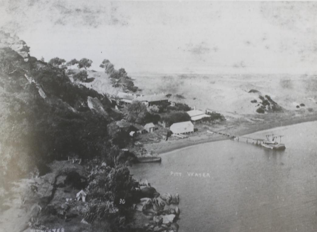
... As we came up to the place we observed Tom, and what we conceived to be two other persons, standing on a high sandy ridge near the house. One of these was Mr. Ross, the Custom-house officer, stationed here, but who was the other ? He appeared to be a military officer, for he had he orthodox scarlet swallow-tail, and infantry shacko; yet what puzzled us was that he held in his hand a long pole at the end of which was a most unmistakable vane. How an officer and a gentleman should so demean himself as to be guilty of conduct unbecoming to him in either capacity, by turning himself into a weathercock, I could not understand, neither could Nat; but as he would never trouble himself to think about anything and never cared to understand anything that was not at once and immediately appreciable, I didn't think much about that. However, Tom shouted to us, and we took off our hats in salute. Mr. Ross returned the compliment, but the red coated gentleman seemed too intent upon his vane to take any notice of us, and I at once determined to treat him as cavalierly as he had treated me.
We mounted the bank, being met half-way by Mr. Ross and Tom, the former gentleman shaking us by the hand and welcoming us heartily to Barranjuee. We had some little conversation, and Mr. Ross pressed us to hurry up to the house. Now, it struck me, that as we were to pass the evening here, it would be quite as well that at all events the ice should be broken between us and the military gentleman, who I regretted to find, did not come up to join us, so I gently put it to Mr. Ross.
"H'm, don't you think-wouldn't it be as well to introduce us to your friend ?"
Poor Ross looked at a loss to understand me, whilst Tom opened his eyes to their utmost stretch.
"My friend? What friend?" asked Ross.
"The military gentleman that was with you," I answered, not at all comprehending all this hesitation.
The words were scarcely out of my mouth than Tom uttered a yell, and fell back rolling in the grass; whilst Ross, who is by no means demonstrative, gave a quiet, but withal so palpable a smile, that told me much more plainly than all Tom's outrageous laughter that I had somehow made a blunder.
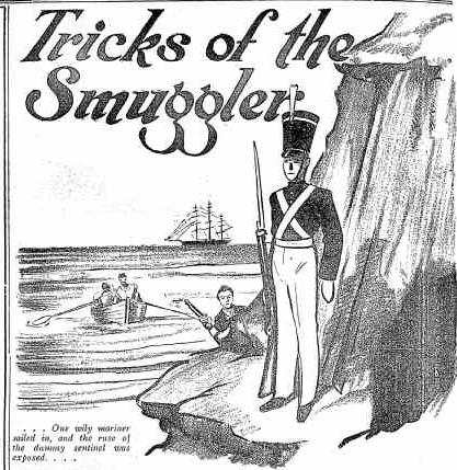 ''I'll introduce you to my friend," said Ross at last, " with much pleasure," and he turned back up the hill, whilst I followed him, raising my cap in order to give me an opportunity of running my fingers lightly through my hair, in order to make as favourable a first appearance as could be done under the circumstance.
A dozen or so of paces brought us on the top of the sand hill, and there to my intense surprise and disgust, I found that Ross's military friend was nothing more than a painted log of wood ! I heard Tom's wild yells of mirth, and even Nat's sardonic grunts of satisfaction at my discomfiture reached my ears, whilst saw the serio-comic expression of Ross's face, as he watched me scanning with astonishment the pudding-faced effigy of one of Briton's bold defenders. I could stand no more, so clubbing my piece I rushed on the scarlet- coated deception, and should most certainly have smashed it, or more probably my fowling piece, if Ross had not thrown himself across my path and stayed my murderous hand.
Left Illustration from; Tricks of the Smuggler. (1936, May 29). The Land (Sydney, NSW : 1911 - 1954), p. 14. Retrieved from http://nla.gov.au/nla.news-article104230976
...And truly it is a magnificent view that is spread out before me, as I recline in that seat on the summit of Barranjuee, and smoke my pipe Away to the left I can see the mouth of the Hawkesbury, and can trace that river up a considerable distance until it is shut in by numerous woody headlands. Almost in front of it is Mount Elliott receiving its name from is very remarkable resemblance to a lion couchant, the emblem of the Elliotts To the north of that again, and extending away to the right, is a long sandy beach upon which the sea breaks in heavy and ceaseless rollers for nearly a mile from the shore. This beach stretches away right to the entrance of Brisbane Water, and forms ore side of that entrance, the other being a peaked and pyramidal looking hill, which looks gray and indistinct in the distance. More in the foreground there stands Little Box Head, and from where I stand, the sea appears to break right across from this headland almost to Mount Elliott, and although there is a channel constantly shifting, I cannot see it at so great a distance.
From Little Box Head to the North Head of Broken Buy a distance of six or seven miles, there is a constant succession of headlands and long sandy beaches, with here and there a bluff faced wall of rock with a long reef running out from it, as though Old Ocean had made some more savage attack than ordinary upon this particular spot and had shaved it down to the ordinary marine level.
Here we sat and gazed and gazed, at each instant finding out something new, some mellow light, some deep shadow, until at last the setting sun threw his last crimson glow upon the western hills, and then the prospect began to fade gradually away, the more distant parts receding piece-meal from view, retreating behind the veil of haze that seemed to come down before them and to advance slowly step by step as the twilight deepened into night. At the same time, the wind came upon us cold and bleak, off the vast expanse of water, and with something like a longing for the snug parlour and the cheery fireside, we hurried down the hill to the cottage -(To be continued )
MY HOLIDAY. (1861, September 9). The Sydney Morning Herald (NSW : 1842 - 1954), p. 3. Retrieved from http://nla.gov.au/nla.news-article13063749
Another instance of those who owned the land being responsible for the roads needed:
Department of Lands,
Sydney, 20th August, 1878.
PARISH ROADS.
HIS Excellency the Governor, with the advice of the Executive Council, having deemed it expedient to open and make the several Parish Roads mentioned in the Schedule appended hereto, to be maintained at the expense of the parishes through which they pass : Notice is hereby given, that in accordance with the provisions of the Act 4th William IV No, II, plans and books of reference, showing the intended lines of the roads in question, are now deposited at the Office of the Surveyor General in Sydney, and at the Police Offices mentioned.
It is requested that any well-grounded objections that may exist to the formation of the roads in question may be transmitted in writing to the Clerk of the Executive Council within one month from this date.
By His Excellency's Command,
JAMES S. FARNELL.
Schedule Referred to. Roads No. 78-1265 R. 1477
Description of Roads
Road from near Barrenjoey Headland to the Manly and Pitt water Road, parish of Narrabeen, county of Cumberland.
Names of reputed owners or occupiers through whose properties the Roads pass.
Darley ………………
Police Offices at which the plans and book of reference have been lodged. ..Gosford. PARISH ROADS. (1878, August 20). New South Wales Government Gazette (Sydney, NSW : 1832 - 1900), p. 3262. Retrieved from http://nla.gov.au/nla.news-article223111173
As soon as 'excursionists' began to flood into the area via boats, and come via coaches as places like the Newport Hotel, the Rock Lily at Mona Vale, and numerous cottages and boarding houses, the way north needed improvement and those living here, eager to supplement their basic farming income by attracting these crowds, were calling for improvements to the road.
SUBORDINATE ROADS.
A paper has just been issued by order of the Legislative Assembly, showing the classification and proposed distribution of the vote on the Estimates for subordinate roads. The total amount of the estimate is £300,995, to provide for 15,000¼ miles of road. The Northern roads comprise 6079½ miles, on which it is proposed to expend £131,938 : there are 2833 miles of Western roads, for which £62,081 is to be appropriated ; there are 6168 miles of Southern roads, which will require £115,976. It is proposed to expend—on first class roads, £50 per mile ; on second class, £25 ; on third class, £15 ; on fourth class, £10 ; fifth class, £7 ; and sixth class, £5. The details are as follow :—
NORTHERN ROADS.—Road from St. Leonards, via Balgowlah, to Manly, 7 miles, £350 ; Military-road, St. Leonards, 7 miles, £350 ; Manly Cove to Pittwater, 16 miles, £800 ; Pittwater to Barrenjuey, 4 miles, £200 ; Balgowlah to Pittwater-road, 4 miles, £60 ; Lane Cove, via Stony Creek, to Pittwater, 12 miles, £300 ; Wiseman's Ferry to St. Albans, 12 miles, £180 ; SUBORDINATE ROADS. (1883, March 16). The Sydney Morning Herald (NSW : 1842 - 1954), p. 5. Retrieved from http://nla.gov.au/nla.news-article13530272
In the same newspaper, just days later:
A Meeting of the residents of Pittwater was held on Saturday evening at the Bolton Hotel, for the purpose of urging the Government to make the road from the Lagoon to Newport. Mr. Crawford, who was voted to the chair, explained the object of the meeting, and drew attention to the state of the road, which in some parts was almost impassable. He stated that he was convinced it was only necessary to bring the matter under the notice of the Minister for Works to get the work done. After several speeches had been made, the following gentlemen were appointed to form a deputation to wait upon the Minister:-Messrs. Mc Koowa, Dr. Tibbitts, J. Riley, B. James, and F. Smith. NEWS OF THE DAY. (1883, March 28). The Sydney Morning Herald (NSW : 1842 - 1954), p. 7. Retrieved from http://nla.gov.au/nla.news-article13531240
DEPUTATIONS.
PITTWATER-ROAD.
A deputation waited upon the Colonial Secretary yesterday in reference to the road between Manly Beach and Newport, Pittwater.The deputation consisted of Dr Tibbets and Messrs M'Ewan, F. Smith, R. Crawford and R. Innes. It was represented that the Government expenditure on the road under notice had been made on the Manly Beach end, leaving the other end in a disgraceful state. A large coach traffic passed over the road in the shape of visitors to the Hawkesbury, and the bad condition of the road caused them great inconvenience. Mr STUART said he was aware that the road was very bad, but it was being gradually improved, and as soon as the bridge over the Narrabeen was finished, work could go on at the end of the road which now required to be put into a proper condition. DEPUTATIONS. (1883, June 2). The Sydney Daily Telegraph (NSW : 1879 -1883), p. 6. Retrieved from http://nla.gov.au/nla.news-article238491545
Department of Public Works,
Sydney, 7th January, 1884.
THE following Tenders have been accepted :—
Jas. Donnelly—Contract 46m, Road Bowral to Robertson.
Turner & Collins—Contract 32m, Road Pittwater to Barrenjuie. Government Gazette Tenders and Contracts (1884, January 8). New South Wales Government Gazette (Sydney, NSW : 1832 - 1900), p. 213. Retrieved from http://nla.gov.au/nla.news-article222085426
Albert Turner, of Barrenjoey and Stokes Point, and the Collins family of Avalon at Careel Bay and also Barrenjoey would be the contractors.
The same reappears four years later, showing was is 'proposed' doesn't always eventuate:
Despite numerous applications for basic services, images and reports show the road was mostly a single carriageway and unsealed until the mid 1920's when the state government taking a more active role in the building of main artery roads, and leaving the small by-roads and deviations to local councils, became the vision.
The increased access roads allow, coupled with improved bus services and the advent of the motor vehicle, as well as a love for Palm Beach when Sydney was having a 'Society' of her own that was one step away from the 'Society' that had reigned since the First Fleet, and one step past Federation, as well as the 'coming of age' many ascribe to what happened to Australia as a result of WWI, were all factors leading into a great change:
LOCAL GOVERNMENT.
THE MAIN ROADS BILL.
The Main Roads Bill as it emerges from criticism and amendment by the Assembly is, if anything, a closer model than ever of the Victorian system. It is natural that it should be so. After eleven years of experience and a number of modifications, Victoria has arrived at a system which has the dual advantages of providing an effective machine for road improvement, and at the same time one which works with the goodwill of the councils and the land owners. Only two amendments of importance were made in the bill by the Assembly. One of these reduced the proportion of cost of maintenance charge-able to country councils from two thirds to one half, this being in keeping with the Victorian Act. The other amendment provided a safeguard to councils which is unknown In the Victorian measure, namely, that the contribution asked from the councils shall not under any conditions be more than would be paid by a rate of 1/2 d in the £ on the U C.V. Looked at broadly, both the city councils and the country councils will be in a much better position after the bill is passed than they are in to-day.
THE COUNTRY'S SHARE.
When the bill is in operation country councils will lose the present main roads endowment of about £160,000 per annum. In lieu of this, the board will be paid an annual contribution from consolidated revenue of £90,000 a year. In addition the board will receive for expenditure through the councils on country main roads £453,000, from motor fees. On top of this the board will have for expenditure. In the country £2,000,000 of loan money, of which £1,000,000 is a grant, only half of it being repayable by the board. As the £2,000,000 will be expended at the rate of £400,000 a year, the councils will be getting £200,000 a year from outside sources, or with the Commonwealth grant £881,000 per annum. For this they surrender to a central body In Sydney the power to levy upon them for contributions towards the cost of main roads, and also the right to say how these roads are to be constructed, subject, however, to a protection that they cannot be called on to pay more than half the cost of construction nor subjected to a levy of over ½ d in the £. There Is also to be considered the experience of the other States that once such a board is established, and is working satisfactorily, it draws money from the central treasury. Summed up, the position is that the burden to country councils in the construction of main roads is to be shared by sources other than the taxation of their ratepayers to the extent of nearly £1,000,000 per annum, with a certainty that the motor fees alone will soon bring it over that figure.
THE OPPOSING VIEW.
Councillor Houston of Yallaroi Shire writes voicing the opposition still held by some of the shire councillors to any such measure -
“Having recently perused a copy of the Main Roads Bill, I cannot help admiring the boldness of the National Government in practically wiping out local government in one act, and centralising every thing in connection therewith In the metropolis.
The board that it is proposed to create in to be endorsed with almost unlimited powers in its dealings with councils. Indeed, these powers are so much in evidence throughout the bill that is doubtful If many ratepayers will be found be lacking in self respect as to accept the position of alderman or councillor under this city created oligarchy
Under existing conditions the shire councils have constructed and maintained roads within their areas, with the object of assisting primary producers by enabling them to get their produce to the nearest railway station ... ,
This appears to me to be a sound policy, and much more in the interests of developing the interior than spending revenue on so called main roads, which, although they may lead to the metropolis, are frequently running parallel to and in close proximity to a railway. While there has always been the strictest economy practised by various Governments towards shire and municipal councils, there appears to be quite a generous spirit In evidence where the Roads Board is concerned. There is a degree of vagueness about the remunerations of Its members that may mean anything up to £5000 per annum for the chairman, with other members and staff in proportion
Many of the electors have been expecting to hear of some opposition to this bill from the Progressives, but perhaps long association with the city has somewhat modified their views on decentralisation
THE METROPOLITAN GAIN
Up to the present the amount received by the councils of the County of Cumberland to assist main road construction has been a negligible factor. The only exception to this rule is that an amount of approximately £500,000 has been spent in placing in order the principal thoroughfares to Sutherland, Liverpool, Penrith, and Windsor. Of this amount halt is to be charged to the Main Roads Fund. The Metropolitan Fund will receive a sum of over £100,000 per annum from motor taxes and loan moneys at the rate of £200,000 a year for five years, of which £500,000 is a grant. Then there is a sum of £10,000 a year from consolidated revenue, and £6000 a year from public vehicles. There will also be the city of Sydney's quota, which, even if reduced to one-eighth of a penny, will amount to £20,000 a year. The councils other than the city of Sydney will be taxed to the extent of £164,000, which is only £42,000 per annum more than was spent by them in 1922 on main road construction and maintenance. The metropolitan councils, excluding Sydney, will therefore be called upon to raise £40,000 more, and the roads will receive an additional annual subsidy of £240,000 per annum It is true that some councils will receive a great deal more benefit than others, but it Is impossible to handle the roads question In the metropolitan area other than by treating it as one composite matter, even though it does not work with the same justice to every rate-payer.
THE ADDED AREA.
One of the most contentious matters that has arisen in connection with the bill has been the adding on of the areas of Blue Mountains Shire and the Municipalities of Katoomba and Blackheath to the County of Cumberland. The question has perhaps been given a prominence greater than it deserves. The effect will be that the County of Cumberland Fund will be loaded with an additional length of 34 miles of main road. As against that it will receive rates of /01 In the £ over the three areas mentioned, amounting to nearly £5000 per annum, and half the motor fees from that area. The territory of the Metropolitan Main Roads Fund previously proposed embraces the County of Cumberland, an area which is bounded by a line drawn from Bulli to Camden, and then along the Nepean River to Windsor, and the Hawkesbury to Barrenjoey. There are in this district about 600 miles of main roads, so that in road mileage the addition is a trifling one On the other hand, this 34 miles badly needs reconstruction, and oven in tarred macadam would probably cost £6000 per mile The country people say that the very fact of its requiring such expensive construction is proof that it Is not a country road, but the city people claim that if this added expense Is to be thrown on to them a sum should be provided to meet it Of the councils concerned Black-heath and Blue Mountains are in favour of the proposal, and Katoomba is against it, the rateable value of Katoomba being such that the aldermen consider the town would get the worst of the bargain
WIDTH OF TYRES
When the Main Roads Bill reached the second reading stage this State was closer to getting legislation to govern width of tyres thin ever before in its history The bill contained a clause enabling ordinances to be mode "with respect to the regulation of the width of tyres of vehicles using main roads" .
"When this clause was reached the leader of the Opposition objected to such a vital matter of principle being handed over to a board, It being, in his opinion, ' one of the most contentious questions that could exercise the minds of hon members ". The Minister in charge of the bill agreed that it should be dealt with, by a special Act of Parliament, and consented to the clause being struck out. On being put to the division only eight members voted in favour of its retention. If this is to be taken as an indication of the temper of the House in regard to control of width of tyres the prospect of any such legislation passing is extremely remote. The bill proposes that £10,000,000 shall be spent on roads in the next five years, and the chief agent in destroying the benefit of this expenditure will be the tyres of vehicles. The width of them, the weight that presses them on the road, and the speed at which they travel will mainly govern the life of the asset created by this £10,000,000. Nevertheless Parliament has decided that the board is not to be given power to protect the roads built out of Its funds. LOCAL GOVERNMENT. (1924, September 11). The Sydney Morning Herald (NSW : 1842 - 1954), p. 5. Retrieved from http://nla.gov.au/nla.news-article16181789
There were major changes past the 1920's commencement of the filling in of the Newport Lagoon (or creek), such as the initial cutting into ''Bushrangers'', the Bungan, Hill to form a road during the 1930's and the subsequent 1955 commenced widening of Barrenjoey road from Mona Vale to Newport which resulted in a six-lane carriageway with a median strip between the two and a two-lane dual carriageway aside median strip through Newport itself, as well as the changing of the route further on at Bilgola during the 1920's when the 'Bilgola Bends' were cut into the hill to go around the beach.
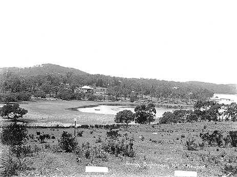
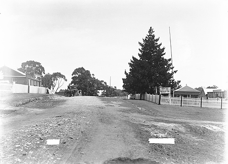
Bushrangers Hill at Newport (NSW) December 31, 1908 and View of Newport (NSW) December 31, 1908 - both courtesy State archives and records - Images No.; 18526_a024_000100 and 18526_a024_000099 - both of which are down near the Newport Hotel and Collin's Retreat-Bay View House-Scott's Hotel.
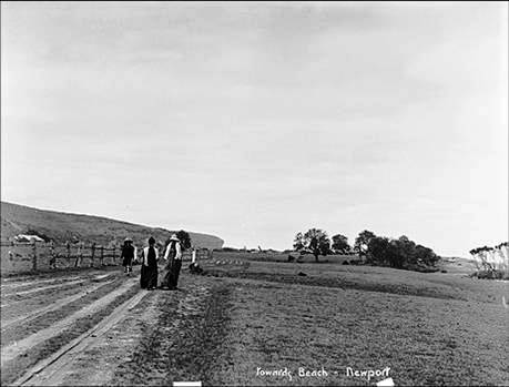
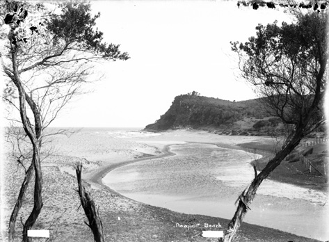
'Walking towards Newport Beach' Pic No: 18526_a024_000069, and Newport Beach (NSW) the lagoon exit to the beach - December 31, 1908, Image No.: 18526_a024_000040, both courtesy the State Records of NSW
My dad met my mum at 'Wharfdale' which was next door to where the Melvey Victor Richardson place is. Wharfdale was owned by Frank Keighly, (a founder of Bradford Cotton Mills; they used to have a lot of the property there. Dad was a stonemason. He used to be allotted rights at Manly Wharf, he had a truck; the materials used to come across on the punt. They had the old hard tyre reos; they went to the opening of the Harbour Bridge on those; on Bottle’s Buses; Bertie; these were hard rubbered old Internationals; Federals; we used to have to get out and push them up at Bilgola Beach, that was the road then (now called the Serpentine), no Bilgola Bends. The road used to go along through where Avalon public school is up the hill and straight across; there was no Barrenjoey road yet. So it went straight across to the hill and down into Bilgola.
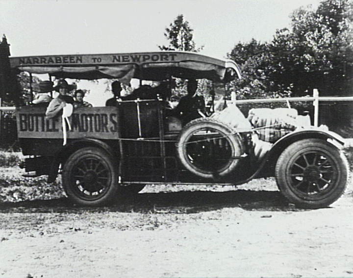
Bottle's Buses, 1920's, courtesy Mr Philip Lipscombe.
... it was a beautiful area to live. What I hated was when they built Roseville bridge and they brought all the fill and all the crap in it and dumped it at Bilgola Bends which spoilt that whole area. You used to be able to drive around Bilgola Bends and look out over the lovely scenery and they dumped that there at the south end of it, they were going to widen Bilgola Bends, and nothing ever happened. And now we’ve got all that crap that’s there; it’s environmentally just bad I reckon.
Apart from that land filling exercise, there was also:
The society decided to unite with other bodies in a protest to the Government regarding the Main Roads Board's use of a section of a tourist road near Bilgola Beach, as a quarry. WILD LIFE. (1934, November 28). The Sydney Morning Herald (NSW : 1842 - 1954), p. 14. Retrieved from http://nla.gov.au/nla.news-article17133917
NARRABEEN LAKES. Protest Against Shell-dredging Scheme.
The Parks and Playgrounds Movement decided yesterday to co-operate with other public bodies in a deputation to the Minister for Local Government to protest against the granting of a lease by the Mines Department to a public company for the dredging of Narrabeen Lakes. Mr. A. J. Small (chairman) said that the company proposed to obtain shells for lime-stone. The dredging of the lakes for this purpose would be detrimental to the surroundings. At present the water in the lakes was shallow and safe for children and non-swimmers, but if the dredging was allowed a dangerous channel, 20 feet deep, would be created down the centre of the main lake. The waters would be stirred up, big holes would be created, and the beauty of Narrabeen Lakes would be spoilt.
The meeting also decided to protest against the action of the Main Roads Department in establishing a quarry on the hillside of Bilgoela Beach. The road from Sydney to Palm Beach, it was stated, was the most beautiful coast drive in the State, and the establishment of the quarry at Bilgoela ruined a delightful vista. The whole of the hillside over-looking the beach was being devastated.
The Main Roads Department, it was stated, was usually very helpful in preserving natural surroundings, but on this occasion no thought or consideration had been given to the question of town planning. NARRABEEN LAKES. (1934, December 6). The Sydney Morning Herald (NSW : 1842 - 1954), p. 15. Retrieved from http://nla.gov.au/nla.news-article28021345
From the then department of Main Roads annual report of 1934-1935, page 13:
(c) Main Road No. 164 - Barrenjoey Road.)
The Department commenced by day labour the reconstruction of Barrenjoey-road northward from the end of the existing cement concrete pavement at Narrabeen. The work involves the improvement of alignment by deviations, regrading and widening. Wherever the condition and levels of the existing pavement are suitable it is being utilised as a base-course for the new drag-spread macadam wearing course, but where the old pavement cannot be adopted, a ballast base-course is laid with an intermediate course of premixed material using hard local sandstone as the aggregate. Realignment involving resumptions has been undertaken at Sheepstation Hill (between Narrabeen and Mona Vale), near Mona Vale at " La Corniche " corner at Bassett-street and north of Grandview-parade on the " 11-mile " hill. A further deviation is in hand adjacent to the Avenue, Newport. For the supply of the stone required for the reconstruction a quarry has been opened at Bilgola.

There were other little changes along the way, but these were the major ones to the original aboriginal track between a point from Narrabeen Lagoon to Barrenjoey. What is important to remember is that these 'modifications' changed the original physical landscape. Pittwater's coastal headlands are what those from pre-Main roads era, the 1930's 'unemployment relief works' and post WWII builds, would recognise most if they visited today - and it is these distinct features that may even help those born today recognise the places shown below.
The need for farm produce to reach the market once local farmers could transport goods on land, the coming of the mails and with their coaches, the coming of the tourists who would stay longer than the day-long visitors or thousands of 'excursionists' brought here via steamers and residents demanding safer roads for both them and to increase the destination of Pittwater as a holiday resort, the advent of better roads driven by the automobiles, the need to meet a growing population as much as the want to have a place to call home in a pristine, if then, slightly harder to get to place, are all aspects of the change of a place from rural to suburban.
The way north is separated into sections below as every beach and village developed differently. Below these a pictorial shows the shifts in the run north along the Barrenjoey Road.
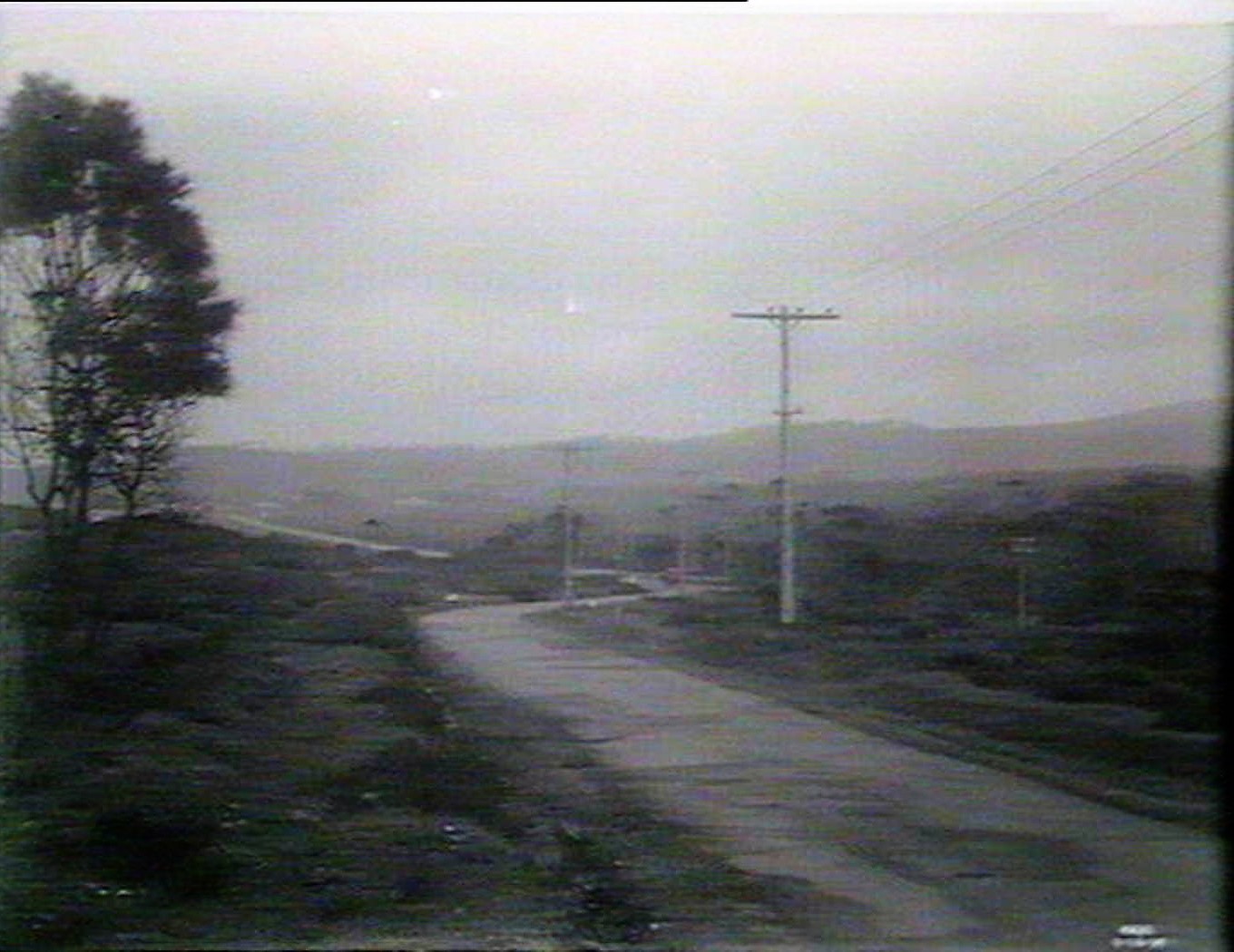
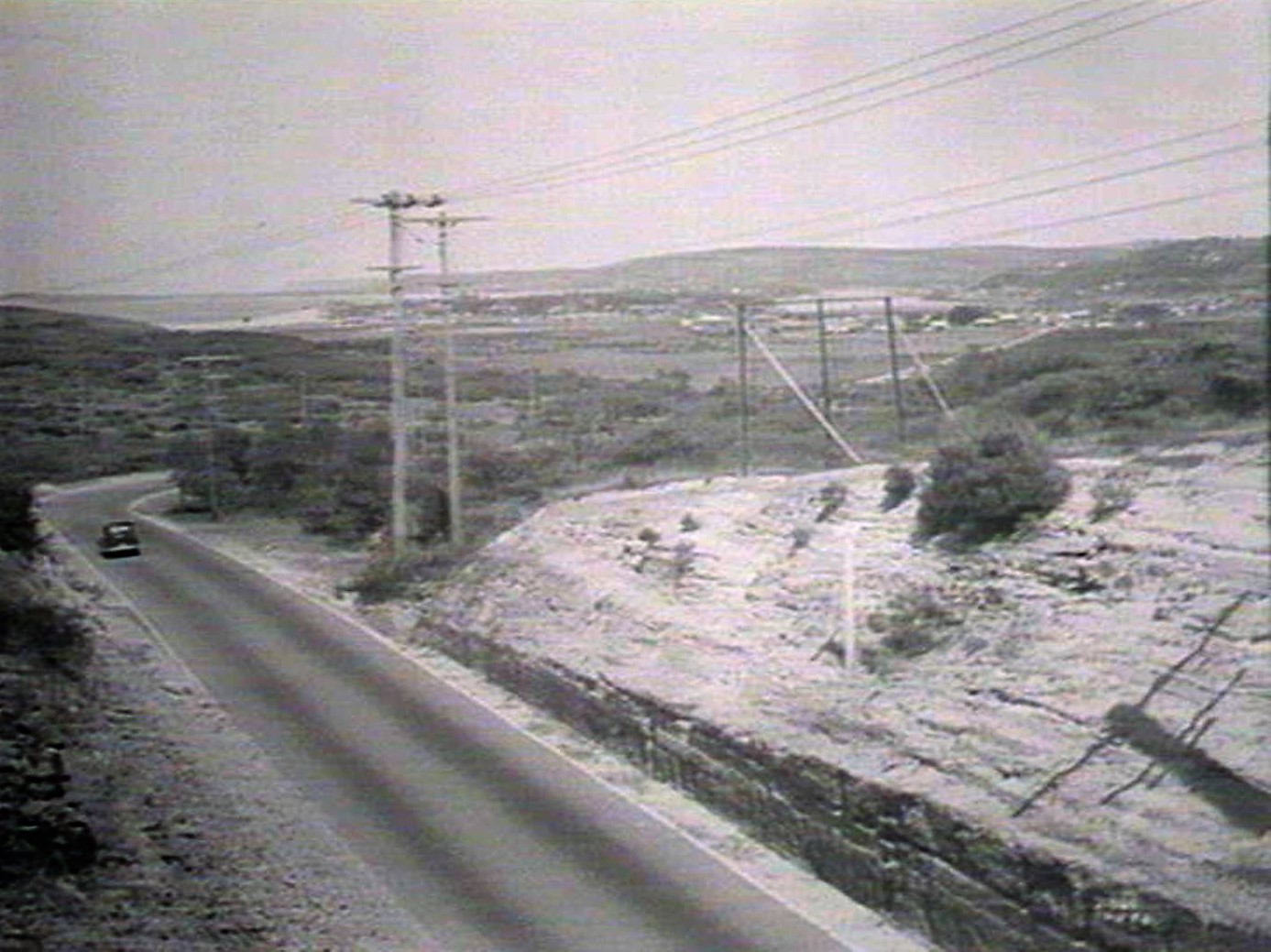
Mona Vale
The road to Rock Lily from Narrabeen and on to Mona Vale went past Turimetta, through what we call Warriewood, due to the Macpherson family, over Sheepstation Hill along the stretch aligned with Bongin Bongin (Mona Vale) Beach beside the Black Swamp to Rock Lily and to Taramatta (Village Green) Park where one met a fork in the road - to your left went to Church Point along the Bay View Road, straight ahead led to the 'road to Newport'.
Once a bridge had been built, the 'pathway' of walking across the lagoon at low tide, or at the beach-lagoon mouth at high tide, meant access for cart and then car.
Narrabeen [a view, possibly of the lagoon and beach] Watercolour, 16.2 × 34 cm (6 3/8" × 13 3/8") circa 1870 by William Andrews, 1840-1887. Image No. c12838_0017_c, courtesy State Library of NSW
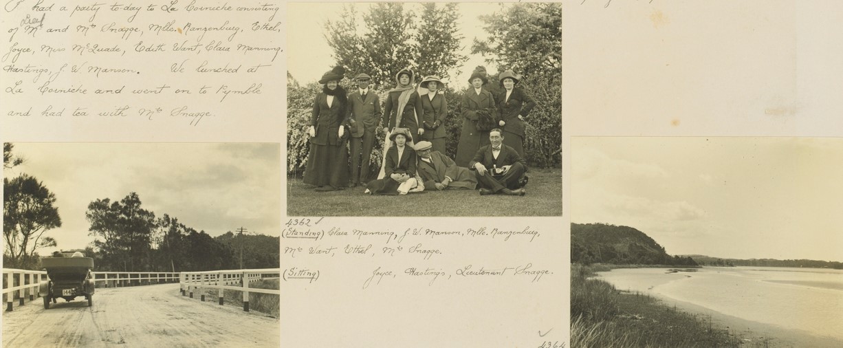
Sunday 27th August 1916. Today I took the new Electric Car 146 for a long run to Narrabeen, Margaret being with me. The Lancia car followed with Joyce,Ken, Miss Cadman and Miss Stickland. At Narrabeen, Margaret and I left the Electric car and we all went on to Bilgola in the Lancia, arriving there in time for lunch.
The Lancia car at Narrabeen. The Electric car at Narrabeen. Image No. a3295021h. From Album 67 Photographs of the Allen family 14 January 1916 - 5 February 1918, courtesy State Library of NSW.
Sheepstation Hill, separating Warriewood and Mona Vale. Before a cutting was made for Pittwater Road, it climbed up and over the steep slope. In the 1880s, coach travellers to Pittwater had to dismount at the foot of the hill to help push the coach to the top.
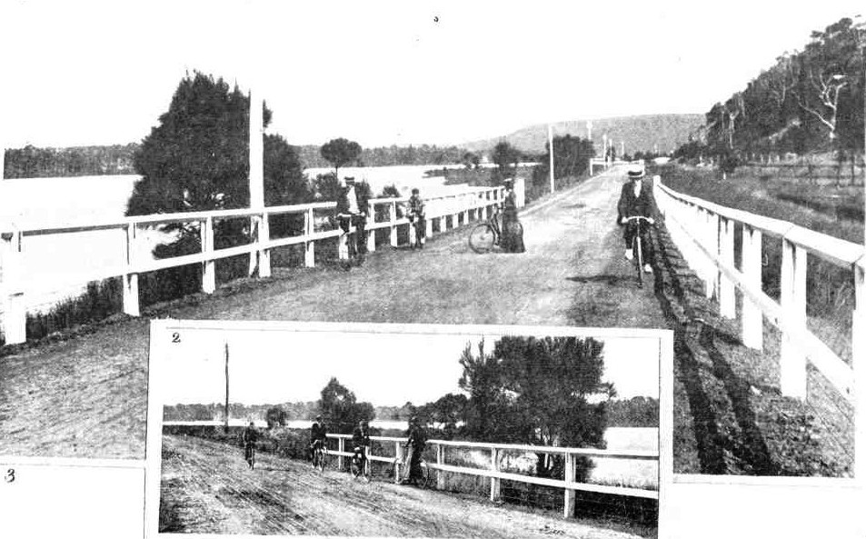
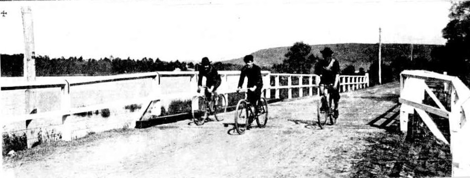
Before the advent of a cycling route opened in 1901 for those who liked to ride to Newport and beyond, the hill was described as;
None of the hills are very bad, and there are only two places on the whole route where it is necessary that, more than ordinary caution should he exercised. They are both on the Newport road. One is a hill recently graded, encountered soon after Newport is left on the return journey. It is indicated in the map by arrows. There is a sharp turn half-way down in a cutting and cyclists should not let their machines go until they are safely round this. A similar turn, though without the cutting, will be found in the Cutting-hill, between Narrabeen and Rocklily, when returning to the city. Care need be exercised to make the turn safely. Apart from these two points the road can be ridden In perfect safety by the crudest novice.
All the cross-roads and "turn-offs" which are marked in the map are surveyed roads, but are to all Intents and purposesimpracticable for cycling, as they have not been formed. Some cyclists have ridden over them, but more from a spirit of adventure than from any hope of an enjoyable ride. The distances on the map are all measured from Manly. FAVORITE CYCLING ROUTES. (1897, July 31). The Daily Telegraph (Sydney, NSW : 1883 - 1930), p. 4. Retrieved from http://nla.gov.au/nla.news-article238392082
.jpg?timestamp=1537905699975)
1. On the Narrabeen Lagoon. 2. View from Sheepstation Hill, looking south. 3. Bay View. 4. A dip in the surf at Narrabeen. 5. Near Long Reef. 6. Approaching Narrabeen. 7. One of the creeks. The distance from Manly to Bay View is about 15 miles. The road is by the Narrabeen-road past Rocklily. A proposal to put down a tram line is now being considered, and a member of the ministry was recently driven over the country, which in many parts is remarkably picturesque. MANLY TO BAY VIEW—A POPULAR EASTER RESORT BY ROAD. (1900, April 14). The Sydney Mail and New South Wales Advertiser (NSW : 1871 - 1912), p. 878. Retrieved from http://nla.gov.au/nla.news-article165297416
THE MANLY-PITTWATER CYCLE PATHS.
1. An ideal bicycle stretch near Pittwater. 2. The Lagoons, Narrabeen.
4. At Narrabeen.
THE MANLY-PITTWATER CYCLE PATHS. (1901, August 24). The Sydney Mail and New South Wales Advertiser (NSW : 1871 - 1912), p. 479. Retrieved from http://nla.gov.au/nla.news-article165234777
A MOTOR CAR ON THE PITTWATER-ROAD, NARRABEEN
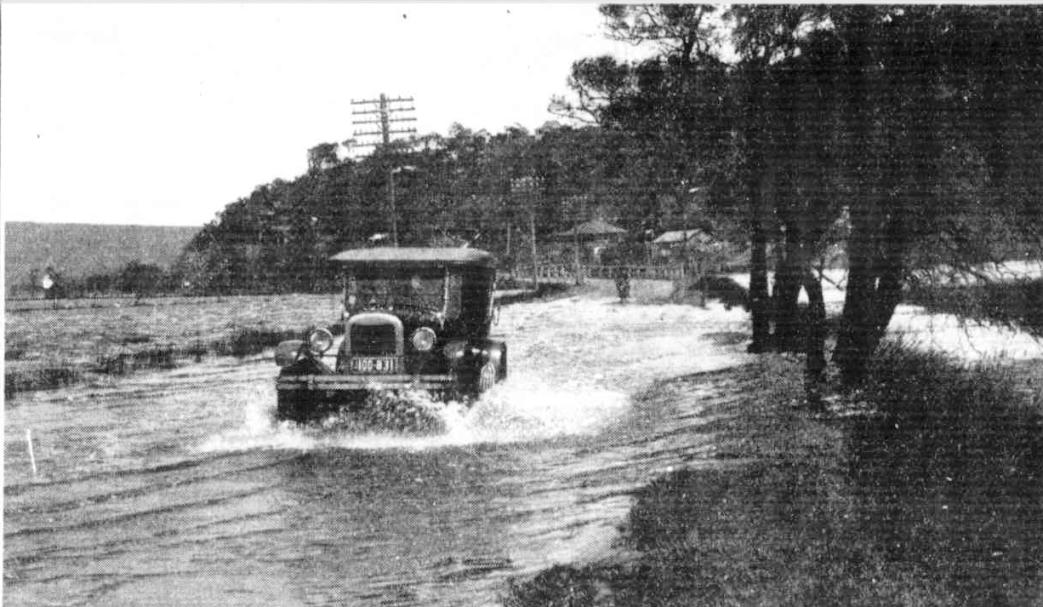
The foreshores of the lake were flooded by the recent heavy rains. The Warringah Council workmen opened a way to the sea on Sunday morning. Forestry, Floods, and Kindergarten Work (1927, November 30). Sydney Mail (NSW : 1912 - 1938), , p. 9. Retrieved from http://nla.gov.au/nla.news-article158295859
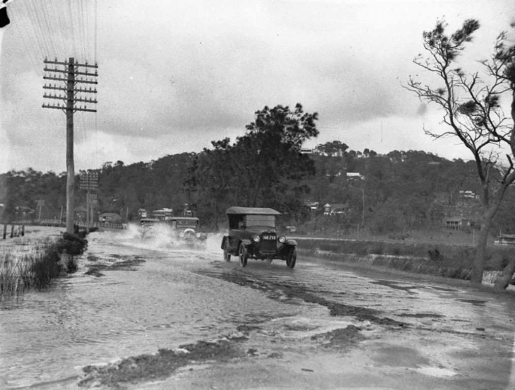
A 1926 Overland, a 1928 (?) Chrysler, and a 1928 (?) Dodge ploughing through Narrabeen floods - Image. No: hood_06391- from the collections of the State Library of NSW.
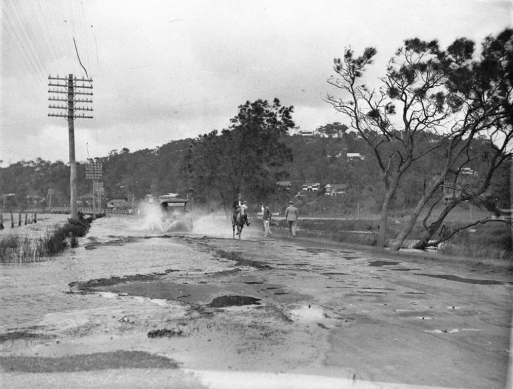
A car and a horse plough through a flooded road, Narrabeen - Image. No: hood-006394 from the collections of the State Library of NSW
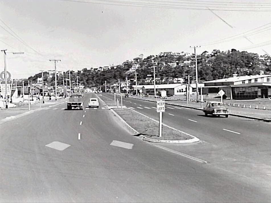
Pittwater Rd, Narrabeen - circa 1960. DMR Photo
Some facts about the Combined Assembly Hall - the large building on the RH side of the image. This is from my dad's family memoir - John Gault was foreman, employed by Roseville Constructions and Arch Clark was Clerk of Works, representing NSW Gov. He writes that the roof sheeting was, at the time, the longest continuous rolled lengths of colorbond in the southern hemisphere, being 75 foot from apex to gutter.- Dave Gault.
Tenders called for—continued.
Construction, &c., of—continued
Deviation at Sheep Station Hill, Road Manly to Barrenjoey 5982 . Second Class Culvert over Swamp Creek, Defence Road to Pittwater Road 5771 Index page (1906, December 31). Government Gazette of the State of New South Wales (Sydney, NSW : 1901 - 2001), p. xxii. Retrieved from http://nla.gov.au/nla.news-article226530018
'Palm Beach Road, near Mona Vale' Albert James Perier photo courtesy State Library of NSW - 1920s
BUS PASSENGER INJURED. Cameron v Greig. Margaret Cumming Cameron sued to recover £1000 from Lawton Greig, who, at the relevant time, traded as the Pittwater Motor Company, for Injuries suffered while a passenger In one of the defendant's motor buses plying between Newport and Narrabeen on Easter Monday last. Plaintiff stated that the bus was crowded on the holiday, and that to steady herself she grasped a stanchion at the back of another passenger. At the bottom of Sheep Station Hill, as a motor car was approaching, the 'bus turned wide. The motor car struck and dislodged some luggage at the side of the car and struck Miss Cameron's left arm, Injuring It, and fracturing a bone of the hand. Plaintiff alleged that the defendant had been guilty of a lack of care and skill required of a common carrier. Defendant denied the alleged negligence, and also that the plaintiff was a passenger as alleged. Mr. Halse Rogers, K.C., and Mr. Moors (Instructed by Messrs.. Norton, Smith, and Co.) appeared for the plaintiff; and Mr. H. B. Bignold and Mr. Esme Bignold (Instructed by Mr. Norman H. Murray) for the defendant. The case is part heard. BANCO JURY CAUSES. (1927, April 5). The Sydney Morning Herald (NSW : 1842 - 1954), p. 8. Retrieved from http://nla.gov.au/nla.news-article16389848
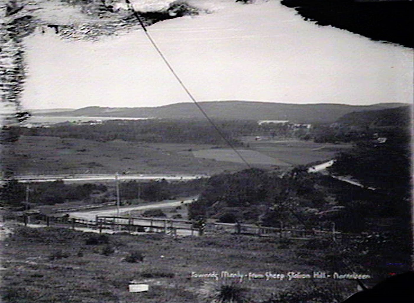
Towards Manly from Sheep Station Hill, Narrabeen. From NSW Govt Printer series. Image No.: d2_53089h courtesy State Library of NSW.
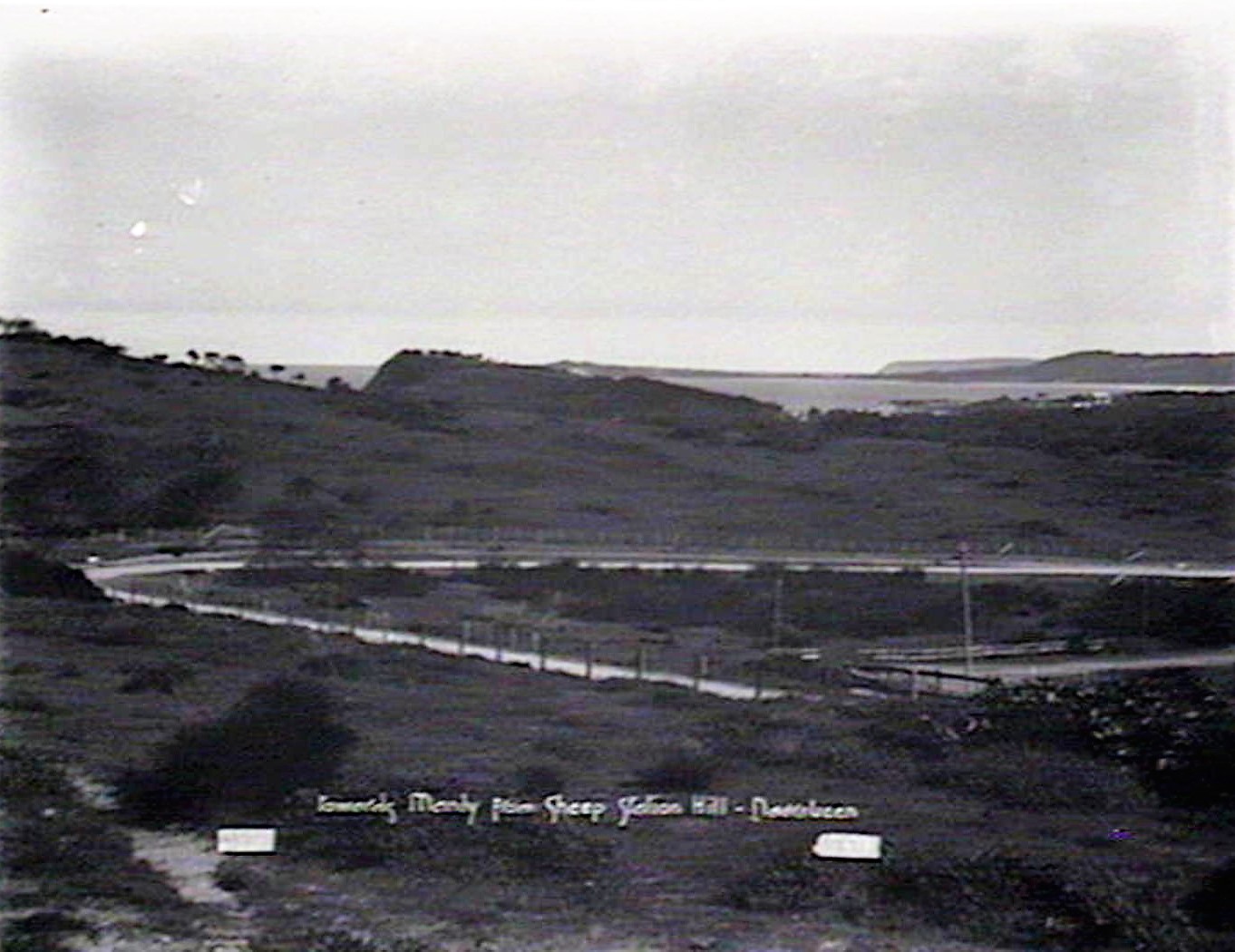
Towards Manly from Sheep Station Hill, Narrabeen. From NSW Govt Printer series. Image No.: d2_53100h courtesy State Library of NSW.
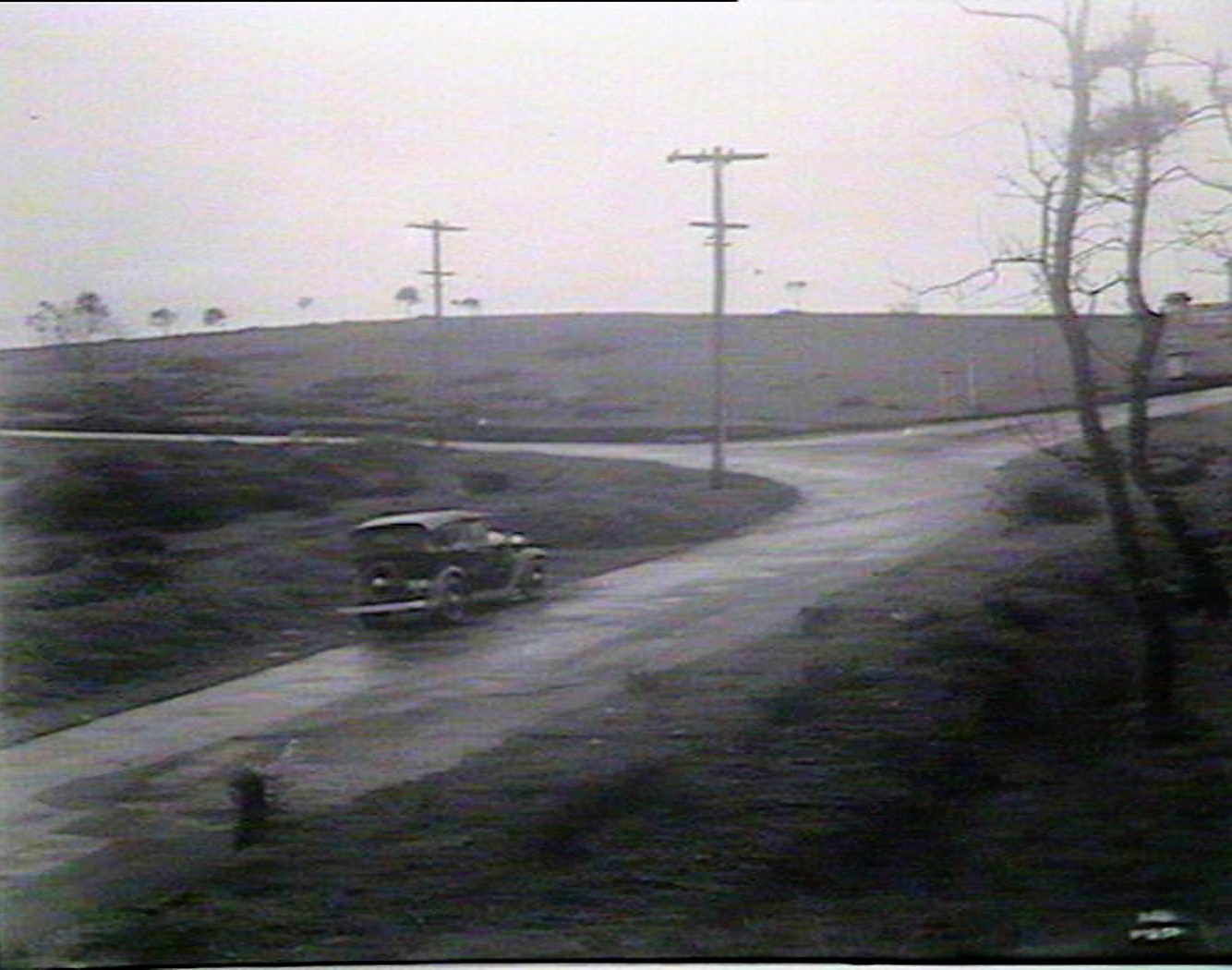
Curve on Sheep Station Hill Southern side, From NSW Govt Printer series- Main Roads: Main Rd 164, Shire of Warringah. December 1934. Image No.: d1_01822h courtesy State Library of NSW.
Curve at foot of Sheep Station Hill to South Side. From NSW Govt Printer series- Main Roads: Main Rd 164, Shire of Warringah. December 1934. Image No.: d1_01823h courtesy State Library of NSW.
Main Road 164: on top of Sheep Station Hill looking south. March 10th 1938. Image No.: d1_26929h, courtesy State Library of NSW.
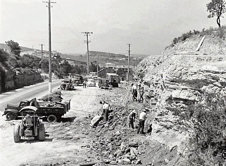
Sheepstation Hill, Pittwater Road on way to Mona Vale - 1957 DMR Photo - see DMR Annual Report
Workmen widening Pittwater Road between Mona Vale and Narrabeen, in the area known as Sheepstation Hill (Warriewood). Department of Main Roads New South Wales, 1957-58 - OpenGov NSWImage https://www.opengov.nsw.gov.au/viewer/f2f43f5015a04b5aa61c36124ba031c7.pdf
The construction of a six lane divided road between Narrabeen and Mona Vale... and to Newport Shopping Centre.
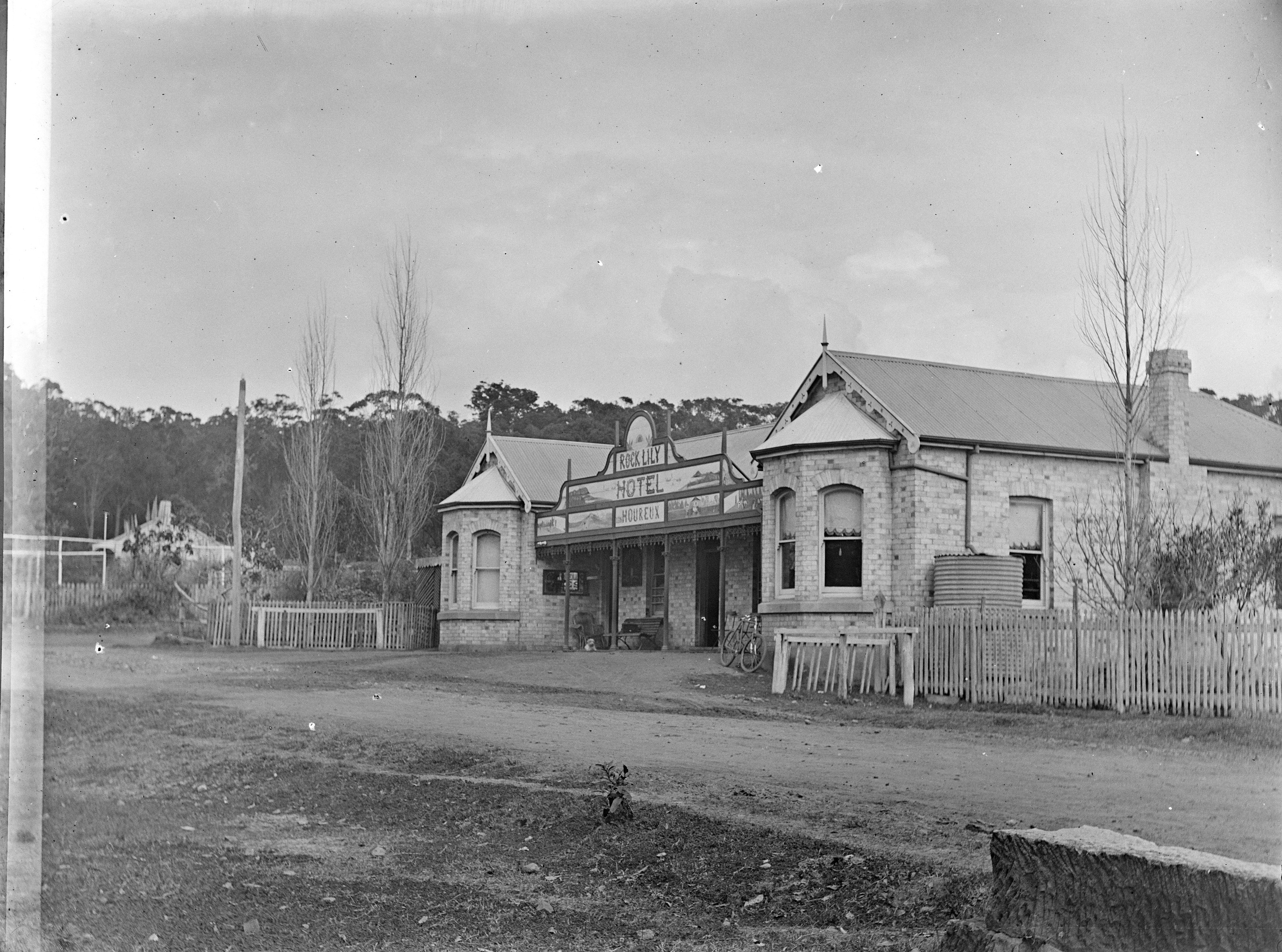
Rock Lily Hotel, [before 1905] from Album; Box 14: Royal Australian Historical Society : photonegatives, ca. 1900-1925. Image No.: c16401_0050_c courtesy State Library of NSW - Visit: Rock Lily Hotel - Pittwater Restaurants you could also Stay at.
ROCKLILY HOTEL
OLD RENDEZVOUS CLOSED.
Where Parkes and Dalley Dined. Frenchman's Famous Paintings.
After nearly thirty years cheerful existence, the old Rocklily Hotel on the Pitt-water-road, near Mona Vale, closed its doors a few days ago against the "sale of alcoholic liquors. The action' of the proprietor (Mr. Briquet) was not voluntary; it was brought about through a decision of the Licensing Court, which selected, the famous tourist rendezvous for slaughter, when the electors of Middle' Harbor voted Reduction three years ago. That reduction in Manly or the Pittwater district was never favored locally has been abundantly proved by the overwhelming majority recorded for Continuance at the recent elections. The thousands of voters in residential Mosman who in 1910 were included In the Middle Harbor electorate, are responsible for the closing of the old Rock-lily Hotel In the tourist territory of Pittwater, the absence of which will leave all the route from Narrabeen to Newport without a licensed house of accommodation. At the elections the other day over 90 per cent of the Pittwater people voted Continuance, and the fact that Mosman residents had the power to legislate for the liquor requirements of a holiday area like Pittwater, demonstrates effectively the many absurd and unfair defects of the Liquor Act.
When Leon Houreaux opened the doors of the hospitable old-fashioned French inn thirty years back, he brought with him from France a first-class knowledge of the cookery of his country, and a fine discrimination regarding the vintage of the grape. Soon the Rocklily Hotel acquired a high reputation amongst tourists for its excellent French dinners, and the superior quality of Its wines. But, besides the reputation reached on account of its attractive cuisine, and cosy comfortableness, the hotel was gradually becoming famous in another direction. Leon Houreaux, who in his days of childhood in France never had a lesson in painting, but who, according to his own words to his daughter, received many thrashings from his parents for disfiguring the neighboring rocks and. fences with colored pictures of man and beast, conceived the idea of decorating the walls of his hostelry with the efforts of his prentice paint brush. Before long, people used to come specially to see the quaint wall paintings, and as he assiduously added picture after picture, the Rocklily Art Gallery became a regular resort of tourists, and brought the painter-proprietor much custom, When Houreaux died several years ago, he had filled every foot of space on the walls, windows, and doors, with his odd oil paintings, representing all kinds of things from battlefields to funny French tit-bits.
Yesterday, as Madame Briquet, daughter of the late painter proprietor, was removing the family belongings from the old rooms, a "Sun" representative was courteously shown the whole life work of the imaginative old Frenchman. As you enter the hall, the first thing to greet you Is a life-size picture of ex-Licensing Inspector Lenthall, the lucky N.S.W. retired police officer who a few years ago came in for an immense fortune in the old country, and died on his English estate. The Rocklily Hotel was a favorite resort of the licensing inspector. Alongside Inspector Lenthall is a big picture of a Bacchanalian individual, evidently wishing the officer a merry Christmas.
In the first of the large rooms one wall is completely filled with a brilliantly-colored representation of the 'battle of "Rorke's Drift." Another wall depicts the death of Nelson at Trafalgar, while a third shows a stirring battle scene, "Vive L'Empereur." The fourth wall is delightfully ; Incongruous, devoted as it is to humorous French subjects. In another room the captive Napoleon on board the Bellerophon glares gloomily down at the deck, while on the opposite wall his great rival, Wellington, Is shown riding up to a battlefield camp; and, judging from the cook's operations, to dinner!
Vividly-hued pictures of French culrasseurs and English lancers in action adorn the remaining walls. There are large pictures in., other rooms of naval reviews, wrecks by the dozen, battles, old-time knights of the road, Australian bush scenes, and pastorals of his own loved native land, all gloriously mixed up with humorous little sketches of the French school. The faces of Generals Hutton and Baden Powell are the most modern additions to the gallery.
The imagination of the energetic old painter was thoroughly cosmopolitan; he dragged every country and every phase of life Into his productions, which though perhaps not works of art, are very interesting, and are remarkable for their bold coloring. Houreaux was undoubtedly a master of color!
The old landlord's faith in the future of Pittwater is shown in a picture on the verandah walls. Houreaux was, by-the-way, a valuable pioneer of the district, and ran the coaches from Manly for many years. The painting shows a steam tram passing the doors of the Rocklily Hotel, while a bustled nigger cyclist capsizes In front of the engine. It was painted 28 years ago, and It looks prophetic. The electric tram now comes to within a few miles of the spot, and will assuredly pass the doors of the old building within a very short period, according to Mr. Griffith's promise.
Old-time frequenters of the hostelry will be pleased to hear that the famous pictures will be preserved. Mr. Briquet, son-in-law of the dead painter, who owns the property, states that he and his wife will keep the place Intact at all costs.
"It has so many -memories for us," says Mr. Briquet. "Ah, It was a great rendezvous for four great men In the old days," Mr. Briquet went on in his quaint French accent; "Mr. Dalley always dined here on Sundays. He was a grand man. Sir Henry Parkes and the other great members of Parliament often visited us, and Sir George Reid— he was here hundreds of times. How did he like a good dinner! It was a pleasure to see him dine! All the artists and great men used to come and enjoy our dinners, and sit sipping their wine under the old grapevines. The great Phil May loved the place. He lived here for nearly a year. He was the great man, and made such fun. And your brilliant young artists the Lindsays stayed here, too. Everybody from all parts of the world used to come here for our dinners, and to see the paintings on the walls!"
One can easily Imagine Sir George Reid, after a delectable French dinner, seated under the spreading, vines, and lazily reaching up now and then for a bunch of luscious grapes. The grapes at present are nearly ripe, and hang In huge clusters, but there will be no hotel patrons to enjoy them. Thanks to the blundering of the Liquor Act, the career of the old hostelry, with its quaint picture gallery,' has been closed, and the road to Pittwater has lost one of its time-honored and cherished attractions.
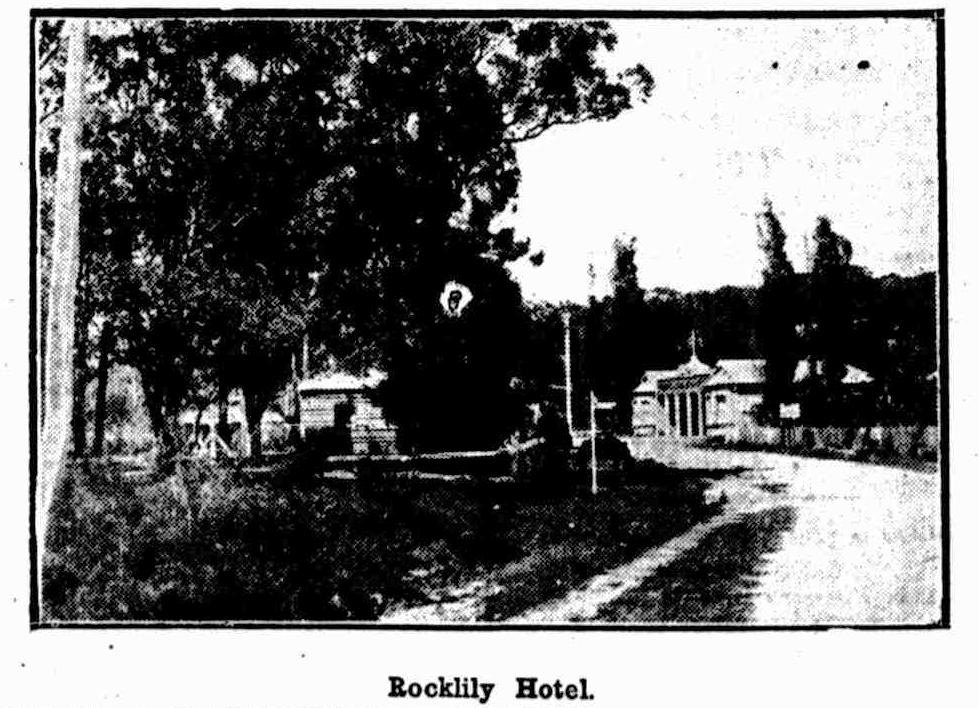
Rocklily Hotel.
ROCKLILY HOTEL. (1914, February 2).The Sun (Sydney, NSW : 1910 - 1954), p. 10. Retrieved from http://nla.gov.au/nla.news-article221559251
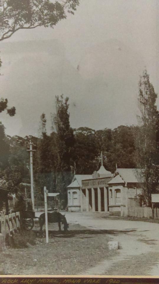
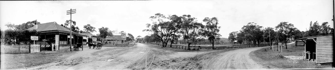
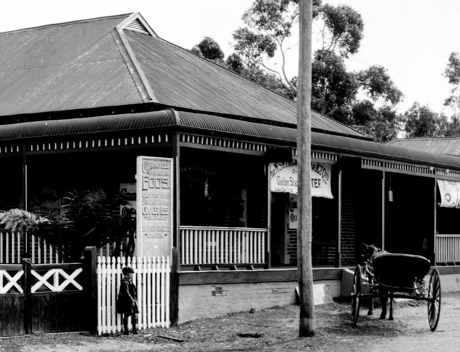
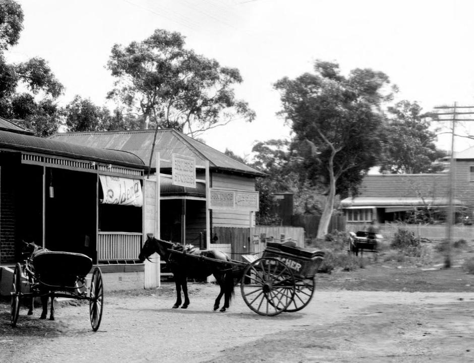
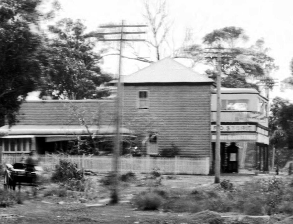
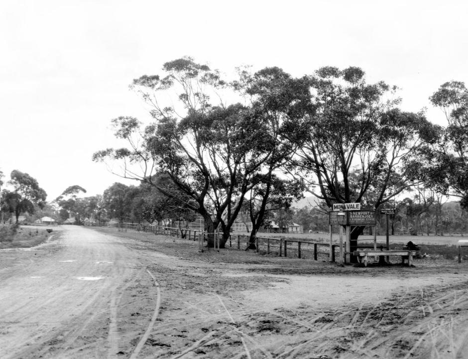
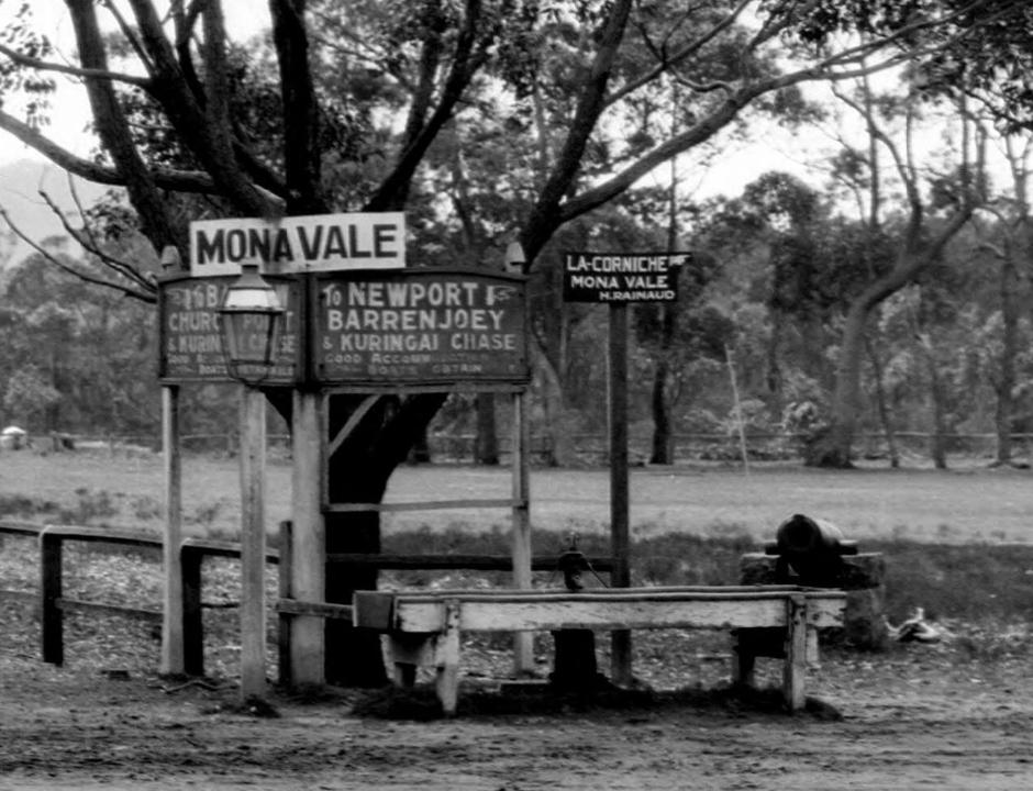
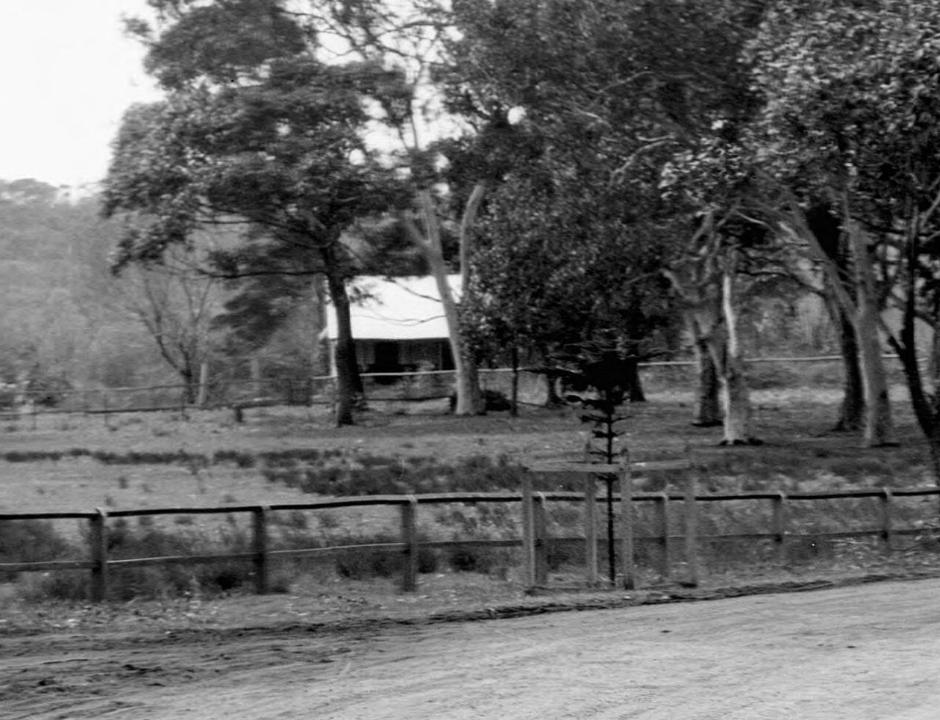
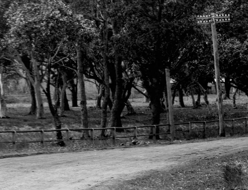
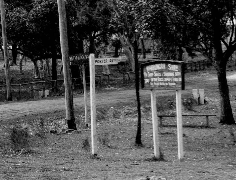
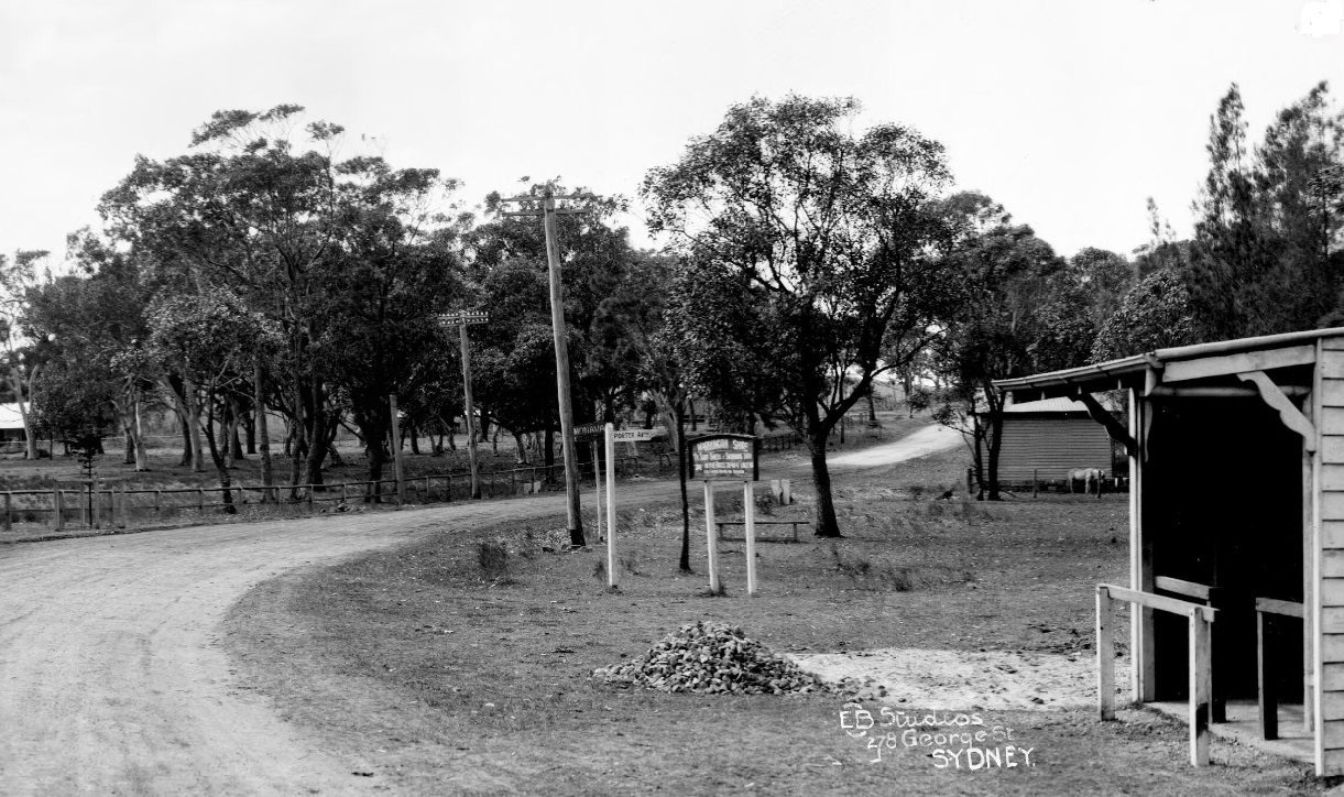
This 1927 Advertorial and location map for the Tonkin Estate shows a 100 foot wide concrete road to Mona Vale - an earlier, 1925, advertisement still has the area as 'Rock Lily-Mona Vale':
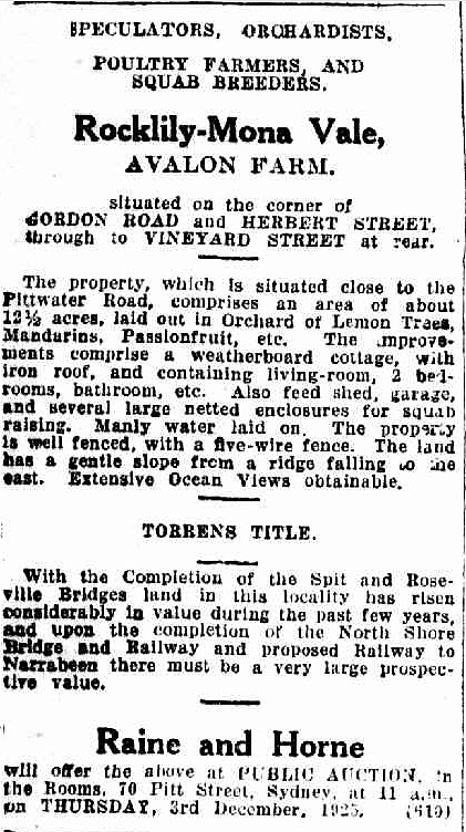
Advertising (1925, November 28). The Daily Telegraph (Sydney, NSW : 1883 - 1930), p. 6. Retrieved from http://nla.gov.au/nla.news-article245056028
Tonkin Estate
A well-known landmark on the Main Lane Cove or Gordon Road at Mona Vale, known as Avalon Squab Farm, has at last passed into the hands of the land subdivider, and is to be offered on the- ground at 3 o'clock on Saturday, November 19, by Messrs. Peach Bros., auctioneers, of 76 Pitt Street, Sydney. The lithograph shows 44 fine blocks fronting the Main Lane Cove Road, Vineyard and Herbert Streets. Lot 11 is to be offered with, the original homestead. The estate is reached just off the Pittwater Road leading to Newport, Palm Beach, and Barrenjoey, and good fishing, surfing, swimming baths, and golf links are all within five minutes of the estate. Practically every block commands views of ocean and the surrounding district looking right over French's Forest, and the situation is an exceptionally fine one from' a residential point of view. There is a regular motor 'bus service direct from Manly to Newport, and 'buses also connect up with the tram at Narrabeen terminus. The title of the land Is Torrens, and easy terms are offered, £10 per lot deposit only being required, and the balance over five years, with 6 per cent. Interest and a 5 per cent, discount for cash within thirty days, with special easy terms for the homestead purchase, to which city water is laid. The sale will be held, wet or fine, as there is ample room to accommodate a large crowd in the homestead. Hot water will be available, and arrangements have been made for cars to meet the tram at the Narrabeen terminus on the day of the sale. (See Locality Plan next page).
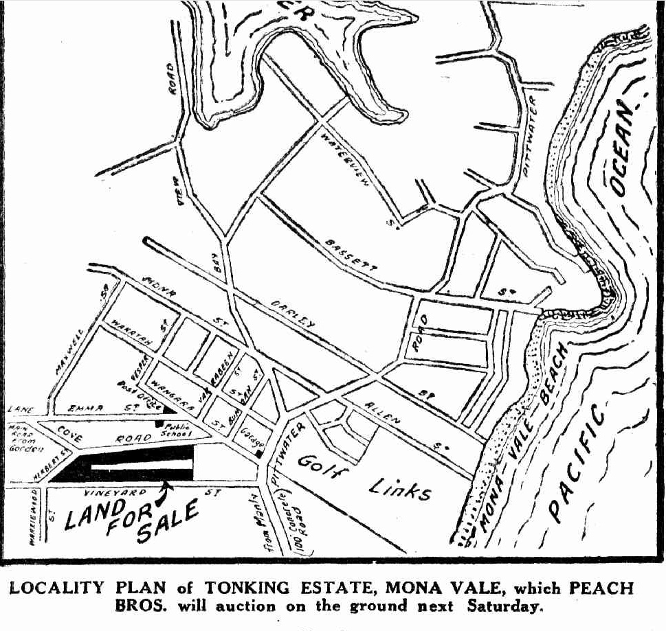
Tonkin Estate (1927, November 16). The Daily Telegraph (Sydney, NSW : 1883 - 1930), p. 26. Retrieved from http://nla.gov.au/nla.news-article246396445
Despite all the inducements of a new Spit Bridge and new roads, these contracts for land sales didn't always end happily:
IN EQUITY.
(Before Mr. Justice Long Innes.)
MONA VALE CONTRACT RESCINDED.
Makim V Tonkin and another.
This was a suit in which the plaintiff, Frederick Winslow Makim, asked, among other things, for a declaration that a certain con-tract entered into between him and the defendant, Roy Ernest Stanley Tonkin, had been validly rescinded by him; that the defendants, Tonkin and Australian Securities, Ltd.. or one of them, be ordered to deliver the contract up to him for cancellation; and that the de-fendant Tonkin be ordered to repay to him the sum of £255/19/ with Interest from the date of payment until repayment of same.
Mr. E. W. Street (Instructed by Messrs. Rand and Drew, Sydney agents for Messrs. Borthwick and Butler, of Inverell) appeared for the plaintiff; there was no appearance for the defendant Tonkin; and the defendant company entered an appearance submitting to any order the Court might make.
Plaintiff claimed that on September 27, 1928, he entered Into a contract to purchase from the defendant Tonkin certain allotments of the Avalon Gardens Estate, Mona Vale, for £2100. At the time of the signing of the contract he paid Tonkin's agents £255/19/, being £240 deposit, £15/15/ stamp duty, and 4/ for exchange. He was induced to enter into the contract by representations made by Tonkin's agents, which representations, he subsequently discovered, were false. On learning of the falsity of the representations he immediately notified Tonkin of his rescission of the contract, and requested him to return the '£255/19/. Tonkin had neglected and refused to repay him the said sum. Plaintiff alleged that since the matters set out in the statement of claim the defendant company claimed that Tonkin had assigned all his right, title, and interest under the contract to them, but he was not aware whether Tonkin had! purported to so assign.
The defendant Tonkin admitted that at the time of the signing of the contract the plaintiff paid to one Brown on his behalf the sum of £255/19/, and that Brown had, duly accounted to him for the said sum, but he did not know and could not admit the allega-tions in the plaintiff's claim. He submitted that the statement of claim disclosed no right in the plaintiff to bring the suit, and that his proper remedy, ii any, was at common law.
His Honor made a decree for a declaration as asked; ordered the defendants, or such of them as had the custody or control of the contract, to deliver up the same to the plaintiff for cancellation; ordered the defendant Tonkin to repay the £255/19/ to the plaintiff with Interest at the rate of 5 per cent.; the defendant Tonkin to pay plaintiff's taxed costs; and declaration that plaintiff has a Hen on the lands for the sum of £255/19/ with Interest. IN EQUITY. (1929, October 17). The Sydney Morning Herald (NSW : 1842 - 1954), p. 8. Retrieved from http://nla.gov.au/nla.news-article16593674
QUARTER SESSIONS.
(Before Judge Curlewis.)
Senior Crown Prosecutor, Mr. L. J. McKean, K.C.
CONSPIRACY.
Roy Ernest Stanley Tonkin, 44, investor, and Harold Frederick Browne, 31, salesman, were charged with having conspired together and with an unknown man, to cheat and defraud John Fisher of large sums of money, on February 11, at Sydney. Mr. Rooney (instructed by Mr. B. J. Tier) appeared for Tonkin; and Mr. E. R. Abigail for Browne.
The allegation by the Crown was that Browne, under the name of Hopgood, and an-other man whom he introduced as Kirby, waited upon Fisher at his farm at Greene-thorpe, near Grenfell. Browne represented Kirby as a builder who wished to purchase some blocks of land owned by Fisher at Bankstown. Fisher had paid £900 for the blocks, and Kirby offeied him £1625, which offer was accepted, and Kirby passed a cheque over to Browne, who then asked Fisher to purchase five blocks on the Avalon Garden Estate, Mona Vale, for £ 900. Fisher agreed on condition that the Bankstown property went through, and gave Browne a cheque for £ 125 as deposit. He was told that citrus fruits were growing on the estate. Later on, Fisher called upon Tonkin at Sydney and was taken to see the land at Mona Vale, and found that there were no citrus fruits upon it. Tonkin said that if there was any false pretence about the matter he would repay the money himself.
The defence was that it was a perfectly legitimate transaction, and that there had been no conspiracy to victimise Fisher. Neither of the accused gave evidence or made a statement.
Both of the accused were convicted, and his Honor said that the jury had done right to convict upon the evidence, but he thought its verdict might have been different had Tonkin and Browne placed their defence before the jury, instead of remaining silent.
Browne, on being asked whether he had anything to say, told the Court that Tonkin had nothing to do with the negotiations re- garding the sale of the land and said that his intentions with regard to the sale were honourable all through.
Detective-Sergeant Alford referring to Kirby who was said to have been concerned in the conspiracy said that he was the best known confidence man in Australia and had left the country under a false passport.
His Honor: I cannot understand why any honest man should not go into the witness box if there is nothing against him.
His Honor also said that he would if requested sign a certificate for a new trial.
Both of the prisoners were bound over in their own recognizance to come up for sentence if called upon within three years, a condition of their release being that they paid £125 to the Clerk of Peace for Mr Fisher at the rate of £2 a month each, or be called up for sentence. QUARTER SESSIONS. (1929, August 1). The Sydney Morning Herald (NSW : 1842 - 1954), p. 8. Retrieved from http://nla.gov.au/nla.news-article16572084
Unemployment Relief Works during the 1930's
Despite the depression of the 1930's making funds for roads limited the state government used what had been the response in earlier Australian 'depressions in initiating Unemployment Relief Works during the 1930's
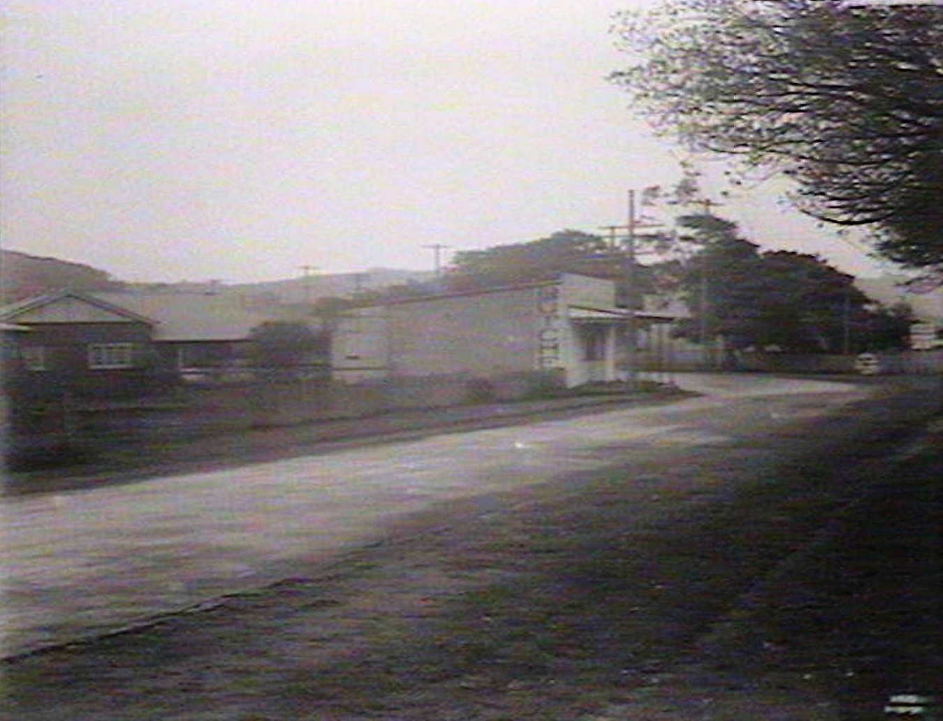
Curve opposite La Corniche, Mona Vale. December 1934. Image No.: d1_01821h, courtesy State Library of NSW
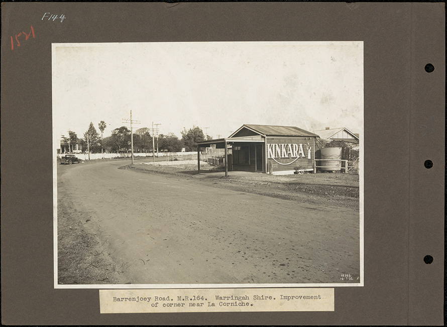
F144 - Barranjoey Road. M.R. 164 [Main Road]. Warringah Shire. Improvement of corner near La Corniche. July 10th, 1935. Courtesy State Records of NSW. To the left you can see a home named 'The Oaks', part of Mr. Brock's Estate originally and now the site of a Service Station and corner of Darley Road East.
Throughout the building of roads past the colonial era, when a Highway or Main road and under the jurisdiction of the State or Federal government, or a road leading onto these, and under the jurisdiction of local Councils, the proposals were discussed, submitted and the funds to do these works came from taxes levied through those who would use the roads, once motor vehicles became more popular and these thoroughfares were being created for them, as well as those who lived on these new roads, and were stated to also beneftiing form them, as well as special rates variations that were levied, within council areas, with other funds being met through Loans from the state government - for some of these interest was charged, for others, according to Annual reports through the various changes of the Department of Main Roads from a 'Board' to the DMR.
As shown through the published Notices in the Government Gazette, proposals and finalised plans and finalised works took years. Some of these, including Roads TO Pittwater ( The Wakehurst Parkway Along Old Oxford Falls Track, The Pittwater Road , The Sandspit Punt and Spit Bridge and The Mona Vale Road )- with Pittwater road from Narrabeen to Mona Vale and Barrenjoey road improvements highlighted:
Mona Vale formerly Turimetta Site register card - 1930-01-01 to 1980-10-20; Site Register cards. These cards were compiled in the Department of Education and its successor agencies from approximately 1930, and record details of school sites purchased and subsequently disposed of since the early nineteenth century. These record cards include the key sections of firstly the "Sites Register" of the actual land and how it was acquired, secondly the eventual "disposals of land", thirdly a site map, plus fourthly on particular cards the "School Buildings".- from NSW State Archives and Records
Shire of Warringah. Main road number 164 - Barrenjoey road. Reconstruction. Quarry at Bilgola - 1935-05-30 to 1935-07-07- NSW State Archives and Records, Ministry of Transport
Shire of Warringah main road number 164 Pittwater Road Representations on behalf of Mrs M McLean of Narrabeen - 1938-06-27 to 1938-11-10 - NSW State Archives and Records, Ministry of Transport
Mona Vale - Newport anti-tank ditches 1942-01-20 to 1942-12-04 from NSW State Archives and Records, Part of Series; Murrumbidgee Irrigation Area [M.I.A.] files [Water Resources Commission]
Shire of Warringah Main Road Number 164 sea erosion at Collaroy - 1946-04-09 to 1946-04-10 NSW State Archives and Records, Ministry of Transport
Shire of Warringah main road no [number] 174 Bayview to Church Point - 1946-08-22 to 1946-12-07 NSW State Archives and Records, Ministry of Transport
Shire of Warringah proposed reclassification as a main road of the road from Roseville-Deewhy at French's Forest to Pymble-Mona Vale at Terrey Hills - 1947-01-22 to 1947-03-01- NSW State Archives and Records, Ministry of Transport
Shire of Warringah. Main road number 162 Gordon Road. Proposed widening at Mona Vale. Land acquisition - 1947-02-10 to 1947-09-16 - NSW State Archives and Records, Ministry of Transport
Shire of Warringah proclamation of a new main road from North Manly to Dee Why - 1947-02-27 to 1947-12-02 - NSW State Archives and Records, Ministry of Transport
Shire of Warringah. Main Road No.[Number] 397 - Wakehurst Parkway - 1947-05-30 to 1947-11-06 NSW State Archives and Records, Ministry of Transport
Shire of Warringah main road no [number] 164 Pittwater Road. Proposed improvement at the corner of Waterloo Street - 1947-03-29 to 1947-11-04 - NSW State Archives and Records, Ministry of Transport
Shire of Warringah: main road no [number] 162 Gordon-Mona Vale Road: provision of drainage - 1948-06-08 to 1948-08-13- NSW State Archives and Records, Ministry of Transport
Shire of Warringah. Main Roads Nos [Numbers] 328 and 397. Intersection of Wakehurst Parkway with road from Roseville Bridge to Dee Why - 1948-09-17 to 1948-10-09 NSW State Archives and Records, Ministry of Transport
Shire of Warringah. Main Road No. [Number] 174-Bayview Road: drainage - 1949-10-11 to 1949-11-18 - NSW State Archives and Records, Ministry of Transport
Shire of Warringah Main Road No [Number] 174 Mona Vale-Church Point Road Proposed widening Land acquisitions - 1950-04-17 - NSW State Archives and Records, Ministry of Transport
Shire of Warringah: Main Road No. [Number] 162-Gordon Road proposed widening - 1950-06-23 to 1950-07-06 NSW State Archives and Records, Ministry of Transport
Resumption of land for road widening of Pittwater Road between Narrabeen and Mona Vale - 1950-07-20 to 1950-07-28,Correspondence files [Ministry of Transport] from NSW State Archives and Records
Shire of Warringah Main Road No [number] 164 Pittwater Road proposed widening between Mona Vale and Newport - 1950-10-11 to 1950-10-26 - NSW State Archives and Records, Ministry of Transport
Shire of Warringah Main Road No 174 McCarr's Creek Road construction of a new culvert at Crystal Creek - 1951-01-08 to 1951-08-23 NSW State Archives and Records, Ministry of Transport
Shire of Warringah; proposed renaming of Main Roads Nos. [Numbers] 159, 162, 164, 174 - 1951-02-02 to 1951-03-01 NSW State Archives and Records, Ministry of Transport
Shire of Warringah: main road no [number]164 widening of Pittwater Road between Narrabeen and Mona Vale - 1951-03-28 to 1951-06-04 - NSW State Archives and Records, Ministry of Transport
Shire of Warringah: Main Road No. [Number] 397-Wakehurst Parkway disposal of surplus land - 1951-04-20 NSW State Archives and Records, Ministry of Transport
Shire of Warringah: Main Road No. [Number] 397. Proposed Bird and Fauna Sanctuary at Middle Creek, Narrabeen [plan] - 1951-08-10 to 1951-10-10 NSW State Archives and Records, Ministry of Transport
Shire of Warringah Main Road Number 162 Gordon Road proposed widening near intersection with Pittwater Road - 1952-02-14 to 1952-03-14 - NSW State Archives and Records, Ministry of Transport
Shire of Warringah Main road No. [Number] 164 - Pittwater Road proposed widening between Namona Street and Warriewood Road - 1952-05-09 to 1952-06-19 - NSW State Archives and Records, Ministry of Transport
Shire of Warringah. Main Road No. [Number] 397. Wakehurst Parkway. Proposed widening. Land acquisition - 1953-10-22 - NSW State Archives and Records, Ministry of Transport
Shire of Warringah, Main Road No. [Number] 164 - Barrenjoey Road: proposed widening between Mona Vale and Newport - 1954-07-01 NSW State Archives and Records, Ministry of Transport
Shire of Warringah Main Road No. [Number] 162 Mona Vale Road. Acquisition of an easement for drainage - 1954-03-12 NSW State Archives and Records, Ministry of Transport
Shire of Warringah main road no [number] 164 Pittwater Road proposed widening between Warriewood Road and Kitchener Park Mona Vale - 1954-04-03 to 1954-04-03 - NSW State Archives and Records, Ministry of Transport
Shire of Warringah main road no[number]164 construction of reinforced concrete bridge over Narrabeen Lagoon - 1954-08-02 to 1954-12-07 - NSW State Archives and Records, Ministry of Transport
Shire of Warringah: Main Road No. [Number] 328: Warringah Road: Proposed widening between Wakehurst Parkway and Pittwater Road, Dee Why - 1954-10-06 NSW State Archives and Records, Ministry of Transport
Shire of Warringah main road no 164 [number 164] widening of Barrenjoey Road Mona Vale 1955-06-16 - NSW State Archives and Records, Ministry of Transport
Shire of Warringah. Renaming of Main Road No. [Number] 529 as Forest Way - 1955-10-13 - NSW State Archives and Records, Ministry of Transport
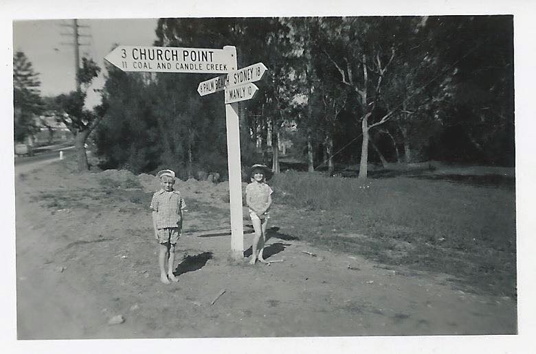
Mona Vale/Church Point junction in 1950 - photo owned by and courtesy Ken Little
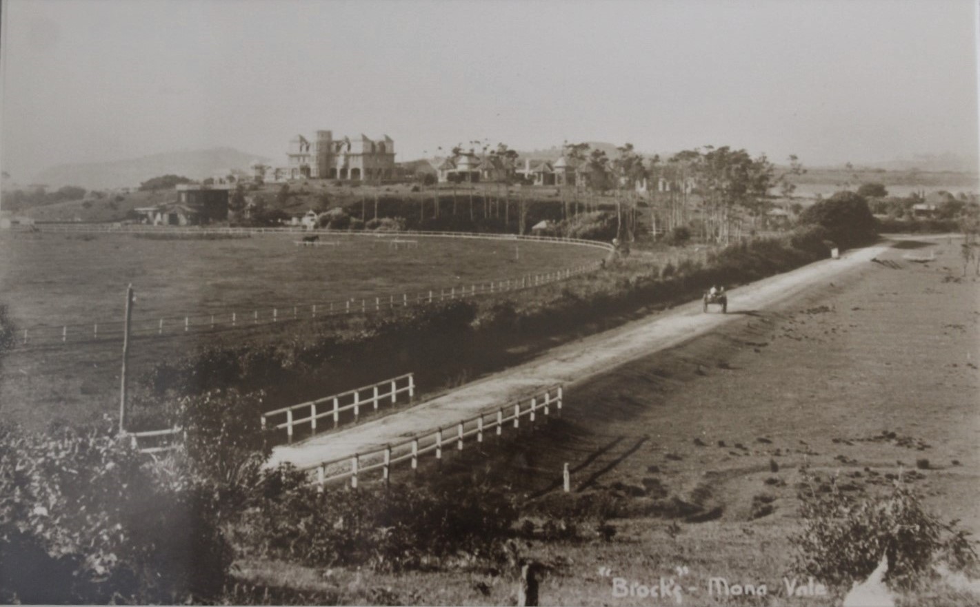
'Brock's' circa 1907, showing what would be renamed the Barrenjoey Road.
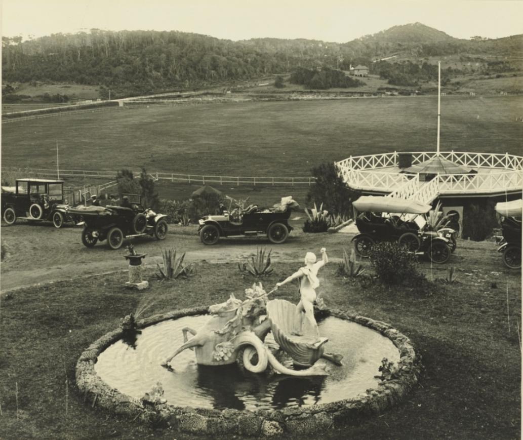
MAIN ROADS ACT, 1924-1951.
Notification of Approval of Governor to Plans of a Proposal for the Realignment (by the Realignment Method of Acquisition) of Portion of Main Road No. 164 (Barrenjoey-road) in the Shire of Warringah under Division 1 of Part Vb of the Main Roads Act, 1924-1951.
IN pursuance of the provisions of section 27e of the Main Roads Act, 1924-1951, The Commissioner for Main Roads, who proposes to cause the alignment of Main Road No. 164 between Pittwater-road (Main Road No, 174) and Bassett-street, Mona Vale and between Beaconsfield-street and Neptune-road, Newport, in the Shire of Warringah, to be realigned pursuant to Division 1 of Part Vb of the Main Roads Act, 1924-1951, and to apply the realignment method of acquisition to the lands affected by such realignment hereby notifies that the plans of the proposal have been approved by His Excellency the Governor, with the advice of the Executive Council, and that such plans (being plans Nos. 164S.284, 164S.288 and 164S.289) may be inspected at the Department of Main Roads, and copies of such plans may be inspected at the Warringah Shire Council Chambers.
Signed and sealed at Sydney, this 11th day of January, one thousand nine hundred and fifty-four.
I, Howard Macoun Sherrard, The Commissioner for Main Roads, have hereto affixed the Official Seal of The Commissioner for Main Roads in the presence of—
J. Fleming, J.P.
H. M. SHERRARD. (r.s.)
(D.M.R. No. 479-1,693) MAIN ROADS ACT, 1924-1951. (1954, January 22). Government Gazette of the State of New South Wales(Sydney, NSW : 1901 - 2001), p. 174. Retrieved from http://nla.gov.au/nla.news-article220288751
WARRINGAH SHIRE COUNCIL.—Proposed Partial Closure of Grandview Parade, Mona Vale.—Local Government Act, 1919 (section 269A).—Ordinance No. 30, clause 55a.—Notice is hereby given that Council intends to apply to the Traffic Authority of New South Wales for the consent to the placing and maintaining of obstructions or barriers in Grandview Parade, Mona Vale, at Barrenjoey Road, to prevent the exit of vehicles to Barrenjoey Road at that point. Any person may lodge with the Council an objection to the application in writing. The time for lodging objections will expire on Friday, 23rd February, 1979. R. M. STUCKEY, Shire Clerk, Civic Centre, Dee Why, N.S.W. 2099. 5870—$12.60 WARRINGAH SHIRE COUNCIL.—PROPOSED PARTIAL CLOSURE OF GRANDVIEW PARADE, MONA VALE.—Local (1979, January 26). Government Gazette of the State of New South Wales (Sydney, NSW : 1901 - 2001), p. 468. Retrieved from http://nla.gov.au/nla.news-article219966050
Bungan
This Charles De Boos description of the road up Bungan Hill and into Newport matches some of the etchings and paintings found among the State Library of NSW and National Library of Australia records:
We followed a broad and well-defined cart track leading northerly, which mounted and crossed the range that terminates in the bold rocky headland, called Bulgola Head. Keeping for about half a mile along the crest of the ridge, which, with the exception of a few dwarfed and stunted honeysuckles, and occasional tufts of coarse wiry grass, is entirely denuded of verdure, the road at length takes a sweep down along the inland fall of the ridge, through a beautiful open forest of fine lofty and heavy timber. Here we see that the road has been cut out, with evident care, from the side of the range, the earth dug out in levelling the upper portion of the road serving to raise up the lower half. Upwards the enormous trees, their trunks black with age and bush fires, towered up in gradually decreasing size as they reached the top, where the cutting breezes from the ocean reached and kept them down. Below, the open forest changed progressively, from the park-like wood to the thick bush and the dense and tangled jungle; whilst from the heavy brush of the bottom rose up the notes of the feathered songsters, for it is a libel to say that we have no song birds in Australia, and the sharp whistle of the coachman, the mocking tones of the gill bird, the liquid note of the bell bird, and the song of many other denizens of the scrub, mingled with the drowsy hum of a running stream that occasionally sent up sounds like far off bells, as its waters struck the air in descending the many crannied rocks that lined its course.
I stood for some minutes, at a turn of the road as it wound round a short spur of the range, in contemplation of the wild Salvator-Ross-like landscape, and was gradually tailing into-yes, I will say it-a poetic reverie, when I was roused again to sublunary things by a loud and distant shout from my companions, and then became aware of a sharp pattering amongst the leaves overhead, and of heavy raindrops that were falling most peltingly and pitilessly.
"Come on ! come on !" I now heard in Tom's most impressive tones, "without, you intend to stand there all day in the rain."
I had no intention of the kind; but, on the contrary, having a perfectly cat-like antipathy to getting wet, hurried on to overtake my comrades. Luckily, the shower was the first of the series and, therefore, though a sharp, and decisive, was also short whilst the heavy canopy of verdure overhead to a great extant sheltered us from its effects
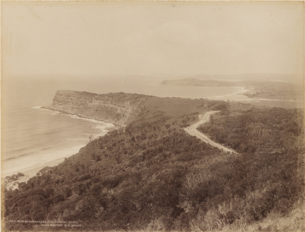
"View from Bushrangers Hill (looking South) Near Newport" Image No.: a924065h, New South Wales, 1879 - ca. 1892. N.S.W. Government Printer, Bushrangers Hill, Newport, NSW. Courtesy State Library of NSW.
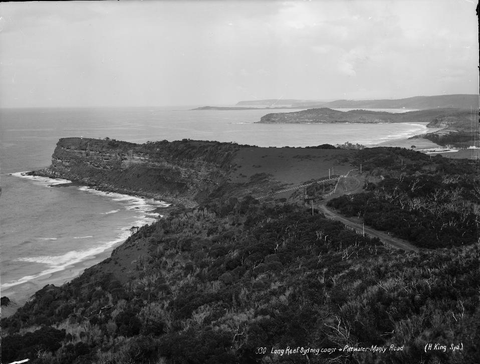
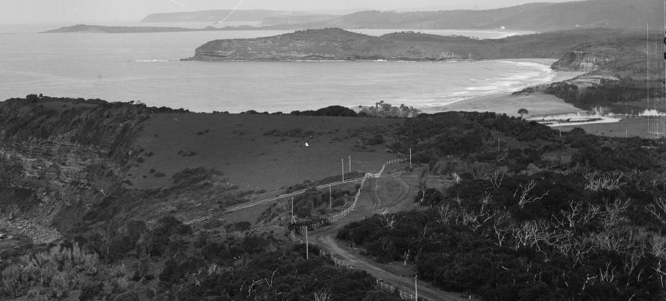
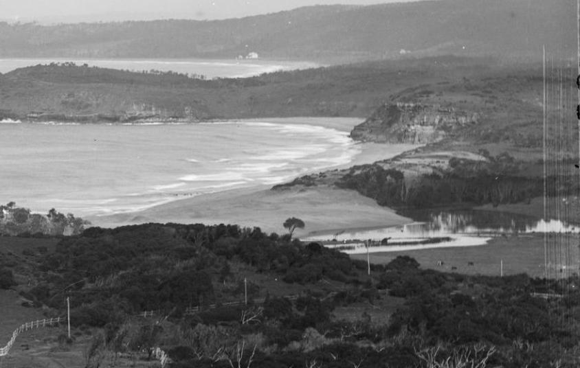
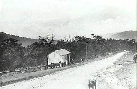
The Road to Newport - Allen Family Album 1905
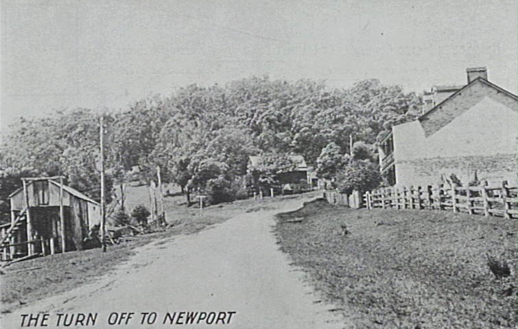
The turn off to Newport - circa 1905, postcard
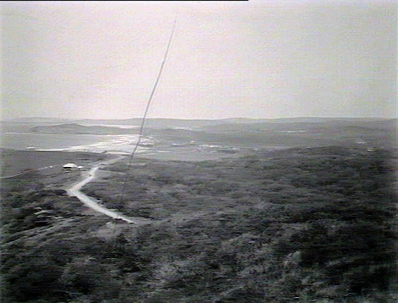
Panorama. View from Bushrangers Hill Newport. April 1912. Image No.: d1_12133h, courtesy State Library of NSW
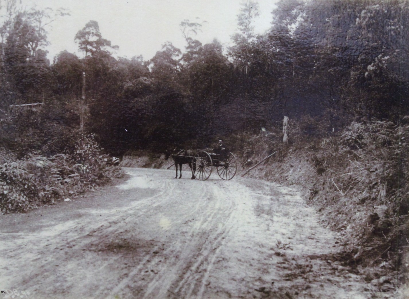
'On the Road to Newport' - Avalon Beach Historical Society Photo from 2018 Exhibition - possibly near the corner just prior to the 11 Mile Store - railing shown at side could be start of Hill View Crescent, Bungan Beach
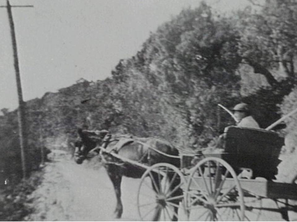
Compare : Mrs. Yewen (Bungan Beach-Newport) in her horse drawn cart on Barrenjoey Rd., 1918
Just beyond that bend is the Porter family store, known by two names incorporating 'mile' which indicate the change of mileage between there and Manly:
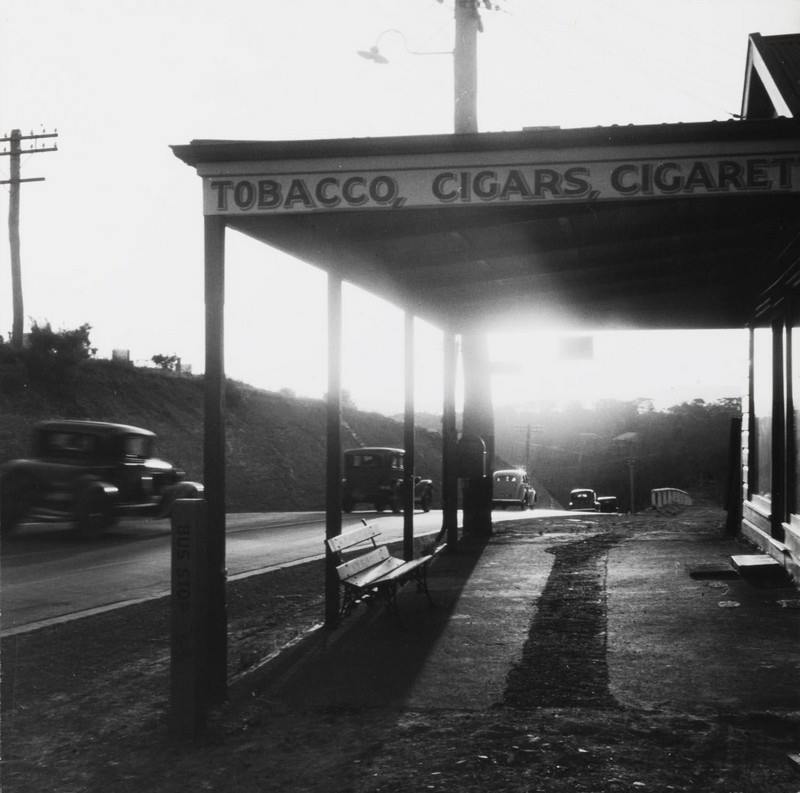
In Roads to Pittwater: The Mona Vale Road, there are listed as churchgoers the family of R. Porter, an associated or friend of the W. McKeown who would come to give services at Church Point. An A.S. Porter is the successful Tender bid for building or repairing a section of the road to Barrenjoey in 1900 - see under Newport section. Church records from the Porter family living at Pymble-Gordon then indicate they are relatives.
Other sources state Robert Porter Snr. came to Newport from Manly – he was a maintenance man on the roads, appearing in a Warringah Shire Council minute of meeting as early as their 12th Meeting in 1906 , 'attesting to the accuracy of his worksheet'. Accounts passed for payment at this Meeting were: '£9 - 2 - 10' - Robert Porter.
Mr. Porter's work stretched from the 9 mile peg to Barranjoey as well as to Bayview and Church Point. He also ensured Newport Public school had adequate firewood during the colder months for years when this was the means for keeping pupils warm.
The family’s home, in the Avenue, Newport, is on early cartographic sales maps dated from 1900, and was called simply “Home” during a prolonged era when people gave names to their homes. This choice may indicate a family that wanted just that, a home, or that the warmth and love that fills a house and makes it a home thrived there.
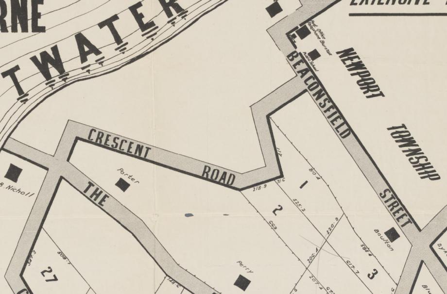
Section from: Sales plan for land in Mona Vale, New South Wales. "A.W. Stephen, licensed surveyor RPA, 47 Castlereagh Street". Sales plan of Mona Vale estate, Pittwater. Mona Vale [cartographic material]. Mona Vale estate, Pittwater [cartographic material] 1900 - 1909. MAP Folder 103, LFSP 1554. Courtesy National Library of Australia.
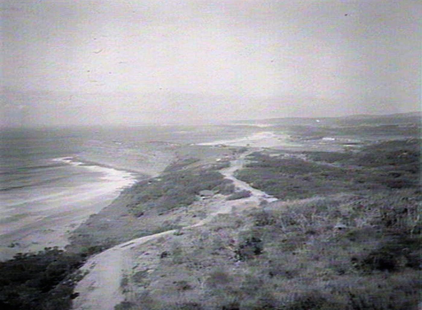
Mona Vale views: another view, panoramic. June 1925. Image No.: d1_15679h, courtesy State Library of NSW
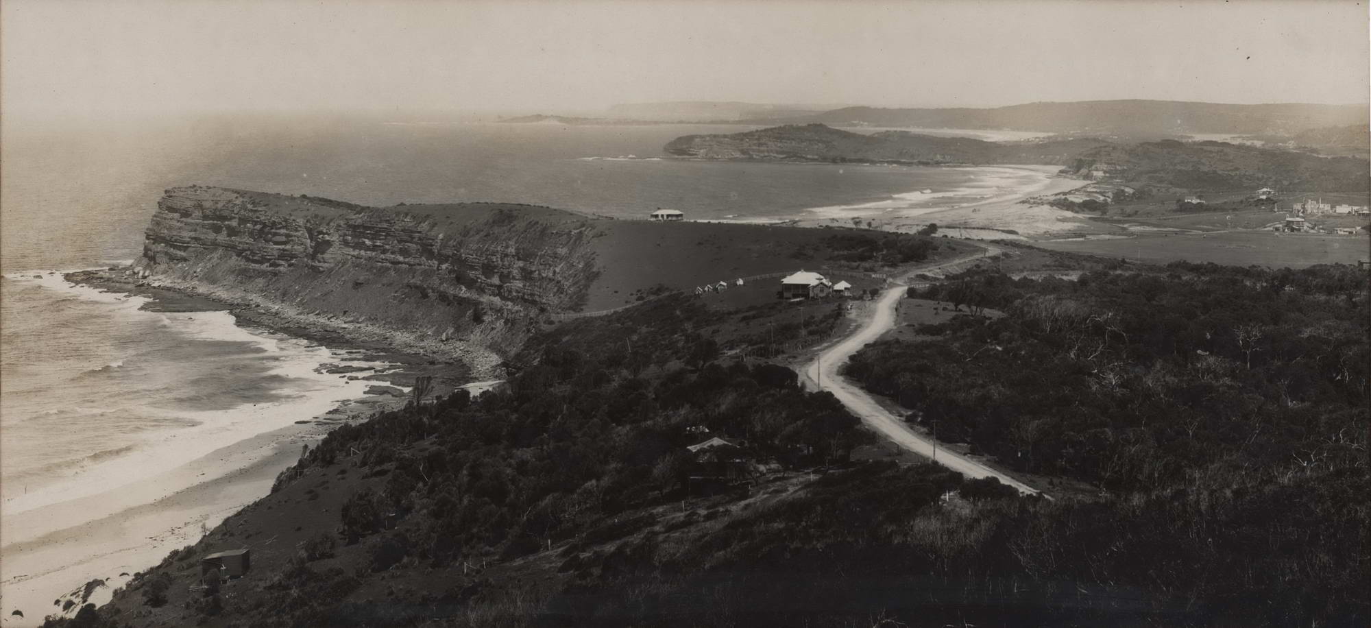
View From Bushranger’s Pt Near Newport Hill [NSW] c1920s. Vintage silver gelatin photograph, typed title on accompanying slip, 18.1 x 39.6cm. Discolouration to upper and left portions. Original frame. NSW Government Printer. Shows Bungan and Mona Vale Beaches. From JOSEF LEBOVIC GALLERY; $1,250.00
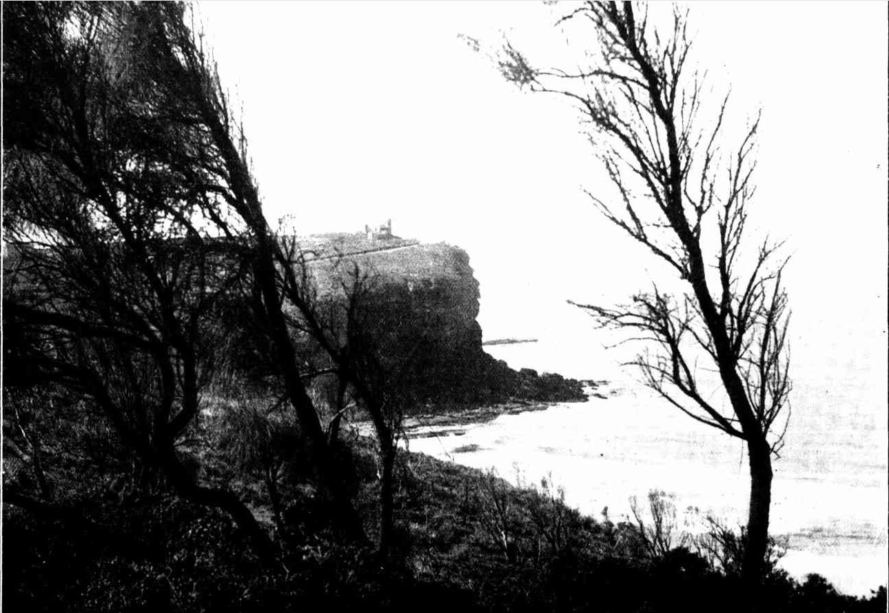
In Rugged Beauty — Bungan Head
This headland, so typical of the coastal scenery of New South Whales, confronts the sea a little north of Sydney, between Manly and Barrenjoey. It is a beautiful spot and, owing to its accessibility, is much favoured by motorists. The building seen on the headland is a private residence, which has become a well-known landmark. In Rugged Beauty — Bungan Head (1933, September 20). Sydney Mail (NSW : 1912 - 1938), p. 5. Retrieved from http://nla.gov.au/nla.news-article165961885
During World War II, in 1942, a trench was dug from Bungan Beach, across Pittwater Road and into the mangrove swamp at the head of Winji-Jimini Bay. This effectively cut off all those north of Bungan Beach from Mona Vale.
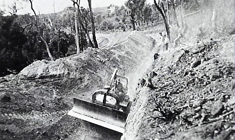
Members of the 18th Infantry Battalion using a bulldozer to excavate trench for tank trap at Mona Vale between Bungan Beach and Philip Road. Photo courtesy Fred Powderley.
A Castle Fronts The Sea
By M. FLYNN
While travelling along the Pacific Coast highway from Sydney recently we felt suddenly that our eyes were deceiving us.
There on Newport Head stood an old Norman Castle, complete with towers and castellated walls, as though mysteriously transported from Britain or old France. However, a closer approach showed the castle to be undoubtedly real. A small sign stated that we could inspect it and we promptly did so, curious to learn its history, which, briefly, is as follows: In 1916 an artists' representative, Mr. A. W. Alvers, of Sydney, widely travelled in older lands, decided to build himself a weekend castle, on the then deserted Newport Head, modelling it after old fortresses he had seen. It was solidly built of the local stone, and friends and soldiers helped in its building.
Completed In 1918
In 1918 it was completed and sat firmly on the headland many hundreds of feet above the blue Pacific rolling below the steep cliffs. From the windows of its round tower rooms one may see magnificent views along the coast-north to Avalon; south to Narrabeen and Collaroy, with Long Reef stretching its talons into the blue; and east to the immensity of the Pacific.
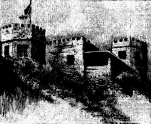
Bangan Castle, Newport, N.S.W. From a drawing by F. R. Stelling
The rooms of the castle are filled to overflowing with treasures and curios collected from all over the world. The skull of a long-dead French sailor jostles that of an aboriginal. A Malay kriss rests side by side with an old flint-lock gun. Ancient ships' lamps hang in every room and window. A tom-tom(relic of the Portuguese-Timor war) stands beside a pair of 80 year-old Russian samovars. The headpiece and chain-mail of a 15th Century Knight of Malta rests by the head of a Balinese woman carved cunningly in wood.
"Rare And Profitable"
It is a veritable museum of things "rare and profitable" ancient pewter, old French silver candlesticks, English china of a past age of elegance, Japanese enamels, and sad relics of the old convict days. The castle stands proudly on the sheer ridge of Newport Head, though settlement has crept up on its rear and the coast highway sweeps past its entrance. Mr. Alvers, its builder, growing old now, still lives there with a faithful Great Dane for company, in his fortress home that has no terrible memories of war or dungeons, but which expresses instead an enduring solidity, grandeur and peace. Life and Letters. (1953, May 16). The West Australian (Perth, WA : 1879 - 1954), p. 30. Retrieved from http://nla.gov.au/nla.news-article55804281
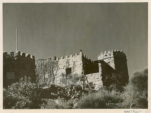
"The Castle", Bungan Head (NSW) Image No.: 12932-a012-a012X2442000144, from 'Original Prints of Photographs used in NSW trains', courtesy NSW Archives and records
SHIRE OF WARRINGAH.—Naming of Roads.—Ordinance 30, Clause 53, Local Government Act.—Notice is hereby given that the undermentioned roads have been renamed in accordance with section 249 (a) of the Local Government Act:—
Past Name or Location—New Name.
1. Road connecting Prescott-avenue with Bix-road, Dee Why—Wigan-street. (The above proposed name supersedes an earlier proposal to name this street Narree-street.)
2. French's Forest road, French's Forest:— (a) From Wakehurst Parkway easterly to its junction with Warringah-road—French's Forest road East.
(b) From Wakehurst Parkway westerly to the eastern boundary of portion 1,134 (the point at which road closure commences)—French's Forest road West.
(c) Between Rabbett-street and Forest-way—Naree-road. (d) Between Grace-avenue and Prince Charles road— Sorlie-road.
3. Beaconsfield-street East, Newport, between Barrenjoeyroad to Myola-road—Bungan Head road.
J. MORGAN, Shire Clerk, Shire Hall, Brookvale, 25th November, 1957. 1787—£1 11s. 6d. SHIRE OF WARRINGAH.—NAMING OF ROADS.—Ordinance (1957, November 29). Government Gazette of the State of New South Wales (Sydney, NSW : 1901 - 2001), p. 3859. Retrieved from http://nla.gov.au/nla.news-article220359872
From the then department of Main Roads annual report of 1934-1935, page 13:
(c) Main Road No. 164 - Barrenjoey Road.)
The Department commenced by day labour the reconstruction of Barrenjoey-road northward from the end of the existing cement concrete pavement at Narrabeen. The work involves the improvement of alignment by deviations, regrading and widening. Wherever the condition and levels of the existing pavement are suitable it is being utilised as a base-course for the new drag-spread macadam wearing course, but where the old pavement cannot be adopted, a ballast base-course is laid with an intermediate course of premixed material using hard local sandstone as the aggregate. Realignment involving resumptions has been undertaken at Sheepstation Hill (between Narrabeen and Mona Vale), near Mona Vale at " La Corniche " corner at Bassett-street and north of Grandview-parade on the " 11-mile " hill. A further deviation is in hand adjacent to the Avenue, Newport. For the supply of the stone required for the reconstruction a quarry has been opened at Bilgola.

Curve near the Avenue, South Newport. December 11, 1934. [From NSW Government Printer series: Main Roads: Main Rd 164, Shire of Warringah] dated 11.12.1934, NSW Records and Archives photo, Item: FL2658786
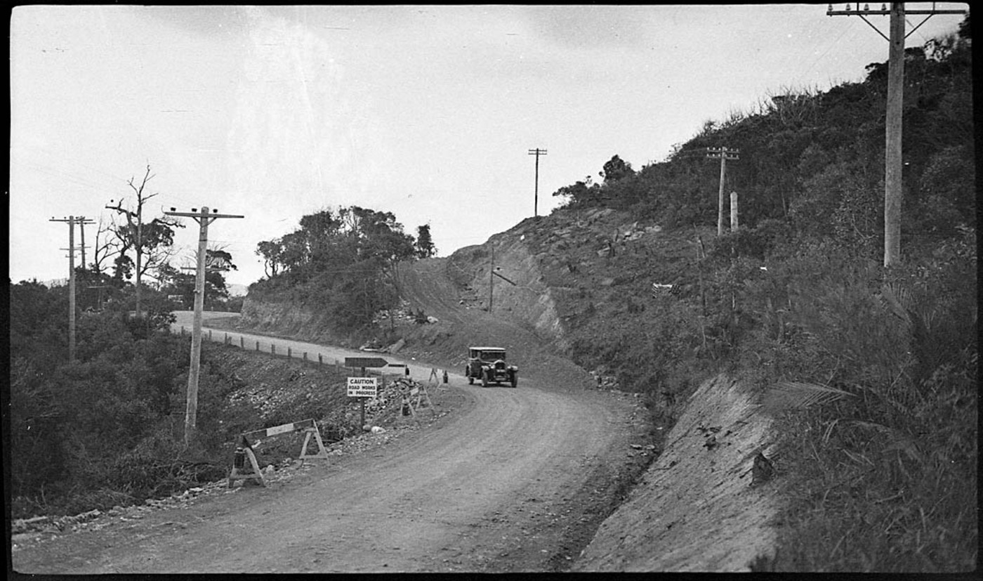
Road to Newport being fixed - Image No.: perier_34298h, courtesy State Library of NSW
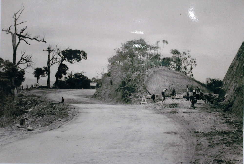
The Road leading up the hill between Mona Vale and Newport - this spot is near Bushrangers Hill at thew top of the stretch that goes over Bungan and towards Newport - the road on the right of the picture will become the Barrenjoey road - these road works were done, alike that out past Church Point to Coal and Candle Creek, through Australian Depression Work Relief Programs. If you come out of The Avenue in Newport now, on the Bungan-Newport ridge, you are looking straight across to that rock face on the right, although clearly the road has been widened since then. ABHS Photo
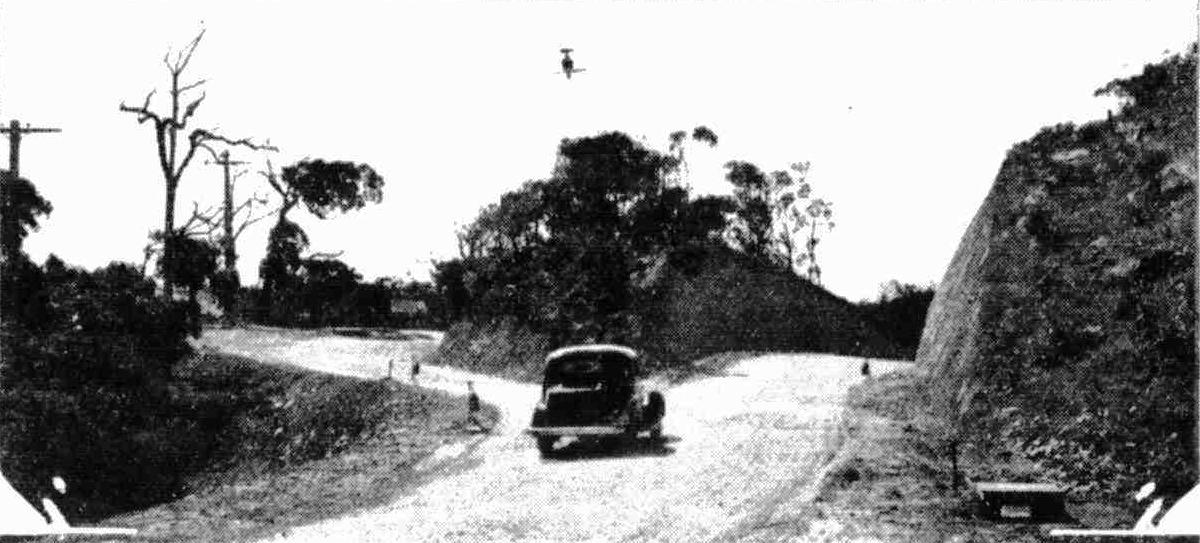
Extensive improvements are being made to the road to Palm Beach. This big cutting on the Newport-road has just been completed. The old blind turn, which was a source of danger when traffic was heavy, is on the left. Another cutting is being made at the northern end of Mona Vale. Tents and Motor-Campers (1935, November 20). Sydney Mail (NSW : 1912 - 1938), p. 50. Retrieved from http://nla.gov.au/nla.news-article160499041

The Avenue Newport looking south March 10 1938. [From NSW Government Printer series: Main Roads] dated 10.3.1938, NSW Records and Archives photo, Item: FL3612714 - now with posts and barriers at side of road and has been sealed and is now a dual carriageway.
Further widening and adding lanes top become the six-lane dual carriageway most are familiar with atop Bungan and between there and Mona Vale were works first proposed in 1955 and completed just over ten years later. Between this there were other road works and land acquisitions to meet these:
MAIN ROADS ACT, 1924-1954.
NOTIFICATION OF APPROVAL OF THE LIEUTENANT GOVERNOR TO PLAN OF A PROPOSAL FOR THE RE-ALIGNMENT (BY THE RE-ALIGNMENT METHOD OF ACQUISITION) OF PORTION OF MAIN ROAD No. 164—BARRENJOEY-ROAD— BETWEEN BASSETT-STREET AND BEACONSFIELD-STREET IN THE SHIRE OF WARRINGAH, UNDER DIVISION 1 OF PART VB OF THE MAIN ROADS ACT, 1924-1954.
IN pursuance of the provisions of Section 27b of the Main Roads Act, 1924-1954, The Commissioner for Main Roads who proposes to cause the alignment of portion of Main Road No. 164-—Barrenjoey-road—between Bassett-street and Beaconsfield-street—in the Shire of Warringah, to for re-aligned pursuant to Division 1 of Part VB of the Main. Roads Act, 19241954, and to apply the re-alignment method of acquisition to the lands affected by such re-alignment, hereby notifies, that the Plans of the proposal have been approved by His Excellency the Lieutenant-Governor, with, the advice of the Executive Council, and that such Plans, being Plans Nos. 164. 6.314 and 164.S.315), may be inspected at the Department of Main Roads, and copies of such Plans may be inspected at the Warringah Shire Council Chambers, Brookvale.
Signed and sealed at Sydney, this 27th day of August, 1956.
I, Howard Macoun Sherrard, The Commissioner for Main Roads, have hereto affixed the Official Seal of the Commissioner for Main Roads in the presence of—
J. Fleming, J.P.
(L.S.)
H. M. SHERRARD.
(D.M.R. No. 479.1,593 Part 2). MAIN ROADS ACT, 1924-1954. (1956, October 12). Government Gazette of the State of New South Wales (Sydney, NSW : 1901 - 2001), p. 2968. Retrieved from http://nla.gov.au/nla.news-article220349115
Newport
As seen above, Newport had a resident population who were quite active from early in the 1870's to better the road to Newport. A hotel keeper, those with produce best transported by cart and horse, those who had children they may need to get to a doctor, those who made a livelihood from visitors and holiday makers all wanted improvements.
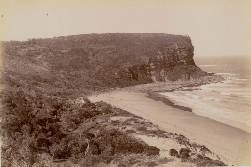
'Bulgola Head' circa 1880-1900, Image No.: a116493h, courtesy State Library of NSW. On early maps Bungan was called 'Bulgola/Belgola/Belgoula' and Bilgola was named 'Bungan'.
Mr De Boos describes descending down the Newport Hill;
The road now descended the range, but so gradually as to appear all but level until it brought us down upon a broad, swampy flat on which belts of ti-tree and clusters of swamp-oak began to mingle with the monarchs of the forest, and ultimately to outnumber them as we proceeded.
After travelling for half-a mile over the flat, the water squelching and bubbling up from the saturated soil with every step we took, we observed an opening in the timber that proclaimed a clearing. A clearing, naturally suggested a proprietorship; and a proprietorship, a homestead, and with a homestead were connected thoughts of shelter, fire, and comfort that were exceedingly consoling to think upon, especially on such a cold, bleak, wet day as the one we were favoured with.
At last we came, down to a broad, noisy, dirty-watered creek, crossed by a rough but substantial bush-bridge of logs, over which were thrown a number of ti-tree bushes. The approach to the bridge on either side was guarded by a wide belt of mud, the depth of which Nat, by slipping off the causeway, ascertained to be a little below the knee. Over this ti-tree bruin had been pretty freely thrown down, in order to allow of a passage by horses and carts. Of course, the pedestrian, in going over the causeway, would be about to the ancles in mud, a depth as disagreeable to the biped as it was Immaterial to the quadraped. The crossing of this Rubicon of mud having I been effected, and a secure footing on firm ground having been gained, we now looked around us at the magnificent prospect to which we had not previously been able to give our attention.
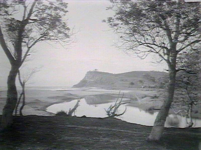
Above and below: Farrells Beach, Bungan Head. Circa 4/1912. Images d1_12147h and d1_12148h, courtesy State Library of NSW.

In the centre of the picture stood the homestead, a long low slab building faced with weatherboards, and fronted by a verandah supported on rough bush posts that gave a kind of rude picturesque air to a building that would have otherwise passed as tame. It was perched on the crest of a small though sharp rise that started up from the bed of a deep and brawling creek which ran between where we stood and the house, and from which we were separated by between two and three hundred yards of flat swampy land. This creek ran away to the eastward; widening out rapidly until it emptied itself, in company with the muddy brook we had first crossed, into a miniature lagoon, separated from the sea by an extensive sand-bank. It was crossed by a substantial timber bridge, raised high above flood level, whilst its southern border was ornamented with two cabbage- tree palms, the last remnants of the giant denizens of the forest that had at one time crowded the spot when it was a close and all but impenetrable jungle. These relics of former days now rustled their half withered fen-like leaves sadly as the wind swept through them, as though mourning for the comrades that had once surrounded them, and for the departed days of prosperity and verdure.
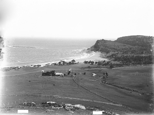 Right Newport Beach circa 1908, courtesy State Records of NSW.
To the left of the house a clear flat, on a considerably higher level than the one we were on, stretched out to a belt of honey-suckle and ti-tree, which separated' it from the line of sand-banks that intervened between it and the sea-shore, whilst in the background was a high, blank range, covered with a scanty stunted scrub and running far out into the sea, terminating in a bold rocky headland. Immediately to the right of the house were the barn, stables, and various other out-houses, all neatly and handily arranged, whilst at the back of them, and running along southerly to quite as far as where we were making our observations, was the eastern line of the paddock fence.
From this fence the enclosed land was nearly level, with a slight rise only, for about two hundred yards, when the hill became steeper, until at last it was too precipitous for cultivation, and mounted up grandly into a lofty range, whose heavily timbered sides, and stern rocky crests, seemed to hang sombre and threatening over the peaceful clearing below, that at no very distant date had formed part of its domain.
Along its side, the line of fence, now white with age and exposure to the weather, could be clearly traced against the dark background of the verdant forest, in which enormous trees and thick undergrowth, showed how hardly and with what toil the victory had been gained by man over nature. In the large area of cultivation land thus enclosed were to be seen-first, a broad and well-defined belt of yellow, that told distinctly of a com stubble; then a square plot of yellowish green, which we could see to be a plantation of sorghum; next occurred a wide belt of block, which we knew from the narrow strip of white left near one edge of it, to be land in course of ploughing ; then came a smell portion of fallow land; and afterwards a belt of beautiful green, that could not be taken for anything else but young barley. The land thus actually under cultivation may have included one-third of the whole area of the enclosed land-that area being at a rough guess about forty acres.
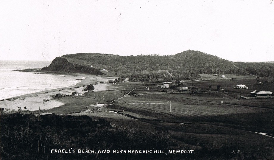
Newport circa 1903 - photo courtesy State Library of NSW
Whilst I had been making my observations on the magnificent scene here spread out before me, Tom and Nat-with Spanker as usual in the van,-had gone on ahead ; and I had once more to hurry up to join them, knowing from previous sad experience that it is always the rearmost of a party that the yelping pests of stations most favour with their attentions-barking and snapping savagely around him as though to excuse themselves for allowing the advanced guard to pass:- I therefore bustled on as well as my load and the slippery nature of the ground would permit, and managed to catch them as they were crossing the bridge. Following the dray track, we mounted the hill, but were no sooner on its top than we were set upon by about a dozen cattle dogs of various ages from the old and toothless, but still watchful, slut, down to the extreme juvenile pup, whose shrill piping bark mixed with the deeper and hoarser voices of the parents of the pack. As the shrill note of the bugle calls together our valiant volunteers, so did the loud challenge from these many canine throats bring forth the denizens of the farm, and from every conceivable corner, door; or window forms' protruded, or heads were seen, and men, women and children seemed to start up into sight where previously no sign of animal life had been visible. Their dogs were gradually approaching within disagreeable propinquity to our legs. Spanker had sought refuge from them in our midst, and we were considering-whether or not to sacrifice one or more of the animals to secure our safety, when a loud voice was heard rebuking the dogs, telling them to- "lie down,", and directing, us to "come on."
With many a sidelong glance at the legs, particularly I thought at mine, from which 'they had hoped to snatch a refreshing morsel, the dogs obeyed, and I presume, “laid down." that is, if they could possibly find a dry place, to lie down; and then we, the men, obeyed also, and "came on" to the barn door whence the voice that had hailed us had proceeded.
"Hilloo," said, in a voice of astonishment, a fine, strapping, fresh complexioned man, with a face the very personification of good humour, as his laughing eye fell upon Tom, when we had reached the barn door at which he stood, "so you've come to see me at last."
"What," cried Tom, "is it you. Why, I thought you lived ten miles further on."
"No, here's my place. But come in to the House. I'm heartily glad to see you, and so will the old woman be."
With that he led us over to the house, and we entered by the back door, that being the nearest, in company with our host, three young kids, five puppies, and about seven children. Before anything at all could be done, the kids, the pups, and a portion of the children had to be got rid of; the two first were disposed of very summarily by an application of rattan, the last, however, were dealt with more persuasively, by an application of bread and butter. And now I had an opportunity of looking round me, I perceived that we had passed through a skilling or lean-to, that served as store, tool house, and work shop, and had entered a good sized apartment, the common keeping room of the establishment, in which the first thing that took my attention was the enormous fireplace that extended nearly the whole width of the room, and in which were burning two logs, or rather young trees, that would have furnished fuel to a Sydney fireplace for a fortnight at least.
Standing at the fire was a young girl of apparently between twelve to thirteen years of age, holding the handle of a Brobdignagian frying pan, truly worthy, from its vast proportions, to be employed for cooking at such a fire, and on such a fireplace. A quantity of fish sufficient to have provided a meal for half a dozen hungry men, were spitting and cracking and hissing in the pan, which ever and anon the young damsel would swing from off the flame, when the heat became too powerful. A large table occupied the centre of the room, at which the mistress of the house-was busily engaged in dredging with flour another huge heap of fish destined to take the place of those in the pan so soon as they should be declared by competent authority to be done. At the far end of the table was a stoat strong armed wench, with another heap of fish before her, which she was employed in salting, rubbing the coarse grains into the flesh so lustily as, from some sympathetic cause that I did not stop to enquire into, to make me nervously uneasy and to attract my eye, nolens volens, to the irritating process so long as it was continued.
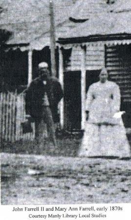 On looking round further, I found that capacious tin dishes, huge buckets, and medium-sized washing tubs, all full of fish in different stages or states of preparation, covered the floor. It seems that I had, on entering the room, passed unaware, but safely, through this chaotic confusion, though how I had contrived to do so was a mystery. And now the last sprinkle of flour having been given to the last fish, for, good husband that he was he knew better than to disturb the house wife at her work, our host introduced us to his "old woman”. From her we received as frank and hearty but as little formal a welcome as we that just had from the master of the house.
“But come,” said Farrell, our host; "off with your swags. Now you are here, you're not going to move any farther to-day.'
I was about to raise some objections, for I half dreaded that we were not far enough beyond the reach of our ancient, and, no doubt, irate dame.
“We were thinking of getting as far as Barranjuee today," put in Tom.
"What’s your hurry Look, there !” and Farrell pointed to a heavy cloud that was drifting fast up and from which at the same moment heavy threatening rumblings were sent forth. "It's going to be wet all day long and if it isn't, I’ll show you some sport, more than you'll get at Barranjuee. And then if the rain holds up at night, we'll go candleing,. Oh!, such fun !" and here he broke into ecstatic laughter at the very idea.
"Candleing?" queried Nat and I in one voice; but the old soldier Tom, who knew everything, let fall no such indication of ignorance but, with an air of perfect acquaintance with all details, said, "'Well, it is fine fun so, I don't care if we do."
"And don’t you know what candleing is?" asked Farrell of Nat and I.
We honestly confessed that we did not.
"Ohl Oh! Oh!" laughed Farrell, as if it were a good joke to meet with two persons who actually did not know what this fine fun of his was.
...(To be continued.)
MY HOLIDAY. (1861, August 5). The Sydney Morning Herald (NSW : 1842 - 1954), p. 2. Retrieved from http://nla.gov.au/nla.news-article28624608
The roadworks clearly met with approval:
SYDNEY BICYCLE CLUB
One of the most enjoyable runs the club has had for some time was that of last Saturday and Sunday to Newport and Barrenjoey. Some 20 members took part, and with ideal cycling weather and good roads a most enjoyable outing resulted. SYDNEY BICYCLE CLUB. (1903, May 27). The Australian Star (Sydney, NSW : 1887 - 1909), p. 2. Retrieved from http://nla.gov.au/nla.news-article228534163
A Maintenance notice. Just of interest, £8 in 1903 is around £924.41 in 2017 or $1700.00 Australian dollars - not a huge amount but a lot more seemed to be done for a lot less and as 'maintenance of dirt roads was often just spreading more gravel or ballast, this 'portion' of an amount set aside also indicates every penny was counted:
The Department of Public Works has notified the Manly Council that £8 has been paid to their credit, being a portion of the amount set aside for the maintenance of the road from Manly to Barrenjoey. BREVITIES. (1903, September 12). Evening News(Sydney, NSW : 1869 - 1931), p. 3. Retrieved from http://nla.gov.au/nla.news-article115848446
NEWPORT.
At the last meeting of the Newport Progress Association, a letter was received from the Public Works Department, notifying that Mr. W. Boulton's tender for the sinking of a public well at Newport was accepted. Dr. Arthur. M.L.A., notified that the following sums have been granted for the district: — Public well, £50: road at Bushrangers'-hill, £60; quarry work, £60. A vote of thanks was passed to Mr. Stuart Greig for his services as Hon, secretary to the association for the last eight and a half years, and Mr. F. G. C. Hanslow was elected to fill the vacancy. The Works Department wrote, saying that the screwing up of the new wharf, and the stone-work on the Immediate approach would be attended to at once. NEWPORT. (1904, November 8). The Daily Telegraph(Sydney, NSW : 1883 - 1930), p. 7. Retrieved from http://nla.gov.au/nla.news-article237840883
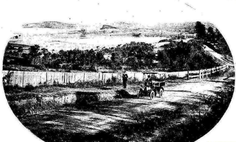
Round Sydney - BY Motor Car- A Trip to Newport.
THE motor car is a luxury for the comparative few. In Sydney the delights of yachting have been vouchsafed to many who could never have experienced them otherwise by co-operative ownership and by hiring. Messrs. Thomas Cook and Sons, the well known tourist agents, whose Sydney branch is in Hunter-street, guided by the success of the motor service to the Jenolan caves, have decided to make a motor drive equally accessible to all. They have arranged for motor trips around the most attractive routes about Sydney— and no other city possesses so infinite a variety —on very moderate terms, which afford to the motorless resident an opportunity of showing new hospitality, and to the visitor a delight hitherto difficult of attainment. It was for one of these trips — Sydney to Newport, via Manly — that our representative last week accepted an invitation, and took with him a ''Mail' photographic artist.
The stretch of coastal country between Manly and Rock Lily, and thence along to Newport by one road and Bayview by another, is justly esteemed to afford one of the most beautiful drives of its type in Australia —many go further, and declare it to be one of the most beautiful in the world. When to this is added the strip of country between North Sydney and Manly, with its magnificent glimpses and panoramas of the lake-like waters of Middle Harbour, and of Sydney Heads, there is comprise d within the day’s outing a series of pictures for which we can only seek rivals in the world-famous portions of the Mediterranean coasts. And here we have characteristic elements of beauty either lacking there or possessed by us in a higher degree.
The popularity of the bicycle made familiar to thousands, who would not have otherwise seen them, these beauty spots. Others have driven or used the coach services. But the ideal method of seeing this beautiful stretch of country and spending a thoroughly enjoyable 'open-air' day is by motor car. There is no questioning the fascination of automobilism. The man who has not a car may effect to disparage his more fortunate neighbour who has, and may make satiric remarks as to the latter’s misadventures in his initiatory stages. He may jibe at 'stink pots,' at dust, at the odour of petrol, and the rest — all these are for the man who stays behind, not for the man in the car. And for the man in the car there is the glorious sense of speed controlled at will, the bounding freedom of the rapid moving automobile, the easy run up the hills that have hitherto been toilsome trials to his horses, the grand rush of speed on the level stretches, the flight as through space against the keen breeze. All this produced by a turn of the wrist, and all comprising a sense of exhilaration and of power almost intoxicating in its delights where, as on the routes chosen by Messrs. Cook, the roads are good and the scenery is delightful.
Our car, a 9-h.p. De Dion, piloted by an expert driver, set out from Messrs. Cook's office, on a delightful day of last week — bright, clear, sunny, with a light cool breeze. It was threaded skilfully through the traffic over the wood blocks to the North Shore horse ferry. Landed on the other side, we ran easily up the long hill to Ridge street, and thence fairly flew along the level roads on the heights, with their superb outlook, to the Spit ferry, experiencing a preliminary taste of what a motor can do when the road is free and good. Here and there a stop was made to take a photograph.
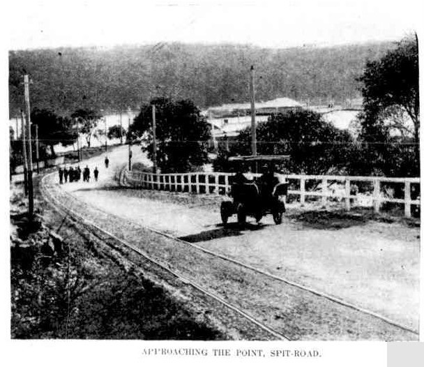
APPROACHING THE POINT, SPIT-ROAD.
Across the Spit ferry, and again we set out up the picturesque winding road on the Manly side, along the crest past many spots of interest. We passed a dwelling where the two coiners were wont to practice the revolver shooting which they ultimately used upon policemen. As we went, every turn of the wheels seemed to open out a fresh aspect, each more insistent than the last, in its claims to consideration. Down the Red Hill, past 'Dalley's Castle,' and that most picturesque of kirks, the Manly Presbyterian Church, and after a brief pause for refreshment, our driver turned him on that coastal stretch to Newport, which lives in the memory of all who have ever seen it.
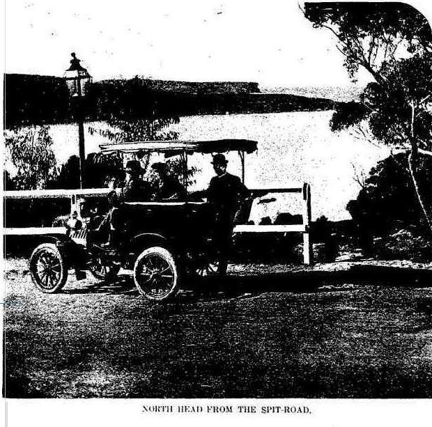
NORTH HEAD FROM THE SPIT-ROAD.
The pictures on this page will give some idea of the glories of the whole trip, but no mere black and white can suggest the wealth of colour and the atmosphere which are the most exquisite elements in the scenes themselves. There is every type of waterscape —Smooth beaches in Middle Harbour, with the gently rippling marge of lake-like waters, shimmering in the sunlight or giving back amore intense blue than even the blue of the Australian sky. Lagoons at Curl Curl and Deewhy, the waters running in among the thickets on the banks, and the trees mirrored oil their surface. The forest-bound lake at Narrabeen; great stretches of white and grey and yellow beaches along the long line of ocean front from Manly to Barranjoey.
Rushing surf breaking upon the sands, surging over the rocks at Long Reef, dashing on the cliffs of each bold headland that breaks the beach line till they are mist enshrouded with the rising spray. And for landscape, nearly every variety but the Alpine. The Middle Harbour heights give glimpses of the picturesque suburbs that are generically termed Mosmans, with their red roofs and constant effort at the picturesque in architecture from cottage to mansion — an effort often crowned with success. The sunlit bush and verdure-cinched hills set in opalesque waters as the run down the Spit-road is made. There is the charm of Sydney's only 'village' when Manly is reached: and then along the road to the far famed Hawkesbury at Pittwater — only the brush of the inspired artist and the pen of the true poet could convey adequate idea of that.
Take one scene alone. The view from the Newport hill looking south across Mr. Brock's estate, and on over Rock Lily to the bold hills and headlands about Narrabeen. Here the great master of artistic composition, Nature, has made a masterpiece. Look at the photograph as it is reproduced — and it has some of the defects inherent in even the best photograph in its accentuation of the line of fencing. But take the picture as a whole— the long stretch of road across the foreground and to the right carrying the eye away with its admirable perspective. In the reality the road banks have red and rich yellow tints: above them the blackberry bushes run riot in autumn colouring; across the fence the rich dark greens and browns of the bush throw and the bright greens and light yellows of the neat pastures beyond. Lagoons, like opals in a golden setting, more trees, green hills, dark distant bush on the n-ht and in the centre. And on the left the white beach with its whiter fringe of ever-moving surf, a sapphire sea, a towering, bold, brown cliff. Above all the vivid blue sky and the whole landscape bathed in the rich light of an Australian winter day's sun that glorifies all it touches. A mere catalogue of forms and colours, you say? Yes, but the reality is exquisite, and it is only one of a long series of beautiful scenes along a beautiful road. Near where we stopped to take the photographs one of the great army of cyclists to whom every inch of the way is familiar, lay under a tree conning a little volume. It was Omar. The cyclist had realised his tree and his flask of wine, and 'thou'? Possibly she, too, might have materialised had we waited — he was evidently waiting — or perhaps his wheel was his love. At least the Rubaiyat seemed peculiarly suited to the setting. That, the Persian poet would have revelled in — even plus a bicycle and motor car. As we bowled gaily along the smooth surface with the free swinging motion of the motor car at speed, at every turn in the road came the suggestion that the photographer should get down and ''take that.' The car must have been laden with photographic plates had a tithe of the suggestions been adopted. Yet each was fully justified by the special aspect of the moment.
Take the Narrabeen lake, for instance, with its surface still and every stem and bough reflected It is charming even from the roadside, and when that is left and by boat the visitor rows in among the bold hills with their adornment of splendid forest trees the wonder is that though thousands visit it in the year, and hundreds go upon its waters, the number is not many scores of thousands- We go far to see lake scenery any finer. Then take the stretch of forest road running down into Rock Lily with the hills beyond. That is exquisite. And on the coast from Newport to Barranjoey there are scenes rivalling the famous Illawarra coastal scenery — smooth buffalo-grassed slopes and flats, bush-crowned hills, tropic luxuriance of palm, towering cliffs, shell-strewn beaches, and always crowning beauty— sea and sky.
As for Pitt water (which term includes the lovely Bay View), that would require a chapter to itself, and then its beauties would not be adequately described. All that visitors, distinguished or undistinguished, have written as to the glories of the Hawkesbury applies in an accentuated form to its Pittwater arm. Here we have the bold and graceful hills, palm-clad slopes, fern gullies rivalling the great fern gullies in the Dandenong ranges, of which Victorians are so proud, fjord-like waters, recalling Norway or New Zealand, and the splendid stretches of that noble reserve, the Kuring-gai Chase, accessible only rowing boat or launch 'obtainable on the spot- It is not surprising that Sydney people — Professor Anderson is a notable instance — are establishing summer homes for themselves here, where all is peace, and Nature has lavished her richest gifts of soil and water, climate and scene — the gardens and such orchards as those of Mr. Roche show the fertility of the soil. And there is this added attraction about the whole district we have been endeavouring to suggest, everyone has heard of the particular portion of the anatomy upon which an army is held by high military experts to travel — sometimes (when bullets fly) in a literal- but always in a metaphorical sense. J. M. Barrie last year invented for it a new euphemism. On the road from Manly to Pittwater, and at that lovely Hawkesbury arm, 'Little Mary' is well catered tor at every stage. There need be no anxiety as to commissariat, even when the hamper has been forgotten in the eager zeal of the motorist to 'get her going.' As for our car, it did its work, guided by the driver (J Cunningham) admirably. Since then it has had a run up to Moss Vale, whence it returned comfortably in five hours.
Round Sydney. (1904, June 29). The Sydney Mail and New South Wales Advertiser (NSW : 1871 - 1912), p. 1628. Retrieved from http://nla.gov.au/nla.news-article163988582
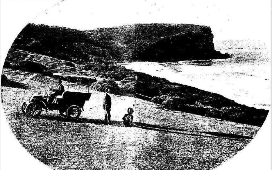
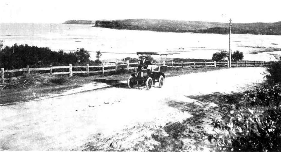
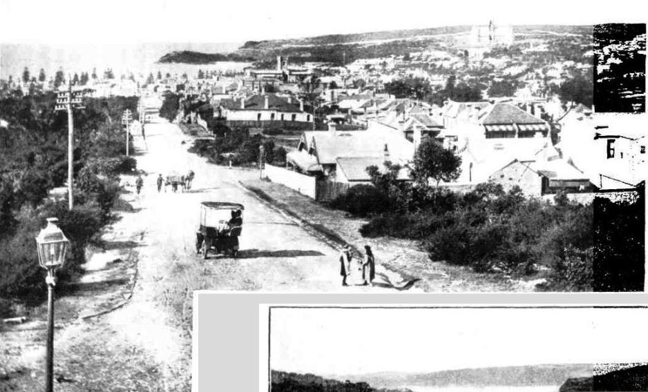
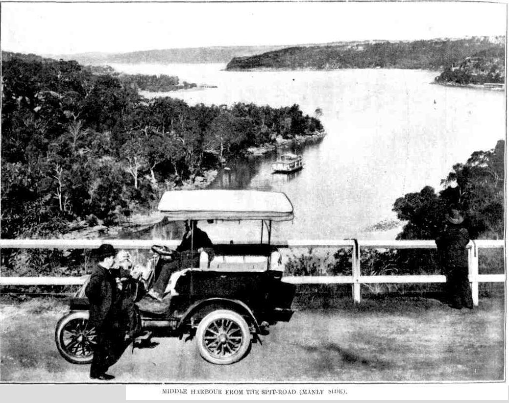
.jpg?timestamp=1540673186627)
.jpg?timestamp=1540673302943)
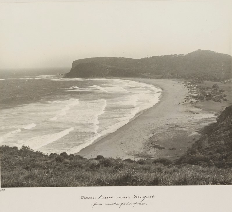
'Ocean Beach near Newport from another point of View' From Album 52 Photographs of the Allen family November - December 1909 Image.: a1373016h, courtesy State Library of NSW
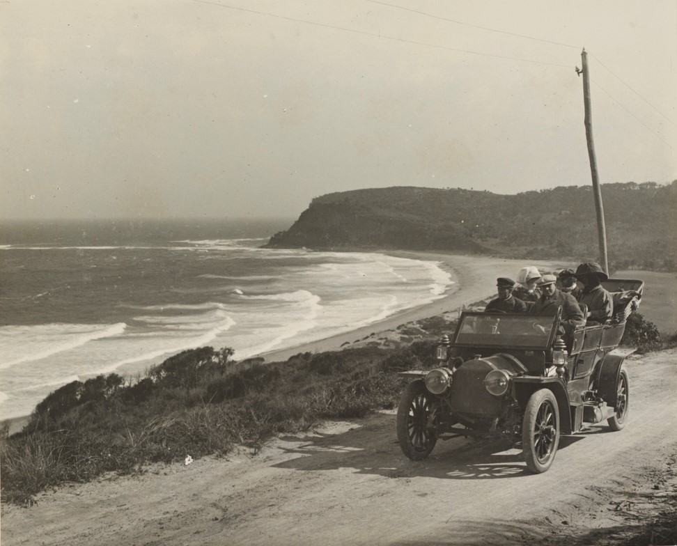
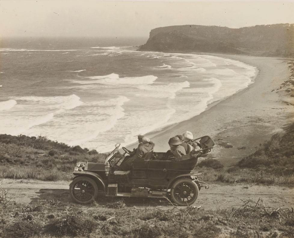
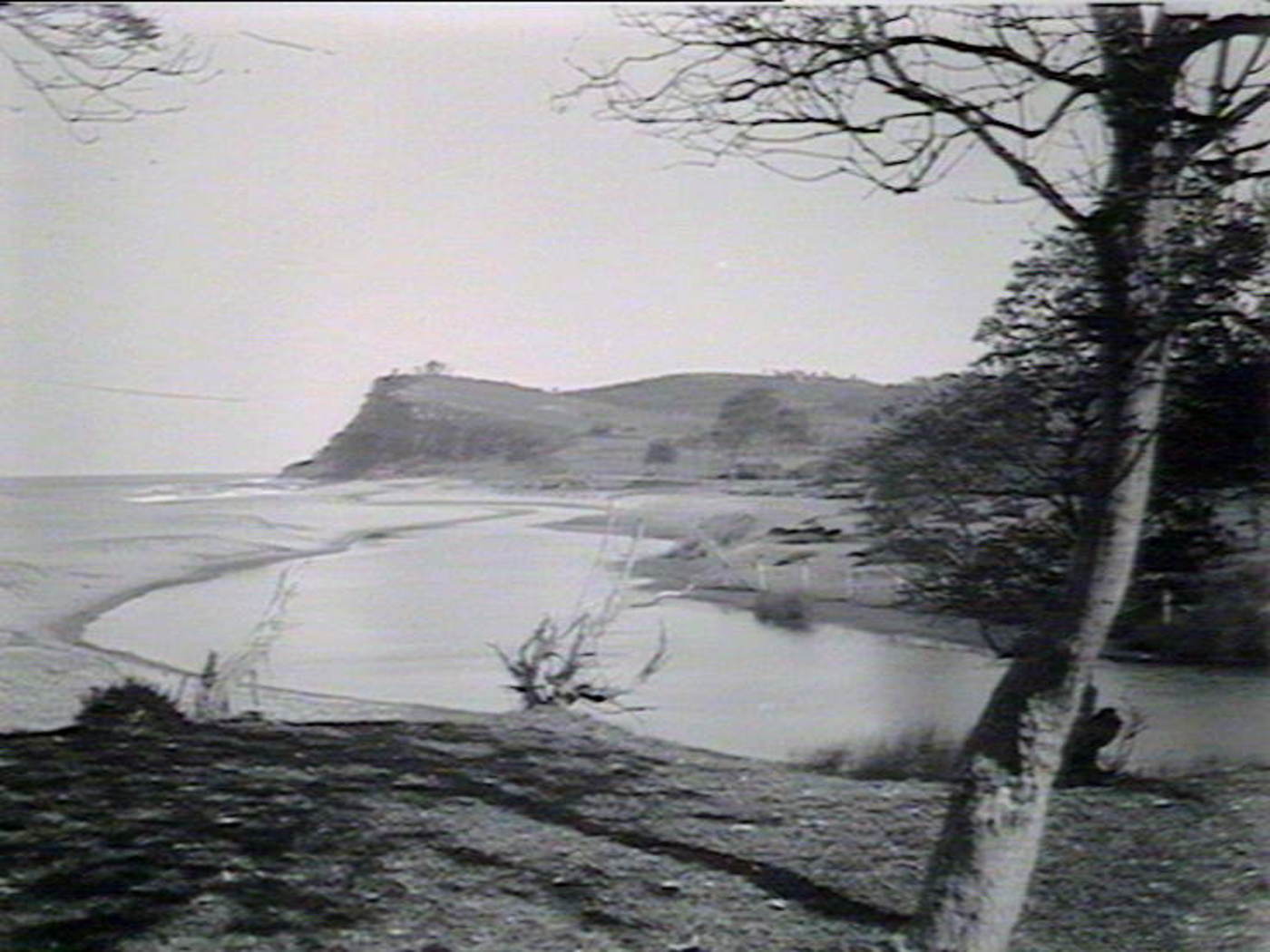
Farrells Beach and Bungan Head, April 1912 - Government Printing Office 1 - 12148. Image No.: d1_12148h, courtesy the State Library of New South Wales.
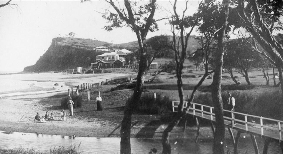
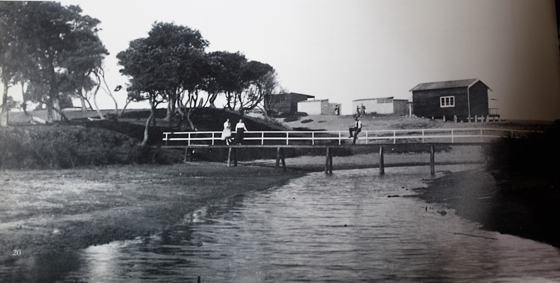
Newport Lagoon circa 1912-1915
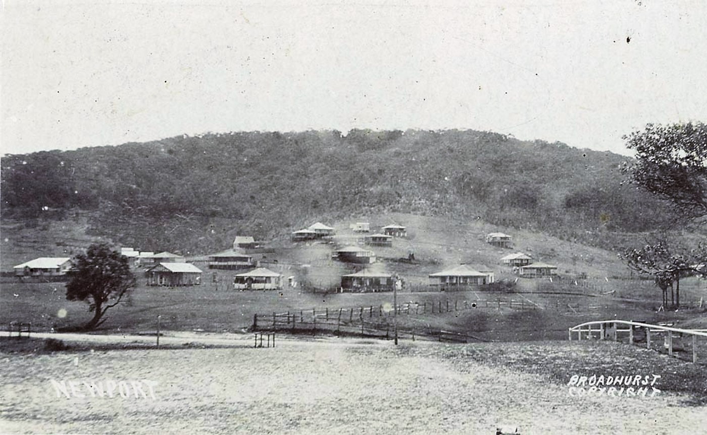
Newport from album Scenes of Newport N.S.W, circa 1900-1927. Image No a106122h. Courtesy State Library of NSW - the 'road' north runs along the base of the photo beneath the sole tree to left of frame.
on leaving Mona Vale one climbs more headlands commanding magnificent views. Then comes Newport, where there is a modern tourist hotel. Within a stone's throw is Farrells Beach, where there are 20 or 30 furnished cottages, a surf club-house, and ample dressing accommodation for both ladies and gentlemen. Over more headlands to Palm Beach, and five miles further on, one passes Barrenjoey Lighthouse, perched on a rocky prominence which rises some 200 feet above the sea. For motorists the road is somewhat 'tricky' after leaving Farrell's Beach, but the coastal views are lovely, and the panorama on the Hawkesbury side simply glorious. There is good accommodation at Barrenjoey, and one has the advantage of being right on the sea front, where there is good surfing and fishing, and at the same time' may turn that will to the calm waters of the Hawkesbury for boating, sailing, or line fishing. Is it any wonder that this district is fast becoming one of the most popular holiday resorts around Sydney. It is certainly one of the finest assets of the State. TWENTY MILES OF OCEAN BEACHES. (1915, April 7). Sydney Mail (NSW : 1912 - 1938), p. 33. Retrieved from http://nla.gov.au/nla.news-article166255869
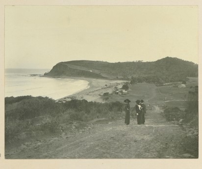
'The big beach not far from Bilgola'. Friday 13th of March 1913. on page reads; 'After Captain Scott's death, Captain Evans took charge of the South Pole expedition. He arrived in Sydney about the 8th of March. I lunched with him at the Australia on the 10th. Mrs. Evans came to Merioola to stay two days later. Evans had been to Melbourne, arriving the next day. This afternoon I drove Capt. and Mrs. Evans and Blanche Blomfield to Bilgola. It was a very happy afternoon. From Album 61 Photographs of the Allen family 1 February 1913 - 10 May 1913, Image No. a3290020h, courtesy State Library of NSW
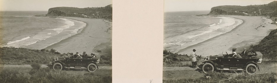
The Lancia car near Bilgola (Newport beach). We stopped for a few minutes to take photographs. Image No. a3295021h. From Album 67 Photographs of the Allen family 14 January 1916 - 5 February 1918, courtesy State Library of NSW. Sunday 27th August 1916. Today I took the new Electric Car 146 for a long run to Narrabeen, Margaret being with me. The Lancia car followed with Joyce,Ken, Miss Cadman and Miss Stickland. At Narrabeen, Margaret and I left the Electric car and we all went on to Bilgola in the Lancia, arriving there in time for lunch.
No. 21,297. APPLICANT :—William Charles Woolcott, Sydney. LAND:—Shire Warringah, at Newport, 4 acres 1 rood 22 ½ perches, 3 acres 3 roods 27 perches, and 3 roods 35 ½ perches situated in Barrenjoey-road, Gladstone and Bishop streets, comprising section H, lots 7, 8, and 11 to 18, inclusive, section J, of Newport Township. Diagrams delineating these lands may be inspected at the Land Titles Office, Sydney. W. G. H-WILLIAMS, Registrar-General. 7th March, 1919. NOTICE UNDER REAL PROPERTY ACT. (1919, March 7). Government Gazette of the State of New South Wales (Sydney, NSW : 1901 - 2001), p. 1468. Retrieved from http://nla.gov.au/nla.news-article229667678
Despite the rise and rise in use of the motor vehicle, many were still transporting goods via wagon and horse - as this sad account proves - this is also a reflection of the state of that road down Newport hill:
Carter's Death
CRUSHED BY A WAGGON Strange Accident Near Newport
The death of Alexander M’Pherson, 85, a carter, whose body was found at the foot of hill on the Barrenjoey-road, near Newport, on November 13. with his neck and chest terribly crushed, formed the subject of on enquiry before the City Coroner.,
William Hunter, a waggon driver, employed by Wild and Sons, told the coroner that he and M'Pherson left Manly on November 12 for Barrenjoey, M'Pherson driving a two-horse waggon and witness a five-horse vehicle. After passing Newport witness took the lead, and about a mile and a half past Farrell's Hill he camped for the night. He waited some time for M'Pherson to come up, and then walked back some distance, but could see no sign of him, and he returned to look after his horses. At daylight he went back along the road, and found M’Pherson lying dead about 5ft. from the bottom of the hill. There were marks across his neck and chest like wheel marks. The waggon was 12 or 15 feet beyond the body in a waterhole. The near side horse was lying dead in its harness. The offside horse had slipped the harness without breaking it in any way. Witness went to Newport and communicated with the police.
Dr. Arthur Palmer stated that he had made an examination of the body at the morgue. The man's chest and neck were crushed, and the body was considerably bruised. The Injuries could have been caused by a wheel passing over the body, and were the cause at death. A verdict of accidental death was recorded. Carter's Death (1919, November 27). Evening News (Sydney, NSW : 1869 - 1931), p. 3. Retrieved from http://nla.gov.au/nla.news-article115883017
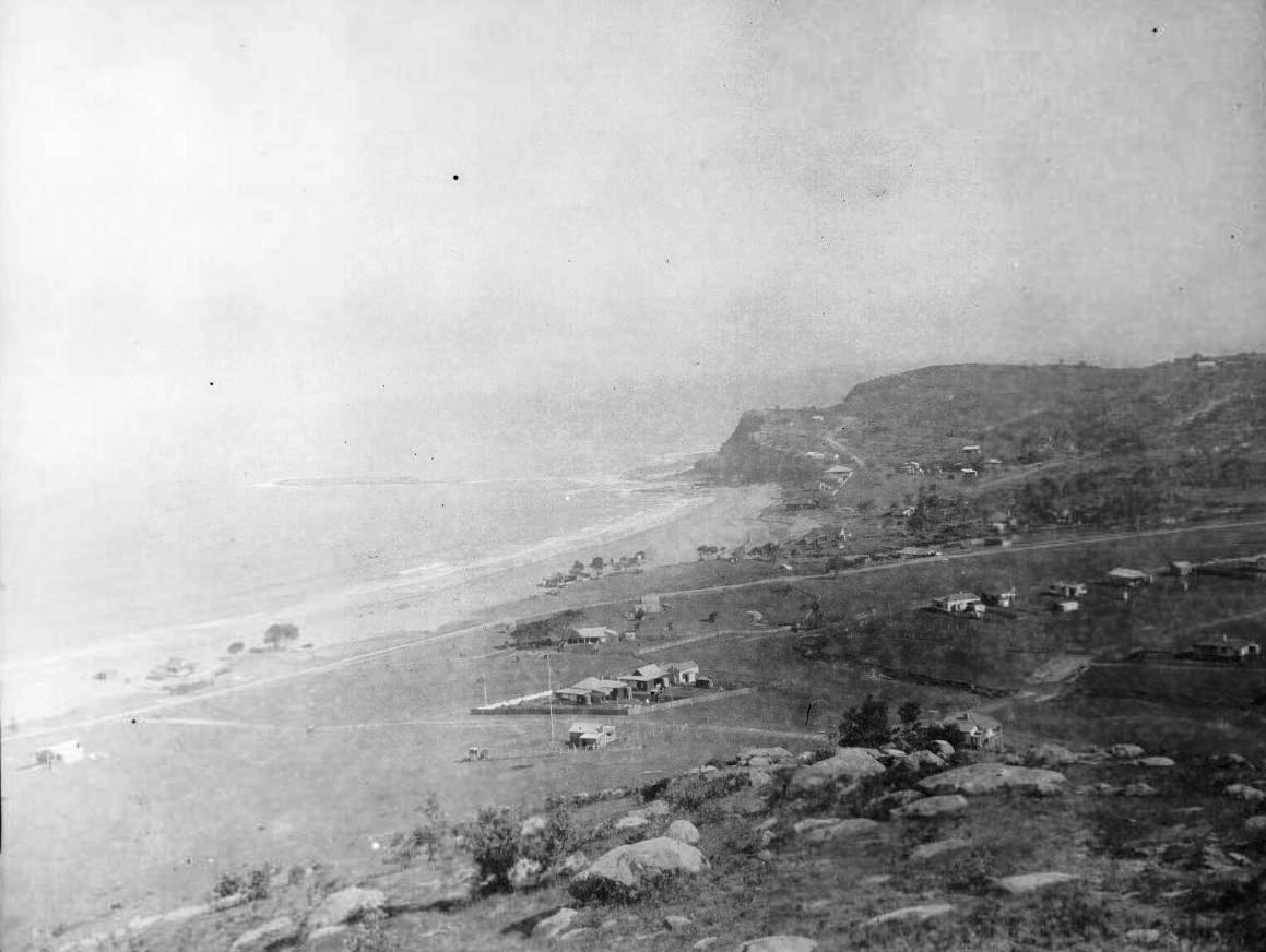
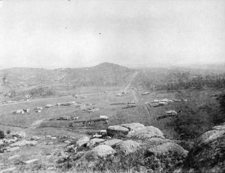
A CREEK AT NEWPORT BEACH, (Photo: C. S. Harnett.)
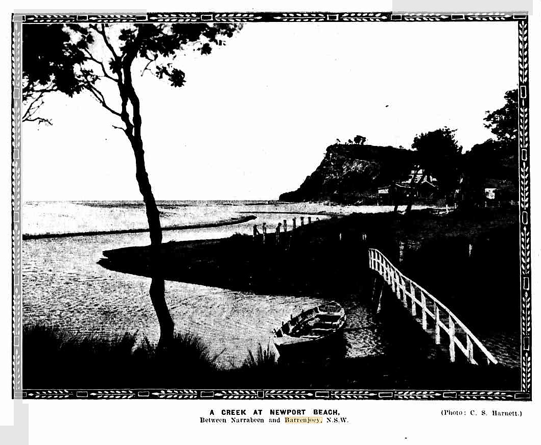
Between Narrabeen and Barrenjoey, N.S.W. OUR NEW SERIAL (1923, October 10). Sydney Mail (NSW : 1912 - 1938), p. 11. Retrieved from http://nla.gov.au/nla.news-article159036756
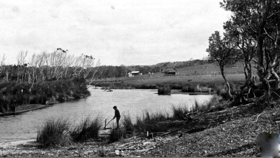
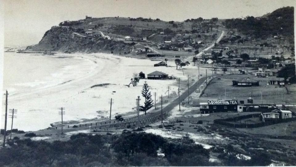
COURTS OPENED AT NEWPORT.
Two new courts, erected by a company for lease to the Newport Tennis Club, were formally opened yesterday afternoon by Major-General Sir Granville Ryrie, M.H.R., in the presence of an interested gathering, which included councillors of the Warringah Shire. The land is situated between the beach and the town, within ten minutes of the tram and about six minutes of the beach. The reserve comprises about two acres and later there will be additional courts. Up to date the company has spent £750 in putting the place in order, but a lot has to be done yet, including the erection of the necessary accommodation houses. The 'company' is included in the club, which holds the courts under hire. The club's fortunes to be guided by a committee of ten, with Mr. W. A. Crane as president, Mr. F. Tucker hon. treasurer, Mr. E. T. Penfold (treasurer of the company) secretary, and Mr. N. E. Penfold hon. assistant secretary. To mark the official opening, exhibition sets were played by Horace Rice, H. Utz, Dr. Utz, and G. Fisher, and Mrs. Utz, and Misses L. Bull, N. Lloyd and C. Lance. At night there was a celebration dance at Beach House. LAWN TENNIS. (1923, December 9). Sunday Times (Sydney, NSW : 1895 - 1930), p. 11. Retrieved from http://nla.gov.au/nla.news-article120539041
The 'creek' that had a bridge to cross it; A long and magnificent beach fronts this property, flanked by two imposing headlands; and on crossing a rustic bridge over a small salt-water creek, the pinch of the road is met with winding up a cliff not less than 300 feet above the sea. - A Ride to Barranjoey - 1867, and what some once called the Newport Lagoon, was filled in in:
FAIR NEWPORT
INCREASINGLY POPULAR RESORT
Twelve miles from Manly, the erstwhile quaint old village of Newport is becoming increasingly popular amongst health and pleasure seekers. From the hilltops there is a magnificent panorama of the coast from Barrenjoey to Manly, and the tourist can watch the surf breaking into seven inlets. Looking inland are the hills and dales of Kuring-gai, with the wooded slopes, placid water, and picturesque islets of Pittwater in the foreground, and Broken Bay and the Hawkesbury estuary in the tar distance. Alternative routes to this resort, each with attractions of its own, are via ferry to Manly, thence by road; via the Spit, through Balgowlah, to join the Pittwater Road near the Curl Curl Lagoon: or from the Spit along French's Forest Road to the Gordon-Pittwater Road.
Newport offers facilities for surfing, yachting, and fishing. It is the starting-point of the Hawkesbury River trip arranged by the Government Tourist Bureau. Steamers and launches are available for the exploration of the lavish natural beauty. The surf club is equipped with the latest style of surf boat, and three life-lines are manned by between 20 and 30 trained lifesavers. It is proposed to increase the club-rooms to accommodate the rapidly-growing membership. The programme for the coming season includes a combined carnival of all the clubs from Dee Why to Palm Beach. Public dressing-sheds are free. The safety of the beach Is proved by the fact that the club has not had to record a fatality.
Baths have been constructed in the rock at the north end of the beach. Adjacent to a grassy slope, the rendezvous of picnic parties, is the site of a proposed golf course. Other projects are a bowling green, adjoining tennis courts, the latter to be ready in a few weeks, and a large hall for dancing or other entertainment. The cleaning-out of the lagoon and the plotting of an ornamental park are engaging the attention of a live progress association. With the co-operation of the shire council, resumptions of foreshores to increase the recreation ground and give improved access to the beach are well under way. FAIR NEWPORT (1923, November 10). The Daily Telegraph (Sydney, NSW : 1883 - 1930), p. 4. Retrieved from http://nla.gov.au/nla.news-article246003398
The land around the lagoon at Newport was declared unhealthy in 1924 - a declaration not revoked until 1959:
Chief Secretary's Department and Office of the Minister of Public Health,
Sydney, 27th November, 1924.
PUBLIC HEALTH ACT, 1902, SECTION 55.
Unhealthy building land, Barrenjoey and Palm roads, and Ross-street, Newport, comprising lots 1 to 5, .-section 1, and lots 1 to 13, section 6, Ocean Beach Estate; lots 1 to 4, and portion of lot 44, Sea Murmur Estate; portion of lots 4 to 8, the whole of lots 9 to 17, and 31 to 33, Lilli Pilli Estate, Warringah Shire.
The Board of Health have reported that, after due inquiry, they are of opinion that it would be prejudicial to health if certain land situated within the Warringah Shire and described in Schedule hereunder was built upon in its present condition.
The Board of Health have further reported that in order to render such land fit to be built upon it is necessary that: —
(a) The present surface of the land be covered with clean soil or sand to the height of the crown of Barrenjoey-road at a point over the existing culvert passing under that road about 105 feet north from Palm-road;
(b) The surface of all that part of the land which is included within the walls of every building which may be built upon it, except buildings erected upon piles or piers, be covered with a layer of concrete comprised of the following ingredients, namely: —
One measure of cement of approved brand, three and a half measures of clean, sharp sand, free from loam or organic metier, and six and a half measures of broken metal or gravel of 2 ½ inch gauge, laid 6 inches thick, properly spread and well rammed;
(c) All floors to be laid on joists not less than 1 foot 6 inches above the concrete covering, the space thus formed to be ventilated by insertion of air bricks each measuring 9 by 6 inches to every 6 feet (lineal) of foundation, except in the case of buildings erected on piles or piers, the floors of which are to be laid on joists 1 foot 6 inches above the surface of the filling upon the said land;
(d) The space between piles and piers to be left open, the whole of the work to be done to the satisfaction of the Board of Health.
Now, therefore, in pursuance of the power and authority vested in me by section 55 (1) of the Public Health Act, 1902, I hereby declare that such laud shall not be built upon until the measures above referred to, which are also specified in a document deposited in the Office of the Local Authority (The Council of the Shire of Warringah) and open to the inspection of any person, have been complied with, or until this notice has been revoked by me.
E. H. FARRAR,
(for Chief Secretary and Minister of Public Health.)
Schedule.
All that piece or parcel of land situated within the Shire of Warringah, parish of Narrabeen, county of Cumberland, described as follows; Commencing at the northern corner of lot J3, section 6, Ocean Beach Estate, shown on deposited plan 6,248 and bounded thence by the south-eastern side of Barren joey-road south-westerly to the north-westerly corner of lot 1 aforesaid, section 6; thence north-westerly across Barrenjoey-road to the north-eastern corner of lot 5, section 1, of the same estate; thence westerly by the northern boundary of aforesaid lot 5 to its western boundary; thence southerly by the western boundaries of lots 5, 4, 3, 2, and 1, of the same section and estate to the southern boundary of last mentioned lot; thence easterly by that boundary to Barrenjoey-road; thence south-easterly across that road to the south-western corner of lot 1, Sea Murmur Estate, shown on deposited plan 10,529; thence easterly by the northern side of Palm-road to the south-eastern corner of lot 4 of same estate; thence northerly by the eastern boundary of that lot to its north-eastern cornier; thence easterly by the northern boundaries of Lots 5, 7, and 8, of the same estate to the eastern boundary of the last mentioned lot; thence by a line bearing northerly in prolongation of the said eastern boundary 60 feet; thence by a line hearing easterly to the south-western corner of lot 2, Lilli Pilli Estate, shown on deposited plan 7,424; thence northerly by the eastern boundary of lot 4 of the same estate to the northeastern corner of that lot; thence northerly across Ross-street to the south-eastern corner of lot 31 of the same estate; thence northerly by the eastern boundary of that lot and lot 33 of the. same estate to the northern corner of lot 33; thence north-westerly across Ross-street to the eastern corner of lot 17 of the aforesaid Lilli Pilli Estate; thence north-westerly by the north-eastern boundary of that lot to its northern corner; thence north-westerly to the eastern corner of lot 33, section 6, Ocean Beach Estate, shown on deposited plan 6,248; thence north-westerly by the north-eastern boundary of lot 13, to the point of commencement.
The abovenamed deposited plans are lodged at the Office of the Registrar-General, Sydney. PUBLIC HEALTH ACT, 1902, SECTION 55. (1924, December 5). Government Gazette of the State of New South Wales (Sydney, NSW : 1901 - 2001), p. 5469. Retrieved from http://nla.gov.au/nla.news-article223003271
"NO DANGER"
NEWPORT SAND SHIFTING COMPANY'S REPLY
Complaints have been made in "The Sun" from Newport residents that the operations of a syndicate which is removing sand from the beach to fill in a swamp, will do lasting damage to the beach. In reply, the managing director of Boulevarde Estates, Newport, Ltd. (Mr. F. E. Penfold), states "that residents and visitors need have no fear of any permanent damage being done to the beach or of any danger to bathers through the formation of channels. "Our experts have assured us," said Mr. Penfold, "that there is no danger of any 'break-out' in this sand, and that when the north-easterly wind blows the sand which has been removed will be quickly replaced. "The swamp, which has been not only an eyesore to residents but also a danger, on account of bad odors and mosquitoes, is to be filled up. A considerable amount of money has already been spent in making a large concrete drain through the centre, and when this is completed it will improve Newport and the surrounding district very considerably."
IMPROVING DISTRICT
Mr. Penfold, said that the land which was being reclaimed had been condemned by the Health Department and had never been built on. It was intended to put down a good road, giving direct communication with the beach, thus enhancing the value of the surrounding properties. He added that the Under-Secretary for Lands (Mr. Flemming) had recently inspected the locality and commended the work of the company, Mr. Flemming said that the Government or the shire council should have done the work of reclaiming "the pestilential spot," but said that the company was doing good work in the Interests of the public. Mr. Penfold has been a week-end resident of Newport for many years. "NO DANGER" (1926, November 8). The Sun (Sydney, NSW : 1910 - 1954), p. 14 (FINAL EXTRA). Retrieved from http://nla.gov.au/nla.news-article224119056
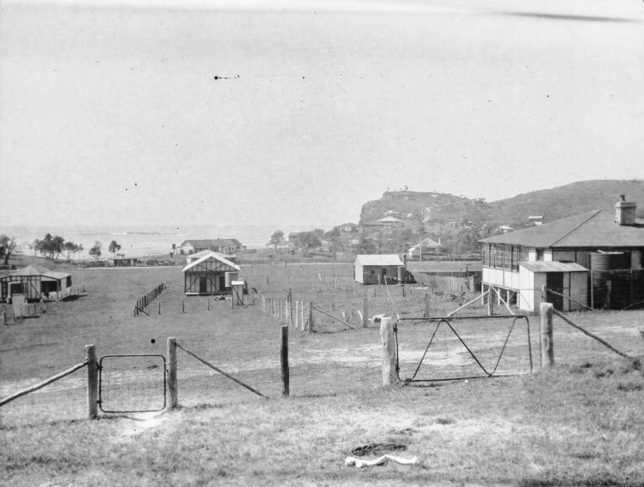
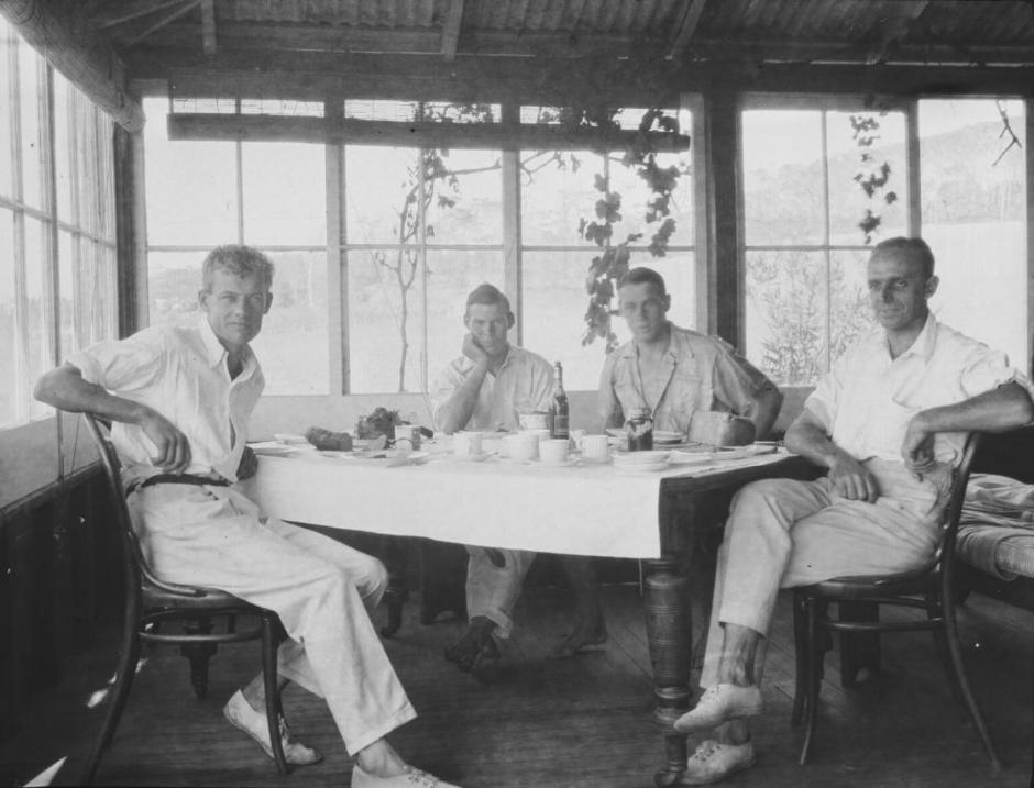
Michael Terry (left of picture) and friends at breakfast at the Penfold's home, Newport Beach, Sydney, 1922 - PIC/8847/3/9 LOC Nitrate store PIC/8847 - Others in Picture are two sons of Frederick Edwin Penfold, Eumungerie was the home of the Penfolds.; two Penfold boys were foundation members of Newport SLSC. One B. Penfold was in the first Bronze Squad of 1922. Fredrick and Alice M Penfold had five sons and one daughter Edwin T (born 1893), Frederick H (born 1894) Norman E (born 1896) Frank L (born 1898) Ian S (born 1910) and Alice G (born 1904). Frederick Edwin Penfold was partner with his brother in W. C. Penfold & Co. - See William Clark Penfold
In fact, filling this lagoon in with sand and removing that from the now visual landscape wasn't completed until the 1930's Depression works:
PREVENTION AND RELIEF OF UNEMPLOYMENT ACT, 1930-1931.
DECLARATION OF WORKS TO BE WORKS FOR THE RELIEF OF UNEMPLOYMENT.
(L.S.)
PHILIP GAME, Governor.
IN pursuance of section nine of the Prevention and Belief of Unemployment Act, 1930-1931, and the Prevention and Belief of Unemployment (Further Amendment) Act, 1932, I, Sir Philip Woolcott Game, Governor of the State of New South Wales, on the advice of the Minister for Labour and Industry, being the Minister for the time being administering the said Acts, do hereby declare the works enumerated in the Schedule attached hereto to be works provided for the relief of unemployment. -
Dated at Sydney, this seventh day of December, one thousand nine hundred and thirty-two.
By His Excellency's Command,
J. M. HUNNINGHAM,
Minister for Labour and Industry.
Schedule.
U.R.C. 174.
Warringah Shire.—Storm water drainage and reclamation construction, Farrell's Lagoon, Newport, including excavating, filling, levelling, top-dressing, concreting, laying and jointing pipes, demolishing and re-erecting lavatories, etc. and such other work as may be required in connection therewith. PREVENTION AND RELIEF OF UNEMPLOYMENT ACT, 1930-1931. (1932, December 7). Government Gazette of the State of New South Wales (Sydney, NSW : 1901 - 2001), p. 4307. Retrieved from http://nla.gov.au/nla.news-article219912285
Before leaving the filling in of the Lagoon, there is a belief among locals that this was once a burial ground for the original inhabitants, which some published reports indicate has credence:
ABORIGINES' BONES.
An old aboriginal burying place was discovered by workmen making an excavation at Newport Beach yesterday. An almost complete skeleton was found about 8ft from the surface, and another collection of bones was turned up nearby. Constable Huckins, of the Narrabeen police, took charge of the remains. ABORIGINES' BONES. (1933, March 9).The Sydney Morning Herald(NSW : 1842 - 1954), p. 8. Retrieved from http://nla.gov.au/nla.news-article16967172
This wasn't the only one found:
SKELETON ON BEACH
A human skeleton was discovered in a channel at Newport Beach yesterday afternoon by two set of twins, John and Peter Morris, 14, and their sisters, Judith and Joan, 8. "Look what I found," said John, excitedly thrusting the head of the skeleton in the face of a woman on the beach. The woman fainted with shock. Police say the bones have been there for years. They may be the bones of an aborigine. SKELETON ON BEACH (1942, April 5). The Sun (Sydney, NSW : 1910 - 1954), p. 7. Retrieved from http://nla.gov.au/nla.news-article231763395
SKELETON PROBABLY 100 YEARS OLD
The action of the sea, assisted by the recent flood rains, on Saturday unearthed a human skeleton in a channel near the Newport Beach. The bones were examined by the Government Medical Officer, Dr. Percy, at the City Morgue yesterday, and he expressed the opinion that it was the skeleton of a female aboriginal, and had probably been buried for at least 100 years. SKELETON PROBABLY 100 YEARS OLD (1942, April 6). The Sydney Morning Herald (NSW : 1842 - 1954), p. 7. Retrieved from http://nla.gov.au/nla.news-article17816956
A GRUESOME TOY
Erosion of a dry creek bed at Newport during the recent rains was responsible for exposing a skeleton, which was later decided to be that of an aboriginal woman who died at least 100 years ago. The remains were found by some children who played with them for some time, till one, tiring of the game, thrust the grinning skull into the face of a woman visitor to the beach. The shock proved too much, for her, and she fainted. The police were notified and took charge of the bones. A GRUESOME TOY (1942, April 11).Molong Express and Western District Advertiser (NSW : 1887 - 1954), p. 4. Retrieved from http://nla.gov.au/nla.news-article140104755
The 1959 Notice revoking the health hazards associated with Newport's lagoon/creek:
Department of Public Health,
Sydney, 26th June, 1959.
PUBLIC HEALTH ACT, 1902-1952 (SECTION 55)
Unhealthy building land at Barrenjoey and Palm roads, The Boulevarde and Ross-street, Newport, Shire of Warringah, Metropolitan Land District. Area No. 318.
IN pursuance of the provisions of the Public Health Act, 1902-1952, I declare that the notice published in Government Gazette No. 153, of 5th December, 1924, in regard to the abovementioned land, is hereby revoked. W. SHEAHAN, Minister for Health. PUBLIC HEALTH ACT, 1902-1952 (SECTION 55) (1959, June 26). Government Gazette of the State of New South Wales (Sydney, NSW : 1901 - 2001), p. 1887. Retrieved from http://nla.gov.au/nla.news-article220270039
Improvements of the run to Newport were the focus of what would become completing works all the way to Palm Beach and include the cutting into the hill for the making of the Bilgola Bends;
MANLY TO NEWPORT.
PROPOSED CONCRETE ROAD.
A deputation from the Warringah Shire Council waited on the Minister for Local Government (Mr. Fitzpatrick) yesterday, and urged that the Government should subsidise the council on the £ for £ principle in connection with the concrete road it was pro-posed to construct from the boundary of the municipality of Manly to Newport, a distance of about 12 miles. It was estimated that the cost would be £80.000 to £90,000. The council. It was stated, could not afford the whole of the cost on what was, after all, a national highway. Difficulty was being experienced in maintaining roads out of revenue.
Mr. Fitzpatrick said he was not prepared to make a definite promise, but he would undertake that the matter would receive the closest possible consideration, in connection with several other proposals of a similar character. There was no doubt that the time had long since arrived when councils, Instead of expending small sums here and there on patchwork, should make a calculation as to whether It would not be better to raise a loan and put the roads into decent order. MANLY TO NEWPORT. (1923, March 6). The Sydney Morning Herald (NSW : 1842 - 1954), p. 6. Retrieved from http://nla.gov.au/nla.news-article16071998
MANLY TO NEWPORT.
PROPOSED CONCRETE ROAD.
A deputation representing the Warringah Shire Council, and supported by the State members for the Northern Suburbs, yesterday asked the Minister for Local Government (Mr. Fitzpatrick) for assistance in the building of the Pittwater-road from Condamine-street, Manly, to Newport, a distance of 9 ¼ miles. The Government was asked to pay the interest, averaging £2247 a year, dining the repayment of the loan of £70,000 required for a concrete road.
Mr. Fitzpatrick, in reply, said that the Government at present was similarly assisting In the reconditioning of the Botany and Gordon roads, and he fully approved of the principle where the work was of an essential and progressive nature, and was too largo for the council. He would have a departmental report made, and if it was satisfactory would recommend to the Cabinet that some tangible assistance should be given to the shire. MANLY TO NEWPORT. (1923, November 3). The Sydney Morning Herald (NSW : 1842 - 1954), p. 18. Retrieved from http://nla.gov.au/nla.news-article16103548
NEWPORT ROAD
12 Miles of Concrete
Work, it is expected, will commence shortly on the concreting of Newport road, from Manly to Newport, -a distance of 12 miles. Negotiations have been in progress between Warringah Shire and the Main Roads Board for some time, and the shire has been authorised to present a plan of the road, and also of an extra mile from Manly Bridge to the Junction of Pittwater-road and Condamine-street. NEWPORT ROAD (1925, July 9). Evening News (Sydney, NSW : 1869 - 1931), p. 17. Retrieved from http://nla.gov.au/nla.news-article113919802
SHIRE OF WARRINGAH.
Proposed Special Loan of £32,000.
NOTICE is hereby given that it is the intention of the Warringah Shire Council to apply for authority, under section 180, Local Government Act, 1919, to borrow the amount of £32,000 for the purpose of constructing the undermentioned roads, and carry out the undermentioned work, within A Riding of the Shire, and for purposes incidental thereto: —
1. Barren joey-road, from Neptune-street, Newport to Beach-road, Palm Beach 21,100
2. Warriewood-road, from Pittwater-road to Vineyard-street — . 1,700
3. Powderworks-road (a) from Pittwater road to the E end of Kobado-road; (b) Kobado-road for its entire length, and (c) Powderworks-road from the W end of Kobado-road to the junction with, the Gordon-Mona Vale road '. 4.000
4. Gladstone-street, Newport 1,000
5. Drainage of Black Swamp, Mona Vale 1,900
6. Resumptions, surreys and contingencies 2,300
£32,000
(Included in the estimate of £21,100 for Barrenjoey-road is a sum of £4.000 for the formation, only, of proposed deviations of that road, which itsm is taken into consideration in fixing the differential rate referred to hereunder.)
The interest payable on such loan shall not exceed six sand a half (6\) per cent, per annum, and it is proposed to arrange the loan on terms which shall provide for the repayment of principal and the payment of interest, combined, in equal half-yearly instalments extending over a period of ten years. The approximate amount of each such instalment will be £2,200 18s. 6d.
To provide the sum necessary for such instalments it is proposed to levy a local loan rate of one and four-tenths penny (1 4/10ths d.) in the £ on the unimproved capital value of all ratable land within that portion of A Riding described in the subjoined Schedule, and nine-tenths of a penny (9/10ths. d.) in the £ on the unimproved capital value of all ratable lands in the remainder of the Riding, the extra impost on the lands described in the Schedule being to cover the instalments of so much of the principal (£4,000) of the loan as it is proposed to expend on the formation of the deviations of the Barrenjoey-road. Should these rates not provide sufficient for the purpose, the balance "will be paid from the General Fund of the Council. The total unimproved capital value of all ratable lands in the area described in the Schedule is £207,842, in the remainder of the Riding, £737,320, the total for the whole Riding being £1,005,162.
Plans, specifications and reports giving details of the proposal, may be inspected at the Shire Hall, Brookvale, at any time during office hours.
Within one month of the publication of this notice, any number not less than 25 per cent, of the ratepayers of A Riding may petition the Council to take a poll of ratepayers, either as to whether the ratepayers approve of the loan, or as to whether the loan rate shall be on the unimproved capital value or the improved capital value, or on both questions. The number of ratepayers enrolled for A Riding is 3,892.
Schedule.
All that land bounded on the north by the entrance to Broken Bay, on the east by the Pacific Ocean, on the west by Pittwater Bay, and on the south by the southern boundaries of Village Reserve 18,805, parish portion 21, block VI of the southern division of Pittwater Estate, and parish portion 31.
E. G. JAMIESON.
Shire Hall, Brookvale, Shire Clerk.
25th September, 1925.
1263 £4 4s. SHIRE OF WARRINGAH. (1925, October 2). Government Gazette of the State of New South Wales (Sydney, NSW : 1901 - 2001), p. 4246. Retrieved from http://nla.gov.au/nla.news-article220255392
The new 'Bilgola Bends' - also known as 'Kamikazee Corner':
SHIRE OF WARRINGAH.
Proposed Special loan of £5.800.
NOTICE is hereby given that it is the intention of- the Warringah Shire Council to apply for authority under section 180, Local Government Act, 1919, to borrow the sum of £5,800 for the purpose of carrying out the undermentioned works within A Riding of the Shire, and for purposes incidental thereto, namely:—
Barrenjoey-road—Formation of three deviations of Barrenjoey-road, between Neptune-street, Newport, and Avalon-parade, Avalon—at estimated cost of £5,430 Contingencies £370
The interest payable on such loan shall not exceed six and a half (6 1/2 ) per cent, per annum, and it is proposed to arrange the loan on terms which shall provide for the repayment of principal and the payment of interest combined in half-yearly instalments extending over a period of ten years. The approximate amount of each such instalment will be £398 18s. 4d.
To provide the sum necessary for such instalments, it is proposed to levy a local loan rate of three-fifths of a penny (3/5d.) in the £ on the unimproved capital value of all ratable land within the area described in the subjoined Schedule, and generally known as the Barrenjoey Peninsula. Should such rate not provide sufficient for the purpose, the balance will be paid from the General Fund of the Shire. The total unimproved capital value of all ratable lands in such area is £267,842.
Plans, specifications and reports, giving details of the proposal may be inspected at the Shire Hall, Brookvale, during office hours.
Within one month of the publication of this notice any number not less than 25 per cent, of the ratepayers of A Riding may petition the Council to take a poll of ratepayers, either as to Whether such ratepayers approve of the loan or as to Whether the loan rate should be on the unimproved capital value or the improved capital' value, or on both questions. The number of ratepayers enrolled for the area affected is 1,021.
Schedule.
All that land bounded on the north by the entrance to Broken Bay; on the east by the Pacific Ocean; on the west by Pittwater Bay; and on the south by the southern boundaries of Village Reserve 18,805, parish portion 21, block VI of the Southern Division of Pittwater Estate, and parish portion 31.
R. G. JAMIESON, Shire Hall, Brookvale. Shire Clerk.
23rd November, 1925. SHIRE OF WARRINGAH. (1925, November 27). Government Gazette of the State of New South Wales (Sydney, NSW : 1901 - 2001), p. 5353. Retrieved from http://nla.gov.au/nla.news-article223017028
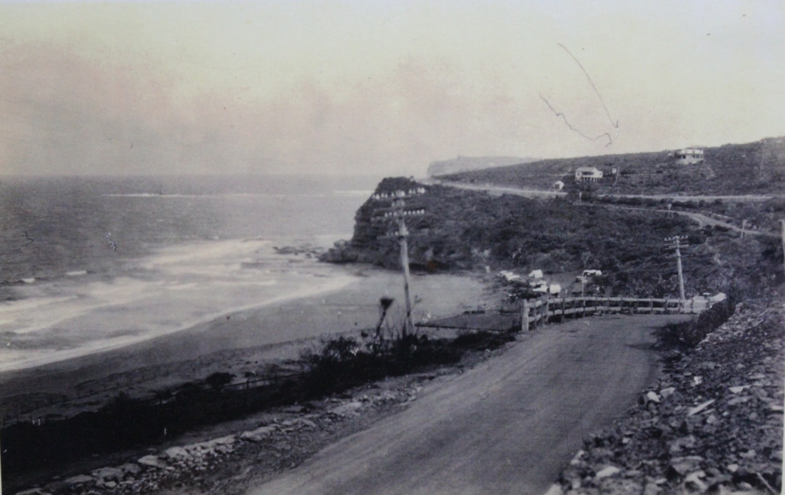
SHIRE OF WARRING AH.
Proposed Special Loan of £28,200.
NOTICE is hereby given that it is the intention of the 1 Warringah Shire Council to apply for authority, under I section 180, Local Government Act, 1919, to borrow the sum of £28,200 for the purpose of carrying out the undermentioned works within A Riding of the Shire, and for purposes incidental thereto:—
1. Construction of Barrenjoey-road, from Seaview-parade, Newport to Beach-road, Palm Beach, including proposed deviations between Neptune-street and Avalon-parade, estimated cost (excluding cost of formation of deviations) ,— 17,600
2. Construction of Warriewood-road, from Pittwater-road to Vineyard-street, at estimated cost of 1,700
3. Construction of Powderworks-road; (a) from Pittwater-road to eastern end of Kobado-road; (b) Kobado-road, for its entire length; and (c) Powderworks-road, from the western end of Kobado-road to its junction with the Gordon-Mona Vale road, at estimated cost of 4,000
4. Construction of Gladstone-street, Newport, estimated cost 1,000
5. Drainage of Black Swamp Reserves, Mona Vale 1,900
6. Resumptions, surveys and contingencies .. 2,000
The interest payable on such loan shall not exceed six and half (6$) per cent, per annum, and it is proposed to arrange the loan on terms which shall provide for the repayment of principal and the payment of interest, combined, in half-yearly instalments extending over a period of ten years. The approximate amount of each such instalment will be £1,939 11s. 4d,
To provide the sum necessary for such instalments, it is proposed to levy a local loan rate of four-fifths of a penny (4/5ths d.) in the £ on the unimproved capital value of all ratable lands in A Riding of the Shire. Should such rate not provide sufficient for the purpose, the balance will be paid from the General Fund of the Shire. The total unimproved capital value of all ratable lands in A Siding is £3,005,162.
Plans, specifications and reports giving details of the proposal may be inspected at the Shire Hall, Brookvale, during office hours.
Within one month of the publication of this notice, any number, not less than 25 per cent, of the ratepayers of A Biding, may petition the Couneil to take a poll of ratepayers, either as to whether such ratepayers approve of the loan, or as to whether the loan rate should be on the unimproved capital value or the improved capital value, or on both questions. The number of ratepayers enrolled for A Biding is 3,892.
(N.B.—The foregoing proposal is in lieu of the proposal notified in the Government Gazette of 2nd October, 1925.)
R. G. JAMIESON, Shire Hall, Brookvale, Shire Clerk.
23rd November, 1925.
SHIRE OF WARRINGAH. (1925, November 27). Government Gazette of the State of New South Wales (Sydney, NSW : 1901 - 2001), p. 5354. Retrieved from http://nla.gov.au/nla.news-article223017024
BARRENJOEY ROAD.
GREAT PLEASURE DRIVE.
The Minister for Local Government has approved of the Warringah Shire Council's application to borrow £28,200 for the reconstruction of roads and the drainage of public reservation reserves in A riding.
The principal work will be the tar-metalling of a length of 6 miles 11 chains of the Pittwater-road including 1 mile 46 chains of road deviation between Newport and Avalon. The main road from Manly to Newport is, it is understood, to be tar-metalled or concreted by the Main Roads Board. The council's proposal is to tar-metal from the end of the main road right through to the narrow neck of road between Palm Beach and Barrenjoey, thus creating what is regarded as an unrivalled pleasure drive.
The deviation of the road between Newport and Avalon is to be defrayed from an additional loan of £5800, which has also been approved. BARRENJOEY ROAD. (1926, April 29). The Sydney Morning Herald (NSW : 1842 - 1954), p. 8. Retrieved from http://nla.gov.au/nla.news-article16289112
The news reports this as:
REAL ESTATE
DEVELOPING NORTHERN BEACHES
NEW SUBURBS ACROSS THE HARBOR THREE NEW FACTORS WHICH WILL HELP
Lack of an unbroken path from the city to beyond Manly has retarded the development of— the beaches on the Barrenjuey peninsula. This Is due to the fact that there are vast suburban areas on the north side of the Harbor barely scratched by development and, consequently, the majority of Sydney's citizens are congregated on the south side. Naturally, they patronise the beaches nearest home; few cross the harbor to swim and surf. This aspect will be changed by the growing North Shore bridge, whose steel link, should create an enormous new population whose surf benches will be Newport, Avalon, Whale Beach, and Palm Beach. Co-ordinating with this work, the Warringah Shire Council is straining every effort to have the road from Manly lo Newport constructed in a permanent manner, either of concrete or of something equally durable, and plans to improve the existing road from Newport to Palm Beach up to Main Roads Board standard. A start is already being made, for a deviation is to circle the ugly hill which divides Newport from Avalon, and surveyors are now studying contours and levels on the Avalon side. This deviation will do more than cut out a bad-surfaced route with a nasty grade. It will Improve the road to the north by adding new scenic vistas, for the route will curve around the hill towards the ocean, skirt the bluff, and, before it rejoins the existing road, pass between the golf course and sea, and run the length of Avalon behind the reserves.
Better roads, naturally, lead to Improved transport facilities, and, now they are assured that their 'buses will not be shaken to pieces by a succession of pot-holes, proprietors of the 'bus companies who have been serving this district have amalgamated Into one big, company which plans to put new and better 'buses on the run. Soon after Christmas, they anticipate, they will have at least 20 'buses serving the district between Manly and Palm Beach. This, normally, should mean Increased tourist traffic and quicker residential development — which will, In turn, demand still more 'buses.
These aids should help the northern beaches to a quick move forward. Palm Beach has long been popular with the class who own motor cars, and now attention is being paid to Avalon, which is closer to the city, and, yet quite as attractive in Its less spectacular way. Here the land flows gently in the beach Instead of rising to the sudden heights which (is) rampart at Palm Beach, and, as a result, offers easy building conditions and proximity to the surf. Hundreds of motor-owners now make it a week-end resort, and many are lured by the interesting golf course, with its novel holes. Land Is now being sold here, adjoining the golf course, fronting the new main road, and on the gentle slopes overlooking the beach. Many very fine sites are available in the Avalon Estates, despite the speed with which they are being bought. The inauguration of the better 'bus services and the completion of the deviation should undoubtedly add to the beach's popularity, and, at the same time, to values In the vicinity. REAL ESTATE (1926, October 29). The Sun (Sydney, NSW : 1910 - 1954), p. 15 (FINAL EXTRA). Retrieved from http://nla.gov.au/nla.news-article224122137
The big change for Newport came in the construction of the six-lane carriageway between Mona Vale and the Newport Village shops, where it is a dual carriageway until the road up the hill to Bilgola commences. This plan first appears as a proposal in Main Rods Annual Reports in 1955 but it took a lot longer than that for funding and construction works. These were commenced at the same time those widening the road between Narrabeen and Mona Vale were. Warringah Shire Council records of Meetings Minutes show the widening of the road leading into Newport commenced in 1955. Land Acquisitions were part of this process. There were also numerous council discussions during the 1955 records where the problem of parking at Newport was trying to be addressed - signalling the amount of visitor traffic that would have spurred on the six-lane road build. Some records:
Department of Main Roads New South Wales, 1956-57 - OpenGov NSWImage https://www.opengov.nsw.gov.au/viewer/10efa09d693b46758ce9e358369b0d5d.pdf
The construction of a six lane divided road through Newport Beach Shopping ...
Department of Main Roads New South Wales, 1957-58 - OpenGov NSWImage https://www.opengov.nsw.gov.au/viewer/f2f43f5015a04b5aa61c36124ba031c7.pdf
The construction of a six lane divided road between Narrabeen and Mona Vale. and to Newport Shopping Centre.
Sydney, 17th August, 1956.
RESERVE FROM AFTER-AUCTION SALE.
IT is hereby notified that in pursuance of the provisions of section 29 of the Crown Lands Consolidation Act, 1913, the Crown land hereunder described shall be temporarily reserved from after-auction sale. SOGER NOTT, Minister for Lands.
Land District—Metropolitan ; Shire—Warringah.
No. 78,825 from after-auction sale. Parish Narrabeen, county Cumberland, allotments 2 to 5,. section X and 1 to 8, 10 and 11, section 2, at Newport. C, 7,483. 7,484-2,030. T* 55 5,914.
Notice of Acquisition by the Crown of land, under Section 197 of the Crown Lands Consolidation Act, 1913, and the reservation from Sale or Lease of such land. RESERVE FROM AFTER-AUCTION SALE. (1956, August 17). Government Gazette of the State of New South Wales (Sydney, NSW : 1901 - 2001), p. 2404. Retrieved from http://nla.gov.au/nla.news-article220389383
MAIN ROADS ACT, 1924-1954.
NOTIFICATION OF APPROVAL OF THE LIEUTENANT GOVERNOR TO PLAN OF A PROPOSAL FOR THE RE-ALIGNMENT (BY THE RE-ALIGNMENT METHOD OF ACQUISITION) OF PORTION OF MAIN ROAD No. 164—BARRENJOEY-ROAD— BETWEEN BASSETT-STREET AND BEACONSFIELD-STREET IN THE SHIRE OF WARRINGAH, UNDER DIVISION 1 OF PART VB OF THE MAIN ROADS ACT, 1924-1954.
IN pursuance of the provisions of Section 27b of the Main Roads Act, 1924-1954, The Commissioner for Main Roads who proposes to cause the alignment of portion of Main Road No. 164-—Barrenjoey-road—between Bassett-street and Beaconsfield-street—in the Shire of Warringah, to for re-aligned pursuant to Division 1 of Part VB of the Main. Roads Act, 19241954, and to apply the re-alignment method of acquisition to the lands affected by such re-alignment, hereby notifies, that the Plans of the proposal have been approved by His Excellency the Lieutenant-Governor, with, the advice of the Executive Council, and that such Plans, being Plans Nos. 164. 6.314 and 164.S.315), may be inspected at the Department of Main Roads, and copies of such Plans may be inspected at the Warringah Shire Council Chambers, Brookvale.
Signed and sealed at Sydney, this 27th day of August, 1956.
I, Howard Macoun Sherrard, The Commissioner for Main Roads, have hereto affixed the Official Seal of the Commissioner for Main Roads in the presence of—
J. Fleming, J.P.
(L.S.)
H. M. SHERRARD.
(D.M.R. No. 479.1,593 Part 2). MAIN ROADS ACT, 1924-1954. (1956, October 12). Government Gazette of the State of New South Wales (Sydney, NSW : 1901 - 2001), p. 2968. Retrieved from http://nla.gov.au/nla.news-article220349115
A side or subordinate road at Newport named
SHIRE OF WARRINGAH.—Naming of Roads.—Ordinance 30, Clause 53, Local Government Act.—Notice is hereby given that the undermentioned roads have been renamed in accordance with section 249 (a) of the Local Government Act:—
Past Name or Location—New Name.
1. Road connecting Prescott-avenue with Bix-road, Dee Why—Wigan-street. (The above proposed name supersedes an earlier proposal to name this street Narree-street.)
2. French's Forest road, French's Forest:—
(a) From Wakehurst Parkway easterly to its junction with Warringah-road—French's Forest road East.
(b) From Wakehurst Parkway westerly to the eastern boundary of portion 1,134 (the point at which road closure commences)—French's Forest road West.
(c) Between Rabbett-street and Forest-way—Naree-road.
(d) Between Grace-avenue and Prince Charles road— Sorlie-road.
3. Beaconsfield-street East, Newport, between Barrenjoey-road to Myola-road—Bungan Head road.
J. MORGAN, Shire Clerk, Shire Hall, Brookvale, 25th November, 1957. SHIRE OF WARRINGAH.—NAMING OF ROADS.—Ordinance (1957, November 29). Government Gazette of the State of New South Wales (Sydney, NSW : 1901 - 2001), p. 3859. Retrieved from http://nla.gov.au/nla.news-article220359872
Younger readers may not be aware that Porters Reserve, where the Newport Rugby Team the Breakers now have their home, began as a tip. Places that need a tip having a growing population that needed or used these in the pre recycling era :
LANDS DEPARTMENT NOTICES.
(3273) Sydney, 1st February, 1957.
ERRATUM.
Land District—Metropolitan; Shire—Warringah.
IN the notification in the Government Gazette of 25th January, 1957, folio 218, of the appointment of trustees for "Reserve No. 79009 for Public Recreation at Newport" read "Reserve No. 79009 for Rubbish Depot at Newport". P. 56-4,825.
ROGER NOTT, Minister for Lands. LANDS DEPARTMENT NOTICES. ERRATUM. (1957, February 1). Government Gazette of the State of New South Wales (Sydney, NSW : 1901 - 2001), p. 348. Retrieved from http://nla.gov.au/nla.news-article220350260
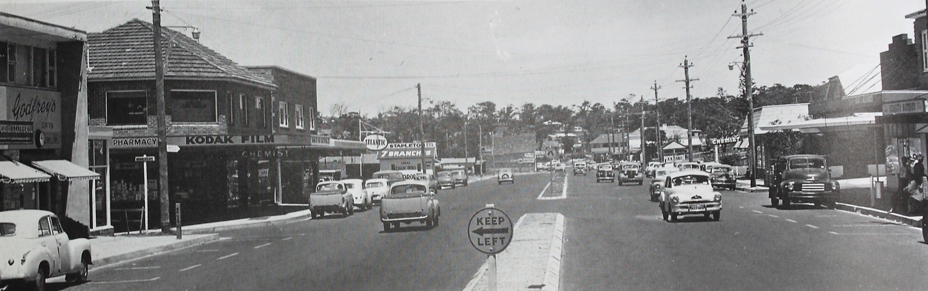
Barrenjoey Road, Newport, 1957 - new tar and unpainted dual carriageway through shops area
DEPARTMENT OF MAIN ROADS - Levels
MAIN ROADS ACT, 1924-1963
Section 264 of the Local Government Act, 1919
Shire of Warringah. Main Road No. 164—Barrenjoey Road
Reconstruction between Bramley Avenue and Neptune Road, Newport.
NOTICE is hereby given that the levels of Main Road No. 164—Barrenjoey Road, between Bramley Avenue and Neptune Road, Newport, and so much of any side roads thereby affected within the Shire of Warringah, in accordance with and as shown on plans registered No. 164-C. 2,562 exhibited at the Head Office of the Department of Main Roads, 309 Castlereagh Street, Sydney, and at the Department's Metropolitan Division, Milson's Point and at the Council Chambers of the Warringah Shire Council, and duly notified in the "Sydney Morning Herald" on Thursday, 26th September, 1963, and in the Government Gazette, on Friday, 1st November, 1963, have been approved.
The levels are now fixed and/or refixed and will take effect from the date of publication of this notice
Signed and sealed at Sydney, this 16th day of November, one thousand nine hundred and sixty-four.
I, John Alexander Lachlan Shaw, The Commissioner for Main Roads, have hereto affixed the Official Seal of the Commissioner for Main Roads in the presence of—
C. W. Mansfield, J.P. (D.M.R. No. 479-1,922)
(L.S.) J. A. L. SHAW. DEPARTMENT OF MAIN ROADS (1964, December 11). Government Gazette of the State of New South Wales(Sydney, NSW : 1901 - 2001), p. 4021. Retrieved from http://nla.gov.au/nla.news-article220345819
Department of Main Roads New South Wales, 1966-67 - OpenGov NSWImage https://www.opengov.nsw.gov.au/viewer/a156c1f4c6754010a74eaeb312c7155b.pdf
Barrenjoey Road, Mona Vale to Newport Beach, in the Shire of Warringah. ...
Department of Main Roads New South Wales Annual Report 1966-67
In the County of Cumberland, road works completed were principally reconstruction and pavement widening to provide additional lanes for traffic, installation of median strips in six-lane carriageways, channelisation of intersections and construction of approaches to bridges. (- page 9.)
WIDENING OF METROPOLITAN MAIN ROADS
During the past year the principal roads on which property was being acquired by the Department for widening purposes were as follows:—
Mona Vale Road in the Shire of Warringah and Municipality of Ku-ring-gai.
Barrenjoey Road, Mona Vale to Newport Beach, in the Shire of Warringah.
ROAD WORKS
Lane Cove Road —Ryde Reconstruction and bitumen surfacing to provide a six-lane divided carriageway from Blaxland Road to Quarry Road.
Pittwater Road—Narrabeen Widening, reconstruction and major channelisation of the intersection with Wakehurst Parkway.
Warringah Road—French's Forest Widening from Fitzpatrick Avenue to Wakehurst Parkway to provide a six-lane divided carriageway with major channelisation at the intersections with Forest Way and Wakehurst Parkway .
Robertson-road to Neptune-road, Newport - Reconstruction and widening
Warringah Expressway—North Sydney Construction of first section from northern end of Sydney Harbour Bridge to Miller Street. Cammeray . (See also page 20).
The intersection of Pittwater Road (Main Road No. 164) and Wakehurst Parkway (Main Road No. 397) at North Narrabeen.
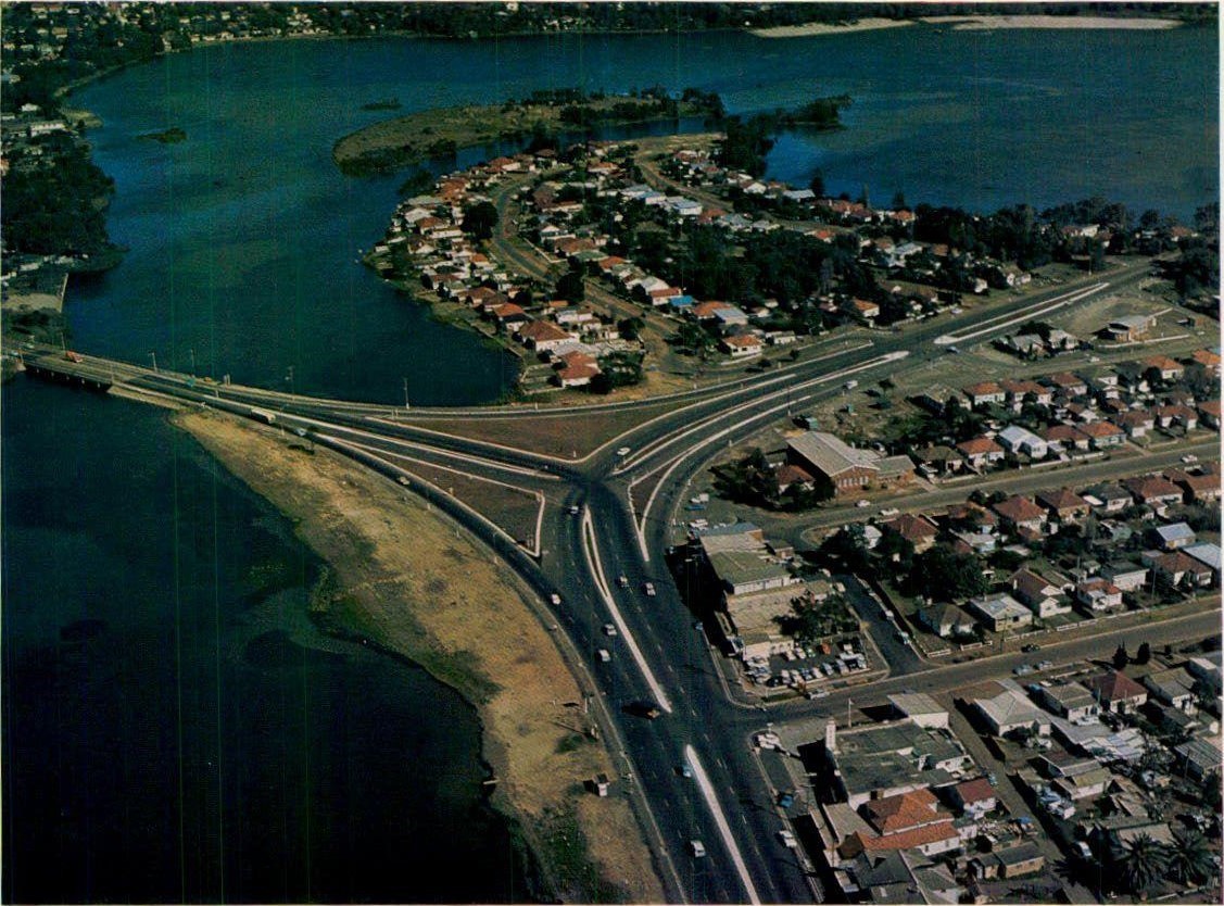
Above photograph is from this 66-67 report. Report freely available at https://www.opengov.nsw.gov.au/publications/16113;jsessionid=92140CF4231C66D19F32491653947E7D
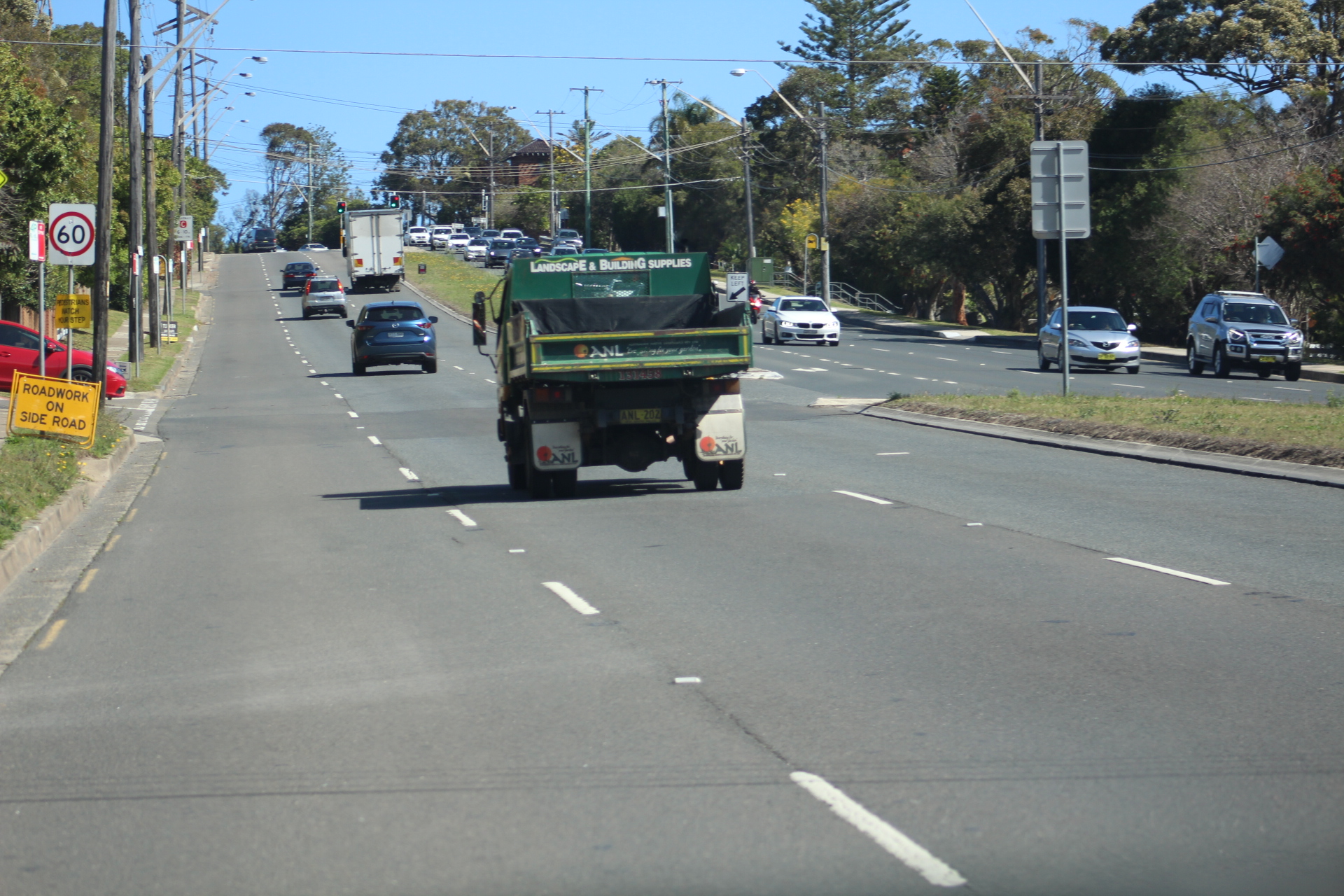
Bilgola
Named and known as Balgowlah, Cabbagetree, Dalley's, also known locally as Cranky Alice's Beach and Mad Mick's Hollow and Belgoula as well as Bilgola Beach. Earlier land maps named the place 'Bungan' head, just as what we now call Bungan was named 'Belgoula' and in a new Warringah Shire council version as 'Balgowla' head.
In 1832 Surveyor Larmer reported that, “The first person that squatted upon the land E of Stream [McMahon’s Creek, Bilgola Plateau and Newport] was Isaac Marsh then in the service of Jeremiah Bryant - he cleared part of the land on the West side of stream for Bryant and on the East side for himself. Michael Sullivan was also employed by Jeremiah Bryant to clear the land W of the Stream.”
Jeremiah Bryant was still living at “Belgoula” at the time of the 1841 census. He purchased 5 acres from Henderson on 2 October 1841 for £5, the same 5 acres being purchased by John Farrell II on 7 January 1848, also for £5. - Profiles of the Pioneers in Manly, Warringah and Pittwater. Page 10-11, Shelagh Champion OAM and George Champion OAM
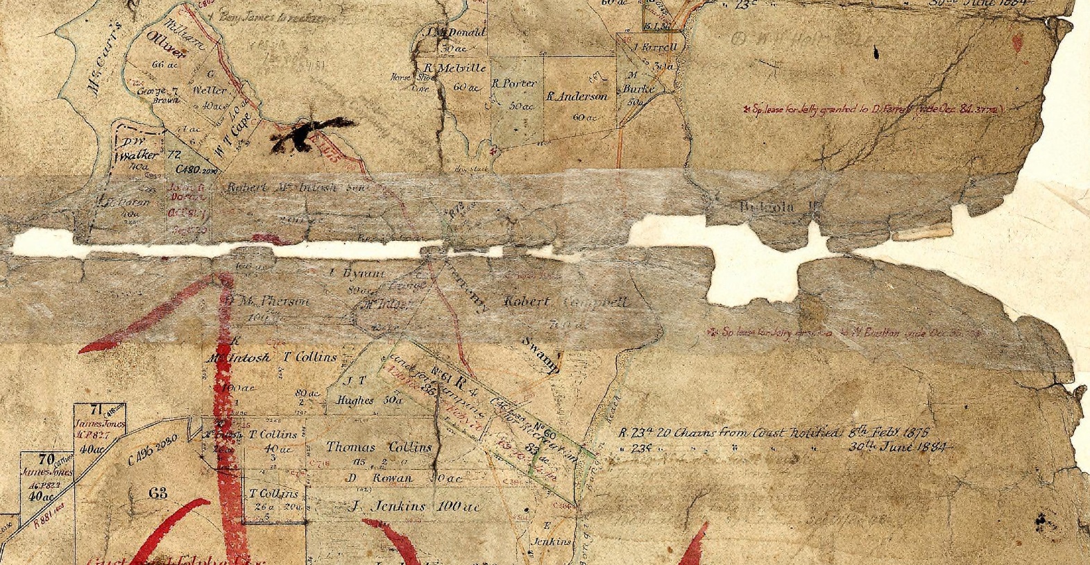
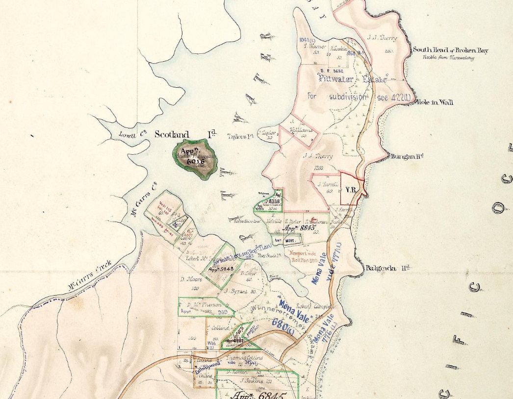
PITTWATER.
How this pleasant picturesque watering-place is advancing is well indicated by the opening of a telegraph station there the Saturday before Christmas, "Our bachelor" and myself in-tended to be present at the ceremony. We were prevented by the temporary suspension of the vehicular traffic between Manly and there, owing to the supply not being equal to the demand. The extra demand on that day from visitors to Newport and holiday parties taxed the resources of the Manly coach proprietors; but by the exercise of a little patience and with the loss of a little time all were accommodated. The road between the lagoon at Manly and Dee Why Lagoon has been stripped of many of its charms. Formerly it was like a woody winding lane odoriferous as a flower garden at dewy eve or early morn ; now it is tame and treeless, here and there shorn of most of its glory by bush vandals and land jobbers. There are four public-houses between Manly and Newport, two of which, I believe, have been built since the "unemployed" were set to work at French's Forest and Narrabeen. How the tenants and owners of the houses can make a living is a mystery. Perhaps their owners are far-seeing men, who have speculated in anticipation of the Pittwater tramway (the bill for which was lately passed) being constructed. When we arrived at Pittwater harbour the day was declining, but the gala remained in all its glitter. Mr. Cracknell, who performed the opening ceremony, had departed with some others for Sydney; but the notabilities of the locality were in no hurry to leave, having their gondolas at hand to convey them home. A few years have made a great change in Pittwater. The western shore of the harbour is all under cultivation. Fruit trees of all kind flourish there, and some vegetables can be produced a fortnight earlier than around Sydney. Fish is abundant in the harbour.
We assisted at three hauls of the net of our host, Mr. Bulfin. "Our bachelor" and another gentleman donned fishing garb for the occasion, put their shoulders to the wheel, or rather to the ropes, and towed very well indeed for amateurs. Our labours were attended with but moderate success. There is much inquiry for land in Pittwater now, the prospect of the tramway thither doubt-less stimulating it. Scotland Island, in the middle of the harbour, area about 150 acres, has been sold to a Melbourne company for £2,500. There is some speculation as to what they are going to do with it. The impression prevails that it is to be utilized for a marine public resort. It was also said down there that a well-known gentleman on the North Shore intends building a large marine hotel on the eastern shore of the harbour, between Stokes's Point and the new wharf. It is a very eligible site if trade could be commanded; but that, no doubt, would come to a well-conducted house. A place there would be easy of access from the harbour, the new wharf affording facilities for landing found nowhere else in the Pittwater peninsula. The largest excursion steamers can come alongside it in all weathers, there being a depth of over 18 feet at low water.
The romantic marine retreat of the late lamented Mr. Dalley on Cabbagetree beach, underlying Bilgola head on the Pacific shore, has been purchased by Mr. Jackson. Mr. J. M. Taylor, our bachelor (so designated from having obtained his B.A. degee as an evening student at the University the morning of our visit), was delighted with Pittwater. As a holiday retreat he would prefer it to the mountains principally because— "There is a society where none intrudes By the deep sea, and music in its roar." C. B. PITTWATER. (1889, January 12). Freeman's Journal (Sydney, NSW : 1850 - 1932), p. 17. Retrieved from http://nla.gov.au/nla.news-article115380870
DALEY'S BEACH.
'Bloore' writes in ecstatic holiday mood as follows: —
Where is Daley's Beach? you will ask. Let me tell you. It is but twenty miles from Sydney, our great city, where thousands are toiling in the shop, the office, and factory, and where the cars go slam-banging their way through the streets, discharging their human freight at every corner. Yes, twenty miles from Sydney; but so far as the outside world is concerned it may well be a thousand miles, for here I am loafing — that's it, just loafing— the time away under God's blue sky. Twenty gallons of sleep you can have each night in this paradise that is carved out between headlands that would challenge even the much-boomed Sydney Heads. Think of it! What sweeter lullaby than the old Pacific crooning its centuries-old refrain?
To lie on the beach and look up at the stars, to drink in the incense of the great grey gums that lie at the back o' me, to lave myself in Neptune's arms, and breast the white-crested combers that come spilling themselves on sands of gold. This is joy! Rave on, ye men of colder climes, of your meadows and lanes, where wild thyme, buttercups, and violets grow. Here in this Elysian vale will I show you all these things. Wild raspberries shall be yours for the plucking, and the cool mountain spring shall be your drink.' No vintage that ever lay in monastic cellar can set the veins afire as this old brew. Of fish you may have your choice, for the shelf upon which this sequestered nook lies teems with the denizens of the deep. You may angle with the rod from the rocks, or throw out your line from the beach. In any case it means but a cast of the line,' for as yet the fish are not troubled by the cheap tripper, and consequently are not so cute as the wily old bream that Manlyites see from the wharf each morning. And here, when the sun has kissed the trees, and little twinkling lights pop up on the distant hills that lie to the south, 'tis then, O my bell-toppered gentlemen, that I, stripped of all conventional garb, shall stretch myself, like Jack Senhouse, in the lush grass, green as the Emerald Isle itself.
A little beyond, the Barrenjoey light sends forth its rays. It is the last lighthouse the Sydney-bound steamer from the north will signal before reaching its destination. Below the light a brown-sailed ketch dips to the long Pacific swell. True, the steamer will be moored to its wharf hours before this picturesque craft sidles to its less pretentious anchorage; but what matter? He in his ketch and I on the beach are citizens of a Federal capital of our own, situated on the banks of the river 'Content.' It is the 'city of nothing matters.' His Majesty's mail and immaculately-clad passengers wishing to know 'What time will we reach port?' worry not this bronzed old salt; and for myself, the busy mart I have left may burn even as Rome burned, for I'm loafing— just gipsying, rusticating on Daley's Beach. Bricks and mortar I will have none of. Let me bask in this sensuous languor of body and will, and when my call comes let it be to the accompaniment of the lapping tide on Daley's Beach. OUTDOOR AUSTRALIA (1911, February 1). The Sydney Mail and New South Wales Advertiser (NSW : 1871 - 1912), p. 33. Retrieved from http://nla.gov.au/nla.news-article164298491
.jpg?timestamp=1537475492208)
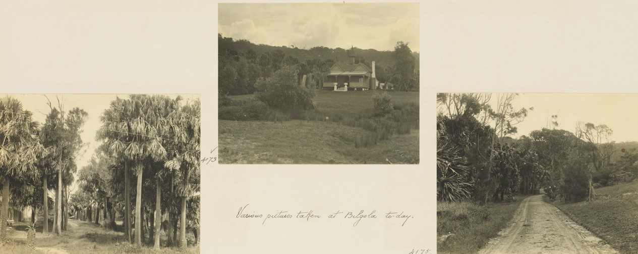
'On Balgowlah Beach or Dalleys', circa 1915. Image No.: d1_33119h, courtesy State Library of NSW
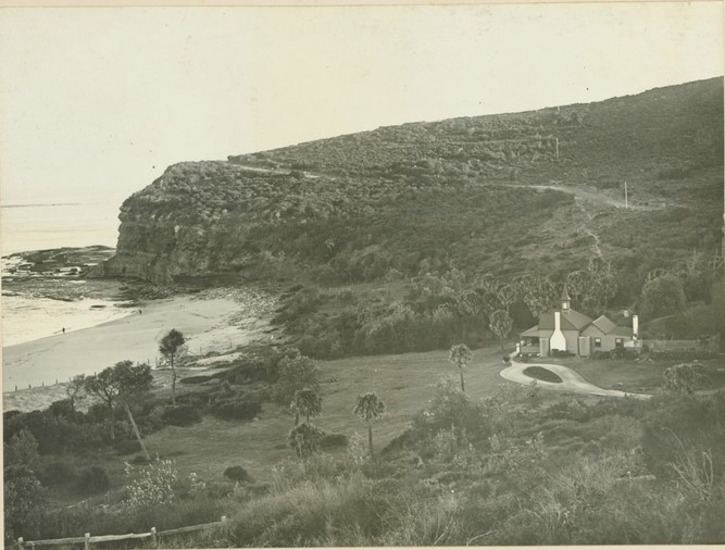
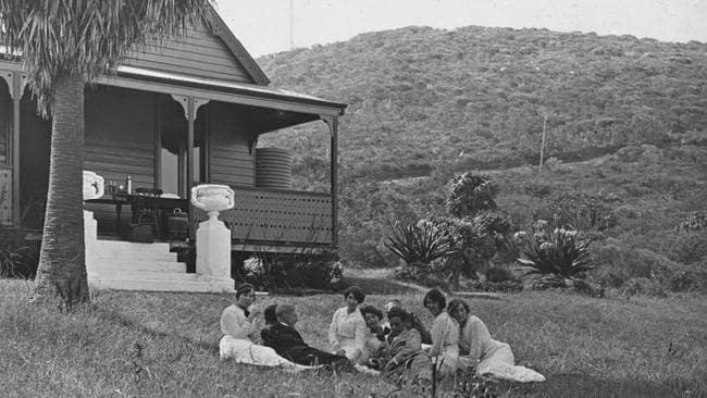
THE WATT DIVORCE CASE.
MORE EVIDENCE.
SYDNEY, Thursday.
In the divorce Court to-day additional evidence was taken in the suit in which Muriel Watt seeks dissolution of her marriage with Captain Watt on the grounds of misconduct with Miss Ivy Schilling, the well-known actress.
Mr Henry Jones, the owner of a house on the Barrenjoey-road, stated that Captain Watt was in the habit of visiting his place during the week-end with a party of five or six, occasionally Including Miss ' Schilling. Once Captain Watt and Miss Schilling un-expectedly arrived in a motor car at mid-night. They stayed the night, but he was absolutely certain they occupied rooms in both ends of the building. Witness saw Watt asleep in his room at 6 o'clock in the morning when he passed It on his way to the surf. His Honor Intimated that he will probably deliver Judgement tomorrow. THE WATT DIVORCE CASE. MORE EVIDENCE. (1913, June 27). Leader (Orange, NSW : 1899 - 1939), p. 3. Retrieved from http://nla.gov.au/nla.news-article100889934
WATT DIVORCE SUIT.
VISIT TO WEEK-END COTTAGE.
Mr. Justice Gordon, in the Sydney Divorce Court, on June-26, beard the conclusion of the evidence in a case in winch Muriel Maud Watt, formerly Williams, petitioned for the dissolution of her marriage with Walter Oswald Watt, on the ground of alleged misconduct.
The Court was asked by petitioner to find whether, her husband had been guilty with some woman or women unknown to petitioner at Sydney and Melbourne; and whether her husband had been guilty with a woman known as Ivy Schilling at Sydney, between December 18. 1911, and July 1, 1912, '
Henry Leddon Jones said that he lived at 'Palm Grove," on the Barrenjoey-road, near Newport. He formerly owned "Balgowlah," and the respondent purchased it from him in April last year. Witness lived there formerly, and used to let portion of the cottage to fishing parties.
Mr. Whitfield (for petitioner).-Did you ever see Mr. Watt there?
Witness.-Yes....WATT DIVORCE SUIT. (1913, July 5). The Australasian (Melbourne, Vic. : 1864 - 1946), p. 34. from http://nla.gov.au/nla.news-article143294016
No. 18,395. APPLICANT :—John Stevenson, Gladesville. LAND:—-County Cumberland, parish Narrabeen, shire Warringah, 26 acres 5 perches, on Bilgola Creek and road leading to road from Manly to Barrenjoey,—lot 19, and part lot 18, South Division, Pittwater Estate, and part 1200 acres (portion 20, parish), granted to John Joseph Therry; adjoining properties of W. J. Hollins, C. W. B. King, — Humphrey, and Crown Land. NOTICE UNDER REAL PROPERTY ACT. (1914, December 9). Government Gazette of the State of New South Wales (Sydney, NSW : 1901 - 2001), p. 7291. Retrieved from http://nla.gov.au/nla.news-article227425078
Article after article describes the path and then road through Bilgola Beach, whether during 1861 or several decades on. Then, as now, once people are at and through Bilgola, they consider themselves on the fast run to Palm Beach. The placement of the beach, and its increasing attraction as a little nook where people may camp described a need to shift the main flow of increasing traffic away from the dip down into Bilgola as the main thoroughfare and connection to Avalon. Apart from organisations applying to have permanent camps in the area, a shift towards keeping the 'Cabbagetree Vale' slightly apart, and the idea of the Bilgola Bends commenced with resumptions proposals to secure those camping and foreshore areas in 1925. Some examples of and the Notices:
Tents Beside the Sea
BABEL OF BROGUES Ex-Service Women's Camp
BILGOLA'S SURF AND BLACKBERRIES
THERE are fifteen of them — there will be forty of them — lasses from Lancashire, Yorkshire, Devonshire, Northamptonshire, Che-shire, and goodness knows how many other "shires" — camped on the bit of green grass that slopes down to the yellow sands of Bilgola Beach. Brogues and burrs float curiously on the Australian air. They are wood-nymphs and mermaids together these girls; it is difficult to discover where the dryad of the bush gives place to the rider of the sea.
Yet one moment "Smiler" — she was known all over France in the days of the war as "Smiler"— is pirouetting in a pair of sandshoes round a gum sapling, her white teeth stained purple with the juice of blackberries, and the next instant she is dashing into the surf, her long brown hair streaming in the wind. Smiler is one of the many W.A.A.C.'s — members of the ex-Service Women's Club — who are in camp at Bilgola Beach. For a fortnight they are for-getting that in their Australian jobs as domestic assistants there is such a thing as a 6 a.m. alarm clock to call attention to pots and pans, and brooms and dusters. The only alarm clock is the boom of the surf against the rocks, and the single frying-pan makes melodious music as it swings and bangs against the tree to which it is hung. There are four big roomy tents, and the campers are in charge of Miss Norah Dickson. There is no routine day; every girl plays round and enjoys herself as she wishes. Many of the girls never knew what surfing really was till they came to Sydney, and in camp they are living the days in their bathers, changing into the dresses of convention only for the evening meal.
These English girls are getting a good cloak of Australian tan, but in some cases it is a tan which survives only after a first coating of red. The woman's touch is evident throughout tho camp. Palm fronds and bunches of leaves decorate every tent, and the centre pole of the "dining-room" is hidden by masses of greenery, The table boasts a jam jar stuck with red gum tips, but no silver vase ever looked more beautiful. The spare boxes, which act as serveries, are covered with odd bits of muslin, and even the plank-upon-boxes, which serves for half-a-dozen chairs, is set square against the table. Dozens of dresses upon coat-hangers are the chief adornment of the "bedrooms," If you except the pieces of mirror tied on to the canvas. Femininity is also proclaimed by the many pairs of gloves, washed, and pinned up to dry on the outside of the canvas.
The kitchen is a place of mystery. Last year the Boy Scouts helped to build an earth oven — a mound like a small ant-hill, with a tunnel running up to it — and this year the oven only needed a little building up to be ready for action. All sorts of wonderful things happen round about that mound. The girls have had varied experience of field cookery, and it is marvellous what they can do with food. Bread was baked yesterday morning, because the baker forgot to call, and the most delicious cakes were turned out for afternoon tea. The principle of baking is an involved one, needing small tins, with lids and kerosene tins without lids, but the business of frying is much easier. The simplest method of all has the most appetising result, and naturally finds great favor with a troop of hungry girls. There is nothing to equal the flavor of chops or sausages cooked on sticks held over the fire, washed down with plenty of billy tea.
These English girls are rapidly acquiring a taste for campers' fare, and the breezes out-of-doors give zest to even the appetite inclined to flag. Since the girls went in camp their number has been increased by "Waac," who introduced himself the day of their arrival. The shaggy terrier has declared him-self delighted with the company and surroundings, and refuses to leave. Realising, no doubt, that he is the only man about the place, he has constituted himself Watchman-In-Chief, and guards towels, hats, and shoes with admirable patience. He has become the pet of the camp, and there are all sorts of arguments foreseen for the time when it comes to deciding who shall remain the guardian of "Waac."
The four white tents by the sea will flap their canvas until February 15, when for a fortnight many girls will have had their first taste of holiday camping. Some of them camped in France, but that was different. Miss Dickson says the second camp has been much more successful than the first, and the third — next year— is expected to eclipse everything that has happened this year. Tents Beside the Sea (1923, February 11). The Sun (Sydney, NSW : 1910 - 1954), p. 3 (WOMEN'S SUPPLEMENT). Retrieved from http://nla.gov.au/nla.news-article223464813
THE CALL OF THE OUT OF DOORS
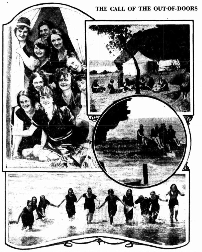
- Happy members of the ex-Service Women's Club enjoying Australian camp-life at Bilgola beach. The girls are all English, and sewed as W.A.A.C.S. during the war. THE CALL OF THE OUT- OF- DOORS (1923, February 11). The Sun (Sydney, NSW : 1910 - 1954), p. 3 (WOMEN'S SUPPLEMENT). Retrieved from http://nla.gov.au/nla.news-article223464816
WOMEN'S COLUMN.
SEASIDE CAMP.
On Sunday several members of the Country Women's Association, including Dame Alice Chisholm, Mesdames Hazlett, H. C. McIntyre, Kierie, Tindal, Arding Thomas, Osborne, E. Nyland, Fraser-Clark, Nest, Carpenter, Weaver, Chapman, Henderson, and Miss Warby Lugsdon, and many others representing the Cumberland branch, and the Manly and Mosman sub-branches of the association, paid a visit to the proposed site of the first seaside camp. Mr. W. B. Wearne, M.L.A. (Minister for Lands), also accompanied the party, as the area proposed belongs to the Crown. It is at Bilgola Bay, just north of Newport, and is one of the most beautiful situations Imaginable.
Mr. Wearne made the very generous offer of an area of about 30 acres, including the beach frontage, to the association. It was considered by some members that the site was too far from Sydney, but In view of the impossibility of getting a sufficient area nearer town, and the ideal character of the site, which would be reserved for all time for the benefit of the people out back, there was a general feeling that Mr. Wearne, offer should be accepted at once.
The Minister Invited the ladies present to attend at the Lands Department on Wednesday, at 2 p.m., when he would be in a position to Inform them if there were any other areas of Crown lands on the coast near Sydney which would be suitable for camp purposes. WOMEN'S COLUMN. SEASIDE CAMP. (1923, September 26). The Sydney Morning Herald (NSW : 1842 - 1954), p. 9. Retrieved from http://nla.gov.au/nla.news-article16095915
BILGOLA BEACH.
PROPOSED RESUMPTION OF FORESHORES.
Mr. Wearne (Minister for Lands) yesterday visited Bilgola Bay, north of Newport, and inspected a site which had been proposed as a seaside camp tor bush children. The Minister decided that the spot was too far distant from transport and other facilities, and that it was also unsuitable owing to the absence of life-saving apparatus. It was arranged that Dr. Arthur and Councillor Parr (Shire President) should confer regarding another site at Narrabeen.
The Shire Council asked the Minister to reserve the foreshores of Bilgola Bay and to reserve for park purposes the land be- tween the beach and the eastern side of the main road. It was estimated that the resumptions would cost about £8000.
Mr. Wearne said that the Government should not be expected to bear the cost of the resumption. He suggested that the Shire Council should approach the owners of the land on the western side of the road and endeavour to induce them to contribute one third of the cost. The Shire Council, he thought, should contribute one-third, and on those conditions the Government would consider providing the balance. BILGOLA BEACH. (1925, March 23). The Sydney Morning Herald (NSW : 1842 - 1954), p. 10. Retrieved from http://nla.gov.au/nla.news-article16196468
The former runs through scrub for a few miles, until Newport is reached. This is a fine surfing resort, and week-end pleasure homes are in evidence everywhere. Leading out of Newport towards Palm Beach, the road climbs the northern headland on a stiff grade, and provides a wonderful vista of sea and white beach from the peak. On the right a road runs to the cliff edge, where a stone structure, resembling somewhat a medieval castle, has been built. It stands on the highest point of the headland, directly facing the sea. A few more speedometer click and we dropped down into Bilgola Beach a snug little hollow, where the Palm Beach Pass begins. This pretty little spot, although on the sea-front, boasts a wealth of palm-trees and ferns of all descriptions with villas peeping through the foliage. From here the road runs on the ridge between the sea and the Hawkesbury River, but no glimpse of the former is obtained until Palm Beach is reached. The Palm Beach Pass has many twists and turns and palms grow in profusion along the cliff edges sloping down to the Hawkesbury River It should be very cool drive in the summer months, but on the Sunday in question was rather nippy. Palm Beach is about a quarter mile in extent, running from the Barrenjoey headland along the Hawkesbury River. It is separated from the Pacific' Ocean by a series of low sand dunes, the ocean beach running right to the foot of the high cliffs on which stands the mouth of the Hawkesbury River. Visitors are recommended to climb this headland... MOTOR CAR RAMBLES IN NEW SOUTH WALES. (1927, July 28). The Gundagai Independent and Pastoral, Agricultural and Mining Advocate (NSW : 1898 - 1928), p. 1. Retrieved from http://nla.gov.au/nla.news-article131004938
A line was installed on Bilgola but didn't prevent people getting caught in the 'Newport Express' - the rip that runs out at the south end of the beach to Newport:
"FAULTY LINE"
BILGOLA TRAGEDY DIED FOR DAUGHTER
THAT the life-line on Bilgola Beach, Newport, was knotted and in a useless condition on New Year's Day, when Stanley Edward Wallace, 39, was drowned, was stated by a witness at the Coroner's Court to-day.
The City Coroner, Mr. May, held an inquest on Wallace, who lost his life in a heroic attempt to save his daughter. The latter was rescued with difficulty. Constable Grant said the only appliance on the beach was a life-line supplied by Warringah council. The beach was considered safe for surfers. In returning a verdict of accidental death by drowning, the Coroner said those concerned in the rescue deserved great credit for their action, which was taken at great risk to themselves. Mr. May added that he did not intend to comment upon the condition of the life-line. The publicity given to the matter, however, might cause the authorities to tee that the line was kept in good order.
PRACTICE SUGGESTED
He suggested that life saving practice be introduced on Bilgola Beach, so that in case of trouble prompt assistance could be given. "No doubt," he declared, "many young men would be willing to indulge in life saving practice."
Phyllis Wallace, 14, daughter of deceased, told the Coroner that while she was swimming at Bilgola Beach on New Year's Day she was caught by the under-tow. "I called my father, who was on the beach," she said, "and he came to my assistance. We were parted, and I then saw another man swimming towards me. At that time I couldn't see my father, and didn't know what had become of him." Arthur P. Jacobs, electrical fitter, said he saw the line out and noticed three persons in trouble in the water. Witness and his brother went to the edge of the rocks where witness saw Miss Wallace in the water being assisted by a man.
DIVED TO RESCUE
Witness removed his clothing, dived into the water, and assisted Miss Wallace to the shore. After that he went to the assistance of the girl's father, who was then swimming well out from the shore. "I kept him up for some time," said witness, "and then he appeared to me to be dead. My brother came with the line, and we were all assisted ashore, where resuscitation methods were applied to Wallace without success. "Wallace was struggling when I reached him, and I dived for him. The first wave appeared to finish his last breath. "The life line was knotted and in a terrible condition. It should have been inspected before it was taken out." "FAULTY LINE" (1929, January 7). Evening News (Sydney, NSW : 1869 - 1931), p. 5. Retrieved from http://nla.gov.au/nla.news-article115694811
2 NEARLY DROWNED AT BILGOLA.
A.I.F. Man's Rescue Swim.
Two surfers were nearly drowned at Bilgola yesterday. An A.I.F. man rescued one and a wave washed the other on to a rock. There are no life-savers at Bilgola, but a belt and line are kept on the beach.
Norman Leslie Mobbs, 27, of Midson Road, Epping, and John Archer, 22, of Meadowbank, were swimming on the southern end of the beach when they were caught in the undertow. Mobbs lost consciousness and Archer supported him. Lance-corporal Brian Lloyd Badgery, of the A.I.F., who was one of a picnic party on the beach, saw their plight, donned the belt and, after a swim of nearly 200 yards, brought Mobbs in.
Mobbs appeared to be dead, but two doctors on the beach applied artificial resuscitation while the Newport Surf Club's boat brought round a gas cylinder. Later Mobbs revived and was taken by Manly Ambulance to the Manly Hospital.
After Mobbs had been rescued, Archer got into difficulties while trying to reach the beach and Mr. John Hillier, of Bilgola, donned the belt and went to his aid. Before he reached him, however, Archer was carried on to a rock. 2 NEARLY DROWNED AT BILGOLA. (1941, March 3). The Sydney Morning Herald (NSW : 1842 - 1954), p. 9. Retrieved from http://nla.gov.au/nla.news-article17728633
A change of the route which would avoid the 'dip into Bilgola' was begun with an announcement in 1926 after the preceding 1925 discussions:
SHIRE OF WARRINGAH.
Proposed Special Loan of £28,200.
NOTICE is hereby given that it is the intention of the Warringah Shire Council to apply for authority, under I section 180, Local Government Act, 1919, to borrow the sum of £28,200 for the purpose of carrying out the undermentioned works within A Riding of the Shire, and for purposes incidental thereto:—
1. Construction of Barrenjoey-road, from Seaview-parade, Newport to Beach-road, Palm Beach, including proposed deviations between Neptune-street and Avalon-parade, estimated cost (excluding cost of formation of deviations) ,— 17,600
2. Construction of Warriewood-road, from Pittwater-road to Vineyard-street, at estimated cost of 1,700
3. Construction of Powderworks-road; (a) from Pittwater-road to eastern end of Kobado-road; (b) Kobado-road, for its entire length; and (c) Powderworks-road, from the western end of Kobado-road to its junction with the Gordon-Mona Vale road, at estimated cost of 4,000
4. Construction of Gladstone-street, Newport, estimated cost 1,000
5. Drainage of Black Swamp Reserves, Mona Vale 1,900
6. Resumptions, surveys and contingencies .. 2,000
The interest payable on such loan shall not exceed six and half (6$) per cent, per annum, and it is proposed to arrange the loan on terms which shall provide for the repayment of principal and the payment of interest, combined, in half-yearly instalments extending over a period of ten years. The approximate amount of each such instalment will be £1,939 11s. 4d,
To provide the sum necessary for such instalments, it is proposed to levy a local loan rate of four-fifths of a penny (4/5ths d.) in the £ on the unimproved capital value of all ratable lands in A Riding of the Shire. Should such rate not provide sufficient for the purpose, the balance will be paid from the General Fund of the Shire. The total unimproved capital value of all ratable lands in A Siding is £3,005,162.
Plans, specifications and reports giving details of the proposal may be inspected at the Shire Hall, Brookvale, during office hours.
Within one month of the publication of this notice, any number, not less than 25 per cent, of the ratepayers of A Biding, may petition the Couneil to take a poll of ratepayers, either as to whether such ratepayers approve of the loan, or as to whether the loan rate should be on the unimproved capital value or the improved capital value, or on both questions. The number of ratepayers enrolled for A Biding is 3,892.
(N.B.—The foregoing proposal is in lieu of the proposal notified in the Government Gazette of 2nd October, 1925.)
R. G. JAMIESON, Shire Hall, Brookvale, Shire Clerk.
23rd November, 1925. SHIRE OF WARRINGAH. (1925, November 27). Government Gazette of the State of New South Wales (Sydney, NSW : 1901 - 2001), p. 5354. Retrieved from http://nla.gov.au/nla.news-article223017024
A few months on:
BARRENJOEY ROAD.
GREAT PLEASURE DRIVE.
The Minister for Local Government has approved of the Warringah Shire Council's application to borrow £28,200 for the reconstruction of roads and the drainage of public reservation reserves in A riding.
The principal work will be the tar-metalling of a length of 6 miles 11 chains of the Pittwater-road including 1 mile 46 chains of road deviation between Newport and Avalon. The main road from Manly to Newport is, it is understood, to be tar-metalled or concreted by the Main Roads Board. The council's proposal is to tar-metal from the end of the main road right through to the narrow neck of road between Palm Beach and Barrenjoey, thus creating what is regarded as an unrivalled pleasure drive.
The deviation of the road between Newport and Avalon is to be defrayed from an additional loan of £5800, which has also been approved. BARRENJOEY ROAD. (1926, April 29). The Sydney Morning Herald (NSW : 1842 - 1954), p. 8. Retrieved from http://nla.gov.au/nla.news-article16289112
£34,000 Road
Unrivalled Pleasure Drive
LOAN APPROVED
The Minister for Local Government has approved of the Warringah Shire's proposed loan of £34,000 for the road between Newport and Barrenjoey. The Commissioner for Local Government (Mr. L. G. Bucknell) reports that the scheme will ensure an excellent length of road to. Barrenjoey, one that will be without rival as a pleasure drive. Deviations will be made to avoid the steep grades between Newport and Avalon. £34,000 ROAD (1926, April 28). The Sun (Sydney, NSW : 1910 - 1954), p. 10 (FINAL EXTRA). Retrieved from http://nla.gov.au/nla.news-article224206660
A few months after this July 1926 Avalon Beach Estates article has some information about the projected completion of the 'bends' while the Lithographs to go with shows the road. One section of these have been enlarged to show the road names:
New Road in a few Months
£34,000 is to be spent immediately on the construction of a new road from Newport to Palm Beach. This road passes right through the centre of Avalon Beach. Avalon Beach, linking Avalon Beach directly with Manly and the City.
This new road is to be completed during the coming Summer season. The run-only one hour from the heart of the City— will be one of the most fascinating in New South Wales. Sites that you can buy now for a few pounds per foot should advance to double their value when this road is completed--before next Christmas.
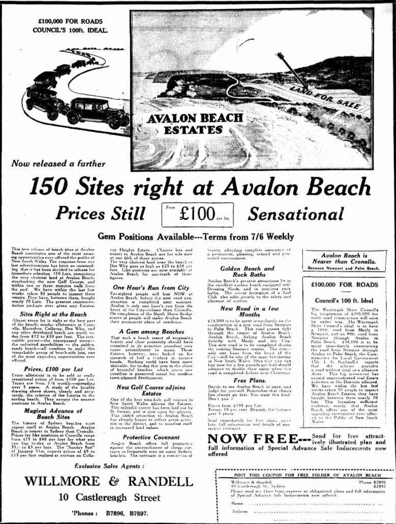
Advertising (1926, July 25). The Sun (Sydney, NSW : 1910 - 1954), p. 17 (CRICKET STUMPS). Retrieved from http://nla.gov.au/nla.news-article222723559
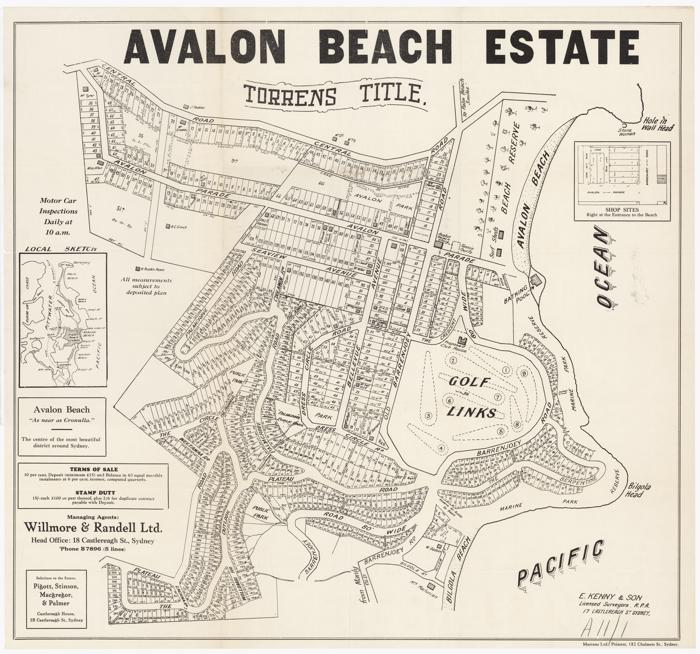
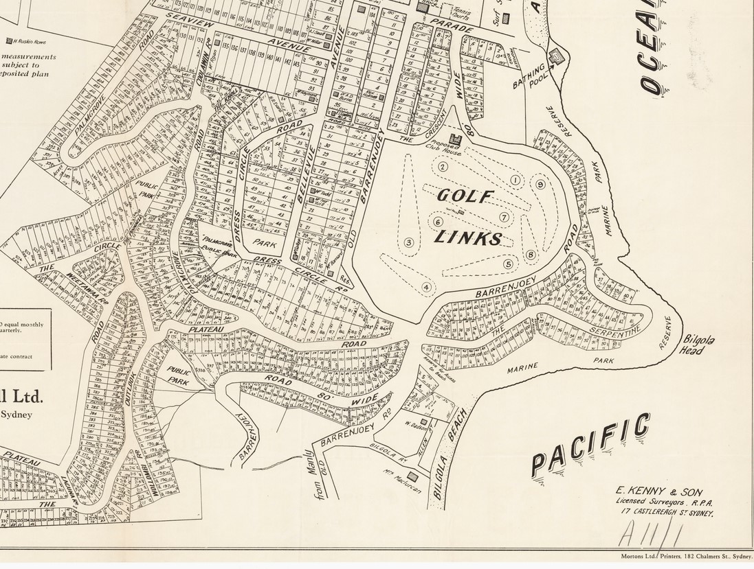
Avalon Beach Estates 1926 Image No. c027560001h, from Avalon Subdivision Maps, courtesy State Library of NSW - this shows 'Old Barrenjoey Road heading down into Bilgola Beach.
More 'news' courtesy of the Real Estate section:
REAL ESTATE
DEVELOPING NORTHERN BEACHES
NEW SUBURBS ACROSS THE HARBOR THREE NEW FACTORS WHICH WILL HELP
Lack of an unbroken path from the city to beyond Manly has retarded the development of— the beaches on the Barrenjuey peninsula. This Is due to the fact that there are vast suburban areas on the north side of the Harbor barely scratched by development and, consequently, the majority of Sydney's citizens are congregated on the south side. Naturally, they patronise the beaches nearest home; few cross the harbor to swim and surf. This aspect will be changed by the growing North Shore bridge, whose steel link, should create an enormous new population whose surf benches will be Newport, Avalon, Whale Beach, and Palm Beach. Co-ordinating with this work, the Warringah Shire Council is straining every effort to have the road from Manly to Newport constructed in a permanent manner, either of concrete or of something equally durable, and plans to improve the existing road from Newport to Palm Beach up to Main Roads Board standard. A start is already being made, for a deviation is to circle the ugly hill which divides Newport from Avalon, and surveyors are now studying contours and levels on the Avalon side. This deviation will do more than cut out a bad-surfaced route with a nasty grade. It will Improve the road to the north by adding new scenic vistas, for the route will curve around the hill towards the ocean, skirt the bluff, and, before it rejoins the existing road, pass between the golf course and sea, and run the length of Avalon behind the reserves.
Better roads, naturally, lead to Improved transport facilities, and, now they are assured that their 'buses will not be shaken to pieces by a succession of pot-holes, proprietors of the 'bus companies who have been serving this district have amalgamated Into one big, company which plans to put new and better 'buses on the run. Soon after Christmas, they anticipate, they will have at least 20 'buses serving the district between Manly and Palm Beach. This, normally, should mean Increased tourist traffic and quicker residential development — which will, In turn, demand still more 'buses.
These aids should help the northern beaches to a quick move forward. Palm Beach has long been popular with the class who own motor cars, and now attention is being paid to Avalon, which is closer to the city, and, yet quite as attractive in Its less spectacular way. Here the land flows gently in the beach Instead of rising to the sudden heights which (is) rampart at Palm Beach, and, as a result, offers easy building conditions and proximity to the surf. Hundreds of motor-owners now make it a week-end resort, and many are lured by the interesting golf course, with its novel holes. Land Is now being sold here, adjoining the golf course, fronting the new main road, and on the gentle slopes overlooking the beach. Many very fine sites are available in the Avalon Estates, despite the speed with which they are being bought. The inauguration of the better 'bus services and the completion of the deviation should undoubtedly add to the beach's popularity, and, at the same time, to values In the vicinity. REAL ESTATE (1926, October 29). The Sun (Sydney, NSW : 1910 - 1954), p. 15 (FINAL EXTRA). Retrieved from http://nla.gov.au/nla.news-article224122137
An aerial photo (and enlarged section)from early in 1927 shows the roads and that going up to Bilgola Plateau:
ONE OF THE MOST SUPERB COASTAL VIEWS IN THE WORLD.
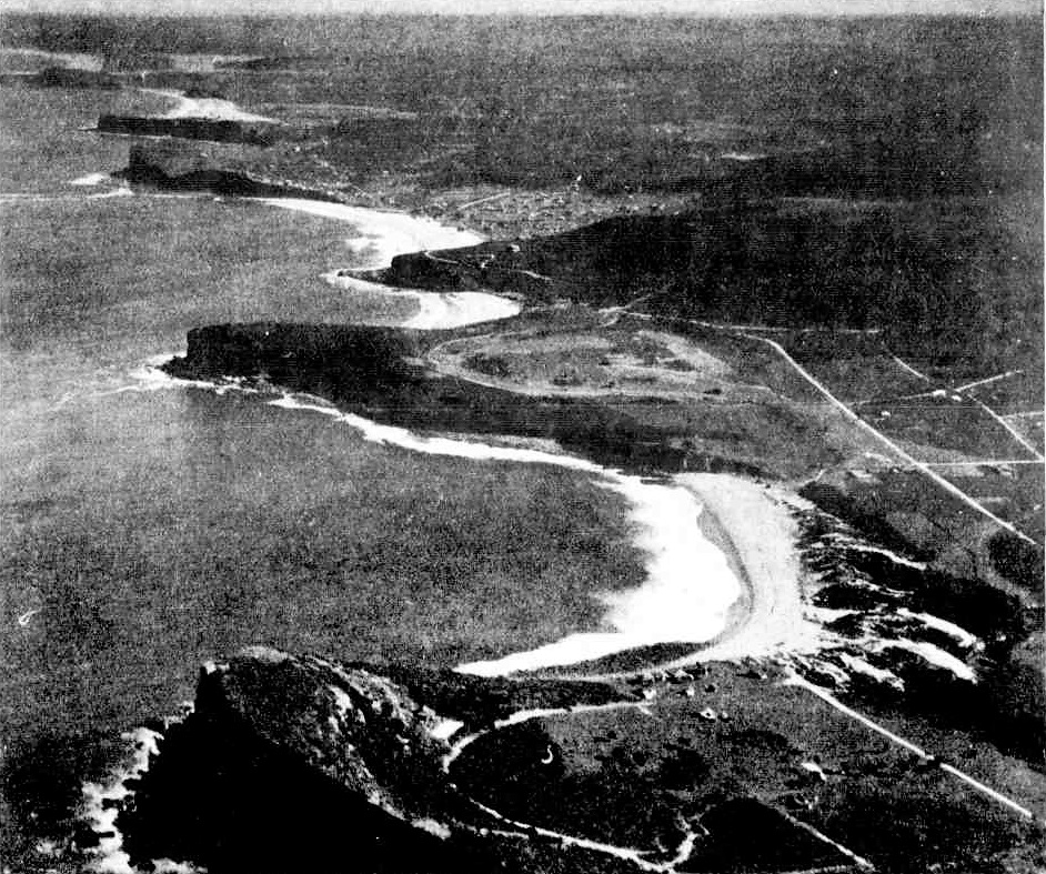
.jpg?timestamp=1539394735101)
Travelling along the road from Manly to Barrenjoey one sees a succession of magnificent views, which world travellers declare are unsurpassed in any part of the globe. This favoured area forms part of the Warringah Shire. In the foreground of the picture is Avalon Beach. Our Glorious Beaches: Some Carnival Snapshots (1927, February 2). Sydney Mail (NSW : 1912 - 1938), p. 11. Retrieved from http://nla.gov.au/nla.news-article169144794
My dad met my mum at 'Wharfdale' which was next door to where the Melvey Victor Richardson place is. Wharfdale was owned by Frank Keighly, (a founder of Bradford Cotton Mills; they used to have a lot of the property there. Dad was a stonemason. He used to be allotted rights at Manly Wharf, he had a truck; the materials used to come across on the punt. They had the old hard tyre reos; they went to the opening of the Harbour Bridge on those; on Bottle’s Buses; Bertie; these were hard rubbered old Internationals; Federals; we used to have to get out and push them up at Bilgola Beach, that was the road then (now called the Serpentine), no Bilgola Bends. The road used to go along through where Avalon public school is up the hill and straight across; there was no Barrenjoey road yet. So it went straight across to the hill and down into Bilgola.
Bottle's Buses, 1920's, courtesy Mr Philip Lipscombe.
... it was a beautiful area to live. What I hated was when they built Roseville bridge and they brought all the fill and all the crap in it and dumped it at Bilgola Bends which spoilt that whole area. You used to be able to drive around Bilgola Bends and look out over the lovely scenery and they dumped that there at the south end of it, they were going to widen Bilgola Bends, and nothing ever happened. And now we’ve got all that crap that’s there; it’s environmentally just bad I reckon.
Apart from that land filling exercise, there was also:
The society decided to unite with other bodies in a protest to the Government regarding the Main Roads Board's use of a section of a tourist road near Bilgola Beach, as a quarry. WILD LIFE. (1934, November 28). The Sydney Morning Herald (NSW : 1842 - 1954), p. 14. Retrieved from http://nla.gov.au/nla.news-article17133917
NARRABEEN LAKES. Protest Against Shell-dredging Scheme.
The Parks and Playgrounds Movement decided yesterday to co-operate with other public bodies in a deputation to the Minister for Local Government to protest against the granting of a lease by the Mines Department to a public company for the dredging of Narrabeen Lakes. Mr. A. J. Small (chairman) said that the company proposed to obtain shells for lime-stone. The dredging of the lakes for this purpose would be detrimental to the surroundings. At present the water in the lakes was shallow and safe for children and non-swimmers, but if the dredging was allowed a dangerous channel, 20 feet deep, would be created down the centre of the main lake. The waters would be stirred up, big holes would be created, and the beauty of Narrabeen Lakes would be spoilt.
The meeting also decided to protest against the action of the Main Roads Department in establishing a quarry on the hillside of Bilgoela Beach. The road from Sydney to Palm Beach, it was stated, was the most beautiful coast drive in the State, and the establishment of the quarry at Bilgoela ruined a delightful vista. The whole of the hillside over-looking the beach was being devastated.
The Main Roads Department, it was stated, was usually very helpful in preserving natural surroundings, but on this occasion no thought or consideration had been given to the question of town planning. NARRABEEN LAKES. (1934, December 6). The Sydney Morning Herald (NSW : 1842 - 1954), p. 15. Retrieved from http://nla.gov.au/nla.news-article28021345
From the then department of Main Roads annual report of 1934-1935, page 13:
(c) Main Road No. 164 - Barrenjoey Road.)
The Department commenced by day labour the reconstruction of Barrenjoey-road northward from the end of the existing cement concrete pavement at Narrabeen. The work involves the improvement of alignment by deviations, regrading and widening. Wherever the condition and levels of the existing pavement are suitable it is being utilised as a base-course for the new drag-spread macadam wearing course, but where the old pavement cannot be adopted, a ballast base-course is laid with an intermediate course of premixed material using hard local sandstone as the aggregate. Realignment involving resumptions has been undertaken at Sheepstation Hill (between Narrabeen and Mona Vale), near Mona Vale at " La Corniche " corner at Bassett-street and north of Grandview-parade on the " 11-mile " hill. A further deviation is in hand adjacent to the Avenue, Newport. For the supply of the stone required for the reconstruction a quarry has been opened at Bilgola.
QUARRY AT BILGOLA
An attack on the Main Roads Board was made by Mr. Small, vice-president of the Parks and Playgrounds Movement of N.S.W., at the general meeting yesterday, following the Board's establishment of a quarry at Bilgola, which, he contended, destroyed the beauty of a spot unique in the State. It was decided to bring the matter before the Premier and urge him to exercise his Influence to have the project stopped. QUARRY AT BILGOLA (1935, May 11). The Labor Daily (Sydney, NSW : 1924 - 1938), p. 14. Retrieved from http://nla.gov.au/nla.news-article236506318
The Premier didn't have that much influence and was unable to interfere in the works of the Department of Main Roads or its Board.
Mr. Small, Tom and his family weren't the only ones to lament what was being lost, as early as 1926, when it had become apparent the motor car boom was causing the destruction of the areas people ran to, most visibly in the taking of masses of wildflowers, the rise and rise of buildings and a perception that some were placed where they should never have been allowed to be, became a feature point for frequent visitors to Pittwater:
PALM BEACH
PROPOSED RESUMPTIONS
Mr. F. M. Rothery writes: —
I shall feel obliged If you will kindly afford me space in your columns for this letter, the subject of which is one affecting the public welfare, and will, I feel sure, meet with your sympathy as a citizen of Sydney. I have recently been a visitor to Palm Beach for the first time, and was struck with its loveliness. Its beauty is so charming in its reality that no words of mine can adequately express my feelings when I viewed what Nature had provided for the enjoyment of our people. There, between two prominent headlands, that stand like sentinels over this picturesque spot, on one of which stands the Barrenjoey Lighthouse, is the beautiful crescent-shaped Palm Beach, sheltered from all boisterous winds, and affording every facility for the pleasure of surfers. This beach is said by surveyors, who know the coast thoroughly, to be the most beautiful locality of any from Twofold Bay to Cape York. Being the last of our beaches, it is of primary importance that its charming surroundings should be protected from the hands of vandals, some of whom, having land there, have already begun to show their evil propensities for defacing the beauties of Nature by laying low with the axe and tree-devil ti- trees, acknowledged to be the finest In Australia, some with a measurement of 10ft. in circumference, real old monarchs of the bush, probably over a hundred years old.
To carry out my views of reform (and I am not alone in this matter), I would suggest that the area of land contained in the 16 blocks between Florida-road, Beach-road, and Ocean-road be resumed by the Government as a park for the people of New South Wales, and I Understand that the majority of landowners of Palm Beach are quite prepared to pay interest to the Government on the cost of resumption. Unfortunately, there are some property-owners at Palm Beach who say, "Oh, why bother; leave things as they are." But these people are in the minority, and are looking backward Instead of forward. The approximate value of such resumption would be about £5000. .These figures were obtained by me from one who has known Palm Beach thoroughly for the past five years, and who has valued thousands of acres for resumption for the State Government. Palm Beach, which will undoubtedly be the beach of the future, has many attractions. Its excellent surf, its palm grove, its recently discovered blacks' carvings, its landscapes, its beautifully colored stones, marked us clearly as If painted by the hand of man,' &c., &c. Perhaps affairs might be quickened in the matter if members of the Government were invited to Palm Beach, and see for themselves the advisability-of the proposed resumption ere It is too late. The reason this land has not been built upon to date is that the storm water has been diverted by one of the residents, and now lie's over the area proposed to be resumed, and it would cost a considerable sum to direct this water' into its proper channel. In the event of this resumption being effected, it would be necessary to provide a caretaker (say a wounded Anzac), and the park placed under the control of local, trustees. PALM BEACH (1920, January 17). The Sun (Sydney, NSW : 1910 - 1954), p. 5 (CABLE EDITION). Retrieved from http://nla.gov.au/nla.news-article221386292
OUR BEACHES.
And Their Backgrounds.
(BY AMY ELEANOR MACK).
During the past few weeks I have been living in a world of beaches-broad, clean, white beaches, green-flanked, with grassy headlands running out into the sea at either end. At high water the waves wash the feet of the headlands, but when the tide is out it leaves uncovered smooth terrace's of flat brown rocks which tempt one to walk for miles along the shore.
There is a fascination about those South Coast beaches quite different from those of Sydney-the unexpected charm of smooth, green grass growing right to the water's edge, and of standing crops ripening In the rich soil Just beyond the high water mark. But perhapsthe greatest joy to the Sydenysider is the open spaces beside the beaches, the absence of cramping habitations pushing their way on to the sands, a sight with which we are all too familiar in most of our popular Sydney seaside resorts. In this district, whenever the road approaches tho sea, there is nothing but a stretch of green sward to separate it from the ocean, and no ugly buildings to shut out the view from the traveller. One feels here that the beaches are for all to enjoy, that they are in reality the national playing places, free to rich and poor alike, a thing which cannot truthfully be said of the beaches immediately north and south of Sydney.
This South Coast district is one of the oldest settled parts of New South Wales. For generations the same families-some of them with names Illustrious In our history-have been cultivating the soil, and adding to the wealth of the country, but seldom have they encroached upon the shores of the ocean, it seems to have been an accepted, if unspoken tradition, that the beaches belonged to all, and must be left free for-all. The delightful result is that, so far as I have seen, every beach has its background of paddocks or bush, where picnickers can rest in comfort after their struggles with the surf.
A COMPARISON.
How different it Is on the popular beaches near Sydney. Comparisons may be in bad taste, but surely there are times when they are inevitable, and after a month's enjoyment of the freedom of these South Coast watering places it is impossible not to com-pare them with the limitations of such resorts as Collaroy and Narrabeen, so much more lately settled, and already so much more cramped and crowded. There, houses have been built, and are still being built, right at the very edge of the beach, with back yards extending almost to high water mark, cutting off all possibility of a walk along the sea front.
Most of us can remember when the drive to Pittwater was a sheer joy, with the road running for miles within view of the ocean; then losing itself in deep bush. Now, for the whole long stretch from the Deewhy lagoon to Narrabeen Lakes the ocean is hidden by rows of shops and houses, with just irritating glimpses of the water flashing into view at the ends of the streets. By the shortsighted policy which has allowed the erection of buildings on the narrow strip of land between the road and the beachwe have lost the opportunity of a wonderful marine drive that would have been as great an attraction to tourists as the famous drive at Capetown. If it had been our only beauty spot, no doubt it would have been jealously preserved, but because Sydney is blessed more than any other city with a prodigality of loveliness we have been careless, and bit by bit, have let it slip away from us.
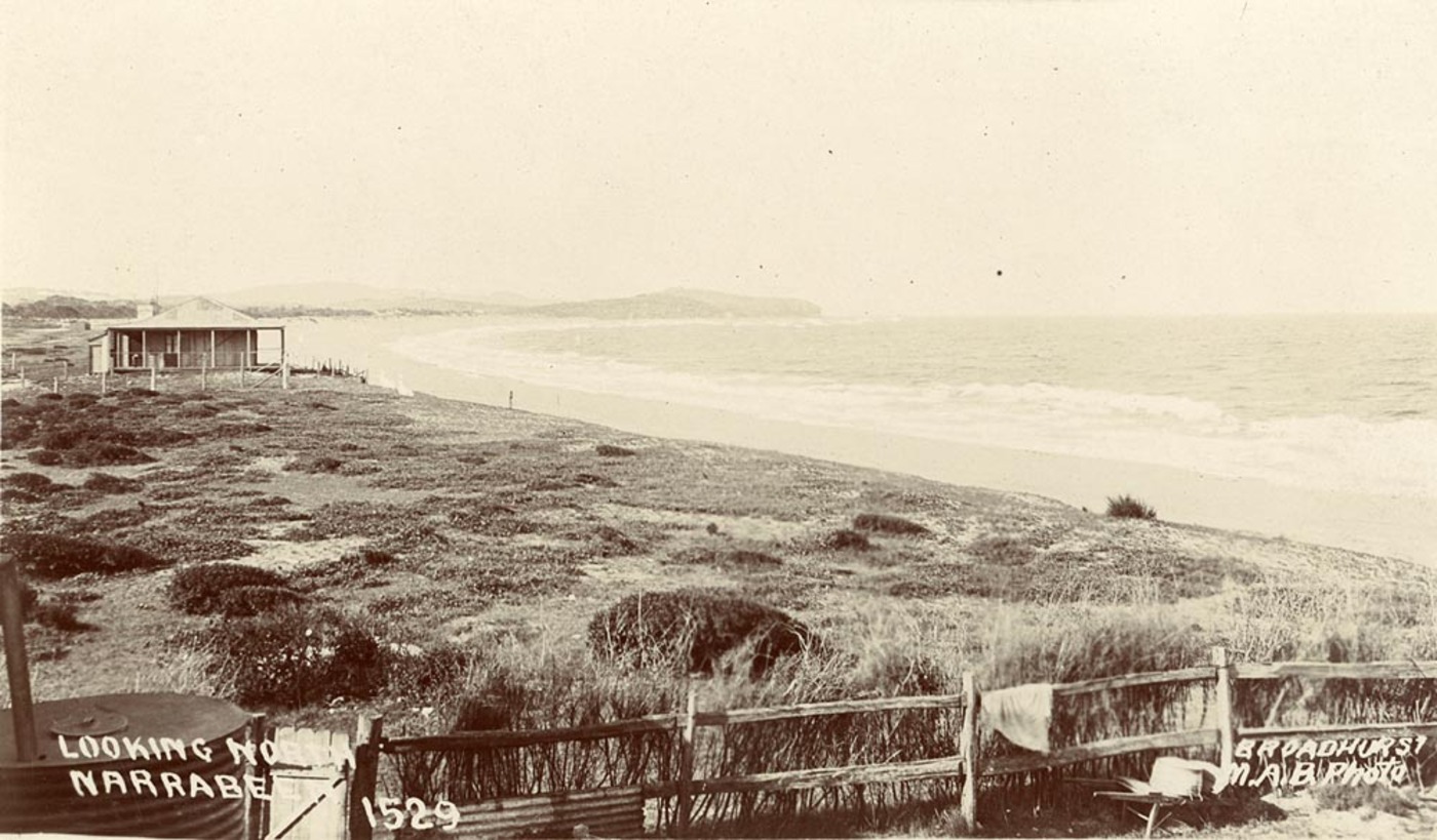
Looking north to Narrabeen, From Scenes of Narrabeen album, circa. 1900-1927 Sydney & Ashfield : Broadhurst Post Card, Images No.: a106058h and below; a105160h courtesy State Library of NSW
In large residential places like Manly, Bondi, and Coogee, "improvements" were doubtless to be expected, and it was Inevitable that sea walls, bandstands, and canvas chairs should take the place of grass and trees and naked rocks. But surely the further beaches might have been preserved in a little of their natural beauty for the enjoyment of generations to come. And there is still time to save a good deal. The work of spoliation is going on day by day, but if, an ordinance could be passed to prohibit building between the roadway and the sea in all those places where the road runs close to the water, much loveliness would be retained, and the future millions of Sydney would not he forced to travel long distances to find pleasant playing places. But action will have to be taken quickly. With motor cars wiping out distance, there will soon not be one unspoiled beach between Botany Bay and the Hawkesbury. From Manly to Narrabeen the mischief Is done, and when with the awakened civic pride which must surely come sooner or later, and the people demand the restoration of their natural heritage, it will cost no small fortune to resume the land that has been so heedlessly alienated. North of Narrabeen there is still time-but only just time-to stop the work of desecration. At Newport, Bilgola, Avalon, and Whale Beach, the houses between the road and sea are still only "single spies," and immediate action could prevent the arrival of the whole battalions.
At Palm Beach-loveliest of all our seaside places-the work goes on with fatal quickness, and a few weeks ago I was horrified to find that the tine old banksias which made such refreshing shade at the back of the beach were being destroyed, and the spot which most people had regarded as a reserve was being prepared for building. When those areas are gone there will be no shade for holiday-makers, and nothing more than a narrow strip of sunbaked grass between the garden fences and the beach. ... OUR BEACHES. (1926, March 20). The Sydney Morning Herald (NSW : 1842 - 1954), p. 13. Retrieved from http://nla.gov.au/nla.news-article16264079
That 'shortsighted policy' was and remains the brunt of so much misery for owners of homes on that Collaroy to Narrabeen stretch every time a storm typical of many a season, especially Winter, comes in. By many markers, the definition of insanity is doing the same thing over and over again and expecting a different result.** This generation, too, seems doomed to repeat the mistakes on their forefathers rather than rip the band-aid off.
Barrenjoey Road going around Bilgola, creating the 'Bilgola Bends' took more than a few years to complete from excavations, filling some sections to make a level path (as per Tom) and sealing that road as well as putting in place a fence to guard against vehicles running off that road and down the embankments:
MOTOR ACCIDENTS.
Car Over Embankment.
MAN CRITICALLY HURT.
Mr. Henry Hunt. 59, of "Avon" Station, Coonamble, suffered a fractured spine when a motor car went off the road above Bilgola Beach yesterday. Mr. Hunt, who Is 59 years of age, is in a critical condition. Driven by Mr Sidney Bennett, of Emmett-street, Crow's Nest, the car was travelling along Pittwater-road in the direction of Manly. The road above Bilgola is cut round the side of hills which slope down 300 feet or more to a gully leading to the beach. As Bennett passed another car the hub of one engaged with the wheel of the other. The steering wheel was wrenched from Bennett's grasp, and, out of control, the car dashed over the unfenced edge of the road and commenced to run down the steeply-sloping hill.
When just over the edge, the machine hit an obstacle and somersaulted, throwing the Ave occupants out in all directions Hunt was flung against a tree about 12 yards from the edge, and the car, turning over, pinned him down. The machine was arrested by the tree against which it leaned, upside down, and completely wrecked The other occupants of the car had rolled about 100 feet down the scrub and rock-covered hillside.
Passing motorists, and a police constable from Narrabeen, who reached the spot just at this time, removed Hunt from beneath the car and assisted the others to the roadway. Manly Ambulance took them to Manly Cottage Hospital. Hunt and Doris Bennett, 36 years, of Emmett-street, Crow's Nest, who suffered severe abrasions, were admitted. Nancy Knapman of Edar-street, Bankstown, was treated for shock. The other two were treated for minor injuries. MOTOR ACCIDENTS. (1930, February 17). The Sydney Morning Herald (NSW : 1842 - 1954), p. 12. Retrieved from http://nla.gov.au/nla.news-article16626553
By mid 1930 the first works were done and proclaimed done through recognition of the extension to a main road- an item listed in Warringah Shire Council records and the Proclamation
18. Main Roads Board. 16/7/28. Advising that the length of Barrenjoey Road which is proposed to be proclaimed a main road is that extending from Newport to the end of the last at deviation at Avalon. Resolved: (Crs. Hitchcock, Atkins) - That an application be made to have the whole length of Barrenjoey Road proclaimed a main road.
MAIN ROADS ACT, 1924-1929.
PROCLAMATION.
(l.s.)
PHILIP GAME,
Governor.
I Sir Philip Woolcott Game, Governor of the State of New South Wales, with the advice of the Executive Council, and in pursuance of the provisions of section 8 of the Main Roads Act, 1924-1929, do hereby repeal the proclamation of Main Road No. 164 published in Government Gazette No. 37 of 15th March, 1929, and proclaim the road numbered and described in the Schedule hereto as a Main Road.
Signed and sealed at Sydney, this fifth day of August, 1930.
By His Excellency's Command,
MICHAEL F. BRUXNER.
GOD SAVE THE KING!
Schedule.
No. 164. From the intersection of the Great Northern Highway (Main Road No. 9), Lane Gove road and Mount-street, North Sydney, via Miller-street (with branch from Great Northern Highway, via Falcon-street to Miller-street), and Falcon-street, Merlin-street, Military-road (with branch from Merlin-street easterly and northerly via Falcon-street and Laycock-street to Military-road), Spit-road, Upper Spit road, Spit Bridge, Sydney-road, Condamine-street, Pittwater-road, Barrenjoey-road and Avalon-parade to the intersection of Avalon-parade and Old Barrenjoey-road. MAIN ROADS ACT, 1924-1929. (1930, August 22). Government Gazette of the State of New South Wales (Sydney, NSW : 1901 - 2001), p. 3347. Retrieved from http://nla.gov.au/nla.news-article223076515
BARRENJOEY PENINSULA ADVANCEMENT LEAGUE
A Year of Progress
Little over twelve months ago the Barrenjoey Peninsula Advancement League was formed. In this short period it is able to record excellent progress in several directions. The President, Mr. Arthur J. Small, in this, its first annual report, says: "It seems that one of the principal functions of the League will be to wage a constant fight against the destruction of beauty or acts of vandalism in a district which nature has so richly endowed with physical charms." During the year considerable development has taken place in the Warringah Shire, particularly in the Barrenjoey Peninsula. Thus, electricity is now available throughout and the extension of the city water supply as far as Palm Beach is also projected during the coming year. The vital factor of transport has also been greatly improved by the establishment under Government auspices of a cheap and efficient diesel-engined bus service plying between Manly and Palm Beach.
To provide stone for the re-making of the road between Narrabeen and Palm Beach the Department of Main Roads, with the concurrence of the Warringah Shire Council, opened up a quarry on the Barrenjoey Road, near Bilgola Beach, the position chosen being situated amidst probably the finest roadside scenery in the Barrenjoey Peninsula, and despite strong protest and public condemnation, the work was continued. Such a disregard of the amenities of the situation is rare, but unfortunately reflects on the aesthetic sense of the whole community in the eyes of tourists and overseas visitors in whose country such scenery would be treated as a priceless asset, to be preserved at all costs. The damage has now been done, but it is hoped that the rest of the State, owing to the public outcry in this instance, will be saved from similar regrettable blunders. Mr. Archdale Parkhill, M.H.R., is Patron of the League; Mr. A. J. Small has been re-elected President, while the Vice-Presidents include the Right Hon. W. M. Hughes, P.C., M.H.R.; Mr. Creswell O'Reilly; Mr. Dan Carroll; Mr. John Downes; Mr. Percy Hunter; Mr. H. Ruskin Rowe, F.R.A I A and Mr. E. Lloyd Sanders, M.L.A. BARRENJOEY PENINSULA ADVANCEMENT LEAGUE (1936, January 2). Construction and Real Estate Journal (Sydney, NSW : 1930 - 1938), p. 3. Retrieved from http://nla.gov.au/nla.news-article222917904
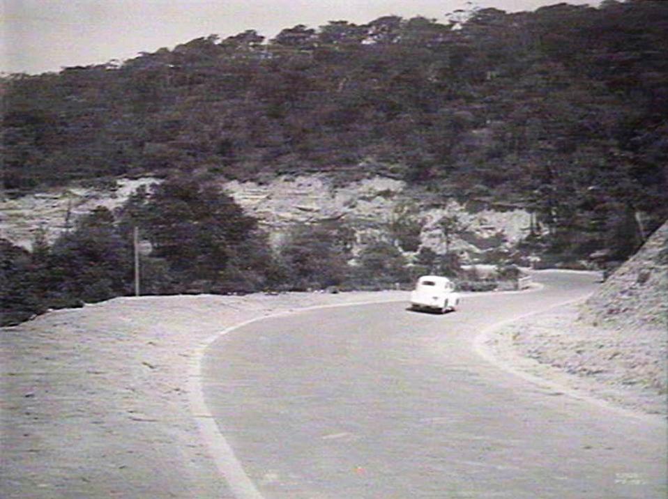
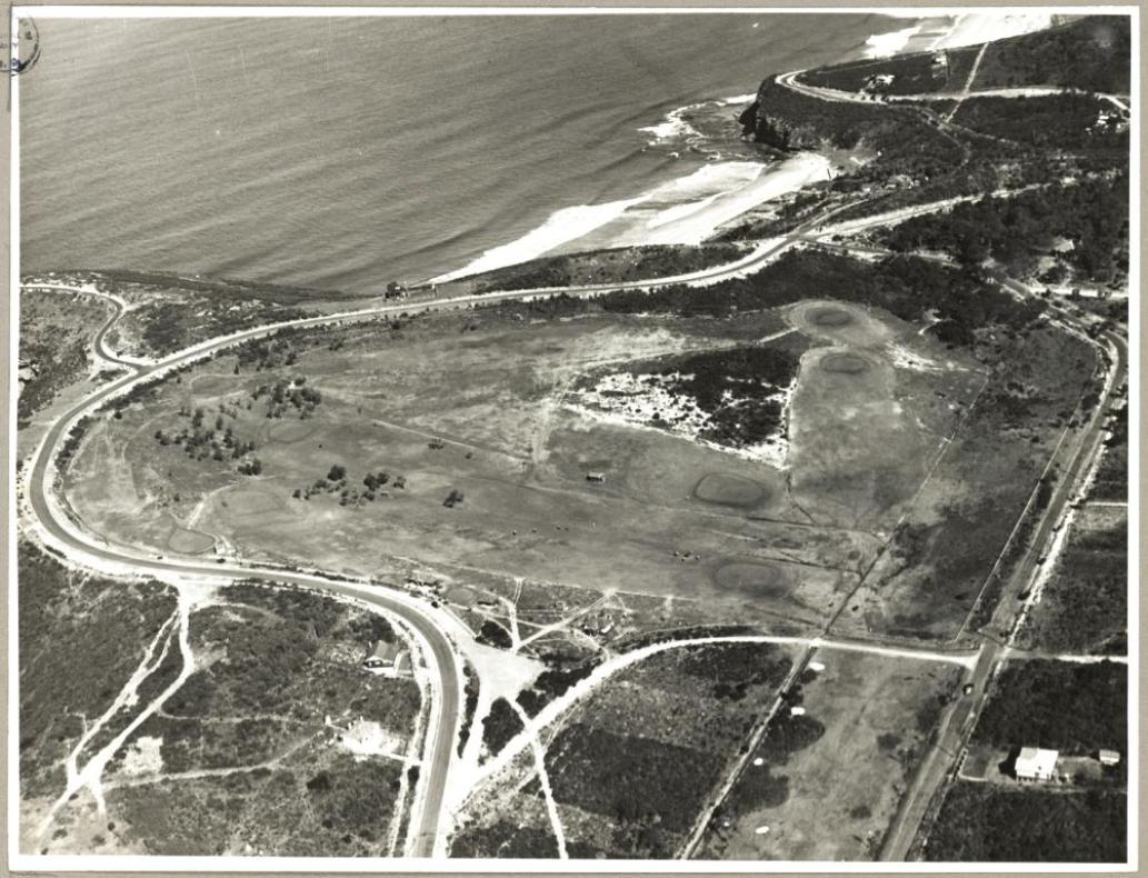
A 1937 article, Roads of To-Day— Tales of Yesterday, describes the route many still preferred to take - for the views;
...THE road from Newport climbs steeply up a head-land and runs along the cliff-face, to dip down again towards the beautiful little Bilgola Beach. The Right Hon. W. B. Dalley (the first Australian to become a Privy Councillor) used the beach as a week-end resort; it bore his name for a few years. It was also known locally as Cranky Alice's Beach and Mad Mick's Hollow, owing to the personal peculiarities of some of Dalley's neighbours or predecessors. It is as snug, secluded, and as beautiful as that other perfect little beach, Stanwell Park, near Bulli.
We took the Serpentine Road leading round Bilgola Head, because the view down the coast is a majestic one of black headlands rising sheer from the sea. And so past Avalon Beach and across to Careel Bay. ARCHPRIEST J. J. Therry played a prominent part in the history of Pittwater. He owned land, some 1200 acres, extending from Careel Bay across to Bilgola Head; a portion of it is still known as Priest's Flat. Father Therry was a man of energy and outlook, both of which (from the agricultural viewpoint) were misplaced. He farmed vigorously, hoped to found a town to be called Josephton, and mined for coal on Bilgola Head. He had a theory that the coal seams of Newcastle ran beneath the Pittwater district, and so on down the coast to outcrop at Bulli. He was probably right, but the coal (if any) was a long way down and he never reached it. On the coast midway between South Head and Bilgola is a cave known as Monk's Cave. A track guided by a fingerpost leads off the main road, down over the cliff-side, and then two hundred yards south to a giant cave, in which, quite erroneously, services are said to have been held. Therry called it St. Michael's Cave and planned to build a church on the headland above it. Jane and I clambered down somewhat painfully and stood inside the cave and listened to the sea roaring beneath. It was rather like a trip to the under-world. Every moment we expected the head of a ferocious dragon to appear suddenly, breathing fire and smoke and roaring enough to drown the sound of the sea.
The road crosses Priest's Flat and runs alongside Careel Bay, where boat building was carried on in the early days. STOKES, after whom Stokes Point is named, built several sloops here. Stokes was a fine old man who lived a secluded life on his little promontory across the bay. He was trans-ported for being found in a crowd with a stolen hand-kerchief in his possession. He always protested his innocence, saying that the handkerchief had been planted on him by a pick-pocket; his subsequent conduct certainly bore witness to his good character. He had been a ladies' shoe-maker in London, and his neatness and tidiness were in keeping with the refinement of his early profession. His manner was courteous, his hands were well kept despite his arduous employment, and on Sunday he was a magnificent sight in a tight bottle-green coat with large buttons, a very tall hat, and a stock which might have belonged to Beau Brummell himself. Fashions came and fashions went but the bottle-green coat remained as a brilliant speck of colour in that colourful district. The road runs on and swings across to Palm Beach some hundreds of yards short of the Barrenjoey Headland. Barren-joey, too, has its history. Smugglers came into Broken Bay and discharged their cargo.... ROADS OF TO-DAY—TALES OF YESTERDAY (1937, August 25). Sydney Mail (NSW : 1912 - 1938), p. 43. Retrieved from http://nla.gov.au/nla.news-article160498911
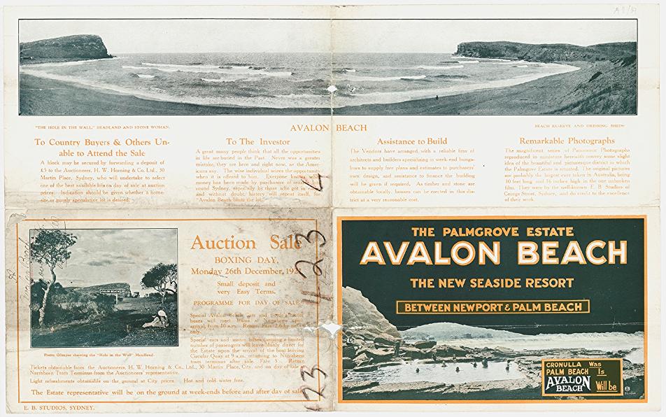
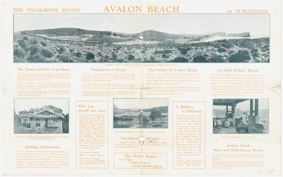
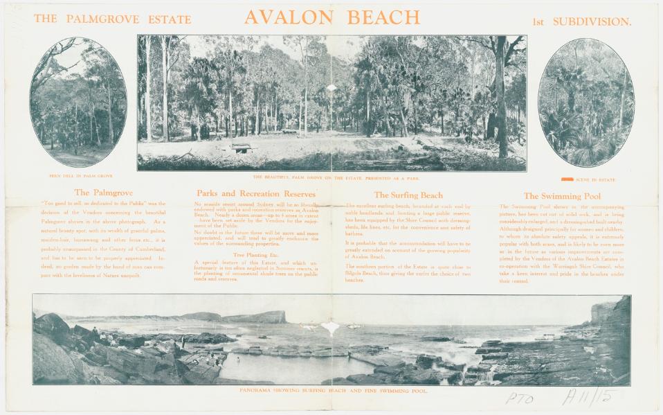
Avalon
In 1921 the first subdivisions of land at Avalon Beach took place. The developers were asked to contribute to the costs of the roads or built them entirely themselves. What we now call Old Barrenjoey Road was the main road through the valley, and that way trekked by Charles De Boos and the unnamed authors of other early articles. As mentioned in those, the area called 'Priest's Flat' was fairly wet, which we can still see today during heavier rains, when the channel built to hold the Careel Creek fills or when business premises at the corner of Old Barrenjoey and Avalon Parade are inundated.
A COASTAL DRIVE
Vale of Avalon
BAYS OF BLUE AND GOLD
(By NIYA BECKE.)
Entering the scrub-fringed French's Forest Road, our purring car swung through open, softly, undulating spaces, giving way in the distance to mist softened glimpses of low-lying, plum-purple mountains. Under a clear horizon of pale turquoise, it wended past tended orchards, where apple and peach trees blossomed, pink and white, to, the ardor of the southern sun, against a mellow glow of light green camphor laurels, shadowed with sombre sorrel-and-grey gums. We met with partly-cleared, grass-grown dingles, spangled with shimmering lakes of sunlight, and gemmed with clear, calm pools. We passed down a leafy vale, lovely as a country lane of Old England (only the white and delicate purple violets, wild roses, and primroses were not there), on to a terra-cotta colored highway, between ' smiling fields, richly carpeted in spring green, where calves, brown, black, and piebald lay dreamily, basking in the warmth of the sun-flooded clay. A straight run down a long grey hill, over a stretch of ochre red road, and then, suddenly, afar.. came a flash of intense color, a blazing streak of blue fire. Sensing the promise of the beauty of the sea, we sped onward to the coast.
Over the bridge at Narrabeen. where a solitary pelican paddled placidly, above mysterious, muddy depths, by fields, and more fields, and by cottage colonies clustered in bowl-round hollows, and emerald-covered clearings. On to the blue bay, where stands the travellers' inn of La Corniche with its curiously modelled Interior arches, like those of some prince's pictured palace in a fable of the East. Up a gentle Incline, and we were abreast the little brown-castle of Bungan Head, perched on the extreme edge of the cliff, facing the Peri-guarded gates of dawn, and the everlasting sea.
THE BLUE, BLUE WATERS.
From this point the outlook south towards Manly, and northward to Barrenjoey, revealed, a chain of blue bays, some evenly scalloped, others jagged-edged, broken in one place by a ledge of indigo and reddish-brown rocks jutting in a foam-silvered peninsula, through ultramarine waters. Blue bay after blue bay, and curving beach upon curving beach of fine yellow or coarse red-gold sun-dappled sand, and grass-tufted, wind-ridged dunes. Here cerise-clawed. seabirds paddled .through lambent amber and almond green ripples on the ocean brink. They pressed wave-powdered shells in intricate, marquetry into the shining strand, which the rising tide .would laughingly sweep away to pave 'hidden' paths, deep down in measureless' marine gardens, where Leviathan looms with swordfish and shark, above rotting Chinese junks, a nu sunken galleons from sun-kissed Spain.
We climbed another whale backed hillock by Bungan Castle, which called to mind, so weird, and- cloud-Wrapped, and remote it was, Keats's line —
. . magic casements, opening on the foam .
Of perilous seas, in faery lands forlorn."
For from here there is a gorgeously fantastic view of violet-and-green veined waters, flecked with stars of flame fallen from the crimson coronal of the Sringod of the South. Those who listen intently may hear by these charmed shores, sou-sylphs singing those ballads, sailor men love. On we went again, down a steep declivity to beautiful Bilgola, whose rustling palm grove whispers of Arabs, and camels, and the music of the desert wind at dawn! over the mount at the northern end of the beach, which bears a bright green crest of fresh glass, pendant, in a still cascade, over the cliff-edge, and glistening purple-blue rocks below. We stopped here a moment, and looked on the' sparkling Pacific unrolled in a mighty plain of that inimitable shade to which- may be likened only the radiant -tints of the skies, whence it purloins its magic hue. An we pondered on the glory of a golden springtime day,. "By- the long wash of Australasian shores." Onward, once more, and then, behold! The Vale of Avalon!
"LOVELY AND LONELY."
The land rises and shelters this gracious valley on the seaward frontage, from the strength of the wind, and it is scrub-surrounded, and denizened by happy-hearted birds. Wild flowers hide amid the guardian lulls of the lonely, lovely Vale of Avalon. Further afield we followed the twisted road, where the valley winds gently down. Rich, kingfisher blue flashes of water glowed to the left, through closely-spaced gums, like a liquid opal bursting the brown husk of the land. A strip of bracken-grown wayside lay parallel with a fair beach of fine, white sand, where upturned fisher-boats offered rounded cheeks to the fires of the sun. The sea, outward from the shoreline, toned from a transparent sheet of opalescent jade, to azure, and sunlit, lapis lazuli. Round a sharp curve to the right, up one hill and down another, under, a canopy of leaves, and Palm Beach was reached, and the end of the road.
We rested awhile on the grass-fringed shore, and watched the great waves swell, and break in a splendor of foam, and ride landward.
To Palm Beach, following the coast, is a bewitching highway to traverse. There stands no angel with a flaming sword before this Eden under southern skies.
A COASTAL DRIVE (1923, October 2). The Daily Telegraph (Sydney, NSW : 1883 - 1930), p. 4. Retrieved from http://nla.gov.au/nla.news-article245994803
The improvement of the road, including what became 'The Serpentine' commenced with discussions in the same year, 1923, and as is usual, came out with some prohibitive costs initially. The first proposal:
MANLY TO NEWPORT.
PROPOSED CONCRETE ROAD.
A deputation from the Warringah Shire Council waited on the Minister for Local Government (Mr. Fitzpatrick) yesterday, and urged that the Government should subsidise the council on the £ for £ principle in connection with the concrete road it was pro-posed to construct from the boundary of the municipality of Manly to Newport, a distance of about 12 miles. It was estimated that the cost would be £80.000 to £90,000. The council. It was stated, could not afford the whole of the cost on what was, after all, a national highway. Difficulty was being experienced in maintaining roads out of revenue.
Mr. Fitzpatrick said he was not prepared to make a definite promise, but he would undertake that the matter would receive the closest possible consideration, in connection with several other proposals of a similar character. There was no doubt that the time had long since arrived when councils, Instead of expending small sums here and there on patchwork, should make a calculation as to whether It would not be better to raise a loan and put the roads into decent order. MANLY TO NEWPORT. (1923, March 6). The Sydney Morning Herald (NSW : 1842 - 1954), p. 6. Retrieved from http://nla.gov.au/nla.news-article16071998
MANLY TO NEWPORT.
PROPOSED CONCRETE ROAD.
A deputation representing the Warringah Shire Council, and supported by the State members for the Northern Suburbs, yesterday asked the Minister for Local Government (Mr. Fitzpatrick) for assistance in the building of the Pittwater-road from Condamine-street, Manly, to Newport, a distance of 9 ¼ miles. The Government was asked to pay the interest, averaging £2247 a year, dining the repayment of the loan of £70,000 required for a concrete road.
Mr. Fitzpatrick, in reply, said that the Government at present was similarly assisting In the reconditioning of the Botany and Gordon roads, and he fully approved of the principle where the work was of an essential and progressive nature, and was too largo for the council. He would have a departmental report made, and if it was satisfactory would recommend to the Cabinet that some tangible assistance should be given to the shire. MANLY TO NEWPORT. (1923, November 3). The Sydney Morning Herald (NSW : 1842 - 1954), p. 18. Retrieved from http://nla.gov.au/nla.news-article16103548
NEWPORT ROAD
12 Miles of Concrete
Work, it is expected, will commence shortly on the concreting of Newport road, from Manly to Newport, -a distance of 12 miles. Negotiations have been in progress between Warringah Shire and the Main Roads Board for some time, and the shire has been authorised to present a plan of the road, and also of an extra mile from Manly Bridge to the Junction of Pittwater-road and Condamine-street. NEWPORT ROAD (1925, July 9). Evening News (Sydney, NSW : 1869 - 1931), p. 17. Retrieved from http://nla.gov.au/nla.news-article113919802
SHIRE OF WARRINGAH.
Proposed Special Loan of £32,000.
NOTICE is hereby given that it is the intention of the Warringah Shire Council to apply for authority, under section 180, Local Government Act, 1919, to borrow the amount of £32,000 for the purpose of constructing the undermentioned roads, and carry out the undermentioned work, within A Riding of the Shire, and for purposes incidental thereto: —
1. Barren joey-road, from Neptune-street, Newport to Beach-road, Palm Beach 21,100
2. Warriewood-road, from Pittwater-road to Vineyard-street — . 1,700
3. Powderworks-road (a) from Pittwater road to the E end of Kobado-road; (b) Kobado-road for its entire length, and (c) Powderworks-road from the W end of Kobado-road to the junction with, the Gordon-Mona Vale road '. 4.000
4. Gladstone-street, Newport 1,000
5. Drainage of Black Swamp, Mona Vale 1,900
6. Resumptions, surreys and contingencies 2,300
£32,000
(Included in the estimate of £21,100 for Barrenjoey-road is a sum of £4.000 for the formation, only, of proposed deviations of that road, which itsm is taken into consideration in fixing the differential rate referred to hereunder.)
The interest payable on such loan shall not exceed six sand a half (6\) per cent, per annum, and it is proposed to arrange the loan on terms which shall provide for the repayment of principal and the payment of interest, combined, in equal half-yearly instalments extending over a period of ten years. The approximate amount of each such instalment will be £2,200 18s. 6d.
To provide the sum necessary for such instalments it is proposed to levy a local loan rate of one and four-tenths penny (1 4/10ths d.) in the £ on the unimproved capital value of all ratable land within that portion of A Riding described in the subjoined Schedule, and nine-tenths of a penny (9/10ths. d.) in the £ on the unimproved capital value of all ratable lands in the remainder of the Riding, the extra impost on the lands described in the Schedule being to cover the instalments of so much of the principal (£4,000) of the loan as it is proposed to expend on the formation of the deviations of the Barrenjoey-road. Should these rates not provide sufficient for the purpose, the balance "will be paid from the General Fund of the Council. The total unimproved capital value of all ratable lands in the area described in the Schedule is £207,842, in the remainder of the Riding, £737,320, the total for the whole Riding being £1,005,162.
Plans, specifications and reports giving details of the proposal, may be inspected at the Shire Hall, Brookvale, at any time during office hours.
Within one month of the publication of this notice, any number not less than 25 per cent, of the ratepayers of A Riding may petition the Council to take a poll of ratepayers, either as to whether the ratepayers approve of the loan, or as to whether the loan rate shall be on the unimproved capital value or the improved capital value, or on both questions. The number of ratepayers enrolled for A Riding is 3,892.
Schedule.
All that land bounded on the north by the entrance to Broken Bay, on the east by the Pacific Ocean, on the west by Pittwater Bay, and on the south by the southern boundaries of Village Reserve 18,805, parish portion 21, block VI of the southern division of Pittwater Estate, and parish portion 31.
E. G. JAMIESON.
Shire Hall, Brookvale, Shire Clerk.
25th September, 1925.
1263 £4 4s. SHIRE OF WARRINGAH. (1925, October 2). Government Gazette of the State of New South Wales (Sydney, NSW : 1901 - 2001), p. 4246. Retrieved from http://nla.gov.au/nla.news-article220255392
SHIRE OF WARRING AH.
Proposed Special Loan of £28,200.
NOTICE is hereby given that it is the intention of the 1 Warringah Shire Council to apply for authority, under I section 180, Local Government Act, 1919, to borrow the sum of £28,200 for the purpose of carrying out the undermentioned works within A Riding of the Shire, and for purposes incidental thereto:—
1. Construction of Barrenjoey-road, from Seaview-parade, Newport to Beach-road, Palm Beach, including proposed deviations between Neptune-street and Avalon-parade, estimated cost (excluding cost of formation of deviations) ,— 17,600
2. Construction of Warriewood-road, from Pittwater-road to Vineyard-street, at estimated cost of 1,700
3. Construction of Powderworks-road; (a) from Pittwater-road to eastern end of Kobado-road; (b) Kobado-road, for its entire length; and (c) Powderworks-road, from the western end of Kobado-road to its junction with the Gordon-Mona Vale road, at estimated cost of 4,000
4. Construction of Gladstone-street, Newport, estimated cost 1,000
5. Drainage of Black Swamp Reserves, Mona Vale 1,900
6. Resumptions, surveys and contingencies .. 2,000
The interest payable on such loan shall not exceed six and half (6$) per cent, per annum, and it is proposed to arrange the loan on terms which shall provide for the repayment of principal and the payment of interest, combined, in half-yearly instalments extending over a period of ten years. The approximate amount of each such instalment will be £1,939 11s. 4d,
To provide the sum necessary for such instalments, it is proposed to levy a local loan rate of four-fifths of a penny (4/5ths d.) in the £ on the unimproved capital value of all ratable lands in A Riding of the Shire. Should such rate not provide sufficient for the purpose, the balance will be paid from the General Fund of the Shire. The total unimproved capital value of all ratable lands in A Siding is £3,005,162.
Plans, specifications and reports giving details of the proposal may be inspected at the Shire Hall, Brookvale, during office hours.
Within one month of the publication of this notice, any number, not less than 25 per cent, of the ratepayers of A Biding, may petition the Couneil to take a poll of ratepayers, either as to whether such ratepayers approve of the loan, or as to whether the loan rate should be on the unimproved capital value or the improved capital value, or on both questions. The number of ratepayers enrolled for A Biding is 3,892.
(N.B.—The foregoing proposal is in lieu of the proposal notified in the Government Gazette of 2nd October, 1925.)
R. G. JAMIESON, Shire Hall, Brookvale, Shire Clerk.
23rd November, 1925.
SHIRE OF WARRINGAH. (1925, November 27). Government Gazette of the State of New South Wales (Sydney, NSW : 1901 - 2001), p. 5354. Retrieved from http://nla.gov.au/nla.news-article223017024
BARRENJOEY ROAD.
GREAT PLEASURE DRIVE.
The Minister for Local Government has approved of the Warringah Shire Council's application to borrow £28,200 for the reconstruction of roads and the drainage of public reservation reserves in A riding.
The principal work will be the tar-metalling of a length of 6 miles 11 chains of the Pittwater-road including 1 mile 46 chains of road deviation between Newport and Avalon. The main road from Manly to Newport is, it is understood, to be tar-metalled or concreted by the Main Roads Board. The council's proposal is to tar-metal from the end of the main road right through to the narrow neck of road between Palm Beach and Barrenjoey, thus creating what is regarded as an unrivalled pleasure drive.
The deviation of the road between Newport and Avalon is to be defrayed from an additional loan of £5800, which has also been approved. BARRENJOEY ROAD. (1926, April 29). The Sydney Morning Herald (NSW : 1842 - 1954), p. 8. Retrieved from http://nla.gov.au/nla.news-article16289112
The Serpentine:
REAL ESTATE
DEVELOPING NORTHERN BEACHES
NEW SUBURBS ACROSS THE HARBOR THREE NEW FACTORS WHICH WILL HELP
Lack of an unbroken path from the city to beyond Manly has retarded the development of— the beaches on the Barrenjuey peninsula. This Is due to the fact that there are vast suburban areas on the north side of the Harbor barely scratched by development and, consequently, the majority of Sydney's citizens are congregated on the south side. Naturally, they patronise the beaches nearest home; few cross the harbor to swim and surf. This aspect will be changed by the growing North Shore bridge, whose steel link, should create an enormous new population whose surf benches will be Newport, Avalon, Whale Beach, and Palm Beach. Co-ordinating with this work, the Warringah Shire Council is straining every effort to have the road from Manly lo Newport constructed in a permanent manner, either of concrete or of something equally durable, and plans to improve the existing road from Newport to Palm Beach up to Main Roads Board standard. A start is already being made, for a deviation is to circle the ugly hill which divides Newport from Avalon, and surveyors are now studying contours and levels on the Avalon side. This deviation will do more than cut out a bad-surfaced route with a nasty grade. It will Improve the road to the north by adding new scenic vistas, for the route will curve around the hill towards the ocean, skirt the bluff, and, before it rejoins the existing road, pass between the golf course and sea, and run the length of Avalon behind the reserves.
Better roads, naturally, lead to Improved transport facilities, and, now they are assured that their 'buses will not be shaken to pieces by a succession of pot-holes, proprietors of the 'bus companies who have been serving this district have amalgamated Into one big, company which plans to put new and better 'buses on the run. Soon after Christmas, they anticipate, they will have at least 20 'buses serving the district between Manly and Palm Beach. This, normally, should mean Increased tourist traffic and quicker residential development — which will, In turn, demand still more 'buses.
These aids should help the northern beaches to a quick move forward. Palm Beach has long been popular with the class who own motor cars, and now attention is being paid to Avalon, which is closer to the city, and, yet quite as attractive in Its less spectacular way. Here the land flows gently in the beach instead of rising to the sudden heights which (is) rampart at Palm Beach, and, as a result, offers easy building conditions and proximity to the surf. Hundreds of motor-owners now make it a week-end resort, and many are lured by the interesting golf course, with its novel holes. Land is now being sold here, adjoining the golf course, fronting the new main road, and on the gentle slopes overlooking the beach. Many very fine sites are available in the Avalon Estates, despite the speed with which they are being bought. The inauguration of the better 'bus services and the completion of the deviation should undoubtedly add to the beach's popularity, and, at the same time, to values In the vicinity. REAL ESTATE (1926, October 29). The Sun (Sydney, NSW : 1910 - 1954), p. 15 (FINAL EXTRA). Retrieved from http://nla.gov.au/nla.news-article224122137
At the Clareville- Paradise Beach-Pittwater side of the valley of Avalon:
Pearl of Pittwater Advertising (1926, October 29). The Sun (Sydney, NSW : 1910 - 1954), p. 15 (FINAL EXTRA). Retrieved from http://nla.gov.au/nla.news-article224122136
.jpg?timestamp=1537509616046)
Avalon Beach Estates: Advertising (1926, October 29). The Sun (Sydney, NSW : 1910 - 1954), p. 15 (FINAL EXTRA). Retrieved from http://nla.gov.au/nla.news-article224122134
An account of the drive north via the coastal route shares the news that the Palm Beach end section is finished:
AVALON AND PALM BEACH
A Pretty Coastal Drive HALF-DAY OR WHOLE-DAY OUTING
FOR those who prefer taking hampers the seaside resorts of Avalon and Palm Beach offer full scope for an enjoyable day, whilst for motorists who desire a morning or afternoon run, by making an early start, a pleasant half-day trip is assured.
LEAVING the city on this picturesque drive entails the crossing of Sydney Harbor per vehicular ferry from Fort Macquarie, and once aboard the good ship Kalang. We took the opportunity to turn back the speedometer to 0.00. Coming off the ferry the main travel is through North Sydney (01.0 miles), Cremorne (03.1) and Mosman, where at Spitroad junction the route lies away to the left, leading down to the well-known Spit bridge, which has proved a successful proposition in every way. After crossing the bridge, take the first turn on the left, which leads over Seaforth Heights, whence glorious views arc obtainable of Middle Harbor and the Heads. Eventually the main road is rejoined at a point that coincides with the speedometer's' registration of 06.5 miles, and one-tenth of a mile further on, the hill-top is reached, where a church is seen on the left, opposite which is a public school. Take the road on the left and pass between the two buildings mentioned above, keeping straight on until the speedo shows. 06.8 miles, when another left-hand turn is made, and a lengthy Incline lies before you. Having climbed this hill, the road bears away to the right, leading in the direction of French's Forest, which can be reached by turning left beside the store you pass as the speedo, indicates 10.4 miles, but our way lies straight ahead where the road turns right, about a quarter mile on. Follow along this road until the speedo records 12.2 miles, when the left-hand turning is taken for Dee Why and Collaroy. As 14.2 comes to view on the speedo. the road forks, the left-hand branch leading to Collaroy, whilst that on the right takes the traveller to Dee Why. Accordingly we turn left until the speedo. registers 14.5 miles, when the road bears around to the right for about five-tenths of a mile, when It becomes necessary to turn left, and keep to the left for nearly a mile when, as 15.7 appears on the speedo, the main road is met, and by turning into it on the left-hand side you will find your car is heading for Collaroy, which is reached after covering 17 miles since leaving the vehicle ferry.
Through Narrabeen Continuing ahead, Narrabeen Is passed through about a mile further on, and as 18.5 miles have been left behind, a bridge over the Narrabeen Lake is crossed, and you follow the well-defined road ahead to Mona Vale, which is reached as 21.2 miles are recorded. At this point the road turns away to the right, passing La Corniche and the 11-mile store en route to Newport, which is passed through as the speedo shows 23.5 miles. Keep on along this main highway, and ascend the hill ahead, from which point line coastal views are obtained, and on the other side you run down past Bilgola Beach as the speedometer indicates that 24.3 miles have been traversed.After negotiating another hill, you descend, to the left, into Avalon, but as the speedo shows 24.6 miles, take the road on the left for Palm Grove, which is veil worth the short detour, and by keeping straight on along this track you will eventually come out on to the main road l-y turning right as the speedo shows 25.3 miles. Continuing straight ahead will bring you to Avalon Beach, where there Is ample space for picnicking; the surfing is good, and a swimming pool in the rocks is freely used. For Palm Beach it is necessary to return to the main road, which is followed for a further four miles, the latter portion of which is over splendid roadway that has recently been reconstructed.
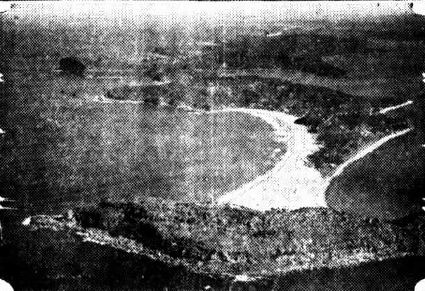
Aeroplane view of Palm Beach and Avalon. — Milton Kent photo.
AVALON AND PALM BEACH (1927, March 13). Truth (Sydney, NSW : 1894 - 1954), p. 9. Retrieved from http://nla.gov.au/nla.news-article168687811
The 'new' Barrenjoey Road appears among advertisement for Avalon Beach Land sales towards the end of 1927 and includes those famous panoramas made by EB Studios:
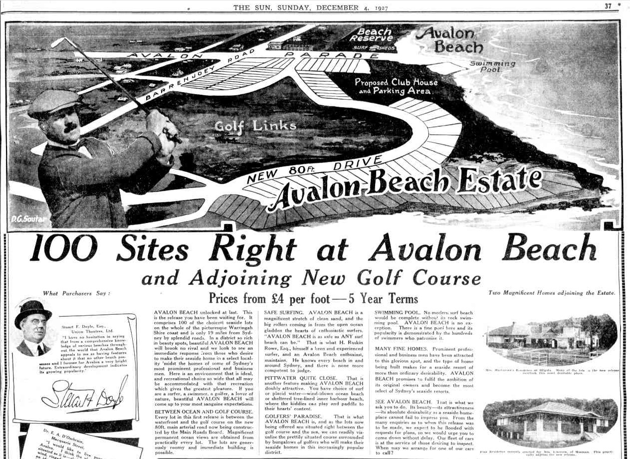
.jpg?timestamp=1538072004368)
Advertising (1927, December 4). The Sun (Sydney, NSW : 1910 - 1954), p. 37. Retrieved from http://nla.gov.au/nla.news-article222741251
The work of constructing The Serpentine was carried out in 1928 by W. M. Farley (Mervyn) and Gerald Lewers, brothers in law from Queenscliffe (Mervyn built the 'Kiosk' at Freshwater).
A February land sale advertisement from the same year provides a basic map as well as the homes that had been photographed for the Prospectus photographs of Avalon album by Rex Hazlewood:
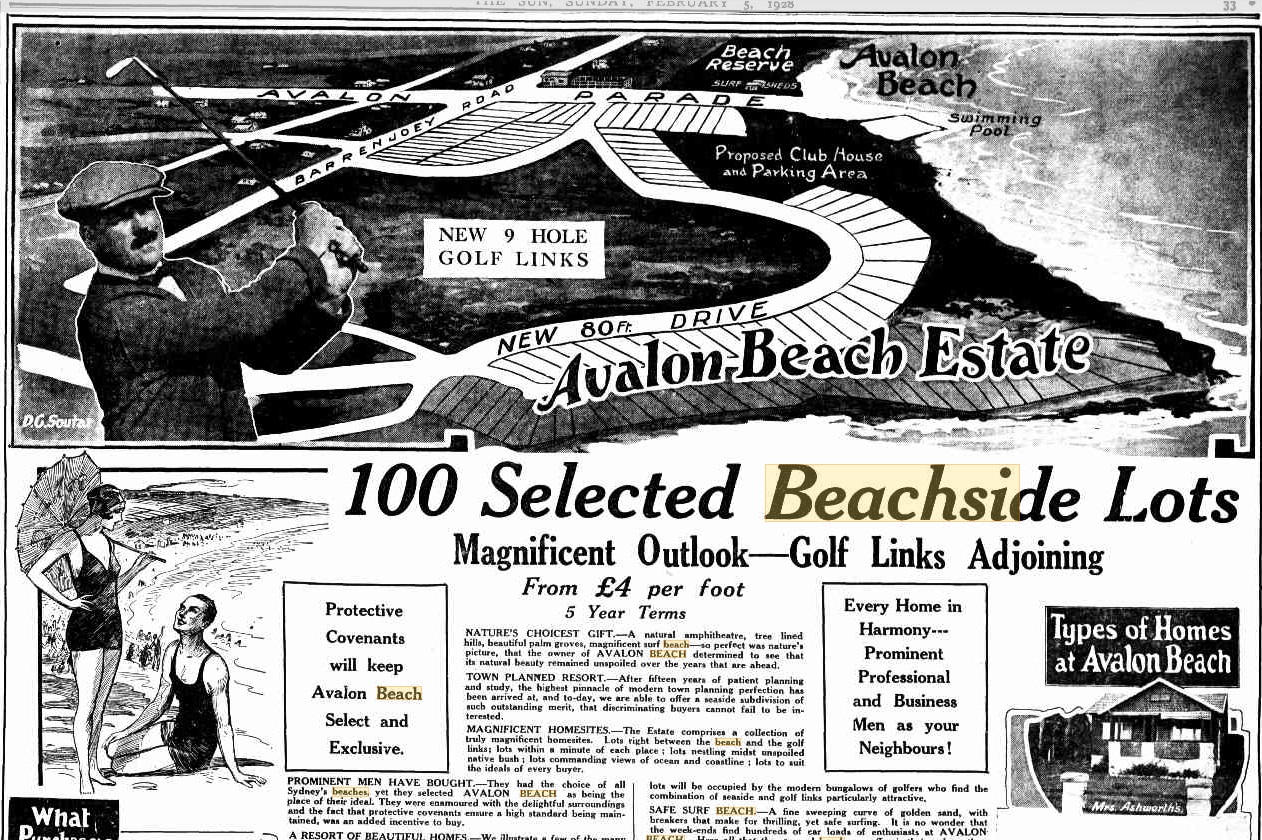
.jpg?timestamp=1537835865003)
Advertising (1928, February 5). The Sun (Sydney, NSW : 1910 - 1954), p. 33. Retrieved from http://nla.gov.au/nla.news-article224226748
The road being built had a base of crushed stone over which tar was laid. The sketch below, from the Main Roads Board 1928 Annual Report, shows the four methods for making roads in New South Wales at that time. Under that, one EB studios panorama taken during this time shows the base - the full pano and sections to show detail runs below:
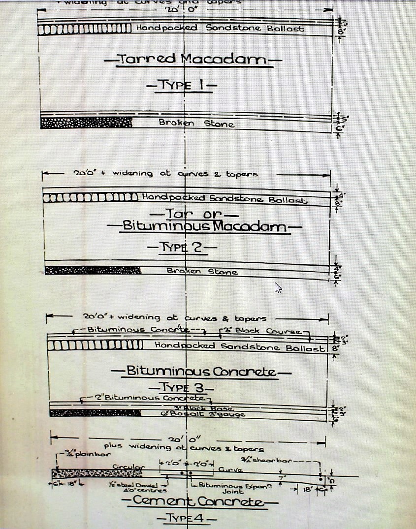
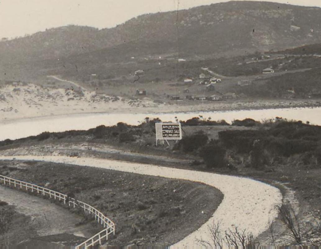
Some road extracts from later that same year, with a map atop the full page spread for land sales at Avalon Beach:
Situated right in the heart of AVALON BEACH ESTATE, and encircled by the new 80 foot main arterial road laid down by the Main Roads Board, it is almost at the surf.
Already the authorities have commenced to resume the land necessary for the widening of the main Manly-Newport Road.Minor construction has also commenced, but as the Warringah Shire Council is fully alive to the vital necessity for this work, it is certain to be. expedited. Also attention is being given' to the branch roads, making this area easily accessible from the North Shore Railway Suburbs.
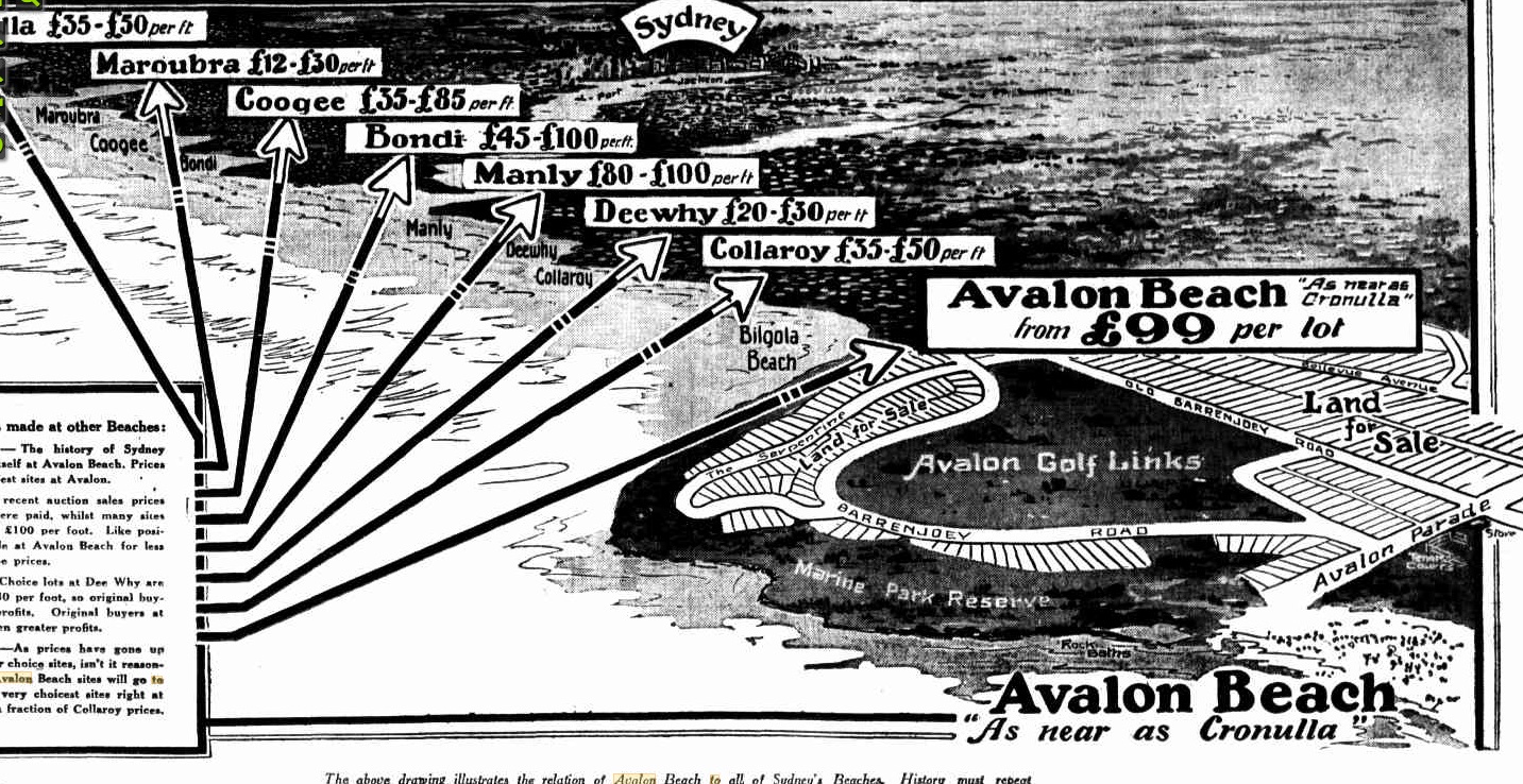
Advertising (1928, June 10). The Sun (Sydney, NSW : 1910 - 1954), p. 37. Retrieved September 28, 2018, from http://nla.gov.au/nla.news-article223212039
And another
Palmgrove Estate … Fascinating Selection of Sites Including Ocean and Golf Link Frontages
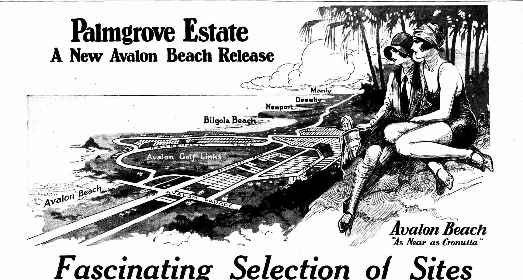
.jpg?timestamp=1537508769710)
.jpg?timestamp=1537508817675)
AS SAFE AS ANY SURF BEACH CAN BE. That is the expressed opinion of H. Ruskin Rowe, Esq., a keen, experienced j surfer, and an AVALON BEACH , enthusiast. AVALON BEACH is a magnificent stretch of clean sand and the big rollers gladden the hearts of enthusiastic surfers.
Sites from £99 each Five Year terms A magnificent selection of allotments close to Surf Beaches and Golf Links, and adjoining some of the finest homes at Avalon Beach, are available at attractive prices arid terms. Homesites of individual beauty and gorgeous landscape setting. Faultless sites, generously proportioned, with matchless views of the entire surroundings. Read the list given below.
FINEST 9 - HOLE SEASIDE GOLF LINKS IN THE STATE. the number of players during
THESE SITES WILL BE ALMOST UNPROCURABLE IN A FEW YEARS EVERY YEAR SEES MORE AND MORE PEOPLE TURNING TO THE BEACHES With the opening of the North Shore Bridge AVALON BEACH will become so accessible that many city business men will make it their permanent home place. A forty minute run in their cars and the city will be reached. The PALMGROVE Sites we are offering at from £99 each, will then be almost unprocurable, even at several times to-day's prices, and as in developed beaches of the past, demand will exceed supply, and the result will be greatly enhanced values. ' You could not ask for a more sound and profitable investment than is offered by PALMGROVE ESTATE to-day. Get further Particulars and arrange to inspect.
BELLEVUE AVENUE. Lot 39 — faultless site generously proportioned, level as a lawn and practically opposite the homes of Messrs. Ivor Youill and W. Todd. Many other fine homes in' the vicinity. Golf Links and Surf Beach quite handy. 10 per cent, deposit. 5-year terms. PLATEAU ROAD. Lots 165 and 173, two of the cheapest lots in Avalon Beach. Gloriously elevated with views of Golf Links, Surf Beach, and Ocean, that can never be built out. £99 each. 5 years in which to pay. Lot 158 has a wonderful appeal. Entrancing views, faultless position, magnificent setting — a truly charming site for your beach-side home, or a sound and profitable investment. Only £150, on five year terms. 10 per cent, deposit. THE SERPENTINE. Lot 100, right opposite the magnificent new residence just completed for W. C. Abbott, Esq., occupies one of the most commanding actual ocean frontage positions in Avalon Beach. Two minutes surf — 3 minutes Golf Links. 65ft. frontage, with reserve access along one side. Lot 103, another actual ocean frontage site, overlooking Mrs. Maclurcan's palatial residence, and the whole of the picturesque Warringah Shire Coast as far as Manly. The view from this site presents a picture of marvellous beauty and charm. 10 per cent, deposit. 5 year terms. BARREN JOEY ROAD. Lot 123, a magnificent site, with matchless views, and only three minutes Bilgola Surf. This creased rapidly. Fror splendidly situated site', has assured prospective value, and values have risen at … and at £170 is exceptional buying. 10 per cent, deposit. 5 year Beach will reach that terms. Lots 133-144 inclusive. An interesting group of 12 fascinating sites, with permanent panoramic views that almost defy description. Beautiful Bilgola Beach settlement, with its palms and native trees, nestles at your feet. £155 each. 10 per cent, deposit 5 year terms.
AS AT EVERY SYDNEY BEACH, BIG PROFITS WILL BE MADE AT AVALON Take the history of every Sydney Beach as your guide. Without exception, tremendous profits have been made — profits beyond those returned by any other form of investment. AVALON BEACH prices, originally ruled "where to-day as high as £100 per foot is asked. That is why history must repeat itself at Avalon Beach to the profit of those who buy to-day. . BONDI. The increased, population is reflected in increased prices. In 1910 £6 per foot— to-day as high as £100 is the value. Avalon Beach will show equally striking - increases. CRONULLA, ' Only a few years ago homesites, right at the beach could be bought for a few pounds per foot. The same lots to-day bring as high as £50 per foot. As Cronulla values grew so will Avalon, MAROUBRA. Before the tram was built sites could be had at almost your own price. To-day £12 to £30 per foot are the ruling rates. COLLAROY. During the past few years value have...week-ends and holidays is evidence of its popularity. A Club House is there now, but provision has been made for the erection in the future of a much larger one; the area for this purpose has been reserved. L - — £15,000
THE NORTH SHORE BRIDGE WILL FORCE VALUES UP. Rapid … growth is inevitable. The great Harbour Bridge will wipe away the present travelling inconvenience. Electric trains will open up the North Shore to a flood of incoming population, and the Northern Beaches will come into their own.
BEAUTIFUL 4-COLOUR ART FOLDER FREE ON APPLICATION.— It contains photo-graphs of magnificent homes, of golfing and surfing scenes, comprehensive drawing showing the relation of Avalon Beach to Sydney and the great North Shore Bridge; and, above all, an exquisite 3-colour painting of Avalon Beach itself. WILLMORE & RANDELL LTD. Managing Agents, Head Office : 10 CASTLEREAGH STREET, SYDNEY 'PHONE: B7896 (5 lines).
At present Avalon Beach prices the .. new homes is high as £60 per foot, Avalon in the past 12 months at figure In a shorter period. . . Avalon Beach. (551 Free ... WILLMORE & RANDELL, LTD., Hi . 110 Castlereagh Street, I B AVALON I Box 2132 L, CJ>.0. M 3 L- 1 Please -send me ( free 0/ any expense or H B 1 obligation ) free plan and price list of H | I AVALON BEACH ESTATE, together II H 1 with handsome art folder. I M \ NAME ... SYDNEY ADDRESS' ...
Advertising (1928, December 9). The Sun (Sydney, NSW : 1910 - 1954), p. 37. Retrieved from http://nla.gov.au/nla.news-article223248101
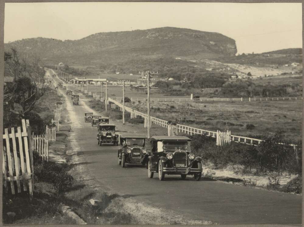
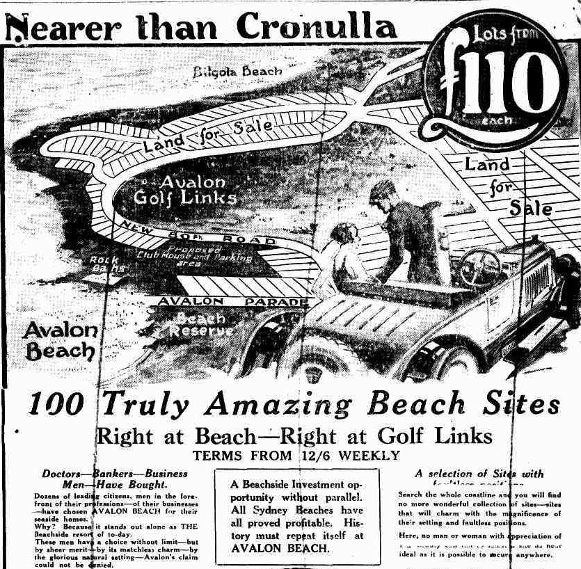
Known in early days as 'Six Ways' and then 'five ways' junction, from as early as February 1933 the Avalon Beach & District Progress Association were sending regular requests to the then Warringah Shire Council - ' that danger sign be erected at the Six Ways junction at .the top of the hill between Bilgola and Avalon . Resolved, - That the Association be informed there is no money available' - letter dated 17/2/1933 and response in Minutes of Meetings.
Eventually the council moved way beyond not being able to afford to put a sign in place:
A letter dated March 18th, 1955 from the Avalon Beach Progress Assoc., 'suggesting that the corners at what is known as "The Five Ways" be rounded off to minimise the danger at that spot.' shows that the several directions, of the Serpentine, Bilgola, coming from south and east, the Bilgola Bends heading north or south and Barrenjoey road continuing, the Plateau road up the hill to Bilgola, Old Barrenjoey road out of Avalon, may have given rise to this name and also that 'six' has become five at what is still known as Kamikaze Corner':
SHIRE OF WARRINGAH—Naming of Road.—Ordinance 30, clause 53, Local Government Act.—Notice is hereby given that the undermentioned road has been renamed in accordance with section 249 (a) of the Local Government Act Past name or location,—Section of Old Barrenjoey road between the Serpentine and southern junction of New Barrenjoey road. New name —The Serpentine. J. MORGAN. Shire Clerk, Shire Hall, Brookvale, 19th December, 1957. 2095—12s. SHIRE OF WARRINGAH.—NAMING OF ROAD.—Ordinance (1957, December 27). Government Gazette of the State of New South Wales (Sydney, NSW : 1901 - 2001), p. 4289. Retrieved from http://nla.gov.au/nla.news-article220360671
ROAD TO NEWPORT
A £1,500,000 ROAD VAST PLAN
An offer has been made to the Warringah Shire Council by a Sydney firm to build a concrete highway from the bridge approaches on the North Shore to Newport, over which a highspeed 'bus service would operate. The cost, It is estimated, would be £1,500,000, which would be met by repayments over a long term. In its present nebulous stage, the scheme Is for a 30-feet road, 10 miles long, over which high-speed 'buses would run a service from Wynyard-square to Newport. Up to the present the project has been discussed only in the most informal way, so much so that there is no record of it on the Warringah Council's books. It seems that one night, after the council's meeting had closed, Mr. Frank Corkery, a former president, disclosed the scheme, which he had been studying for more than a year. The councillors, their hopes of a start being made with the construction of a railway to their district sadly dashed, warmly acclaimed the plan. Without revealing the proposed financial arrangements, Mr. Corkery assured his council colleagues that the terms were very advantageous in the light of money market conditions.
Many Difficulties
The council is under no illusions as to the difficulties which stand hi the way of the consummation of the scheme. There is, for example, the fact that such a road would pass through four municipalities— North Sydney, Mosman, Manly and Warringah. In such circumstances it is unlikely that the authorities would agree to Warringah alone controlling the highway. The position, however, might be met by the creation of a trust, for which an enabling bill would be necessary. There is also the question of how far the proposed highway would conflict with the operations of the Transport Trust, which the Government intends shortly to set up. Another big problem lies in the question of resumptions. The shire clerk of Warringah (Mr. R. G. Jamieson) roughly estimates that for this purpose at least £500,000 would be required. Mr. Jamieson doubts whether £1,500,-000 would be enough to cover the total cost of the highway. He points out that £40,000 a mile would be a fair average cost of a 30ft. concrete road. With his councillors, Mr. Jamieson regards the idea as a splendid one, provided the financial side of it can be arranged.
Bruxner Not in Secret
The Minister for Local Government (Mr. Bruxner), who is charged with the administration of Sydney's transport. had not heard of the proposal up to this morning. He explained that in order to borrow the money the council would be required to make application to the department and advertise its intentions. Twenty-five per cent, of the ratepayers could demand a poll on the matter, and if the loan were approved by the ratepayers the Minister's sanction would finally be necessary. Mr. Bruxner added that if it were intended to charge a toll for the use of the road special legislation would be necessary. TO NEWPORT (1930, April 12). The Sun (Sydney, NSW : 1910 - 1954), p. 3 (LAST RACE RESULTS). Retrieved from http://nla.gov.au/nla.news-article223705104
Side -Tracks of the Palm Beach Road
The much-travelled road from Sydney to Palm Beach has not yet lost all its native charms, despite the spread of civilisation along that stretch of coastline.
MOTORTSTS who generally follow the main road to Palm Beach without making a single deviation, and then park their cars in the crowded rank at that popular resort, are missing many of the pleasures which this excursion offers. On the other hand, the more imaginative tourist who does not feel impelled to follow the crowd can spend a thoroughly enjoyable afternoon in this district. The Spit Bridge route should be followed, and then, after proceeding a little way along the Manly road, one turns into Condamine-street and so continues to Brookvale, where the main road and the Narrabeen tramway are joined. Soon after leaving Brookvale the motorist will come to the turn-off to Deewhy Lagoon, which lies close beside the highway. This is the first of many diversions which may profitably be undertaken. Then for some miles the scenery is dominated by popular resorts until Narrabeen is reached. At Narrabeen the prettier road is the scenic drive along the ocean front. On entering Narrabeen take the right-hand fork in the road, and follow along Ocean-street to the bridge which spans the mouth of the lagoon. A little further on some excellent views of the ocean and coast are to be seen.
CONTINUING towards Palm Beach, the traveller must be careful to bear to the right in Mona Vale, and not to follow the Bayview and Church Point road, which, by the way, leads onto some very charming spots. Some little distance before Newport a small but stately and modern castle may be seen overlooking the Pacific. This building stands on Bungan Head, which may be reached by turning off to the right a quarter of a mile before the point where the main road to Newport Beach forks with the road leading downhill, to the left, to the Newport hotel. The side-track to Bungan Head is quite good for the most part, but beware of abrupt turns and steep pinches.
Again journeying along the high road, one passes through Newport and Avalon of golfing fame, and keeps a look-out for the deviation to the Hole-in-the-Wall. After reaching the northern outskirts of Avalon, the Palm Beach road bears to the right downhill and crosses a small bridge, and then immediately bears left. Just here, on the right of the road, is the track to the Hole-in-the-Wall.The car can be driven almost to the edge of the cliffs, whence a goat-track is followed to the rocky seashore. The 'hole' is a large and unusual sandstone cave of. imposing dimensions set in the hillside a little distance south of the point where the rough foot-track reaches the ocean shore, but a quick scramble will bring one to it within a few minutes.
AGAIN reverting to the Palm Beach road, we would draw attention to the turn-off to Whale Beach, another picturesque spot which is rapidly gaining in popularity. Finally, after passing over the Palm Beach golf links the excursionist can drive to within easy walking distance of Barrenjoey headland, where he can, if he is energetic, climb up to the lighthouse, or else disport himself on the lower levels of that bluff promontory. The spots of interest which we have named are but a few sidelights on this well-known highway, and will, we trust, serve as a reminder of its manifold attractions.
A VIEW OF PITTWATER FROM NEAR THE BARRENJOEY , ROAD. Barrenjoey Lighthouse is shown on the high land on the right of ? the picture. Lion Island is on the left. Note the aeroplane flying over Barrenjoey. Portion of the Pittwater side of Palm Beach is on the right. Side - Tracks of the Palm Beach Road (1930, October 29). Sydney Mail (NSW : 1912 - 1938), p. 40. Retrieved from http://nla.gov.au/nla.news-article159659948
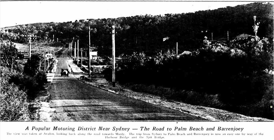
Popular Motoring District Near Sydney — The road to Palm Beach and Barrenjoey. The view was taken at Avalon, looking back along the road towards Manly. The trip from Sydney to Palm Beach and Barrenjoey is now an easy one by way of the Harbour Bridge and the Spit Bridge. Motoring: Search for Petrol Substitutes (1932, August 24). Sydney Mail (NSW : 1912 - 1938), p. 44. Retrieved from http://nla.gov.au/nla.news-article166225233
In Charles De Boos account of 'My Holiday' we read that 'Priest's Flat' is quite swampy with lots of water. Cartographic maps for Land Sales at Careel Bay show this area as marked as 'swampy'. Only time changed this with the cementing in at the Avalon Beach shops area of the creek that runs from Careel Bay.
Past accounts of those who would be camping at Avalon Camping area prior to that closing being flooded out were numerous. As recently as last year owners of shops at the corner of Old Barrenjoey Road and Avalon Parade experienced flooding. In this area too a similar Health Department Notice alike that seen for Newport around the lagoon area, as well as numerous pleas by the Avalon Progress Association throughout the 1930's to change things, to build drains, preceded the only occasional 'flood' we have today:
(1930). [Motor cars, some with tarpaulins attached, parked adjacent to Avalon Beach, New South Wales, 1930, 2] Retrieved from http://nla.gov.au/nla.obj-147290238 - shows the road running north in the background
Department of Public Health,
Sydney, 23rd May, 1934.
PUBLIC HEALTH ACT; 1902, SECTION 55.
Unhealthy building land at Avalon, fronting Barrenjoey-road, Old Barrenjoey road, Avalon-parade and Central-road, Shire of Warringah.
THE Board of Health have reported that after due inquiry, they are of opinion that it would be prejudicial to health it certain land situated in the Shire of Warringah, and described in Schedules hereunder, were built upon in its present condition.
The Board of Health hare further reported that in order to render such land fit to be built upon it is necessary that:—
(a) the land be drained by properly constructed storms at or channels of capacity sufficient to carry off all water passing over the area;
(b) The surface of the land comprised in Schedule 1 be raised with clean soil or sand to conform to the following grades—
1. at Barrenjoey-road and Old Barrenjoey road to the height of the adjacent crown of those roads, rising therefrom 011 a grade of one in 100;
2. at the drainage easement or lane to a height
3 inclines above the natural surface of the land, rising therefrom on a grade of one in 100;
(c) the surface of the land comprised in Schedule 2 be raised with clean soil or sand at the watercourse to a height 3 inches above the natural surface, rising therefrom on a grade of one in 100;
(d) all floors be laid on joists, the undersides of which shall be not less than 18 inches above the surface of the land when raised;
(e) the whole of the work be done to the satisfaction of the Board of Health.
Now, therefore, in pursuance of the power and authority vested in me by section 55 (1) of the Public Health Act, 1902, I hereby declare that such land shall not be built upon until the measures above referred to which are also specified in a document deposited in the office of the Local Authority (the Council of the Shire of Warringah) and open to, the inspection of any person, have been complied with, or until this notice has been revoked by me.
R. W. D. WEAYEH, Minister for Health.
Schedule No. 1.
Commencing at a point 011 the north-western side of Old Barrenjoey road, being the southernmost corner of lot 10, d.p. 9,151; and bounded thence 011 the south-west by the south-western boundary of Jot 10 north-westerly to lane; thence by that lane north-easterly to Avalon-parade; thence by a line north-easterly to the westernmost corner of lot 13; thence by lane north-easterly to the northernmost corner of lot 20; thence by part of the north-eastern boundary of lot 20 south-easterly to a point 135 feet along that boundary north-westerly from Barrenjoey-road; thence by a line north-easterly to a point on the south-western boundary of lot 22, being 70 feet along that boundary from Barrenjoey-road thence by that boundary south-easterly to Barrenjoey-road;
thence by lines bearing consecutively 37 degrees 185 feet, 47 degrees 310 feet, 122 degrees 125 feet, 189 degrees 250 feet, 196 degrees 0*50 feet; thence by a line southwesterly to the easternmost corner of lot*8, d.p. 13,975; thence by the south-eastern and south-western boundaries of lot 8 to the westernmost corner of lot 8; thence by a line south-westerly to the southernmost corner of lot 13, d.p. 12,047; thence by lane south-westerly to the*southernmost corner of lot "21; thence by the south-western boundary of lot 21 north-westerly' to Old Barrenjoey road; thence by Old Barren joey road north-easterly to the westernmost corner of lot 13; thence by a line northwesterly, to the point of commencement.
Schedule No. 2.
Commencing at a point on the north-eastern side of Avalon-parade, being the westernmost corner of lot 33, d.p. 9,151; and bounded thence on the south-west by Avalon-parade north-westerly to the westernmost corner of lot 52; thence by the north-western boundary of lot 52 north-easterly 80 feet; thence by a line parallel to Avalon-parade north-westerly to the south-eastern boundary of lot 60; thence by a line north-westerly to the north-western boundary of lot 66, beings point 190 feet north-easterly along that boundary from Avalon-parade; thence by that boundary north-easterly 430 feet; thence by a line south-easterly to the south-eastern boundary of lot 37, being a point 30 feet north-easterly from the southernmost corner of lot 37; thence by a line parallel to the south-western boundary of lot 36 south-easterly to the south-eastern boundary of lot 34; thence by a line south-easterly to the southernmost corner of lot 33; thence by a line bearing 116 degrees 160 feet; and by a line north-easterly to the northernmost corner of lot 20; thence by lane south-westerly, to the point of commencement. PUBLIC HEALTH ACT, 1902, SECTION 55. (1934, May 25). Government Gazette of the State of New South Wales (Sydney, NSW : 1901 - 2001), p. 2030. Retrieved from http://nla.gov.au/nla.news-article223060059
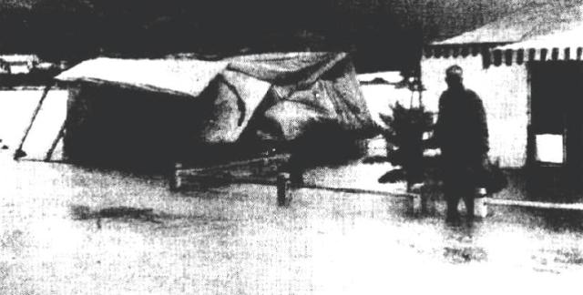
The tent on the left, owned by Mr D. Needham, was completely capsized by the rushing waters.
One of the shops which suffered most damage was Le Clercq's general merchandise store in Avalon Parade. Mr. Le Clercq, the owner, bored holes in the floorboards in an attempt to drain away the two feet of water which was damaging his goods.
He said he had only just cleaned up the debris from a flood which occurred on Friday. He had suffered more than £250 worth of damage in that flood. The rush of water through Avalon Parade was so great at one stage that several cars were almost submerged. The swirling flood carried one car almost 200 yards before dumping it on the pavement. Freak Storm Hits Avalon: Drives Out Tent Dwellers. (1953, May 7). The Sydney Morning Herald, p. 1. Retrieved from http://nla.gov.au/nla.news-article18372783
More road improvements:
MAIN ROADS ACT, 3924-1945—PROCLAMATION.
(l.s.) F. B. JORDAN, Lieutenant-Governor.
I, the Honourable Sir Frederick Richard Jordan, Lieutenant Governor of the State of New South Wales in the Commonwealth of Australia, with the advice of the Executive Council, do hereby in pursuance of the provisions of subsection (1) of section 49 of the Main Roads Act, 1924-1945, and of the Ministry of Transport Act, 1932, and of the Transport (Division of Functions) Act, 1932-1943, and of every other power thereunto me enabling declare the land described in the Schedule of Lands hereunder written to be a public road and the Commissioner for Main Roads having so recommended PLACE the said land under the control of the Council of the Shire of Warringah.
Signed and sealed at Sydney, this thirteenth day of February, 1946, By His Excellency's Command, M. O'SULLIVAN, Minister for Transport.
GOD SAVE THE KING!
Schedule of the Land referred to.
All that piece or parcel of land situate in the Shire of Warringah, parish of Narrabeen, county of Cumberland and State of New South Wales, being part of the land comprised in Certificates of Title, register volume 5,022, folio 42, volume 4,197, folio 83, and volume 4,201, folio 30: Commencing at the intersection of a south-eastern side of Barrenjoey-road with the south-eastern side of Central-road; and bounded thence on the north-west by part of the south-eastern side of Central-road aforesaid bearing 51 degrees 23 minutes 24 feet inches; thence on the south-east, east, north-east, again on the east, again on the south-east and again on the northeast by marked lines bearing consecutively 196 degrees 346 feet 9 ¼ inches, 193 degrees 4 minutes 52 feet 2g inches, 187 degrees 12 minutes 52 feet 2g inches, 181 degrees 20 minutes 52 feet 2§ inches, 175 degrees 28 minutes 52 feet 2| inches, 169 degrees 36 minutes 52 feet 2ft inches, 163 degrees 44 minutes 52 feet 2g inches, 357 degrees 52 minutes 52 feet 2 ½ inches, 154 degrees 56 minutes 108 feet 1 1/8 inches, 157 degrees 27 minutes 50 seconds 52 feet 1 inch, 102 degrees 31 minutes 1 20 seconds 52 feet 1 inch, 167 degrees 35 minutes 52 feet 1 [inch, 172 degrees 38 minutes 30 seconds 52 feet 1 inch, 177 (degrees 42 minutes 5 seconds 52 feet 1 inch, 182 degrees 45 minutes 40 seconds 52 feet 1 inch, 187 degrees 49 minutes 120 seconds 52 feet 1 inch, 190 degrees 21 minutes 104 feet 1inch and 148 degrees 10 minutes 30 seconds 14 feet 95 inches to the north-eastern side of Avalon-parade thence on the south-west by part of that side of that parade bearing 280 degrees 100 feet 4 ¼ inches; thence again on the north west by marked lines bearing consecutively 58 degrees 10 : minutes 30 seconds 13 feet 51 inches, 10 degrees 21 minutes 94 feet 4f inches, 7 degrees 49 minutes 20 seconds 46 feet 0 ¼ inches, 2 degrees 45 minutes 40 seconds 45 feet 0i inch, 357 degrees 42 minutes 5 seconds 45 feet 0J inch, 352 degrees 138 minutes 30 seconds 45 feet 0 inch, 347 degrees 35 minutes 45 feet 0£ inch, 342 degrees 31 minutes 20 seconds 45 feet [0£ inch, 337 degrees 27 minutes 50 seconds 46 feet 9 ½ inches,_334 degrees 56 minutes 108 feet 5& inches, 337 degrees 52 [minutes 58 feet 4\ inches, 343 degrees 44 minutes 60 feet 11 ¼ inches and 269 degrees 52 minutes 10 feet ¼ inch to the south-eastern side of Barrenjoey-road aforesaid; thence on the north-west by part of that side of that road bearing 16 degrees 619 feet 2 ½ inches to the point of commencement,—having an area of 1 acre 2 roods 14 perches or thereabouts.((D.M.R. File No. 479-1,278) MAIN ROADS ACT, 1924-1945.—PROCLAMATION. (1946, March 1). Government Gazette of the State of New South Wales (Sydney, NSW : 1901 - 2001), p. 485. Retrieved from http://nla.gov.au/nla.news-article224761684
Barrenjoey road Avalon was to be changed again. From where the first set of traffic lights is now until George street at the north end of Avalon would become a dual carriageway - first a little renaming though:
WARRINGAH SHIRE COUNCIL.—Notice is hereby given that the Council of the Shire of Warringah in accordance with section 249 (a) of the Local Government Act, 1919, as amended, has renamed that section formerly known as New Barrenjoey Road, between Newport Beach and Central Road, Avalon—Barrenjoey Road; and has renamed that section of Barrenjoey Road known locally as Old Barrenjoey Road, between Plateau Road and the Fire Station at Avalon, Old Barrenjoey Road, in accordance with details on a plan which has been exhibited at the Shire Hall, Brookvale. J. MORGAN, Shire Clerk, Shire Hall, Brookvale. 6694—$2.40. WARRINGAH SHIRE COUNCIL.—Notice is hereby given (1966, May 20). Government Gazette of the State of New South Wales (Sydney, NSW : 1901 - 2001), p. 2044. Retrieved from http://nla.gov.au/nla.news-article220017694
MAIN ROADS ACT, 1924-1965
Notification of Approval of Governor to Plan of a Proposal for Realignment Under Division 1 of Part Vb of the Main Roads Act, 1924-1965
Shire of Warringah. Main Road No. 164—Barrenjoey Road.
Proposed widening at the intersection of Barrenjoey Road with Avalon Parade, Avalon.
IN pursuance of the provisions of section 27e of the Main Roads Act, 1924-1965, The Commissioner for Main Roads, who proposes to cause the alignment of part of Main Road No. 164—Barrenjoey Road, at the intersection of Avalon Parade, within the Shire of Warringah, to be realigned pursuant to Division 1 of Part Vb of the Main Roads Act, 19241965, and to apply the realignment method of acquisition to the land affected by such realignment, being the land described in the Schedule hereto, hereby notifies that a plan of the proposal has been approved by His Excellency the Governor, with the advice of the Executive Council, and that such plan (catalogued as 164.S.490 in the Department of Main Roads and lodged with the Registrar General's Department on 23rd September, 1966, and numbered as Deposited Plan 230,967) may be inspected at the Department of Main Roads and a copy of such plan may be inspected at the Warringah Shire Council Chambers, Brookvale.
Schedule
Lots 1 and 2, Deposited Plan 230,967.
Signed and sealed at Sydney, this 28th day of February, one thousand nine hundred and sixty-seven.
I, John Alexander Lachlan Shaw, the Commissioner for Main Roads, have hereto affixed the Official Seal of The Commissioner for Main Roads in the presence of:
C. W. Mansfield. (D.M.R. No. 479-1,594)
(L.S.)
J. A. L. SHAW. MAIN ROADS ACT, 1924-1965 (1967, March 10). Government Gazette of the State of New South Wales (Sydney, NSW : 1901 - 2001), p. 827. Retrieved from http://nla.gov.au/nla.news-article220339548
Careel Bay
As can be seen in the map cancelled in 1886 there were marsh-like flats from 'Priest's Flat' in Avalon out towards Careel Bay. This was mentioned in the group brought out on the paddle steamer Collaroy by Archpriest Therry, who 'danced and played games on the flat' and is also shown in part in the Surveyor Sir Thomas Mitchell's sketchbook from 1828:
The passengers were landed at a small, but commodious wharf, erected on the property of the Venerable J. J Therry, ...
...but many remained with the band near the house on the flat, and amused themselves with dancing, playing cricket, and so on. There was some dancing also at the steamer after dinner was over. The Kembla steamer visited the wharf at an early hour, landed some passengers, and afterwards returned for them. The Collaroy left the wharf for Sydney at about five o'clock, and arrived safe at Sydney soon after eight. The Right Worshipful the Mayor of Sydney, the Mayoress, and other members of the family were on board. We also observed the Rev. Fathers Corish, Curtis, Hanson, and Powell, besides the Venerable J. J. Therry. The trip appeared to give general satisfaction, although a slight shower, soon after the arrival of the Collaroy at Pitt Water, interfered with some of the arrangements.
PITT WATER. (1862, April 22). The Sydney Morning Herald (NSW : 1842 - 1954), p. 4. Retrieved from http://nla.gov.au/nla.news-article13227471
Careel Bay in 1828 by Sir Thomas Mitchell from 'field and sketchbook, 1828' . Image No.: c03082_0024_m, courtesy State Library of NSW
Careel Bay in 1828 by Sir Thomas Mitchell from 'field and sketchbook, 1828' . Images No.: c03082_0015_m and c03082_0016_m, courtesy State Library of NSW
Those who were in Careel Bay then:
113. Thomas Warner, 50, Fifty Acres, Parish of Narrabeen, commencing at the Northeast corner, and bounded on the East by a side Hue of twenty-five chains; on the South by a West line of twenty-five chains to Pitt Water; and on the West and North by the waters of Pitt Water to the commencing corner.
Promised by Governor Macquarie on 31st March, 1821. Quit-rent Is. sterling per annum, commencing 1st January, 1827.
114. Henry Gaskin, 50, Fifty Acres, Parish of Narrabeen, commencing at the North-east corner of Warner's fifty acres, and bounded on the West by a South line of twenty-nine chains; on the South by an East line of twenty chains ; on the East by a North line of twenty four chains to Pitt Water ; and on the North by the waters of Pitt Water to the commencing corner. Promised by Governor Macquarie on 31st March, 1821. Quit-rent Is. sterling per annum, commencing 1st January, 1827.
115. John Joseph Therry, 1200, One thousand two hundred Acres, Parish of Narrabeen, commencing at the South-east comer ofthe Government Reserve of two hundred andeighty acres, and bounded on the North by that Reserve by a line West twenty-five chains to a Stream ; on the North by that Stream and Careel Bay to the North-east corner of Henry Gaskin's fifty acres; on the West by Gaskin's by a line South twenty-four chains ; on the South by a line West twenty chains, and again by a line North four chains to the South-east corner of. Warner's fifty acres; on the North by Warner by a line West twenty-five chains to Pitt Water; on the West by the waters of Pitt Water to the North-west coiner of John William's sixty acres ; on the South by that farm by a line South fifty degrees East 38 chains ; on the West by a line South forty decrees West sixteen chains ; on the North by a line North fifty degrees West thirty-nine chains to the North corner of John Taylor's thirty acres; on the West by Taylor by a line South twenty three chains to Pitt Water ; on the West by the waters of Pitt Water to the North-west corner of James M'Donald's thirty acres ; on the South by that farm by a line East eleven chains ; on the West by a line South twenty-three chains to Robert Melvyn's sixty acres; on the South by part of Melvyn's farm, and by Porter's and Anderson's farms by a line East fifty chains to Martin Burke's fifty acres; on the East by that farm by a line North six chains to a Stream ; on the East by that Stream, which is the Western boundary of John Farrell's sixty acres; on the South by that farm by a line East twenty-eight chains to the Village Reserve of one hundred acres; on the East by part of the Village Reserve by a line North seven chains to a Stream ; on the South by that Stream, which is the North boundary of the Village Reserve to the Sea; and on the East by
the Sea to the commencing comer. Promised by Sir Thomas Brisbane, 200 acres,on 23d July, 1824 ; 500 acres on 1st September,1824; and 500 acres on the 19th December,1825. Quit-rent £9 8s. 4d. sterling per annum, commencing 1st January, 1829. Classified Advertising. (1832, November 1). The Sydney Gazette and New South Wales Advertiser (NSW : 1803 - 1842), p. 1. Retrieved from http://nla.gov.au/nla.news-article2209217
By 1862 a wharf had been installed:
Pittwater.
 It is not without reason that we boast of the many beauties that almost every nook and corner of the shores of Sydney Harbour offer to our view; the numbers of our citizens who, upon occasions of public rejoicing, flock to the principal points of interest are a sufficient proof of the thorough appreciation of them by the inhabitants of our fair city; but, great as are the attractions which we are accustomed to look upon with so much pleasure, there are others which possess the additional recommendations of novelty. We are not about to insinuate that the attractions of the numerous favourite localities in the harbour are by any means exhausted — 'rather, we should say, that the increase of appetite for the charms of Nature which lie at, we may say, our very doors grows by what it feeds on, if we may judge of the public taste by the greatly increasing number of visitors to the most celebrated localities in the harbour; but still, it is a matter of some surprise that the Heads should so long remain the Ultima Thule of our excursionists, and that the numerous beautiful spots on the shores of the Pacific, within easy distance of Sydney, should be comparatively, Terra Incognita to its inhabitants.
We heard, therefore, with great pleasure that, on Easter Monday, the ordinary rule of excursions was about to be broken through by the members of St. Benedict's Young Men’s Society and their friends, and that the 'Collaroy' had been engaged to land them on Father Therry's property at Pittwater, in Broken Bay, whence they could proceed to view St. Michael's Cave, that celebrated natural curiosity, to which we have already called attention in the Freeman's Journal. The day, fortunately, was most propitious for a sea trip, there being scarcely any wind to raise the fears of those to whom a voyage outside the Heads is looked upon as rather an adventurous enterprise — the long, majestic roll of the mighty ocean tending rather to add a zest to the pleasures of the voyage to those who are not affected by the vial de mer, so distressing to its victims, but which; unfortunately, meets with so little sympathy from those who have the good fortune to escape it.We were, however, very much pleased to see that there were very few who suffered in the slightest degree from this unwelcome concomitant to the pleasures of a sea voyage, and that those who underwent the ordeal of a slight attack recovered themselves long before our destination was reached.
The 'Collaroy,' under the command of Captain Mulhall, left the A. S. N. Co.'s Wharf shortly after ten o'clock; and as she is known to be one of the fastest boats sailing from the port of Sydney, she steamed gallantly down the harbour and along the coast to her place of destination. As we proceeded along the coast, the constant succession of beautiful scenery excited the admiration of every one onboard — many points on the coast, by their calm and placid beauty, calling to mind the parks and woodlands same of us have been accustomed to see at Home, than those spots untouched by the hand of man, and where Nature still reigns supreme.
Passing Barranjuee Head, which spreads out East and West like the head or a hammer at the end of along, narrow isthmus, which may not inaptly he compared to the handle, we steamed up Pittwater, and entered tint arm on its Eastern side upon which Father Therry's property is situated. As we proceeded up the Bay, the beautiful scenery on every side — so similar in its general character to that of our own harbour, and yet so different in its arrangement and general effect — excited the unqualified admiration of everyone on board. The situation of Pittwater and the beautiful country which surrounds it on every side renders it particularly available for the foundation of a watering place, which it will probably be at no distant period, when it becomes fashionable, for our citizens and their families to seek for change of air and scene during the heats of summer.
The steamer having landed its freight at the wharf constructed by Father Therry for the convenience of persons residing in the locality, and for those excursionists to whom he might give permission to land upon his property, they proceeded to walk towards the Cave, one of the chief attractions of the day's excursion. The path lay across a pleasant, undulating country to the rocks fronting the ocean, on the face of which the Cave is situated. A path has been constructed on the ledges of rock jutting out from the face of the cliff, and presenting in some places difficulties of approach to it which might have deterred many from venturing on the expedition had they been aware of them. The steps were frequently so steep and narrow that the slightest slip might have subjected a person to serious injury by precipitating him from a height of thirty or forty feet on to the rocks below, very similar to those at the base of the Gap, and against which the waves dashed with violence as great as we see at that spot, with which so much melancholy interest is associated. After what we had heard of the Cave itself, we certainly were rather disappointed on gaining the entrance: it is only by scrambling over the rooks, taking up a position at the extreme end and looking back towards the entrance that the full solemnity of the scene can be realised. The dim unearthly light streaming through the entrance and broken up by the projections of the roof and sides left an impression upon the mind not easily to be effaced; it was a fitting scene for all the horrors of the incantation scene in per Freischutz, its resemblance to which was rendered more striking by numbers of bats which flitted to and fro through the gloom;or to that scene in Macbeth where the Weird Sisters' Round about the cauldron go.'

The cave is certainly a very curious and interesting object, and but for its distance from Sydney would, without doubt, be a source of' great attraction to our pleasure seekers. Unfortunately a shower of rain, which fell between two and three o'clock, caused a slight interruption to the pleasures of the day by preventing the anticipated pleasure of a dance upon the green sward, but this little contretemps caused a great degree of attention to be paid to the creature comforts, the steward of the steamer being kept constantly employed in providing for the numbers of persons visiting the cabin to partake of the excellent lunch be had provided, and for which, be it remembered, he did not fail to charge a price considerably higher than we have been accustomed to see paid on similar occasions.
It was intended that Father Therry should have delivered the inaugural lecture of the season of St. Benedict's Society in St. Michael’s cave, but he was compelled, with great reluctance, to turn back without having reached it, having found the journey too fatiguing for him.
A great number of the excursionists scattered themselves in the bush and on the shores which skirt the beautiful bay, and several employed themselves in shooting and fishing. The Collaroy left Pitt Water about six o'clock in the evening and arrived in Sydney a little after eight no accident having occurred to mar the pleasures of a most agreeable day. Among the guests onboard we noticed the Very Rev. J. J. Therry Archpriest, Rev. Dr. Powell and Fathers Anselm, Corish, Donovan, McGirr, the Mayor of Sydney, with Mrs Oatley and family, &c. &c. The Band of the12th Regiment had been engaged by the committee and played a selection of drama and other music which tended greatly to increase the pleasures of the day.
We must not omit to mention the extremely discreditable conduct of those who without asking any permission of Father Therry, on whose property St. Michael's cave is situated, very coolly advertised the Kembla to proceed there on another occasion at a less rate than the Collaroy, to the great annoyance and discomfort of those who had asked and obtained permission of Father Therry to make use of his ground. We are informed that an exorbitant price, no less than £70, was asked for the use of the Kembla for Easter Monday, her proprietors no doubt imagining that no other vessel suitable for the excursion was to be obtained, but finding afterwards that the Collaroy had been engaged, they immediately advertised the Kembla to go to the same place at a cheaper rate, thereby preventing many persons from going by the Collaroy who would in all probability have done so. There cannot be the slightest doubt that making use of a private landing place and with the greatest coolness taking possession of a gentleman's land to picnic upon and walk about is just as much a trespass as walking unbidden into his drawing room, and we are certainly surprised that a gentleman bearing the high character of Messrs. Manning should have in any way lent themselves to so mean and discreditable an act. We hope, however, that this hint will be sufficient to prevent a recurrence of a similar proceeding and that the first excursion of St. Benedict' s Young Men's Society having proved so agreeable to all who attended it we may have the pleasure of attending others as agreeable when a like opportunity is offered us. PITTWATER. (1862, April 23). Freeman's Journal (Sydney, NSW : 1850 - 1932), p. 6. Retrieved from http://nla.gov.au/nla.news-article115761495
The climb past Careel Bay towards where the present day turnoff to Surf Road and Whale Beach is described in some articles/journals, along with the 'descent to Dark Gully', as a 'bridle track' in 1867.
A mail route in 1871 via the Pelican, and then in 1879 per the Phoenix,
After the Barrenjoey lighthouse opened, where members of the Collins family had worked, the way north was still via the estuary for many.
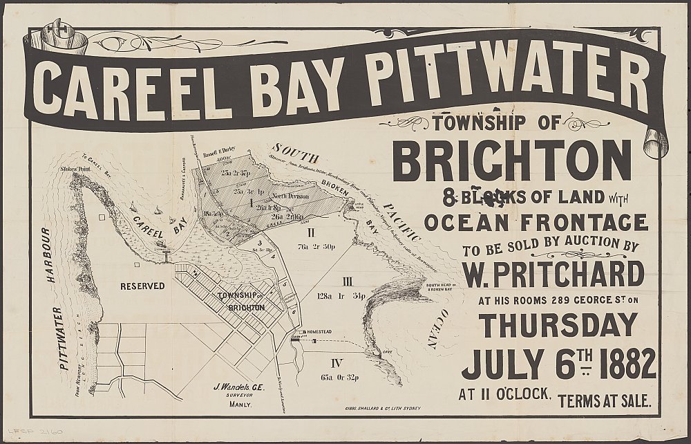
Careel Bay Pittwater [cartographic material] : township of Brighton, 8 blocks of land with ocean frontage 1882. MAP Folder 135, LFSP 2160 by Pritchard, W., courtesy National Library of Australia.
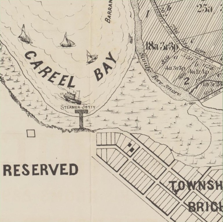
Section from above shows a 'Government road one chain wide leading north.
EIGHT MAGNIFICENT BLOCKS OF LAND, CAREEL BAY, PITTWATER, SURVEYOR'S DESCRIPTION. W PRITCHARD will sell by auction, THIS DAY, Thursday, JULY 6th, at 11 o'clock, in his Rooms, 289, George-street. The above magnificent blocks of land.
SURVEYOR'S DESCRIPTION. The land forms the pick of the late Rev. Therry's PITTWATER ESTATE, on CAREEL BAY. It is with regard to beauty of scenery, salubrity of climate, and fertility of soil, unsurpassed in this charming locality, and overlooks the tranquil waters of CAREEL BAY and PITTWATER HARBOUR, backed by the bold MOUNTAINS of the WORLD-FAMED HAWKESBURY on the WEST; and commands an immense and extensive view over the PACIFIC OCEAN on the EAST. Lots A and B. of block 1, rise in gentle terraces from the MAINROAD to BARRENJOEE, to a height of above 200 feet, and then slope down to the coast in a northerly direction. Lots C and D of Block 1 lie on gently rising ground, partly cleared, and are protected against southerly winds by a wall of high COAST CLIFFS. All these four lots contain an abundant supply of USEFUL TIMBER and practicable facilities for a PER-MANENT SUPPLY OF FRESH WATER, particularly lots C and D. which are traversed by a watercourse running into CAREEL BAY.
ALL lots have large frontages to the GOVERNMENT MAIN ROAD leading to the POST and TELEGRAPH OFFICE and LIGHTHOUSE at BARRENJOEE,THERE IS DAILY COMMUNICATION WITHIN A FEW MILES OF THE LAND FOR SALE, either by LAND or SEA, Coaches run duly from MANLY to NEWPORT, and thence a ride, drive, or sail for a few miles brings one to CAREEL BAY. The STEAMER FLORRIE, which runs in connection with the coaches from NEWPORT to GOSFORD, will also land passengers and luggage at BARRENJOEE; steamers run also direct from SYDNEY to the HAWKESBURY and BRISBANE WATER, and land passengers at the LIGHTHOUSE STATION. The whole distance from MANLY is about 14 miles. The GOVERNMENT have voted the necessary funds for a bridge over the NARRABEEN LAGOON, and it is also clearing a new one-chain road from the LANE COVE-ROAD to the PTTWATER-ROAD, and so avoids the NARRABEEN LAGOON. FOUR SCHOONERS are plying regularly between PITTWATER and SYDNEY, and so facilitate the transfer of heavy material. PLENTY of SPORT with GUN, ROD or BOAT.
(Signed) J. WANDELS, CE., 19-6-82. The land in this locality has been proved to be well suited for ORANGE GROWING ; but in a few months there will not be an acre of land in the locality available for purchase. LITHOGRAPHIC PLANS may be had at the Rooms of the Auctioneer. TERMS AT SALE. Advertising. (1882, July 6). The Sydney Morning Herald (NSW : 1842 - 1954), p. 10. Retrieved from http://nla.gov.au/nla.news-article13514755
More about the development of Careel Bay may be read in Careel Bay Steamer Wharf And Boatshed
Just preceding the years when the first Enemark Panoramas were made - especially this one taken from above the Barrenjoey road which shows us the condition of the track-road north, another sizeable chunk of land and lands at Bay View come under the Real Estate Property Act;
No. 19,218. APPLICANT :—Herbert Russell Nolan, Sydney. LAND:—County Cumberland, parish Narrabeen, shire Warringah, 179 acres 3 roods, on Careel Bay, at the South Head of Broken Bay, and on the road from Manly to Barrenjoey—lots 2 to 6 and blocks 1 and 2, north division, Pittwater Estate, and part 280 acres (portion 49, parish), granted to John Joseph Therry, exclusive of three roads each 1 chain wide, and land within the 100 feet reservation in the abovementioned grant the areas of which are not included in the above-mentioned area, 179 acres 3 roods ; adjoining properties of E. Trevor-Jones, H. Mackenzie, and Mrs. K. M. Roche.
No. 19,248. APPLICANT .—Mabel Daisy Black, Annandale. LAND: County Cumberland, parish Narrabeen, shire Warringah,—8 acres 20 perches, at Pittwater, on Bay View road and a road 30 links wide,—being part 40 acres (portion 43. of parish), granted to George Weller ; adjoining properties of F. J. S. Young, S. R. Mitchell, P. T. Taylor, Dr. J. Isbister, and G. Leslie. NOTICE UNDER REAL PROPERTY ACT. (1914, August 19). Government Gazette of the State of New South Wales (Sydney, NSW : 1901 - 2001), p. 5039. Retrieved from http://nla.gov.au/nla.news-article227674898
APPLICATIONS having been made to bring the lands hereunder described under the provisions of the Real Property Act, Certificates of Indefensible Title will issue, unless Caveats been lodged in accordance with the Third Schedule to the said Act on or before THE 20TH SEPTEMBER, 1919: —
No. 20.950. APPLICANTS:—Emily Darvall, Moss Vale, and Florence Maud Callaghan, Sydney. LAND : — Shire Warringah, 8 acres 0 roods 24, perches,—lot 9 of the North Division of the Pittwater Estate, at the junction of the roads from Manly to Careel Bay, and to Barrenjoey, about 17 chains northerly from Central-road. NOTICE UNDER REAL PROPERTY ACT. (1919, August 8). Government Gazette of the State of New South Wales (Sydney, NSW : 1901 - 2001), p. 4425. Retrieved from http://nla.gov.au/nla.news-article222512530
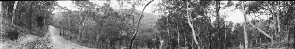
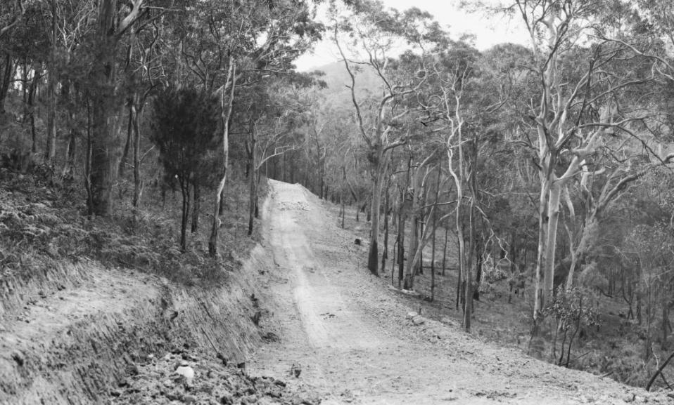
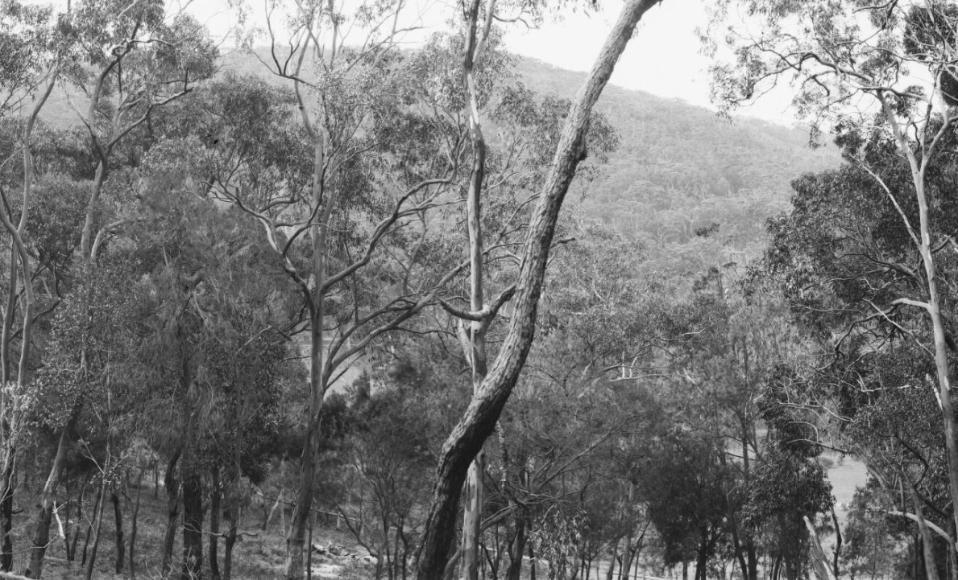
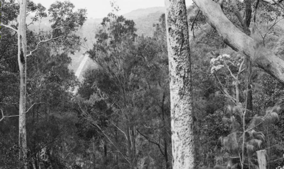
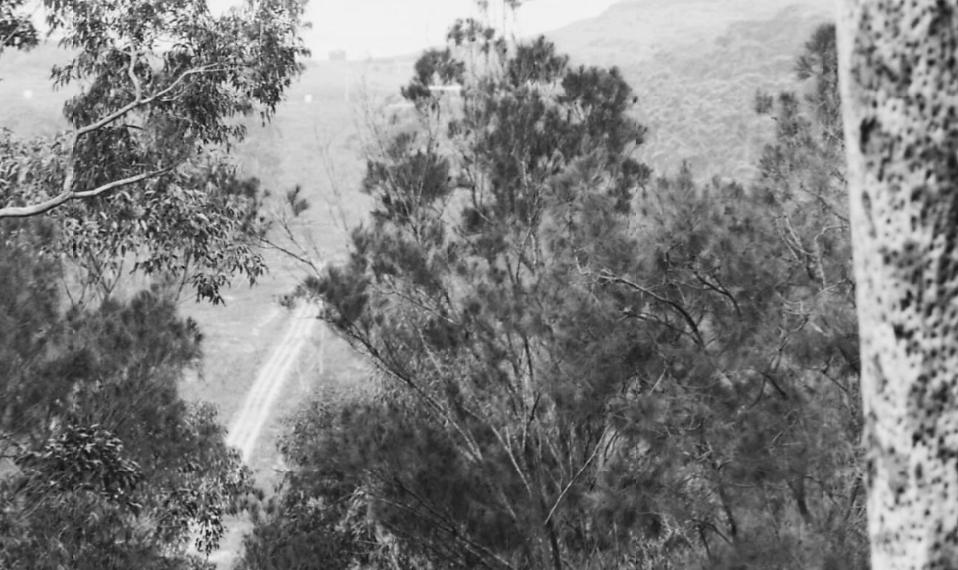
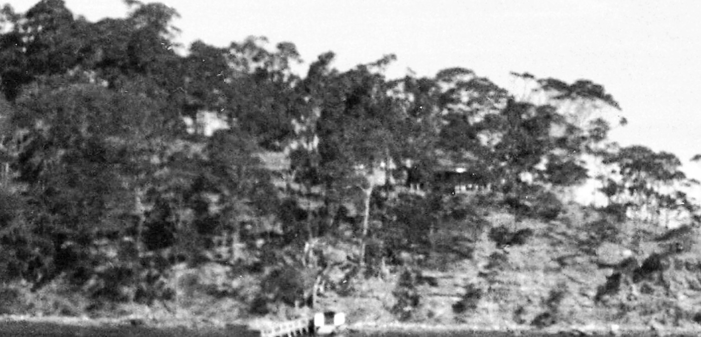
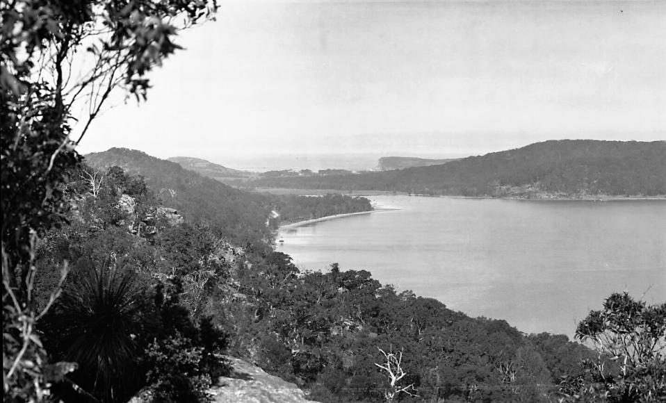
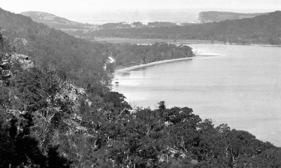
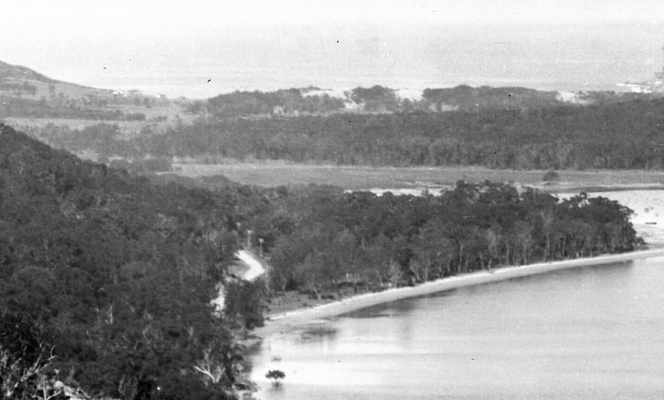
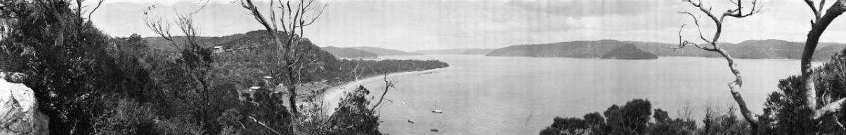
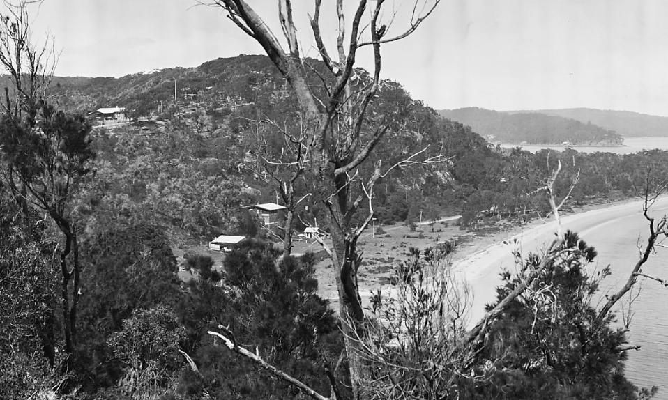
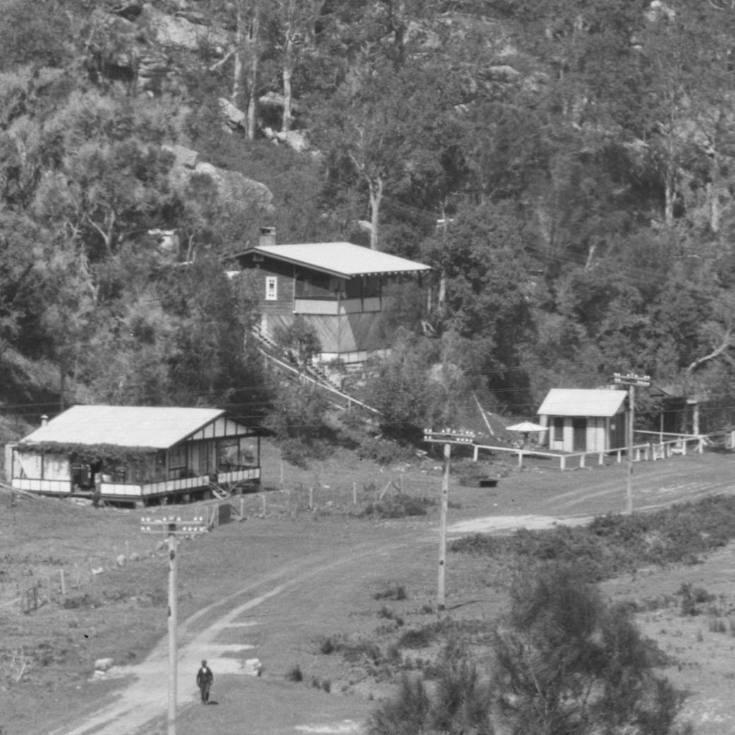
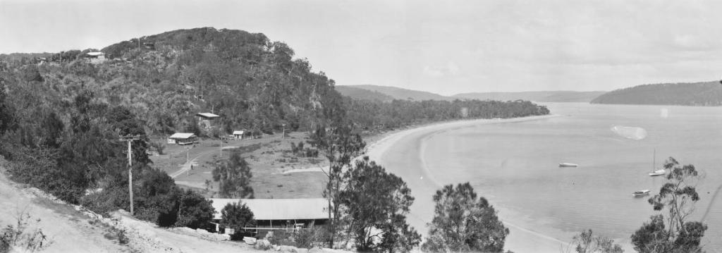

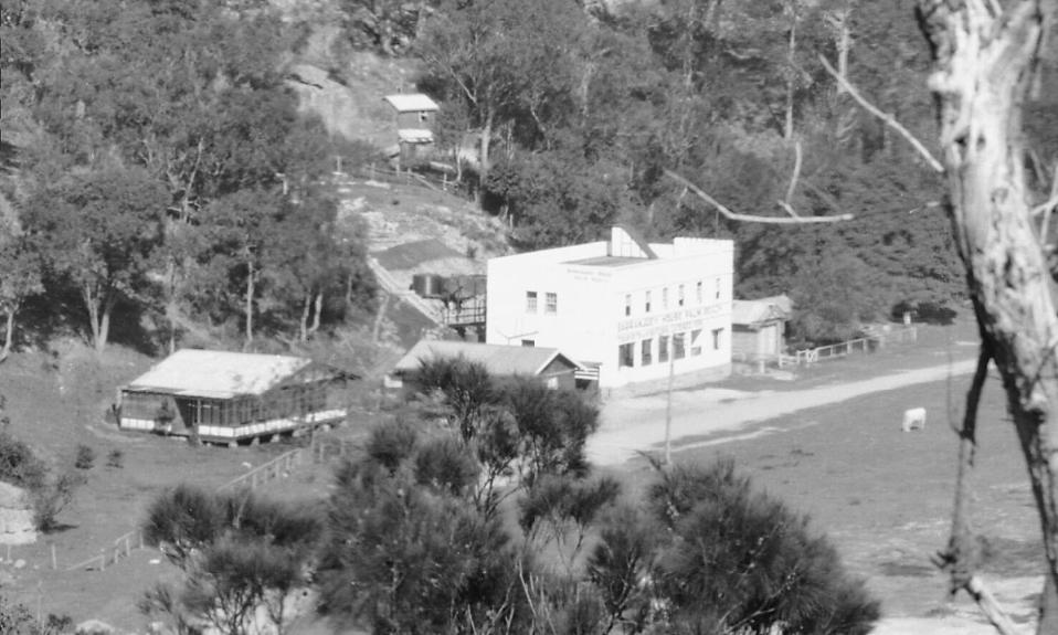
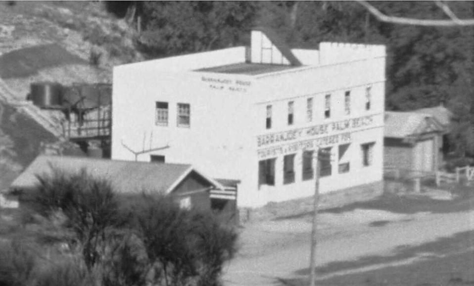
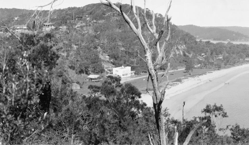
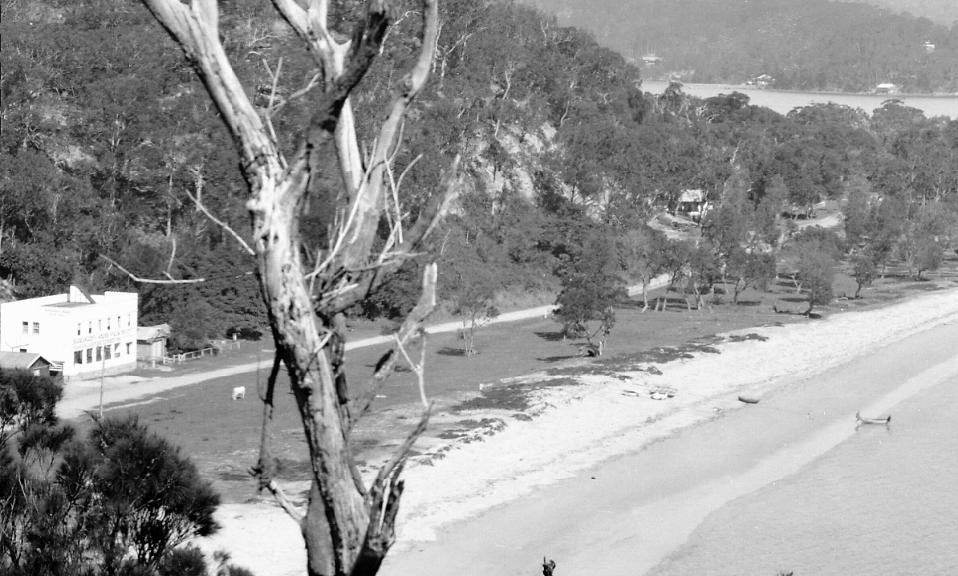
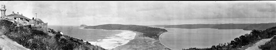
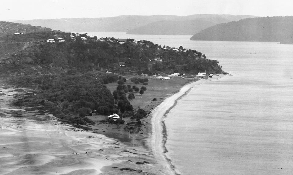
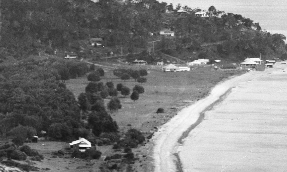
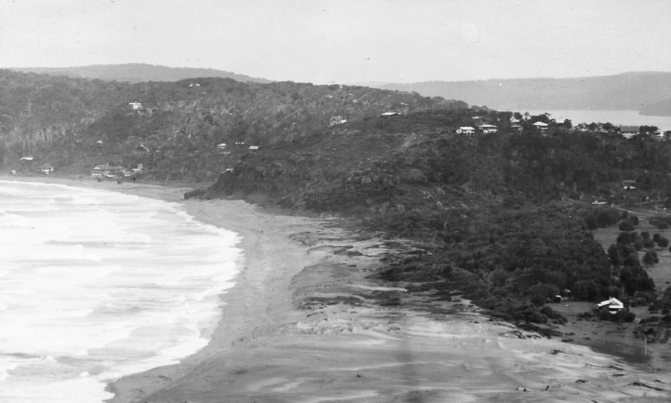
Palm Beach
The opening of the Barrenjoey Lightstation and the subsequent runs of steamers bringing 'excursionists' to Pittwater also brought more than just the day trippers. Although known as a safe harbour and a place those who fished or owned leisure craft would visit, these would mainly 'camp' and structures on shore were predominantly owned by people who worked in Pittwater - the Palm Beach holiday home and weekender, and camping park on the tombola had not commenced - as shown in this article:
THE MISSING FISHING PARTY
A MYSTERIOUS AFFAIR.
Up to an early hour this morning no traces had been discovered of the six occupants of the sailing boat the Gift, which was found at Barrenjoey by the lighthouse-keeper early on Sunday morning. Senior-constable Taylor and two more Manly police, together with a number of campers, several relatives of the missing young men, and others have been searching along the shores near Barrenjoey.
In the light of fuller information the affair is more mysterious than ever. To begin with, it turns out that when the Gift first reached the beach she was not only upright, but was uninjured. The hampers, etc., were in their places inside, and the eight oildrums used as floats were in position. It was not until later that they were washed out on the beach. About 16cwt of iron borings were carried as ballast, and this was also in place.
Mr. J. McGirk, the father of one of the missing boys, went down to Barranjoey yesterday afternoon, and there heard that a resident had seen the boat come in at about 5.30 on Sunday morning, on to the beach. It appears that she drifted in with her mainsail set, the jib having carried away. The weather at Barrenjoey was even rougher on Sunday than on Saturday night, and the Gift has now shifted nearer the lighthouse end of the beach-it is a two-mile beach-and is rapidly going to pieces. Mr. Walter Harris, of Manly, who was camped not far from the place, and who with the lighthouse-keeper discovered the boat on the sand, helped to take the contents out of her, and it was he who came upon the metal watch casing inscribed with Doodson's name. He states that a piece of stout fishing line was found attached to a length of rope, as though one of the occupants of the boat had tried to bring a line ashore.
The boat's crew were accustomed to sailing, and all, except perhaps Mr. Fagan, were good swimmers. Indeed, Mr. Hawk, the owner of the Gift, was rather proud of the "big blows" he had been in. The boat was seaworthy, and the same crew had often been out in her before; indeed, they sailed her on most holidays. "I know this, anyway, they're not ashore," said Mr. McGirk when seen last evening. "If there had been a capsize anywhere near the shore their hats and coats would have been floating about; and those oil-drums could have floated twice as many men. All they had to do was to sit in her. Unless they were washed out of her by the seas. It looks as if they had deserted her," he added
Mr. W. J. Hulbert, the father of another of the crew, said that they had all been accustomed to sailing and pulling about for nearly eight years. A queer thing was that on last Eight Hours' Day there had been the same fear that they were drowned. They had then gone up Middle Harbour, and decided to come back a day later than they were expected. "I wouldn't have let my boy go only for his mother," said Mr. Hulbert. "I hadn't let him out since Eight Hours' Day "
It may safely be assumed that none of the crew reached the beach. Although on Saturday night a tremendous sea was running, both the Southern and northern ends of the beach would have been sheltered from it. Moreover, if any of the crew has landed near where the boat came in they would have been almost certain to have made for the lighthouse, and if they had come upon the road, and attempted to reach Manly in the dark, they would have had to pass Mr. Harris's camp.
In the event of those not having been rescued by a passing steamer, the probability is that a big sea suddenly swept them out of the boat, which then drifted in empty, as it was found. In this case, unless picked up at once, they would have had small chance of life in the rough sea. THE MISSING FISHING PARTY. (1908, November 10). The Sydney Morning Herald (NSW : 1842 - 1954), p. 6. Retrieved from http://nla.gov.au/nla.news-article15004779
All that talk about a railway to Mona Vale or Newport for defence purposes, and a 1911 discussion about placing a Naval College at Barrenjoey, spelled Barranjoey during these years, attracted the attention of those who weren't campers to the isthmus.
NAVAL COLLEGE SITE. SYDNEY. June 25.
My report respecting suitable sites for the Commonwealth Naval College was forwarded to the Federal Government on Saturday,' said Capt. Bertram Chambers, R.N., today, and I am hoping that we shall soon be able to make a start. I saw three or four sites which I greatly admired. One just a little to the north of Sydney impressed me. Of course, there are others.' There is every reason to believe that the site he has in view is that of Barrenjoey. This appears to fulfill all the requirements spoken of by Capt. Chambers on his arrival in Sydney early this month. Barrenjoey is the headland at the entrance to Broken Bay, into which the Hawkesbury River flows, and is about 19 miles north of the Sydney Heads. NAVAL COLLEGE SITE. (1911, June 26). The Register(Adelaide, SA : 1901 - 1929), p. 7. Retrieved from http://nla.gov.au/nla.news-article59039495
The Barrenjoey Company, soon to be known as the Barrenjoey Land Company, landed people at the purpose built Palm Beach jetty for the first successful sales of property at Palm Beach:
TO LIVERY STABLE PROPRIETORS, MOTOR CARS and TAXI CAR PROP.-TENDERS are invited for the Conveyance of about 100 to 150 people on January 26 next, from Manly Pier to Bayview, Pittwater, and return, leaving at 10 a.m., arriving at Bayview Wharf at 12; return at 5 p.m. Subsidy, 2s per bead each way. Tenders will be received up to December 4.The lowest or any tender not necessarily accepted THE BARRENJOEY CO., Ltd., 1 Moore-street. Advertising. (1911, December 1). The Sydney Morning Herald(NSW : 1842 - 1954), p. 14. Retrieved from http://nla.gov.au/nla.news-article15293434
The jetty was built by Mr. Booth, and subsequently a store, known as 'Booths store' until it was sold to Carl Gow and Reginald Howlett, WWI Diggers looking for a more peaceful way of being. Carl's brother and father were stationed at Barrenjoey Lighthouse when he came home, and Mr. Howlett's father had had a store at Mona vale and was known as a Manly resident. So both had connections in the area. It was James Booth who built the original Palm Beach jetty though:
APPLICATIONS FOR LEASES FOR SPECIAL PURPOSES.
The Barrenjoey Company (Limited). S.L. 1911-7, Metropolitan. Pittwater, parish of Narrabeen, county of Cumberland For: Wharf. Objections to be lodged by - 13th December, 1911. APPLICATIONS FOR LEASES FOR SPECIAL PURPOSES. (1911, December 6). Government Gazette of the State of New South Wales (Sydney, NSW : 1901 - 2001), p. 6534. Retrieved from http://nla.gov.au/nla.news-article226918390
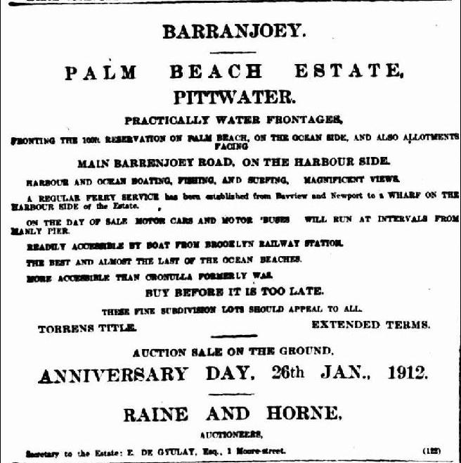
Advertisement for above stating 'harbour side wharf': Advertising. (1912, January 6). The Sydney Morning Herald(NSW : 1842 - 1954), p. 21. Retrieved from http://nla.gov.au/nla.news-article15300293
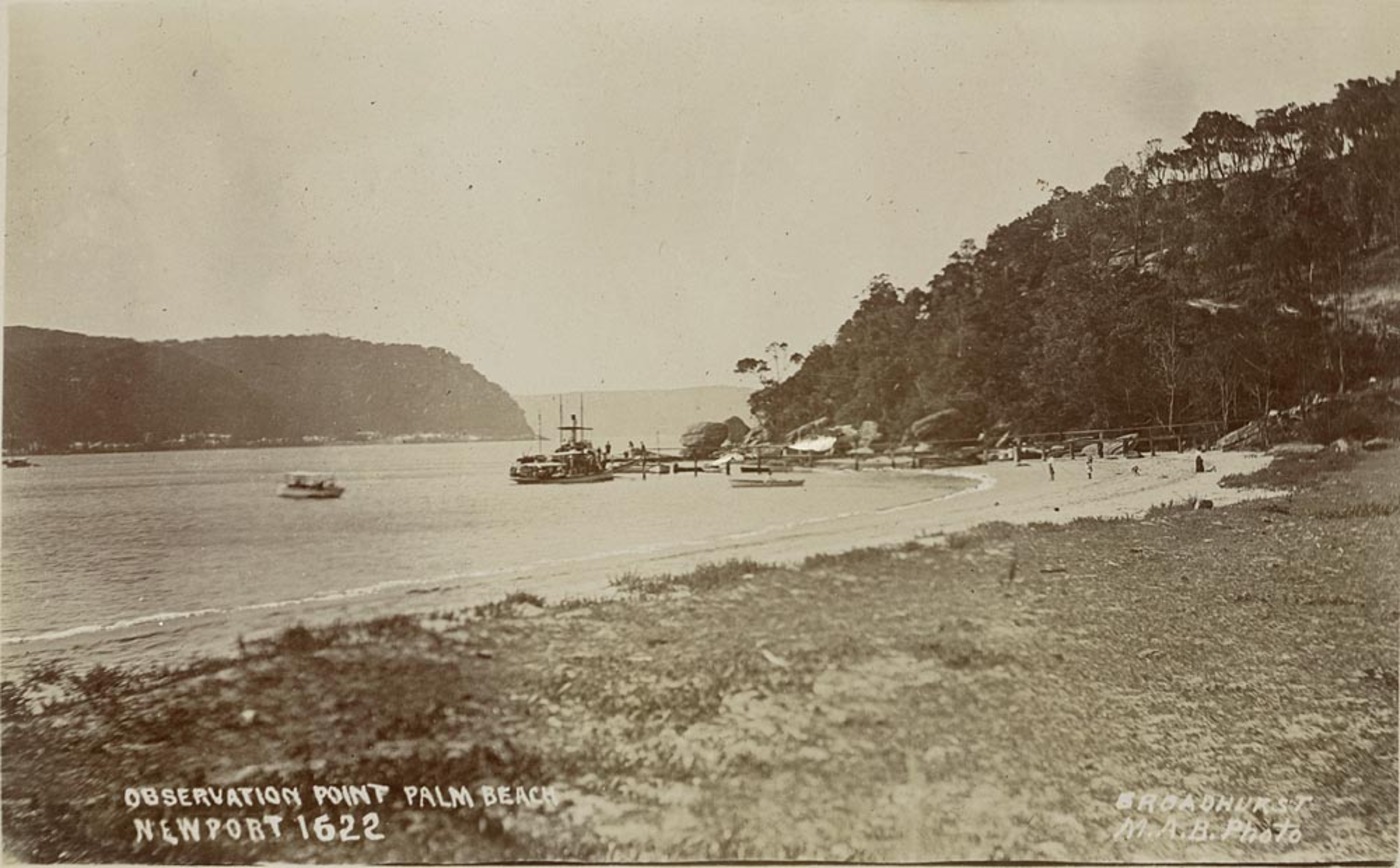
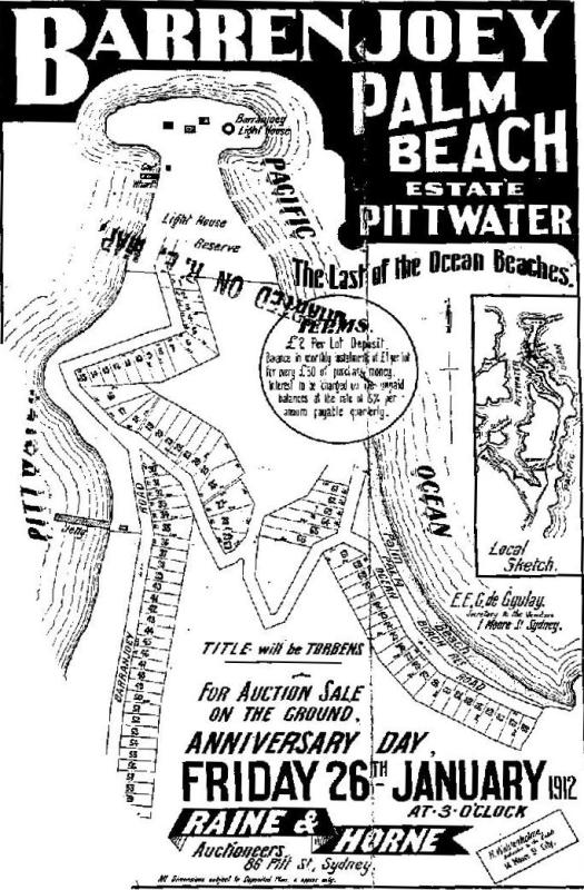
NB: 'Barranjoey Road' on Pittwater/Snapperman Beach end of the above advertisement for land at Palm Beach. As can be seen from the section of the Enemark panorama enlarged above, Barrenjoey House was originally spelled BARRANJOEY too.
NOTICE UNDER REAL PROPERTY ACT.
APPLICATIONS having been made to bring the lands hereunder described under the provisions of the Real Property Act, Certificates of Indefeasible Title will issue, unless Caveats be lodged in accordance with the Third Schedule to the said Act on or BEFORE THE 21ST AUGUST, 1912.
No. 17,737. APPLICANT:—The Barrenjoey Company, Limited. LAND:—County Cumberland, parish Narrabeen, Shire Warringah, 437 acres 2 roods, on Careel Bay, Pittwater, and on South Pacific Ocean, and on road from Manly to Barrenjoey,—lots 1 to 18. subdivision of Bassett-Darley Estate, and part 400 acres (portion 18 of parish), granted to James Napper;—exclusive of road 1 chain wide from Manly to Barrenjoey, the area of which is deducted from the total area; adjoining properties of C. Forssberg and M. M. Jones and Crown Land.
Diagrams delineating these lands may be inspected at the Land Titles Office, Elizabeth-street, Sydney.
W. G. H-WILLIAMS,
Registrar-General.
17th July, 1912. [362] NOTICE UNDER REAL PROPERTY ACT. (1912, July 17). Government Gazette of the State of New South Wales (Sydney, NSW : 1901 - 2001), p. 4485. Retrieved from http://nla.gov.au/nla.news-article221604355
All that talk of a Naval College at Barranjoey in 1911 may have brought these visitors into the area:
MILITARY ESPIONAGE
AUSTRALIAN INCIDENTS
In the course of a paper read in Melbourne last night by Mr. G. A. Taylor, secretary to the Conference of the Institute of Australian Local Government Engineers, he said that a distinguished Japanese officer who had fought in the Russian war had been discovered a few days ago making surveys of several vulnerable points on the New South Wales coast. A month ago, at Prospect, near Sydney, a party of Germans were discovered making plot surveys of natural features. It appears that the German incident took place at the time of the Hawkesbury floods. A small party from the Australian Intelligence Corps, under the command of Captain Taylor, surprised the two foreigners, arrested them, and seized their belongings. Subsequently, however, the captives were released, as under existing laws there Is not authority to arrest for espionage unless the suspected persona are surprised in making maps or surveys on a military reserve, Although the two men arrested at Prospect were set at liberty, their actions have since been very closely watched. The party of Japanese were discovered accidentally. It appears that at Easter time a party of campers came upon three Japanese in the vicinity of Barrenjoey. They had with them a plane table and military survey instruments. When asked what they were doing they answered in a manner which made it seem that only one of thorn could speak English, and that only 'Imperfectly. The matter was reported to the authorities, and on inquiries being made it was ascertained that the three Japanese were officers, one of them of high standing, and that they could all speak English very well, and were known to have been in constant communication with Japan during the time they had been in Australia. It was also found that they had succeeded in making an elaborate and extensive military survey of the country around Broken Bay. Their movements were closely watched, and It is understood that they have since returned to Japan.MILITARY ESPIONAGE (1912, October 31). The Daily News (Perth, WA : 1882 - 1950), p. 2 (THIRD EDITION). Retrieved from http://nla.gov.au/nla.news-article79870637
A description of the road to Barranjoey-Barrenjoey from later that year
A CHARMING DRIVE.
MANLY TO BARRENJOEY.
BY BUSH AND SEA.
There are so many charming walks and drives around Sydney that it is almost impossible to say one exceeds the other in its attractions. But among the many there are few people who will dispute the claims of the country lying between Manly and Barrenjoey. A portion of this very picturesque neighbourhood has recently been brought nearer the pleasure-seeking people by the tram extension to Collaroy Beach, which is within striking distance of Narrabeen. The running of a regular tram service to this point must help to popularise the district, and it is already in evidence that many more people visit this magnificent stretch of beach than was the case when only coaches provided the means of transit.
The road from Manly northwards along the coast through Narrabeen, Rocklily, to Bayview, and Church Point, on the one hand, and to Newport and Barrenjoey on the other, is not so well known to the masses as it should be, although its charms are more widely enjoyed since the advent of the motor car. After leaving Manly, the tram at a distance of about three miles passes through Brook-vale along a pretty road, by sea and bush. It is an attractive little village, in fine surroundings, and in the distance may be discerned Beacon Hill, on the French's Forest-road, whence an extensive panoramic view is to be obtained. A mile and a half further on are the Oxford Falls, which find an outlet in the Narrabeen lakes. But the route proper is the Pittwater-road, and as we pass along we see the fine buildings erected and controlled by the Salvation Army, and that quiet stretch of placid water known as Deewhy Lagoon, whose surface is often covered with black swans. Within seven miles of Manly is Narrabeen itself, whose lagoon winds for miles into French's Forest. This lagoon, however, is very shallow, and is not navigable with safety for any distance except to shallow draught boats which are available on the banks near the main road. On the ocean side is a fine beach considered safe for surf-bathers, but those who fear to venture into the open sea may fall back on the still waters of the lagoon. A number of fishermen are located here, and large quantities of fish are annually netted in the lagoon.
Two miles further on we reach Rocklily, which boasts an hotel, recreation grounds, and a park, the entrance being guarded by a cannon which has done service in its day. Within the hotel itself is a fine collection of paintings, the work of a late proprietor. After passing through Mona Vale — a picturesque settlement possessing several fine buildings, including elaborate club rooms and cottages — a branch of the road is passed which leads to Gordon and Pymble on the Milson's Point-Hornsby railway, and later the excursionist must choose his road, as one will take him to Bay View and Church Point, while the other will land him at Newport.
The main road, however, continues to Newport and Barrenjoey Lighthouse. Bay View, eleven miles from Manly, and Church Point, three miles further on, are well worth a visit. From the head of the bay there is an extensive and beautiful view over the expanse of Pittwater, with Scotland Island in the mid-distance, and the hills of Kuring-gai Chase in the far distance. The roadway skirts the water to Church Point, whence the journey may be made to Newport by launch if so desired. From Church Point a view is obtained of some seven miles of water of Broken Bay and Barrenjoey, with Lion Island standing like a grim sentinel in the path. It is an ideal position for a quiet and picturesque home.
Newport — 12 miles from Manly — is also a most charming retreat, and possesses two good hotels. A short walk to the point where the road branches off to Barrenjoey, gives visitors a magnificent view, and within easy distance is Bushranger's Hill, which recalls a time when these lawbreakers, from which the elevated site takes its name, made their attacks upon the unsuspecting mailman. There is a fine sandy, ocean beach within a few minutes walk of the hotel, where surf-bathing is indulged in. Close by is the road leading to Barrenjoey Lighthouse, which occupies a picturesque and prominent position at the entrance to Broken Bay, and so well-known to yachtsmen. All these places may be reached by coaches which meet the trams at Narrabeen, and it is safe to say that, once the beauties of the drive are known, and greater facilities provided for reaching them, this glorious coastline will be the most popular out of Sydney. A CHARMING DRIVE. (1912, December 19). Evening News (Sydney, NSW : 1869 - 1931), p. 12. Retrieved from http://nla.gov.au/nla.news-article113777520
MOTORS AND MOTORING
SUNDAY TIMES' SPECIAL NOTES AND ARTICLES
ROAD REPORTS
The 'Sunday Times' again extends an invitation to all road-users,, particularly all motorists, j to contribute reports regarding the condition of the roads they traverse in their weekly runs and holiday tours. It is unnecessary to point - out to them the value and interest of such reports to every road-user. The reports appended will indicate the class of matter the 'Sunday Times' requires for these reports. This week's report is by Mr. N. Bradley concerning the picturesque Milson's Point to Barrenjoey road : —
Milson's' Point to the Spit, fair ; Spit Hill good, corners bad, with heavy dust ; Spit Hill to Manly, dusty and scattered with loose metal on approach to Red Hill. The short cut to Narrabeen (Condamine-street) is in a shocking state for motor cyclists, being covered with heavy cobble stones, while the latter part is thick with red dust, and thus, altogether, is in a very bad condition. It is totally inadvisable for motor cycles.
From Manly to the Lagoon is good; from the Lagoon to Narrabeen fair, with occasional rough and bumpy patches. There are scatterings of loose metal, but good portions are to be found at intervals.
From Narrabeen to Bayview turn-off the surface is patchy, with small stretches of good road. From Bayview turn-off to Newport ocean beaches very good, though at times scattered with loose metal.
From Newport ocean beach to Barrenjoey, two steep hills have to be encountered; the first is in very bad repair, the surface being denoted by large stones, gutters, and nearing top, heavy, loose sand, which necessitates careful riding on account of its proximity to the cliff. There is also a very rough descent, with loose sand, large stones, gutters, and irregularities. To the foot of the second hill there is a cart track, which is very heavy with loose sand. The road has been neglected. The second hill is the same as the first, yet not so loose with heavy stones, but is steeper in places. The descent is bumpy, and covered in loose sand, and is altogether badly neglected.
Then the road becomes a track which is more or less covered in sand. Here, a sign-post is met, which very indistinctly points the way to Barranjoey; those unable to read it will keep to the right. From here the road becomes rough and indistinguishable. From a track it becomes a grass field, but keeping straight on, the track is once again picked up in very loose sand, which is deep in places, but the absence of big stones is something to be noticed.
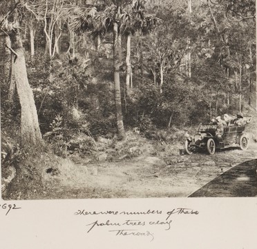
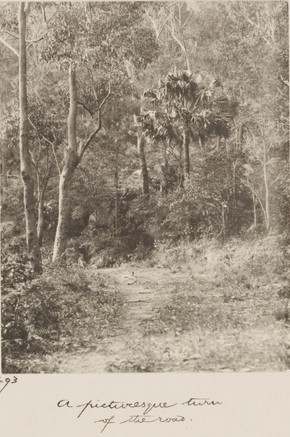
The premature track is in places fair, but mostly rough, with loose metal and occasional pinches on to Barranjoey. The trip from Newport to Barranjoey is, altogether, unpleasant for the motorcyclist at the present time. I would advise that the rider who wishes to visit the beautiful resort for the week-end leave his machine at Newport, and take the ferry, which runs twice a day from Newport and Bayview. This is advised if he has any respect for his 'jigger.' Petrol cannot be purchased at Barranjoey, but should the motor-cyclist's tank become dry, he has only to ask the ferryman to bring the required quantity back on the next run. MOTORS AND MOTORING (1913, February 2). Sunday Times (Sydney, NSW : 1895 - 1930), p. 18. Retrieved from http://nla.gov.au/nla.news-article126462595
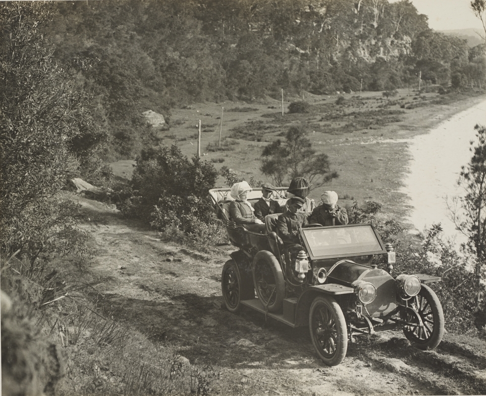
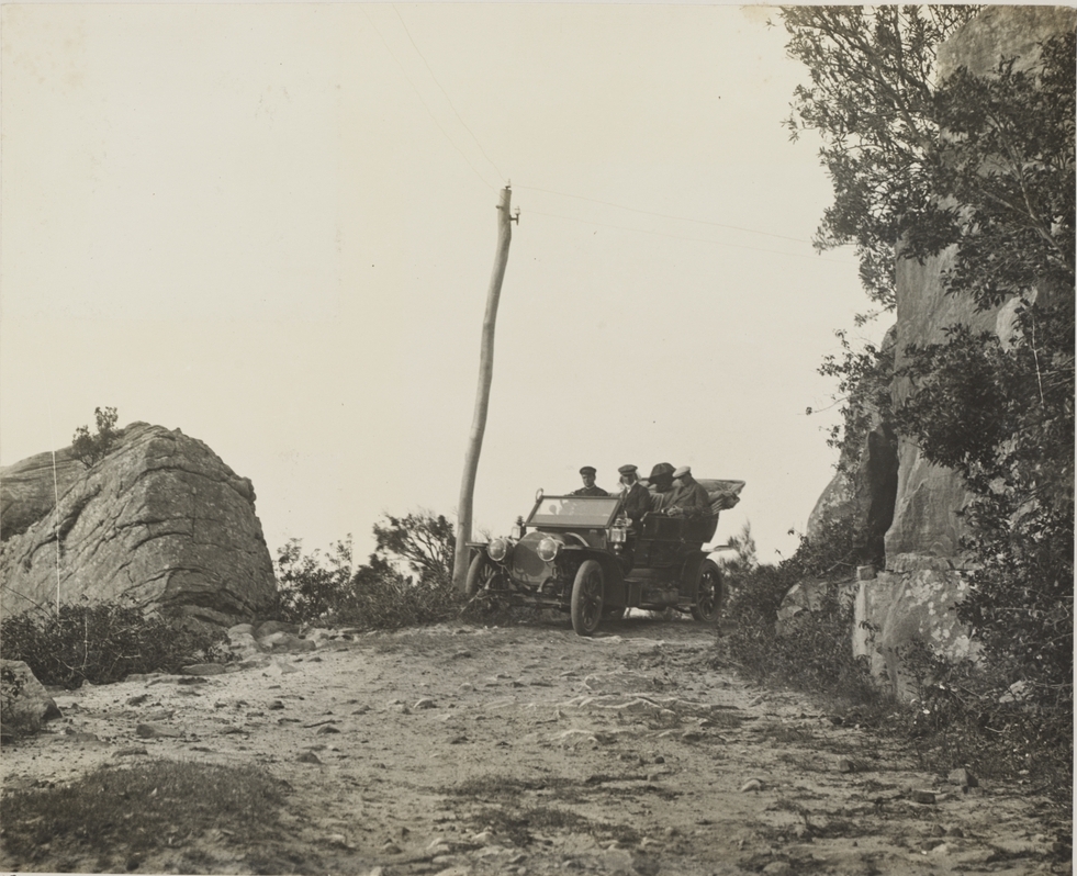
And then, finally, the State Government decided they'd help out with the 'track' to Barrenjoey:
Department of Lands,
Sydney, 10th June, 1914.
NOTIFICATION OF PROPOSED OPENING OF ROADS.
NOTICE is hereby given that the Minister for Lands deems it expedient that certain roads should be opened, and that it is proposed to resume for the purpose, under the provisions of the Public Roads Act, 1902, the lands hereunder described.
The proposed roads are shown upon plans which can be inspected at this Office, and a copy of the same may be inspected at the respective Offices of the Crown Land Agents for the Land Districts in which the lands are situated.
All persons interested are hereby called upon to set forth in writing and to forward to the Minister, within one month from date of this notice, any objections which may appear to them to exist to the proposal to open the roads referred to.
J. L. TREFLE.
Description of Road to be opened - Road from Pittwater to Palm Beach at Barrenjoey, parish of Narrabeen, county of Cumberland, Warringah Shire.
[Registration No. of Papers—Roads 1912-1,091-11; Catalogue No. of Plan—R. 11,872-1,603.]
Owner. James Napper (grantee); The Barrenjoey Co., Ltd. (owner). Occupier. The Barrenjoey Co., Ltd. Character of Holding. Freehold. Width of Land to be Resumed. 100 links ... Area to be Resumed 1a 2r. 0p.
Remarks. Part of this proposed resumption (5 perches) is covered by part of private subdivision road in use. NOTIFICATION OF PROPOSED OPENING OF ROADS. (1914, June 10). Government Gazette of the State of New South Wales (Sydney, NSW : 1901 - 2001), p. 3485. Retrieved from http://nla.gov.au/nla.news-article226768719
Description of Road opened :—Road from Pittwater to Palm Beach at Barrenjoey, parish of Narrabeen, county of Cumberland, Warringah Shire.
[Registration No. of Papers—Roads 1912-1,091-19; Catalogue No. of Plan—B. II,872-1,603.J ]
Description of land now returned for the road specified above, and dedicated as a public road.
A proposal to resume the land referred to for the road in question, was published in the Government Gazette of 10th June, 1914, folio 3185. NOTIFICATION, UNDER THE PUBLIC ROADS ACT, 1902, OF RESUMPTION OR WITHDRAWAL AND DEDICATION OF LANDS FOR ROADS. (1915, January 20). Government Gazette of the State of New South Wales (Sydney, NSW : 1901 - 2001), p. 334. Retrieved from http://nla.gov.au/nla.news-article227053700
TWENTY MILES OF OCEAN BEACHES.
On the opposite page We publish several views of what is becoming one of the most delightful g tourist resorts in Australia — that fine stretch of -p. country, with it's many picturesque drives and charming ocean beaches, running from Manly right to Barrenjoey, at the entrance to the Hawkesbury River — a distance of quite 20 miles.
WE are a holiday-loving people, and we like to get to the bush or the beach with our hampers. The ; difficulty is, where there is such a plethora of resorts to choose from, to decide just where to go. In this respect the Warringah shire, which includes, all those fine beaches and natural lakes between Manly and the Hawkesbury, makes a strong call. It is a district that might fittingly be called the new Playground of Sunny New South Wales. Do you like surf-bathing?— You will find it at Freshwater, Curl Curl, Dee Why, Collaroy, Narrabeen, Mona Vale, Farrell's Beach, Palm Beach, and Barrenjoey. This is a formidable list, and on almost all the beaches there is splendid bathing accommodation. Do you love boating? —You can pull your skiff over the charming stretches of .( the Hawkesbury which surround the restful holiday resorts of Pittwater and Newport. Do you fish?— You will need strong lines and hooks for the schnapper, bream, and : ..; whiting which abound around the many reefs and bays. These are but a few of the assets of this great region of holiday resorts. When that all-important question has to be decided — Where shall we go for a holiday? — both the toiler in the city and the visitor from out back would do well to decide on some spot in this charming region. When the Warringah Shire Council realised the valuable asset they have in their continuous line of beaches, they quickly set about improving the surroundings in no half-hearted manner. Week-end bungalows have sprung up everywhere along the sea fronts, the price of handy allotments is soaring upward, and convenient hotels and boarding-houses catering for holiday-seekers are now in evidence at all the popular centres, such as Freshwater, Collaroy, Narrabeen, Newport, Pittwater, and Barrenjoey. This new playground has one big advantage over its principal competitors; it is within an hour of Sydney. The tram takes one from Manly right to the Narrabeen Lakes, where a fine expanse of water leads up to a waterfall that is easily reached by pleasure skiffs and launches. At the tram terminus an ample motor service takes up the running for all the more distant resorts as far as Newport and Pittwater. On Sundays and holidays the services are very frequent, and are well patronised. During the present season the whole district served by the motor-cars has been particularly popular. There are many week-enders who make a practice of visiting their favourite resort every Saturday, leaving town at midday and turning home-wards again on Sunday afternoon or evening.
SOME of those who visit this region of beaches go in search of health, some to preserve their health; but the great majority go for the sheer joy of sporting in the surf, wandering ever the picturesque hills and dales, or picnicking in some secluded spot. Every motorist knows, or should know, the delights of the Warringah shire. It includes some of the finest runs in the State, and on Sundays and holidays a constant stream of cars and vehicles may be seen along the main road, which follows the coastline to Barrenjoey. The council have gone to considerable expense in placing the French's Forest road in excellent travelling condition. After crossing The Spit, one turns sharply to the left at the top of a hill, and once the first rise is negotiated a noble panorama opens out. Away to the left are picturesque glimpses of Middle Harbour, behind which rise the rocky headlands, and in the distance one gets a glimpse of the red-tiled villas along the North Shore line.
Presently the road diverges, and one has the choice of striking the ocean front again either at Narrabeen, Brookvale, or Rock Lily. Probably the first road, which takes the motorist over the South Creek road, is, from a tourist point of view, the most interesting, although many avow that the road over Tumble Down Dick affords one of the finest panoramas on the coast of New South Wales. At points enroute one gazes out over a magnificent stretch of hilly country, and, indeed, it is hard to realise that one is within an hour's drive of the heart of a big city. On leaving one or other of the routes indicated, one finds a splendid macadamised road passing over the bridge at Narrabeen Lakes; then one crosses a headland or two and arrives at Rock Lily. To the left is a beautiful drive to Pittwater, the road running alongside the placid waters of the Hawkesbury through Bayview to its termination at Church Point. Here there are launches which link together the many week-end bungalows and homes dotted about the wooded slopes. To the right at Rock Lily the road keeps to the ocean front, and on leaving Mona Vale one climbs more headlands commanding magnificent views. Then comes Newport, where there is a modern tourist hotel. Within a stone's throw is Farrells Beach, where there are 20 or 30 furnished cottages, a surf club-house, and ample dressing accommodation for both ladies and gentlemen. Over more headlands to Palm Beach, and five miles further on, one passes Barrenjoey Lighthouse, perched on a rocky prominence which rises some 200 feet above the sea. For motorists the road is somewhat 'tricky' after leaving Farrell's Beach, but the coastal views are lovely, and the panorama on the Hawkesbury side simply glorious. There is good accommodation at Barrenjoey, and one has the advantage of being right on the sea front, where there is good surfing and fishing, and at the same time' may turn that will to the calm waters of the Hawkesbury for boating, sailing, or line fishing. Is it any wonder that this district is fast becoming one of the most popular holiday resorts around Sydney. It is certainly one of the finest assets of the State. TWENTY MILES OF OCEAN BEACHES. (1915, April 7). Sydney Mail (NSW : 1912 - 1938), p. 33. Retrieved from http://nla.gov.au/nla.news-article166255869
BROKEN BAY FISHING.— Groper and other crab-eating fish are often caught at this time of the year from the rocks at Barrenjoey and West Head, and from those on northern side of the bay outside the entrance to Brisbane Water. As the road to Barrenjoey has been improved slightly, motor car and motor bicycle anglers are easily able to make the trip at week-ends. The northern beach is chiefly visited by Woy Woy and Kincumber visitors. GAME FISH ARE IN ALL THE BAYS ALONG THE COAST (1915, November 6). Saturday Referee and the Arrow (Sydney, NSW : 1912 - 1916), p. 3. Retrieved from http://nla.gov.au/nla.news-article117550631
A visit to Barrenjoey is recommended to rock and beach fishermen who have the use of a motor-car or motor-cycle. The road from Manly has been improved in some places, and a little care will ensure a safe trip over the rest of the rough. Rock fishers should be ready to catch heavy drummer, groper, carp, and other fish that frequent ,the rocky waters on the baits that the rocks themselves afford, and beach fishers should have no difficulty in catching whiting and black bream on crabs, pippies and beach worms, all. of which are found on or near the beaches.
Exciting sport is often obtained in the fresh water of some of the coastal rivers amongst the freshwater mullet — that is, small sea mullet which have got up above the tidal limit during flood time and remained in pools some distance above the saltwater. The mullet is an adaptable customer, and soon changes its habits to fit in with its new quarters. It then seems to be more ready to rise to small baits of dough or soaked barley than when in the sea, and when hooked it gives its captor great work on a light rod. Regarded as angling, the game of catching freshwater mullet is not in the same class as trout fishing with the artificial fly, because no casting can be done. The baits used on the flyhooks are too soft to stay one cast. If a man tried to cast with a do bait he would be spotting the surrounding rocks or tree trunks with tiny white blobs.
Apparently barracouta are gone from the bream grounds between Manly and North Head. Last Sunday, although Messrs. N. and G. Lowe, W. Parker, J. Balson, A. Bull, R. Tombs, and J. Danehy, who had three boats out from Skinner's, fished most of the day with mackerel, they surprised only one barracouta, and it refused to come into a boat. The party had a mixed bag of black and red bream, flathead, and other fish, but it was not equal to their hopes or half compensatory for their outlay on bait. FISHING (1916, August 2). Referee (Sydney, NSW : 1886 - 1939), p. 6. Retrieved from http://nla.gov.au/nla.news-article121175377
EXTENSION OF TERMS OF SPECIAL LEASES. County Cumberland, parish Narrabeen, below high-water mark, Pitt water, portion Sp. L. 1912 4 ; Ms. 3,922 Sy. Area, 1 rood 20 perches.
1917 -1176 Barranjoey Co., Ltd., 14 Castlereagh-st., Sydney. No. of Application – 1912 – 4, Metropolitan Bathing Place – from 1 Jan. 1917 to 31 Dec. 1921
Special Lease 1912 4, Metropolitan. Barrenjoey Company, Limited.—The lease shall be subject to subsections 1, 3, 4, G to 0, 11, and 13 of Regulation No. 10G (notified 20th April, 1917), and to the following special conditions:—(a) The lessees shall permit children attending any school in Warringah Shire, and in charge of teachers, to have the free use of the baths without payment on one day in each week between the hours of 2 p.m. and 4 p.m., such children to provide their own towels and bathing costumes. (b) The lessees shall have not less than three life-buoys readily available at all times. (c) The lessees shall be responsible for the proper conduct and cleanliness of the baths, and shall compel bathers to wear suitable bathing costumes, (d) The lessees shall, after determination of the lease by forfeiture, effluxion of time, or otherwise, and within such time as may be given, remove the structure or all or any material from the lanel at their own cost, and without compensation, if required by the Minister in writing to do so. ) The lessees shall, within six months from the date of notification in the Government Gazette of the granting of the extension of the term of the lease, enclose the land with a shark-proof fence, and maintain such fence in efficient repair throughout the currency of the lease. (e) A breach of any of the conditions, or the occurrence of any indecent or disorderly conduct, will render the lease liable to forfeiture. EXTENSION OF TERMS OF SPECIAL LEASES. (1917, November 2). Government Gazette of the State of New South Wales (Sydney, NSW : 1901 - 2001), p. 5968. Retrieved from http://nla.gov.au/nla.news-article227328341
The influence of Palm Beach 'holiday home' owners, as shown in a January 1923 article in the Sunday Times, should also not be underestimated - being able to access these homes in a safe and timely manner, a vast improvement on the previous decade when people had to catch a ferry or launch from Newport, land at Gow's wharf or further along on Station Beach:
At 7.30 on Monday morning a very enthusiastic crowd of 80 to 100 friends assembled on the wharf at Palm Beach, Barranjoey, to bid farewell to Mr. W. Chorley and Mrs. Chorley and their daughters, of 'Mount Pleasant,' Cheltenham. The family have been staying over the holidays at 'The Rest,' which is their pretty seaside residence facing the ocean, and situated at Palm Beach. At 'The Rest' friends were right royally entertained, and received the Chorley family's usually abundant hospitality. Croquet tournaments were played, surf parties and plenty of music were indulged In, and altogether the holidays were very delightfully'spent. There was great rejoicing when Mr. Chorley's private launch came alongside the wharf, which was overcrowded with sincere friends. The Hon. W. Tyler, of South Australia, made a most humorous speech; and Mr. Chorley responded in his usual happy way, and hoped that they and their friends would all be spared to meet again next Christmas. All joined hands and sang 'Auld lang syne' whilst the launch drew out from the wharf and steamed down the river. PERSONAL PARS. (1915, January 13). The Cumberland Argus and Fruitgrowers Advocate (Parramatta, NSW : 1888 - 1950), p. 3. Retrieved fromhttp://nla.gov.au/nla.news-article86103157
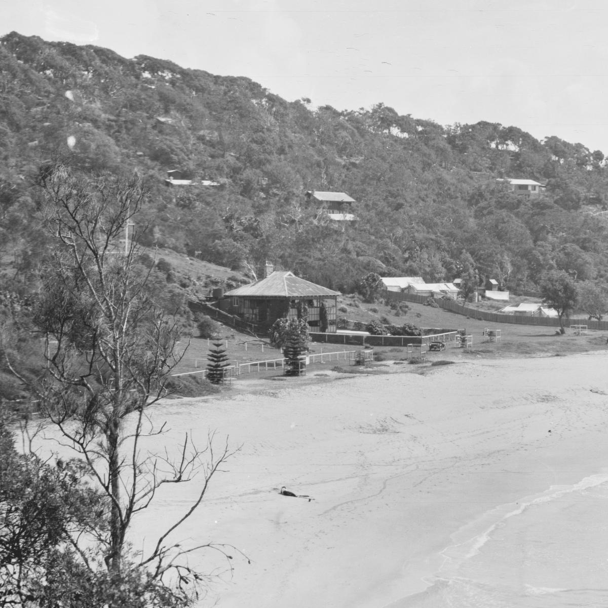
Lady French, who has a cottage at Palm Beach, remembers going there 30 years ago (1916) with her first husband, the late Sir Herbert Maitland. Travelling in their Rolls-Royce, they would take several hours to make the journey, they had to cross in two punts at where the Harbor Bridge and the Spit Bridge are now.
"a trip to Palm Beach about 30 miles, was no light-hearted jaunt. Sometimes it felt like a cross-continent expedition," said Lady French. There were two punt crossings and miles of rough dangerous roads, with the worst stretch between Newport and the Beach. The small population at Palm Beach was far outnumbered by the herds of wild goats.
Pill Hill
" I Remember on one of our usual Palm Beach social functions-a walk along the sand to Barrenjoey Lighthouse-coming face to face with a fierce old goat and almost being shunted over the cliff."
The late Sir Herbert Maitland and I were among the original people to build holiday homes at Palm Beach. In addition to Sir Herbert, the late Doctors Bullmore, Gordon Craig, and Thring had homes there. Dr. R. Godsall and Dr. Brown Craig were also among the "early settlers" to live along the "top" road, which, because of their profession, became known as Pill Hill.
The doctors who pioneered Palm Beach in those early days likened it to a tropical paradise. It is still favored by members of the medical profession, and many young doctors are members of the local surf club.
The first general store was at Palm Beach, on the Pittwater side near the jetty, as early as 1914, and was known as Booth's store. Later it became Ellis' store, and then after the last war two returned Diggers, Mr. Fred Howlett and his partner, Gow, took it over. Their general supplies came by ship from Sydney by the Erringhi and the Kallawatta, and meat and bread came by launch from Newport.
They made their own ice-cream in those days, and froze it in old fashioned freezers with coarse salt. It was just as popular as the well known brands are to-day.
It was not until 1929 that Howlett's store was established on the beachside of Palm Beach. Before that there was no road through from Pittwater, and the top road was used by residents.
The same free-and-easy way of life still goes on at Palm Beach. These days, however, welcome guests bring their own sheets because of the laundry difficulties; their own rations-meat, butter, sugar, and tea. Palm Beach setting for smartest sea and sun togs. (1946, January 12). The Australian Women's Weekly (1933 - 1982), p. 22. Retrieved from http://nla.gov.au/nla.news-article47245736
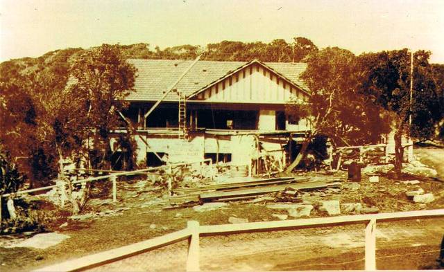
The Maitland home, built by Albert Verrills, Corner of Beach Road, Palm Beach. image courtesy Lady Maitland and Peter Verrills.
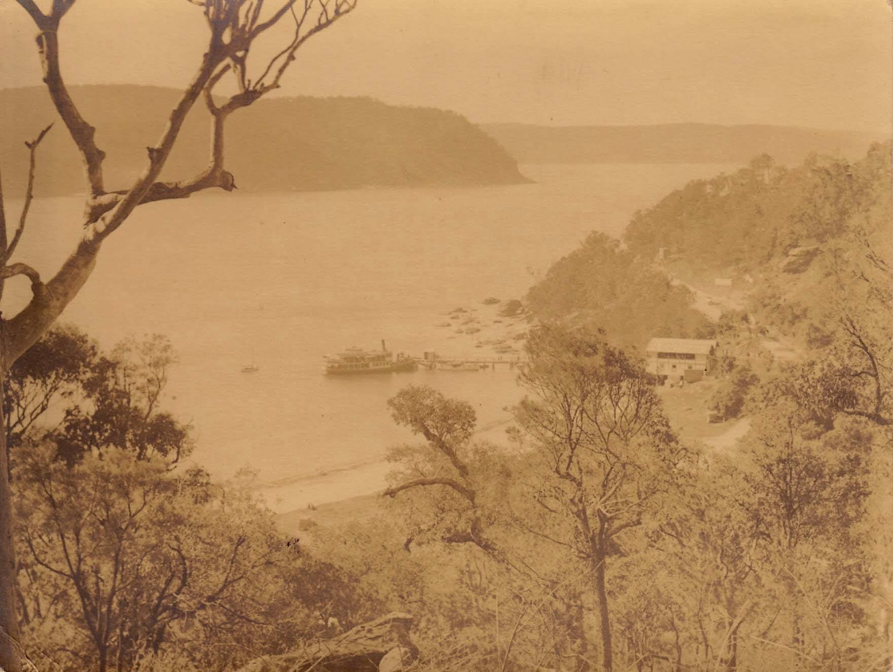
The Phoenix at the Palm Beach Jetty, pre 1918 - this shows the boatshed and tea rooms soon to be operated by Carl Gow and the Gonsalves. The Barrenjoey road can be seen going up hill to Observation Point. The large rock seen at right will soon come tumbling down - photo courtesy John Cowper, from private collection
Land Slip
(See photo, on page 11)
Henry A. Wilshire sent us the above striking photograph with the following note : —
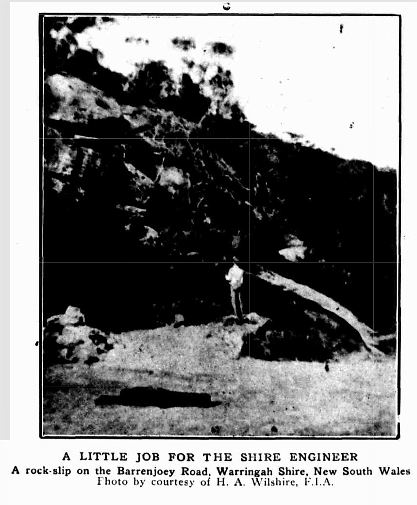
I am sending you a couple of negatives of photos of a land slip or rock slip on the Palm Beach Road, next to the Barrenjoey Road. The rock in measurement would weigh some 700 tons, and a small one next to it, 300 odd tons. The slide was very smooth, the bed being white pipeclay, and since it has been on the road, it creeped 2 feet. It should form an interesting problem for engineers in Shires as how would be the most economic way of removing same, and the quickest way to get rid of such a lot of stone. It seems to me if the earth were removed from the front of it, the weight may take it farther, where it would eventually go into the waters of Pittwater. However, 10 men are starting to blast it and try and remove it for the property owners who are at present cut off from any road communication. SHIRES (1918, June 4). Construction and Local Government Journal (Sydney, NSW : 1913 - 1930), p. 6. Retrieved from http://nla.gov.au/nla.news-article109675349
700 Tons Rock Falls at Palm Beach
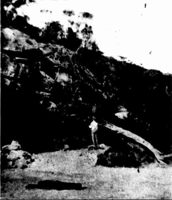
(See photo, on page 11) Henry A. Wilshire sent us the above striking photograph with the following note : — I am sending you a couple of negatives of photos of a land slip or rock slip on the Palm Beach Road, next to the Barrenjoey Road. The rock in measurement would weigh some 700 tons, and a small one next to it, 300 odd tons. The slide was very smooth, the bed being white pipeclay, and since it has been on the road, it creeped 2 feet. It should form an interesting problem for engineers in Shires as how would be the most economic way of removing same, and the quickest way to get rid of such a lot of stone. It seems to me if the earth were removed from the front of it, the weight may take it farther, where it would eventually go into the waters of Pittwater. However, 10 men are starting to blast it and try and remove it for the property owners who are at present cut off from any road communication. SHIRES. (1918, June 4). Construction and Local Government Journal (Sydney, NSW : 1913 - 1930), p. 6. Retrieved from http://nla.gov.au/nla.news-article109675349
This wasn't the last rock slip in that particular area of Palm Beach:
This photo is by John Stone. It appeared in the Warringah and Pittwater News of Thursday November 5th, 1970.
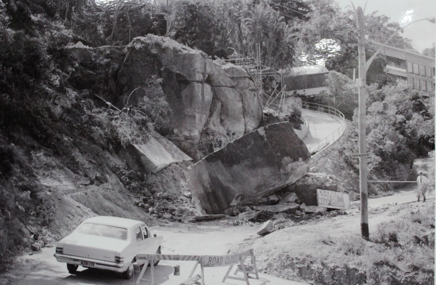
Caption read "Traffic was blocked since last week when this rock, which was estimated to weigh 240 tons, crashed onto the roadway. One hour prior to the fall workmen on a nearby construction site heard a grating sound as the rock began to shift. Warned by these sounds they stayed well clear. Avalon Police expect the road to be reopened for traffic next week.
The road is Palm Beach Road, which goes up and over the hill on the right just as you are going up towards Observation Point. Now part of the Avalon Beach Historical Society photos collection.
The first proposal of a road improvement past the initial 1914 one put in by government was only going to go as far as Newport to begin with:
MANLY TO NEWPORT.
PROPOSED CONCRETE ROAD.
A deputation from the Warringah Shire Council waited on the Minister for Local Government (Mr. Fitzpatrick) yesterday, and urged that the Government should subsidise the council on the £ for £ principle in connection with the concrete road it was pro-posed to construct from the boundary of the municipality of Manly to Newport, a distance of about 12 miles. It was estimated that the cost would be £80.000 to £90,000. The council. It was stated, could not afford the whole of the cost on what was, after all, a national highway. Difficulty was being experienced in maintaining roads out of revenue.
Mr. Fitzpatrick said he was not prepared to make a definite promise, but he would undertake that the matter would receive the closest possible consideration, in connection with several other proposals of a similar character. There was no doubt that the time had long since arrived when councils, Instead of expending small sums here and there on patchwork, should make a calculation as to whether It would not be better to raise a loan and put the roads into decent order. MANLY TO NEWPORT. (1923, March 6). The Sydney Morning Herald (NSW : 1842 - 1954), p. 6. Retrieved from http://nla.gov.au/nla.news-article16071998
These Notices may be read in full in the Newport, Bilgola and Avalon sections above - at the Palm Beach end:
SHIRE OF WARRING AH.
Proposed Special Loan of £28,200.
NOTICE is hereby given that it is the intention of the 1 Warringah Shire Council to apply for authority, under I section 180, Local Government Act, 1919, to borrow the sum of £28,200 for the purpose of carrying out the undermentioned works within A Riding of the Shire, and for purposes incidental thereto:—
1. Construction of Barrenjoey-road, from Seaview-parade, Newport to Beach-road, Palm Beach, including proposed deviations between Neptune-street and Avalon-parade, estimated cost (excluding cost of formation of deviations) ,— 17,600
2. Construction of Warriewood-road, from Pittwater-road to Vineyard-street, at estimated cost of 1,700
3. Construction of Powderworks-road; (a) from Pittwater-road to eastern end of Kobado-road; (b) Kobado-road, for its entire length; and (c) Powderworks-road, from the western end of Kobado-road to its junction with the Gordon-Mona Vale road, at estimated cost of 4,000
4. Construction of Gladstone-street, Newport, estimated cost 1,000
5. Drainage of Black Swamp Reserves, Mona Vale 1,900
6. Resumptions, surveys and contingencies .. 2,000
The interest payable on such loan shall not exceed six and half (6$) per cent, per annum, and it is proposed to arrange the loan on terms which shall provide for the repayment of principal and the payment of interest, combined, in half-yearly instalments extending over a period of ten years. The approximate amount of each such instalment will be £1,939 11s. 4d,
To provide the sum necessary for such instalments, it is proposed to levy a local loan rate of four-fifths of a penny (4/5ths d.) in the £ on the unimproved capital value of all ratable lands in A Riding of the Shire. Should such rate not provide sufficient for the purpose, the balance will be paid from the General Fund of the Shire. The total unimproved capital value of all ratable lands in A Siding is £3,005,162.
Plans, specifications and reports giving details of the proposal may be inspected at the Shire Hall, Brookvale, during office hours.
Within one month of the publication of this notice, any number, not less than 25 per cent, of the ratepayers of A Biding, may petition the Couneil to take a poll of ratepayers, either as to whether such ratepayers approve of the loan, or as to whether the loan rate should be on the unimproved capital value or the improved capital value, or on both questions. The number of ratepayers enrolled for A Biding is 3,892.
(N.B.—The foregoing proposal is in lieu of the proposal notified in the Government Gazette of 2nd October, 1925.)
R. G. JAMIESON, Shire Hall, Brookvale, Shire Clerk.
23rd November, 1925.
SHIRE OF WARRINGAH. (1925, November 27). Government Gazette of the State of New South Wales (Sydney, NSW : 1901 - 2001), p. 5354. Retrieved from http://nla.gov.au/nla.news-article223017024
BARRENJOEY ROAD.
GREAT PLEASURE DRIVE.
The Minister for Local Government has approved of the Warringah Shire Council's application to borrow £28,200 for the reconstruction of roads and the drainage of public reservation reserves in A riding.
The principal work will be the tar-metalling of a length of 6 miles 11 chains of the Pittwater-road including 1 mile 46 chains of road deviation between Newport and Avalon. The main road from Manly to Newport is, it is understood, to be tar-metalled or concreted by the Main Roads Board. The council's proposal is to tar-metal from the end of the main road right through to the narrow neck of road between Palm Beach and Barrenjoey, thus creating what is regarded as an unrivalled pleasure drive.
The deviation of the road between Newport and Avalon is to be defrayed from an additional loan of £5800, which has also been approved. BARRENJOEY ROAD. (1926, April 29). The Sydney Morning Herald (NSW : 1842 - 1954), p. 8. Retrieved from http://nla.gov.au/nla.news-article16289112
The Serpentine:
REAL ESTATE
DEVELOPING NORTHERN BEACHES
NEW SUBURBS ACROSS THE HARBOR THREE NEW FACTORS WHICH WILL HELP
Lack of an unbroken path from the city to beyond Manly has retarded the development of— the beaches on the Barrenjuey peninsula. This Is due to the fact that there are vast suburban areas on the north side of the Harbor barely scratched by development and, consequently, the majority of Sydney's citizens are congregated on the south side. Naturally, they patronise the beaches nearest home; few cross the harbor to swim and surf. This aspect will be changed by the growing North Shore bridge, whose steel link, should create an enormous new population whose surf benches will be Newport, Avalon, Whale Beach, and Palm Beach. Co-ordinating with this work, the Warringah Shire Council is straining every effort to have the road from Manly lo Newport constructed in a permanent manner, either of concrete or of something equally durable, and plans to improve the existing road from Newport to Palm Beach up to Main Roads Board standard. A start is already being made, for a deviation is to circle the ugly hill which divides Newport from Avalon, and surveyors are now studying contours and levels on the Avalon side. This deviation will do more than cut out a bad-surfaced route with a nasty grade. It will Improve the road to the north by adding new scenic vistas, for the route will curve around the hill towards the ocean, skirt the bluff, and, before it rejoins the existing road, pass between the golf course and sea, and run the length of Avalon behind the reserves.
Better roads, naturally, lead to Improved transport facilities, and, now they are assured that their 'buses will not be shaken to pieces by a succession of pot-holes, proprietors of the 'bus companies who have been serving this district have amalgamated Into one big, company which plans to put new and better 'buses on the run. Soon after Christmas, they anticipate, they will have at least 20 'buses serving the district between Manly and Palm Beach. This, normally, should mean Increased tourist traffic and quicker residential development — which will, In turn, demand still more 'buses.
These aids should help the northern beaches to a quick move forward. Palm Beach has long been popular with the class who own motor cars, and now attention is being paid to Avalon, which is closer to the city, and, yet quite as attractive in Its less spectacular way. Here the land flows gently in the beach Instead of rising to the sudden heights which (is) rampart at Palm Beach, and, as a result, offers easy building conditions and proximity to the surf. Hundreds of motor-owners now make it a week-end resort, and many are lured by the interesting golf course, with its novel holes. Land Is now being sold here, adjoining the golf course, fronting the new main road, and on the gentle slopes overlooking the beach. Many very fine sites are available in the Avalon Estates, despite the speed with which they are being bought. The inauguration of the better 'bus services and the completion of the deviation should undoubtedly add to the beach's popularity, and, at the same time, to values In the vicinity. REAL ESTATE (1926, October 29). The Sun (Sydney, NSW : 1910 - 1954), p. 15 (FINAL EXTRA). Retrieved from http://nla.gov.au/nla.news-article224122137
An account of the drive north via the coastal route shares the news that the Palm Beach end section is finished:
AVALON AND PALM BEACH
A Pretty Coastal Drive HALF-DAY OR WHOLE-DAY OUTING
FOR those who prefer taking hampers the seaside resorts of Avalon and Palm Beach offer full scope for an enjoyable day, whilst for motorists who desire a morning or afternoon run, by making an early start, a pleasant half-day trip is assured.
LEAVING the city on this picturesque drive entails the crossing of Sydney Harbor per vehicular ferry from Fort Macquarie, and once aboard the good ship Kalang. We took the opportunity to turn back the speedometer to 0.00. Coming off the ferry the main travel is through North Sydney (01.0 miles), Cremorne (03.1) and Mosman, where at Spitroad junction the route lies away to the left, leading down to the well-known Spit bridge, which has proved a successful proposition in every way. After crossing the bridge, take the first turn on the left, which leads over Seaforth Heights, whence glorious views arc obtainable of Middle Harbor and the Heads. Eventually the main road is rejoined at a point that coincides with the speedometer's' registration of 06.5 miles, and one-tenth of a mile further on, the hill-top is reached, where a church is seen on the left, opposite which is a public school. Take the road on the left and pass between the two buildings mentioned above, keeping straight on until the speedo shows. 06.8 miles, when another left-hand turn is made, and a lengthy Incline lies before you. Having climbed this hill, the road bears away to the right, leading in the direction of French's Forest, which can be reached by turning left beside the store you pass as the speedo, indicates 10.4 miles, but our way lies straight ahead where the road turns right, about a quarter mile on. Follow along this road until the speedo records 12.2 miles, when the left-hand turning is taken for Dee Why and Collaroy. As 14.2 comes to view on the speedo. the road forks, the left-hand branch leading to Collaroy, whilst that on the right takes the traveller to Dee Why. Accordingly we turn left until the speedo. registers 14.5 miles, when the road bears around to the right for about five-tenths of a mile, when It becomes necessary to turn left, and keep to the left for nearly a mile when, as 15.7 appears on the speedo, the main road is met, and by turning into it on the left-hand side you will find your car is heading for Collaroy, which is reached after covering 17 miles since leaving the vehicle ferry.
Through Narrabeen Continuing ahead, Narrabeen Is passed through about a mile further on, and as 18.5 miles have been left behind, a bridge over the Narrabeen Lake is crossed, and you follow the well-defined road ahead to Mona Vale, which is reached as 21.2 miles are recorded. At this point the road turns away to the right, passing La Corniche and the 11-mile store en route to Newport, which is passed through as the speedo shows 23.5 miles. Keep on along this main highway, and ascend the hill ahead, from which point line coastal views are obtained, and on the other side you run down past Bilgola Beach as the speedometer indicates that 24.3 miles have been traversed.After negotiating another hill, you descend, to the left, into Avalon, but as the speedo shows 24.6 miles, take the road on the left for Palm Grove, which is veil worth the short detour, and by keeping straight on along this track you will eventually come out on to the main road l-y turning right as the speedo shows 25.3 miles. Continuing straight ahead will bring you to Avalon Beach, where there Is ample space for picnicking; the surfing is good, and a swimming pool in the rocks is freely used. For Palm Beach it is necessary to return to the main road, which is followed for a further four miles, the latter portion of which is over splendid roadway that has recently been reconstructed.
Aeroplane view of Palm Beach and Avalon. — Milton Kent photo.
AVALON AND PALM BEACH (1927, March 13). Truth (Sydney, NSW : 1894 - 1954), p. 9. Retrieved from http://nla.gov.au/nla.news-article168687811
Further Improvements:
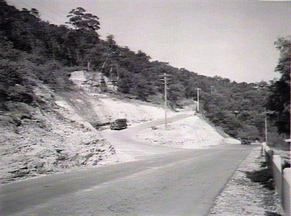
The Barrenjoey Road - Historical Pictorial
The road out to the Barrenjoey Headland and later lighthouse is one of those that attracted Artists and Photographers when photographs became available and allows us to see different and same points of view over a long time period.
A few of these, commencing from where Barrenjoey road now does, at Mona Vale, in one run:
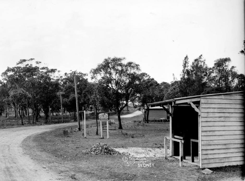
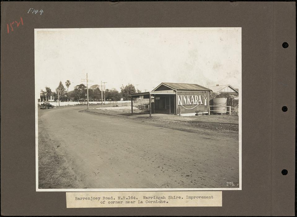
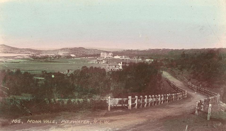

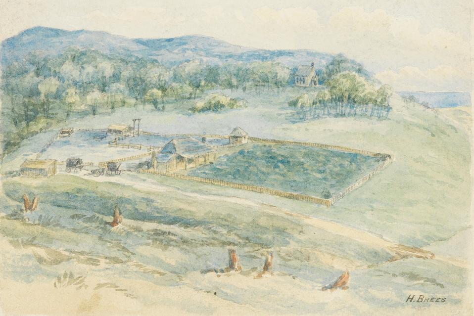
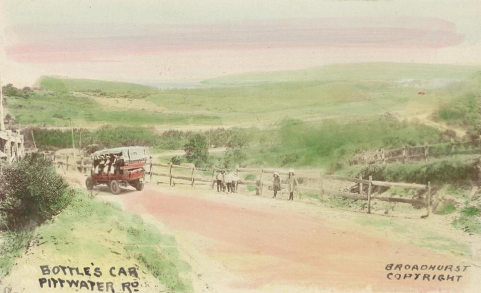
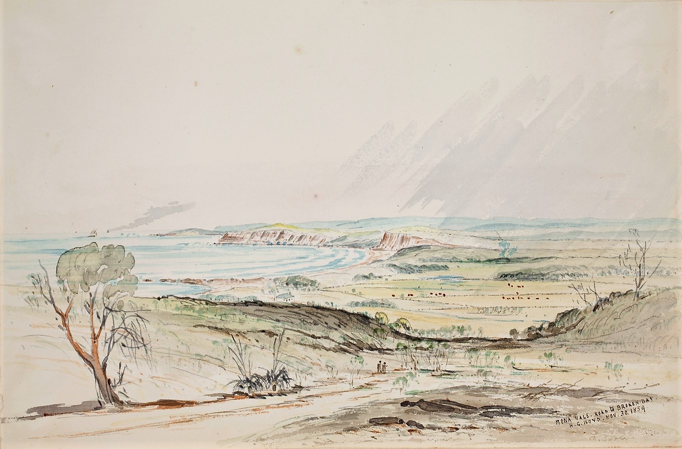
F.109 Mona Vale road to Broken Bay from Volume 1: Sketches of N. S. [New South] Wales, 1857-1888 / by H. Grant Lloyd, Image No.: a5894117h, courtesy Dixson Library, State Library of New South Wales. NB: This aspect looks as though the walkers are heading to Mona Vale from Newport, also there is no St John's on what we now call Mona Vale headland - that chapel opened in 1871.
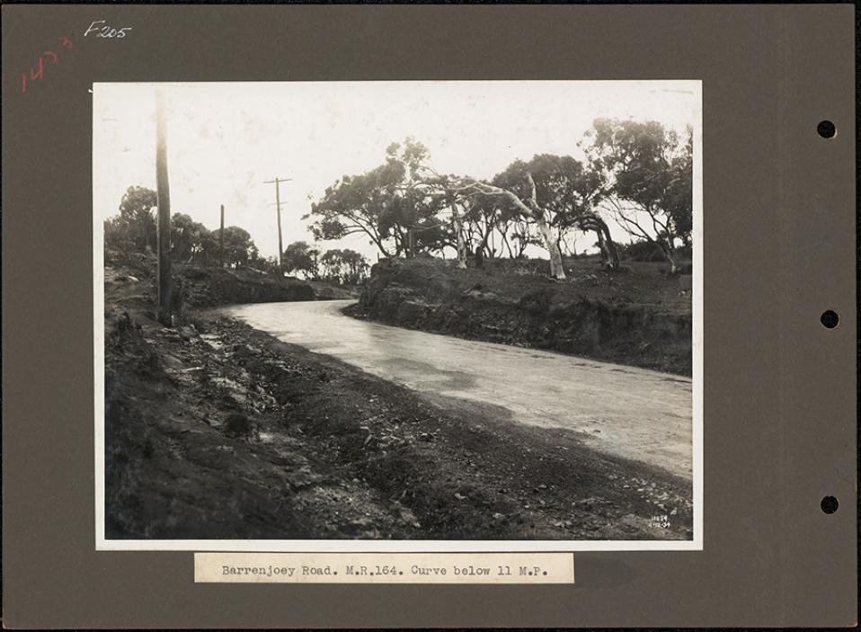
The Road leading up the hill between Mona Vale and Newport - this spot is near Bushrangers Hill - these road works were done, alike that out past Church Point to Coal and Candle Creek, through Australian Depression Work Relief Programs. ABHS Photo
Extensive improvements are being made to the road to Palm Beach. This big cutting on the Newport-road has just been completed. The old blind turn, which was a source of danger when traffic was heavy, is on the left. Another cutting is being made at the northern end of Mona Vale. Tents and Motor-Campers (1935, November 20). Sydney Mail (NSW : 1912 - 1938), p. 50. Retrieved from http://nla.gov.au/nla.news-article160499041
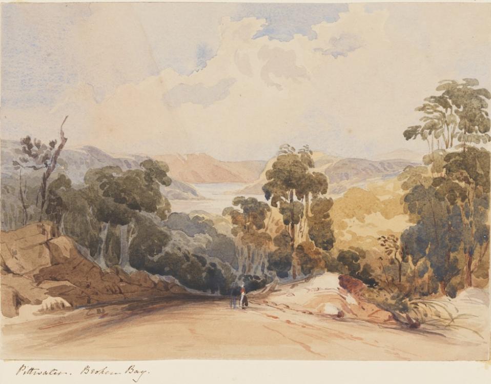
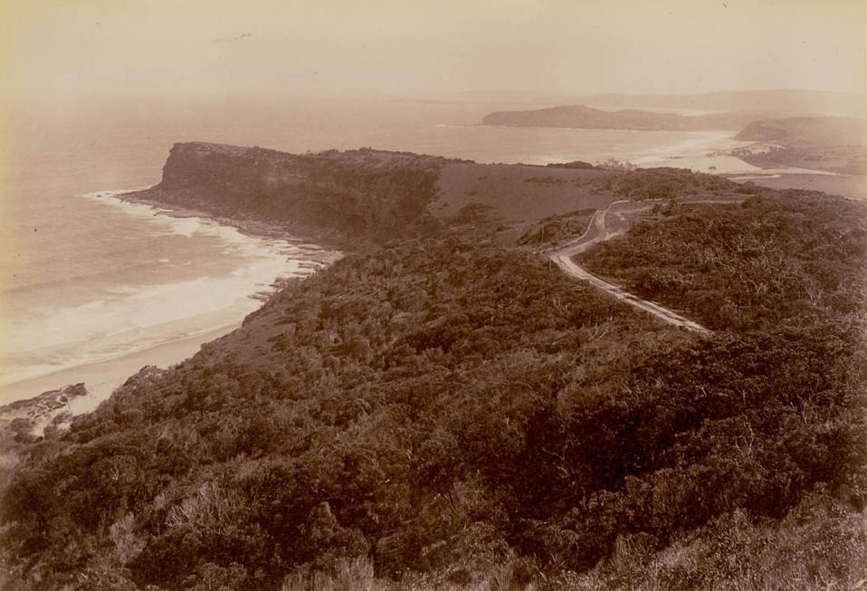
Coast view Newport, circa 1900-1910, Image No.: a116494h, courtesy State Library of NSW

View From Bushranger’s Pt Near Newport Hill [NSW] c1920s. Vintage silver gelatin photograph, typed title on accompanying slip, 18.1 x 39.6cm. Discolouration to upper and left portions. Original frame. NSW Government Printer. Shows Bungan and Mona Vale Beaches. From JOSEF LEBOVIC GALLERY; $1,250.00
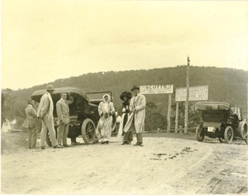
Campbell Avenue (main view) Newport, from the corner of Beaconsfield Street, from album Pittwater scenes, 1880 / Harold Brees courtesy State Library of NSW - note the Telegraph wires.
The drawings appear to be the originals for six of the lithographs illustrating 'The Pittwater and Hawkesbury Lakes album'. [Sydney] : Mills, Pile & Gilchrist, 1880. (Lithographed by S.T. Leigh & Co.)
We have received from Messrs. Mills, Pile, and Gilchrist, (who have published it for the proprietors) an interesting pamphlet descriptive and illustrative of the beauties and attractions of Newport, Pittwater, and the celebrated Hawkesbury lakes. The work consists of about eight pages of letter-press and nine carefully lithographed drawings, depicting the more important scenes and places of interest in the locality. The description is capably written, and the illustrations, lithographed by Messrs. S. T. Leigh and Co., from water colour drawing- by Mr. H. Brees, are very creditably executed, and give excellent ideas of the places represented. Appended is a plan and local sketch of the new marine township of Newport, and altogether the publication is one which will commend itself highly to all interested in one of the most picturesque spots on the New South Welsh coast. NEW'S OF THE DAY. (1880, August 26). The Sydney Morning Herald (NSW : 1842 - 1954), p. 5. Retrieved from http://nla.gov.au/nla.news-article13466890
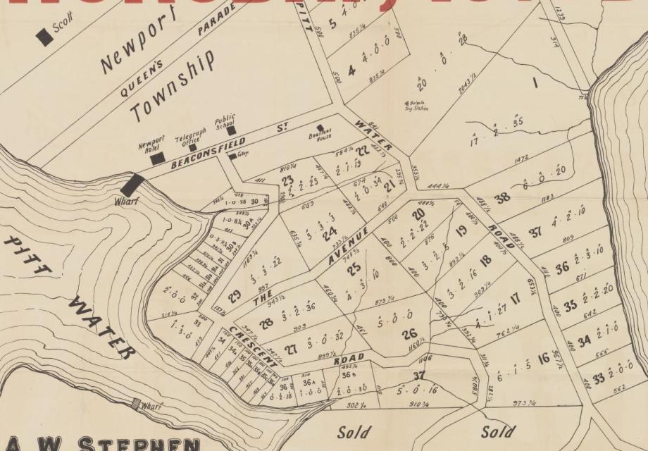
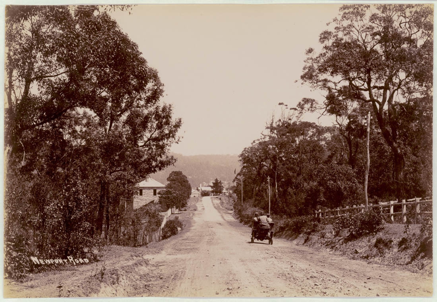
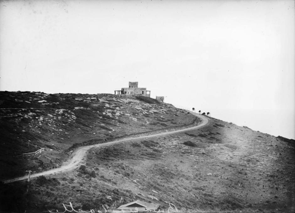
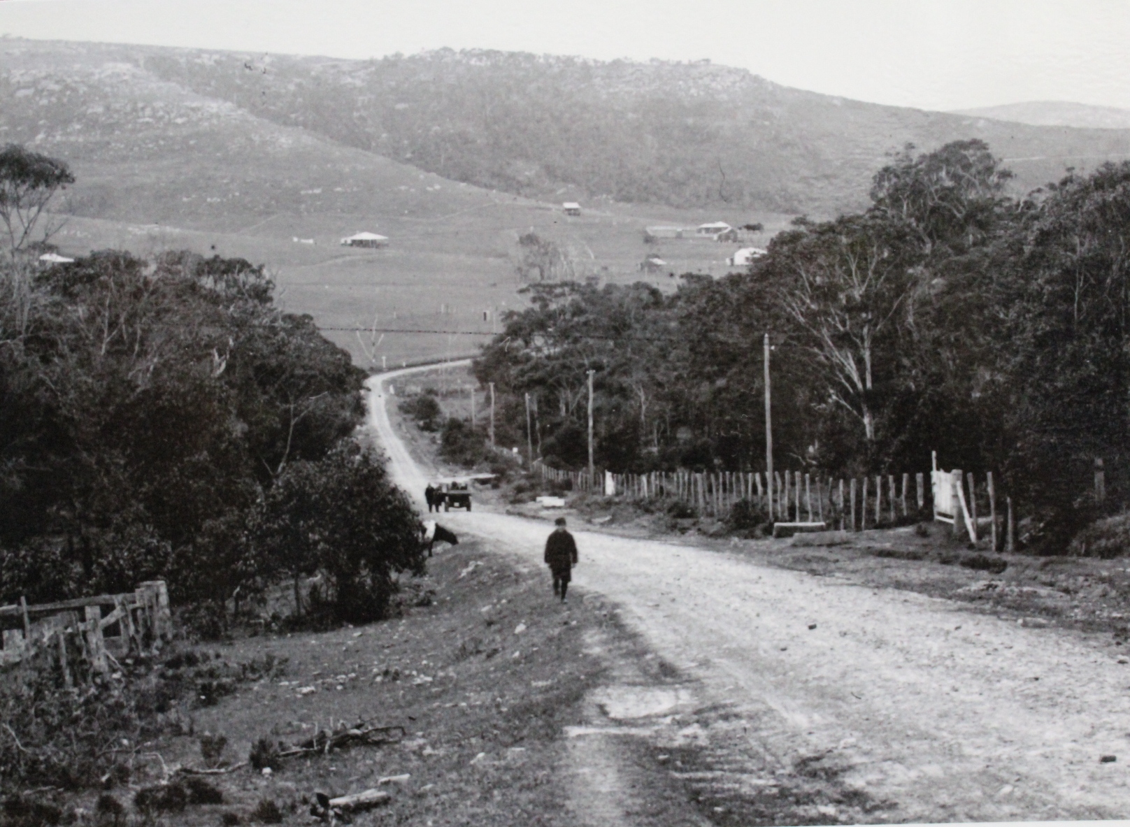
Heading north along Barrenjoey Road - this is the track leading down the hill with Newport hill in the background, circa 1915
Newport circa 1903 - photo courtesy State Library of NSW
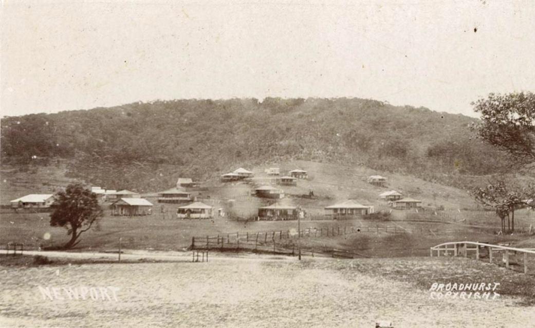
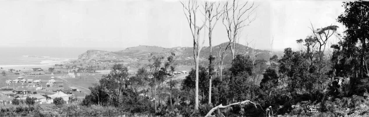
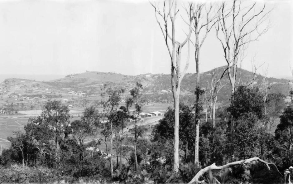
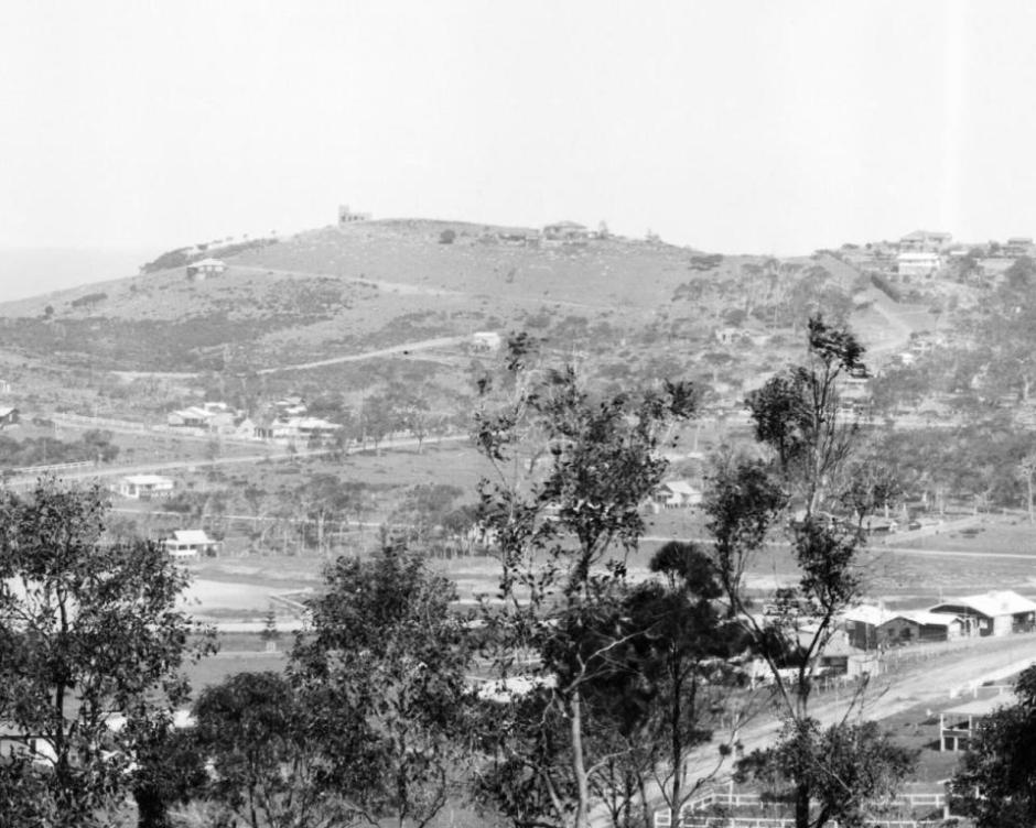
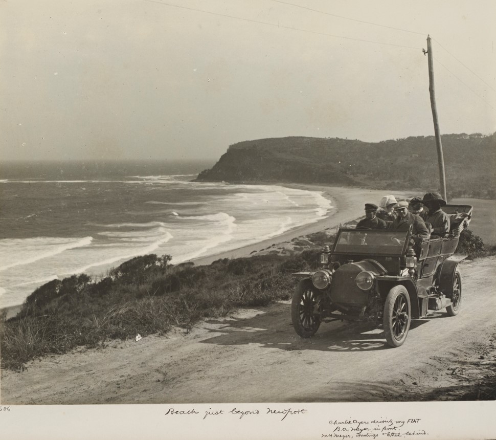
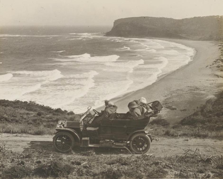
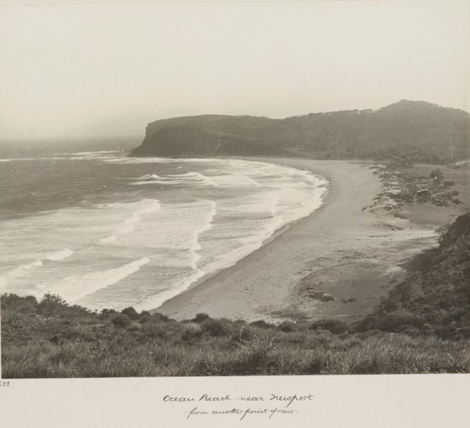
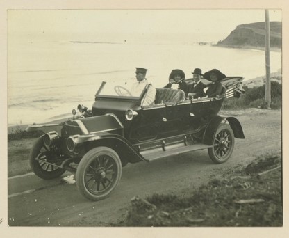
'The big beach not far from Bilgola' 'Plumer driving the Italia car. Blanche Blomfield, Capt. and Mrs. Evans in the back.'
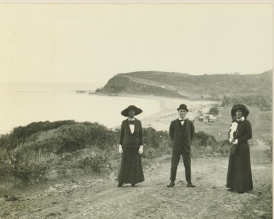
Friday 13th of March 1913. (Newport in the background and shows road, and state of this road, up the Newport hill prior to leading to Bilgola). The people in the photo are L to R: Mrs. Evans, Captain Evans (of Antartica fame) and Blanche Blomfield. From Album 61 Photographs of the Allen family 1 February 1913 - 10 May 1913, Image No. a3290021h, courtesy State Library of NSW
The Newport Beach resumtion began in 1910 in an idea that came from and was lead by the then newly formed Newport Surf Club and the also then quite new Warringah Shire Council which had jurisdiction over the whole of Pittwater:
Proposed Resumption of Newport Beach. At a public meeting held at Newport resolutions were carried urging the Government to have the Newport beach resumed by the Warringah shire council as a public reserve. Speakers representing local residents, tourists to the district, and the Newport Surf Club pointed out that resumption would been easier matter at present than later on, when the beach would probably come under private ownership. The proposal is to resume the whole of the beach from low water-mark to Barranjoey-road, and it was decided to ask tho council to arrange a deputation to the Minister for Lands on the subject. EMPIRE FORESTS. (1910, March 22).The Sydney Morning Herald (NSW : 1842 - 1954), p. 8. Retrieved from http://nla.gov.au/nla.news-article15133762
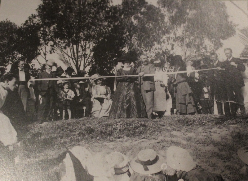
NEWPORT BEACH OPENED.
The Newport Beach, which was recently resumed by the Lands Department and Warringah Shire Council, was dedicated on Saturday before a large gathering. The ceremony was performed by Mrs. Nielson (wife of the Minister for Lands). Councillor Ralston, (president of Warringah Shire) in presenting Mrs. Nielson with a pair of silver scissors with which to sever the blue ribbon, said they could well call it a red-letter day in the annals of the shire. The council had recognized the nescessity of securing the beaches for the people, and a few more would be resumed later on.
Mrs Nielson, in cutting the ribbon, said “I hereby declare the Newport beach open for the public.”
Alderman C. D. Paterson and Dr Arthur, M.L.A. also spoke and congratulated the shire on securing such a fine beach.
During the afternoon the members of the North Steyne Surf Club and Newport Surf Club gave exhibitions in the surf and refreshments were supplied by a committee of local ladies and gentlemen. The Warringah Shire Band rendered a programme of music. NEWPORT BEACH OPENED. (1911, April 10). Evening News(Sydney, NSW : 1869 - 1931), p. 10. Retrieved from http://nla.gov.au/nla.news-article114136984
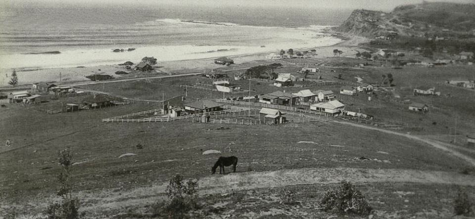
Above: Newport Beach, Sydney, February 1922, 1 / Michael Terry - PIC/8847/3/6 LOC Nitrate store PIC/8847 Visit: Pittwater Reserves - The Green Ways: Bungan Beach And Bungan Head Reserves; A Headland Garden or Newport's Bushlink 'From The Crown To The Sea' Paths
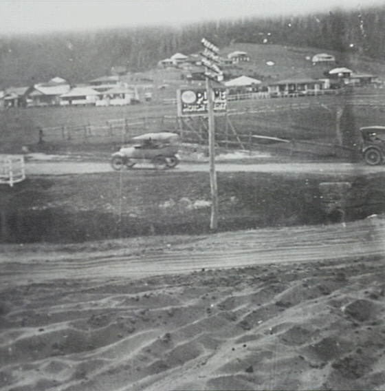
The Road alongside Newport Beach during the 1920's
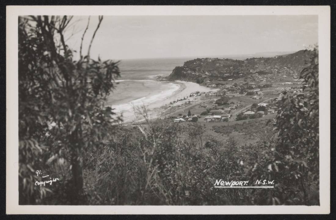
Newport, 1930's National Museum of Australia image from the Josef Lebovic Gallery collection no. 1 Unused Postcard. Image No.: nma.img-ci20122889-019-wm-vs1_o3_1100
FOAM
An optimistic motorist drives his sports car through the five feet of foam, which yesterday covered the whole of the camping and parking areas and the beach at Newport. No title (1950, June 25). The Sunday Herald (Sydney, NSW : 1949 - 1953), p. 3. Retrieved from http://nla.gov.au/nla.news-article18478326
FOAM
In the Sydney Morning Herald, 'Kanangra,' dealing with the gales of April, 1861, has this to say about the foam: —
Gales lashed the coast for seven days, keeping the sailing 'ships overlong in port at Sydney and Newcastle.
At Port Macquarie the seas were breaking miles off the coast, and foam in the bays stood twelve feet deep until' the wind changed. Then the foam 'covered the surrounding hills as in a snowstorm.'
The vast blanket of sea foam that invaded some Sydney, beaches in the recent cyclone is puzzling scientists. The week before last issue of the 'Sunday Herald' showed a picture of a car ploughing through the foam at Newport. Next day, thousands of people visited the northern beaches — and went home baffled. And small wonder. The snow-like froth they saw covered many acres and much of it was several feet deep. There were two peculiarities about this foam: it stuck for a surprising time, and it occurred only between Manly and Palm Beach. There was hardly any foam on the southern beaches, and none at Cronulla. Sydney scientists believe there must have been something unusual in the sea water to make the bubbles stay put; some substance that gave it- a soapiness or oiliness. One theory is that this substance came from the storm-pulverised bodies of myriads of minute jelly fishes and the like, and from seaweeds. If that is so, why wasn't there a foam blanket along more of the coast?
My own theory is that this substance, probably partly mineral and partly organic, was brought down to the sea by the flooded Hawkesbury River. The south-flowing Notonectian current would carry some of it past Palm Beach and the others, after it got through Broken Bay. Maybe some of this material was the very finest particles of clay, which has 'sticky' qualities.
Gradually, under the impetus of the onshore wind, the ever-growing mass of bubbles was literally pushed up the beach— and finally across on to the grassy foreshores. [The foam was a magnificent sight at Port Macquarie during the recent gales and floods; -in the early 1930's, during 'a gale, there was also a great mass of foam on Oxley Beach, where a tent, in which people were- living was completely engulfed]. FOAM (1950, July 14). The Port Macquarie News and Hastings River Advocate (NSW : 1882 - 1950), p. 1. Retrieved from http://nla.gov.au/nla.news-article112552881
For an insight into a similar storm and 'foam' visit: St. Michael’s Arch, Avalon – 1864 To 1962
AT NEWPORT ON BOXING DAY.
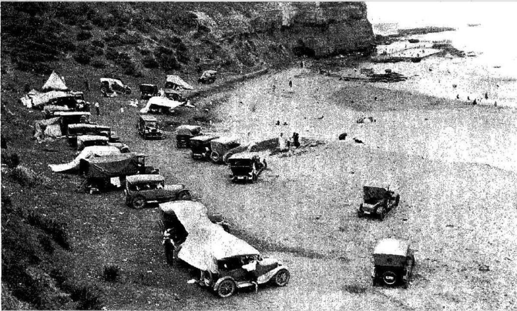
It is a very pleasant run from Sydney to Newport, and will be much more enjoyable when the Spit bridge is a reality and the wearisome wait for the punt is a thing of the past. Motoring (1924, January 2). Sydney Mail (NSW : 1912 - 1938), p. 37. Retrieved from http://nla.gov.au/nla.news-article166151463
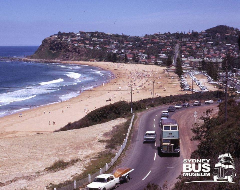
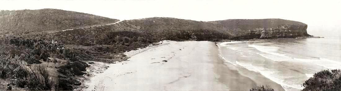
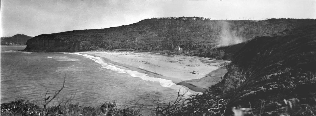
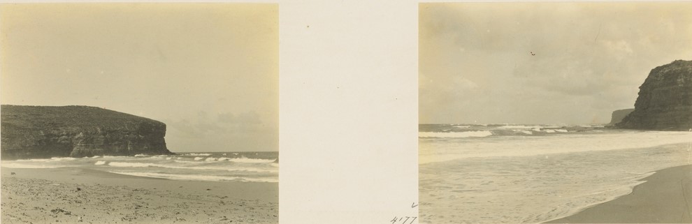
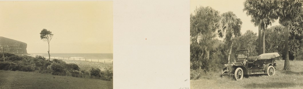
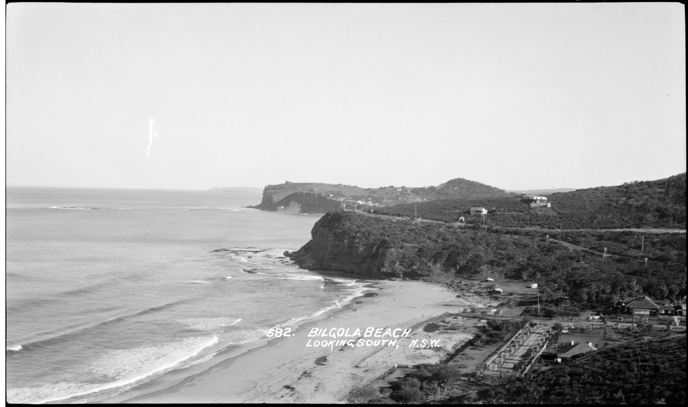
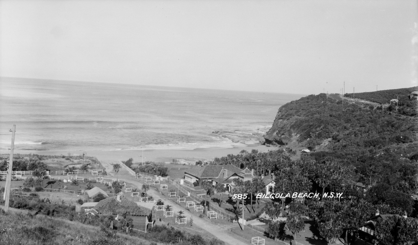
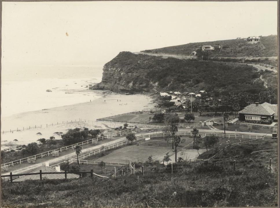
'View of Bilgola from the hill' Bilgola 1930, courtesy National Library of Australia, Picture http://nla.gov.au/nla.obj-147289233 - from Album titled 'Prospectus photographs of Avalon'. Tents can be seen where the clubhouse now stands and the Norfolk Pines have only just been planted. Bilgola House, instead of Bilgola Cottage. The Bilgola 'Bends' can be seen running inland.
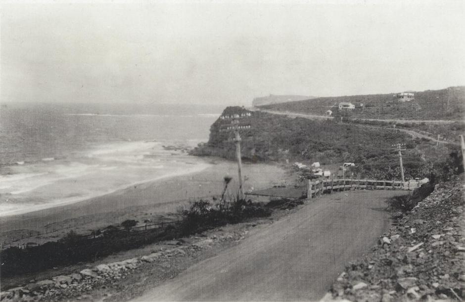
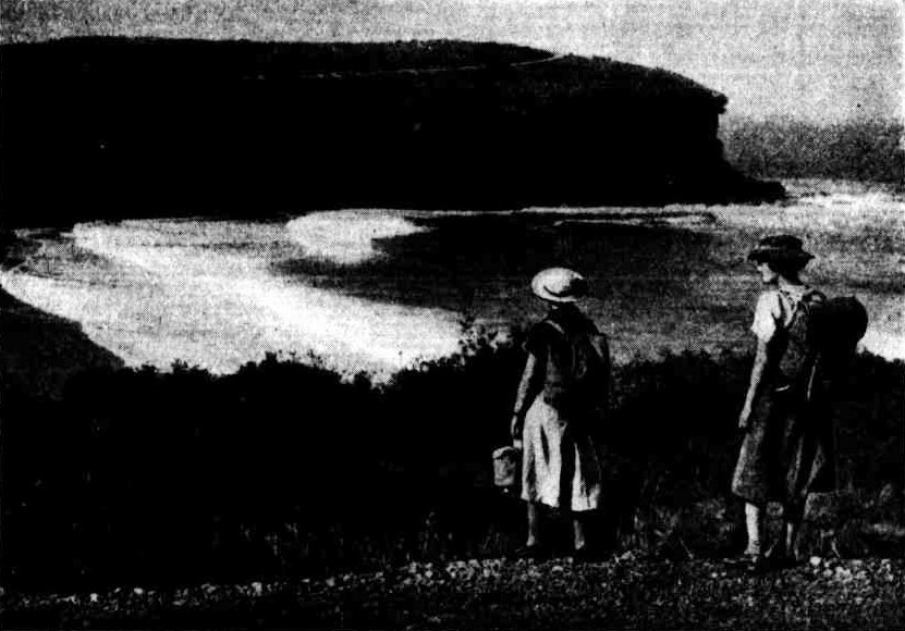
THE CLIFF ROAD, BILGOLA, BETWEEN MANLY AND BARRENJOEY. No title. (1937, November 24). Sydney Mail (NSW : 1912 - 1938), p. 48. Retrieved from http://nla.gov.au/nla.news-article160498181
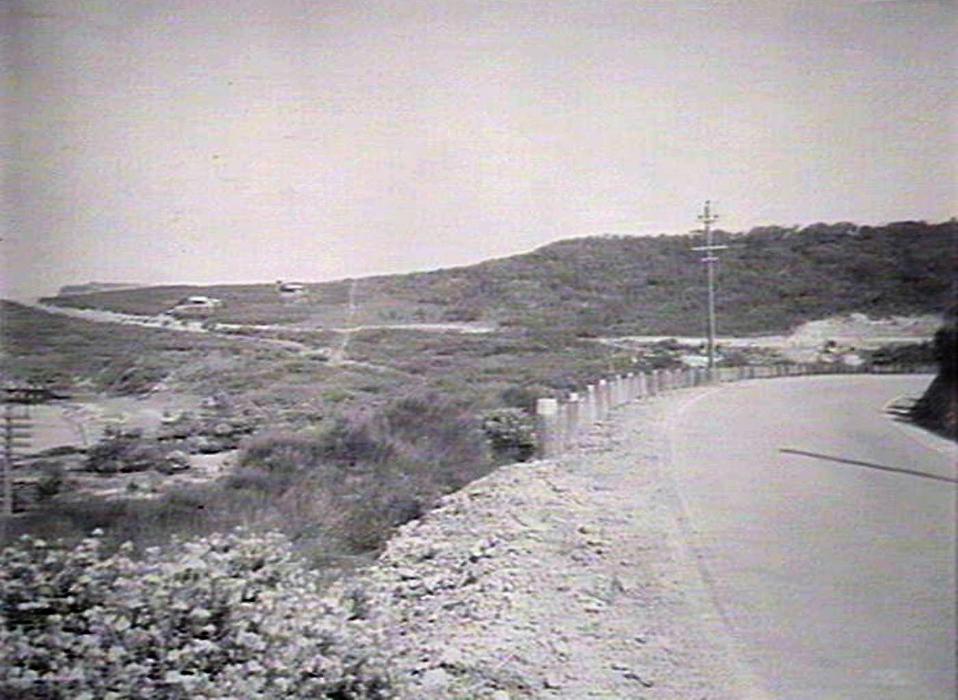
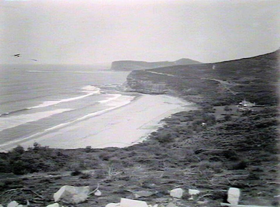
Warringah Items.
It was unanimously decided to place the seal of the council to a document from the trustees of the late Father Terrey's Estate, dedicating to the council a 20 acre reserve, including the whole of the beach on "Priest's Flat," Barrenjoey Peninsula. This land was left for a reserve some 25 years ago, when the Pittwater Estate was being cut up, but was never dedicated, and the Registrar-General would not recognise it as such. After considerable trouble the dedication was arranged, without expense to the council, and the shire deserves congratulation on the result of their negotiations.
A numerously signed petition was received for transmission to the Department asking that 10 acres, known as the Oaks Picnic grounds, and owned by the Salvation Army, be resumed for a recreation reserve. Decided to forward the document to its destination with the council's endorsement.
It was decided that the Fisheries Board be asked to erect poles in the mouth of the Deewhy Lagoon, in order to prevent illegal net fishing. It was stated that this was a particular prawning ground, but it is being frequently invaded by net fishers, who decimated the prawns.
Decided to request the Postmaster General to instal slot telephones at all the post offices in the shire.
Warringah Items. (1912, March 8). The Land (Sydney, NSW : 1911 - 1954), p. 9. Retrieved from http://nla.gov.au/nla.news-article102916271
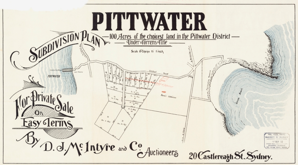
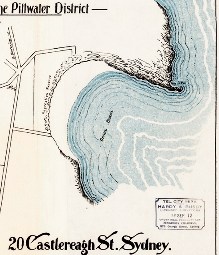
Avalon subdivision plans, September 1912. Image No.: c027560011h, courtesy State Library of New South Wales
KNIGHTLEY ESTATE Advertising (1912, November 4). Evening News (Sydney, NSW : 1869 - 1931), p. 8. Retrieved from http://nla.gov.au/nla.news-article117687749
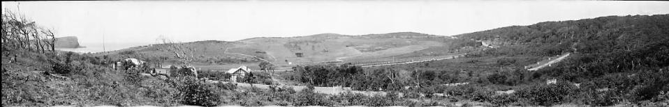
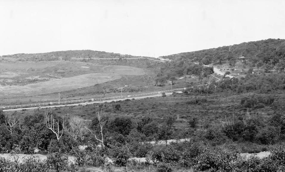
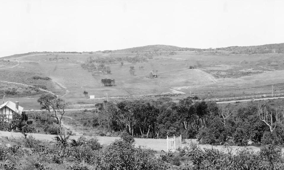
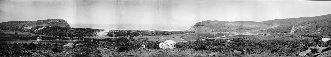
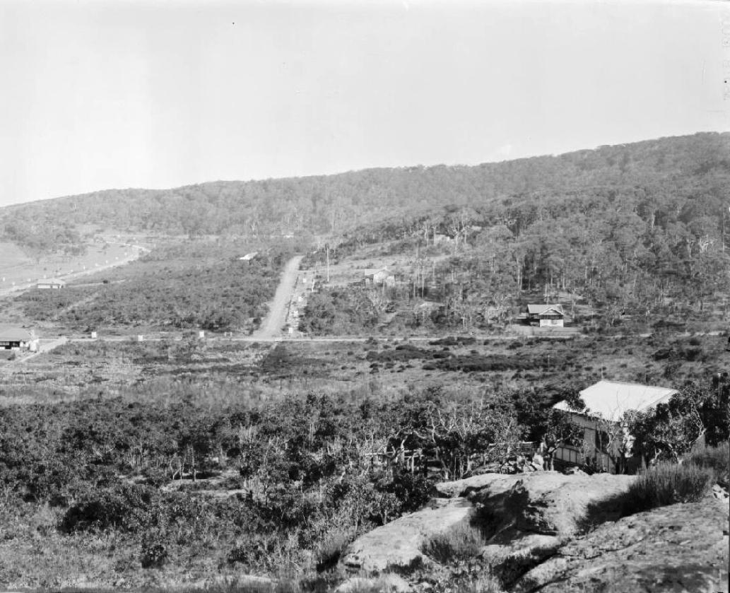
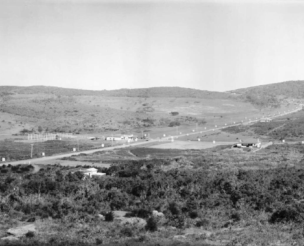
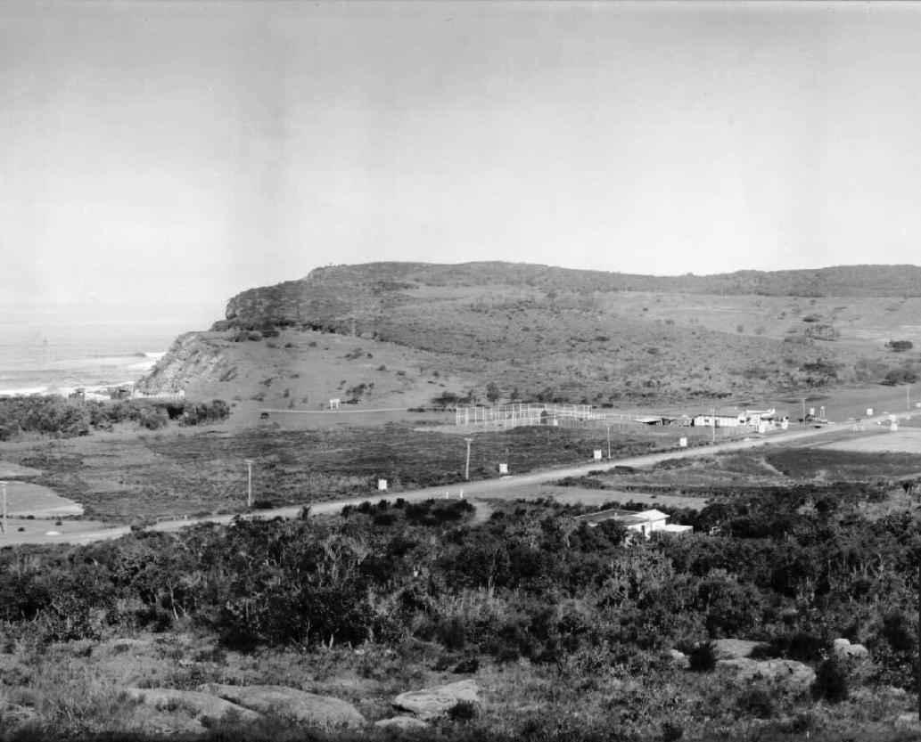
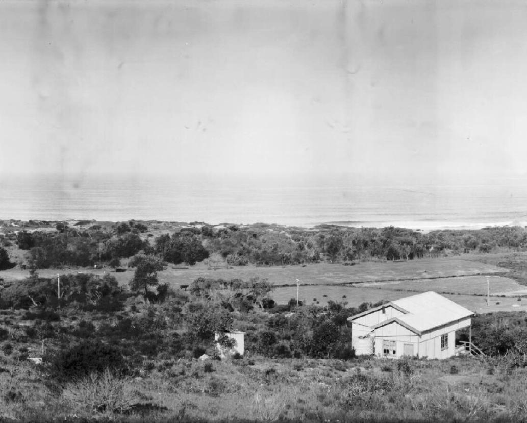
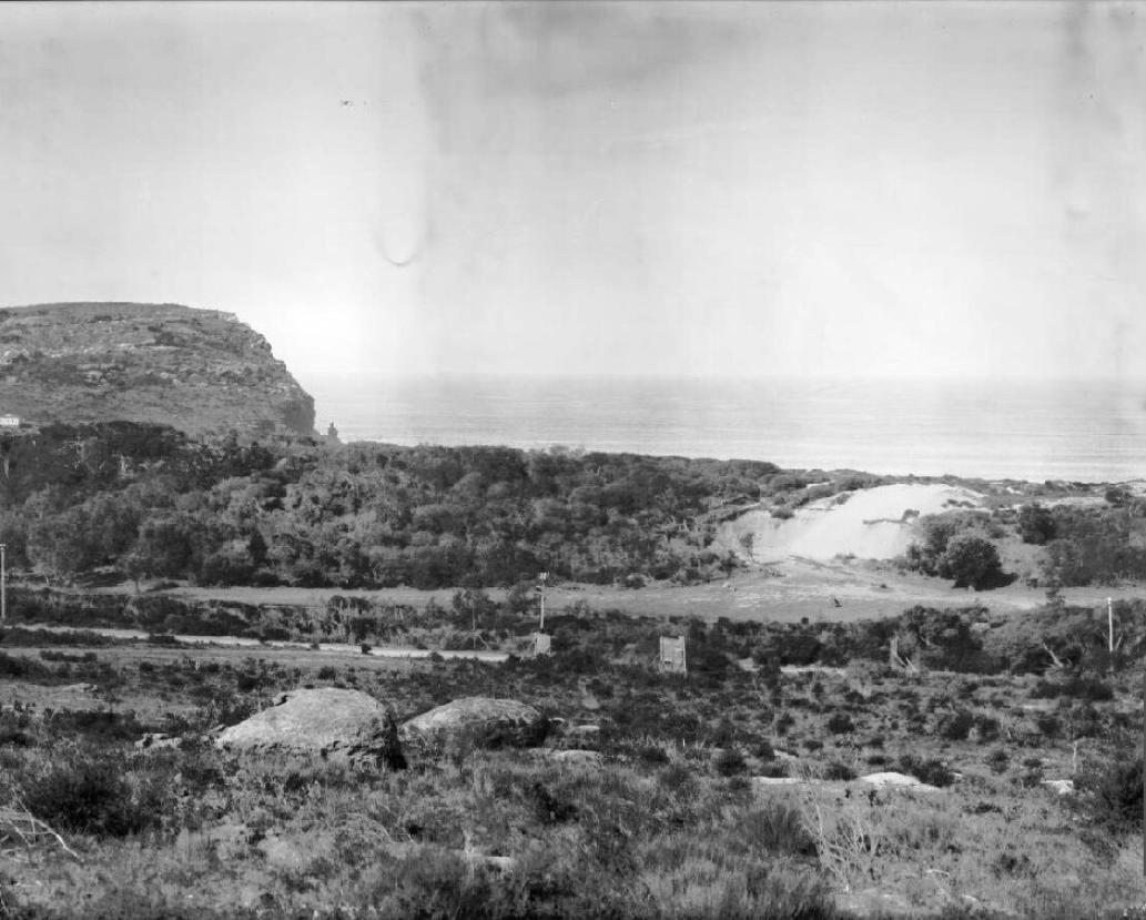
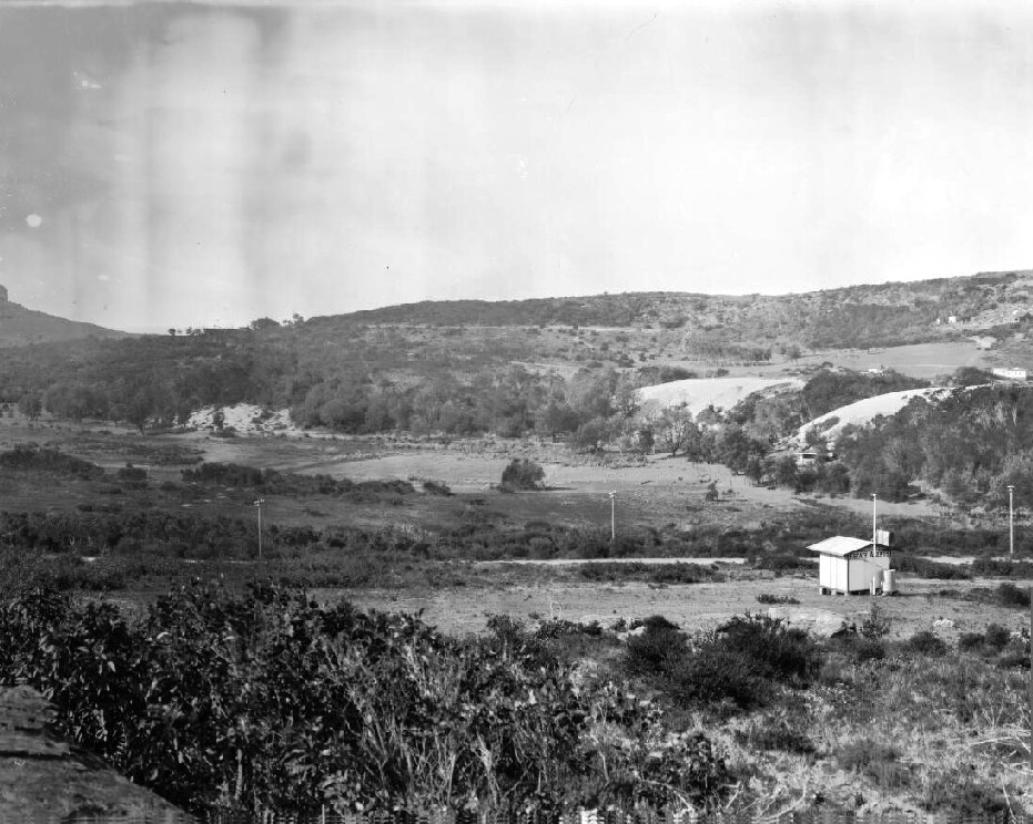
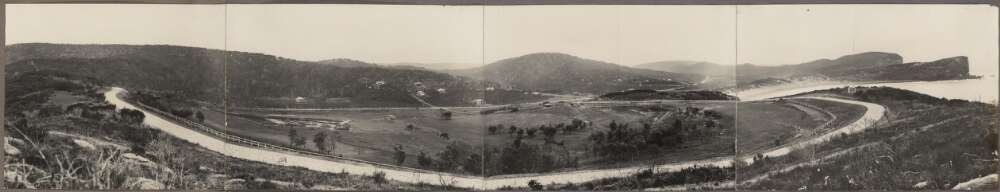
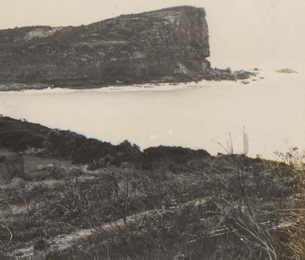
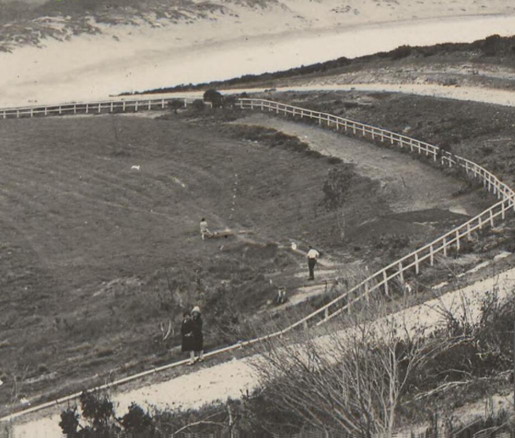
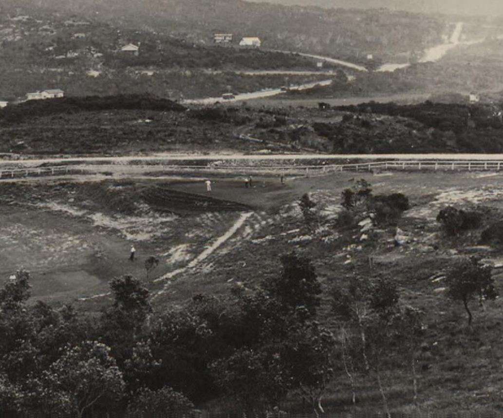
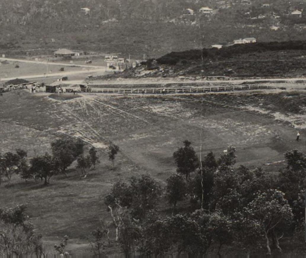
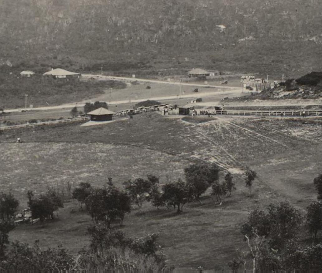
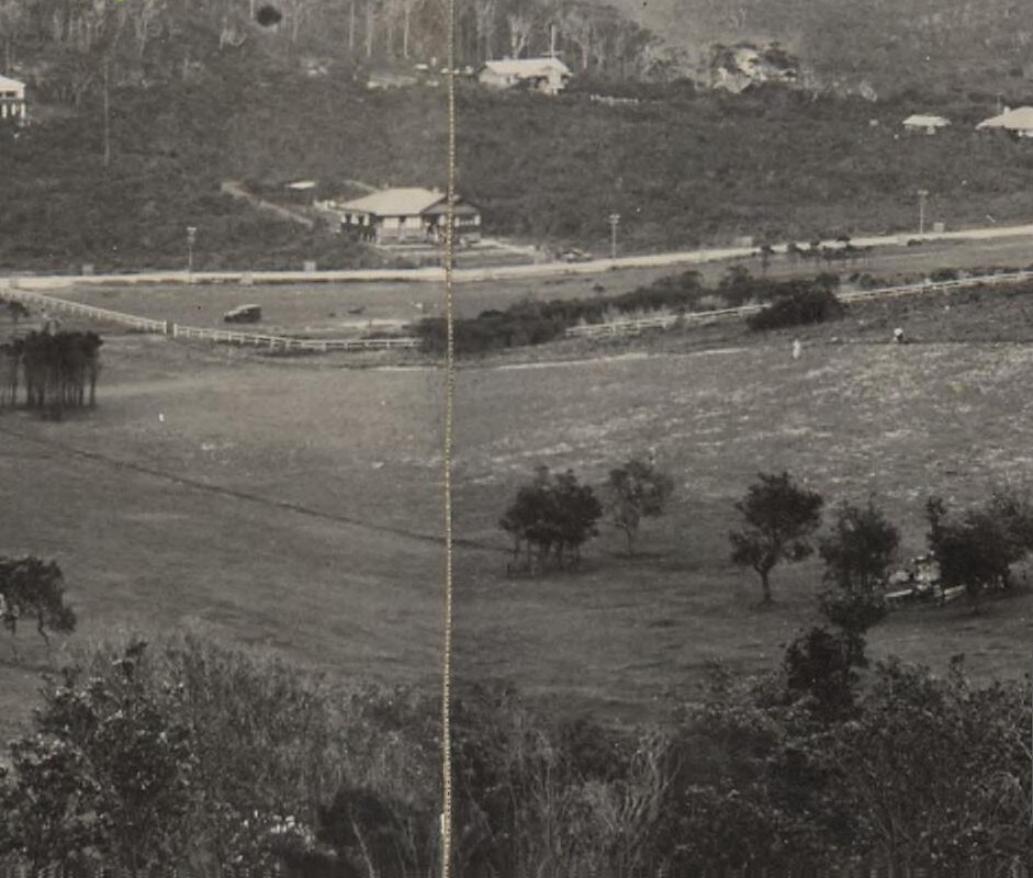
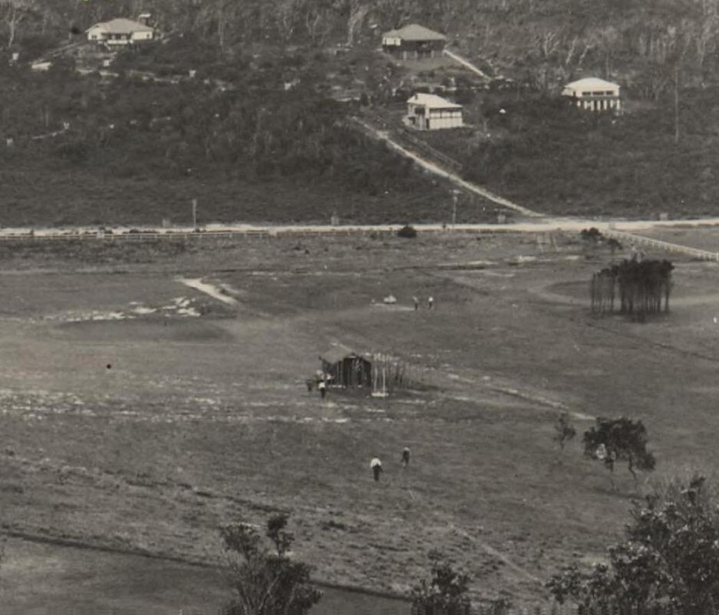
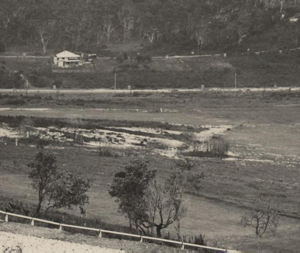

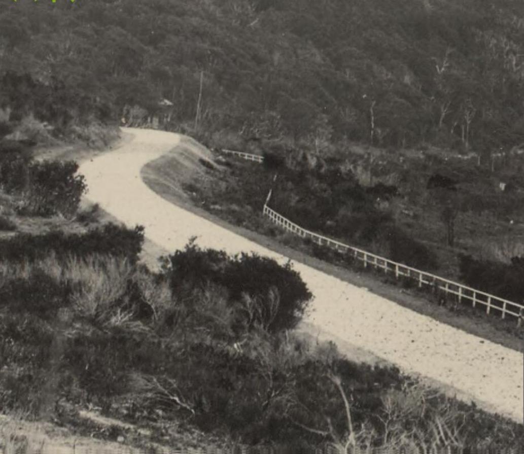
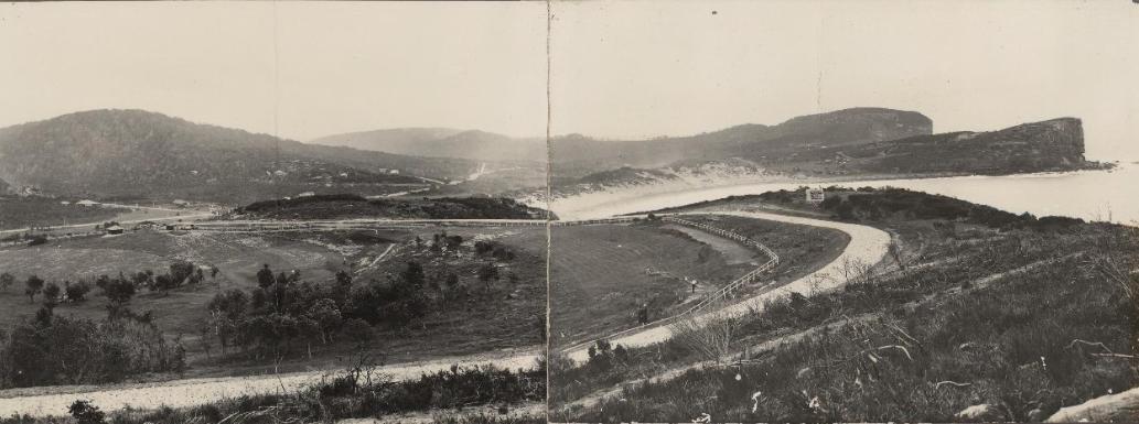
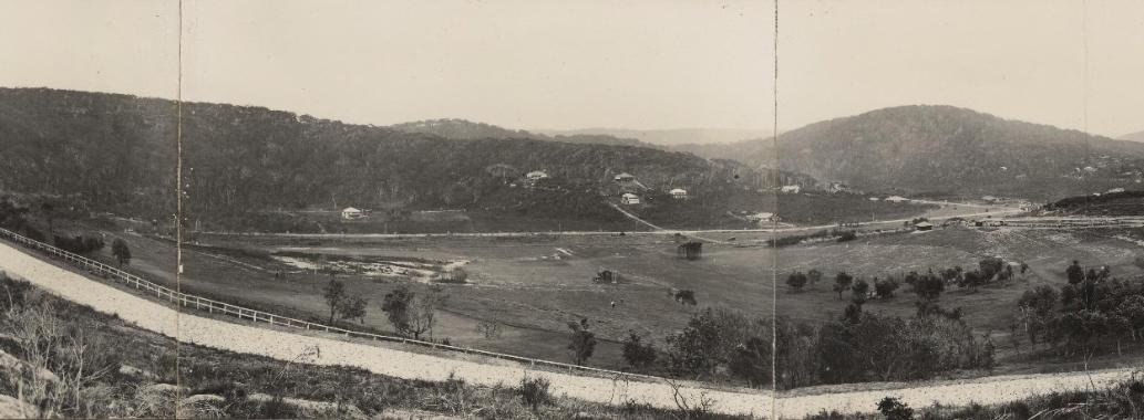
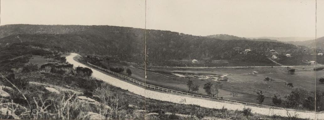
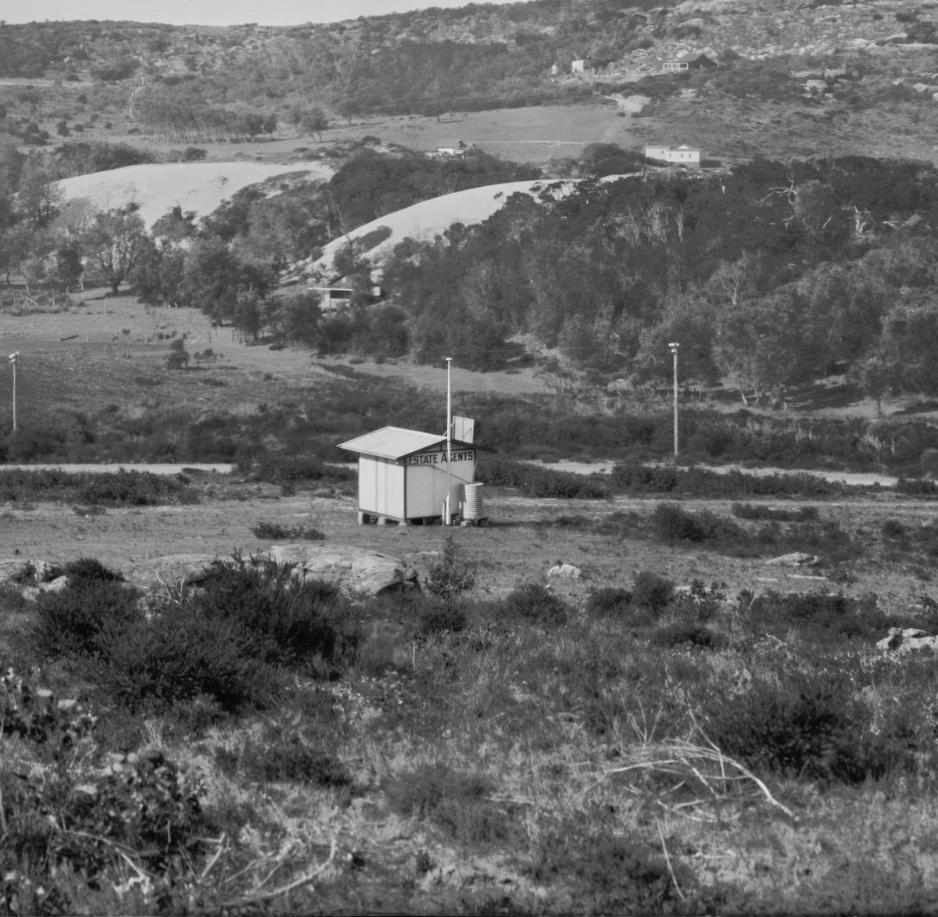
Section from - Panorama of Avalon Beach, New South Wales, ca. 1925, Enemark collection of panoramic photographs, Image No.: nla.pic-vn6217971, courtesy National Library of Australia.
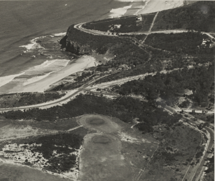
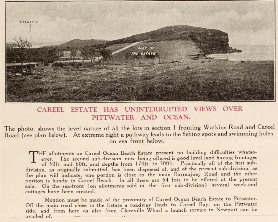
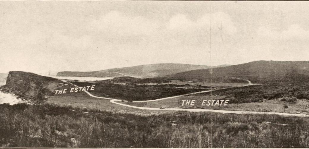
Section showing John Collins Dairy Fields - from Stanton & Son. Careel Ocean Beach estate [cartographic material] : "The hole in the wall", 2nd subdivision, 1922. MAP Folder 37, LFSP 499. Part 1. and Stanton & Son. Careel Ocean Beach estate [cartographic material] : "The hole in the wall", 2nd subdivision 1922. MAP Folder 37, LFSP 499. Part 2., courtesy National Library of Australia.
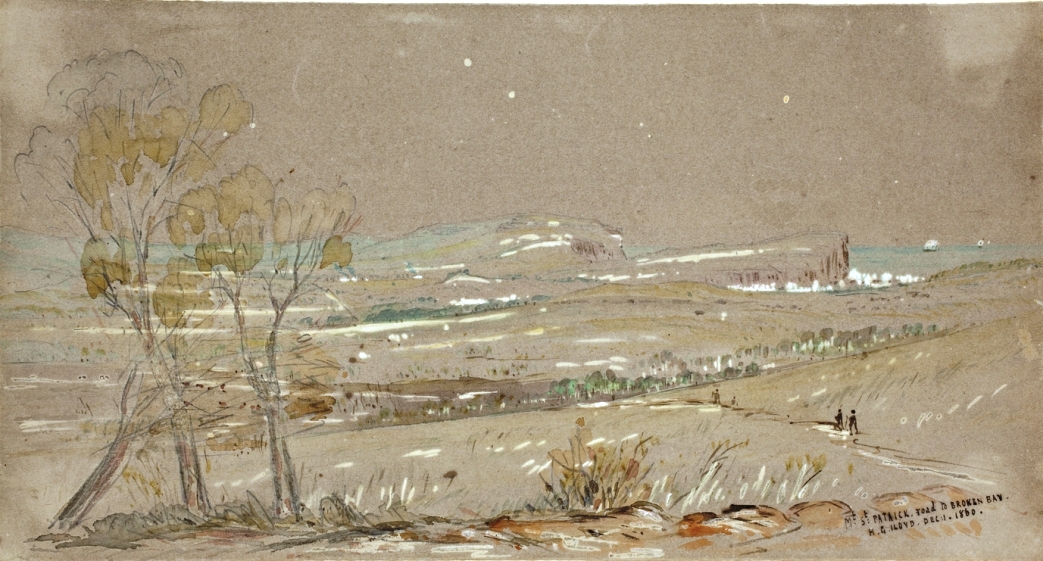
Popular Motoring District Near Sydney — The road to Palm Beach and Barrenjoey. The view was taken at Avalon, looking back along the road towards Manly. The trip from Sydney to Palm Beach and Barrenjoey is now an easy one by way of the Harbour Bridge and the Spit Bridge. Motoring: Search for Petrol Substitutes (1932, August 24). Sydney Mail (NSW : 1912 - 1938), p. 44. Retrieved from http://nla.gov.au/nla.news-article166225233
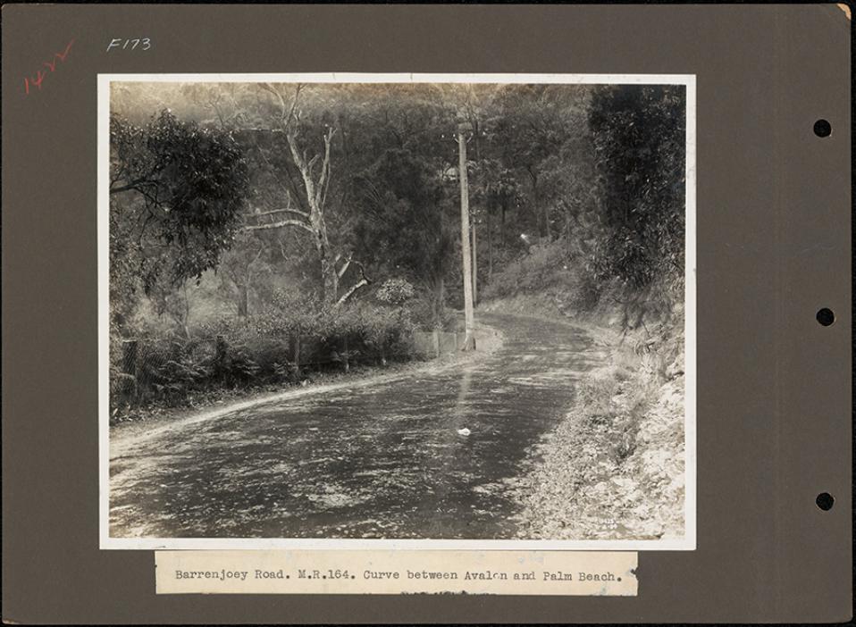
.jpg?timestamp=1586910521060)
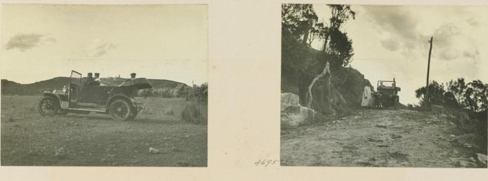
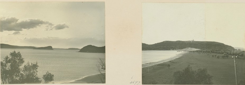
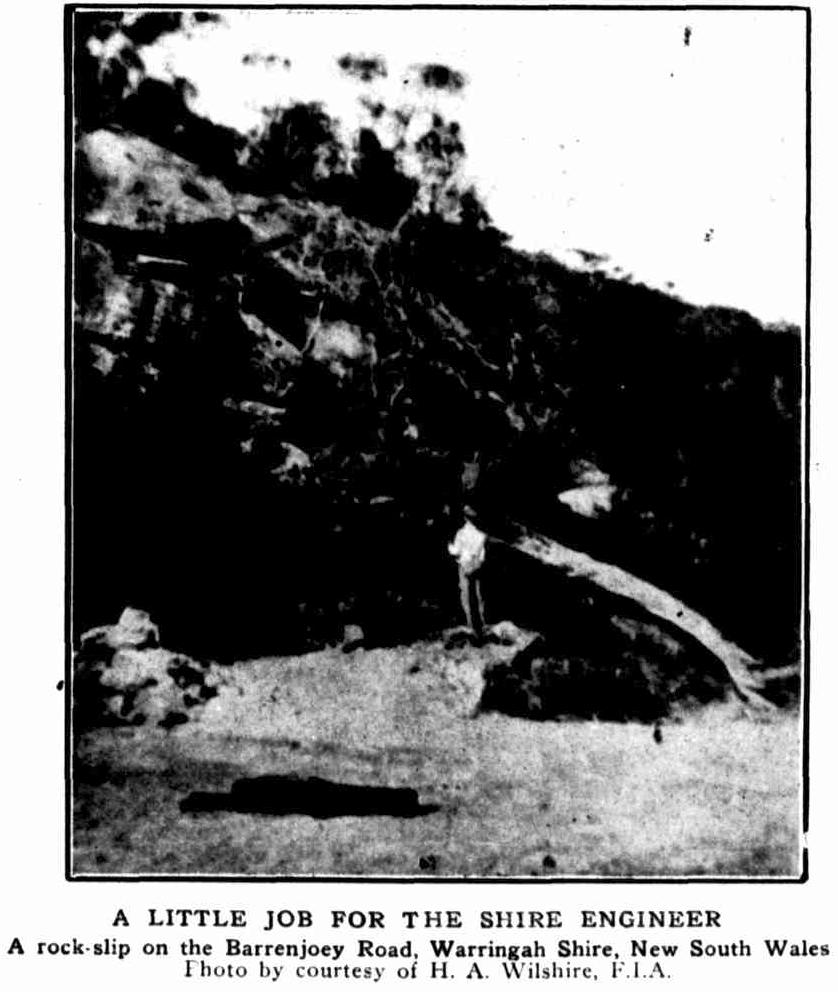
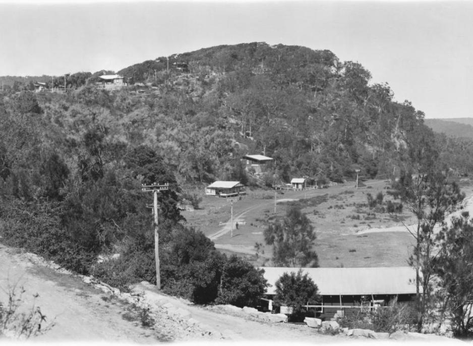
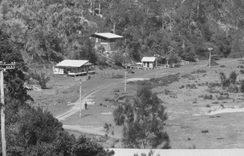
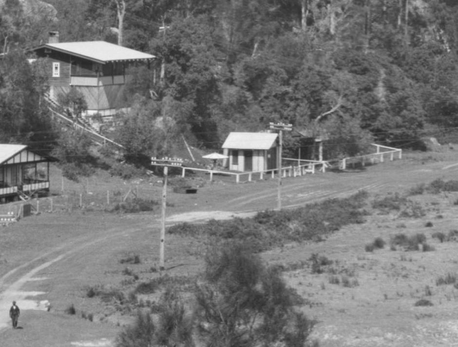
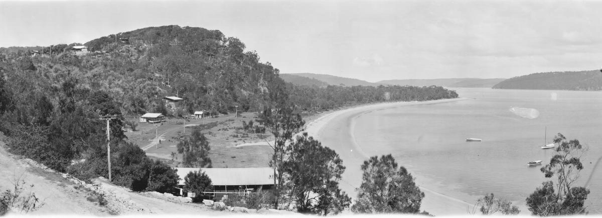
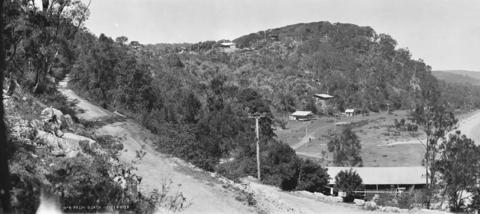
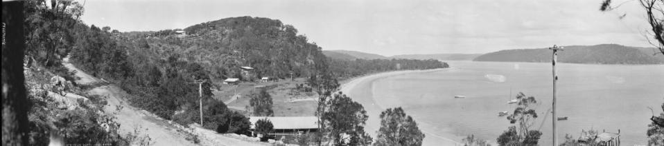
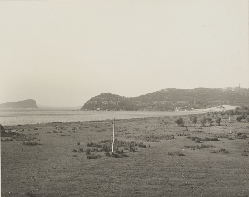
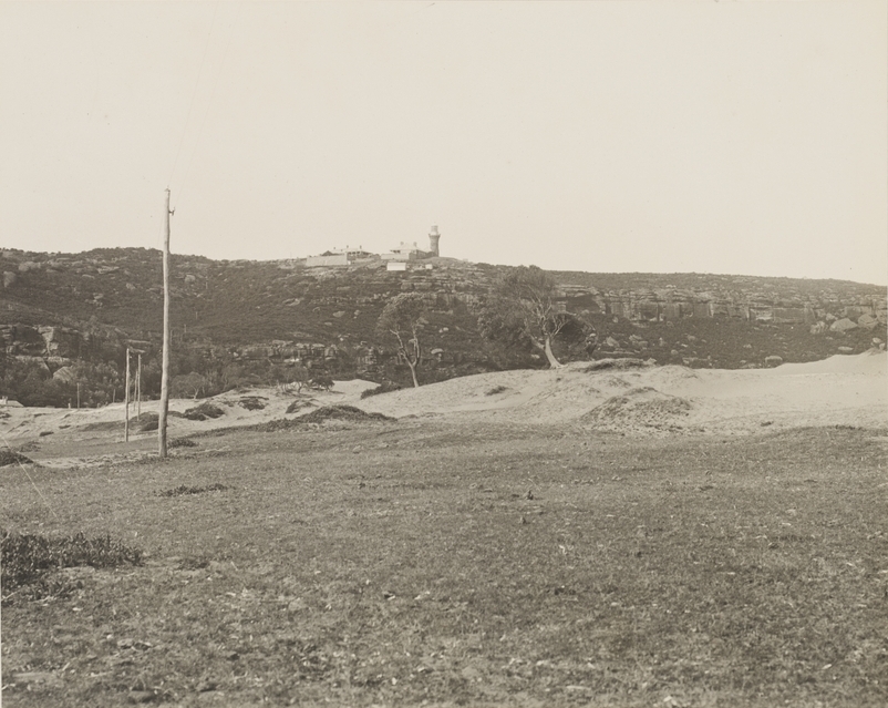
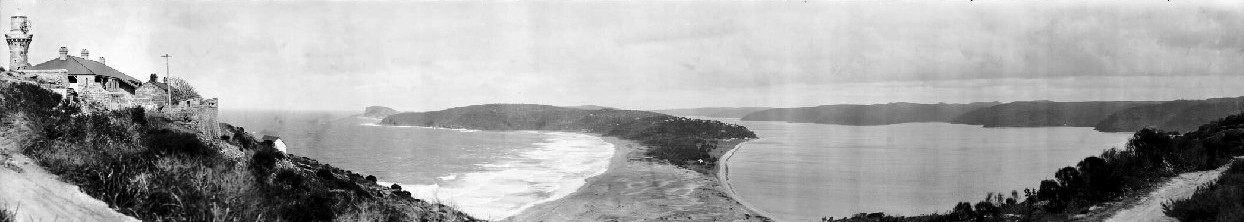
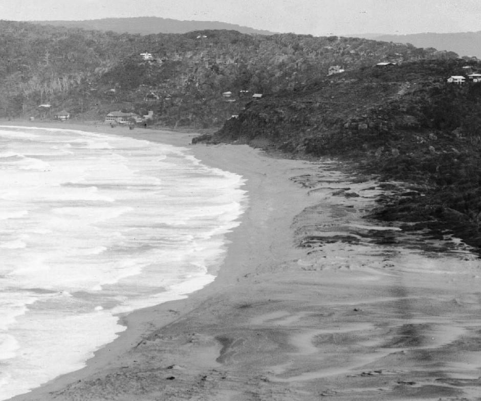
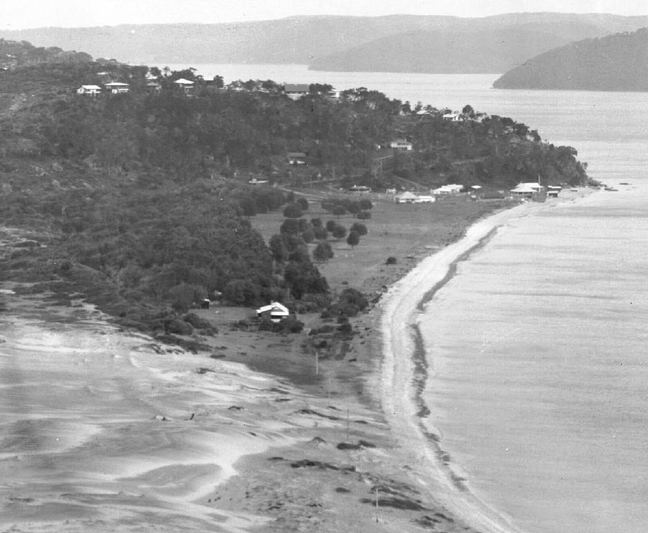
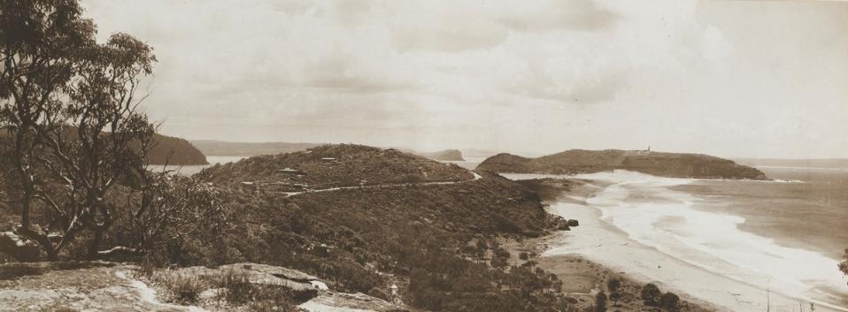
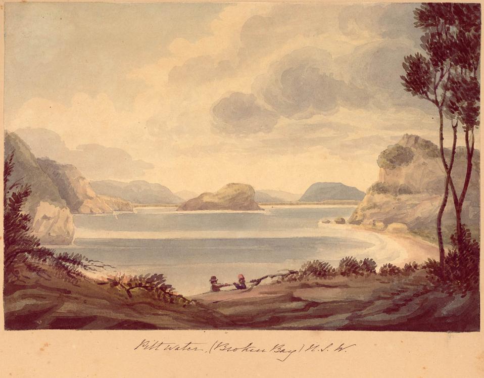
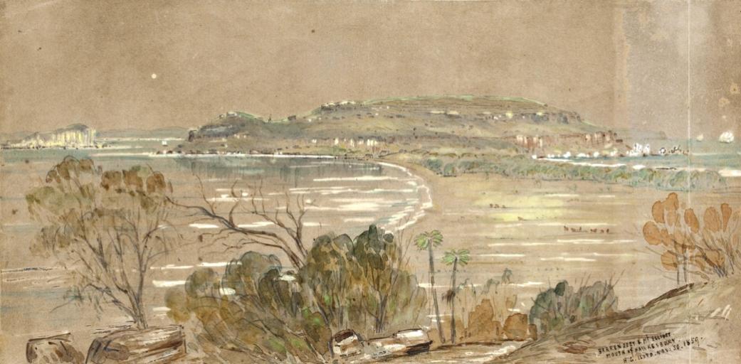
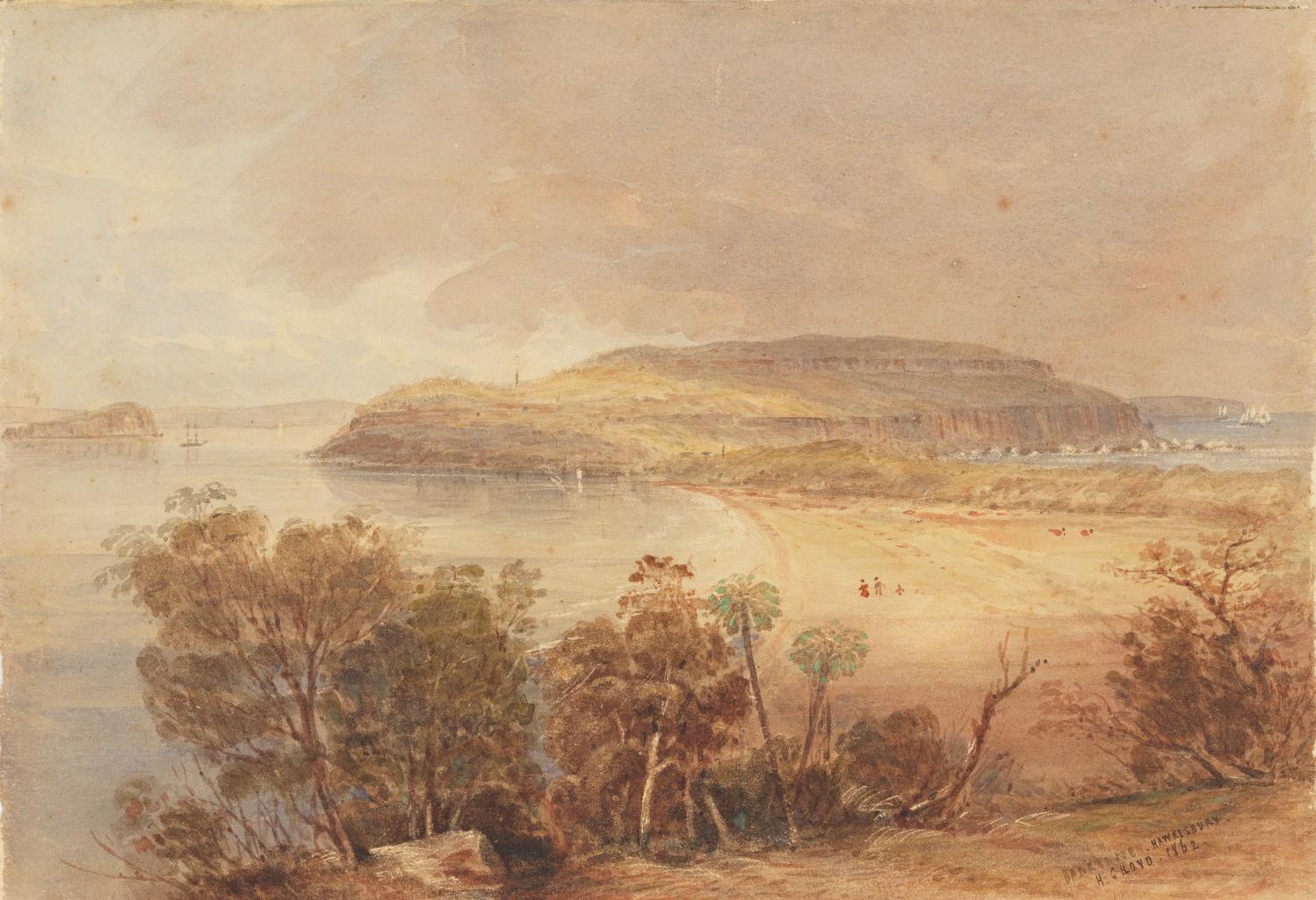
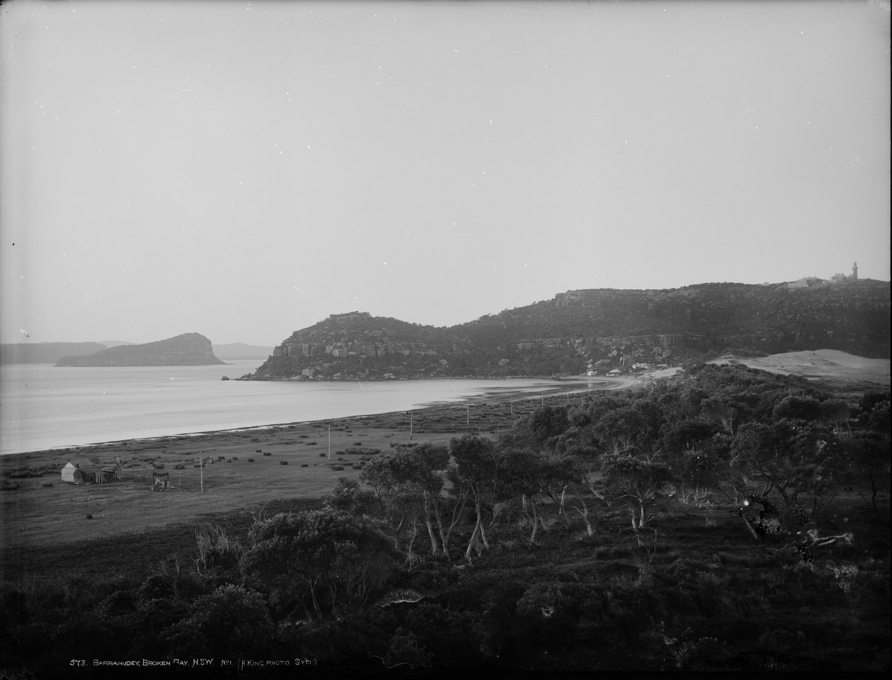
Barrenjoey - Palm Beach circa 1890 - a Henry King photo
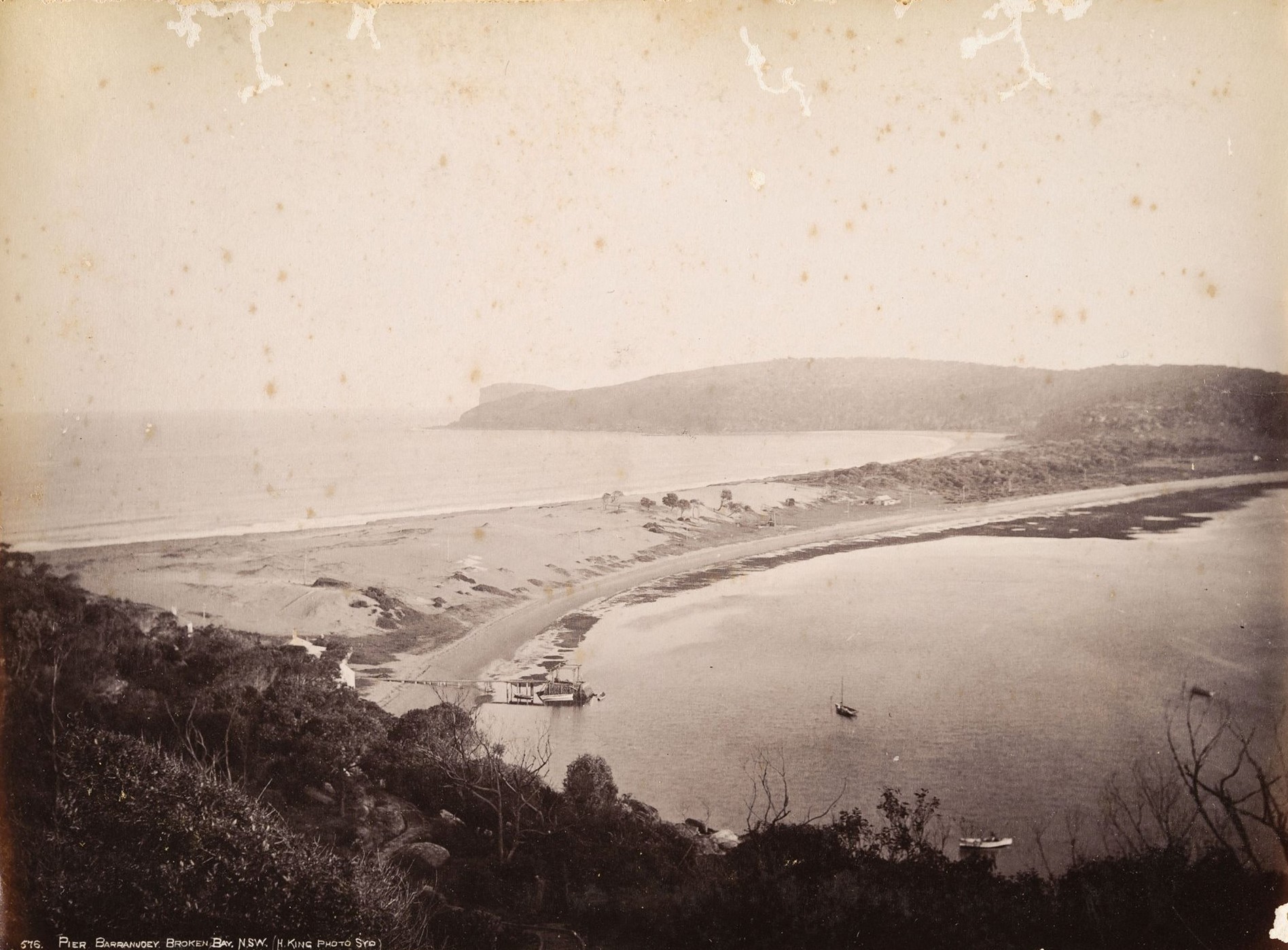
Barrenjoey Pier - Palm Beach circa 1880 - 1890 - a Henry King photo - courtesy RAHS