Hawkesbury-Nepean River System Coastal Management Program (Pittwater) Stage 4: Feedback Invited until May 31
.JPG?timestamp=1616882478499)
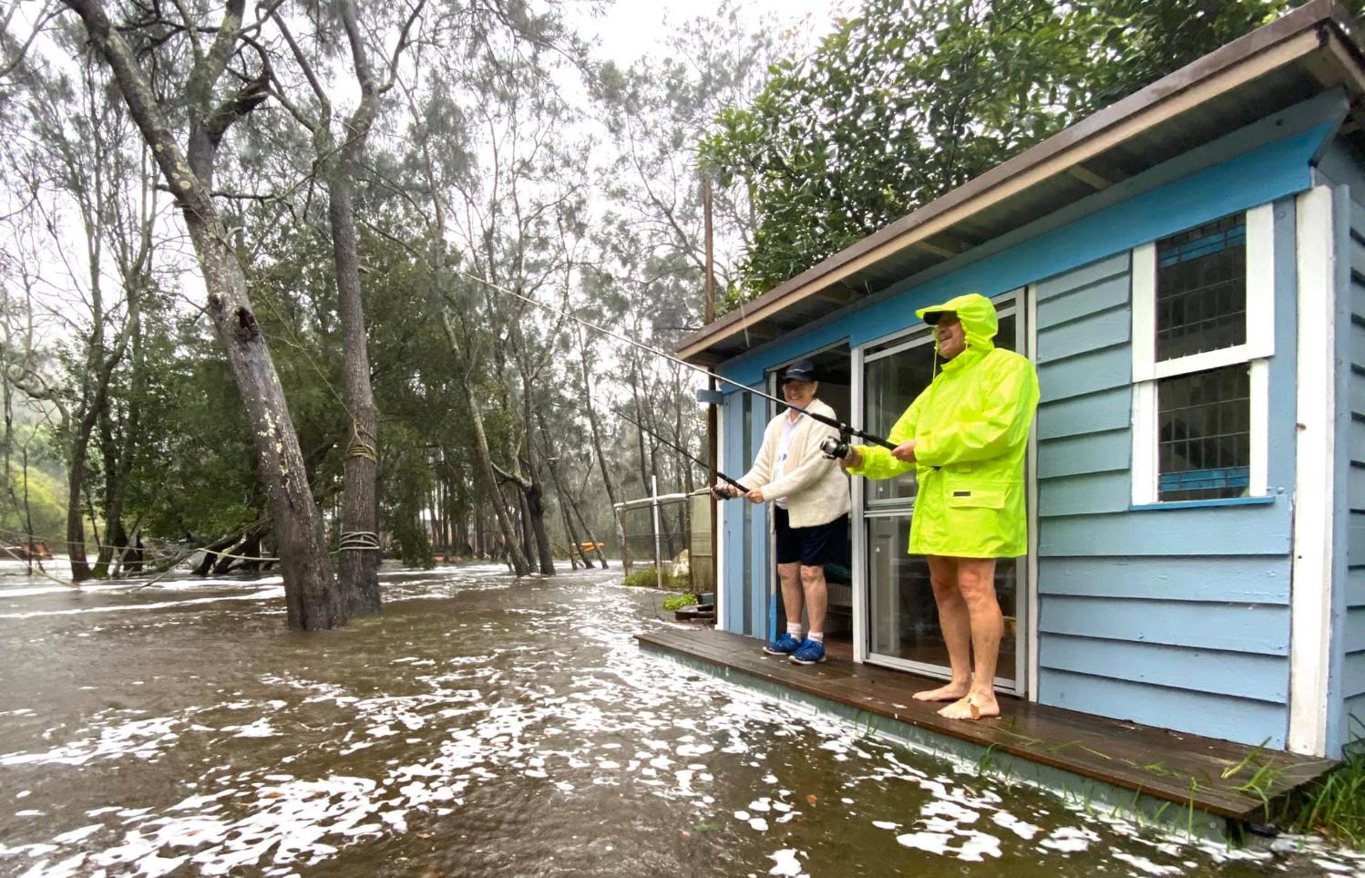
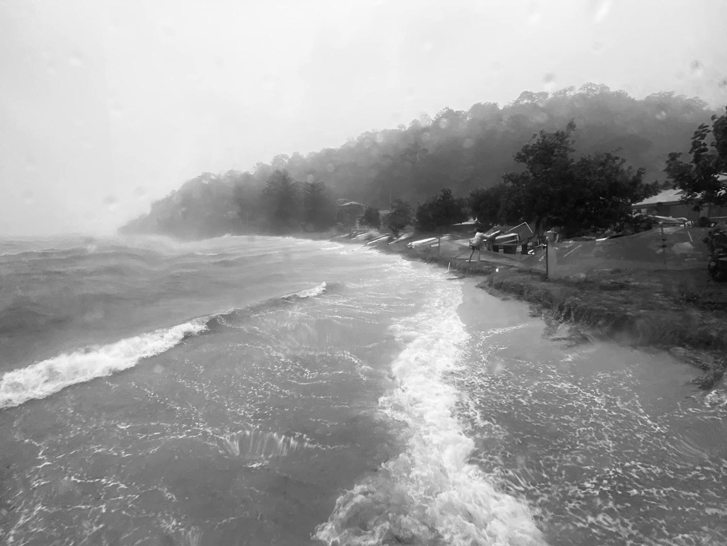
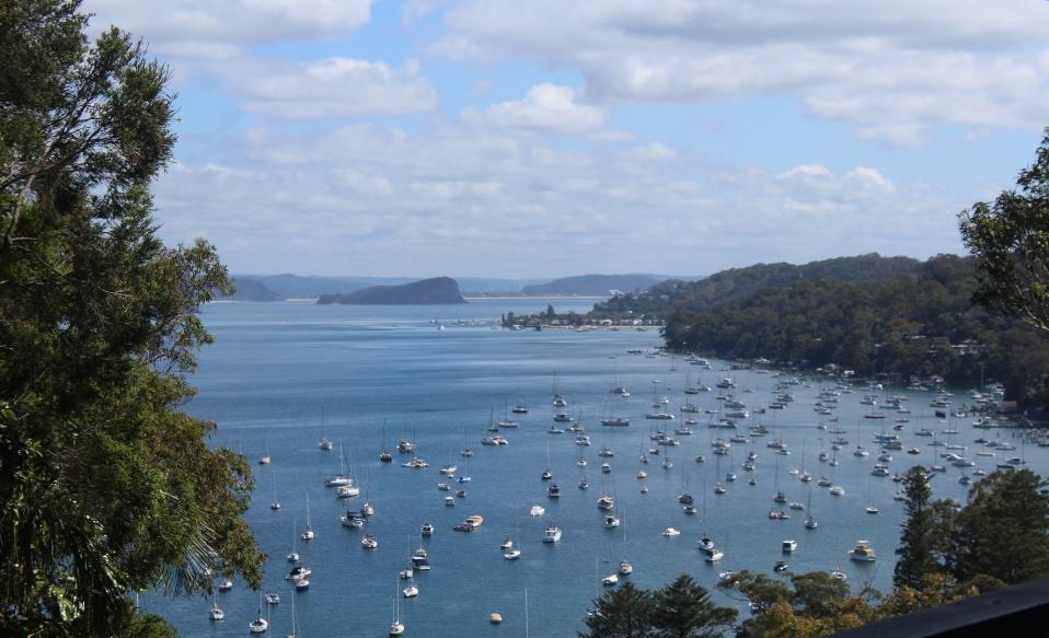
March 27, 2021 - brown water off Barrenjoey headland at north Palm Beach, heading south. Pic: AJG/PON
There are 5 stages in preparing a CMP - the current one is Stage 4: Finalise, exhibit, certify and adopt CMP.
The Stages so far encompass:
Stage 1: Scoping study: This study involved collation of existing information, preliminary risk assessment, community consultation strategy, and scoping of technical studies to fill key information gaps. This stage was completed in 2020.
Stage 2: Risks, vulnerabilities, opportunities: This phase involved community engagement, confirmation of key issues and concerns, fieldwork to confirm current knowledge, and completion of identified technical studies to fill key information gaps. This stage was completed in 2023.
Stage 3: Identify and evaluate management options: Through an online portal, feedback was collected on a number of proposed actions. Input is instrumental in ensuring the sustainable management of this vital waterway. This stage was completed in May 2023, and used to prepare the draft CMP now on exhibition.
Under the Coastal Managment Act, councils are required to take a systems approach to coastal management looking at coastal zone management issues in the broader, catchment scale context. The tidal and estuarine reaches of the Hawkesbury-Nepean River system extend from the confluence of the Grose River at Yarramundi 145km downstream to Broken Bay intersecting 6 Local Government Areas. In order to consistently and effectively address catchment-scale issues, it is important that the 6 local councils with management jurisdiction of the river system work together and that one program is prepared to guide this process.
The broad objectives of the CMP are stated below however it is anticipated that they may be refined during the development of the CMP to reflect stakeholder and community feedback.
Broad objectives
- to protect and enhance the integrity and resilience of the environmental values of the Hawkesbury River, Brisbane Water and Pittwater estuaries, including healthy, diverse aquatic ecosystems.
- to maintain and protect water quality across the system and its impacts on environmental, social and economic values - including ecological condition, recreational amenity and agricultural uses;
- to maintain and preserve the unique scenic amenity and natural character of the Hawkesbury River, Brisbane Water and Pittwater estuaries;
- to support the social and cultural values of the system and maintain public access and recreational amenity;
- to maintain the health, safety and wellbeing of those using the coastal zone (both directly and indirectly) - and to protect the health of human consumers of aquatic foods;
- to acknowledge Aboriginal peoples’ spiritual, social, customary and economic use of the Hawkesbury and to protect local indigenous cultural heritage;
- to recognise the coastal zone as a vital economic zone and to support sustainable coastal economies such as recreational fishing, aquaculture and tourism;
- to facilitate appropriate management of the coastal zone through ecologically sustainable development, and the promotion of sustainable land use planning and decision-making that is consistent with regional and local strategic plans;
- to mitigate current and future risks from population growth, urbanisation and coastal hazards (erosion and inundation of foreshores caused by tidal waters and the action of waves, including the interaction of those waters with catchment flooding);
- to ensure co-ordination between relevant government and public authorities relating to the river system - and to facilitate the proper integration of management activities across all levels of government;
- to maintain meaningful engagement with the community, and to support public participation in coastal management and planning, and to create greater public awareness, education and understanding of coastal processes and management actions;
- to encourage and facilitate research and monitoring – and to maintain the scientific and educational values of the river system;
- to support the objects of the Marine Estate Management Act 2014; and
- to align with the NSW Risk-based Framework for Considering Waterway Health Outcomes in Strategic Land-use Planning Decisions.
Feedback is open until May 31 2026.
The related documents are available at: https://yoursay.northernbeaches.nsw.gov.au/hawkesbury-nepean-river-system-coastal-management-program
The Draft document, dated October 2, 2025, states:
The CMP includes a total of 141 management actions, with an additional 9 management actions included in the associated Catchment Companion. These actions are broken down by strategy and implementation plan in Table EX-1 below. For each action, this document provides a summary of the tasks involved, roles and responsibilities, costs, and timeframes for delivery, and well as objectives and performance indicators.
Management actions have been developed for a ten-year period and have been aligned with the Partner Council’s respective four-year Delivery Programs under the NSW Integrated Planning and Reporting Framework.
Business Plan
A Business Plan has been developed which outlines the key components of the funding strategy for the CMP, including the cost of proposed actions, proposed cost-sharing arrangements, and other potential funding mechanisms. Delivery of the CMP is estimated to cost $75 Million (2025 dollars) over 10 years.
Sustainable funding and financing arrangements for management actions will be established in consultation with key stakeholders. Funding for management actions may be gained from various sources, including competitive State Government grant programs, councils’ internal funds, and local third parties.
Implementation and Review
This CMP is considered a ‘living document’ that is to be reviewed and updated over time. A strategic review of the CMP should occur at least once every 10 years to assess the effectiveness of the CMP in achieving its objectives and to incorporate changes in light of new information, legislative and policy changes, and improved understanding of the local coastal processes.
The purpose of this Coastal Management Program (CMP) is to establish an integrated program for the coordinated management of the Hawkesbury-Nepean River System (HNRS). The 6 local councils that border the estuarine reach of the river system have agreed to partner in the development of an integrated, whole-of-estuary, CMP. The 6 councils, hereafter referred to as the Partner Councils, comprise:
- ◼ Central Coast Council (CCC)
- ◼ Hawkesbury City Council (HCC)
- ◼ The Hills Shire Council (THSC)
- ◼ Hornsby Shire Council (HSC)
- ◼ Ku-ring-gai Council (KC)
- ◼ Northern Beaches Council (NBC)
Objectives
The strategic management objectives determined during Stage 1 of the CMP are summarised in Table 1-1. It should be noted that the objectives of this CMP have been designed with consider of, and are intended to be complimentary to, the NSW Water Quality Objectives (see Section 2.6).
Table 1-1 Objectives of the CMP
Objectives
a) to protect and enhance the integrity and resilience of the environmental values of the Hawkesbury River, Brisbane Water and Pittwater estuaries, including healthy, diverse aquatic ecosystems.
b) to maintain and protect water quality across the system and its impacts on environmental, social and economic values - including ecological condition, recreational amenity and agricultural uses;
c) to maintain and preserve the unique scenic amenity and natural character of the Hawkesbury River, Brisbane Water and Pittwater estuaries;
d) to support the social and cultural values of the system and maintain public access and recreational amenity;
e) to maintain the health, safety and wellbeing of those using the coastal zone (both directly and indirectly) - and to protect the health of human consumers of aquatic foods;
f) to acknowledge Aboriginal peoples’ spiritual, social, customary and economic use of the Hawkesbury and to protect local indigenous cultural heritage;
g) to recognise the coastal zone as a vital economic zone and to support sustainable coastal economies such as recreational and commercial fishing, aquaculture and tourism;
h) to facilitate appropriate management of the coastal zone through ecologically sustainable development, and the promotion of sustainable land use planning and decision-making that is consistent with regional and local strategic plans;
i) to mitigate current and future risks from population growth, urbanisation and coastal hazards (erosion and inundation of foreshores caused by tidal waters and the action of waves, including the interaction of those waters with catchment flooding);
j) to ensure co-ordination between relevant government and public authorities relating to the river system - and to facilitate the proper integration of management activities across all levels of government;
k) to maintain meaningful engagement with the community, and to support public participation in coastal management and planning, and to create greater public awareness, education and understanding of coastal processes and management actions;
l) to encourage and facilitate research and monitoring – and to maintain the scientific and educational values of the river system;
m) to support the objects of the Marine Estate Management Act 2014; and
n) to align with the NSW Risk-based Framework for Considering Waterway Health Outcomes in Strategic Land-use Planning Decisions
Coastal Zone Emergency Action Subplan
Section 15(1)(e) of the CM Act requires that a Coastal Zone Emergency Action Subplan (CZEAS) be included in the CMP where:
- ◼ The study area contains land within a certified Coastal Vulnerability Area (CVA), and
- ◼ Beach erosion, coastal inundation or cliff and slope instability is occurring on that land due to storm activity or an extreme or irregular event.
The CM Act specifies emergency management requirements for these hazards. In particular, Section 15(3) of the Act defines a CZEAS as:
“A coastal zone emergency action subplan is a plan that outlines the roles and responsibilities of all public authorities (including the local council) in response to emergencies immediately preceding or during periods of beach erosion, coastal inundation or cliff instability, where the beach erosion, coastal inundation or cliff instability occurs through storm activity or an extreme or irregular event.”
While no CVA has been formally prepared for the HNRS study area at the time of certification, it is recognised that the HNRS coastal zone is subject to the coastal hazards of beach erosion and coastal inundation.
Consequently, 3 CZEAS documents have been prepared in line with the mandatory requirements of the CM Act and accompanying CM Manual (OEH, 2018a).
The CZEAS documents cover the locations and hazards summarised in Table 1-4 and are provided as appendices to this CMP.
Table 1-4 CZEASs accompanying this CMP
Area of Coverage Coastal Hazards Location
The Beaches of Broken Bay ▪ Beach erosion
▪ Coastal inundation Appendix E
Pittwater ▪ Beach erosion
▪ Coastal inundation Appendix F
Lower Hawkesbury River ▪ Coastal inundation Appendix G
Proactive planning is critical to managing the risks associated with storm-related coastal hazards. The CZEAS framework provided herein provides a clear, coordinated approach for responding to emergencies such as beach erosion, and coastal inundation. By outlining the roles and responsibilities of councils and other public authorities, the CZEAS helps deliver timely, effective, and well-integrated emergency responses that support broader coastal management objectives.
The Stage 4 Draft Appendix F, dated December 5 2025, states:
This Coastal Zone Emergency Action Subplan (CZEAS) forms an integral part of the Hawkesbury-Nepean River System Coastal Management Program (HNRS CMP). It applies to the beaches and foreshores of the Pittwater waterway, within the Norther Beaches Council Local Government Area (LGA). These beaches are part of the legally defined study area for the HNRS CMP (Water Technology, 2025). It has been prepared
based on the requirements of:
◼ The Coastal Management Act 2016 (the CM Act).
◼ The NSW Coastal Management Manual (OEH, 2018a).
◼ The NSW Guideline for preparing a coastal zone emergency action subplan (DPIE, 2019).
1.2 Purpose and Objectives
As specified in the CM Act, a CZEAS is a plan that outlines the roles and responsibilities of all public authorities (including the local council) in response to coastal emergency events immediately preceding or during periods of beach erosion, coastal inundation, or coastal cliff and slope instability, where those processes occur through storm activity or an extreme or irregular event.
Subsequently, this CZEAS details arrangements for the four phases of emergency events (prevention, preparation, response, and recovery) relating to coastal hazards for Pittwater.
In accordance with the New South Wales (NSW) Guideline for preparing a coastal zone emergency action subplan (DPIE, 2019), the purpose of this CZEAS is to identify and facilitate the implementation of appropriate emergency response actions in order to:
◼ Protect human life and public safety.
◼ Minimise damage to property and assets.
◼ Minimise impacts on social environmental and economic values.
◼ Not create additional hazards or risk.
The objectives of this CZEAS are to:
◼ Set a clear definition for what constitutes a coastal emergency (Section 2), and associated triggers for emergency response actions (Section 3).
◼ Identify the locations that may be affected by beach erosion, coastal inundation, or coastal cliff and slope instability that would constitute a coastal emergency (Section 4).
◼ Outline the roles and responsibilities of all public authorities, including Northern Beaches Council (Council) and the NSW National Parks and Wildlife Service (NPWS), and coordinate their response to emergencies immediately preceding or during periods of beach erosion, coastal inundation and coastal cliff and slope instability (Section 5).
◼ Outline the communications required in the four phases of emergency management (Section 6).
◼ Summarise key actions to be carried out in the four phases of emergency (Section 7).
◼ Identify approvals pathways for CZEAS actions as they relate to the NSW Coastal Management Framework (Section 8).
Study Area
This CZEAS applies to public foreshore areas managed by Northern Beaches Council and NPWS. Six key foreshore locations have been identified as particularly vulnerable to beach erosion and/or coastal inundation due to exposure to ocean swell wave energy and the presence of significant public assets (see Figure 1-1):
◼ Station Beach (Council foreshore and NPWS foreshore)
◼ Snapperman Beach (Council foreshore)
◼ Sandy Beach (Council foreshore)
◼ The Basin Campground (NPWS land tenure)
◼ Currawong Beach (Council foreshore)
◼ Great Mackerel Beach (Council foreshore)
A detailed local emergency plan is provided for each of these areas (in appendix A - at end of Appendix F document - not that listed as Appendix A mapping on council webpage).
It is acknowledged, however, that other foreshore areas across Pittwater may also be exposed to coastal hazards. Accordingly, this CZEAS includes a “Pittwater-wide” plan applicable to all public foreshore areas within the waterway.
Definitions of Coastal Hazards
The NSW 2017 State Level Risk Assessment (NSW Office of Emergency Management, 2017) classifies storm and coastal erosion as priority hazards that pose a significant risk to the state. The CM Act identifies three types of coastal hazards that should be considered when developing a CZEAS. These are defined in the guidelines (DPIE, 2019) as:
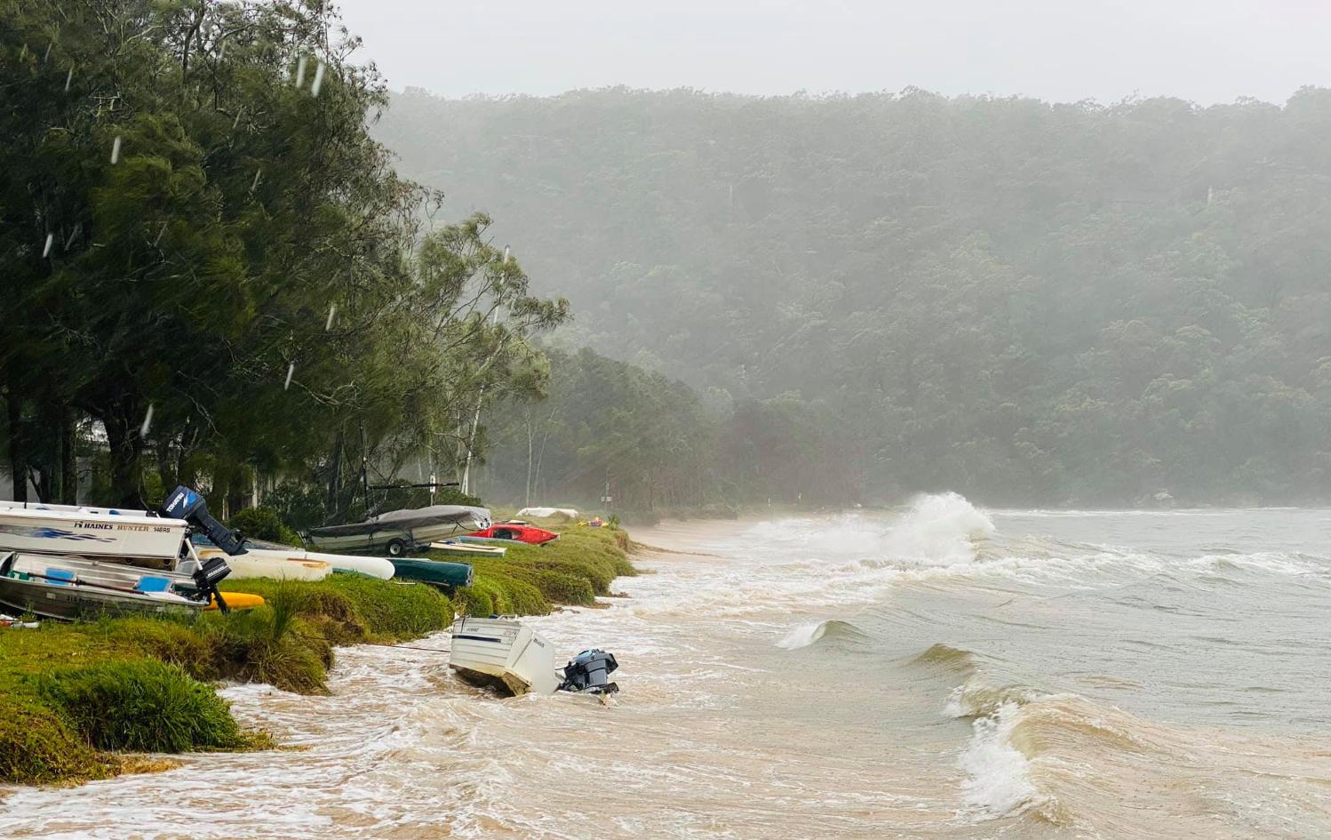
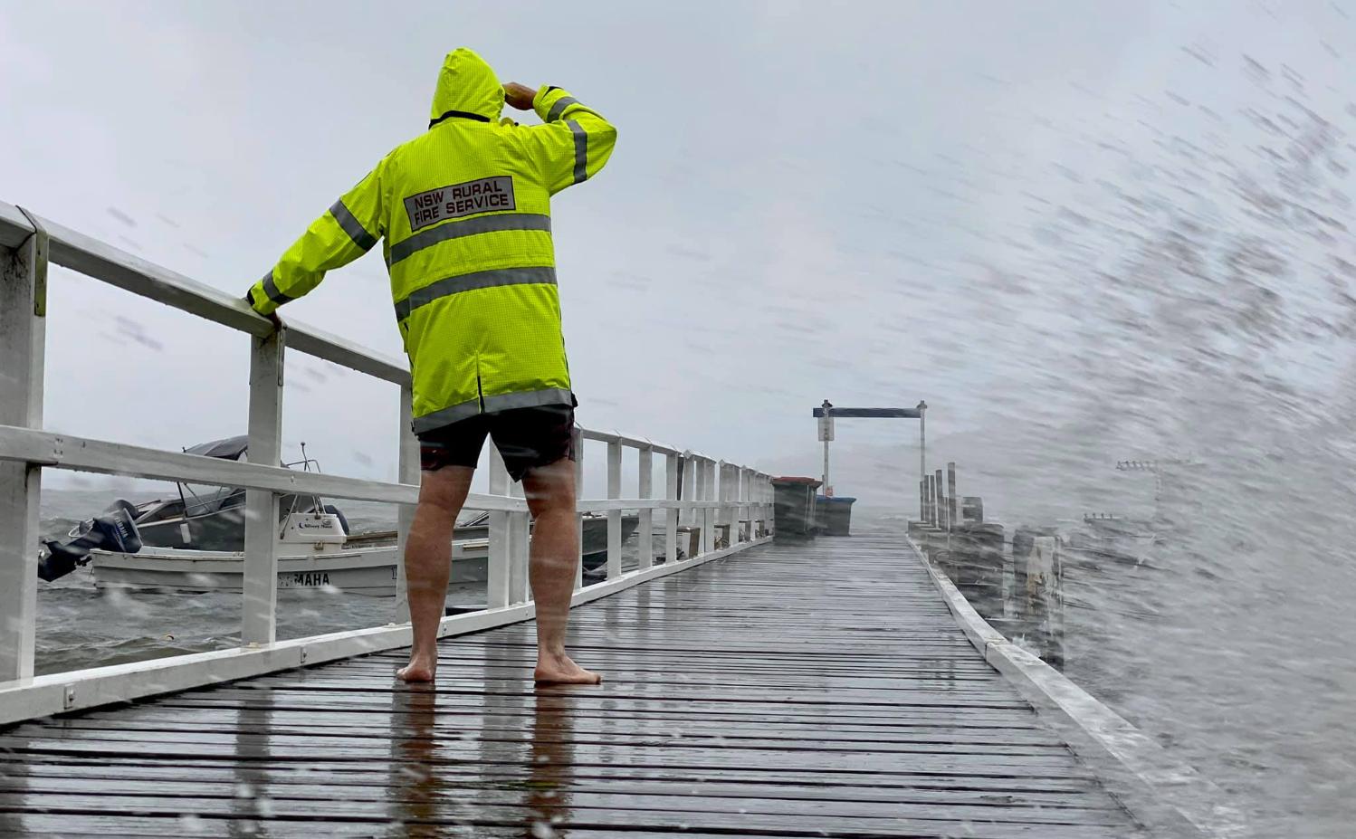
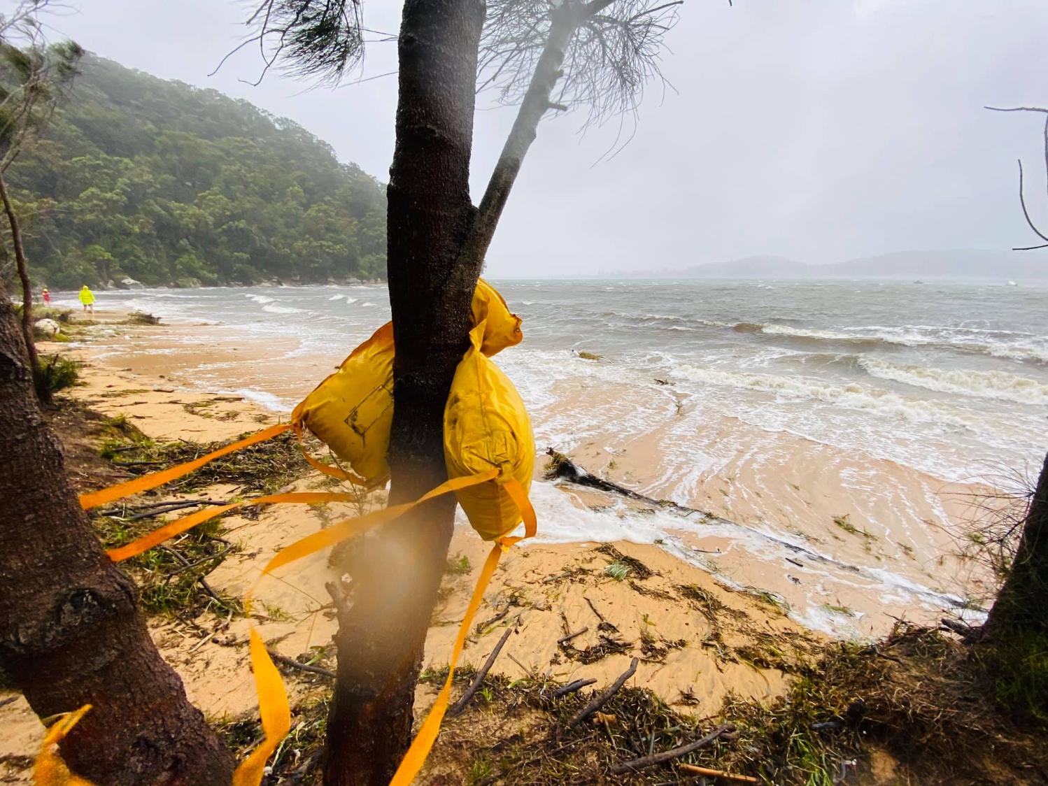
◼ Beach erosion: Not all beach erosion occurring during a storm event provokes a coastal emergency response. Therefore, a “beach erosion emergency” in the context of this CZEAS can be defined as an actual or imminent occurrence of a beach erosion event that occurs when wind, waves, and currents are removing the sediment that comprises the foreshore and/or frontal dune system, landward of the fully accreted condition. The consequence of such erosion can create risks to public safety, and public and private assets - which requires a coordinated emergency response.
◼ Coastal inundation: Coastal inundation occurs when marine and atmospheric forces combine and raise water levels at the coast (or inside estuaries) above normal elevations causing dry land to be inundated by seawater. Coastal inundation is often associated with storms and results in elevated still water levels (storm surge), wave set-up, wave runup and over-wash flows. Storm surges and powerful waves can also penetrate estuaries giving rise to strong currents or seiching. This may result in the inundation of roads and low-lying land adjacent to estuaries. For the open coast, it is associated with wave overtopping of beach dunes and the extent of wave runup onto the back-beach area.
◼ Coastal cliff and slope instability: This refers to a variety of geotechnical processes on coastal cliffs and bluffs, including rock fall, slumps, and landslides. These may be driven by coastal processes such as wave undercutting and overtopping, or by differential weathering of rock layers in cliffs and bluffs or by surface and groundwater flows generated by extreme rainfall. Instability may occur during or following a coastal storm event but may also occur at other times. There may be very little warning that a coastal cliff or slope instability incident is imminent. These hazards may endanger life and property at the site of the process (e.g., through collapse of a lookout platform or walking track, or undermining of dwellings), and at the toe of the cliff or bluff (rock platform or beach).
As stipulated in the NSW Guideline for preparing a coastal zone emergency action subplan (DPIE, 2019), the other coastal hazards identified in the CM Act are outside the scope of this CZEAS – including long term shoreline recession, coastal lake or watercourse entrance instability, tidal inundation, and erosion and inundation of estuary foreshores caused by tidal waters and the action of waves. These hazards either pertain to estuary environments outside the scope of this CMP or are not related to storm activity or an extreme or irregular event.
Emergency Plan actions include, as example:
Great Mackerel Beach:
Respond Action 3.9; Close foreshore and wharf access as required
Recovery Action 4.5; Assess damage to wharf
Recovery Action 4.8; Restore safe beach access
Station Beach - South:
Respond Action 3.8; Close road and car park access as required
Respond Action 3.9; Close foreshore access
Recovery Action 4.4; Collapse escarpment at accessway(s) to reinstate safe access
Recovery Action 4.8; Restore safe beach access
Snapperman Beach:
Respond Action 3.8; Close road as required
Respond Action 3.9; Close foreshore access
Recovery Action 4.4; Collapse escarpment at accessway(s) to reinstate safe access
Sandy Beach:
Respond Action 3.9; Close foreshore access
Recovery Action 4.4; Collapse escarpment at accessway(s) to reinstate safe access
Recovery Action 4.5; Assess damage to infrastructure - including boat ramp, wharves, and stormwater outlets
Recovery Action 4.8; Restore safe beach access
Related reports:
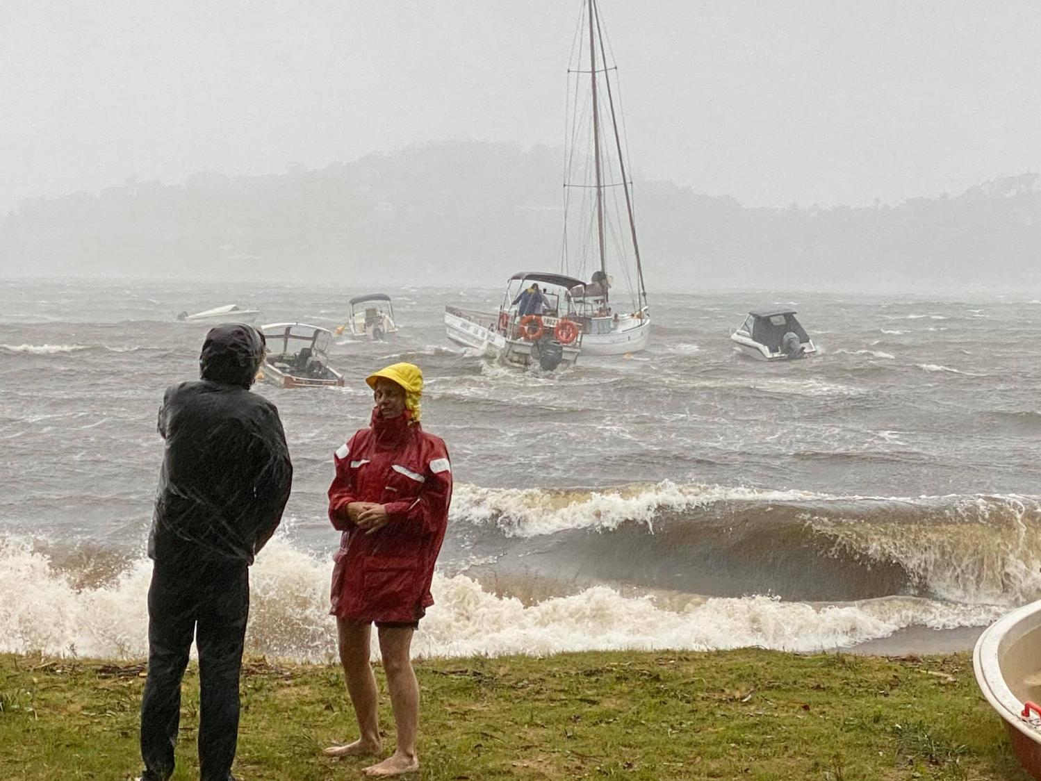
- February 22 To March 9 2022 Weather Event: Some Records
- East Coast Low: Storm Swell Impacts On Beaches - Lagoon - April 2022
- July 2022 Storms - Floods
- February 2020 Storm Event: Rains & Waves Cause Floods
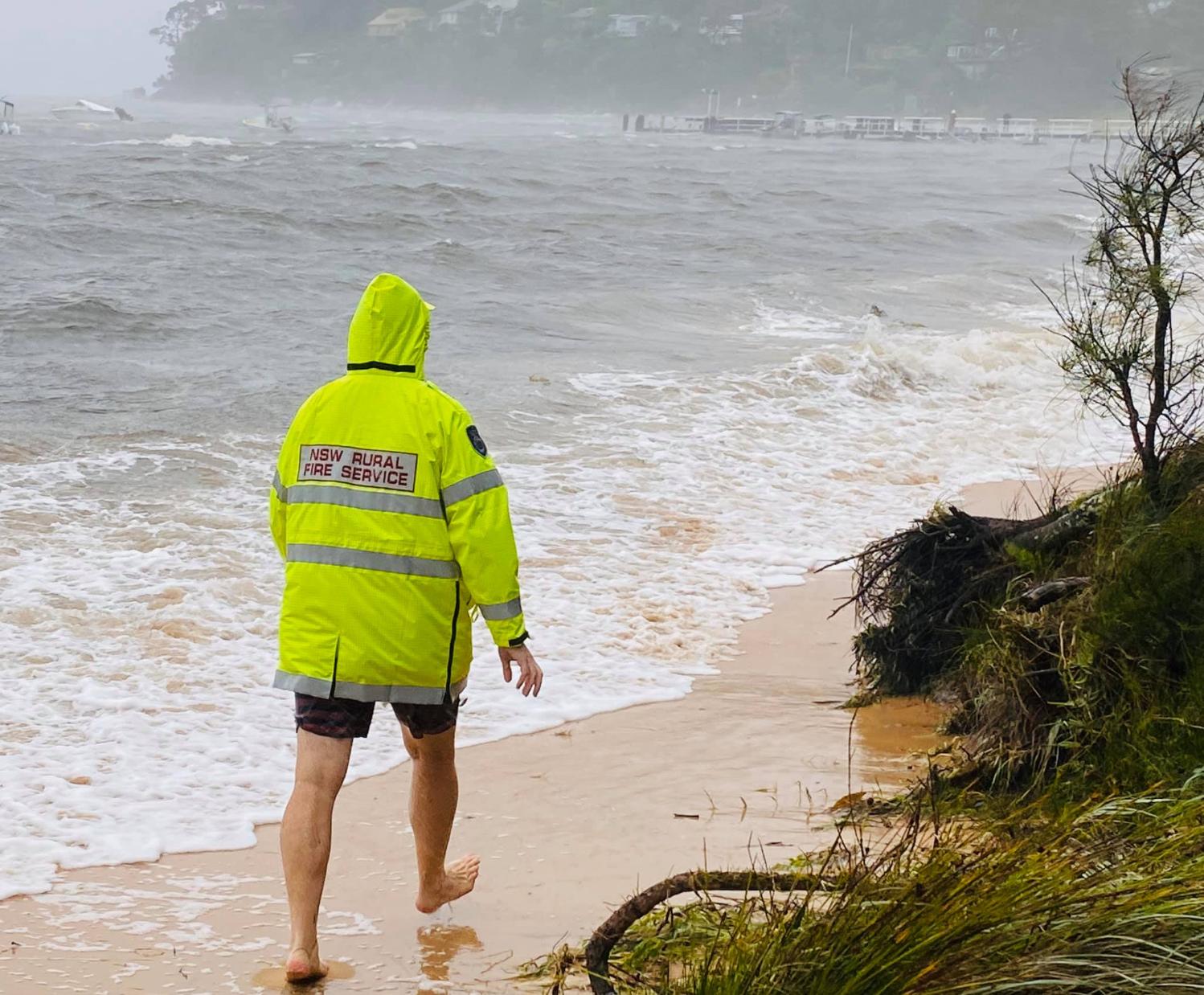
- March 2021 1 In 100 Years Weather Event Sends Locals All Over The Beaches As Well As Far From Home To Help Others
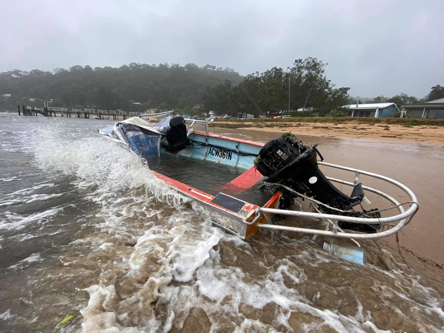
- Hawkesbury River: 1 in 100 Years Floods - What washed up on Pittwater Beaches - April 2021
- NSW SES, NSW RFS Volunteers Conduct Hundreds Of Flood Rescues During Rain Event: April 5-6 2024
- Stealing The Bush: Pittwater's Trees Changes - Some History - 2025
- New Study Shows Floods from Hawkesbury Causes Abundance of Reef Fish to Drop by 50% - August 2025
- Brilliant News: Bayview - Mackerel - Currawong Wharves Allocated $3,173,117 for Upgrades under Boating Infrastructure for Communities Grant Program - August 2025
- NSW Audit Office report on Coastal Management Finds Objectives of Coastal Management Act are not being met: Recommendations - September 2025
- Great Mackerel Beach Wharf - contract awarded at December 16 2025 council meeting to SMC Marine Pty Ltd for RFT 2025/001048 – Mackerel Beach Wharf Upgrade for the sum of $1,574,800 excluding GST.- works are extending the wharf by approximately 35m to approximately 105m total length to provide access at all tidal times for all users that complies with the Disability Discrimination Act (DDA) 1992. Works commenced March 16 2026, and are expected to finish in October 2026, weather permitting. A grant of $1,470,466 was approved by Transport for NSW for these works, Executive Director, NSW Maritime
Great Mackerel Beach: February 2020
All photos by previous Artist of the Month, Nat Bromhead of Pittwater Photography