
The NSW SES carried out more than 160 flood rescues overnight and into the morning of Friday April 5 and April 6, following a severe weather event that resulted in flash flooding and damage to properties and roads throughout Sydney, the Illawarra and South Coast.
More than 200ml of rain impacted parts of Sydney and the Illawarra, with around 4,000 NSW SES volunteers responding to 3135 calls for help over a 24-hour period.
On Friday just before 6pm Narrabeen and surrounds to Warriewood, the Narrabeen catchment and Warriewood floodplain, were put on 'watch and act' status as the Wakehurst Parkway was closed at 4.30pm, although water had been over the road prior to then, and a high tide was expected to impact on the lagoon entrance.
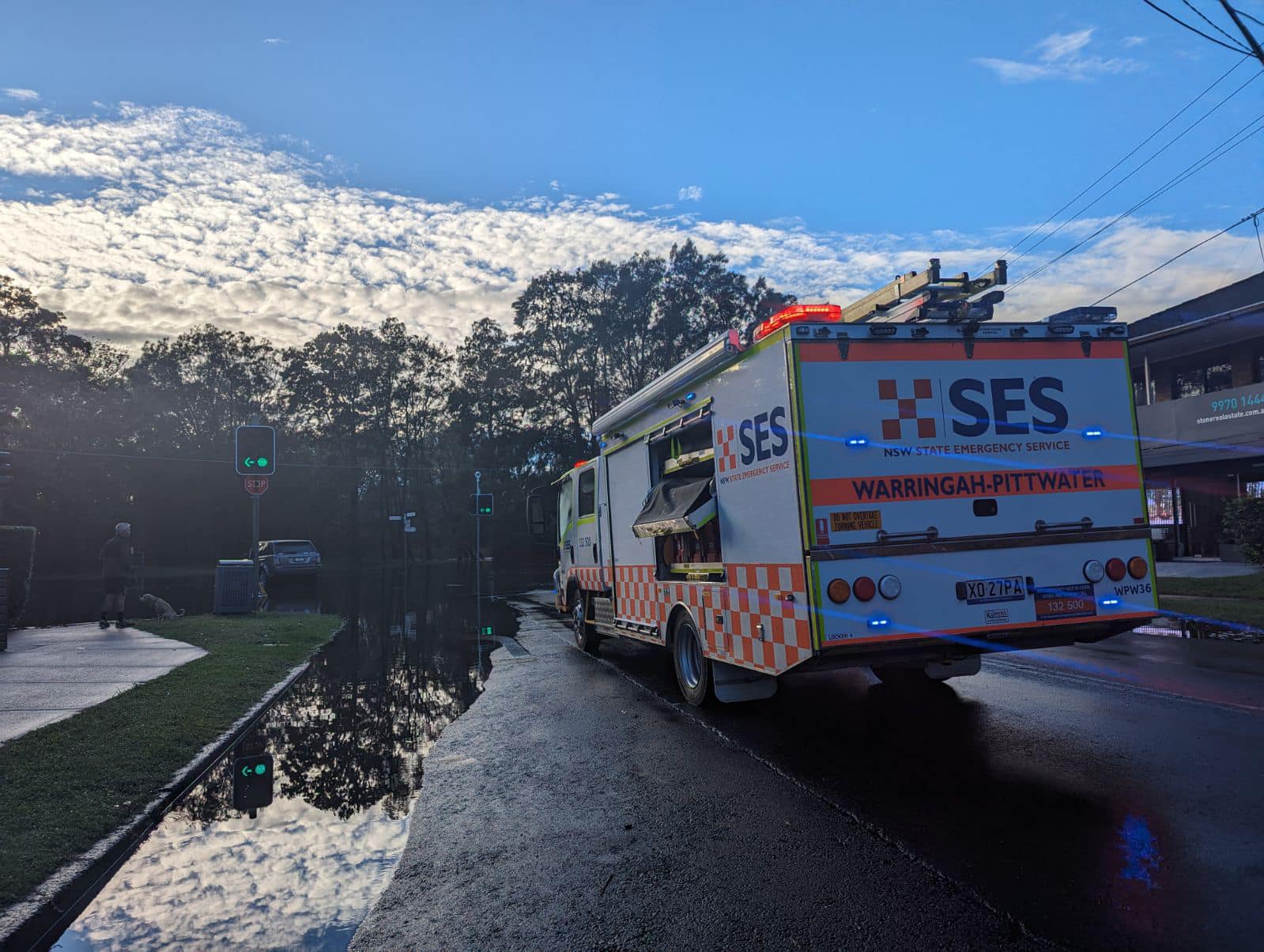
At 5am on Saturday morning water over Pittwater road between Narrabeen and Collaroy closed that section of road as well for around two hours.
However, it was not until 7am Saturday morning, with a high tide already coming in, that residents were advised to evacuate as water funnelling into the lagoon from adjacent creeks, combined with the tide, began to flood local streets and areas.
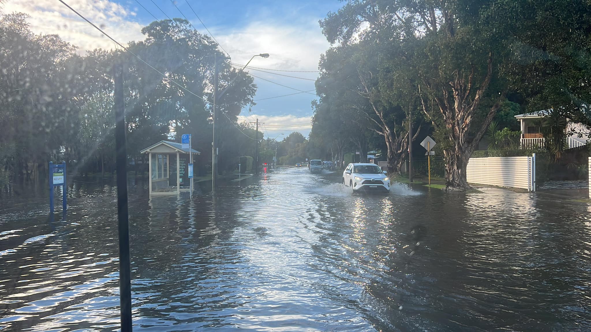
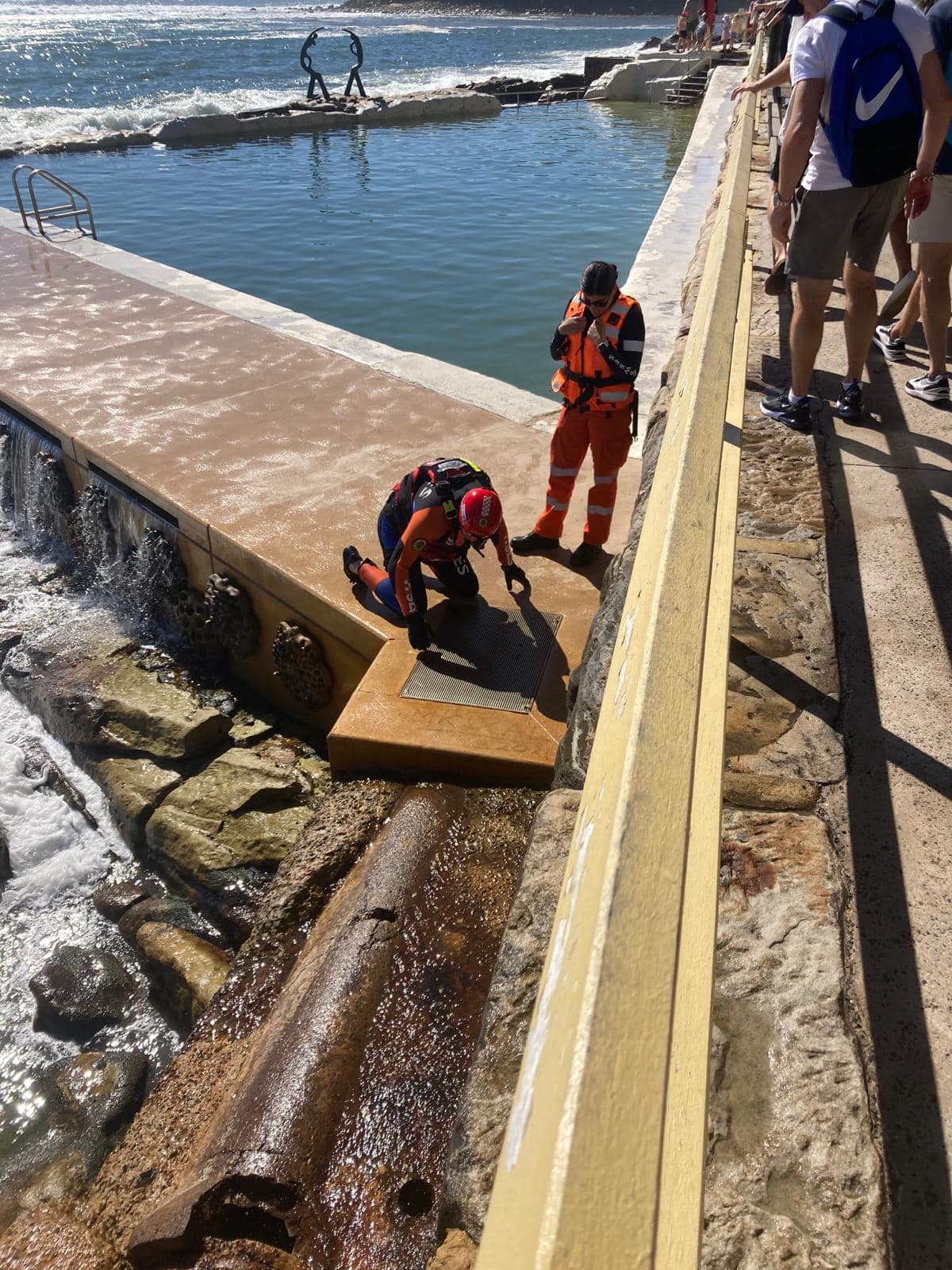
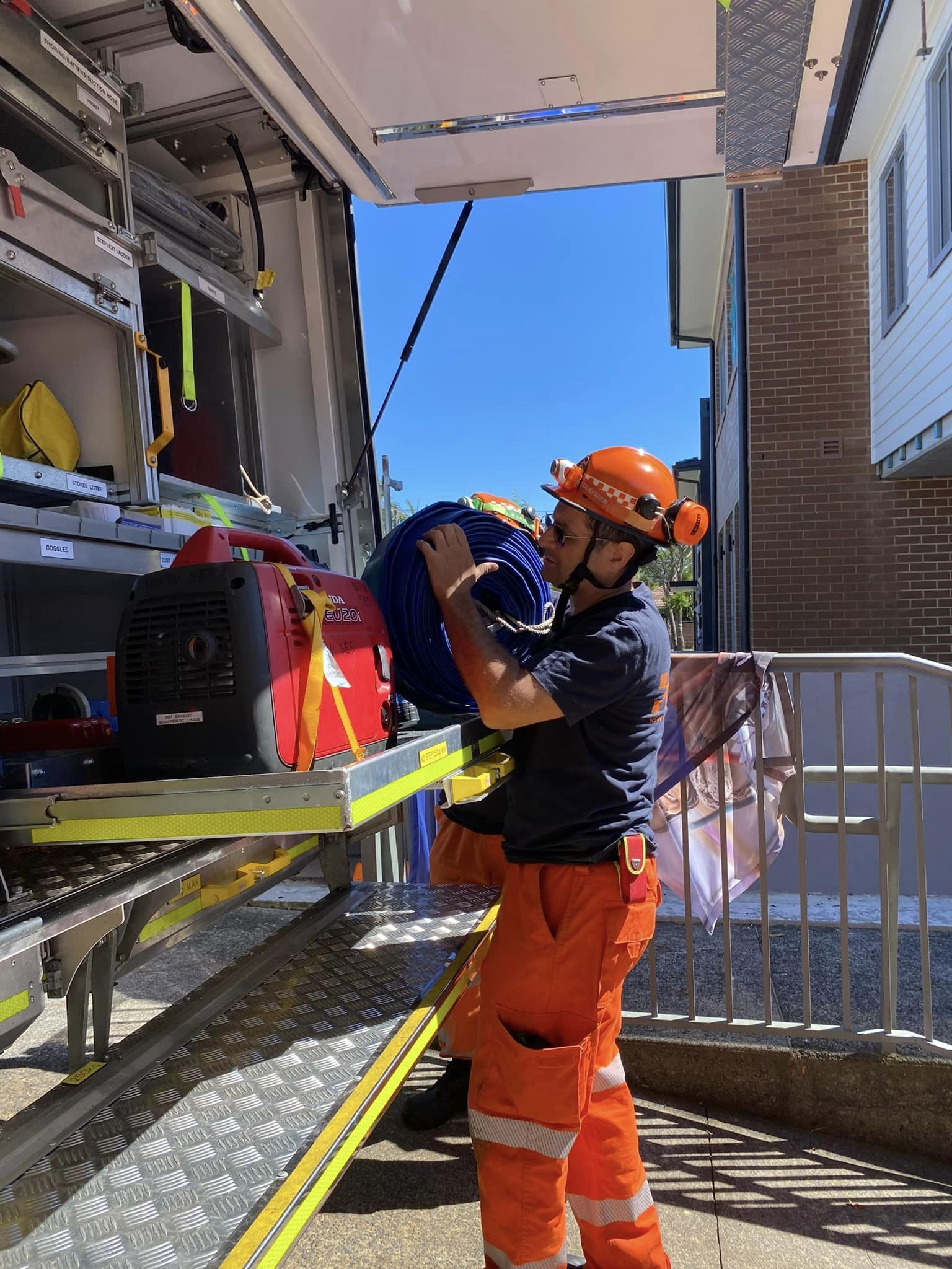
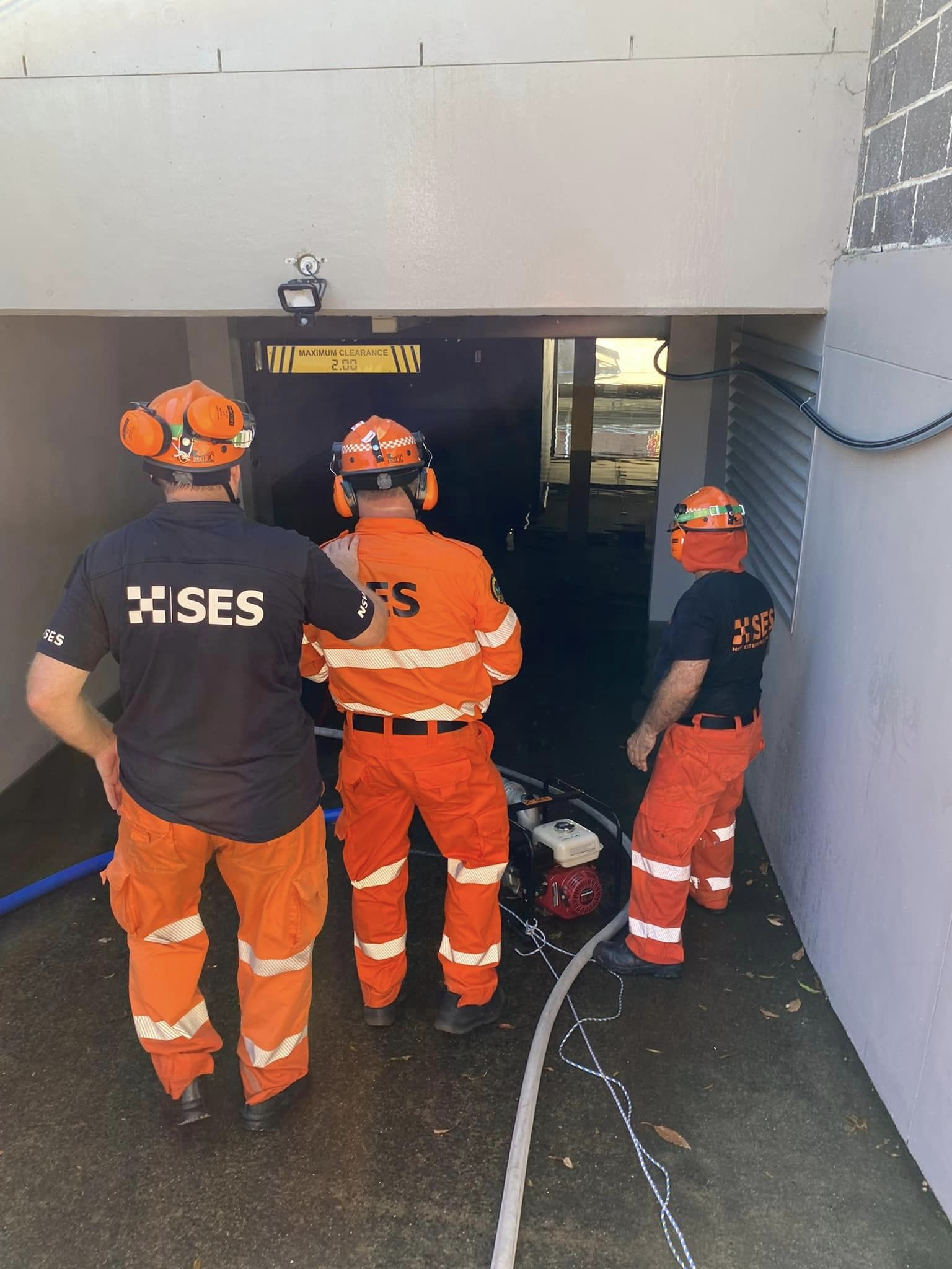
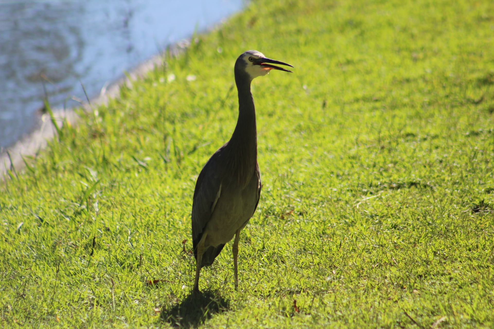
Photo: NSW SES Warringah / Pittwater Unit
The council had contractors working on opening the entrance on the Thursday and again on Friday.
This drone footage, shot by local photographer Tim Seaton on Saturday morning, shows the extent of flooding at Narrabeen and the channel out of the lagoon to the ocean:
Residents along flooded streets were asking people to not drive along them or to slow down as the wash created was further damaging their homes.
At the same time residents adjacent to Manly dam were placed on 'watch and act' status by the NSW SES as well as water overflowed.
Earlier flooding nearby of Manly streets kept local teams from the NSW SES Manly Unit and NSW SES Warringah-Pittwater Unit busy throughout the night helping residents with leaking rooves, roping off dangerous areas, fallen trees and hundreds of other tasks.
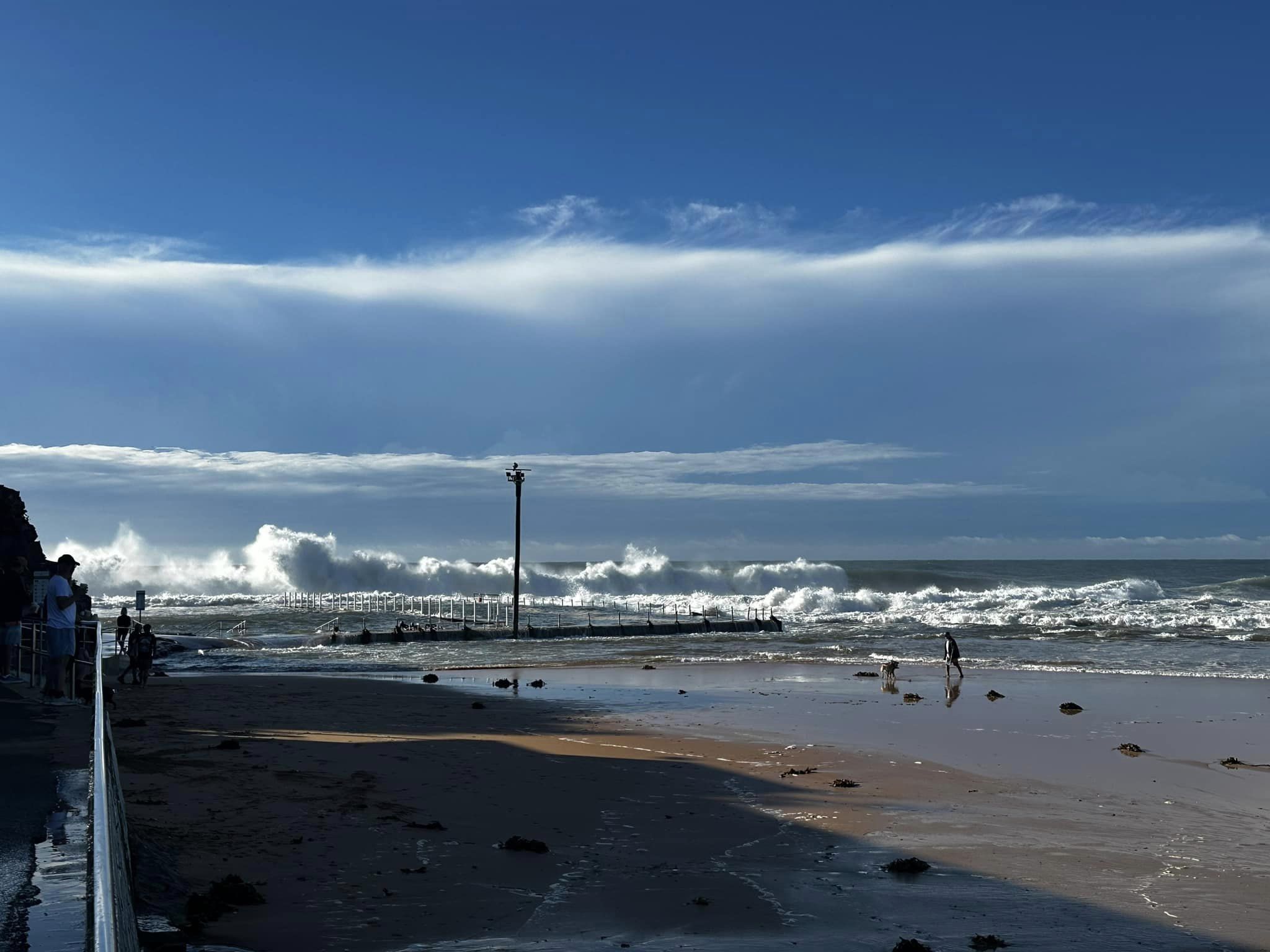
The council closed all beaches as run off from both the Hawkesbury river, also flooding, along with stormwater and creek runoff, brought pollutants and debris to the beaches.
Pittwater was the scene of numerous vessels being dislodged from their moorings by strong damaging winds and heavy rainfall, and the water, coloured brown, showed the debris and runoff from the river had filled the estuary, along with runoff from nearby land.
As rain conditions cleared in the north of the state on late Saturday morning, Sydney and the Illawarra, NSW SES, NSW RFS and NSW SLS volunteers were still supporting clean up activities and responding to reports of fallen trees, property damage and landslides.
The weather system moved south, impacting parts of the south coast, and was expected to move off the coast Saturday evening.
NSW SES State Duty Commander, Assistant Commissioner Dean Storey, said riverine flooding will continue to impact people who live in low-lying properties along the Hawkesbury, Nepean and Colo Rivers.
“While the significant rain event has now passed and blue skies have returned, flooding is expected to occur for residents in the Hawkesbury Nepean and Colo communities as the rainfall moves into the rivers and downstream over the coming days,” Assistant Commissioner Storey said.
“Many of the affected properties are rural, so we are asking landowners to move their equipment, pumps and stock to higher ground.
“I would also like to remind affected communities that significant amounts of rain have fallen in a short period of time, so there is a lot of water across roads, bridges and causeways. If you come across a flooded road, stop, turnaround and find an alternate route.”
The NSW SES currently has 13 Emergency Warnings in place requesting affected residents evacuate their properties. A full list of the current warning locations can be accessed on the NSW SES website.
Assistant Commissioner Storey praised the efforts of the 4000 volunteers who undertook rescues and helped communities through the storm.
“We saw significant rainfall over a short period of time this morning. NSW SES volunteers did an incredible job responding to hundreds of flood rescues, mostly for drivers caught in flash flooding,” Assistant Commissioner Storey said.
“This demonstrates the skill, professionalism and dedication of our volunteers.”
NSW Rural Fire Service stated; ·
''It's been a busy night and day for emergency services across NSW, with heavy rainfall and damaging winds impacting much of the state's east coast. RFS volunteers continue to assist the NSW SES respond to fallen trees, downed powerlines, flood rescue and clean up. The RFS is also providing aviation rescue support with helicopters positioned at Bankstown, Taree, Mudgee and Coffs Harbour.''
These volunteer services continued clearing roads of fallen trees and debris throughout Saturday. There were also a number of dislodged drain covers that were found and placed back by these services.
The community had nothing but sincere thanks, praise and applause for the volunteers of the NSW SES Manly Unit and NSW SES Warringah-Pittwater Unit, who were still workjing to help people as this Issue went to press.
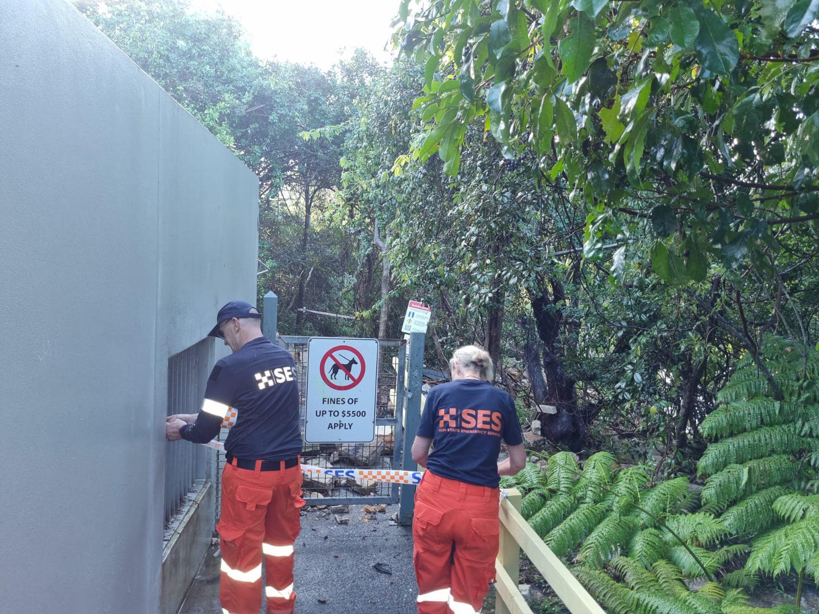
NSW SES Manly Unit - making people aware an area is dangerous an taping it off
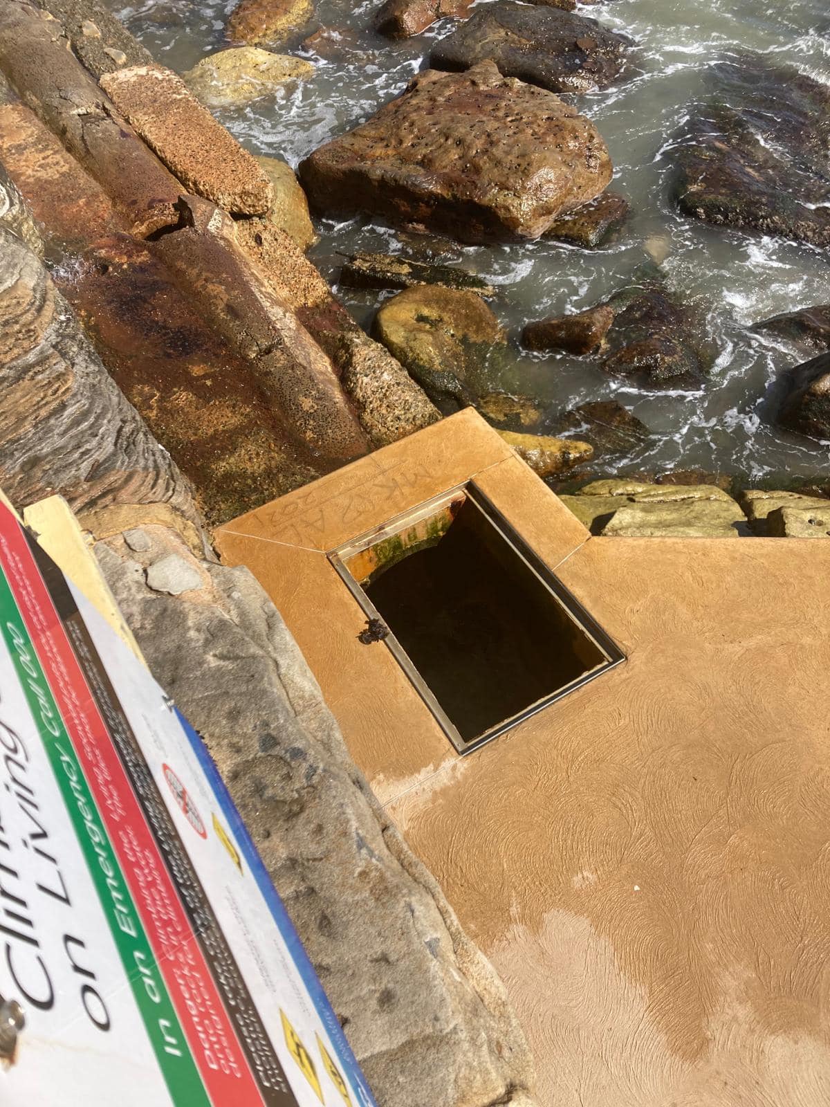
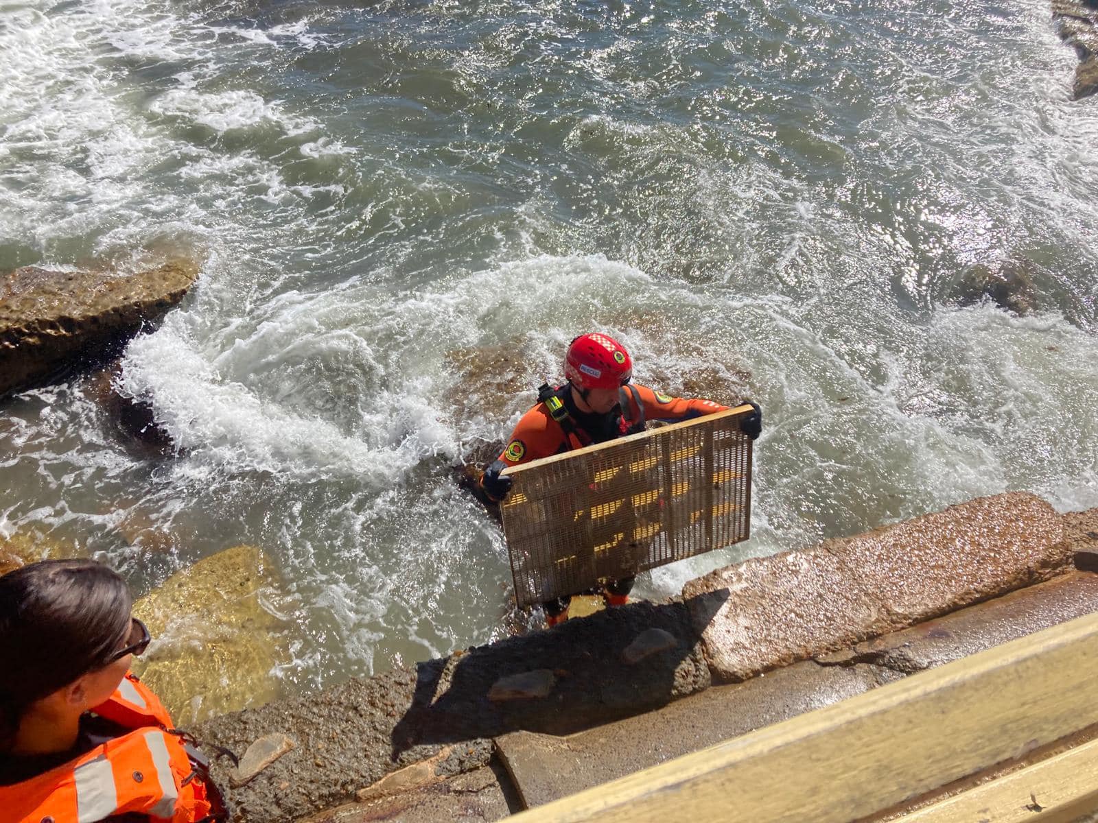
NSW SES Manly Unit and NSW SES Mosman Unit rescued a storm water grate that had been washed away at Fairy Bower Pool; a potentially dangerous situation if a child had fallen in:
The rainfall totals BOM gauges for the Sydney area for April 6 2024 record Mona Vale Golf Club: 140.2mm, Belrose (Evelyn place) recorded 150.0mm, and Terrey Hills AWS was 161.2mm.
The Bureau of Meteorology's 2024 Autumn Long-Range Forecast, issued on February 29, states there is a roughly equal chance of above or below median rainfall for most parts of eastern New South Wales including Sydney, the Hunter and South Coast. This remains the same as updated on April 4 2024.
The BOM's preliminary summer summary states Australia is on track to have the third-warmest summer on record nationally, after 2018–19 and 2019–20.
All states and territories had above-average daytime and night-time temperatures, except Victoria, and are likely to be in the top 10 warmest on record.
Western Australia is on track to have its warmest summer on record. The state's previous hottest summer was 2018–2019.
Summer has been wetter than usual for many areas. Rainfall is tracking around 14% above average for Australia overall. This is Australia's third-highest summer rainfall total on record during an El Niño, behind 2009–10 and 1994–95.
To stay up to date with the latest flood information download the Hazards Near Me App.
If you require storm or flood assistance call NSW SES on 132 500. If the situation is life-threatening, call Triple Zero (000).
Below runs some of the photos taken by NSW SES Warringah Pittwater and NSW SES Manly Units and some from residents over this 12 hour storm period, along with an insight into the science of this rain event.
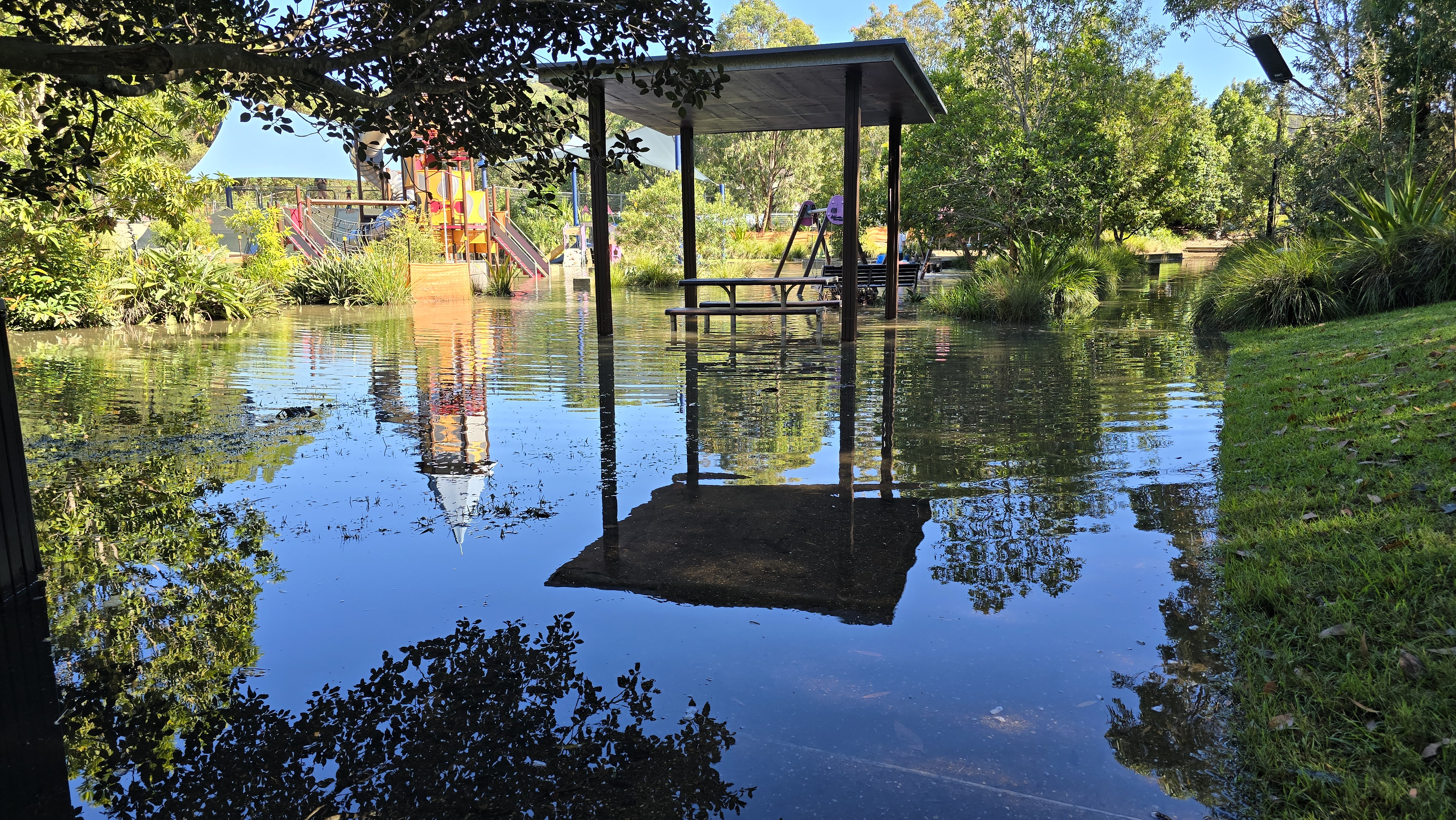
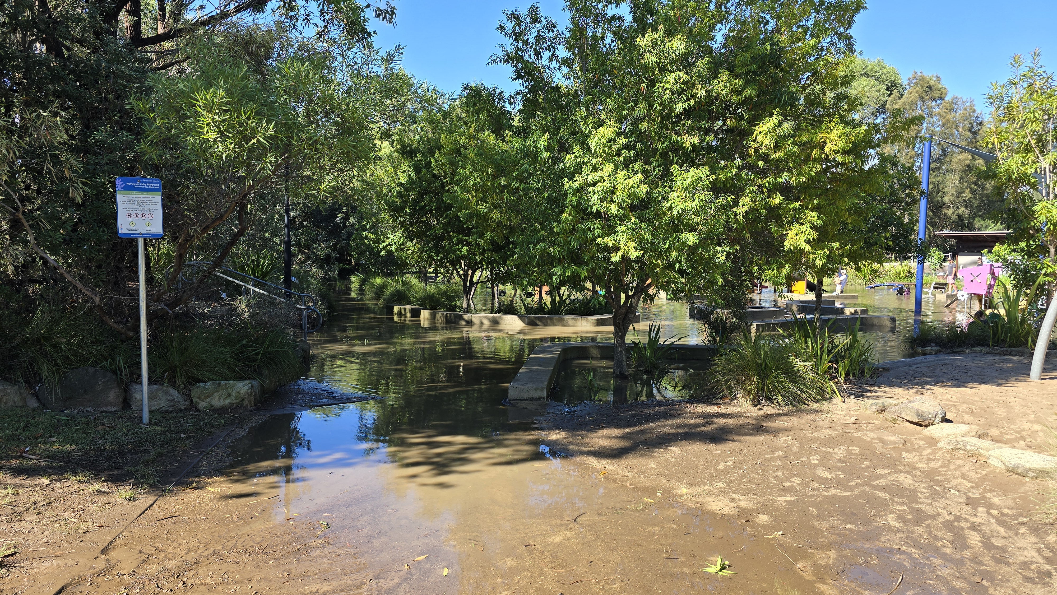
Photos by Kevin Murray - "Rocket Park" (actually "Warriewood Valley Playground") is now a lake, following the recent heavy rain and changes to its drainage due to recent works. The kids didn't seem to mind. though!
Here are a few pics...
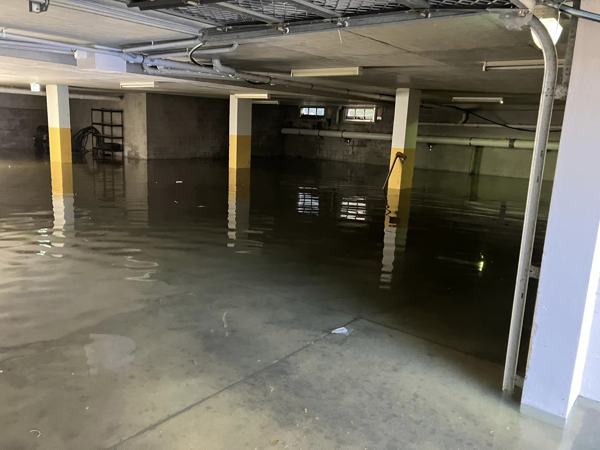
photos by NSW SES Warringah / Pittwater Unit - what a busy day! Water everywhere for our crews to pump out. Remember to never walk, play or drive in floodwater no matter how much fun it looks. Saturday afternoon;
photos by NSW SES Warringah / Pittwater Unit at Narrabeen Saturday morning:
Photos by AJG/PON - at Avalon Beach/Careel Creek - Saturday morning

Why is Australia’s east coast copping all this rain right now? An atmospheric scientist explains
Kimberley Reid, Monash UniversityHeadlines declaring a “Black Nor'easter” appeared this week as New South Wales and Queensland copped heavy rain – and residents have been warned to brace for more.
The Bureau of Meteorology is forecasting a 75% chance of Sydney receiving at least 50mm of rain, and a 25% chance of at least 100mm of rain on Friday (the average rainfall for the entire month of April in Sydney is 121.5mm).
Parts of Sydney were drenched in more than 100mm of rain overnight and the main dam that supplies the city’s drinking water is expected to spill in coming days. At least one man has died in Queensland floodwaters after torrential rain.
You might be wondering: what is a Black Nor'easter, what’s causing all this rain and does it have anything to do with climate change? I’m an atmospheric scientist who researches atmospheric rivers, extreme rainfall and climate change. Here’s what you need to know.
A Wavy Atmosphere Leads To Wild Weather
Nor'easter simply means the wind comes from the northeast and black refers to the thunderstorm clouds likely to darken the sky.
Pirate-esque poetry aside, this type of weather system is not that unusual for this time of year, and technically the weather system started in the south.
But to understand the bigger question of why the east coast is copping all this rain, you need to remember the atmosphere is a fluid.
That means the same laws of physics that apply to water in the ocean also apply to air in the atmosphere. Like the ocean, the atmosphere has waves that break.
The jet stream is a current of fast winds about 10km high that blows from west to east and steers high and low pressure systems around the planet.
High pressure systems tend to bring clear skies and sunny weather, while low pressure systems are associated with clouds and rain.
But when the jet stream becomes wavy or even breaks, the high and low pressure systems can veer off course.
Like sea spray blowing off an ocean wave as it breaks, a low pressure system can blow off an atmospheric wave, as seen in the video below:
What Causes A Long Stretch Of Intense Weather?
When a high or low breaks away from the jet stream, it can become “stuck”, leading to a stretch of wet weather or a stretch of hot weather.
The worst heatwaves are caused by high pressure systems stalling.
Conversely, some of the worst floods in the world are caused by low pressure systems being cut off from the jet stream and dumping rain in one place for multiple days.
The map below shows the cut-off low and blocked high over eastern Australia.
Like toothpaste in a tube, the air between the high and low is being squeezed along a narrow path (the purple arrow in the map above).
Since the air is coming from the Coral Sea, the air is warm and humid. This narrow region of enhanced moisture in the air is called an “atmospheric river”.
This atmospheric river acts like a hose, feeding moist air into the low. There, the atmospheric moisture is converted to rainfall.
We Have Seen This Before
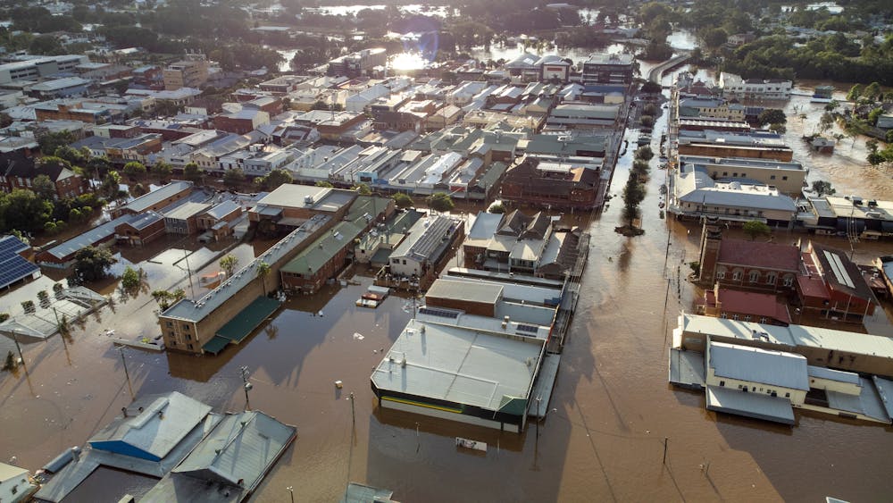
This is the exact weather set up that caused the devastating floods in Lismore and other places in February to March 2022.
In fact, a recent study showed 72% of all heavy rainfall events over the eastern seaboard are caused by this same weather set up.
That said, we are unlikely to see the same devastating impacts we did in 2022.
The stalled systems causing the current wild weather are forecast to move away after two days. By contrast, the set up that caused the torrential rain in 2022 persisted for three and a half days. It may not sound like a big difference but to atmospheric scientists, it is.
The atmospheric river associated with the current event is also weaker, so there is less moisture in the air to turn into rainfall.
How Will Climate Change Affect These Weather Events?
Recent research found an increase in the intensity of rain from short (less than an hour long) downpours over Sydney.
Another study has shown the atmospheric moisture over Sydney is projected to increase by the end of the century.
However, the representation of certain weather systems in climate models isn’t good enough yet.
Since we are missing this key part of the puzzle, it’s still uncertain how heavy rainfall over eastern Australia may change in the future.
Recent funding to research on this topic and developments in powerful, high definition models should improve our understanding of how these weather events may change in the future.
In the meantime, for those about to face the current deluge, heed warnings from the SES and the Bureau.
Never drive through flood waters and if the sky does turn black, put your headlights on.![]()
Kimberley Reid, Postdoctoral Research Fellow in Atmospheric Sciences, Monash University
This article is republished from The Conversation under a Creative Commons license. Read the original article.