Protecting Pittwater's spectacular environment from inappropriate development will be the focus of a public forum featuring Greens NSW MP Cate Faehrmann on February 2nd.
Pittwater Greens Councillor Miranda Korzy said the forum will look at how we can strengthen and enforce local planning and development rules.
“Many of us in Pittwater are distressed by the all too common sound of chainsaws destroying our trees and massive excavations for modern mansions,” Ms Korzy said.
“This forum is for those of us who still treasure the vision of Pittwater as a collection of villages connected by the bush, beach and water,” Ms Korzy said.
Speakers, including Environment and Planning lawyer James Ryan, will discuss problems with NBC’s Conservation Zones Review, its new Local Environment Plan, Development Applications and the NSW government’s planning regime.
It will take place on February 2, 7pm - 9pm, in the Angophora Room, Nelson Heather Centre, at 5 Jacksons Rd, Warriewood.
The Council's recent Conservation Review ignored the Pittwater Council's 60/40 ruling for Environmentally sensitive blocks in Pittwater, and 50/50 for all others, as in the Pittwater 21 Development Control Plan (DCP). Planners told councillors they estimate that in the former Pittwater LGA, 3,613 properties will move from a Conservation zone to an R (residential) zone, and 1,328 from an R zone to a C zone, resulting in an overall loss of 2,285 properties from C zones.
The former Manly LGA will lose just 54 properties from the C zone while the former Warringah will lose just 1.
Residents state this document has been drafted so a new DCP will fit in with what occurs in the former Warringah Council area.
''The 'Warringah methodology and formulas' are already being seen in over the height limit and filling the whole block developments being passed by council show little knowledge of or respect for what was formulated by residents and adopted for Pittwater by Pittwater Council. It's as though this approach commenced as soon as the amalgamated councils did and everything else other than Warringah council practice and approach was thrown out.''
Residents state that DA breaches have had a very detrimental effect, including:
- an accumulative loss of local native flora and fauna, many of it endangered (one report suggests a devastating loss of 19,650 trees from DAs alone since 2018, many mature local natives); and
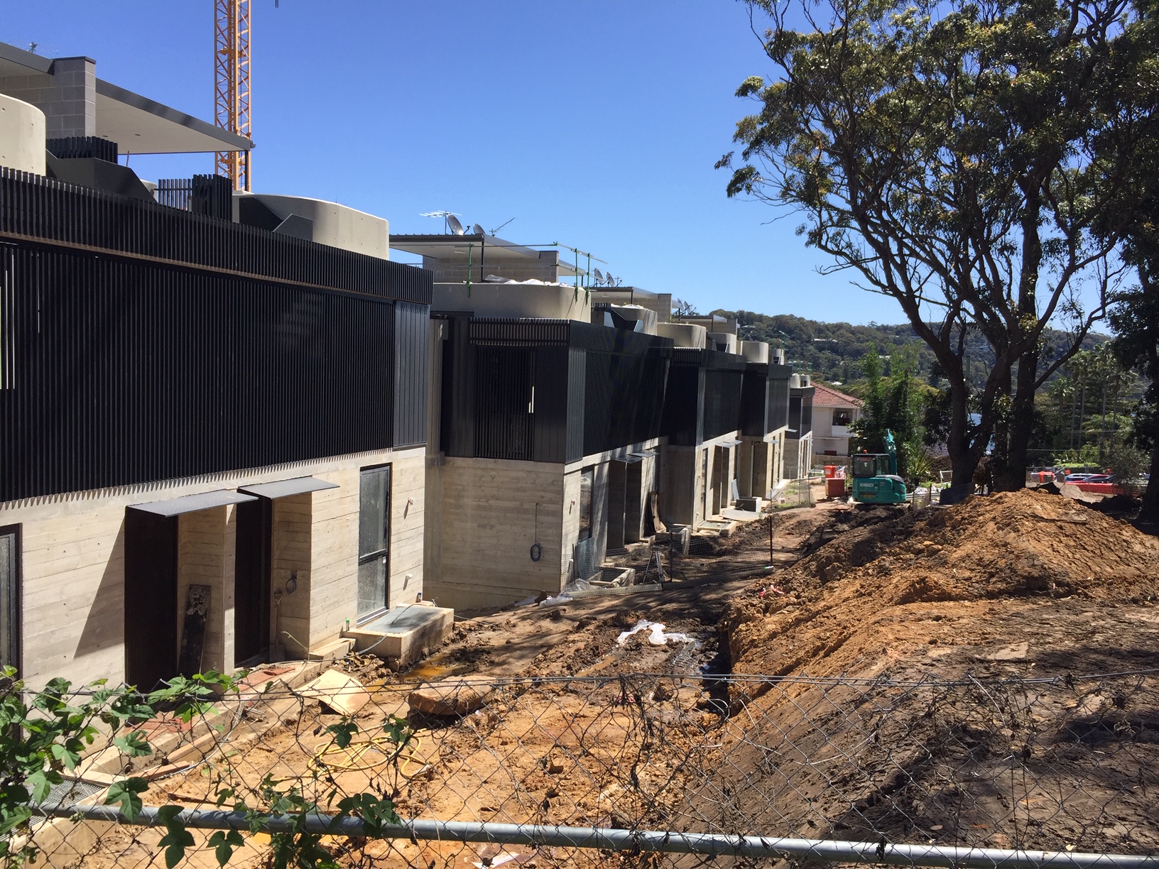
- an addition of ugly, monster homes (many breaching the 8.5 metre height, some by more than a whopping 40%) - and other developments which do not fit the local character of the area.
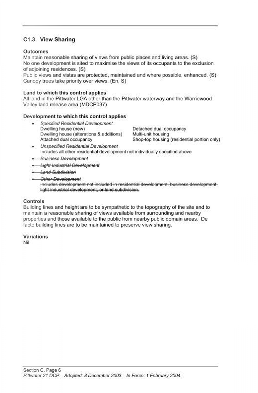
Many of the breaches concern clear cut rules such as the 60:40 rule under C1.1 Landscaping, 4.3 Building Height, 7.6 Biodiversity, B4 Controls Relating to Natural Environment, B3 Hazard Controls and B5 Water Management, along with breaches of not blocking out the view of the public along our coasts and waterways, C1.3.
Trees that are required to be retained suddenly die, some poisoned deliberately, some with their roots flooded until they fall over.
In every suburb and every street plans with height breaches, to fill the whole block with concrete, to remove all vegetation or hillside, are passed by the council.
Along with the required by State Government housing densification, drafted and passed by the Northern Beaches Council, the destruction of what many love about Pittwater is already taking place and scheduled to be increased.
.JPG?timestamp=1674174838497)
filling the block at Bilgola - photo taken January 2023. Photo supplied
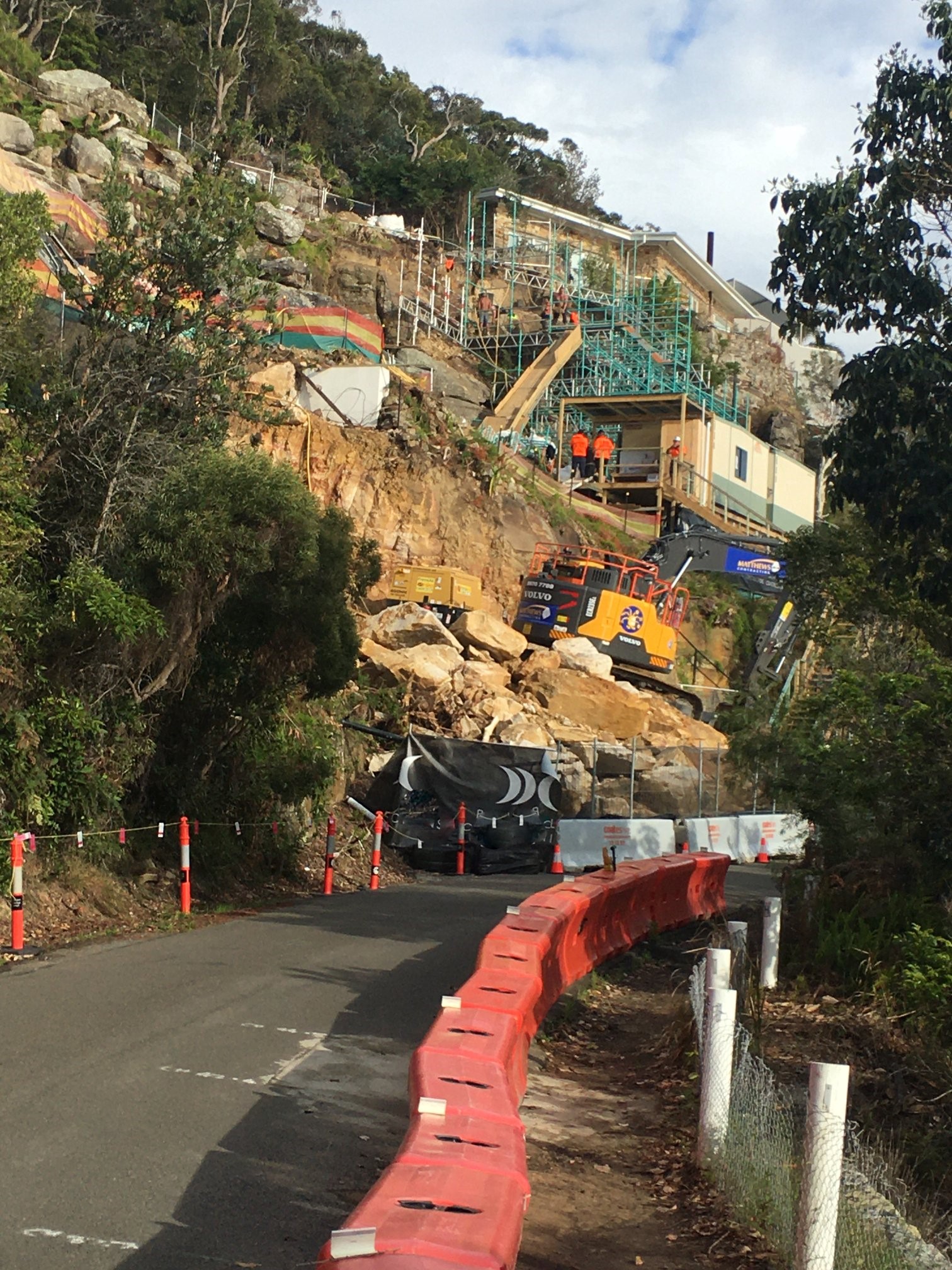
razing the hillside at Palm Beach. Photo supplied
every single tree removed from this site of a 3-storey development at Newport. Photo supplied
The 'Desired character of Pittwater' in the finalised 21DCP states:
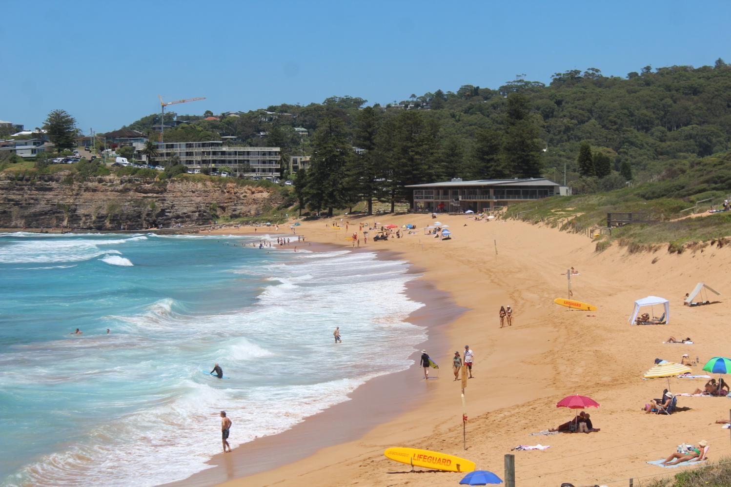
Any future growth of Pittwater must conserve, protect and enhance the natural environment and beauty of the area. Development will need to be ecologically sustainable and considerate of the natural hazards of the area that have helped to shape the region, which will ensure a safe and good quality of life for the community and future generations.
Pittwater will remain water orientated with recreational use of the waterways and public access to these waterways being actively promoted. Improved access by both pedestrian and cycle paths needs to be provided around the waterways and through the area. The built environment shall not extend above existing ridgelines, and shall remain below existing tree canopy levels.
The environmental objectives of this DCP are to:
a)conserve and enhance the ecological integrity, biodiversity, wildlife corridors, aquatic habitats, water quality, environmental heritage and environmental significance of Pittwater;
b) maintain the natural beauty of the area by retaining natural landforms, minimising land excavation and fill, and by minimising erosion, pollution and other forces that may impact on the landscape;
c)prescribe limits to urban development having regard to the potential impacts of development on the natural environment, natural hazards, and the provision, capacity and management of infrastructure; and
d) plan, design and site development to achieve the principles of ecologically sustainable development
As well;
Future development will maintain a building height limit below the tree canopy, and minimise bulk and scale.
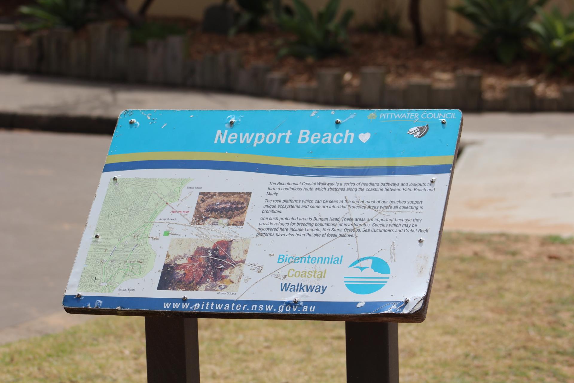
Natural scenic views from the Bicentennial Walkway will be preserved.
Pittwater 21DCP - updated in 2015 to include heritage conservation areas like Ruskin Rowe, Avalon Beach
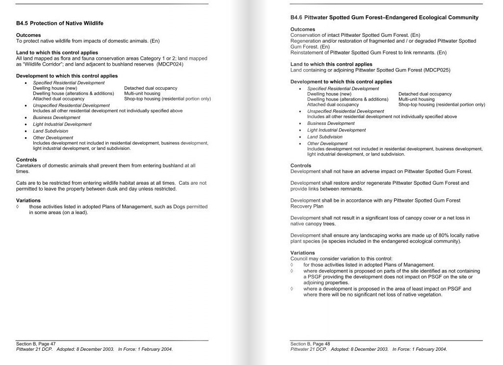
Pittwater 21DCP 2014 - wildlife and spotted gums
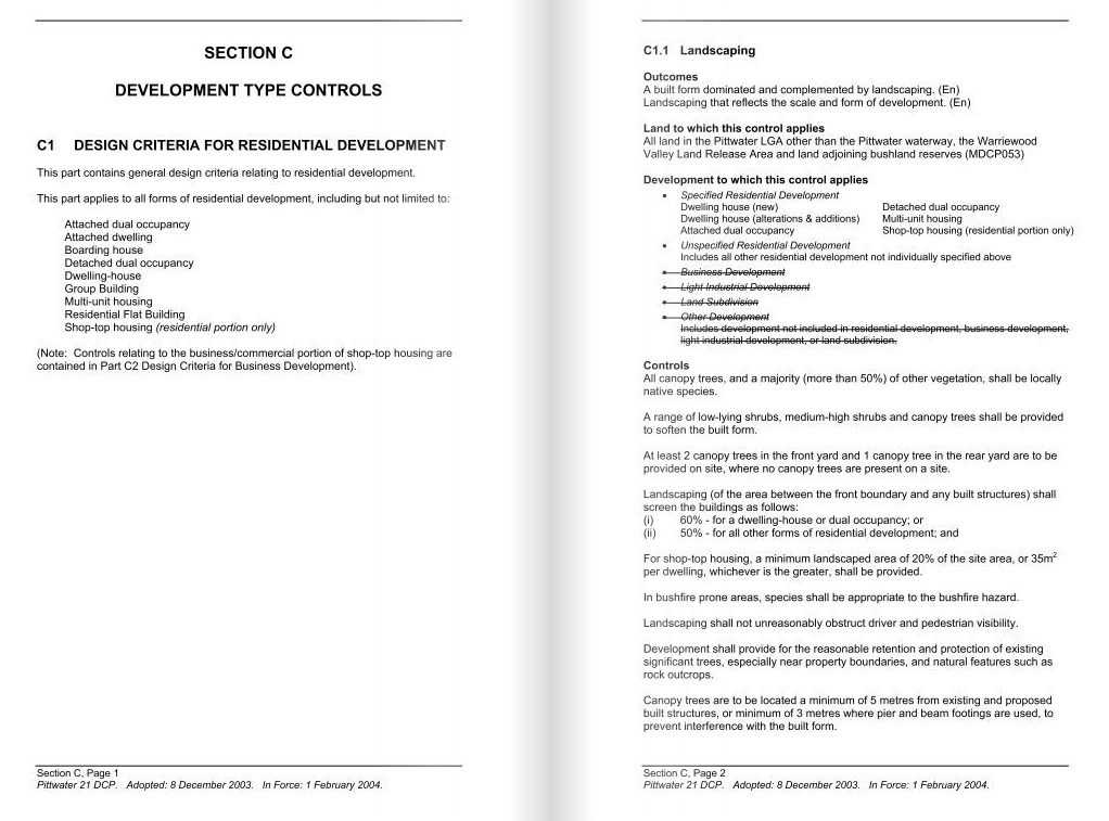
Pittwater 21DCP 2014 - the 60/40 and 50/50 plan and rules
The phrase 'enhance wildlife corridors' is repeated for each location throughout the document. Fences, where needed, are also to enable wildlife to pass through them as a place steeped in so much retention of native vegetation across urban blocks makes these wildlife corridors as well, at tree canopy level and at grounded shrub and grass level.
At the 2022 LGNSW a Motion to address the loss of wildlife in blocks submitted for development was passed - but has not, as yet, been ratified at NSW State Government level. In fact, the incumbent government is still passing approvals to raze Listed critically endangered woodlands and species - such as Sydney's Koalas. An overview of that long overdue structure is available in the October 2022 report:
Such a standard would include requirements for:
- Pre-clearance surveys to be carried out to establish which species are present on the site, including identification of any threatened and native species.
- The identification of suitable nearby areas where wildlife could possibly be relocated.
- The provision of possum, glider and bat boxes sufficiently in advance of vegetation clearing to allow wildlife time to discover the boxes and become familiar with them.
- Compliance with the NSW Code of Practice for Injured, Sick and Orphaned Protected Fauna and the licencing requirements contained in the Biodiversity Conservation Act 2016.
- Best practice for wildlife handling and care (including contact with local wildlife rescue groups).
- Reporting of injured or killed fauna to the NSW Department of Planning, Industry and Environment to enable the data to be used in statewide biodiversity monitoring programs.
The premise of this is that mandatory pre-clearance surveys to establish what wildlife lives there before works commence, and to document this in a formal way, should be required on any site that has vegetation and for which a DA has been approved. The experience is that often vegetation is removed before an application is submitted, often leaving wildlife with no home. Wildlife then ends up on roads dead or dies after being displaced/evicted. More in: Ringtail Posse 2023: The Generation Witnessing An Extinction Of Urban Wildlife
The 2014 Pittwater 21 Development Control Plan (DCP) itself has been modified since Pittwater Council was subsumed into what many residents now call the 'Greater Warringah' council. Some of these changes were made prior to the first election for Northern Beaches Councillors on September 9th 2017, when Pittwater's representation was reduced to 3 Councillors for a 'Pittwater Ward' out of 15 overall, after Pittwater Council was dismantled by the State Government and forcibly amalgamated with Warringah and Manly in March 2016.
Those changes to Pittwater Council's DCP include:
Date Adopted - Date in Effect
- 27 June 2017 8 July 2017: Removal of Preliminary Section and Repeal of Notification Policy (Appendix 1)
- 26 July 2017 7 August 2017: Harmonisation of Flood controls across all three DCP's. Removal of Appendix 8 and Appendix 15.
- 22 8 August 2017 28 August 2017: Harmonisation of Tree and Bushland Vegetation control across all three DCP's. Addition of Appendix 16-19.
- 19 Dec 2017 13 Jan 2018: Changes made to Control C6.11
- 25 Sept 2018 20 Oct 2018: Tree and Waste Management amendments made to A1, A5 B4.22, C1.12, C2.9 and C3.10
- 26 Nov 2019 1 Dec 2019: Removal of Section A.5 Exhibition, Advertisement and Notification of Applications to give effect to the Northern Beaches Community Participation Plan
These changes to the do not include, as yet, include amendments by the State Government to the Pittwater Local Environmental Plan 2014:
Standard Instrument (Local Environmental Plans) Amendment (Land Use Zones) Order 2021 (650) (amended by Standard Instrument (Local Environmental Plans) Amendment (Land Use Zones) Order 2022 (726)), Sch 3 (not commenced — to commence on 26.4.2023). See also: Planning Legislation Amendment Bill 2019.
The response to the Northern Beaches Council allowing serious breaches of the LEP, DCP and EP&A Act has seen community groups such as the Pittwater Environmental Heritage Group launched, and the Ku-Ring-Gai GeoRegion: A New Concept In Landscape Conservation and UNESCO Proposal being advanced.
At the October Pittwater Community Forum regarding the proposed 'one size fits all Rezoning' a number of Resolutions were passed that would see a lot more trees left standing and a lot less overdevelopment in inappropriate areas, such as known flood zones, or oversized and over height limit concrete filling the whole block with every skerrick of habitat razed from the same.
Mona Vale Residents Association member Marcia Rackham spoke to the Northern Beaches Council Meeting held in October 2022, presenting the Resolutions that stemmed from that Community Forum. That address was:
Presentation of Resolutions to Council. Draft Review Conservation Zones Pittwater LGA.
I would like to begin by acknowledging the Garigal people on whose land we are conducting this meeting this evening and pay my respects to ancestors past, present and emerging.
On Sunday 16th October a planning forum was held in the Memorial Hall in Mona Vale to high light and discuss the proposed changes to land zoning in the Pittwater local government area. This was a very well attended meeting and was supported by the following 11 Pittwater interest groups:
- Bayview and Church Point Residents Assoc
- Canopy Keepers
- Church Point Friends
- Clareville and Bilgola Plateau Residents Assoc
- Mona Vale Residents Assoc
- Palm Beach Protection Group
- Pittwater Environmental Heritage Group
- Pittwater Community Alliance
- Pittwater Natural Heritage Assoc
- West Pittwater Community Association
- and the Palm Beach/ Whale Beach Assoc.
The purpose of the forum was to try and get a better result for Pittwater from the review in terms of nature conservation, protection of visual quality and scenic character of the natural and built environment, into the future for the Pittwater LGA.
We had several speakers and had some distinguished guests for our Q and A panel. What was evident during the meeting was just how confused people are about the proposal to re-zone vast parcels of land throughout the suburbs of Pittwater from a conservation zoning into an R? zone. I have used the term R? purposefully as it is unclear what R zoning, we have the potential to move into if reclassified. Many in the Pittwater community have no idea this is happening. Only seven years out from a very up to date LEP council is wishing to change the rules again. It was very evident when comparing mapping for the now three combined councils that Pittwater was rich in conservation zones. These proposed changes to conservation zoning will tip the balance heavily into residential zoning along ridgelines, steep sloping land, canopied forests all contributing to areas that possess bucket loads of scenic beauty. Scenic beauty that has been completely omitted from the review yet is the very essence of the Pittwater LGA.
We understand that residents can book an onsite visit from council to inspect their property prior to the review being finalised but it is unclear on the “your say” page as to how this can be arranged, surely an oversight on council’s part.
The criteria that council has set for conservation zones is also hotly contested by the community. We consider the methodology to be flawed. Has council really considered what the implications could be for the community of Pittwater if things that we value so highly are downgraded to the degree that they have been in the draft review. And why change a zoning from Environmental living to conservation when the former classification in many instances is a much better fit.
Out of our forum the following three resolutions were recorded all with an overwhelming majority.
Resolution 1.
That the medium Environmental value criteria that form the basis of the conservation zones review should be changed as follows:
- Biodiversity Corridor and urban tree canopy be given a High Environmental Value.
- Ridgeline or Escarpment given a High Environmental Value
- Geotechnical Planning Class: C3 Hawkesbury Sandstone with slope >25 degrees or C5 Narrabeen Group with slope >15 degrees be included in Hazard criteria.
Resolution 2.
We the residents of the Northern Beaches Council area, believe the bushland landscape of the former Pittwater Local Government area is its predominant feature. With the built form secondary, and that this must be maintained in the future local environmental plan and development control plan.
We therefore call on NBC, in the former Pittwater area, to:
- Rule out rezoning of C4 land to residential.
- Apply conservation zonings to properties where any significant environmental values or hazards are present.
- Create scenic foreshore protection areas from shorelines to ridges.
- Retain all heritage conservation areas and investigate those proposed- but not yet implemented- by the former Pittwater Council.
Resolution 3.
This meeting strongly objects to the proposed reduction in the numbers of properties in Conservation Zones in the area of Pittwater ward within Northern Beaches Council LGA.
Such rezoning will enable a greater level of development and consequent reduction in native flora and fauna, green space and the unique natural character of the Pittwater area.
We ask that all candidates for Pittwater in the coming State election declare their position on:
- The proposed changes to conservation zones.
- The establishment of a scenic foreshore protection area.
- What planning controls they will support to address our concerns.
Thank you.
On Thursday February 2nd 2023, at 7pm the public forum titled 'Saving Pittwater from the Chainsaws' will be held in the Angophora Room, Nelson Heather Centre, 5 Jackson Road Warriewood.
The organisers ask; ''Do you want Pittwater to remain “a series of villages connected by bush, beach and water”? If so, please join us for a discussion about how we can strengthen and enforce our local planning and development rules.
Join Greens MP Cate Faehrmann, planning and environmental lawyer James Ryan and Northern Beaches Councillor Miranda Korzy to learn more about issues related to the new Northern Beaches Local Environment Plan, Development Applications and the NSW government’s planning regime.''
This is a Free event. Residents can reserve their spot: www.eventbrite.com/e/saving-pittwater-from-the-chainsaws-tickets-517387408667
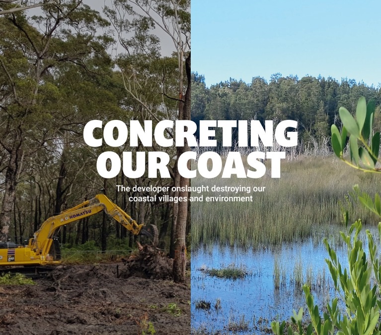
Concreting our coast: New report released
In related news, on Thursday January 19th Greens MP and planning spokesperson Cate Faehrmann released a report, 'Concreting our Coast: The developer onslaught destroying our coastal villages and environment'.
 The 40-page report documents 20 case studies from the length of the NSW coast. of new housing developments that pose a serious cumulative threat to bushland, wildlife and coastal villages.
“In town after town, community groups are fighting damaging and inappropriate developments that threaten to overwhelm their already struggling local services and infrastructure, and wipe out much of the precious bushland that surrounds them,” said Cate Faehrmann.
“This report shows just how scary the big picture is. The NSW Liberal-National government has given developers the green light to bulldoze thousands of hectares of bushland for development. Everywhere you look, our precious coast is about to disappear under a layer of concrete and houses crammed together like sardines.
“We’re not talking about a couple of small bush blocks here. We’re talking about the destruction of very environmentally sensitive areas, as well as Aboriginal cultural heritage, on a massive scale. If it’s not stopped, our beautiful NSW coast will be unrecognisable in a matter of a few short years.
“Much of the bushland destined to be clearfelled on the South Coast is the last remaining habitat for wildlife after the Black Summer fires. Greater gliders, glossy black cockatoos, swift parrots, powerful owls - these animals have nowhere left to go, and the sheer scale of all of these developments could well push them to extinction.
“The report also shows that many of the new developments are planned on floodplains and wetlands, or in areas of high bushfire risk.
“There is no way we should be building homes in these risky locations. The last four years have shown just how much the climate crisis is affecting our homes, with more and more extreme weather events.”
“Many of these proposed developments are off the back of ‘zombie DAs’ that were approved decades ago avoiding any need to undertake the type of environmental or cultural heritage impact scrutiny required today,” said Ms Faehrmann.
More than 25 local community groups, many which formed to fight these developments, have signed onto a set of Framework Principles to Save our Coast.
Claire Haywood from the Culburra Residents & Ratepayers Action Group said,
“There is other already cleared land available in the Shoalhaven region that is not prone to flooding and closer to existing infrastructure that could and should be developed to assist with the housing shortage.
As a coastal village, Culburra does not have the infrastructure in terms of roads and facilities to support a permanent threefold increase in population.
When you have 80 per cent of Shoalhaven bushland burnt to the ground, any future coastal land development must be done in a responsible and respectful manner to everyone who shares that land.''
Cat Holloway from the Callala Environmental Alliance has said
''The 40ha in Callala Bay slated for development is diverse Coastal Lowland Forest, a habitat type designated as “critically endangered”.
More than 1000 submissions opposed the development plan on environmental grounds - more than 97% of the community spoke out against this destruction of Greater Glider and other threatened species habitat.
People need affordable homes, near jobs, transport, health facilities and infrastructure. We don’t more overpriced real estate and expensive rentals. We don’t need more dangerous traffic, more polluted waterways or more properties at risk from bushfire.''
Coupled with the pre-Christmas 2022 announcement by the State Government of the NSW Reconstruction Authority Corporation Formally Announced - Has Powers To Acquire and Develop Land: Potential Local Implications, it becomes clear that Pittwater is not standing along in trying to protect what attracts so many visitors and why so many choose to live here.
Image: Concreting our Coast report cover.