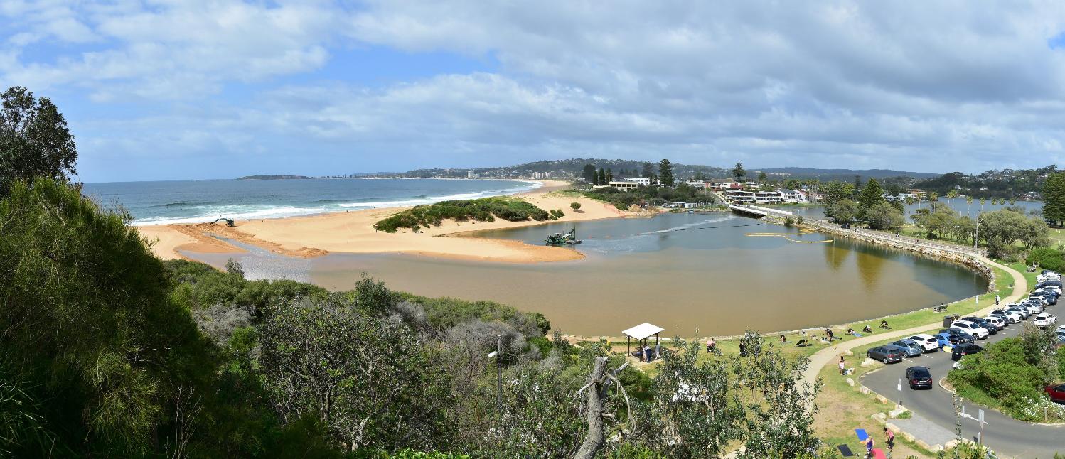
Council announced on Tuesday, 12 September 2023 work to clear Narrabeen Lagoon entrance to reduce the risk of flooding to local homes and businesses.
''Council contractors will excavate more than 20,000 cubic metres (40,000 tonnes) of sand – equivalent to the weight of 100 jumbo jets – to the east and west of Ocean Street Bridge.'' it was stated
The sand is to be deposited at Collaroy-Narrabeen Beach between Goodwin and Stuart Streets.
Works were expected to start in the coming weeks, although the above photo shows they were commenced immediately, and will be completed by the summer school holidays.
''To get the job done before the busy summer months, up to 200 truckloads of sand will be carted each day.
To ensure public safety, Birdwood Dune car park will be closed during this time and there will be parking and pedestrian access restrictions during work hours at Mactier and Wetherill Streets.'' Council's statement reads
Northern Beaches Mayor Sue Heins said the works are part of Council’s Narrabeen Lagoon Entrance Management Strategy and based on flood risk management studies.
“Narrabeen Lagoon is one of our greatest natural waterways but as locals know all too well, it is prone to flooding,” Mayor Heins said.
“Council has a strategy to manage the lagoon entrance to minimise the risk of flooding, backed by research and analysis by coastal experts.
“It includes more frequent sand clearance operations, as well as reshaping and revegetating sand dunes to assist with sand stabilisation.
“We appreciate that these works may be an inconvenience in the short term, but they are necessary to protect our community from flooding in the medium to long term.”
The project is partly grant funded under the NSW Government Floodplain Management Program.
Council announced on Friday October 9 2021 they were getting works done to open the entrance of Narrabeen to let the water flow as ''there is rain forecast for every day this coming week''.
It includes an assessment of potential entrance management options looking at technical feasibility and economic, social and environmental impacts and risks. The assessment was informed by a literature review of best practice, modelling, and a detailed cost benefit analysis by a quantity surveyor, and was peer-reviewed during its preparation.
Following the extensive assessment and analysis the draft Strategy recommends that Council:
- continue periodic large scale sand clearance operations
- trial more frequent sand clearances but with smaller volumes, in targeted areas
- continue intermittent mechanical breakouts if the lagoon entrance closes between major clearances and in response to forecast high rain and swells
- revegetate and maintain Birdwood Park dune to assist sand stabilisation
- review mobile sand pumping (as an alternative to trucking) if lower cost pricing becomes available.
Then Mayor Michael Regan said the main objective of the draft strategy is to reduce the risk of flooding on the Narrabeen Lagoon floodplain.
“Residents on the floodplain know too well the stress that comes every time there is forecast high rainfall, large swells or flood warnings,” Mayor Regan said.
“The development of this draft strategy is about making sure we’ve canvassed all feasible options to reduce that stress, to reduce the risk and to make sure our lagoon management continues to follow best practice.
“Council has been actively managing the entrance to Narrabeen Lagoon to reduce the risk of flooding in the catchment while working on the longer-term management strategy.
“Fortunately, Council was able to complete the major sand clearance operation before Christmas ahead of the huge amount of rain that we’ve had in the first few months of this year.”
At the meeting on Tuesday 27 September 2022, Council adopted its Narrabeen Lagoon Entrance Management Strategy.
'The final adopted strategy includes a range of priority actions', the Council stated, 'which we will now begin to implement including:
- trialling more frequent but smaller sand clearance operations (every two-three years rather than four-five years)
- developing a more flexible set of the conditions which trigger Council intervention to open the lagoon if required
- adjusting the alignment for the pilot channel
- reshaping and revegetating the denuded part of Birdwood Park dune to assist with sand stabilisation
- investigating the financial viability of mobile sand pumping as a longer term alternative to trucking.
Residents who have lived in the area and with the risk of flooding have suggested the dune built at Birdwood Park in the past is part of the problem and should be removed. They recall the flow of sand and tides through seasons along the whole of the Narrabeen to Collaroy beachfront worked better prior to this.
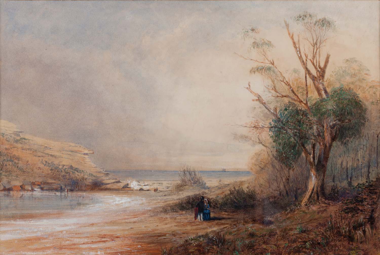
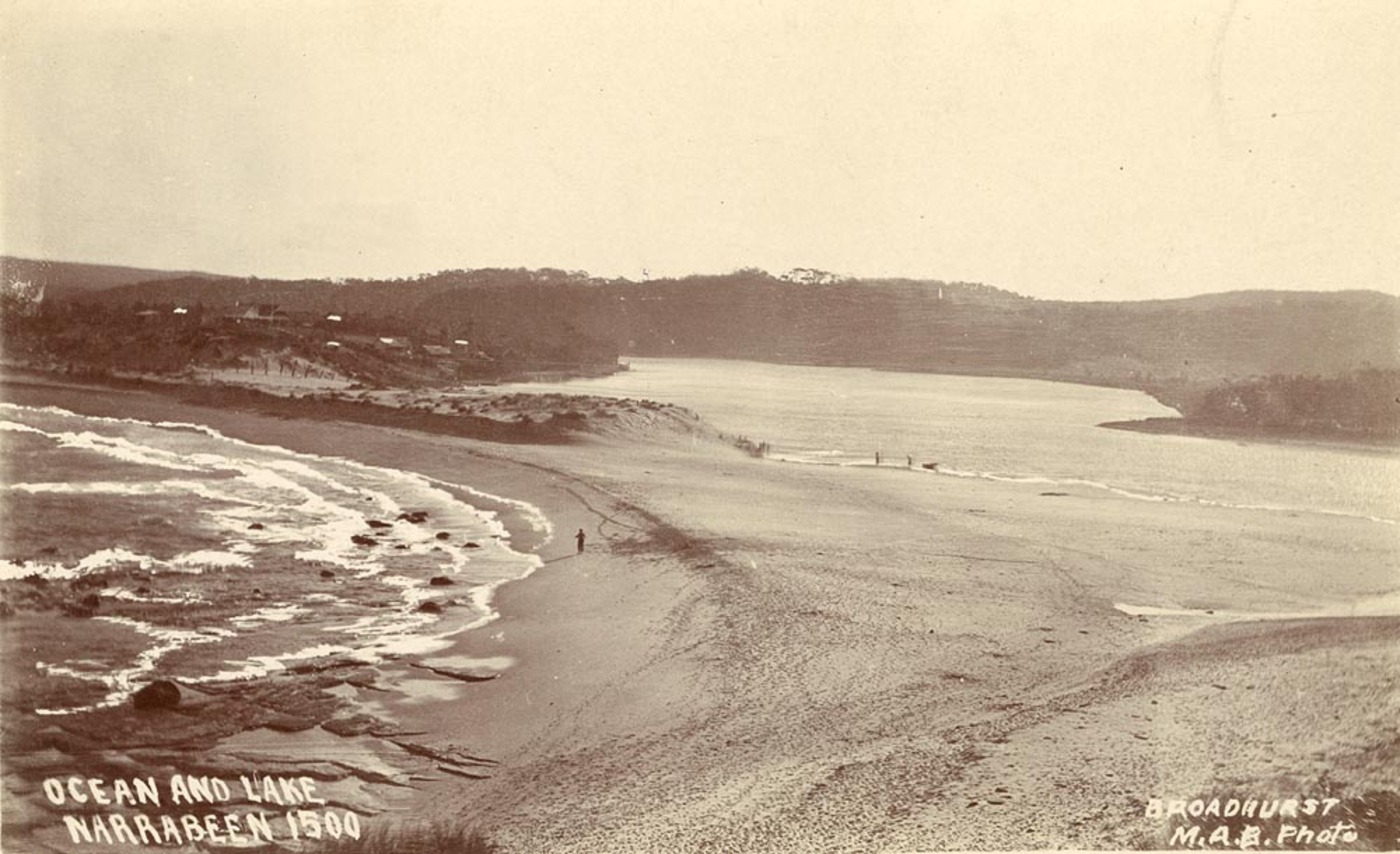
Historical photographs and one painting from the early 1800s show a steep bank in the Birdwood park area and a closed lagoon entrance, while one image from 1928 shows a steep bank present at Birdwood park.
There are also numerous reports in older newspapers of lagoon entrance clearance works being undertaken.
The Water Research Laboratory, which assisted Warringah Council by providing quantitative and independent monitoring of the entrance to Narrabeen Lagoon, notes as well that 'The lagoon entrance is subject to continuous infilling which restricts water exchange between the estuary and the ocean; and in extreme cases closes the lagoon off completely. This in turn effects the entire lagoon system leading to problems with flooding and water quality.'
However, the periods between mitigation works is lessening given there have been major sand clearance works undertaken in 2016, 2018, 2021 and now 2023 are a statement of fact that the period between 'in extreme cases' now averages every two years, with residents finding more sand still being present during those in between periods.
The numerous studies that have been compiled over the years, especially the more recent ones, did take into account the impacts of climate change but that a 'head in the sand' approach was the feedback Warringah Council and those commissioned to do the PoM received.
The Narrabeen Lagoon Plan of Management prepared for Warringah Council in 2011 and Adopted by Andrew Stoner on October 9 2013, stated:
On Friday, August 6th 2021 the council published ‘’Council Provides Facts On The Collaroy Residents’ Seawall’’ where Item 4 stated; 'The current works are entirely on private land'
However, a February 20, 2019 document and Notice by the NSW Department of Planning, Industry and Environment, ‘Notice of compulsory acquisition of land in the local government area of Narrabeen’ states;
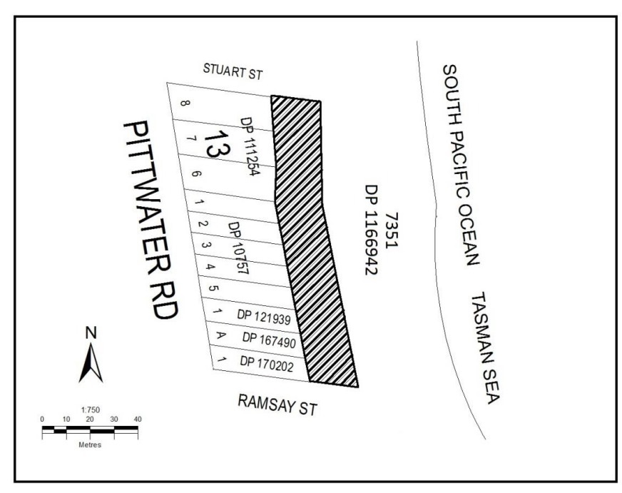
‘The area of land 20m wide bound to the east by a line parallel to the eastern boundaries of Lots 6 to 8 Section 13 DP 111254, Lots 1 to 5 DP 10757, Lot 1 DP 121939, Lot A DP 167490 and Lot 1 DP 170202 and bound to the north by the prolongation of the northern boundary of Lot 8 Section 13 DP 111254 to the east and bound to the south by the prolongation of the southern boundary of Lot 1 DP 170202 to the east as indicated by hatching on the diagram below.’
The corresponding webpage states;
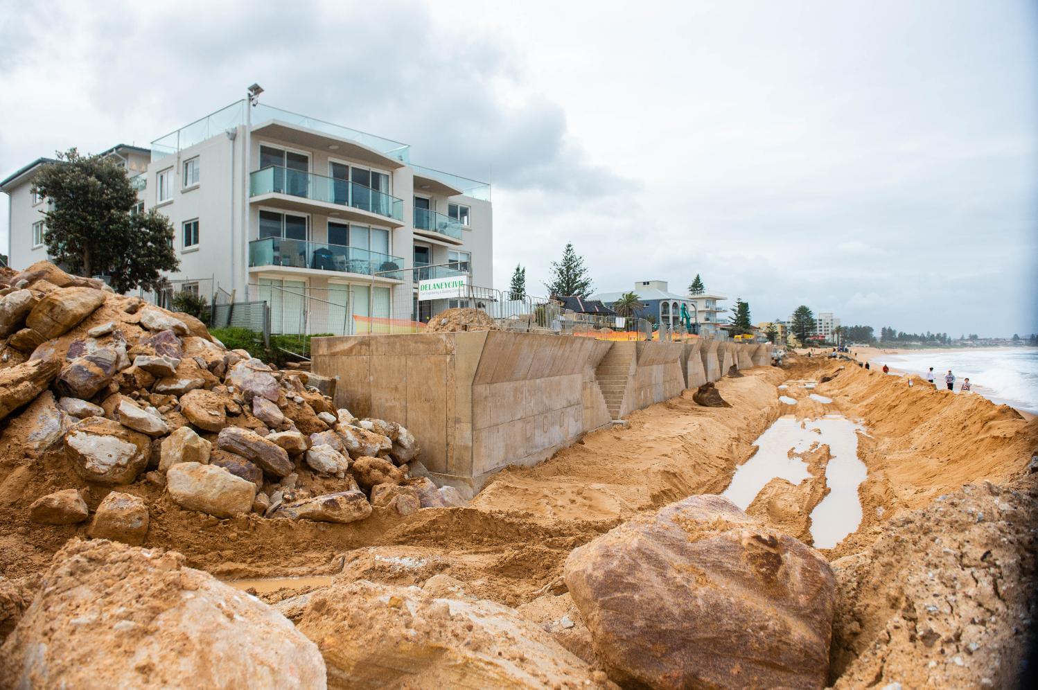
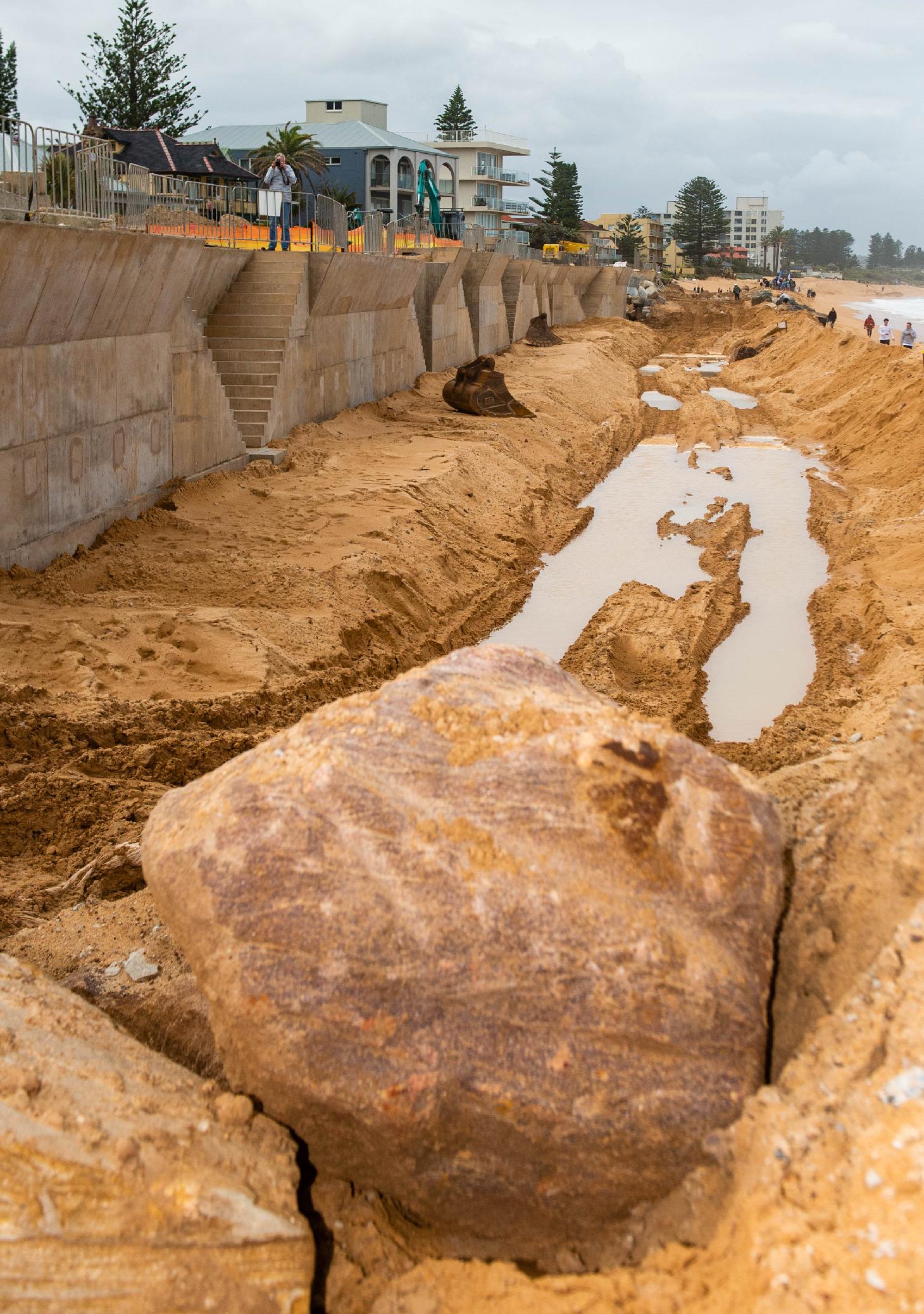
‘’ The DA is for a sloping rock revetment seawall, around 210 metres in length and 15 metres wide. The proposed structure, if approved, would encroach on Crown land by around 15 metres from property boundaries…’’
And;
‘’ The department has granted landowner’s consent for the DA to be assessed by Northern Beaches Council, which is required under Environmental Planning Assessment Regulations 2000. Landowner’s consent is not development approval. It is only the first step in the planning assessment. Should the DA be approved by Northern Beaches Council, the department will then begin negotiations on an appropriate tenure for the occupation of Crown land.’’
The compulsory acquisition of 20 metres of land was approved on February 20th, 2019. The approval included a diagram of the land compulsorily acquired:
The Guardian Australia published a photo on October 24th, 2021 by Lewis Isaacs that shows how far east from the boundaries of the owners' private land this wall has been built. That report is called 'A 7m wall has gone up on a Sydney beach: are we destroying public space to save private property?'
As the former NSW State Government formally announced the Reconstruction Authority Corporation at the end of 2022 in response to the Northern Rivers floods, and vested it with powers that include acquiring and subdividing land for rebuilding communities, and the current state Government is continuing with the same, announcing on September 4 it is committing $115 million to properly resource the NSW Reconstruction Authority, residents hope Council is also funded to properly address the recurring floods at Collaroy, Narrabeen, Warriewood, North Manly, Freshwater, Avalon, Mona Vale and Newport before what is left of the bushland on the hills is eyed off as where those those living in these floodplains and ancient watercourses will be moved to.
At present, even with a forecast dry and hot Spring and Summer, it is known the flood rains will return, the lagoon will close, the parkway will flood, and the continued and increasing frequency of mitigation works, along with the increased expense, is alike that little Dutch boy sticking his finger in a dam wall hole with residents footing the bill as rate payers and tax payers and still left standing in a deepening puddle.
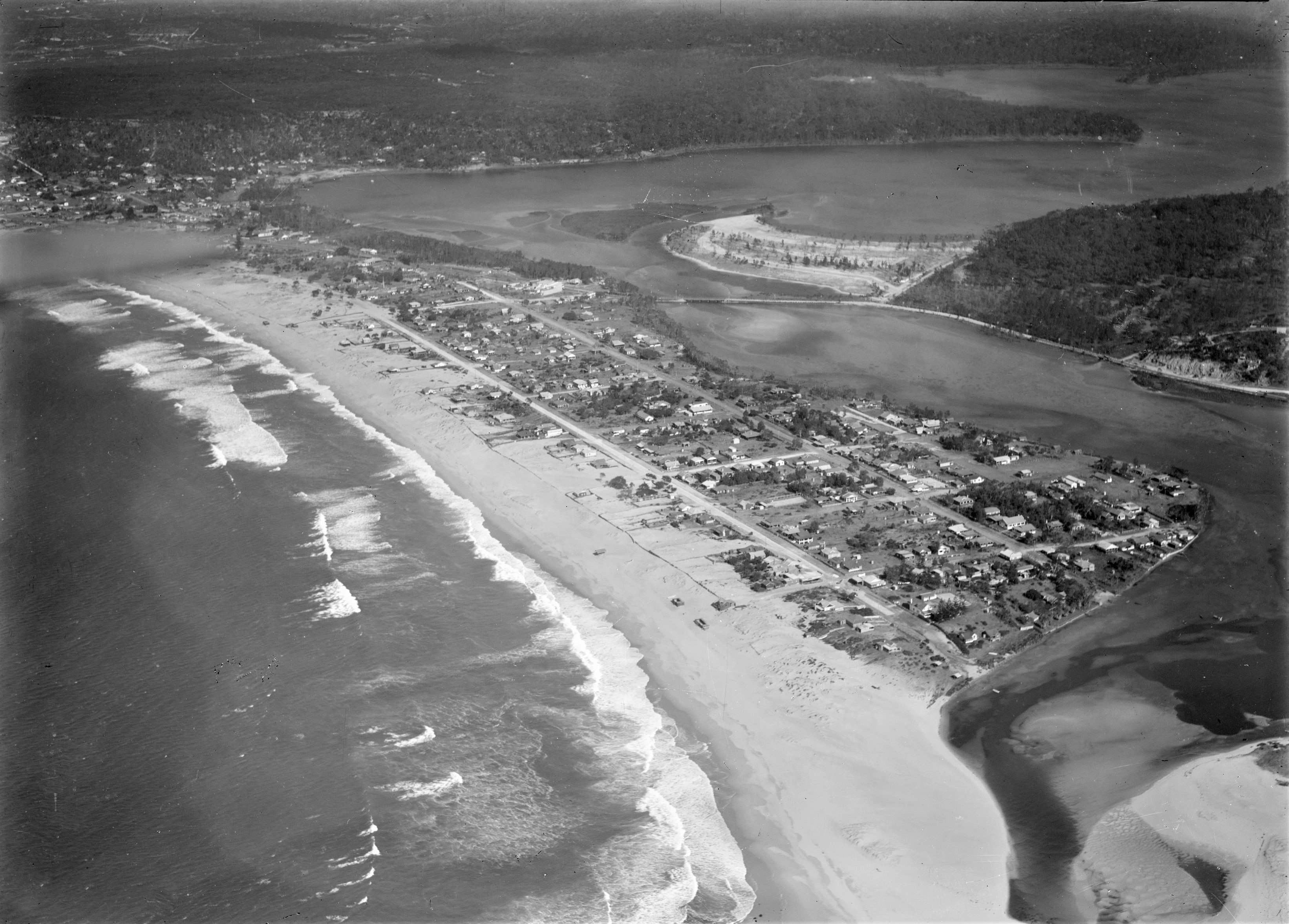
Narrabeen Lagoon aerial, from album Milton Kent aerial views of Bondi, Cronulla, Granville, Haberfield, Middle Harbour, Narrabeen, Mascot, Sydney, Sydney Harbour, Tempe, between 1926-1938, Item: c111660015, courtesy Mitchell Library, State Library of New South Wales - and sections from to show details; NB - no Bridge from Ocean street across Lagoon present, and old Nth. NSLSC still on beach - so pre-1927 and showing the larger section now reclaimed where Wimbledon Avenue was being formed:
.jpg?timestamp=1593071813851)
Striking Aerial Views : Newcastle and Narrabeen
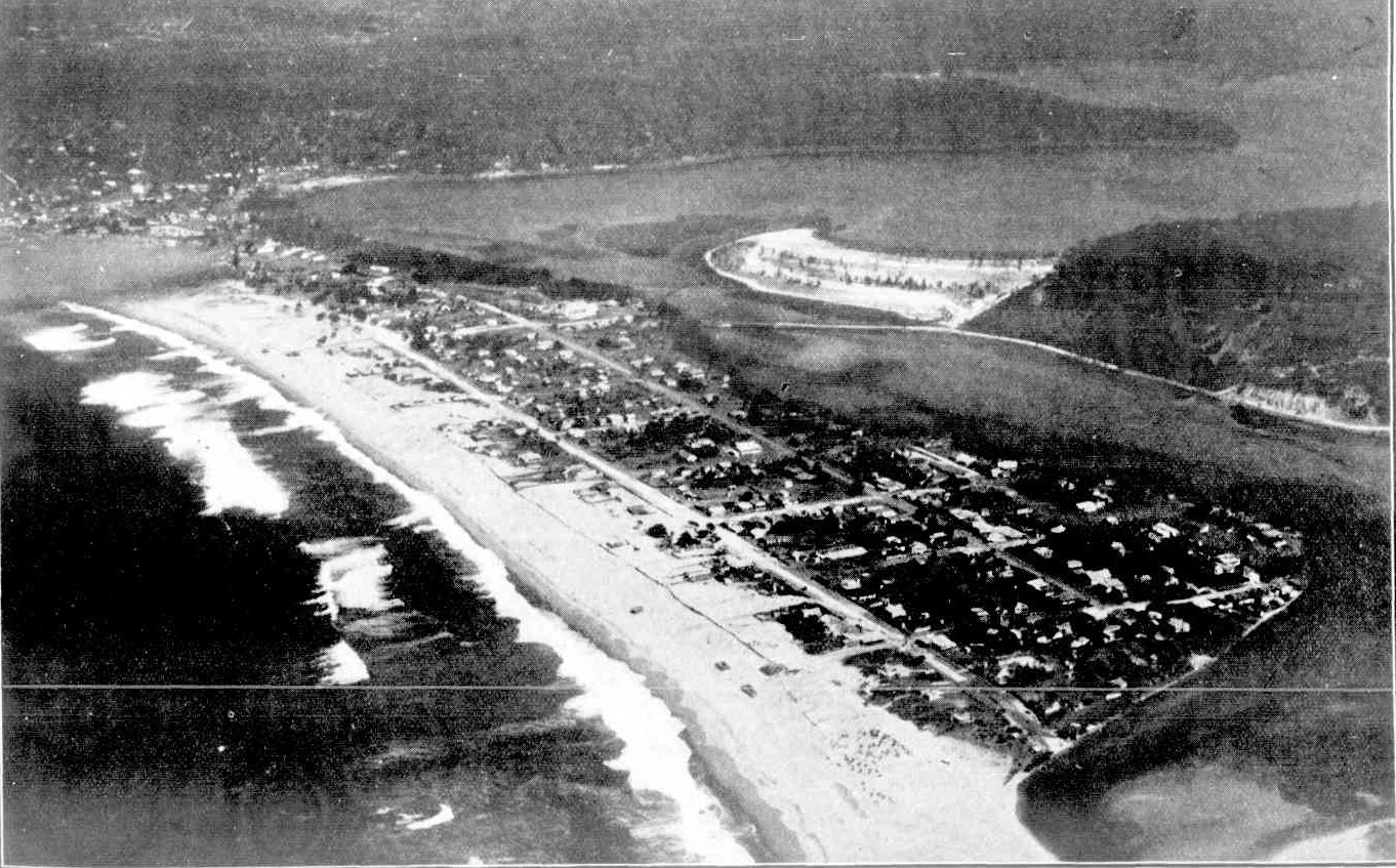
NARRABEEN, BETWEEN OCEAN AND LAKE. This fine strip of ocean beach runs from North Narrabeen through South Narrabeen to Collaroy (on the left). Narrabeen proper is situated on the peninsula in the centre of the picture. The main road from Manly to Newport, Avalon, and Palm Beach runs through the upper portion of Narrabeen, crossing the lake by the bridge, beyond which is seen a portion of low -lying land now being reclaimed. Striking Aerial Views : Newcastle and Narrabeen (1928, August 22). Sydney Mail (NSW : 1912 - 1938), p. 17. Retrieved from http://nla.gov.au/nla.news-article158401835
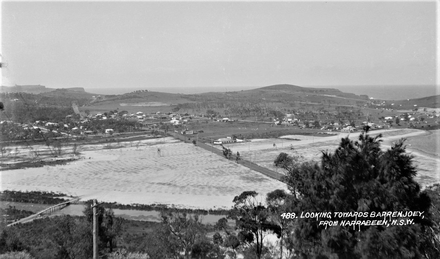
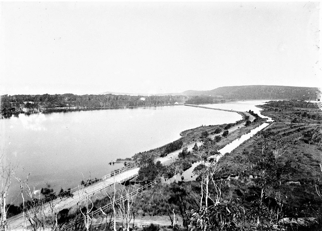
Narrabeen Lagoon, General View showing Lagoon and Ocean and Looking Towards Barrenjoey, From Narrabeen circa 1927, from Album 'Samuel Wood - postcard photonegatives of Narrabeen,' - Items a1470096h, a1470091h, courtesy State Library of NSW
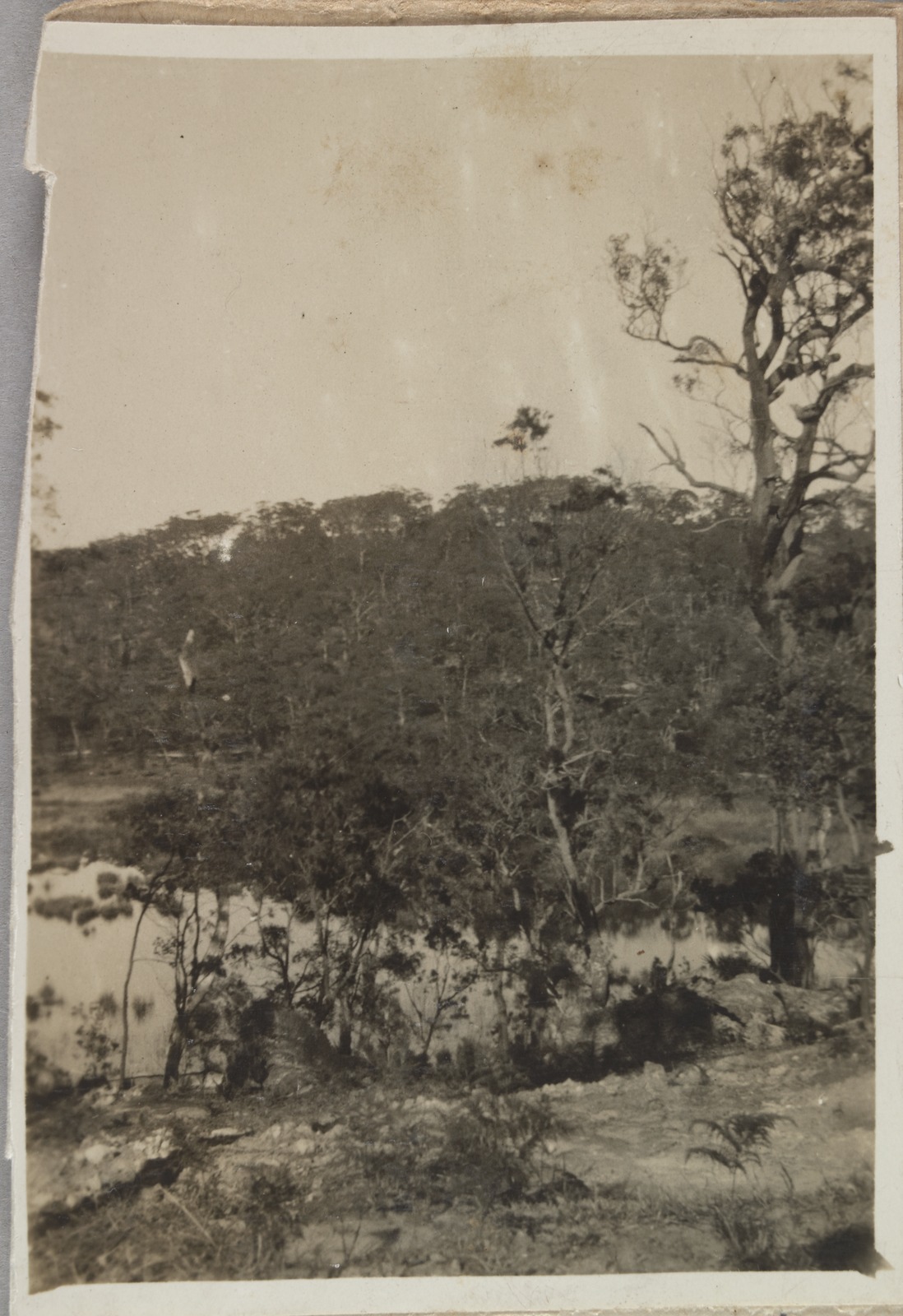
Narrabeen lagoon, circa 1915, Item hall_34703h, courtesy State Library of NSW
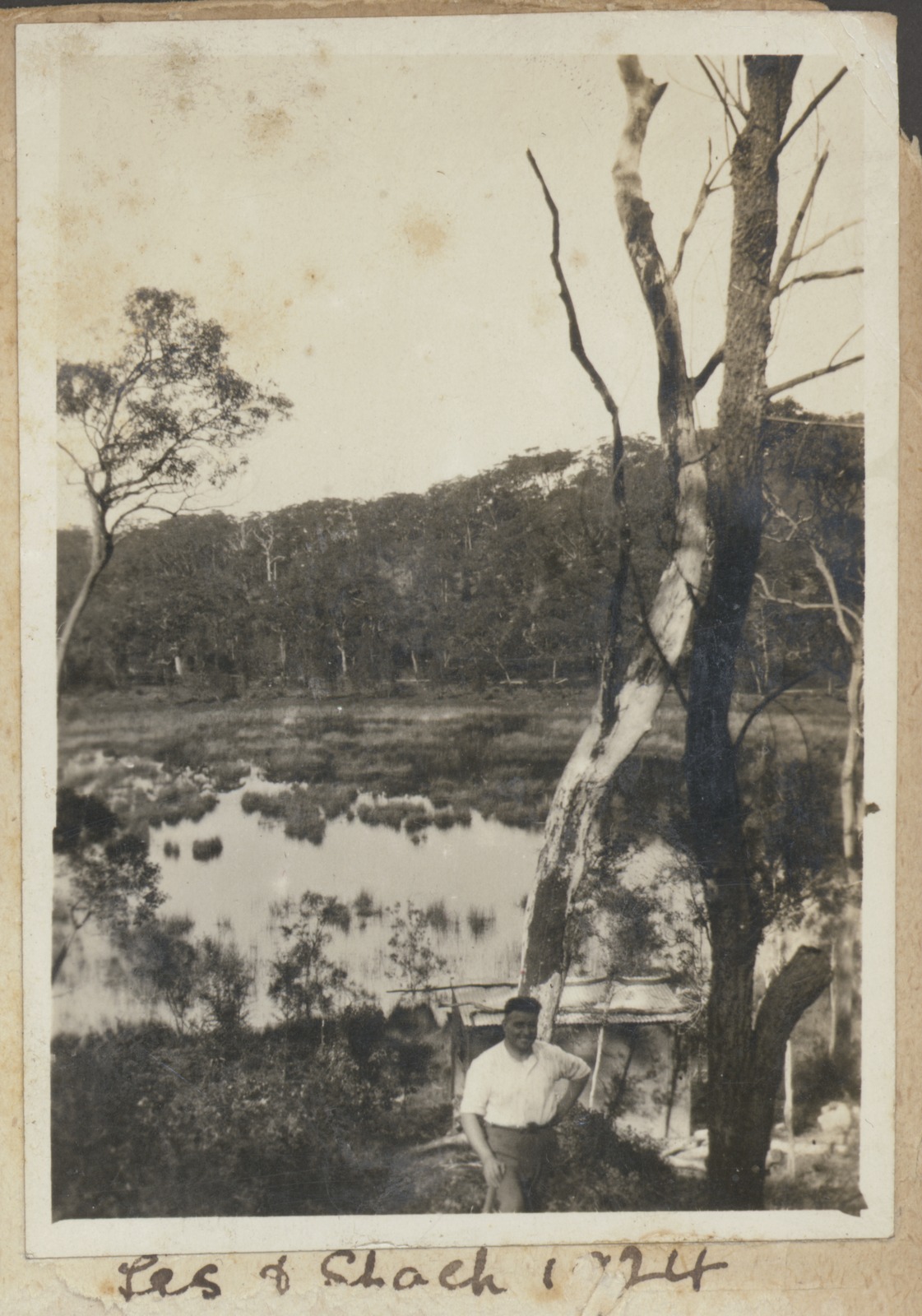
Collection of photographs relating to the Whetton family. circa 1923-24, Items FL15564591 and FL15564563 courtesy the State Library of Victoria.
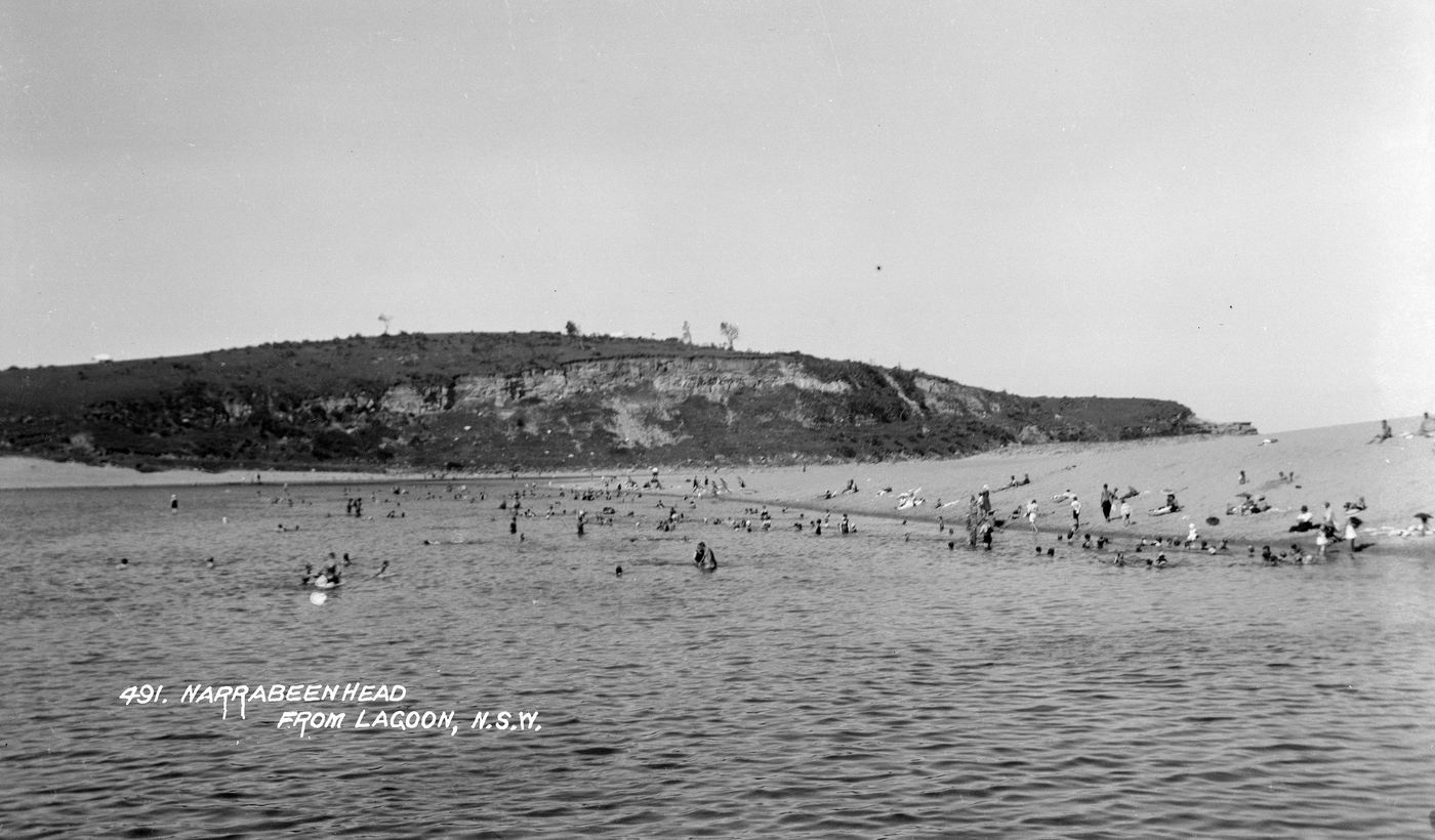
Narrabeen Head from Lagoon, circa 1928, from Album 'Samuel Wood - postcard photonegatives of Narrabeen,' - Item a1470094h, courtesy State Library of NSW
BIRDWOOD PARK. The land purchased by the Warringah Shire Council to give the public a right of way to Narrabeen Beach has been christened Birdwood Park. BIRDWOOD PARK (1916, December 28). The Sun (Sydney, NSW : 1910 - 1954), p. 4 (FINAL EXTRA). Retrieved from http://nla.gov.au/nla.news-article223373938
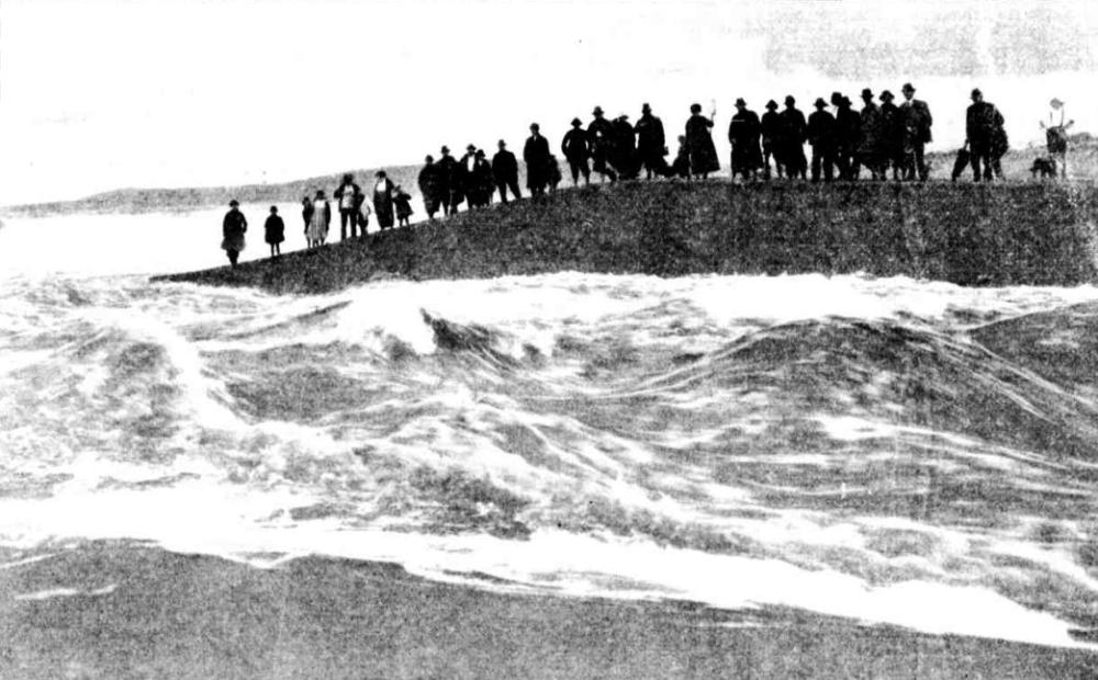
WHEN NARRABEEN LAKE RUSHED OUT TO SEA.
Last week we published a brief account of some sea tragedies connected with the 'letting out' of Narrabeen Lake (see BREAKING OF A LAKE. (1919, May 21). Sydney Mail. Here We illustrate the event that created so much interest among residents on the other side of Manly.
SOME day Narrabeen Lake will be transformed into permanent navigable waters from the sea to the head of the three beautiful creeks five miles above the bridge, at the present tram terminus. During periods of drought (writes L.A.S.), when very little water is running out to sea, the action of the waves builds up a wall of sand at the entrance. This backs up the water, and when heavy rain falls it is thrown over the low-lying land for miles surrounding the lagoon, to the joy of the small boy and the black swan, and to the dismay and discomfort of the week-ender. To the permanent resident who delights to see his beloved lake 'full' the mere suggestion of 'letting it out' is sacrilege; but when the butcher refuses to call, the baker who delivers his bread is clad in a bathing-suit, and the stove wood floats into the best bedroom, it is realised it is time to call upon the shire council to 'let her out.'
Within ten minutes of this decision everybody in Narrabeen knows of it.
WHEN the momentous decision was come to recently I was told by an old hand not to worry about the fish being thrown up on the beach this time, because their numbers had been sadly depleted, net fishermen during the last two months having 'dragged the bottom out of the lake.' And so it proved. The only fish secured wore half a dozen small silver bellies. The porpoises, sharks, etc., who were instinctively waiting outside for the feast, had this time 'grossly exaggerated their instinct.' and it is not to be wondered at that they quarrelled among themselves. They were probably eating one another. Now, if the lake had been let out say, during February, there would have been something doing in the fish line. There were plenty of fish in the lake then. Despite, the poor half-dozen 'silver-bellies' this time, one could tell tales of wonderful hauls of fish on previous occasions. The most memorable was about fourteen years ago.
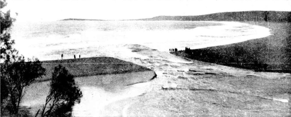
IT is the professional fisherman's business to know where the fish are in the estuaries along our coast. They knew that there were plenty of fish in Narrabeen Lake, and when they heard it war, to be let out they came from Botany and La Perouse and Watson's Bay, per medium of a varied assortment, of vehicles. After waiting all night, the lake broke out and the fish went through the channel, representatives of all the species, and in enormous numbers. The buffeting about and the sudden transmersion from practically fresh to strong sea water was too much for many pampered lake fish, and they were thrown back on the sandy shore by the waves in a stunned rendition in tons. All sorts of implements were used in their capture, from table forks to garden forks; they were thrown into chaff-bags, carts, kit-bags, tin dishes, baskets, and colanders. It is stated that over 50 tons of fish were secured. A few years later, when the lake was again opened, not a professional fisherman appeared on the scene; some amateur fishermen waited for two days, but did not get even six 'silver-bellies.' The lake had been netted beforehand. Every man to his job. The accompanying pictures show the appearance of the channel a few hours after a gang of corporation labourers bad dug a 'let-out' in the sand to give the water a start. The rapidity with which the increasing volume of water displaced the thousands of tons of sand gave some idea of the enormous shifting power of a rushing stream. At 2 o'clock the channel was four feet deep and about six feet wide; at 5 o'clock it was 10 feet deep and 50 yards wide. On a rough calculation over 2000 acre feet of water rushed through the channel in two hours.
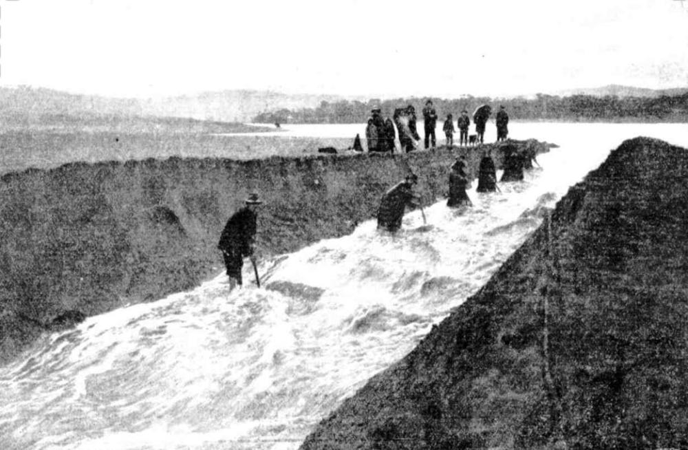
CUTTING THE CHANNEL THROUGH THE SANDBANK. A gang of men cut a narrow 'let out' about six feet wide— the water did the rest.
SOON AFTER THE OPENING OF THE CHANNEL. So great was the rush of water that within three hours the torrent was 150 feet wide. It is estimated that over 2000 acre-feet of water rushed out to sea in two hours.
WHERE NARRABEEN AND THE SEA WERE JOINED JUST BEFORE THE LAKE RUSHED OUT. WHEN NARRABEEN LAKE RUSHED OUT TO SEA. (1919, May 28). Sydney Mail (NSW : 1912 - 1938), , p. 13. Retrieved from http://nla.gov.au/nla.news-article159655216
MODERN MOSES
SHOVELS FIGHT FLOOD NARRABEEN SAFE
FISH . BOARDERS LEAVE
Nobody in Narrabeen has a magic rod of Moses such as rolled back tho turbulent waters of the Red Sea. A posse of trusty shovels, however, to-day rolled back waters to make part of Narrabeen safo for democracy. They served tho purpose quite wolL In Holland a dyke Is cut. to encourage a Hood. In Narrabeen they out a dyko to defeat a flood. Twenty men to-day fought creeping waters of the Narrabeen Lagoon by carving a channel 10 feet wide through the tumbled dunes of part of the beach. To Narrabeen people and those who live for week-ends In the wood and fibro cottages inside the rugged golden range of the beach, the lagoon, when properly behaved, is restful and soothes the nerves. But in the last three days the lagoon has not been well behaved! Insidious Flood Narrabeen on Saturday and Sunday was rained upon with a merciless savagery, which residents said to-day had not been equalled anywhere round Sydney.
"They officially gave us 168 points, but ,i think it should have been 668 points," said one man gloomily, as he looked out on chicken coops floating in the backyard of his home. Water crept across paddocks; it blotted out roads leading from the beach; it rippled through fences, set stacks of firewood floating between back verandahs and garages, and lapped the bridge on the main road, asphalt midway in its wet grip. There as no surging of waters, no rumbles or rescues or plashing of oars or shouting of men la boats. They just awoke, in houses skirting the lagoon, yesterday, to find fishes playing round the roofs of kennels where Fido should have frisked. This was too much.-The challenge of the expanding lagoon, with its silent Insidious creep of waters was accepted!
War Declared
It was war between the Narrabeans and the spreading lake. Rattling shovels In defiance, a body of men employed by the Warringah Shire trecked to the beach with grim set jaws. They were out to teach the lagoon a salutory lesson. While the surf smoked, and the rollers thundered in the grey dawn, twenty shovels bit and hacked at the beach. By the time that the early Spartan surfers appeared on the beach, twenty hats rose and fell In a deep trench through the sand and particles of beach flew In the air from shovels.
At 10 a.m. the huts had disappeared in the sand trench, but gusts of sand still floated up from tho energetic shovels. Soon afterwards Narrabeen rejoiced! The first trickle of the revolutionary waters of the lagoon threaded its way along the channel, and was lost in the boiling froth of the Pacific. Men and women sat along the steep banks of the new channel and felt as satisfied as residents do at the cutting of a ribbon opening a new railway section, or the throwing in of a switch starting a new electric light plant. The trench was cut with a considerable fall towards the sea and by 11.30 a.m. a tumultous river swept along the channel from the lagoon. The light was won. The flood had been defeated! Water began to drop a little In the backyards, but It will be many hours before any decided change Is shown In the 300 acre expanse of swollen lagoon. This afternoon the council gang has to contend with land slides or rather sand slides that threaten to obstruct the channel.
"Red Tape"
Councillor Greenwood complained to the Warringah Shire Council last night of the red tape connected with the opening of the lagoon when floods threatened. Before council could drain the water the consent of the Lands Department had to be obtained, and frequently dangerous delays occurred. The flood waters were menacing the safety of the bridge, and damage to the extent of £100 had been caused to property, he said. (See Picture on Page 1) MODERN MOSES (1927, April 5). The Sun (Sydney, NSW : 1910 - 1954), p. 13 (FINAL EXTRA). Retrieved from http://nla.gov.au/nla.news-article223229819
April 1927 Cutting a channel from the Narrabeen lagoon to the ocean photos:
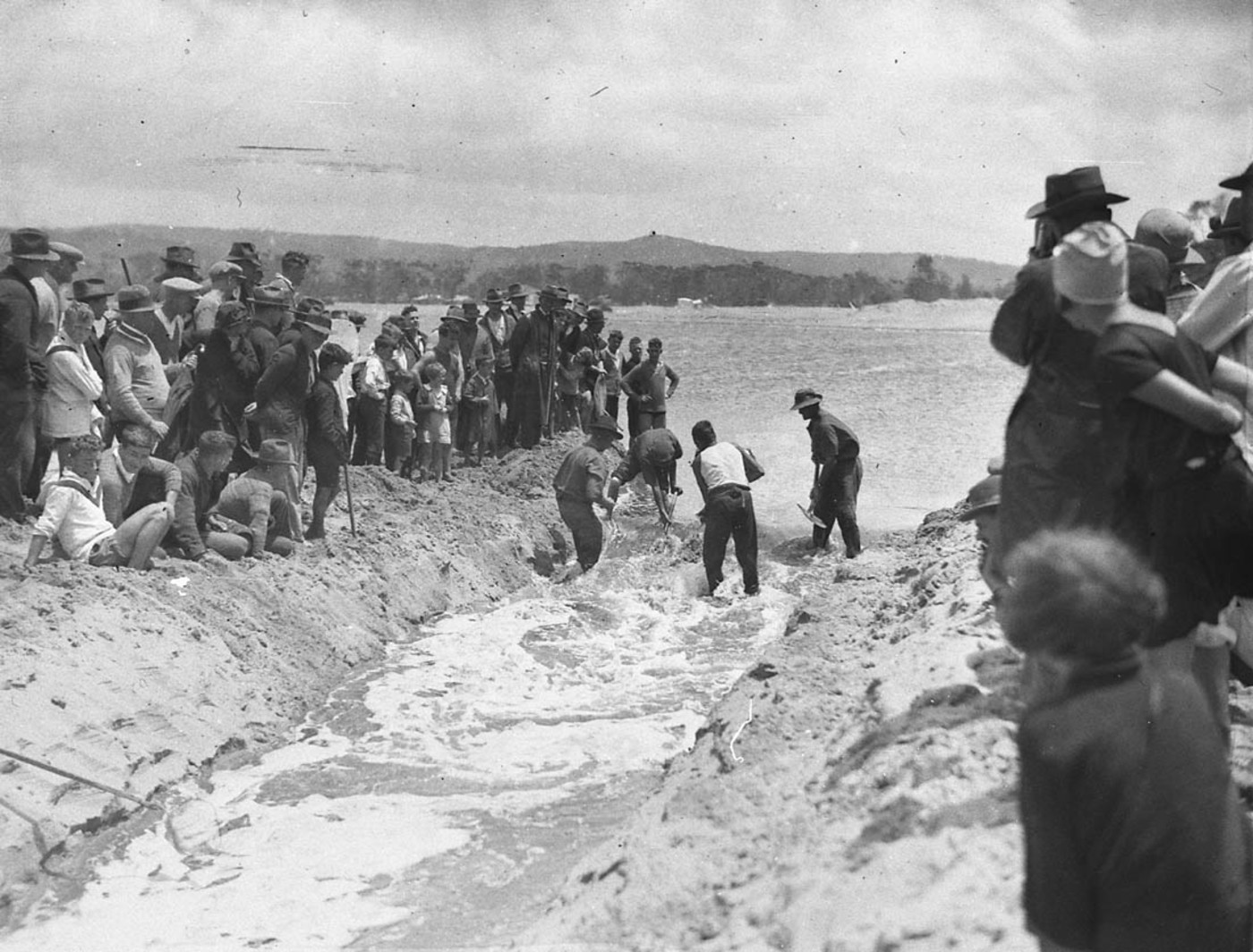
Flood mitigation work by council workers 1927 - Image. No: hood_06390, courtesy State Library of NSW
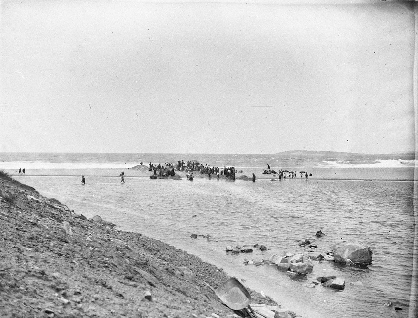
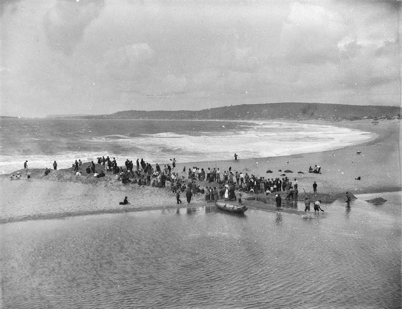
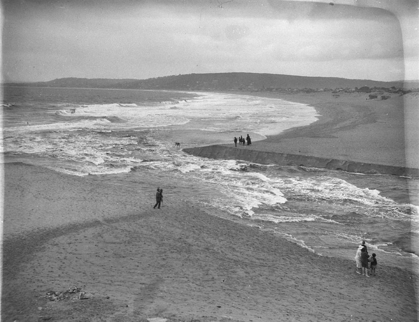
Crowds gather on some earthworks near the flood waters, Narrabeen Image No.: hood_06393h, courtesy State Library of NSW
Flood control ditch dug from the Lake to the Beach, Narrabeen Image. No: hood_06407h, courtesy State Library of NSW
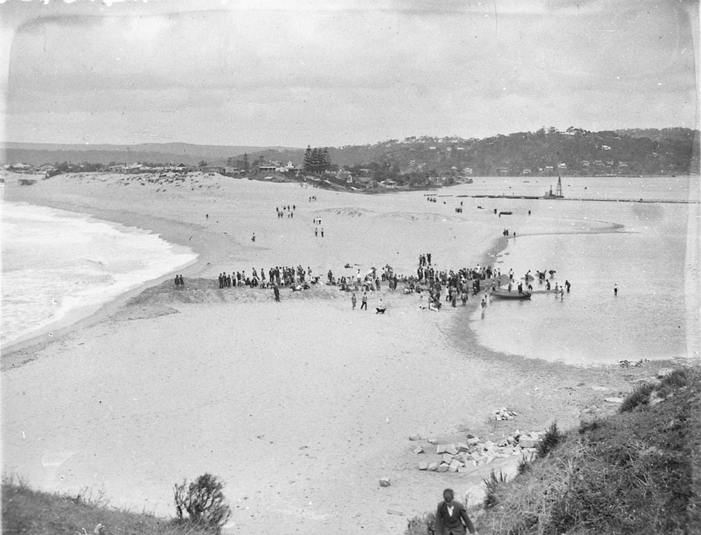
Crowds around a new flood control channel from Narrabeen Lake to sea Image. No: hood_06408, courtesy State Library of NSW
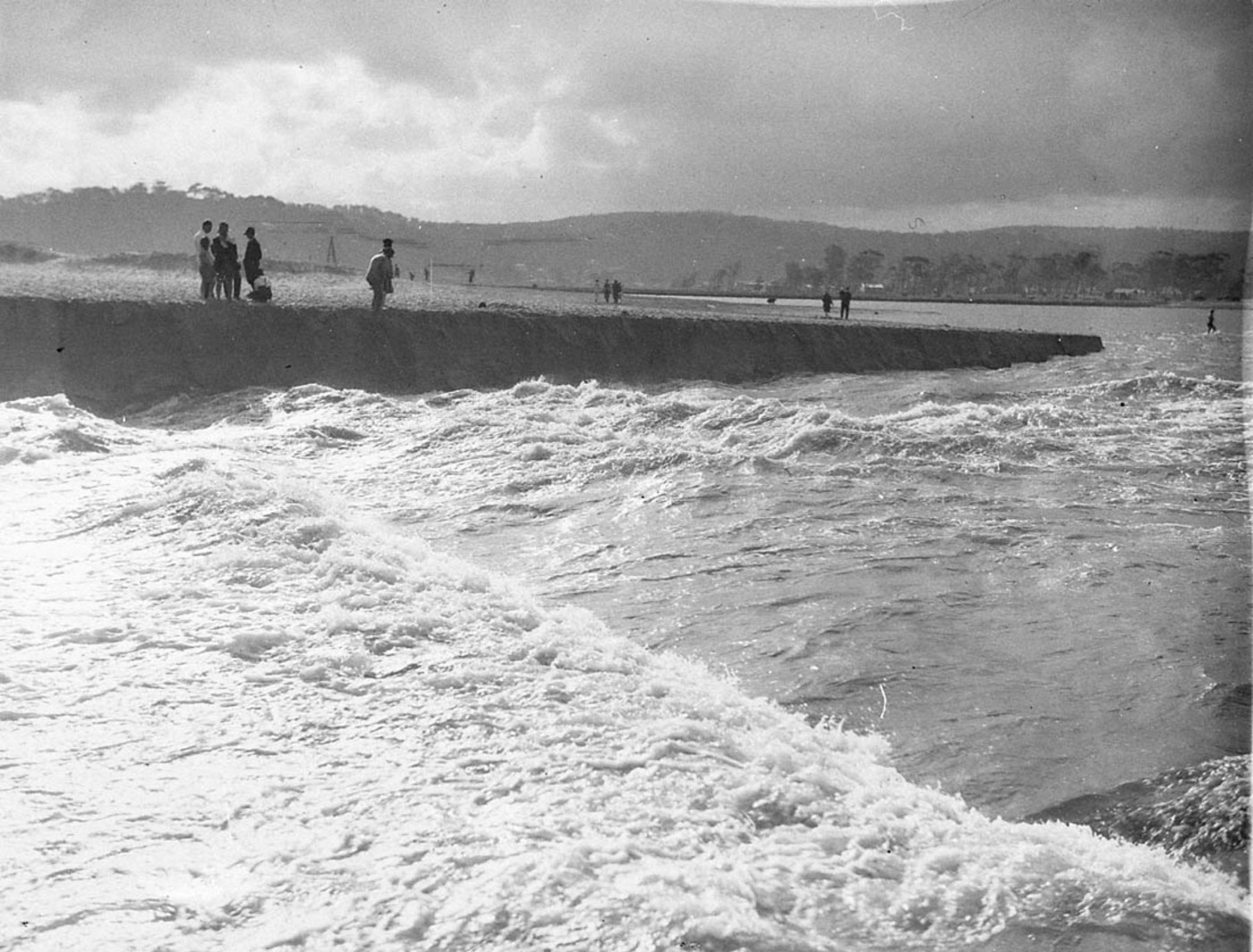
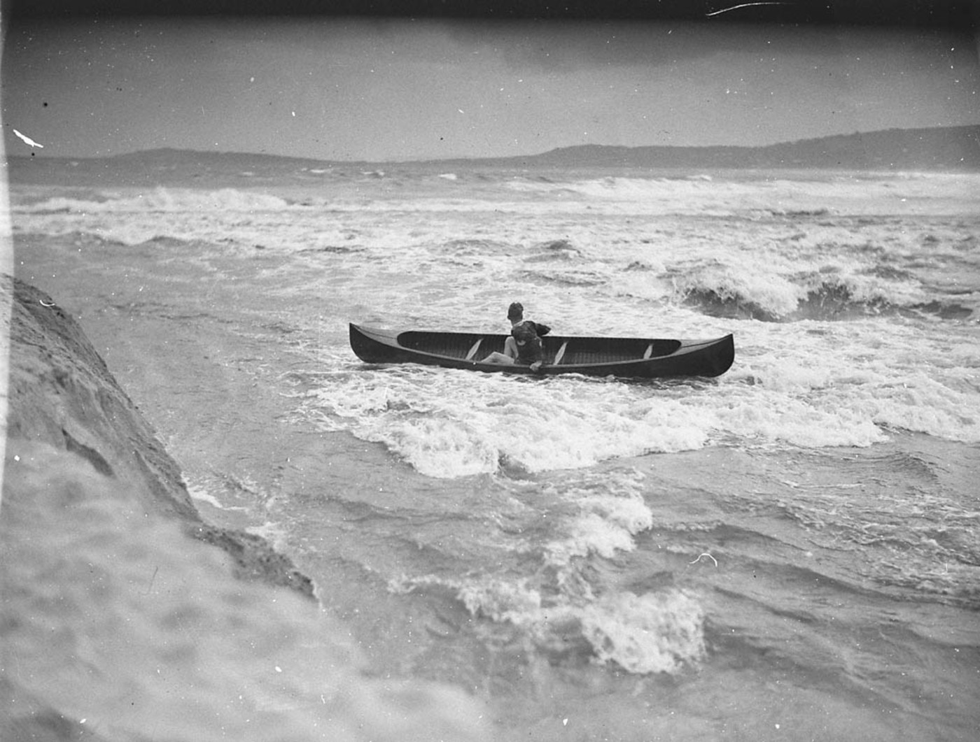
Flood waters from Narrabeen Lake pour into the sea. Image No: hood_06396h, courtesy State Library of NSW
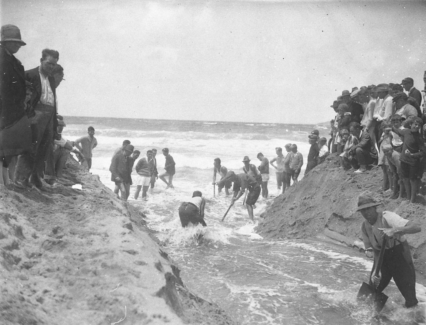
Workmen deepen a channel to drain Narrabeen Lake in the floods April 1927 Image. No: hood_06401h, courtesy State Library of NSW
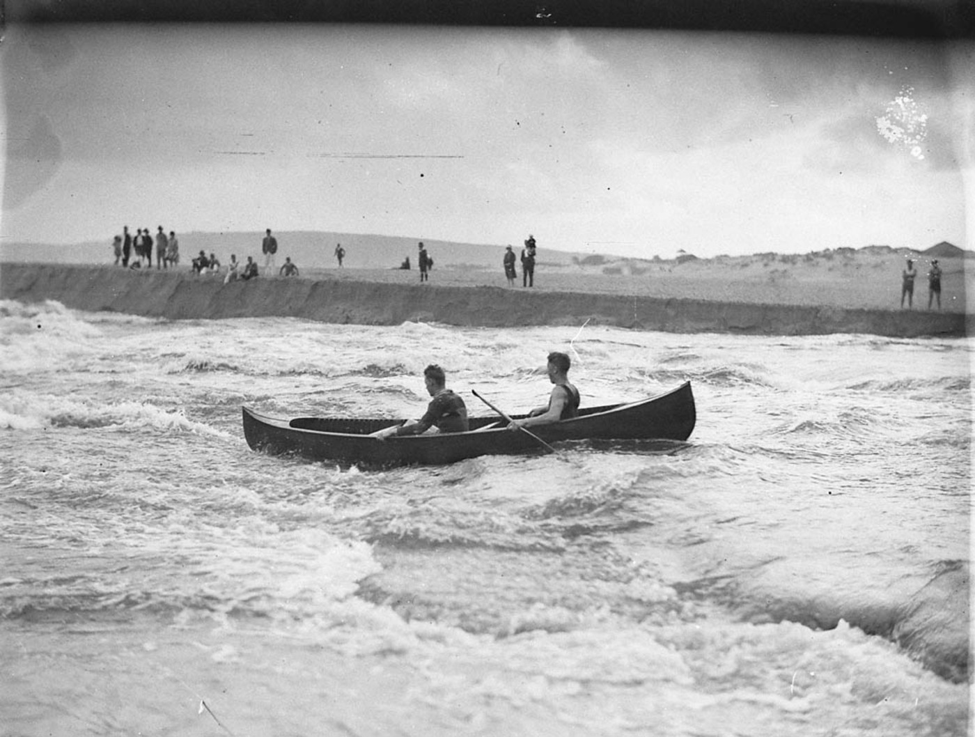
Two canoeists brave the rapids where Narrabeen Lake flood pours into the sea – Top one appeared in newspaper _06397h and _06404h, courtesy State Library of NSW
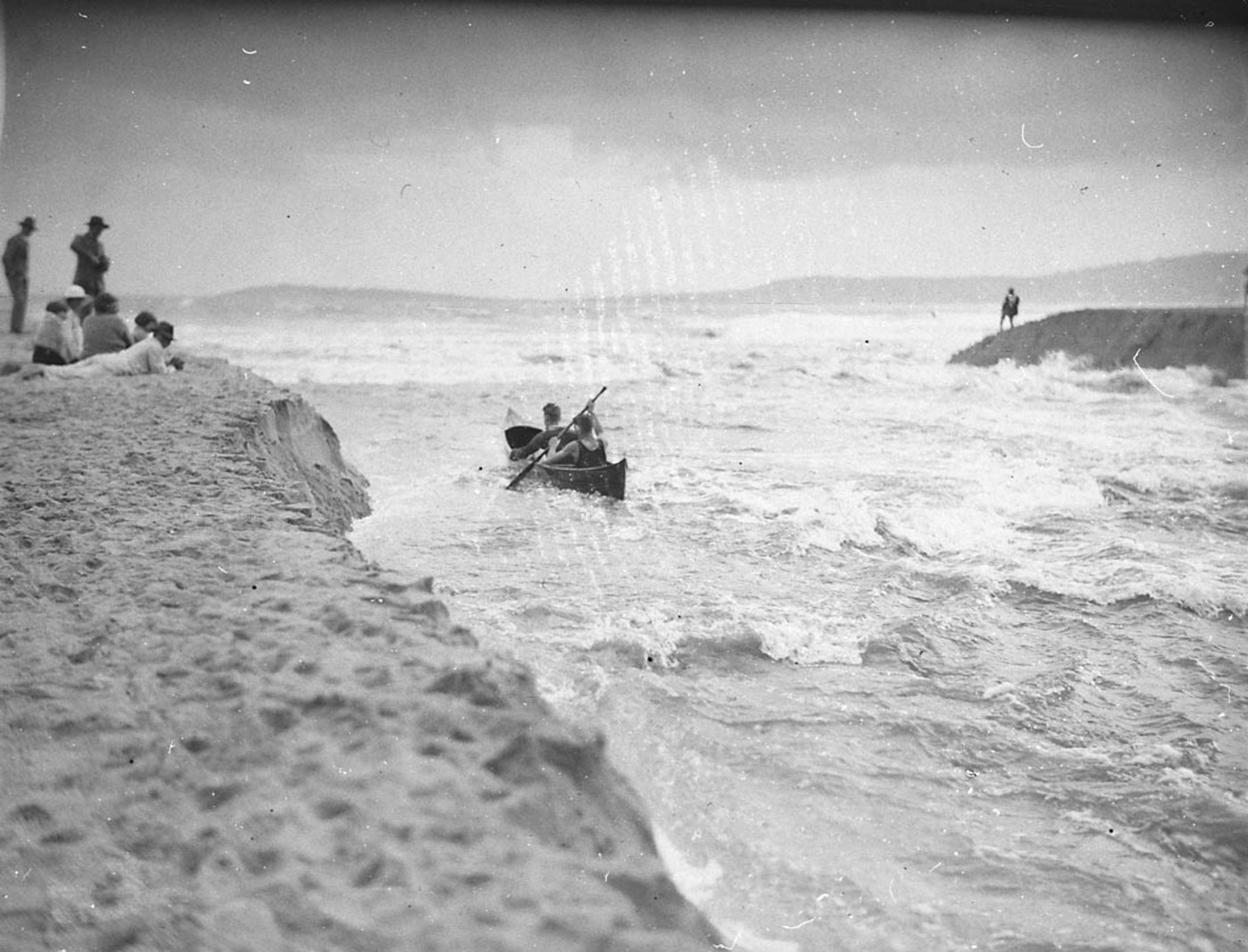
Canoeist in danger as canoe swept out to sea in the Narrabeen flood, Image No.: hood_06405h, courtesy State Library of NSW
Flood waters pours from Narrabeen Lake into the sea Image. No: hood_06395, courtesy State Library of NSW
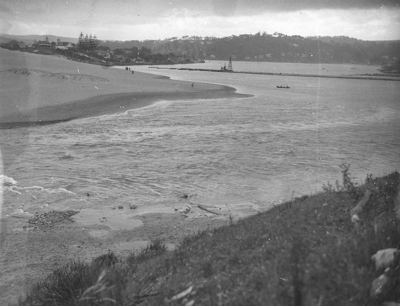
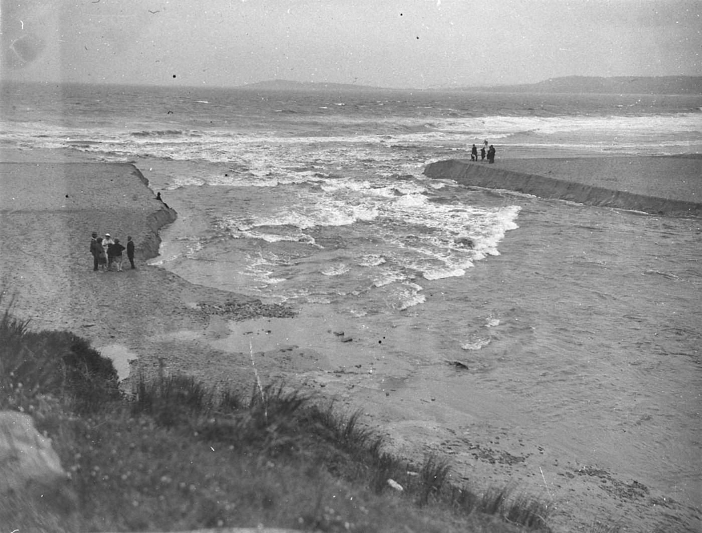
Flood waters and the channel to the sea, Narrabeen. Image No: hood_06403h, courtesy State Library of NSW
Flood control ditch dug from the Lake to the Beach, Narrabeen Image. No: hood_06406h, courtesy State Library of NSW
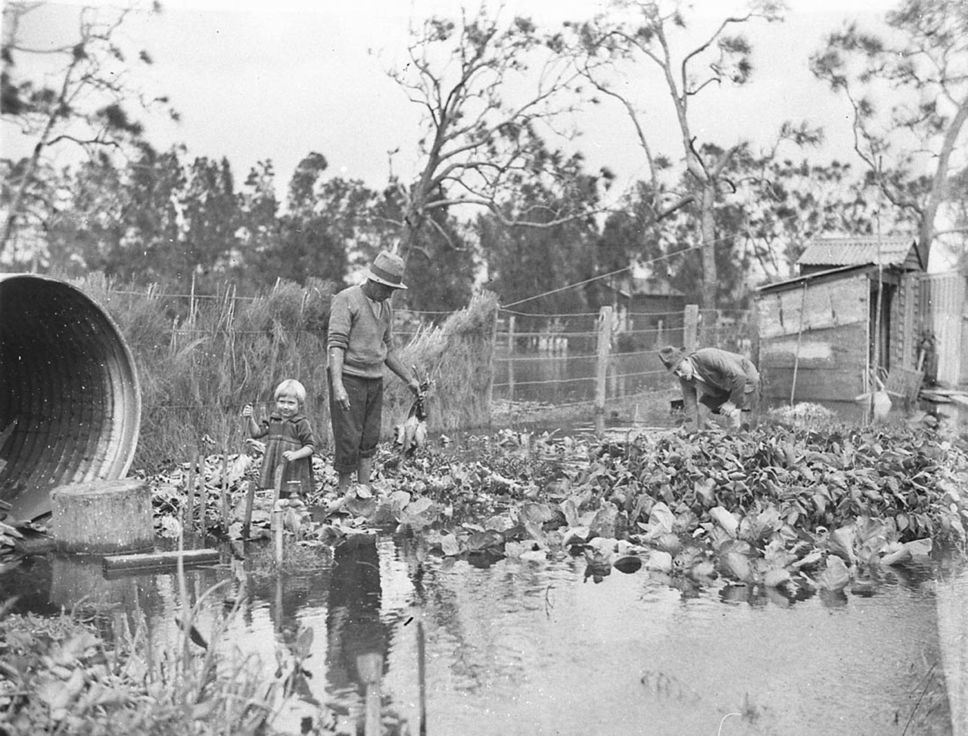
Man surveys his vegetable garden in the Narrabeen flood - Image. No: hood_06399, courtesy State Library of NSW
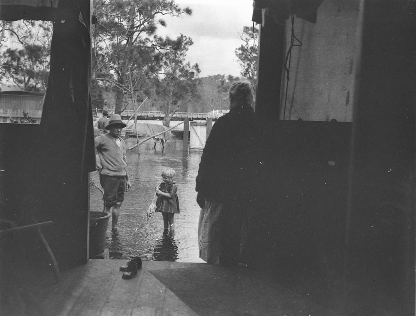
A man, a woman, and a small girl and their flooded house, Narrabeen Image. No: hood_06392h, courtesy State Library of NSW
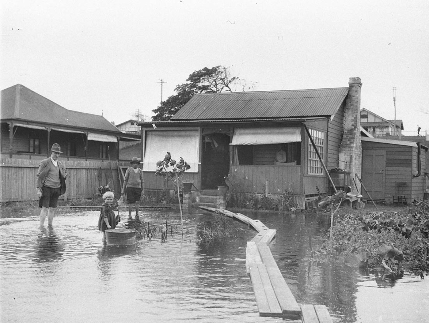
Narrabeen flooding; duck-boards for access Image. No:hood_06402 - all courtesy The Mitchell Library, State Library of NSW, courtesy State Library of NSW
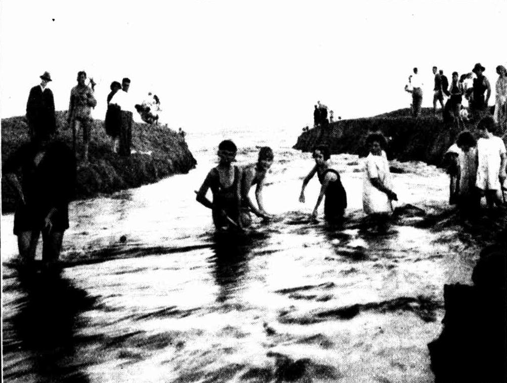
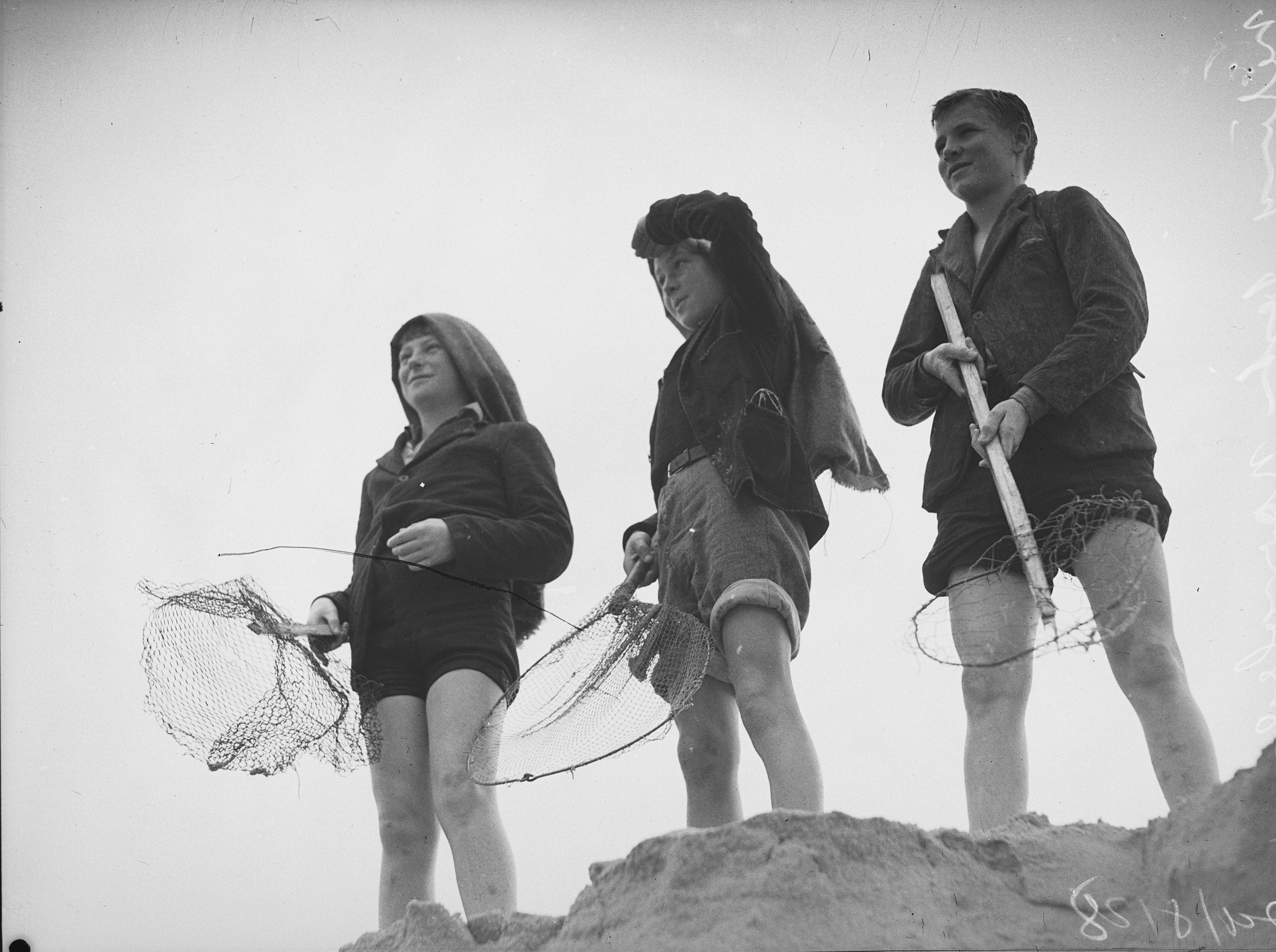
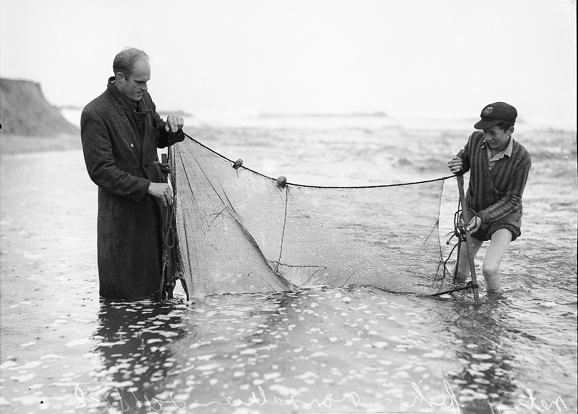
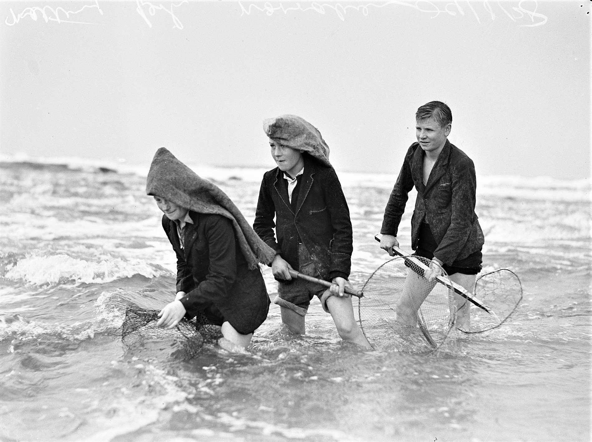
Netting fish at Narrabeen Lakes, 29 August 1938 (Prawning nets used), courtesy Mitchell Library, State Library of New South Wales. From history page; Narrabeen Prawning Times - A Seasonal Tide Of Returnings