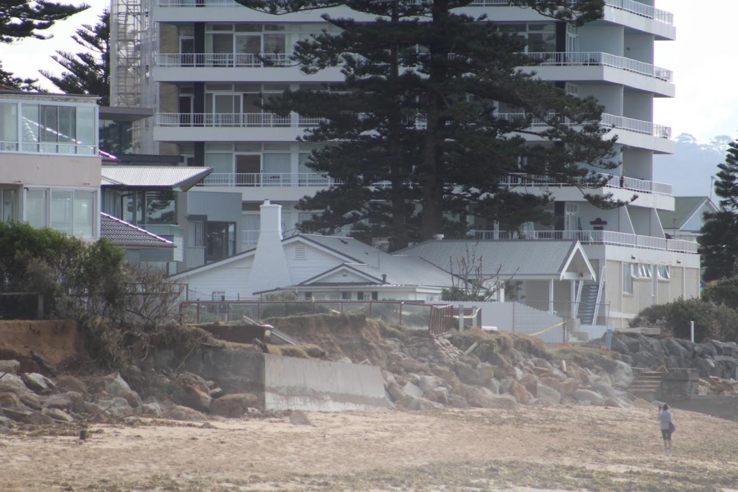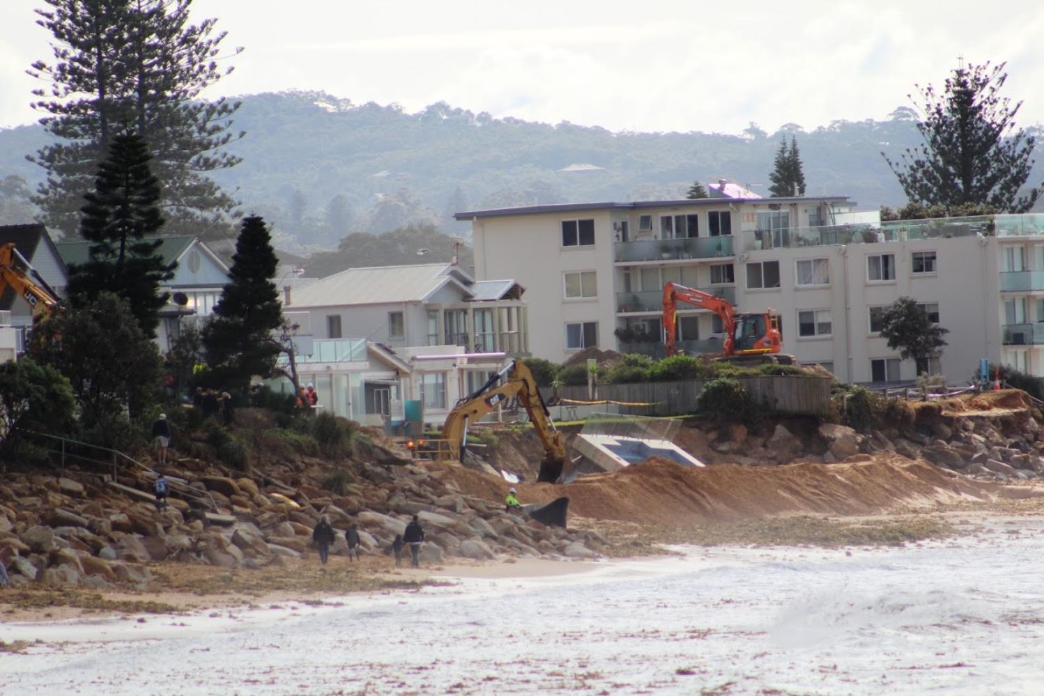
The Council has a further application currently on display for an extension of this wall towards North Narrabeen (DA2021/1612) between Clarke Street and Mactier, which its webpage states was 'advertised'. The cost of this section of works is listed as $ 2,047,433.00 of which 10% will be met by council and 10% by the state government - or 20% by taxpayers and ratepayers in real terms.
The proposed extension is described as;
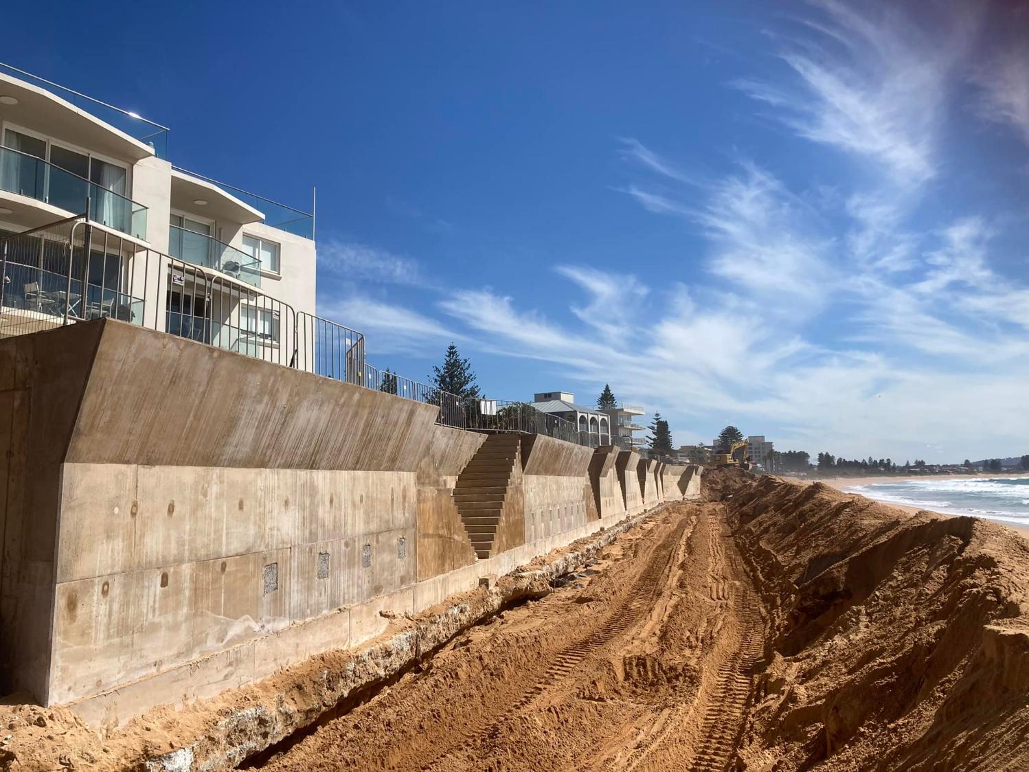
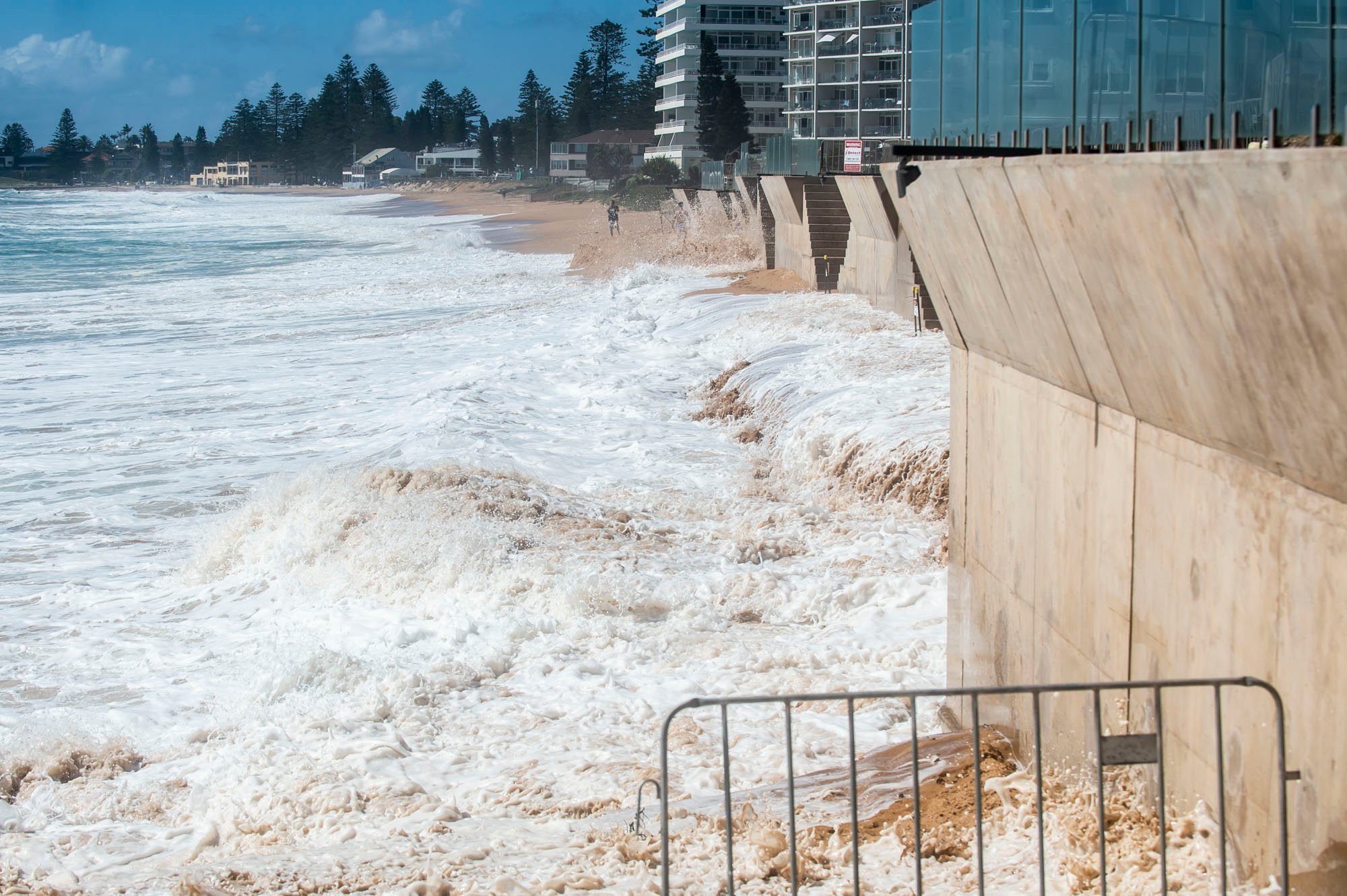
'coastal protection works comprise a reinforced concrete wall supported on continuous flight auger (concrete) piles, either contiguous piles with plug piles or jet grout, or secant piles. Anchors attached to the wall (and permanently buried landward of it) have been designed to provide support for the wall and piling at times of beach erosion when sand levels lower on the seaward side of the wall'.
The piles extending below the surface have been designed as a complete and permanent barrier to soil migration through the wall.
This wall will be a 7.5 metre high design from its base as well, described as:
''A wave return (concrete face that slopes seaward and directs waves seaward) has been provided at the top of the concrete wall (which has a crest level of 7.0m AHD) to reduce wave overtopping of the wall. This wave return extends 0.5m seaward of the main face of the wall.''
The report on the Environmental Effects states that;
'It is recognised that long term recession due to projected sea level rise is expected to translate beach profiles upward and landward, thus reducing average beach widths over the long term where profiles are truncated at protection works (assuming that beach scraping and beach nourishment is not undertaken)'.
The council, in it's ‘Council Provides Facts On The Collaroy Residents’ Seawall’, has stated;
''Council will continue to manage the beach into the future - Council will continue to move sand from the entrance to Narrabeen Lagoon to Collaroy as required. We are also working with the NSW Government and Sydney Coastal Councils Group on proposals to bring additional sand onto our beaches in response to climate change from offshore marine sand deposits or from clean terrestrial sand. These types of programs are new and require the highest levels of environmental scrutiny before they could be progressed.''
These ongoing management costs will be met by residents - although the Narrabeen-Collaroy beachfront has been where sand has been dumped bi-annually from Narrabeen for decades, except now the costs will be met, since the amalgamation of the Manly, Warringah and Pittwater councils, by all in the new LGA.
In 2014 community consultation of Warringah Council residents was undertaken in regard to the Collaroy beachfront that resulted in the 2014 Coastal Zone Management Plan for Collaroy-Narrabeen Beach and Fishermans Beach.
In July 2016, weeks after the councils had been forcibly amalgamated and in response to the June 2016 storm, the NSW state government installed administrator Dick Persson outlined a Draft Coastal Erosion Policy for Collaroy that resulted in the December 2016 Coastal Zone Management Plan for Collaroy-Narrabeen Beach and Fishermans Beach being formalised under the same administration.
That Administrators Minute stated:
I am advised that the initial estimates for 1.1km of works from The Marquesas to 1096 Pittwater Road has been estimated at approximately $22 million. While Council will work with the State Government to meet the cost of directly protecting public assets in this area (approximately $5.5 million), I will also ask the State Government to join Council in providing up to 10% each towards the cost of private protection as a contribution subject to a positive cost benefit analysis for these public assets. Early estimates suggest this contribution could be approximately. This contribution has been estimated at approximately $3.3 million ($1.65 million from State and $1.65 million from Council) and is in recognition of the public asset protection that is provided by these private properties.....A recent report by the Sydney Coastal Council’s Group identified that to combat the impact of sea level rise in the Collaroy-Narrabeen embayment significant volumes of sand will be required as these impacts are felt. For example, it is predicted that some 1.3 million cubic metres of sand (approximately 4 times the amount removed during the June storms) will be required for the first 10 year nourishment effort, and around 420,000 cubic metres for each following 10 year campaign.In 2009 dollars this will cost around $30 million for the first 10 year nourishment, and around $12 million for each following 10 year campaign.These costs are based on the assumption that sand nourishment will be undertaken across large areas of the NSW coast and the costs shared accordingly.....Works on this scale are simply unaffordable for Northern Beaches Council on its own, and the responsibility for delivery of offshore sands must be shared with benefitting Councils and also with State and Federal Government. The State Government is obviously best placed to co-ordinate and manage such an undertaking, and I will write to the Premier to request that the State provides a long-term sand replenishment strategy for NSW that addresses the many issues I have raised, and amends the Offshore Minerals Act (1999) to enable effective medium and long term beach amenity to be preserved.
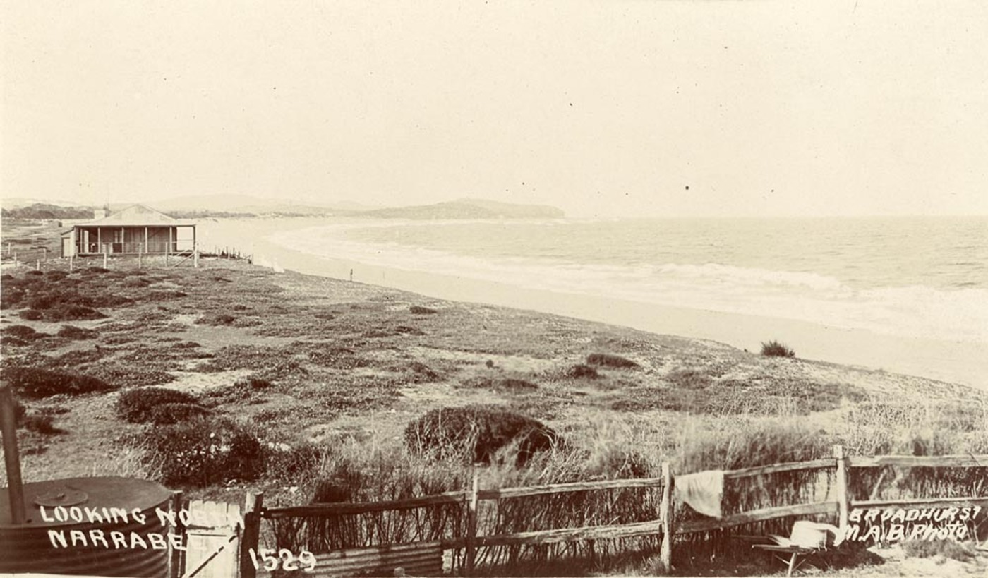
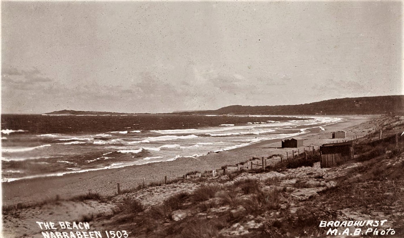
Looking north to Narrabeen, From Scenes of Narrabeen album, circa. 1900-1910 Sydney & Ashfield : Broadhurst Post Card, Images No.: a106058h and below; a105160h courtesy The Mitchell Library, State Library of NSW
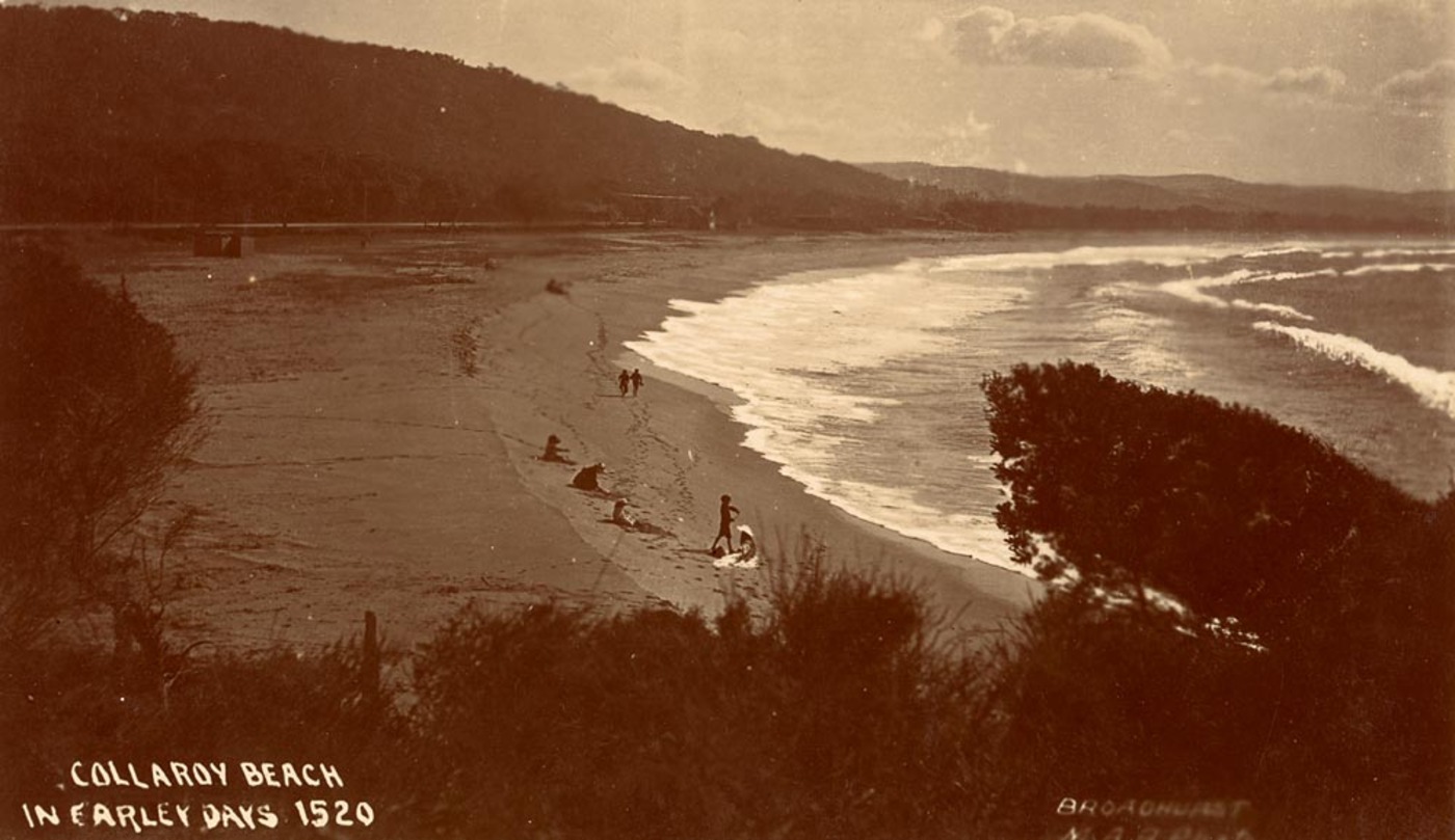
Collaroy Beach in earley [ie. early] days ca. 1900-1927; Sydney & Ashfield : Broadhurst Post Card Publishers, by William Henry Broadhurst, 1855-1927, courtesy State Library of NSW
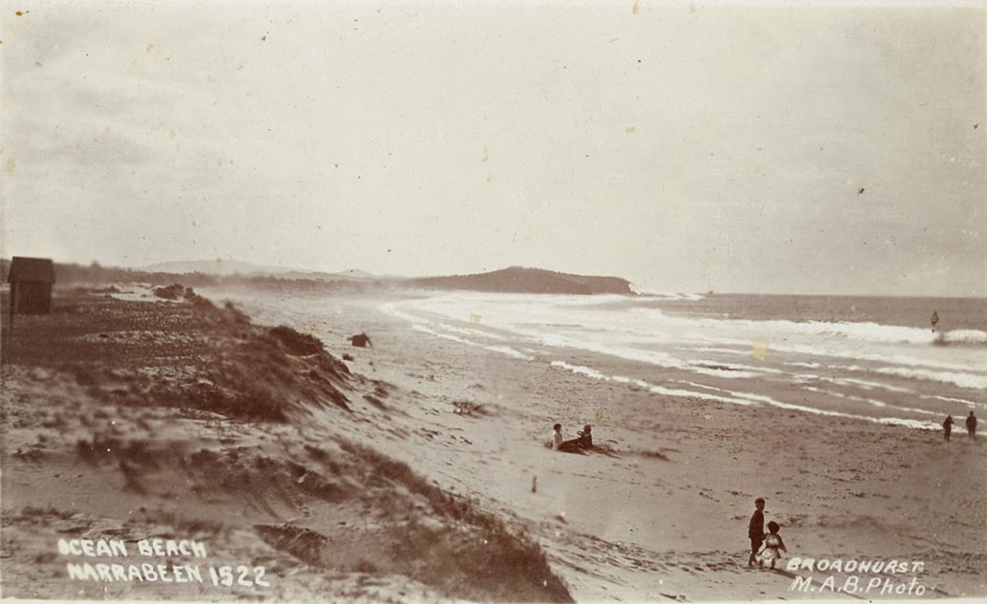
Views north and south at North Narrabeen and Collaroy Beach Image Nos.: .a106051h a106052h, from Scenes of Narrabeen Album, Courtesy The Mitchell Library, State Library NSW.
On Friday, August 6th 2021 the council published ‘’Council Provides Facts On The Collaroy Residents’ Seawall’’ where Item 4 states; 'The current works are entirely on private land'
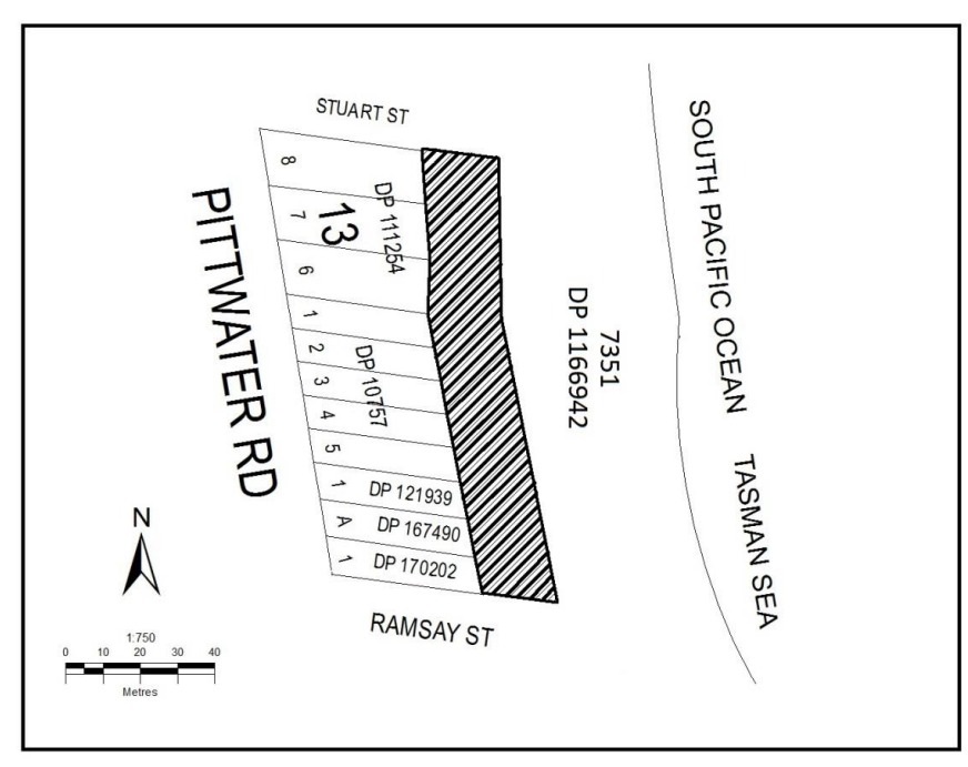
However, a February 20th, 2019 document by the NSW Department of Planning, Industry and Environment, ‘Notice of compulsory acquisition of land in the local government area of Narrabeen’ states;
‘The area of land 20m wide bound to the east by a line parallel to the eastern boundaries of Lots 6 to 8 Section 13 DP 111254, Lots 1 to 5 DP 10757, Lot 1 DP 121939, Lot A DP 167490 and Lot 1 DP 170202 and bound to the north by the prolongation of the northern boundary of Lot 8 Section 13 DP 111254 to the east and bound to the south by the prolongation of the southern boundary of Lot 1 DP 170202 to the east as indicated by hatching on the diagram below.’
The corresponding webpage states;
‘’ The DA is for a sloping rock revetment seawall, around 210 metres in length and 15 metres wide. The proposed structure, if approved, would encroach on Crown land by around 15 metres from property boundaries…’’
And;
‘’ The department has granted landowner’s consent for the DA to be assessed by Northern Beaches Council, which is required under Environmental Planning Assessment Regulations 2000. Landowner’s consent is not development approval. It is only the first step in the planning assessment. Should the DA be approved by Northern Beaches Council, the department will then begin negotiations on an appropriate tenure for the occupation of Crown land.’’
The compulsory acquisition of 20 metres of land was approved on February 20th, 2019. The approval included a diagram of the land compulsorily acquired:
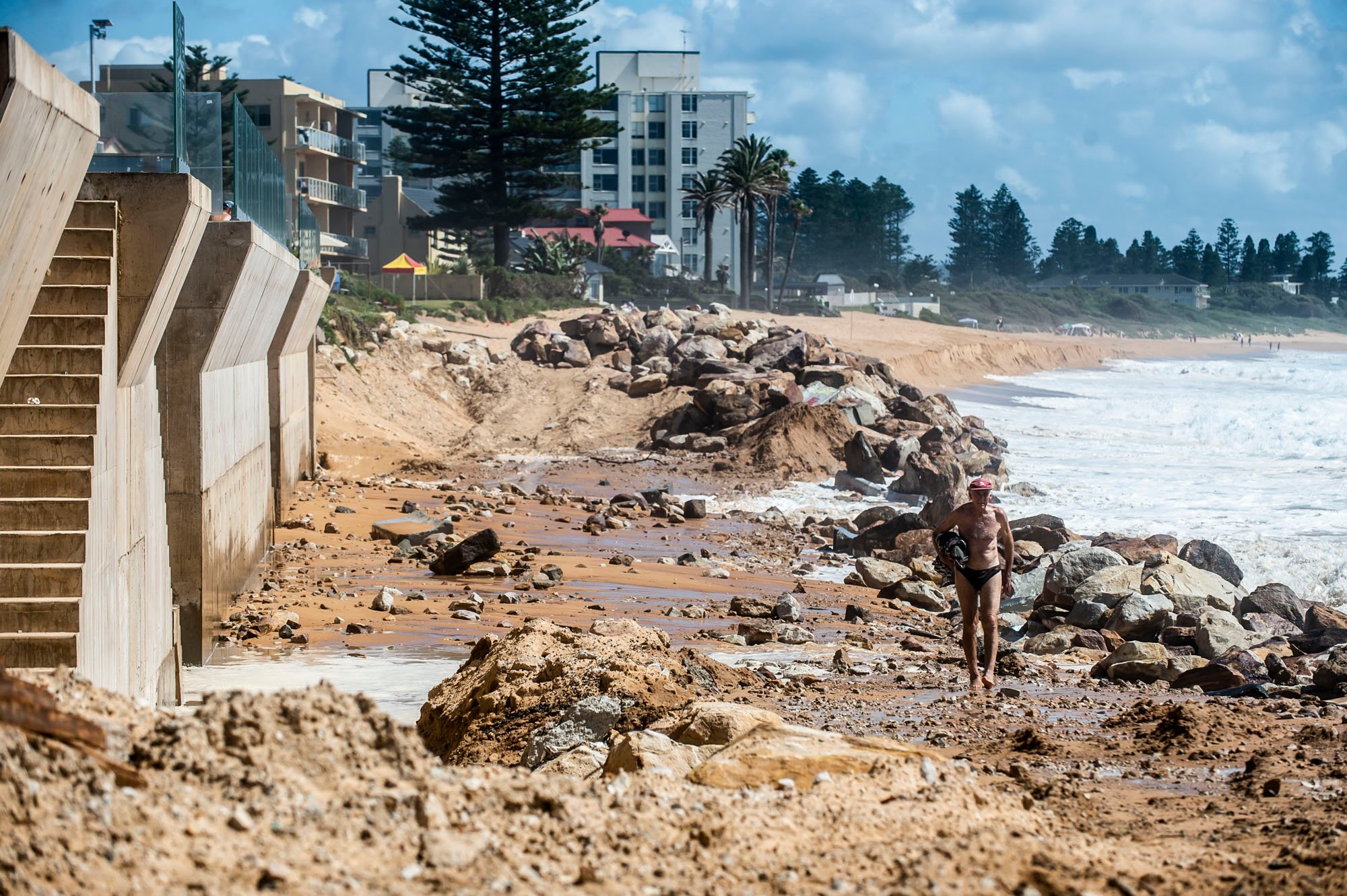
The Guardian Australia published a photo on October 24th, 2021 by Lewis Isaacs that shows how far east from the boundaries of the owners' private land this wall has been built.
That report is called 'A 7m wall has gone up on a Sydney beach: are we destroying public space to save private property?'
The south extension is causing anxiety for those who own these beachfront properties as well, with some submissions to the council DA2021/1612 webpage by those homeowners stating their mental health is being impacted, especially during storm events, and that 'the way forward isn't to punish the current residents of this strip of beach for the errors of the past.'
Other supporters state that without such walls the connection that is Pittwater road at Collaroy and Narrabeen will be cut off, as it has been in the past.
One Araucaria heterophylla, a Norfolk Island Pine, approx. 20m height at No.1204 Pittwater Road, is required to be removed as part of the extension north works.
Many studies have shown that with Climate Change storms are becoming more frequent and sea level rise will occur, prompting experts in the area of coastal engineering to state the council and the government need to acquire all these beachfront properties along this stretch of coast.
The council has already stated that to purchase all the beachfront property just at Collaroy would run to the many hundreds of millions of dollars and is outside the budget of a local council and that given the numbers of affected properties around the country, there are no state or federal government plans to use taxpayer dollars for a buy back scheme either.
The 377 beachfront lot addresses had a July 1, 2012 combined unimproved land value of $239 million, at an average of $635,000 per address. This average was skewed by the large number of units (which do not get individually valued), with the average unimproved land value per lot address (with 97 lot addresses) being $2.5 million. The largest unimproved lot land value was $12.5 million at “Marquesas” (11 Ocean Street Narrabeen) and the smallest was $1.2 million.
Ten years usually doubles the price of homes in this area, land value aside, although recently beachfront and waterfront properties at Palm Beach have been selling for in excess of $20 million each.
The extension north proposal is supported by the council's Building Assessment and Principal Planning officers.
However, the Coastal Act and the Coastal SEPP both state that “Development consent must not be granted……unless the consent authority is satisfied” and there are a list of matters the consent authority must be “satisfied” are met.
To be “satisfied” the consent authority has to have the qualifications and experience to be professionally satisfied. Reliance on external advice must be specific to the actual development location for the development type on the specific site and the specific location on that site.
The available information, other than information submitted by the applicant (which cannot be construed as independent advice) does not meet the necessary criteria and hence the consent authority has no basis on which to be satisfied.
The Local Planning Panel hearing for the DA '1 Clark Street Narrabeen' will be held on the 16th of March.