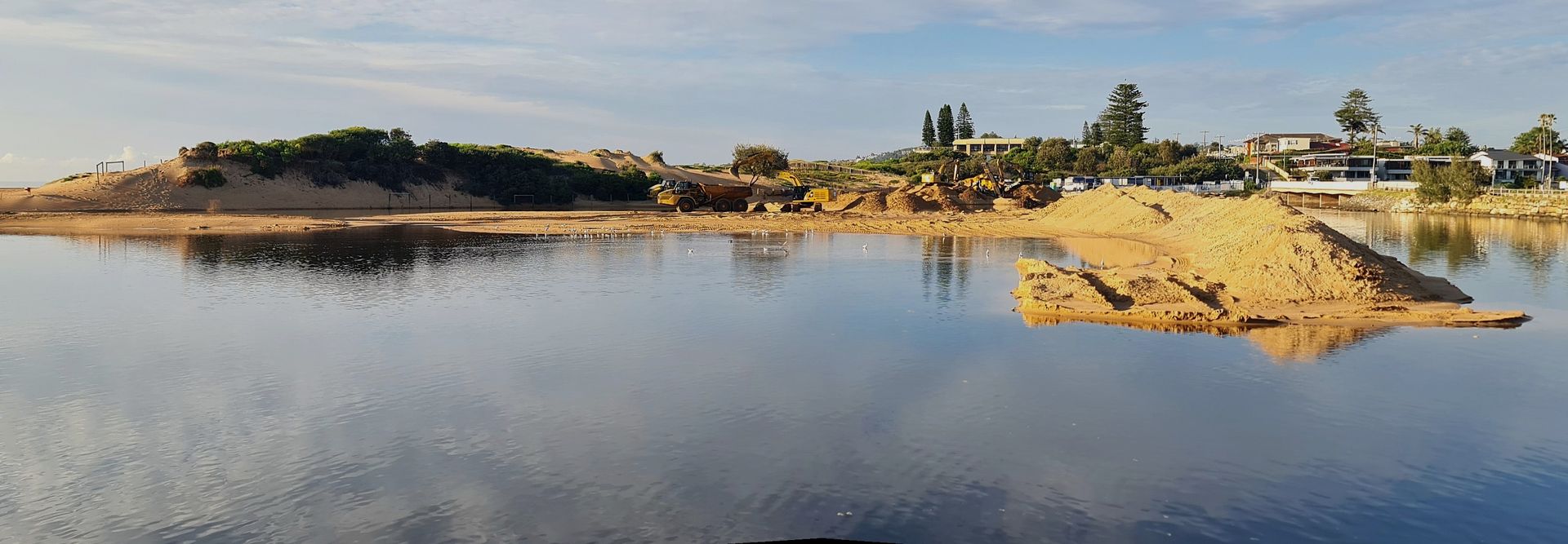

Narrabeen Lagoon dredging works,. October 2025. Photos: Joe Mills
The council has commissioned a Scoping Study as the first stage of its program towards the development of Coastal Management Programs (CMPs).
See September 2025 report: NSW Audit Office report on Coastal Management Finds Objectives of Coastal Management Act are not being met: Recommendations
CMPs are used by local councils around NSW to establish coastal management goals and actions. Developed in consultation with the community and state government, a CMP creates a shared vision for management and provides the steps of how to get there through local input and costed actions.
The development of the CZMPs within NSW occurred under the former Act (Coastal Protection Act 1979). The current council has two certified CZMPs under the former Act - ‘Bilgola and Basin Beach’ and ‘Collaroy-Narrabeen-Fisherman's Beach’.
In July 2016, weeks after the councils had been forcibly amalgamated and in response to the June 2016 storm, the NSW state government installed administrator Dick Persson outlined a Draft Coastal Erosion Policy for Collaroy that resulted in the December 2016 Coastal Zone Management Plan for Collaroy-Narrabeen Beach and Fishermans Beach being formalised under the same administration.
That Administrators Minute stated:
I am advised that the initial estimates for 1.1km of works from The Marquesas to 1096 Pittwater Road has been estimated at approximately $22 million. While Council will work with the State Government to meet the cost of directly protecting public assets in this area (approximately $5.5 million), I will also ask the State Government to join Council in providing up to 10% each towards the cost of private protection as a contribution subject to a positive cost benefit analysis for these public assets. Early estimates suggest this contribution could be approximately. This contribution has been estimated at approximately $3.3 million ($1.65 million from State and $1.65 million from Council) and is in recognition of the public asset protection that is provided by these private properties.....A recent report by the Sydney Coastal Council’s Group identified that to combat the impact of sea level rise in the Collaroy-Narrabeen embayment significant volumes of sand will be required as these impacts are felt. For example, it is predicted that some 1.3 million cubic metres of sand (approximately 4 times the amount removed during the June storms) will be required for the first 10 year nourishment effort, and around 420,000 cubic metres for each following 10 year campaign.In 2009 dollars this will cost around $30 million for the first 10 year nourishment, and around $12 million for each following 10 year campaign. These costs are based on the assumption that sand nourishment will be undertaken across large areas of the NSW coast and the costs shared accordingly.....Works on this scale are simply unaffordable for Northern Beaches Council on its own, and the responsibility for delivery of offshore sands must be shared with benefitting Councils and also with State and Federal Government. The State Government is obviously best placed to co-ordinate and manage such an undertaking, and I will write to the Premier to request that the State provides a long-term sand replenishment strategy for NSW that addresses the many issues I have raised, and amends the Offshore Minerals Act (1999) to enable effective medium and long term beach amenity to be preserved.
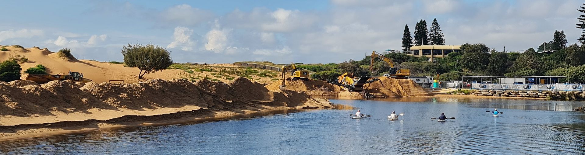
As a result of the approved CZMP a 7.5m concrete seawall was installed at Collaroy, resulting in more rapid and greater erosion, and a slower beach recovery, and a now annual cost to ratepayers to move the sand funnelled into the Narrabeen Lagoon entrance to be shifted back to that part of Collaroy beach.
In September 2022 a further application for an extension of this wall towards North Narrabeen (DA2021/1612) between Clarke Street and Mactier was approved despite 93% of respondents objecting to the proposal. The cost of this section of works was listed as $ 2,047,433.00 of which 10% will be met by council and 10% by the state government - or 20% by taxpayers and ratepayers in real terms.
The beach has also been the site of “line in the sand protests” against vertical seawalls in 2002 and more recently on November 27, 2021.
Although the transition from the CZMP to CMP occurred in 2016 with the introduction of the Coastal Management Act 2016 (see above report), the December 2016 Coastal Zone Management Plan for Collaroy-Narrabeen Beach and Fishermans Beach was progressed.
The council states these two existing CZMP’s have now expired and will be updated in the ‘Open Coast and Lagoons’ and ‘Collaroy-Narrabeen’ CMPs.
Now, 9 years later, the council is taking steps to become compliant.
The CMPs will also incorporate Estuary Management Plans that are currently in place for the four lagoons; Manly, Curl Curl, Dee Why and Narrabeen.
The NSW Government CMP manual prescribes a mandatory five-stage process to developing a CMP. Typically, each stage takes a year to complete, however the time it takes varies upon the baseline information, level of complexity, size and area, and community engagement that has previously been undertaken, the council states.
Local councils and public authorities are required to manage their coastal areas and activities in accordance with relevant state legislation, policies and plans.
The framework for managing the NSW coast includes:
- Coastal Management Act 2016 (CM Act)
- State Environmental Planning Policy (Resilience & Hazards) 2018 (R&H SEPP)
- Coastal management programs (CMPs), prepared in accordance with the NSW coastal management manual.
The Open Coast and Lagoons CMP covers a large area (Palm Beach to Manly) and has a wide range of issues, the council states. As with all CMPs, it will require technical studies and community and stakeholder engagement, and is likely to take around 5 years to complete, the council states.
For the Collaroy-Narrabeen CMP, extensive technical studies and community engagement will occur with the council aiming to have a certified CMP in place by 2026.
The Hawkesbury-Nepean CMP (incorporating the Pittwater waterway and being led by Hornsby Council) and Outer Sydney Harbour CMP (incorporating North and Middle Harbor and being led by the Sydney Coastal Councils Group) are at Stages 3 (November 2024 for Pittwater estuary was last update) and Stages 2-4 for North and Middle Harbor. The work is expected to take approximately three years to complete for North and Middle Harbor which was due to commence in early to mid-2025.
The council is currently inviting feedback on its commissioned Scoping Study from Monday November 3 until Sunday December 14 2025.
Previously:
- Coastal Management Bill 2016 Passed - June 2016, Issue 266
- Collaroy Seawall Prompts Calls For Residents To Join In Drawing A Line In The Sand - 2021
- Line In The Sand Demonstrators At Collaroy Sea Wall Call For A Better Solution Than Destroying This Public Beach - 2021
- No Sediment Barriers At Collaroy-Narrabeen Seawall Site: Surfrider Foundation Northern Beaches February 4th Video Of Runoff + Extension North Proposal - February 2022
- Council Works To Open Narrabeen Lagoon Entrance Again: An Expense Recurring More Frequently - Extension of Wall North; Northern Beaches Council called an extraordinary meeting of the Northern Beaches Local Planning Panel (NBLPP) to be held at Council Chambers Dee Why, 725 Pittwater Rd on Monday 25th September at 10.30am. - 2023
- Pittwater Greens councillor calls for moratorium on seawalls- November 2023- Follow up report; From the Chamber November 2023 Report
- NSW Audit Office report on Coastal Management Finds Objectives of Coastal Management Act are not being met: Recommendations - September 2025
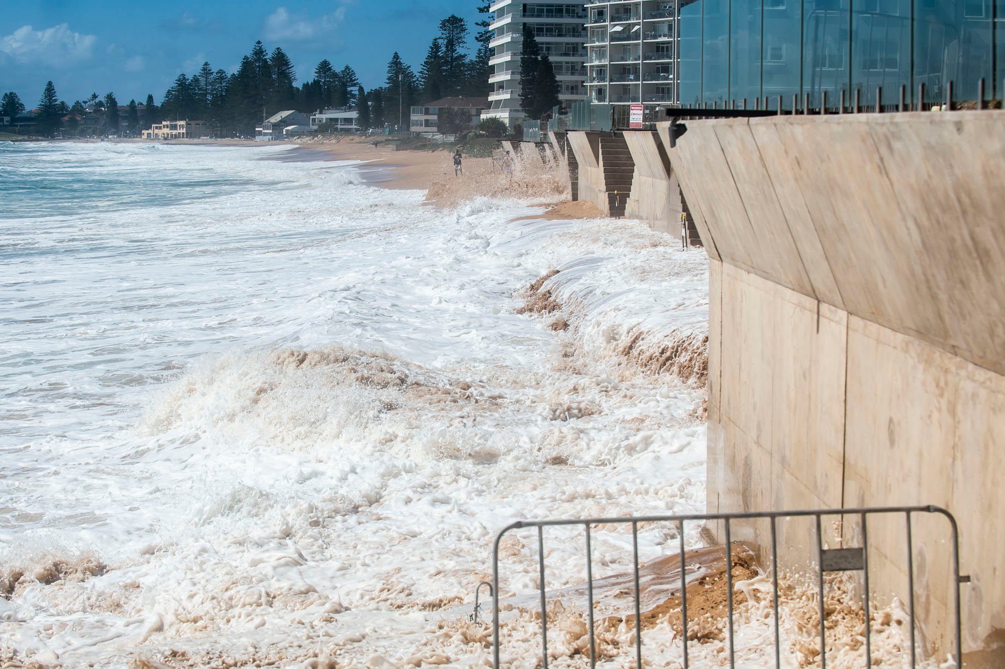
Collaroy on January 4th 2022. Image: Ian Bird Photography.
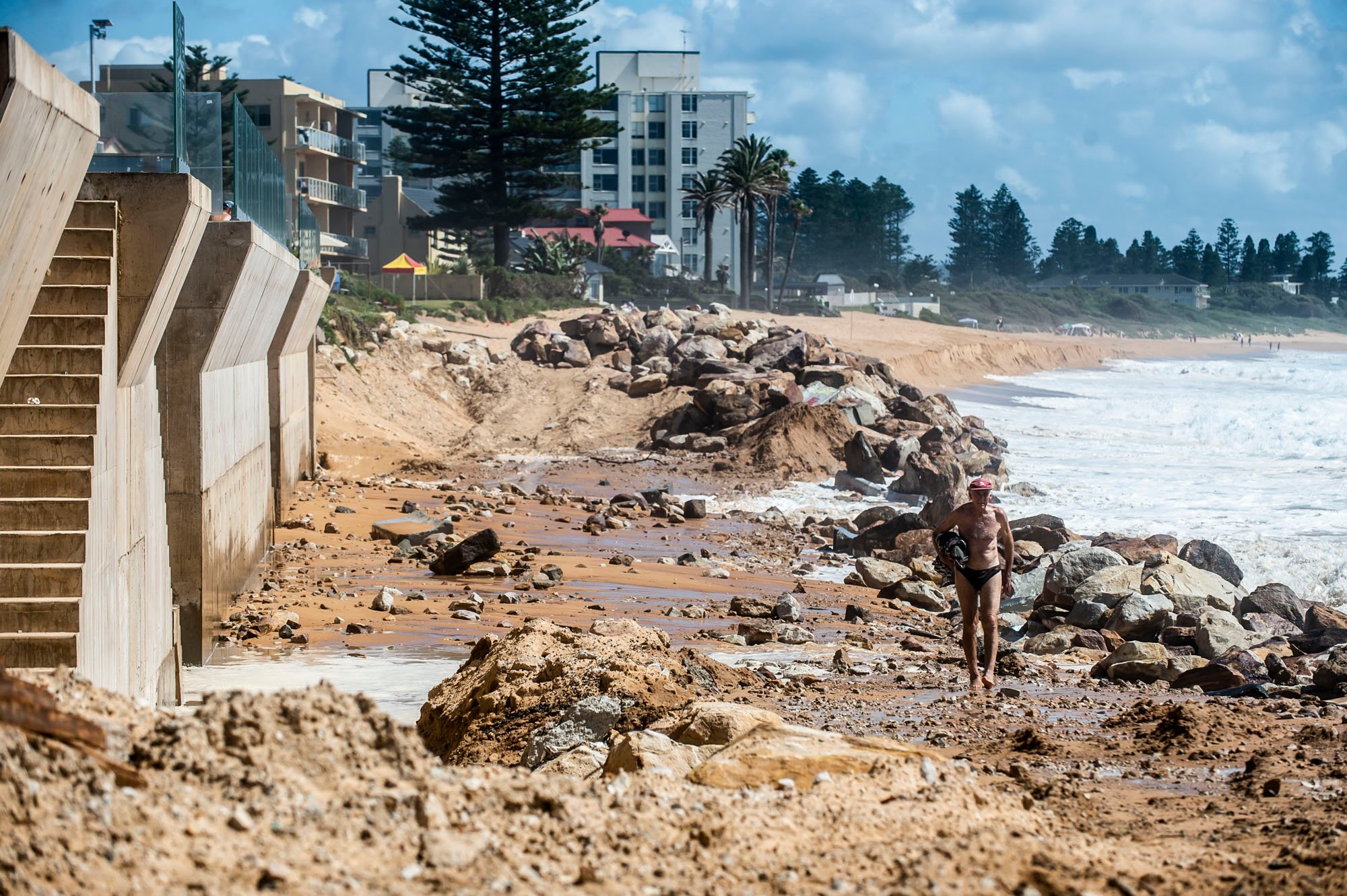
Collaroy on January 4th 2022. Image: Ian Bird Photography.

Narrabeen Lagoon entrance near bridge: dredging works and kayakers, October 2025. Photos: Joe Mills