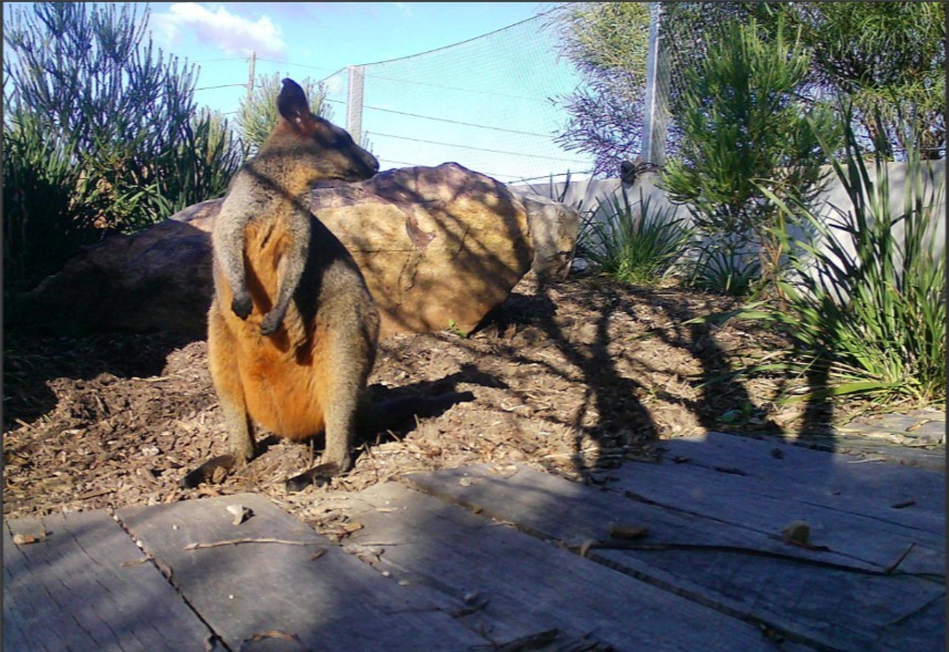
Swamp Wallaby crossing Mona Vale Rd East on the fauna bridge. Photo supplied
The Northern Beaches Council has announced it has agreed to progress a proposal to strengthen the long-term protection of the Ingleside wildlife corridor, including seeking the transfer of identified State-owned land to Council and to rezone it for environmental conservation.
The land is part of a corridor that links Ku-ring-gai Chase National Park, Katandra Bushland Sanctuary and Ingleside Chase Reserve, while also connecting habitat to Irrawong Reserve and Warriewood Wetlands.
A preliminary council assessment found the area contains largely intact native bushland in good condition and provides important habitat connectivity. The Ingleside corridor contains habitat that supports, or has the potential to support, more than 30 threatened species from the local area. Native vegetation within the corridor also includes areas of coastal upland swamp, an endangered ecological community.
Mayor Sue Heins said protecting the corridor would help safeguard valuable bushland and support wildlife movement across the area.
“This is a rare opportunity to strengthen protection for an important wildlife corridor and preserve habitat that supports threatened species.
“Keeping this bushland connected is also vital to the continued success of the fauna overpass and underpasses delivered as part of the Mona Vale Road East upgrade,” Mayor Heins said.
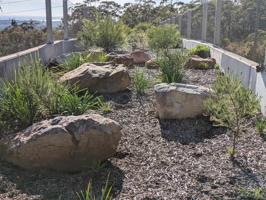
Fauna overpass on Mona Vale Road East looking towards Ingleside Chase Reserve Photo D Palmer
Under the proposal, the council stated it would formally express interest in identified land parcels being transferred to the council from the NSW Office of Strategic Lands (OSL) and seek agreement to apply a C2 Environmental Conservation zone under council’s Local Environmental Plan.
A C2 zoning would provide a higher level of environmental protection than the currently proposed C3 Environmental Management zone by prohibiting dwelling houses and other uses that could affect the corridor’s environmental values.
“Council ownership could provide greater certainty for the corridor’s long-term protection and enable active management including bushland regeneration, weed control and hazard reduction,” Mayor Heins said.
“We’d like to acknowledge Pittwater Natural Heritage Association for its diligence in promoting the benefits and importance of the Ingleside Wildlife Corridor.
“Before any decision is made, Council would undertake detailed due diligence so the community can be confident the environmental benefits, risks and long-term costs have been carefully considered.”
The investigations would examine terms of land transfer, whole-of-life financial impacts, funding requirements, bushfire management obligations, contamination and geotechnical risks. A further report would be presented to the council before any land transfer is finalised, the council stated.
If the land is transferred to the council, it will require reclassification in accordance with the provisions of the Local Government Act 1993. Should the land be transferred to Council, it is intended that it would become Community Land and be categorised as Natural Area - Bushland, meaning that it will not be able to be sold but will be retained for conservation and sustainable community use.
Prior to the October 2026 council meeting two members of PNHA spoke in support of saving the wildlife corridor.
Jacqui Marlow:
I want to speak about why preserving bushland connectivity is essential for the new wildlife overpass and Mona Vale Road East and protecting what the community community values.
According to the council's state of well-being 2026 report, living in a beautiful natural environment surrounded by bushland and wildlife ranked as equal first amongst 16 attributes contributing to community well-being.
This demonstrates just how much community value the community values the natural environment and the wildlife that makes the northern beaches such a special place to live. Protecting bushland is about protecting habitat and wildlife corridors that allow native animals and plants to survive and thrive. The northern beaches is home to hundreds of native species, so regional biodiversity corridors are very important.
If you look at this map that's on page 178 of the agenda, you can see from the north where there is Ku-ring-gai National Park down through Katandra Bushland, then through Ingleside Chase and down to Narrabeen Lagoon catchment, there is a corridor of high biodiverse land.
This area of connected bushland forms an important regional biodiversity corridor. It allows animals and plants to spread through the landscapes, maintain healthy populations, and recolonise areas when local populations have disappeared. Without these connections, bushlands become pockets of isolation, and the populations sin these pockets will become increasingly vulnerable and genetic diversity can decline and species will eventually become locally extinct.
The importance of these corridors is particularly evident on the northern beaches where roads and urban development have progressively fragmented the natural landscape. A major habitat connection between the Narrabeen Lagoon catchment and the Manly Dam catchment has been broken by the Warringah Road upgrade near the [northern beaches] hospital.
This fragmentation makes remaining corridors even more valuable. We cannot afford to lose any more bushland that links our natural areas.
The wildlife overpass must remain connected to surrounding bushland.
A wildlife overpass can't be considered in isolation from the surrounding landscape. An overpass surrounded or disconnected with through cleared habitat will have limited value.
The overpass must be connected to substantial areas of native vegetation reserves to to restore a functioning wildlife corridor.
David Palmer:
Thank you. Jacqui and I are both members of Pittwater Natural Heritage Association and our association been campaigning on this matter for quite some years.
We're pleased to know that the council has been listening and is taking action.
That is why we ask you to support the recommendation in the staff report so that staff can continue to work towards preservation of this environmentally valuable land.
The land we're concerned about is located adjacent to the Mona Vale Road East for Bridge and Underpass in Ingleside and the environmental significance of this land was recognised in 2016 when a plan for residential subdivision in Ingleside was released.
The land was classified in the release document as environmental protection. The intention being that it be conserved for a fauna corridor and managed for conservation.
This decision was based on thorough research and led to transport for New South Wales decision to build a fauna crossing or a couple of fauna crossings on Mona Vale Road East. So now we have our Fauna crossings.
We've got an overpass and underpass, but the bush land needed to support them has an uncertain future because, despite of the recognition of the environmental value of the land, we find that in the new LEP, it is planned to be zoned C3, which allows the construction of houses.
But if the land is zone C3 in the new LEP, would it be suitable for housing?
Well, we say no. And this is because the land's in a bushfire area; it has no water or sewer services, the roads are narrow and are unsuitable for egress during bushfire events, and the lands in the upper catchment of two local creeks, Mullet Creek and Narrabeen Creek, as bushland, contributes to flood mitigation water quality protection and the downstream environmental health in the Warriewood Valley.
The C3 zoning would enable uses that would harm the environmental functions required to support long-term viability of Ingleside Chase Reserve and the functioning of the fauna crossings on Mona Vale Road East.
We ask you to support the recommendation in the report to council and most importantly we believe that the recommendation outlines a prudent responsible approach which does which does not commit council to accepting the land on unfavourable terms.
Item 11.6: 'Investigate Options for Protection of Ingleside Wildlife Corridor' was passed unanimously.
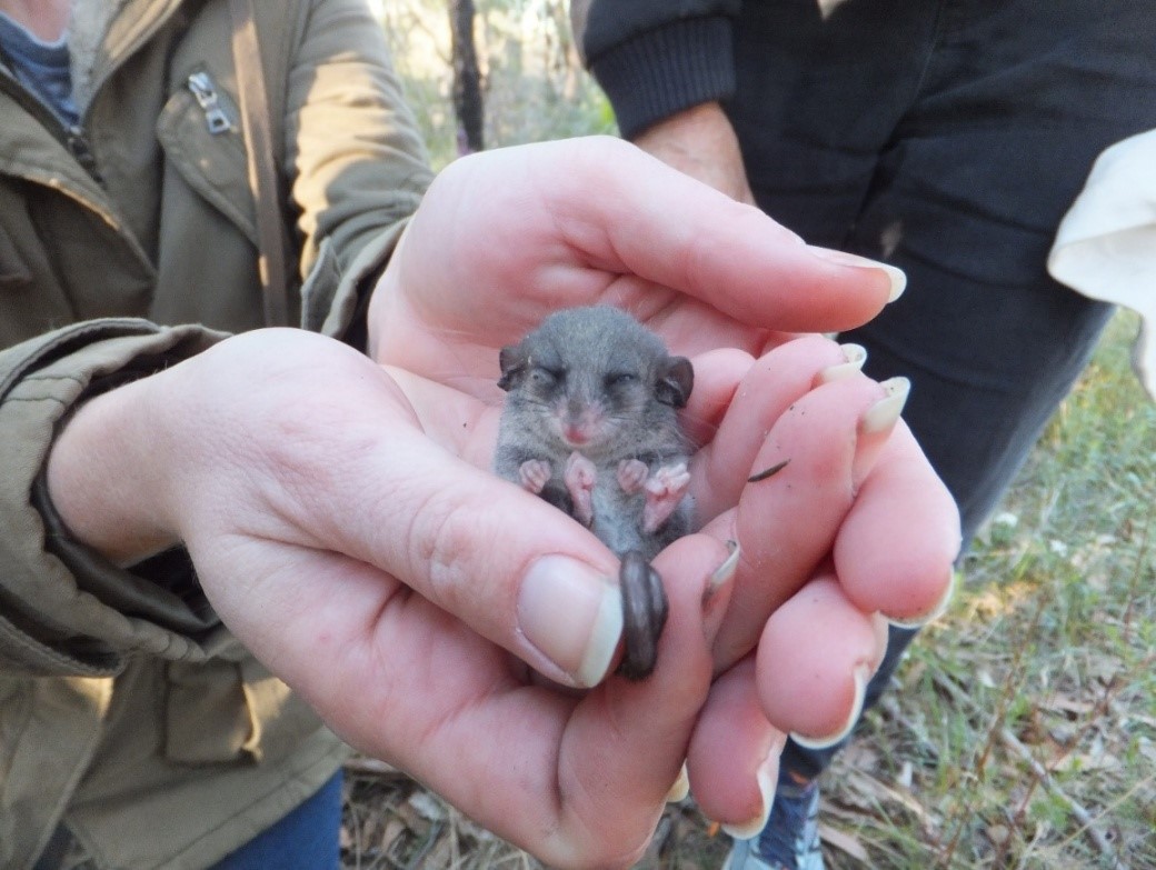
Eastern Pygmy possum near the fauna bridge on Mona Vale Road East. Photo David Palmer
The bridge was installed in August 2023. Next day the road was open and later the bridge was planted with native plants.
The bridge lies between bushland lots owned by NSW State Government. A permanent fauna corridor through this must be established.
See February 2026 report: The fauna bridge on Mona Vale Road East – will it be a bridge to nowhere?
March 2026: Council - local politicians back Ingleside fauna corridor land campaign: Update March 2026
Background
More in:
- Mona Vale Road (East) Upgrade: Fauna Bridge Supports Installed - August 2023
- Sydney's First Fauna Overpass To Be Installed On Mona Vale Road + RMS March 2018 Mona Vale Road update
- Front Page Issue 330: Jumping For Joy: Fauna Crossing For Mona Vale Road Confirmed - September 2017
- Reducing Roadkill On Mona Vale Road by David Palmer, Pittwater Natural Heritage Association - September 2017
- Bill To Facilitate Mona Vale Road Upgrades Passes: Vital Fauna Bridge Discussed - Stage 3, Mona Vale Road Upgrade- West, one step closer - June 2016
- Once Was Barrenjoey - Can Community Reduce Fauna Road Deaths - Community Consultation on stage 2 (between Mona Vale and Ingleside) for Mona Vale Road upgrades is expected to begin later this year and will also include fauna connectivity options: if you too are distressed by the growing numbers of wallabies, possums and bandicoot road deaths, supporting a few other locals may help - August 2014

Photo: David Palmer, Jacqui Marlow and Marita Macrae celebrate the June 2017 announcement of a fauna bridge to be built over Mona Vale Rd East.
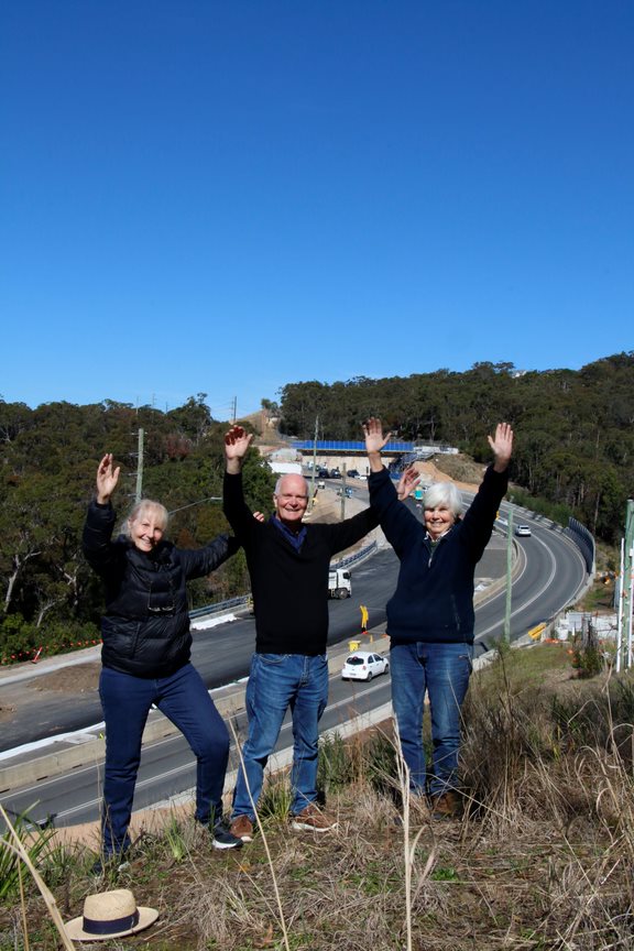
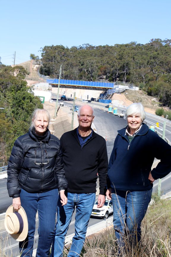
Photo: August 19 2023 - Jacqui Marlow, David Palmer and Marita Macrae celebrate the installation of the MVR East Upgrade fauna bridge supports.
The Wildlife Roadkill Prevention Association aims to reduce the roadkill of native animals on the Northern Beaches of Sydney, Australia. In 2005, the association was formed to address wildlife roadkill and raise awareness of broader conservation issues for our area.
The Pittwater Natural Heritage Association was formed to act to protect and preserve the Pittwater areas major and most valuable asset - its natural heritage.
Pittwater Natural Heritage Association seeks to raise awareness and provide information and advice to members on issues such as:
Find out more and become a member at: https://pnha.org.au