renewed calls to 'fix' wakehurst parkway following rain event provide short-term mitigations ensuring long-term Recurrence
There have been renewed calls this week to mitigate flood prone Wakehurst Parkway. The road has been closed due to flooding for much of this week and on a few days last week as well. As we go to press this morning the parkway has again been closed at 7.20am; the land is already drenched and cannot soak in anymore water.
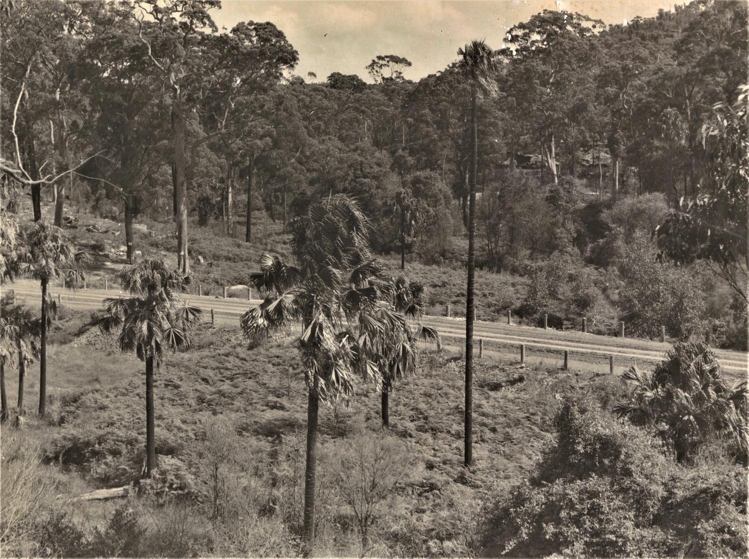
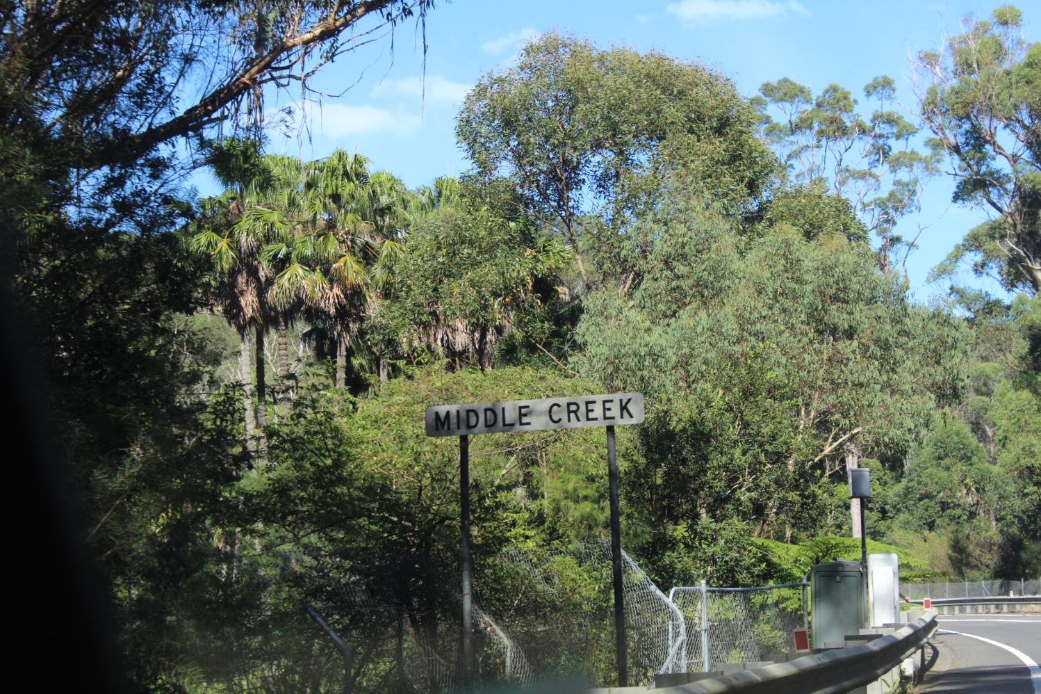
Two serious accidents have occurred at Middle Creek during the past two weeks of rain as well, closing the parkway from early peak hour to midday and later as those involved were taken to hospital and a crash scene investigation took place.
Member for Pittwater Rob Stokes is calling on Northern Beaches councillors to accelerate the Wakehurst Parkway Flood Mitigation Project.
The NSW Government has allocated more than $18 million to implement a series of recommendations for flood control measures along the Middle Creek corridor, which runs adjacent to Wakehurst Parkway.
The funding was secured in the NSW Government’s 2020/21 State Budget and the project options were publicly exhibited by Northern Beaches Council in May 2021.
With a new Council elected in December 2021, Councillors must meet to formally approve the progression of the project.
“The studies have been completed and the funding has been secured – let’s get on with it,” Rob Stokes said on Thursday, March 3rd.
“There’s no question this project needs to be a key priority of the newly elected council.
“This is one of our community’s most important arterial roads and a concerted effort is needed from all levels of government.
“Like many major projects there are environmental challenges to be worked through – but community safety must come first.
“Council staff have done an excellent job behind the scenes – we now need all the Councillors to get on board and make this an absolute priority.
“For the first time ever we’ve secured the funds and have a plan ready to go. We’ve been talking about this for too long – we need to hit the accelerator,” Rob Stokes said
Mackellar MP Jason Falinski has also weighed into calling for Wakehurst Parkway to be fixed this week, posting a video to his social media platform on Facebook. Mr. Falinski stated in this that 'Last night (Feb. 3rd) [we had] 10 centimetres of rain and the major road to the Northern Beaches Hospital is blocked' - also posting; 'We don’t need another study. We need one our most busiest local roads FIXED!'
In February 2020 Mr Falinski stated he had already begun conversations with the then Minister for Urban Infrastructure, the Hon Alan Tudge MP who indicated funding for a study could be made available through the Federal Government’s $4 billion Urban Congestion Fund.
The Federal Government's 'Roads to Recovery Program', supports the maintenance of the nation's local road infrastructure assets, and facilitates greater accessibility and improves safety, economic and social outcomes for Australians. The Program provides funding to all local councils. Local councils are responsible for choosing road projects on which to spend their Roads to Recovery funding, based on their local priorities. The Roads to Recovery Program does not contain a sunset clause under the National Land Transport Act 2014, meaning no new legislation is required for the continuation of the program.
As part of the Local and State Government Road Safety Package announced in the 2019-20 Budget, the Australian Government committed an additional $100 million per year to the Roads to Recovery Program from 2019-20. From 2013-14 to 2023-24, the Government will provide $6.2 billion under the Roads to Recovery Program, with an ongoing commitment of $500 million each year.
The Northern Beaches Council has been allocated $ 7,091,660 overall under the Roads to Recovery Program with the 2021/2022 allocation being $ 1,418,332.
The Federal Government also allocates funding under the Black Spot Program. As part of the Local and State Government Road Safety Package announced in the 2019-20 Budget, the Australian Government committed an additional $50 million per year from 2019-20 to the Black Spot Program. The Government stated it would provide $1.2 billion to the Black Spot Program from the 2013-2014 financial year to the 2024-25 financial year, with an on-going commitment of $110 million each year following.
Nominations for Black Spot locations are invited from state and territory governments, local councils, community groups and associations, road user groups, industry and individuals. On receipt of a completed Black Spot nomination form, the relevant state and territory transport agency will examine the nominated site’s eligibility, and may undertake an economic assessment of a treatment proposal.
Since December 2015 Pittwater MP The Hon. Rob Stokes has secured funding for flood mitigation works. Then Pittwater Council was allocated $220,000 to assist with the preparation of floodplain management strategies and the development of warning and information systems. Key locations identified for projects included residential areas surrounding Narrabeen Lagoon and Great Mackerel Beach.
On August 24th 2017 up to $5 million was to be made available by the NSW Government to support the council’s detailed investigation and the implementation of any practical actions to reduce the frequency of flooding on Wakehurst Parkway. An interim report presented to the council that week found that making changes to Middle Creek, and removing vegetation, may be able to reduce road closures in smaller but more frequent flood events.
In August 2020 the NSW Government announced it would allocate a further $13.1 million to reduce the frequency of flooding along Wakehurst Parkway, bringing total funding for that project to $18.1 million.
In March 2021 the council announced it had completed a Flood Mitigation Study which would be made available in May for community feedback.
Mayor Michael Regan said then it was time for the community to have their say on the approaches available to reduce flooding impacts.
“This a major state-managed arterial road which is closed by flooding approximately six times a year – creating a huge inconveniences for many motorists – which is why we lobbied the State Government for funding for the Study and potential works. However, the Study confirms there are no easy or quick fixes for this issue.
“The road runs through the middle of a sensitive, rich ecosystem supporting an array of threatened plants and animal species, and there are no options that fix the wider flooding problem without environmental impacts. We are right at the beginning of the process – commissioning this feasibility study was the first step in order to get a sense of the options available.
“We have a lot more work to do to make sure we have a full and extensive picture of what flood mitigation measures will mean for the sensitive environment. In the meantime, it’s important the community has an opportunity to have a look at the options documented in the Study and give their initial feedback for us and the State Government to consider. We’ll only proceed with options if we have general community support.
“As this is a significant project, this will be the first of a number of times the community will be asked for input.” Mayor Regain stated.
On May 27th feedback opened with Council stating on the webpage allocated to the project;
Council's webpage states under the FAQ's in answer as to why they are not looking at major road changes which would more significantly reduce flooding;
The draft feasibility study is focused on the smaller more frequent floods that close Wakehurst Parkway rather than the larger flood-proofing, road-raising options. Any large-scale changes to the road of that nature are the responsibility of Transport for NSW and we understand that they have looked at these options but that they have not been progressed further. On this basis Council are examining what could be done (on land that Council has care, control and management of) for these smaller more frequent flood events.
Gazetted Road Number 397 (Main Road) includes; From the junction of Manly Road and Sydney Road (MR164) Balgowlah, via Sydney Road, Frenchs Forest Road and Wakehurst Parkway to Pittwater Road (MR164) Narrabeen. State Roads are maintained by either the RTA’s own Road Services organisation or by contractual arrangements with councils and private contractors. In carrying out work under the contract arrangements, councils work in the capacity of a contractor, rather than as the road authority.
State Roads, including the land under the road reserve are capitalised by the RTA as an RTA asset. Under the Roads Act 1993, councils are the owners and roads authority for State Roads other than Freeways. However, the Act allows the RTA to exercises roads authority functions to the extent necessary for the functioning of a road as a State Road. The RTA generally funds and manages:
- the main carriageway between kerbs in the Sydney built up area
- the road formation and associated drains in rural areas
- the central lanes through towns elsewhere, including traffic lights, roundabouts, signs and line markings
Councils retain responsibility for the road reserve of State Roads, including service roads, footpaths and control of noxious weeds except in situations where the RTA has specified to, or agreed with, council that the RTA would be responsible for specific other assets, works or activities within the road reserve.
Transport for NSW invested at least $700 million to upgrade the road network around the new Northern Beaches Hospital, with works completed in August 2020. TfNSW engaged Ferrovial Agroman and York Civil (FYJV) to deliver the design and construction of the project, while WSP was engaged as the Project Verifier. The project was delivered in two stages; Stage 1: Hospital Connectivity – surface works associated with intersection upgrades and improvements to accommodate the increased traffic generated by the new Northern Beaches Hospital on Forest Way, Frenchs Forest Road, Wakehurst Parkway and Warringah Road, Stage 2: Network Enhancement – the main works associated with improving traffic movements along Warringah Road including a 1.3km long underpass for Warringah Road through traffic between Forest Way in the west and Rodborough Road in the East.
On January 11th 2022 the NSW Government announced the Fixing Country Roads Program, a $543 million program providing targeted infrastructure funding from Restart NSW for regional freight projects. Applications for truck wash facilities can be made through Fixing Country Roads. Local councils can apply to repair and upgrade local and regional roads to facilitate the movement of freight, to key freight hubs and state roads.
On Wednesday January 19, 2022 the NSW Government announced construction of the Western Harbour Tunnel will begin within months, after a $722 million contract was awarded to deliver the first stage of tunnelling. The Western Harbour Tunnel will link WestConnex at Rozelle with the Warringah Freeway at North Sydney via 6.5 kilometre tunnels under Sydney Harbour, with three lanes in each direction.
The Western Harbour Tunnel and the Beaches Link, (which would be a toll road consisting of 7 kilometres of tunnels) will connect the Warringah Freeway at Cammeray to Balgowlah and Seaforth. The 2021-22 State Budget allocated $454 million to the Western Harbour Tunnel, Beaches Link and Warringah Freeway upgrade for the financial year, and $6.3 billion over four years. The project is expected to be completed in 2028.
An Inquiry into the Western Harbour Tunnel and the Beaches Link project commenced in March 2021 and has still not tabled a report on its findings.
The Official Opening of Wakehurst Parkway took place on March 22nd, 1946, meaning it celebrated its 75th anniversary in 2021. On April 16th of the same year serious rainfall and winds impacted on the local population, leaving homeless many of those living in the Narrabeen Lagoon camping area particularly, and flooding local streets. This was a bad storm that impacted many low lying areas along the eastern seaboard and went on for a few days afterwards. Records and old newspapers show this has been a regular occurrence ever since, especially during the change of seasons and what is regarded as storm season; March through June, but can also occur during Summer, January showing up regularly as a time when torrential rains will cut roads with floodwaters.
Data from the council states Wakehurst Parkway is closes for 6 to 7 times a year. The statement does not elucidate for how long each closure is, this week's example showing continued flow of rains will close the road for days in a row, or whether this count includes closures due to vehicle accidents.
The options to put community safety first that would fit under the allocated funding (for 1-2 years) would destroy a large swathe of the Wakehurst Parkway's bushland and impact on several threatened fauna species as well as those that moved from one reserve to the other to feed - our local wallabies for instance. There are also Endangered and Threatened ecological communities in the subject areas which are home to keystone species.
Local organisations have stated the Northern Beaches Council should approach the state government for a better solution.
All have stated the road should be elevated at those flood points via bridges which would allow access for wildlife from one side to the other beneath these and permanently fix the flooding problems without impacting on the bushland and what lives there.
It's the same basic theory people follow in many other life practices; we save for and buy the really good coat because not only will it last a lifetime, it will be the best at keeping us dry and warm and also look as it is for all of that time; the best you can get. Ultimately it will prove to be a lot less expensive over that lifetime of use than the cheap version bought to be thrown out just a few uses later - and there you will be, every time you need it, dressed in the best you can get. Although you may not be able to buy that quality of coat anymore as the wool gets thinned down to stretch profits, there is no reason we cannot build it when it comes to an essential road - we have the knowledge and technology now.
In June 2021 Miranda Korzy, the Greens candidate for Pittwater at the then coming council election, said that since the NSW government closed acute services at Mona Vale Hospital two years ago, the fastest route from Pittwater to the nearest emergency department is along Wakehurst Parkway.
''Yet the government and council, which supported the new hospital site, must have known that this road is flood prone and its single carriageway closes when there’s an accident or bushfire.'' Ms Korzy stated.
“The council has placed residents in an impossible position asking them to choose between a set of unacceptable options,” Ms Korzy said.
“They’re now asking us to choose between upgrading that road, which would still flood at times anyway - and protecting the surrounding environment.
“We must have fast and reliable access to the hospital, but the trees must be protected.”
Six out of seven of the options would have a significant impact on bushland – destroying up to 2,000 trees – an area the size of a small forest. Many now realise that the time to keep getting our environment and its wildlife to foot our bills has long elapsed. Not only that, local sentiment is we have a duty to protect vulnerable species like the Powerful Owl, Large Eared Pied Bat and Red-crowned Toadlet, that live in the bush surrounding Middle Creek.
Although every inch of terrestrial land on earth forms part of a catchment, this is writ large in the Narrabeen Catchment, where the landscape has been modified to suit urban development and problems are occurring. A healthy catchment is one that is still able to function as a catchment should; able to filter and clean water as it flows overland and seeps through the ground, with lots of opportunities for water to seep into the ground so that it can be used by plants. Soil and vegetation actually absorb water, reducing flood impact. Every time a tree is felled, a wetland drained or land developed, the local flood risk is heightened.
This week's IPPC Report, presented in 16 Chapters at: https://www.ipcc.ch/report/ar6/wg2/ and particularly in CHAPTER 11 - Australasia. Chapter 11 assesses climate change impacts and risks, vulnerability as well as barriers and options for adaptation and climate resilient development in Australia and New Zealand, states;
Climate impacts are cascading and compounding across sectors and socio-economic and natural systems (high confidence). Complex connections are generating new types of risks, exacerbating existing stressors and constraining adaptation options. An example is the impacts that cascade between interdependent systems and infrastructure in cities and settlements. Another example is the 2019-2020 south eastern Australian wildfires which burned 5.8 to 8.1 million hectares, with 114 listed threatened species losing at least half of their habitat and 49 losing over 80%, over 3,000 houses destroyed, 33 people killed, a further 429 deaths and 3230 hospitalizations due to cardiovascular or respiratory conditions, $1.95 billion in health costs, $2.3 billion in insured losses, and $3.6 billion in losses for tourism, hospitality, agriculture and forestry. [1.]
Further:
Key risks that have potential to be severe but can be reduced substantially by rapid, large-scale and effective mitigation and adaptation:
...
Loss of natural and human systems in low-lying coastal areas due to sea-level rise, e.g. for 0.5 m sea level rise, the value of buildings in New Zealand exposed to 1-in-100 year coastal inundation could increase by NZ$12.75 billion and the current 1-in-100 year flood in Australia could occur several times a year. - IPCC, 2022: Climate Change 2022: Impacts, Adaptation, and Vulnerability. Contribution of Working Group II to the Sixth Assessment Report of the Intergovernmental Panel on Climate Change [H.-O. Pörtner, D.C. Roberts, M. Tignor, E.S. Poloczanska, K. Mintenbeck, A. Alegría, M. Craig, S. Langsdorf, S. Löschke, V. Möller, A. Okem, B. Rama (eds.)]. Cambridge University Press. In Press.
The 1 in 100 year flood is the still referred to as a mechanism for drawing floodplains maps, most commonly used or referred to for housing. Although it may be great for selling real estate, the reality is the term is not understood, nor does it take into account homes or roads built below the flood level in that floodplain or catchment, or the growing accumulation of data as well as the current lived experience of what is occurring.
The common misconception is that a '1 in 100 year flood', for example, can only occur once every 100 years; or that you are 'safe' for another 100 years after you experience such an event. For example, in Kempsey, NSW, major floods approaching the 1% AEP level occurred in 1949 and then again a year later in 1950. In reality, the chance of experiencing different sized flood events in a given period of time can be estimated mathematically. If you lived for 70 years in a location that had a 1% chance of flooding in any one year (that is, it would only flood if a '1 in 100 year flood' occurred), then there would actually be a 50% chance, or one in two odds, of you experiencing at least one flood during that 70 year period. The way we calculate this is: 100% minus the chance of a flood not happening 70 times in a row, i.e. 0.5 = 1 - 0.9970.
In recent years the '1 in 100 year flood' has become an annual event. For a road that is part of a catchment, and includes a waterfall as part of what is in that landscape, this will occur every time we have a significant rain, stated to become much more frequent.
A 2018 Narrabeen Lagoon Floodplain Risk Management Plan prepared by Cardno for the council delves into this. In the conclusions of this report it was noted that;
''The assessment of management options in the Floodplain Risk Management Study facilitated the identification of the most beneficial options (in terms of hydraulics, economics, environmental and social issues). A priority list has been recommended in this Floodplain Risk Management Plan that is a mix of structural and non-structural options to reduce the likelihood and / or consequence of flooding at locations in the catchment.
This plan should be regarded as a dynamic instrument requiring review and modification over time. The catalysts for change include new flood events and experiences, legislative change, alterations in the availability of funding and reviews of Council planning policies. In any event, a review every five years or so is warranted to ensure the ongoing relevance of the Plan.''
ALL of the options presented so far would only mitigate floods for a 1-2 years period. The reason the council took this approach is defined under their Frequently Asked Questions:
Why are we only looking at flood-protection options up to 1-in-2 years?
Historically, the most frequent flooding observed on the Parkway, and cause for disruption for the community and drivers has been for 1-in-2 year rainfall events or those more frequent.
The mitigations proposed within the feasibility study addresses these and would significantly reduce the need for road closures associated with these smaller events.
More intense floods are likely to trigger flooding from Narrabeen Lagoon and not just Middle Creek. Mitigating the impact of these events will need significant amounts of investment, modification to the Parkway, and would also need to put measures in place around Narrabeen Lagoon. This extensive piece of work has larger environmental implications and would merit its own investigation.
Without a fully funded permanent fix approach the community and the taxpayer would be locked into a cycle of perpetual ongoing costs, continued flooding events closing the carriageway, and continued accidents along its worst sections.
The list compiled from feedback sent in from other community groups for reducing (Note: reducing not removing) the numbers of days per year that the Wakehurst Parkway needs to be closed due to flooding included:
1. None of the presented proposals will prevent ALL flood events along the Wakehurst Parkway, particularly if you take into account the increasing frequency of flood events predicted due to Climate Change.
2. In common parlance, the proposals are "Band-aid Solutions" that fit within the given budget provided by the Roads and Maritime Services (RMS) for now.
3. Wakehurst Parkway is a STATE road and, with the Hospital and proposed Frenchs Forest area development at the top of the hill, the Parkway is a crucial link that needs to be properly funded by State Government.
4. The Northern Beaches Council has been requested to provide solutions that involve using the surrounding bushland - letting the RMS off the hook from having to do anything about the road itself.
5. The RMS may say that the water comes from the surrounding environment and that the administrators of the bushland must solve the problems but actually, it is the alignment of the road that has caused the modification of the surrounding environment that now causes the flooding. It is the road that needs to be modified not the surrounding environment.
6. The flooding occurs at several different locations along the Wakehurst Parkway.
7. ALL the given proposals involve serious environmental disturbance including:
a) removal of large areas of bushland and
b) exposing contaminated sediments that would need to be treated (and the cost of de-contaminating those sediments is not revealed)
8. There is no discussion of other solutions to the flooding issues - such as raising the road or building bridges at critical points. The RMS has studied some of those solutions and concluded that they are too expensive but there is no mention of them in the current list of options. The public deserves to know the cost of doing the flood proofing PROPERLY.
9. If the road were elevated by bridges, animals could move through underneath. The road needs to be redesigned to allow for animals to move safely from one area of bushland to another.
10. It is not a satisfactory process to ask the public to choose between bad solutions and worse solutions without revealing the costs and the environmental impacts of a good or better solution.
The only option (in the proposals that went on exhibition) not expected to cause significant environmental damage would involve building a levy on one section of the road, which would make only a minor reduction in flooding – and possibly create ‘some negative impacts at certain flood return periods’.
“It’s hard to accept the proposal’s statement that ‘Background research and field inspection of the study area’ were enough to conclude that none of the known 59 Aboriginal sites in the area would be impacted,” said Ms Korzy, who has addressed the council on a number of occasions about problems with the road.
“We can’t afford to lose yet more bushland because of poor hospital planning.
“It should not be the council’s responsibility to fix a state road that provides access to a major piece of state infrastructure.
“It must go back to the state government and ask for a properly funded solution that raises the road without destroying the forest.” Ms Korzy stated.
With soo much spent on road upgrades around the new hospital that stretch of the Wakehurst Parkway between Oxford Falls and Pittwater Road, North Narrabeen and all living north of North Narrabeen need a proper solution.
As the priority to save human lives, where motor vehicle accidents still occur on a weekly basis in the stretches of North Narrabeen into Wakehurst Parkway as well as along that road length itself, a permanent solution is what is being called for, needed, and that would be broader in scope then that now allowed for.
The feedback already provided could support and empower the Council and the State Government and our local representatives in the Member for Pittwater, Member for Wakehurst and Member for Davidson to choose and fully fund the option that will fix the problem while still retaining the bush and in doing so, save the lives of people as well as all the wildlife and endangered plant communities it is our privilege to be the current custodians of.
Our area was spared most of the heavier rains that have caused devastation elsewhere in this state and in Queensland this week, but as day after day the Wakehurst Parkway is closed as the catchment is already sodden and cannot take in any more water through the seepage any healthy catchment will.
With so much current and historical data pointing out this will recur and get worse, short-term 'fixes' combined with immediately commenced long-term solutions with an horizon to horizon view reinforces a mthod for approach. Before developers are allowed to expand the urban footprint and density throughout this area, installing more hard, impermeable surfaces, installing more roads, footpaths and carparks and replacing absorbent green spaces, and thereby increasing the likelihood of flooding, decisions which all refer back to working with the environment rather than against it must be at the core. We ignore this at our own, and our children's peril.
As with so many issues impacting the community lately, what is occurring is a reflection of current policy put into practice - that does not mean policy and practice cannot be shifted to a better solution being found and followed.
It's time to invest in the good coat.