The Pittwater Council McKay Reserve Plan of Management (Adopted November 28 1994, Amended December 2, 2001), just 25 years ago, states:
'McKay Reserve is an area of remnant bushland in Palm Beach on the steep western facing slopes above Pittwater managed by Pittwater Council. Bush regeneration work has been carried out in the Reserve for a number of years, by local resident volunteers and professional bush regenerators under Council's supervision. Dark Gully Park is a small reserve on the foreshore of Pittwater at the lower end of Dark Gully Creek and directly adjoins McKay Reserve.
Aboriginal people lived in the area for several thousand years prior to European occupation. The local aboriginals belonged to the Guringai group who inhabited the land between Port Jackson and Broken Bay. The diverse range of food resources in the Pittwater - Barrenjoey area attracted aboriginal people to the area. The forests and woodlands provided a plentiful supply of plant foods throughout the year.
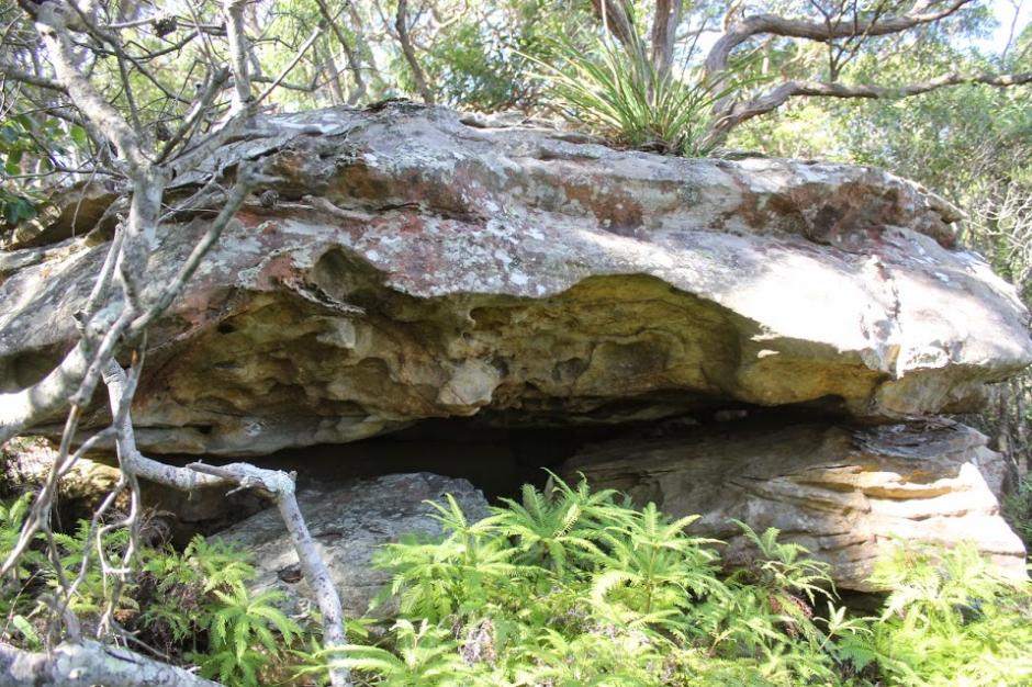
A number of aboriginal sites have been located within McKay Reserve and Dark Gully Park. These include a rock shelter with hand stencil and shell middens, including one with a stone axe. Precise location details are not divulged as a matter of policy [to prevent vandalism of these sacred sites].'
There are also known sites for the original custodians of this place along Pacific Road, marking the ridgelines, outlooks, and pathways as well as the known shelter places, of which must have formed the original songlines of this place and the annual turns across the lands of what Europeans call the 'Guringai' peoples.
Part of the Napper grant was acquired by the State Government in 1881.
Charles John Edward Forssberg purchased 31 acres of the original Napier Grant fronting Pittwater from the then Wentworth Estate on the 23rd of August 1900.
The earliest recorded use of the name 'Palm Beach' for the locality was in 1911-1912 to liken the Barrenjoey Peninsula to the then more famous 'Palm Beach' of America, a popular holiday spot for the rich and famous. The name derives from the Cabbage Tree Palms which occur in the area, behind the beach and in Dark Gully.
In 1911 a group of Sydney businessmen purchased the remainder in the name of the Barrenjoey Land Company Limited. The 'by stages' subdivision of the Palm Beach area into housing allotments commenced in 1912 and was far more successful than the earlier subdivision plan.
Dark Gully Park/Reserve: 10.5 acres/ 4.29 hectares dedicated in March 1925
Dark Gully Park is a small reserve on the foreshore of Pittwater at the lower end of Dark Gully Creek and directly adjoins McKay Reserve at its upper, eastern end. This is the first part of this green bushland dedicated to the then current and future generations, with a March 18 1925 Warringah Shire Council meeting confirming in its minutes this came from the Palm Beach Lands Company.
Dark Gully Park is a historic local reserve located at 933B Barrenjoey Road, Palm Beach, New South Wales. Positioned along the shore of Pittwater at the mouth of Dark Gully Creek, it represents an important piece of early 20th-century conservation on the peninsula.
Dark Gully Reserve is a key component of Pittwater Council’s popular Beach to Bay Walk. This walking trail seamlessly links four historic local reserves: Hordern Park, Wiltshire Park, McKay Reserve, and Dark Gully Park.
The reserve protects an essential pocket of native bushland, a natural watercourse, and an intertidal foreshore. It functions as a critical wildlife corridor, offering a safe urban transit pathway for native fauna and local bird populations.
For the local boating community, the reserve provides steep pedestrian path access to the edge of Pittwater. The council maintains a watercraft storage facility featuring 21 dedicated dinghy slots available for hire.
In Barrenjoey Road (Roads In Pittwater) the sandspit alongside the estuary at the Careel Bay end, included in descriptions from early walkers to the Barrenjoey Headland, naming Dark Gully and other recognisable features along the way. The photographs of the Allen Family, and later, the then Department of Main Roads, record the shift from a thin track to a wider unsealed track, and eventually something that could barely be negotiated by early motor vehicles, led to open access along sand covered roads and subdivisions that eventually ensured every available block of land for housing was bought and then filled with a structure of some form.
An extract from an early account, A Ride to Barranjoey, describes:
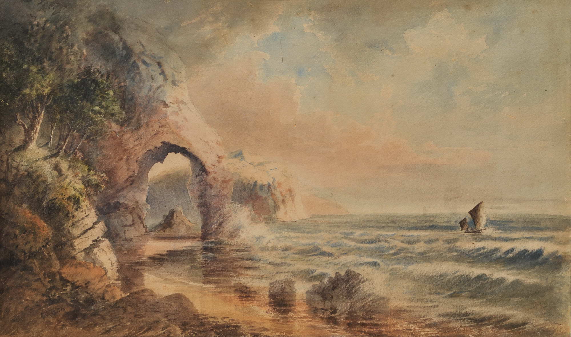
W.H. Raworth (Brit./Aust./NZ, c1821-1904). St Michael’s Arch, NSW [Avalon] c1860s. Watercolour, signed lower left, obscured title in colour pencil verso, 34.2 x 56.5cm. Tear to left portion of image, slight scuffs and foxing to upper portion. Price (AUD): $2,900.00 at:https://www.joseflebovicgallery.com/pages/books/CL181-53/w-h-raworth-c-brit-aust-nz/st-michaels-arch-nsw-avalon

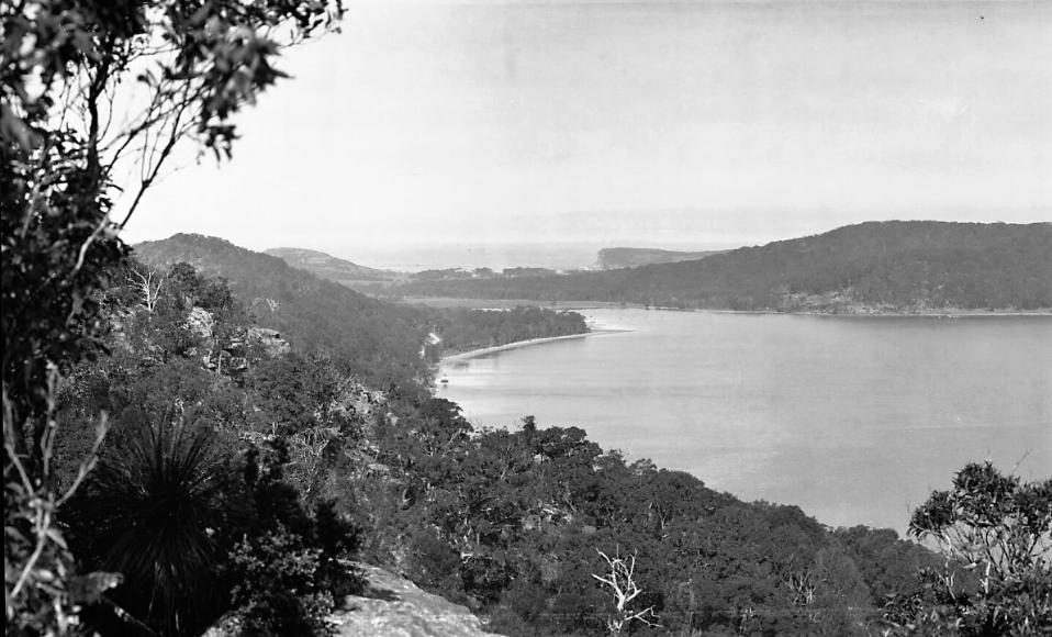
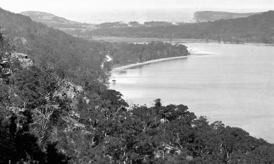
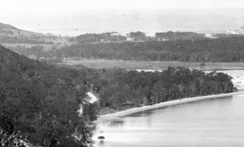
From Newport ocean beach to Barrenjoey, two steep hills have to be encountered; the first is in very bad repair, the surface being denoted by large stones, gutters, and nearing top, heavy, loose sand, which necessitates careful riding on account of its proximity to the cliff. There is also a very rough descent, with loose sand, large stones, gutters, and irregularities. To the foot of the second hill there is a cart track, which is very heavy with loose sand. The road has been neglected. The second hill is the same as the first, yet not so loose with heavy stones, but is steeper in places. The descent is bumpy, and covered in loose sand, and is altogether badly neglected.
Then the road becomes a track which is more or less covered in sand. Here, a sign-post is met, which very indistinctly points the way to Barranjoey; those unable to read it will keep to the right. From here the road becomes rough and indistinguishable. From a track it becomes a grass field, but keeping straight on, the track is once again picked up in very loose sand, which is deep in places, but the absence of big stones is something to be noticed.
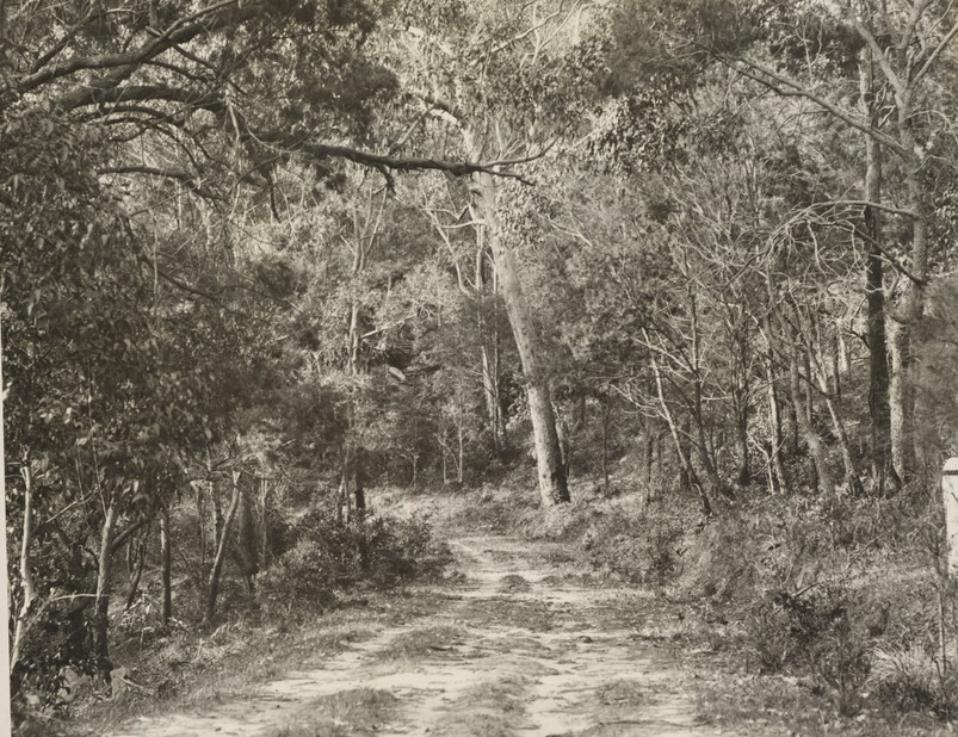
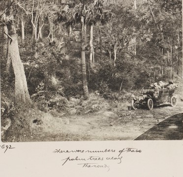
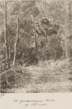
The premature track is in places fair, but mostly rough, with loose metal and occasional pinches on to Barranjoey. The trip from Newport to Barranjoey is, altogether, unpleasant for the motorcyclist at the present time. I would advise that the rider who wishes to visit the beautiful resort for the week-end leave his machine at Newport, and take the ferry, which runs twice a day from Newport and Bayview. This is advised if he has any respect for his 'jigger.' Petrol cannot be purchased at Barranjoey, but should the motor-cyclist's tank become dry, he has only to ask the ferryman to bring the required quantity back on the next run. MOTORS AND MOTORING (1913, February 2). Sunday Times (Sydney, NSW : 1895 - 1930), p. 18. Retrieved from http://nla.gov.au/nla.news-article126462595
Originally these lands were part of the Archpriest J J Therry grant at its southern Avalon Beach - Careel Bay end, with around 170 acres comprising Lots I and II of that northern Careel Bay-Whale Beach Therry lands.
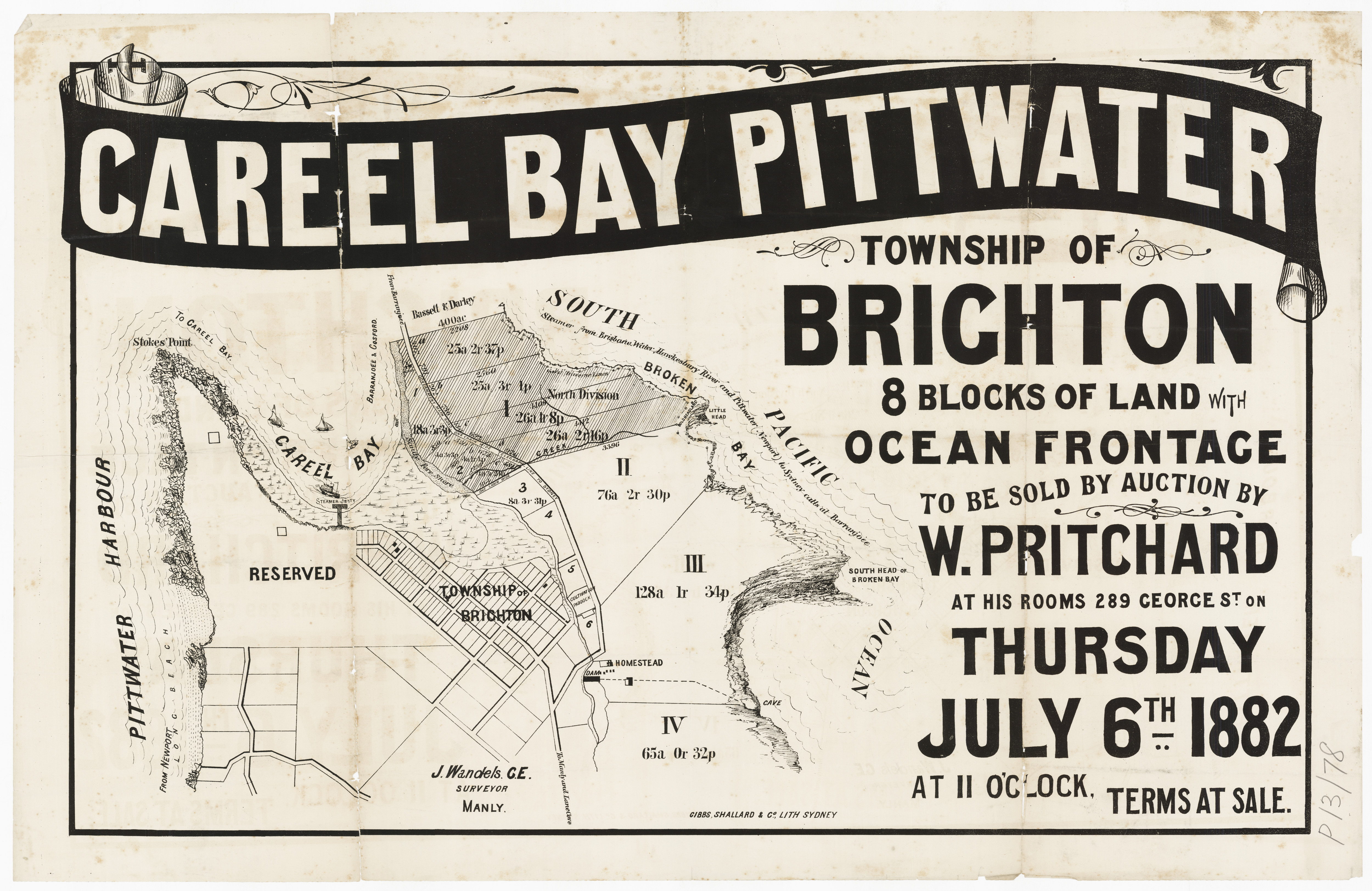
Careel Bay Pittwater - No boundaries shown, 1882. Item No: c053460084, courtesy State Library of NSW.
It should be noted that 'Careel Bay' on earlier maps, and through the 1920's, was described as stretching from the Dark Gully and MacKays Reserve at Palm Beach end of the Pittwater estuary down to what we today call Careel Bay.
IN THE MATTER OF THE BARRENJOEY COMPANY, LIMITED.
AT an Extraordinary General Meeting of the above named Company, duly convened and held at 92b Pitt street, Sydney, on the nineteenth day of June, one thousand nine hundred and twenty-four, the following Resolution was duly passed, and at a 'subsequent Extraordinary General Meeting of the Members of the said Company, also duly convened and held at the same place', on Monday, the seventh day of July, one thousand nine hundred and twenty-four, the same Resolution was duly confirmed, as a Special Resolution, viz.: —
That as a result of the recent disposal of substantially the whole of the Company's land, it is advisable to wind-up the Company and accordingly that the Company be wound up voluntarily; and at such last-mentioned Meeting the following Extraordinary Resolutions were passed: —
1. That George Mason Allard, John Malbon Ralston, Ernest Ebenezer Way, and Harry Wolstenholme, be appointed Liquidators for the purpose of such winding-up.
2. That their salary be fixed at one hundred and eighty pounds among them for the first year.
3. That, as regards Mr. J. M. Ralston, he shall be entitled, in addition to his remuneration as a Liquidator, to be paid all usual Solicitor's Profit Costs and Disbursements in connection with any legal work which he may be instructed to do by the Liquidators in his capacity as solicitor.
Dated at Sydney, this 17th day of July, 1924.
H. WOLSTENHOLME, Chairman.
Witness,—E. E. G. de Gyulay. £1 12s.
IN THE MATTER OF THE BARRENJOEY COMPANY, LIMITED. (1924, July 18). Government Gazette of the State of New South Wales (Sydney, NSW : 1901 - 2001), p. 3572. Retrieved from http://nla.gov.au/nla.news-article222025488
First directors:
Palm Beach Lands, Ltd., has effected registration with an authorised capital of £15,000, In £1 shares. To traffic in land, house, and other property is the aim of the new company. First directors: R. R. M'Kay, E. B. Harkness, and A. M. K. Scott. COMPANY NEWS. (1924, July 31). The Sydney Morning Herald (NSW : 1842 - 1954), p. 11. Retrieved from http://nla.gov.au/nla.news-article16177971
In fact R T McKay was Chairman of this new company, not R R McKay. This new group enlisted the expertise of Willmore and Randell, who were looking after Avalon Beach subdivisions by then. Their take on selling block of land at Palm Beach was to focus on the company new owners would be among, not the permanent residents.
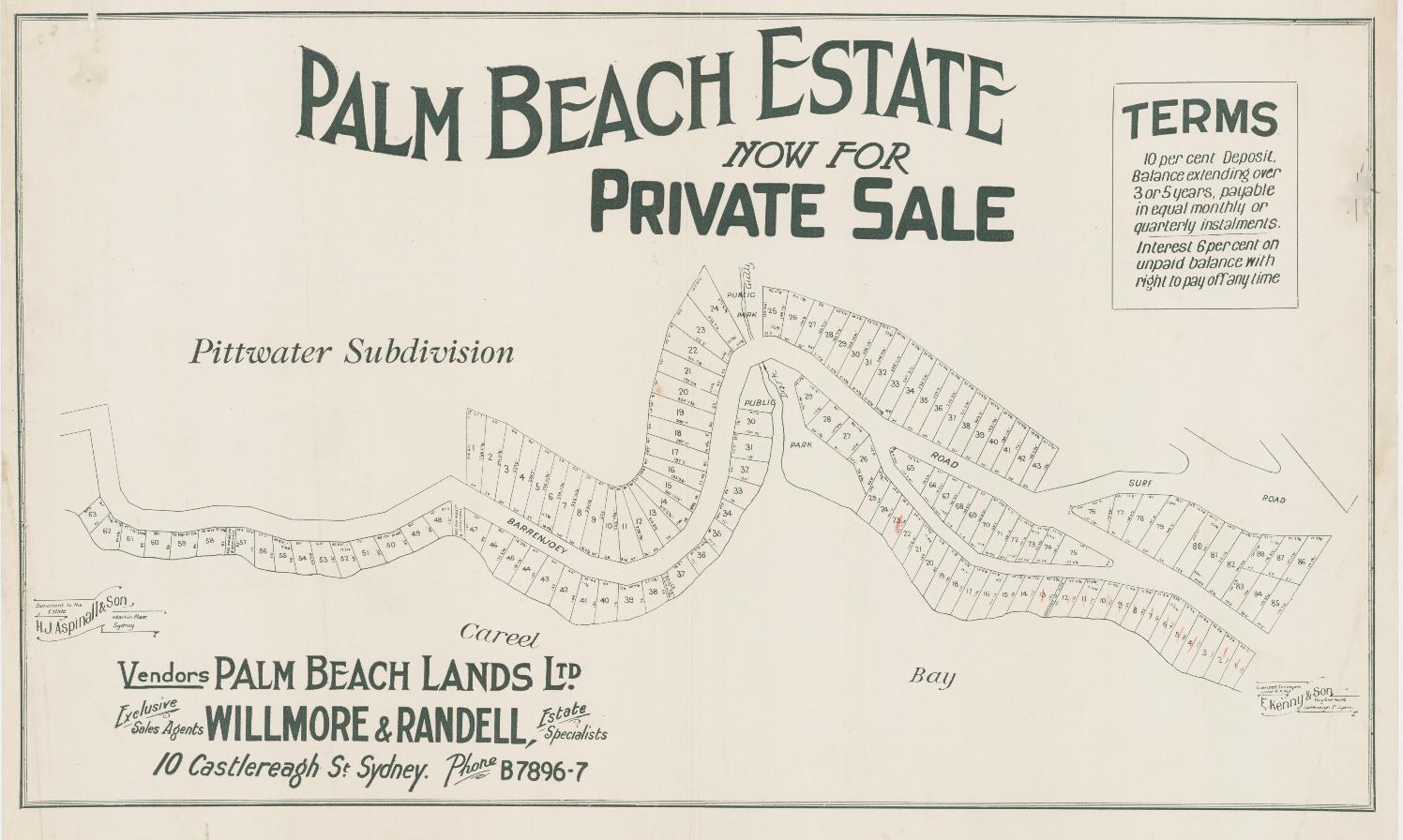
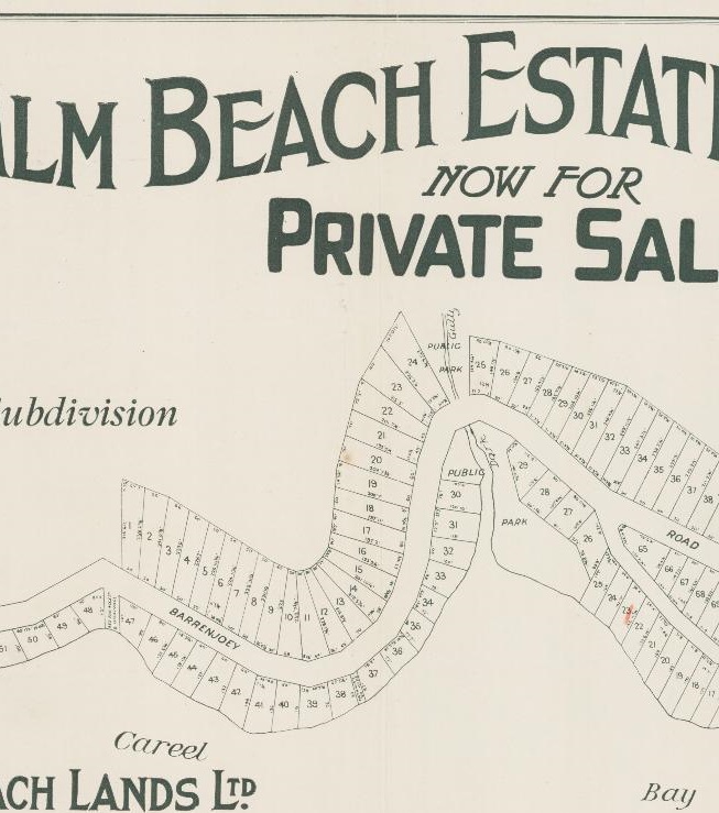
Palm Beach Estate - Barrenjoey Rd, Surf Rd, - shows Dark Gully Park has already been created - Willmore & Randell, from Palm Beach subdivision plans, for Palm Beach Lands Ltd.. Item c052700017, courtesy State Library of NSW
 Palm Beach Estate - Ocean Rd, Northview Rd, Sunrise Rd, Florida Road, Boanbong, Cynthea, Ralston. Item: c052700015, courtesy State Library of NSW
The Warringah Shire Council Meeting held August 23 1920 records:
Palm Beach Progress Assn. , 5/8/20, on Barrenjoey Road between Dark Gully and Palm Beach. Referred to Engineer
The Warringah Shire Council Meeting of July 24 1922 records:
That £50 be voted for - (Votes) metalling bad portions of Barrenjoey Road, between 16 and 17 m.p.s (mile pegs); £30 for a pipe culvert at Dark Gully on Barrenjoey Road and £50 for general maintenance of Florida Road and Pacific Road, Palm Beach. -
The January 27, 1925 meeting records:
Item 17. E. Kenny. 14/1/25, submitting plan of subdivision of parts of Palm Beach Lands Ltd's property at Palm Beach. Sub.Resolved, - (Crs.. Oanij1ell, Hewitt) That it be referred to the Engineer for report; attention to be given to public recreation requirements.
The Wednesday March 18 1925 Meeting records in its Minutes the dedication of Dark Gully Park and, for some reason, the council getting land to sell here as well:
Palm Beach Estate subdivision. - conference took place at Palm Beach, between the Council and representatives of Palm Beach Lands, Ltd. relative to proposed subdivisions of the Palm Beach Estate, the Company being represented by Messrs. McKay, Harkness, Scott, DeGyulay, and Surveyor Kenny.
Three plans were considered, namely -
(1) a plan showing the general lay-out of the subdivision of the whole of the un-subdivided residue of the estate; (2) plan of subdivision of a section of such residue in the vicinity of Pacific Road, to be styled ''No. 9 Subdivision'', and (3) a plan of subdivision to be styled ''No.. 8 Subdivision'', of land lying between Barrenjoey Road and Cartel Bay.
Inspections were made in connection with the last named two.
It- was resolved, - (Crs. Hewitt, Hitchcock) That the plan of No. 9 subdivision he approved, subject to the following conditions.
1. The new roads to be constructed to the Council's specification.
2.. The proposed 4-ft. road to be widened at its ''dead-end''; to 60-ft., to allow motors to turn with ease.
3. A pathway to be constructed for foot-passengers along the 20-ft. pathway, ''Public Park''; and 20-ft, drainage reserve connecting Pacific Road and Florida Road.
4. Drainage easements to be provided wherever required by the Shire Engineer; further that pending the carrying out' of those requirements, the Company be allowed to sell the allotments fronting the existing road namely, Florida Road and Pacific Road.
In connection with No. 8 subdivision, the Company agreed to dedicate to the Council the Reserve on the Pittwater front extending from Dark Gully southwards to the allotment on which the fishermen's camp stands, the western boundary to be as fixed, indicated by natural land marks. It was resolved, - and (Crs. Hewitt, Hitchcock) That the plan be approved subject to the reserve being dedicated, as promised, and that satisfactory access be given it from the Barrenjoey Road subject also to the new road being constructed to the Council's satisfaction, and drainage easements provided wherever required by the council; further that the Council be allowed to proceed with the sale of lots fronting Barrenjoey Road.
3. Seaside Camp at Bilgola. Consideration was given to a proposal, as published in the press to obtain a grant of Crown land at Bilgola Beach, for the purpose of establishing a seaside camp there for families from the interior of the State, and it was resolved, - (CrS :;or?itt, Hitchcock) That a letter be sent to the Minister for lands objecting to the proposal on the grounds 'that the beach is not a safe, and is not protected by life-savers, and that there is neither sanitary service nor water supply there,
The Minutes were confirmed March 23 1925, also confirming Dark Gully Park and bush reserve. The sale of these lots then proceeded, and were described in this advertorial as:
PALM BEACH
ATTRACTIVE SEASIDE RESORT - Incomparable Views
With the rocky headland of Barrenjoey standing guard at the northern extremity, the broad bosom of the Pacific swelling lazily on the right, and the beautiful waters of Broken Bay, on the left, lies Palm Beach, one of the wonder seaside resorts on the New South Wales coast. From the heights of Palm Beach incomparable landscape and seascape views are to be obtained. In Broken Bay the many inlets and small islands make a most charming picture, while the 'Basin' is most popular with yachtsmen. Then there is Careel Bay and Pittwater, affording excellent swimming, boating and fishing facilities, while at Palm Beach itself there is a splendid surfing beach fringed with golden sand. Also, from the heights on Pacific-road, the township of Hawkesbury and Ocean Beach, Woy Woy, are discernible, while Lion Island adds a picturesque touch to the already lavish picture that Nature has painted. Willmore and Randell, real estate specialists, are offering a limited number of home sites for sale at Palm Beach, and they should appeal to the city business man who is seeking a block of land in a marine suburb not too close to the city. It must be remembered that Palm Beach is the last of the ocean beaches within reasonable distance of Sydney, and the completion of the North Shore Bridge will result in quicker transit to that popular resort. These home sites front Florida-road, Pacific-road and Palm Beach-road, and are commodious in size and practically all commanding wonderful views. The selling agents arrange motor inspections by Appointment only, and cars leave their office, 10 Castlereagh-street, daily. To anyone desiring further particulars. Willmore and Randell will forward an illustrated booklet upon application. As an indication of the exclusiveness of the locality, the following list of residents' can be cited: Lady Maitland, A. J. Hordern. Esq., Dr. Gordon Craig, Dr. Goodsell. B. B. Wiltshire, Esq.. Dr.Thring, W. H. Rayner. Esq., G: Mason Allard, Esq.. W. Lipscombe, Esq., Dr. Blaxland, W. Chorley, Esq., W. Lewis, Esq., C. P. Curlewis. Esq.. T. Peters. Esq., Dr. Bullmore, Dr. Brown, C. R. Crossmnn, Esq., E. Gray. Esq., E. R. Moser, Esq., Dr. Brown Craig. PALM BEACH. (1925, October 4). Sunday Times (Sydney, NSW : 1895 - 1930), p. 4. Retrieved from http://nla.gov.au/nla.news-article128163200
However, then as now, Dark Gully could be a problem for the unwary:
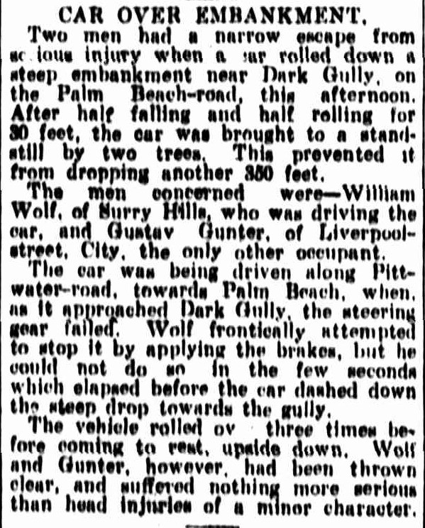
CAR OVER EMBANKMENT. (1930, November 3). Newcastle Morning Herald and Miners' Advocate (NSW : 1876 - 1954), p. 7. Retrieved, from http://nla.gov.au/nla.news-article135440379
Some of this holding towards the Dark Gully end included parts of the Forssberg Estate inherited by Charles Forssberg's children. The corner of Dark Gully Park had originally been sold to William Davison of Annandale, a Stonemason in 1935, who sold it to Annie Florence Derrin, wife of Andrew Derrin of Balmain, Merchant, even before the Certificate of Title was formalised. Mr. and Mrs. Derrin
SILVER WEDDINGS.
DERRIN-SOLOMONS.-January 27, 1904, at St. Mary's Church of England, Balmain, by Archdeacon Charlton, Andrew, eldest son of Joseph and Margaret Derrin, of London, to Annie Florence, youngest daughter of William and Elizabeth Solomons of Sydney. Family Notices (1929, February 9). The Sydney Morning Herald (NSW : 1842 - 1954), p. 16. Retrieved from http://nla.gov.au/nla.news-article16529833
A Survey for the purposes of acquisition - Barrenjoey Road (Dark Gully) - Warringah - was undertaken by N.J Cunningham - 26.10.1936. NSW Records and Archives records NRS-13859-384-1-BS_9407_3000 are a 'PLAN Shewing land to be acquired in connection with the proposed widening of part of Barrenjoey Road at Dark Gully. MAIN ROAD No. 164 Parish of Narrabeen County of Cumberland'.
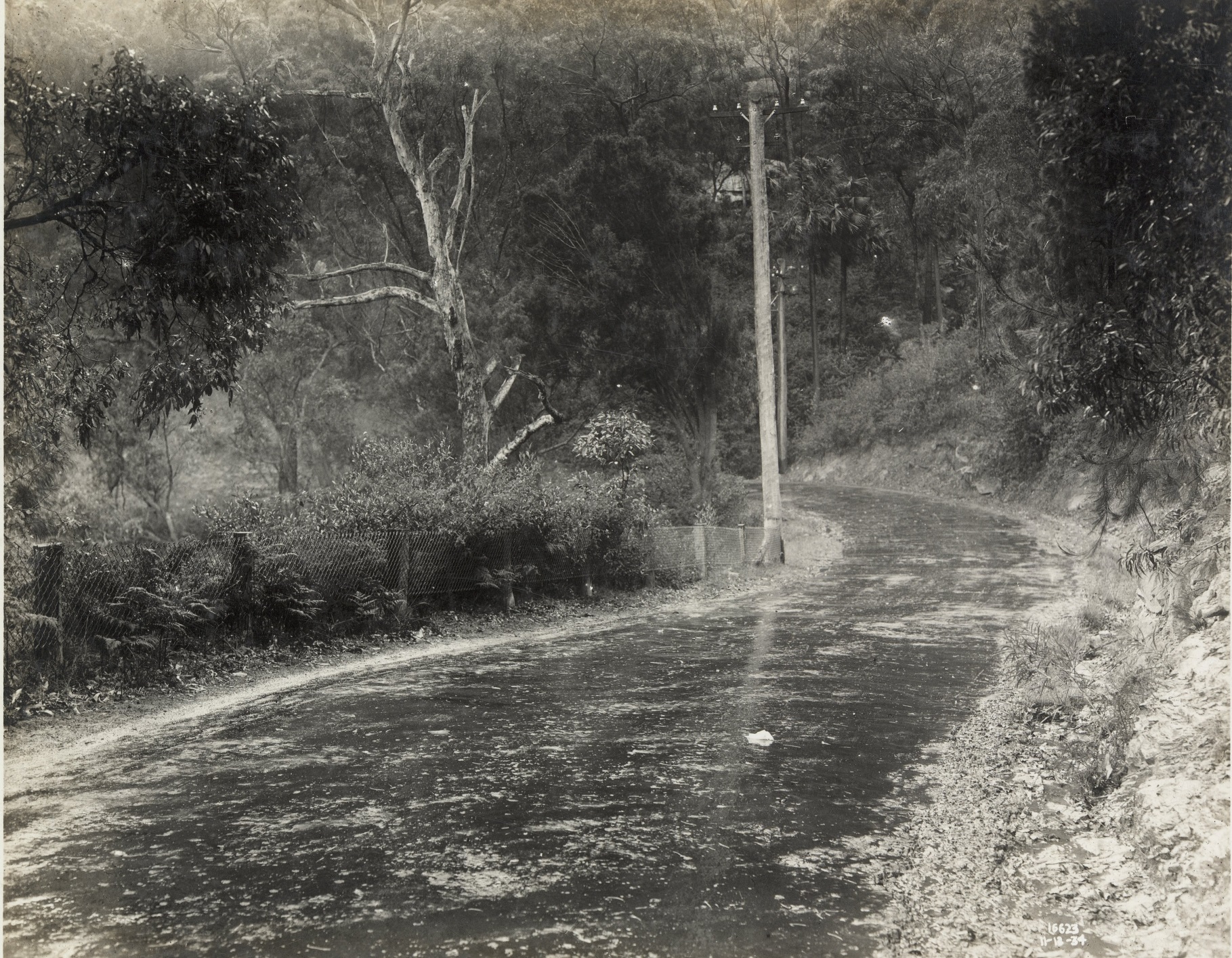
Barrenjoey Road. M.R. 164. [Main Road].''Curve between Avalon and Palm Beach'', 11th December 1934. Item: FL118070, courtesy NSW Records and Archives
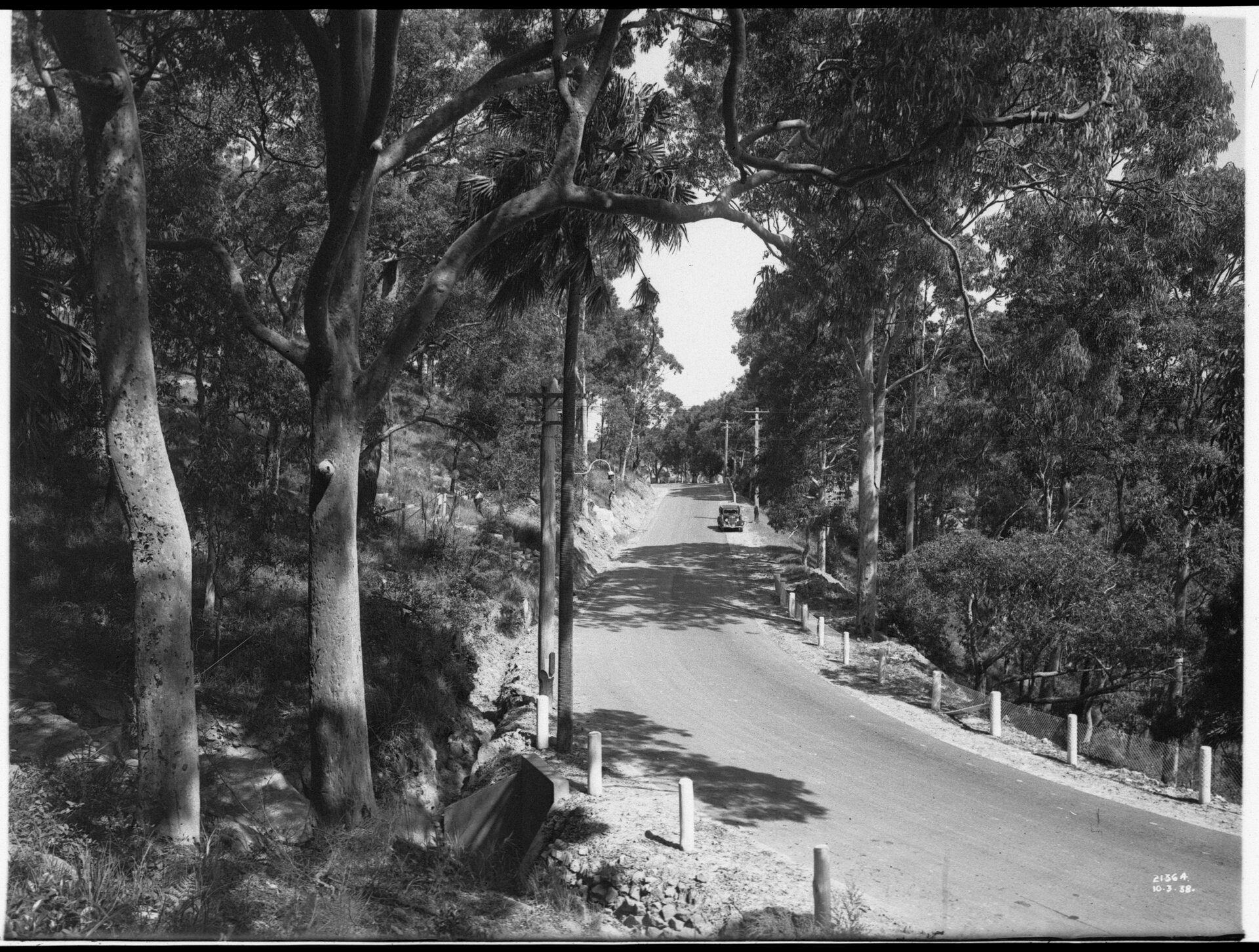
Main Road 164: Little Dark Gully, looking south [From NSW Government Printer series - Main Roads] Date: 10 March 1938 to exact 10-03-1938 . Format; Glass plate negative, Images provided courtesy of the State Library of New South Wales and NSW Records and Archives - note the stonework and piping to channel Dark Gully Creek into Pittwater.
The survey was undertaken and a portion of the land resumed:
NOTIFICATION UNDER THE PUBLIC ROADS ACT,
1902, OF RESUMPTION AND DEDICATION OF LANDS FOR ROAD, OF DECLARATION OF ! EXISTING ROADS TO BE PUBLIC ROAD, AND OF THE CLOSURE OF ROADS DEEMED TO BE UNNECESSARY.
IN pursuance of the provisions of the Public Roads Act, 1902, I, the Right Honourable John de Vere, Baron" Wakehurst, Governor of the State of New South Wales, with the advice of the Executive Council, do hereby notify that the lands hereunder described, which are
required for the roads hereunder specified (in respect of which roads notice of proposal to open the same has been duly given), are hereby resumed for the roads referred to; also that the said lands are hereby dedicated as public roads (except where otherwise stated); also that the existing roads particularised hereunder are hereby declared to be public road and dedicated to the public accordingly; and also that the roads hereunder specified, which are deemed to be unnecessary (in respect of which notice of proposal to close the same has been duly given), are hereby closed.
WAKEHURST, Governor. COLIN A. SINCLAIR, Minister for Lands.
Description of Road opened:—Widening of part of Barrenjoey-road, near-Palm Beach (Main Road No. 164), parish Narrabeen, county Cumberland,—as shown on plan deposited in the Department of Lands, Sydney, and catalogued R. 20,536-1,603. R. 37-1,167. D.M.R. 479-1,151.
Particulars of land now resumed for the road specified and dedicated as a public road are given in Schedule hereunder.
A proposal to resume the land referred to for the road in question was published in the Government Gazette of 18th February. 1938, page 764.
Land District—Metropolitan; Shire—Warringah. Parish
Portion No. 18 (now sub-divided). Area. a. r. p. 400 0 0 Parish Name. Narrabeen Reputed Owner. (Mrs.) Annie Florence Derrin. Occupier. Character of Holding. Freehold Width of Land Resumed. Variable . Area Resumed. a. r. p. 0 0 11perches Title Reference, Part C.T., vol. 4,706, fol. 87. NOTIFICATION UNDER THE PUBLIC ROADS ACT, 1902, OF RESUMPTION AND DEDICATION OF LANDS FOR ROAD, OF DECLARATION OF EXISTING ROADS TO BE PUBLIC ROAD, AND OF THE CLOSURE OF ROADS DEEMED TO BE UNNECESSARY. (1939, March 10). Government Gazette of the State of New South Wales (Sydney, NSW : 1901 - 2001), p. 1235. Retrieved from http://nla.gov.au/nla.news-article222062106
This had been purchased from Vol-Fol: 3885-154 and the Forssberg Estate portion that went to Christina Forssberg and Valetta Eccles, wife of Herbert Eccles of Manly, Sharebroker, after their father passed away in July 1921.
%20vol%203429.%20folio%20234.jpg?timestamp=1644356444054)
%20vol%203429.%20folio%20234.jpg?timestamp=1644356475185)
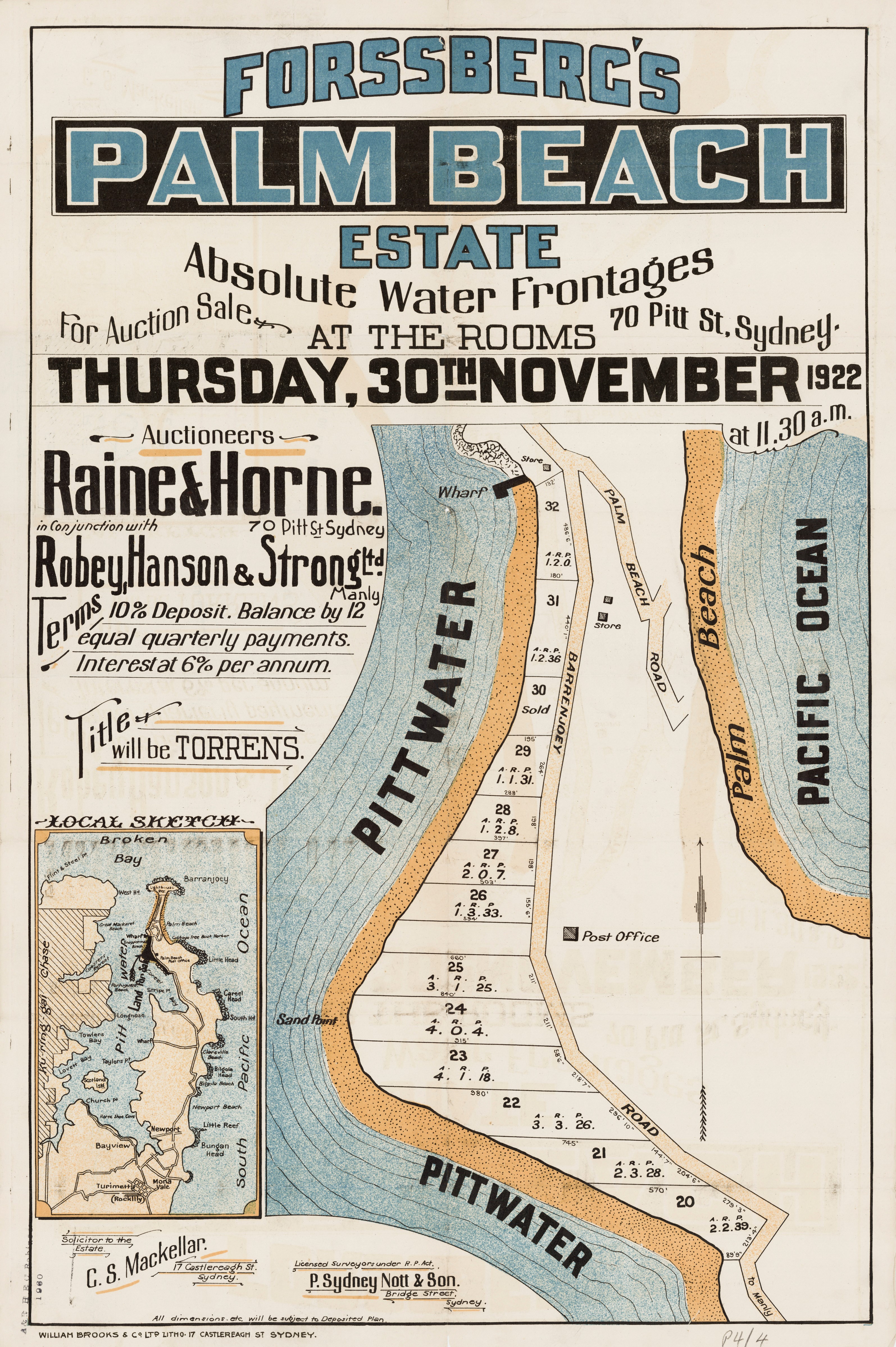
Land resumed from Mrs Annie Florence Derrin – Vol-Fol: 4706-87 for road widening at Dark Gully – becomes Vol-Fol 5164-182:
.jpg?timestamp=1790130322564)
.jpg?timestamp=1790130449093)
.jpg?timestamp=1790130351805)
On November 20 1942 Annie transfers more land to the Metropolitan Water Sewerage and Drainage Board for another Easement. – Vol-Fol: 5164-181. Lot 62 – in the middle and of 30 perches, with the creek running through down into Pittwater. She sells to Robert Gilroy Potts on August 22 1950 and he sells to William James Boyce, Victor John Boyce and Cyril Frederick Colin Boyce (of Rose Bay, Company Director) on November 29 1954 – becomes Vol- Fol: 6928-33,34 and 35.
Robert Gilroy Potts has Lot 62. His Certificate of Title records the transfer to the Warringah Shire Council of a right of a footway, as fully set out in Vol-Fol: 7351-247, on May 25 1959 – which is a pathway down to the water and measures 3 roods and 8 ½ perches, at the perimeter of Lot 61. This is formalised on January 16, 1961.
Lot A of this holding is sold to ‘Seamist Charters Pty Ltd’ on May 25 1959 – Vol-Fol: 8087-162 – and contains the accessway.
The January 4 1957 WSC meeting records weeds need to be cleared from the lower section - a problem that persists today:
By Cr.Reynolds: Will you have steps taken to clear Dark 'Gully, Palm Beach, of blackberries, nettles, etc, local residents then being prepared to keep the grass mown? The President replied that if this was a Council Reserve it would be given attention. By Cr. Reynolds: Will action be taken to have the dangerous culverts on Barrenjoey Road opposite Pittwater Reserve, Palm Beach, covered? The President replied that the Engineer would make an inspection, and if practicable, have attention given by the maintenance staff; otherwise the matter would be referred to the Works Committee for consideration. By Cr. Reynolds: Will you bring before Council at an early date the necessity for making urgent representations to the Education Department either to provide sewerage or to arrange for advantage to be taken of the Council's effluent sullage service at the Avalon Public School? The President replied that this would be made an Order of the Day for the next Ordinary Meeting.
The Warringah Shire Council of the 1960's had plans to develop some of the Reserves that had been dedicated to the residents and visitors - the land they resumed at Bayview from the Hawkins family being one notable scheme that saw mounting problems with this council and part of what led to its sacking in 1967.
Palm Beach Sailing Club, formed in 1949, which purchased land on the corner of Iluka and Barrenjoey Roads in the 1960's, and built a clubhouse there, became the focus of attention very much against what is in the core of this 'all are welcome, all belong' during the early part of the 1960's.
The March 20 1961 WSC meeting records:
G.A. Ashford,923 Barrenjoey Road, Palm Beach and 42 others, 1.3.61 ; protesting strongly against permission being granted to the Palm Beach Sailing Club or any other Club for the use of the Dark Gully Public Reserve for the following reasons:; This is an A Class Residential Area; Property values in the immediate vicinity would be considerably reduced; The running of a successful Club would entail dances and parties, bringing a noise factor into the area; Toilets Would have to be serviced by a tanker as the ground level is only a few inches above high water and this would necessitate a road being built to a very dangerous corner; the Main Roads Department is planning to fill this very dangerous corner on the inside curve which would make this access road very steep; the area in front of this Reserve has many registered moorings and next to these is a Fisheries Department hauling ground for the use of licenced fishermen; the beach portion is used extensively by parents with young children for a safe shallow swimming area and if sailing craft were used the children would no longer be safe. 33. Resolved, ; That this matter be deferred pending reconsideration in conjunction with the Parks and Reserves Committee's Report.
The WSC Meeting held September 18 1961 records:
48 residents of Palm Beach, 7/9/61 (addressed to the President) reaffirming objections contained in previous 'petition re the use of Dark Gully Reserve by the Palm Beach Sailing Club or ally other Club. Adding one of Council's conditions to the Palm Beach Sailing Club was to obtain the goodwill of the local residents and this, they hasten to add will not be forthcoming now or in the future, Further, a meeting of the residents concerned with the 12 Club was convened and the petitioners stated they would assist 'them in obtaining an alternate site and to contact: Mr. Ashford and/or Mr, Forster at any time ** this has not been done**:',, Noted: (Crs . Fisher/Wade )
The Minutes of the Ordinary Meeting of Warringah Shire Council held on 30th October, 1961 record:
48 residents of Palm Beach, 7/9/61 Via R. W. Askin M.L.A. reaffirming objections contained in a previous petition re the use of Dark Gully Reserve by the Palm Beach Sailing Club or any other Club. Adding one of Council's conditions to the Palm Beach Sailing Club was to obtain the goodwill of the local residents and this, they hasten to add will not be forthcoming now or in the future. Further, a meeting of the residents concerned with the Club was convened and the petitioners stated they would assist them in obtaining an alternate site and to contact Mr. Ashford and/or Mr. Forster at any time - this has not been done. Mr. Askin asks can anything be done to help these constituents? 22, . Resolved _that Mr. Askin be informed that Council has considered and studied the problem thoroughly. (Crs. Fisher/Wilson)
This persisted into 1962:
Ordinary Meeting.5.2.62. PETITIONS (RECEIVED AND DEALT WITH SERIATIM) (A)D.Bunn„„_50 Herbert Ave, Newport and 9 others, (addressed to the President, 1C$76777-drawing attention to the very dangerous turning area in Herbert Avenue, which is--a cul-de-sac, as in the middle of, the road is a large tree; one side of which is a steep bank and on the other a sheer drop. Requesting removal of the tree and excavation of soil from the bank. 34. Resolved, that this matter be referred to the Shire Engineer for invesitigation and brought forward to the next meeting of the Works Committee. (Crs. Jones/Bertram). (B)10. Eal.Stephen 21 Thyra Rd. Palm Beach and G.A. Ashford 923 Barrenjoey road, regarding residents ratepayers within the near vicinity of Dark Gully Park, 16.1.62 - again protesting against Council's approval' of the Occupancy of part or whole of Dark Gully Reserve by the Palm Beach Sailing Club for the purpose of erecting a Club House and the use of the beach for its activities and strongly urging Council to rescind the approval given as they are definitely opposed to Council's action. Adding that local ratepayers and residents feel very strongly against the fact that members of a Club, who may come from any area, should be able to over-ride the objections of people who help to maintain the area and pay rates. 357 Resolved, that the Petitioners be informed that this Council believes-The approval given to the Palm Beach Sailing Club will not interfere' with the amenities of the district. (Crs. Fisher/ Brown).
The May 14 1962 meeting records:
re. Item 14 _Dark Gully Reserve, Palm Beach _re. ..proposal by the Palm Beach Sailing Club to establish sailing headquarters on land forming part of the Dark Gully Reserve, Palm Beach. 13.Resolved, _that the Committee's recommendation be adopted, and that a copy of this resolution be sent direct to Councillor R.S,Luke, (Crs.Fisher/Job).
Although those early plans and Certificates of Title show a pathway down to the beach on the estuary to the western side of Dark Gully Park, access to Dark Gully Park is now solely from a steep pathway off Thyra Road. Access is also possible from Pittwater, if you have a boat. The access from Thyra Road was difficult to find due to lack of signposting - however, that was rectified by Pittwater Council and renewed since. The track is steep and some steps were deteriorating with age years ago.
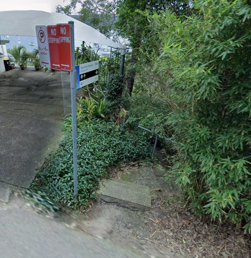
Thyra Road signposted entrance to Dark Gully Park - beachfront/estuary and west side of Barrenjoey Road
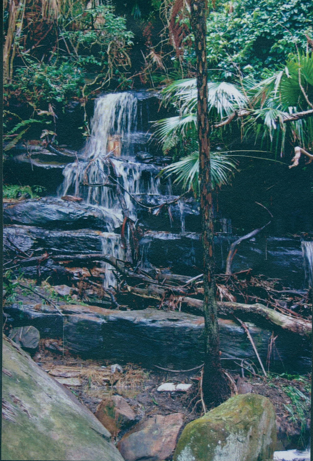
Waterfall, Dark Gully Creek, 1st January 1970
Showing some of the stonework at the north end of the creekline in 2018:

May 2022 PBWBA Newsletter:
There is a major slip area at Dark Gully Reserve on Barrenjoey Road and it is proposed to close the road at night for a few weeks in August, to undertake maintenance. Likewise, Florida Road has a major slip area and is reduced to one lane. We have no indication when the road will be repaired. Whale Beach Beach Road needs a major upgrade.
August 12, 2022: - Kate Bryant:
This is Barrenjoey Road on the Palm Beach bends at dark gully. It is the only 20m of actual pedestrian footpath. There is a gap between the ground and the bitumen. Not sure what the sandbags actually achieve, but with the number of trucks and buses that go over this everyday I can't see how this is actually safe! I think state roads are waiting for it to completely collapse down the cliff so it money comes out of emergency works budget instead???
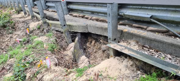
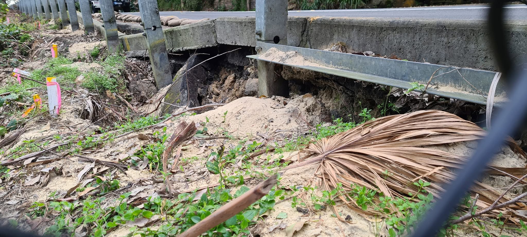
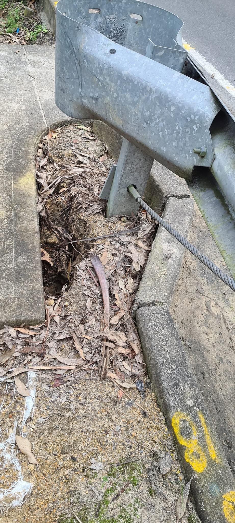
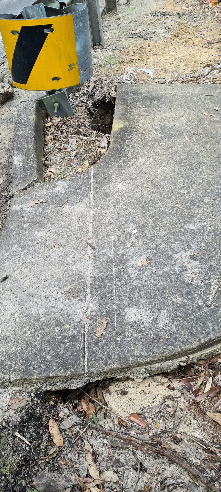
July 2023 PBWBA Newsletter:
SLOPE STABILISATION WORK IN DARK GULLY, BARRENJOEY RD PALM BEACH
Works will continue until Friday July 28th from 9.30am to 4pm. Reduced 40km speed limit, traffic control will be in place.
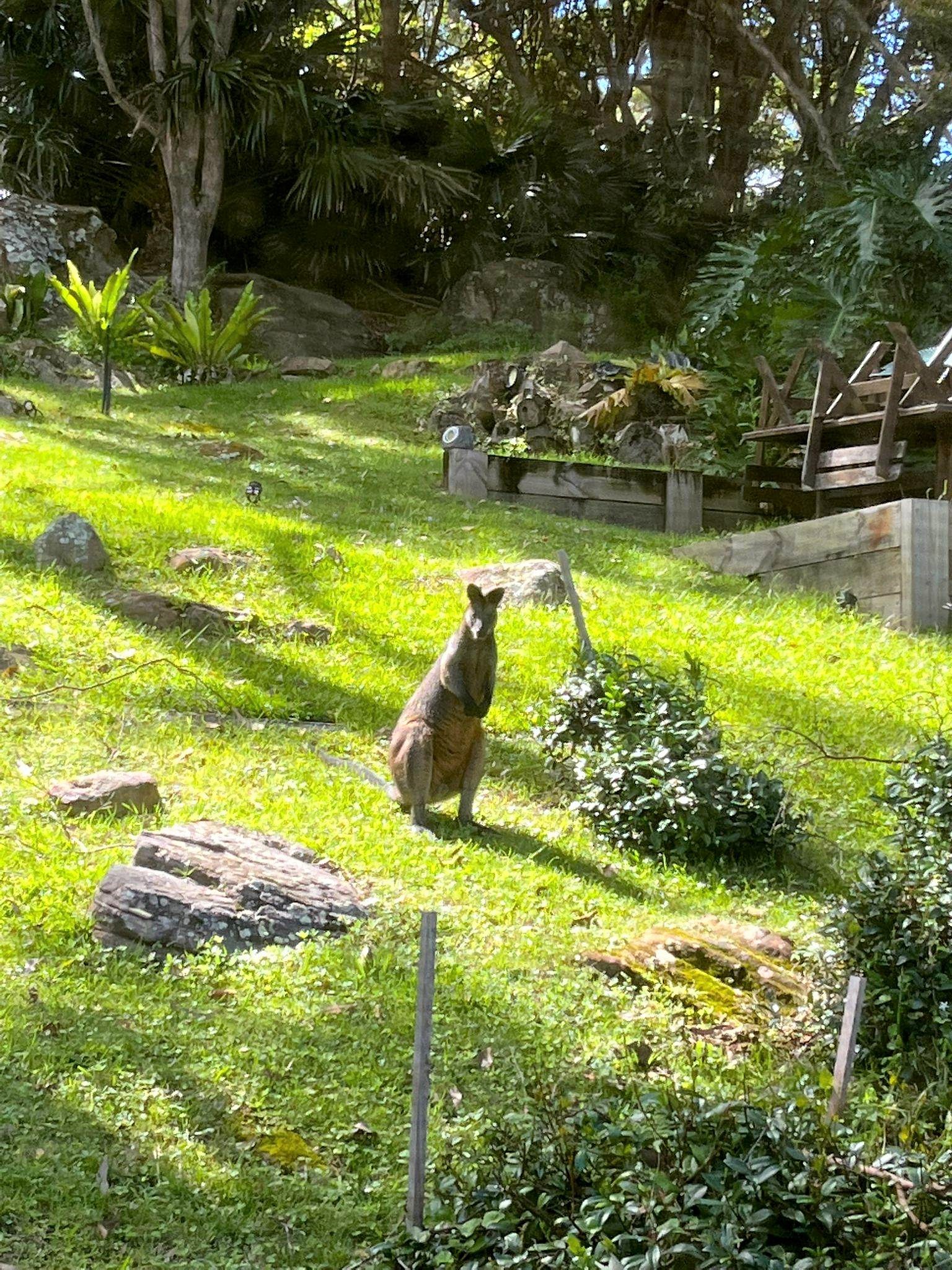
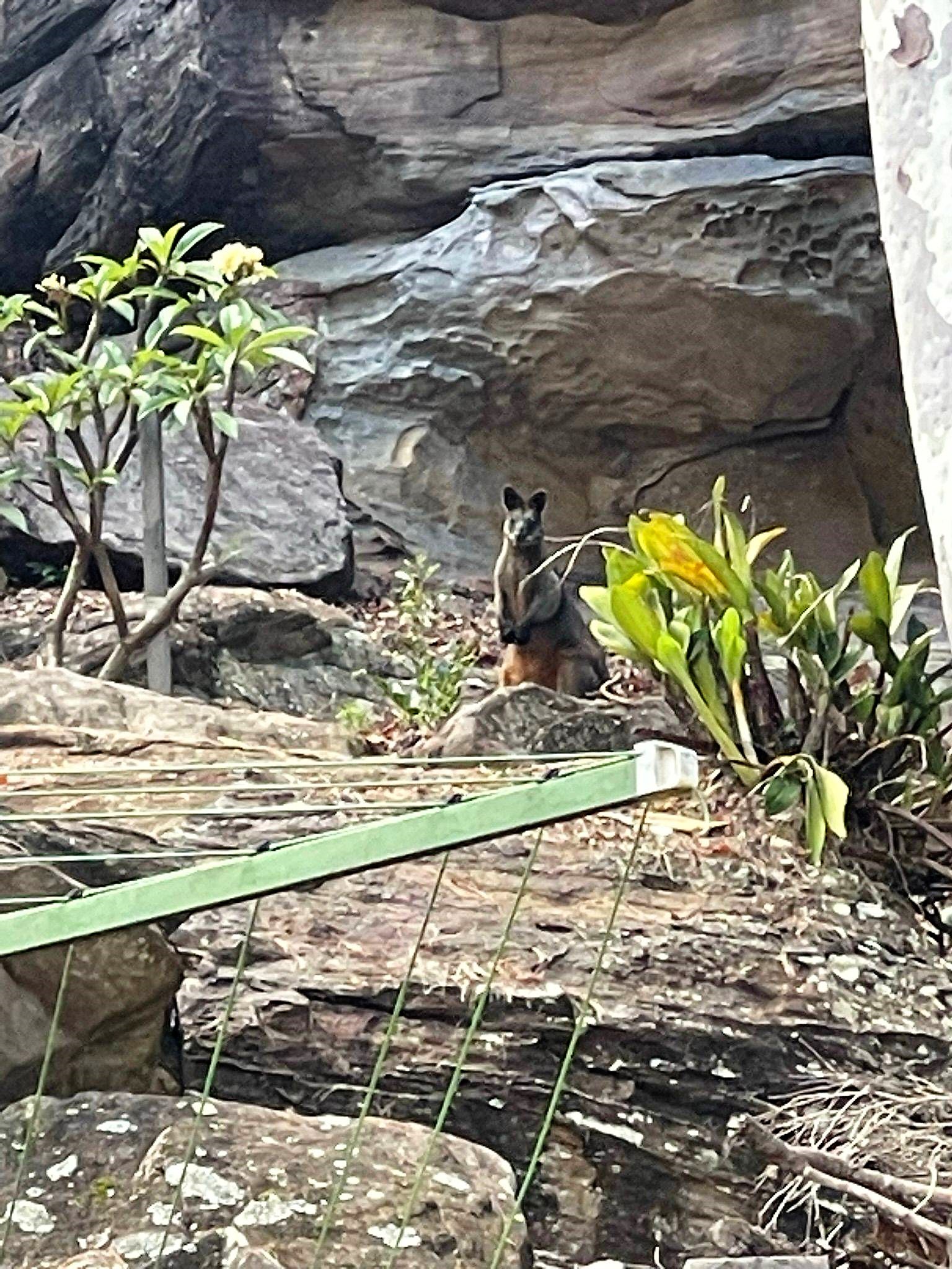
Swamp Wallaby At Dark Gully Palm Beach, Photos: Emilio Gallego, taken Friday March 3, 2023 at Dark Gully:
.jpg?timestamp=1790140763885)
.jpg?timestamp=1790140867323)
.jpg?timestamp=1790140890925)
.jpg?timestamp=1790140954997)
.jpg?timestamp=1790140993110)
McKay Reserve
The land which includes much of the present McKay Reserve was included in the Barrenjoey Land Company's subdivisions, although it would be the Palm Beach Land Co., under some of the original Directors, who would give or sell the lands to the residents of Pittwater and New South Wales.
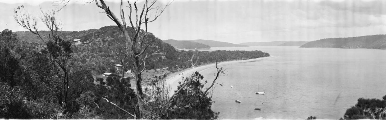
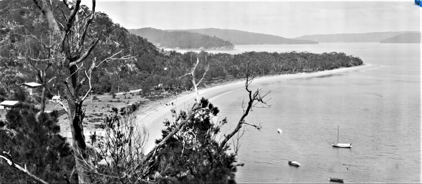
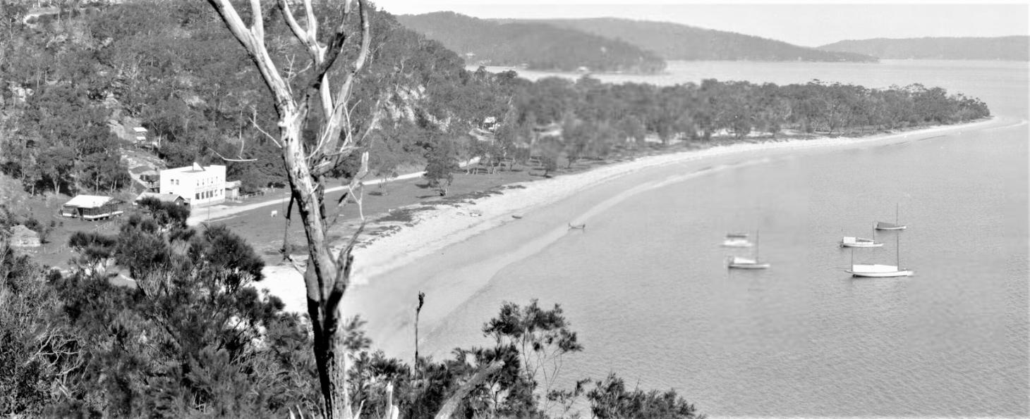
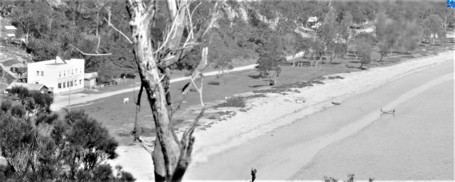
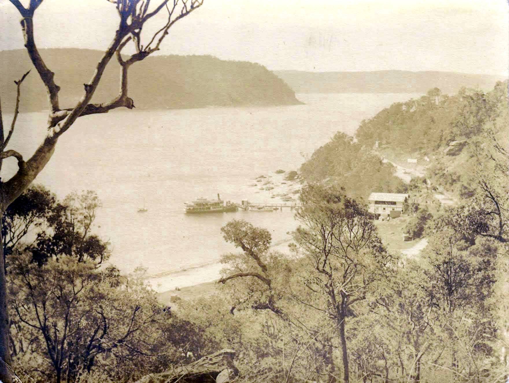
The Phoenix pulling into Palm Beach wharf, pre 1931 - circa 1925, from John Cowper's family albums. Taken from up the hill
The Reserve was created through Palm Beach Lands donating sections to the then Warringah Shire Council to look after for residents of then and the future, and under the County of Cumberland Planning Scheme, with some being formally entrusted to Warringah Shire Council on 10th July 1958.
Others were donated or sold into the 1960's. An August 1963 Warringah Shire Council meeting minutes records:
R.J.Aspinall & Son, Solicitors, 27.8.63 re acquisition of part of portion 18, Cynthea Rd. Palm Beach Heights, zoned "Open space - Public Parks and Recreation"; advising the owners of the land, Palm Beach Lands Pty. Ltd. have accepted Council's offer to purchase this land for £950 and forwarding contract of sale for approval and completion. 60 Resolved,- that the Shire Clerk be authorised to complete the contract of sale on Council's behalf.(Crs. Mill/Job).
Pittwater Council's POM states:
'McKay Reserve includes a number of separate parcels of land acquired over a number of years. The County of Cumberland entrusted major components of the Reserve to Warringah Shire Council during the years 1957 to 1960. Additional areas, mainly previous road reserves, have been added to the Reserve over the years.
'Part of the unmade section of Ralston Road (Lot 1 DP 821374) is owned by Pittwater Council, their POM states. 'The northern part of this road (Lot 1 DP 790731) is a public road and is noted on the Local Environmental Plan as Proposed Road Closure.'
The Certificate of Titles for Palm Beach Lands, which continued until 1960, are where these are listed, including those formalised in 1960 as the company was, finally, winding up what commenced in January 1912.
Examples are listed below and via screenshots of the same in the Certificate of Titles.
In the Certificate of Title and Vol-Fol 665-159 formally registered on May 12 1953 of 6 acres 2 1/4 perches - the lots of land outlined in red form the part of McKay Reserve - others are listed under References below:
.jpg?timestamp=1790183550312)
.jpg?timestamp=1790183569820)
.jpg?timestamp=1790183620695)
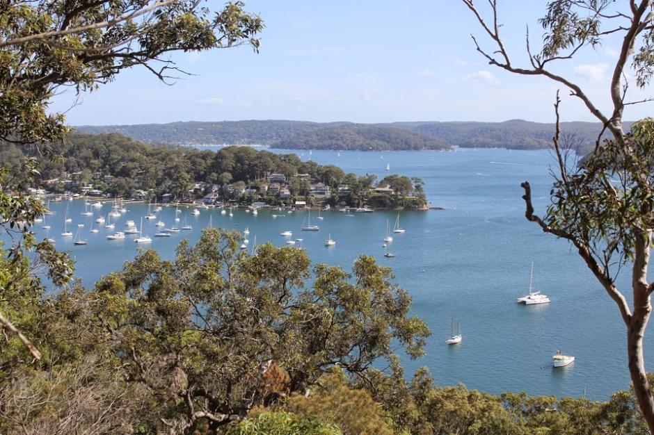
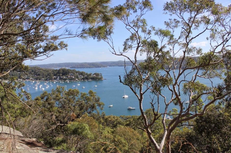
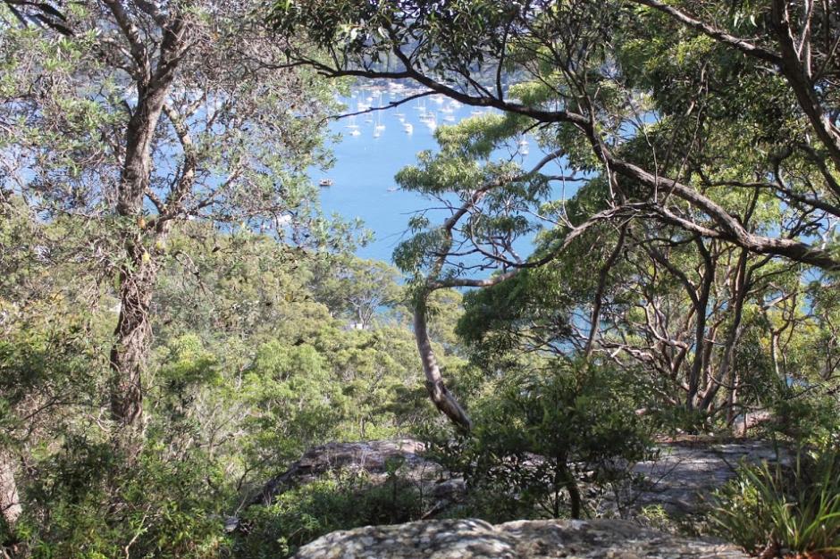
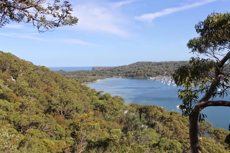
The reserve lies on a ridge on the Barrenjoey Peninsula and overlooks western Pittwater.
smaller.jpg?timestamp=1790191961327)
September 2026
small.jpg?timestamp=1790192050449)
Mapping by the NSW Office of Environment and Heritage in 2013 shows the reserve contains Coastal escarpment littoral rainforest, a particular subgroup of the Littoral Rainforest community, which is an endangered ecological community.
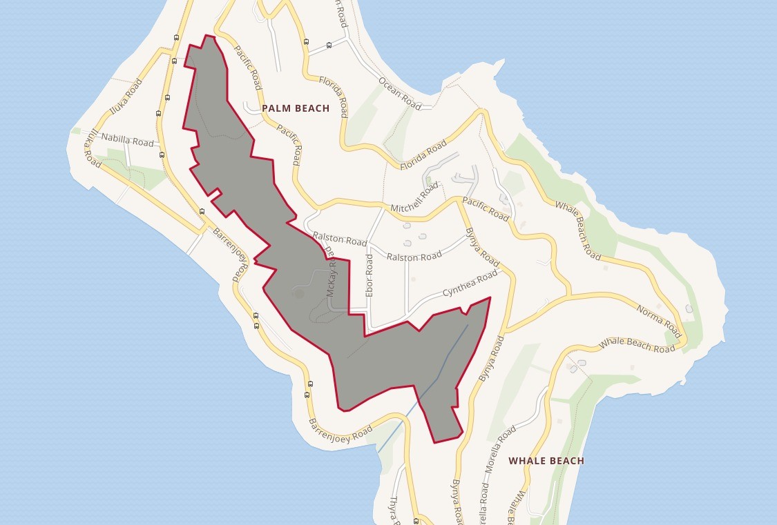
McKay Reserve map showing extent of reserve across the top of Palm Beach and Dark Gully creekline into southern end
The steepness of the escarpment led to some problems. The Warringah Shire Council Minutes of the meeting held December 12 1968 record:
McKAY ROAD RESERVE, PALM BEACH - R.W.T. Dumphy, requesting erection of a 6' high chain wire fence along the perimeter of the level area of McKay Road Reserve in an endeavour to prevent persons throwing stones onto his property below in Barrenjoey Road. Comments. Estimated cost of the fence is $150, but it is considered the erection of the fence would not be a solution to the problem of stone throwing and there appears to be no practicable solution available to Council that would effectively overcome the throwing of stones. RECOMMENDATION. That Council take no action in regard to the erection of the fence in McKay Road Reserve and that the writer be advised to contact the local Police in regard to the matter. SHIRE ENGINEER.
The June 12 1978 WSC meeting records:
PROJECTS PROPOSED FOR INCLUSION IN THE FUTURE PARKS AND RESERVES IMPROVEMENT PROaRAMME co RESERVES COMMITTEE MEETING, 12TH JUNE,1978 0 '1 pp Progressive Provisiopal 0 No. Description of Project Estimate co co 48 File 611/190 co Reserve Ebor and McKay Roads, Palm Beach Removal of spoil and eradication of noxious weeds from Ebor and McKay Roads Reserve $1,000 Note: Waste material has been deposited on the Reserve by persons .0 unknown and has built up around the base of trees eventually 3 C3 destroying them. The presence of noxious weeds is also evident.
A Report to Ordinary Meeting, 25th August. 1980records:
1.5 PROPOSED SUBDIVISION _LOTS 47 AND 48, D.P. 6746, PACIFIC ROAD, PALM BEACH. (File SF 360/L47&48) Council has received a proposal on behalf of the owners of Lots 47 and 48 for the dedication of the western portion of these lots to Council in return for the easterly extension of the property boundaries onto the adjoining Mckay Reserve as shown on attached plan. F The Property Management Panel has inspected the site at its Special Meeting of 6th July, 1980. Council at its Ordinary Meeting of 3rd June, 1968, considered a similar application from the owners of Lots 47 and 48, when it was resolved:__;That Council approve of the access across the open space, subject to: (a)Access being constructed at the owner's full cost in accordance with the Engtneering plans, as submitted, and the access being available to the owners of Lots 49 and SO. (b)Provision of an 18; diameter piped culvert under the access to discharge into the drainage easement adjacent to the northern boundary of Lot47. _(c)Dedication as public road of the frontal strip along Barrenjoey Road free of cost to Council, but Council to bear all legal and survey costs involved in the transfer. (d)Approval of the Stat61Planning Authority.*; State Planning Authority approval was sought by Council and no objection was raised 'by the Authority to the proposal. In September, 1968, the owners were advised accordingly, but no further action was taken by them in this regard. The current proposal seeks the transfer of 670m2 of Council land in return for the dedication to Council of 1,736m of Residential land for Open Space Reservation. A right-of-way 4m wide is also proposed over the unconstructed Ralston Road for a distance of approximately 33m. The applicant has stated that, in his opinion, a 2.4m wide driveway could be constructed over this right-of-way, avoiding major destruction of the existing trees. An investigation of the impact of such a boundary change on other properties fronting onto the unconstructed section of Ralston Road has revealed no adverse affects to current accesses or potential accesses, as other adjoining lots
Pittwater Council, in compiling its own Plan of Management (POM), stated, in listing the plant communities present then, states 4 vegetation communities are found in McKay Reserve:
- Red Bloodwood - Scribbly Gum Woodland
- Hawkesbury Sandstone Open-Forest
- Spotted Gum Forest
- Newport Bangalay Woodland
The Reserve had been home to koalas, prior to 1984. Smith and Smith (1992) found that four mammal species, 37 bird species, one frog species and three reptile species have been recorded for McKay Reserve. They stated that further species were likely to be found with additional surveys. These could include a further four mammal species, 21 bird species, one frog species and eight reptile species. Smith and Smith (1992) state that the low numbers of fauna species present can be accounted for by the extent of urban development adjacent to the Reserve. They stated that Koalas, which were previously found in the Reserve, were no longer present due to the presence of dogs, reduced areas of suitable habitat and road kills.
They concluded that despite the small and isolated nature of the Reserve, it still supported quite a variety of fauna, similar in diversity and composition to that recorded in Angophora Reserve. A more recent survey of residents by Pittwater Council has found resulted in additional records for fauna in and near to the Reserve. These include a record of a Koala near Bynya Road.
Glossy Black-Cockatoos will still visit and feed, and the Reserve was home to the Squirrel Glider and Long-nosed Bandicoot a decade ago, under Pittwater Council.
McKay Reserve protects an example of the bushland of Barrenjoey Peninsula in a condition similar to that which occurred when the area was first visited by Captain Phillip in 1788 and includes samples of plant communities which are uncommon in the Pittwater area and which are inadequately conserved in New South Wales.
The Reserve protects populations of three plant species which have regional conservation significance; Snow Wood, Daviesia umbellulata and Large-fruited Red Mahogany.
Local involvement in Reserve management was formalised in 1984 through the formation of a 530A Committee by Warringah Shire Council, although they had been discussing the formation of such a group in December 1982.
In recent years local concern at the management of McKay Reserve saw an active management involvement by volunteers and subsequent contracting of bush regeneration teams by Warringah and Pittwater Councils. Pittwater Council took over care, control and management of the Reserve in 1992.
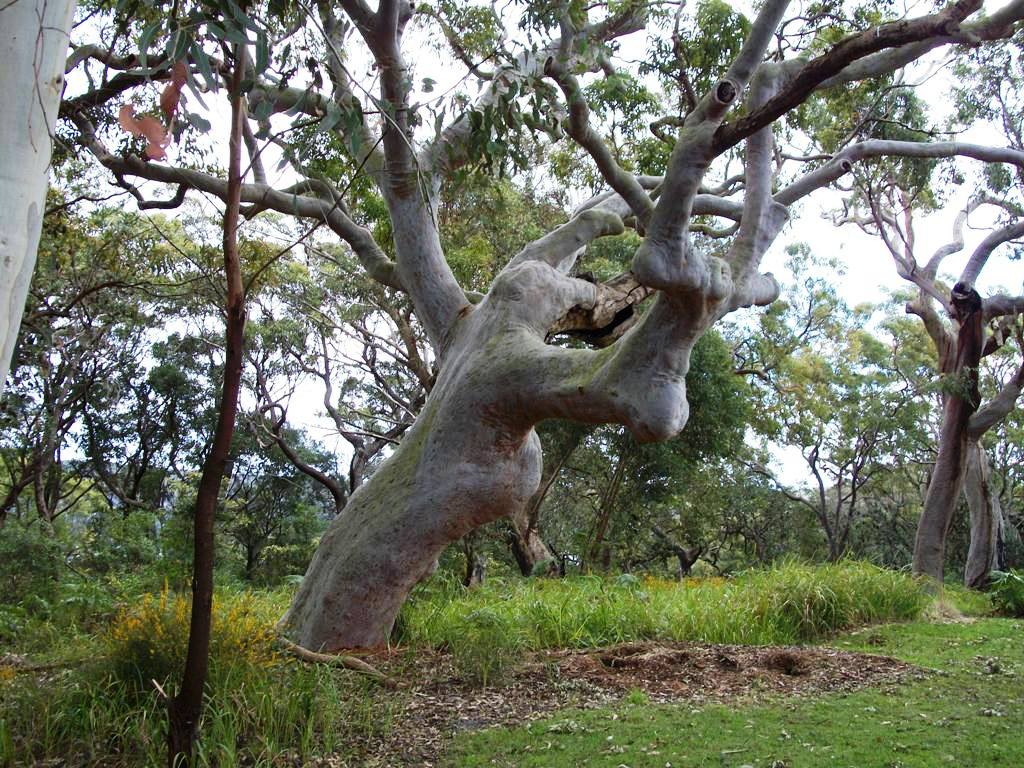
Pittwater's Angophora Costata in McKay Reserve - 2015:
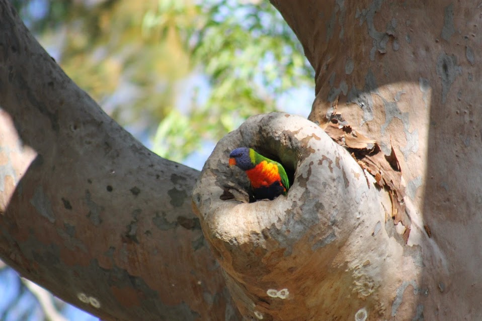
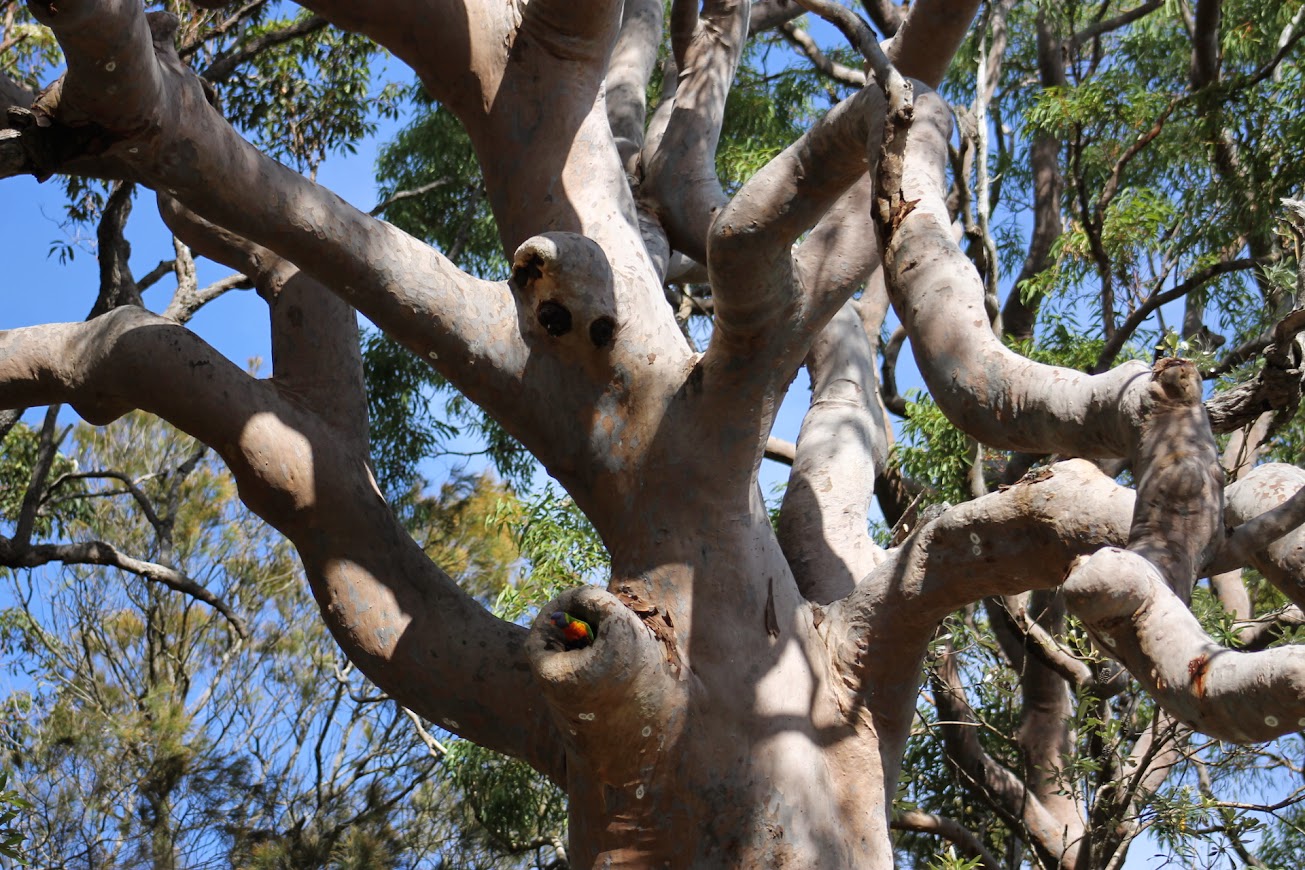
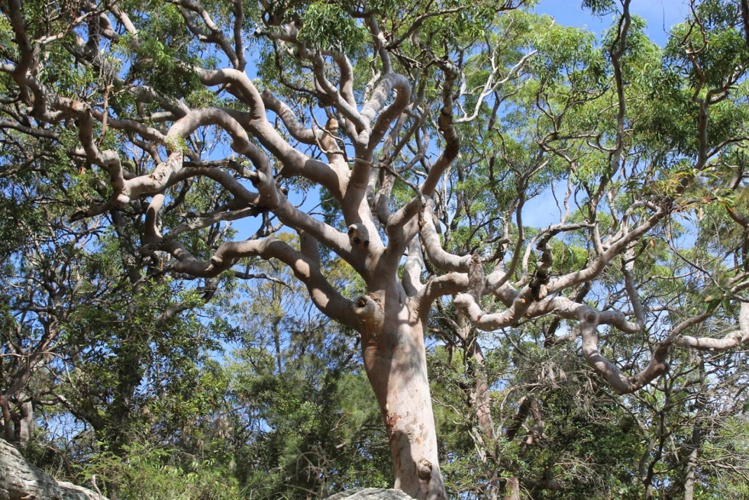
Provision of public access in McKay Reserve is for the purpose of providing low impact recreational use of the reserve by visitors, consistent with maintaining its natural values.
Access to McKay Reserve is possible from the junction of Pacific Road and the unmade part of Ralston Road, McKay Road, Ebor Road, Cynthea Road, Bynya Road and Barrenjoey Road. Rights of way or access reserves between houses occur off Pacific Road, Cynthea Road and Bynya Road. McKay Road also provides access through part of the Reserve, splitting a section of the Reserve off from the bulk of the Reserve. A track leads from McKay Road to the Water Board Reservoir.
The western end, which overlooks Pittwater, begins at 1078 Barrenjoey Road, Palm Beach, directly opposite the intersection with Iluka Road, if you're going to climb up and over the hill that way.
 smaller.jpg?timestamp=1790144180186)
Barrenjoey road opposite Iluka road, Palm Beach entrance, August 2026
small.jpg?timestamp=1790144279981)
Below: more signage - a vandal has removed the 'dogs prohibited' sign from this, but as this is a Wildlife Protection Area, all but the arrogant and ignorant or incredibly self-centred and selfish would know not to take dogs into these areas :
smaller.jpg?timestamp=1790145837177)
More signage in place, August 2026:
 smaller.jpg?timestamp=1790145967990)
smaller.jpg?timestamp=1790145478939)
smaller.jpg?timestamp=1790145547482)
Sections to the south opposite Palm Beach RSL:
 smaller.jpg?timestamp=1790145611296)
Pathway from Barrenjoey/Iluka section in 2016:
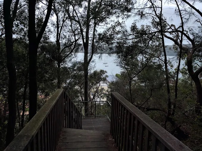
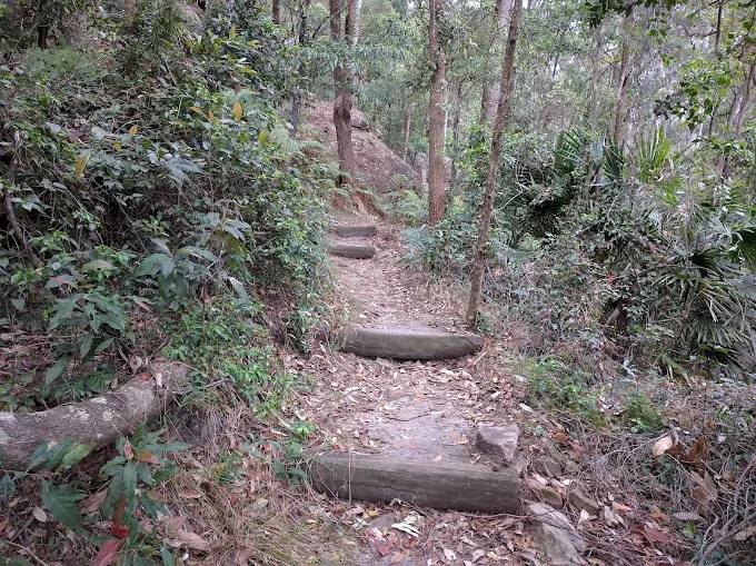
Turning left at top of path to wen along the way that comes out behind private homes on Pacific Road, Palm Beach (of people author also knows - this is not a public thoroughfare, residents can access the reserve, trees and views - in 2013:
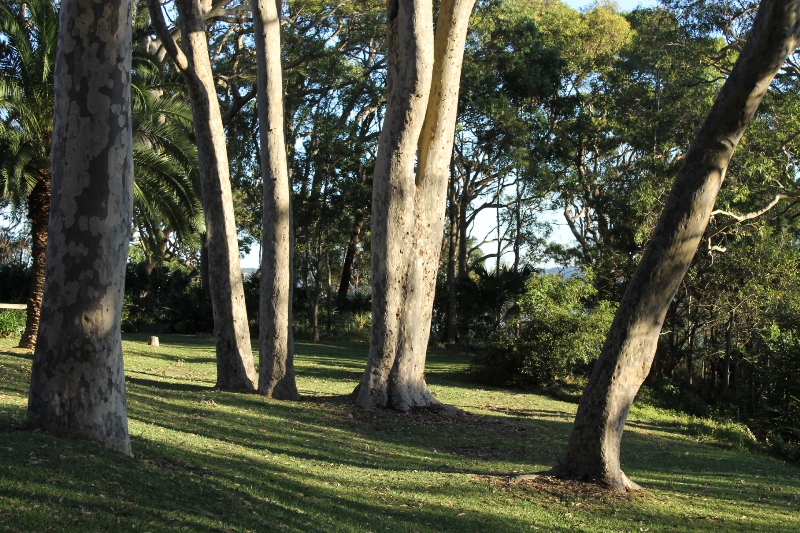
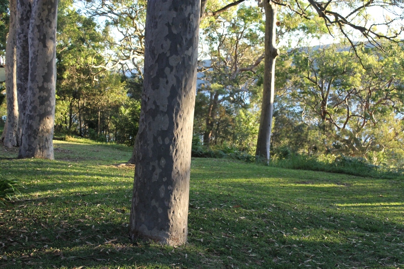
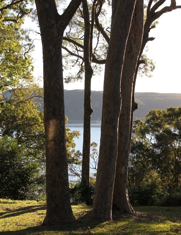
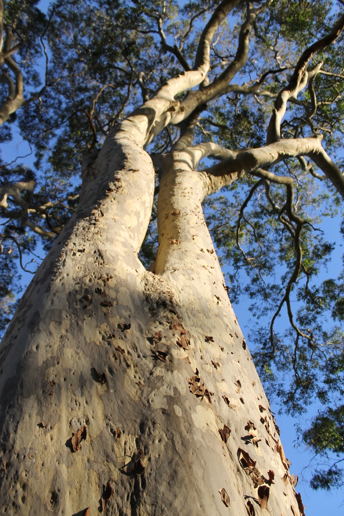
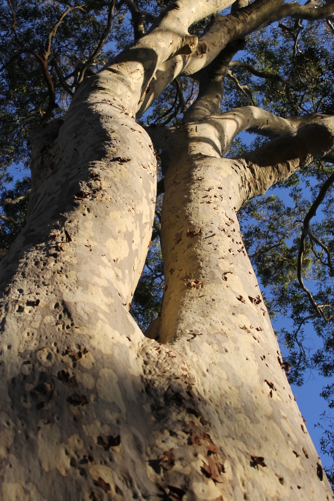
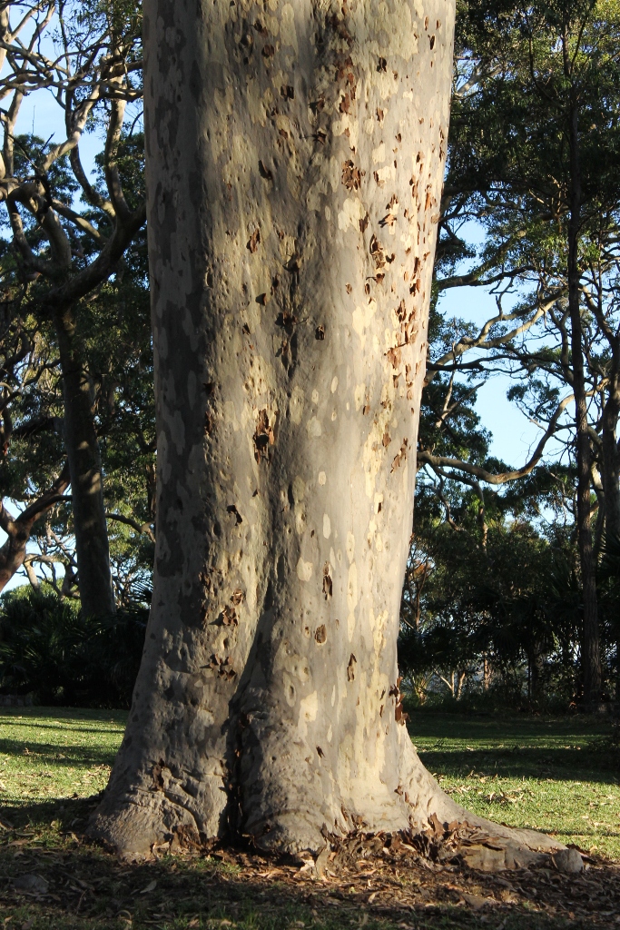
The disposal of stormwater into the Reserve had been permitted in the past as it offered the cheapest and easiest option. This practice led to long term management problems in the Reserve.
Once Pittwater Council was established and had care and control of McKay Reserve this was no longer permitted for new developments or redevelopment. In the case of established residences a cooperative approach between Council and land owners had the most effective solution. Many will remember connection of properties adjacent to the Reserve to the sewer took place over the 1992 to 1994 along Bynya Road, Ebor Road and parts of Ralston Road. This was expected to halt the decline of the reserve through introduced weeds, and phosphorus through dog faeces and garden fertilisers. Eucalyptus Trees in the reserve had been going into dieback prior to Pittwater Council undertaking this project in conjunction with residents.
The long-awaited connection is also a reminder of how long people in Pittwater waited for services that had been extended to Manly and Warringah half a century or more prior to this. Long-term residents will recall even sealing of roads along such places at Surf Road at Whale Beach did not occur until the early 1980's under the Warringah Shire Council. That December 1992 Connection Notice:
WATER BOARD ACT 1987
Sewer-mains
NOTICE is hereby given that sewermains as described below and shown on plans which may be inspected at the Regional Office shown below and at the Head Office of the Board, have been laid and are available for connection.
Notice is also given that, in the opinion of the Board, for the identified properties on the plans, it is reasonably practicable tor sewage to be discharged.
Northern Regional Office, Chatswood, tel.: 4109414
PITTWATER MUNICIPALITY, at PALM BEACH: Work No. 307542 (Palm Beach LL. Area IB) Lines 1, 2, 3, 4, 5, 5a, 6, 7, 8a, 9,10,12, 13, 14, 15 and 16, Sidelines One (1) and Two (2) and their appurtenant junctions, sidelines and inlets serving PACIFIC ROAD, FLORIDA ROAD, RALSTON ROAD, EBOR ROAD and BYNYA ROAD.
PITTWATER MUNICIPALITY, at PALM BEACH: Work No. 307583 (Palm Beach LX. Area 2D) Lines One (I), Three (3), Four (4), Five (5), Six (6) and Seven (7), Sideline One (l) and their appurtenant junctions, sidelines and inlets serving PALM BEACH ROAD, SUNRISE ROAD, OCEAN ROAD BEACH ROAD and NORTHVIEW ROAD.
PITTWATER MUNICIPALITY, at PALM BEACH: Work No. 307582 (Palm Beach L.L. Area 2C) Lines One (1) to Ten (10) inclusive and their appurtenant junctions, sidelines and inlets serving PACIFIC ROAD, PALM BEACH ROAD, SUNRISE ROAD, LIVINSTONA LANE, CANARA PLACE and RALSTON ROAD.
PITTWATER MUNICIPALITY, at PALM BEACH: Work No. 307526 (Palm Beach IX. Area 1A) Lines One (1) to Thirteen (13) inclusive, Sidelines One (I), Two (2) and Three (3) and their appurtenant junctions, sidelines and inlets serving FLORIDA ROAD, PACIFIC ROAD, ROCK BATH ROAD and MITCHELL ROAD.
Subject to the provisions of the Water Board Act 1987, the owners of all lands being identified properties on the plans, will be liable for payment of sewerage service charges after the expiration of twenty-one (21) days from the publication of this notice.
A. RAEBURN, Regional Manager, Northern. Sydney, 11th December, 1992. WATER BOARD ACT 1987 (1992, December 11). Government Gazette of the State of New South Wales (Sydney, NSW : 1901 - 2001), p. 8760. Retrieved from http://nla.gov.au/nla.news-article231950770
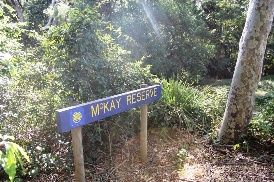
The Reserve itself was named after a then Warringah Shire Councillor and resident of Collaroy. An information board on the western side at the base of the steps leading up into the reserve just further north of Palm Beach RSL states it was named after Leonard McKay, a Master Builder, and also a former A Riding (Pittwater) Councillor on that Warringah Shire Council from 1948 to 1956.
He became Deputy President in November 1954 and was also Chairman of Mackellar County Council from 1955 to 1956. A Riding corresponded to North Narrabeen to Palm Beach under the Warringah Shire Council system of representation of residents.
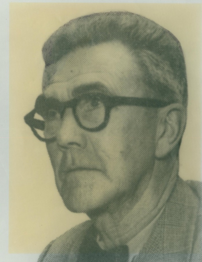
Leonard McKay in 1956. Photo: Warringah Shire Council report
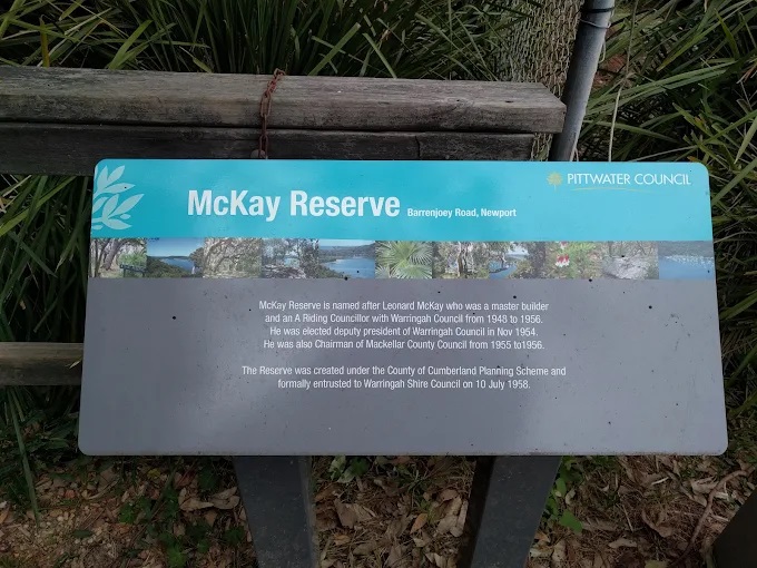
Information board opposite Iluka and Barrenjoey roads in 2016
smaller.jpg?timestamp=1790205512662)
In August 2026
He passed away on December 28 1971.
The January 10 1972 Warringah Shire Council meeting recorded:
DEATH OF MR. L. McKAY, A FORMER COUNCILLOR OF THE SHIRE. (Copy supplied to each Councillor). 6.Resolved, That the sentiments in the Minute be conveyed to the members of Mr. McKay's family in a letter bearing the Council's Common Seal. (Crs. Huntingdon/Dawson). One minute's silence was observed by all present at the meeting in memory of the late Mr. McKay.
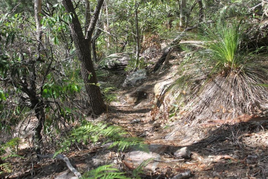
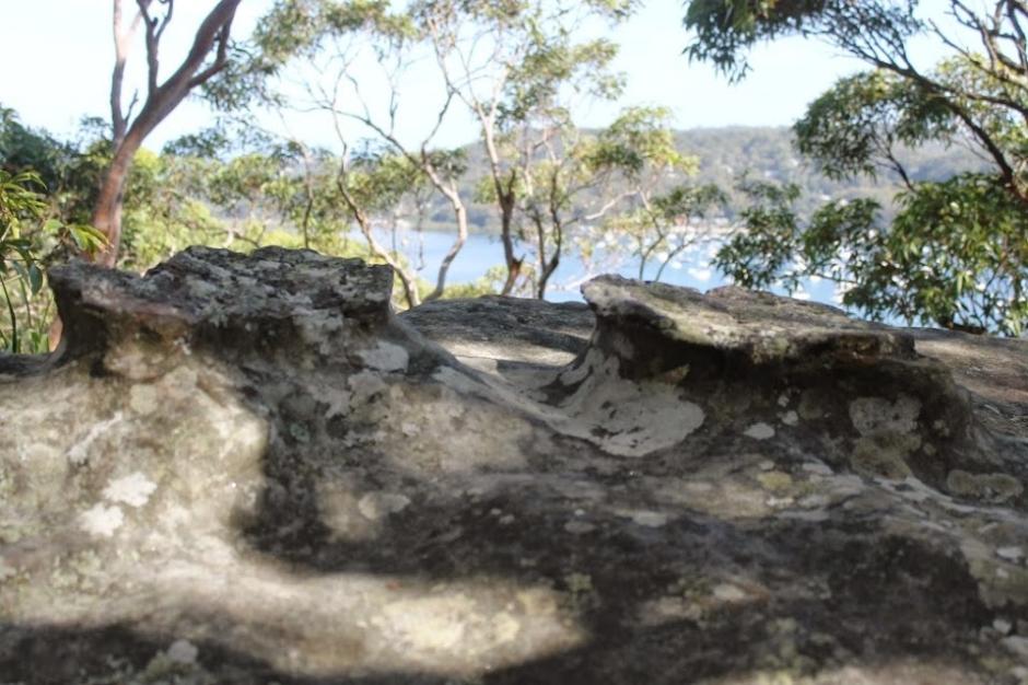
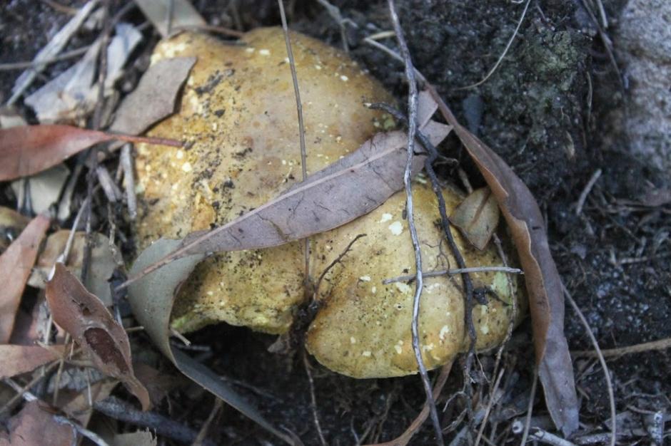
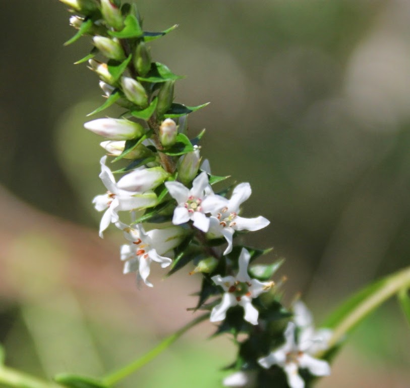
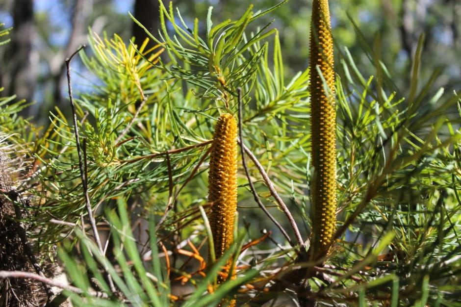
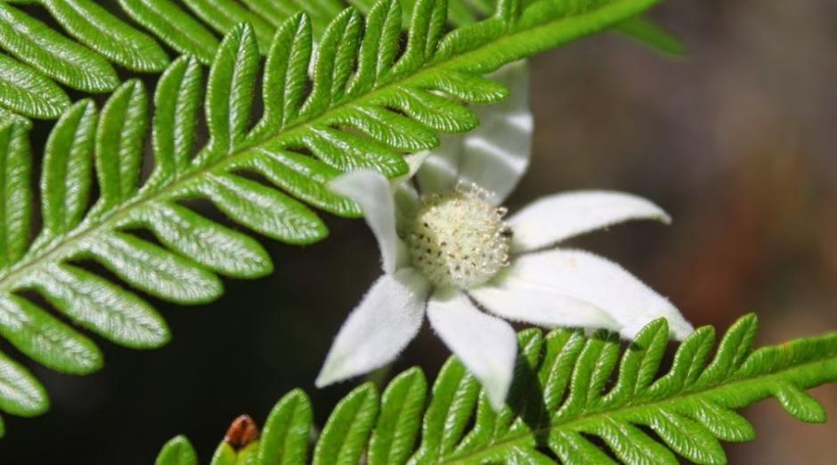
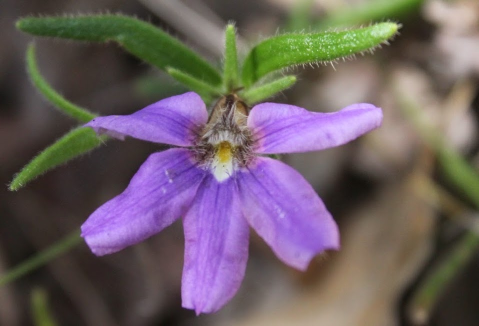
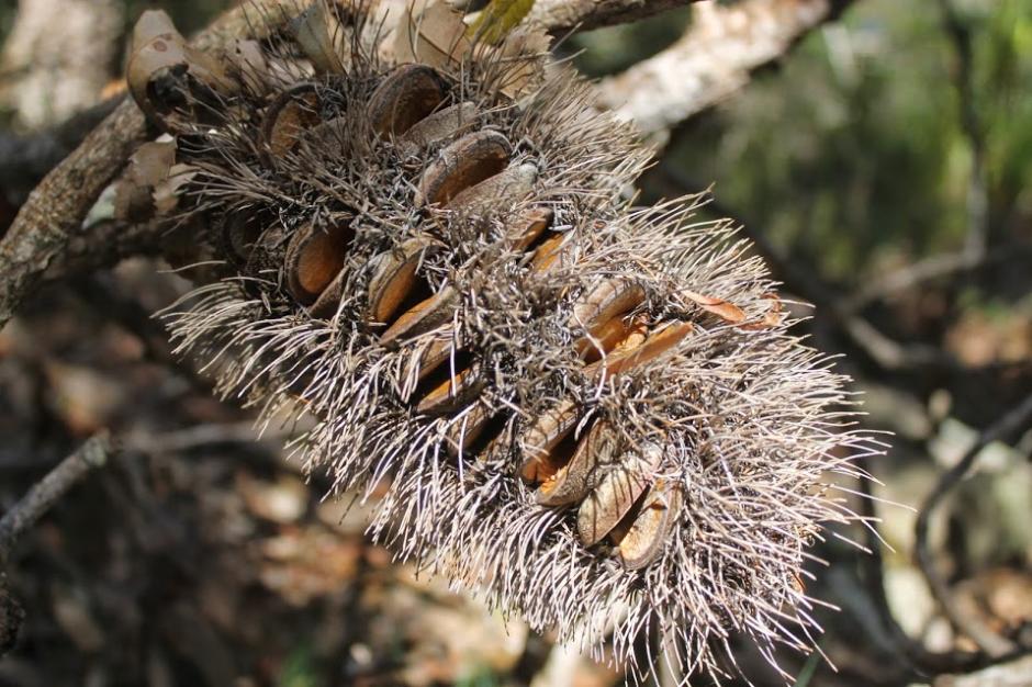
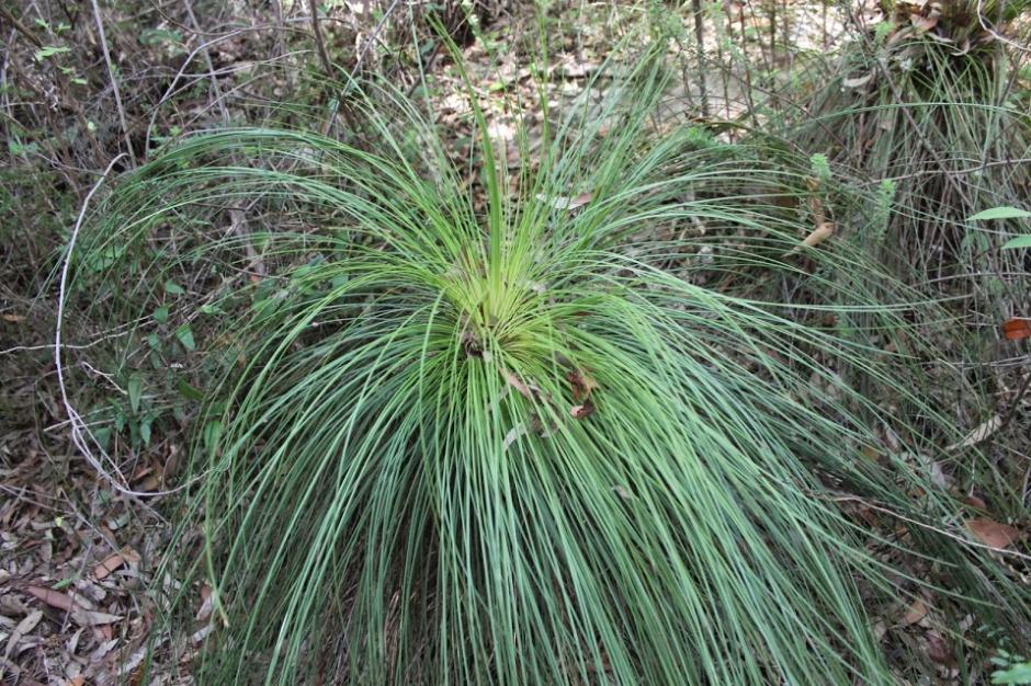
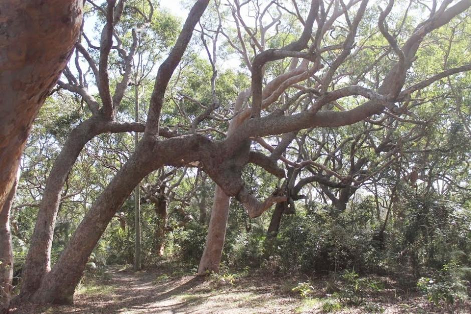
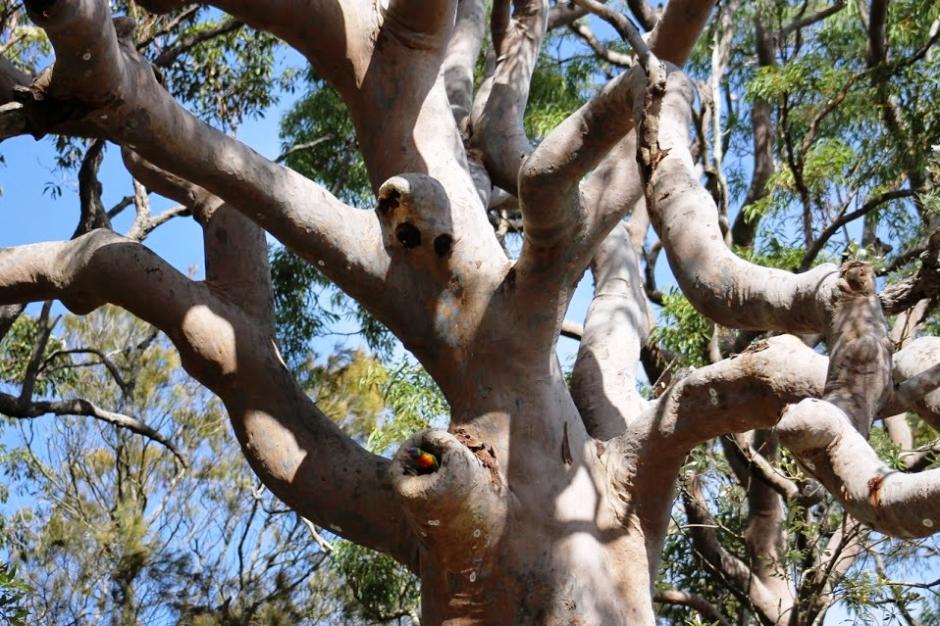
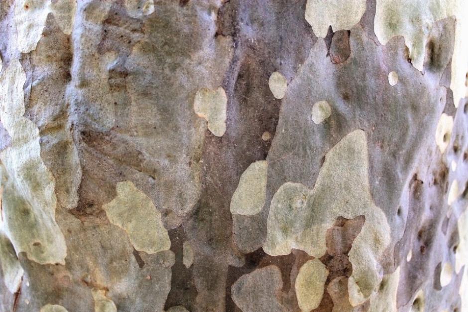
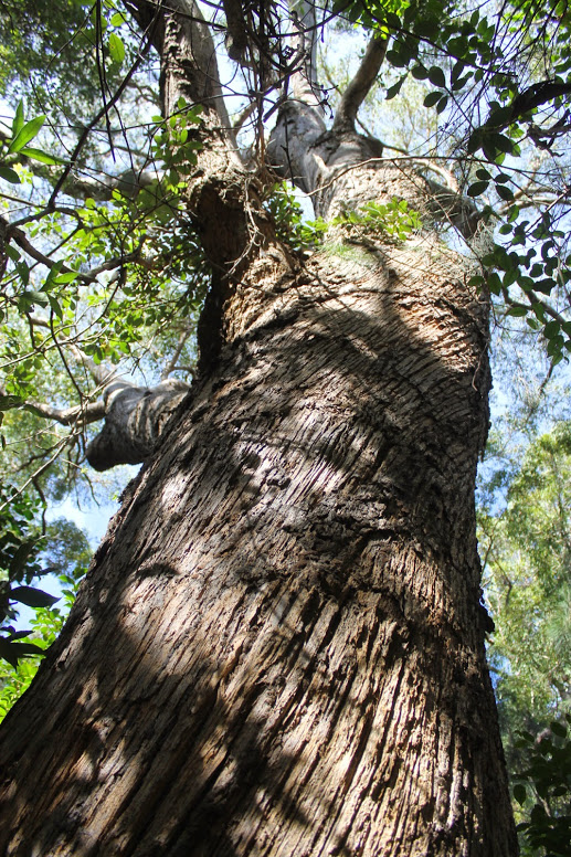
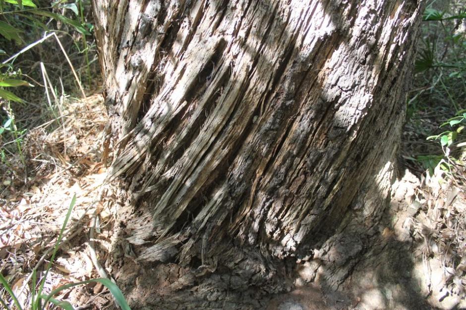
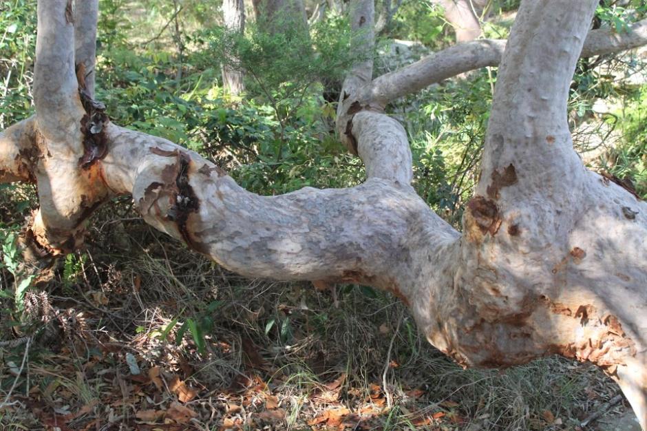
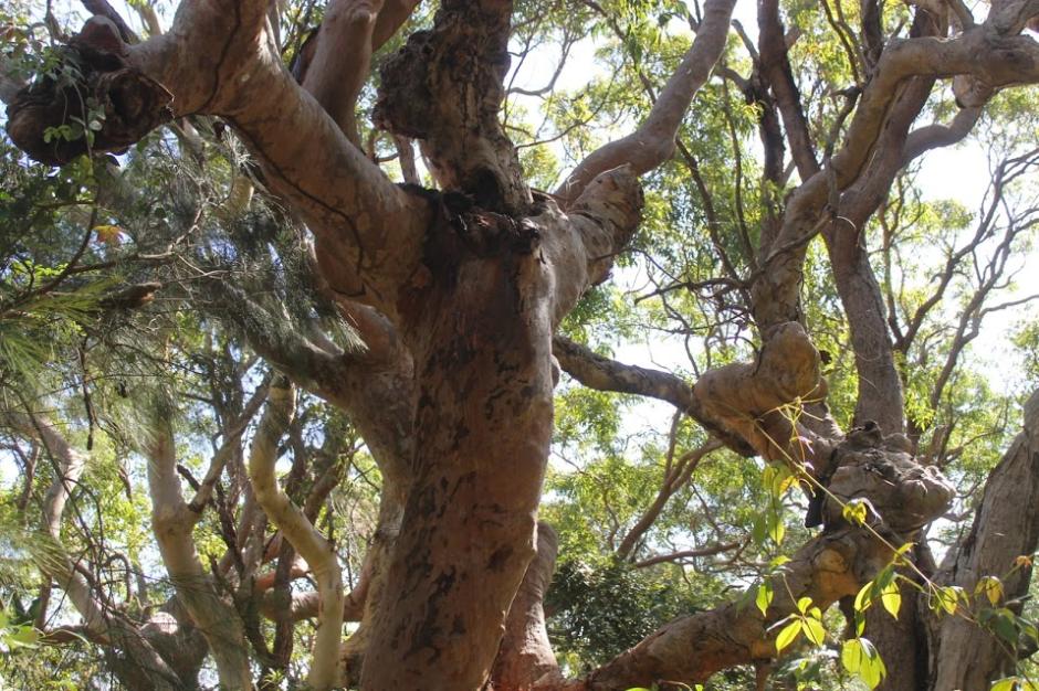
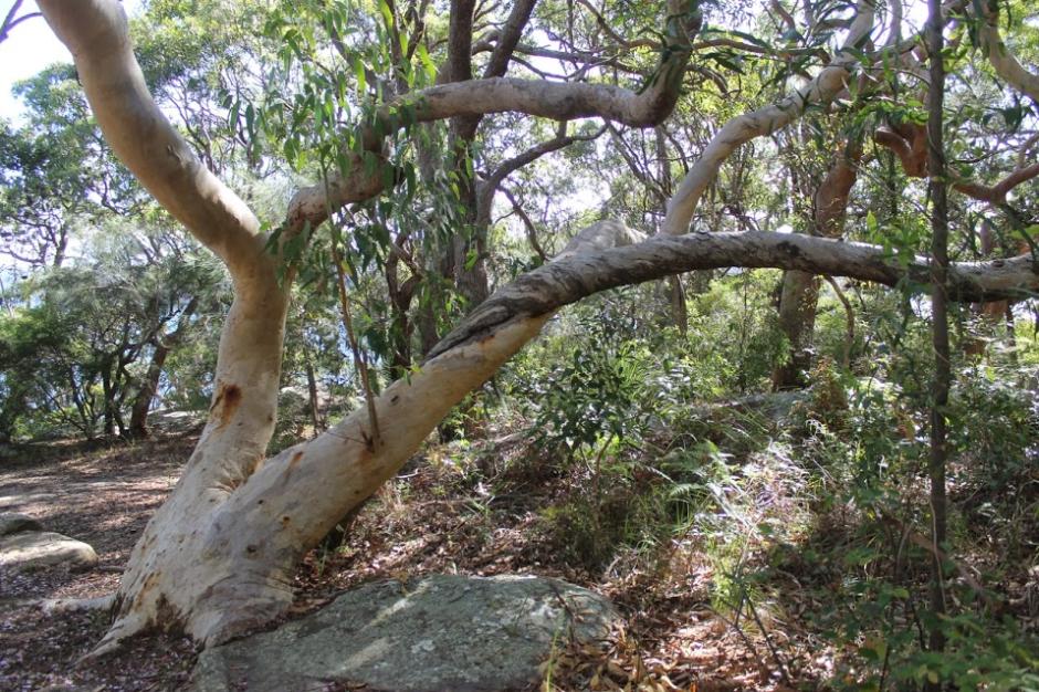
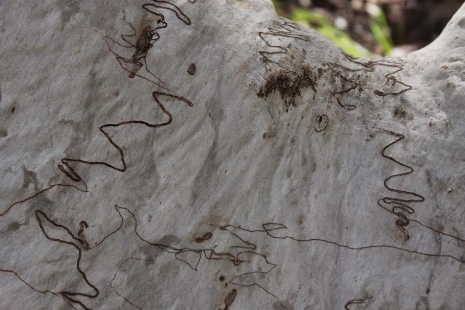
Below runs some Spring, September 2026 photos of McKay Reserve along the top ridgeline between Ralston and McKay roads. Those taken in 2015 are also available at the link under references and are shared here once more for a comparison.
The currently named 'Palm Beach Whale Beach Association members and other residents also undertake to train annually to use the following, which are station alongside the Reserve:
sm.jpg?timestamp=1790214596106)
references:
- TROVE - National Library of Australia
- Pittwater Council PoM's 1992 to 2016
- McKay Reserve walking tracks, 2011 - site investigation of Spotted Gums of Pittwater along Palm Beach ridgelines through the Coast to Bay tracks established by Pittwater Council
- McKay Reserve - Palm Beach, 2015 Pictorial
- Pittwater Reserves: The Green Ways Hordern and Wilshire Parks to McKay Reserve – From Beach to Estuary - 2015 Notes
- Warringah Shire Council, Minutes of Meetings, digitised by Warringah Council
- National Museum of Australia
- Australian Archives
- State Library of New South Wales
- Pittwater Roads II: Where The Streets Have Your Name - Palm Beach
- Pittwater Roads II: Where the Streets Have Your Name - Whale Beach
- Iluka Park, Woorak Park, Pittwater Park, Sand Point reserve, Snapperman Beach Reserve - Palm Beach: Some History
- The First Weekenders On The Palm Beach Beachfront + A Look Into Palm Beach SLSC Clubhouses In The Club's 101st Season
- Pittwater Summer Houses: Kalua, Palm Beach
- Kookoomgiligai, Sunrise Hill, Palm Beach
- Palm Beach Golf Course 1924 To 2024: Some 100th Year History Celebratory Insights
- Wilshire Park Palm Beach: Some History + Photos From May 2022
- The Top Predator - McKay Reserve - people taking dogs offleash into a Wildlife Preservation Area, August 2025, by resident
- Snapperman Beach, Pittwater: 1790-2026
Land Lots that formed McKay Reserve:
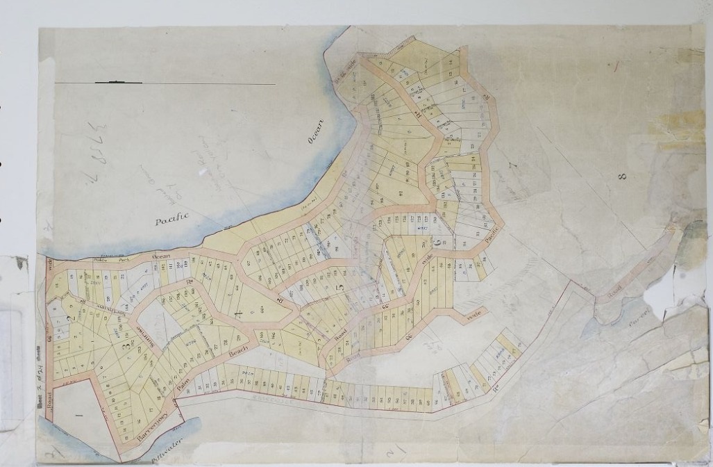
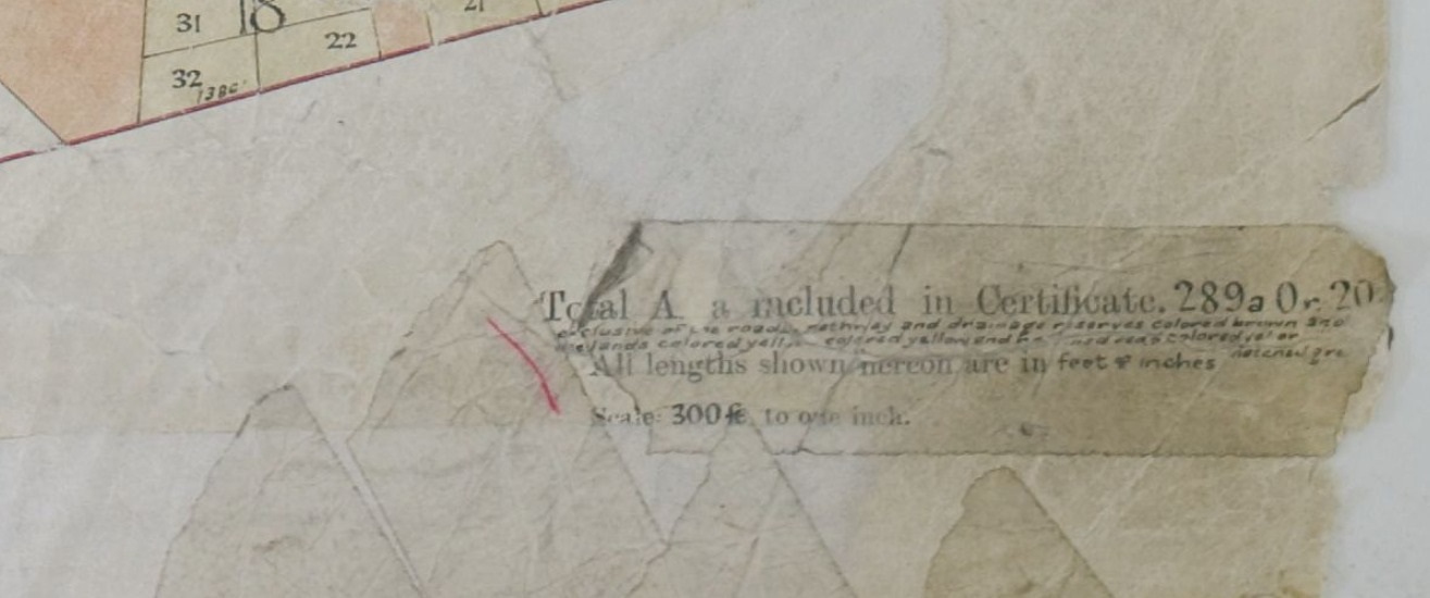
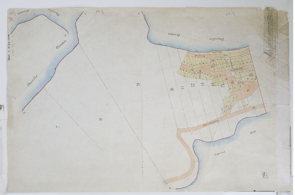
Palm Beach Lands Co. 1925 map - 289 acres, 20 perches still left


Minutes - Ordinary Meeting 22.12.1975:
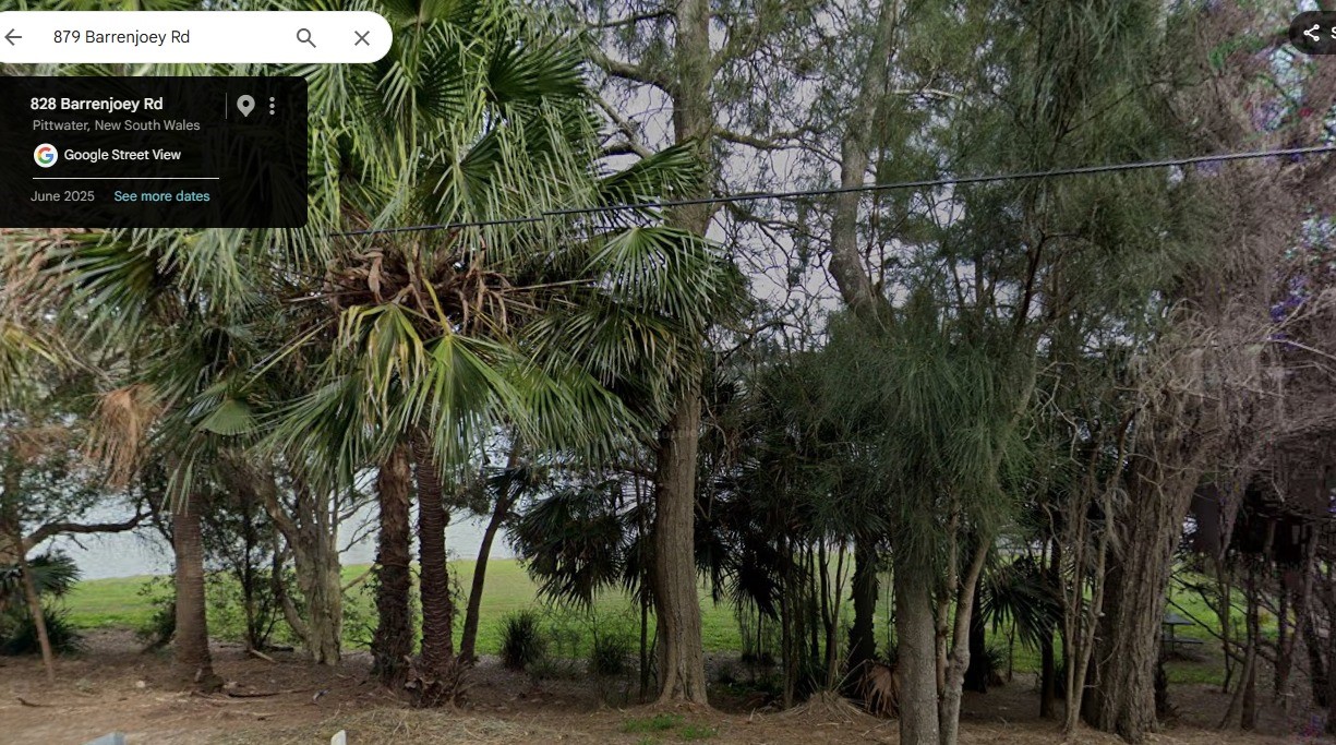
TOWN PLANNER'S REPORT NO. 75/579 - RECLAMATION FRONTING LAND IMMEDIATELY SOUTH OR LOT PT.19, D.P.328958 (No.879) BARRENJOEY ROAD, PALM BEACH 35. Resolved - That the recommendation of the Town Planner. be adopted, viz.: That the Lands Department be advised that Council favours the subject land including reclamation south of No.879 Barrenjoey Road, Palm Beach being reserved for "public recreation"; that control should devolve on the Council under Section 344 of the Local Government Act, 1919, and that Council resolves that the land be zoned "Existing Recreation 6(a)" in the next Varying Scheme. (Crs. Sainsbery/Hoy)
No: 879 Barrenjoey road is little reserve fronting Careel Bay and tucked into the corner just before the rise of the hill up to the Surf road turnoff - two park benches can be seen in the reserve at the top of this photo:
 for resreve 1975.jpg?timestamp=1790201743314)
Mackellar County Council
The Mackellar County Council (MCC) was a county council and state–owned enterprise of the Government of New South Wales, Australia. Established in 1951, it was an electricity and gas supplier and retailer which primarily supplied the Manly to Barrenjoey peninsula area of Sydney, New South Wales, being jointly managed and operated by Manly Municipal Council and Warringah Shire Council.
The idea of a County Council, specifically dealing with the control and development of electric utilities in the area shared by Manly Municipality and Warringah Shire first occurred in 1938 and again in 1943 but was postponed for consideration because of the Second World War.
The first delegates to the Mackellar County Council were elected by the Warringah Shire Council on 16 July 1951 and by the Manly Municipality on 17 July 1951. The inaugural meeting was held at the Manly Municipal Council Chamber on 15 August and commenced operations on 1 September 1951.
Soon after the Council's establishment, the councillors resolved to commission a 'Common Seal' to be the primary visual identifier for the council. The Council asked the eminent local historian and President of the Manly and Warringah District Historical Society, Percy Walter Gledhill FRAHS to draw up a heraldic design that represented the area over which the council had responsibilities. Gledhill, who had noted to the Sydney Morning Herald that "They wanted something historic, something to represent light and something from the so-called arms of Manly and Warringah. Those arms aren't registered either, you know",[8] made the following description of his design to the council:
"The scroll bears the name 'MACKELLAR COUNTY COUNCIL' and if desired the date of its institution could be added by placing beneath the scroll the date 1951.
The lower portion of the seal shows the landing of the first white man in Manly, viz., Governor Phillip, on 21st January 1788. The two aboriginals shown holding spears representing the original holders of the country. Phillip speaking of the Manly blacks said 'their confidence and manly behaviour induced me to give the name Manly Cove to this place'. The Barrenjoey lighthouse shown is erected at the extreme north of the area of the County Council and is emblematic of light, from the beacon lights of mediaeval times to the modern lights of today.
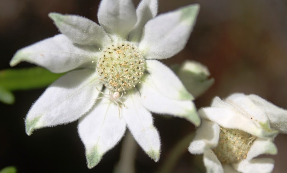
The flannel flowers remind us of what has been looked upon as the emblem of Warringah. This, together with the waratahs, are symbolic of the wild flowers of the district. The colours of the flowers, white and red, represent the English colours."

Common Seal of the Mackellar County Council, 1951-1980 - Annual Report of the Mackellar County Council, 1962.
The Council eventually moved to more permanent headquarters, with the administrative headquarters positioned between Manly Local Court and Manly Town Hall on Belgrave Street in Manly and the technical headquarters situated in offices next to the Warringah Shire Hall on Pittwater Road, Brookvale. On 14 September 1962 the Minister for Local Government and Highways, Pat Hills, opened the new headquarters building of the County Council, located on 48-52 Sydney Road, Manly.
In May 1965, the employees of the County Council registered the "Mackellar County Council Employees Credit Union Limited". The Credit Union later operated as the Manly Warringah Credit Union. Then later became the Northern Beaches Credit Union and in 2016 merged with Community First Credit Union.
In 1968 the County Council was involved in litigation involving its responsibilities under the law over the liability of adjoining properties to its developments. The Supreme Court of New South Wales ruled that under the ordinances of the Local Government Act 1919, the council had liability over damage to adjoining properties to any of its developments. The case of Anderson v. Mackellar County Council is now an oft-cited case of precedent in construction law in Australia.
By the late 1970s, the NSW Government resolved to restructure of electricity distribution areas in New South Wales, which included the reduction of the number of electricity councils. This was implemented on 1 January 1980, with the Mackellar, St George, and Brisbane Water county councils being amalgamated with the Sydney County Council.
Refs: [ 1;"3488 Mackellar County Council". State Records Archives Investigator. NSW State Records. Archived from the original , 2; Mackellar County Council First Annual Report, 1952. "History and Origin". 3; Anderson v Mackellar County Council (1968) 69 SR (NSW) 444.]
smaller.jpg?timestamp=1790209643596)
smaller.jpg?timestamp=1790209719395)
smaller.jpg?timestamp=1790209782356)
smaller.jpg?timestamp=1790209815559)
smaller.jpg?timestamp=1790209878752)
 smaller.jpg?timestamp=1790209967902)
 smaller.jpg?timestamp=1790210366406)
smaller.jpg?timestamp=1790210468758)
 small.jpg?timestamp=1790210534694)
sm.jpg?timestamp=1790210596680)
sm.jpg?timestamp=1790210660838)
sm.jpg?timestamp=1790210753589)
sm.jpg?timestamp=1790210810615)
sm.jpg?timestamp=1790211158183)
sm.jpg?timestamp=1790211226368)
sm.jpg?timestamp=1790211288512)
sm.jpg?timestamp=1790211379600)
sm.jpg?timestamp=1790211411581)
sm.jpg?timestamp=1790212582582)
sm.jpg?timestamp=1790212662450)
sm.jpg?timestamp=1790213048791)
sm.jpg?timestamp=1790213368982)
sm.jpg?timestamp=1790213425574)
sm.jpg?timestamp=1790213481942)
sm.jpg?timestamp=1790213543683)
sm.jpg?timestamp=1790213603832)
sm.jpg?timestamp=1790213949174)
This is the land of McKay Reserve opposite the estuary side of the reserve on McKay road:
sm.jpg?timestamp=1790214084912)
sm.jpg?timestamp=1790214108176)
sm.jpg?timestamp=1790214188530)
sm.jpg?timestamp=1790214264279)