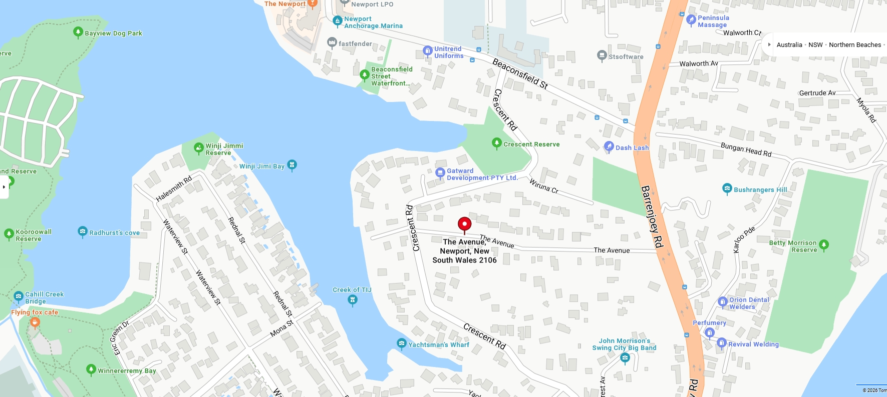
James Verrall, Boatman and Boatshed Proprietor, and Walter Verrall, Carpenter and Boat Builder, both of North Harbour Manly and sons of James Verrall senior, acquired 5 acres 3 roods and 34 perches through Primary Application 27062 on March 2nd, 1926 – 100 years ago this month - on the Crescent and The Avenue at Newport with just over 2 acres of this fronting what had been known in earlier times as 'Old Mangrove Bay' and alongside where 'Boulton's Jetty/Wharf' had been in one lithograph.
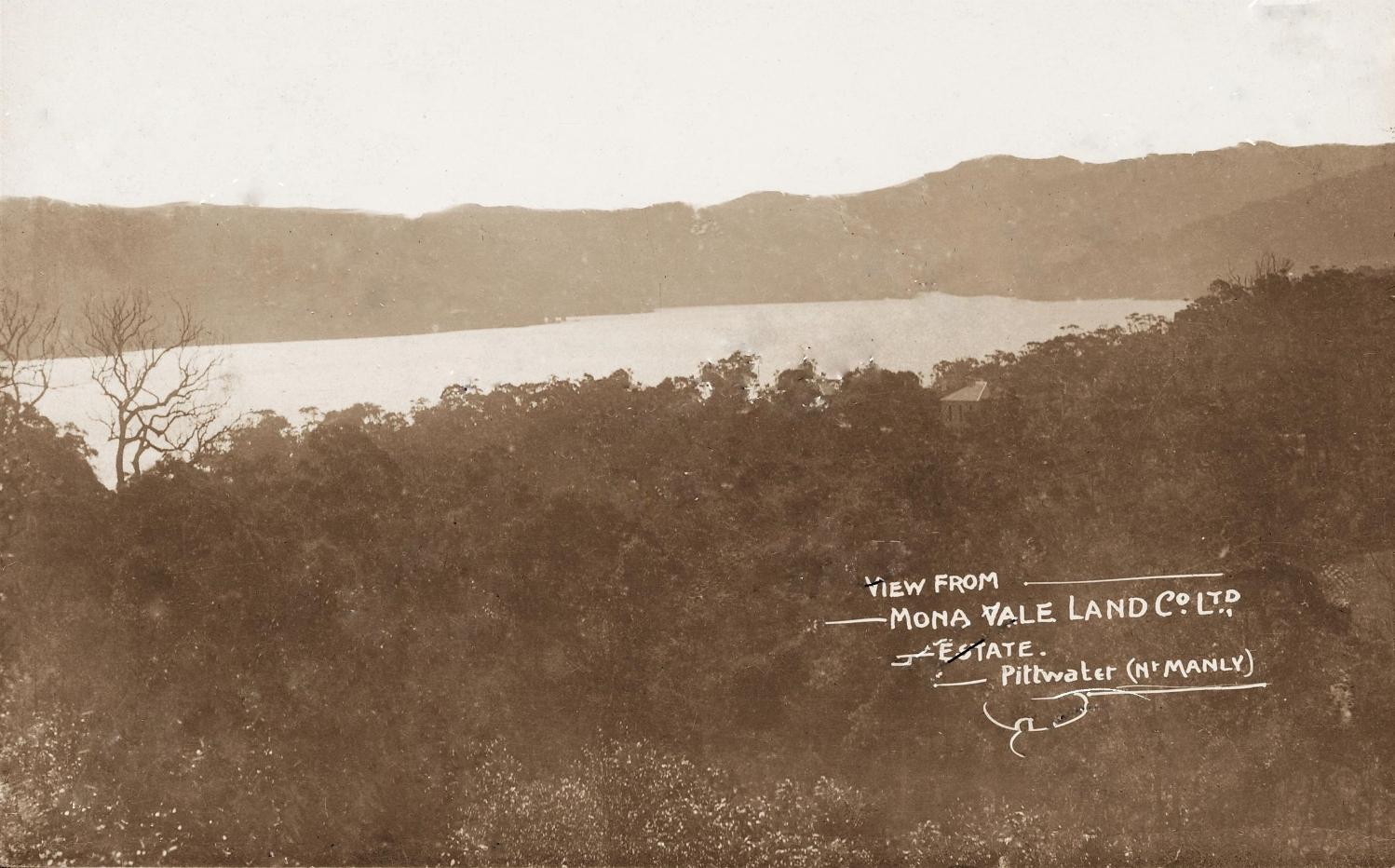
Their father had bought the Newport land in 1891 on January 1st, according to the records, from the Mona Vale Land Company. James Verrall senior drowned aged 84 in North Harbor on Thursday November 6 1924, between Side Hall and Forty Baskets beach. He had been fine that morning when Walter gave him his breakfast at the family home ‘Harbor View’, Condamine Street, North Harbor, Manly, but a few hours later was lost to his sons.
James Verrall senior, was one of the early boatmen of Manly, who had settled at 'North Harbour' by 1875. Boatmen were like today's water taxi proprietors, except they rowed people in that pre-engine age for boats. George Mulhall, first Lightkeeper at Barrenjoey Lighthouse, was also a boatman and considered the First Champion in Rowing in Australia due to his ability to beat all comers in races that form part of early Sydney Harbour Regattas or in betting races that would see big wins for the person who came first. Then, as now, boatmen's boats used to transport fare paying passengers around or across the harbour, before regular ferry services in the 1860s and even afterwards, for those who missed the last boat home.
When James Verrall snr. passed way his sons, James and Walter, needed to go through a land titles searches to ascertain what he actually bought over the years, to establish their claim on his assets, and then went through the processes to dispose of the holding. A Notice from 1925 states:
No. 27,062. James Verrall and Walter Verrall, 3 a. 2 r. 36 p., cor. The 'Avenue and Crescent-rd., and 2 a. 0 r. 38 p., lots 30 and 30a, sec. 5, front. Crescent-rd. and Pittwater. NOTICE UNDER REAL PROPERTY ACT. (1925, December 24). Government Gazette of the State of New South Wales (Sydney, NSW : 1901 - 2001), p. 5728. Retrieved from http://nla.gov.au/nla.news-article223018175
HRLV Vol-Fol: 3836-198:
.jpg?timestamp=1773772325523)
.jpg?timestamp=1773772421779)
.jpg?timestamp=1773772372112)
.jpg?timestamp=1773772469654)
.jpg?timestamp=1773772506988)
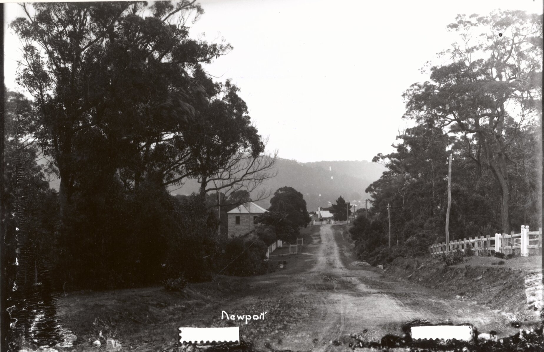
Beaconsfield Street Newport, circa 1900, Item: FL11281565, NSW Records and Archives - white paling fence of Newport school on right, Houreaux stone house on left, taken from just near Crescent road turn off to left.
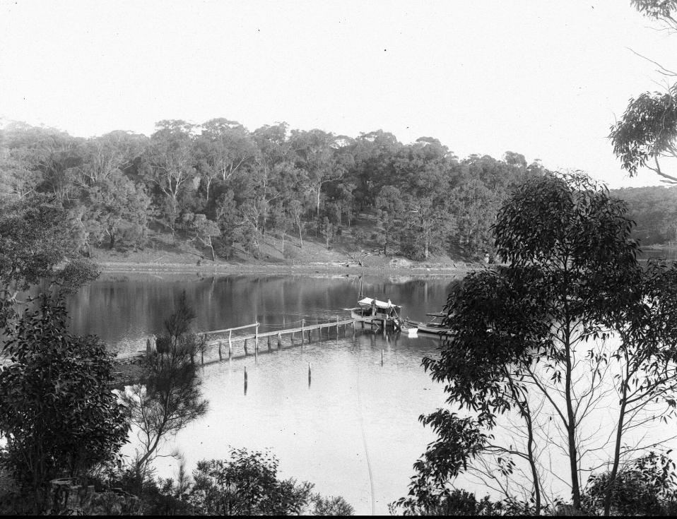
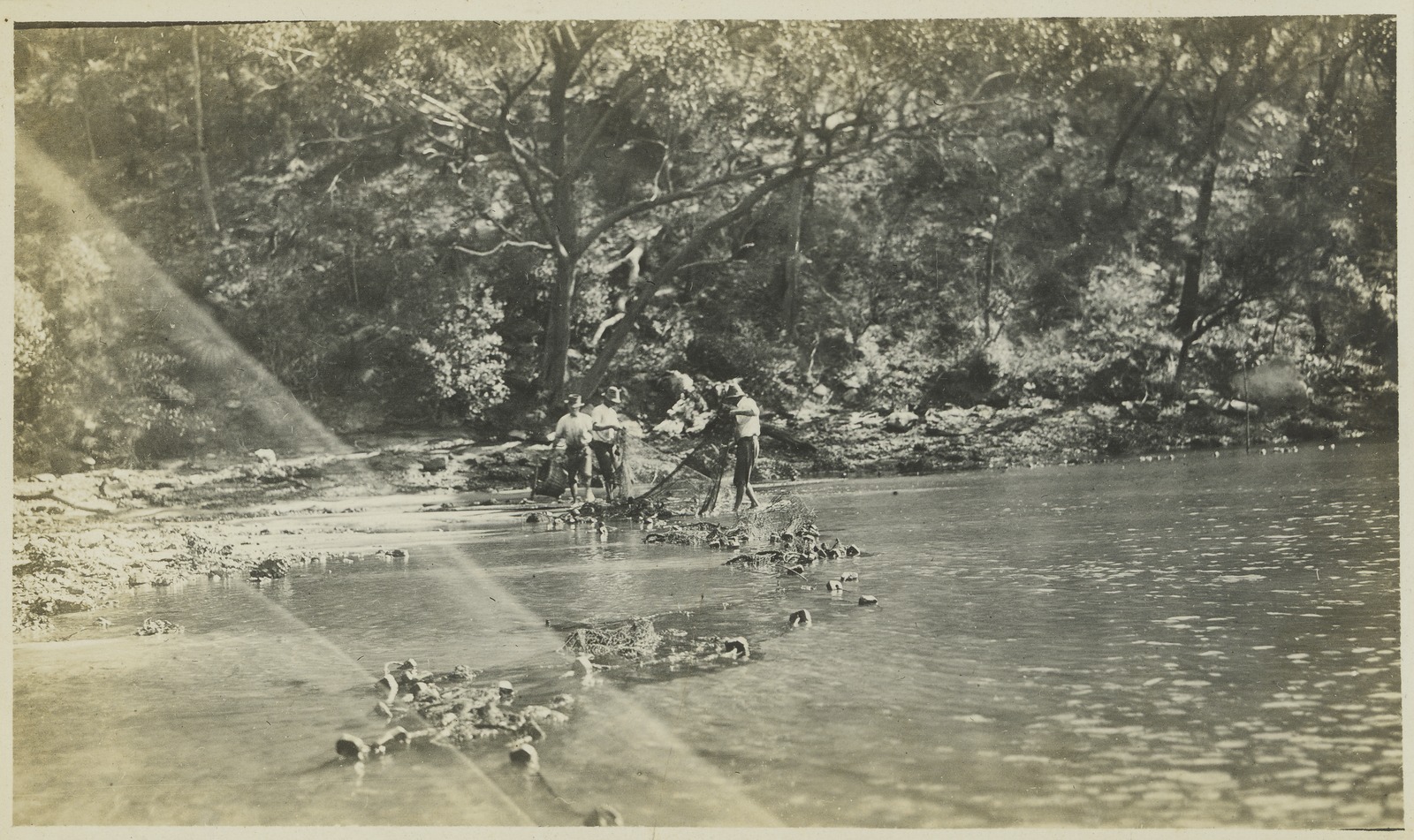
Interestingly what was called 'Vogan's Point' was alongside them, the holding bought and sold by journalists and early photographer of Pittwater Arthur James Vogan, who bought this land in June 1911. A letter about the destruction of birds in January 1914 shows he is at 'Newport' then, so if some properties were sold, some was also held onto. His aim in selling his holdings was to further his work and the costs this incurred, for travelling, became more expensive as time went on. The ownership of this vessel may account for some of the from the water views that are among his photographs:
Arthur James Vogan Crescent Road & The Avenue at Pitt Water Shire Warringah Parish Narrabeen Volume 2216 Folio 68:
.jpeg?timestamp=1773773386390)
.jpeg?timestamp=1773773423558)
.jpeg?timestamp=1773773465201)
.jpeg?timestamp=1773773496218)
Crescent Reserve Resumed
An area alongside the water, measuring of 2 acres and 36 perches, was resumed by Warringah Shire Council in 1937 from Walter Verrall. The WSC was continuing its policy to ensure residents had access to the waterfront of the Pittwater estuary and place to play – which also befitted local wildlife in this instance as their habitat was retained.
Around the corner, in the decade before, the WSC were resuming what would become 'Dearin Reserve'. Up the hill Trafalgar Park was placed under the Warringah Shire Council, after being put under the locals by the original subdividers, through a council decree of December 1910. Further south, Crescent Road was sheltered enough to be a place where tropical fruits were grown, even in the middle of Winter. See a little about Frederick Mason's farm where Crescent road met Waterview street in: Pittwater's Tropical Fruits: The Estuarine Farmlets At Mona Vale-Newport That Kept Sydney Stocked With Hot Area Fruit In The Middle Of Winter
In the lead up to resuming this acreage for public access to the water and for a recreation space, the WSC had been taking out loans for ratepayers to service, building roads and pools, and according to this report, pretty busy even during the financial depression of the 1930's:
WARRINGAH.
The Warringah Shire Council experienced difficulty in 1934, mainly because of the rapid development in the shire. The 13 beaches in the shire constituted both an asset and a liability. While they attracted thousands to the shire and had been largely responsible for its progress, they also entailed a big expenditure on necessary improvements and conveniences. New beach buildings were erected at Newport, Avalon, Mona Vale, South Narrabeen, and North Curl Curl, at a total cost of £5800. Extensions were being made at North Narrabeen, and £2000 was being spent on a modern building at Harbord. The clubhouse at Collaroy would shortly be extended. In addition, rock baths were provided at North Narrabeen.
An effort was made to secure the surroundings of Deewhy Lagoon as a public reserve. The Minister for Lands gave a sympathetic reply to a deputation's request that the Government should resume the area. The matter went to the Cabinet for consideration. Farrell's Lagoon at Newport was converted into a recreation area, as an unemployment relief work. Reserves throughout the shire had been improved.
The problem of communication between the city and the shire was one of the problems of the council. The Main Roads Department carried out work on Pittwater-road, Warringah-road, and Condamine-street, and the roads connecting with Roseville. These, it was stated, were providing speedier access from the northern suburbs to the beaches. It was hoped that a scheme would shortly be carried out to make a marine drive from Manly through Harbord, Curl Curl, and Deewhy.
Building in the shire continued to improve. In the quarter ended September 30 last, the value of buildings approved was £35,595, the largest quarterly total in the history of the shire. THE COUNCILS. (1935, January 2). The Sydney Morning Herald (NSW : 1842 - 1954), p. 4. Retrieved from http://nla.gov.au/nla.news-article28022988
Geoff Searl OAM, President of the Avalon Beach Historical Society sent in a great shot of the Sharp’s farm in the Crescent which allows us to see the orchard planted by them surrounded by the trees and bush.
Geoff said; ''This was given to me by Gordon Sharp around 30 years ago.
We were in the Avalon Fire Brigade together - he and brother Arthur.
The fence line on the right, later became the northern boundary of the Avenue’'.
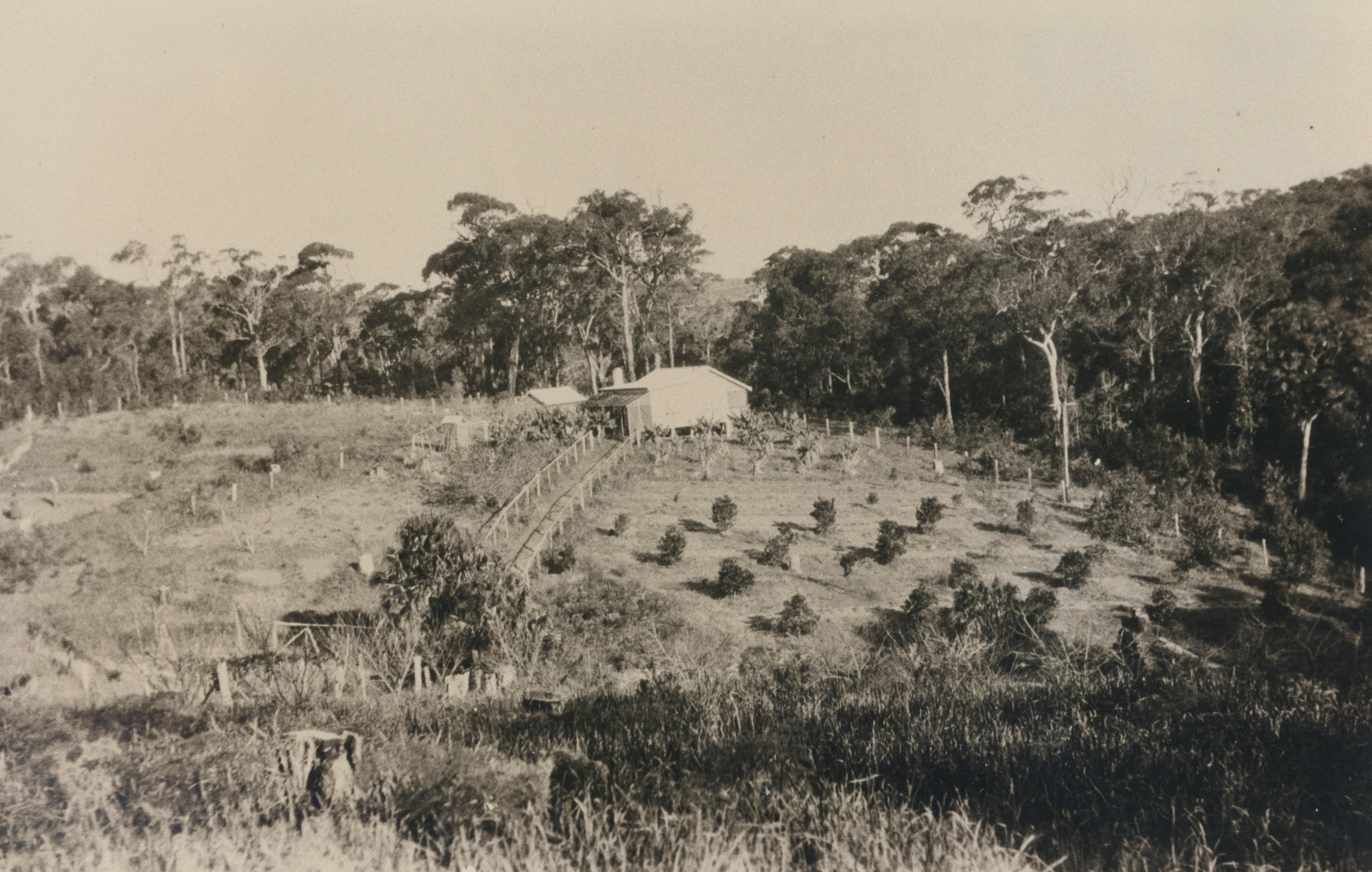
Sharp’s farm. Photo: courtesy Sharp Family/and Geoff Searl OAM
The State Government had also been busy making changes at the top of the hill during the 1930's, where The Avenue Newport met Barrenjoey Road:
From the then department of Main Roads annual report of 1934-1935, page 13:
(c) Main Road No. 164 - Barrenjoey Road.)
The Department commenced by day labour the reconstruction of Barrenjoey-road northward from the end of the existing cement concrete pavement at Narrabeen. The work involves the improvement of alignment by deviations, regrading and widening. Wherever the condition and levels of the existing pavement are suitable it is being utilised as a base-course for the new drag-spread macadam wearing course, but where the old pavement cannot be adopted, a ballast base-course is laid with an intermediate course of premixed material using hard local sandstone as the aggregate. Realignment involving resumptions has been undertaken at Sheepstation Hill (between Narrabeen and Mona Vale), near Mona Vale at "La Corniche" corner at Bassett-street and north of Grandview-parade on the "11-mile" hill. A further deviation is in hand adjacent to the Avenue, Newport. For the supply of the stone required for the reconstruction a quarry has been opened at Bilgola.
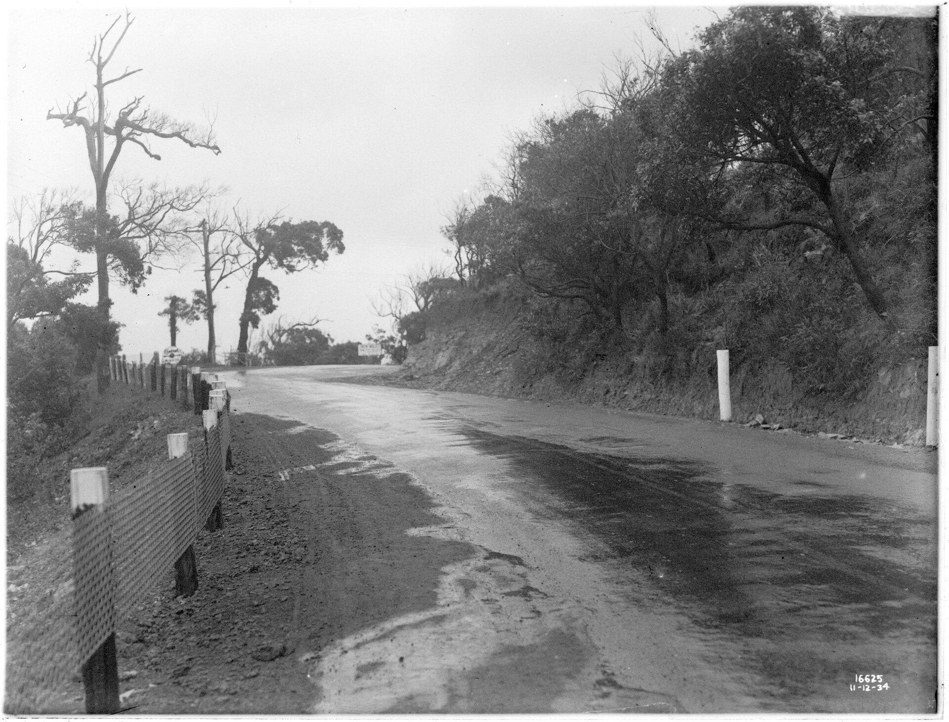
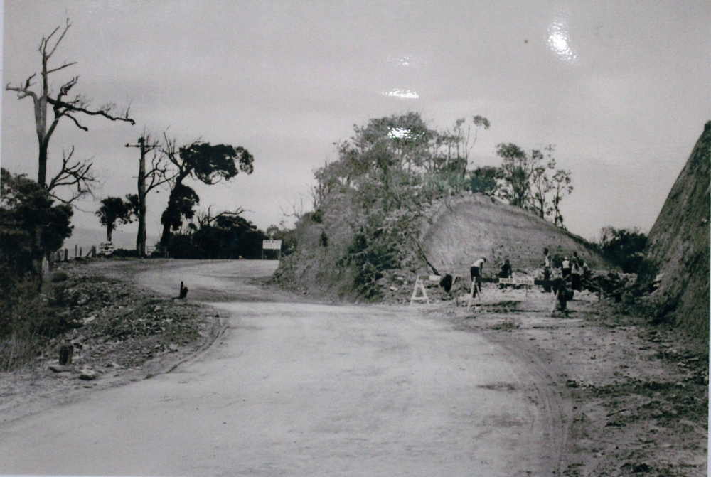
Curve near the Avenue, South Newport. December 11, 1934. From NSW Government Printer series: Main Roads: Main Rd 164, Shire of Warringah] dated 11.12.1934, NSW Records and Archives photo, Item: FL2658786
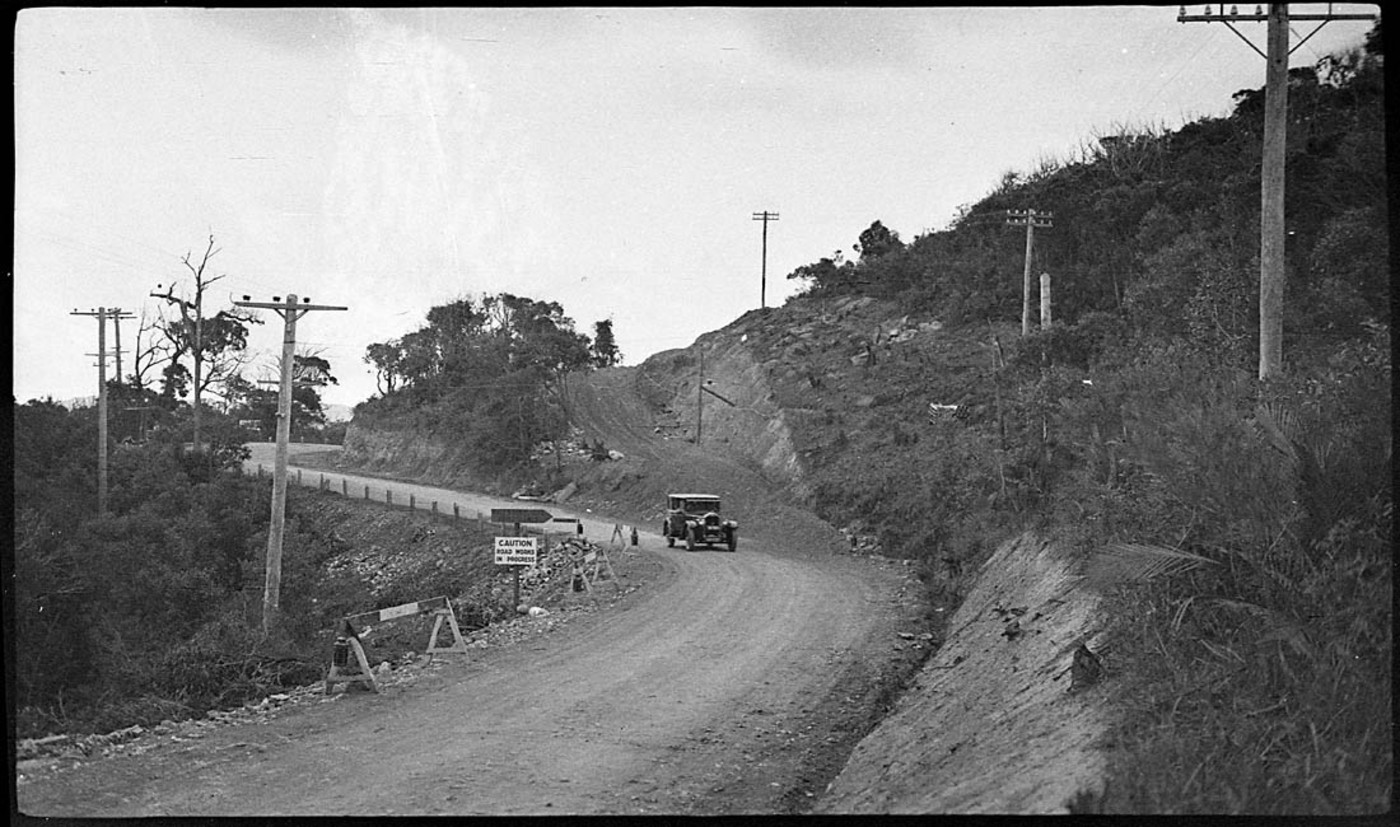
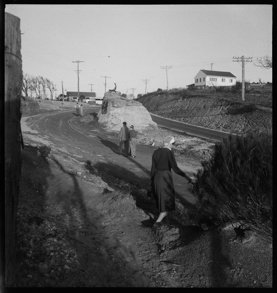
Road to Newport being fixed - Image No.: perier_34298h, courtesy State Library of NSW
The Road leading up the hill between Mona Vale and Newport - this spot is near Bushrangers Hill at thew top of the stretch that goes over Bungan and towards Newport - the road on the right of the picture will become the Barrenjoey road - these road works were done, alike that out past Church Point to Coal and Candle Creek, through Australian Depression Work Relief Programs. If you come out of The Avenue in Newport now, on the Bungan-Newport ridge, you are looking straight across to that rock face on the right, although clearly the road has been widened since then. ABHS Photo
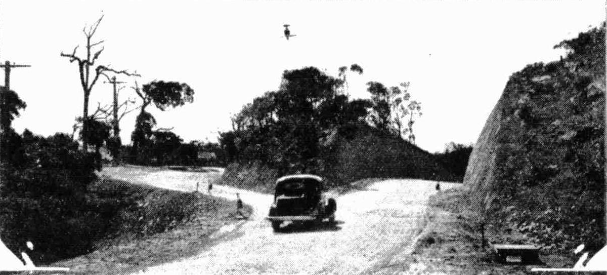
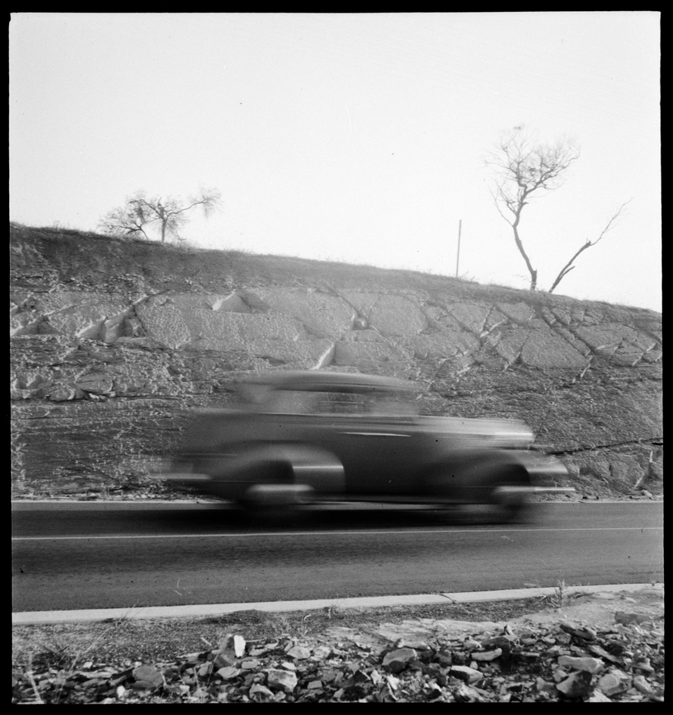
Extensive improvements are being made to the road to Palm Beach. This big cutting on the Newport-road has just been completed. The old blind turn, which was a source of danger when traffic was heavy, is on the left. Another cutting is being made at the northern end of Mona Vale. Tents and Motor-Campers (1935, November 20). Sydney Mail (NSW : 1912 - 1938), p. 50. Retrieved from http://nla.gov.au/nla.news-article160499041
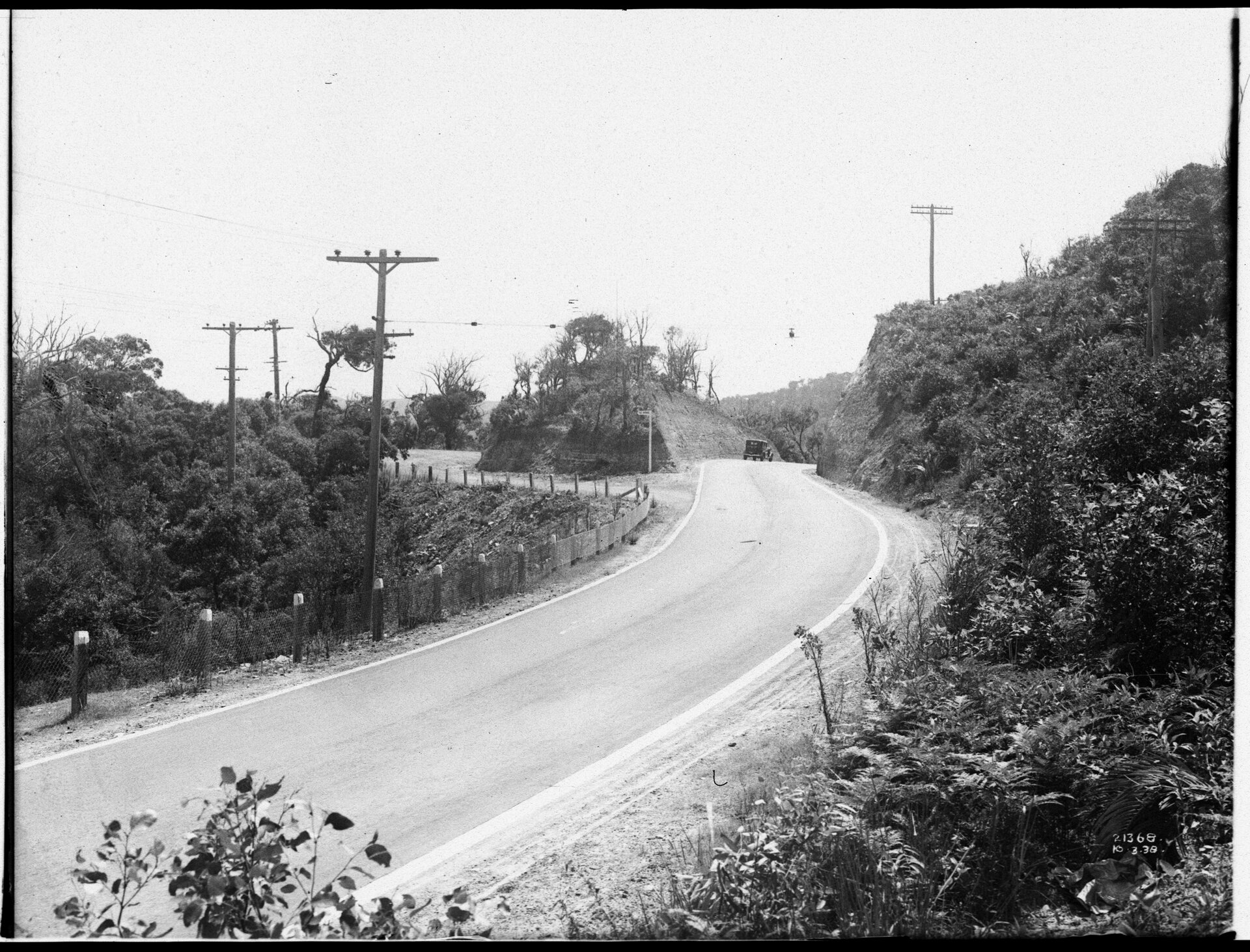
The Avenue Newport looking south March 10 1938. [From NSW Government Printer series: Main Roads] dated 10.3.1938, NSW Records and Archives photo, Item: FL3612714 - now with posts and barriers at side of road and has been sealed and is now a dual carriageway.
'Mona Vale landscape' 1936. photographed by Max Dupain. Item: SLNSW_FL19489391, courtesy Mitchell Library, State Library of New South Wales
Mona Vale near 11 mile store, 30s / photographed by Max Dupain, Item: SLNSW_FL19501832, courtesy Mitchell Library, State Library of New South Wales
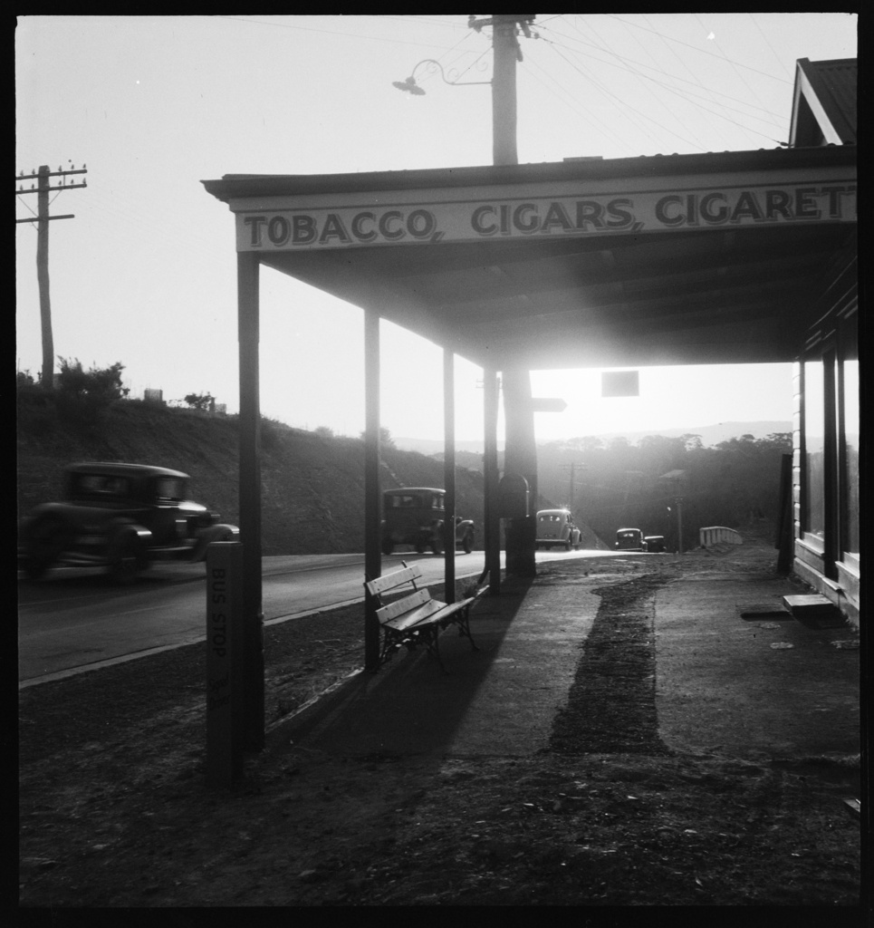
After these roadworks it is suddenly the 'Nine Mile store, Mona Vale', 1930s / photographed by Max Dupain. Item: SLNSW_FL19488950, courtesy Mitchell Library, State Library of New South Wales
The Certificate of Title for Crescent Reserve is registered on September 17 1937 and can be seen in Vol-Fol: 4871-66:
.jpg?timestamp=1773774363722)
.jpg?timestamp=1773774451906)
.jpg?timestamp=1773774400125)
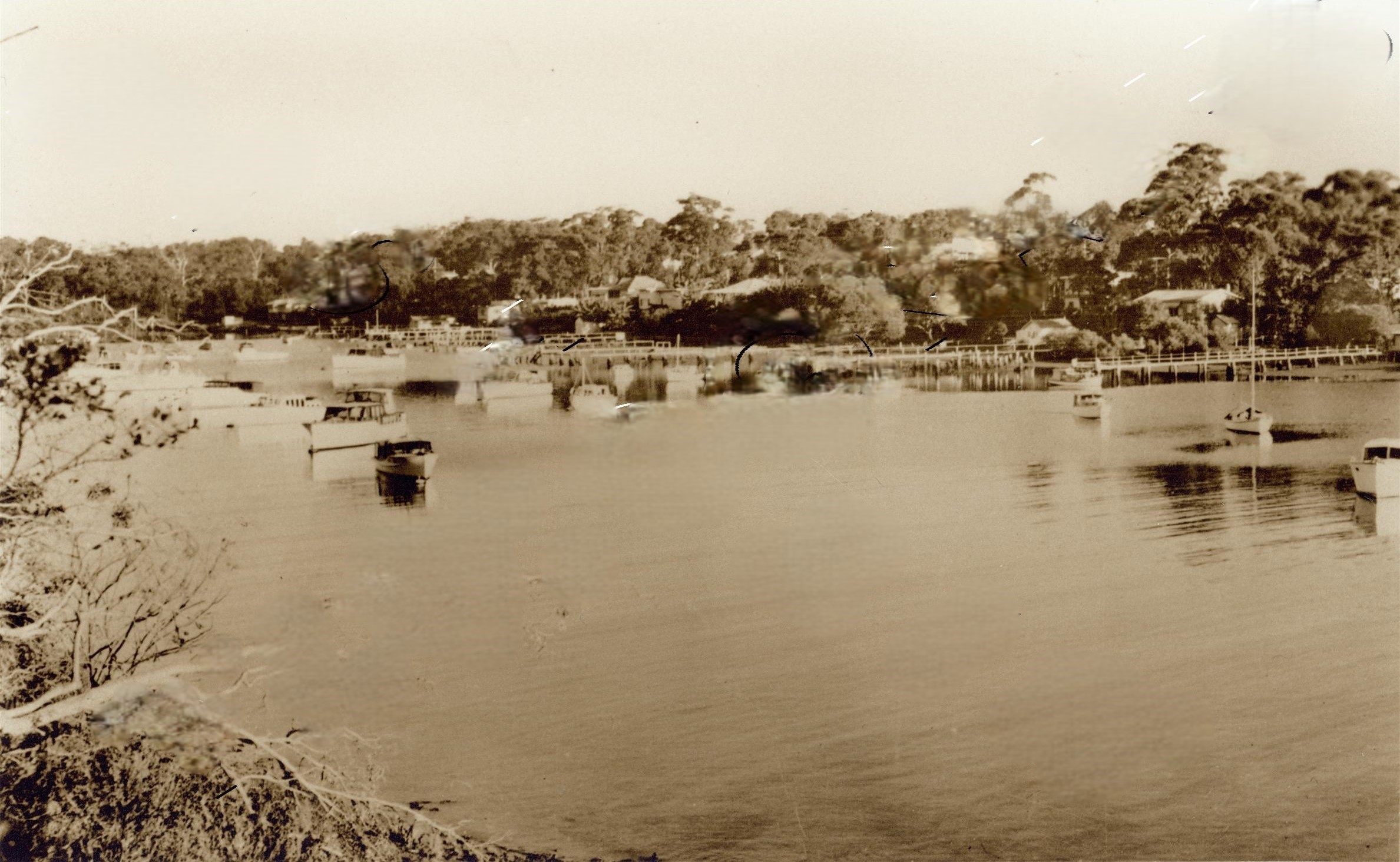
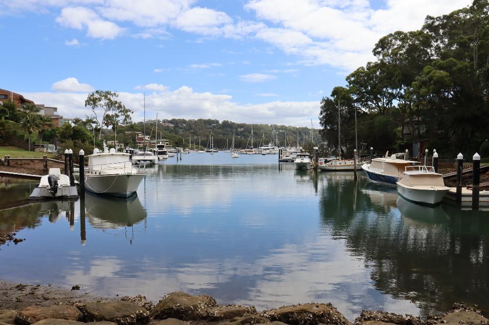
'Pittwater from Newport Hotel', 1940's - view into bay formerly known as 'Old Mangrove Bay' - just south of current day Newport Hotel
This wasn’t the only and taken from the Verrall family to make a local parkland for others during the same years:
IN EQUITY.
(Before Mr. Justice Nicholas.) RECLAMAT ION AT MANLY
Recently the Government resumed certain lands at North Harbour, Manly, and vested them in the municipal council to be used in a reclamation scheme. Mr. Walter Verrall, of Condamine Street, part of whose land was resumed, has now commenced proceedings against the Government and the council, by which he seeks an order directing the council to resume the whole of his land, as required by Section 138 of the Public Works Act.
Mr. Verrall said that on Thursday, the council in commencement of its reclamation scheme dumped soil on the land, and that as a result he had been unable to launch a boat he had built.
The matter came before the Court on motion for interim injunction, and, by consent, an injunction was granted, counsel for the municipality promising that nothing would be done until the hearing to prejudice plain-tiff.
It was arranged that his Honor should view the locality this afternoon.
Mr. D. B. Hunter (instructed by Messrs Read and Read) for plaintiff and Mr. E. S. Miller (by Messrs Florance and Crocker) for the Manly Council. IN EQUITY. (1938, June 7). The Sydney Morning Herald (NSW : 1842 - 1954), p. 6. Retrieved from http://nla.gov.au/nla.news-article17473549
The following March:
IN EQUITY.
(Before Mr. Justice Nicholas.)
LAND RESUMPTION AT MANLY.
Claim Against the Council.
The hearing has commenced of the suit instituted by Mr. Walter Verrall against the Municipal Council of Manly to which the Under-Secretary for Public Works is joined as a nominal defendant arising out of the resumption of land for purposes of a public park at the head of the northern arm of Manly Cove on the western side of Condamine Street.
In order to construct the park the council made application for certain land, and, in the Gazette of December 3 1937, by notice of resumption, an area of land was resumed and appropriated and vested In the council.
In Mr Verrall’s deeds of title his lands are described by metes and bounds from Button Street and are also described as running to the waters of north harbour. He says that since he became owner of the lands the waters of the harbour which formerly came up to his southern boundary have receded so as to leave an exposed area and he claims that if he was not entitled to this area by virtue of his deeds giving title to lands bounded by the water, he became entitled by accretion arising from the receding of the water.
The area resumed and appropriated for the park was the area left by the receded water and the plaintiff says part of his land outside the area of accretion. He claims that under section 138 of the Public Works Act the resuming authority is obliged to take the whole of his lands being lots 10, 11, 12, 13, in front of which the park is being made.
The council disputes taking any of plaintiffs land or that he was entitled to any part of the land resumed either by deed or by accretion. It also submits that the suit has been brought in breach of agreement, arising out of District Court proceedings, under which the plaintiff undertook not to oppose the reclamation scheme.
During the afternoon the Court viewed the subject land. The matter stands part heard
Mi Dudley Williams r. C Mi E W Wickham and Mi D B Hunter (instructed by Messrs Read and Read) appealed for plaintiff and Mr Maughan KC Mr ES Millet and Mr I R Ken (instructed by Messrs I A Froiante and Crocker) for the Manly Council. IN EQUITY. (1939, March 10). The Sydney Morning Herald (NSW : 1842 - 1954), p. 6. Retrieved from http://nla.gov.au/nla.news-article17578195
The decision went against Manly Council, and they were ordered to resume lots 12 and 13 and pay costs. Alderman Hanson-Norman stated that this would cost Council some £500.
The Sydney Morning Herald reported:
LAND RESUMPTIONS.
Court Decision Disturbs Council.
"A grave situation has arisen as a result of Mr Justice Nicholas's decision in the equity case of Verrall against Nott and the Manly Council," said Alderman Miller at the meeting of the Manly Council last night.
Mr Justin Nicholas found that the council, in resuming land at North Harbour for a park was bound to resume the whole of the land instead of a strip across the front of it.
Alderman Miller said that the decision had far-reaching effects, touching, many public bodies. The council had been in the habit of resuming pieces of land at street corners for public safety. This decision would compel them to take the whole of the allotments affected, which would be quite beyond their financial resources.
The Mayor, Alderman Hanson-Norman said statements were being, made out-side that the aldermen had involved the council in £4,000 costs. This was incorrect. The amount had not yet been made up but he could safely say it would be less than £500. The council was guided in the action it took by the advice of eminent legal men.
The council resolved to ask the Minister for Works and Local Government, Mr Spooner, to have section 138 of the Public Works Act amended to meet the position. LAND RESUMPTIONS. (1939, May 10). The Sydney Morning Herald (NSW : 1842 - 1954), p. 14. Retrieved from http://nla.gov.au/nla.news-article17580575
The Manly Council then went on to form North Harbour Reserve at Balgowlah.
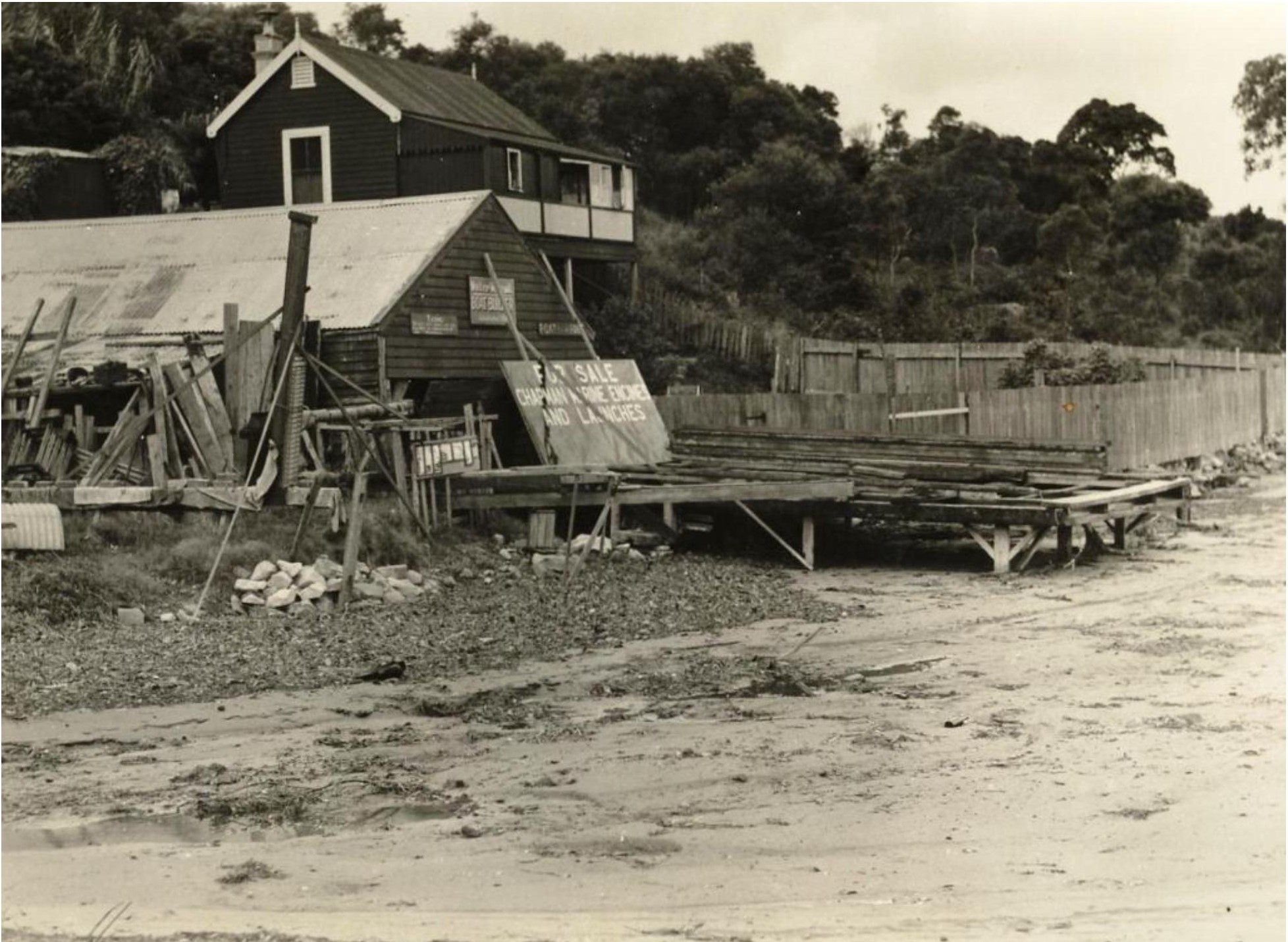
January 1938 - W Verrall’s boatshed. Image: Manly History Unit
Walter Verrall had applied to erect a weatherboard and iron boatshed at North Harbour in June 1936; the application was refused because it would be inimical to the best interests of the locality. The proposed boatshed would have taken the place of an existing building. The boatshed shown above was in situ before 1936.
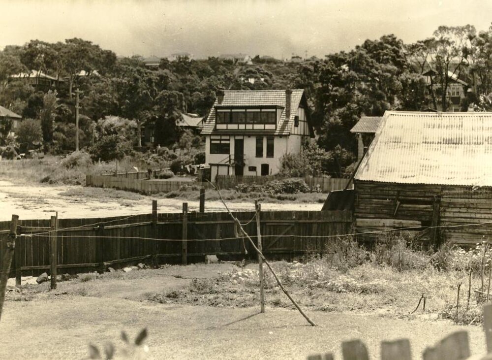
House of Walter Verrall, North Harbour, Manly, 20th January 1938. Image: Manly History Unit. The Manly Council’s Engineer’s Department commissioned local photographers to record the ongoing progress of public works in the area. This image is part of a collection documenting civil engineering projects of great interest, and adds considerably to the set of suburban street-scenes in Manly.
James Verrall, son of James Verrall snr., passed away in 1932 with probate granted April 20 1933. Walter Verrall passed away in 1944.
VERRALL -May 2, 1932, James Verrall of Boling-broke-parade Manly (North Harbour Boat Sheds) beloved father of Vivian, Vera, Jack, and Dorothy, aged 63 years. Family Notices (1932, May 3). The Sydney Morning Herald (NSW : 1842 - 1954), p. 8. Retrieved from http://nla.gov.au/nla.news-article16860282
VERRALL.—August 31, 1944, at his residence, 122 Condamine Street, Balgowlah, Manly, Walter Verrall, beloved husband of Edith, loved father of Winifred and Lena (Mrs. K. Karnaghan), aged 67 years. Family Notices (1944, September 1). The Sydney Morning Herald (NSW : 1842 - 1954), p. 10. Retrieved from http://nla.gov.au/nla.news-article17919282
The November 9 1970 Warringah Shire Council Meeting records:
Cr. Dawson: 62. At a meeting on the 16th October with the President, the Engineer promised to produce a plan for the development of Crescent Road Reserve Newport. Has this been completed, and could it be referred to the Parks and Reserves Committee's next meeting? The Engineer will advise if you bring it forward, and I will see that the matter is expedited. 63. Knowing that foreshore retaining wails of properties and reserves can be constructed with random stone (Yachtsman's Paradise as an example), and having been asked by ratepayers for assistance in Winji Jimmi with random stone for the same purpose, why is random stone being deposited in Crescent Road Reserve by Council staff? Put your question in and I will have it referred to the Parks and Reserves Committee.
The Pittwater Parks, Reserves and Playgrounds lists made by Pittwater Council in 2000 states this is:
Crescent Reserve, Newport
Reserve No.: 89 Area (ha): 1.1 Asset No: A11991 Location ( eg, street frontages): Suburb / Locality: Land Title Reference: Crescent Road Newport Lot 2, DP 597102. Classification: LGA 1993, Category(s): Natural area-foreshore Park. Zoning: Community Land Natural area-foreshore Park 6 (a) Existing Recreation
The Description provides: A medium sized park and bushland area, located in a gully between Crescent Road and the foreshore of Pittwater. The eastern portion adjoining the street has a large play structure, with a very long slide and consists of open lawn areas, with a white arris rail fence in a curved alignment separating the park area from the wide grassed verge of Crescent Road. A driveway provides access to the pumping station and turfed area adjoining the foreshore.
Recreation Setting Category(s) %: Small developed Park (20%) Beach shoreline (20%) Bushland (60%).
Native Vegetation Type (s): Lower shale slopes. Soil Landscape: Erina
The Pittwater Urban Bushland Inventory and Action Plan - Crescent Reserve, Newport, compiled in 1997, states:
Crescent Reserve is a foreshore Reserve located west of and abutting Crescent Road in Newport. The Reserve is contained in a gully that empties into a cove of southern Pittwater. It occupies 1.0ha and has a play area in the eastern portion. Sydney Water has an access road and Pumping Station (Lot 1 in DP 597102).
The Reserve is owned by Council, being described as Lot 2 in DP 597102 which is zoned 6(a) Open Space - Existing Recreation and includes Part Lots 19 and 20 in DP 160505 zoned 2(a). Foreshore reclaimed Crown land is managed as part of the Reserve under Council’s care, control and management and is owned by the Department of Land and Water Conservation.
The Reserve is community land under the Local Government Act 1993. It is categorised as a natural area and further categorised as bushland (60%) and foreshore ( 20% ). It meets the definition of urban bushland described in State Environmental Planning Policy No 19 - Bushland in Urban Areas.
Crescent Reserve is located in a gully at the footslopes of a small catchment that commences at Bushrangers Hill and flows west to Pittwater. The Reserve has a general westerly aspect and the gully has an east-west axis with moderately sloping sideslopes. Downstream the Reserve meets a tidal boundary of Yachtsmans Paradise, a bay in Pittwater. The parent geology is underlying shales and sandstones of the Newport Formation in the Narrabeen Group. This geology has given rise to deep yellow podzols and some deep yellow earths on colluvial footslopes. These soils have been mapped as the Erina soil landscape. The footslopes experience seasonal waterlogging.
Located on the foreshore, the Reserve is at the bottom of a largely residential catchment. The upper catchment is limited by Bushrangers Hill and Barrenjoey Road and contains some steep slopes. The foreshore and creekline have been extensively modified by Water Board works.
Vegetation is described and listed as:
The northern side of the Reserve supports a Narrabeen Slopes community dominated by Grey Ironbark (Eucalyptus paniculata), Grey Gum (E. punctata) and Turpentine (Syncarpia glomulifera). The low tree and shrub layer includes locally significant Guioa (Guioa semiglauca), Smooth Mock Olive (Notelaea venosa), Yellow Pittosporum (Pittosporum revolutum), Native Peach (Trema aspera), Bottlebrush (Callistemon spp.). The groundcover and vine layer includes Blue Flax Lily (Dianella caerulea), Native Geranium (Geranium solanderi), Native Raspberry (Rubus spp), Kidney Weed (Dichondra repens) and Centella asiatica. The southern slope supports a diverse native plant community with a modified understorey. The modified gully floor supports a Swamp Oak Woodland community dominated by Swamp Oak (Casuarina glauca) with remnant Cabbage-tree Palms (Livistona australis) and Prickly-leaved Paperbark (Melaleuca stypheliodes).
Fauna is stated to be:
It is likely that the threatened Glossy Black cockatoo forages in the maturing Swamp Oak. Arboreal mammal scratch marks are evident on Grey Gums and numerous birds regularly frequent the Reserve. The Reserve also provides continuity for fauna moving to adjacent bushland understorey. Council's Habitat and Wildlife Corridor Conservation Strategy maps the Reserve as "Corridor - Co3" which indicates residential areas with some tree cover but requiring supplementary planting to aid faunal movement. The Newport area is a high priority for enhancement as a wildlife movement area.
Aboriginal and European Heritage sites
There are no recorded Aboriginal sites within the Reserve, although there is potential for Aboriginal sites such as middens to occur in the area. There are no known European Heritage sites in the Reserve. Areas where previous disturbance associated with the Water Board Pumping Station and a sealed access road along the northern slope lessens the likelihood of intact sites in the disturbed parts of the Reserve.
The Pittwater Council Statement of Significance
Crescent Reserve is significant because:
- it provides an enclosed bushland setting on the foreshore with potential to incorporate a picnic area
- it protects a sample of a thin band of rainforest which includes locally significant species, namely Guoia semiglauca
- it contributes to the landscape quality of Pittwater and Newport
- it provides a record of the original landscape and the changes wrought by settlement and development,
- it acts as a local refuge for fauna and provides potential feeding habitat for the threatened Glossy Black-cockatoo,
- it provides a stepping stone between larger areas of habitat due to the diversity of flowering eucalypts and rainforest species,
- it is a contact point with nature for residents and an educational resource, and
- it allows urban residents to undertake informal recreation pursuits in an enclosed bushland setting.
Management Objectives
The management objectives for Crescent Reserve are:
- to protect the natural, cultural and landscape features of the Reserve,
- to maintain the natural range of structural and floristic diversity of bushland in the Reserve, to protect the locally significant stand of Guioa (Guioa semiglauca)
- to conserve habitat features for fauna, such as winter flowering eucalypts Grey Ironbark (Eucalyptus paniculata) and Grey Gum (E. punctata), Swamp Oak (Casuarina glauca) and Cabbage-tree Palms (Livistona australis)
- to provide supplementary planting to aid faunal movement
- to adequately manage the bushland in relation to weed invasion and restore the creekline erosion and water quality
- to improve the bushland character of the Reserve with a revegetation program in the previously disturbed areas, and restrict mowing practices on southern slope
- to manage fuel and protect life and property from fire whilst maintaining a near natural fireregime in the Reserve to conserve native flora and fauna,
- to control introduced animals in the Reserve,
- to provide opportunities for low impact recreational and educational use of the Reserve consistent with the other objectives, and
- to encourage community appreciation and neighbourhood participation in bushland management in the Reserve through support of the volunteer bush regeneration group
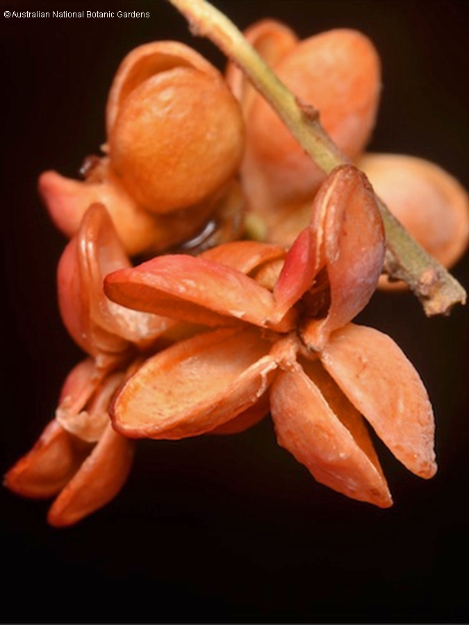
Guioa semiglauca
Guioa semiglauca, known as the guioa or wild quince, is a rainforest tree of eastern Australia It grows from Kioloa near Batemans Bay in southern New South Wales to Eungella National Park in tropical Queensland. It grows in many different types of rainforest, particularly common in regenerating areas and on sand in littoral rainforest.
Guioa semiglauca grows to around 25 m tall and 43 cm in diameter, but it may flower and fruit when only 6 m tall. The outer bark is smooth and the trunk is fluted. It is similar to coachwood, however it is more fluted and irregular.
The veiny leaflets are pinnate and measure up to 10 cm long. The midrib extends beyond the leaf to form a tiny tip. They are green above and whitish (glaucous) below. The yellow/green flowers form around September to November. The fruiting capsule matures from January to May. The seeds are oval covered by a thin layer of fleshy aril. The fruit is eaten by a large variety of birds, including the Australian king parrot. Indigenous Australians used the saponin in the bark as a fish poison.
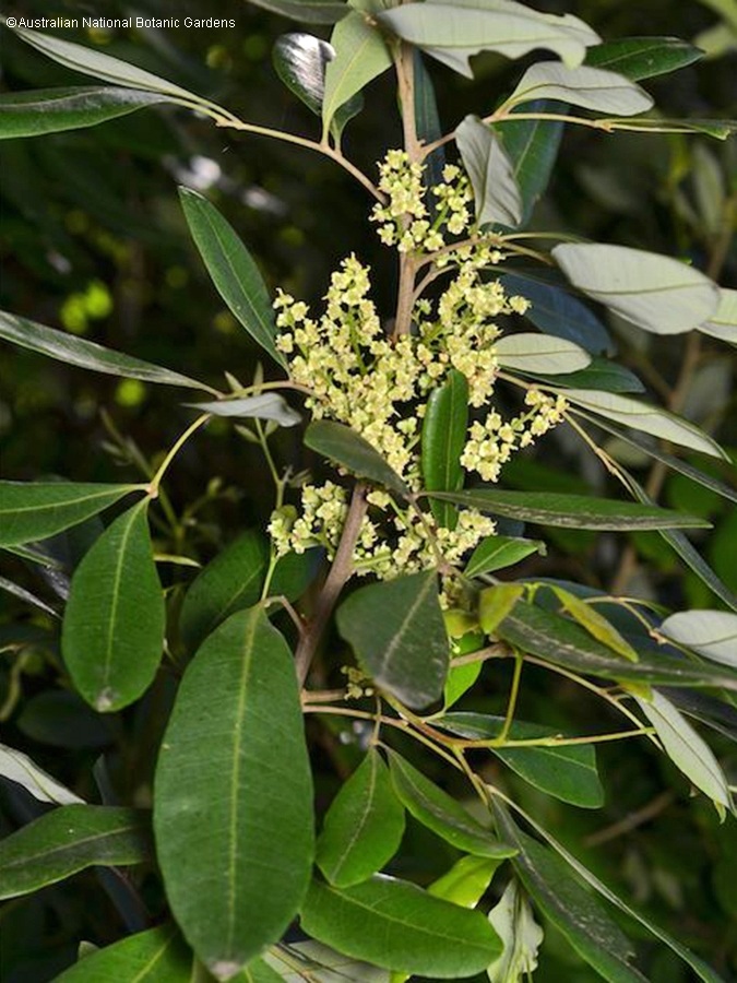
Guioa semiglauca foliage and flowers. Photo: Australian National Botanic Gardens
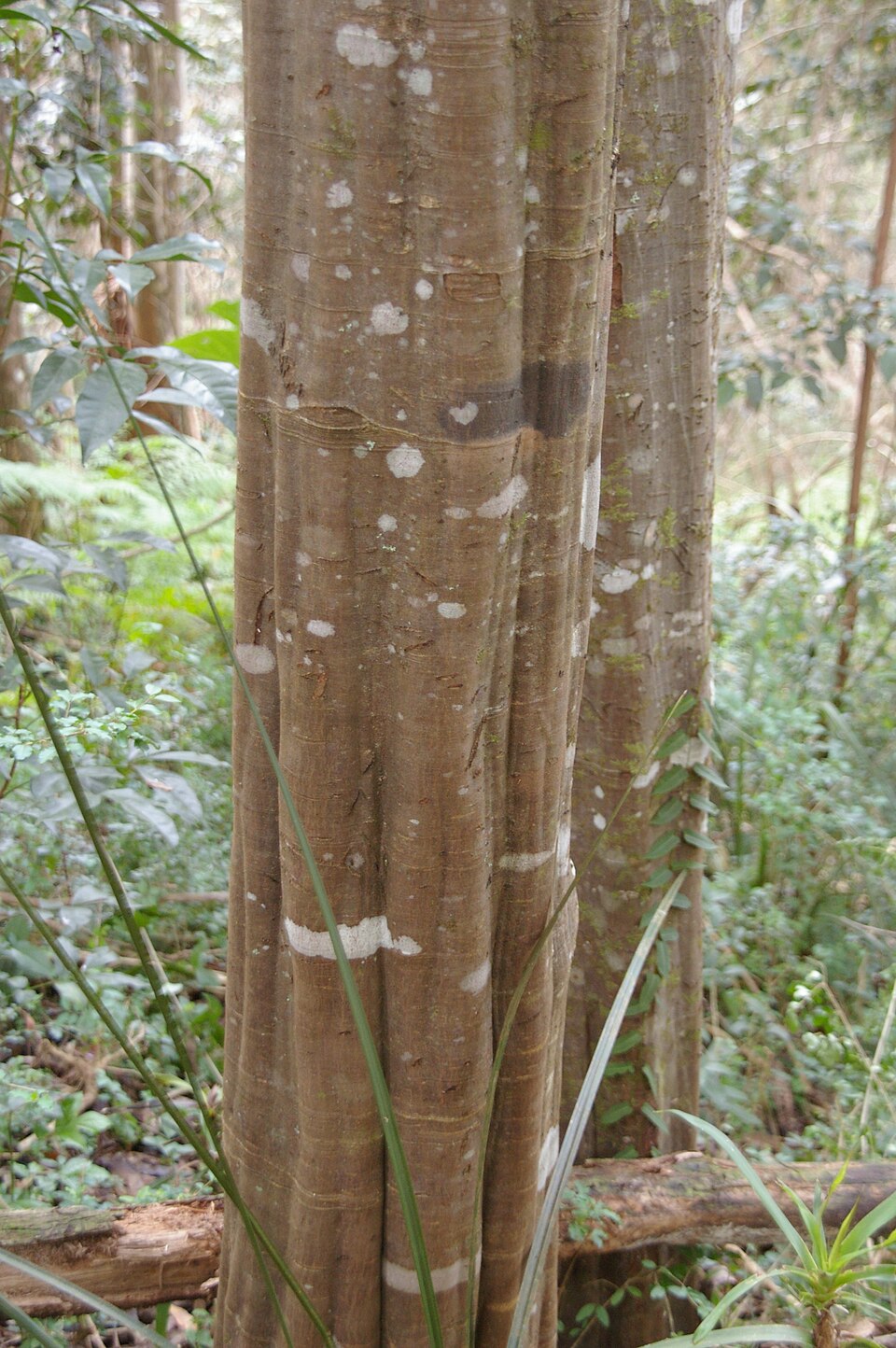
Fluted trunk. Photo: Paul Segal
Fruit. Photo: Australian National Botanic Gardens
Bushrangers Hill Creek to Old Mangrove Bay
A Creek runs down from Bushrangers Hill through the reserve. The Stormwater Management plan states:
The creekline has been extensively modified. It discharges from a pipe from the embankment into a drainage line that has two basins formed by gabions to collect stormwater debris which includes vegetation, sediment, roadway pollutants and litter. These basins require a regular maintenance program. The creek appears to breach its banks prior to being piped into the bay, discharging at the boulder embankment. Dense planting of native sedges along the top of the embankment may assist in stabilising the drainage line. The boating activities within the bay may pollute the waterway through fuel spillage and bilge water. The impact of stormwater and motor boat activity on water quality should be incorporated into a monitoring program which includes community education.
sm.jpg?timestamp=1773781516216)
Bushrangers Hill to Old Mangrove Bay creek, March 2026
sm.jpg?timestamp=1773781544430)
Weed Invasion and Bush Regeneration
The extensive earthworks within and adjoining the Reserve have allowed numerous weed species to dominate. These include African Olive, Small and Large-leaved Privet, Lantana, Acacia saligna, Fennel and Ivy. The fill slope below the cleared park area is dominated by Kikuyu and the lower area has includes Ivy, Honeysuckle, Moth Vine and Asparagus Fern.
A bush regeneration program in the Reserve should include the following:
- The north-eastern corner of the Reserve has been weeded and maintained by a volunteer group. The group should be encouraged to maintain their focus on the upper slope prior to working down into the Reserve.
- The southern slope is regularly slashed and this should be gradually restricted to mowing only of the lower parts. The upslope areas should be allowed to regenerate naturally and to extend into the gully.
- The Swamp Oak Woodland between the access road and the creek requires regular treatment to remove the weedy vines.
- The foreshore area with its boulder wall should be enhanced using local sedges and grasses with some mown areas.
- A border to the parking area near the road should be improved by planting of wildlife corridor trees, understorey and ground covers.
- Other areas that are weed infested do require treatment, but are lower priority than the above areas and should be commenced after the other areas have been consolidated.
Crescent Reserve Newport Bushcare Volunteers
The Crescent Reserve Newport Bushcare group was formed in 1997 and still works to look after this reserve on the third Sunday of every month from 9am until 12 noon.
Included among its original members was Claire Deane, a National Trust Member who worked as a Bush Regenerator and was tragically killed on June 8th 2000 during a hazard reduction burn in Ku-ring-gai Chase National Park.
A plaque dedicated to Claire is in the Crescent Reserve at Newport. Although it has deteriorated and needs replacement, an earlier photos makes the dedication readable:
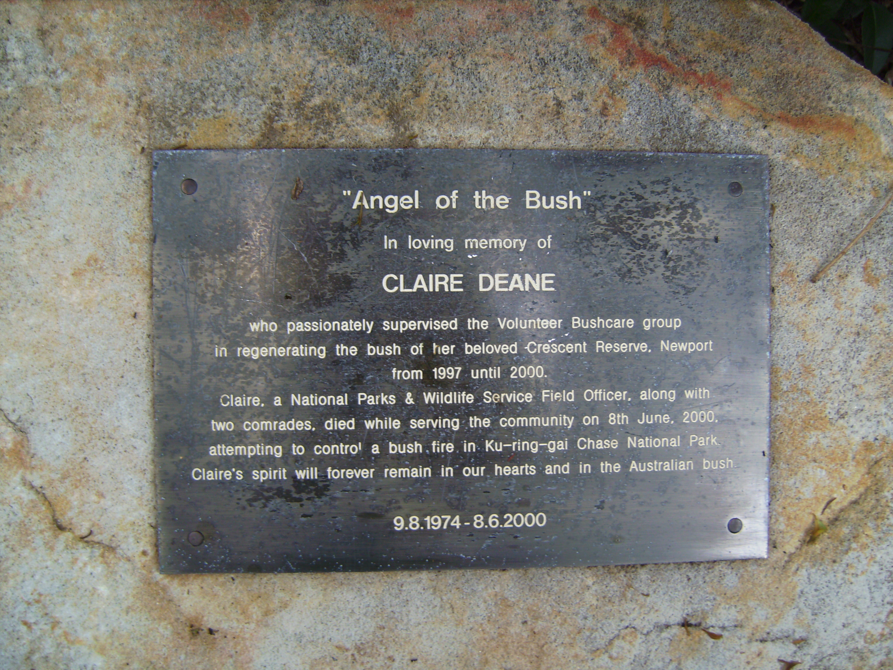
 sm.jpg?timestamp=1773780784258)
Claire's plaque dedication in March 2026
At Forestville the Claire Deane Bush Sanctuary, a 3.7-hectare space that Claire commenced returning to its natural vegetation in the mid 1990’s, also honours her work in restoring our local reserves.
For further information or to confirm the meeting details for volunteer bushcare groups, please contact Council's Bushcare Officer on 9970 1367 or visit council's bushcare webpage to find out how you can get involved.
Pittwater Council's plan of management for this Reserve states:
Crescent Reserve provides a good stepping stone habitat for fauna with a variety of habitat components. The Casuarinas, Eucalypts and Cabbage-tree Palms encourage diversity and year-round food availability. Supplementary planting will be undertaken to aid faunal movement. A Pittwater wide public awareness campaign will address the value of bushland as habitat for fauna and how residents can be responsible neighbours by ensuring that domestic cats and dogs do not roam in the Reserve. Compliance signs can assist this. Feral cat and fox predation is an issue that needs to be addressed through a Pittwater-wide control strategy.
The sealed road provides vehicular access to the Pumping station for maintenance crews. An informal path from the play area to the foreshore could be combined with a bush regeneration program. The foreshore area is well used for boating, dinghys are stored on the grass and the seats are regularly occupied. Development of the foreshore area with more bush planting and the incorporation of a picnic area would improve the aesthetic quality of the area and provide a community facility.
Where residential properties border the Reserve, dumping of vegetation and building excavation material has occurred, spreading weeds, increasing nutrients and creating fire hazard. Public awareness and possible involvement in the regeneration work being undertaken may improve this practice.
This will be extra important since a Land and Environment action passed a DA just last week which residents state has already been impacting on the Old Mangrove Bay.
See: The Avenue Newport DA Approved through Land and Environment Court - Update
The Pittwater Council Fauna Species List for Newport
Although some of the species, such as koala, are no longer found at Newport, the whole list is included here, as all this was once here.
Key Record APM - Angophora Reserve Plan of Management; L - likely to occur Status R=resident F=frequent visitor W=winter migrant O-occasional or uncommon visitor S=summer migrant Bold = regionally significant species Bold Italic = Threatened species * - introduced species Common Name Scientific Name Record Status
Birds
Spotted Turtle-dove Streptopelia chinensis APM F Sulphur-crested Cockatoo Cacatua galerita APM F Little Correla Cacatua sanguinea APM F Galah Cacatua roseicapilla APM F Australian King-Parrot Alisterus scapularis APM F Crimson Rosella Platycercus elegans APM F Eastern Rosella Platycercus eximius APM O Scaly-breasted Lorikeet Trichoglossus chlorolepidotus APM O Rainbow Lorikeet Trichoglossus haematodus APM F Common Koel Eudynamys scolopacea APM S Channel-billed Cuckoo Scythrops novaehollandiae L S Southern Boobook Ninox novaeseelandiae APM R Powerful Owl Ninox strenua L O Tawny Frogmouth Podargus strigoides L R Spine-tailed Swift Hirundapus caudacutus L S Kookaburra Dacelo novaeguinea APM R Sacred Kingfisher Halcyon sancta L S Dollarbird Eurystomus orientalis APM S Black-faced Cuckoo-shrike Coracina novaehollandiae APM R Golden Whistler Pachycephala pectoralis APM R Grey Fantail Rhipidura fuliginosa L R Rufous Fantail Rhipidura rufifrons L S Eastern Whipbird Psophodes olivaceus APM R Superb Fairy-wren Malurus cyaneus APM R Variegated Wren Malurus lamberti lamberti APM F White-browed Scrubwren Sericornis frontalis APM R Brown Thornbill Acanthiza pusilla APM R Eastern Spinebill Acanthorhynchus tenuirostris L R Red Wattlebird Anthochaera carunculatus APM R Little Wattlebird Anthochaera chrysoptera APM R Yellow-faced Honeyeater Lichenostomus chrysops APM W Noisy Miner Manorina melanocephala APM R White-naped Honeyeater Melithreptus lunatus APM W Noisy Friarbird Philemon corniculatus APM R White-cheeked Honeyeater Phylidonyris nigra L F New Holland Honeyeater Phylidonyris novaehollandiae L F Mistletoebird Dicaeum hirundinaceum APM O Spotted Pardalote Pardalotus punctatus APM F Silvereye Zosterops lateralis APM F Red-browed Finch Emblema temporalis L F Common Mynah Acridotheres tristis APM R Olive-backed Oriole Oriolus sagittatus L S Spangled Drongo Dicrurus hottentotus L S Grey Butcherbird Cracticus torquatus APM R Australian Magpie Gymnorhina tibicen APM R Pied Currawong Strepera graculina APM R Australian Raven Corvus coronoides APM R
Mammals
Sugar Glider Petaurus breviceps UBS R Squirrel Glider Petaurus norfolcensis L F Common Ringtail Possum Pseudocheirus peregrinus APM R Common Brushtail Possum Trichosurus vulpecula UBS R Koala Phascolarctos cinereus UBS R Long-nosed Bandicoot Perameles nasuta APM R House Mouse Mus domesticus L R Black Rat Rattus rattus APM R Grey-headed Flying-fox Pteropus poliocephalus APM O Gould's Wattled Bat Chalinolobus gouldii F R
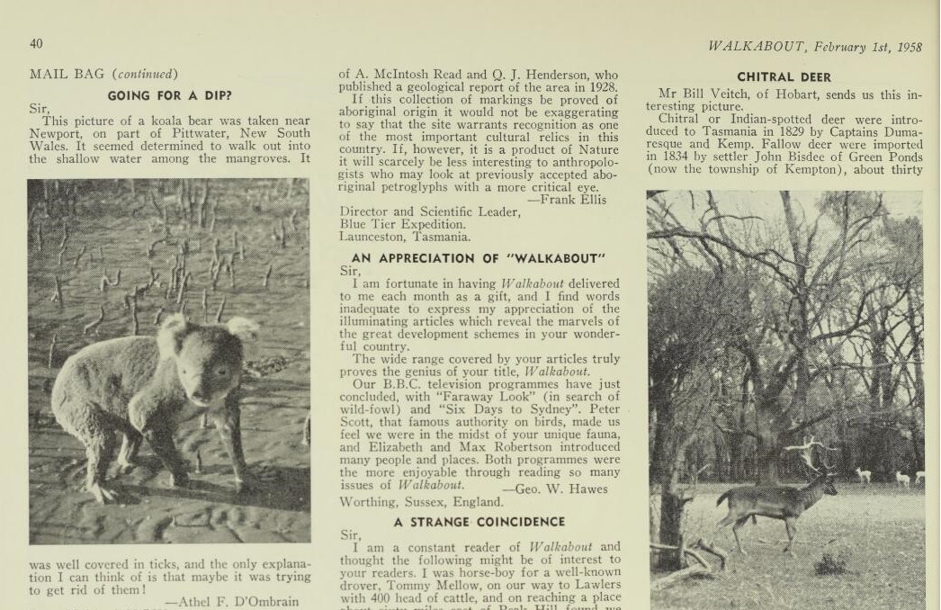
A Newport Koala going into the mangroves - Feb 1st, 1958 edition of Walkabout magazine - possibly trying to escape dogs
Reptiles
Eastern Water Dragon Physiagnathus leseurii L R Eastern Water Skink Eulamprus quoyii APM R Copper-tailed Skink Ctenotus taeniolatus APM R Grass Skink Lampropholis delicata APM R Weasel Skink Saproscincus mustelina L R Blue-tongued Lizard Tiliqua scincoides L R Eastern Long-necked Tortoise Chelodina longicollis L R Frogs Common Eastern Froglet Crinia signifera APM R Brown-striped Frog Limnodynastes peronii APM R Green Tree Frog Litoria caerulea L R Peron's Tree Frog Litoria peronii L R
Below run site investigation photos of Crescent Reserve Newport, Taken Saturday March 15 2026.
sm.jpg?timestamp=1773789547329)
sm.jpg?timestamp=1773789569614)
sm.jpg?timestamp=1773789598455)
sm.jpg?timestamp=1773789736557)
sm.jpg?timestamp=1773789776523)
sm.jpg?timestamp=1773789828597)
 sm.jpg?timestamp=1773789852099)
sm.jpg?timestamp=1773790888839)
sm.jpg?timestamp=1773792898853)
sm.jpg?timestamp=1773792999616)
sm.jpg?timestamp=1773793125645)
sm.jpg?timestamp=1773793157335)
sm.jpg?timestamp=1773793203945)
sm.jpg?timestamp=1773793235927)
sm.jpg?timestamp=1773793358743)
sm.jpg?timestamp=1773793394579)
sm.jpg?timestamp=1773793435901)
sm.jpg?timestamp=1773793481311)
sm.jpg?timestamp=1773793513922)
sm.jpg?timestamp=1773793655184)
sm.jpg?timestamp=1773793554405)
sm.jpg?timestamp=1773793587595)
sm.jpg?timestamp=1773793620463)
sm.jpg?timestamp=1773793699045)
sm.jpg?timestamp=1773793808270)
sm.jpg?timestamp=1773793931121)
sm.jpg?timestamp=1773793969778)
sm.jpg?timestamp=1773794023286)
sm.jpg?timestamp=1773794143597)
sm.jpg?timestamp=1773794201002)
sm.jpg?timestamp=1773794271422)
sm.jpg?timestamp=1773794319492)
sm.jpg?timestamp=1773794354008)
sm.jpg?timestamp=1773794384908)
sm.jpg?timestamp=1773794421277)
sm.jpg?timestamp=1773794452769)
sm.jpg?timestamp=1773794480105)
sm.jpg?timestamp=1773794518508)
sm.jpg?timestamp=1773794559489)
sm.jpg?timestamp=1773794586719)
sm.jpg?timestamp=1773794619341)
sm.jpg?timestamp=1773794817507)
sm.jpg?timestamp=1773794845847)
sm.jpg?timestamp=1773794889123)
sm.jpg?timestamp=1773794915641)
sm.jpg?timestamp=1773794946631)
sm.jpg?timestamp=1773794975537)
sm.jpg?timestamp=1773794999659)
.jpg?timestamp=1773795105237)
.jpg?timestamp=1773795142188)
.jpg?timestamp=1773795175859)
.jpg?timestamp=1773795205311)
.jpg?timestamp=1773795255847)
References - Extras - Notes
- TROVE - National Library of Australia
- Manly Council History Unit - Archives
- NSW Records and Archives
- Mitchell Library, State Library of NSW
- Geoff Searl OAM
- The Crescent Reserve Newport Bushcare Volunteers Group - thank you for all your work looking after this place for 30 years!
- The Mulhalls Of Broken Bay And Barrenjoey: George Mulhall First Champion Of Australia In Rowing, First Light-Keeper At Barranjuey Headland - Commenced July 20 1868
- Boulton's Jetty on 'Old Mangrove Bay' + Newport hotel jetty + Newport Public wharf: Some history
- Roads In Pittwater: The Barrenjoey Road
- Pittwater Roads II: Where The Streets Have Your Name - Newport
- The 'Newport Loop': Some History
- Leon Houreux 1831 – 27th Of April, 1907
- Historic Photographers Of Pittwater: A. J. (Arthur James) Vogan, 1859-1948
- Newport's Dearin Reserve has Had Residential Environmental Defenders Since 1906: Third Time inspired Iconic Logo Epitomising the Mangroves of the estuary Became Symbol of Pittwater Council
- Trafalgar Square, Newport: A 'Commons' Park Dedicated By Private Landholders - The Green Heart Of This Community
- Pittwater's Tropical Fruits: The Estuarine Farmlets At Mona Vale-Newport That Kept Sydney Stocked With Hot Area Fruit In The Middle Of Winter
- The Avenue Newport DA Approved through Land and Environment Court - Update
- Bushrangers Hill - 18956 and 1935
Boulton's Wharf and Old Wharf
Other lithographs show this wharf, labelled 'Old Wharf' where today's Waterview street is - this wharf was used when visitors were taken to Barrenjoey Lighthouse to lay the foundation stone in April 1880.
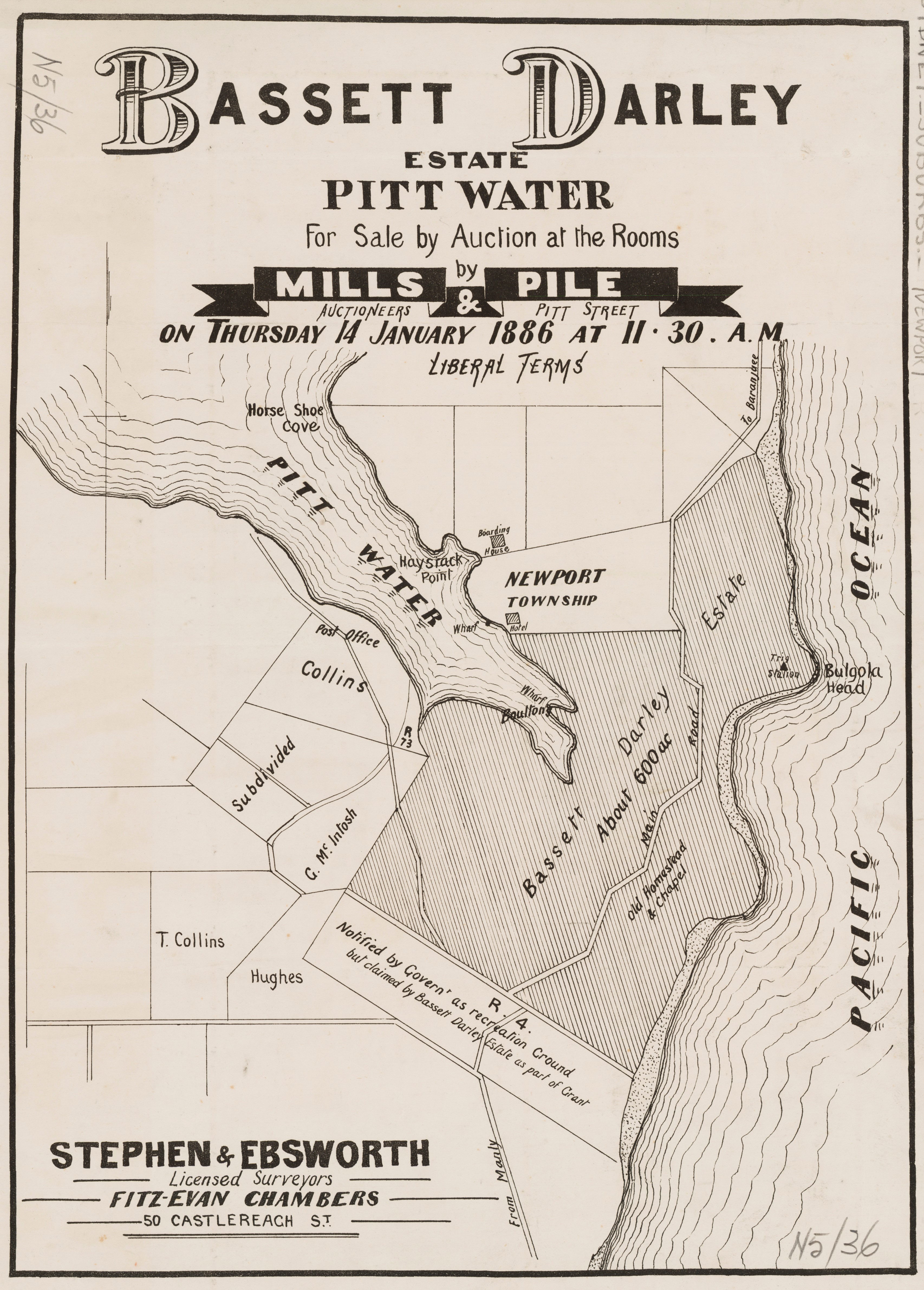
Bassett Darley Estate - Pittwater - Main Rd, Pittwater, 1886. Item No.: c050400027, from Mona Vale Subdivisions folder, courtesy State Library of NSW.
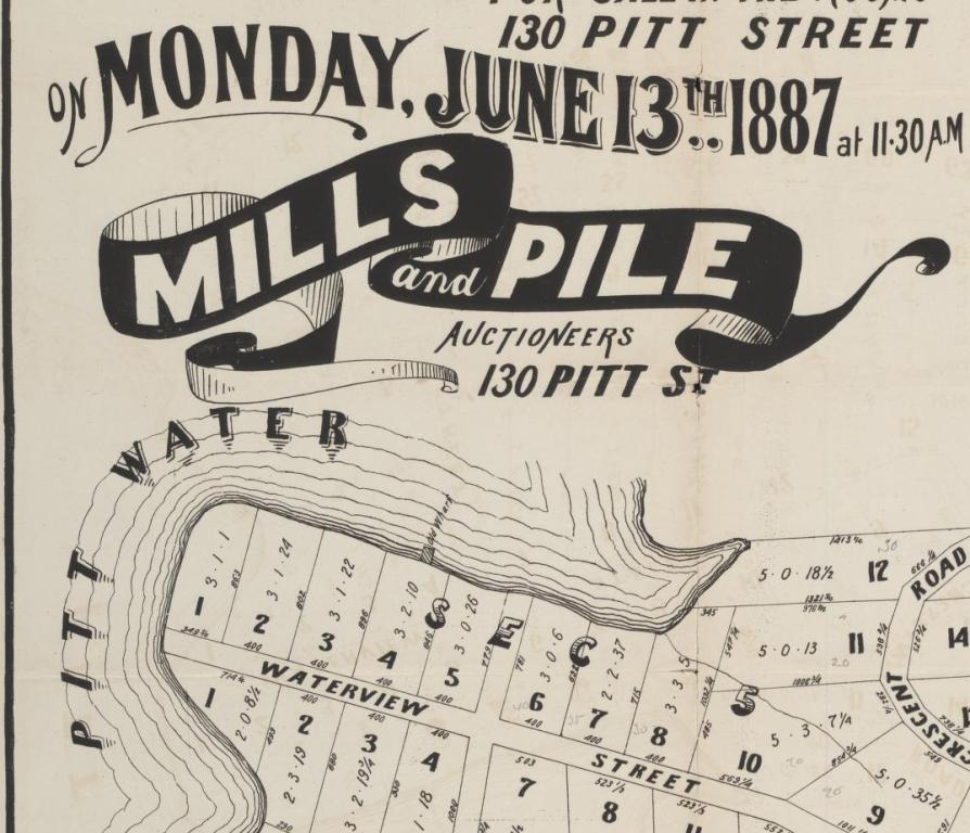
Mona Vale, Pitt Water [i.e. Pittwater] [cartographic material] / for sale in the rooms, 130 Pitt Street on Monday June 13th 1887 at 11.30 a.m., Mills and Pile, auctioneers, 130 Pitt St. MAP Folder 103, LFSP 1553. Courtesy National Library of Australia.
Verralls Family - from Manly History Studies Unit:
John Verrall was born at Eastbourne, Sussex in 1819. He married Elizabeth (nee Putland1) at Eastbourne in 1840, and had children including Anne (born circa 1842), James (circa 1840) and George. In the 1841 Census he was listed at Eastbourne aged 22, with Eliza, 22 and James, 9 months. He was then an agricultural labourer. In the 1861 Census for England, James was living at Brighton with George and his family. Anne married a James Pumfrey in the 1860s. In 1861, John Verrall, 42, was living at 27 Cavendish Place, Eastbourne, listed as a gardener, with Eliza, 42.
In the 1871 Census for England, John and Eliza Verrall were both listed as “bath chair attendants”. They were now living with their son-in-law James and Anne Pumfrey at Eastbourne.
In 1873 the Verralls and Pumfreys emigrated to Australia, arriving at Melbourne on the Anglesey in December 1873. Listed on the passenger list were: James (Terrall, sic), James Verrall (2) (aged 5), Kate Verrall (7), James Pumfrey (Humphry, sic), Anne Pumfrey (Punhry, sic) and their daughter Alice Pumfrey (Punhry, sic, born circa 1872).
John and Elizabeth Verrall were not on the passenger list, and may have travelled on a later ship. James Verrall’s first wife was not listed, and may have died some time before.
It is not known when the Verralls and Pumfreys settled in Manly, but it was fairly soon after arrival in Australia. James Pomfrey (sic), plasterer, was listed in the 1875, 1876 and 1877 Sands’ Directories living at Balgowlah; in 1879 at Whistler Street, and in 1880 at Short Street, as a builder.
John Verrall was listed in the 1875 and 1879 Sands’ Directories at Balgowlah or Middle Harbour. It is likely that he was a market gardener.
The Petition for the Municipality described John Verrall[2] as ‘householder’ rather than ‘freeholder’.
The 1891 Census of NSW listed James Verrall and James Pumfrey as neighbours at North Harbour.
John Verrall died aged 78 at home at Balgowlah; his body was found by his son. He was “much respected in the district.”[3] He was buried in Manly Cemetery on 10 April 1897, plot B.205. His wife Elizabeth (unnamed in Burial Register) was buried in the same plot on 31 October 1891. James and Anne Pumfrey were buried in the adjacent plot, B.206.
John Verrall’s son James Verrall (1), born in 1840, married (i) Charlotte Farmes at London (ii) and then Rebekah Price at Sydney in 1875. He was a boat proprietor/boatman. He died by drowning himself at North Harbour and was buried on 7 November 1924 at plot H.259.4 Rebekah was buried in the same plot on 7 July 1930. Their son, Walter Verrall married Edith Pumfrey, the daughter of James and Anne Pumfrey, in 1907. Walter died at Manly in 1944.
The son of James and Charlotte Verrall, James Verrall (2) married Daisy Wheeler on 12 June 1900, but divorced her in August 1925.5 He was a boatbuilder. He died in 1932 aged 63.
1 Death certificate of James Verrall 18029/1924.
2 By coincidence, the surname ‘Verrall’ supposedly means ‘manly’.
3 Evening News 12 April 1897, p6.
4 SMH 7 November 1924, p7; 10 November 1924, p8. NSW BDM states he was son of John and Elizabeth.
5 SMH 21 August 1925, p8.
Edith Verrall sells the remaining acreage at Newport to William James Glover in 1945:
.jpeg?timestamp=1773772582908)
.jpeg?timestamp=1773772614912)
.jpeg?timestamp=1773772647631)
.jpeg?timestamp=1773772718063)