Revised south-Ingleside precinct Housing Development Plan now open for Feedback
On November 28th, 2018 the State Government announced the proposed development plans for Ingleside would not proceed after an independent bushfire risk assessment found the 2016 draft plan would put future residents in danger. Department of Planning and Environment’s Acting Deputy Secretary, Planning and Design, Brett Whitworth, said then the safety of residents is of paramount importance.
“Above all, we need to ensure the safety of residents at Ingleside,” Mr Whitworth said.
“During consultation, we heard loud and clear that bushfire risk and mitigation was a key concern to residents in the area. We listened and responded to these concerns, by going back and relooking at the way we were planning for bushfire protection in Ingleside,” he said.
An independent assessment was undertaken, including a peer review of previous studies and report on bushfires in the area and in line with the latest research and NSW Rural Fire Service (RFS)’ latest risk assessment requirements. The report found the draft plan would put the community at risk.
Mr Whitworth said the Department have halted plans at this stage to work with the Council and NSW RFS.
“We need to ensure we have the right evacuation measures in place for current and future residents – especially in the context of other nearby areas such as Elanora Heights, Warriewood, Bayview and Church Point,” he said.
“This evacuation assessment, as well as consultation with landowners will help determine whether any further development could safely exist in the area.
“Any development would need to be at a much lower scale and we would need a guarantee that the road network could handle the extra development in the event of an evacuation.''
The revised draft Ingleside Place Strategy aims to provide:
- Up to 980 new dwellings with a mix of dwelling types including houses on larger lots, low rise apartments and townhouses;
- A local community hub and shopping centre;
- Attractive and welcoming public areas that positively contribute to Ingleside’s character;
- Public open spaces including attractive streetscapes;
- Better pedestrian and cycling connections;
- Enhanced ecosystems and green spaces for people to relax outdoors;
- A model resilient, sustainable and low-carbon community; and
- New development only in areas that allow for effective and safe evacuation in the event of a bushfire.
The existing minimum lot size over most of Ingleside is 20,000 m2, or 2 ha. This coincides with all RU2 – Rural Landscape land. Areas retaining the RU2 – Rural Landscape zone will retain this minimum lot size
The 2021 draft Place Strategy proposes:
- R2 – Low Density Residential: minimum lot size of 450 m2
- R3 – Medium Density Residential: minimum lot size of 225 m2
- R5 – Large Lot Residential: minimum lot size of 1,500 m2.
An existing maximum height of 8.5 metres applies to most of Ingleside. This is largely retained in the bulk of the land area allocated for the proposal apart from a 10.5 metre control in the proposed R3 – Medium Density Residential zone as well as the areas covered by the SP2 and B1 zones as focussed on the location for neighbourhood shops to allow for apartments and townhouses.
Areas of low and medium density development within this Sub-Precinct are estimated to yield between 5 and 30 dwellings per hectare.
The documents made available state the Warriewood Wastewater Treatment Plant and ocean outfall has sufficient capacity to accommodate the loads associated with the proposed development of the Precinct and that the existing trunk infrastructure has sufficient capacity to service the South Ingleside Sub-Precinct via a gravity led sewer.
Trunk infrastructure is proposed to connect to the Elanora Heights Reservoir and the Ingleside Park Reservoir and the watermains being delivered adjacent to Mona Vale Road as part of the road upgrade. Reticulation mains will feed off these trunk mains to service the South Ingleside precincts. A new booster arrangement is proposed at the Ingleside Park Reservoir which will provide adequate pressure to the elevated areas of the South Ingleside Sub-Precinct.
To determine the potential for land contamination, salinity, slope and other constraints in the Precinct, a Preliminary Site Assessment was conducted. The slope risk analysis classed the precinct as moderate, which does not meet the tolerable risk to future development. Recommendations to reduce this risk to tolerable levels include scaling the slope, installing rock bolts and considering development location. It is recommended that a slope stability assessment be undertaken for any future development.
The assessment identified salinity characteristics as good, indicating reasonable water quality and non-saline groundwater conditions. Limited soil samples collected and analysed for salinity also indicated a ‘non-saline’ classification for soils. No soil sample exceeded the adopted site assessment criteria; however, due to the limited nature of investigations, potential remains for contamination to be present. Potential sources of contamination include: the use of uncontrolled fill material and quarry activities, commercial and industrial facilities, small farm holdings, market gardens and nurseries, hazardous materials within existing buildings and site structures, septic effluent systems and potential dumping of waste in unoccupied lands.
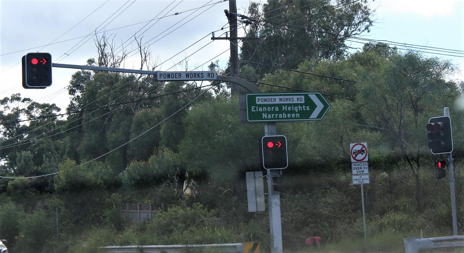
Roadworks and transport are listed within list of infrastructure works that will be required. The documents prepared by consultants include a range of bus services improvements within the precinct, along Mona Vale Road and at Mona Vale, Powderworks Rd | Wattle Rd; Roundabout provided to facilitate access across Powderworks Road, Powderworks Rd | Wilson Ave; Roundabout provided to facilitate safer access to Wilga-Wilson, Powderworks Rd | Ingleside Rd; Roundabout provided to facilitate safer access to Ingleside Road, Powderworks Rd | Wilga St; Roundabout provided to facilitate safer access to Wilga-Wilson and 'other local road upgrades and future local roads, including new bicycle network connections.
The costs for these are proposed to be met through the Development Contribution Plan or voluntary planning agreements (VPA).
The Infrastructure Schedule also lists as requirements, apart from utilities such as gas, sewer, electricity and water, A new 400 m2 Community Centre (excluding childcare space), Open Space; 2-3 playgrounds, including a larger district sized playground of around 500 m2, Environmental Conservation land, Environmental conservation land and creek corridors with a range of opportunities for passive recreation i.e. linear parks connecting to surrounding open space and bushland, environmental interpretation activities, Active open space; Playing fields of up to 3 ha and a Child Care Up to 100 spaces.
All of these are listed as scoped to come from Development Contribution Plan or VPA, or in the case of the Child Carte facility, Private provider/developer.
There is no new school proposed in the documents.
Those who frequent Powder Works road are aware that this is a pathway for local wildlife crossing, with wallabies moving along the corridor, owls hunting along its verges, and turtles making their way down the hill to Warriewood creeks.
In the Biodiversity Assessment prepared for the Department of Planning the report notes that Accessibility was a key limitation. The ability to validate vegetation communities or targeted surveys for threatened flora and fauna species was limited to areas where property owners provided access. The document notes that therefore there is potential that habitat within land which was not accessed may provide suitable habitat for threatened species and Endangered Ecological Communities (EECs).
The Coastal Upland Swamp community listed as endangered under both the BC Act and EPBC Act was found in areas that could be accessed.
The report states that;
''This vegetation community is highly unique as it is one of two hanging or upland swamp communities recorded within the Sydney region (OEH 2013). The vegetation is located at high elevation up to 600 m above sea level. Water seepage is an important feature for this community as it is a groundwater dependent ecosystem (GDE). As such this community is often located at headwaters of creeks on impeded soils. There are several patches of this community scattered within the Precinct. A large patch is located between Manor Road and Powderworks Road and another large patch which extends outside of the Ingleside Precinct, within the north-western aspect in the grounds utilised by the Ingleside Scouts.''
Additional investigations of areas initially mapped as PCT 882, identified additional patches of Coastal Upland Damp Heath Swamp, which forms part of the Coastal Upland Swamps EEC, within the Precinct.
Species credit flora and fauna species under Biodiversity Assessment Method (BAM) found a total of 34 candidate species credit species were identified, of which 13 are flora species, and 21 are fauna species. Of these, 10 threatened flora species and 19 fauna species are also a listed Matters of National Environmental Significance (MNES) under the EPBC Act.
The document states that;
''These species and their biodiversity risk weightings which are the species sensitivity to loss or sensitivity to potential gain are summarised in Table 7. A very high biodiversity risk weighting means that a species cannot withstand loss and is at risk of extinction. These entities are also known as candidates for Serious and Irreversible Impacts (SAII) under the BAM. The higher the risk weighting the larger offset is required (i.e. the higher the weighting, the larger the offset that is required).
The Biodiversity Risk Weighting will be relevant to credit calculations, to be performed when development applications are submitted. The credit calculations will be based on the number of individuals impacted for threatened flora species and the area of habitat for threatened fauna species consistent with the BAM.''
Of those listed [Final species credit species and MNES list for Ingleside Precinct ] the following plants are noted as (SAII) very high; Persoonia hirsuta (hairy geebung), Microtis angusii (Angus's Onion Orchid), Hibbertia puberula.
Those listed as moderate (SAII); Callistemon linearifolius, Darwinia biflora, Epacris purpurascens var. purpurascens, Eucalyptus camfieldii, Lasiopetalum joyceae, Leptospermum deanei, Melaleuca deanei, Tetratheca glandulosa.
Wildlife species under the same criteria lists as 'moderate'(SAII); Callocephalon fimbriatum (Gang-gang Cockatoo) breeding, Calyptorhynchus lathami (Glossy Black Cockatoo) breeding, Chalinolobus dwyeri (Large-eared Pied Bat) breeding, Haliaeetus leucogaster (White-bellied Sea Eagle), Hieraaetus morphnoides (Little Eagle) breeding, Lophoictinia isura (Square-tailed Kite), Ninox connivens (Barking Owl) breeding, Ninox strenua (Powerful Owl) breeding, Petaurus norfolcensis (Squirrel Glider), Potorous tridactylus (Long-nosed Potooroo), Tyto novaehollandiae (Masked Owl) breeding, Tyto tenebricosa (Sooty Owl) breeding, Heleioporus australiacus (Giant Burrowing Frog), Pseudophryne australis (Red-crowned Toadlet), Phascolarctos cinereus (Koala), Cercartetus nanus (Eastern Pygmy Possum), Myotis macropus (Southern Myotis) breeding, Varanus rosenbergi (Rosenberg's Goanna).
The wildlife species listed as high to very high in the (SAII) are; Anthochaera phrygia (Regent Honeyeater - very high ) and Lathamus discolor (Swift Parrot - very high) breeding, Hoplocephalus bungaroides (Broadheaded Snake - high), Petalura gigantea (Giant Dragonfly - high).
The report notes that in the case of the Swift Parrot and Regent Honeyeater they may only be foraging during migrations. Both these birds are now listed as critically endangered.
This indicative list for its purposes, as this is by no means all the species of plants and animals that exist here, also reads a little like a nursery of these other residents will be destroyed, along with all its babies ('you are only moderately extinct'). It also underlines how biodiversity rich and made beautiful thereby Pittwater is, along with how much remains unseen and unchartered, still. This also begs the question of how 'offsets' could ever replace, or return, this unique environment.
These are just some points. The Consultation webpage lists the following documents/reports for those who wish to provide feedback and a decent six weeks in which to do so:
Documents
- View the Explanation of Intended Effect
- View the draft Place Strategy
View the Technical Reports
- Biodiversity
- Bushfire Evacuation Study
- Bushfire Strategic Study
- Economic and Retail
- Infrastructure Delivery Plan
- Noise Vibration
- Riparian Assessment
- Social
- Traffic Evacuation Analysis
- Traffic and Transport
- Water Management and Flooding
Minister for Planning and Public Spaces and MP for Pittwater, The Hon. Rob Stokes said the draft Ingleside Place Strategy now on exhibition is the result of collaboration with several agencies.
“We’ve been working closely with Northern Beaches Council, NSW Police, Rural Fire Service and the community to get the planning right for this beautiful part of Sydney,” Mr Stokes said.
“We’ve listened to concerns raised by the Rural Fire Service about bushfires and we’ve put the safety of residents and homes at the centre of this new plan.
“We want to enable Ingleside to grow while protecting its natural beauty for current and future residents.”
Mr Stokes said the plan significantly reduces the maximum number of new homes proposed to 980 and includes creating new safety measures and evacuation plans.
“The right infrastructure is also key to support our planned renewal of the area, with upgraded roads, more parks and sports fields, a neighbourhood centre, water management plans and environmental conservation,” he said.
“This critical infrastructure will require a small number of land acquisitions within the precinct, and the Department of Planning, Industry and Environment is working with Northern Beaches Council to ensure this is kept to a minimum.”
The draft Ingleside Precinct Place Strategy will be open for public comment until July 6th, 2021. For more information and to have your say visit: www.planningportal.nsw.gov.au/ingleside
Biodiversity risk weighting - The biodiversity risk weighting is one tool used in the Biodiversity Offsets Scheme to mitigate the risk in offsetting the loss of vegetation, threatened entities and/or their habitat. The biodiversity risk weighting does this by increasing the quantum of credits required at an impact site. It is derived from two components:
- sensitivity to loss – based on threat status under legislation or evidence-based information that suggests the entity is at an increased risk of loss
- sensitivity to potential gain – based on life history characteristics and ecological information for a species.
In NSW, different criteria are used for flora and fauna under sensitivity to potential gain and the process to calculate the biodiversity risk weighting for ecosystem and species credits. All associated data can be viewed in the TBDC. The biodiversity risk weighting for each species credit species on the subject land should be documented in the BAR. Species and ecological communities with a ‘very high’ biodiversity risk weighting will be a potential serious and irreversible impact (SAII).

A listed as Vulnerable Eastern Pygmy Possum in Pilliga forest, NSW. Photo by Phil Spark - flickr: Pilliga Forest. Eastern pygmy possums are very small, weighing from 15 to 43 grams and having a body length of between 7 and 9 centimetres with a 8 to 11 centimetres tail. They feed largely on nectar and pollen collected from banksias, eucalypts and bottlebrushes; an important pollinator of heathland plants such as banksias; soft fruits are eaten when flowers are unavailable.