With flood mitigation and safety improvement works
currently being undertaken along Wakehurst Parkway, the first such works for decades, and the road having reached its 80th anniversary as a state public road on May 29 2026, along with Angus Gordon OAM outlining some of the causes of flooding along this road and around Narrabeen at the
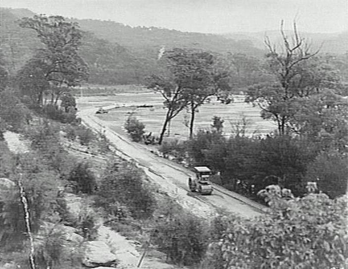
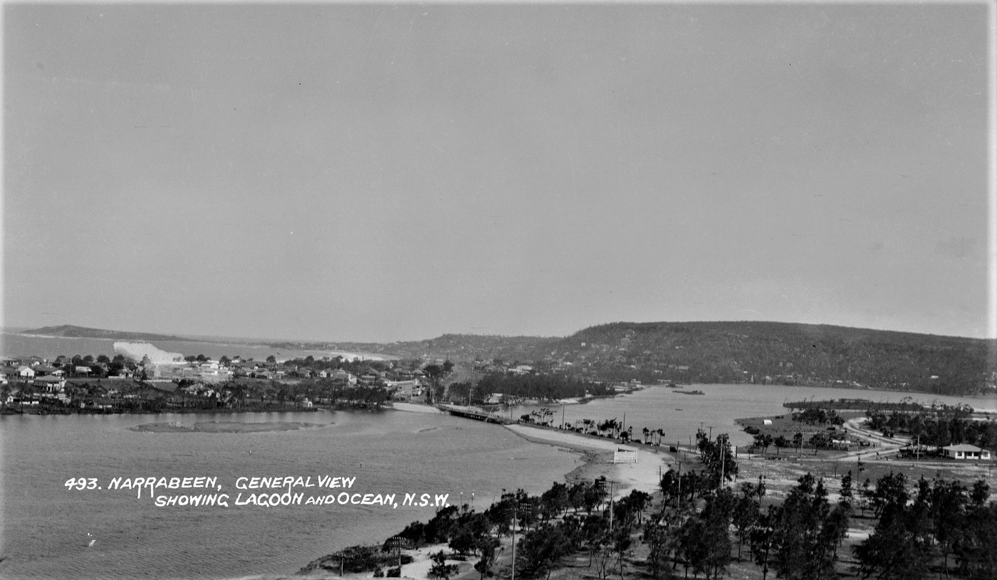
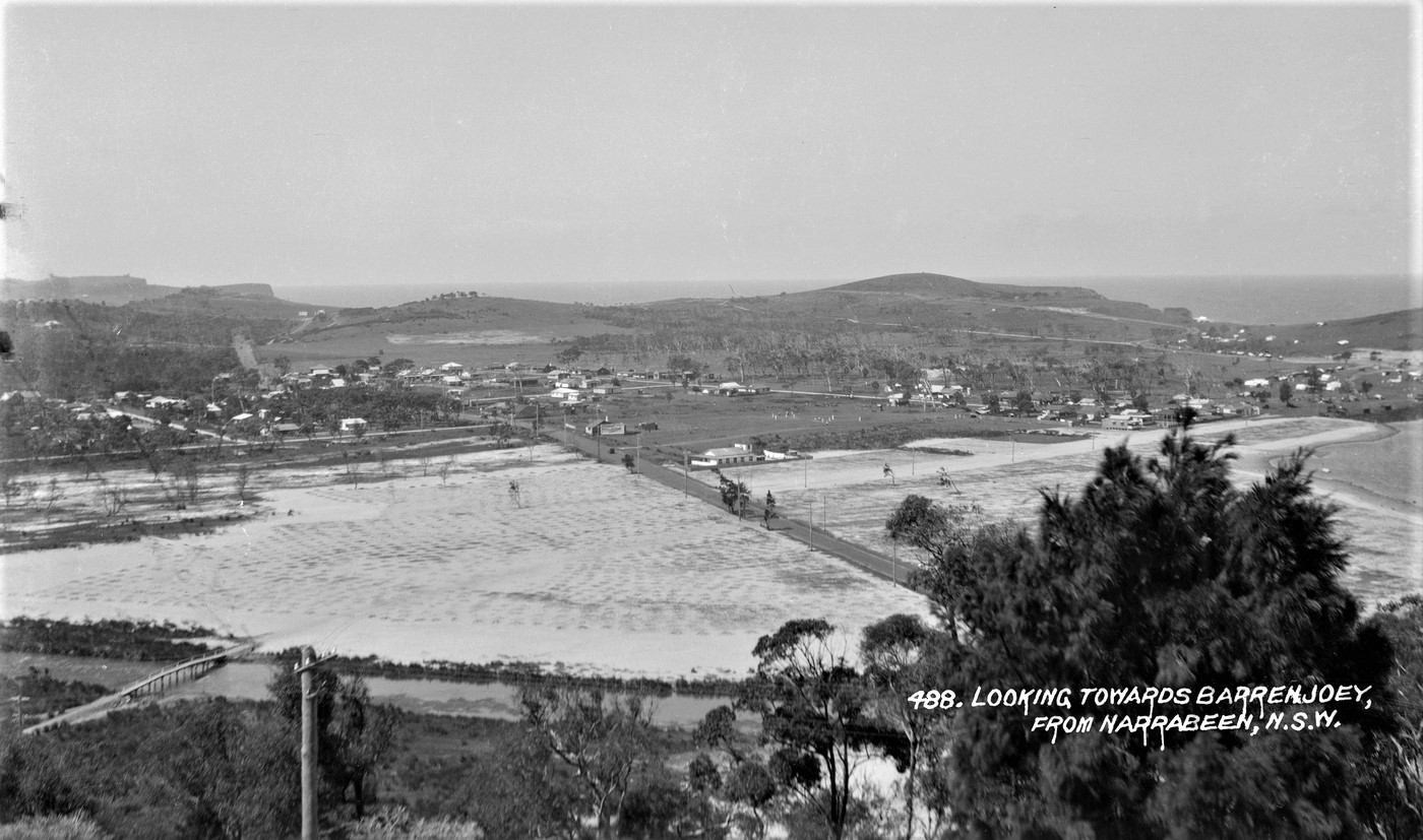
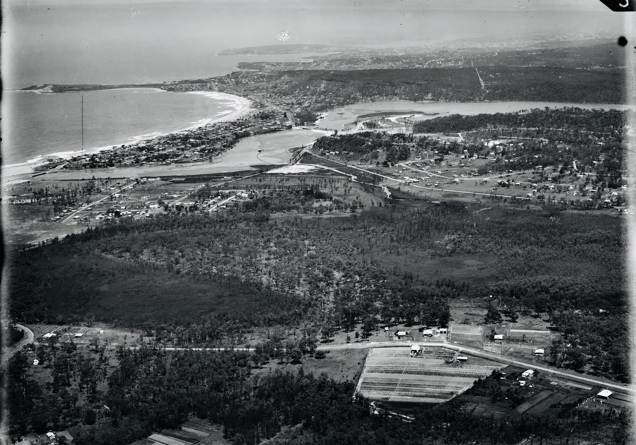
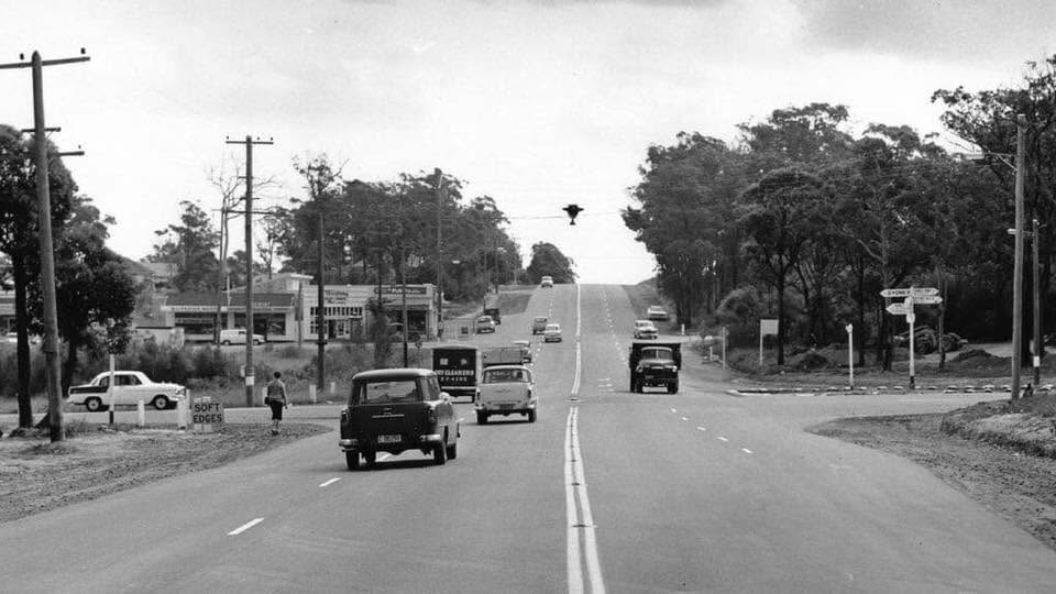
Friends of Narrabeen Lagoon's August 2026 Forum and AGM and deciding its high time we added in old photographs that show the landscape as this road was first being built, a few insights from prior and new materials runs this Issue.
The eastern-Narrabeen end of what is today Wakehurst Parkway was once named ‘Deep Creek Road’ while the western and Frenchs Forest side was accessed via the 'Oxford Falls road', or more accurately, track.
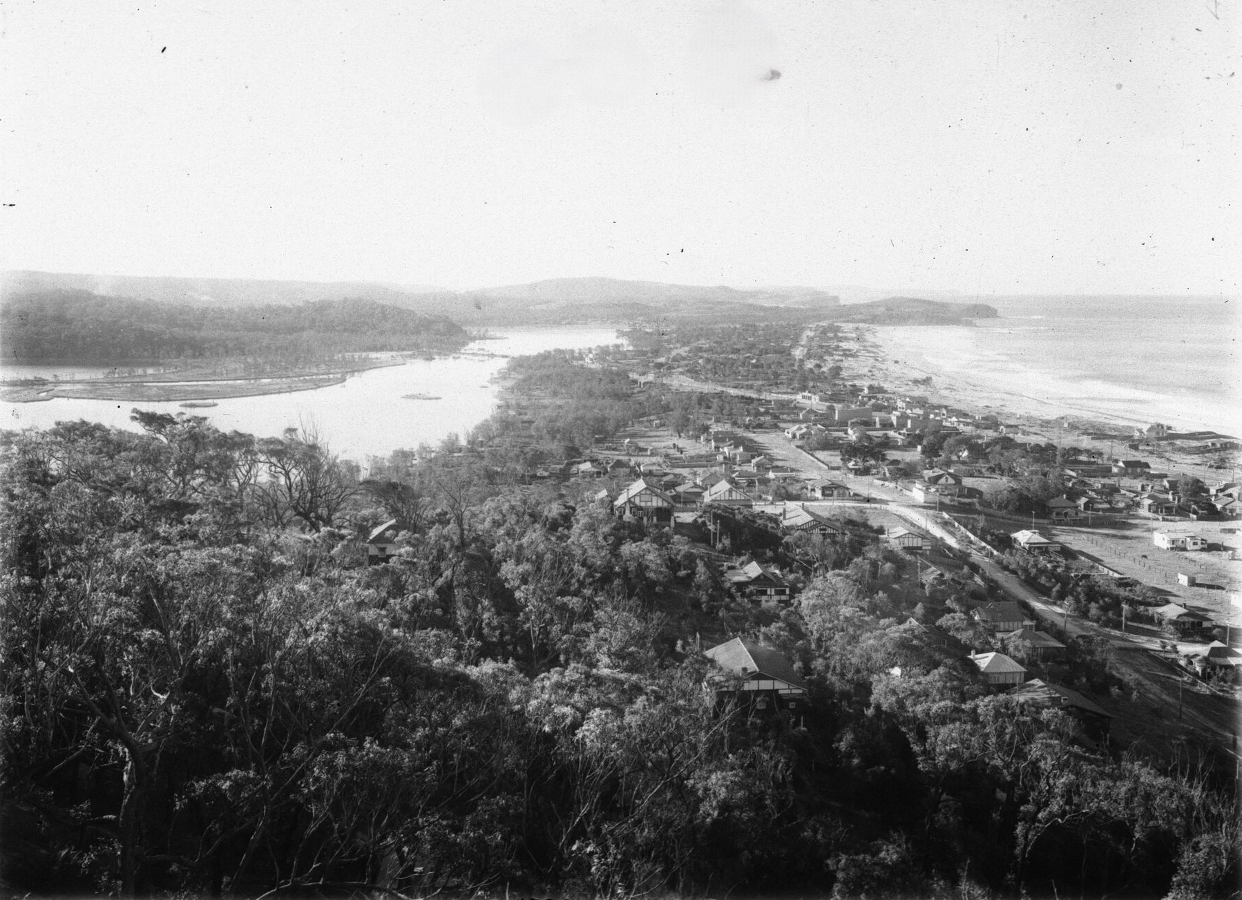
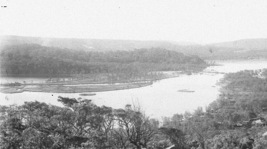
Deep Creek end viewed from Narrabeen from Collaroy heights - the reclaim or filling in of the Lagoon is occurring - photo dated 1925, Item: FL3838771, courtesy NSW Records and Archives. Section from:
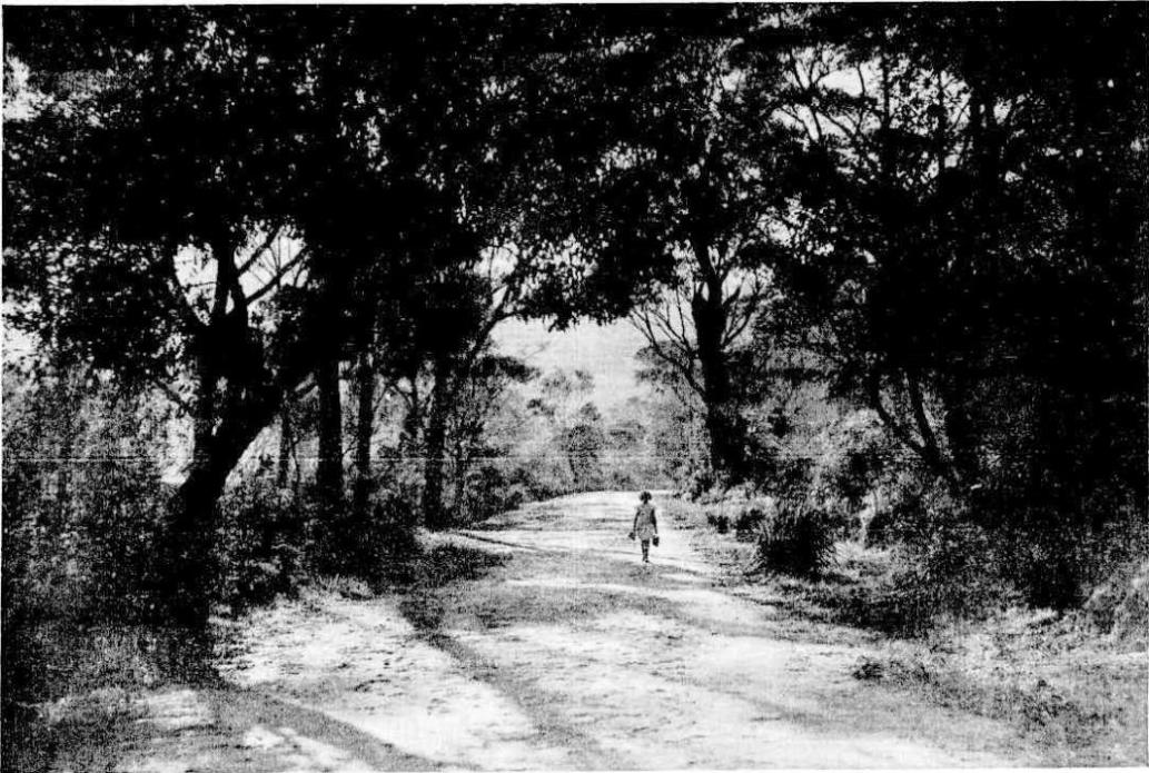
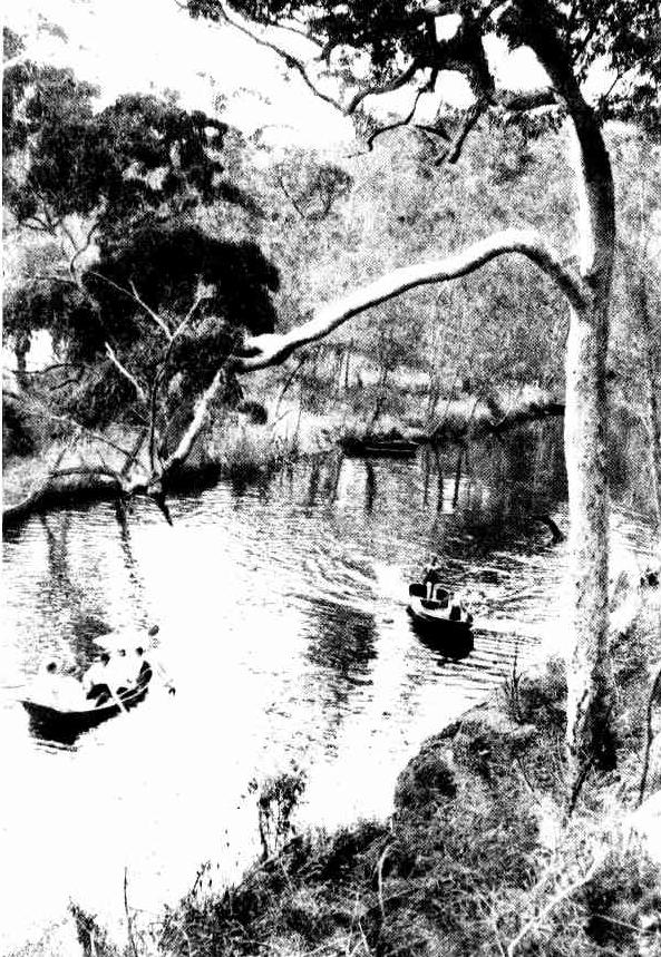
A photo of Deep Creek Road shows us the 'woodland shades' landscape of then:
LATE AFTERNOON STUDY IN DEEP CREEK-ROAD, NARRABEEN. Woodland Shades-- (1935, October 30).The Sydney Morning Herald (NSW : 1842 - 1954), , p. 16. Retrieved from http://nla.gov.au/nla.news-article17237516
A Spring rambler of 1931 describes the western end as:
OXFORD FALLS.
A Spring Ramble.
(BY W GILMOUR.)
A mile or two up the steep road from Brookvale, and you are in the heart of the native heaths and bush that enclose Oxford Falls. Such a cock-a-doodle-doo-ing and cackling rose from the valley to greet me as to put Sydney and its depression clean out of my mind.
I had forgotten my map, but knew very well that if I followed down stream I should eventually reach Narrabeen Lake and the tram to Manly. So, with a brilliant sun overhead and a well-filled haversack on my shoulder, my heart was as light as air itself. Plunging headlong into the bush, I was soon in the wild tangle of scrub, trees, rocks, and bracken that make the headwaters of Middle Creek so picturesque a spot for those who care little for the soft cushions of a motor car, with its accompanying dust and rapidly changing panorama.
On either side of the falls grew in spotless purity the white-flowered heath, epacris macrophylla, and towards midday a trickling waterfall tempted me to lunch upon grilled chops, brown bread, and tea. There the sweet aroma of coachwood lent its presence to the simple feast, and, after a delicious delay of an hour, I was treading softly on the grasslands that border the lake, where the rich bloom of flowering acacia adds variety to the verdure. Half an hour more and I was tramping across the secluded golf links of Deewhy, above which the blue wood-smoke of clearing fires was wafted seawards. Two more miles on a rough bush road takes you to Deewhy itself, that home of peace set like a pearl beside the Pacific. There a friend's door is always open to me, and without more ado than a slamming of a rustic gate and a call for refreshment, I was seated sipping the brown brew of the East while permitting my mind to carry me, by the entrancing smell of stocks, to the days of youth, when spring and sweet delights came every day. OXFORD FALLS. (1931, September 5). The Sydney Morning Herald (NSW : 1842 - 1954), p. 7. Retrieved from http://nla.gov.au/nla.news-article16810530
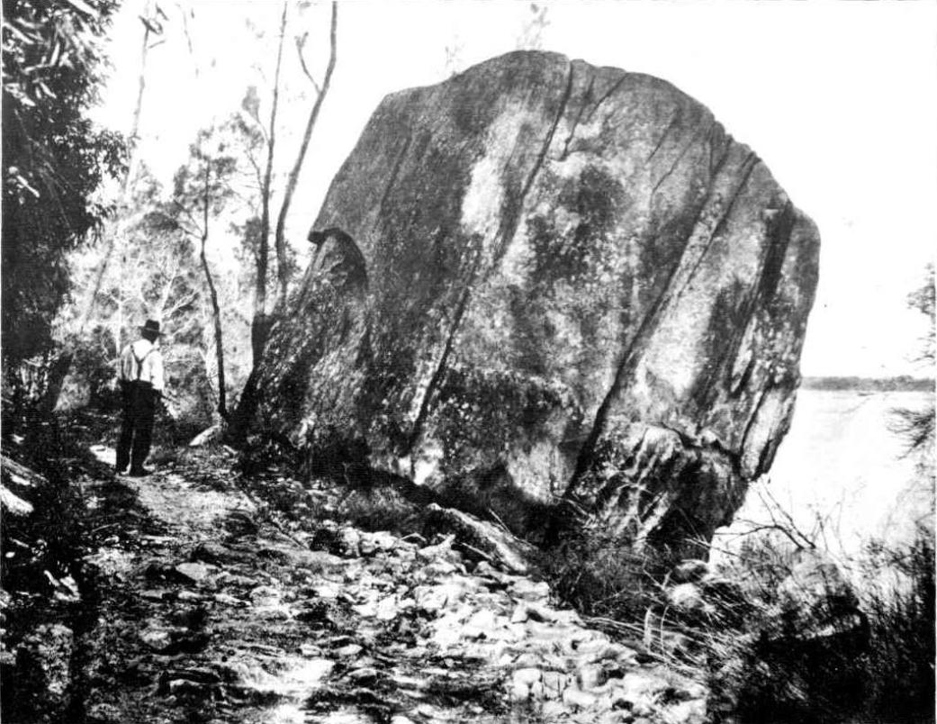
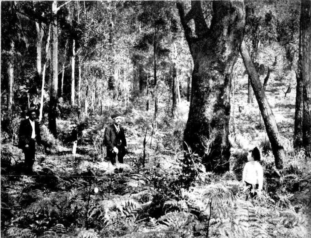
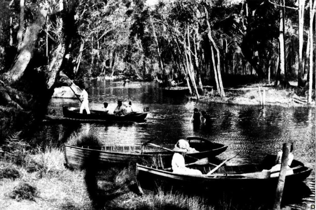
These snapshots record the landscape of then
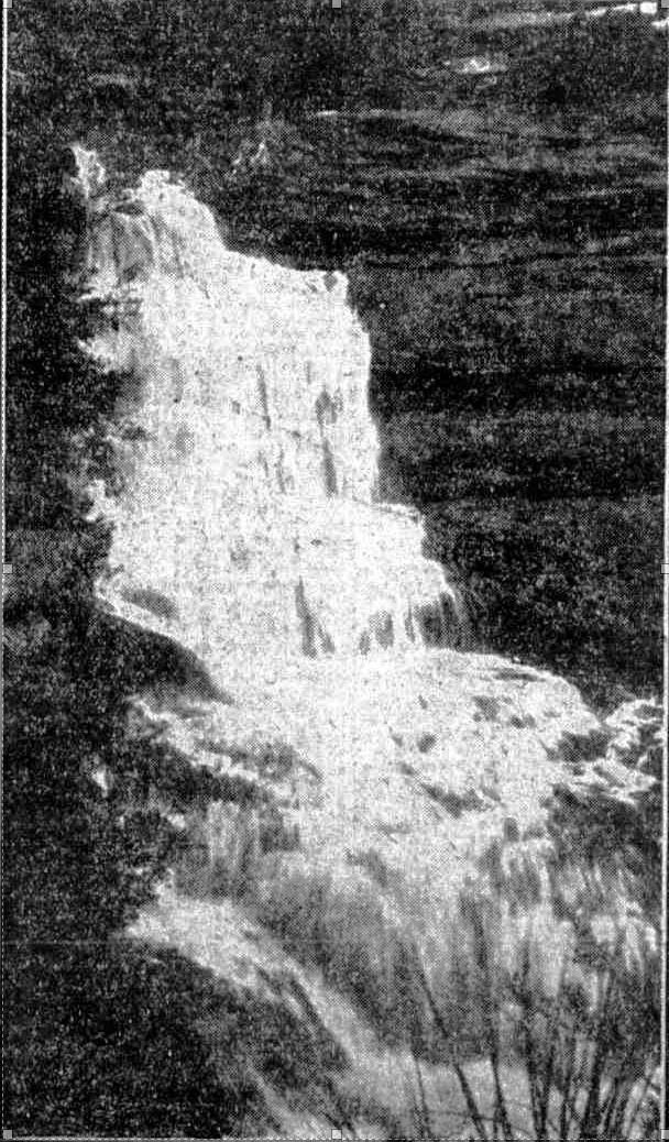
SEE AUSTRALIA FIRST-THROUGH FRENCH'S FOREST
1. Oxford Falls, three miles from Brookvale. 2 A short cut near Narrabeen. 3. Ferns us tall as a man, 4, Narrabeen Lake, as seen from the hills. 5. A creek crossed by logs.
Decades on the 'road' still ended at Middle Creek:
IN THE MANLY DISTRICT
OXFORD FALLS Short Motor Tour
Manly will be en fete this week-end and the N.R.M.A suggests that motorists visiting the district arrange their trip to Include a visit to the Oxford Falls In French's Forest.
In the vicinity of this comparatively little-known beauty spot there are ideal picnic places. The tour planned covers only 30 miles, but it includes, in addition to the falls, fine coastal panoramas and river scenery. It is suggested that the motorist from the city should cross the Harbor Bridge and proceed along Pacific Highway to Roseville, turning off to the right into Boundary-street. From the Highway it Is 2 ½ miles of good road to Roseville Bridge over Middle Harbor one of the beauty spots of the trip.
Leaving the bridge, the road wind up into the forest, and, avoiding side roads, the way to the Oxford Falls turn-off cannot be mistaken. From Roseville Bridge to the turn-off is 4.4 miles. A signpost at the Junction of the roads points the way to the falls, but this should be watched for carefully, as it is not easily visible to travellers going from the direction of Roseville.
DRIVE CAREFULLY
It is about two miles from the turn-off to the falls, and the gravel and clay road, though not difficult, requires careful driving, especially Immediately after rain. A short distance from the turn-off is a hairpin bend, which must be taken with care. From this point It is fairly easy running to the falls. The road leads to the ton of the falls, and the car should be parked just short of the creek, which forms a shallow water splash.
There are really two sections of the Oxford Falls, upper and lower end, to be appreciated, a climb down to the creek, about 200 feet below the road, should be undertaken. There is no definite track down the steep and rocky hillsides, but the climb will not prove to be beyond the power of anybody of average ability. At the foot of the falls there are places where a fire may be made to boil the billy and shelter may be had In a large cave.
A DEAD END
Most maps show the road to Oxford Falls as continuing on across the creek to join the French's Forest-road. This is not the case; the road continues for about half a mile beyond the falls, and then peters out, advises the N.R.M.A.
Returning from the falls to the turn-off by the same road, the motorist keens straight ahead to the top of Beacon Hill, leading down to Brookvale. From the top of the hill there are magnificent panorama of beaches and splendid distant views of the coast. Descending the steep hill, the road to the right is taken and the tram line followed Into Manly. From Manly, the Sydney-road is taken, and a return to the city made by way of The Spit Bridge. If the motorist wishes to extend the trip, to Lake in more of the northern beaches, he should keep straight on at the foot of Beacon Hill, and follow the concrete road from the Brookvale Showground to Narrabeen. A tarred surface is passed over beyond Narrabeen to Palm Beach.
The reason for building roads, connections for a growing demand for housing development to land and spreading suburbia, was a factor in the construction of this thoroughfare. Another was access to cheap labour. Although in 1929, just weeks after Black Tuesday, the stock market crash of October 29th on Wall Street through which billions were lost, there was still talk about a railway from Gordon to Narrabeen alongside the fairly rough Mona Vale Road was still part of the aspirational discussions and would appear in accounts, reports and opinions in local newspapers, even to today, the prohibitive cost kept it all just talk.
The crash and the rise in unemployment, homelessness and then hunger saw governments undertaking subsidised state and council projects by paying only for labor costs at reduced rates, forcing men to work on public projects for far less than standard award wages.
Instead of a direct cash handout, in some areas, unemployed men were required to perform manual labor for local municipal councils to earn food relief vouchers, rations, or meagre pay.
In 1939 what was then called 'unemployment relief' was directed to connect Narrabeen with Frenchs Forest.
Although not commenced until the year World War II also began, rapid progress was made during the first few years:
NEW ROAD TO NARRABEEN.
Start on Monday.
WORK FOR UNEMPLOYED.
The construction of a new road from The Spit through French's Forest to Narrabeen will be begun on Monday morning by the Department of Main Roads.
The road, for which the name Warringah Highway has been chosen, will start from a point in the vicinity of the Dalwood Homes, at the top of the hill on the Manly side of the Spit Bridge, and when completed will considerably shorten the Journey from the city to Narrabeen, and relieve the heavy week-end traffic on the existing roads.
The Minister for Labour and Industry, Mr. Gollan, said last night that about 200 men would be employed on rationed work on the construction of the new highway, and it was expected that it would take about two years to complete. NEW ROAD TO NARRABEEN. (
1939, November 25 - Saturday).
The Sydney Morning Herald (NSW : 1842 - 1954), p. 17. Retrieved from
http://nla.gov.au/nla.news-article17619360
NEW ROAD TO NARRABEEN
Rapid progress is being made with new cross-country road designed to provide more speedy access to the city for residents of the northern end of Narrabeen Lakes and Palm Beach.
The Assistant commissioner for Main Roads (Mr. Craig) said to-day that the project had been started to absorb unemployed and was being carried out as a relief work. Nearly three-quarters of the work has been done, and the date of completion will depend on the number of men retained on the job. The road will be about seven miles long and will give direct connection between The Spit and the northern end of Narrabeen Lakes. At the northern end of the lakes, the road will join the existing route to Palm Beach just beyond a bridge that crosses the Narrabeen Lagoon. Bitumen will later replace the present gravel surface. NEW ROAD TO NARRABEEN (
1940, November 12).
The Sun (Sydney, NSW : 1910 - 1954), p. 4 (LATE FINAL EXTRA). Retrieved from
http://nla.gov.au/nla.news-article231157936
NEW ROAD TO NARRABEEN.
In a recent official report received by the N.R.M.A. concerning the new road being constructed from Dalwood Homes near Seaforth to Narrabeen by way of Oxford Falls, it is indicated that except for two short sections the formation is completed from a point one mile beyond Dalwood Homes to Narrabeen Lake at Middle Creek, a distance of approximately six miles.
Gravelling of the pavement has been carried out for a length of four miles. A number of bridges have yet to be built, and it is likely therefore that it will be some time before the road is available for through traffic. A NEW ROAD TO THE NORTH. (
1941, August 26).
Macleay Argus (Kempsey, NSW : 1885 - 1907; 1909 - 1910; 1912 - 1913; 1915 - 1916; 1918 - 1954), p. 6. Retrieved from
http://nla.gov.au/nla.news-article234472278 here was already a bridge of sorts at Deep Creek.
STRUGGLE IN WATER
Picnickers Rescue Woman
A woman fell into the water near Deep Creek Bridge, Narrabeen Lakes, late yesterday afternoon, and was rescued by a picnic party, one of whom was Mr. John McLean, senr., of the Narrabeen Post Office.
Mr. McLean and the other members of the party were rowing in the lake when they saw a man and a woman struggling in the water. The rowers pulled over to them, but the man jumped out of the water and went away. The woman was helped ashore. On the arrival of Constable Hamer she was taken to the Manly Cottage Hospital, and this morning was able to leave the institution.
NARRABEEN LAKE.
Mining Lease Applied For.
LOCAL PROTEST
It was stated at a conference between Warringah Shire councillors, local residents, and representatives of public bodies, at Narrabeen on Saturday, that In addition to a dredging lease having been granted for Narrabeen Lake, an application had been lodged for a mining lease on the sand spit at the entrance to the lake.
Mr. F W. Heaton, an ex-Mayor of Manly who stated that the proposal in the first Instance was to dredge a channel 200ft wide from the entrance to the head of the lake, said he lodged a caveat against it as he knew it would destroy the lake, the bed of which was a couple of feet above the ocean. He had no objection If the dredging was confined to the part above the bridges, and an agreement to that effect had been signed. He read a letter from the department, which intimated that Industries and Cements. Ltd. (the company concerned) had been Informed that no mining or dredging operations could be carried on between the two bridges until tide gates had been erected at the entrance to the lake.
' I have lodged an objection to the implication of Edward Garland Stone for a mining lease of four acres of land on the sand spit at the entrance to the lake," Mr H S Harvey, a local resident, stated. He said there was a bar of rock at the entrance, which should only be interfered with by a Government department.
"If the lease Is granted" Mr Harvey stated "the Act allows the lessee to erect any building or machinery, and he could take or divert any stream flowing through it and use the water for mining or domestic purposes "
Mr. A. J. Small (acting president of the Parks and Playgrounds Movement) said that to Interfere with the lake would be a crime against the public. It was one of the beauty spots of the State. The proposal was now to industrialise it, and make it a second Botany Bay. A request had been made to the Government for £14,000, to purchase the land around Deewhv Lagoon and at Narrabeen they had a lake infinitely more beautiful. The safety of it for children would be destroyed just to get a very limited supply of sea shell for cement.
Mr. Edward Giles Stone, speaking for the company concerned, said there was a misconception about the whole matter. The original lease was for the area between the bridge and the side of the cement works at Deep Creek. This had received the unanimous approval of the shire council. Later they found that the bulk of the shell was between the two bridges, and when objection was raised to dredging there, they agreed to erect tide gates. They did not Intend to mine on the spit, or to move a bit of sand from there. They were prepared to abandon the application for the mining lease if they were allowed to build the tide gates
Mr. Small: I am astounded that the council should agree to commercialise this area. If the council compromises, we will tight to get the departmental decision reversed.
Councillor Austin (president of the Warringah Shire) stated that the matter of the mining lease would be brought before the council. NARRABEEN LAKE. (
1934, November 12).
The Sydney Morning Herald (NSW : 1842 - 1954), p. 10. Retrieved from
http://nla.gov.au/nla.news-article17138905
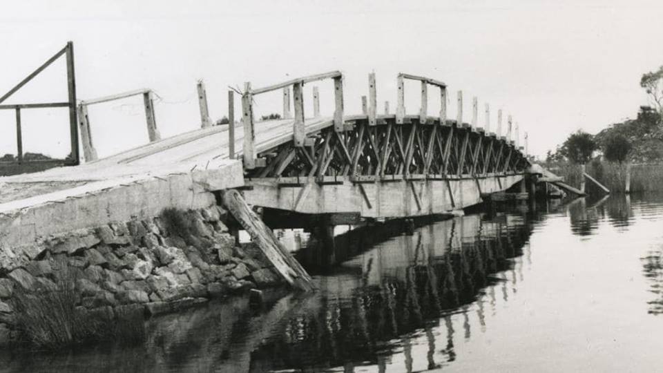
Mr. Stone's bridge at Deep Creek.
WATER SHORTAGE
Sir,-The definite engineering fact that stands out is that only an early start with and ultimate completion of the Warragamba reservoir can materially assist the position. If no rain comes, then nothing that engineers can do with large constructional work can add one gallon to the existing storage. In spite of a full knowledge of the Snowy River and all it means, the Water Board still adheres to the necessity for building first the Warragamba. I must agree that this is sound and in accord with the following facts:-(a), the Warragamba project can be completed in one half the time any other permanent scheme requires; (b), the materials employed In the construction of the dam arc all available and will not weaken our war , effort; (c), the labourers required are very few of them specialists. The mixing and placing of concrete can be carried out by men who are readily trained; (d), at an early stage in the ...nearby existing dams; (e). practically all the Initiatory work is completed and the money has simply to be allocated and the work started; (f), the board's engineers, who are at least equal to any in the world, especially on Australian proposals, have conclusively proved the soundness and sufficiency of the scheme.
Let the board proceed with the Warragamba at once; the Snowy River scheme is useless because of the time factor.
Narrabeen. EDWARD G. STONE.
The gazettal of lands to build the road included Mr. Stone's enterprise, among others:
TRANSPORT (DIVISION OF FUNCTIONS) ACT, 1932-1940.
MAIN ROADS AGT, 1924-1939.
PROCLAMATION.
(L.S.)
WAKEHURST, Governor.
I, the Right Honourable John de Vere, Baron Wakehurst, Governor of the State of New South Wales, in the Commonwealth of Australia, with the advice of the Executive Council and by virtue of the provisions of the Transport (Division of Functions) Act, 1938-1940, and in pursuance of the provisions of the Main Roads Act, 1924-1939, do by this my Proclamation declare that so much of the land hereunder described as is Crown Land is hereby appropriated, and so much thereof as is private property is hereby resumed under the provisions of the Public Works Act, 1912, for the purposes of the Main Roads Act, 1924-1930, and that the land hereunder described is hereby vested in the Commissioner for Main Roads, and I hereby further declare the land hereunder described to be a public road, and, in accordance with a recommendation of the Commissioner for Main Roads, the §aid land is hereby placed under the control of the Council of the Shire of Warringah.
Signed and sealed at Sydney, this twenty-fourth day of July, 1941.
By His Excellency's Command,
M. O'SULLIVAN. GOD SAVE THE KING!
Description of The Land Referred to.
All that piece or parcel of land situate in the Shire of Warringah, parishes of Manly Cove and Narrabeen, county of Cumberland and State of New South Wales, being part of the land in Certificate of Title, register volume 3,056, folio 68 and part of E. 7.49.9 for public recreation notified 6th October, 1888: Commencing at a point on a southern boundary of the land in the Certificate of Title aforesaid bearing 99 degrees 26 minutes 25 seconds and distant 474 feet 71 inches from the south-western corner of that land and bounded thence on the west, north-west, north-east, again on the northwest, south-west and again on the north-west by marked lines bearing consecutively 358 degrees 20 minutes 15 seconds 180 feet 5| inches, 1 degree 38 minutes 45 seconds 112 feet 6J inches, 7 degrees 56 minutes 30 seconds 100 feet, 13 degrees 51 minutes 10 seconds 104) feet, 19 degrees 45 minutes 45 seconds 100 feet, 25 degrees 40 minutes 20 seconds 100 feet, 31 degrees 34 minutes 55 seconds 100 feet, 37 degrees 29 minutes 30 seconds 100 feet, 43 degrees 24 minutes 109 feet, 49 degrees 18 minutes 40 seconds 100 feet, 55 degrees 13 minutes 15 seconds 100 feet, 61 degrees 7 minutes 50 seconds 100 feet, 64 degrees 5 minutes 5 seconds 386 feet 3| inches, 154 degrees 5 minutes 5 seconds 55 feet, 64 degrees 5 minutes 5 seconds 450 feet, 334 degrees 5 minutes 5 seconds 55 feet and 64 degrees 5 minutes 5 seconds 690 feet to the waters of Deep Creek; thence, generally on the south-east and north-east by the waters of Deep Greek and Narrabeen Lagoon to a point bearing 165 degrees 29 minutes 303 feet 0 inches from the south-eastern corner of the land in the Certificate of Title aforesaid; thence again on the south-east by marked lines bearing 203 degrees 4 minutes 183 feet, 212 degrees 57 minutes 30 seconds 147 feet 5£ inches and 225 degrees 38 minutes 30 seconds 33 feet to the waters of Middle Creek; thence generally on the south-west by the waters of that Creek to a point bearing 197 degrees 32 minutes 515 feet 10 minutes from the point of commencement; thence on the northwest and west by marked lines bearing consecutively 45 degrees 38 minutes 30 seconds 50 feet, 32 degrees 57 minutes 30 seconds 100 feet, 23 degrees 4 minutes 100 feet, 13 degrees 10 minutes 30 seconds 100 feet, 3 degrees 17 minutes 300 feet and 358 degrees 20 minutes 15 seconds 83 feet 10f inches to the point of commencement,—having an area of 16 acres 2 roods 5 perches or thereabouts and said as to part to be in the possession of E. G. Stone. (D.M.R. No. 479-1,335) (3581) TRANSPORT (DIVISION OF FUNCTIONS) ACT, 1932-1940. (1941, August 1). Government Gazette of the State of New South Wales (Sydney, NSW : 1901 - 2001), p. 2779. Retrieved from http://nla.gov.au/nla.news-article225122797
MAIN ROADS ACT, 1024-1940.—PROCLAMATION,
(l.s.) F. R. JORDAN, Lieutenant-Governor.
I, the Honourable Sir Frederick Richard Jordan, Lieutenant Governor of the State of New South Wales in the Commonwealth of Australia, with the advice of the Executive Council, and in terms of section S of the Main Roads Act, 1924-1945, and in pursuance of the Transport (Division of Functions) Act, 1932-1943, do hereby proclaim that that section of the main road named and described in the first column of the Schedule hereto is by this my Proclamation given the name appearing opposite thereto in the second column of the said Schedule.
Signed and sealed at Sydney this twenty-ninth day of May, 1946.
By His Excellency's Command,
W. E. DICKSON.
GOD SAVE THE KING!
Schedule.
Description of Main Road. Name: Wakehurst Parkway.
That portion, of the Main Road No. 397 from the Warringah Shire boundary at Clontarf-road, via French's Forest, Oxford Falls, Middle and Deep Creeks, and the northern shore of Narrabeen Lagoon to Pittwater-road (Main Road No. 164) at Narrabeen. (D.M.R. No. 46-M. 53) (8327) MAIN ROADS ACT, 1924-1945.—PROCLAMATION. (1946, June 14). Government Gazette of the State of New South Wales (Sydney, NSW : 1901 - 2001), p. 1340. Retrieved from http://nla.gov.au/nla.news-article224764366
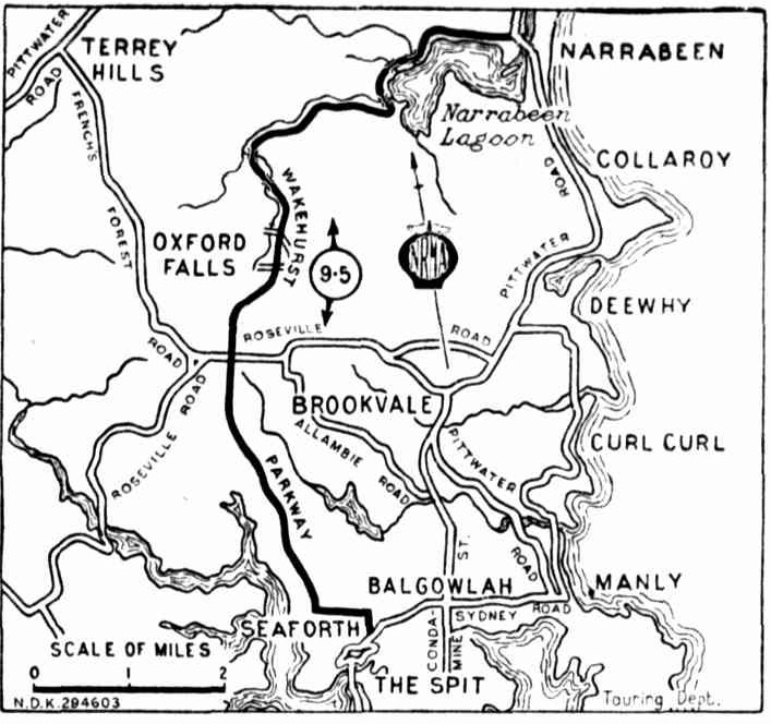
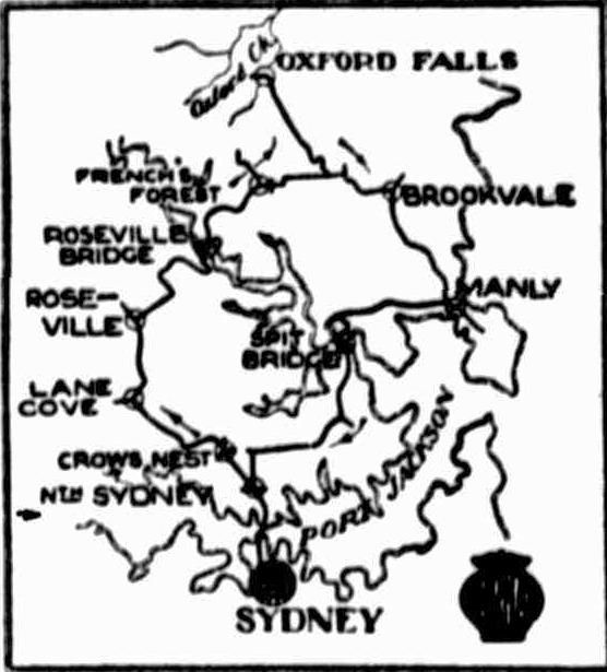
NEW SCENIC ROAD from The Spit to the north side of Narrabeen Lakes is shown on this map, compiled by the NRMA. Built by the Department of Main Roads, the road is named "Wakehurst Parkway." It is an important link in the main road system, and will assist in developing the Warringah area. Ideal picnic spots lie along the Parkway, which has five miles of bitumen, the remainder gravel. No title (1946, April 2). The Sun (Sydney, NSW : 1910 - 1954), p. 9 (LATE FINAL EXTRA). Retrieved from http://nla.gov.au/nla.news-article229459678
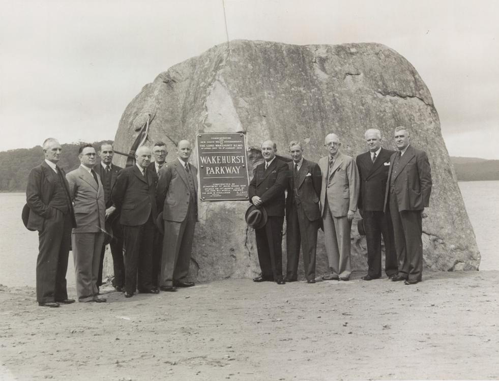
On Friday March 22nd, 1946:
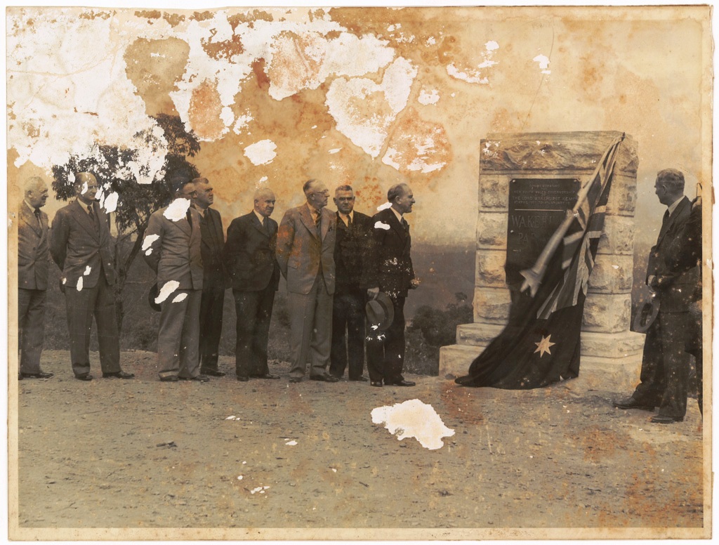
Official Opening of Wakehurst Parkway. Opened March 22nd, 1946 - Alderman J. Anderson Mayor of Manly, Mr E.D. Darby M.L.A, Mr H.M. Sherrard Assistant Commissioner for Main Roads, Mr S.A. Storey M.L.A, Mr F. Laws Metropolitan Engineer, Department of Main Roads, Councillor W.L. Harris, President Warringah Shire, Honourable W.J. Mc Kell M.L.A, Premier of NSW, the late Mr D. Craig formerly Commissioner for Main Roads, Honourable M. O'Sullivan, M.L.Q Minister for Transport, Mr L.A. Robb Official Secretary to the Governor of NSW, Mr... - courtesy State Archives and Records NSW. Also available via Mitchell Library, State Library of NSW. Image No.: Government Printing Office 1 - 37800, dated 2/1946.
NEW ROAD LINK WITH LAKES AREA
A new road, officially opened last weekend, from the top of The Spit hill to the north side of Narrabeen Lakes, will provide a fine scenic drive for motorists, reports the N.R.M.A.
Constructed by the Department of Main Roads and officially named "Wakehurst Parkway" the road runs from Seaforth past Dalwood Homes to Roseville Bridge -Dee Why road in French's Forest, thence to the main Palm Beach road, which it joins immediately north of Narrabeen Lakes. The new road will form an important link in the main road system and, when public transport has been instituted, will assist materially in developing the Warringah area from Narrabeen to Hawkesbury River. Ultimately a new bridge will be constructed at The Spit with an improved approach connecting with the new road. NEW ROAD LINK WITH LAKES AREA (
1946, March 31).
Truth (Sydney, NSW : 1894 - 1954), p. 20. Retrieved from
http://nla.gov.au/nla.news-article168768869
The Wakehurst Parkway was named to commemorate the governorship of New South Wales by Lord Wakehurst from April 1937 to January 8th 1946 —then a record term. He was succeeded by (Sir) John Northcott, and was the last non-Australian Governor of New South Wales.
WAKEHURST PARKWAY .
The new main road from Seaforth to Narrabeen was formally opened to traffic and named the "Wakehurst Parkway " by the Premier, the Hon . W . J. McKell , M.L.A. , at a ceremony on the roadside, on the 22nd March, 1940. A commemorative tablet was unveiled by the Premier near each end of the new work.
The naming of the road is an expression of the Government's desire to pay tribute to Lord Wakehurst, who, as Governor of New South Wales from April 1937 to January 1946, took a great interest in the development o f the State and in its natural beauty. This is the first road in the State to merit the name "parkway, " a term which is applied to a road of exceptional width, including in its width areas in their natural state Of developed as strips of parkland.
From its junction with Main Road No . 164 (Sydney-road ) in Seaforth, the new road follows fairly closely the alignment of French's Forest road to Mai n Road No . 328 (Rodborough-road), and then proceeds past Oxfor d Falls in a general northerly directioa through the Middle Creek area to the western and northern shores of Narrabeen Lake, which it follows to its junction with Main Road No . 164 (Pittwater-road) at Narrabeen. Throughout its length the road is flanked by natural bushland amid attractive scenery, and it is for the purpose of preserving these that a wide road reservation is being acquired.
T h e length of the road is 9.8 miles, of which 7.75 miles are new construction in virgin country. For the remainder of the total length ( 2 miles at the southern end and 0.05 miles at the northern end ) the existing pavement was resurfaced and incorporated in the new work.
from DEPARTMENT OF MAIN ROADS. - TWENTY-FIRST ANNUAL REPORT FOR Year ended 30th June, 1946.