Turimetta Beach Boulders Falling: 2m of Erosion
Regular contributing photographer Joe Mills visited Turimetta Beach on Tuesday August 5 and Friday August 8 this past week, and has recorded some rockfalls along the cliff faces.
Joe said on Saturday:
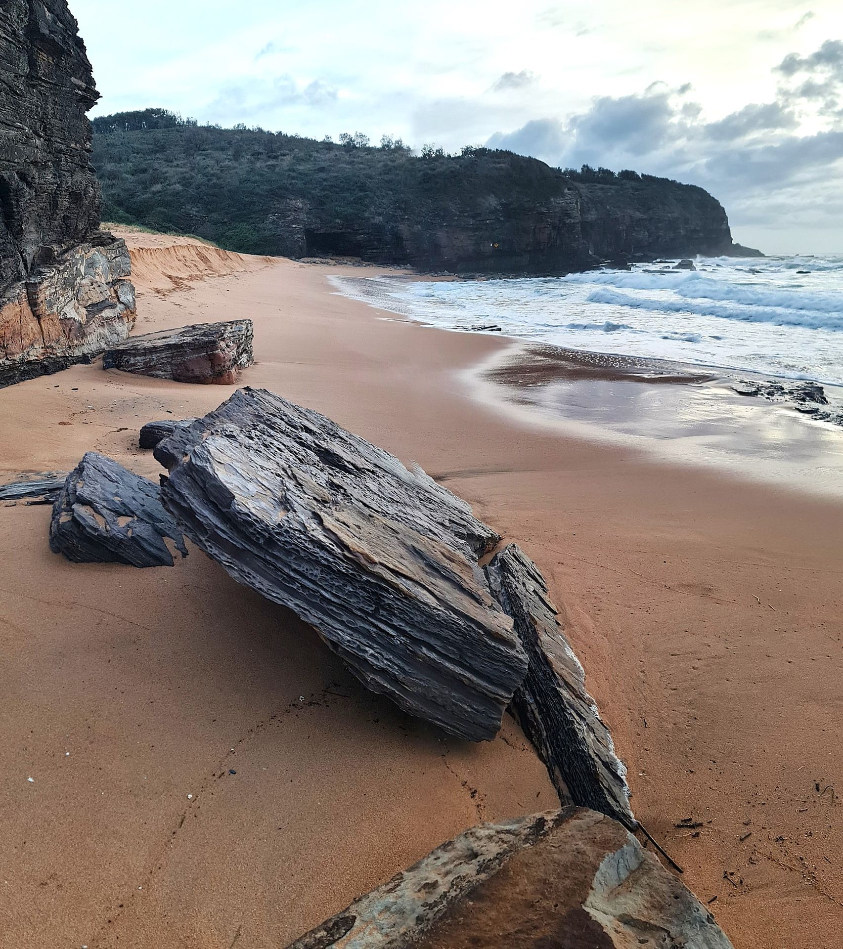
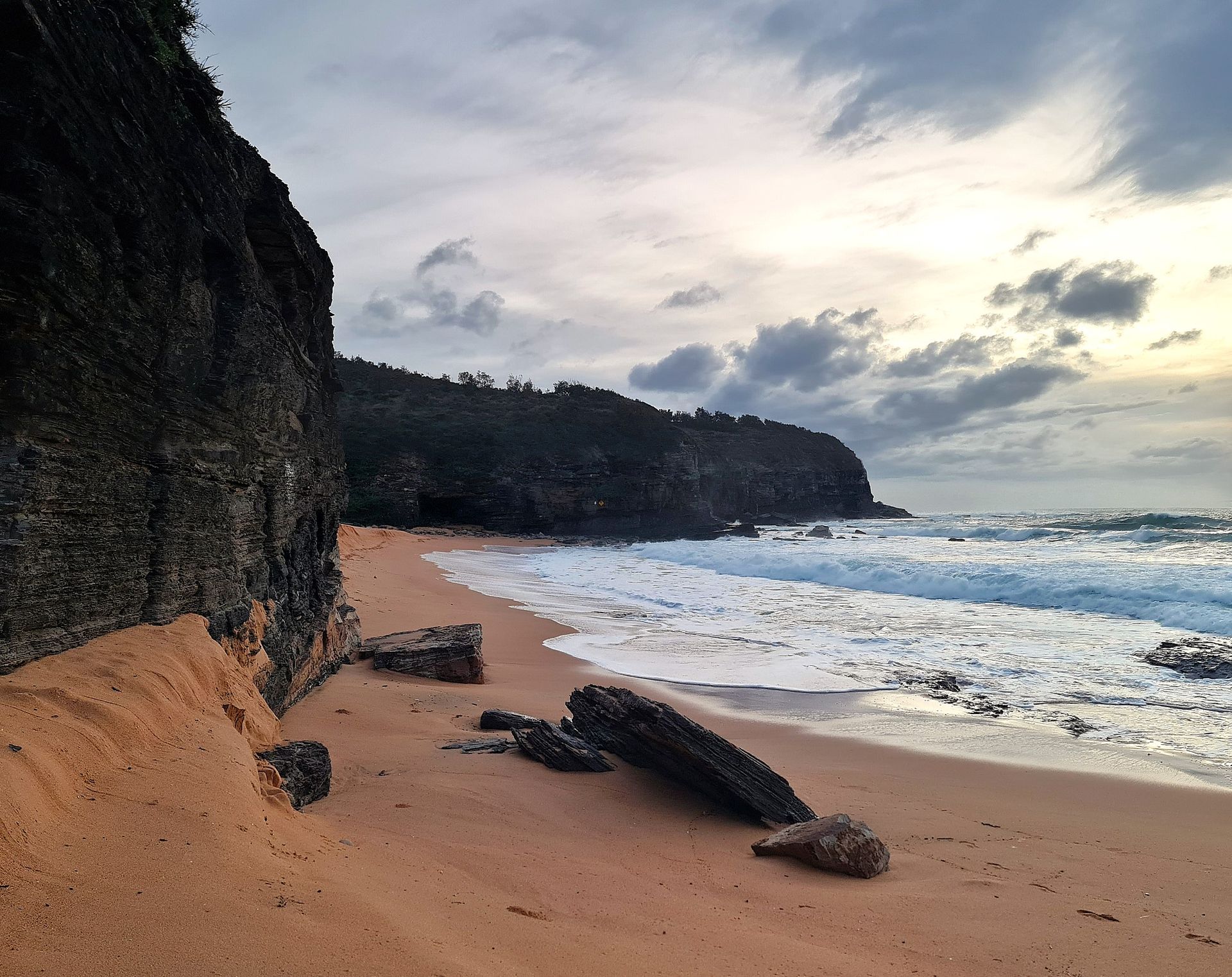
''Due to all the recent rains and heavy swells the beach at the northern end was severely eroded at the end of this week, for about 2m of sand. This is mostly at the northern half of the beach near the steps. It was very noticeable.
As well, there were a lot more big boulders (some up to 1.5m size) scattered along the beach, which fell from the moist cliff tops.''
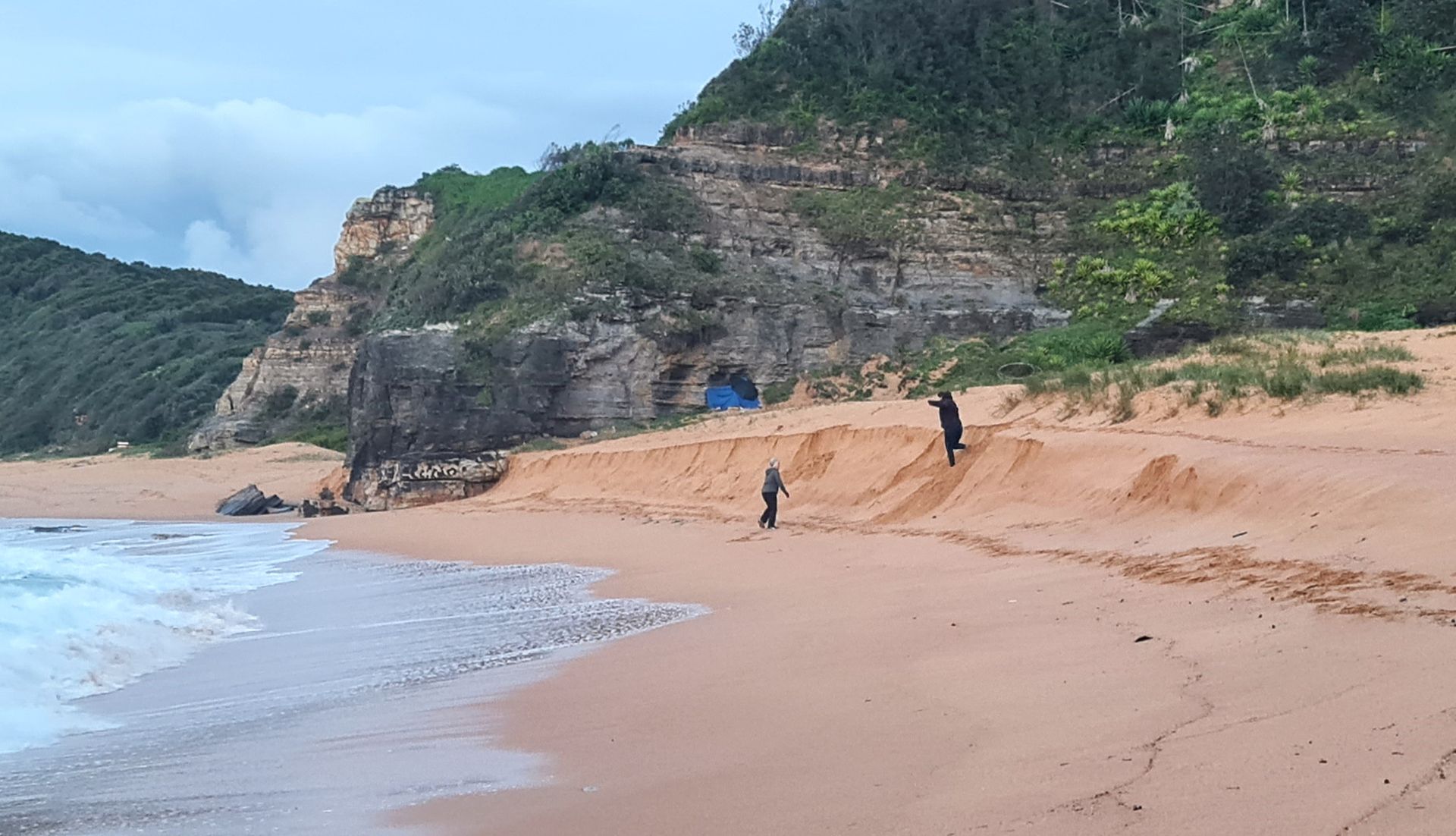
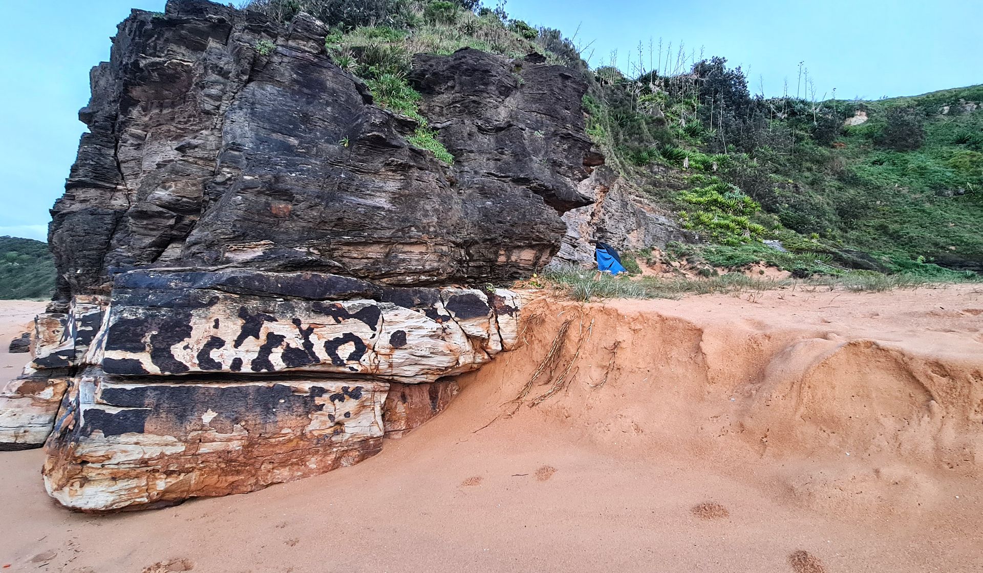
In recent storm events, and smaller rockfalls, Joe has been concerned for the safety of a gentleman he calls 'the hermit' who camps under and against the shelter of the rockface - you can see the blue of his tent in some of Joe's photos from Friday:
mid-beach erosion - August 8 2025
mid-beach erosion - August 8 2025
Turimetta beach erosion from storms - August 8 2025
Turimetta erosion - August 8 2025
Council currently has the beach listed as 'closed' due to storm swells and the absence of patrols of lifesavers on this beach.
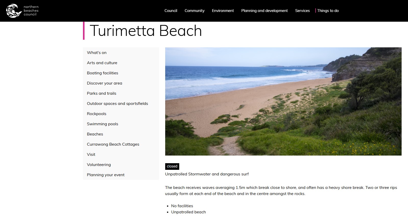
screenshot from council's Turimetta beach webpage, Saturday August 9 2025
Coastal erosion is the loss of land along the shoreline due to the natural removal of sand, vegetation and other features associated with changing wave and water conditions. During severe storms, coastal erosion can happen rapidly, potentially putting people, properties, and infrastructure in danger.
Climate change is likely to increase coastal erosion over time, as the intensity of storms increase and sea levels rise. Infrastructure like roads, access to beaches and connection to utilities are likely to be impacted during these events.
Weather conditions leading to coastal erosion in NSW are typically associated with intense low pressure systems off the coast which generate large waves and higher sea levels. These low pressure systems include tropical cyclones, ex-tropical cyclones and east coast lows. The impacts in NSW of winds, flooding and coastal erosion associated with Cyclone Alfred earlier this year are likely to increase in frequency in the future.
The extent of coastal erosion can be influenced by a range of factors, both natural and unnatural, including:
- Tides
- Waves
- Water currents
- Runoff
- Headlands
- Storms
- Vegetation
- Building and development
- Coastal management activities
However, what's been happening at Turimetta in recent months warrants closer scrutiny.
On Friday August 8, another long-term regular at the news service, John Illingsworth, released 'Teetering Turimetta', a film focussed on the cliffs of this beach between North Narrabeen and Warriewood.
John states in 'Teetering Turimetta':
''Turrimetta Headland in NSW in 2015 is a towering heap of faulted, fractured Newport Formation sandstones and shales, capped at its highest point with a tiny remnant of Hawkesbury Sandstone, all of which rests upon the purplish Bald Hill Claystone unit that you can see at low tide.
In 2021 Turimetta Headland’s cliffs were videoed from a drone, part of a record of the coastline from North Narrabeen to Barrenjoey. This publicly available footage is a baseline against which future geomorphic events - rockfalls in particular - can be identified and measured.
In this 2021 screen capture near where Mitchell showed us the piece of coal, we can see 2 joint blocks missing, plucked from the basement rock by wave action. But by 2025 five blocks are missing, so 3 more were removed in just 3 years, a rate of around one block per year and a steady undercutting of the cliff above.
If we freeze Michell as he walks by this boulder, we can see in the middle distance a pile of rocks, an early rockfall, indicated by the arrow. Remember, this is 2012. In this 2025 picture we see that same fall, pretty well unchanged. We can clearly see that the edges of the boulders are all sharp, unworn by time. We cannot be specific other than to say this fall is also quite recent, though before our record. But when the camera pans left it shows something that wasn’t there in 2012 – a very large rotational rockfall of perhaps 200m3. Now, this fall is also visible in the 2015 drone footage here. So this rockfall dates between August 2012 and December 2015. Rockfalls are most likely to occur during inclement weather when rainfall is heavy and seas high. Good times to stay away!
Which brings us to the sewer outfall where fishermen and women congregate. Construction of the outfall was completed by about 1973. So, the rocks you can see here in 2021 must have fallen later than 1973 because they rest on the concrete covering the sewer. It’s also pretty clear that all these rocks and boulders comprise a multi-fall event which is, perhaps, ongoing.
The May 2021 reference flight shows the precarious position adopted by fishermen. Since this footage was taken two fishermen have drowned here, swept from the platform by waves in January and December 2022. Indeed, this footage may show them, but we don’t know.
This is the earlier 2015 flight (19 December). As the drone rises to return home, just as it sets out, if we freeze the frame we can get a good look at the point and the rock platform. Note there are four boulders on the platform that have obviously fallen from the point. DJI 0042 But the reference flight of 22 May 2021 shows an additional fall: there are now many boulders. And just 3 weeks later, by 13 June 2021, we’ve had a huge fall on top of the previous two. This fall has completely removed Turimetta’s nose.
The view from this angle shows just how unstable Turimetta headland is, not surprising seeing that it aligns with, and is almost certainly part of, the Luna Park Fault Zone.
And this is where this gets interesting. As the camera goes around the point the rock platform comes into wider view. If we freeze the frame here, that crack you can see running across the rock platform toward the cliff is a slickensided fault where rock has moved against rock, polishing the faces and leaving lines that indicate the direction of movement. The line of strike. is xxx degrees, the dip about 75 degrees north, some of the fault plane is curved, and there is a wide crush zone at the base. And if we reverse the camera we can see how the cliff is intersected by the fault and how the southern face has already partially collapsed. We can also project a likely fracture line upwards at least half way up the cliff where it appears to become horizontal and merges with bedding planes.
So on Turimetta’s south face we have serious undercutting along the inclined fault-line; and on its eastern nose massive random fracturing that is opening up, simultaneous with extreme undercutting of the north face. These opposing undercutting processes must eventually intersect. Shot through with cracks, faults and fractures, and undercut on this north face in particular, Turimetta appears to be teetering on the verge of a major collapse.''
See John's 2021 film: Drone Gives A New View On Coastal Stability - Turimetta: Narrabeen Lagoon entrance to Bungan Beach
John's earlier film and August 2025's 'Teetering Turimetta' run below: