Saturday June 4th
NSW SES Warringah / Pittwater Unit - June 4 at 10:25am
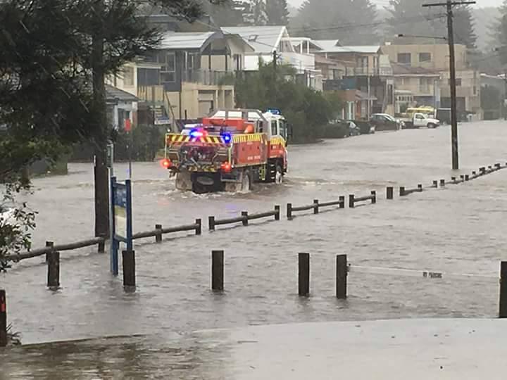
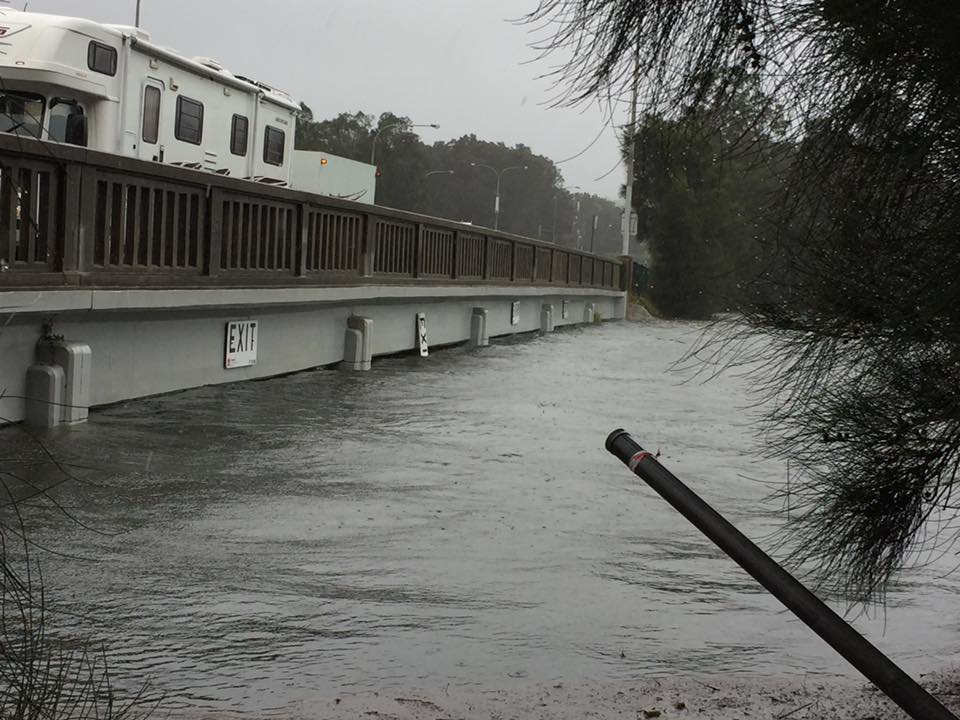
Road Flooded UPDATED: 10:56am Sat 4 June 2016
- Oxford Falls Rd, Oxford Falls is CLOSED in both directions due to flooding. - Macpherson St, Warriewood is CLOSED in both direction between Warriewood Rd and Boonah Rd due to flooding - Blackbutts Rd cross Glen St, Belrose water across road - Victor Rd, Dee Why water across road
Have you experienced any flooding during this storm event? If it's flooded. Forget It.
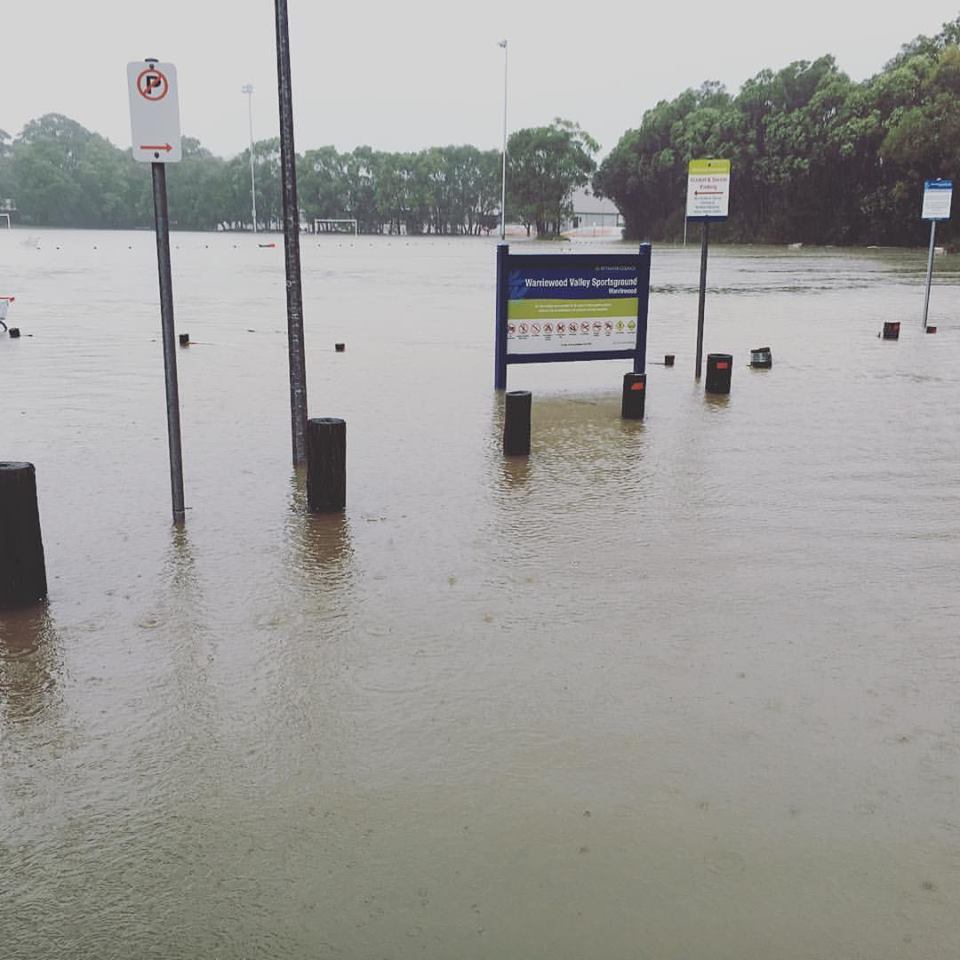
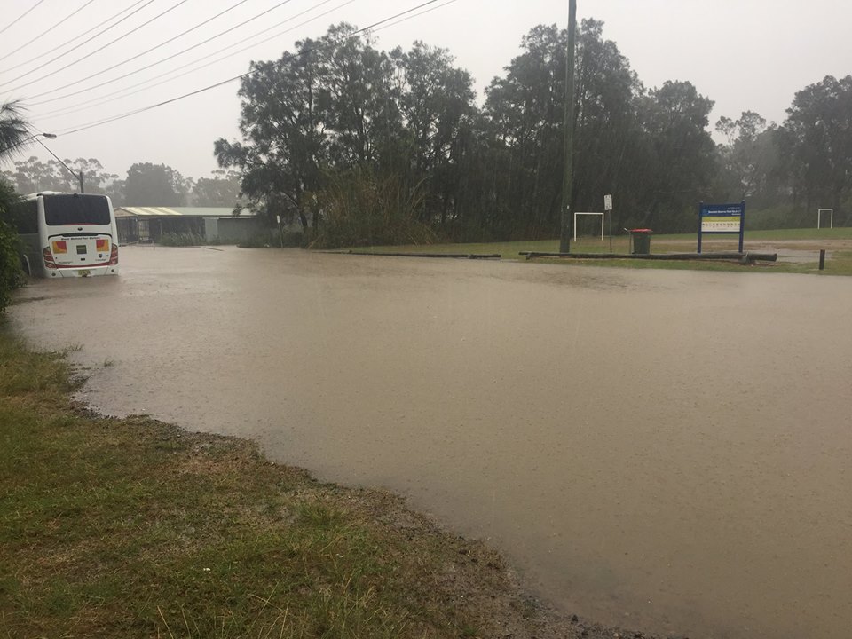
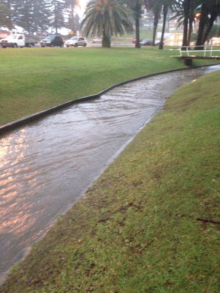
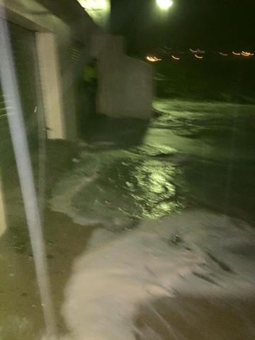
Warriewood playing fields
Boondah Reserve
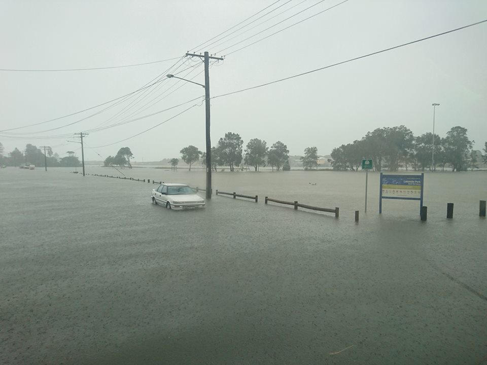
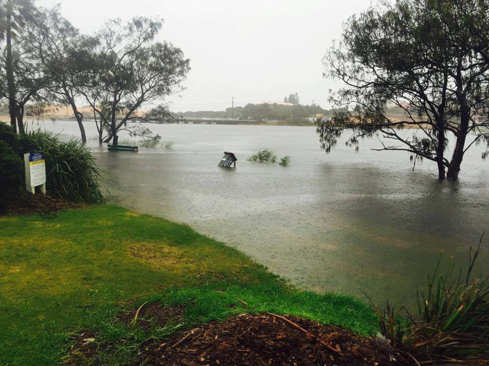
Lakeside park
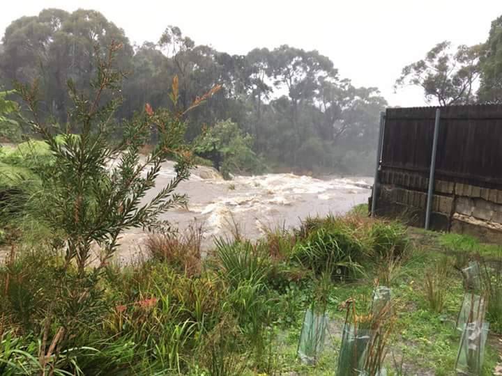
Backyard stream - all photos courtesy members of Ingleside RFS
Residents of eastern NSW urged to stay safe during the Severe Weather this weekend
04/06/2016: BOM
Severe Weather expected over eastern New South Wales due to an intensifying East Coast Low.
A low pressure trough over inland NSW will deepen and move eastwards today.
Acting New South Wales Regional Director, Jane Golding, said as this system moves over warmer waters off the northern NSW coast over the next couple of hours it will develop into an East Coast Low.
“This system is forecast to intensify tonight as it moves southwards and will continue to produce widespread heavy rain and high winds that result in riverine and flash flooding, dangerous roads, bring trees and powerlines down and may cause significant property damage,” Ms Golding said.
"This system has already produced upwards of 200mm in the far northeast of NSW, with more to come. We’ve also seen an increase in winds along the coast today, and these winds will increase further tonight as the low intensifies and tracks southwards. Locally destructive winds of around 125 km/hr are possible over areas to the south of this system.”
“We’re particularly concerned about winds and rainfall intensifying tonight and through into Sunday morning as the low continues to deepen and move southwards. The major population centres of Newcastle, Sydney and Wollongong will be under threat through this period, particularly along the coastal fringe. The focus will most likely shift to the southern NSW coast during Sunday.”
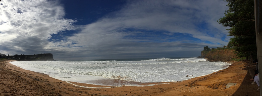
With a King Tide expected and huge seas creating dangerous surf conditions along the whole coast, significant coastal inundation and beach erosion is also expected.
A Flood Watch has been issued for nearly all of the river valleys along the NSW coast. Severe Weather and Flood Warnings have been issued for this event with both meteorologists and hydrologists closely monitoring the situation. Members of the public are advised to stay tuned for updates to these warnings.
The Bureau of Meteorology and the NSW State Emergency Service have been working together in preparation for the upcoming conditions.
NSW SES Acting Commissioner Greg Newton has urged the community to consider the weather conditions and avoid unnecessary travel.
"Torrential rain and damaging winds are expected in the entire coast over the next 12-24 hours. This will lead to localised flash flooding and the risk of drivers being caught in floodwater," Acting Commissioner Newton said.
"The NSW SES asks drivers to stay away from flooded areas and find an alternate, safer route. Better to arrive a little later than be caught in floodwater and risk the loss of your car, or even your life."
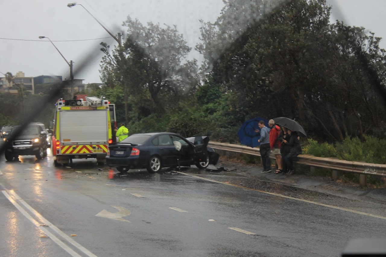
Saturday afternoon: Newport - heading home from Newport Breakers Ladies Day photo shoot - accident happens before eyes - terrible conditions: luckily no one was hurt - A J Guesdon photo taken from bus
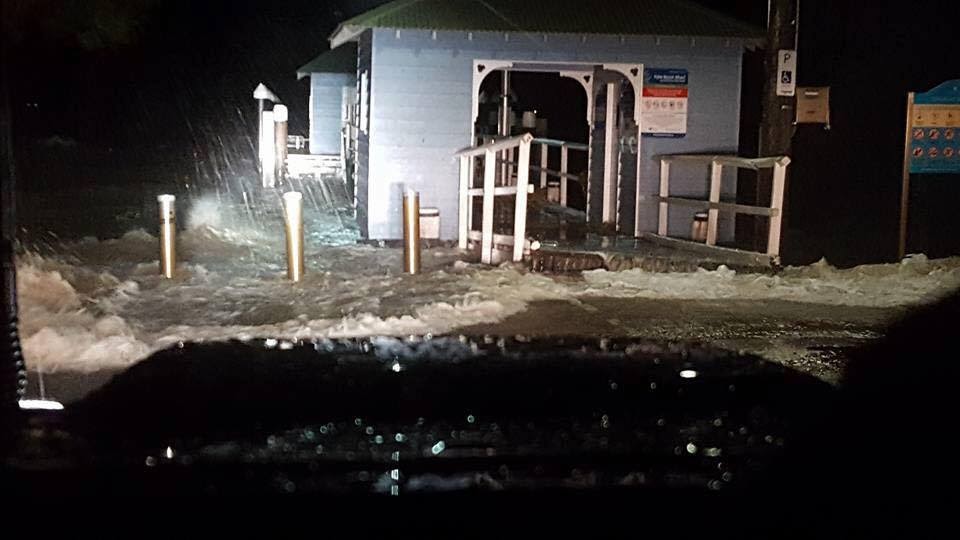
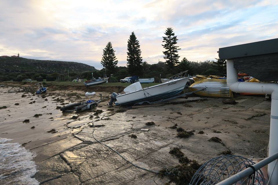
Church Point Ferry Service at Tennis Wharf: June 4 at 5:30pm
Despite the bad weather, with mighty master mariner Ian at the helm, we had no disruptions today. We do not foresee any tomorrow either, so do yourself and your boat a favour if you have to go out tomorrow, and take the ferry.
Sunday, June 5th, 2016
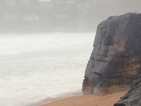
June 5 Palm Beach- 9am
Swim to Black Rock? Road is closed from the club to Kiddies – picture courtesy Adriaan van der Wallen
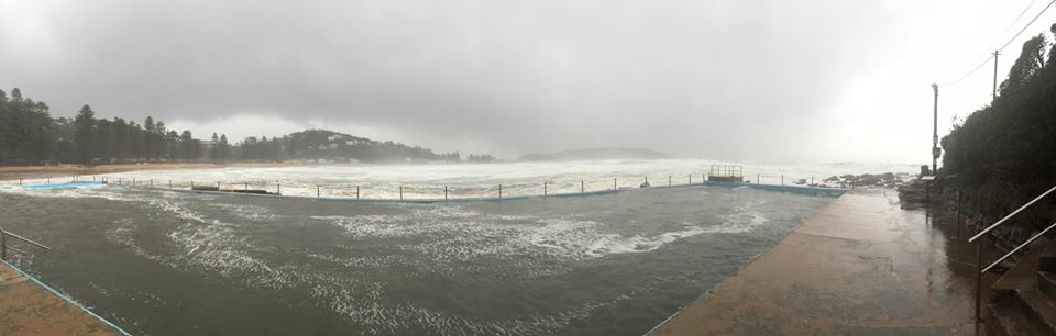
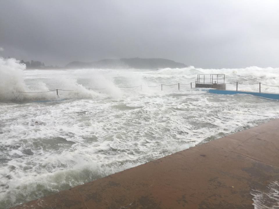
Palm Beach Rock Pool - photos courtesy Alex Tyrell
Church Point Ferry Service: 9am too
The ferry is still operating, however we will not be stopping at eastern wharf. Due to the east coast low, all wharves on Scotland island Except bells will be shut. Please use bells wharf to access the ferry. Lovett, halls and Elvina are all sheltered and should remain useable all day.
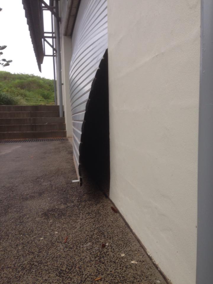
Avalon Beach surf club Warren Young 9am 3- Sunday morning –:
White caps as far as you could see ! Our roller doors all damaged by the winds. This door broken in two on the car park side. Water usually runs down hill but with the huge wind gusts sends the water the other way !Submerged yellow brick road and skate bowl. The canal near Woolworths still filling and high tide still to come tonight
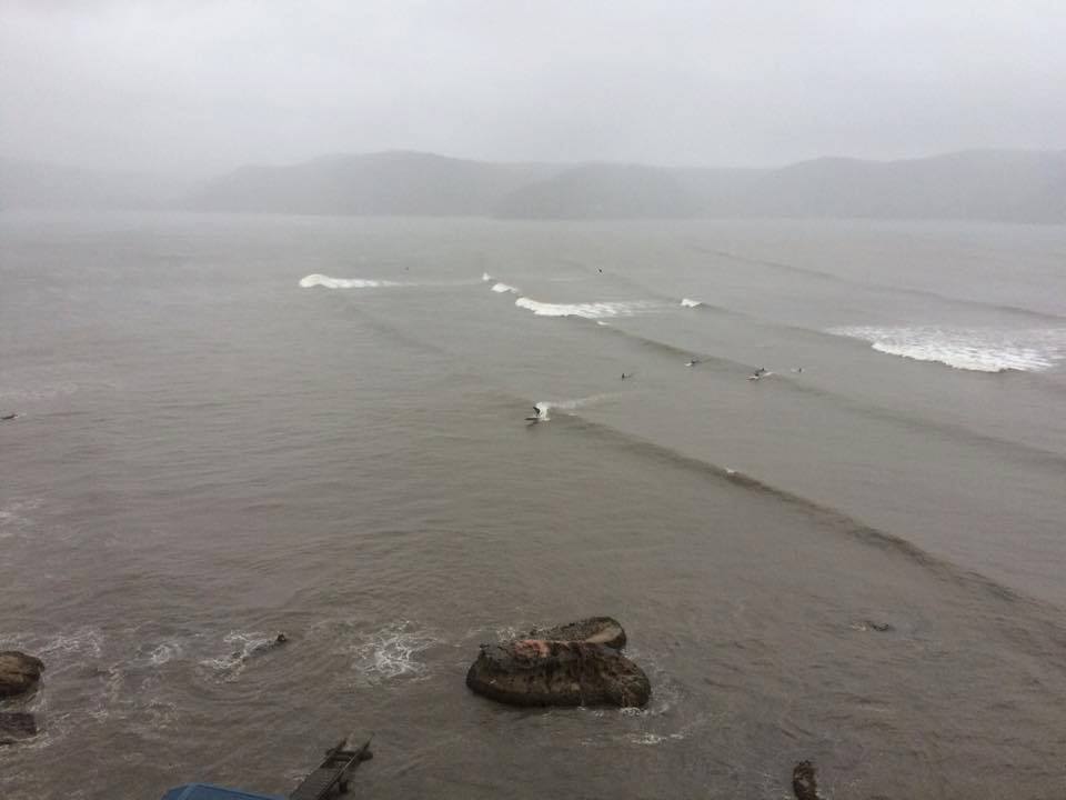
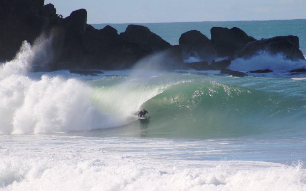
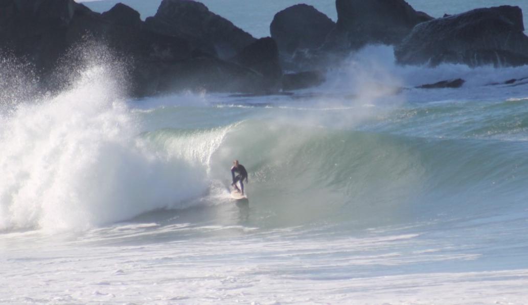
Surfing Station Beach, tucked inside Barrenjoey, Pittwater side of the Estuary, Sunday June 5th. Photo courtesy Matt Chojnacki
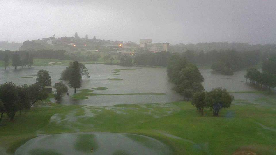
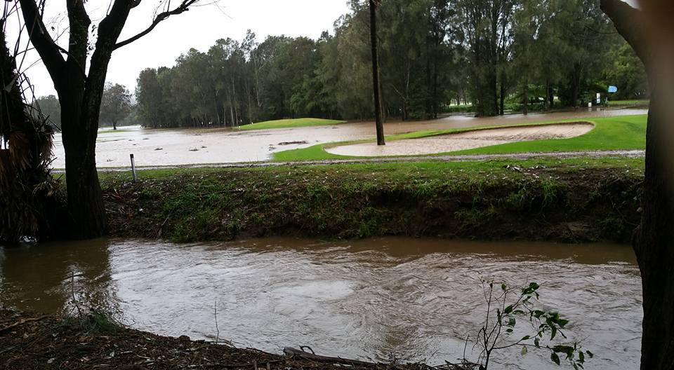
Messaged and announced on other Media that Mona Vale Hospital flooding – Maternity Ward 9am Sunday Morning: asked to message people go to Manly Hospital if needed - message superseded 2 hours later, they can go there, just as well as Naraben was flooding and bridges would soon be cut - Mona vale Golf course - photo courtesy MVGC:
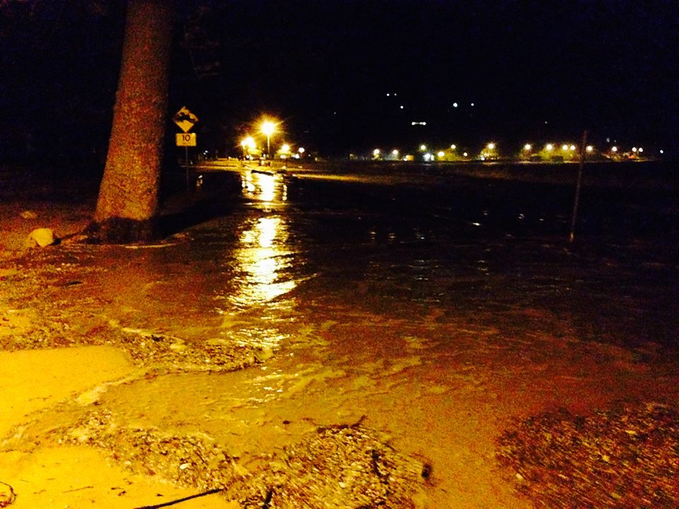
Coastal Environment Centre on Narrabeen Lagoon - Sunday morning
Narrabeen about to go under water – 12pm Sunday June 5 – photo courtesy Craig Miller
Flooding at Narrabeen Lagoon - photos by Isabelle Wise, aged 14
Mobile phone pictures of Narrabeen Lagoon taken through a car window of the devastating flooding occurring in the area at 1.20-1.40pm this afternoon June 5, 2016, Traffic was diverted up Waterloo Street from Pittwater Road and onto Ocean Street, Narrabeen at this time. Wakehurst Parkway was also closed.
.jpg?timestamp=1465696682700)
.jpg?timestamp=1465689206263)
.jpg?timestamp=1465689289550)
.jpg?timestamp=1465689310906)
Job Done photo courtesy Elyse Cole Avalon – 3pm Sunday
We have been thinking about getting rid of the shed for a while now, "job done" and once again, how lucky is Beryl, car still perfect.
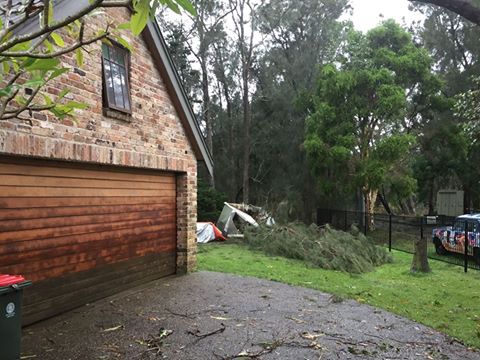
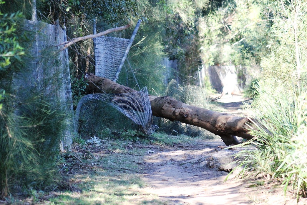
This was one of many trees blown over by wind from rain soaked and softened ground.
Beryl Driver, who lives right on the estuary water’s edge at Palm Beach, later had to be evacuated, along with her most precious possessions
Pittwater RSL is currently an evacuation centre for residents of Narrabeen from 4 p.m. - still messaging people at 10pm Sunday June 5
NSW SES Sydney Northern Region - Residents have been evacuated today in areas surrounding Narrabeen Lagoon due to flooding.
Streets include: Nareen Pde, Lido Ave, Narroy Rd, Venetian Rd, Richard Rd, Windsor Pde, Gondola Rd, Grenfell Rd, Bristol Lne, Garden St, Lagoon St and Wimbledon Ave.
The Lakeside Holiday Park and Sydney Academy of Sport and Recreation have also been evacuated. The majority of residents have relocated to family/friends with others attending the evacuation centres at Pittwater RSL and Cromer Community Centre.
With continuing rain and a high tide due tonight it is unlikely that water in the lagoon will start to recede before tomorrow. Please avoid travelling in and around this area as many roads are closed due to flooding.
Bilgola Beach June 6th - photo by Joanne Seve
Bayview Golf Course - Sunday morning - Photo courtesy Mel Raine
NSW SES Warringah / Pittwater Unit - *** PLEASE SHARE *** Evacuation Centres
Evacuation Centres have been opened at the following places: Cromer Community Centre, 150 Fisher Rd, North Cromer
Pittwater RSL, 82 Mona Vale Rd, Mona Vale. If you have been evacuated please head to these areas.
Newport Surf Club at that night's high tide
Sandy Menzies, President of Newport SLSC - Sunday Night 9.43 pm
Thank you to the Doyle Clan, Rob Emerson, Julie Hegarty, Rob Barkley, Cooper Family, Dave and Vicky Buchanan , Sue and Gus Jones, Amy Bruce, Adrian Hill, Jess and Kieran Menzies, Christina Jenkins and Craig McDougall for going down in the dark, foul rain and bad weather to sand bag and safeguard our club to keep it safe. There were also a few members of the public who stopped to assist - thank you to all!!! Stay safe overnight and we will assess tomorrow. Photos courtesy Sandy Menzies
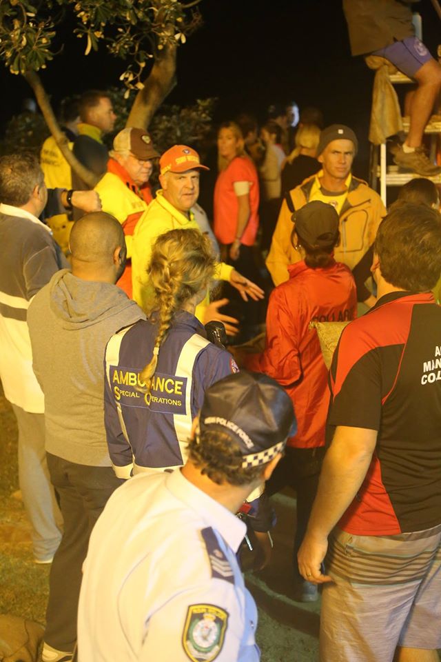
NSW Ambulance @NSWAmbulance 10:27 p.m.: We are PLEADING with you. Stay out of floodwater. It's not worth the risk to your safety or to ours.
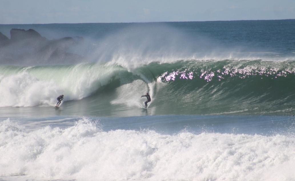
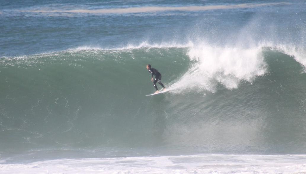
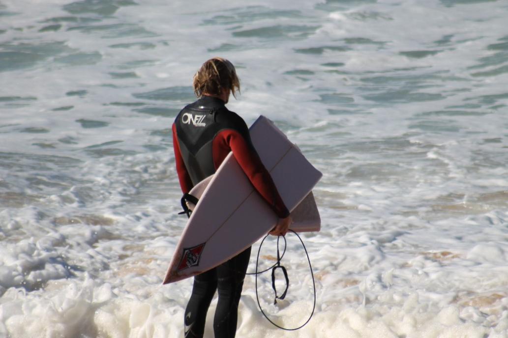
Surf Lifesavers Brave Wild Weather
Sun 5 Jun 2016 – Surf Life Saving New South Wales
Patrol off season for volunteers and state wide beach closures didn't prevent Surf Life Saving from responding to a number of incidents and emergencies across the state today.
While a deep east coast low battered the coastline, throwing up huge seas and torrential rain, most people took the advice of lifesavers and stayed out of the water.
Despite this volunteers were called out to assist police, SES and Marine Rescue with evacuations from flooded suburban areas on Sydney's Northern Beaches and elsewhere. At Narrabeen 75 trapped students had to be evacuated by Inflatable Rescue Boats (IRB) from the NSW Sports Academy by craft and crews from Nth Narrabeen and Newport SLSCs.
In central Narrabeen IRBs from Sydney Northern Beaches Branch and local duty officers braved the downpours to assist residents with rising floodwaters threatening homes and businesses.
Elsewhere in the state volunteers were called out to incidents including a potential stand up board paddler reported missing at Fingal Head in the Tweed.
A kayaker who became stranded in big seas after he became separated from his craft on the North Coast was extremely lucky that an experienced IRB crew from Macksville Scotts Head was able to launch a rescue effort and come to his aid.
On the Far North Coast Australian Lifeguard Service personnel were disappointed by the behaviour of some swimmers and surfers who decided to take to extremely messy waters off Byron Bay because there was a break in the rain.
Local Lifeguard Supervisor Ruben Roxbourgh said surfers were ignoring warnings and obviously still hazardous conditions to head out on the water, making the job of lifeguards even more difficult.
NSW Lifesaving Manager Andy Kent commended all volunteers who lent a hand with callouts today.
"The community is lucky to have volunteers including surf lifesavers who have the skills and commitment to help others at times like this," said Andy Kent.
Conditions are expected to improve during Monday however large, powerful surf conditions will persist along much of the NSW coast and Surf Lifesavers are urging beach goers to exercise caution.
Avalon Beach - 7pm: A Lull in the storm, it stops raining and wind drops - we race down to the supermarket, desrted, and see rsecue and RFS brigades from as far away as Kellyville waiting for their next call for assistance - as we watch, they all turn south - towards Narrabeen
7:30 p.m. - we're sending the message, and asking people to share - that Pittwater RSL is the Evacuation point for everyone surrounding the north end of Narrabeen Lagoon
Church Point Ferry Service: 9p.m. Sunday June 5th
Extra services tomorrow, Newport shops, Mona vale shops, Warriewood square, Narrabeen shops, and if it's still raining Warringah Mall.
Palm Beach Public Wharf - Sunday June 5th at 10 p.m. - photo courtesy Brian Friend OAM
Kiddies Corner Palm Beach - Sunday 10 p.m. - photo courtesy Adriaan van der Wallen
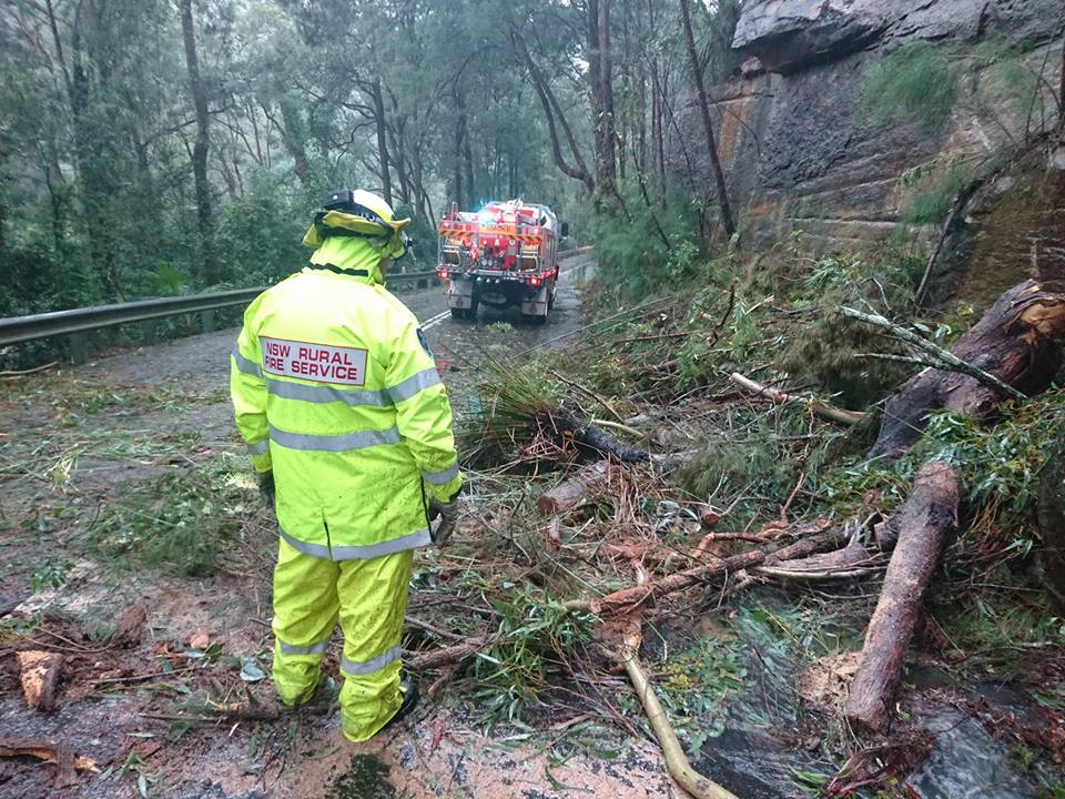
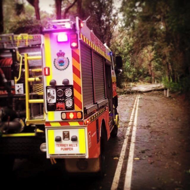
NSW Rural Fire Service- June 5th
After a massive day helping NSW SES, over 580 NSW RFS firefighters will be out overnight continuing to help storm affected communities. A further 120 NSW RFS incident management specialist are also helping NSW SES coordinate the response.
Fishing from balcony – Narrabeen lagoon
This. Is. EPIC :O Meanwhile in Australia, we're catching fish from our balconies! Watch as this man hooks a fish from his second storey balcony while stranded by flood waters at Narrabeen in Sydney's north | VIDEO: Clare Smith – via NSW Alerts
Monday June 6th
Avalon Beach - 10:35am 6.6.16 – photo courtesy Joanne Seve picture
Station Beach - Pittwater 'The Calm After the Storm' - photo courtesy Brian Friend
Northern Beaches LAC - NSW Police Force - Monday June 6th, 2016: 1pm
 Residents who were evacuated from their properties yesterday under an emergency evacuation order are not permitted to return to their properties as the emergency evacuation order remains in force. Residents are being prevented from returning to their properties until such time that critical safety inspections have been undertaken to ensure properties are safe to be re-inhabited. .
Many unseen risks maybe present inside flood effected properties including live power, structural damage, free flowing effluent and associated health risks.
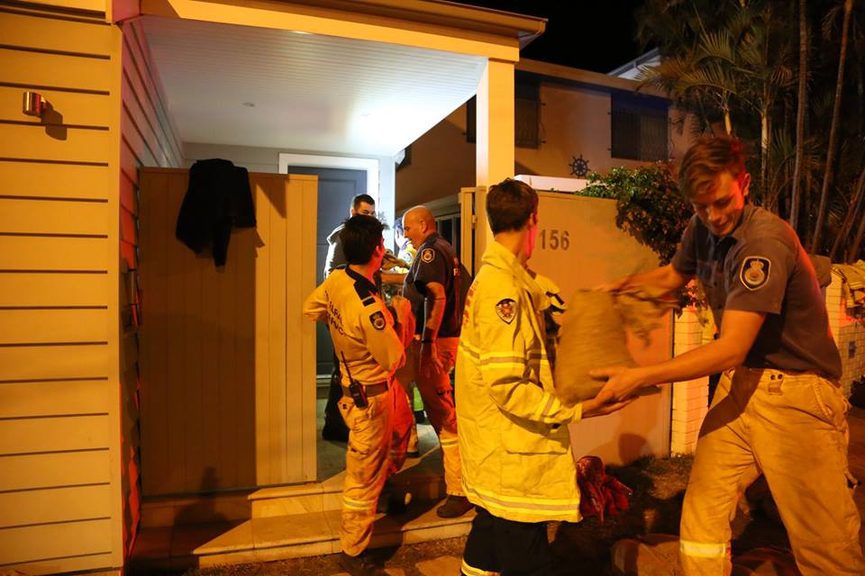
Crews from NSW State Emergency Service, NSW Police Force, NSW Rural Fire Service, Fire and Rescue NSW, Ambulance NSW and Northern Beaches Council continue to work in affected areas. Any non critical travel around flood affected areas should be postponed.
Residents who have been mandatorily evacuated should register for a building safety assessment by contacting Northern Beaches Council on (02) 9942 2111..
Residents who have been mandatorily evacuated who require accommodation assistance should also contact Northern Beaches Council on (02) 9942 2111. .
Community Information Points staffed by emergency service personnel have been set up in the following locations.
1) 7-11 Service Station, Pittwater Rd, North Narrabeen.
2) Lakeside Caravan Park, North Narrabeen (near site management office).
3) Berry Reserve Car park, Pittwater Rd, North Narrabeen.
4) Pittwater Rd, Collaroy (between Stuart and Ramsay Streets).
These Community Information Points will be staffed today until 9pm and tomorrow from 6am to 6pm.
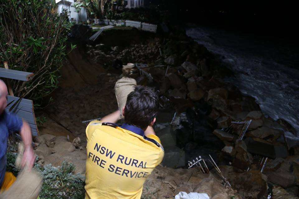
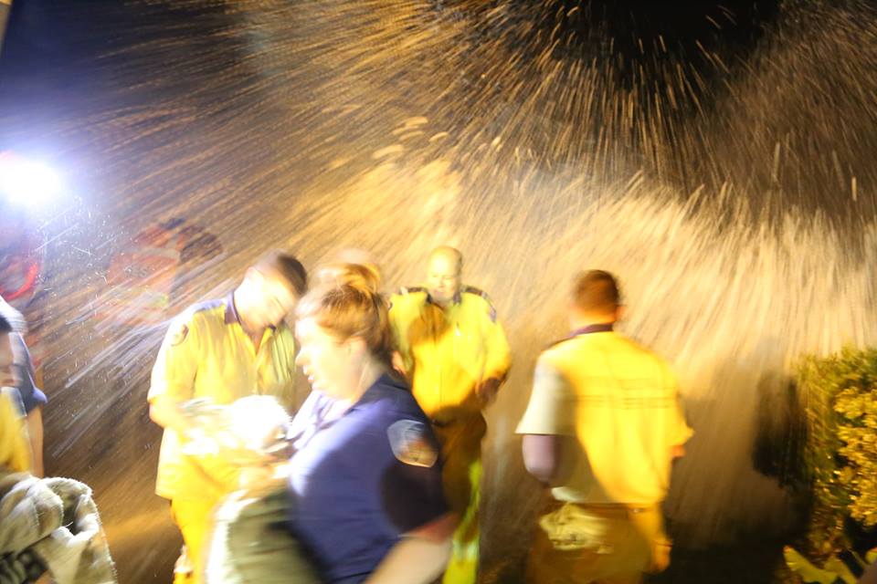
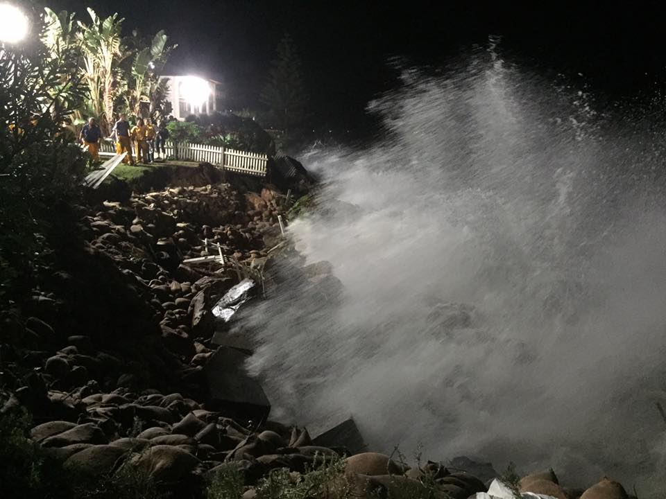
Ingleside Rural Fire Brigade - Monday June 6th – 1.15pm
Ingleside NSWRFS at Palm Beach on edge of Pittwater assisting home owners. A large swell has washed away the sea wall threatening homes to fall into Pittwater. The North East swell, is swinging into Pittwater around Barrenjoey Headland. Police & Council assisting to prevent further erosion at the high 2 metre tide this evening.
NSW SES Sydney Northern Region - June 6 at 2:47pm
NSW SES Sydney Northern Region had received 2545 jobs since 3/6/16. Of that, 912 jobs are still outstanding. Please bear with us while waiting for our arrival. Contact us on 132 500 if you require any assistance.
NSW SES Warringah / Pittwater Unit - June 6 at 6:39pm
Safe to return for areas around Narrabeen Lagoon
Authorised By: Mark Morrow, Sydney Metro Operations Controller
Evacuations were carried out yesterday around Narrabeen Lagoon as a result of flooding in the area. The NSW SES now advises that Council have inspected the area and deemed that it is safe for residents to return to areas around Narrabeen Lagoon with the exception of the area affected by coastal erosion, which is bounded by Collaroy Beach, Pittwater Road, Fielding Street and Stuart Street Collaroy, as at 5.30pm Monday, 6/6/2016.
Narrabeen Lakes Sailing Club – We're OK!: Our lake was hit hard by the floods on the weekend. The good news is that the clubhouse survived without any damage. The water reached higher levels than I have seen in over 30 years but literally stopped on the front door step.
The park area looks a bit like a war zone but Council have already started the
Coogee Surf Club - messaged by Freshwater Surf Life Saving Club
Our thoughts are with fellow lifesavers from Coogee SLSC: “The waves that are coming in are probably eight metres in height. All the ground floor windows, the storm surge just broke them in, so we’ve lost all our gear downstairs. The storm surge is just pummelling it. The boatshed where we store all our equipment has been destroyed,” Mr Karozis said. “I’ve never seen anything like that. I was talking to a couple of old blokes and they said ‘74 was a big year, but not like this.”
Storm Damage - Clean Up: Council Services - Monday June 7th in the a.m.
Extra waste services will be put in place over the coming weeks. Council will endeavour to clean up the waste as soon as possible. Please follow these guidelines.
Vegetation clean up services
Assistance and additional services for vegetation clean up will be provided for residents:
• Please use existing green-lidded bin services for vegetation waste where possible
• Call Customer Service for additional collections if needed
• Leave vegetation on the kerbside in manageable stacks or in vegetation bins (no plastic bags please)
• Larger branches will be collected separately from the kerbside
• Take excess vegetation waste to Kimbriki Resource Recovery Centre for free disposal. Residents will also need to quote ‘Storm Damage’ when passing the weighbridge and show proof of residence.
General Waste Services
Assistance and additional services for other storm damage (household materials) and general waste disposal will be provided for residents.
• Please use existing re-lidded bin services for small general waste items and food where possible.
• For excessive amounts of spoiled food due to flooding or power outages call customer service to arrange a collection.
• For disposal of larger items, such as water damaged furniture, carpet and other household material residents can:
- place items on the kerb and call customer service to arrange a collection, or
- take items to Kimbriki Resource Recovery Centre for free disposal. Residents will also need to quote ‘Storm Damage’ when passing the weighbridge and show proof of residence.
Please call the Council by 14 June 2016 to book your waste pick up
Pittwater (02) 9970 1111
For those experiencing electrical wires down in your street or near your home, please contact Ausgrid Emergency on 13 13 88.
To report fallen trees on public land that are posing a risk to safety; flooding as a result of drainage issues on public land or damage to public buildings or Council infrastructure, please call one of our Customer Service Centres by phone or via our social media channels:
Residents are advised to contact the SES on 132 500 for emergency assistance for property damage on private land or for trees on private land causing damage.
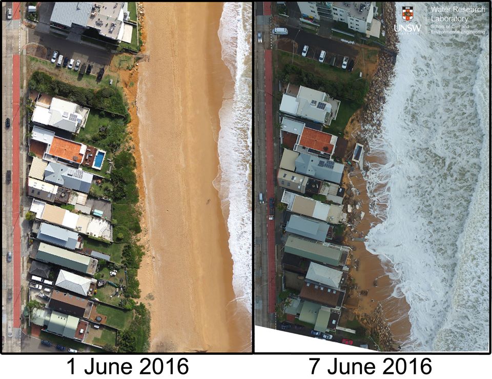
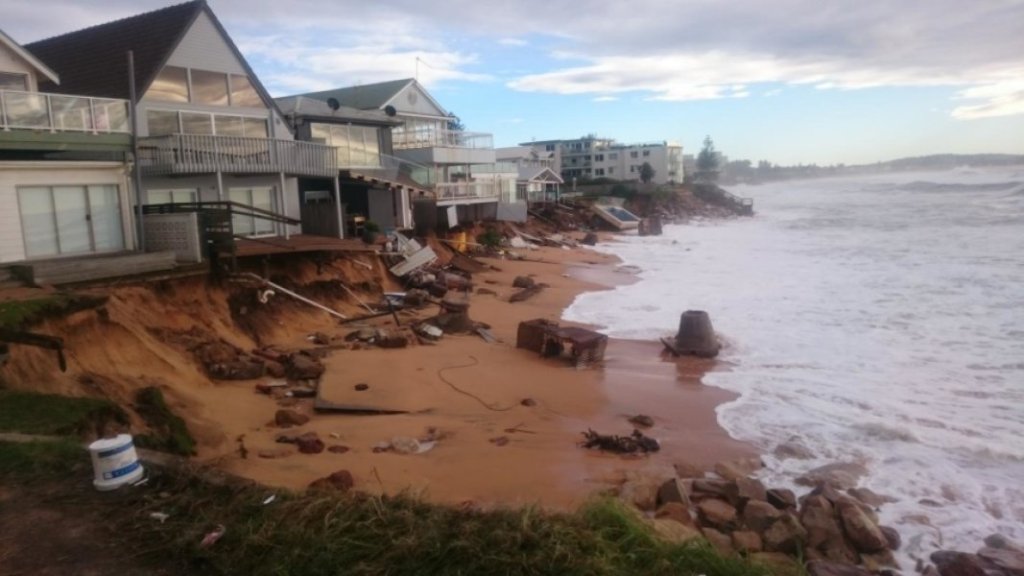
Collaroy Beach SLSC - Monday morning - Devastation - photos courtesy Collaroy SLSC
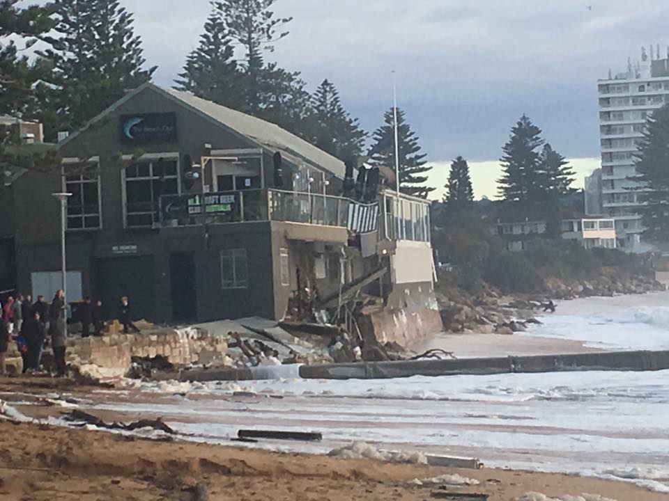
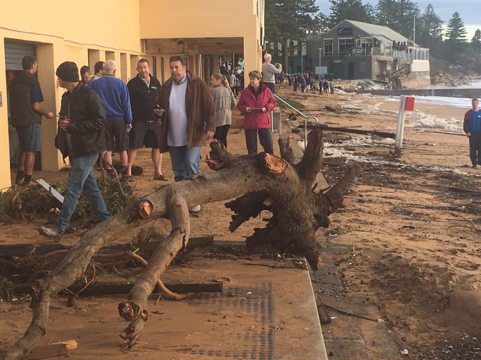
Collaroy Beach Front - Surf Club and Beach Club and Homes Teetering on the brink
Drone footage over Collaroy Beach on Sydney's northern beaches shows the damage caused by the weekend's storms. Credit: UNSW Australia - Water Research Laboratory
Collaroy - next King Tide coming - Not Safe to go home
NSW SES Warringah / Pittwater Unit - 4-5pm Monday June 6th
LATEST UPDATES: Police are now allowing residents who live in the evacuated coastal areas at Collaroy to return to their homes to collect their essential items. Residents are returning via Police escort only and only if the buildings are safe to enter.
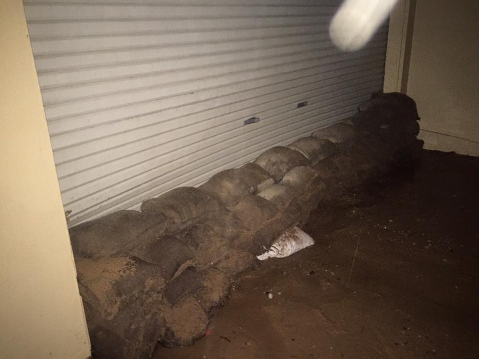
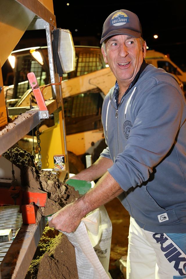
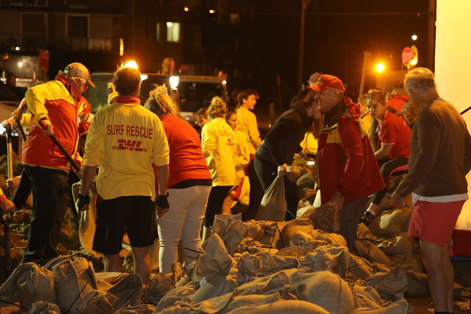
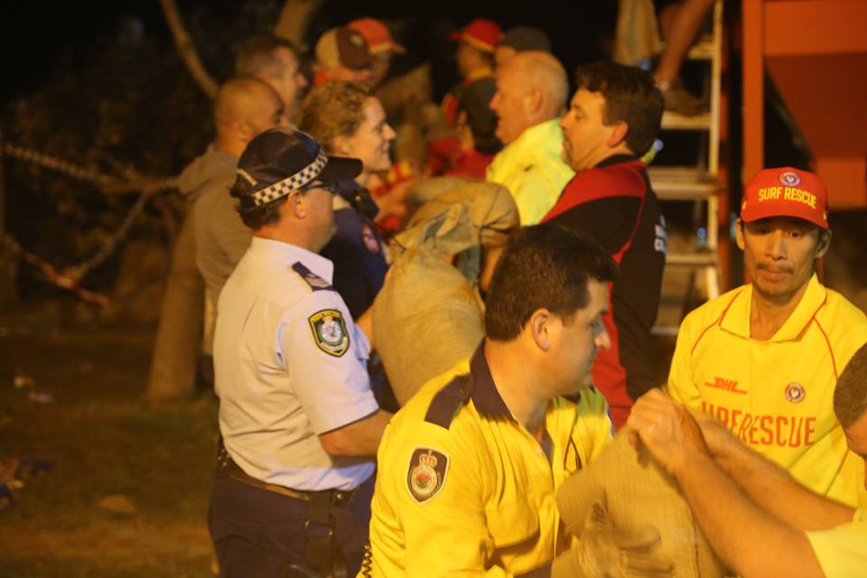
Tuesday, June 7th: The Collaroy Sand Bag Army
Ingleside Rural Fire Brigade - 5.45pm: June 7th, 2016
Ingleside NSWRFS volunteers are working at Collaroy working to fill sand bags to assist with land stabilisation ahead of high tide tonight about 10pm. 5000 still to fill. RFS crews working with Fire and Rescue NSW, NSW SES volunteers, NSW Police Force, & #Surf Life Saving Volunteers, NSW SES Warringah / Pittwater Unit, Warringah / Pittwater Headquarters Rural Fire Brigade, Beacon Hill Rural Fire Brigade, Davidson Rural Fire Brigade and many other RFS brigades.
ATTENTION: All available members - Whale Beach SLSC: June 7 at 7:51pm
Collaroy residents need your immediate assistance to support the banks of the beach with sandbags and various other tasks - if you are available, report to John Lewin at Stuart St, Collaroy.
Similar messages to that sent out above was sent around to every surf life saving club on the Northern Beaches. Surf club members and even people walking past joined the line - and worked, and worked: - photos from various RFS and SES services
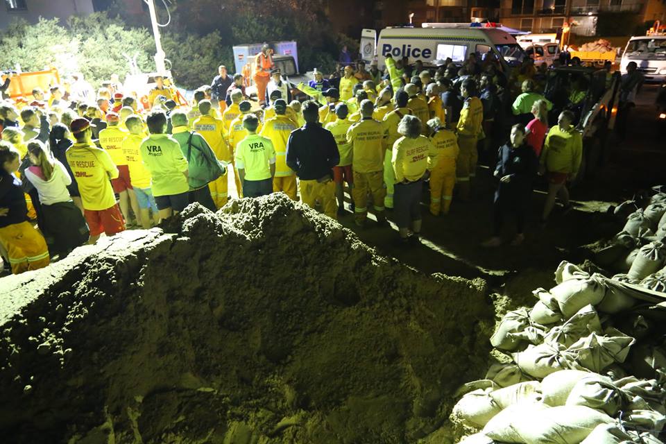

NSW SES Sydney Northern Region - Tuesday June 7th, 9 p.m.
The waves are starting to roll in. Crews continue to throw sandbags in an attempt to beat the rising king tide. The next hour or so is critical.
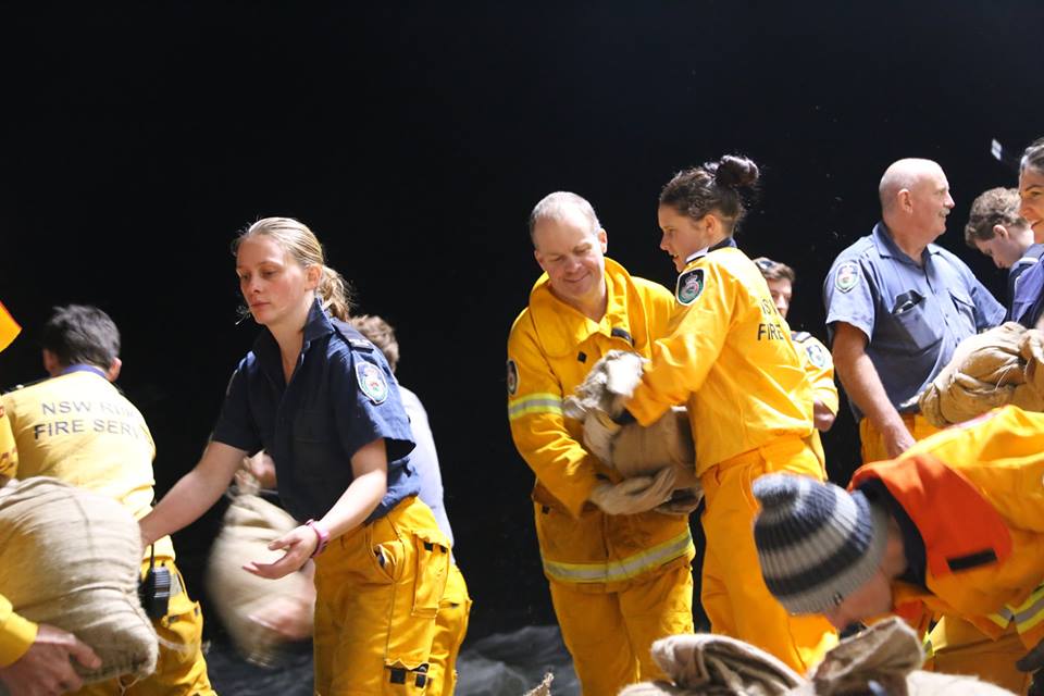
Tumbledown Dick Rural Fire Brigade
Another huge day of sandbagging.
Tumble is returning to station after an evening of sandbagging efforts in Collaroy. Today and this evening saw a huge multi agency effort along with Surf Lifesaving to complete as much sandbagging as possible to protect properties under threat with the King tide. Tumble and brigades from our district and adjoining districts have spent another day on storm damage assistance.
NSW SES Sydney Northern Region – 10.30 to 11.00 p.m.
Mission complete for today! It seems the hard work of all these amazing volunteers has paid off :-) The sandbags are holding!! What an amazing day :-
Ingleside Rural Fire Brigade
Ingleside Rural Fire Brigade volunteers were the in the field today at 9.30 am at Collaroy with a relief crew at 7pm, our crews are working until Midnight tonight, continuing to fill sand bags and place them to protect against high tide due now at 10pm. It was great to see over 70 volunteers also from local Surf Life Saving Clubs along the Northern Beaches who turned up from 5pm and worked extremely hard working side by side RFS crews and Fire & rescue crews helping out.
This video was taken by one of our members coordinating the deployment of crews sand bagging today.
Wednesday June 8th
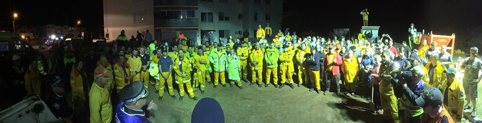
Surf Life Saving Sydney Northern Beaches - June 8 at 9:36am
Thank you once again to all of the amazing Surf Life Saving volunteers who turned up at Collaroy last night to help with the sandbagging efforts. It was a great team effort working with the NSW Police, Fire and Rescue, Rural Firefighters, and SES. NSW Police Incident Commander Inspector Dave Darcy said that he had never seen such a great community effort in his life and praised the 200 Surf Life Savers who responded to the emergency call out.
Inspector Darcy said they were hoping to get 4,000 sand bags in place but was unsure how they would achieve that until the SLS volunteers arrived.
At 10.30pm, following the tide peak, the call to stop work came through and some very tired volunteers gathered for a debrief. During the debrief we were told that 12,000 bags were loaded, passed hand to hand, then placed in front of the at risk properties. An amazing effort !!
PENINSULA POWER TAKES ON MOTHER NATURE FOR A SMALL BUT SIGNIFICANT WIN. - Northern Beaches LAC - NSW Police Force: June 8
State Emergency Services and supporting emergency agencies faced a tough challenge yesterday. Engineers inspecting the ocean break wall north of Stuart Street Collaroy recommended dropping four thousand sand bags on and around the wall to maintain its integrity with the added benefit of protecting six houses from the relentless swell. It was a tough challenge that had to be completed before the two metre king tide arrived in the late evening.
It was inspiring to see up to 500 members from all the agencies working side by side filling sand bags and forming lines to hand deliver them to where they were needed.
In the early afternoon it became apparent that we needed more volunteers to get the job done and we turned to Surf Life Saving Australia. More than two hundred SLSC members turned up and enthusiastically got stuck into the task at hand and more than doubled our output of production and delivery of bags.
In the final stages of our push to get the job done, volunteers walked off the street to help.
Just as the king tide arrived we finished the job with many soaked from drenching sea spray. As the last bag was placed and the Engineer gave his thumbs up of approval, all services had worked together to produce and hand deliver 12,000 bags, a total of 320 tonnes of sand.
Our morning inspection today revealed our efforts had been worth it. Our sand bagging was intact and had prevented further damage to the sea wall.
A heartfelt thanks to all involved.
Northern Beaches Declared Natural Disaster Zone
June 8, 2016
Member for Pittwater Rob Stokes today said the Northern Beaches is among 37 local government areas across NSW to be declared a natural disaster zone.
The joint declaration has been made by the State and Federal Government in response to the damaging storms which swept across the northern beaches over the weekend and means financial assistance is now activated for local families, small businesses, community organisations and the Northern Beaches Council.
“Unfortunately parts of our community are among the most affected areas in NSW,” Rob Stokes said today.
“The amount of damage and disruption we’ve seen is frightening and many families are still doing it really tough.
“Whilst most of the attention is on coastal properties damaged by the ocean surge – there’s many other properties impacted by damaged roofs and flooding.
“With the clean-up now underway the State and Federal Governments are seeking to provide financial assistance to those with limited means to recover on their own.
“Our local emergency service personnel have done an outstanding job – but there’s still lots more work to do.
“Essential council infrastructure is among the key priorities and support is now available to assist with rebuilding and repair works.
“Information on the disaster assistance programs which have now been activated is available by visiting www.emergency.nsw.gov.au ,”Rob Stokes said.
________________________________________
The MP for Pittwater and NSW Planning and Environment Minister Messaged via Facebook, as he too was at Collaroy, moving sand bags:
Rob Stokes - June 8, 2016
Thank you to all the volunteers for their extraordinary efforts following this week’s storms. In tough times, our local community is at its best.
These storms may have hit us hard, but our drive to help others in their time of need shone through, with volunteers from across Pittwater and the northern beaches stepping up to support their fellow residents.
NSW Police asked for 100 people to help at Collaroy on Tuesday. More than 500 people turned up to lend a hand.
Volunteers from our surf clubs, the Rural Fire Service and the State Emergency Service have put in outstanding performances over these last few days. Emergency service personnel also put in a superb effort.
Thank you to everyone who gave their time, and who continue to contribute to the recovery effort.
________________________________
Council Notices
24 Hour Storm Hotline for Affected Residents
09 June, 2016
Northern Beaches Council has established a 24hour Storm Hotline - 9942 2557 - to assist storm and flood affected residents from Collaroy, Narrabeen and North Narrabeen.
The temporary Hotline will be manned by dedicated Council Customer Service staff and will operate for as long as there is a large influx of enquiries from affected residents. Council will prioritise these calls and will provide information as quickly as possible. Council has been working to support all those in the community affected by the storm.
Council appreciates the community’s patience with responses to enquiries and in the delivery of our normal services during the clean up phase.
Northern Beaches Disaster Recovery Information Centre
09 June 2016
A Disaster Recovery Information Centre will open at Council’s Customer Service Centre, at Mona Vale on Friday 10 June for residents who have been impacted by the recent storm.
Administrator Dick Persson said that Council had been working very closely with the Office of Emergency Management NSW to set up the centre, which will be a hub for information and advice on a range of government and welfare services.
“Resident safety will always be our first priority, but now that a few days has passed and we have a clearer idea of what we are dealing with, we are now able to help our community with rebuilding their lives,” said Mr Persson.
The Disaster Recovery Information Centre will operate from Friday 10-17 June.
The Northern Beaches Council has also opened a temporary 24 hour Coastal Erosion Hotline for residents - 9942 2557.
The Disaster Recovery Information Centre will provide a range of services, these include:
• Disaster Welfare Services
• SafeWork NSW
• NSW Fair Trading
• Housing NSW
• LegalAid
• NSW Health
• Insurance Council of Australia
• NRMA, CGU and Coles Insurance
• Red Cross
• Chaplains
Location: Northern Beaches Council - Customer Service Centre
1 Park Street, Mona Vale
Hours
Weekdays 9am-7pm
All long weekend 9am-4pm
Enquiries 9970 1666
For those requiring assistance, representatives of key welfare, business and insurance agencies will be on hand, or via referral from the site to give help, advice and information to affected residents and business people.
Visit the Emergency NSW website: emergency.nsw.gov.au/publications/publications.htm
Storm Damage - Clean Up: Council Services
June 7, 2016
We are extremely concerned for the residents as the East Coast of Australia continues to be hit by storms, high tides and massive swells.
We feel for the affected families on the Northern Beaches and are working with authorities to ensure their safety. We’re also very concerned about the properties that are in danger. Houses and businesses with and without seawalls are now threatened. I will be meeting with the most severely affected residents and land owners today. Council has provided emergency accommodation for the affected residents.
We also are very concerned about the medium to long term protection of properties and critical infrastructure on the Northern Beaches.
We have been in advanced discussions with the Premier, Mike Baird MP, the Minister for Family and Community Services, Brad Hazzard MP. and the Minister for Planning, Rob Stokes MP. to establish a coordinated approach to these issues. With the severity and frequency of storms increasing globally it is important that we have a collaborative and considered response at all levels of government with the community.
I’d like to thank staff who have been working around the clock to help protect the community and recover from the storm.
Council has responded to approximately 400 calls from the public for assistance. To assist with the clean-up, Council has put on a range of extra waste services.
Extra waste services will be put in place over the coming weeks. Council will endeavour to clean up the waste as soon as possible. Please follow these guidelines.
Vegetation clean up services
Assistance and additional services for vegetation clean up will be provided for residents:
• Please use existing green-lidded bin services for vegetation waste where possible
• Call Customer Service for additional collections if needed
• Leave vegetation on the kerbside in manageable stacks or in vegetation bins (no plastic bags please)
• Larger branches will be collected separately from the kerbside
• Take excess vegetation waste to Kimbriki Resource Recovery Centre for free disposal. Residents will also need to quote ‘Storm Damage’ when passing the weighbridge and show proof of residence.
General Waste Services
Assistance and additional services for other storm damage (household materials) and general waste disposal will be provided for residents.
• Please use existing re-lidded bin services for small general waste items and food where possible.
• For excessive amounts of spoiled food due to flooding or power outages call customer service to arrange a collection.
• For disposal of larger items, such as water damaged furniture, carpet and other household material residents can:
- place items on the kerb and call customer service to arrange a collection, or
- take items to Kimbriki Resource Recovery Centre for free disposal. Residents will also need to quote ‘Storm Damage’ when passing the weighbridge and show proof of residence.
Please call the Council by 14 June 2016 to book your waste pick up
Former Manly (02) 9976 1500
Former Warringah (02) 9942 2111
Former Pittwater (02) 9970 1111
For those experiencing electrical wires down in your street or near your home, please contact Ausgrid Emergency on 13 13 88.
To report fallen trees on public land that are posing a risk to safety; flooding as a result of drainage issues on public land or damage to public buildings or Council infrastructure, please call one of our Customer Service Centres by phone or via our social media channels:
Residents are advised to contact the SES on 132 500 for emergency assistance for property damage on private land or for trees on private land causing damage.
Dick Persson, Administrator