Scientists Discover Underwater Volcanic Craters, Reefs And Ancient River Beds In First Section Of NSW Seafloor Map
9 April 2018: NSW Office of Environment & Heritage
Large areas of reef, ancient volcanic vents and relict rivers formed thousands of years ago have been discovered on the sea floor off the Illawarra coast by marine scientists from the NSW Office of Environment and Heritage (OEH) and the University of Wollongong.
The mapping is part of an ongoing effort to create a high-resolution digital map of the NSW seafloor (SeaBed NSW), to better understand the distributions of reef and soft sediment environments.
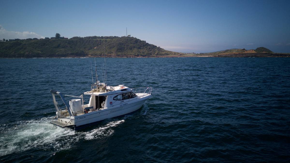
OEH scientists have systematically scanned the first section of seafloor off Wollongong, from Bellambi Point to Red Point (Five Islands), using sonar and video systems mounted on the OEH research vessel RV Bombora.
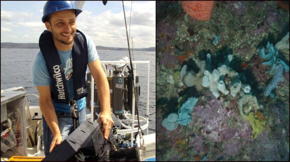
OEH marine scientist, Dr Tim Ingleton said when mapping in the ocean we are unable to directly observe the seabed so we need to use remote sensing technologies to peel back the water to see what lies underneath.
"We use a range of different technologies to 'see' through the water column. These include sonar, laser and video systems, which are operated from boats, planes and even jet skis. We also collect sediment samples to verify our models and understand the composition of the seabed," said Dr Ingleton.
"Once our sonar mapping was completed and built into a 3D digital model, we discovered that reefs cover close to 60% of the area mapped off the Wollongong coast, with video footage collected with our partners from the University of Wollongong showing an array of colourful sponges, boulders and kelp forests.
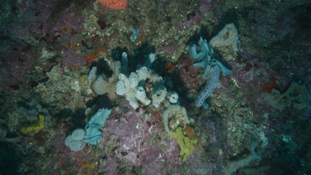
Sponge garden at Five Islands. Picture: Office of Environment and Heritage.
"We discovered evidence of ancient river channels that flowed thousands of years ago when sea level was lower and the coastline was located far offshore, which was confirmed by sediment samples containing smooth and round pebbles typical of fluvial environments.
"We also noticed a few strange round patterns that looked like 'crop circles' on the sea floor.
"These intriguing crater features may have been formed by ancient volcanic activity in the area. Volcanic features called Diatremes form as magma rises through a crack in the Earth's crust and meets ground water. Super-heated water vapor and volcanic gases rapidly expand, causing explosions that leave behind a shallow crater.
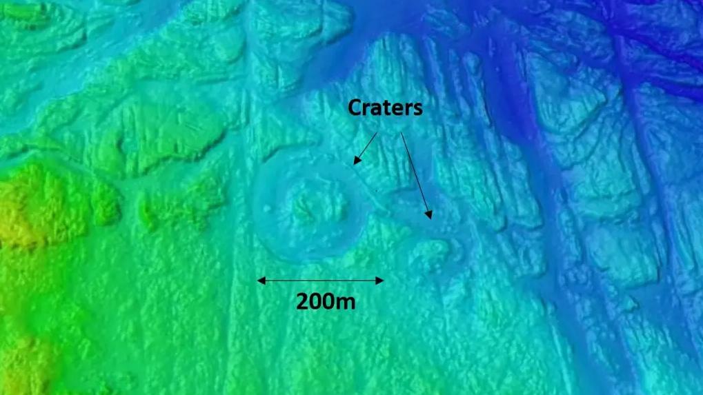
Underwater volcanic craters off the NSW coast. Photo: Office of Environment and Heritage

Paleochannels revealed by the digital mapping. Photo: Office of Environment and Heritage
A palaeochannel, or paleochannel, is a remnant of an inactive river or stream channel that has been filled or buried by younger sediment. The sediments that the ancient channel is cut into or buried by can be unconsolidated, semi-consolidated, consolidated or lithified.
"Since 2005, OEH scientists have mapped as much as 15% of the state's coastal waters. The SeaBed NSW program will expand on that systematically, using RV Bombora and state-of-the-art equipment to collect high-resolution data on the depth and composition of the seabed across targeted sections of the NSW coast. The data will be made available to researchers, councils and the public.
"This work will help to build a baseline digital model of the NSW seabed, and improve our understanding of the NSW seabed," said Dr Ingleton.
SeaBed NSW is a project funded as part of NSW Government's commitment to deliver state wide science and technical advice for coastal management.