
Several local Wildlife, Environment organisations and Residents groups have cited serious flaws in the current proposal for the revised South Ingleside Housing Development Plan. These local organisations have formed themselves into a collective group called 'RAID'.
Among their concerns are a bushfire evacuation modelling that does not take into account volumes of traffic that would be created from surrounding suburbs and a bottleneck on the proposed route, no real fauna thoroughfares, and even a glaring gap between the currently being built fauna pass from Katandra Bushland Sanctuary connecting to a pathway for wildlife in Ingleside, a razed earth plan for the environment which would wipe out two Endangered Ecological Communities present and kill the animals these support, along with the $ contribution cap on each new proposed home not meeting infrastructure needs – a hole that ratepayers across the LGA may be expected to fill.
A Covid-Safe Rally is scheduled, at this stage, to be held along Powder Works Road on the morning of Saturday July 17th between 8 and 9 am, with updates to be posted on the RAID Facebook page - link above.
This week we speak with RAID spokesperson Jackie Jarvis about the groups' concerns.
What does RAID stand for?
RAID stands for Residents Against Inappropriate Development in Ingleside. Our goal is to halt the rezoning currently proposed in Ingleside.
RAID initially came together as just a small group of people on the June long weekend. Shortly after though, through social media posting and through discussions between the contacts of that core group, there has now formed a loose co-operative of groups, residents associations and organisations such as Pittwater Natural Heritage Association, Elenora Heights Residents Association, Friends of Narrabeen Lagoon Catchment, people representing Wildlife Groups, the South Ingleside Residents Association, the Duffys’ Forest Residents Association, the Garigal-Deep Creek Residents Association, and around 8 other local residents associations and community organisations.
We meet regularly via Zoom at present. All these groups and associations are still doing their own individual submissions regarding the Ingleside Housing Development proposal, as is their membership, but we are also coming together and working as one as this collectives’ membership are, as individual organisations, very concerned about one particular aspect of this proposal. For example, some are concerned about the loss of endangered ecological communities, about the impact on the streams in the valley and the lagoon, or concerned about the wildlife – bushfire risk is another, particularly for our Garigal-Deep Creek friends, or turning adjacent suburbs into vehicle rat runs. There’s no doubt that the real potential for loss of life during a bushfire, and this is a very high risk area, and the evacuation route as currently proposed, is a very big one.
RAID was formed to cover all of the issues.
Bushfires and evacuation of residents – what are the main concerns in regards to this?
This is a reasonable well sloping block. There is a history of fire incidents that have demonstrated what happens when a fire goes through this area, in particular, the 1994 fires* are still remembered by residents of Elanora and Ingleside.
It is categorised as a catastrophic bushfire risk area. The 1994 fires went through Elanora, fireballs jumped Mona Vale road and went into Ingleside all the way down Wesley street which sits just off Powder Works road – the Scout Hall burnt down and has never been rebuilt. Elanora Heights is surrounded by bush and National Park.
The consultants that the State Government hired, AECOM, for their Study prior to this latest proposal being put forward, stated ‘don’t build west of Powder Works road’. The irony of that statement is that 45% of this development is proposed for west of Powder Works road.
So the State Government and Department of Planning are not listening to their own consultants. The other point around this is when talking to people involved in the Christmas 2020 fires down on the South Coast is that it is now obvious that fires have changed in nature and ferocity since 1994, it’s a whole different world now with the effects of climate change.
What’s more, just because an area is developed it does not mean it stops fire. Experts along with firefighters state that fires in urban areas sustain themselves going from house to house – as seen in Canberra just 18 months ago.
So, it’s not only an issue of real bushfire risk and loss of life in the area this is proposed for, and leading into Elanora Heights, it is also the compromising of bushfire evacuation routes due to the mass increase of residences at the top of Powder Works road and either side of this road to the tune of around 2000 to 3000 cars that will come with 1000 new dwellings.
This and subsequent technical documents have stated that the only evacuation route is south along Powder Works road. That would mean this road has to handle evacuations from Duffys Forest, Terrey Hills, Elanora Heights, North Narrabeen and Ingleside. *
Has RAID had a meeting with the Member for Pittwater to discuss these concerns?
We have had a meeting with Rob Stokes at which a member from the Department of Planning was present, around a week and a half ago. I did say at that meeting that the people of our area, 2101 especially, felt and thought that as he is the MP for Pittwater but was also the Minister for the Dept. of Planning this was producing some conflicts which led to no positive outcome for his electorate. He certainly acknowledged that this does produce a conflict but to be honest, people and the members of our group feel a little bit abandoned by their representative, especially in this scenario. They have no one to actually go to and have someone who is really really representing us to the State Government in this matter.
The meeting did give us an opportunity to present our concerns, the big one being the bushfire risk and mass evacuation, along with the environmental destruction and the whole strategic economic rationale of the proposal.
From an economic strategic point of view the question of infrastructure is also pertinent. Currently there is no infrastructure. The contribution from developers for each dwelling will be capped at 30 thousand dollars which is woefully inadequate. In Warriewood $62,100 per lot/dwelling was the cap in 2010 and stands at $71,548 in 2021/2022. This is what put pavements and cycle paths and treescapes into Warriewood, as well as all that other infrastructure required.
The Ingleside proposal, as it stands, will not even half of that - so the RAID group has a lot of concerns about the economic viability of this proposal.
The other aspect of this is that not everyone in Ingleside wants to sell or develop their land. Landowners who have 5 acres or one acre or even smaller blocks are not going to be forced to sell, and a lot of them intend to stay. So there isn’t going to be this clearing out of Ingleside so 980 dwellings can be put in. We anticipate there will be a massive shortfall of what the government thinks they will enable to be built here.
There are still some developers and landowners who own parcels of land adjacent to this proposal area, who will want this proposal to progress – is there a concern in the RAID group that this proposal will be used or cited as a means to 'tack on' and develop those parcels, as has happened elsewhere?
Absolutely. The fact of the matter is this is a semi-rural community – it’s not just semi-rural north of Mona Vale road, it’s semi-rural south of Mona Vale road, including alongside Powder Works road.
What is being proposed here, including medium density, is housing in the middle of nowhere, with certainly, especially for the young or the elderly, not even shops being proposed and being placed where they cannot even easily reach the shops at Elanora.
Should this proceed as is it will certainly allow and facilitate the creep of medium density and what are, basically, inappropriate dwellings that will change the character of Ingleside forever.
Currently there are five acre blocks at Ingleside – there are nurseries, farmlets, horses, wildlife, even species that are critically endangered – it’s a rural place. This proposal is completely out of character with what is Ingleside. It’s completely out of character with the adjacent suburb of Elanora Heights as well.
The technical report on the biodiversity states that only 50% of the area to be surveyed for that study could be accessed and that it is basing its study, in a large part, on an earlier Biodiversity Assessment Report. It also states offsets will be triggered by the species of flora and species of wildlife that live off these as either food sources or habitat. Is the group concerned that ‘offsets’ will actually mean this unique and specific to this area ecosystems will be lost?
 The Environmental Lawyer of our group has been speaking about the offsets and has found, along with others, that the offsets system as it stands in New South Wales is a complete and utter mess. We presented a lot of the findings from the wildlife rescue and environment protection groups to the MP for Pittwater.
As you stated, only 50% of the area was surveyed and then cites or uses an out of date study. Eco Logical has over-mapped vegetation as ‘exotic’, without adequately qualifying this, and that brings up the query whether this vegetation would be deemed native under the BAM2020.
There are two Endangered Ecological Communities in the Ingleside Precinct; Coastal Upland Swamp and Duffys Forest Community.
The proposal to surround a Coastal Upland Swamp with a housing zone will destroy that environment. An Upland Swamp needs to collect water from vegetated areas surrounding it. The Swamp then releases the water gradually into the down slope creek keeping a steady flow of water to support the wildlife using that creek as habitat. There needs to be at least a 60m clearance between the Coastal Upland Swamp area and the beginning of residential land to allow for suitable hydrology.
Allowing housing to replace the uphill vegetation means that the Swamp is effectively in an island and is no longer able to adequately provide water for the creek – the water that does drain through it is likely to be nutrient rich - contaminated by fertilisers and exotic seeds from suburban gardens and run-off from roads and driveways that could contain fuels and detergents. Creeks from Ingleside flow through to Narrabeen Lagoon so impacts to the water quality in the creeks will create adverse impacts in Narrabeen Lagoon. These important creeks need to be protected with wide riparian buffers. Water courses require more than 100m of riparian zone protection to allow for movement of wildlife and to ensure water quality downstream.
Eco Logical Australia has recommended that riparian corridors should, where possible, be in public ownership. Their map marks the riparian zones as E2 (Environmental Conservation).
This zone is not given to the creekline corridors in the Structure Plan.
We believe that they must be in public ownership and a total width between built form of 100m, as in the Warriewood Valley. Otherwise they are not sustainable.
A patch of Duffys Forest EEC exists within the precinct which has been overlooked by Eco Logical Australia, the biodiversity consultants working for DPIE. This is Listed as an Endangered Ecological Community under State Legislation and is habitat for Grevillea caleyi which is listed as critically endangered under both State and Federal legislation. Duffys Forest EEC occurs in a few locations in Ingleside, Terrey Hills, Duffys Forest and Belrose and nowhere else in the world. As many sites as possible must be protected to add resilience in case of bushfire and other damaging events.
.jpg?timestamp=1625934358047)
Grevillea caleyi - photo by Jayden Walsh
The Endangered Angus Onion Orchid is also present in this area. The Department of Planning, Industry and Development could permit developers to essentially wipe out a stronghold population of a listed critically endangered species if the current plans go ahead.
RAID members are aware the Office of Environment and Heritage has prepared plans for the study and protection of these orchids. It is unacceptable for a different Government Department to ignore the importance of this critically endangered plant and create plans to permit urban development to disturb the remaining instances of it.
The analysis of Wildlife records is out of date by 5 years or more. The draft Biodiversity Assessment Report completed by Eco Logical Australia is from 2016.
The habitat maps and general understanding of all raptor habitat use is massively incorrect and ignores the value of open farmland as a habitat type and important ecotone especially for the Masked Owl and Little Eagle. Ecotone is a transitional area of vegetation between two different plant communities, such as forest and grassland. It has some of the characteristics of each bordering biological community and often contains species not found in the overlapping communities.
A survey by Ingleside Residents Landcare Group in 2011 identified 86 bird species in the area - most of which are not listed in this Eco Logical Australia technical report.
The area contains an important wildlife corridor that has been known to be used by the Critically Endangered Regent Honeyeaters (Anthochaera Phrygia). It also known to be a breeding site for the listed as Vulnerable Powerful Owl (Ninox strenua).
Recently there has been a report of a new location of Eastern Pygmy Possums, also listed as Vulnerable under NSW legislation, in a bushland area within the precinct which has been set down for residential development. A key listed threatening process for these animals is “Loss and fragmentation habitat through land-clearing for agriculture, forestry and urban development”.
Eco Logical Australia has given advice to DPIE about the number, size and location of fauna corridors through the Ingleside Precinct. This advice is not reflected in the Structure Plan. For example, on page 60 of the ELA biodiversity Assessment, they state, in reference to connectivity links, that:
The most significant link exist between Garigal National Park in the south west and Ingleside Chase Reserve in the East … The rezoning should aim to maintain these areas of connectivity throughout the precinct.
One of these areas of connectivity, the bushland in Waratah Rd, is mapped for R2 Low density residential. Part of this area contains Duffy Forest EEC. And the whole is needed as a fauna corridor between Garigal NP and bushland to the north.
RAID members, after going through all the Technical documents for this proposal, have ascertained that the Department of Planning is riding roughshod over the environment.
The wildlife corridors are only token gestures that will not work as they are not wide enough and what’s more, don’t even connect with the fauna overpass currently being constructed from Katandra Bushland Sanctuary to Ingleside Chase Reserve and then on to Garigal National Park and Narrabeen.
Traffic in the area is already quite heavy – has RAID done any analysis of the vehicle movements aspect of the proposal?
Traffic is already quite heavy in this area, especially along the Powder Works road. The analysis for the bushfire evacuation was done, we believe, on a Sunday – not the best time to see the normal for here. Eleanora Heights is already becoming a bit of a rat run while Powder Works road itself is at a standstill during peak hour and school times, and has been for years. The back roads through adjacent Warriewood are also choked as bad planning has led to more and more cars using these roads or being parked on them because of inadequate parking models being required for development after development.
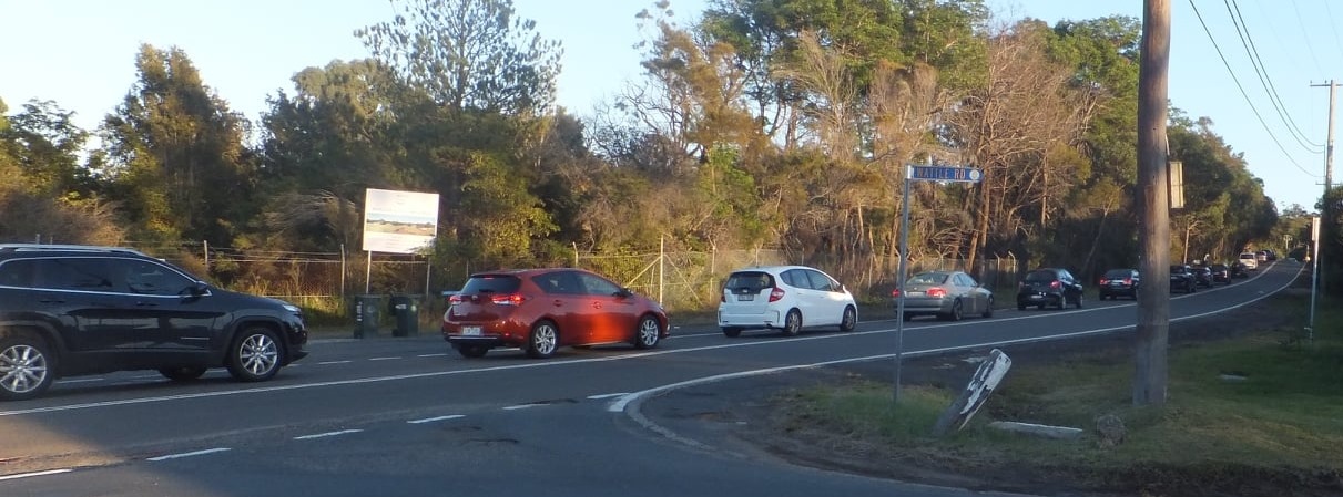
Photo: Powder Works Road, 8am, 2018. Photo supplied.
There are so many holes in this proposal – the lack of school infrastructure, the lack of parking – this will destroy the Elanora Heights community as well as it will become, literally, a through road to the beach.
All this so some landowners, the State Government itself being among those Ingleside landowners, can make another few million? The fact is this is a very uneconomic inappropriate plan to put 980 dwellings where they will destroy a community, endangered ecological communities, endangered and critically endangered wildlife species and put at risk not only those who may live in these dwellings but the surrounding suburbs' residents as well.
The other point RAID members would reiterate is the Council, as required by the State Government, has recently completed its Local Housing Strategy to meet the housing targets set by State Government for this LGA and has done so without changing the zoning of the Ingleside area.
The State Government and its Ministers, among many many others, now openly acknowledge that we have a problem in Sydney with the loss of tree canopy, loss of wildlife, and an urgent need to mitigate the effects of climate change by minimising hard surfaces. It’s so important to retain this open green space and this bushland and yet not a day goes by in our area when you are not hearing a chainsaw and a tree mulcher. Every single day people are cutting down trees. Some of them may be dangerous or old – but they can still be retained as housing for our wildlife, which they are before you cut them down.
If developers, such as those who will develop the State Government land parcels within this proposal, go into this place they will just flatten all that bush and kill everything that exists because it is there, because it is their home. No amount of offsets will mitigate that. And on a 450 square metre block – how many trees do you think you will get on that? The answer is zero.
This planning proposal reads as though it has been rushed, not fully thought through and is not suitable for its environment, its community or the citizens which will be put at risk in the proposed area as well as those suburbs north, south, east and west of it.
We believe that this draft Ingleside Strategy describes a situation that is undesirable, dangerous, anti-democratic and ought to be abandoned.
What does RAID request from the community going forward?
We’re asking everyone in the community to provide feedback on this proposal prior to the close for this. We ask can people please place a comment on the map as well as upload a written submission in response to the technical reports.
We’d also like them to send their submission to their local Councillors as well so they too have a record - and that record goes On The Record.
We’re also planning a Covid-safe rally along Powder Works road on Saturday July 17th, pending the relaxation of the stay-at-home orders, between 8 am and 9 am. Some signage is already going up along Powder Works.
If people follow or like our RAID Facebook page we’ll be able to keep them up to date.
Feedback for the South-Ingleside Place Strategy close July 23rd.
The placepin map is at: dpie.mysocialpinpoint.com.au/ingleside#/
The Technical reports webpage and where you upload your feedback is at: www.planningportal.nsw.gov.au/ingleside
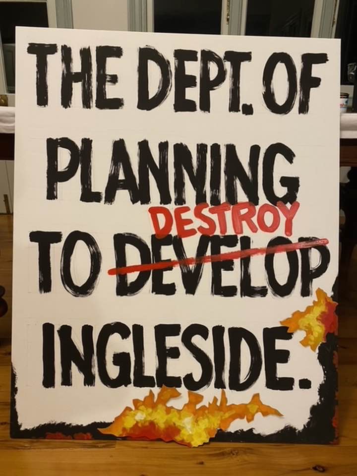
Example of already created Rally poster - image supplied.