Mr. Regan had Tabled a Notice of Motion about the Bill on Thursday September 9.
The Long title is : 'Act to amend the Environmental Planning and Assessment Act 1979 to make further provision about development on bush fire prone land; consideration of the effect on development of other natural hazards; and for related purposes.'
During his 2R speech Mr. Regan stated:
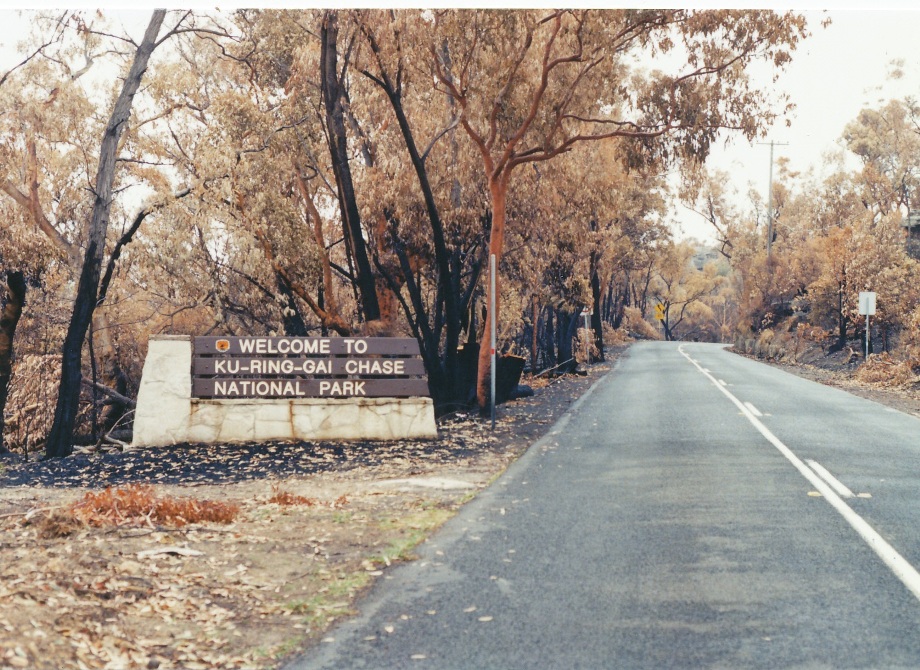
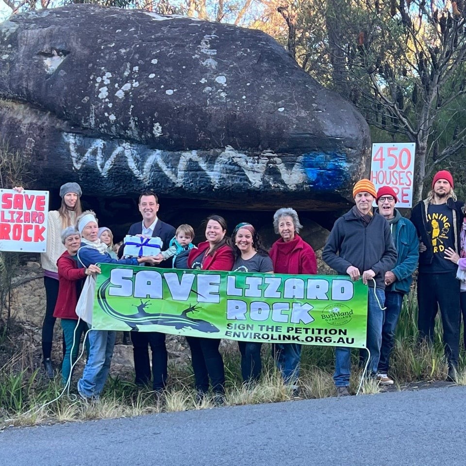
''The issue of bushfire risk and strategic planning has been a consistent theme of my work in council and in Parliament since being elected in 2008. This is a top priority issue for me because the northern beaches, including in my electorate of Wakehurst, has large areas of land which, due to native vegetation cover and topography, are highly bushfire prone. Many of these areas are, or could be, subject to planning proposals to rezone land for more homes. Foremost is the Patyegarang—formerly Lizard Rock—planning proposal that currently seeks to create a new 370‑home subdivision in an area of bushland on Morgan Road in Belrose. The NSW Rural Fire Service has consistently opposed the rezoning of the site due to fire risk, but it is yet to be finally decided. We have to stop building new homes in areas where there is an unacceptably high bushfire risk. It is as simple as that.
With the Government's recent amendments to the planning Act, including the creation of the Development Coordination Authority, I hold serious concerns about downgrading the role of RFS expertise in decision-making about strategic planning. The bill is about safeguarding the role of RFS advice in strategic planning decisions. The bill does three things. Schedule 1 [3] and [4] to the bill amend section 10.3 of the Environmental Planning and Assessment [EP&A] Act, which relates to bushfire-prone land mapping, and to establish the NSW Rural Fire Service as the agency responsible for the State's bushfire-prone land mapping. That includes reviewing bushfire‑prone land mapping every five years.
Importantly, the RFS Commissioner must consult with the relevant council before designating land as bushfire prone. Currently, local councils are responsible for initiating the mapping process and putting forward a proposal to the RFS, which it then certifies. Consulting with industry experts, it appears that in some local government areas there is a lack of resources and/or capability to update maps and in others there is inertia to provide for the continuous changes necessary. That means that maps are inconsistent, and some are out of date and no longer reflect the real fire risk, which may have increased or decreased, largely depending on landscape vegetation changes.
The RFS is best placed to be the custodian of the bushfire-prone land mapping functions and, in many ways, already is. It has the expertise, capacity and resources. The amendments in the bill formalise that role and are consistent with the findings and recommendations of the 2009 Victorian Bushfires Royal Commission that noted mapping should be centralised and placed within the fire services. Bushfire-prone land mapping is the trigger for serious consideration of bushfire risk in land use decisions. It is critical for it to be comprehensive, up to date and based on the best available science.
Schedule 1 [1] to the bill inserts new section 3.25A into the Environmental Planning and Assessment Act to specify special consultation procedures concerning bushfire-prone land for planning proposals. That speaks directly to the role of RFS advice in decision-making regarding rezoning proposals. That amendment makes clear that for rezoning proposals to permit residential accommodation, reduce residential lot size for subdivision or for a special fire protection purpose, the planning proposal authority must consult with the RFS Commissioner before forwarding a planning proposal to the Minister for gateway determination under section 3.34 of the Act. The amendment specifies what information must be provided, that the RFS Commissioner must provide comment within 28 days, or an agreed period, that comments from the RFS Commissioner must be made public and, crucially, that a proposal can only be forwarded to the Minister if the RFS Commissioner does not object to the changes proposed in the planning proposal.
Robust consideration of bushfire risk is absolutely critical at the rezoning stage. That is especially true when allowing homes to be built, which is what the bill focuses on. Once rezoned, the land value changes and the vested interests pushing towards a profit‑maximising development outcome are fully mobilised. Where there is a direct trade-off between dwelling numbers and bushfire safety, the forces pushing for more dwellings become very strong. That is understandable. By that stage, proponents have become financially and emotionally invested. By making smart decisions up-front at the rezoning stage based on the objective scientific assessment of bushfire risk, we can prevent proponents spending millions on reports and we can save communities the ordeal of opposing reckless developments. It would also allow less oxygen for planning proposals to be politicised. That is not in anyone's interests.
I know the process very well because of the Patyegarang, formerly Lizard Rock, planning proposal in my electorate of Wakehurst. The plan was originally for a 450-home subdivision smack bang in the middle of well‑known high-risk bushfire-prone land, with very constrained evacuation routes and no infrastructure. The drawn‑out saga has taken its toll on my community, the proponent and the RFS. I believe it would all have been avoidable if the bushfire risk was objectively assessed at the very start. It is my strong view that RFS advice should be sought and considered up‑front before gateway determination, and that, if the RFS does not support a proposal, it should not proceed. The amendment in the bill secures that outcome.
Schedule 1 [2] to the bill amends section 4.14 of the Environmental Planning and Assessment Act to insert a definition for "qualified person". Why do we need to define qualified consultants? Section 4.14 (1) (c) in its current form provides:
… The regulations may exclude development from the application of this section subject to compliance with any requirements of the regulations. The regulations may (without limiting the requirements that may be made)—
(a)require the issue of a certificate by the Commissioner of the NSW Rural Fire Service or other qualified person in relation to the bush fire risk of the land concerned
"Qualified person" in that context is not defined. The amending bill provides that definition, specifying that a qualified person must hold a formal qualification from a university-accredited postgraduate course on bushfire protection or bushfire planning and design. We are fortunate that Western Sydney University, in conjunction with the RFS, has provided suitable postgraduate qualifications in bushfire design and bushfire protection since 2003. Also, although no longer providing such a qualification, the University of Melbourne also had suitable graduates in the past. The community wants to be assured that qualified persons are in fact qualified in bushfire design or protection and not in other unrelated fields, and not simply because they feel they can do so.
Defining a "qualified person" has broader benefits too. With the Government's reforms to the EP&A Act through the Environmental Planning and Assessment Amendment (Planning System Reforms) Bill 2025, the Government originally sought to remove the major bushfire provisions from the Act. On reflection and at my request, the Government agreed to insert through that bill a new section 4.14 provision for the consent authority to "consider" Planning for Bush Fire Protection and other planning documents. Councils will continue to require bushfire assessment reports from qualified persons such that they can in fact "consider" bushfire planning requirements. I think the wording "consider" could be stronger, but here we are. Making the definition of "qualified person" explicit in the Act sets a much-needed benchmark for industry that councils can draw on and the community can have confidence in when seeking advice from bushfire consultants.
The bill, and my engagement on this issue more broadly, is motivated by one thing: the protection of lives and property from bushfire risk. I want to see the experts in bushfire risk assessment and planning listened to up‑front and not side-lined. I want to make sure that we are taking every step to minimise the danger to the volunteer firefighters in Fire and Rescue, among others, who are brave and selfless enough to go towards the flames in an emergency when everyone else runs away. I want people who buy homes to be able to insure them into the future—a fairly basic request.
We cannot deny the reality that we live in a country with a long history of deadly bushfire tragedies, and we know fire weather is only getting more extreme. At slightly less than 1.5 degrees Celsius of warming in 2019‑20, New South Wales experienced its worst ever bushfires, with property losses more than 1,000 per cent higher than those in the previous worst fire losses in 2013. The recent National Climate Risk Assessment predicts regular 50 degrees Celsius days in Sydney by the turn of the century, which will drive rapid evaporation and drying, flash droughts, increased flammability of bushfire fuels and extreme fire behaviour that will make protection of life and property perilous for firefighters. It is precisely why we need to build safer homes now, rather than establishing building stock incapable of protecting families.
The devastating wildfires in Los Angeles in January also provide a cautionary tale. More than 10,000 homes were destroyed, with losses estimated at over US$250 billion. In an interview on the ABC's7.30, fire expert Professor Char Miller from Pomona College in California explained that building in high‑risk fire zones in the Los Angeles foothills has escalated in the past five to 10 years, partly setting the scene for the destruction we have just witnessed. When asked who was responsible for those decisions, he responded, "Planning commissions and zoning commissions, all of whom greenlight these subdivisions." Experts warn us that it is only a matter of time before a fire event at the scale and of the ferocity of the Los Angeles fires happens in Australia. InThe Sydney Morning Herald in January, NSW Rural Fire Service Commissioner Rob Rogers said:
In the northern beaches, the north shore itself, and the southern suburbs, there's quite a lot of bushland and significant areas of national park, and then you've got housing built on the ridge tops …
That's because of historical planning and we can't change it, but obviously that makes fire management more difficult.
It is true that we cannot change historical strategic planning and land use decisions, but we can make better decisions today about where we put homes to keep people out of harm's way. That is what this bill is about and that is what I will continue to fight for.''
Debate was adjourned.
The Legislative Assembly of the Parliament of New South Wales sits for the last time in 2025 on Friday November 28.
The first sitting of the Legislative Assembly for 2026 is scheduled for Tuesday February 3rd 2026.
.JPG?timestamp=1728146861622)
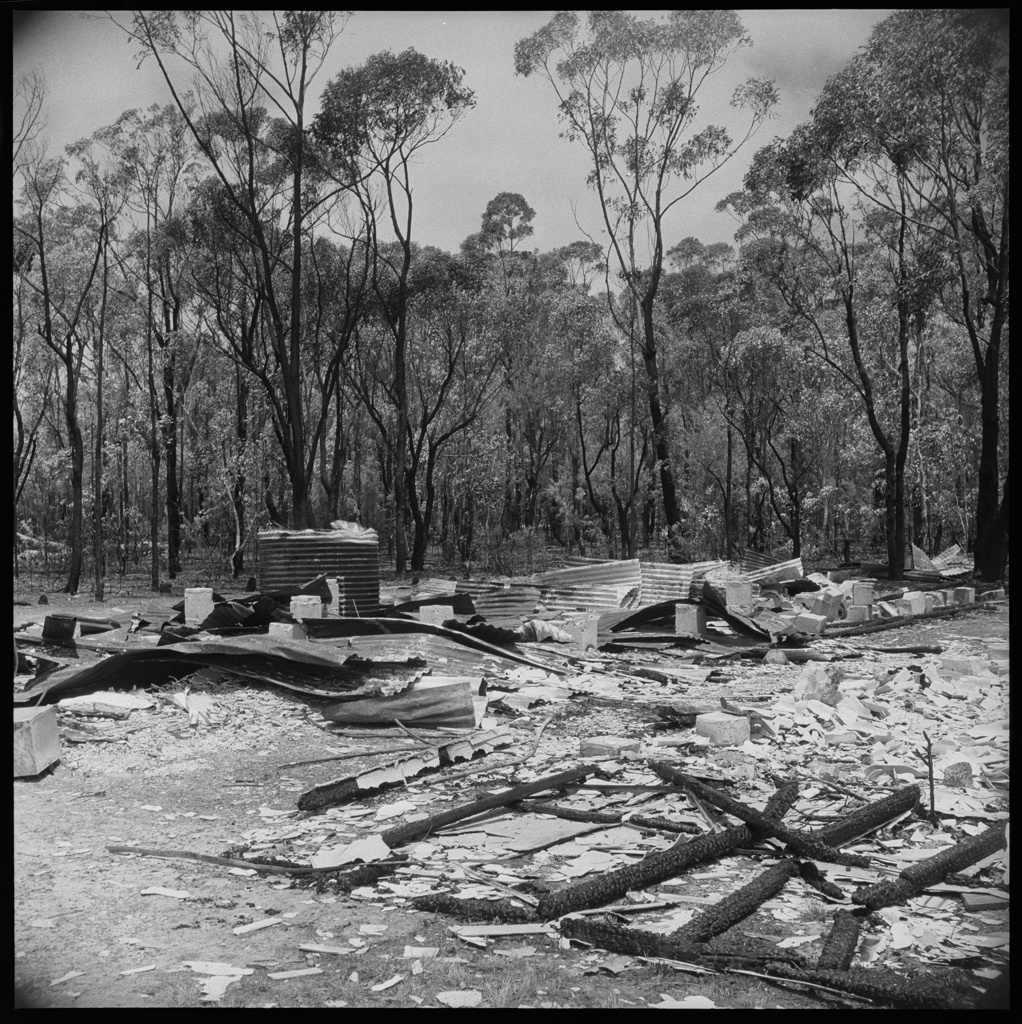
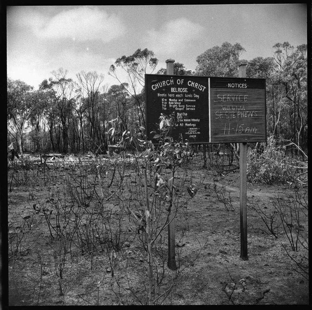
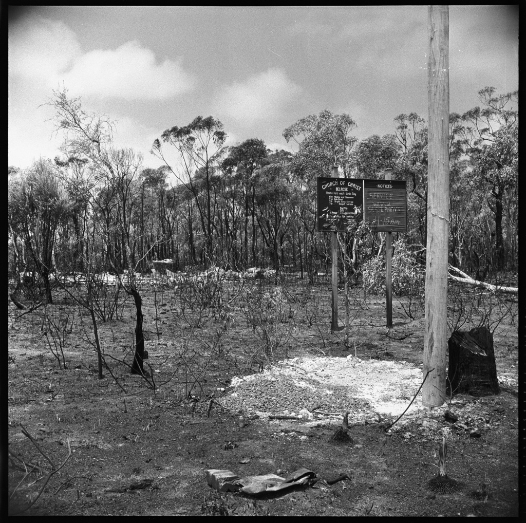
some of the PON/Family newspaper archives collection on the January 1994 fires in Pittwater and Sydney