Mackellar Climate Election Candidates Forum

Sydney Wildlife Carers Course May 2019
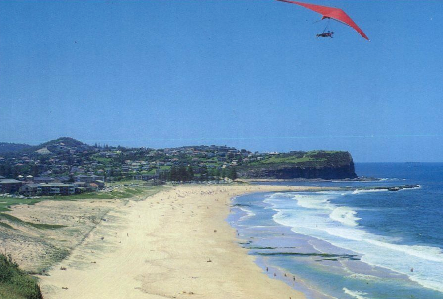
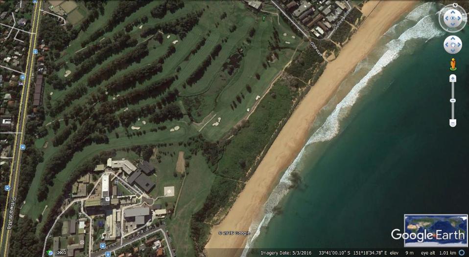
Beach dunes are a feature of the Northern Beaches, particularly along the peninsula. Our beaches and their backdrop dunes, so familiar, are only about 6000 years old, forming as the sea rose after the last ice age.
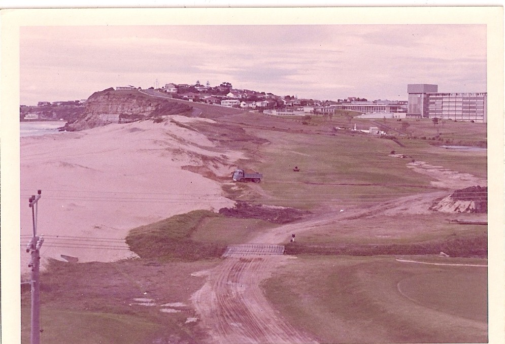
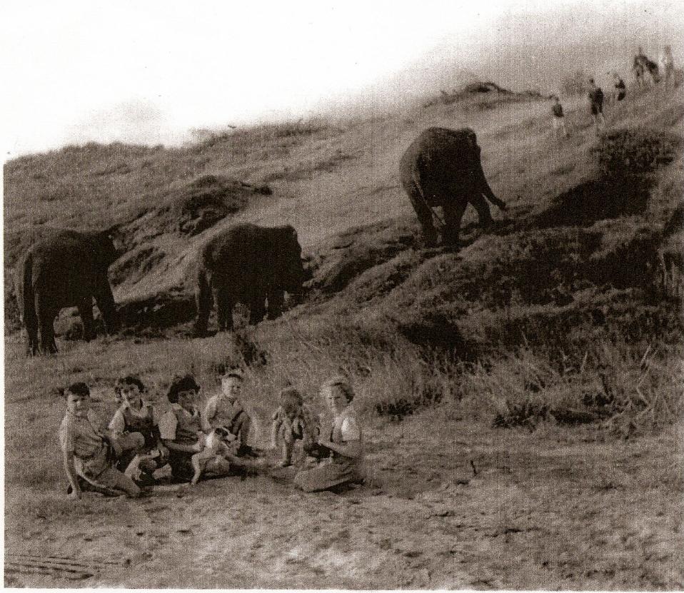
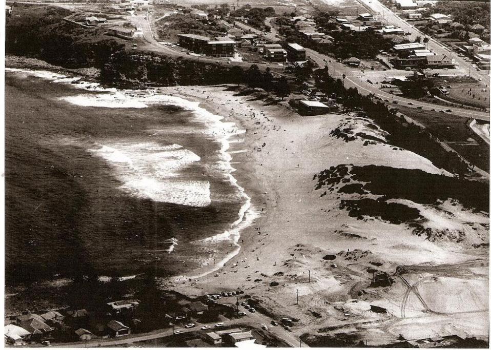
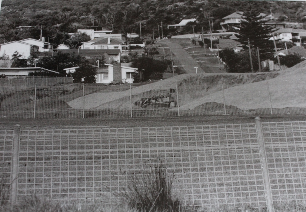
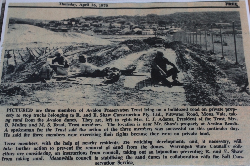
Until the 1970s dunes were regarded as a good source of sand, to be removed. The remaining land would then be levelled and turned to what was seen as a better use, such as land to be developed, parking, a road. Imagine Bondi Beach, before the concreting and building happened! We can see how at Collaroy, with the benefit of hindsight and experience, this was not a good decision. This beach is one of the most affected by storm damage on the NSW coast. The sea often threatens houses built where the dunes used to be, and also Pittwater Road.
Beaches backed by dunes can be resilient in what is a dynamic landscape. Vegetated dunes capture windblown sand, and surrender it in big storms, as the sea and wind claim it back to the beach. An active beach zone should be left undeveloped allowing sand to come and go with winds and tides.
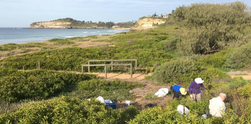
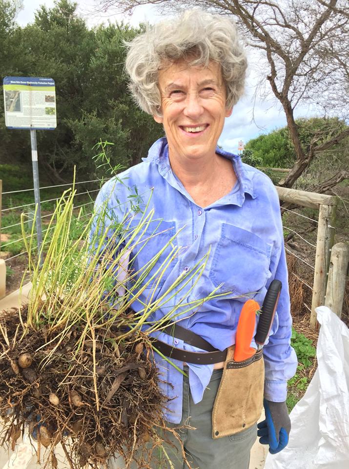
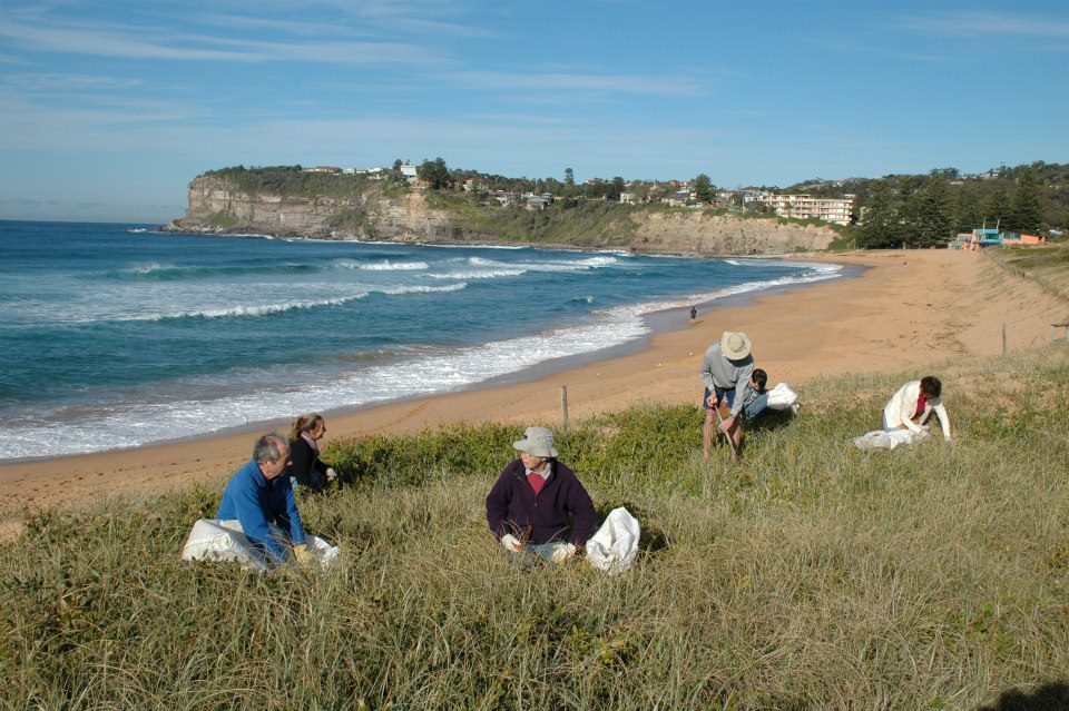
Bushcare volunteers celebrate the special vegetation that keeps our dunes stable and provides habitat for local fauna, specially small birds which use the dense native vegetation to feed and escape the bully birds such as Noisy Miners and Currawongs.
On Mona Vale Dunes we have nesting Willie Wagtails and Eastern Whipbirds and have been visited by Yellow-tailed Black Cockatoos and Brown Quail. However weeds such as Asparagus Fern, Morning Glory, Lantana and Turkey Rhubarb have to be controlled to protect native dune vegetation.
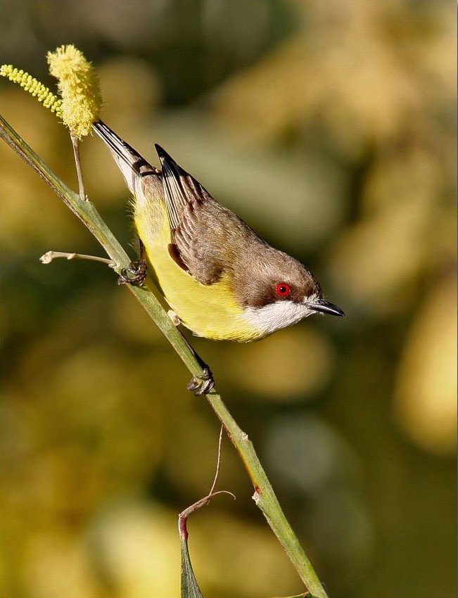
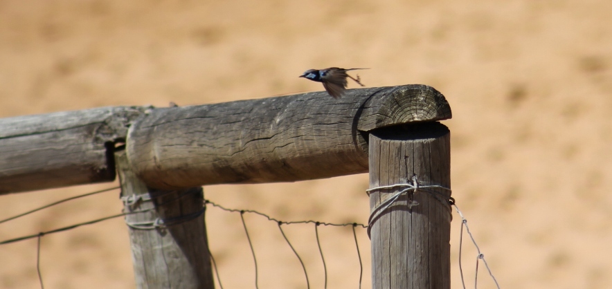
White-throated Warbler - photo Neil Lazarus
Volunteer bushcarers meet at Mona Vale Dunes on the second Saturday and third Thursday of each month. Some people go both days. At Avalon Dunes the first Sunday of each month is the work morning. Work starts usually at 8.30 and goes for 3 hours, including morning tea. Northern Beaches Council provides a supervisor to guide work at Mona Vale and volunteers supervise at Avalon Dunes.Both groups are covered by NB Council insurance for volunteers. Council bush regeneration contractors work on both dunes but need our help as their hours are limited.
Have a look at the Facebook pages for more information and to keep in touch.
Facebook page for Mona Vale Dunes Bushcare where you can keep up to date with progress and find out how to get involved. Visit: www.facebook.com/Mona-Vale-Dunes-Bushcare
Facebook page for Avalon Dunes Bushcare where you can keep up to date with progress and find out how to get involved.
Visit: www.facebook.com/AvalonDunesBushcare
Volunteer bushcarers meet at Mona Vale Dunes on the second Saturday and third Thursday of each month. Some people go both days. At Avalon Dunes the first Sunday of each month is the work morning.
Avalon Dunes Bushcare
After a long break, we'll be back on Sunday April 7. NB Council has changed management so that destructive camps are quickly cleared away and better weed control is happening - we're encouraged! We volunteers need some help, so why not join us at 8.30near the Montessori School. We finish at 11.30, but even half an hour of your help would be great.
Wear long pants, long sleeves and hat. BYO Gloves. We bring tools and morning tea.
In a 2013 interview with Marita Macrae, who had just received the Ruth Readford Award for Lifetime Achievement*, Marita shared an insight into the beginnings of this group.
The restoration and maintenance of the Avalon sand dunes has been a long term and quite big project – how did that start?
It had various beginnings. I was always interested in gardening and when I had the opportunity to do Horticulture in the late 1980s, part of this was a Bush Regeneration course. While doing this I learnt about Bitou bush. Also, Warringah Council as it was at this time, around 1989, started on the dunes as they were about 80% Bitou.
The dunes are divided into paddocks, and you can see tracks between these. Warringah Council started in the one nearest to the surf club. They had a grant and got a tractor in there and pulled out lots and lots of Bitou. They then planted some natives – Coastal teatree, some Beach Spinifex and Coastal Banksias and that was it. The idea of those plants was to stabilise the sand after they’d pulled out the Bitou.
Unfortunately Bitou is a terrible seeder, producing thousands and thousands of seedlings. In 1989 I used to watch what was happening. I had a young Labrador, Toby, which I used to take for walks behind dunes and watch the Bitou bush seedlings there. The area to the north was still mostly Bitou. You can’t just start a job like that and walk away from it or the project would be a waste of money.
At the beginning of 1990 there two people, myself and a man who left Avalon a couple of years later, approached the Council and suggested we form a volunteer group to maintain what had been started and to continue it. That’s how it really began.
What was the name of this volunteer group?
We called it Friends of Avalon Dunes Dune-Care Group, which was a bit of a mouthful. But in those days, the early 1990’s, it was part of a lot of work to control Bitou right along the NSW coastline, mainly on dunes, and also in the forests behind dunes. There were lots and lots of groups working at this – mainly north up the coast but also as far down as Tathra on the south coast There were lots of very good volunteer groups working along the coast and we just became one of those.
Ruth Readford I met when we got started in the early 1990s soon after we’d got started. I hadn’t known her before but she lived at this time at Ballina. She was a very good leader and organiser. She initiated telephone link ups and Dune Care conferences. We would meet in small groups and talk about our projects. She has written a book about community dune care at Ballina.
The restoration works which began in 1990 have an ongoing maintenance though – you have just reformed the group?
We were working on the Avalon dunes for about 20 years and during that time we’d had quite a few different grants. The Catchment Management Authority grant in the early 1990’s, a State Government grant, NSW Environment Trust grant and several Coastcare grants. I cannot take credit for receiving those grants. I helped write them but I had a great deal of help from Pittwater Council staff, particularly Paul Hardie. He always worked as a volunteer as well, right from the very start, despite having a young family. Eventually the Council, after our grants projects were completed, took on maintenance and engaged bushcare contractors to work on the dunes.
We thought everything was going well – the fact is that Bitou is a very obvious weed and people like to do big obvious weeds; they’re satisfying to do because you can see what you’ve done when the work is done.
There are a lot of other weeds there though that benefited from the disappearance of the Bitou, Morning Glory in particular.
About a year ago I noticed that the dunes were still looking pretty weedy so I suggested about September 2012 we reform the group. We’ve been working one morning a month ever since.
Avalon Dunes - weeding with a view in 2013 - Weeding Spinifex grass - not much else grows in this windy salty place.
When and where does this group meet?
On the first Sunday of each month at 8.30am. We’re only working on a small section at this stage and have been meeting at the back of the dunes near the little bridge over Careel creek. Out major weed that we’ve been tackling is Morning Glory, which we’ve been doing for years. It’s a very time consuming insidious weed.
Although the Council still has contractors working here I think this one is best tackled by volunteers who don’t mind doing the fiddly work that you need to do to try and control it. This is not so easy for contractors that need to be able to show where they’ve been working to their employers. If they have a team of six people working a whole day on Morning Glory, you will not be able to see much difference. I think this is a weed better tackled by us volunteers. Many are happy to do this, others would rather find Asparagus Fern, Turkey Rhubarb or Bitou and tackle that.
_______________________________
*The Ruth Readford Award for Lifetime Achievement honours an individual who has dedicated significant energies, time and commitment to improving planning and/or management of the NSW coast. The Selection Criteria is described as: Positive impact of actions of individual either through employment or volunteer effort; length of time involved in coastal issues; and recognition by the broader community of individual’s contribution to coastal management.
EPA Fines Forestry Corp $16,500 For Gibberagee State Forest Offence
 The $16,500 penalty notice was issued under the Biodiversity Conservation Act 2016 for a breach of the Integrated Forestry Operations Approval for the Upper North East Region (IFOA).
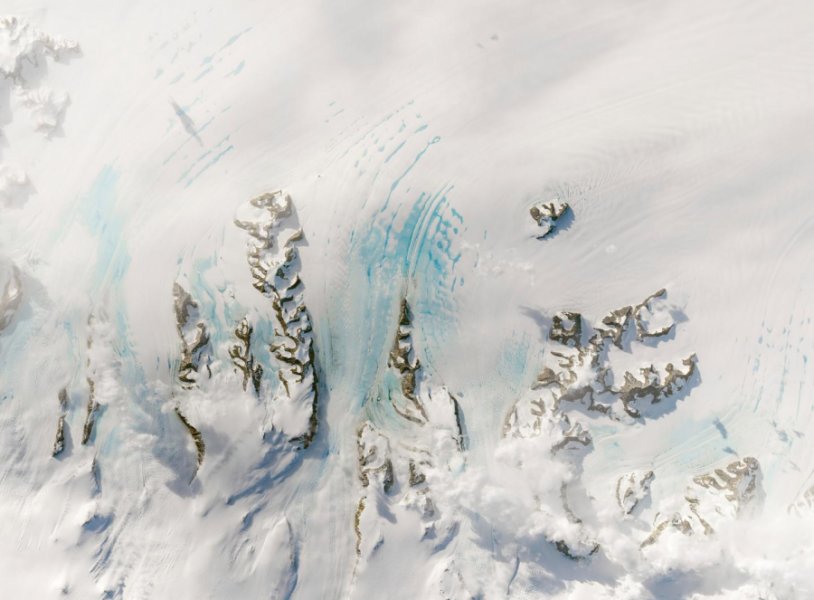
Warm Winds In Autumn Could Strain Antarctica's Larsen C Ice Shelf
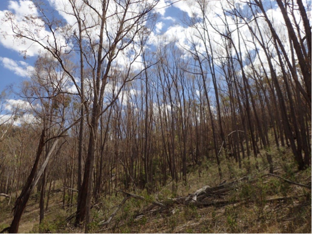
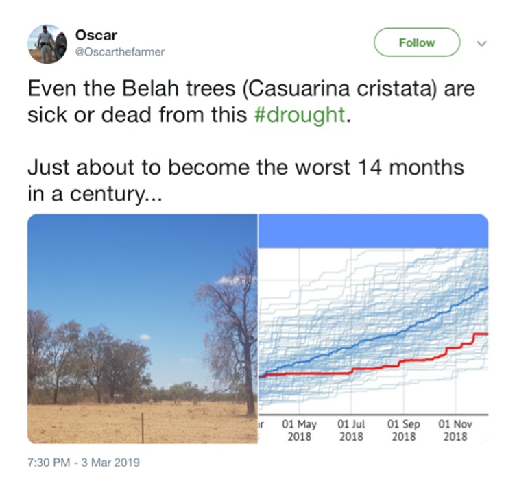
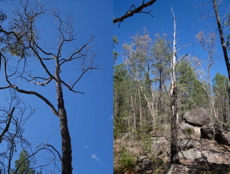
Are More Aussie Trees Dying Of Drought? Scientists Need Your Help Spotting Dead Trees
PITTWATER YHA OFFERS FREE BEDS FOR GREEN HEARTS
Archie's Pittwater Clean Up
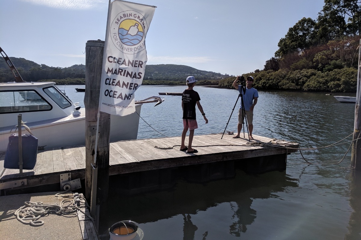

FAQS SHEET
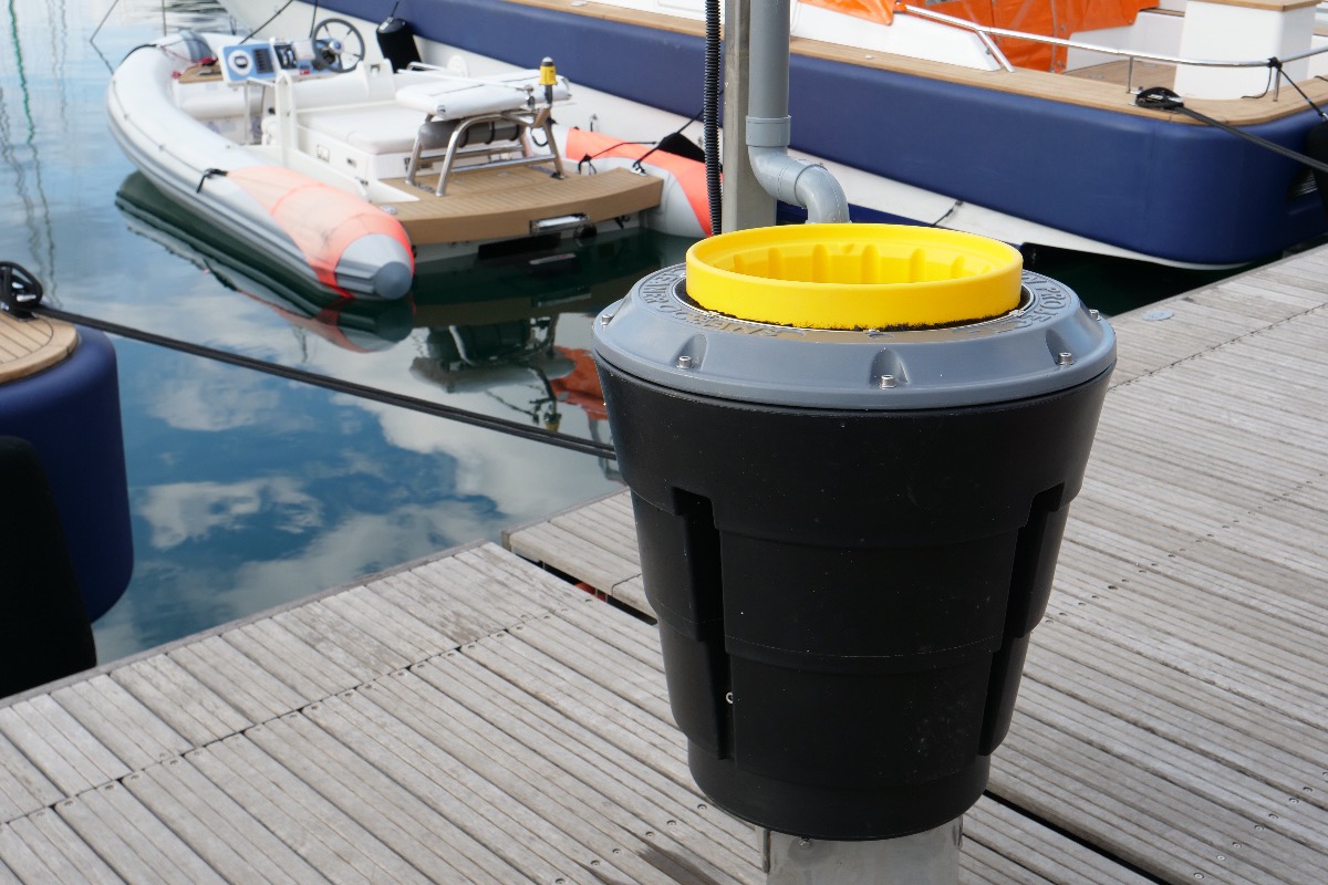
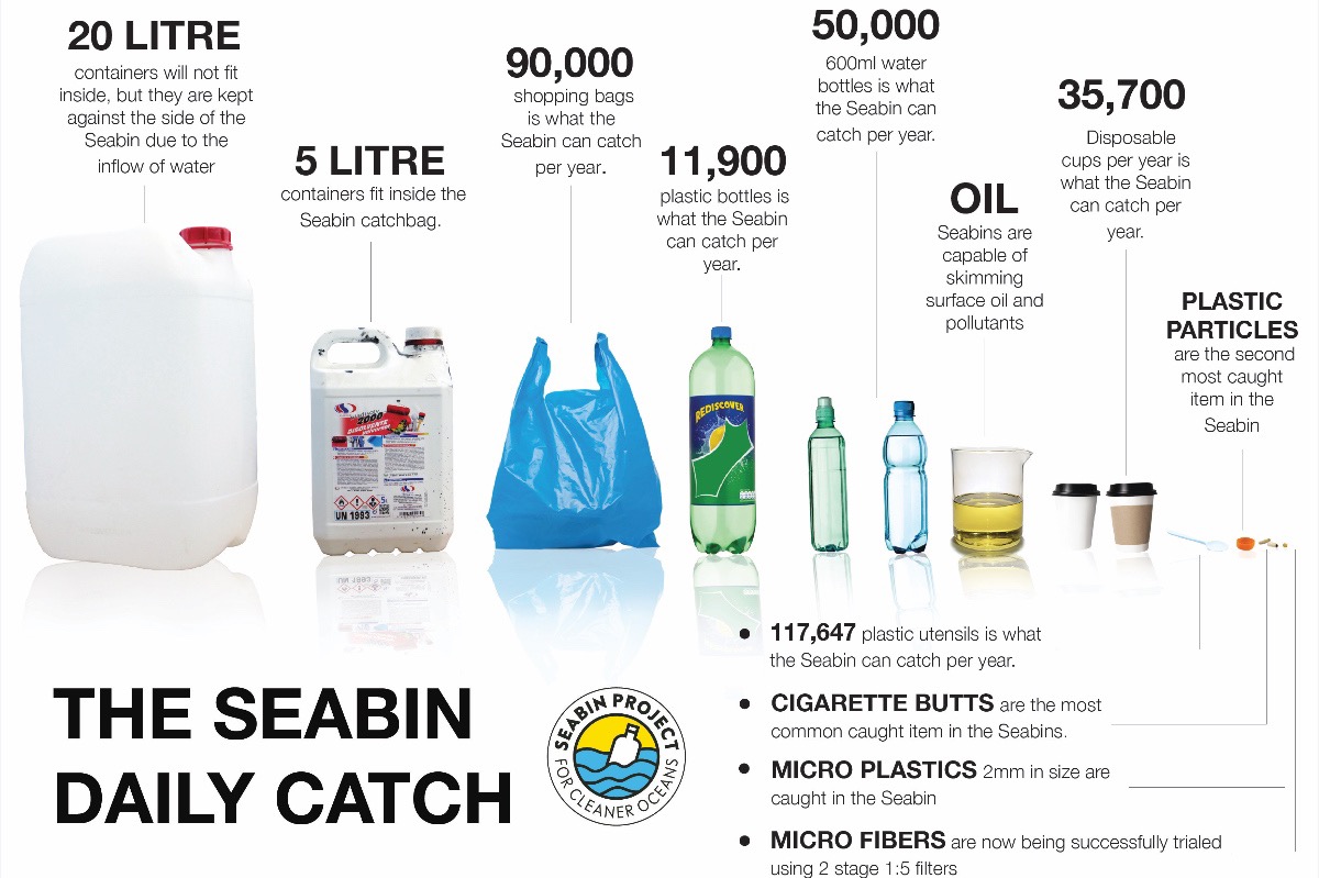
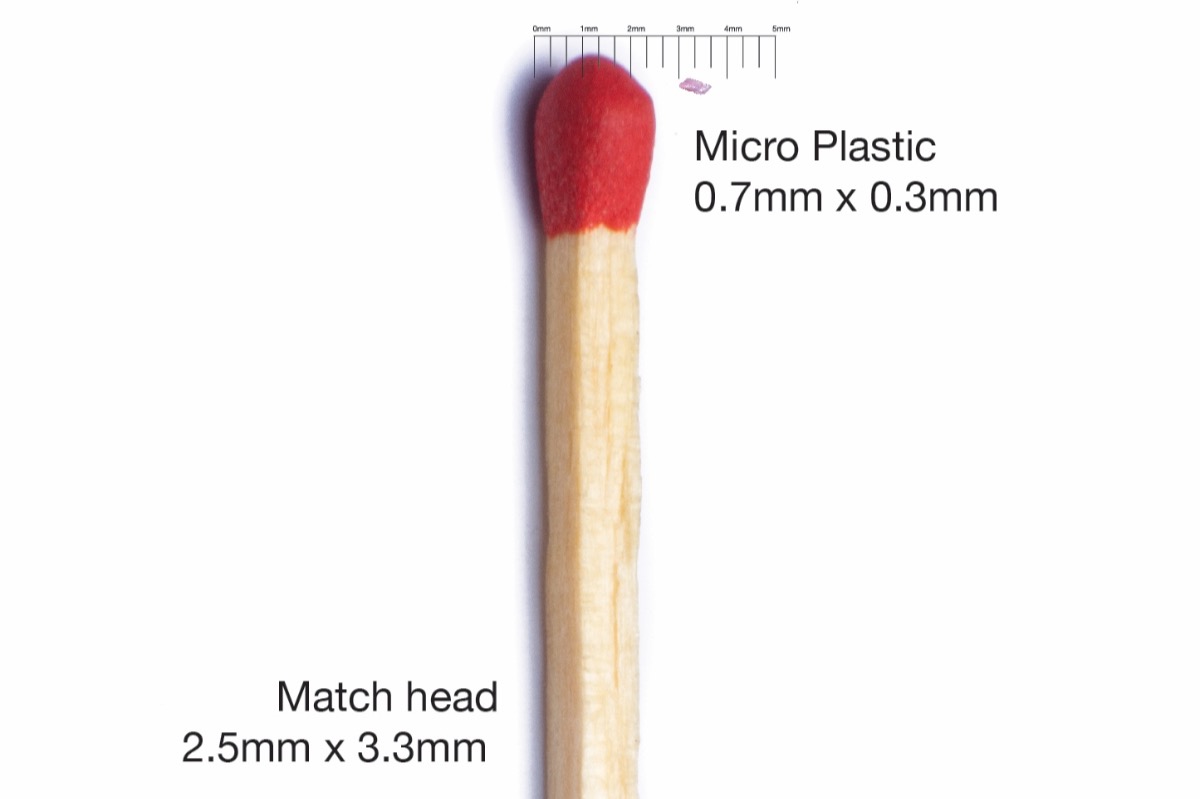
Seabin Project FAQs

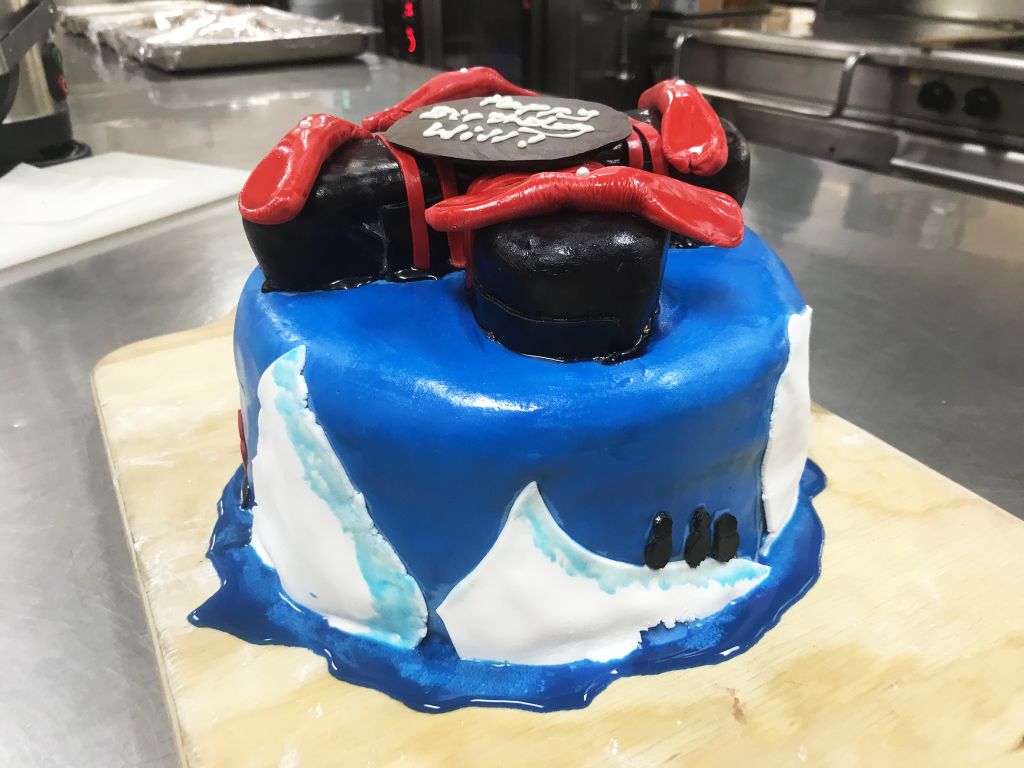
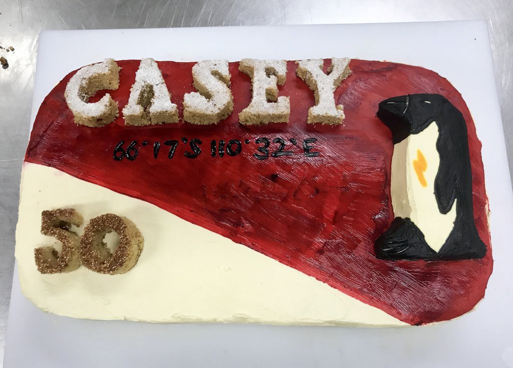
The Icing On The Antarctica Cake: Did Someone Say 'Cake'?!


Curious Kids: is water blue or is it just reflecting off the sky?
Curious Kids is a series for children. If you have a question you’d like an expert to answer, send it to curiouskids@theconversation.edu.au You might also like the podcast Imagine This, a co-production between ABC KIDS listen and The Conversation, based on Curious Kids.
Is water blue or is it just reflecting off the sky? – The students of Ms Brown’s class, Neerim South Public School, Victoria.
This is a wonderful question as it involves many of the puzzles that motivated research into the physics of light in the early 20th century.
The short answer is that the sea is blue because of the way water absorbs light, the way particles in the water scatter light, and also because some of the blue light from the sky is reflected.
But to explain what I mean by that, I have to tell you a bit about light and physics.
Read more: Curious Kids: Why is the sky blue and where does it start?
How Light Works
First, we need to know some fun facts about the nature of light.
The light we see, which we call white light, is made up of incredibly tiny particles called photons. A photon is even smaller than an atom. You can’t see them, but they’re there.
These particles are very strange because when we measure them, sometimes they move like a tiny ball and sometime like a wave – weird, right?
White light is made from photons that have many different wavelengths, some shorter and some longer, and together make up all the colours of the rainbow. The photons with the shortest wavelength we can see look blue, while those with the longest wavelength look red.

So let’s think about sunlight. The photons stream from the sun and interact with all matter on Earth. Depending on what the light touches, some of the photons will get absorbed or soaked up. And some will bounce back. When they bounce back, we call this “scattering”.
The photons that get scattered are what gives things their colour. For instance leaves are green, because the green photons bounce back towards our eyes and that is what colour our eyes perceive. Other coloured photons are absorbed by the leaves.
What Colour Is A Glass Of Water?
Now that we know a bit more about light, we can begin to answer your question.
Experiments have shown that pure water (water with nothing else dissolved in it) absorbs more of the red light than the blue light.
But how much of the red light will get absorbed? Well, that depends on how much water the light has to pass through.
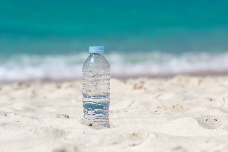
You might be wondering why the water in a glass looks clear. It is because the glass of water is too small to absorb more red light waves. To see the effect with your eye, you would have to look through a glass of water as big as a swimming pool. That amount of water could absorb quite a lot of red light, so the water would look quite blue.
Now imagine a glass that held an entire ocean’s worth of water. It would be enormous! With that much water, you could absorb a LOT of red light. So it would look very blue.
But when it comes to how light interacts with the ocean, there’s more to the story.
Read more: Curious Kids: how is water made?
For starters, sea water is not pure. Sea water has lots of things dissolved in it, like salt and small pieces of dead sea creatures. These particles in the water reflect some of the light before it has time to develop the full blue colour. The light coming back out from the sea is usually more greenish-blue in colour.
You asked about the sky. We know the sky is blue and the sea does reflect some of this light. So, yes, it does play a role.
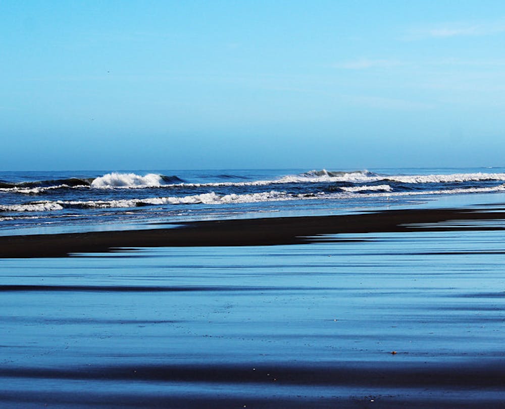
To sum it all up: the sea is blue because of the way water absorbs light, the way particles in the water scatter light, and also because some of the blue light from the sky is reflected.
Finally, we need to think about the time of day and the position of the Sun in the sky. When the Sun is shining bright, the sea appears bluer than it does late at night, when the sea looks very dark and almost black.
Like many questions in science, the answer is not as easy as a simple yes or no. There are often lots of correct, but incomplete, answers to many questions. To me, that’s what makes science so interesting.
Hello, curious kids! Have you got a question you’d like an expert to answer? Ask an adult to send your question to curiouskids@theconversation.edu.au![]()
Justin Peter, Climate Scientist, Australian Bureau of Meteorology
This article is republished from The Conversation under a Creative Commons license. Read the original article.
New Species Of Early Human Found In The Philippines
New Wasps Named After Biscuits And Doctor Who Aliens
Observatories Around The World Produce First Direct Images Of A Black Hole