DA for 120 Mona Vale Road Warriewood site refused by planning panel
The Northern Beaches Local Planning Panel has refused DA2025/1087 for 120 Mona Vale road Warriewood. The Proposal was for Subdivision of three lots into 63 residential lots, one (1) community title lot and one (1) residue lot including the construction of a bridge, associated infrastructure, services and access works.
At the public meeting held May 6 2026, the Panel was addressed by 3 objectors and 2 representatives of the applicant.
The decision became available this week.
The NBPP assesses proposals that are the subject of 10 or more unique submissions by way of objection.
Seventy-three (73) submissions were received all of which were objections to the development. The majority of the concerns raised within the submission surrounded traffic and ecological impacts resulting from the proposed subdivision.
See August 2025 report - Community Concerned: Warriewood DA Proposes removal of 11 Hectares of Vegetation, Bridge Over Narrabeen Creek to funnel 280+ extra vehicles into Warriewood's Back streets
The proposed concept DA sought to proceed with the demolition of all existing structures, subdivision of land, access and infrastructure works, and the construction of dwelling houses on each resulting residential lot. The concept DA is sought across two (2) stages, with stage 1 works sought as part of this application as permitted under Section 4.22 of The Act.
Two request for additional information (RFI) letters were issued to the Applicant, Opera Properties Pty Ltd.
A Stop-the-Clock (RFI) letter was issued to the Applicant on 28 August 2025, raising preliminary concerns raised by the clearing house team and initial referrals.
Subsequently, a meeting between the Council and the Applicant took place on 16 December 2025, where key concerns such as access to the site were discussed. It was acknowledged by the Applicant that a response to the RFI letter would be forthcoming. Council has made numerous attempts to elicit a response to the 28 August 2025 RFI.
No response had been received to this RFI letter at the time of the writing the NBPP and NBC report.
A second RFI letter was issued to the Applicant on 8 April 2026, following a comprehensive review of the proposal. This letter was issued to the Applicant with an invitation to meet to discuss the issues raised. The Applicant declined the invitation.
On 17 April 2026, the Chair of the NBLPP ‘called in the application’ pursuant to the Ministers direction dated 6 August 2023 and requested that the application go before the NBLPP for determination. Notwithstanding this, on 24 April 2026 the Applicant advised that they would need until at least 31 August 2026 in which to respond to the issues in full and sought to have the matter deferred.
This was reiterated at the NBPP Meeting of May 6, however the DA hadn't been withdrawn, so the assessment proceeded.
Stage 1 of the concept DA sought the following works over the following properties:
No. 120 Mona Vale Road:
- Demolition of all structures.
- Tree removal.
- The community title subdivision of land into sixty-three (63) residential lots, and one (1) community title lot. All internal roads, major water management infrastructure, and recreational reserves will be owned and maintained by the Community Plan.
- Civil works to accommodate the proposed subdivision, inclusive of stormwater management works, community title roads and reserves, drainage basins, lighting, and landscaping.
- The rehabilitation and subsequent dedication of the inner riparian corridor zoned C2 Environmental Conservation.
- Provision of emergency vehicle access from Mona Vale Road.
Boundary Street road reserve:
- Tree removal
- Construction of a public road (approximate length of 430m).
- Construction of a public bridge over a creek line corridor (approximate length of 100m)(approximate height 12m).
No. 8 Forest Road:
- Demolition works, including partial widening of the existing fire trail to the northern part of the near completed Residential Flat Building (RFB).
- Connection of the existing roundabout to the proposed public road within the Boundary Street road reserve.
- Tree removal and rehabilitation works.
Jubilee Avenue road reserve:
- Provision of upgrade works, inclusive of the formalisation of a roundabout within the Jubilee Avenue turning bulb.
The Applicant has stated within its Statement of Environmental Effects (SEE) that stage 2 works of the concept DA will involve the construction of dwelling houses on each of the approved residential allotments.
No further details or information have been submitted with regard to stage 2 works.
During the assessment of this concept DA, a fundamental issue was identified and raised to the Applicant in the RFI dated 8 April 2026. As the Applicant did not respond to this RFI, this fundamental issue formed a key reason for refusal.
The proposal seeks vehicle and pedestrian access via Jubilee Avenue onto a public road that extends from the existing Jubilee Avenue turning bulb, onto a widened perimeter road surrounding the recently constructed development at No. 8 Forest Road, and then onto a unformed portion of Boundary Street, with the provision of a bridge over the Narrabeen Creekline, and a new two-way road through the remainder of Boundary Street then finally accessing the site.
Several concerns were raised with the consideration of this access arrangement, including The owner’s consent provided from No. 8 Forest Road is unclear on what works are agreed to.
The council and NBPP report found that 'consent is broad and lacks specific detail to confirm if the owners are aware of the full extent of the proposal', specifically:
o The DA and consent fail to detail future maintenance of the road, and who will pay for and undertake said maintenance.
o The provision of the owner’s consent is dated 10 months prior to the lodgement of the application. The nature of the ownership has changed over No. 8 Forest Road since that time. Confirmation was requested on whether the new owners of No. 8 were aware of the works proposed over this property. No response has been received to date.
o Several right-of-ways (ROWs), easements, and restrictions have been created over No. 8 Forest Road as part of the approval obtained under N0440/15. Insufficient information has been provided to determine who is benefited by the ROWs, easements, and restrictions. It is critical to understand this information to determine whether any further owner’s consent is required for the changes proposed to the roadway within No. 8 Forest Road (i.e. from the properties that are benefited from these ROWs, easements, or restrictions).
The application had not addressed how the proposed access via No. 8 Forest Road will impact the achievement of the conditions of consent within the relevant approval (N0440/15) of No. 8 Forest Road, specifically:
Condition B43 required accessways and fire trails to be protected and maintained by the community association for the life of the development. The proposal seeks to use part of the fire trail; it is not clear how ongoing maintenance will be achieved, and if No. 8 pays for the added burden of this development. Further clarification within the submitted bushfire report is required to determine whether the proposed arrangement will have an impact on the fire protection of No. 8 Forest Road, specifically, whether placing removable bollards around the fire trail is acceptable.
Condition B68 outlined that the community association would have to pay insurance to the community association of Bert Close for the use of the Jubilee Avenue access road and the existing bridge over Narrabeen Creek. It is not clear how this arrangement will change/evolve with the addition of the development site.
Condition F2(I) outlines a restriction that access to Jubilee Avenue is to be closed off once access to Forest Road is available. It is unclear how this condition will be achieved if access to Jubilee Avenue is still open via No. 8 Forest Road, albeit only for the residents of the development site.
It is unclear whether the impact to these conditions will require a modification to the approved application under No. 8 Forest Road.
Amenity impact and development changes to No. 8 Forest Road
Limited detail was provided with regard to the road widening on the northernmost fire trail road within No. 8 Forest Road. The only plan identifying the road widening is located within the Traffic and Parking Impact Assessment prepared by McLaren Traffic Engineering & Road Safety Consultants, which demonstrates the upgrade to this road from a 4m wide fire trail to an 8m wide sealed carriageway.
No consideration has been given to the impacts of the upgraded carriageway on the amenity of No. 8 Forest Road, specifically, loss of approved landscaping and deep soil zones, required under the Apartment Design Guide. It is unclear whether these works will require a modification to the approved application under No. 8 Forest Road.
Acoustic impacts of this road being used for access to a sixty-three (63) lot development weren't addressed. It was noted that the submitted acoustic report refers to a previous DA which sought access via the existing ROW through No. 10 Jubilee Avenue.
Owner’s consent and maintenance of works within Crown Lands
The proposed bridge and extension of Boundary Street will occur within a portion of land marked as Crown Land. No owner’s consent has been received from Crown Lands agreeing to the works proposed.
It was not clarified who will maintain the road, given the council will not take ownership of the section of the road that is vested in the Crown’s control.
Access to properties along Boundary Street
Insufficient information was submitted detailing how access to neighbouring properties, which rely on Boundary Street for access, will be maintained during and after the construction of the bridge and upgrading of Boundary Street. Specific attention is made to No. 3 Boundary Street, No. 4 Boundary Street, and No. 10 Jubilee Avenue.
Clarification of upgrade works
Limited detail was provided with regard to works proposed within No. 8 Forest Road (as outlined above), and works within Jubilee Avenue. Clarification was required as to whether any upgrade works are required to the section of road between the Jubilee Avenue turning bulb and the entry to No. 8 Forest Road (inclusive of the existing bridge) to accommodate the extra vehicles using this access road.
Further concerns raised in the report included:
- Jurisdictional concern relating to the ability of this application to be a concept (staged) DA.
- Breach to the Height of Buildings development standard within the LEP.
- Insufficient information relating to the achievement of permissibility and minimum subdivision lot sizes.
- Inability to achieve subdivision controls within both the LEP and DCP.
- Biodiversity and ecological impacts,
- European and Aboriginal heritage concerns.
- Potential impact on Public Bushland.
- Requirements to be addressed within the site specific DCP.
- Impact of earthworks.
- Adverse geotechnical hazards.
- Lack of services to the proposed subdivision.
- Contamination impact.
- Impact to Koala habitat.
- Range of issues raised by internal and external referrals (Riparian, NSW RFS, Traffic, Urban Design, Water Management, Development Engineering, Landscape, Transport for New South Wales (TfNSW)).
- Insufficient information to carry out a full assessment.
The council and panel assessment report found The Applicant has satisfied the need for a development control plan (DCP) through the making of the concept DA through this application.
Notwithstanding this, a jurisdictional issue is raised, as it is queried how the application can be a concept DA. This application seeks approval for a concept DA for a subdivision including sixty-three (63) lots, access and infrastructure works, and dwellings house. It is noted that stage 1 includes the subdivision and access works, and stage 2 will include the works for the dwelling houses. It is queried how stage 2 can be carried out, as it will relate to newly subdivided sites, which have new title details. It is queried how stage 2 could be linked to the concept DA.
Clarification was sought from the applicant as to whether they can overcome this issue within the RFI letter dated 8 April 2026. As no response was received to this RFI, this matter forms a reason for refusal.
The DA was referred to the NSW RFS to obtain General Terms of Approval under Section 100B of the Rural Fires Act 1997, as the DA is nominated as integrated development under Division 4.8 of The Act. Comments were received from NSW RFS dated 12 November 2025, stating that the proposal is deficient and a revised and updated bushfire assessment report is required. The specific requirements are discussed under the referral section of this report, but link to the requirements of the Planning for Bushfire Protection 2019.
On review of the submitted bushfire report, several issues are raised, separate from the referral made by NSW RFS, including:
• Inner and outer protection areas, as well as APZs, are proposed; no details on how these areas will be managed are included in the proposal (i.e., whether further tree removal or impact to areas of biodiversity will occur).
• APZs are proposed on steeply sloping land; the bushfire report states that geotechnical advice is required to ensure no soil stability issues will result. This has not occurred.
Bushfire impacts on the proposed development have not been resolved. These matters were raised within the RFI issued to the Applicant, and have not been addressed, as such, it forms a reason for refusal along with an absence of GTA’s from the RFS.
No. 120 Mona Vale Road: Contains a single-storey brick and tile dwelling house, and also numerous sheds and shipping containers. The property has large areas previously cleared of any vegetation, but also contains heavily vegetated areas in the north-east and south-west along and around the Narrabeen Creek. Drainage channels and creek line corridors are also located on the site.
The development site and unmade portion of Boundary Street are heavily vegetated with trees, plants, shrubs, and ground covers. Boundary Street contains varying topography including steep falls towards the Narrabeen creekline.
No. 8 Forest Road: Contains a medium-density housing development nearing completion for eighty-one (81) dwellings over four (4) RFBs and fourteen (14) townhouses. This site contains internal roads and firetrails. This development was approved under N0440/15.
The site was used for semi-rural purposes, including agricultural activities such as market gardening between 1955 and 2013.
The development site was rezoned in 2014 under PP0002/12, from “Non-Urban A” under the PLEP 1993 to R2 Low Density Residential and C4 (previously E4) Environmental Living, and allowed minimum lot sizes of between 500sqm and 2000sqm. The rezoning allows for residential development under the PLEP 2014.
A concept DA was submitted under N0330/16 seeking subdivision to create sixty-two (62) allotments with dwellings on each lot, demolition and construction of associated civil works & landscaping (first stage – Demolition & subdivision to create 39 residential lots). A deemed refusal appeal was made to the Land and Environment Court, and the appeal was subsequently dismissed as satisfactory access to the subject site could not be achieved. It is noted that this DA relied on a right-of-way through the Church site at No. 10 Jubilee Avenue for access.
A DA and subsequent review application under N0485/16 & N0485/16/R for a temporary sales office, and business identification signs were refused on 27 February 2017, and 16 August 2017, respectively.
A pre-lodgement meeting was undertaken by the Applicant with Council on 21 April 2022 under PLM2022/0054, for ‘construction of a road connecting 120 Mona Vale Road and 8 Forest Road’.
The RFI letter issued on 28 August 2025 raised issues such as:
- Inadequate detail on the proposed bridge.
- Lack of detail with regard to the provision of services to the proposed subdivision.
- Further detailing to satisfy Aboriginal Heritage concerns.
- Insufficient reporting within the submitted Arboricultural Impact Assessment (AIA) and Biodiversity
Development Assessment Report (BDAR).
- Insufficient flood detailing.
- Lack of an excavation plan/assessment in terms of bushfire risk to the site.
- Inadequate water management reporting.
- Lack of detailing of the strategic infrastructure requirements of the site.
- Concerns relating to the requirement of a site specific DCP.
A meeting between Council and the Applicant took place on 16 December 2025, where key concerns such as access to the site were discussed. It was acknowledged by the Applicant that a response to the RFI letter would be forthcoming.
Following the above meeting, a formal assessment was carried out, and a second RFI letter was issued to the Applicant on 8 April 2026, and raised issues such as:
- No response to the issues raised within the RFI letter dated 28 August 2025.
- Lack of adequate access to the site.
- Potential amenity impacts resulting to neighbouring sites as a result of access works.
- Inability to proceed with further stages of the concept DA.
- Permissibility.
- Subdivision concerns surrounding the inclusion of SP2 and C2 land within the community title subdivision, the inability to determine compliance with minimum subdivision lot sizes, the lack of inclusion of reserves within the community title lot, the irregular subdivision pattern, and inadequate information to determine safe access to proposed lots.
- European and Aboriginal Heritage concerns.
- Potential impact on Public Bushland.
- Requirements to be addressed within the site specific DCP.
- Impact of earthworks.
- Geotechnical hazards.
- Lack of services to the proposed subdivision.
- Contamination.
- Impact to Koala habitat.
- Range of issues raised by internal and external referrals (Riparian, NSW RFS, Traffic, Urban Design, Water Management, Development Engineering, Landscape, Transport for New South Wales (TfNSW)).
- Insufficient information to carry out a full assessment.
Traffic Concerns
Concern was raised by residents regarding the additional congestion that will result from adding sixty-three (63) private allotments to the locality. The application was supported by a Traffic and Parking Impact Assessment prepared by McLaren Traffic Engineering & Road Safety Consultants. The report concluded that there will be no adverse impact on the performance of relevant intersections as a result of the additional generated traffic.
No concerns were raised by the council’s Traffic Engineer with regard to the impact on the existing road network, although concerns were raised with regard to the internal roads on the development site, and the proposed access road and bridge over the creekline.
With regard to the traffic impacts of the proposal, limited detail has been provided as to the upgrading of roads leading to the Boundary Street road reserve from Jubilee Avenue, in terms of what works are required, or whether the existing roads can withstand the proposed traffic generation.
Excessive impact on native vegetation and ecological impact on the adjacent creekline to the site
The Report response stated the proposed development and submitted documentation do not justify the proposed impact on the ecological setting of the development site and the impact on the creekline. Council officers were not satisfied with the proposed development and outlined that the proposal has the potential to result in permanent loss or alteration of habitat for numerous species of fauna and flora, including a serious and irreversible impact. Concern about the impact of the subdivision on the creekline corridor was also raised.
Bushfire impact on the site, and lack of evacuation options
The current proposal is deficient in terms of its response to the bushfire impact on the site, the Response states.
Jurisdictional concerns of staged development.
The assessment agreed that there is a potential jurisdictional issue with regard to the submission of this application as a concept DA (staged DA)
The concept DA seeks all subdivision and access works as part of stage 1. Stage 2 is described as the construction of the dwelling houses on each lot. The jurisdictional concern is that stage 2 cannot be enforced, as each subdivided lot would be subject to a separate DA for construction. In addition, no indicative information has been provided in regard to the dwellings sought under stage 2.
There were concerns relating to the construction of the subdivision, including access to the site and use of the Church site for construction vehicle access.
The submitted information outlines that vehicle access for construction will occur via Mona Vale Road. TfNSW has stated within their referral that further approval is required for temporary construction access to the site to occur prior to the construction certificate.
Notwithstanding this, construction access is still not resolved, as if TfNSW refused temporary access for construction, then an alternative construction methodology needs to be submitted.
No documentation has been submitted that outlines that the church site will be utilised for access.
Neither has The Applicant has not clarified how existing properties that rely on Boundary Street for access will be able to access their properties during and after construction.
As the council's main objections are centred around access to the site during construction, and impacts on the creekline, it is likely this proposal will reappear among the DA's submitted to the council.

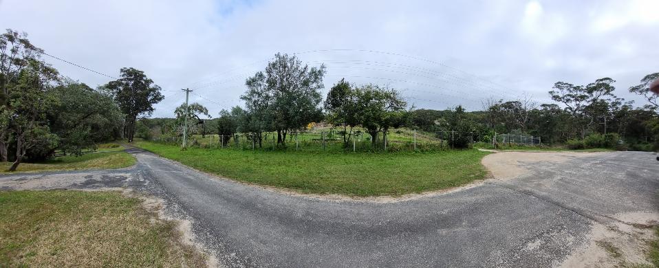
Boundary Road towards the creek and 8 Forest Road. Photo supplied