Ocean Waves Following Sea Ice Loss Trigger Antarctic Ice Shelf Collapse
June 14, 2018: University of Adelaide
Storm-driven ocean swells have triggered the catastrophic disintegration of Antarctic ice shelves in recent decades, according to new research published in Nature today.
Lead author Dr Rob Massom, of the Australian Antarctic Division and the Antarctic Climate and Ecosystems Cooperative Research Centre, said that reduced sea ice coverage since the late 1980s led to increased exposure of ice shelves on the Antarctic Peninsula to ocean swells, causing them to flex and break.
"Sea ice acts as a protective buffer to ice shelves, by dampening destructive ocean swells before they reach the ice shelf edge," Dr Massom said.
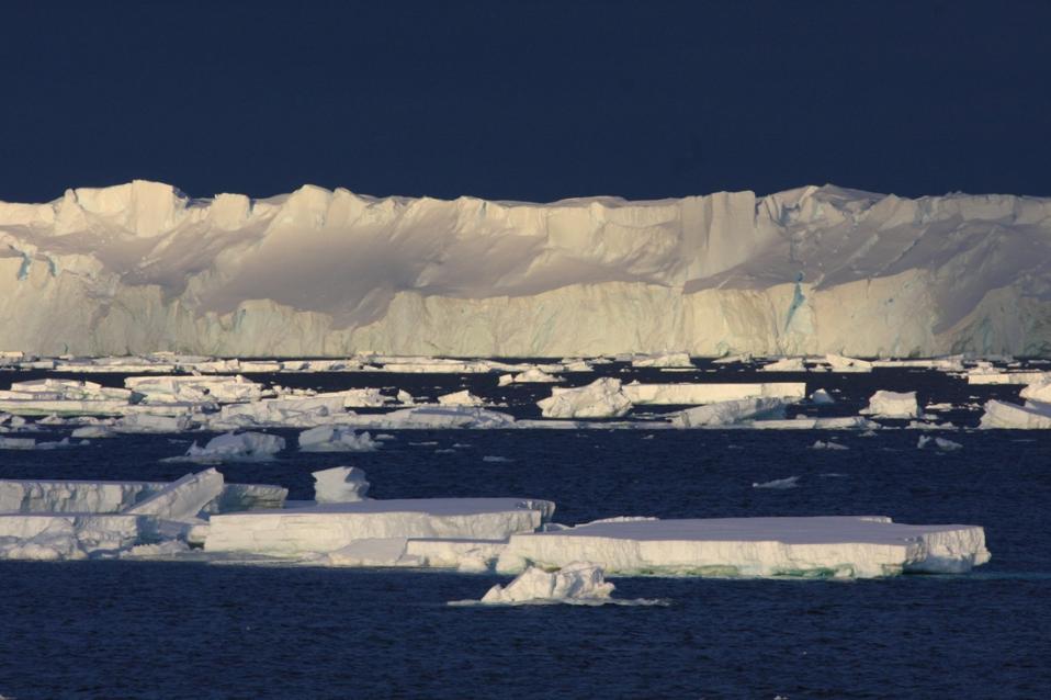
"But where there is loss of sea ice, storm-generated ocean swells can easily reach the exposed ice shelf, causing the first few kilometres of its outer margin to flex."
"Over time, this flexing enlarges pre-existing fractures until long thin 'sliver' icebergs break away or 'calve' from the shelf front."
"This is like the 'straw that broke the camel's back', triggering the runaway collapse of large areas of ice shelves weakened by pre-existing fracturing and decades of surface flooding."
Study co-author Dr Luke Bennetts, from the University of Adelaide's School of Mathematical Sciences, said the finding highlights the need for sea ice and ocean waves to be included in ice sheet modelling.
This will allow scientists to more accurately forecast the fate of the remaining ice shelves and better predict the contribution of Antarctica's ice sheet to sea level rise, as climate changes.
"The contribution of the Antarctic Ice Sheet is currently the greatest source of uncertainty in projections of global mean sea level rise," Dr Bennetts said.
"Ice shelves fringe about three quarters of the Antarctic coast and they play a crucially important role in moderating sea level rise by buttressing and slowing the movement of glacial ice from the interior of the continent to the ocean."
"While ice shelf disintegration doesn't directly raise sea level because they are already floating, the resulting acceleration of the tributary glaciers behind the ice shelf, into the Southern Ocean, does."
Study co-author, Dr Phil Reid, from the Australian Bureau of Meteorology, said the research identifies a previously under-appreciated link between sea ice loss and ice shelf stability.
"Our study underlines the importance of understanding the mechanisms driving these sea ice trends, particularly in regions where sea ice acts as a protective buffer against ocean processes," he said.
The discovery comes after the international research team, from Australia, the United States and New Zealand, combined satellite images and surface and ocean wave data with modelling, to analyse five major ice shelf disintegrations, between 1995 and 2009.
These included the abrupt and rapid losses of 1600 square kilometres of ice from the Larsen A Ice Shelf in 1995, 3320 square kilometres from the Larsen B Ice Shelf in 2002, and 1450 square kilometres from the Wilkins Ice Shelf in 2009.
Each disintegration event occurred during periods when sea ice was significantly reduced or absent, and when ocean waves were large.
In only a matter of days, the collapse of the Larsen B Ice Shelf in 2002 removed an area of ice shelf that had been in place for the previous 11,500 years. Removal of the ice shelf buttressing effect also caused a 3- to 8-fold increase in the discharge of glacial ice, behind the shelf, into the ocean, in the year following disintegration.
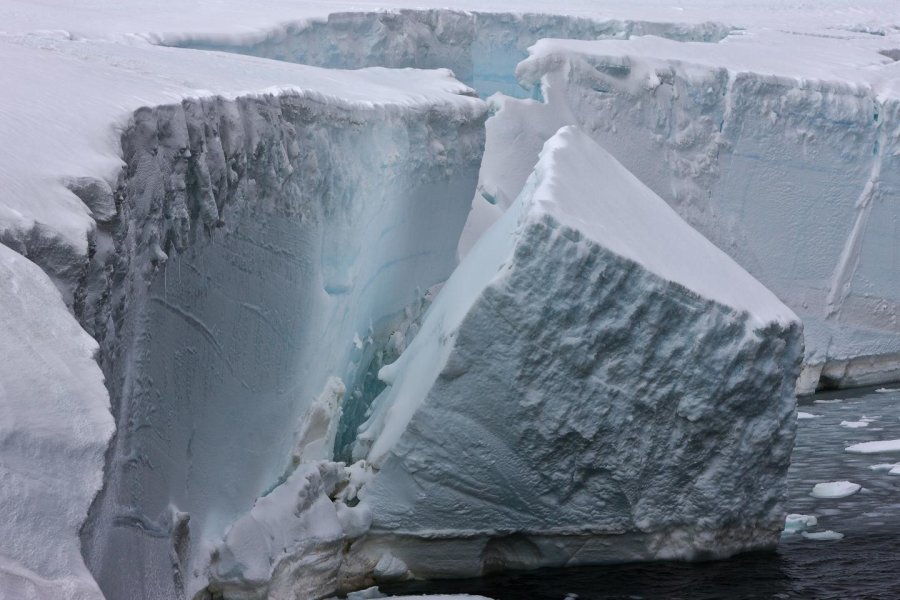
This is ice calving off an ice shelf in the Antarctic. Credit: Ian Phillips, Australian Antarctic Division
DEFINITIONS OF TERMS USED
An ice sheet forms through the accumulation of snowfall, in this case on the Antarctic continent, when annual snowfall exceeds annual snowmelt. Over thousands of years the layers of snow build up and compact, forming a sheet of ice up to thousands of metres thick and thousands of kilometres across. As the ice thickens, the increasing height of snow and ice causes the ice sheet to flow.
The Antarctic Ice Sheet covers an area of about 14 million square kilometres; by comparison, the area of Australia is about 7.7 million square kilometres, and that of the USA is about 9.8 million square kilometres. It contains more than 90% of the world's ice -- enough to potentially raise global mean sea level by about 57 metres.
Grounded ice is that part of the ice sheet that is land-based and not floating on the ocean. Melting of grounded ice above sea level contributes to sea level rise.
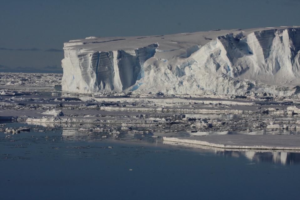
Ice shelves are thick plates of ice, up to several hundred metres thick and fed by tributary glaciers. They are floating seaward extensions of the grounded ice sheet.
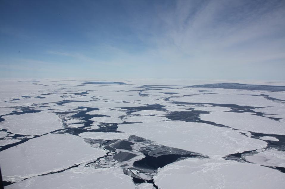
Sea ice is ice that originates from the freezing of seawater (unlike ice sheets, glaciers, icebergs and ice shelves). Sea ice typically forms a thin and highly-dynamic veneer up to a few metres thick that covers between about 3 million square kilometres (in winter) to 19-20 million square kilometres (in summer) of the Southern Ocean surrounding Antarctica. By comparison, the areas of the Antarctic continent, Australia and the USA are about 14, 7.7 and 9.8 million square kilometres, respectively.
Ocean swell is defined as regular long-period waves that are generated by distant storms and are no longer growing or being sustained by the wind (as opposed to locally-generated wind waves).
The Antarctic Peninsula forms a mountainous 1300 km northward extension of Antarctica towards the southern tip of South America. It forms the northernmost part of mainland Antarctica.
Robert A. Massom, Theodore A. Scambos, Luke G. Bennetts, Phillip Reid, Vernon A. Squire, Sharon E. Stammerjohn. Antarctic ice shelf disintegration triggered by sea ice loss and ocean swell. Nature, 2018; DOI: 10.1038/s41586-018-0212-1
Antarctica Ramps Up Sea Level Rise
June 14, 2018: University of Leeds
Ice losses from Antarctica have increased global sea levels by 7.6 mm since 1992, with two fifths of this rise (3.0 mm) coming in the last five years alone.
The findings are from a major climate assessment known as the Ice Sheet Mass Balance Inter-comparison Exercise (IMBIE), and are published today in Nature. It is the most complete picture of Antarctic ice sheet change to date -- 84 scientists from 44 international organisations combined 24 satellite surveys to produce the assessment.
The assessment, led by Professor Andrew Shepherd at the University of Leeds and Dr Erik Ivins at NASA's Jet Propulsion Laboratory in California, was supported by the European Space Agency (ESA) and the US National Aeronautics and Space Administration (NASA).
Their findings show that, prior to 2012, Antarctica lost ice at a steady rate of 76 billion tonnes per year -- a 0.2 mm per year contribution to sea level rise. However, since then there has been a sharp, threefold increase. Between 2012 and 2017 the continent lost 219 billion tonnes of ice per year -- a 0.6 mm per year sea level contribution.
Antarctica stores enough frozen water to raise global sea level by 58 metres, and knowing how much ice it is losing is key to understanding the impacts of climate change today and in the future.
Professor Shepherd said: "We have long suspected that changes in Earth's climate will affect the polar ice sheets. Thanks to the satellites our space agencies have launched, we can now track their ice losses and global sea level contribution with confidence.
"According to our analysis, there has been a step increase in ice losses from Antarctica during the past decade, and the continent is causing sea levels to rise faster today than at any time in the past 25 years. This has to be a concern for the governments we trust to protect our coastal cities and communities."
Dr Ivins said: "The added duration of the observing period, the larger pool of participants, various refinements in our observing capability and an improved ability to assess both inherent and interpretive uncertainties, each contribute to making this the most robust study of ice mass balance of Antarctica to date."
The threefold increase in ice loss from the continent as a whole is a combination of glacier speedup in West Antarctica and at the Antarctic Peninsula, and reduced growth of the ice sheet in East Antarctica.
West Antarctica experienced the largest change, with ice losses rising from 53 billion tonnes per year in the 1990s to 159 billion tonnes per year since 2012. Most of this came from the huge Pine Island and Thwaites Glaciers, which are retreating rapidly due to ocean melting.
At the northern tip of the continent, ice shelf collapse at the Antarctic Peninsula has driven a 25 billion tonne per year increase in ice loss since the early 2000s.
The East Antarctic ice sheet has remained close to a state of balance over the past 25 years, gaining just 5 billion tonnes of ice per year on average.
Josef Aschbacher, ESA's Director of Earth Observation Programmes, said: "CryoSat and Sentinel-1 are clearly making an essential contribution to understanding how ice sheets are responding to climate change and affecting sea level, which is a major concern.
"While these impressive results demonstrate our commitment to climate research through efforts such as our Climate Change Initiative and scientific data exploitation activities, they also show what can be achieved by working with our NASA colleagues. Looking to the future, however, it is important that we have satellites to continue measuring Earth's ice to maintain the ice-sheet climate data record."
Isabella Velicogna, professor of Earth system science, University of California, Irvine, and senior research scientist at NASA's Jet Propulsion Laboratory, said: "Gravity measurements from the joint NASA and German Aerospace Center (DLR) GRACE mission help us track the loss of ice mass in the polar regions and impacts on sea level at points around the planet. The data from these spacecraft show us not only that a problem exists but that it is growing in severity with each passing year."
Eric Rignot, professor of Earth system science, University of California, Irvine, and senior research scientist at NASA's Jet Propulsion Laboratory, said: "Measurements collected by radar satellites and Landsat over the years have documented glacier changes around Antarctica at an amazing level of precision, so that we have now a very detailed and thorough understanding of the rapid changes in ice flow taking place in Antarctica and how they raise sea level worldwide."
Benjamin Smith, senior principal investigator, University of Washington Applied Physics Lab, said: "We're at a really exciting time in Antarctic glaciology, in that we have a lot of mature technologies for measuring ice-sheet changes that were not available when I started in the field in the early 2000s.
"The IMBIE-2 work shows that these have come together just in time to let us watch some really important changes in the West Antarctic Ice Sheet and in the Peninsula. Over the next few years we're going to see some more types of data, from ICESat-2, GRACE-FO, and NISAR, that should let us keep watching Antarctica change in even finer detail."
Dr Pippa Whitehouse, NERC Independent Research Fellow at Durham University, said: "Satellites have given us an amazing, continent-wide picture of how Antarctica is changing. The length of the satellite record now makes it possible for us to identify regions that have been undergoing sustained ice loss for over a decade.
"The next piece of the puzzle is to understand the processes driving this change. To do this, we need to keep watching the ice sheet closely, but we also need to look back in time and try to understand how the ice sheet responded to past climate change."
Michiel van den Broeke, professor of polar meteorology at Utrecht University, said: "To enhance the interpretation of ice sheet mass changes as observed by satellites requires accurate modelling of the amount of snowfall on the ice sheet, something that cannot be reliably measured from space yet.
"Our model results prove that mass loss from the Antarctic ice sheet is caused by acceleration of ice flow in West Antarctica and the Antarctic Peninsula, and that mass variations in East Antarctica are mainly driven by snowfall fluctuations."
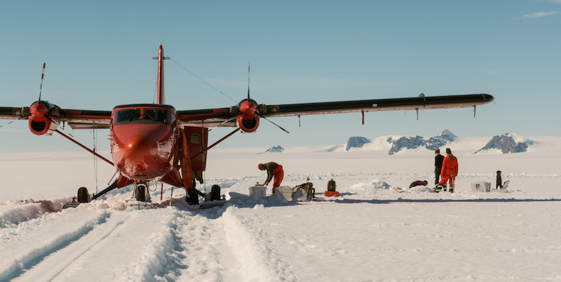
University of Leeds scientists ice coring at the George VI Ice Shelf, Antarctica. Picture: Ian Potten, British Antarctic Survey
The IMBIE Team. Mass balance of the Antarctic Ice Sheet from 1992 to 2017. Nature, 2018 DOI: 10.1038/s41586-018-0179-y